West Bow Peak
August 25, 2023
Mountain height: 2860 m
Elevation gain:
approximately 1500 m
Round-trip time: 9:04
Scrambling with
Leslie.
A ten-day
absence from the mountains had me “champing at the bit” to get out - “chomping”
is more commonly used in North America, but once in a while I need to
acknowledge my English heritage, even though after 44 years in this country I’m
Canadian as Canadian gets, eh! Leslie, a work colleague of mine, was also keen
to do a hike/scramble and so I suggested Ramp and Quartzite Peaks.
On the drive
in, however, I gave Leslie the option of a potentially much shorter trip, 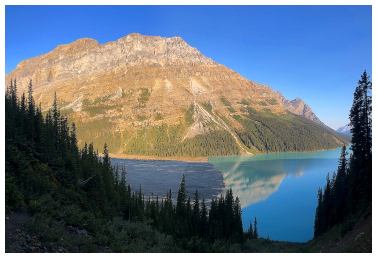 the
obscure northeast outlier of Mount Jimmy Simpson, identified as West Bow Peak,
in David Jones’ excellent Rockies West (a class 2 ascent from Peyto Creek). Of
course, this option was accompanied with a great deal of unknowns and
uncertainty. I was delighted when Leslie opted for the unknown - I love doing trips with those with an adventurous spirit!
the
obscure northeast outlier of Mount Jimmy Simpson, identified as West Bow Peak,
in David Jones’ excellent Rockies West (a class 2 ascent from Peyto Creek). Of
course, this option was accompanied with a great deal of unknowns and
uncertainty. I was delighted when Leslie opted for the unknown - I love doing trips with those with an adventurous spirit!
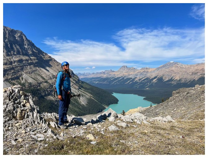
We arrived at
the parking lot at a relatively early 8 am and were surprised to find a horde of
people already at the Peyto Lake viewpoint – must have been a tourist bus, as
the parking lot was almost empty. Then comes the heartbreaking loss of 280 m of
vertical elevation to get down to Peyto Lake – elevation that must be regained at
the end of the day.
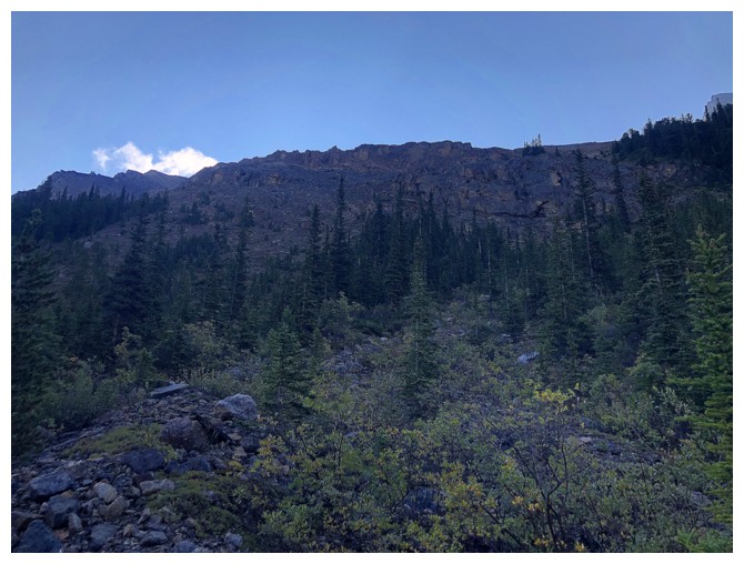
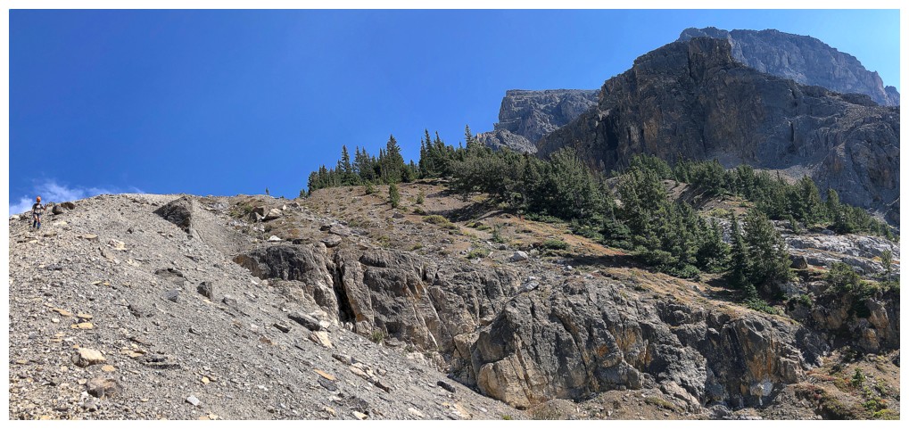
The first
challenge of this route was going to be picking a line up the mountain. The
route description read, “ascend extensive scree and talus on the northwest
flank”, but that turned out to be a pretty big area. We eventually picked a
line further around the west side than predicted. Thankfully after a little
bushwhacking we found a dried-up drainage that granted generally easy access to
the valley above. I say “generally” because there were a couple of alarmingly
steep sections that we both agreed we would try to avoid on descent.
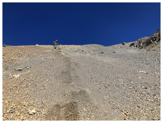
Above that a
short section of gentler terrain led to a drainage that seemed to run all the
way to the summit. However, we quickly grew tired of the ankle-twisting rubble of
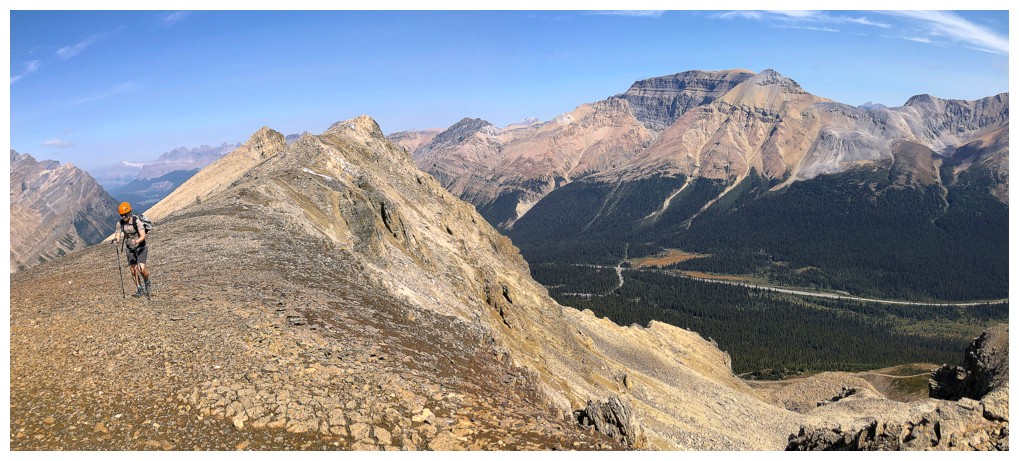
the drainage and decided to gain the north ridge instead. 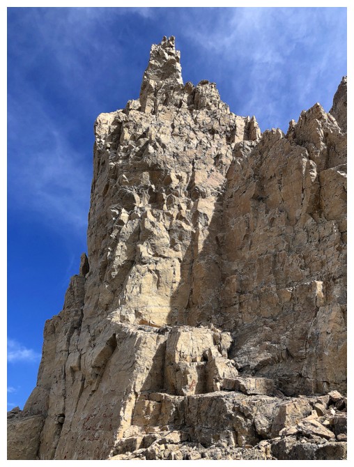 It was a bit of grunt
to get there but the route change paid off, granting us excellent views and
much better footing – at least for the time being! I quickly went up to the
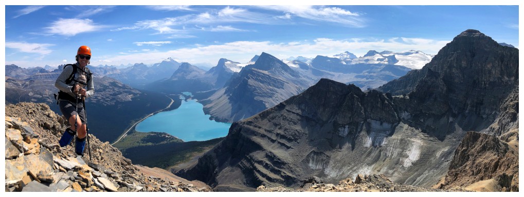
north summit for a terrific view of Peyto Lake and then joined Leslie for the
ridgewalk towards the true summit.
It was a bit of grunt
to get there but the route change paid off, granting us excellent views and
much better footing – at least for the time being! I quickly went up to the
north summit for a terrific view of Peyto Lake and then joined Leslie for the
ridgewalk towards the true summit.
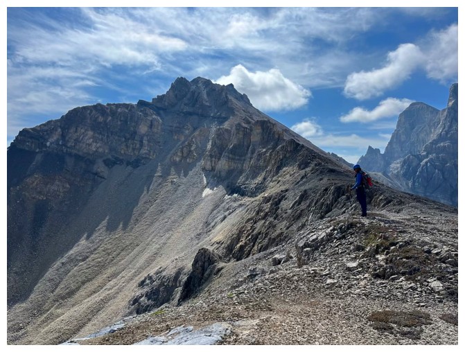
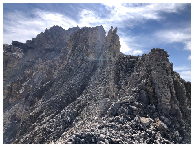
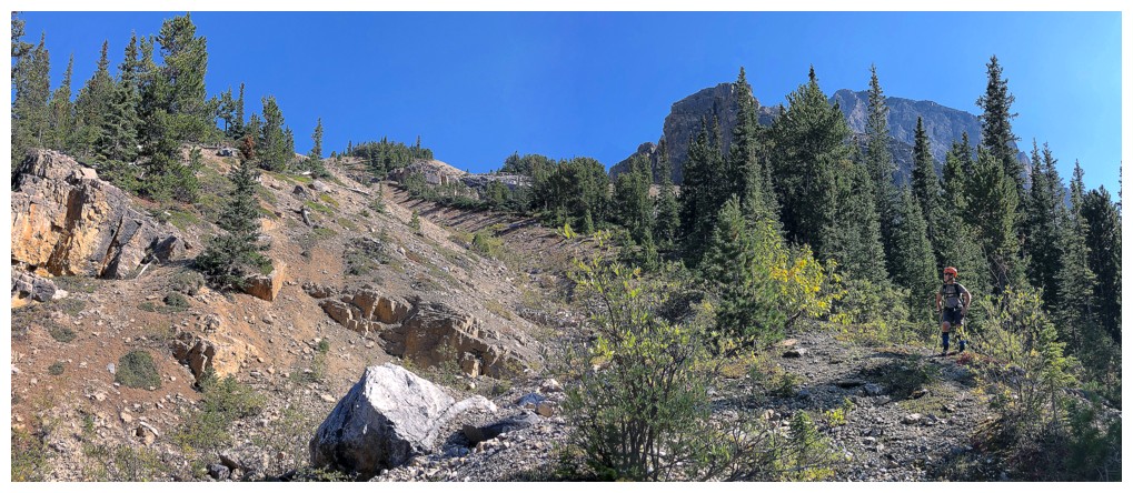
That ridgewalk
was not without challenge. Crumbly pinnacles blocked the route and had to be
circumvented. Regaining the ridge required grovelling up super steep, unstable
rubble. Throughout, I was very impressed with Leslie's hiking/scrambling abilities, as she tackled some pretty loose
and intimidating terrain without batting an eye!
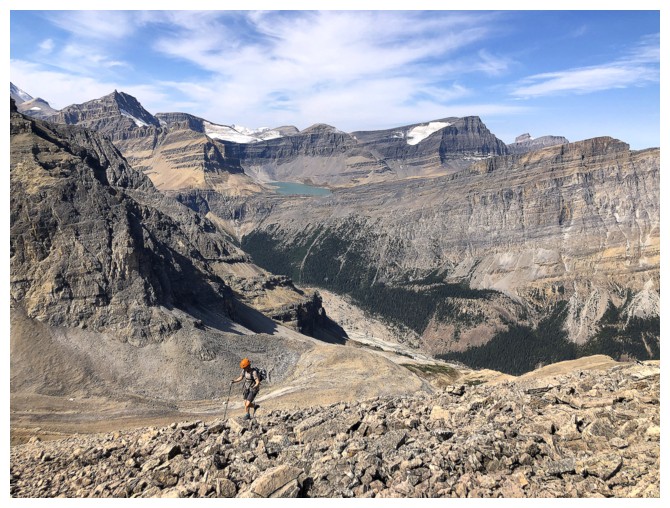
Back on the
ridge, we enjoyed a much easier walk to the summit and then the moment of the
day.... As a much lower outlier of Mount Jimmy Simpson, my expectation for the summit
views were not very high. Boy, was I wrong! The
views were eye-popping, to say the least.
We stayed at the top for a long time to take it all in. Also surprising
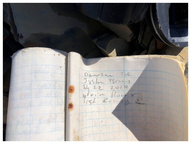
was the
presence of a summit register, buried in the cairn. The four entries
since 1897
(the first had been copied into a new registers and the 1948
ascent described by Jones was absent) attested to the relative
obscurity of the peak – yes, the
first ascent was 126 years ago!
For the descent
we decided to go down the south ridge and then the northwest facing slopes,
hopefully getting back to the drainage we ascended. The route generally
worked well. Again, there’s that word “generally”! The northwest slopes were
deceivingly steep and not surprising, loose. However, in retrospect our north
ridge ascent route was the best way up and this was probably the easiest way
down. I would not have wanted to do the route in reverse. We did manage to
avoid the steep stuff near the beginning and the grind back up to the Peyto Lake
viewpoint, though always longer than you think, did not leave either of us
requiring medical attention!
A superb day!
Big thanks to Leslie for her company, adventurous spirit, and tenacity on some
challenging and less than aesthetic terrain.
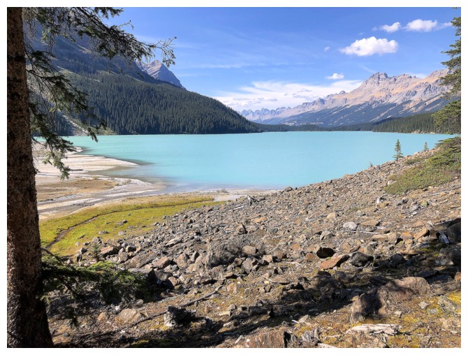
The classic view of Peyto Lake from the Peyto Lake viewpoint
Almost down to the lake (photo by Leslie)
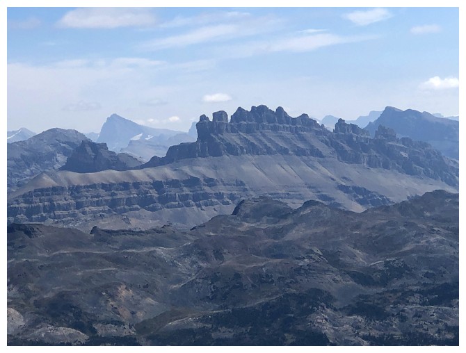
Peyto Peak is going to get its fair share of photo attention
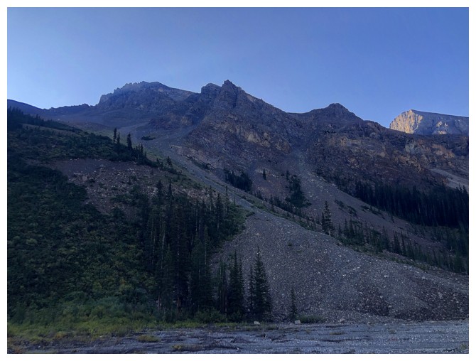
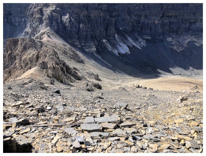
Part of the northwest side of West Bow. We couldn't see a line up at this point so we kept traversing around the mountain.
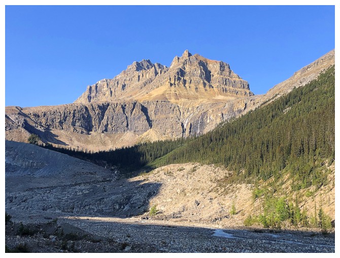
Peyto Peak again
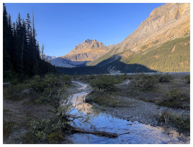
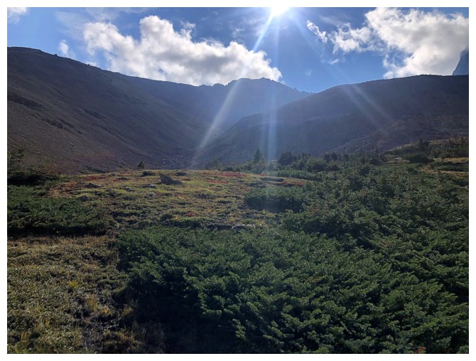
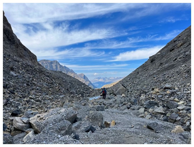
After a short bushwhack we ended up in this dry, overgrown drainage
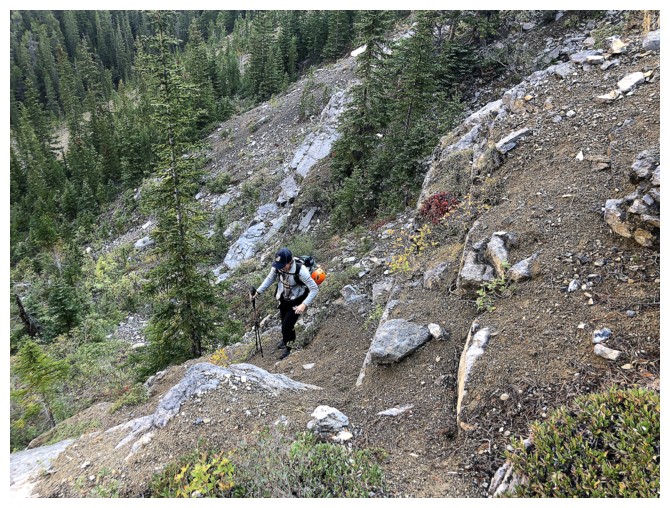
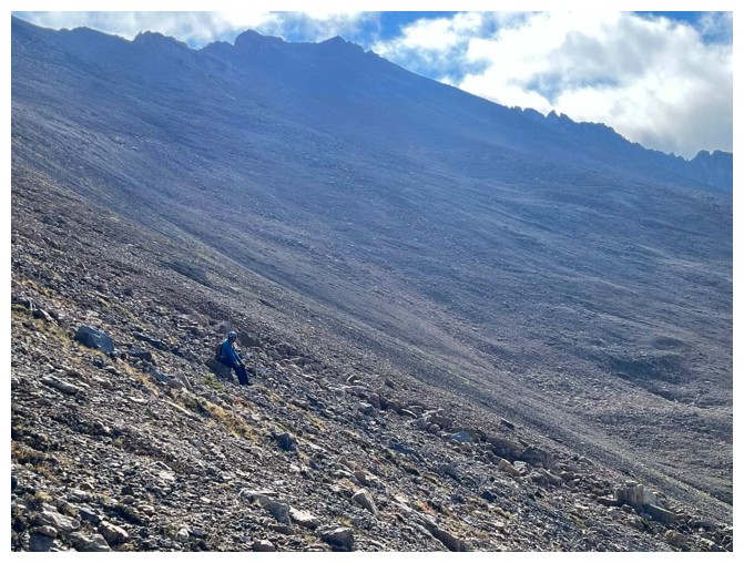
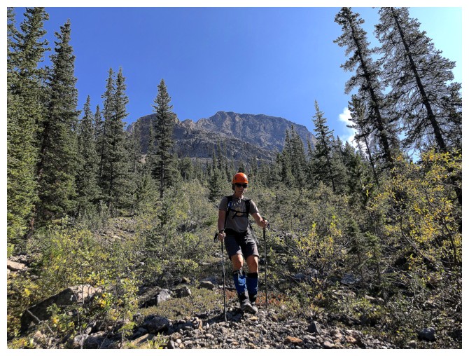
Leslie prepares to ascend the alarmingly steep dirt. We both put
helmets on here. It's much steeper than it looks - a theme for the
entire day.
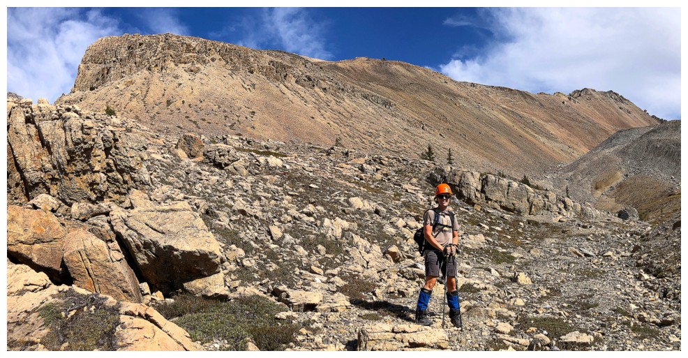
Leslie above the initial difficulties
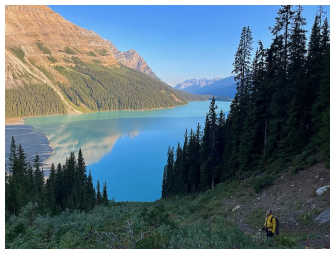
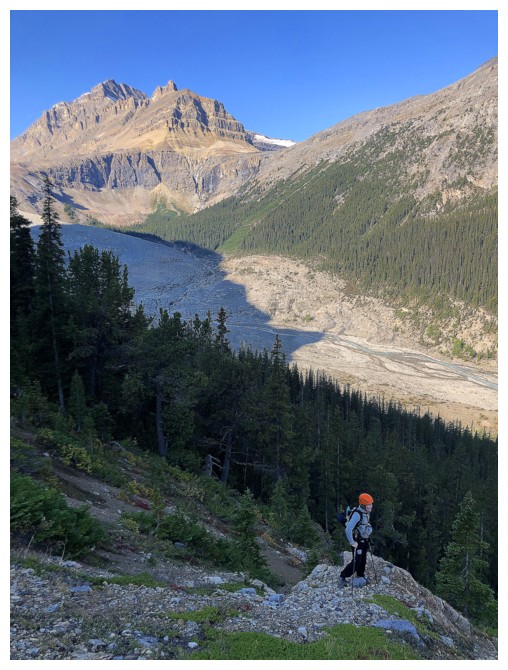
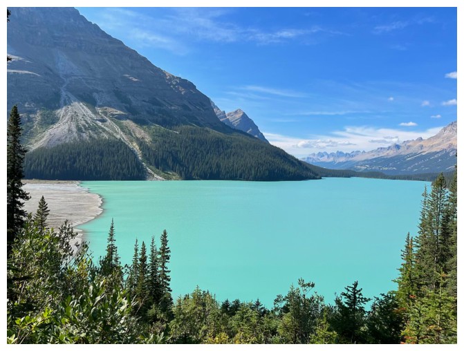
Views of Peyto Lake start to appear again. Leslie over to the right.
Leslie's view of me (photo by Leslie)
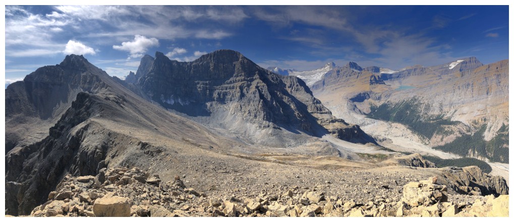
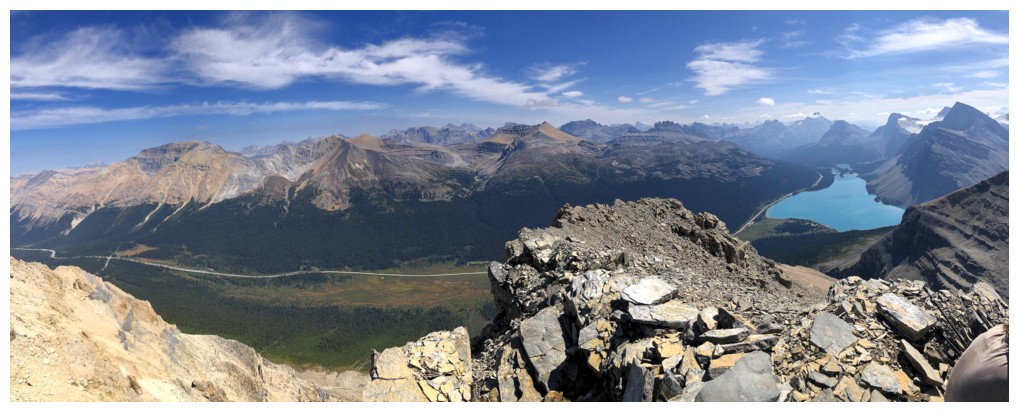
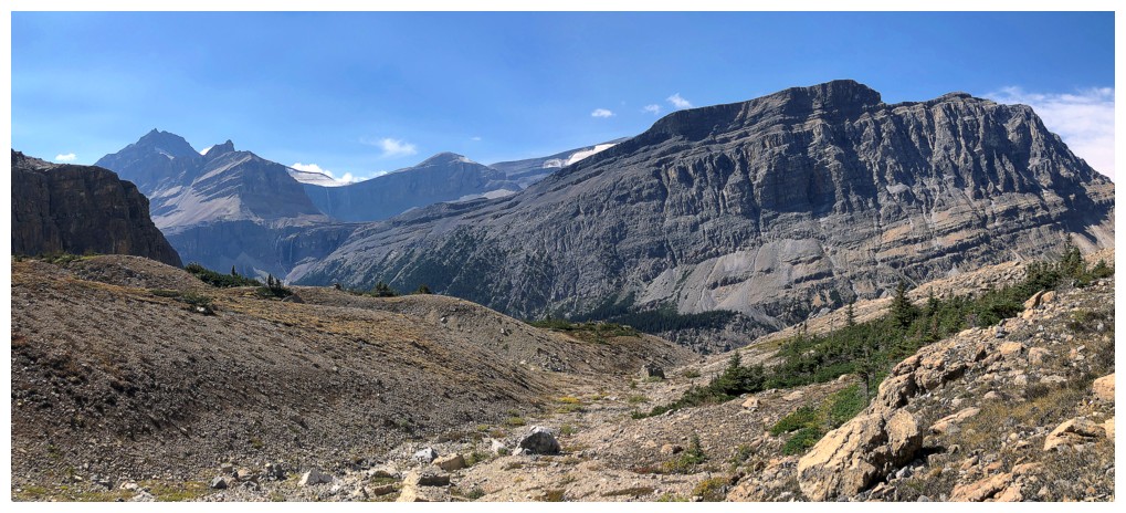
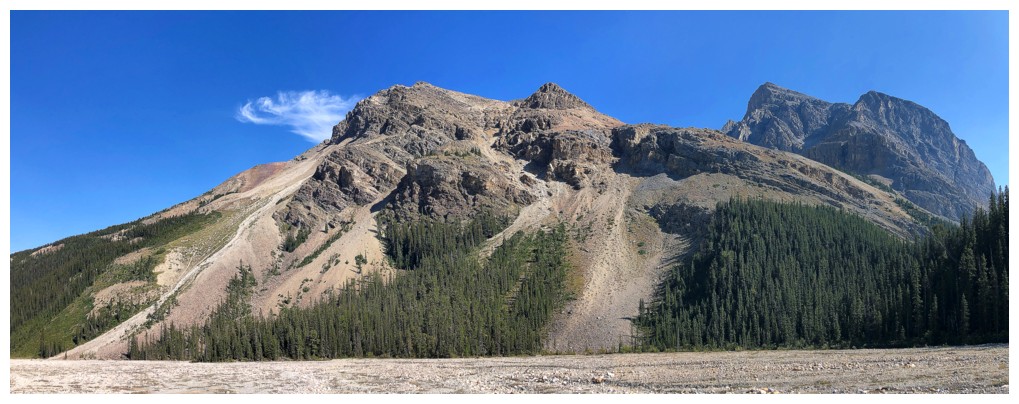
Bigger view of the area
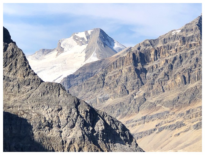
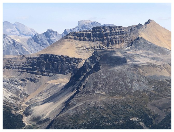
Mount Habel
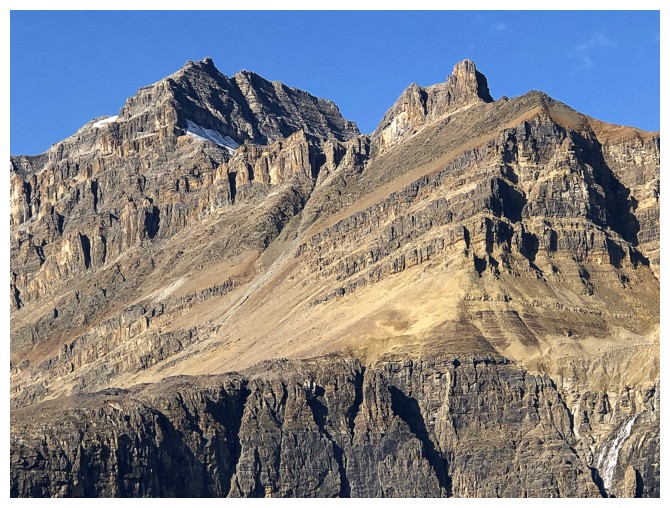
Striking Peyto Peak deserves the photo attention!
Other things don't deserve the photo attention, but I appreciate the thought:) (photo by Leslie)
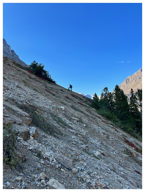
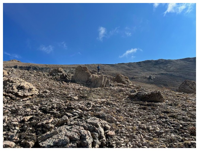
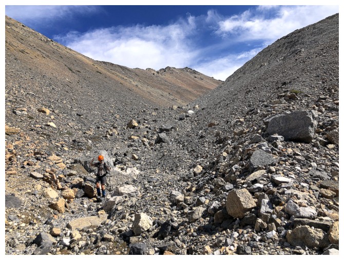
The distant summit of West Bow in the centre
Leslie enjoys a brief stint of "easy on the ankles" terrain
Now enjoying the "brutal on the ankles" terrain (photo by Leslie)
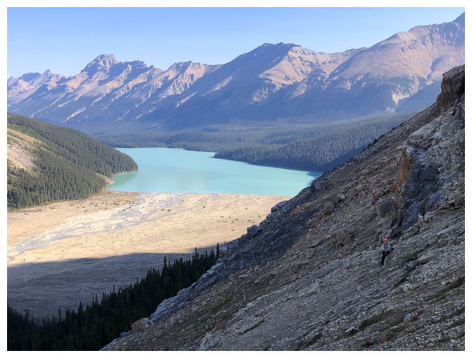
Leslie in the drainage, with Caldron Peak behind
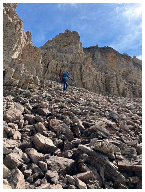
Taking a breather while ascending steep slopes to the north ridge (photo by Leslie)
Leslie is doing the same
Mount Baker is usually ascended in late winter, early spring there's snow all the way up
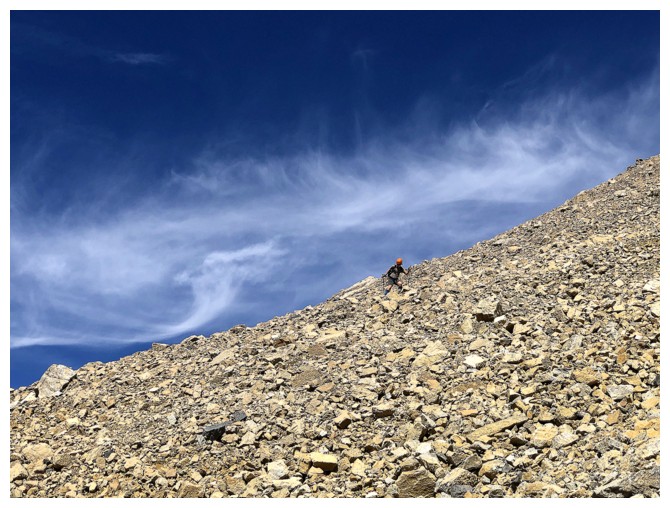
Higher upslope and taking another short break. This slope is much steeper and longer than it appears (photo by Leslie).
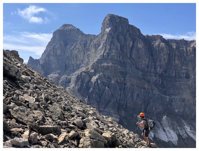
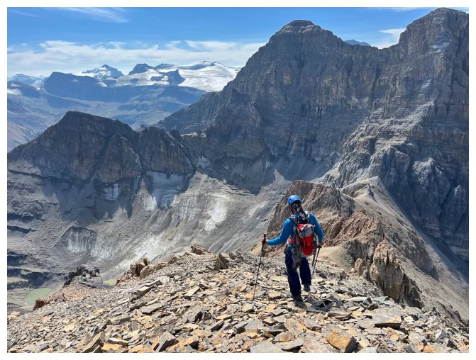
On the north ridge, looking south to the summit. Mount Jimmy Simpson at the right.
View to the north from the north summit
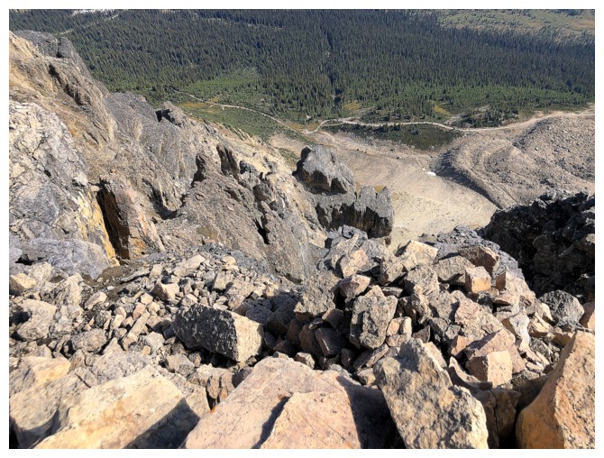
Looking
down the daunting northeast side. Rob Kozarchuk and Colin Jones
ascended this route in 1999, as did the first ascenders, G.P. Baker,
J.N. Collie, and P. Sarbach, over a century earlier.
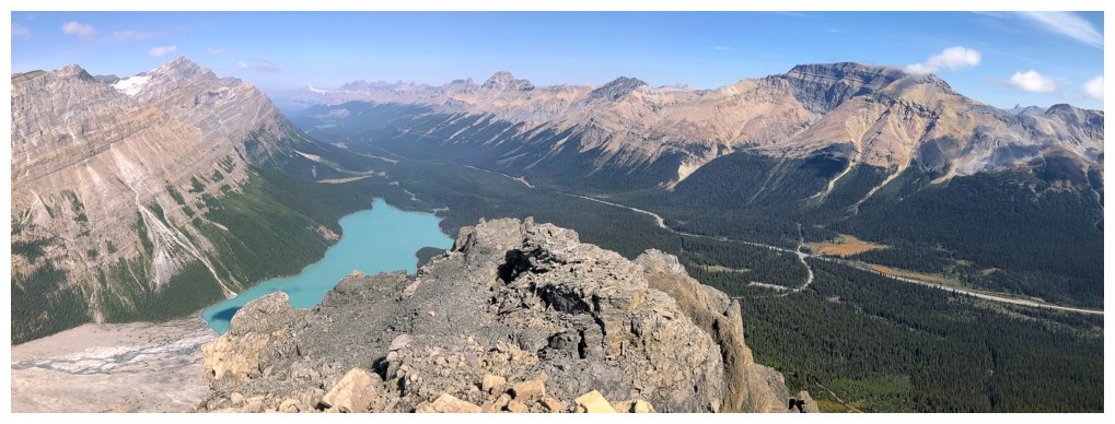
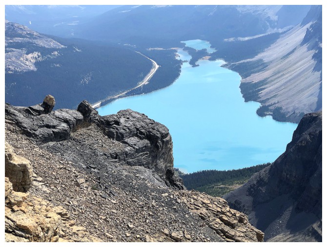
Going a little further north grants a better view of Peyto Lake
The view to the south, southwest, and west is nothing to sneeze at either!
Leslie's view of me on the north summit (photo by Leslie)
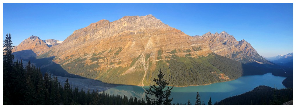
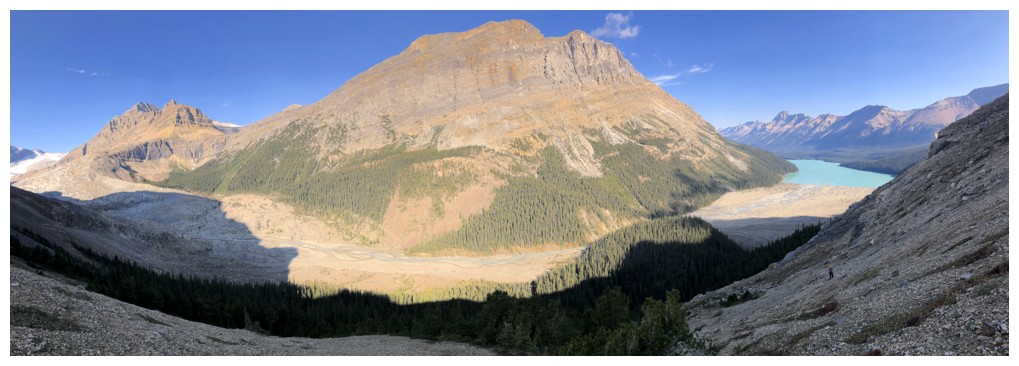
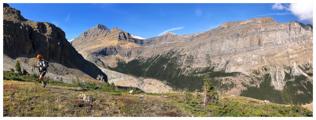
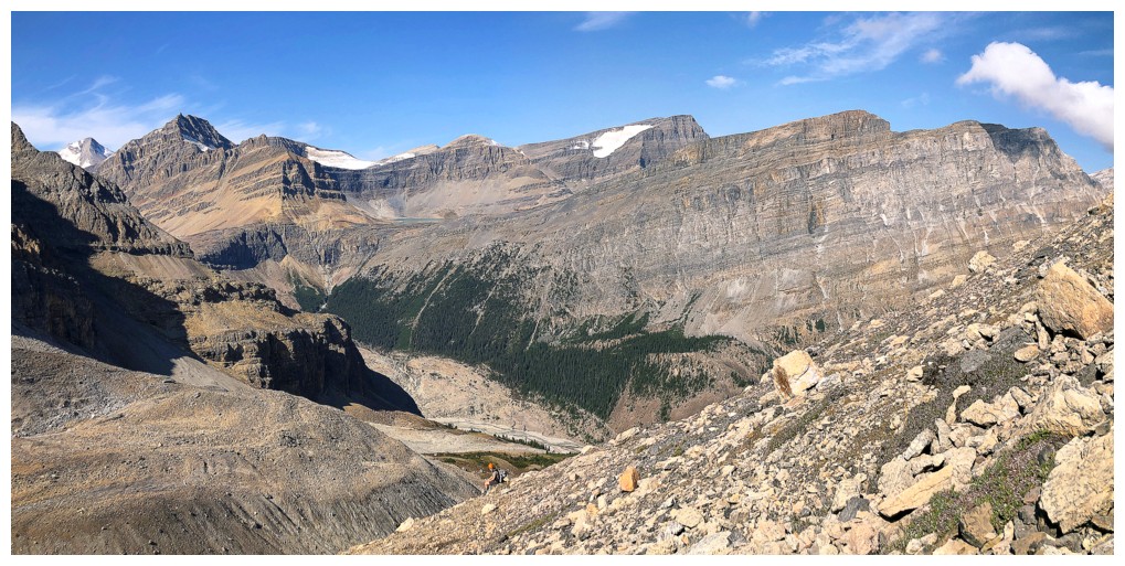
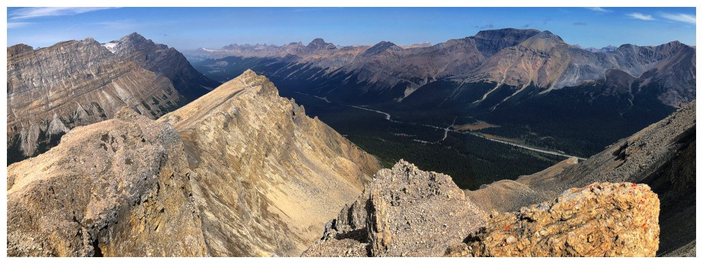
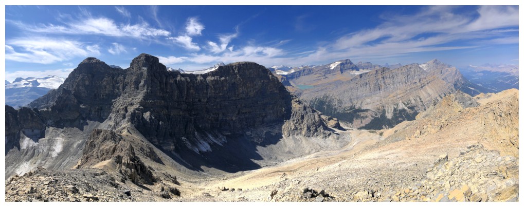
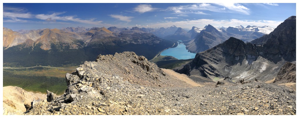
Big pano
Reunited and working our way south to the true summit
From here we optimistically hoped we would cruise to the summit (photo by Leslie)
Leslie on the wide, easy part of the north ridge. Observation Peak at the right.
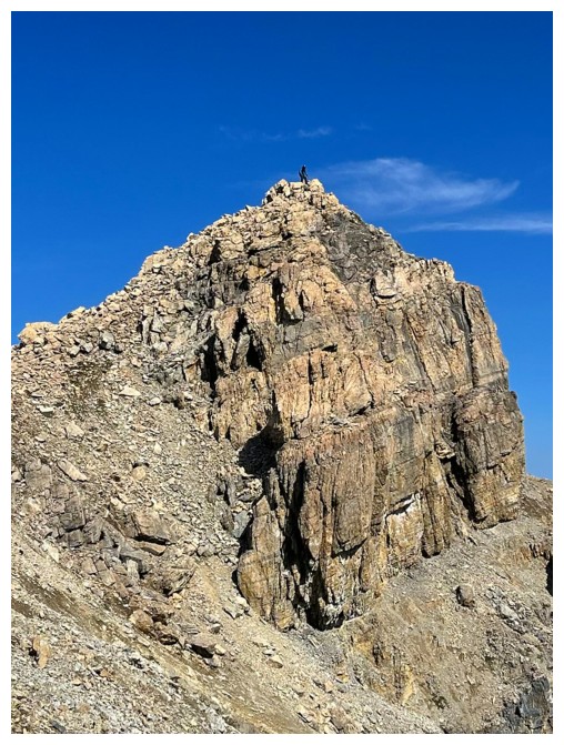
Then this happened!
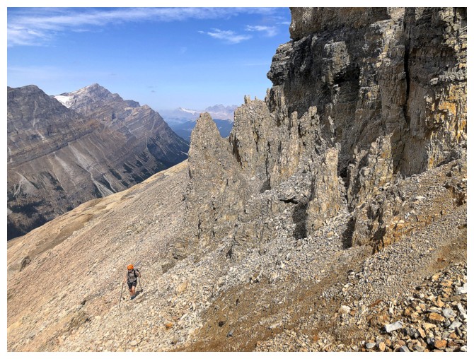
Leslie traverses rubble slopes below the ridge to avoid the pinnacles
But there were more!
Traversing below these ones on ugly terrain (photo by Leslie)
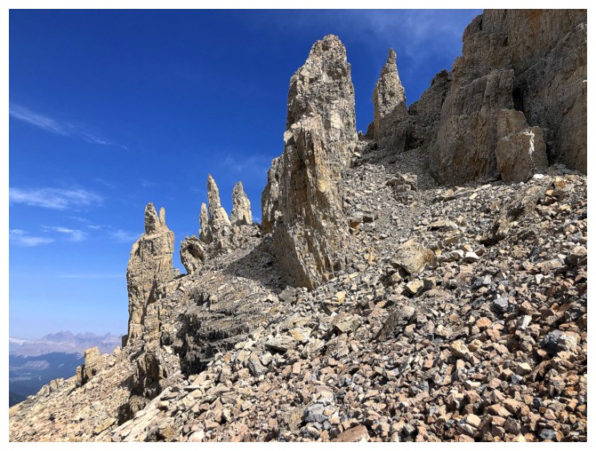
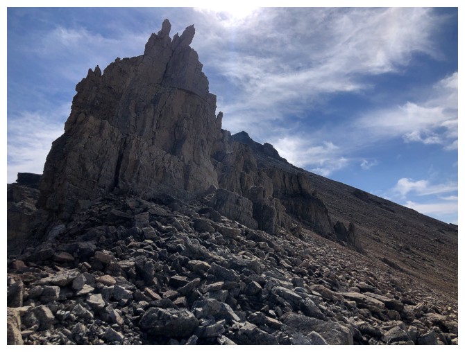
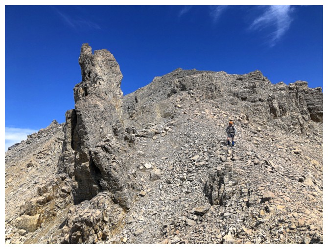
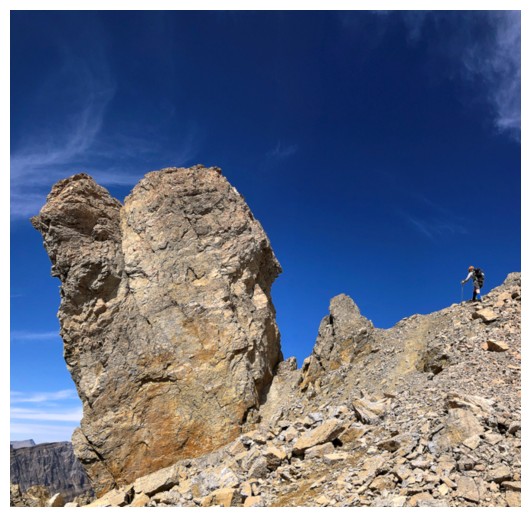
Looking back at some of the pinnacles - spectacular but unclimbable
More traversing before a very steep grovel back to the ridge
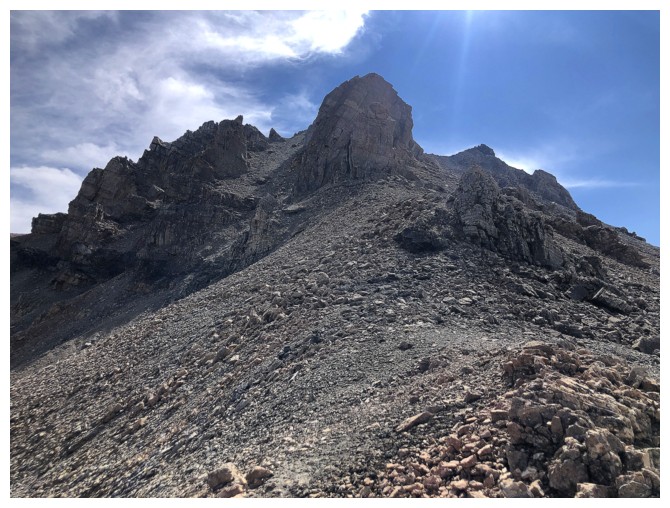
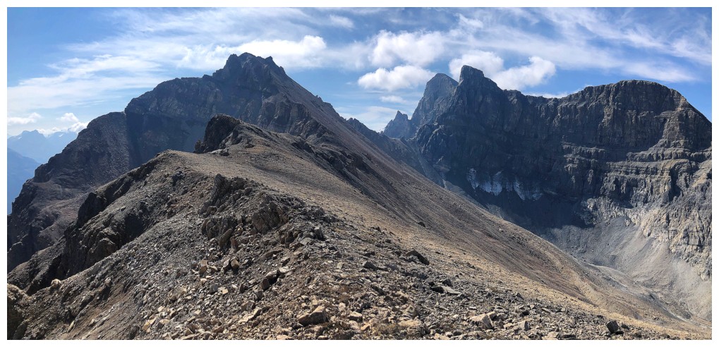
On the ridge again but another obstacle stands in the way
So I'll just turn around and ignore it
Luckily, Leslie has a more proactive plan and is going around the obstacle
Back on the ridge again and the summit is mercifully near
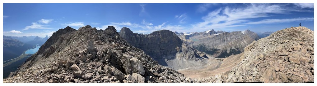
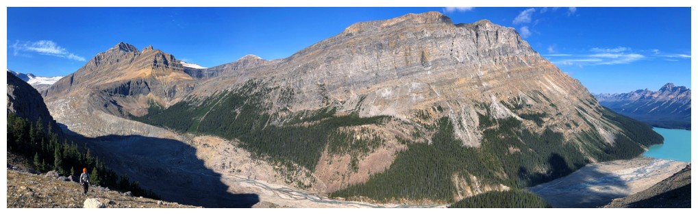
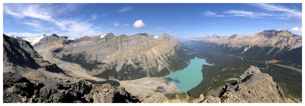
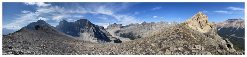
Pano from the ridge
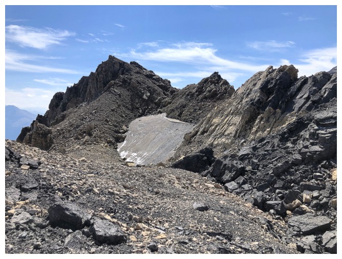
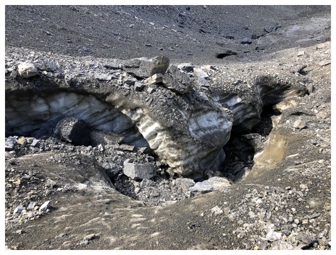
A very tenacious snow patch on the northeast side of the ridge
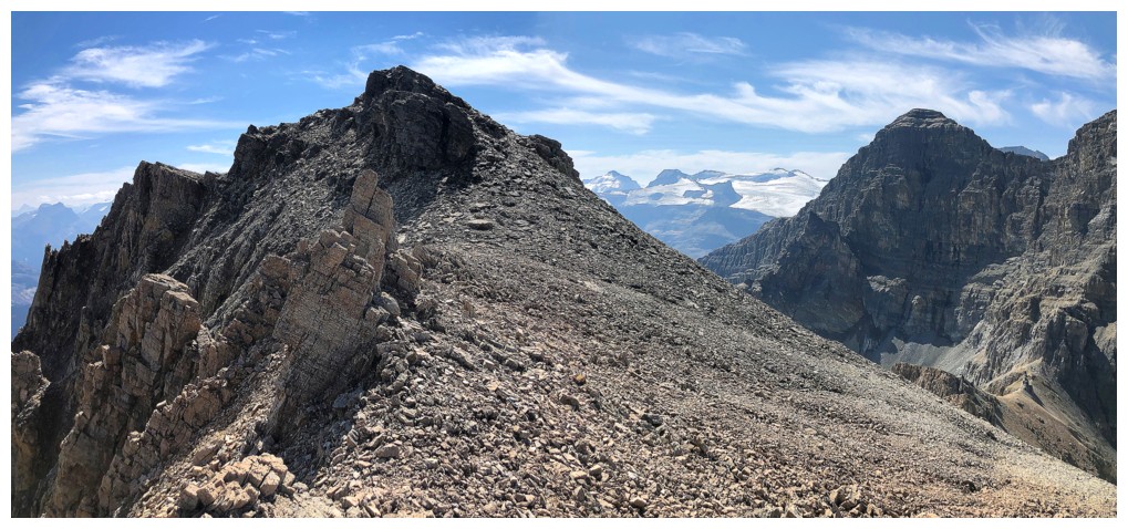
The final stretch
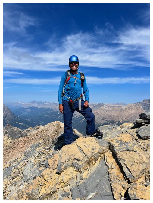
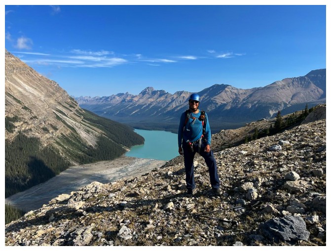
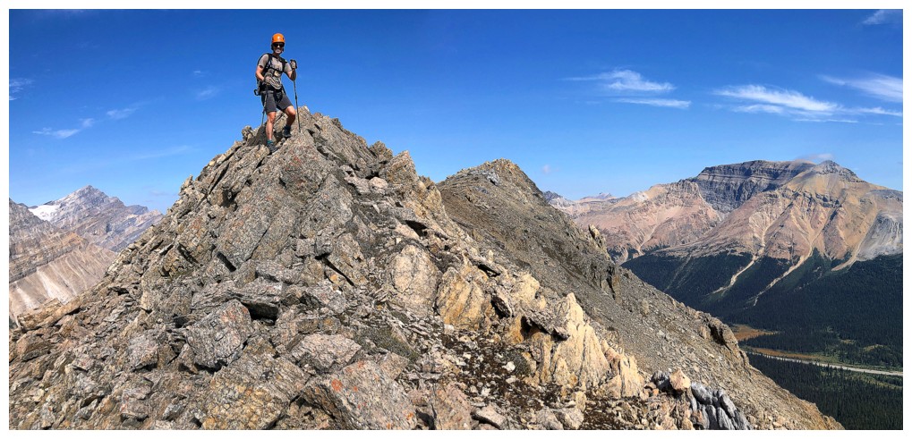
Summit success! (photo by Leslie)
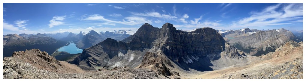
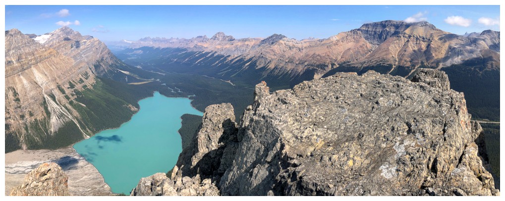
Summit pano
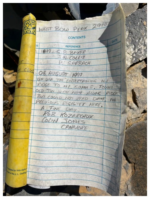
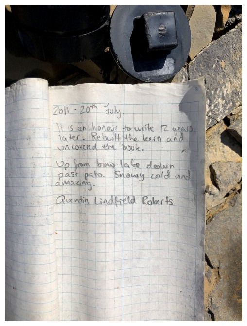
Two of the summit register entries
The third
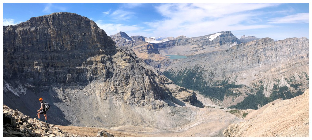
View to the south, southeast, and east
View the southwest, west, and northwest
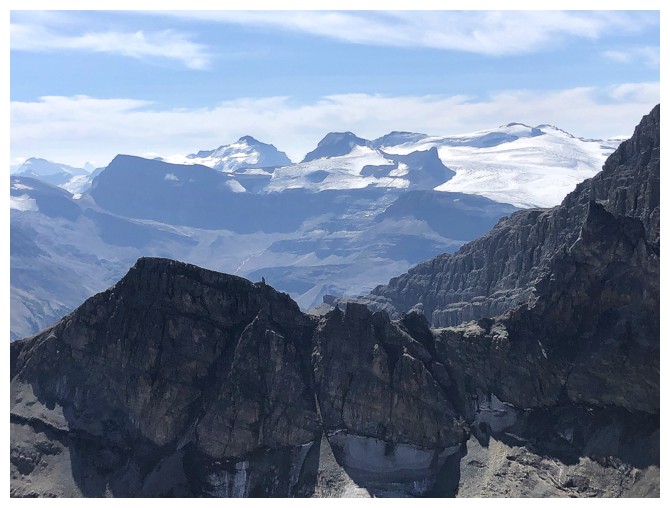
Several peaks of the Wapta Icefield are visible: Balfour, Olive, St. Nicholas, and Gordon
Mount Hector
Dolomite Peak
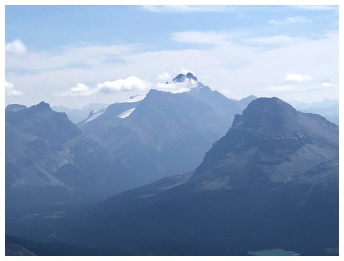
Cirque Peak (far right) and Watermelon Peak (distant centre)
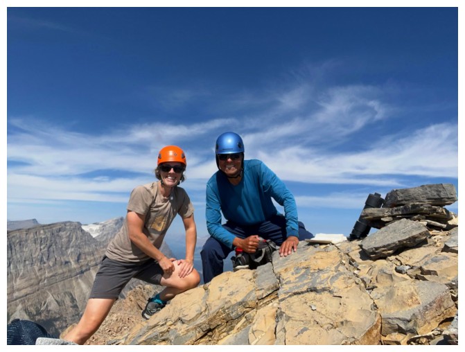
Self-timed summit photo by Leslie
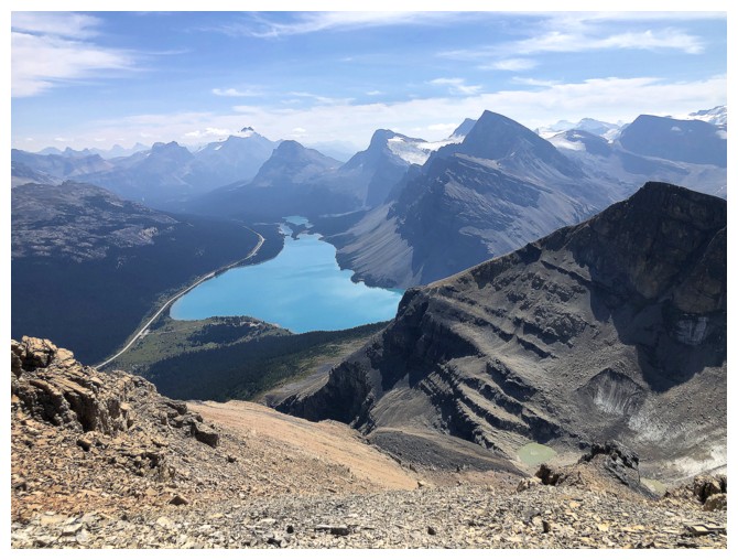
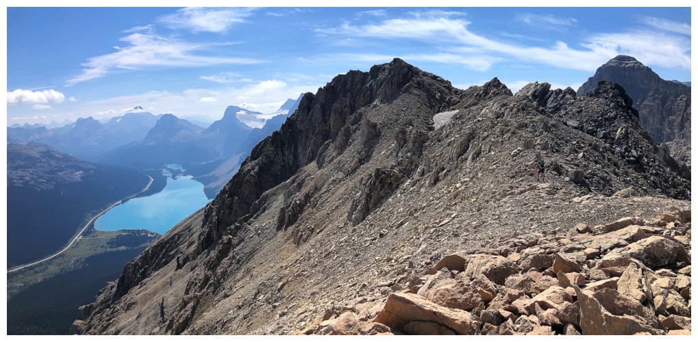
Bow Lake is the highlight of the view. Jimmy Junior at the right.
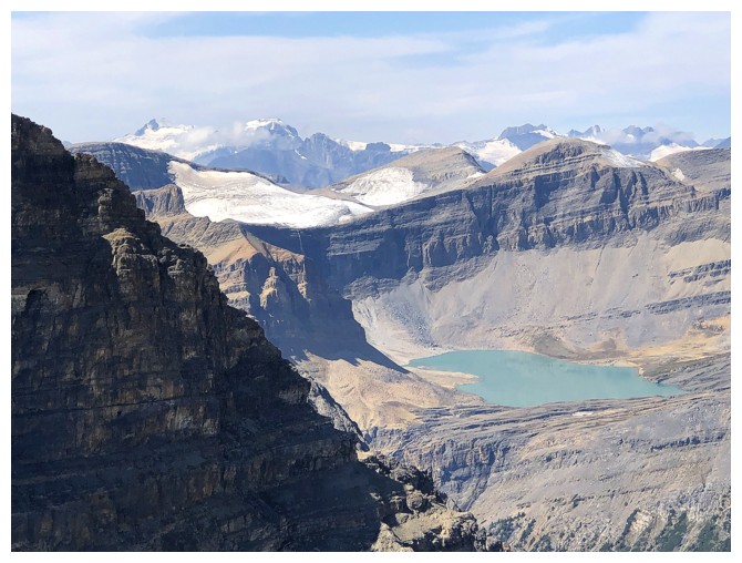
Caldron Lake
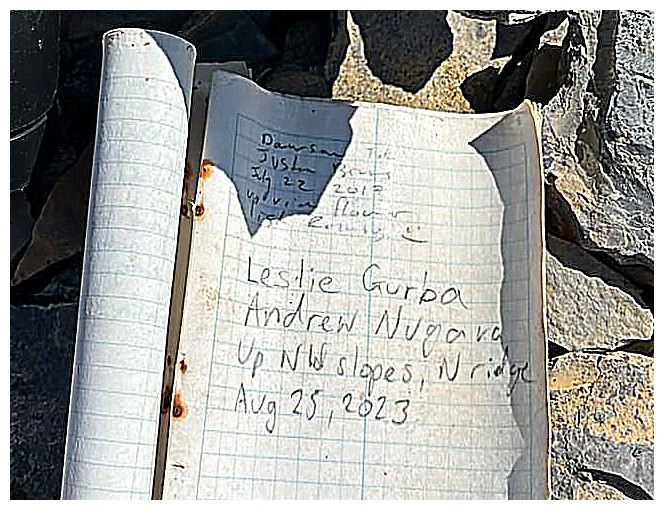
A fourth entry has been added (photo by Leslie)
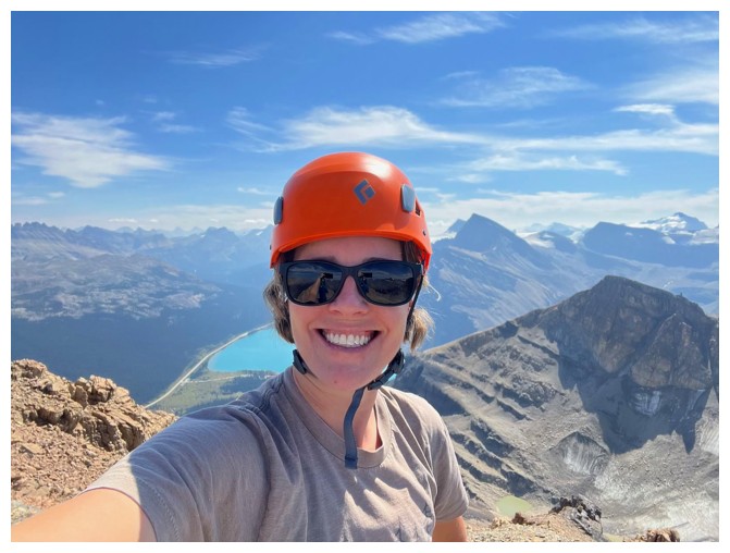
Leslie selfie
Last look at the view before we descend
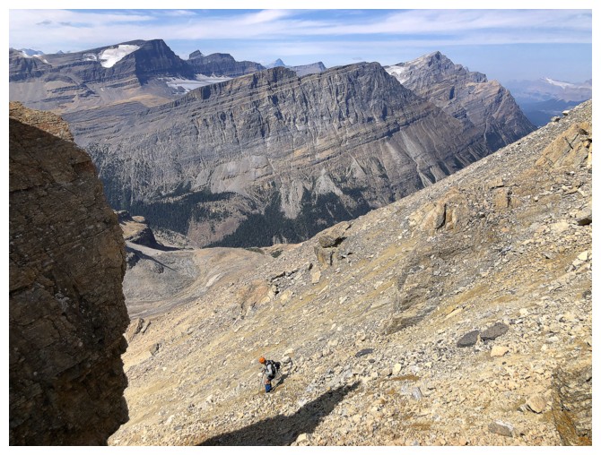
Looking down the descent route. Yet again, it's much steeper than it looks.
Starting down (photo by Leslie)
Still getting great views of Bow Lake
Leslie passes a cool pinnacle
Unfortunately, I led us down the wrong way and we had to return to descend the other side of the pinnacle
Back on track
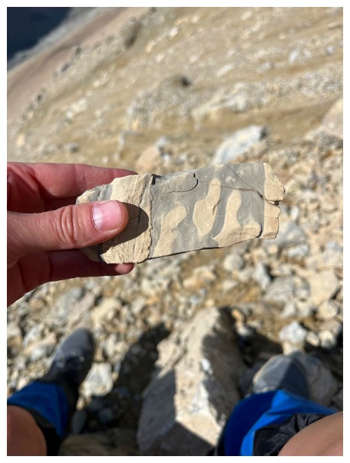
Like me, Leslie loved looking at the different types of rock (photo by Leslie)
Interesting clouds
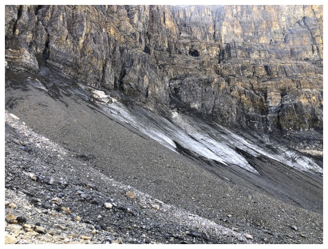
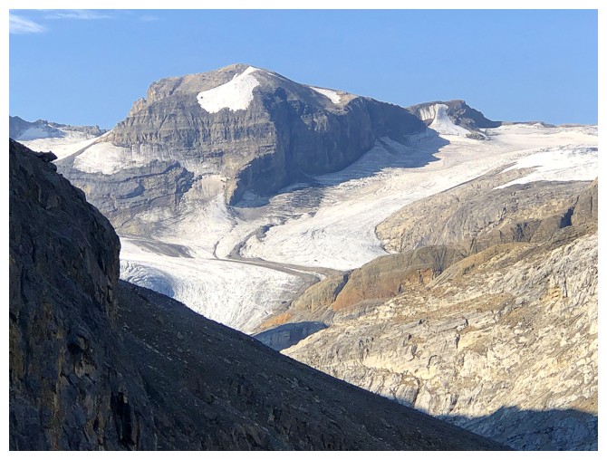
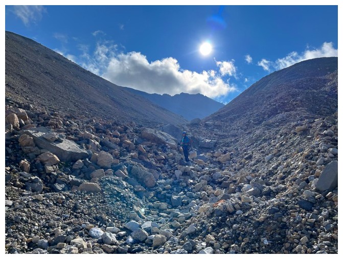
Approaching the glacier
Only a few sections were clearly visible
The remainder was covered in scree and rubble
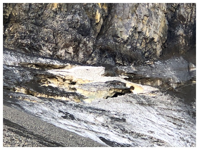
Another visible section
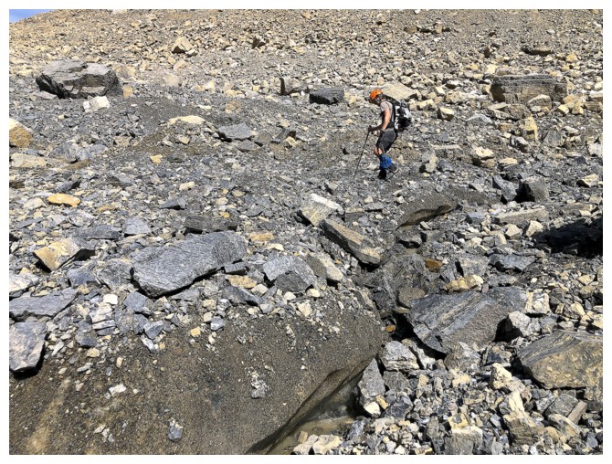
Heading down a drainage but it's the wrong one (photo by Leslie)
Back in the right one
The road ahead and still enjoying good views of Peyto and Caldron peaks
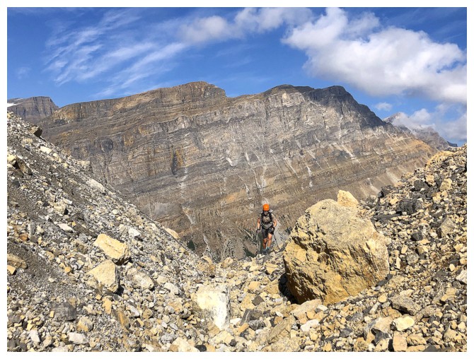
Much of our route up is visible here. The north summit at the left and the true summit at the right.
Looking over that route (photo by Leslie)
Leslie (far left) descends easier terrain than the steep slopes we ascended at this level
Joy! As opposed to hair-raising ascent slopes, we found this beautiful slope of fine scree to descend.
The fine scree is gone, but the terrain remains easy to descend
Leslie powers down the lower slopes
Back in the Peyto Lake valley, looking at West Bow (centre) and Jimmy Simpson (right)
Near the start of the 280 metres of elevation gain back to the Peyto Lake viewpoint
Of course I had to stop multiple times to catch my breath...I mean photograph Peyto Lake!
The End
LOG