Mountain heights:
2474
m, 2350 m
Total elevation gain: approx.
1300 m
Ascent time to Barnaby:
3:35
Traverse time to Southfork:
2.00
Descent time: 1:45
 Scrambling
with Mark.
Scrambling
with Mark.
No
matter how dull a potential ascent route in the Castle Crown area may
look from
the road, it is virtually guaranteed to have you slack-jawed on one or
multiple
occasions throughout the ascent. Such was definitely the case for
Barnaby Ridge
and
 Barnaby
Ridge had been the recipient of ascents by The Southern Scramblers and Linda
and Antri,
in recent months; Southfork Mountain was ascended by Bob,
Dinah, and Sonny
a
week previous to our ascent and fortunately I found their trip reports
while
“scrambling” the internet for potential trip ideas,
early Saturday morning.
Barnaby
Ridge had been the recipient of ascents by The Southern Scramblers and Linda
and Antri,
in recent months; Southfork Mountain was ascended by Bob,
Dinah, and Sonny
a
week previous to our ascent and fortunately I found their trip reports
while
“scrambling” the internet for potential trip ideas,
early Saturday morning.
Bob,
Dinah and Sonny had ascended
The
first part of the route was very easy – clear-cutting
virtually eliminating any
bushwhacking. We then followed the obvious drainage towards the ridge,
just
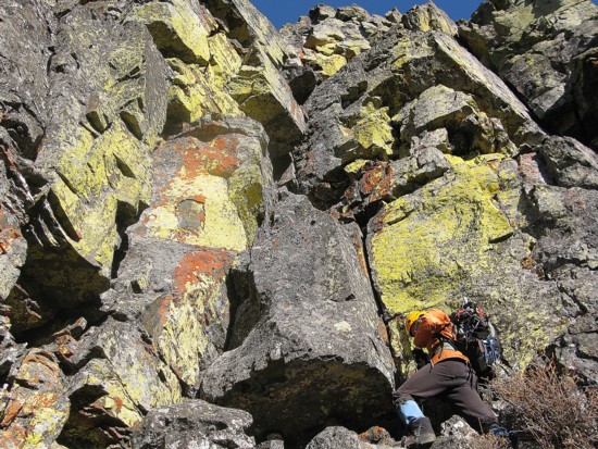
north of the summit. Higher up, we spotted an interesting rock-band to
our left
and deviated from the easy descent route to check it out. This detour
turned
into “slack-jaw” moment number 1. The near
vertical, gray rock-band was covered
in greenish/yellow and rust coloured lichen – it was
absolutely stunning to
look at, especially with the clear sky behind. We
spent a good three quarters of an hour 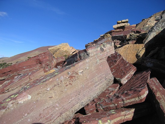 exploring the area and then ascended through a
weakness in the rock-band. This
put us on a ridge between two drainages. The ridge was a pleasure to
ascend,
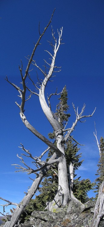
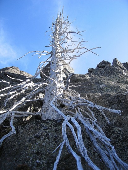
highlighted by a multitude of sun-bleached, twisted, dead trees and the
first
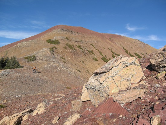
view of the beautiful, red argillite summit to the north - slack-jaw
#2.
exploring the area and then ascended through a
weakness in the rock-band. This
put us on a ridge between two drainages. The ridge was a pleasure to
ascend,
highlighted by a multitude of sun-bleached, twisted, dead trees and the
first
view of the beautiful, red argillite summit to the north - slack-jaw
#2.
After
reaching an intermediate highpoint, we hiked south to the summit of
Barnaby
Ridge. There are three highpoints on the summit, the middle one
registering the
highest altitude. We first went to the lowest and western-most summit,
to take
in an excellent panorama in that direction. While
The
hike north to
At
this point, the excellent weather we had been enjoying all day began to
deteriorate. Though it would have been nice to visit the
Yet another unexpectedly awesome day in The Castle.
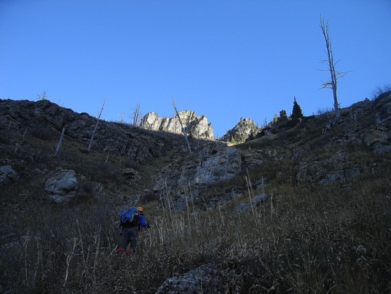
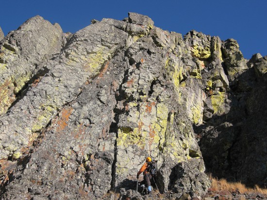
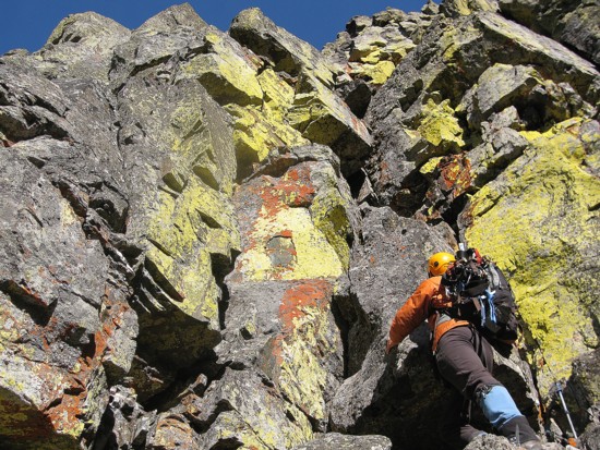
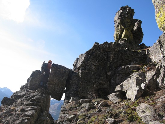
Mark ascends a gully, with the interesting rock-band above
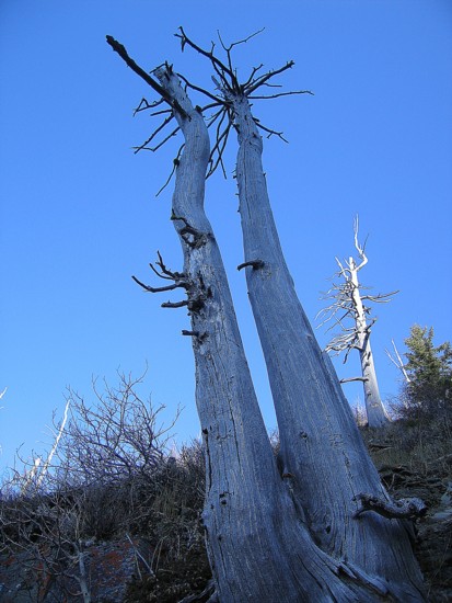
Dead trees
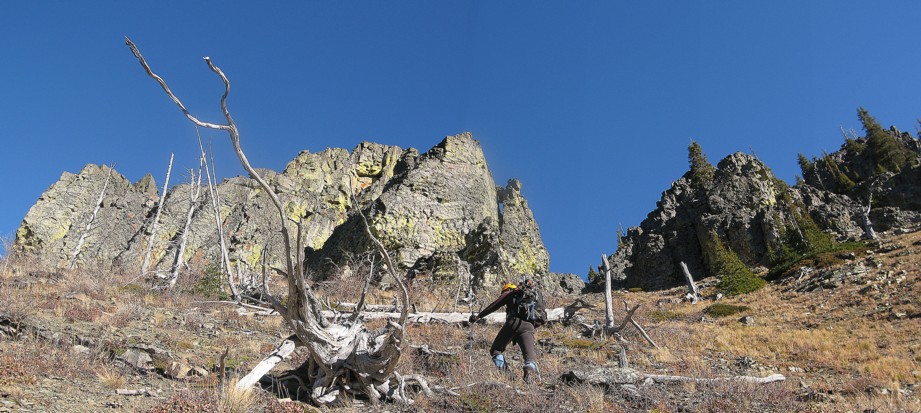
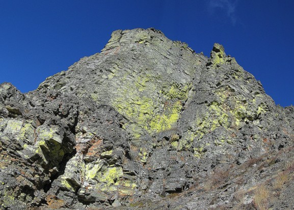
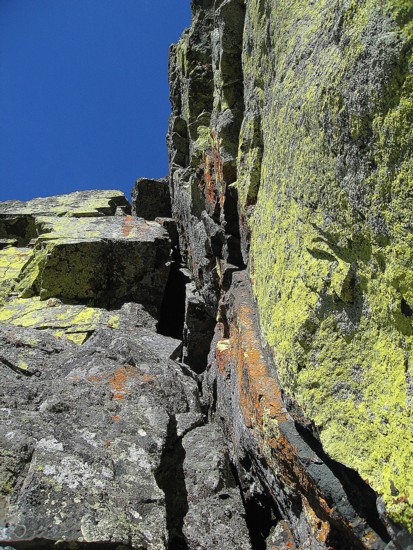
Approaching one of the most interesting and colourful rock-bands we've ever seen
At the rock; note the chockstone in the centre
One side of the rock
Another side
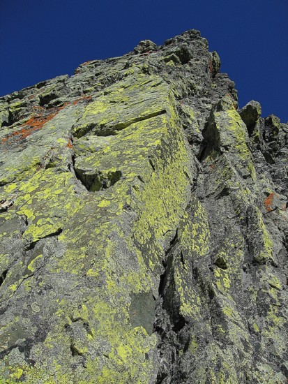
The lichen-covered rock
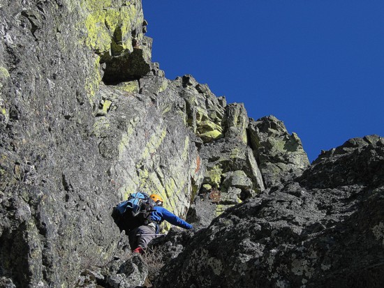
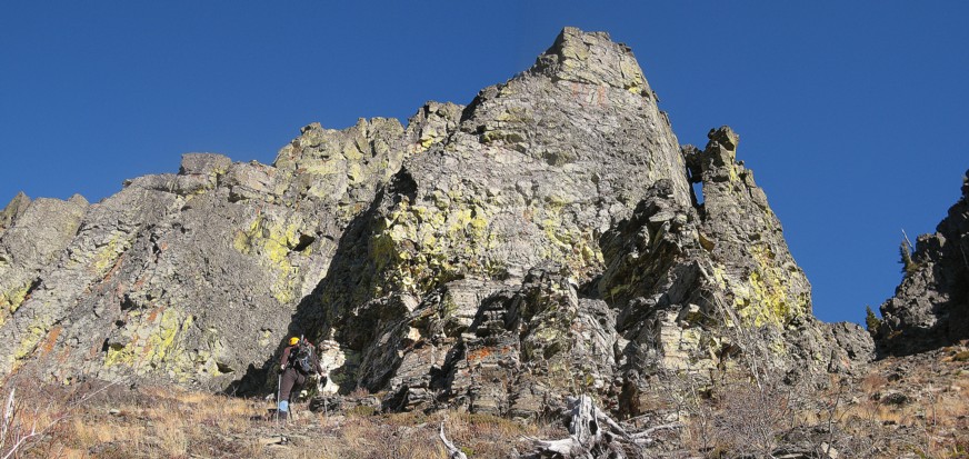
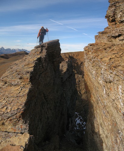
Mark ascends the weakness in the rock-band
More striking colours
Typical posturing - I
had as about as much intention of climbing this as I do calling Jenny
Craig;
definitely some of the coolest rock we've ever seen
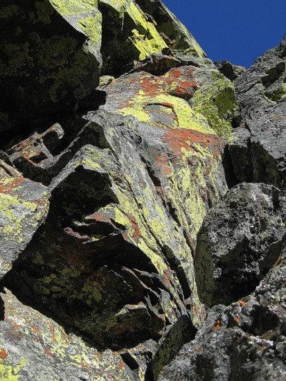
Same as above

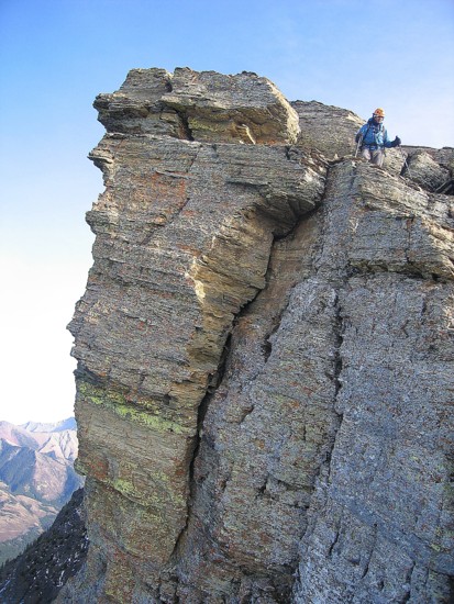
A huge pinnacle
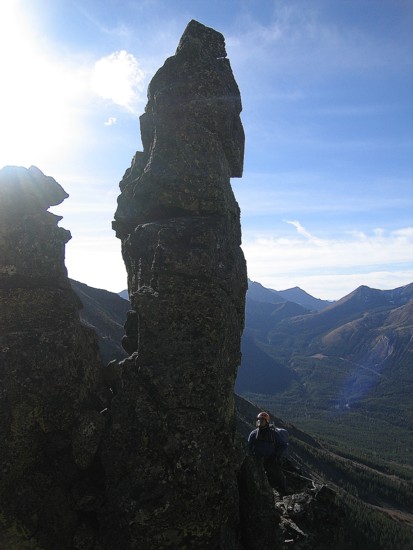
The other side of the pinnacle
Checking out the aforementioned chockstone
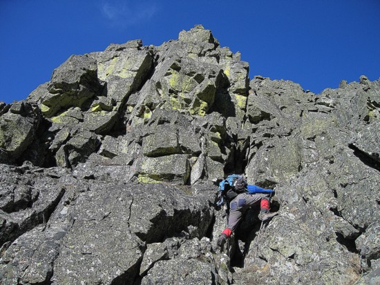
Marks leads the way through the upper section of the rock-band
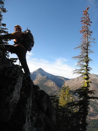
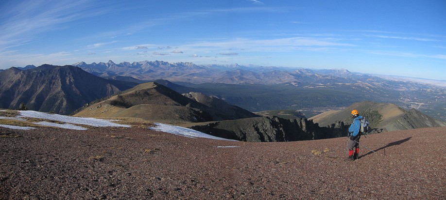
Gaining the upper ridge; Mount Haig in the background
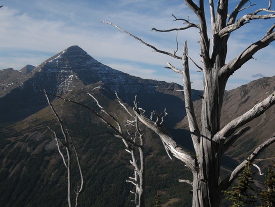
Haig and a dead tree
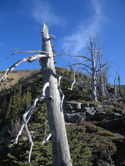
More dead trees
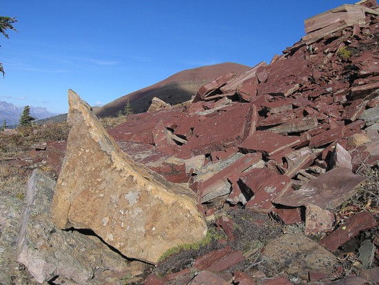
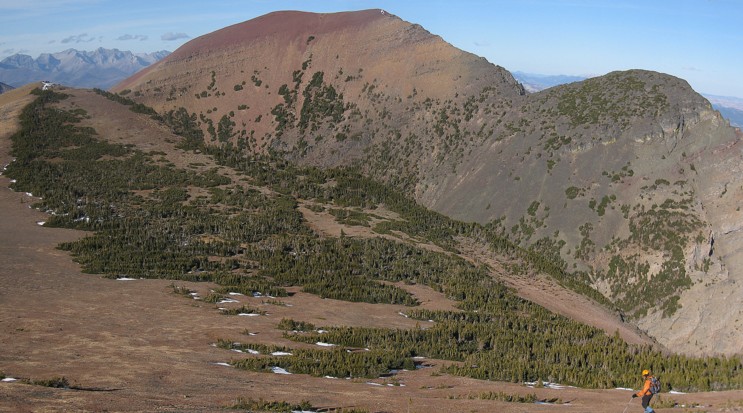
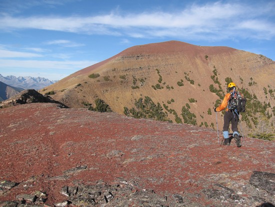
Red argillite and other stuff
Same as above
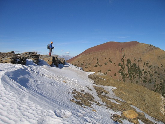
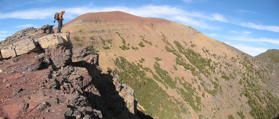
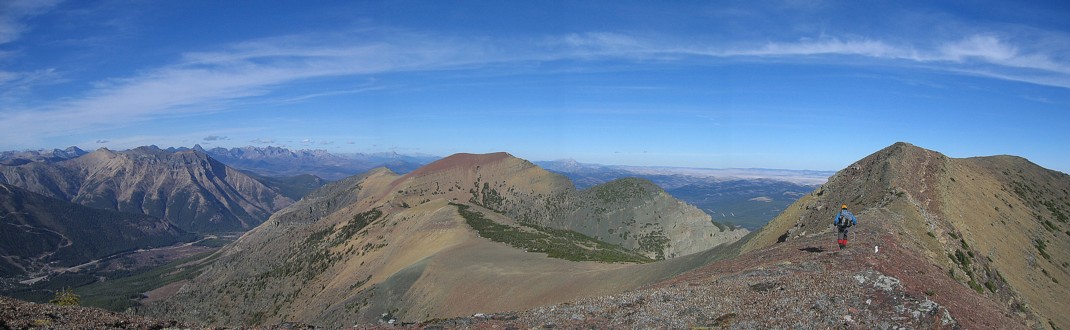
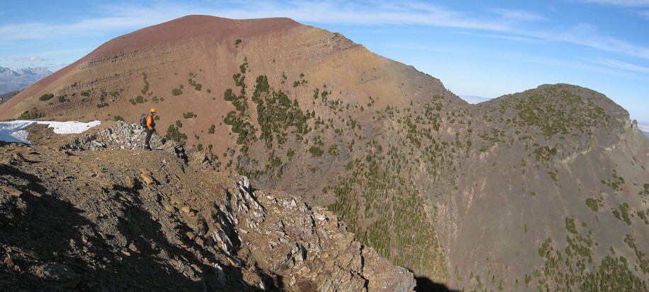
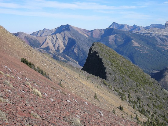
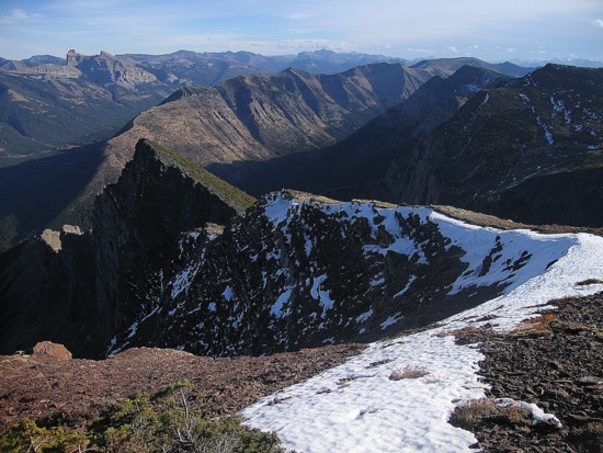
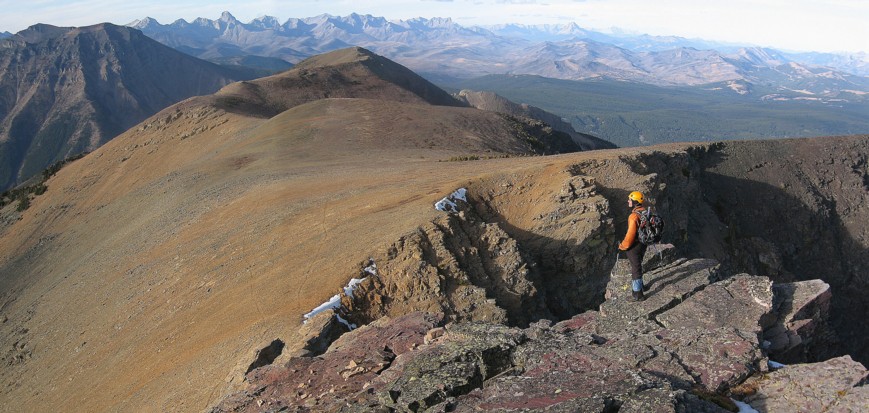
On the ridge between Barnaby and the unnamed RED summit, south of Southfork
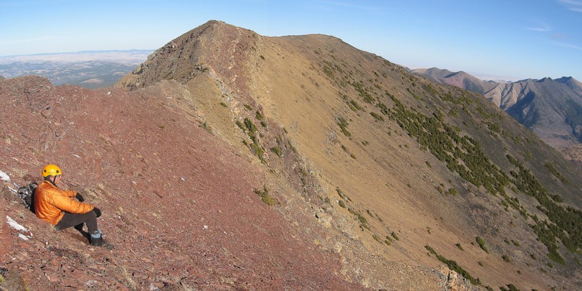
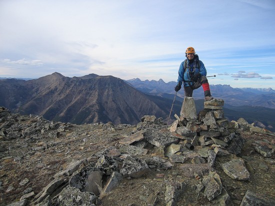
More posturing - usually when I take a break I don't sit right on the edge of a 200 metre vertical drop
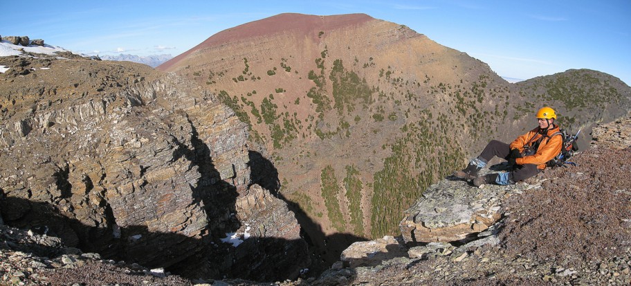
From the lower, west summit, looking back to the true summit (right), with RED to the left and Southfork Mountain just visible to the left of RED
Mark at the lower summit
Seeking respite from the wind
Heading back to the true summit
Heading down
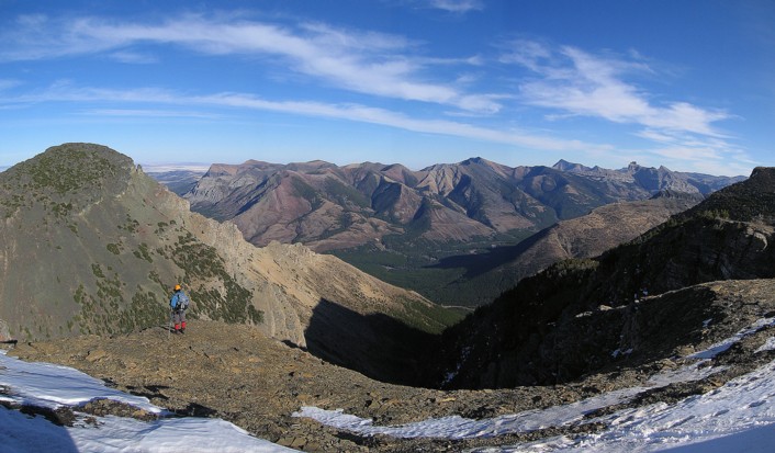
The view to the east: Table, Whistler, Gladstone, Victoria, Castle, and Windsor are visible.
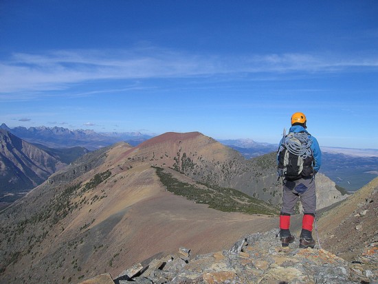
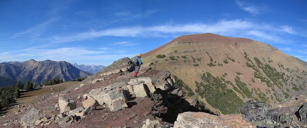
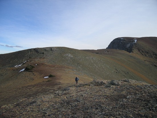
One of many great viewpoints along the way to RED
Lots or red argillite on the way to RED
More interesting rock scenery and colours
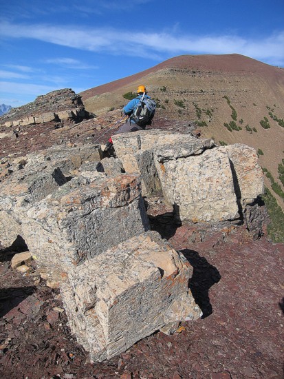
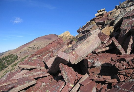
BIG square rocks
More rocks

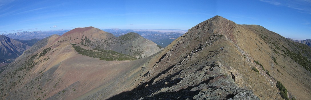
Taking another break; Syncline Mountain stands at the left and Southfork is in the centre
Scenery to the east
Looking down to Southfork
The view to the southeast
More big drops down the east face of the ridge

Same as above
Same as above
Completing the trip
Mark at the summit of Southfork