August 23, 2010
Mountain
height:
2902
m
Total elevation gain: 1200
m
Ascent time:
6:30
Descent time:
4:00
Climbing with Kevin.
After
hearing Ferenc’s riveting account of his day and night
on 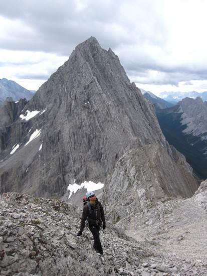 They were benighted on the mountain when the
ascent
turned out to be more difficult than described and the descent far from
trivial. Kevin and I had no intention of doing that route (although
Kevin may
return to do it in the future), but we found an excellent route
description of
a near scramble route by Orvel Miskiw. The ascent went exactly as he
described.
They were benighted on the mountain when the
ascent
turned out to be more difficult than described and the descent far from
trivial. Kevin and I had no intention of doing that route (although
Kevin may
return to do it in the future), but we found an excellent route
description of
a near scramble route by Orvel Miskiw. The ascent went exactly as he
described.
As
usual, it was a sheer delight to be back among peaks of
the magnificent
We
hiked easily up King Creek and then to the Brock/Blane
col. Kevin’s recent ascent of Blane was very helpful in
getting us there via
the fastest and easiest route. 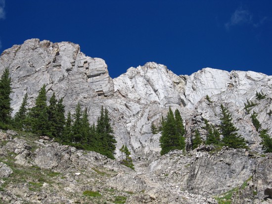 Along the way the uplifts of rock were fantastic,
but bad lighting due to cloudy and potentially stormy skies took some
of the
thunder out of those views (pun intended). A strong and unusually cold
wind for
August ensured we would reach the col wearing almost all our layers of
clothing.
Along the way the uplifts of rock were fantastic,
but bad lighting due to cloudy and potentially stormy skies took some
of the
thunder out of those views (pun intended). A strong and unusually cold
wind for
August ensured we would reach the col wearing almost all our layers of
clothing.
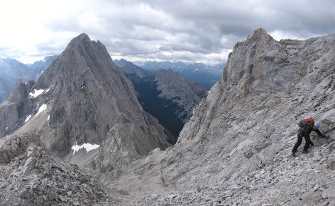
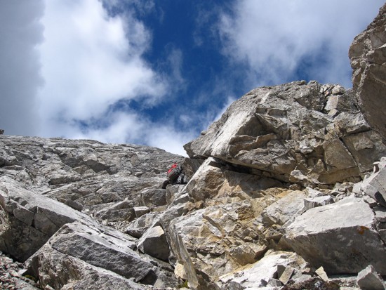
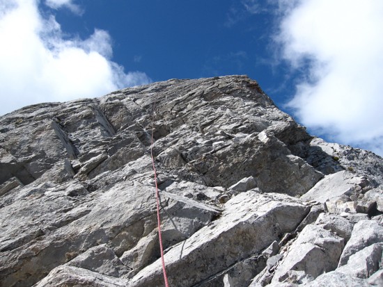
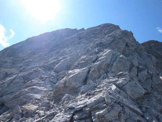
The route from the col seemed very obvious thanks to Orvel’s description – a long scree ramp paralleling the south ridge on the east side of the mountain. We ascended that ramp to a point only 70 vertical metres from the summit. From there, as suggested, we took out the rope and put on the rock shoes. The terrain didn’t look too bad, however, it was deceivingly steep in places and the finesse of rock shoes was definitely appreciated. Kevin led the pitch, deftly placing some good protection, and soon we were at the sub-peak, a few vertical metres and not many horizontal ones from the true summit.
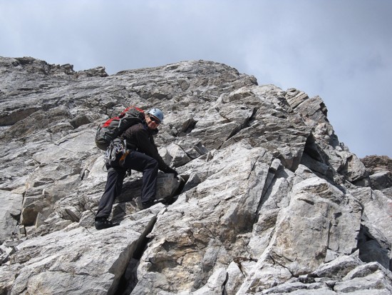
Downclimbing to the gap between the sub-peak and the summit looked a little tricky so we took an easy, but circuitous route around a large rib of rock to the gap, and then contemplated the last few metres to the summit. As Orvel’s outlines in detail, the crux ascent is a short, vertical wall with an excellent crack for protection and/or handholds just above your head. Kevin again stepped up to the plate and climbed the step with ease. After belaying me up we walked to the summit, a short distance away.
Of
course, the summit view was somewhat marred by the
unwelcome cloudy skies, but at least the cloud level obscured only the
tallest
of peaks in the area (ie. Joffre,
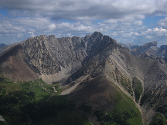
The two necessary rappels to get down from the summit were a little time-consuming, but after that, it was an easy and wonderfully scenic hike back to the car. The skies finally cleared to reveal the incredibly beautiful terrain all around us.
A very, very rewarding day.
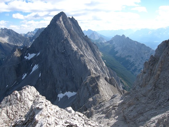
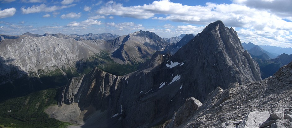
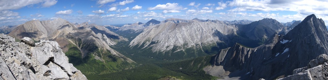
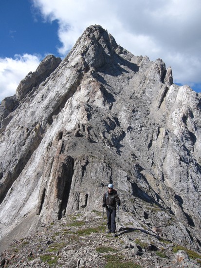
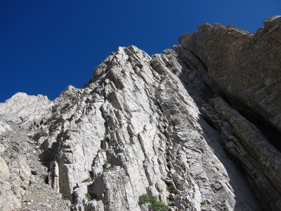
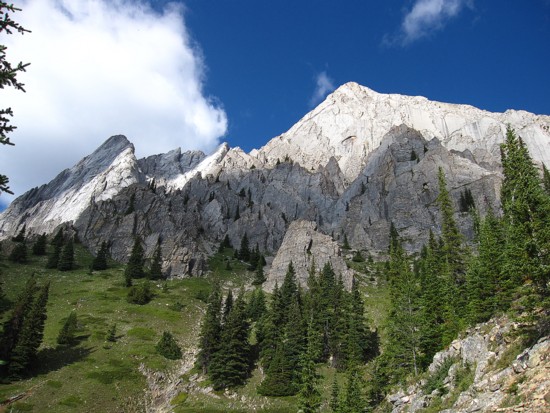
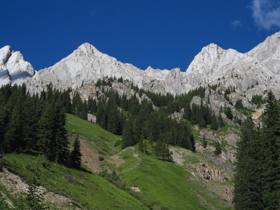
The first look at Brock
(left of centre)
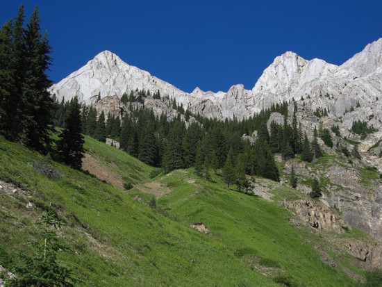
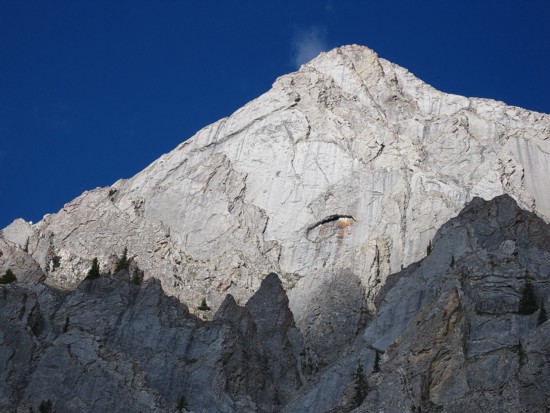
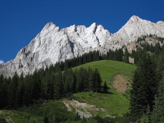
Mount Blane
from near the Blane/Brock col
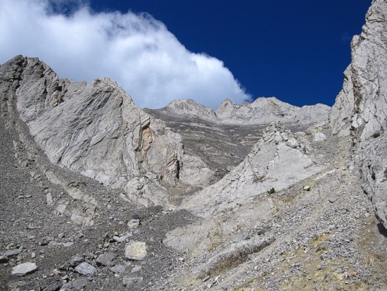
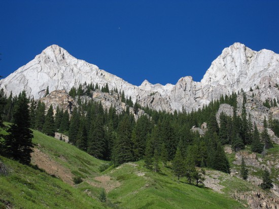
Brock
from the col; the ascent route goes up the obvious scree slopes, right
of the south ridge
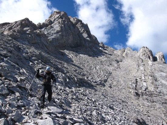
Kevin makes his way up the scree
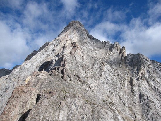
Kevin is all smiles as we start up steeper terrain towards the false
summit
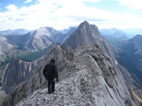
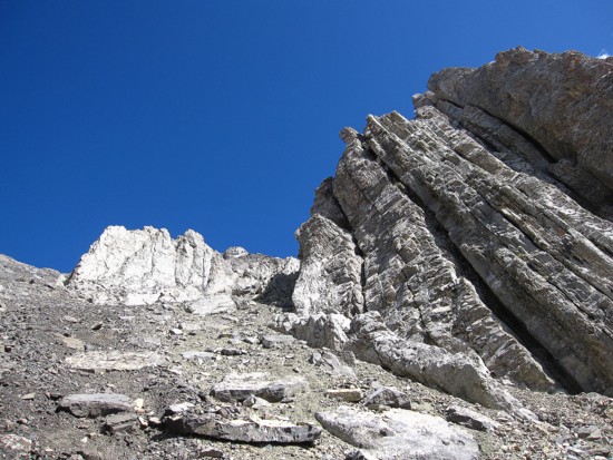
Higher up; just scrambling at this point
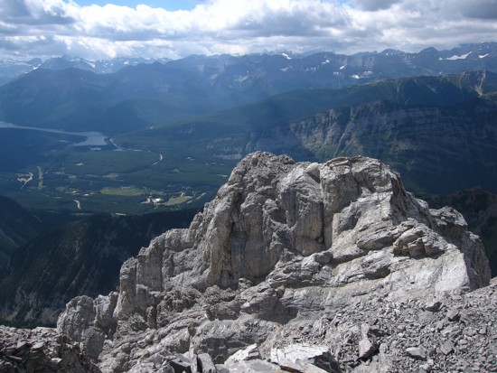
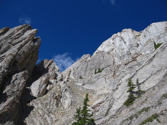
A very beautiful, unnamed peak to the east
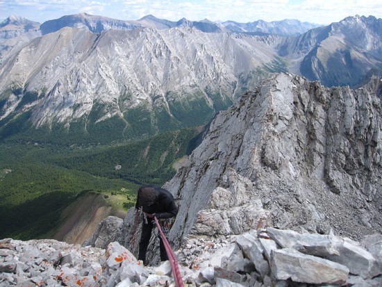
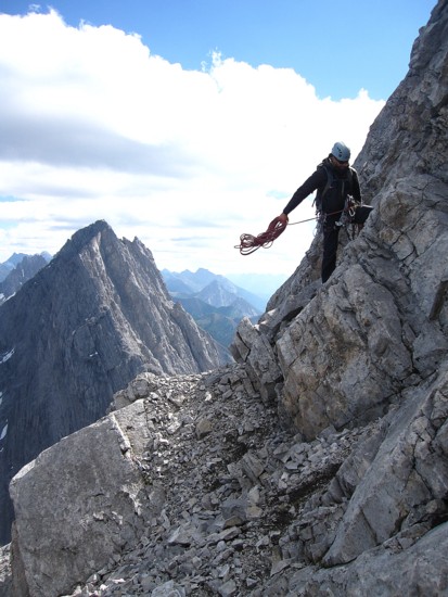
Out comes the rope
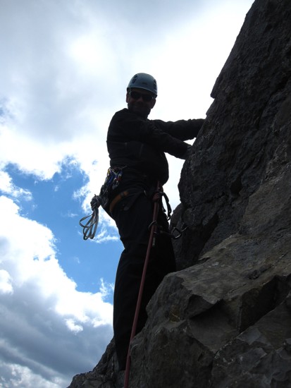
Kevin getting ready to ascend the crux
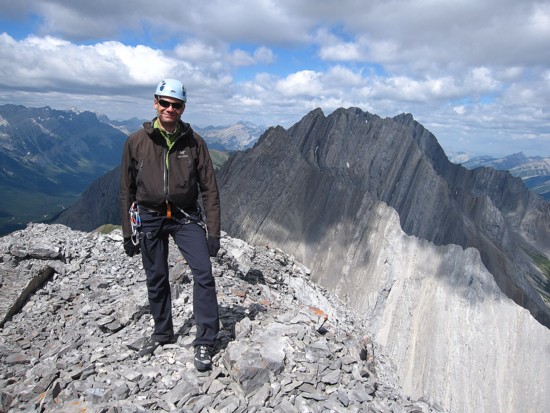
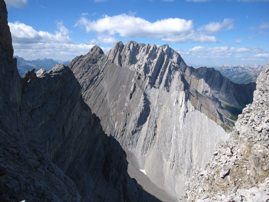
Kevin at the summit, with Hood,
Packenham,
and Evan-Thomas
behind
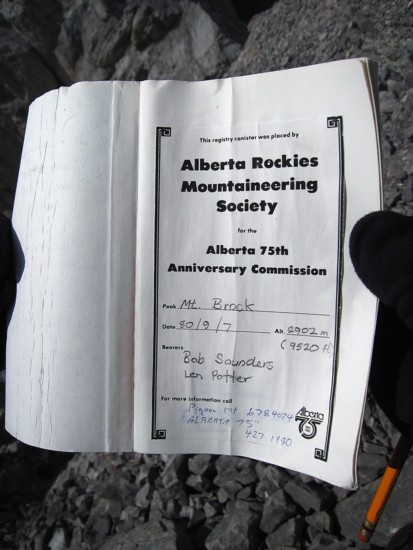
The first page of the summit register
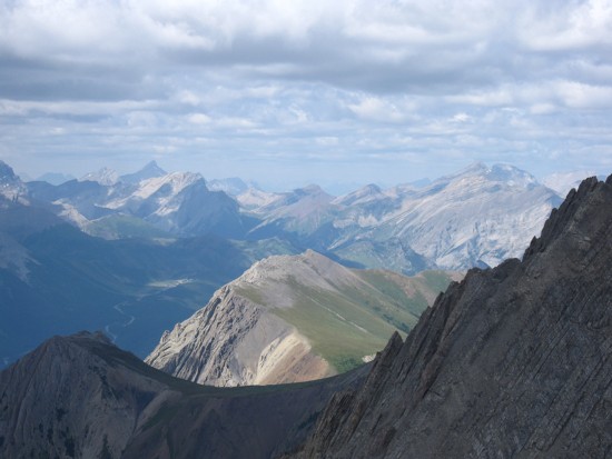
The summit view to the east and southeast
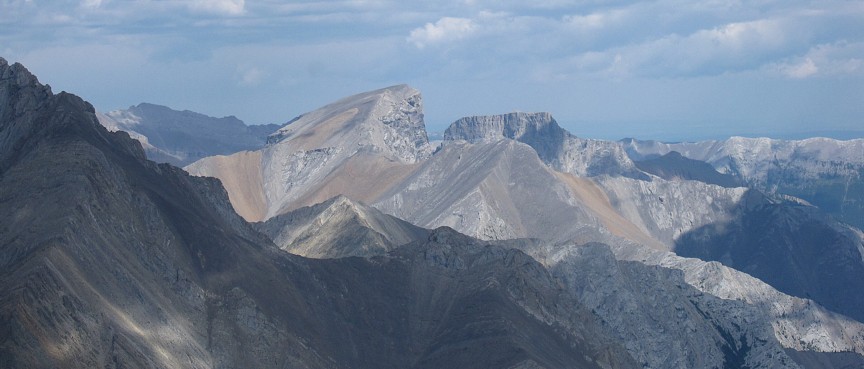
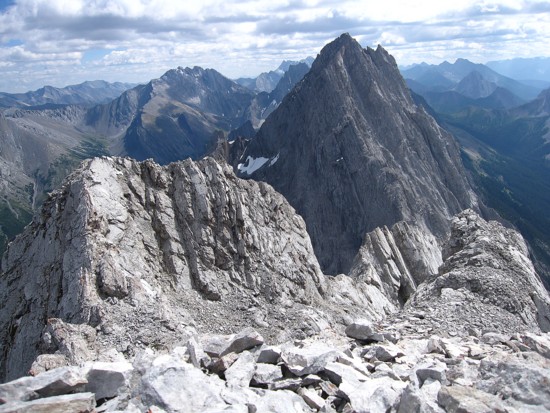
Looking west to the other false summit;
those who took the Pillar route would reach this summit at some point
The south end of Opal
Ridge is visible, with Grizzly
Peak in the shade at the far, lower left
Romulus
and Remus
Kevin starts the descent
Kevin on the first rappel
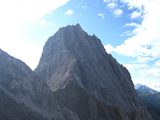
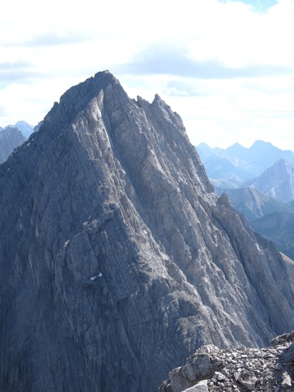
The false summit at the left
The scary looking northwest ridge of Mount Blane
Kevin coils the rope after the second rappel
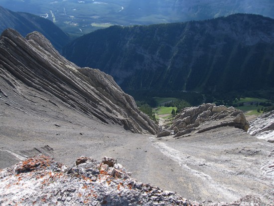
Scrambling back down the the scree slopes
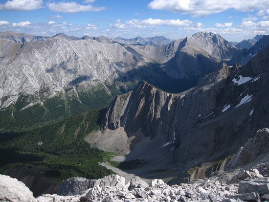
More views to the southeast
The aforementioned peaks to the north
Kevin descends the scree
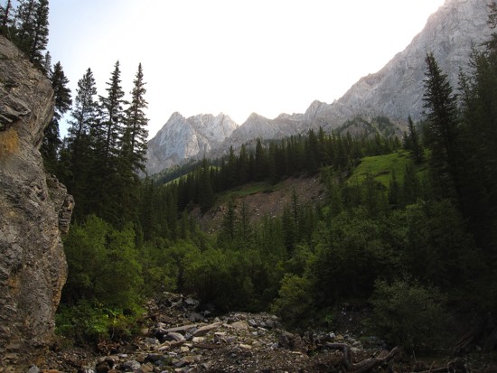
Looking down to the north fork of King Creek from near the col
Kevin at the col; the south ridge descent route looks pretty daunting
from this vantage point
Clear sky arrives as we descend
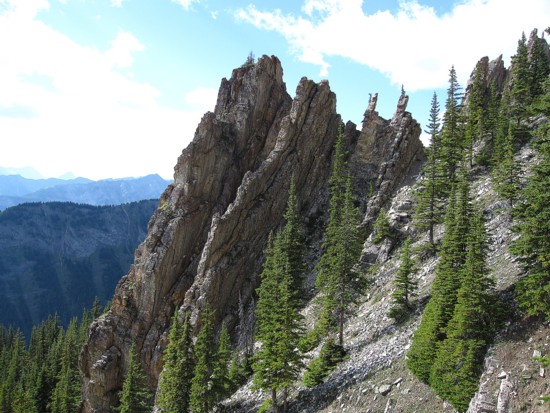
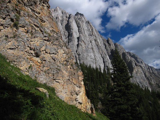
The severely tilted strata of the rock, characteristic of the Opal Range
More terrific scenery on descent
Same as above
A last look at Brock