Crypt Peak attempt
July 21, 2018
Roundtrip
time: 9:30
Scrambling
with Mark.
 Unofficial
Crypt Peak is the bulky, red mass of rock that sits proudly above Crypt Lake. An
attempt of the peak had been on our radar ever since running up adjoining
Boswell Peak in 2008. However, the logistical challenges of an attempt of Crypt
make those of Boswell look easy, as Crypt requires far more horizontal and vertical
elevation gain and all within the time constraints of the boat ride across
Upper Waterton Lake. As such, we considered several options: 1. Take the
earliest boat, run up the peak as fast as possible and run down in time to get
the late boat back. 2. Bike and hike to Crypt Landing via the Vimy Peak trail.
This adds about 28 km to the overall distance. 3. Kayak or canoe across the
lake. This could be the best option, but you obviously need a watercraft and
are at the mercy of the Waterton wind and paddling conditions on the lake.
Unofficial
Crypt Peak is the bulky, red mass of rock that sits proudly above Crypt Lake. An
attempt of the peak had been on our radar ever since running up adjoining
Boswell Peak in 2008. However, the logistical challenges of an attempt of Crypt
make those of Boswell look easy, as Crypt requires far more horizontal and vertical
elevation gain and all within the time constraints of the boat ride across
Upper Waterton Lake. As such, we considered several options: 1. Take the
earliest boat, run up the peak as fast as possible and run down in time to get
the late boat back. 2. Bike and hike to Crypt Landing via the Vimy Peak trail.
This adds about 28 km to the overall distance. 3. Kayak or canoe across the
lake. This could be the best option, but you obviously need a watercraft and
are at the mercy of the Waterton wind and paddling conditions on the lake.
Option 3
was out because we didn’t have a kayak or canoe; even thinking about the
overall distance of travel required for option 2 made us feel nauseous; and so
option 1 it was!
We made a
mistake right off the bat when, after securing a spot on the 8:30 am boat, we
sat right at the front of the jam-packed vessel. This meant that we were the
last off the boat and therefore ended up near the middle of the pack of a long
line of hikers heading to Crypt Lake. Although the pace set by the people at
the front was pretty decent, it was not the “sense of urgency” pace we needed
to make the summit a feasible proposition. Thankfully, we were able to maneuver
our way to a spot near the front and increase our pace a little. Arriving at
the lake in 2.25 hours, we were fairly confident a summit bid was still in the
cards.
Mistake
number 2 was very much under-estimating how along it would take us to gain the
ridge north of the objective. Hoping for somewhere around 1.5 hours, it
actually took 2.25 hours. At this point the summit was close but the remainder
of the ascent looked very steep and would probably take as long to descend as
ascend. There was no way we could get up and down and then make the last boat. Instead,
we hung out at our highpoint – one that sported a terrific panorama in its own
right – and then started a more leisurely descent.
We’ll definitely be back for this one.
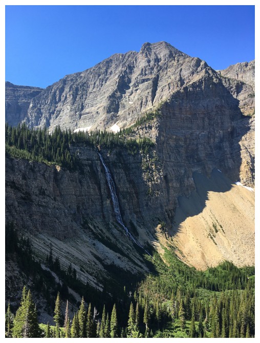
Crypt Falls
Mark approaches the famous tunnel
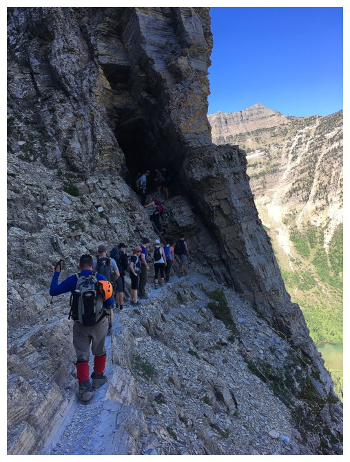
A line-up has already formed
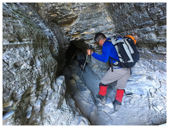
Heading into the tunnel
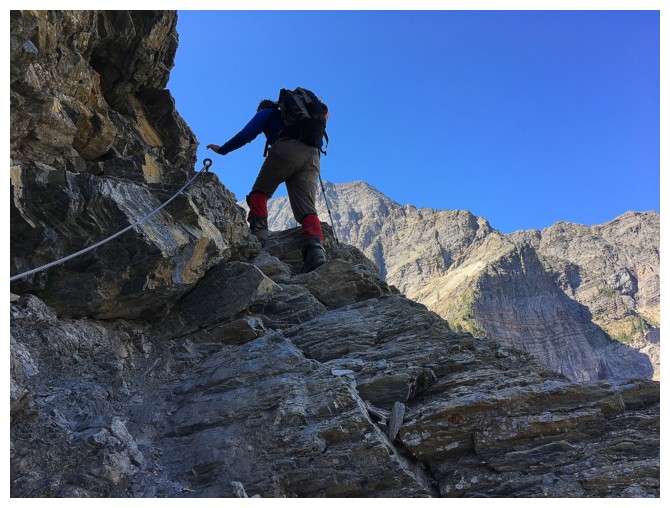
Grab the cable, for God's sake man!!
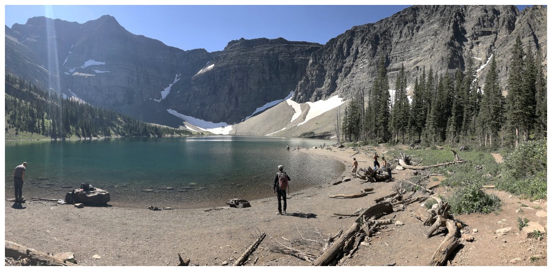
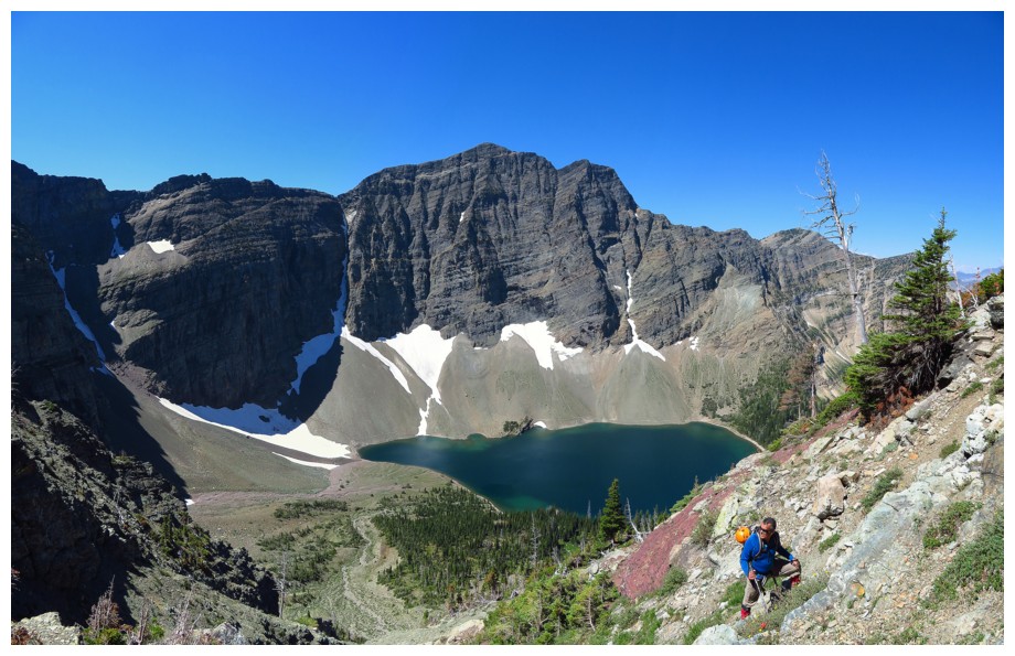
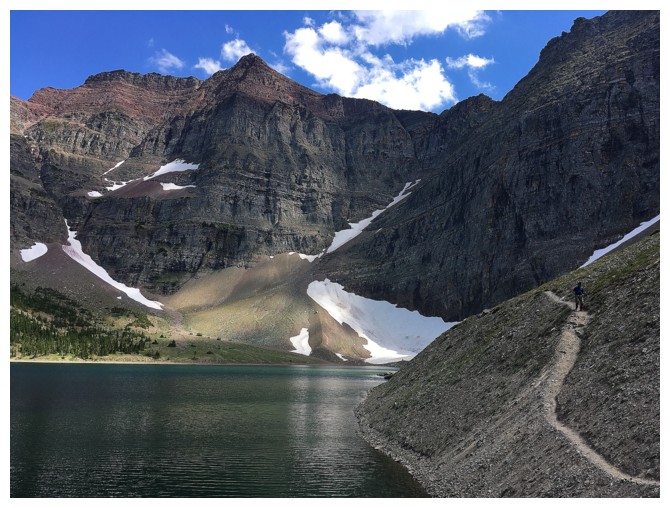
Crypt Lake
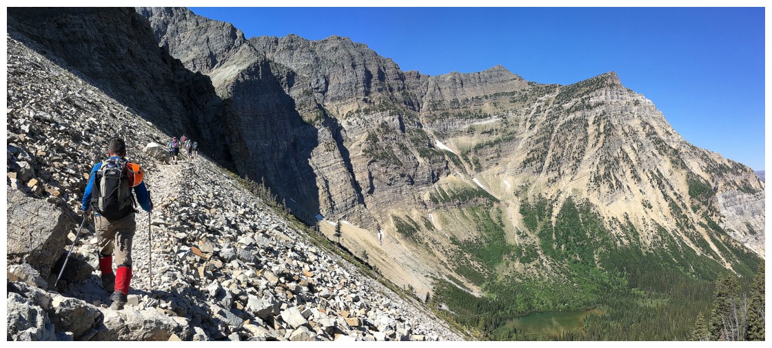
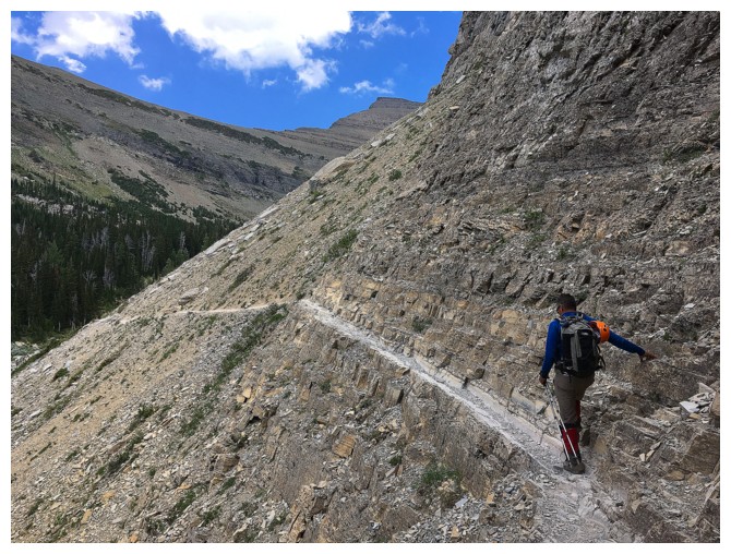
Going around the scenic left side of the lake
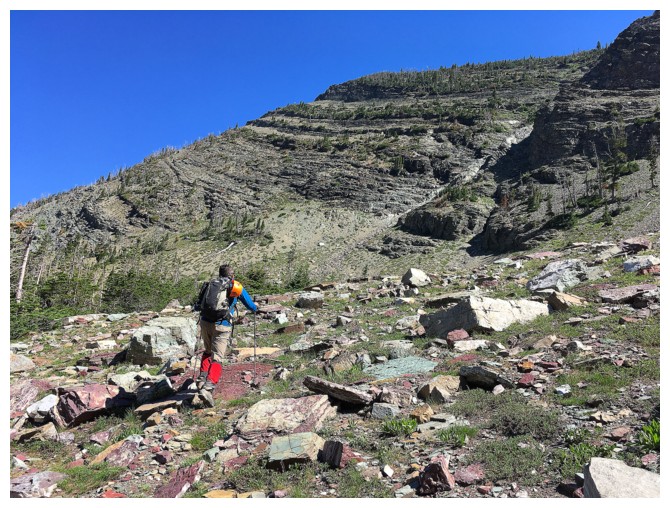
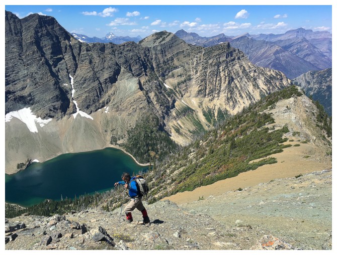
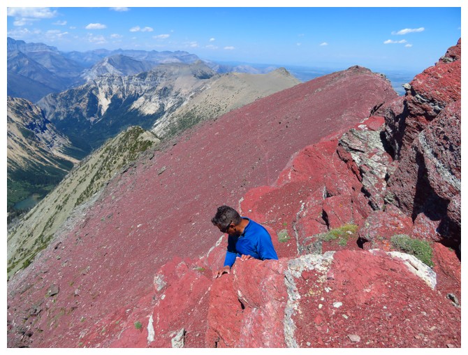
Mark leads the way up to the ridge, north of the summit block
The ascent gully was super interesting, with improving views of the lake
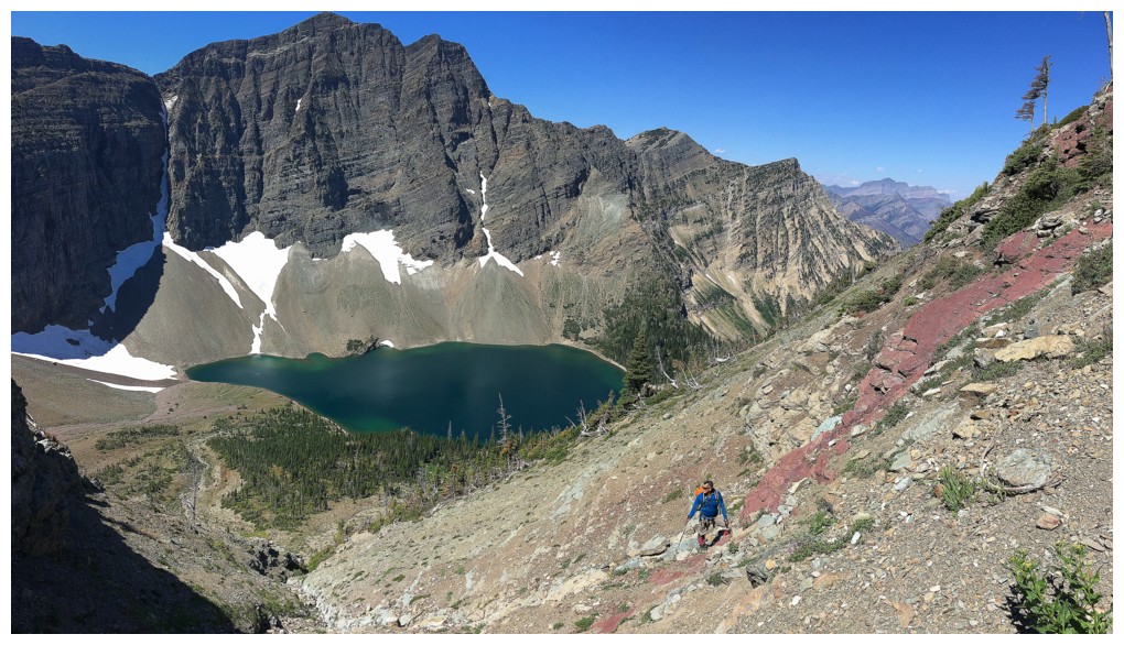
Our first run-in with one of the many highlights of the trip - you guessed it - red argillite!
If you are going to take a break, do it by the red argillite
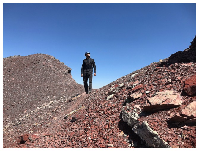
Onward and upward
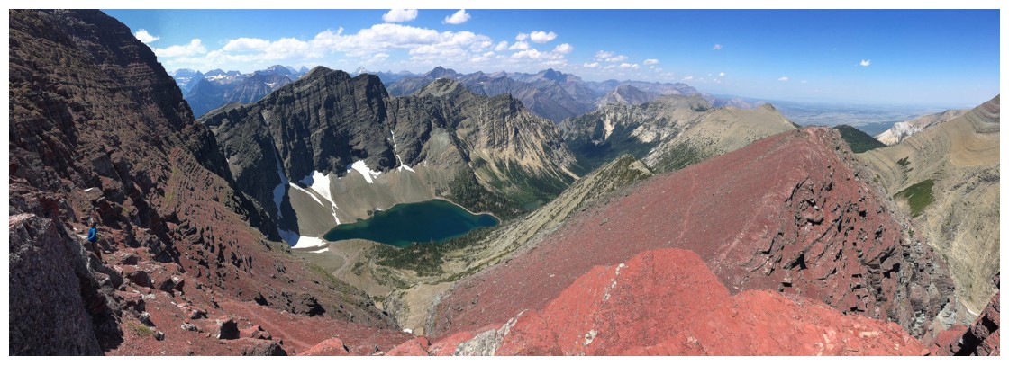
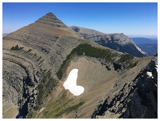
Almost at the ridge. Mount Boswell in the center foreground. Other
notable and distant peaks include Long Knife, Alderson and Blakiston.
The first thing we saw upon reaching the ridge was this nostalgic look at the highest point of Vimy Ridge
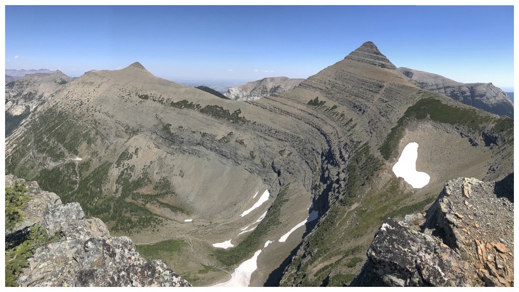
A more comprehensive view of Vimy Ridge
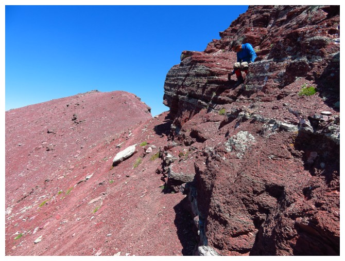
Mark gains the ridge
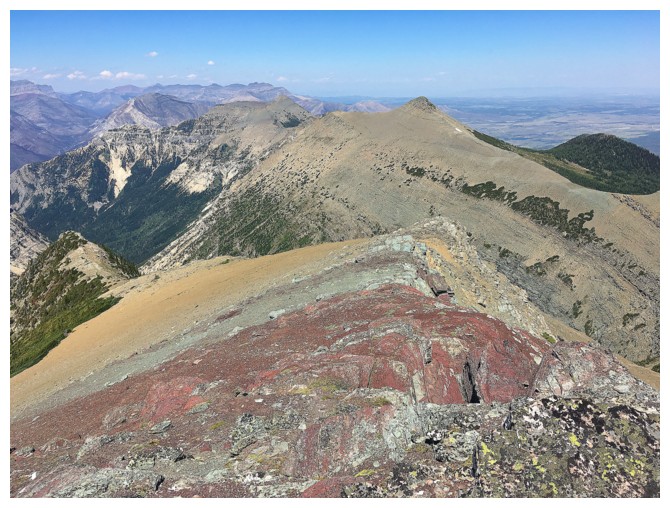
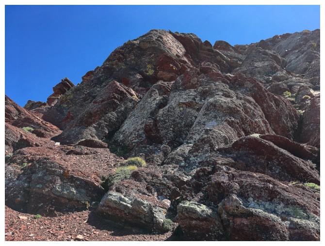
More argillite appears
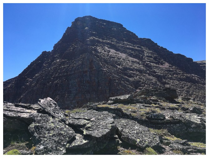
The summit block - it doesn't look very colourful from here, but its really just one big, beautiful blob of red argillite
Mesmerized by the red!
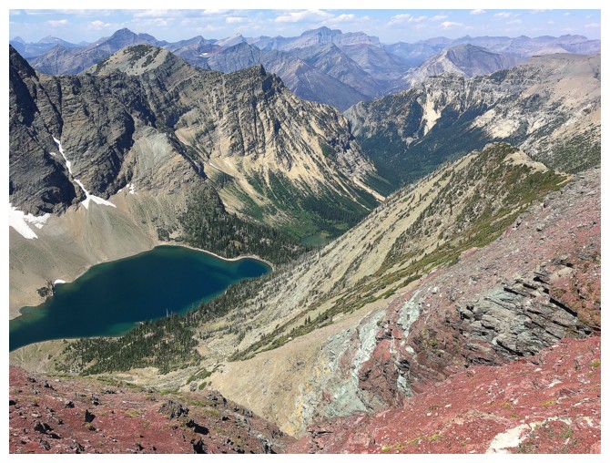
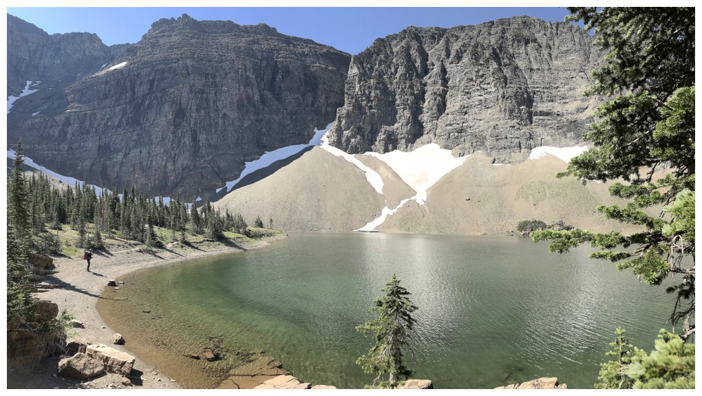
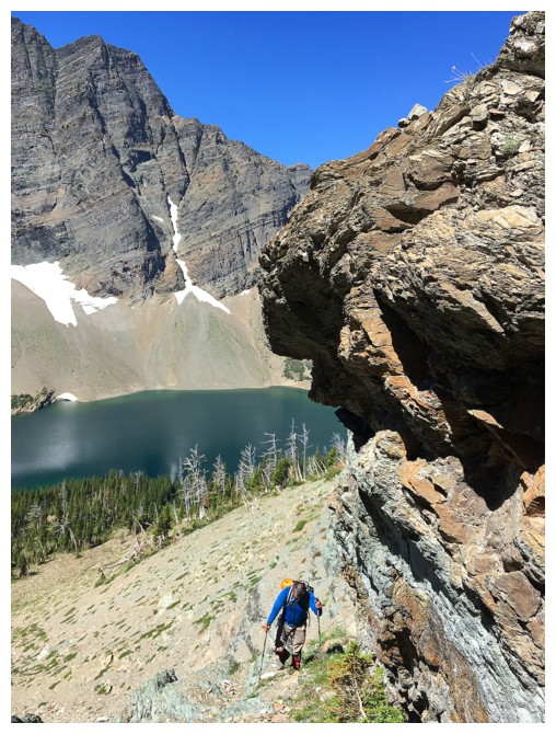
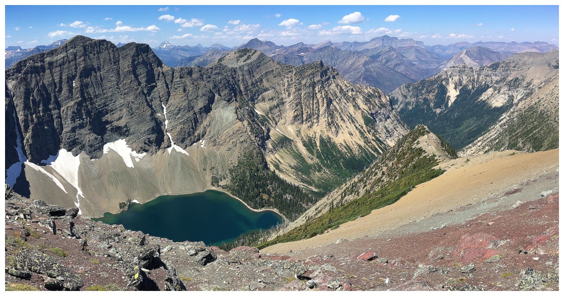
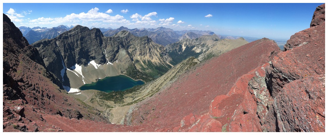
The amazing view down to Crypt Lake
Walking a goat trail along the face
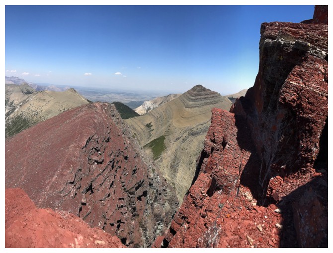
Looking up the summit block
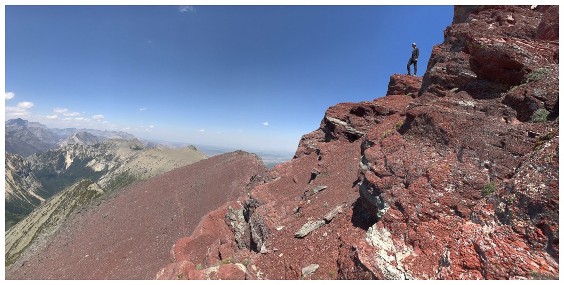
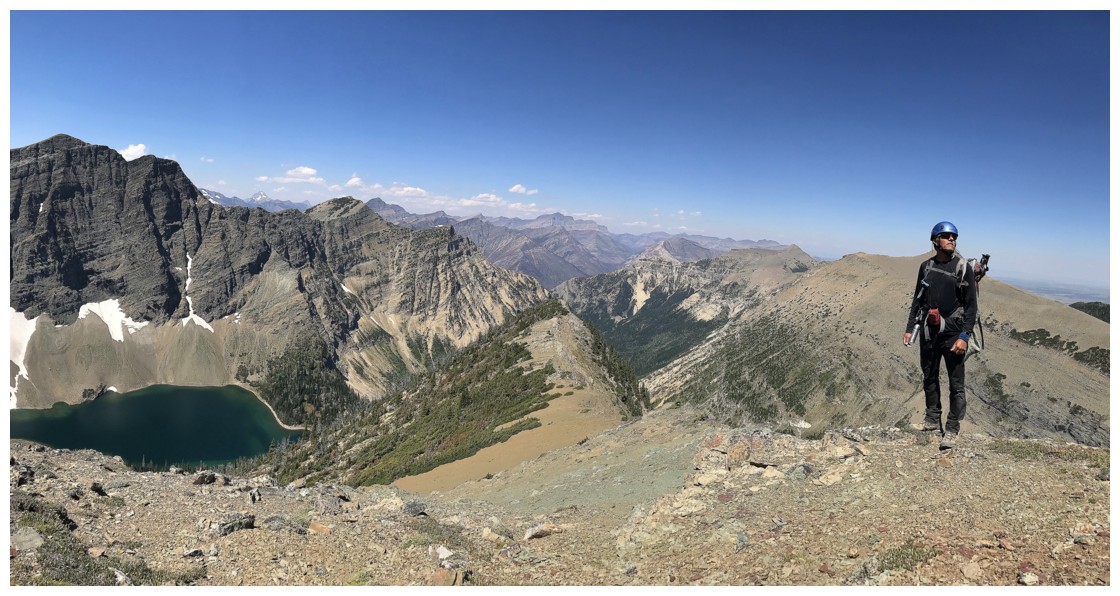
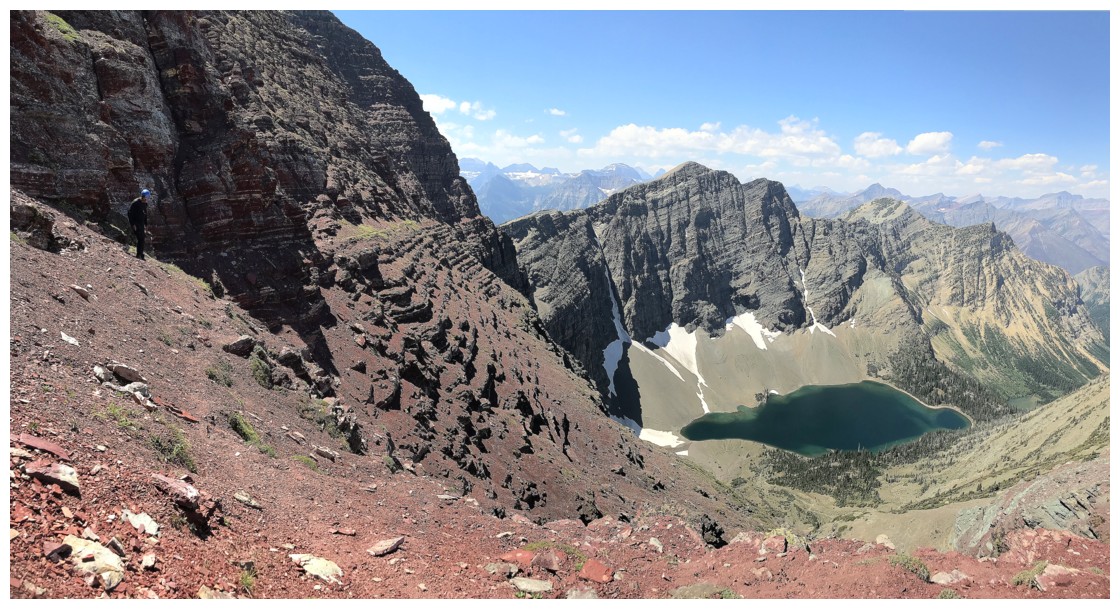
The highest point we reached
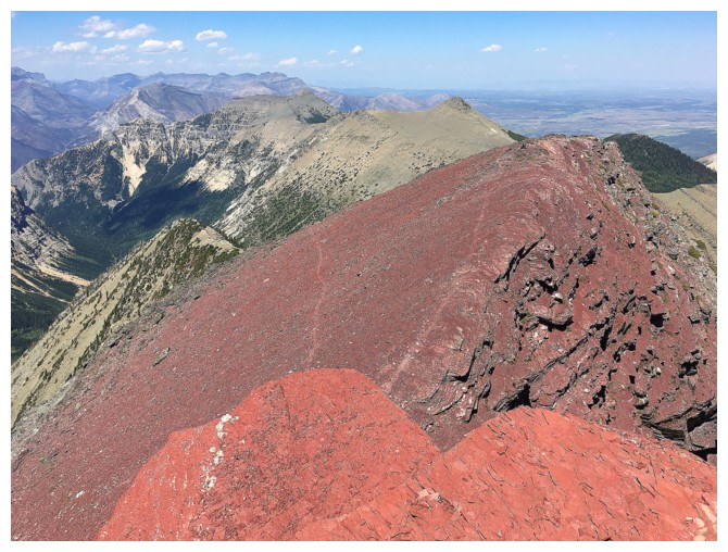
Note the different shades of red argillite
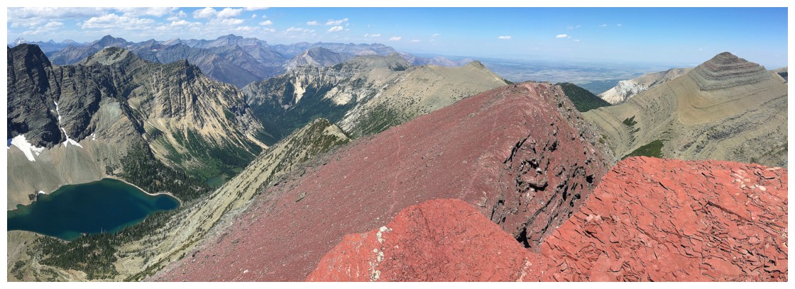
Same as above, with more of the overall view
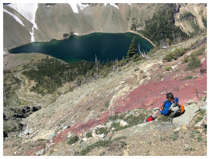
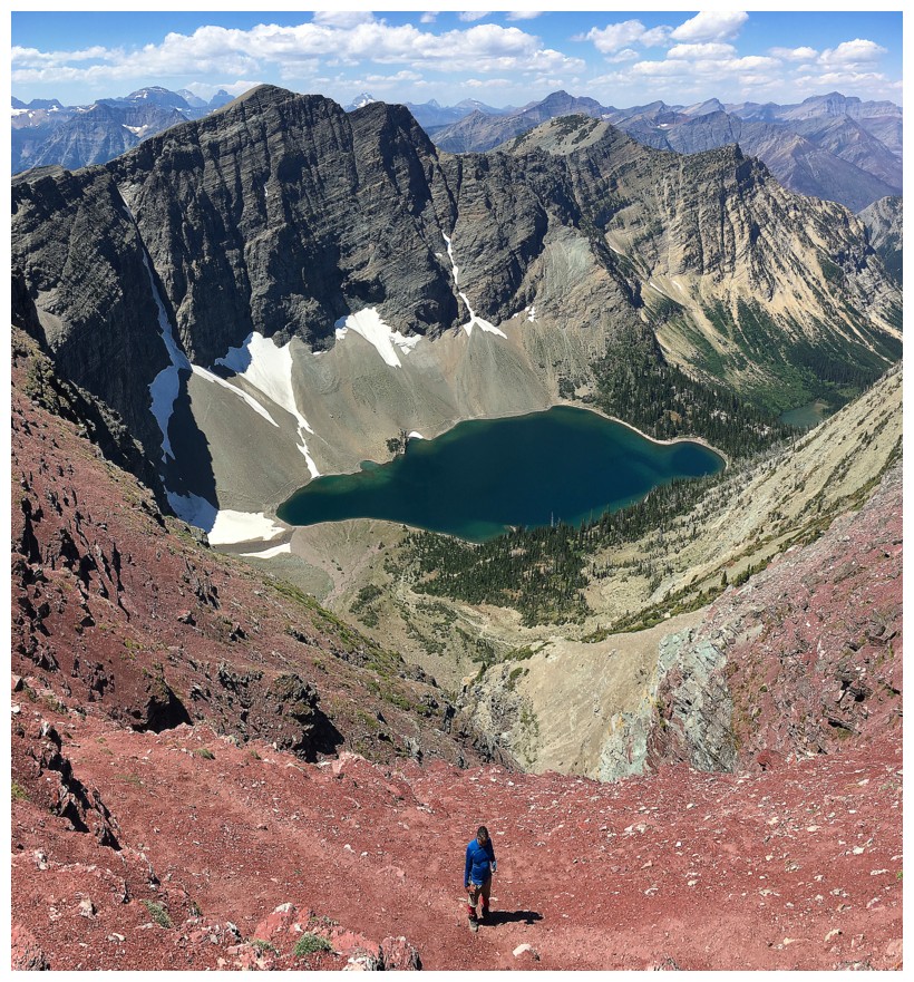
Mark descends from our highpoint
Back at Crypt Lake, circling around the other side
The lake and our failed objective
That's better!
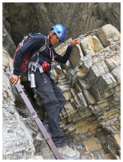
Descending the ladder on the other side of the tunnel
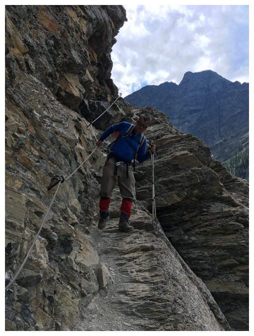
A little exposure after the tunnel
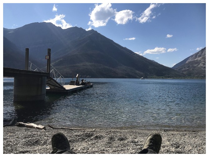
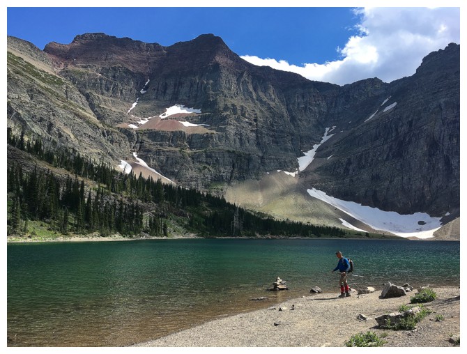
Relaxing on the Crypt Landing beach, as the boat approaches
The End