Lake Dormaar attempt
July 20, 2024
Round-trip time: 8 hours
Solo scramble.
Having stared
longingly at this small lake from several vantage points of the Buchanan Ridge
massif, over the years, I felt it was time to see if I could find a route to
its shores. Initially, I thought the lake was unnamed, however the Waterton
Gem-Trek maps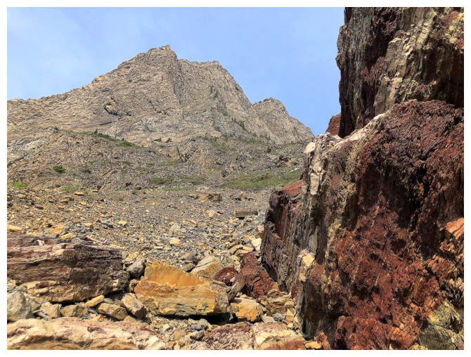 (still the best physical maps out there) identifies it as Lake
Dormaar.
(still the best physical maps out there) identifies it as Lake
Dormaar.
After
scrutinizing several maps, I concluded that the easiest route would involve
hiking about 5.5 km of the 7 km Alderson Lake trail, before heading west and
route-finding my way to the lake. The viability of the route was probably going
to depend on the severity of a section of bushwhacking upon leaving the trail.
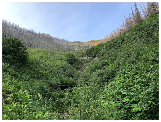
In short, I didn’t
take one step into that forest. Perhaps somewhat gun-shy after an unexpectedly
challenging descent off Darrah SE4, less than 24 hours earlier, I took one look
at the dense bush and abandoned the planned route. 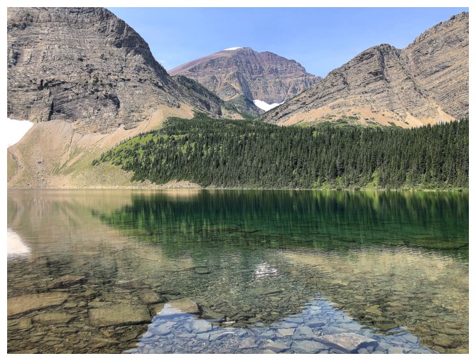 Had
Dave been with me I’m
sure we would have plunged right into it (that's a compliment to Dave's
adventurous nature and not a dig!). However, I was alone, bears have
been
known to frequent the general area, and there were two creek crossings
in the thick
of it - too many reasons to not risk an attempt.
Had
Dave been with me I’m
sure we would have plunged right into it (that's a compliment to Dave's
adventurous nature and not a dig!). However, I was alone, bears have
been
known to frequent the general area, and there were two creek crossings
in the thick
of it - too many reasons to not risk an attempt.
I did have a
Plan B. This route, leaving the trail further up the valley, would avoid all
the bushwhacking, but replace it with a long section of side-sloping across the
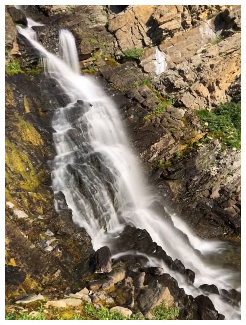
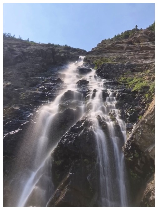
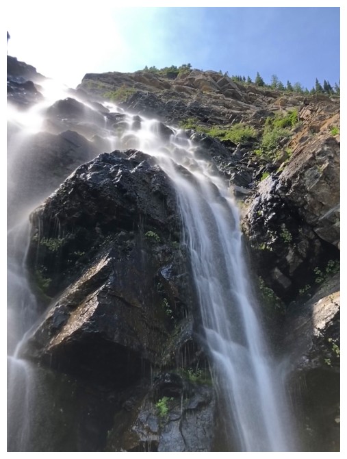
east face of Buchanan Peak. 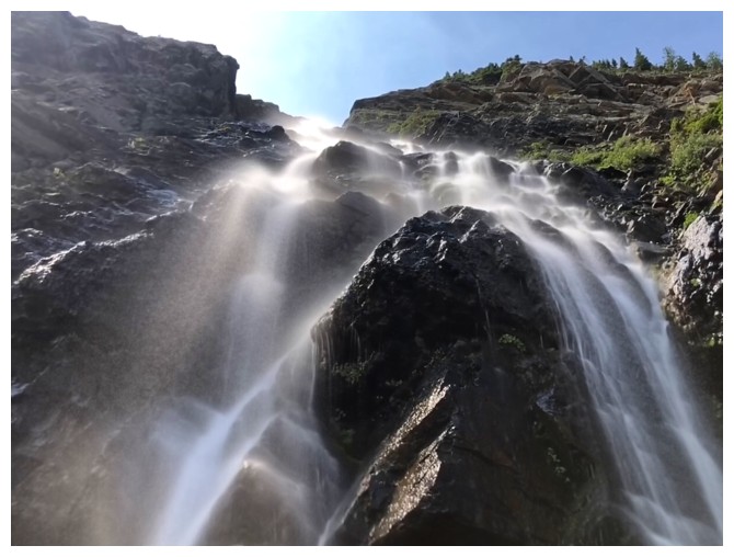 It started very well, featuring an immediate encounter
with a beautiful waterfall. Unfortunately, the waterfall was the highlight of
the attempt. The side-sloping beyond turned out to be tedious, gruelling in
places, and much longer than I thought it would be. Due to the nature of the terrain
underfoot, progress was slow. About 2 kilometres from the lake, I abandoned
this route also. Although 2 km may not seem to be a huge distance, at the rate I
was moving and still facing a significant amount of elevation gain, it would
have taken me at least 1.5 to 2 hours to make it to the lake. At this point of
the day, energy and motivation were waning fast.
It started very well, featuring an immediate encounter
with a beautiful waterfall. Unfortunately, the waterfall was the highlight of
the attempt. The side-sloping beyond turned out to be tedious, gruelling in
places, and much longer than I thought it would be. Due to the nature of the terrain
underfoot, progress was slow. About 2 kilometres from the lake, I abandoned
this route also. Although 2 km may not seem to be a huge distance, at the rate I
was moving and still facing a significant amount of elevation gain, it would
have taken me at least 1.5 to 2 hours to make it to the lake. At this point of
the day, energy and motivation were waning fast.
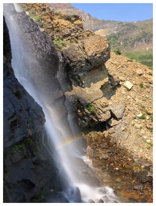
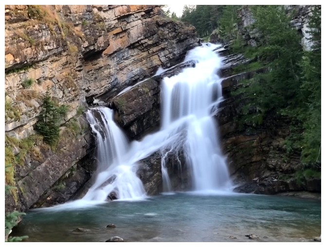
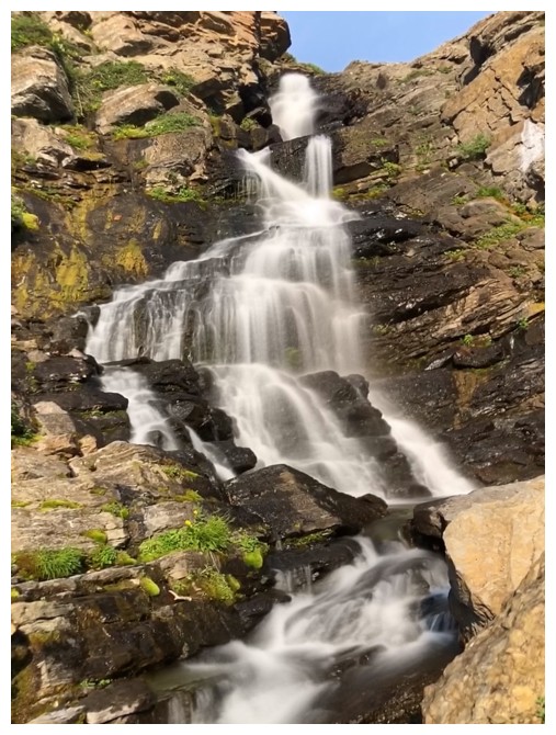
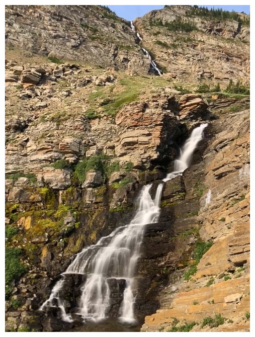
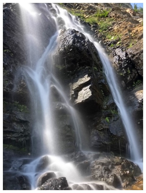
I did have
enough in the tank, however, to check out the other nearby waterfall. Mark and
I had visited this one on our wonderful Mount Alderson ascent in 2018. It had “wowed”
us then and I predicted a similar reaction. Yep – amazing!
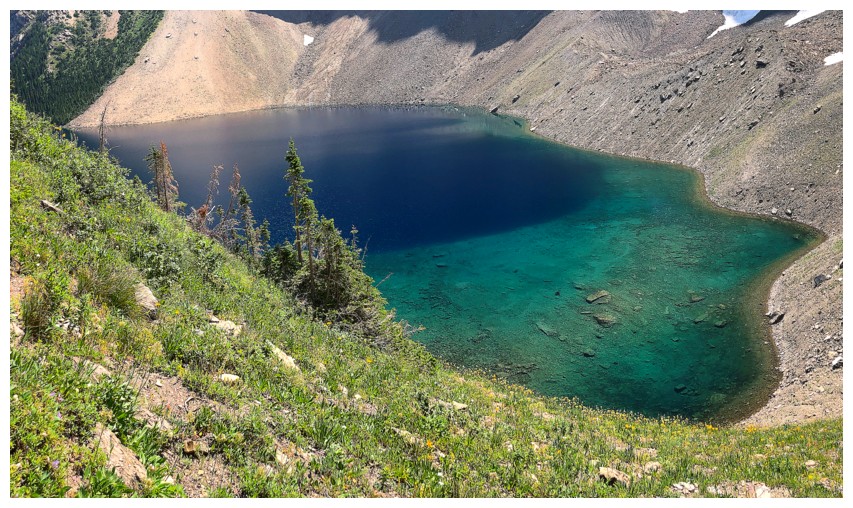
Also amazing was
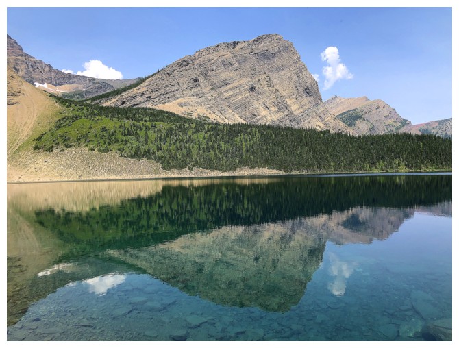
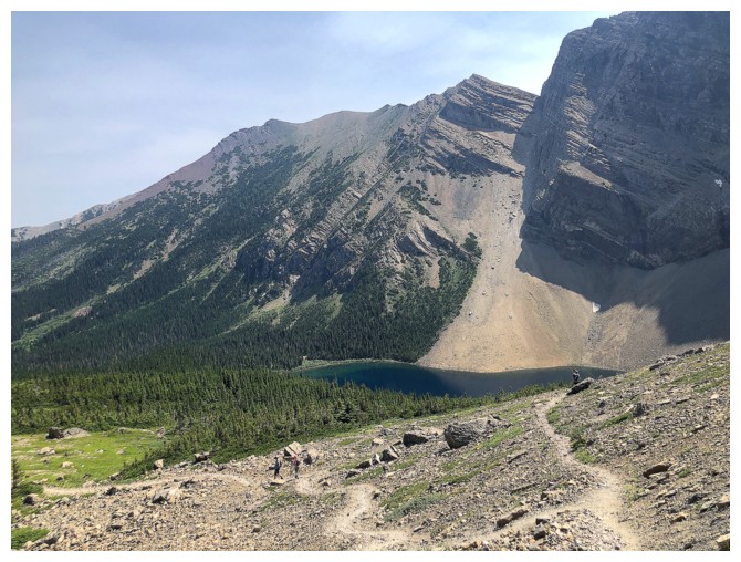
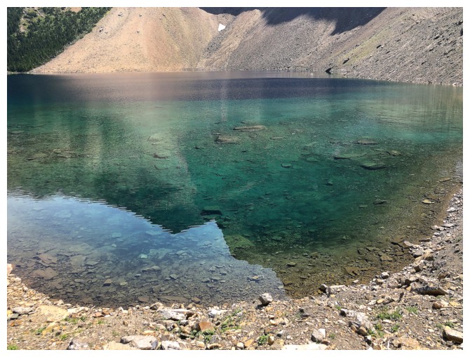
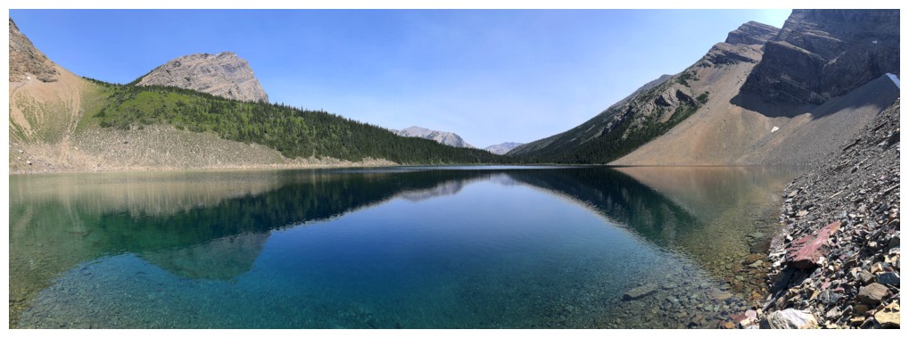
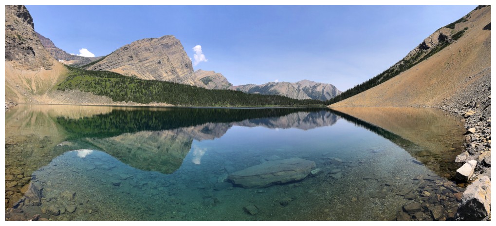
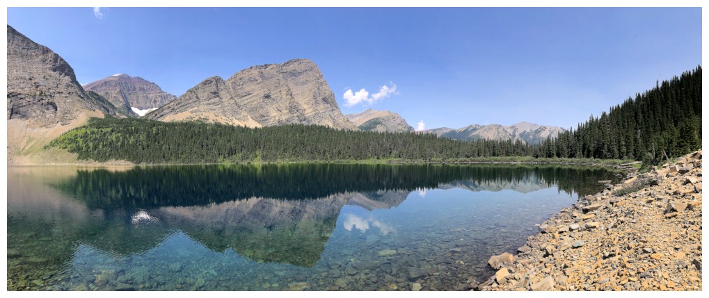
a thoroughly enjoyable jaunt around Alderson Lake. The lake’s blue/green hues were stunning
from above and reflections in the crystal-clear waters stunning from lake-level.
8 kilometres of utilitarian hiking later and the day was done.
Not the outcome
I had hoped for, but an interesting day of exploration and lots of great scenery
to anesthetize the sting of failure.
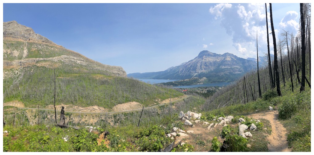
The obligatory shot of Cameron Falls near the trailhead
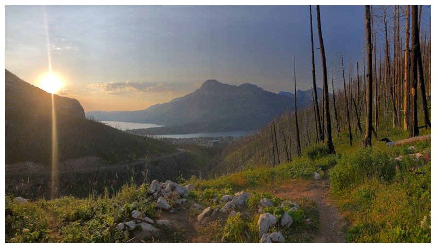
Another mandatory photo of Vimy Peak and the Waterton lakes, before the views become limited for a long stretch
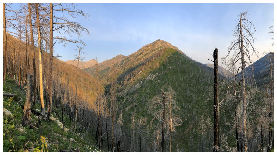
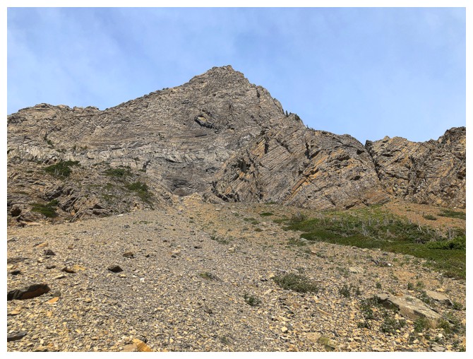
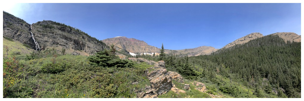
The southeast end of Buchanan Northeast offers an exciting route to the summit
The start of another exciting route, this time up Bertha Peak
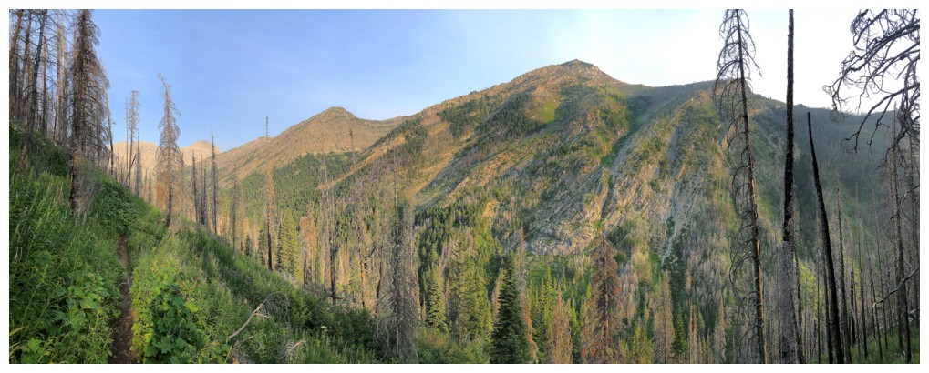
More of Buchanan Northeast
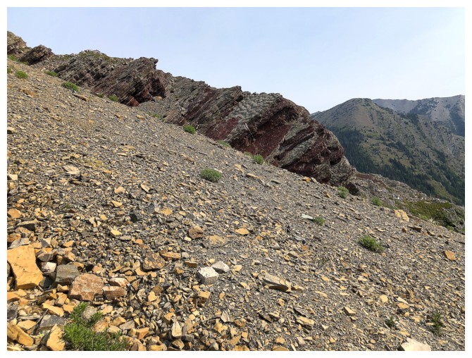
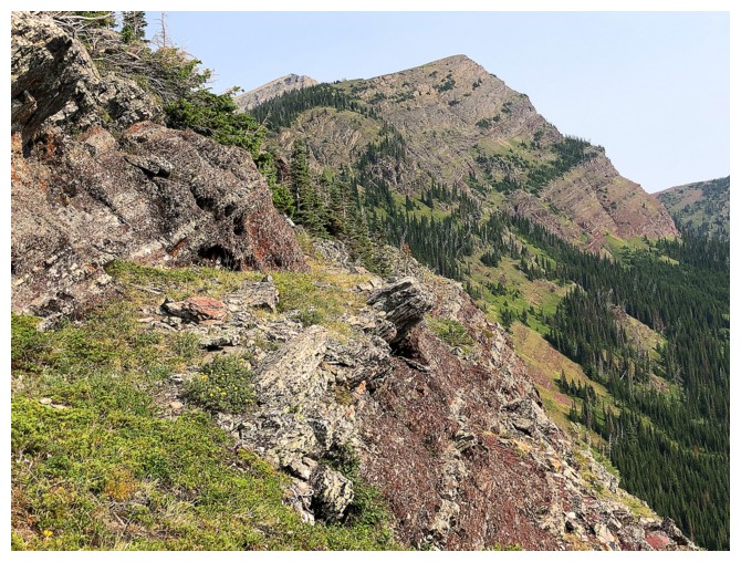
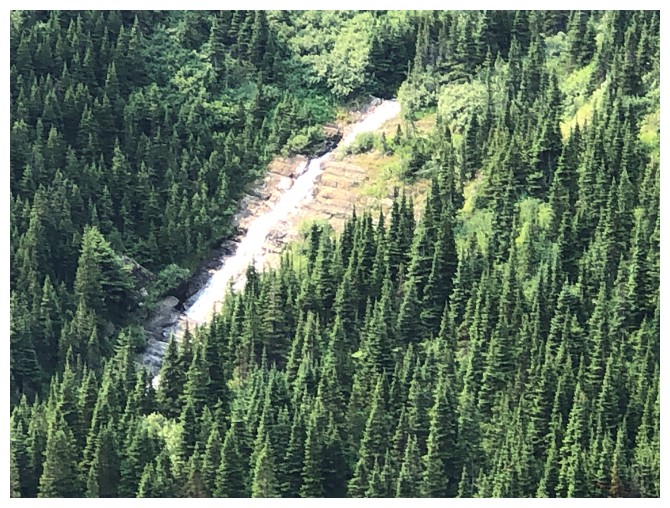
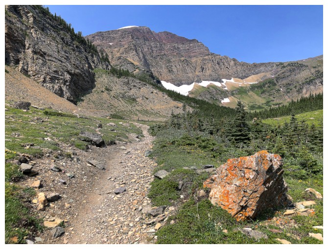
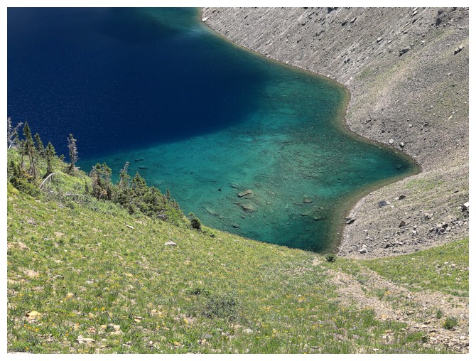
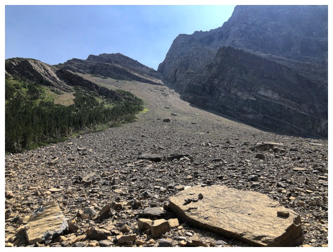
Where I chickened out. The lake is above the forest in the middle. The thick forest in front looked more scary than challenging.
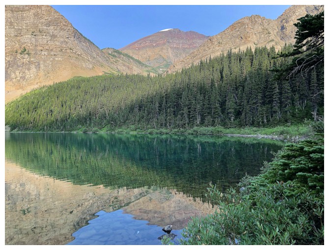
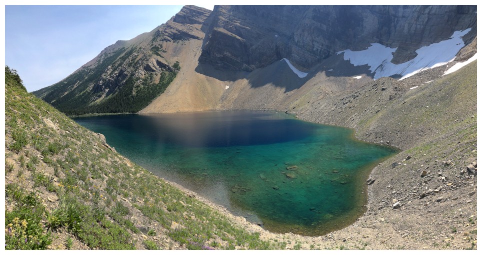
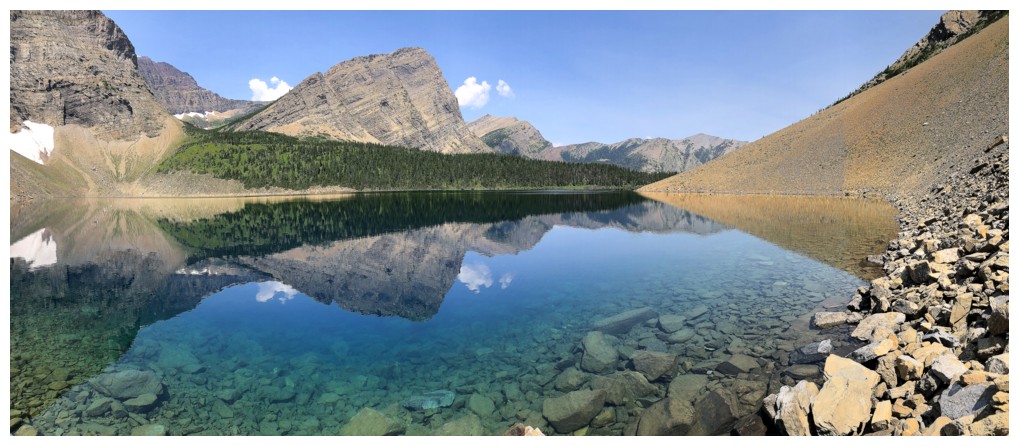
Quick stop at Alderson Lake
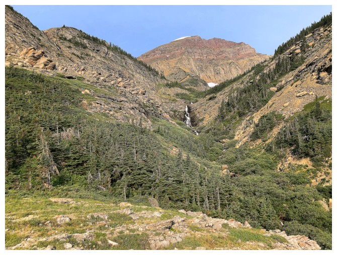
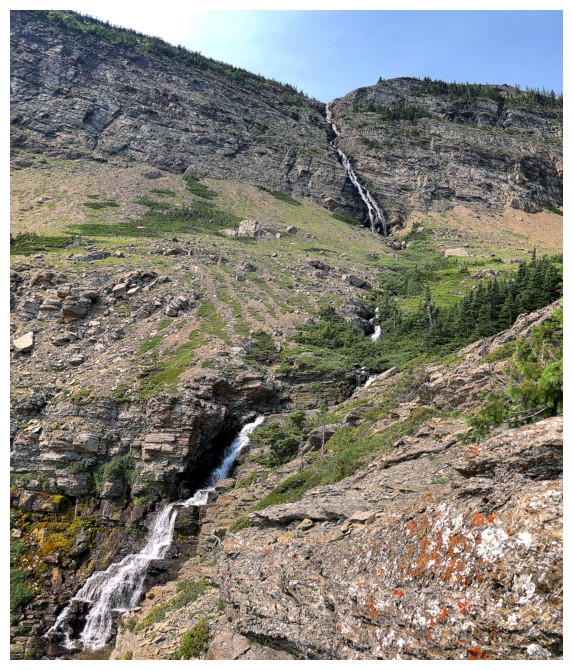
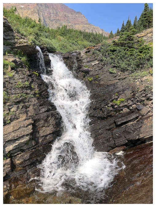
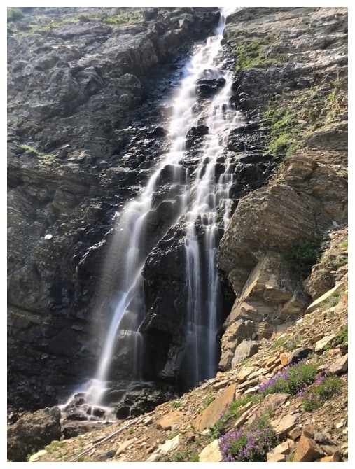
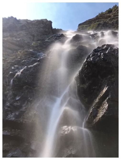
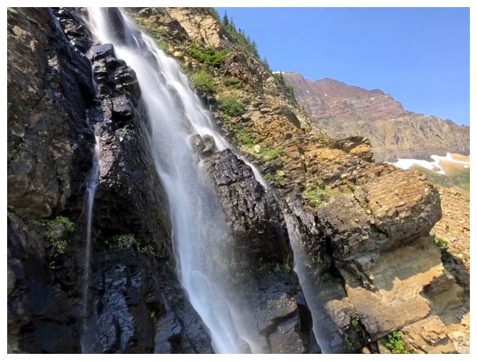
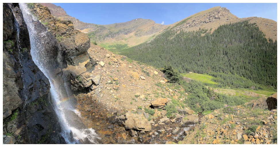
The waterfall I need to get to
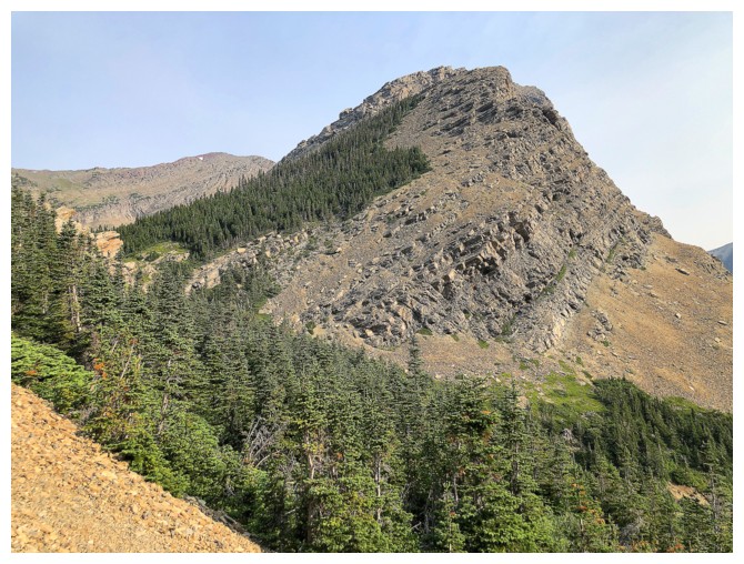
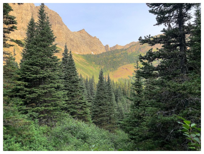
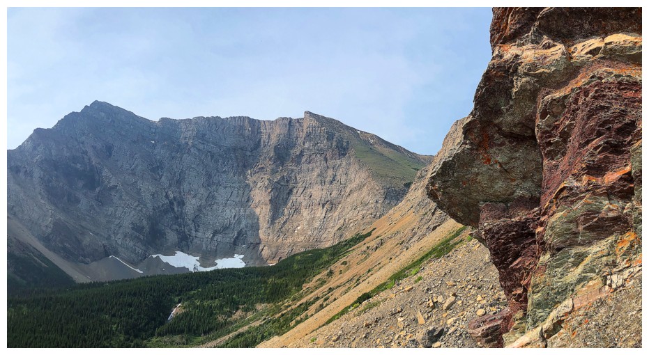
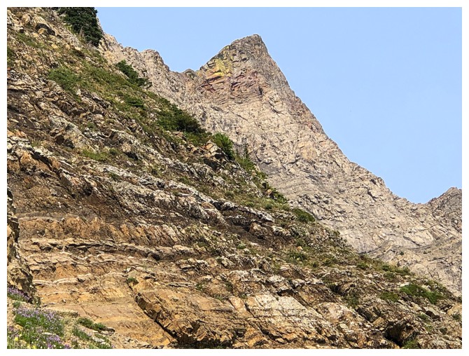
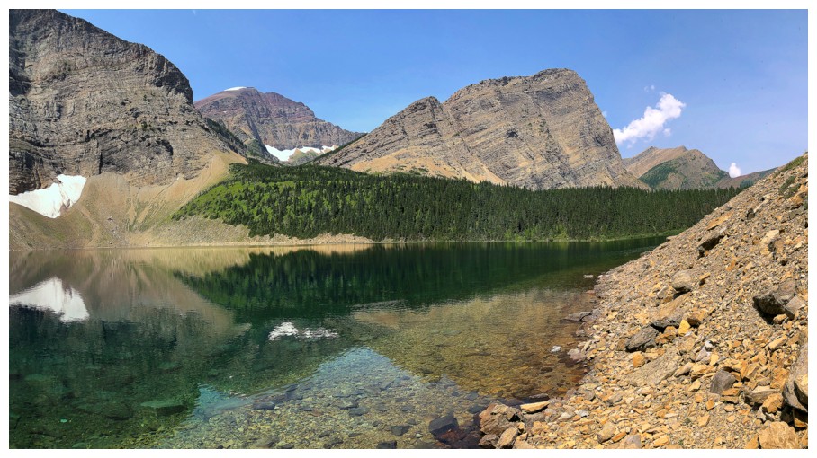
Buchanan Peak. The Plan B route to Dormaar Lake traverses below the right side of the peak.
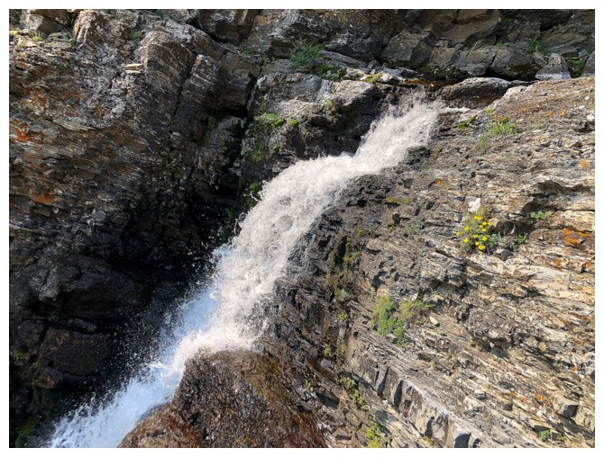
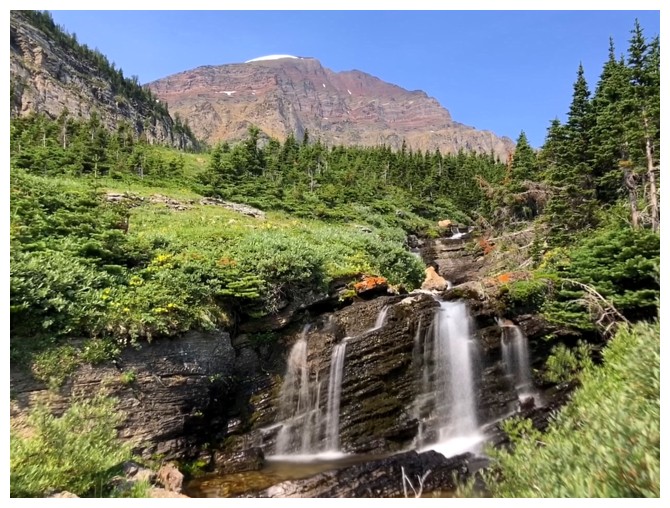
The beautiful lower cascade/waterfall
Saying goodbye, for now
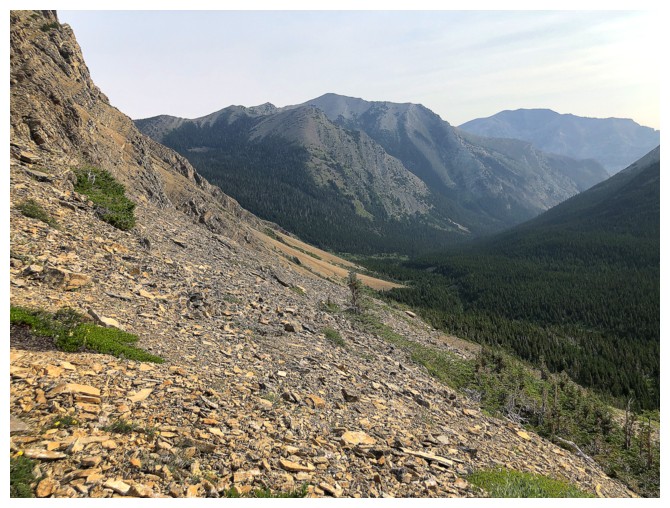
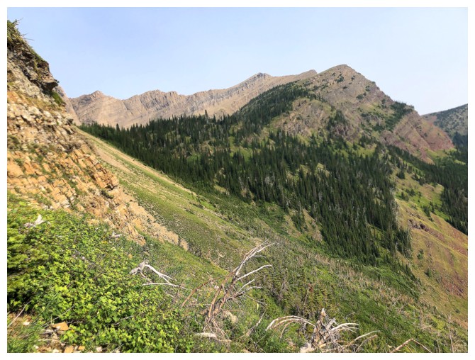
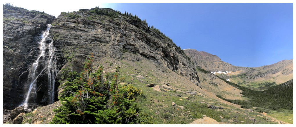
The traverse begins. Looks easy but it turned out to be very long and very tedious.
At least there were decent views of Buchanan Peak's steep east face
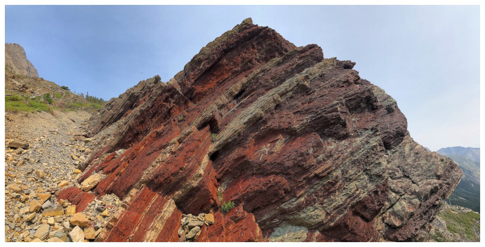
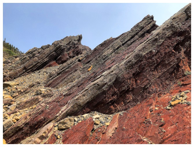
Finally some red argillite!
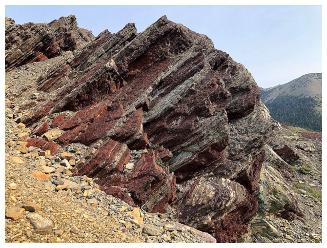
And it's the good stuff!
Mount Alderson will always hold a special place in my cold, black heart, because it was the first mountain I ascended in Waterton
Still traversing. That's the south ridge of The Senator ahead.

And still preoccupied with Buchanan Peak
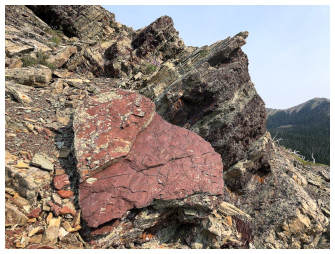
...and red rock
The end of the line. Still a long way to go and the terrain was not getting any easier to traverse.
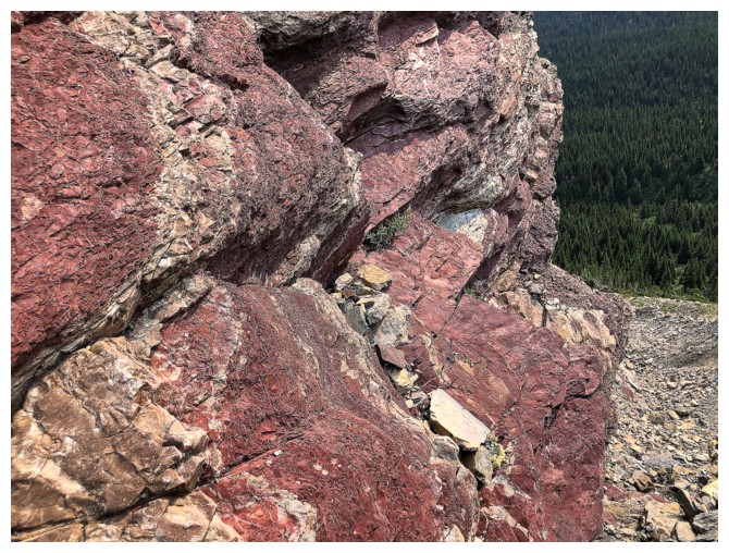
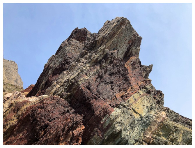
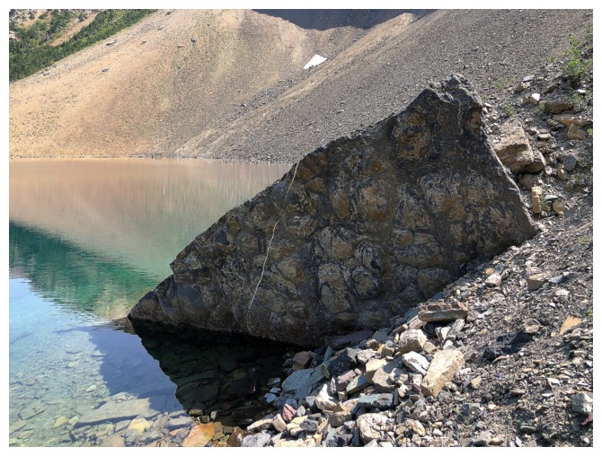
Part of the super cool rock you will encounter when descending from Buchanan Ridge to Buchanan Peak.
Having given up on the route, I now had some time to explore a little
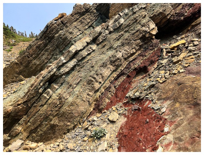
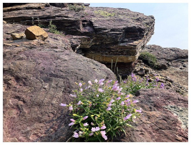
Of course, that exploration centered on seeking out red argillite!
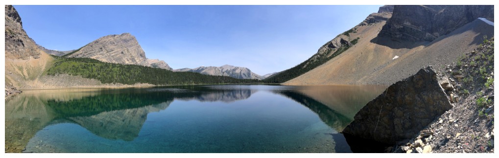
Alderson, the traversing route back, and a cool cascade
Close-up of the cascade. I made a heart-hearted attempt to get to it,
but when I encountered a glut of relatively fresh grizzly diggings the
attempt was immediately abandoned.
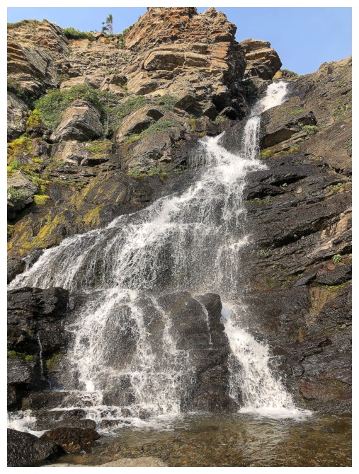
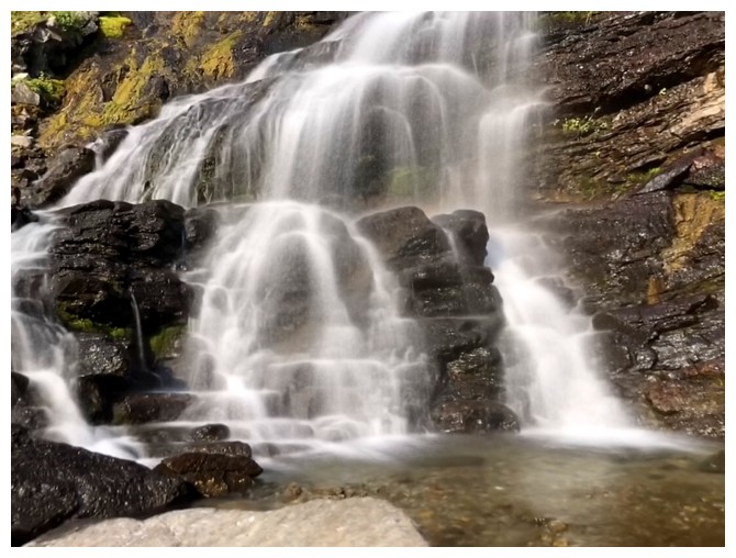
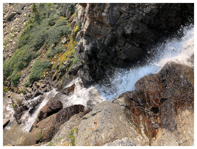
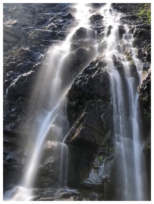
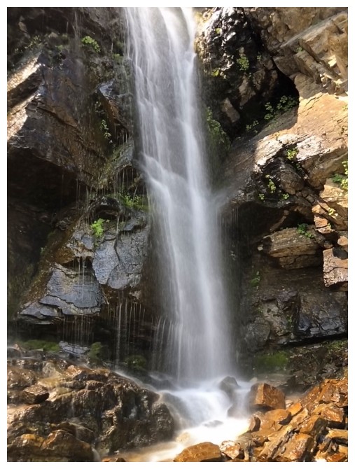
Back to the lower waterfall. The upper fall is next.
Followed the lower fall on its right side back up to the trail
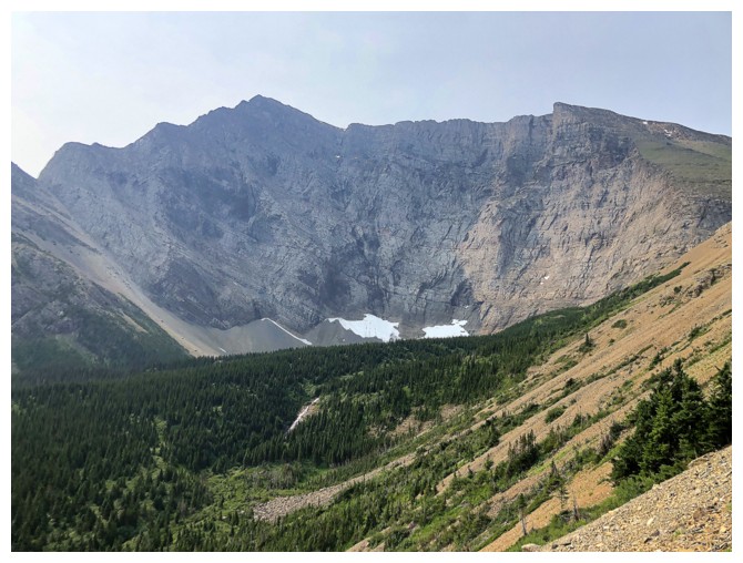
Mount Carthew (just left of centre) is always present
Back on the trail with Carthew front and centre again
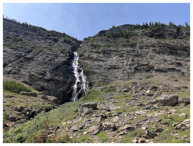
Heading up to the upper waterfall. Second time checking out this beaut.
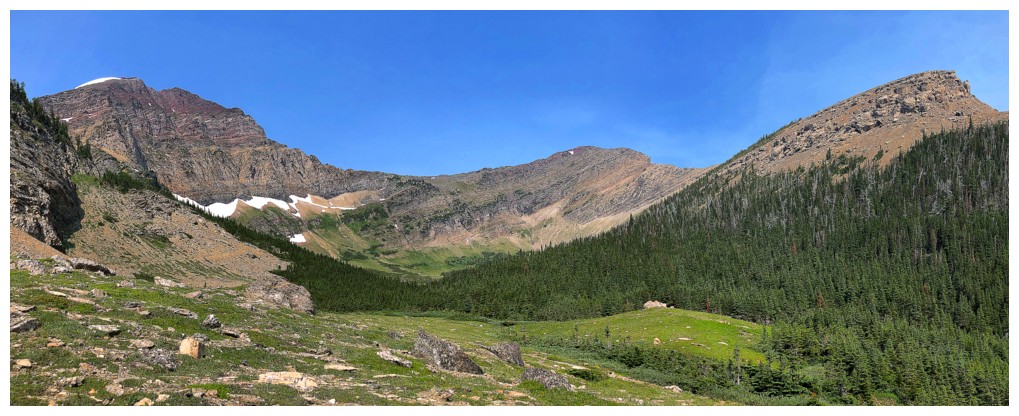
In order from highest to lowest (and also left to right) Carthew, Buchanan Ridge, Buchanan Peak
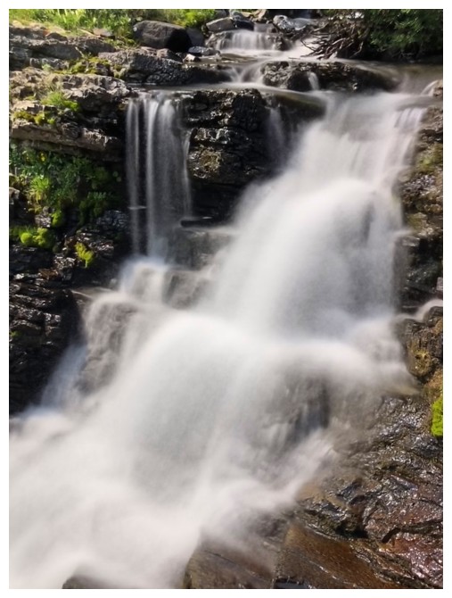
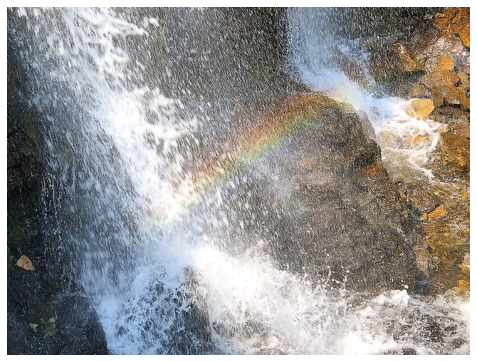
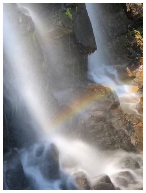
The usual plethora of long exposure photos (and a few normal ones) I
take when encountering moving water (I may have to add this to my red
argillite and chocolate addictions!)
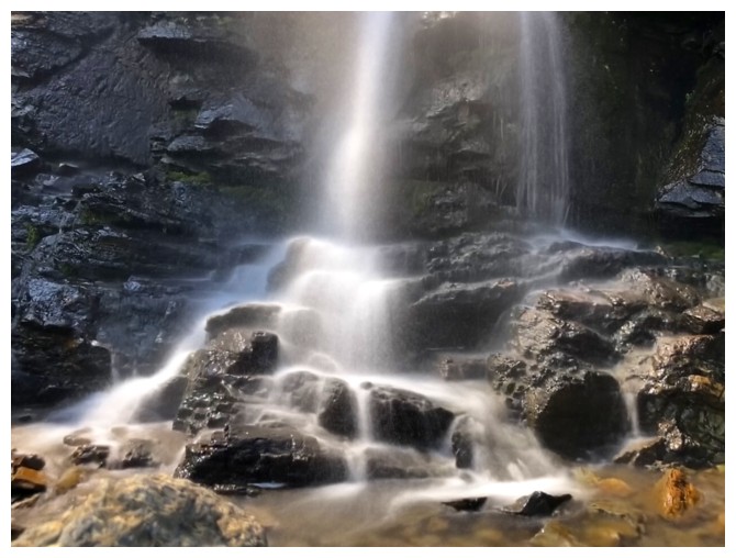
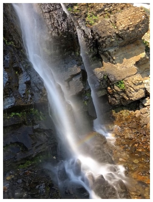
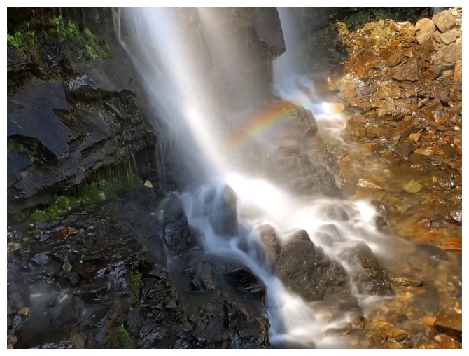
The partial rainbow was a nice feature
Last one
Hiking out
I didn't plan on going around the lake until I saw this easy route down to the southwest side
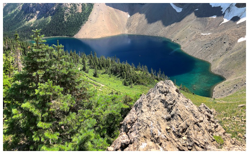
Beautiful colours from above
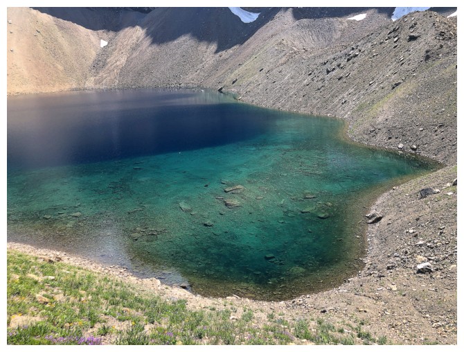
Same as above
And again
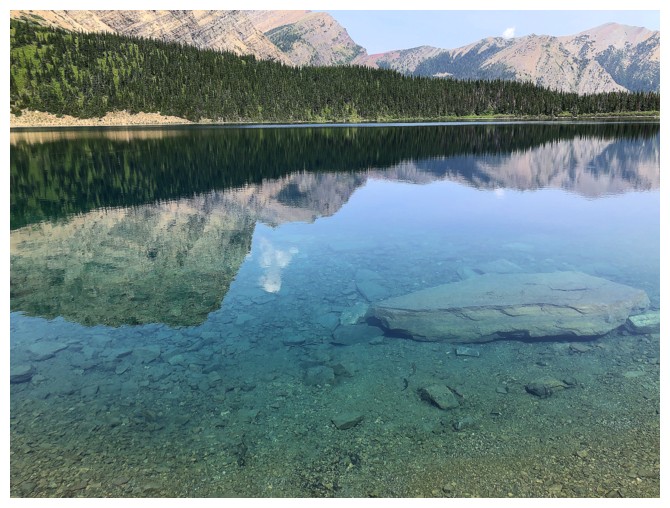
The crystal clear waters of Alderson Lake
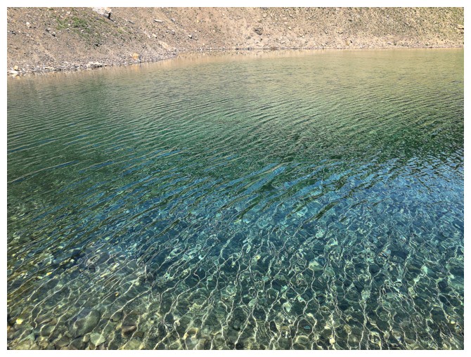
Same as above
Reflection time - another type of photo that I tend to go berserk with!
Interrupted by a cool rock
Back on "reflection" track
Looking up a route that would get you to the base of the east ridge of Mount Alderson, reported to be a 5.8 climb
Last reflection
The scene that indicates you are getting close to the start
The End
LOG