Grinnell Point


July 29, 2024
 
Mountain height:          2350 m (2316 m for Grinnell Point)
Total elevation gain:     approximately 1000 m
Round-trip time:           8:00
 
Solo scramble.
 
My first attempt of this minor summit at the far east end of Grinnell Mountain ended almost before it started, when I encountered a bear near the start of the ascent route. Hopefully a second attempt would be ursidae-free!
 
I shouldn’t have been surprised to find the parking lot completely full at 7:30 am, but I was to find cars lined up far down the road also, especially on a weekday. The place was hoppin’ – good news for reducing the probability of a bear encounter on the approach trail. Of course, the Grinnell Glacier trail is easily one of the best hikes in the park and should be on everyone’s to-do list.
 
Hiking the approach with along with a multitude of others was quite comforting. Almost needless to say, once I left the trail, I would not encounter another human until I returned to it about 7 hours later.
 
As far as the ascent goes – super cool! The route weaves its way up and through a seemingly impregnable rock wall and then more or less follows a steep snow-filled couloir up to the ridge. Easy scrambling, enjoyable route-finding, amazingly colourful rock, and the famous defunct Josephine Mine entrance are notables feature of the ascent.    
 
Upon nearing the ridge, I opted to first visit a higher point to the west. Minus an unexpected and disappointing breakdown in the weather, this summit provided an outstanding view of the area – far better than one you might expect to see from a minor outlier of a much bigger peak. I did consider trying to find a route down to trail from there, but first wanted to visit Grinnell Point.
 
It took a little “bobbing and weaving”, but eventually I reached the massive cairn that marks the summit of the Point. The view was likewise very satisfying, though I will annoyingly repeat my disappointment with the cloudy conditions. Those conditions sufficiently quelled my desire to attempt an unknown route down the mountain from the higher west summit and I settled for returning via the ascent route.  


That was until I arrived back at the Josephine Mine. As stated, a prominent trail leads to the mine and I reasoned that following it in a westerly direction might lead easily back to the Grinnell Glacier Trail, but much higher up the valley. Heading west may also grant me better views of Grinnell Lake and Upper Grinnell Lake. All started well, but about 1 kilometre from the mine the trail very suddenly ceased to exist. I couldn’t see a potential route down and didn’t want to risk getting cliffed-out or end up in dense bush. Playing it safe, I retraced my steps back to the mine and then down my ascent route.    
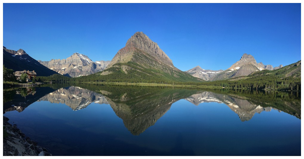
 
I can definitely see why Grinnell Point gets its own designation. Aside from its spell-binding appearance from the shores of Swiftcurrent Lake, the mountain boasts an exciting ascent route and excellent summit views. A return trip, with more exploration of the west ridge, is inevitable!  


Grinnell Point (centre) as seen on June 30, 2019, before Raff and I ascended Allen Mountain


Distant glance at Mount Wilbur - still one of the most memorable days we've ever had in the mountains


The dramatic southeast side of Grinnell Point


Hiking alongside Josephine Lake. Allen at the left and Mount Gould at the right.


The small pond described by Passmore and Edwards


Looking up the route. The hard to spot weakness is just left of centre.


Gaining elevation above the lake


The cool rock appears early on


First glimpse of the weakness - the grassy ramp near the upper right


An interesting sheer rock face


Near vertical, cool rock


The grassy ramp


Going up the ramp


First red argillite encounter of the day and there will be many more


A cairn marks the top of the ramp


The views of the lake, Allen, and Gould continue to improve


The route ahead eventually swings over to the left


Lots of wildflowers before the next rock band is reached


The red rock at the left caught my eye


Close-up


Not so close


Close-up from close-up


A splash of red in a gentler form


Trending left


Grinnell Lake is now visible near the right


Although the route now heads to the right I decided to follow a very prominent trail to the left


The trail led to an awesome couloir and the Josephine Mine


The entrance to the mine


As far as I dared to venture in. Who knows what horrors might be waiting inside!


Allen Mountain


A small amount of water was running down through the gap


The colourful rock was more of an attractant than the water


Had to get right under the spray of snowmelt coming down


Leaving this cool area


Clearly I'm going to be obsessed with Mount Gould throughout


I know my obsessions well!


Interesting route-finding continues all the way up


Not much in terms of greenery, but there was some


The steep snow couloir


Amazing rock on both sides of the snow


Red rock


Red rock and red wildflowers


Couldn't resist returning to the couloir once in a while. It was very impressive.


Folded rock


Had to sneak up and behind these trees to continue


The couloir and the cool rock


The other side of couloir offers great step-like scrambling, but getting over there would be extremely sketchy!


Good rock on this side too


Even with an ice axe and crampons, I wouldn't set foot on that snow at this time of the year


Grinnell Point at the right


Still heading up alongside the couloir


Looking down the couloir


The snow disappeared here so I went straight up to the ridge


The first mountains you see upon reaching the ridge are a few GNP favourites: Crowfeet, Henkel, and Apikuni


Grinnell Point to the east


Heading up to the higher summit to the west


Panorama to the north


Near the highpoint, the full length of Grinnell Mountain is revealed


Mount Wilbur and Bullhead Point


Summit pano to the west


Angel Wing in front of Mount Gould is a great extension of the Grinnell Trail. Upper Grinnell Lake is just visible near the right.


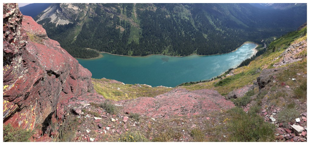
Grinnell Lake is a beaut


Another pano with more stuff in it


Same as above


One more


Mount Merritt


Wilbur


The true summit of Grinnell. Apparently it is possible to get to the summit from this point, but there would be tons of ups and downs and lots of side-sloping if you wanted to keep it within the realm of scrambling.


The next major summit on the Grinnell massif looks attainable...maybe??


Both summits


East


Heading for Grinnell Point


A few obstacles must be circumvented on the right


Wilbur peaks out from behind that obstacle


Circumventing another, with the summit ahead


The last hundred metres


Needed a lichen fill!


Looking west to the multiple summits of Grinnell


There's the summit cairn


It's a big one!


Summit pano


Clearly I'm obsessed with Mount Wilbur also


Swiftcurrent Lake and Lake Sherburne


The Many Glaciers Hotel on the shores of Swiftcurrent


Summit view to the west


Same as above, but less of it


Moving north


Descending


Another cool display of red argillite


Back at the Josephine Mine and ready to try an alternate descent route


The south face of the mountain is nothing but cool, colourful rock


The other mine entrance


The trail suddenly disappears, or I lost it along the way


End of the line. I turned around here and retraced my steps back to the original ascent line.


At least the diversion granted great views of Lake Josephine and Allen Mountain


Love the colour contrast of the red argillite and lake


Lots of colours to keep me distracted from having to regain a bunch of elevation


Like that


And more great views of Allen


A boat going across the lake


Back to the grassy ramp


Another boat as I descend to the trail


Parting look at Allen


The terrific Grinnell Glacier Trail


Passing the pond


Back near the parking lot, with a longish walk back to the car. Altyn Peak ahead - definitely want another run up that peak at some point.

The End

LOG