Iceface Peak
August 23, 2024
Mountain height: 2897 m
Elevation gain: 1300 m
but I took the scenic (tortuous) 1600 m route
Ascent time: 5:20
Descent time: 4:35
Solo scramble.
To say this
trip “kicked the living daylights” out of me would be a grave understatement!
I had been
thinking about this somewhat obscure and unnamed summit, northeast of Mount
Noyes, for several years. An amazing trip up Spreading Ridge in 2022 rekindled
that interest but it would wait until August 2024 to come to fruition.
One of the big
draws for attempting this peak was to check out Noyes Creek. 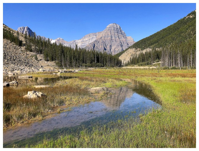 Perhaps it had
similar treasures to those found along its northern sister, Totem Creek;
perhaps not, but I wanted to find out. The initial hike alongside the north
side of the creek was surprisingly easy and pleasant, with few route-finding
challenges. Of equal surprise were signs of human traffic. I always thought
this to be a seldom traveled area, but clearly I was wrong.
Perhaps it had
similar treasures to those found along its northern sister, Totem Creek;
perhaps not, but I wanted to find out. The initial hike alongside the north
side of the creek was surprisingly easy and pleasant, with few route-finding
challenges. Of equal surprise were signs of human traffic. I always thought
this to be a seldom traveled area, but clearly I was wrong.
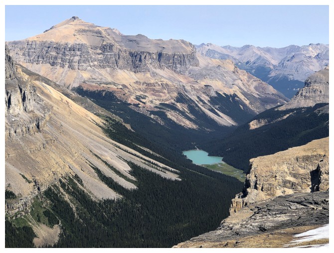
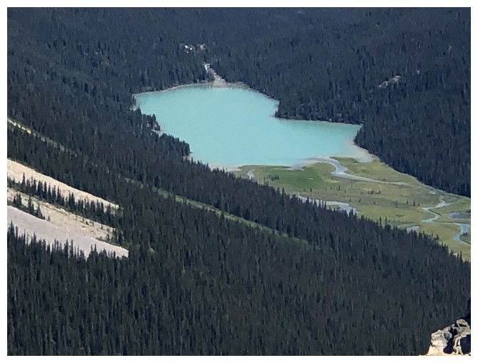
Eventually I
reached the lake marked on the map to find the body of water reduced to a few
streams and lots of marsh. 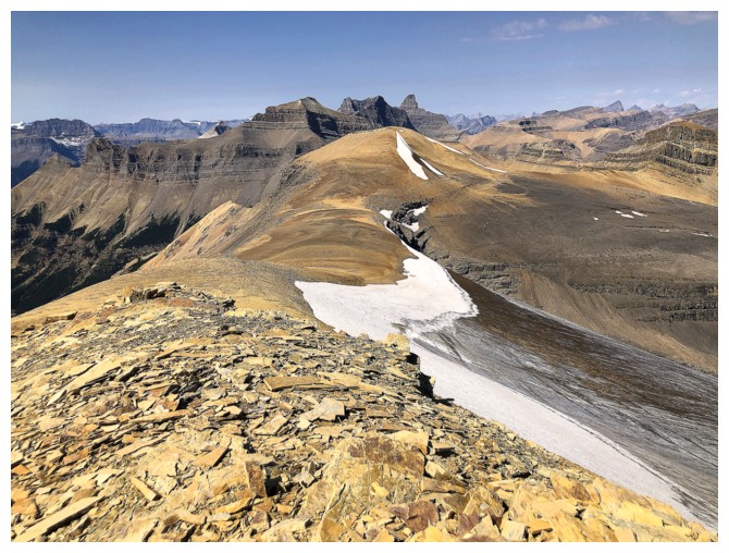 While the area was not quite a scenic match to the
magical first lake along Totem Creek, it certainly possessed a charm of its
own, with many “Oh wow!” views.
While the area was not quite a scenic match to the
magical first lake along Totem Creek, it certainly possessed a charm of its
own, with many “Oh wow!” views.
Although my
plan was to follow Noyes Creek all the way to the head of the valley, bushy
terrain past the lake caused me to change the route. Instead, I crossed the
creek, aiming for open slopes that appeared to lead to a slightly lower summit
northwest of the objective. And there ends the pleasant part of the ascent!
While the
scenery and views throughout this trip were stellar, the terrain underfoot was
anything but. In fact, the several vertical hundred metres of terrain before
the first highpoint was possibly the worst I’ve ever experienced – unstable
rubble on a relentlessly steep and foreshortened slope. When the rubble disappeared,
it was replaced with hard-packed dirt and loose pebbles – the polar opposite of
stellar! And preceding that, I had to endure an even more foreshortened slog up
steep unforgiving slopes of scree. If the views hadn’t been improving with each
metre of elevation gained, I probably would have bailed on the ascent and
returned to explore the creek as a consolation.
By the time I
reached that first summit (a cairn indicated I was not the first to reach it), I was absolutely wiped out; the result not
only of the grueling ascent, but also 2 weeks of gorging myself on fish and
chips, curry, and Cadbury’s Dairy Milk chocolate in England before the ascent! Fortunately,
a food and Gatorade break, plus the scintillating views in every direction were
enough to rejuvenate me. Getting to the true summit from there was mercifully
easy with great footing underfoot – finally! Again, an inspiring summit panorama
was cause for a break and many photos.
The descent was
epic – horribly epic! Initially, I considered trying to descend the route I
wanted to ascend, via the pass south of the summit. However, given that I
couldn’t see the entire route and any cliffs that could stop me dead in my tracks, 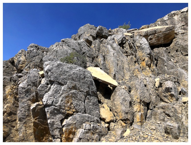 I opted to retrace
my steps towards the first summit and then peal off and descend to the original
route. Had I stuck to that plan, life would have been okay. Instead, I
convinced myself I could take a direct route down to the Noyes Creek valley (apparently,
I REALLY wanted to see that valley!) and then follow the creek out.
I opted to retrace
my steps towards the first summit and then peal off and descend to the original
route. Had I stuck to that plan, life would have been okay. Instead, I
convinced myself I could take a direct route down to the Noyes Creek valley (apparently,
I REALLY wanted to see that valley!) and then follow the creek out.
All
started
well and I was able to lose a significant amount of elevation on decent
scree. Shortly after, however, cliffs barred the route, and I had to go
back up. Thinking
an easy route might be right around the corner I repeated my mistake
and once again had to drag myself halfway up the slope again. 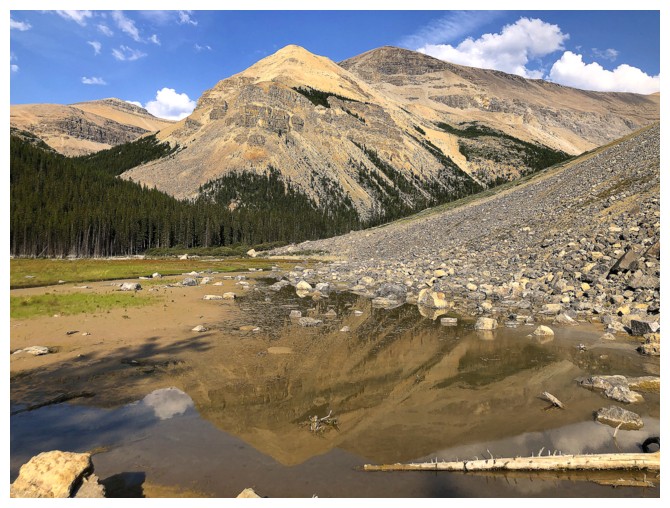 The only
option at this point was to side-slope all the way back to the
original line. I would only describe that part of the trip as
nightmarish – all
the aforementioned nasty terrain underfoot, practically zero surfable
scree,
several forced elevation gains, and way longer than anticipated. It
took me 2.5
hours to finally intercept my ascent route, a task that I imagine I
would have
completed in an hour had I stuck to the initial plan.
The only
option at this point was to side-slope all the way back to the
original line. I would only describe that part of the trip as
nightmarish – all
the aforementioned nasty terrain underfoot, practically zero surfable
scree,
several forced elevation gains, and way longer than anticipated. It
took me 2.5
hours to finally intercept my ascent route, a task that I imagine I
would have
completed in an hour had I stuck to the initial plan.
Physical
and
mental exhaustion were in full play at this point. Depleted and
somewhat
nauseous, I completed the trip in a zombie-like state, my yelling to
warn bears
more of a down-trodden moan - I would have provided little resistance
had a bear mistaken me for a giant bar of Cadbury's Dairy Milk chocolate!
Despite the
general misery getting up and down this peak, the day was filled with beautiful
scenery and fantastic summit views. If I ever return, I will stick to the
valley throughout and lay off the fish n’ chips and chocolate beforehand!
Note: although I initially called the mountain Noyes Creek Peak, several days after the ascent I found a reference to it on Bivouac that identifies it as Iceface Peak.
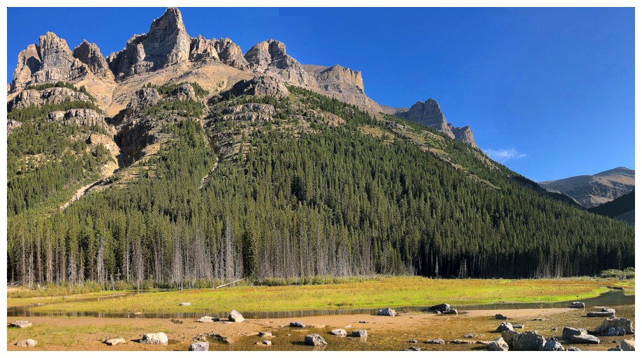
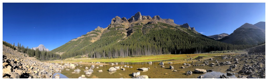
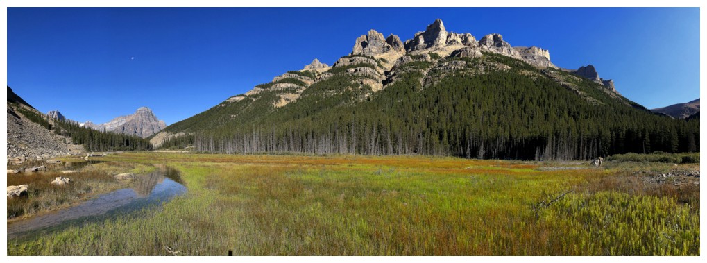
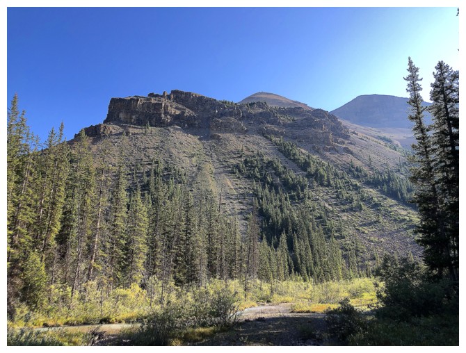
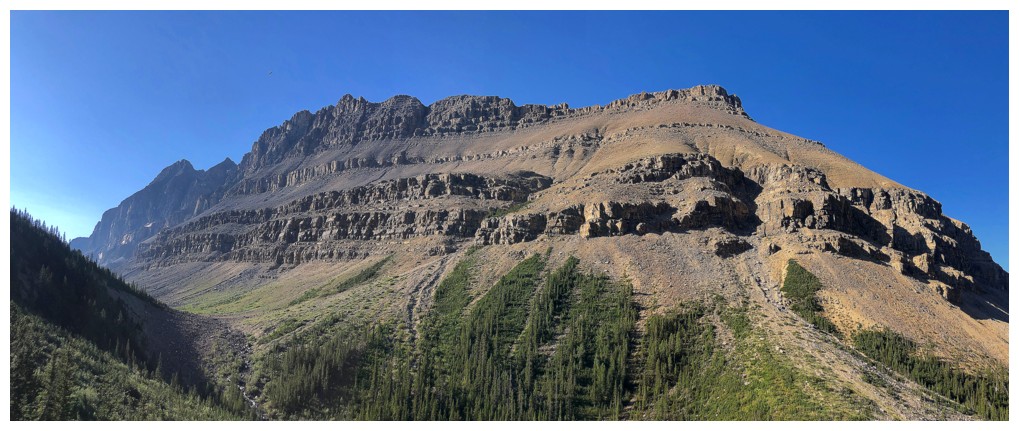
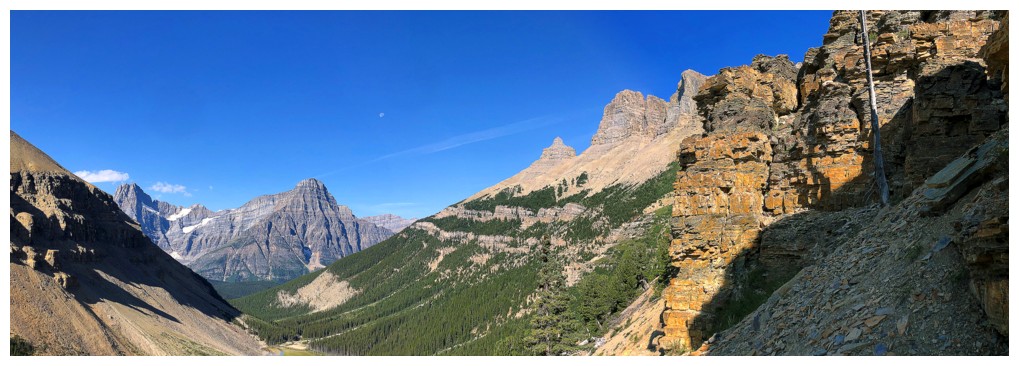
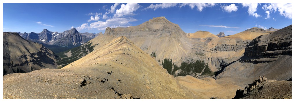
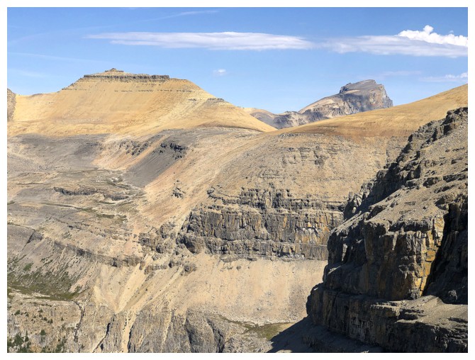
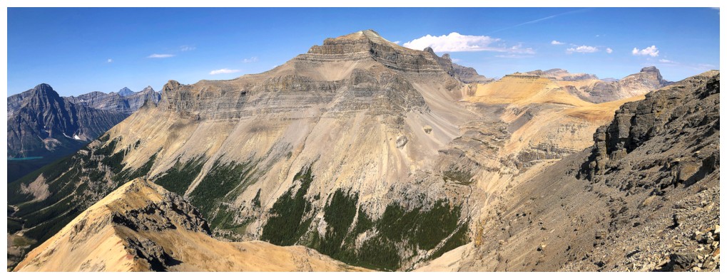
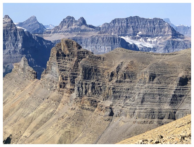
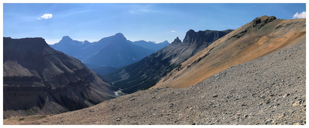
The Noyes Creek valley, as seen from near Spreading Ridge. Iceface Peak is at the left and centre, Mount Noyes to the right.
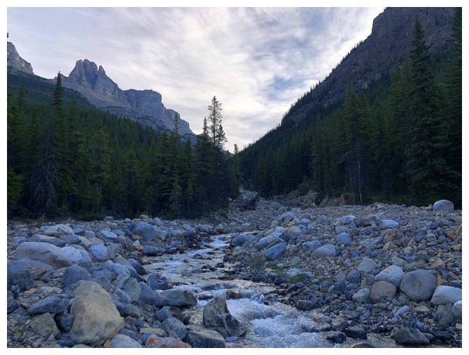
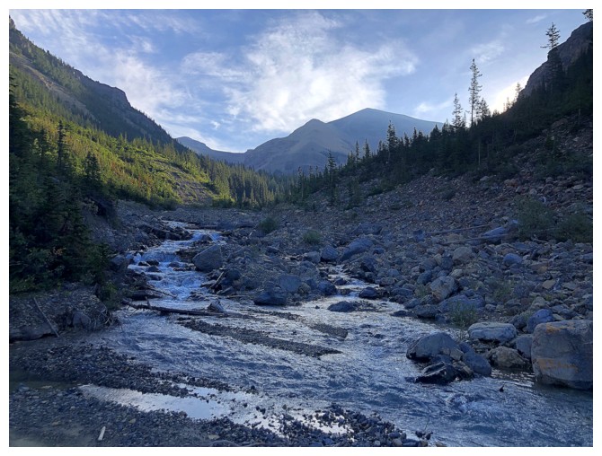
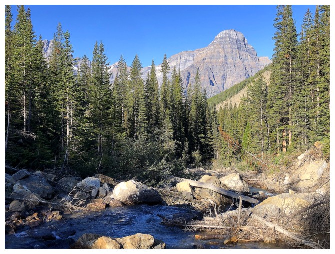
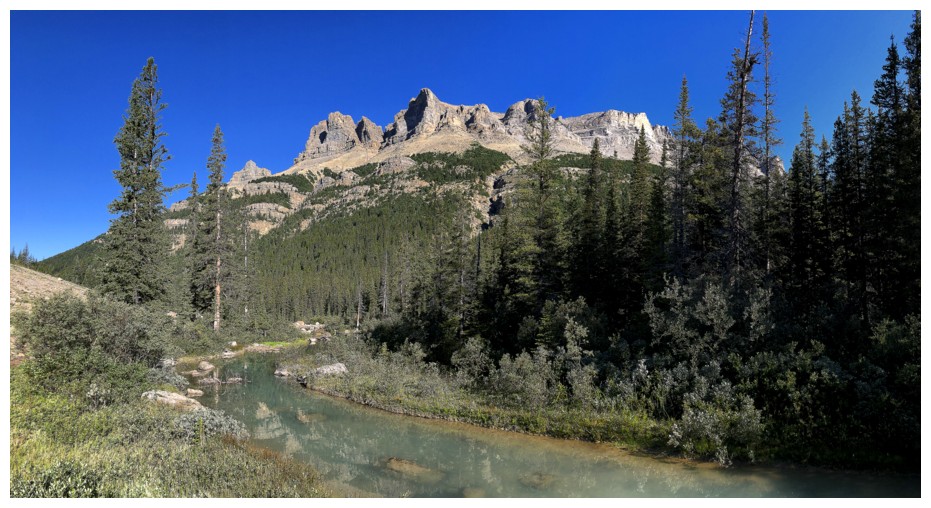
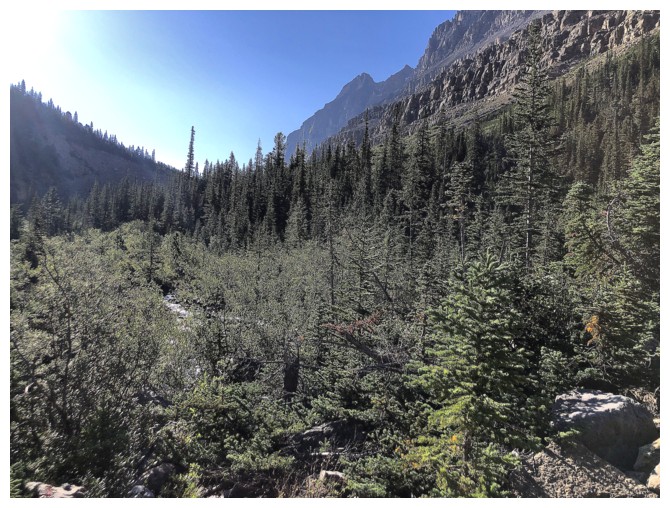
Near the start of the trip. Noyes Creek is followed on its north (left) side throughout.
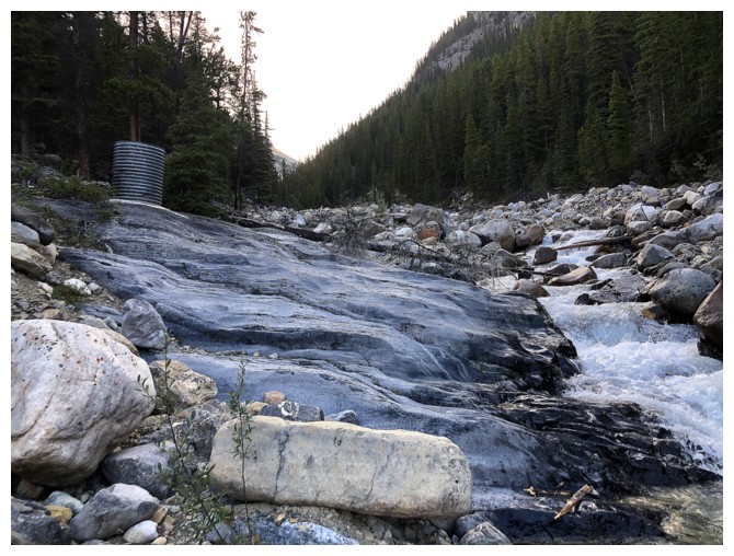
That thing on the left isn't part of nature!
But that is
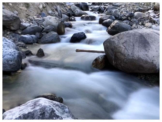
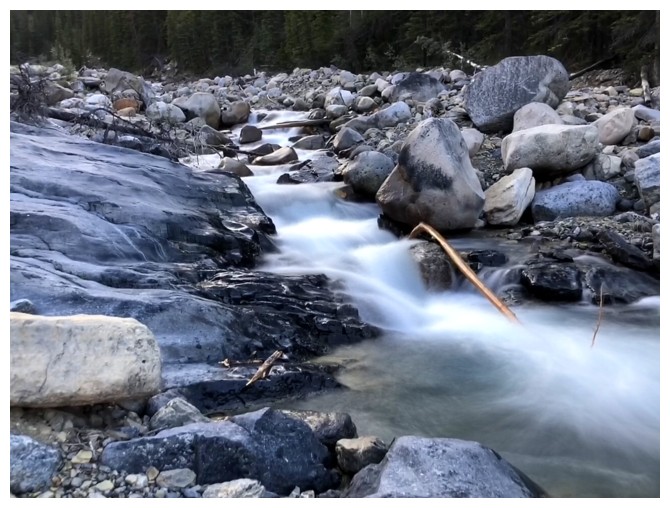
Given I was following a creek throughout, a surprisingly took very few long exposure photos
Howse Peak makes the first of many appearances
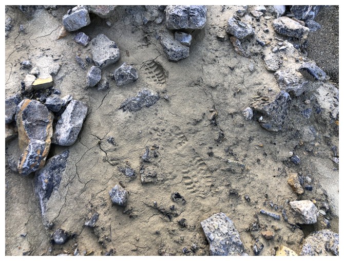
Shockingly, I run into a set of bear tracks. Even more shockingly, the bear was wearing boots!
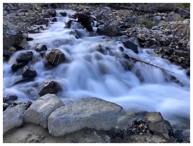
The last of the long exposure photos
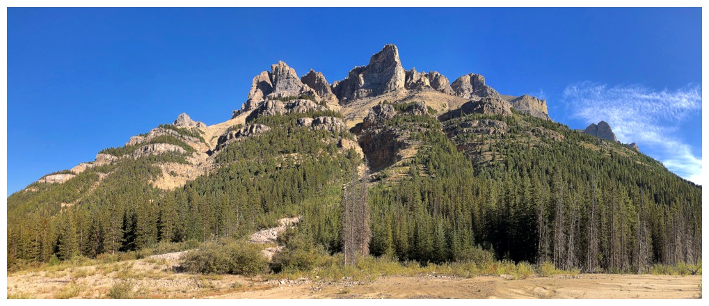
The southwest ridge of Spreading Peak is lined with a string of very impressive highpoints
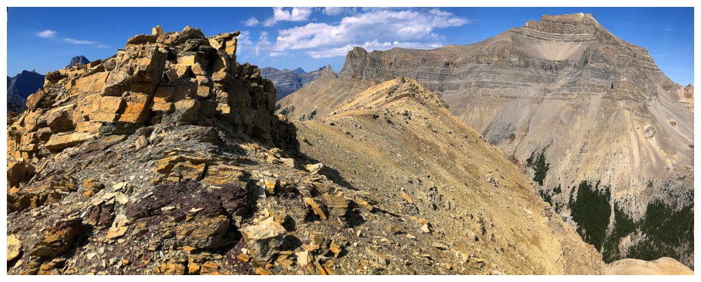
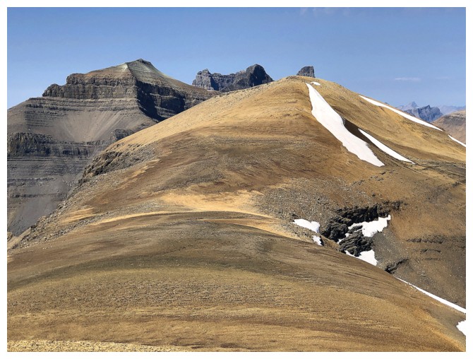
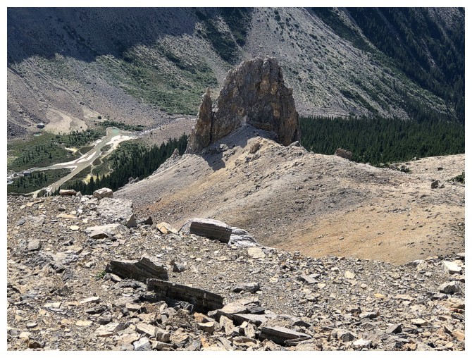
The lower northeast summit of the objective appears
One of those highpoints on Spreading Peak
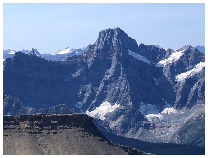
Close-up of awesome Howse Peak
Mount Chephren - my feet still hurt from that ascent, 18 years ago!
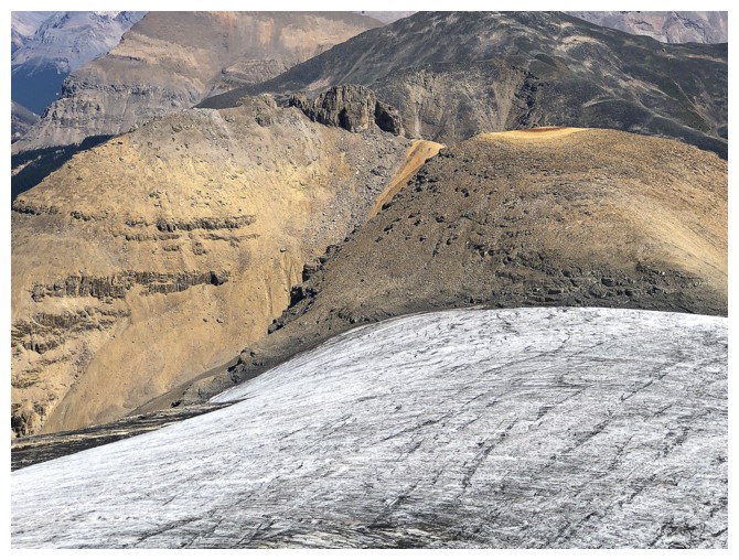
The terrain opens up
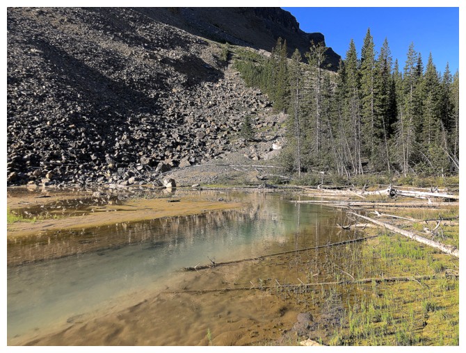
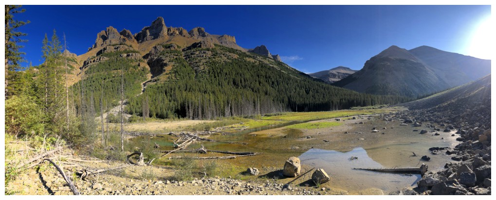
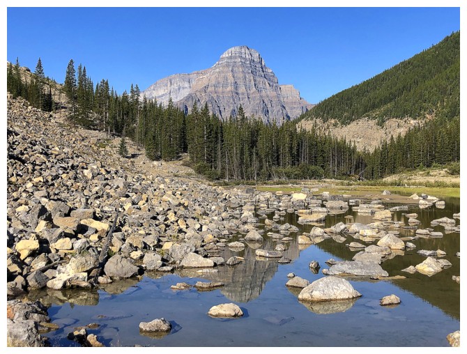
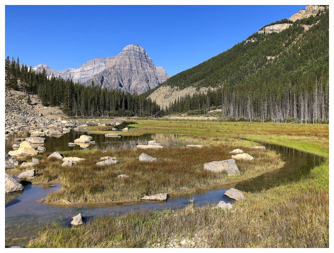
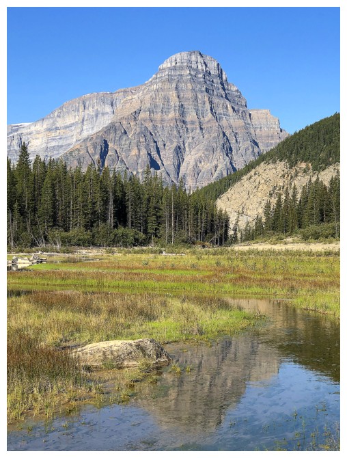
Arrived at the area where there's a lake marked on the map
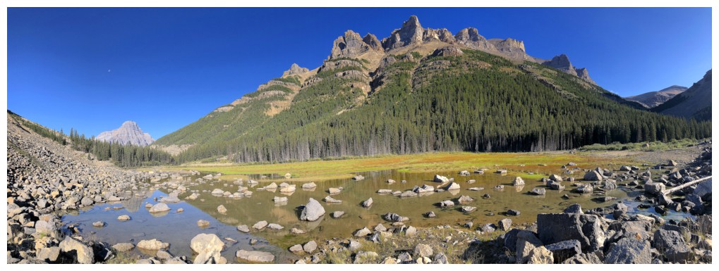
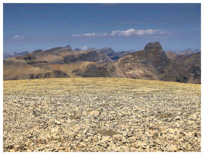
Many of the highpoints on Spreading
Going the wrong way; I need to be on the other side of the water
Logs made the crossing easy
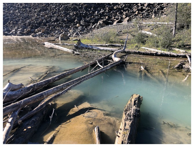
Same as above
This place was the scenic highlight of the trip for me
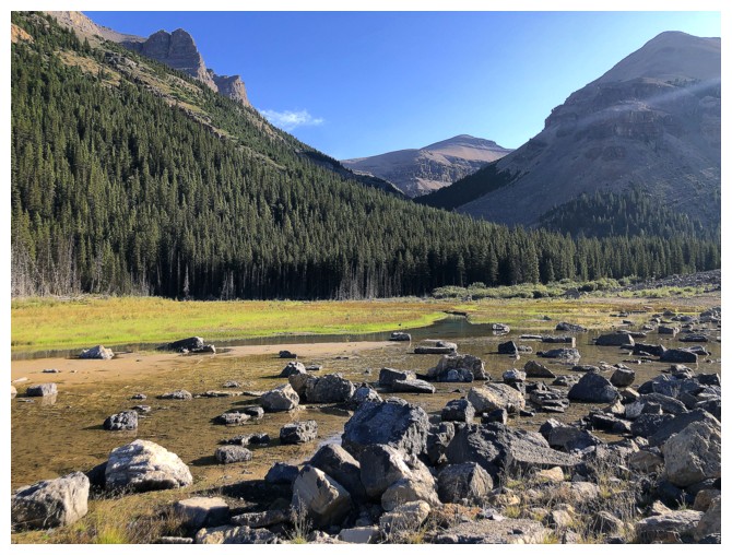
Going around what's left of the lake
Another highpoint
And another
I was able to get close to the summit of this one on the Spreading Ridge trip
Chephren reflected
Chephren and Spreading
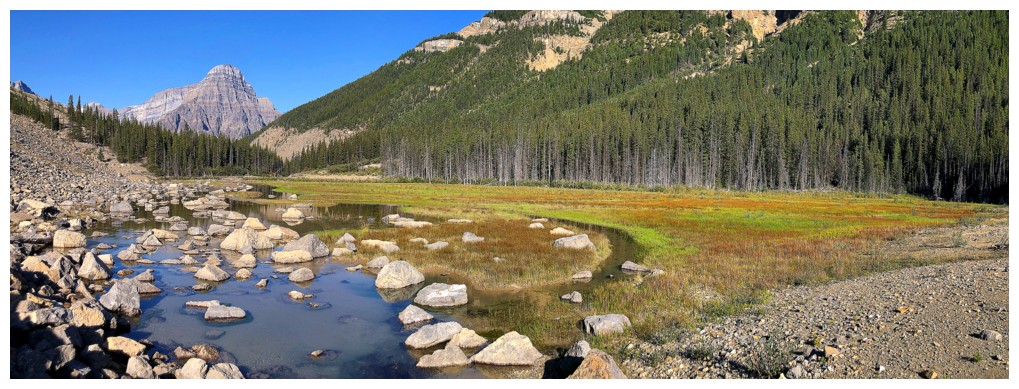
At least the dried-up lake has left behind some beautifully varied scenery
Same as above
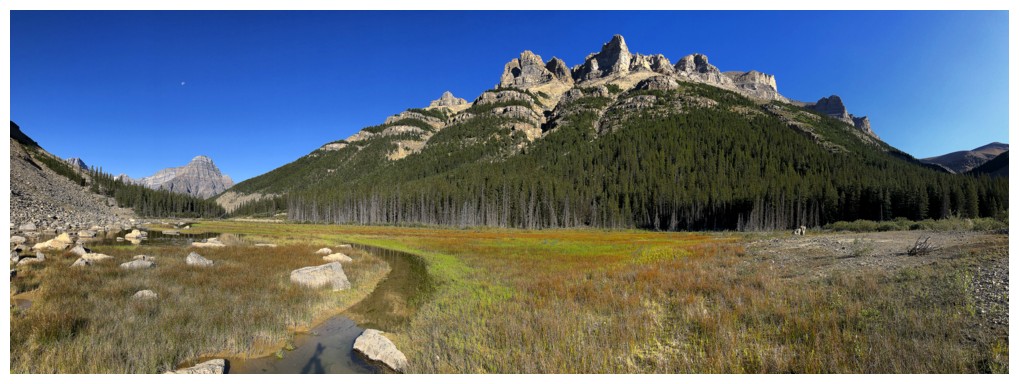
As stated, I loved this area!
Another Chephren reflection
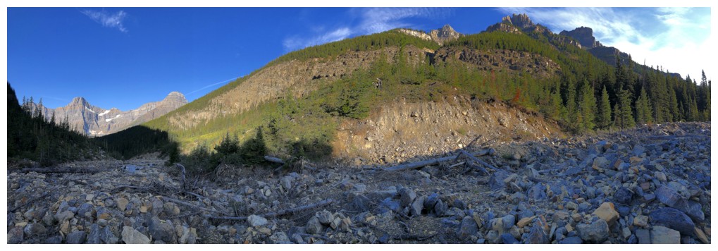
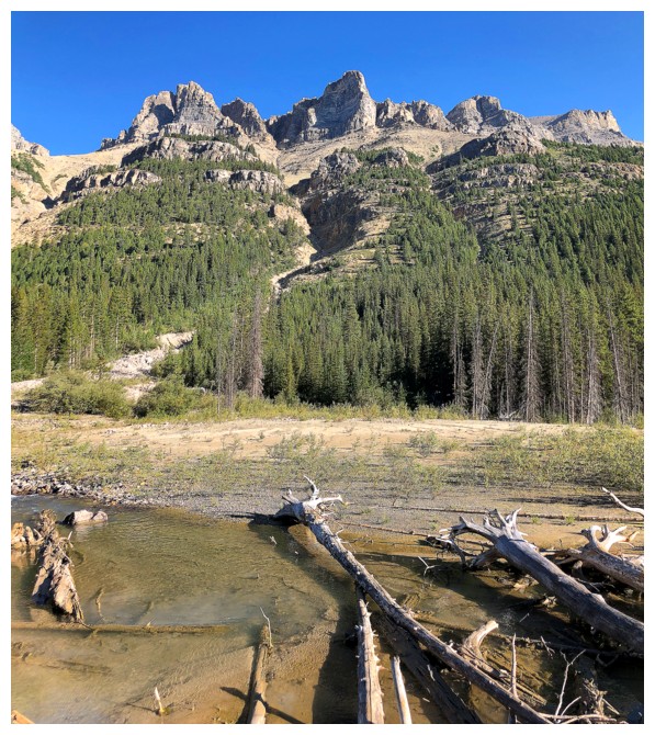
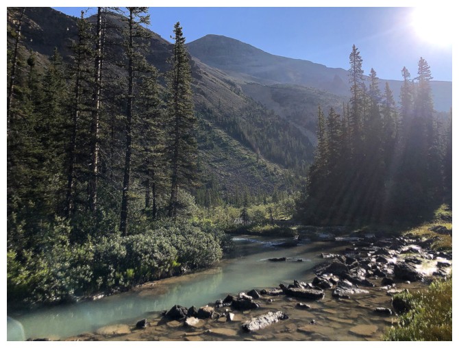
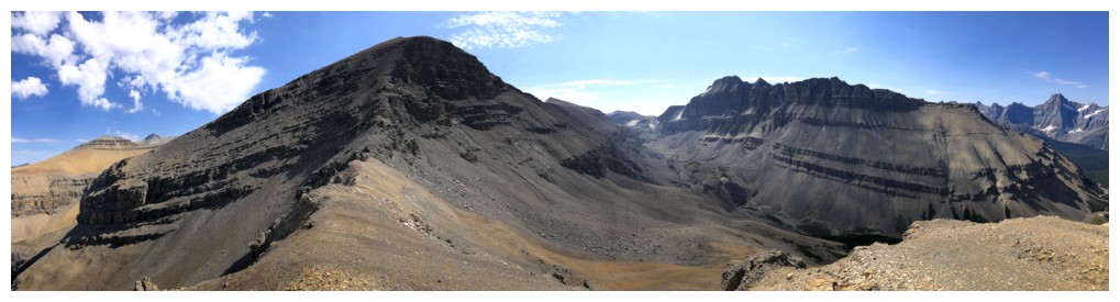
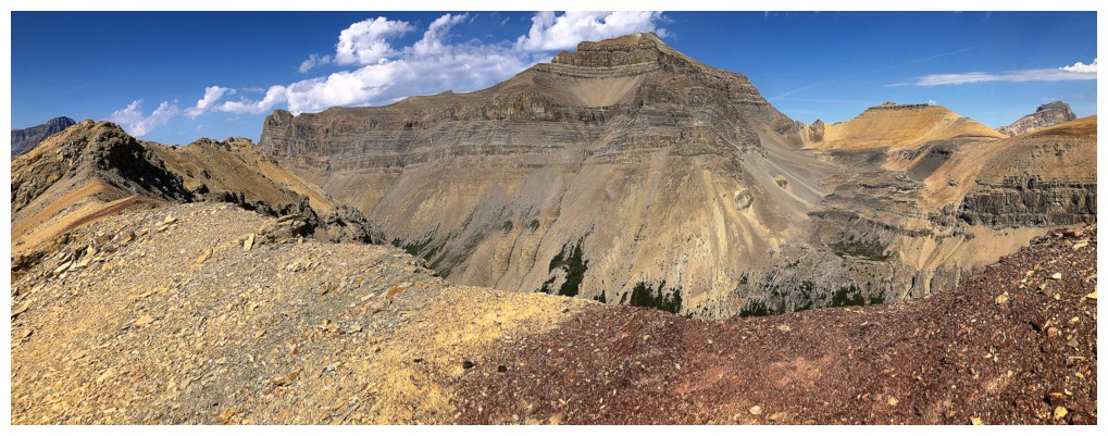
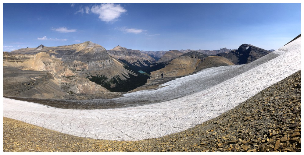
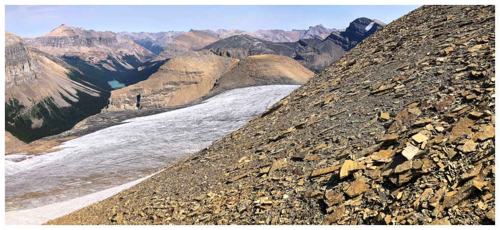
The Spreading highpoints and the glacial stream that originates from the glacier on the northeast side of Mount Noyes
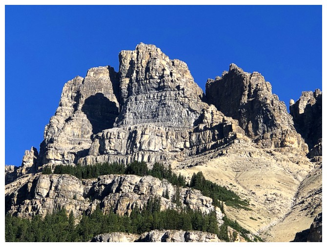
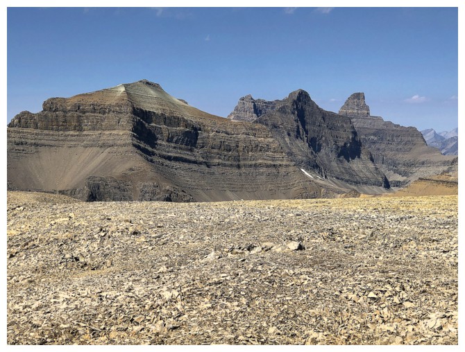
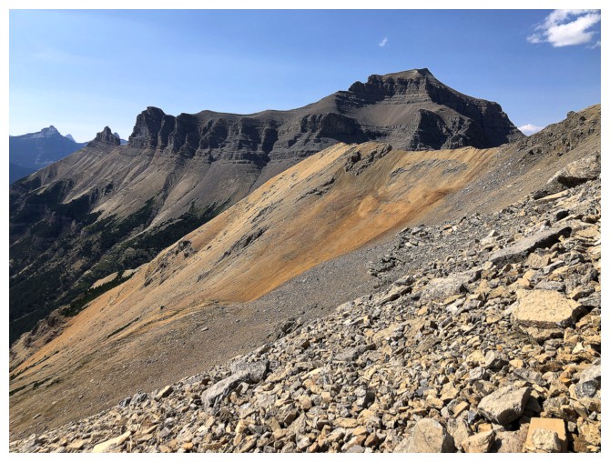
The lower summit of Iceface Peak in the centre
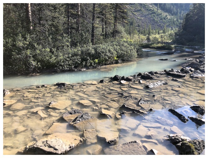
A very silty waterway
The route I would eventually take up the mountain
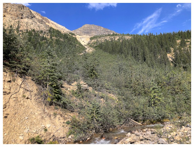
This is why I decided to stop following the creek, though in retrospect it would have been fine
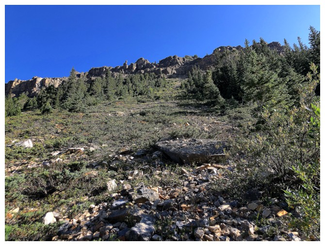
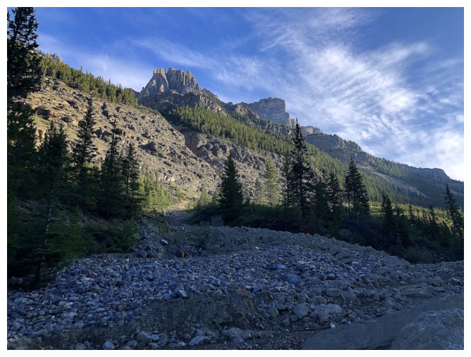
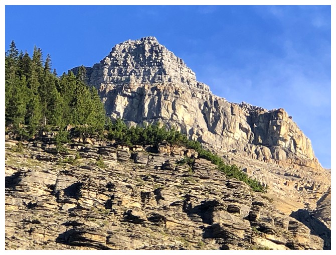
Steep but easy slopes near the start
Still enamoured by Spreading Ridge
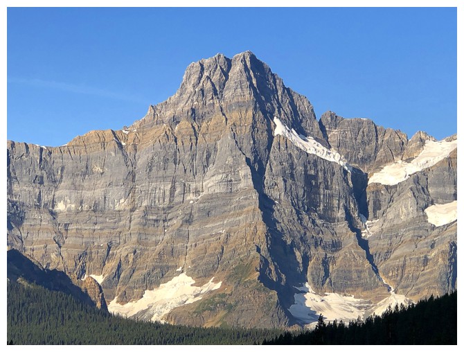
Another impressive massif is now coming into focus - Mount Noyes (summit at far left)

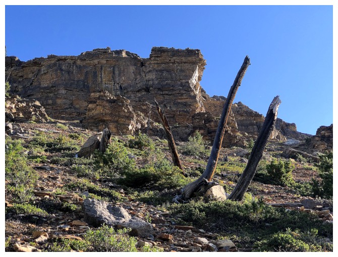
The remains of three random trees
If I was sensitive, I would say the mountain is giving me the finger!
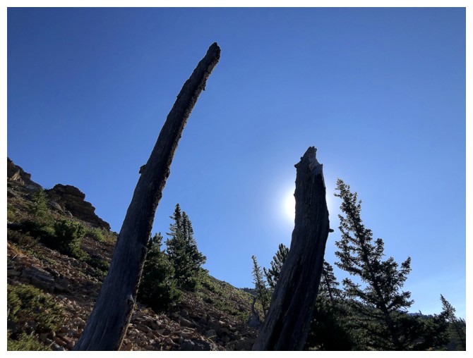
Two of those trees

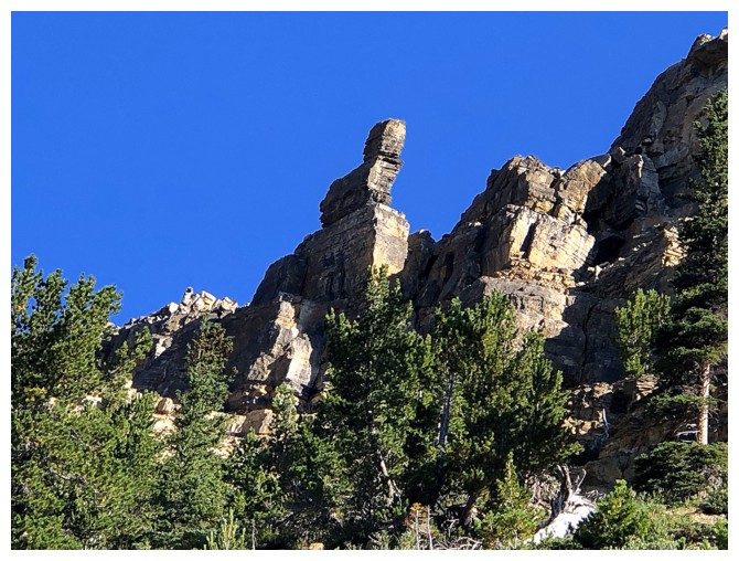
The cool pinnacle that is not a middle finger
The views continue to improve
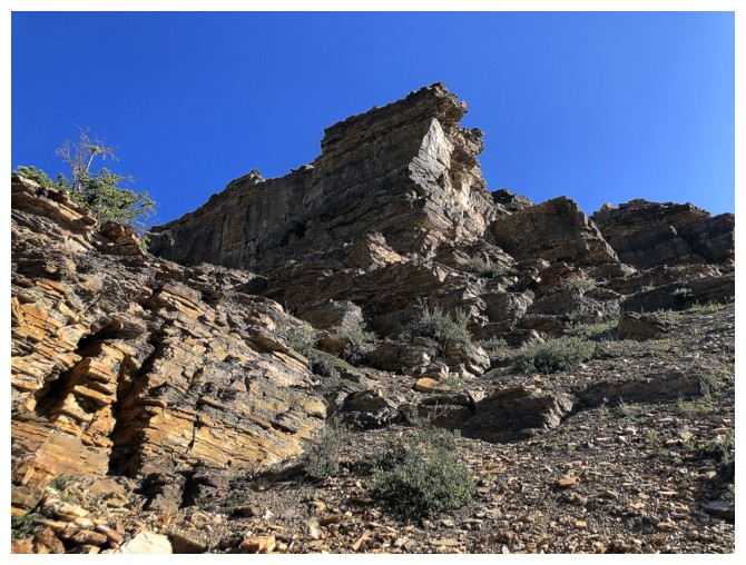
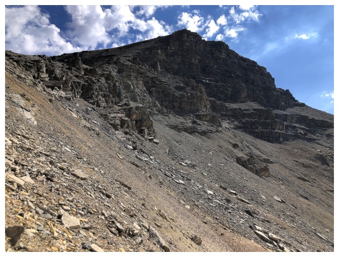
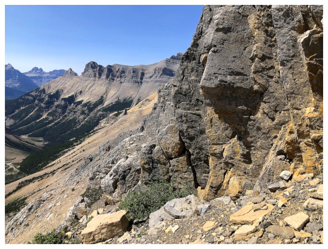
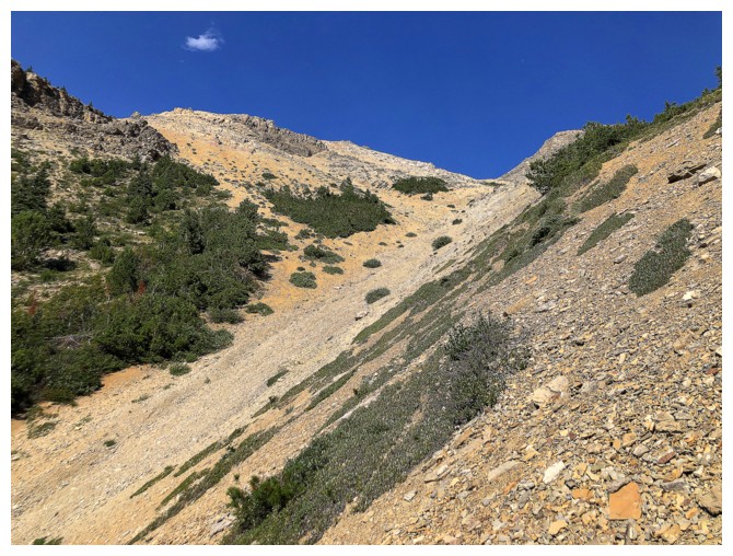
Approaching a rock band that interrupts upward progress
Skirting the band on the right side
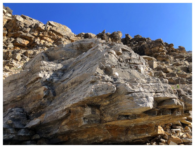
Lots of colourful rock en route to distract from the tedious footing
Trending right onto steep scree slopes
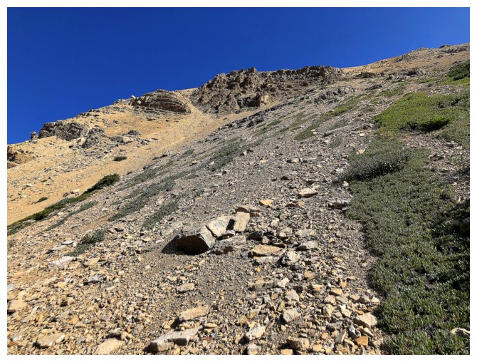
That steep
Heading up to the small col
Good thing the views are great...
...because it's a steep, unrelenting slog to get to that col
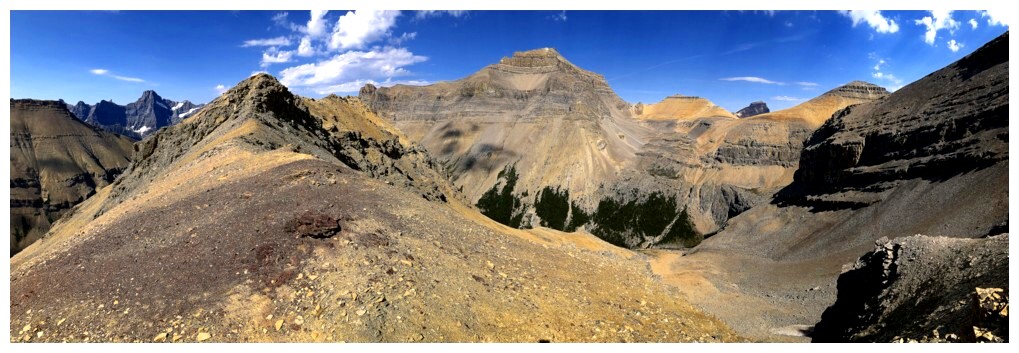
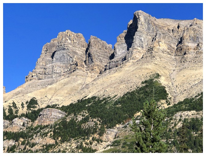
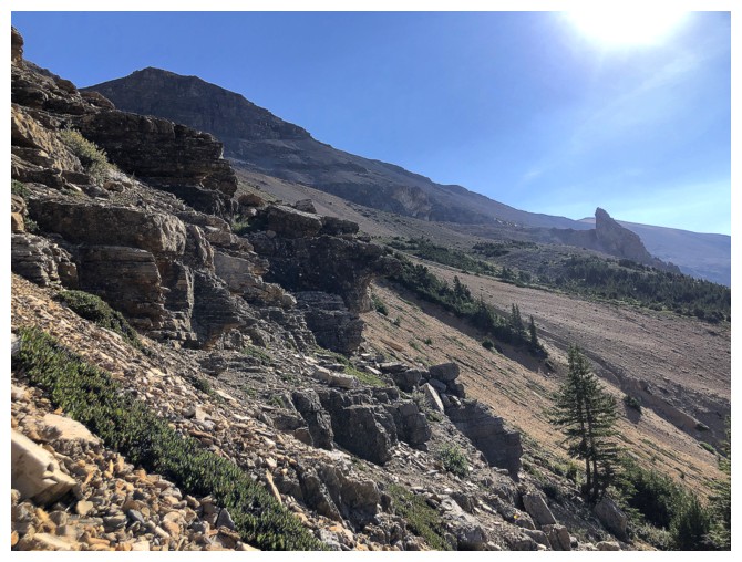
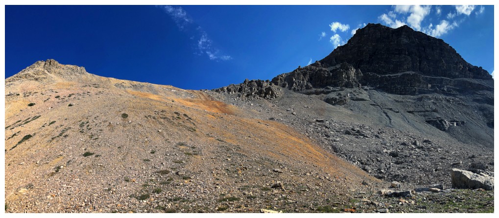
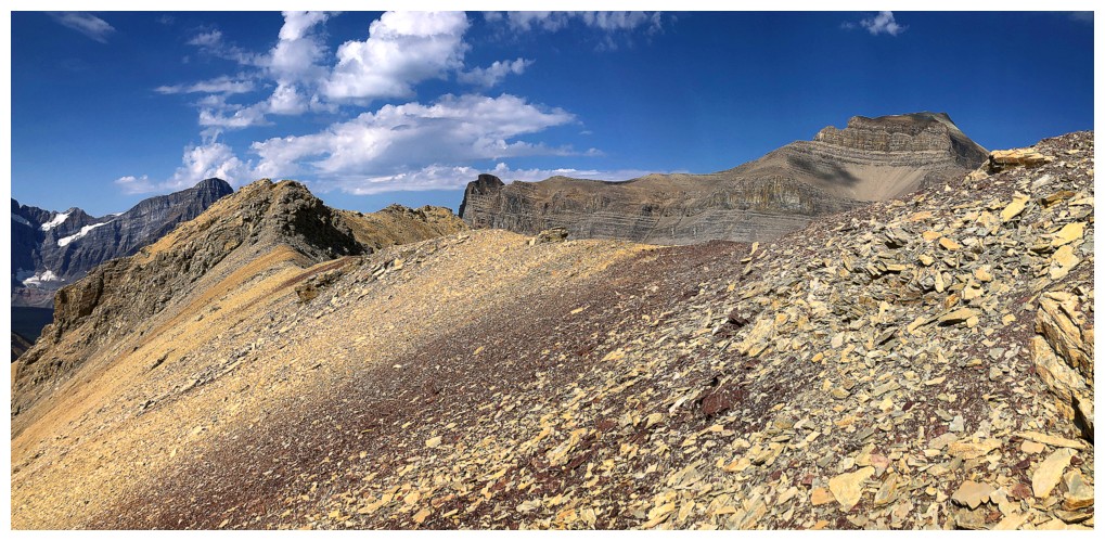
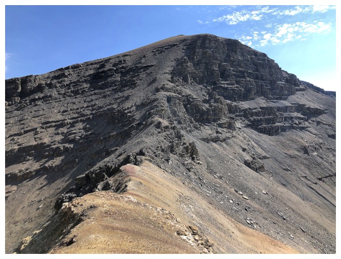
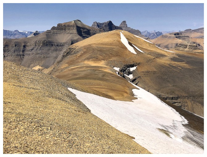
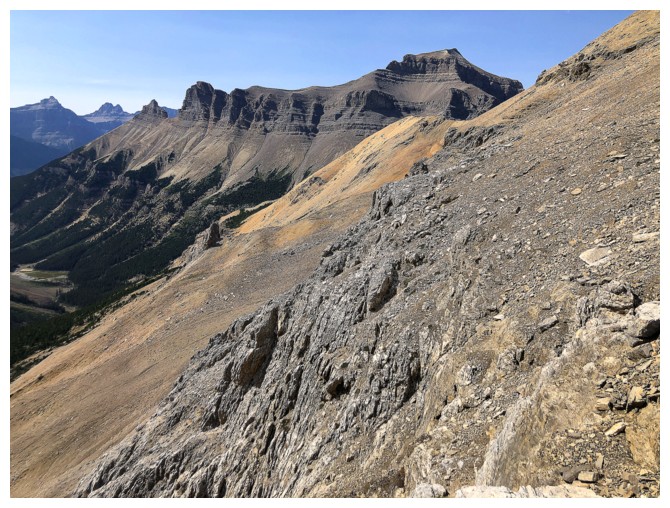
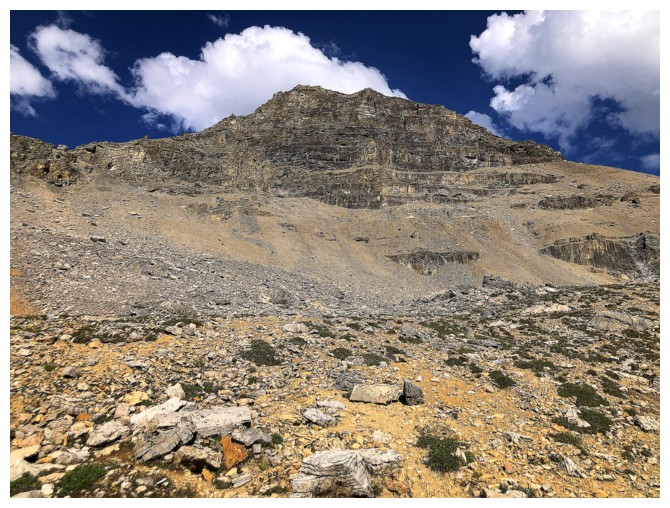
The first objective
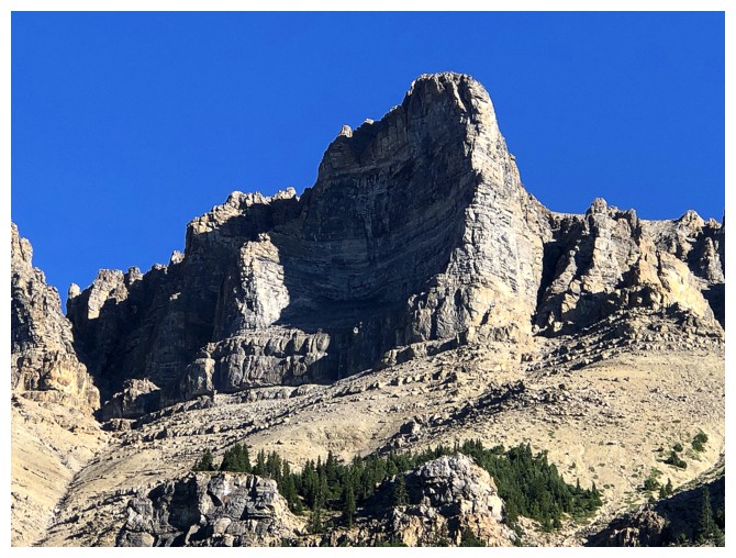
Approaching the col, the layer of reddish rock brings me back to Waterton
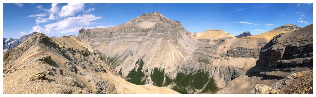
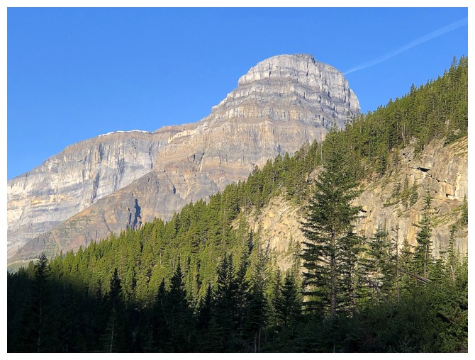
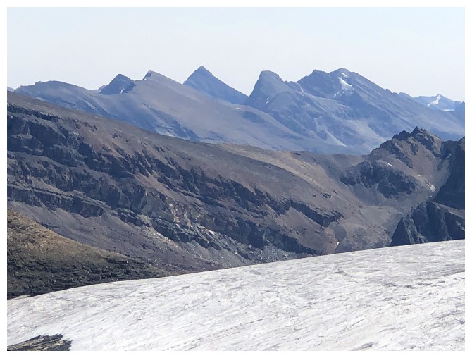
Spreading Peak dominates to the view to the north
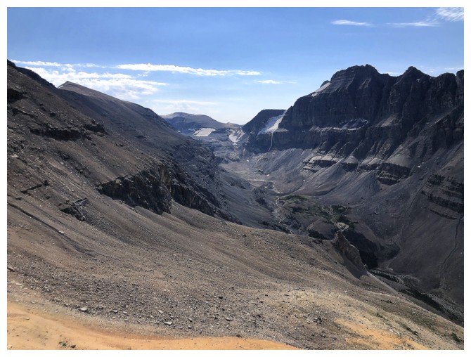
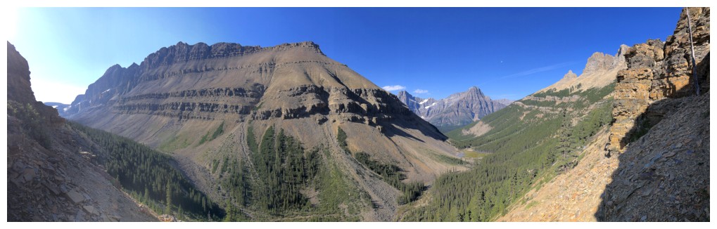
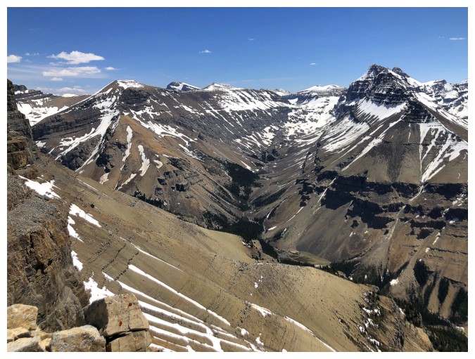
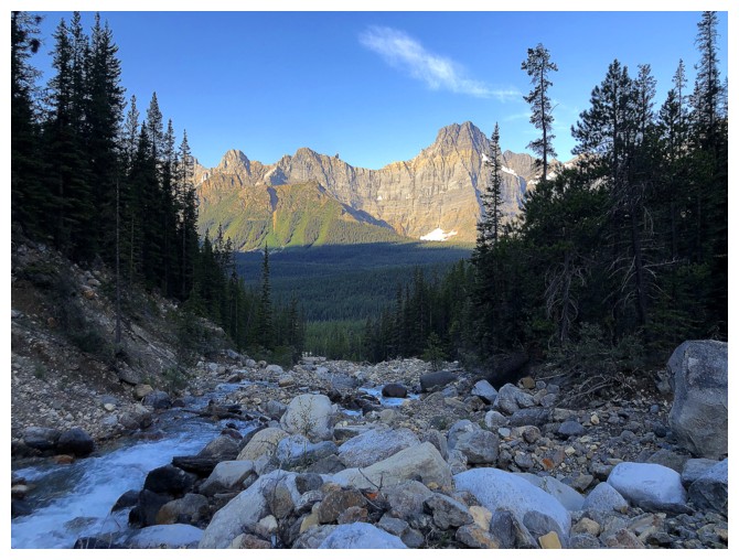
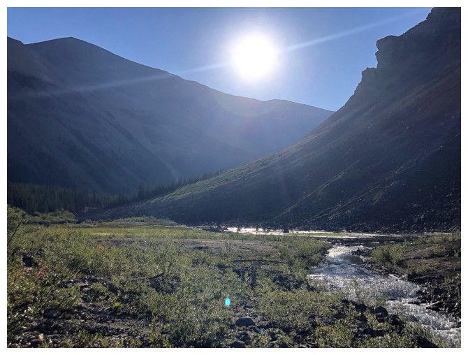
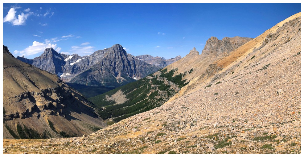
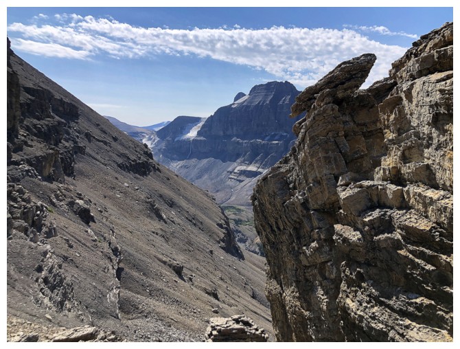
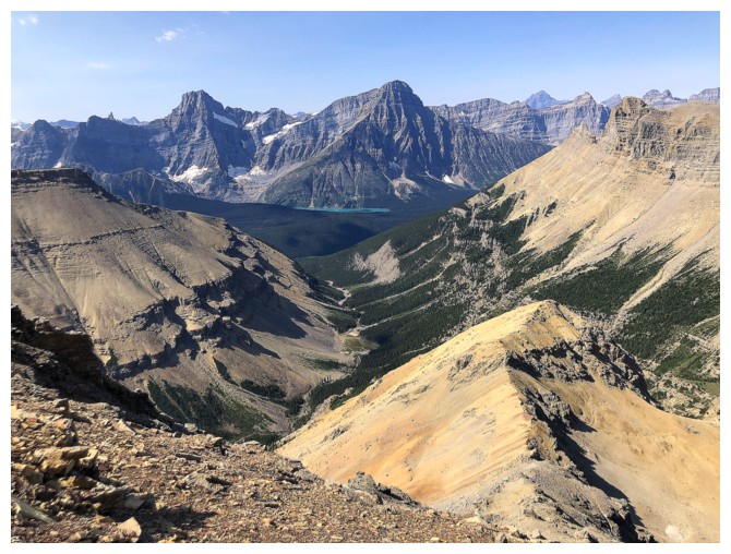
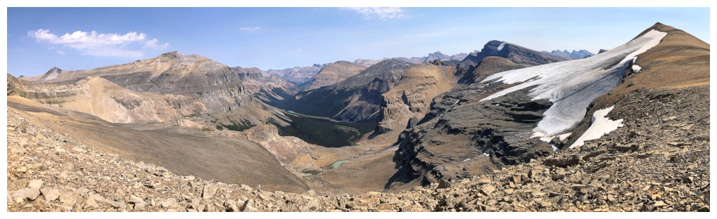
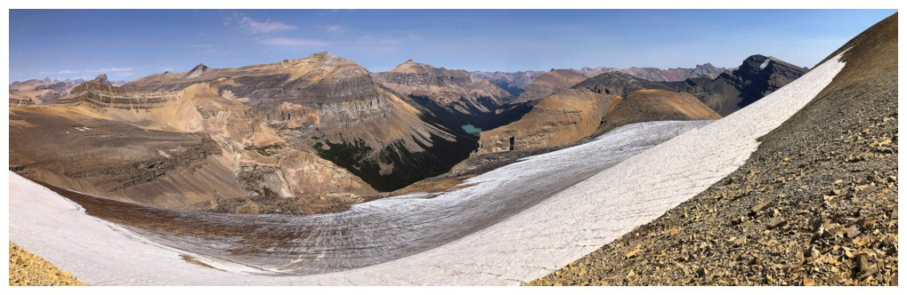
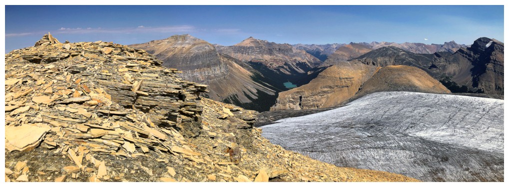
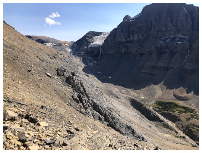
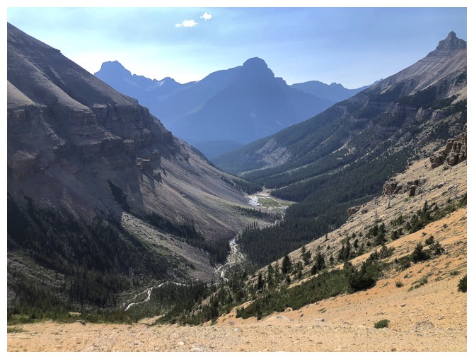
Looking up the Noyes Creek valley. The glacier at the head of the valley is much smaller than the one depicted on maps.
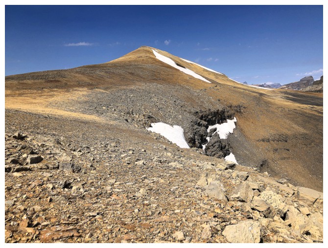
Had to scramble up to a minor highpoint while at the col
View to the north from the highpoint
View to the south
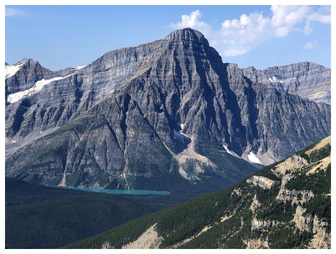
Chephren Lake under Mount Chephren
The ridge up to the lower summit looks relatively straightforward
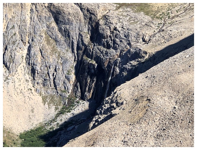
Big waterfall in the valley to the northwest
Spreading and the red rock
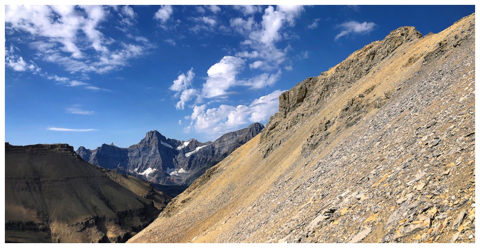
Looking back along the ridge
Distant Corona Ridge
Corona and another outlier of Spreading Peak
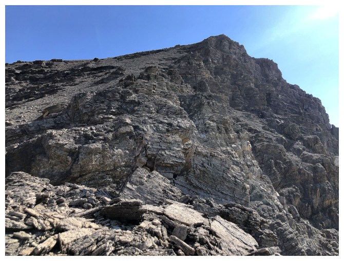
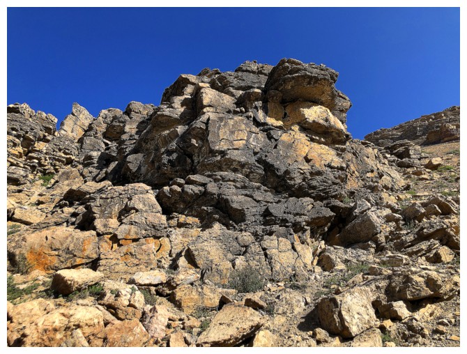
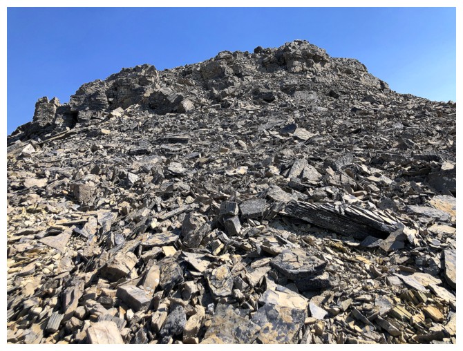
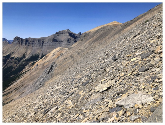
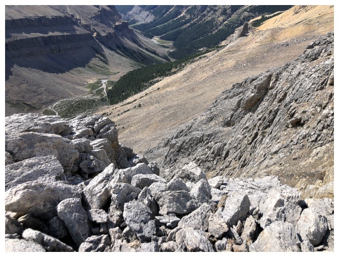
Here comes the nasty stuff. The terrain ahead is steeper than it looks and the footing is atrocious.
I stopped often to curse and take a few photos
Cursing and taking photos - actually a very cathartic combination!
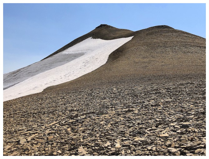
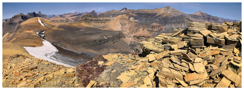
Off the really bad stuff and onto just bad stuff
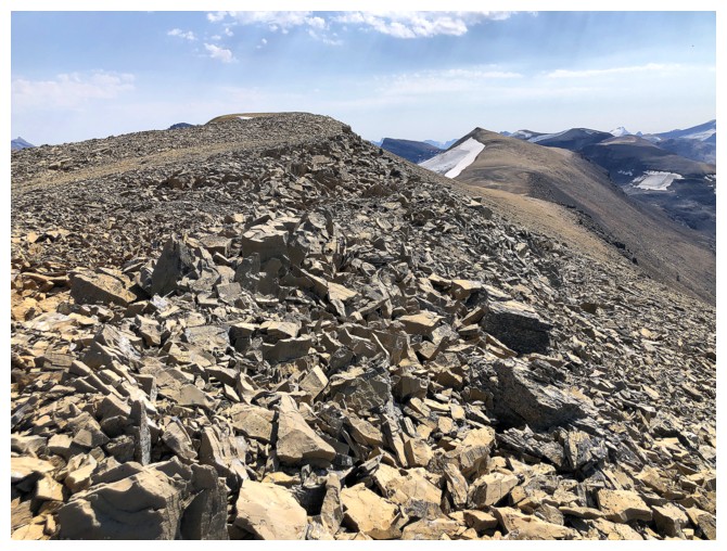
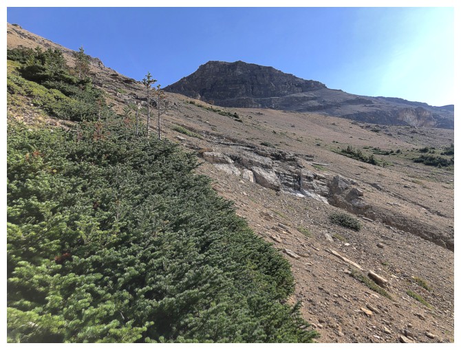
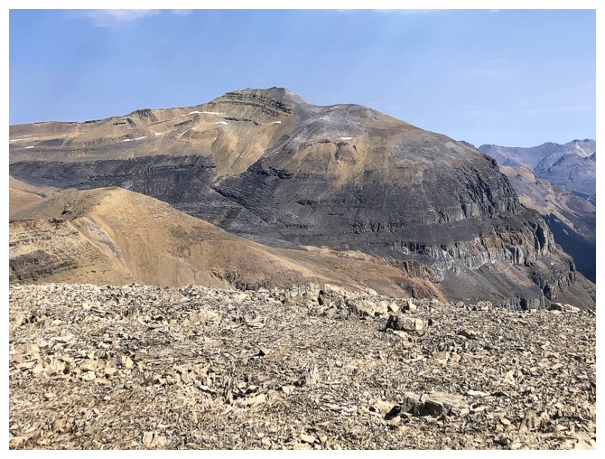
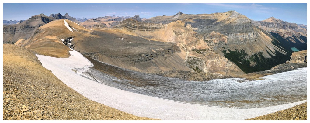
Finally on decent terrain, with a longer than expected walk to the summit
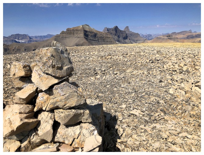
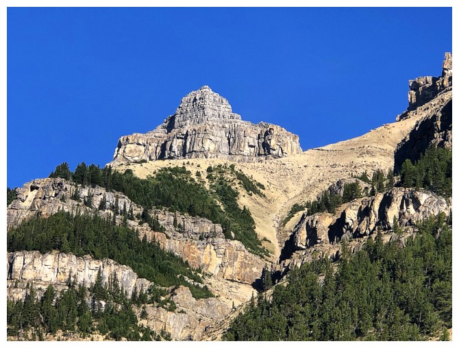
Summit
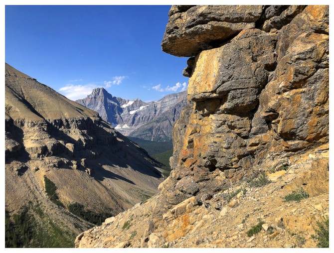
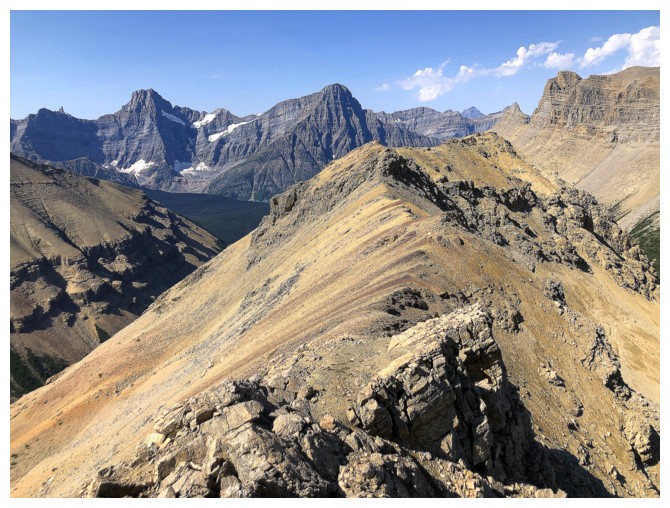
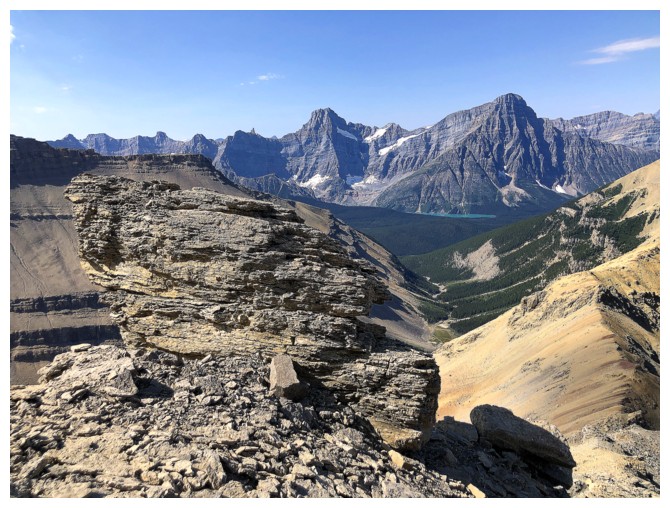
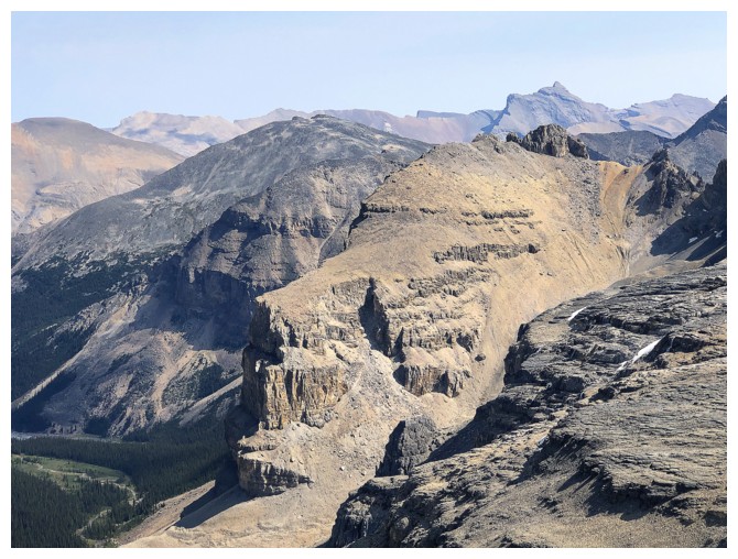
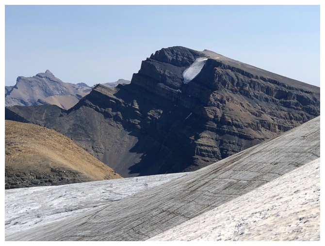
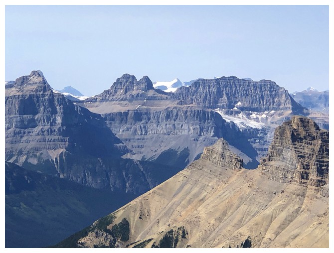
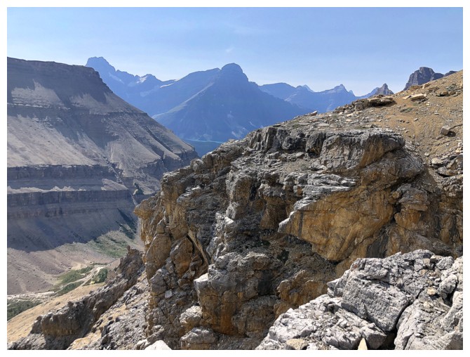
The true summit of Iceface is about 1.8 km southeast (near the right)
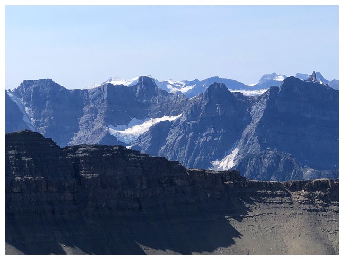
The string of difficult peaks south of Howse Peak
Howse Peak is a beast from the east and a super long slog from the west

Mount Forbes is the highest mountain in sight
Mount Sarbach (right), the two Kaufmann Peaks (centre) and Epaulette Mountain (left)
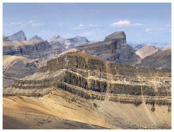
Spreading Peak, Totem Tower, and I think the one of the right is Hall Tower (part of the Murchison group)
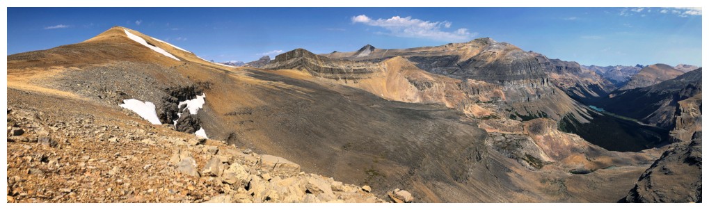
View to the north

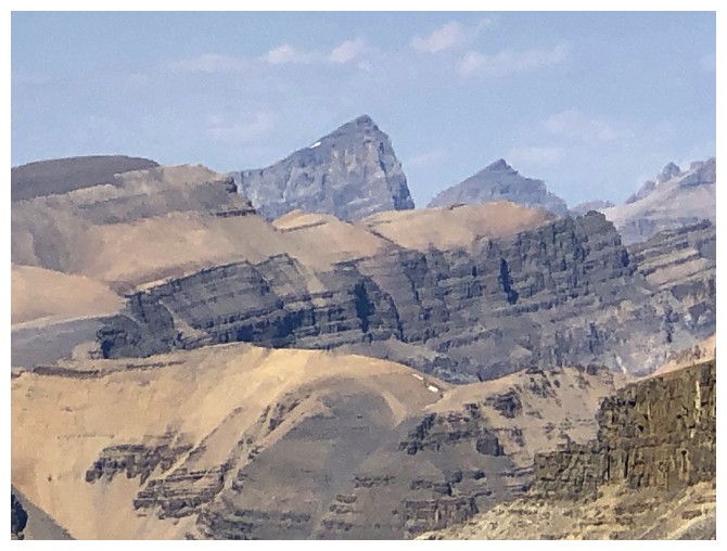
A highpoint of the northwest ridge of Marmota Peak
Marmota Peak
Recondite Peak in the centre
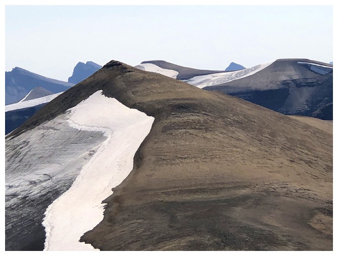
Easy to see how Iceface gets its name
Heading over to the true summit
Good views of Marmota throughout
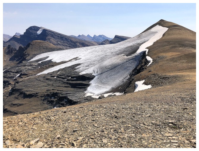
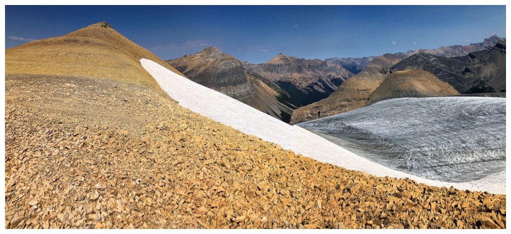
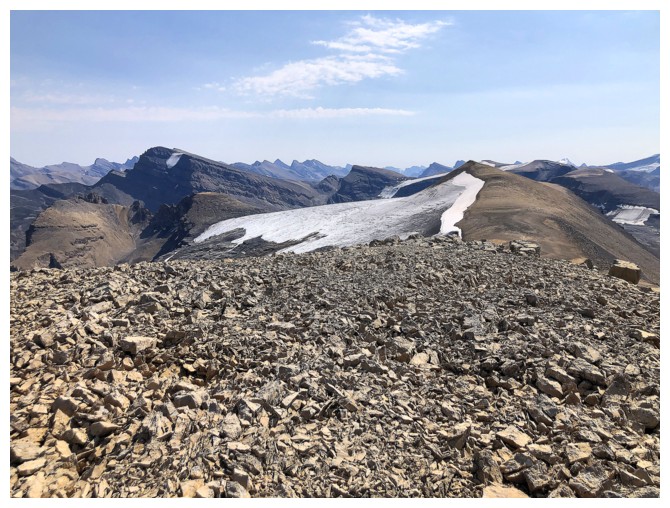
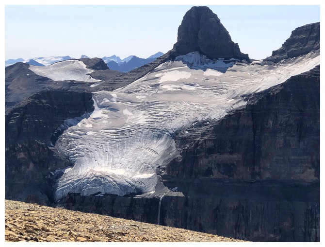
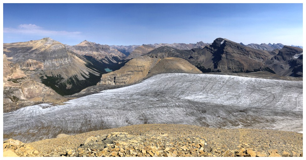
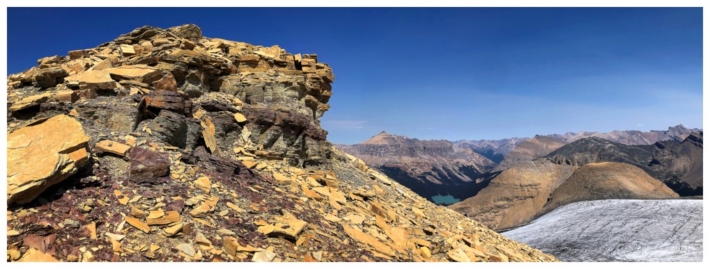
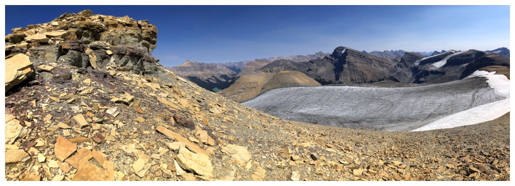
The glacier on the east side of Iceface
Lots of super cool terrain to the southeast
All of the above
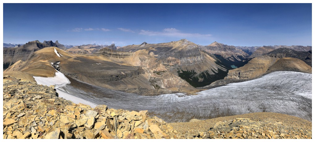
Pano to the northeast
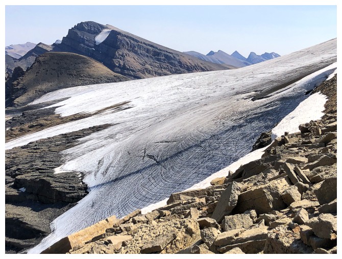
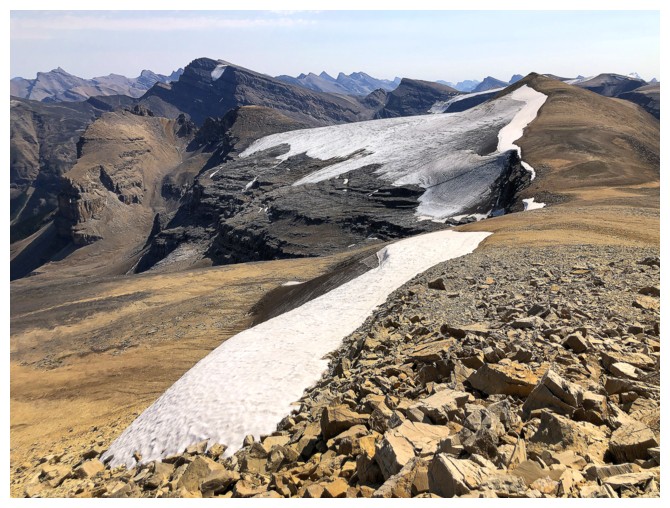
The Iceface glacier
Looking back to the lower summit
Looking forward to the true summit. Pleasant terrain underfoot!
Quill Peak. Interestingly, I couldn't find any map that depicts the small glacier on the northwest side.
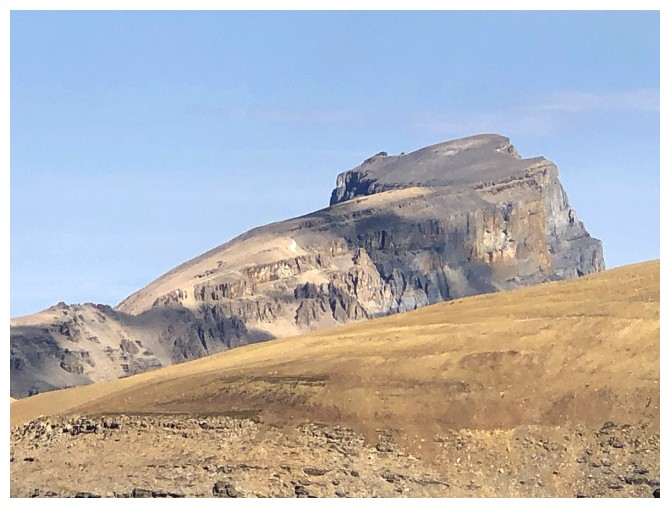
Mount Loudon above Porcupine Lake
Porcupine Lake
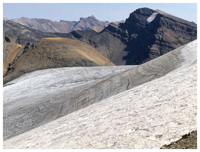
Stayed as close to the glacier as possible without setting foot on it
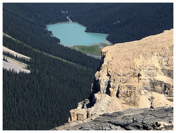
Got smitten with Porcupine Lake!
Mount Noyes and the glacier that feeds Noyes Creek
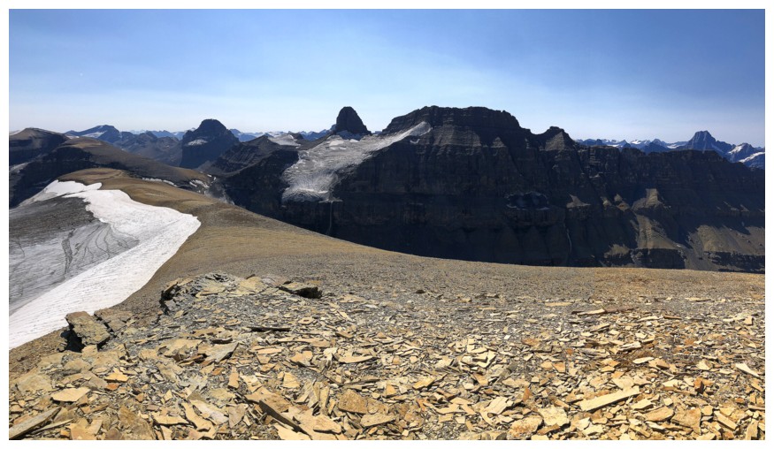
Steps away from the summit, another strip of red rock appears
Summit view to the north
Northeast
Southeast
Southwest

Northwest
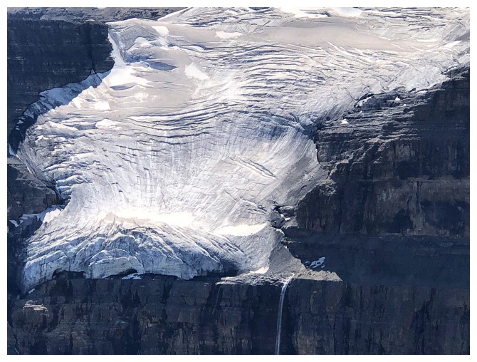
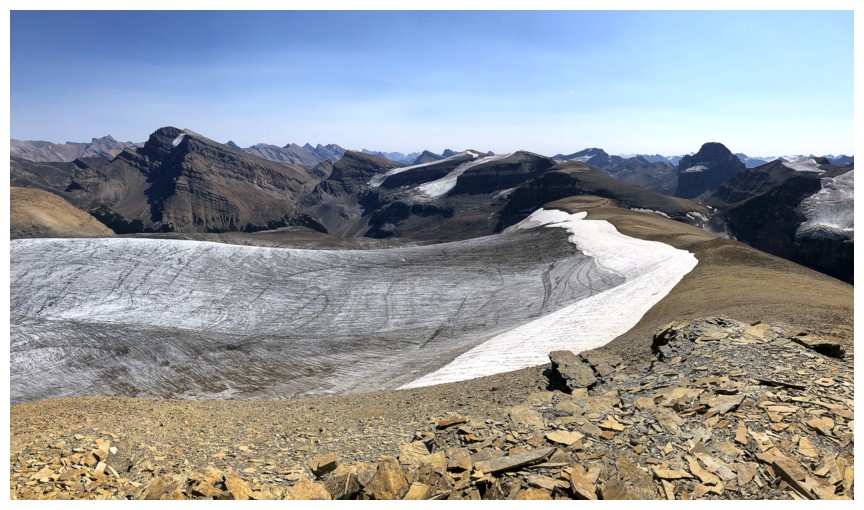
Close-up of the Noyes glacier
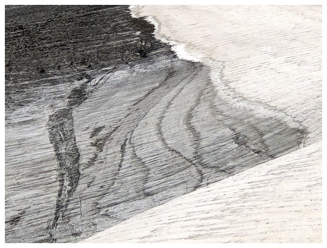
Close-up of the Iceface glacier
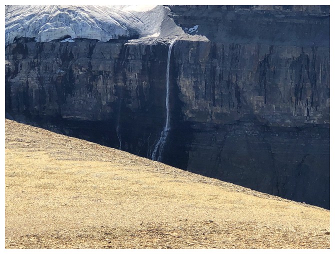
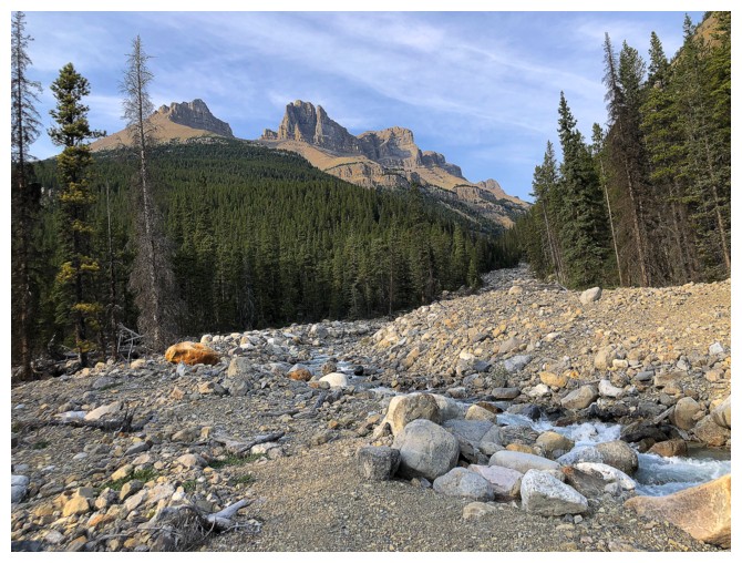
The waterfall that becomes Noyes Creek
I think that's part of The Lyells in the distant centre
Mount Cline - still one of the most disappointing trips I've ever done
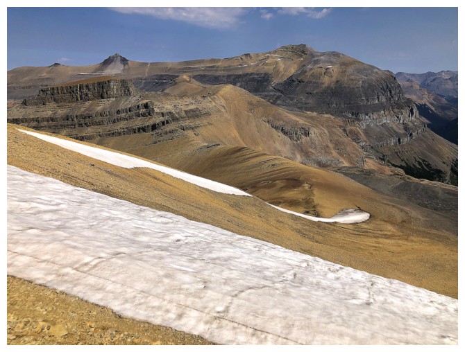
Heading down the south ridge for a short distance before starting the horribly epic descent
There's that red rock
Very cool shades and hues on this and the surrounding mountains
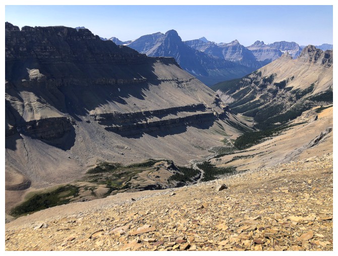
Looking down the Noyes Creek valley
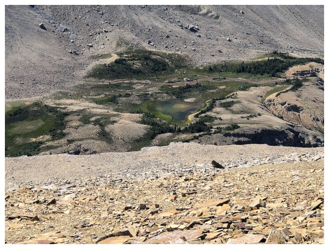
There's a tarn down there that I really wanted to visit
The route that I will eventually have to side-slope
Failed attempt to descend directly down to the valley; have to go back up.
The south end of the valley
Still side-sloping
Another failure
Back up to the side-sloping terrain
Cool pinnacle
Almost back to my ascent line
Same as above
Looking up to the lower summit
While there was some decent scree here, the terrain still required care most of the time
Took a slightly different route down than up
Back at Noyes Creek, with the lower summit above
Back at dried-up lake. The lower summit looks very different than the morning view of it.
Back at the start, completely wiped out, but happy to have seen a new valley and a new summit
The End
LOG