Jimmy Junior III
October 1, 2023
Mountain height: 2750 m
Elevation gain:
800 m
Ascent time: 3:50
Descent time: 1:50
 Scrambling with
Mark.
Scrambling with
Mark.
Got the best of
both worlds in my third run up Jimmy Junior – snow-free lower slopes allowing easy
access to the exciting scramble route, and snowy upper slopes, enhancing the
already magnificent scenery.
Mark and I were
looking for a short trip and Jimmy Junior fit the bill perfectly. Mark had
never up this outlier of Mount Jimmy Simpson and I was excited to repeat the
scramble route up a drainage west of the “normal” route.
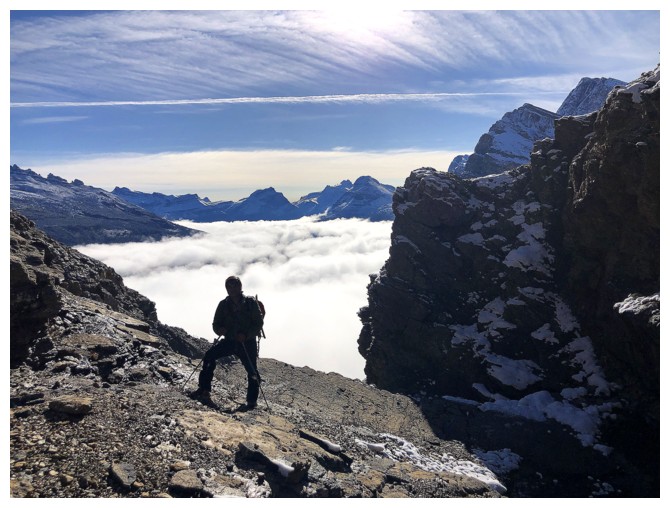
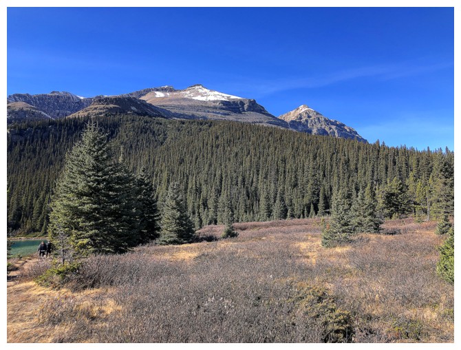
 Things didn’t
look great as we started the trip under cloudy skies and low-lying fog.
However, the forecast predicted clearing in the morning.
Things didn’t
look great as we started the trip under cloudy skies and low-lying fog.
However, the forecast predicted clearing in the morning.
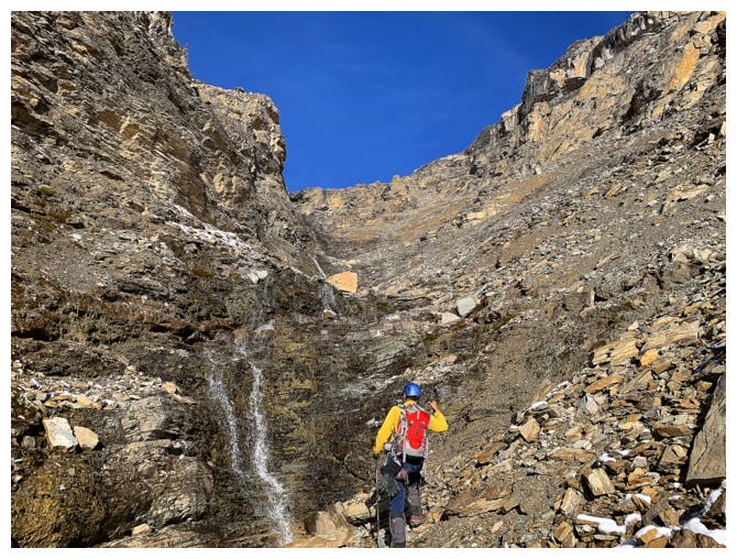
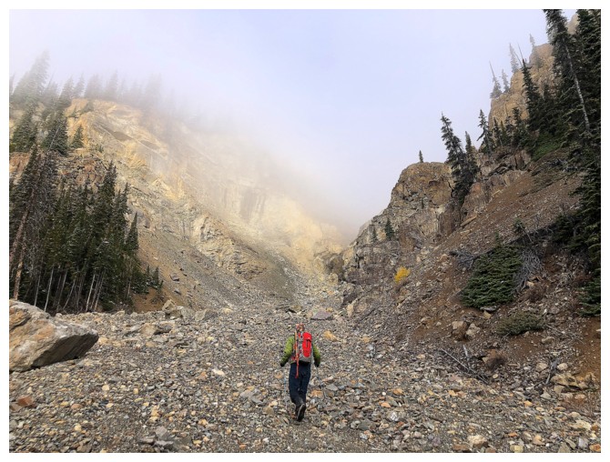
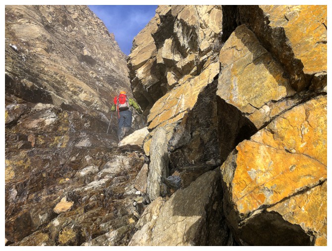
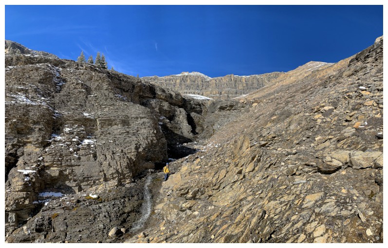
Following the
route I had taken in 2016, we quickly reached the crux of the trip – a short
but very steep section of hard dirt that leads into the main drainage. Microspikes
worked perfectly here and in fact we kept them on for the remainder of the
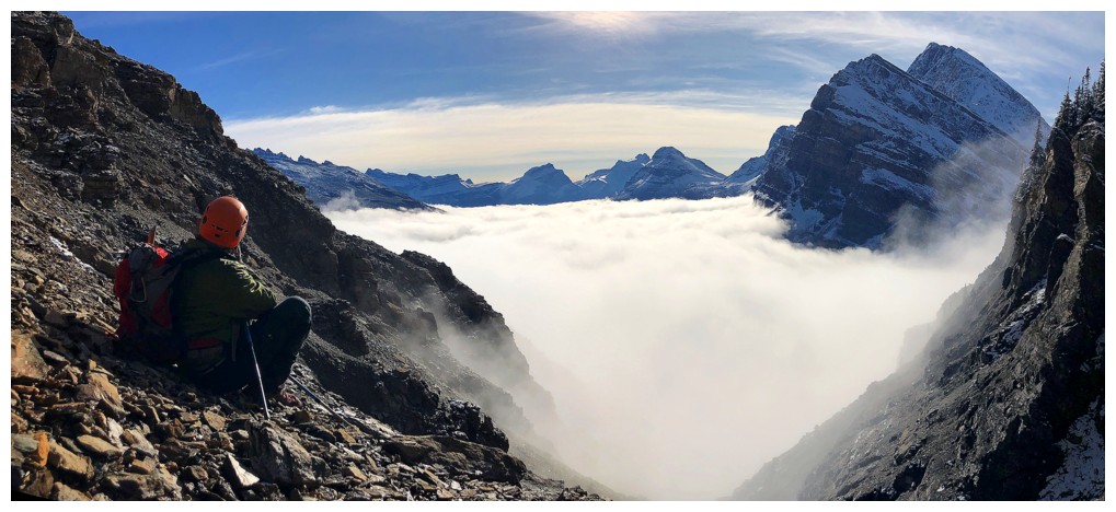
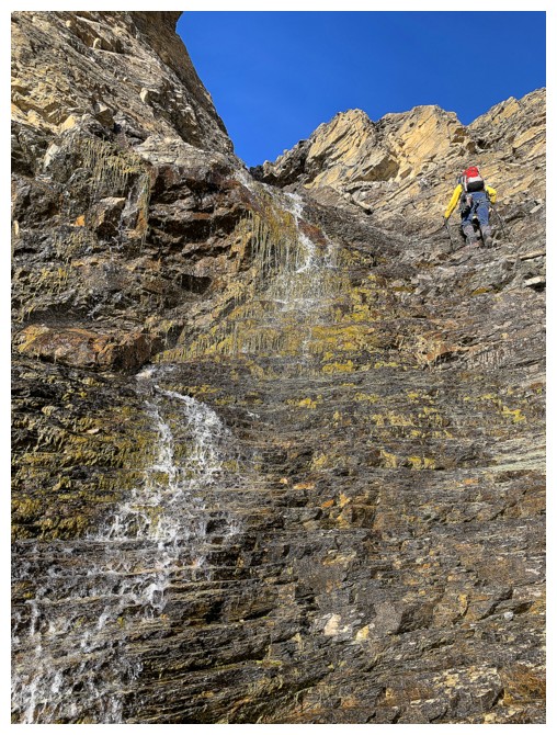
trip. The drainage was as fantastic as I remembered – fun scrambling alongside
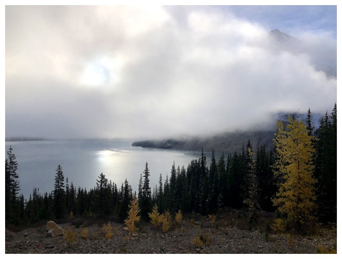
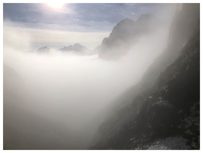
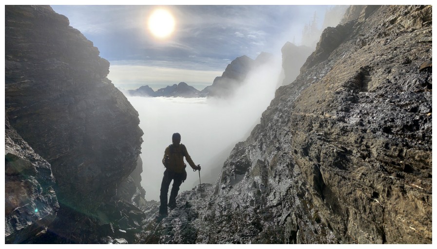
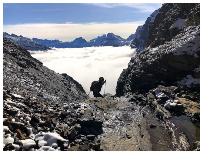
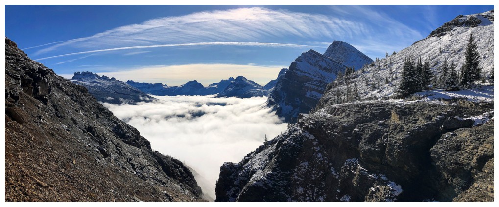
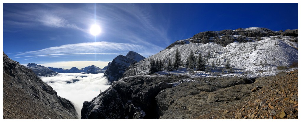
numerous cascades and waterfalls. 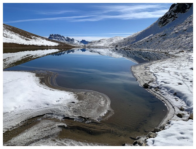 To add to the fun, as we gained elevation in
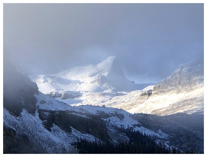
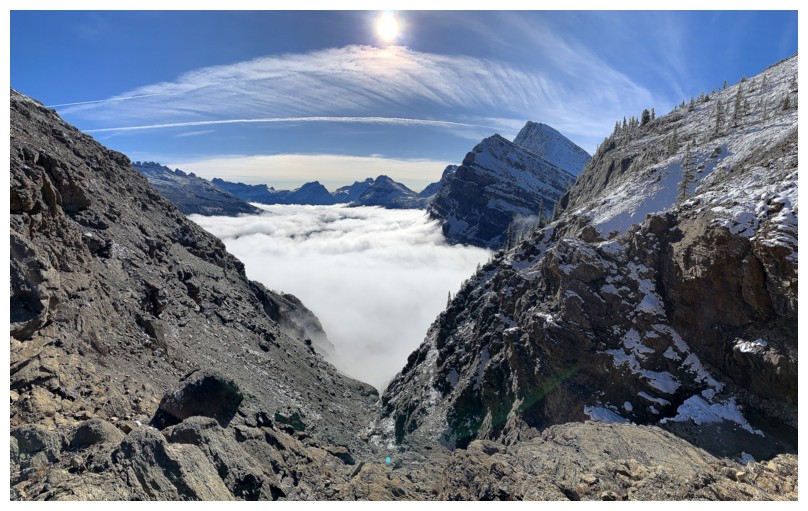
the soupy weather conditions, blue skies suddenly appeared above, and behind us
appeared one of the most remarkable inversions we have ever seen, framed by the
sides of the drainage.
To add to the fun, as we gained elevation in
the soupy weather conditions, blue skies suddenly appeared above, and behind us
appeared one of the most remarkable inversions we have ever seen, framed by the
sides of the drainage.
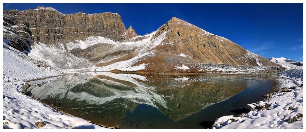
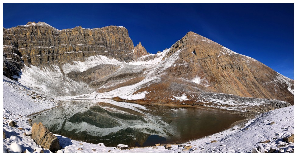
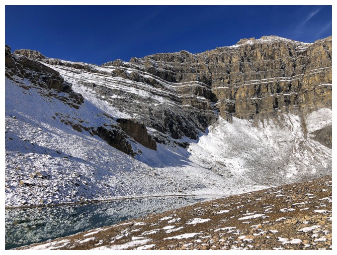
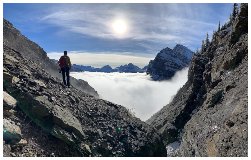
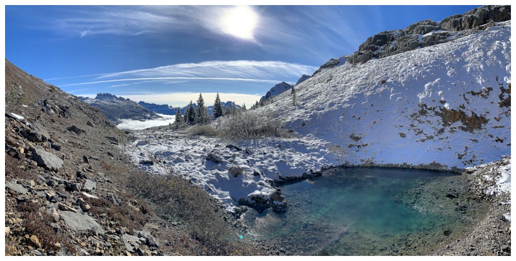
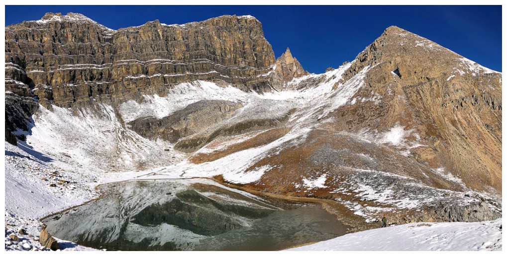
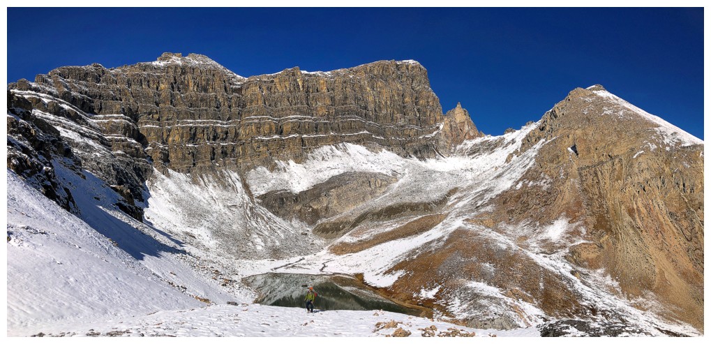
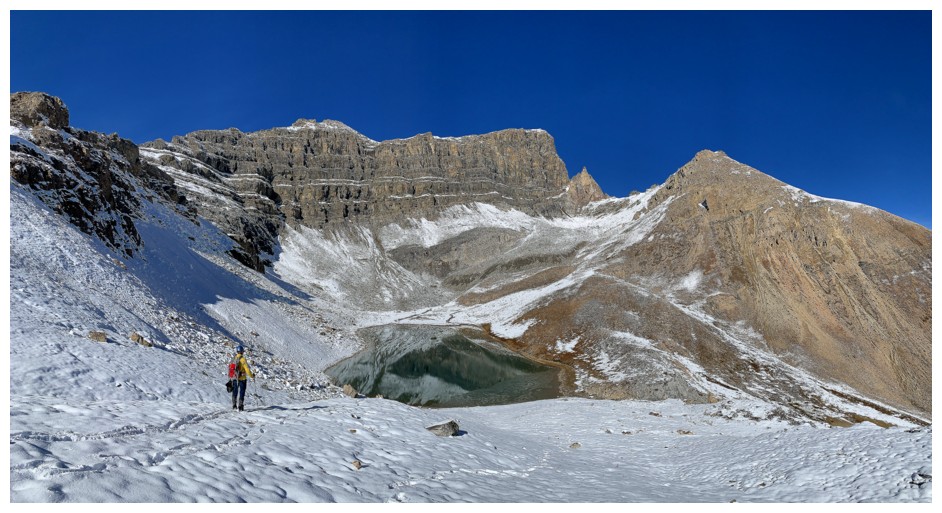
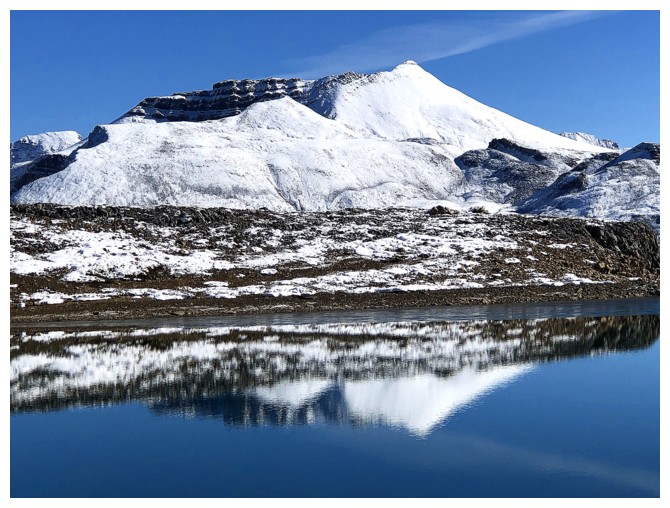
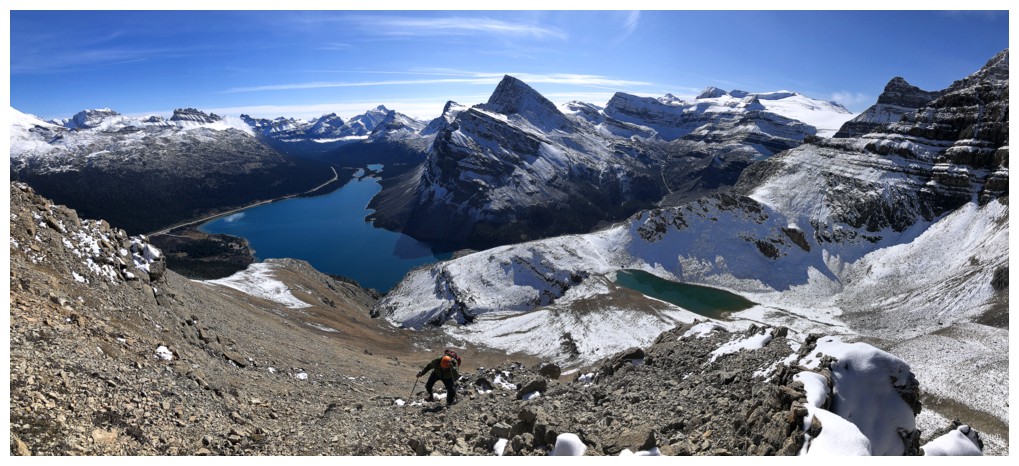
The next “wow” moment
came when we reached the tarn below Jimmy Junior. The fresh layer of snow and
perfect reflections in the tarn inspired us to visit a highpoint above and then
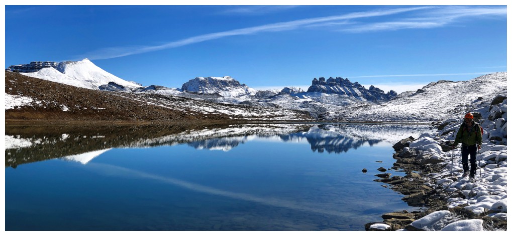
circumnavigate the tarn to see all there was to see. We then set our sights on
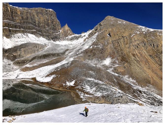
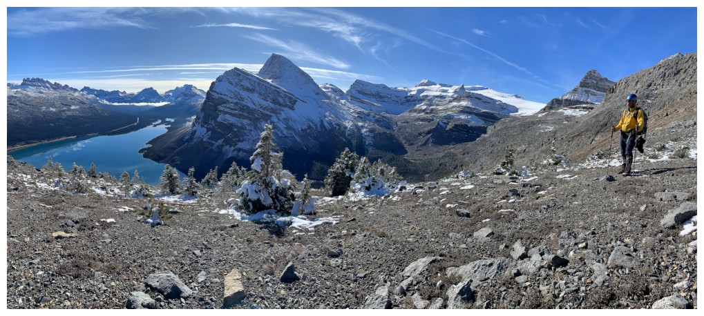
the summit, taking a steep, but interesting route up through numerous rock bands
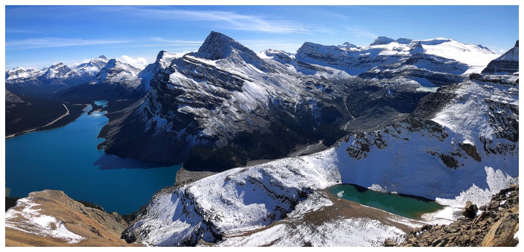
to the ridge. Views of Bow Lake, the tarn, and of course all the wonderful
mountains in the area were inspiring throughout.
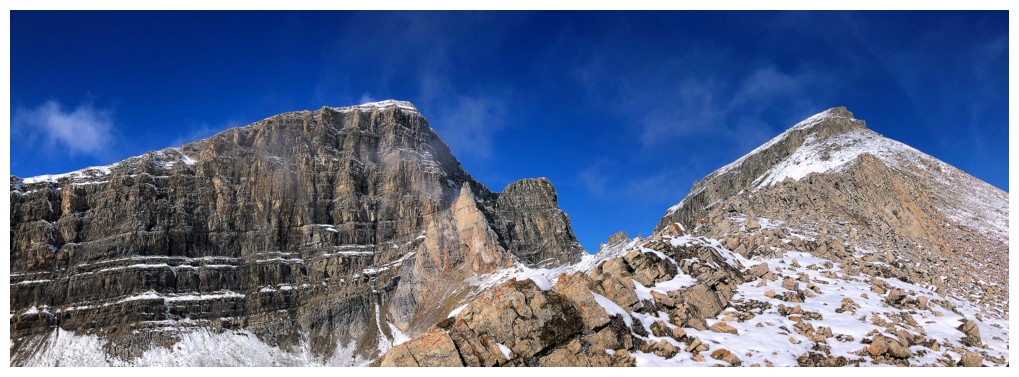
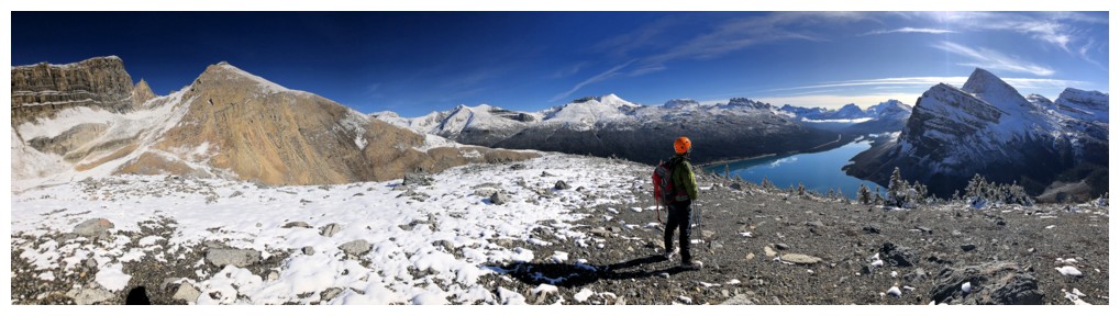
The last part
of the ascent was much easier, and we arrived at the top about 4 hours after
leaving – not a fast ascent time, by any stretch, but that includes a few
side-trips and lots of breaks to enjoy everything the route had to offer. Needless
to say, the summit view was incredible – definitely the best I had experienced
on this summit, due to the clear skies and new snow.
The descent is
a no-brainer, right down the easy south ridge. Upon reaching the forested
terrain below the ridge, we were pleasantly surprised to find a good trail with
flagging to lead us out to Bow Lake.
Another awesome
trip up this wonderful outlier.
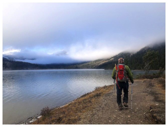
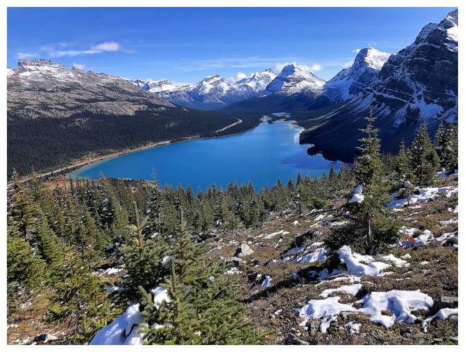
Hiking around Bow Lake
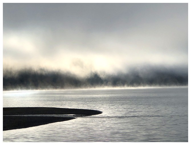
Unusual weather conditions and clouds over the lake
Mount St. Nicholas makes a brief appearance
So does Mount Olive
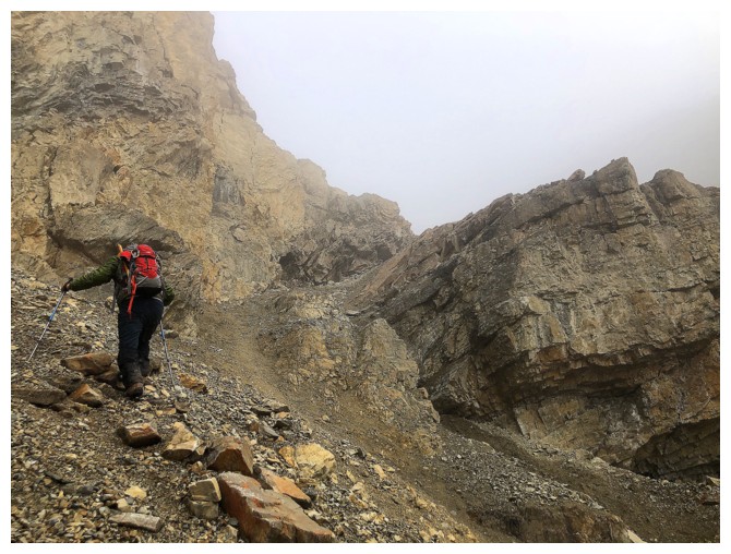
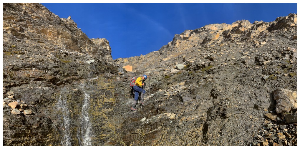
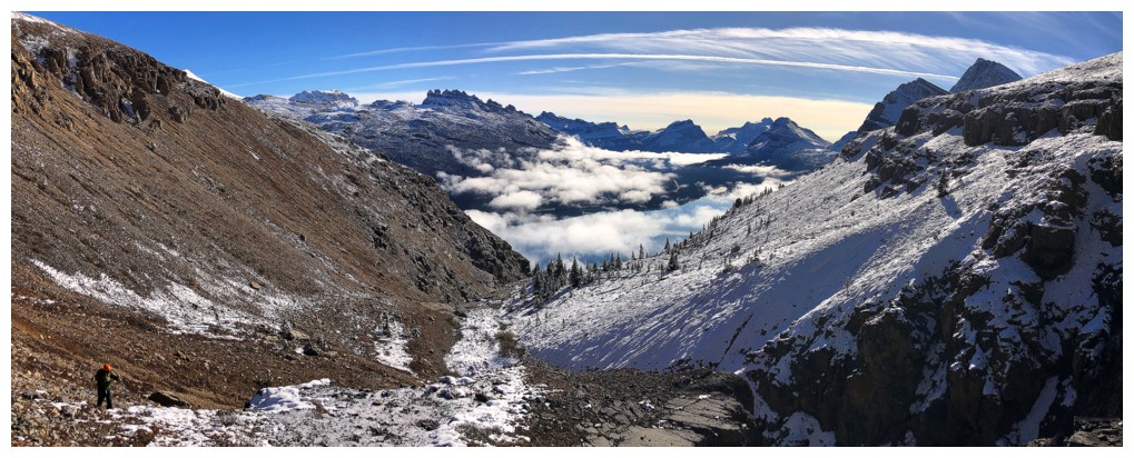
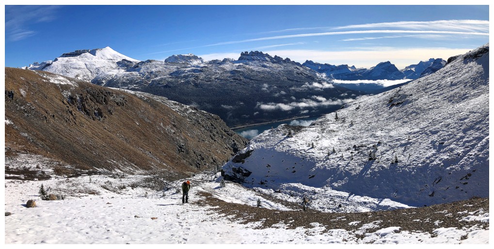
Heading up the ascent drainage
Still very cloudy over the lake
Cloudy in the drainage too
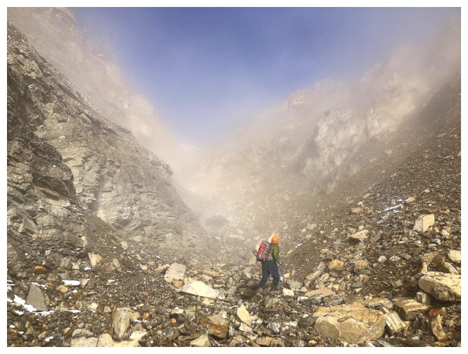
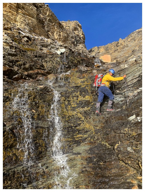
Approaching the crux of the trip - a short but very steep and slick
slope, where extra care is needed. We put the microspikes on here and
didn't take them off until back at Bow Lake.
Much easier travel once back in the drainage. First signs of blue sky above the clouds.
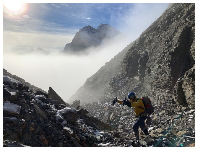
Was not expecting that!
More signs of clearing
Eerie but cool
Fun travel in the drainage
The inversion is slowly being revealed
There it is
Minimal water in the drainage, but it still provided much visual entertainment
Same as above
The clouds above Bow Lake are also going to provide much visual entertainment, and for much longer than expected
Another fun section
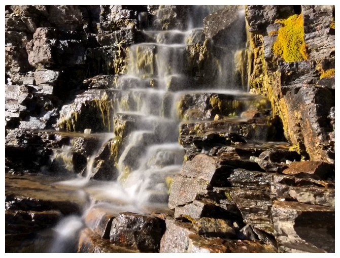
Had to get at least ONE long exposure photo!
Back to the inversion
Back to the drainage
Ditto for the next three!
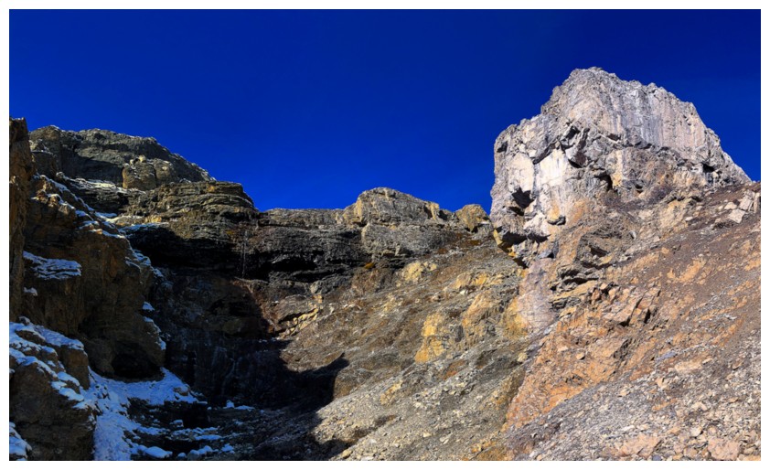
The drainage finally comes to an end
But the inversion doesn't
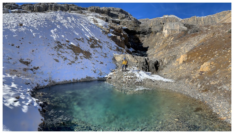
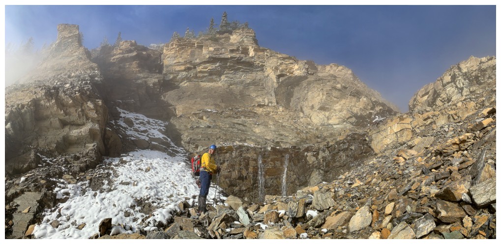
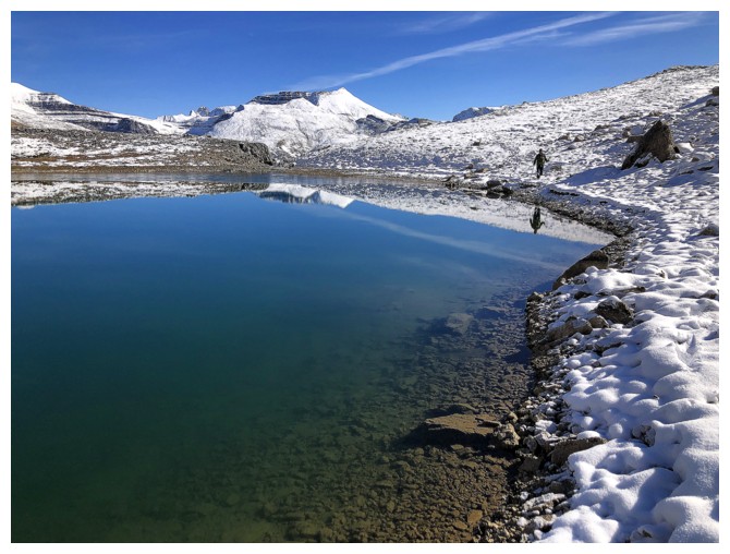
Super cool pool of crystal clear water, with a thin layer of ice at one end
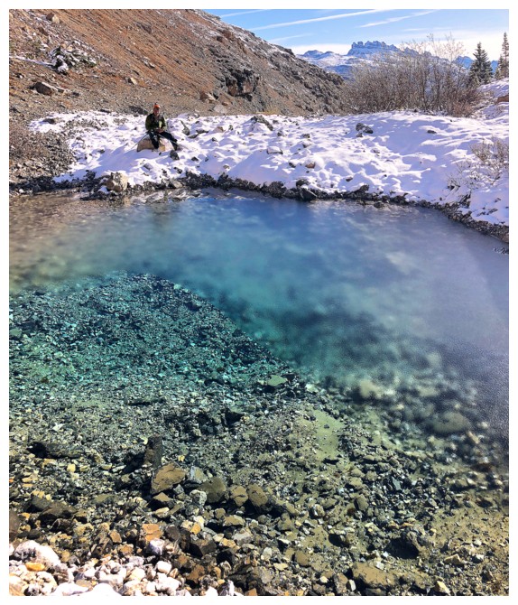
Mark sits on the other side where the ice is
During times of heavier water flow, there is a big waterfall coming down here
Leaving the pool
The inversion finally starts to dissipate
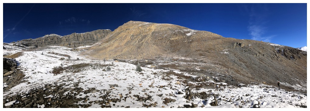
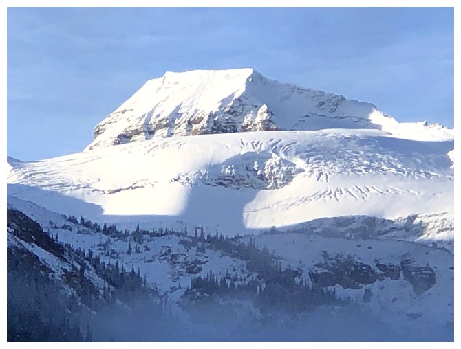
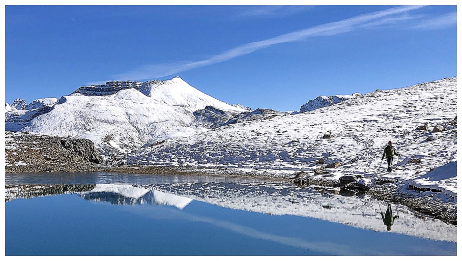
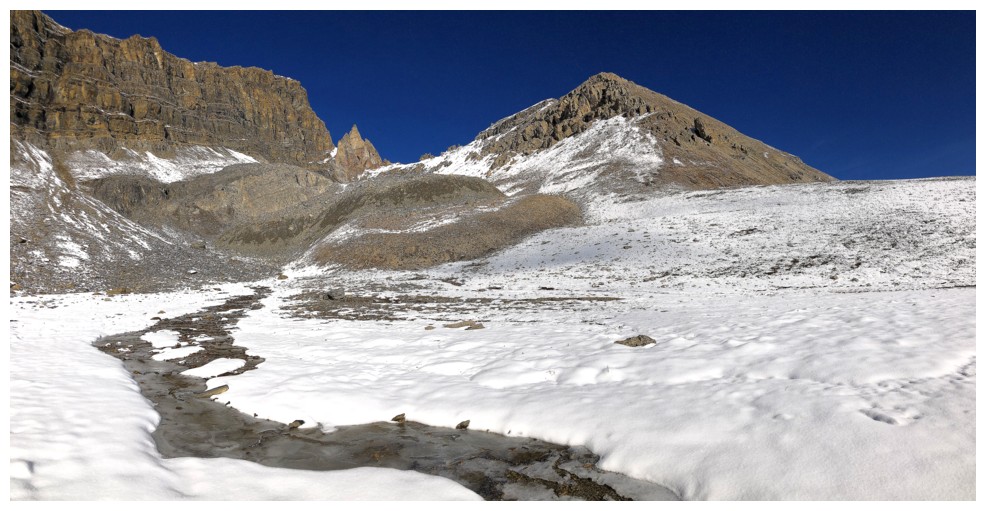
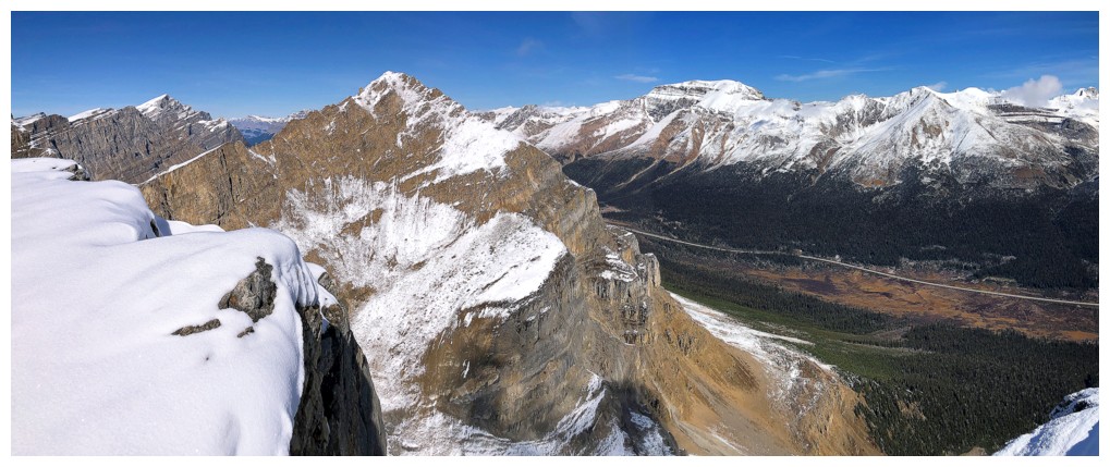
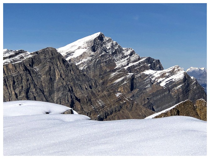
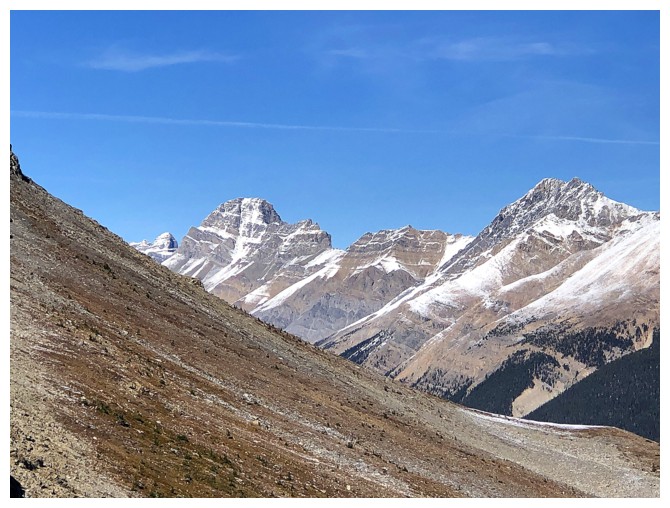
Jimmy Junior
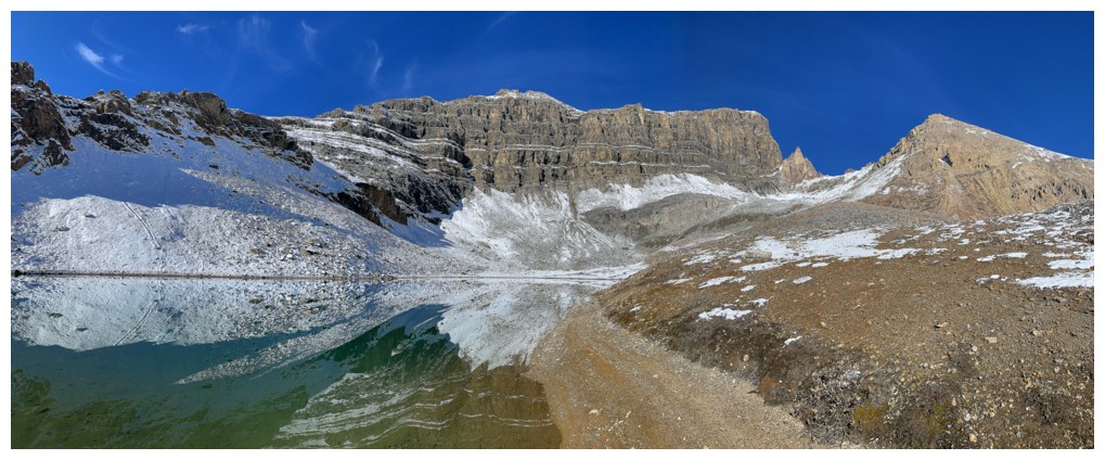
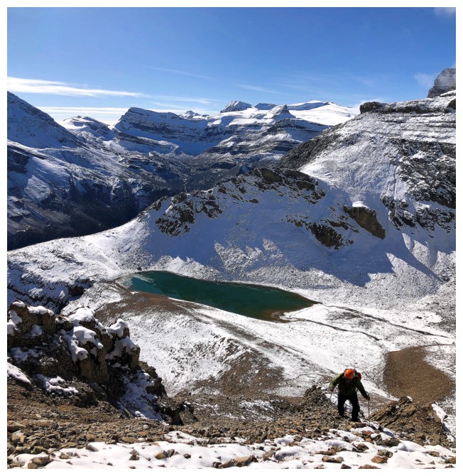
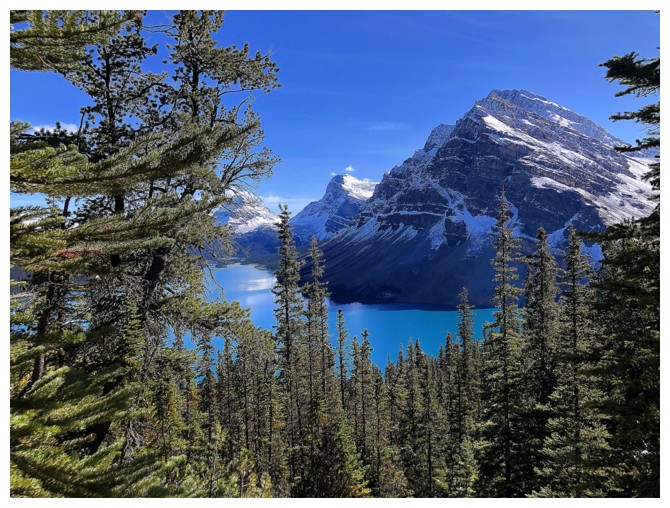
Before ascending the objective, a visit to the tarn below Jimmy Simpson is usually a good idea
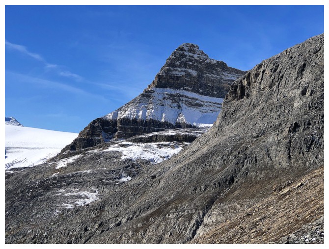
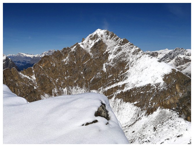
Jimmy Simpson (left) and Jimmy Junior
The clouds over the lake are pretty much gone and the lake starts to appear
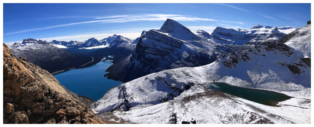
Jimmy Simpson, a sweet pinnacle, and Jimmy Junior
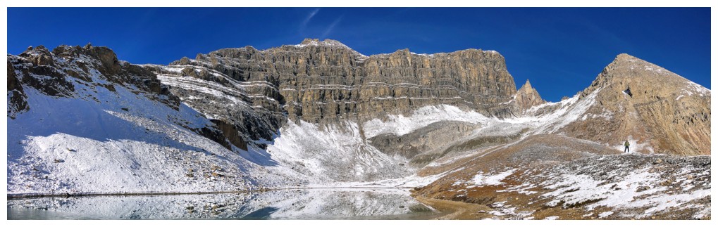
Same as above with the tarn
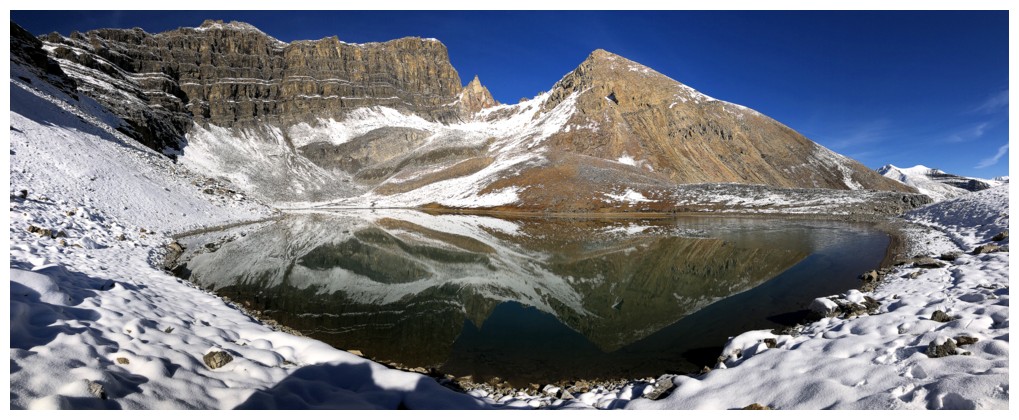
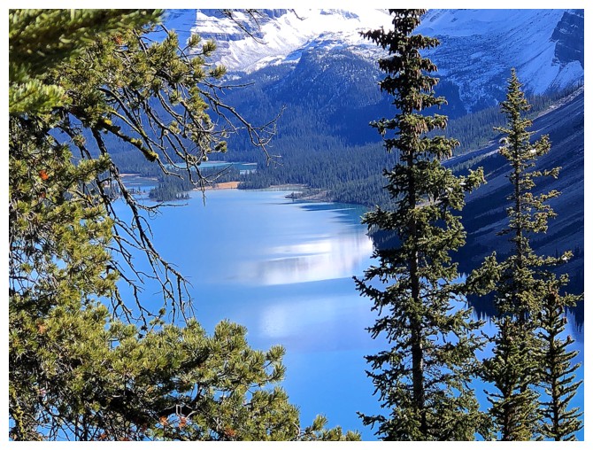
The reflections in the tarn were perfect
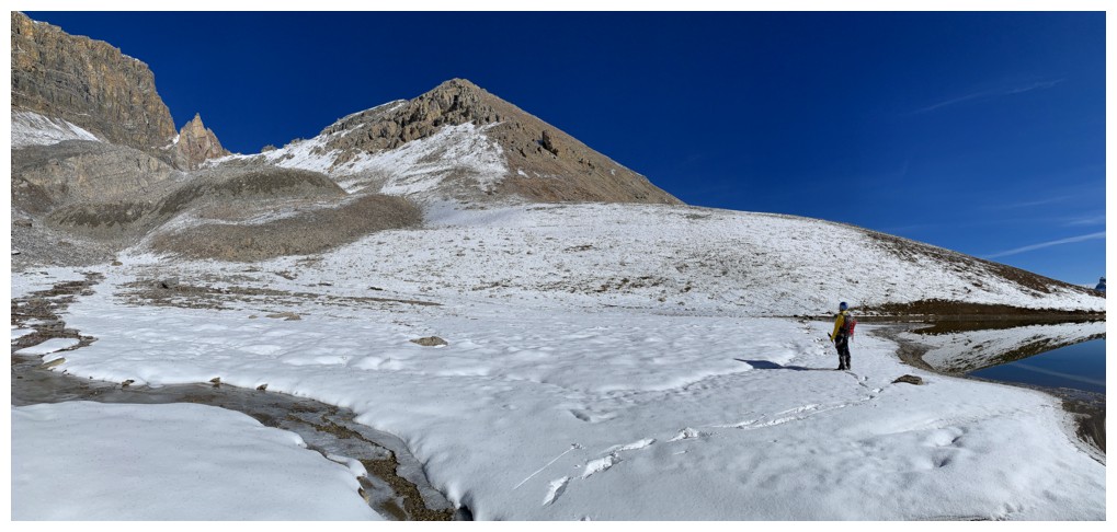
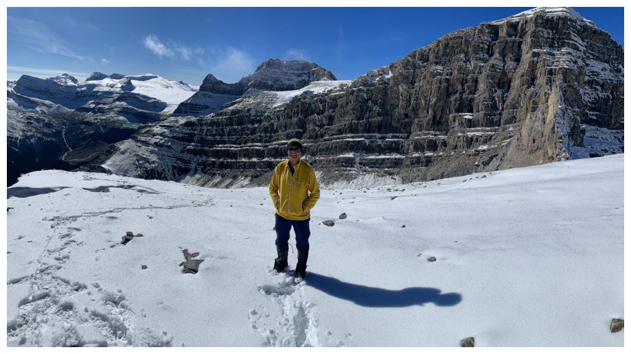
Mark's view
My view
Gaining a little elevation above the tarn
Mark follows
Same as above
That small elevation gain grants you this view
And this one
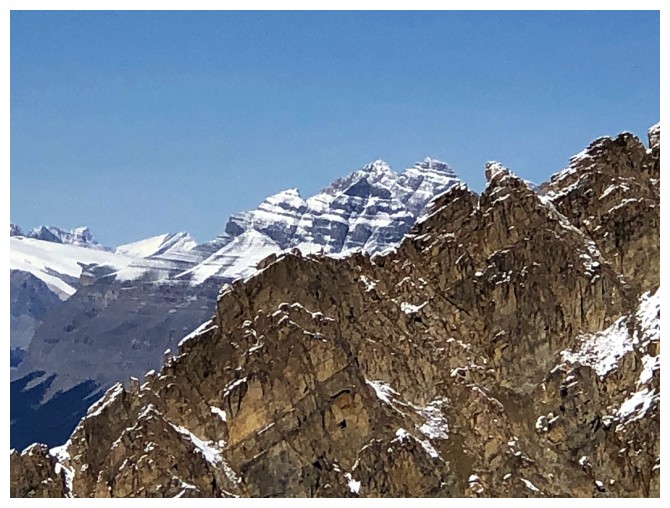
Portal Peak
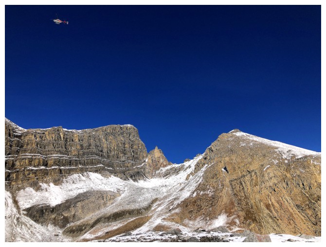
A helicopter flies above us
Heading back to the tarn
Same as above
Had to circumnavigate the entire thing
As stated, the reflections were perfect
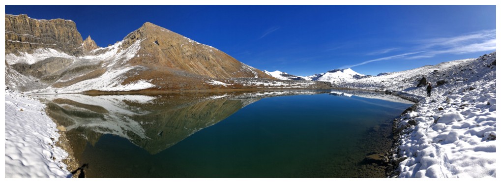
Ditto
Cirque Peak
At the far west end of the lake
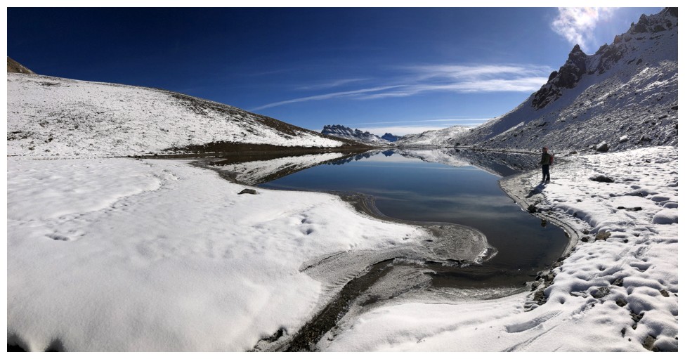
A small stream is draining into the tarn
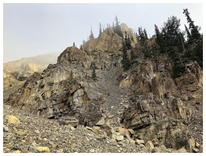
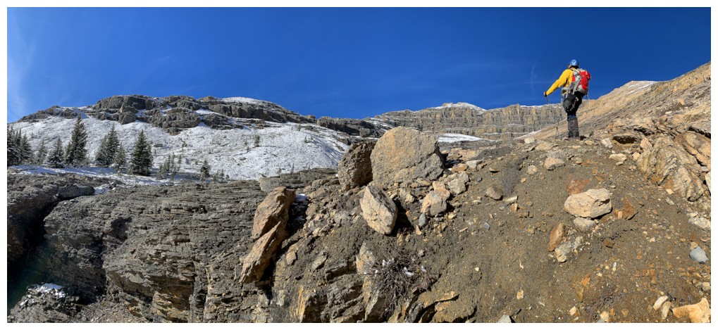
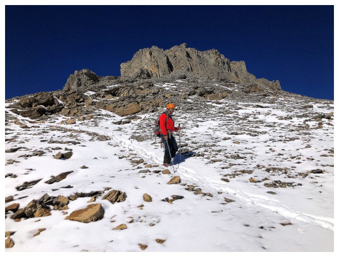
Looking for a good route up Jimmy Junior
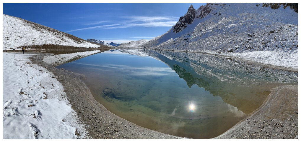
Another view of the tarn
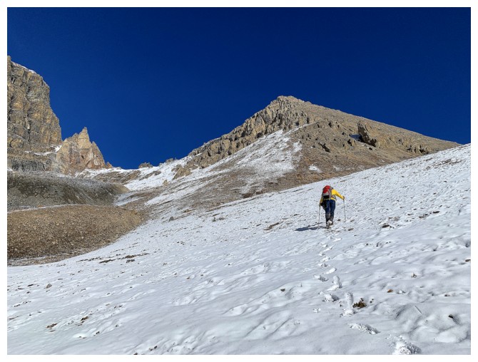
It's go time!
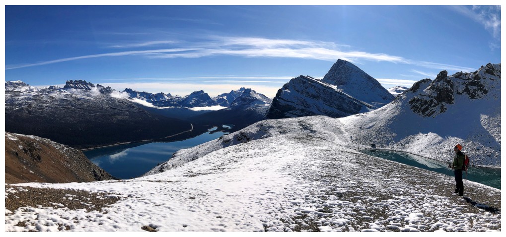
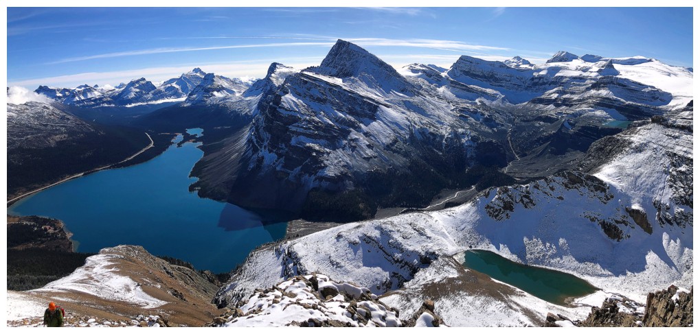
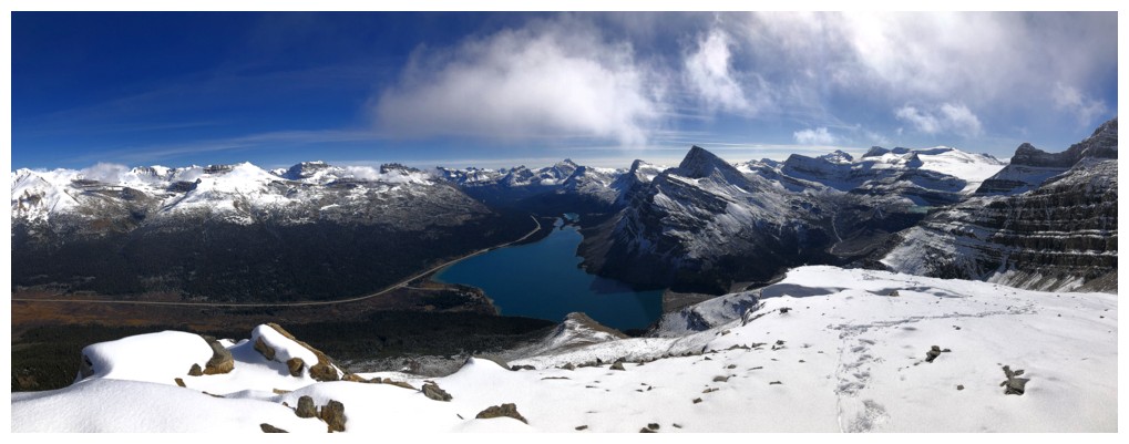
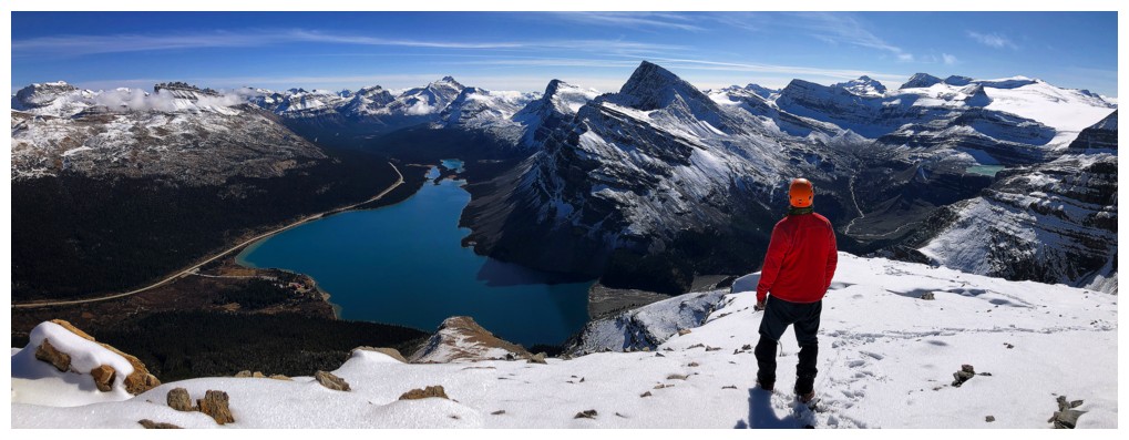
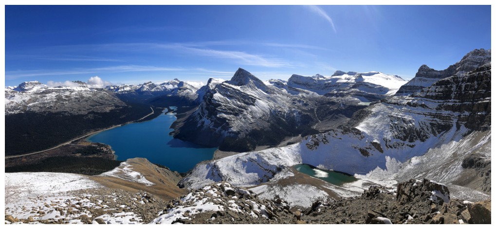
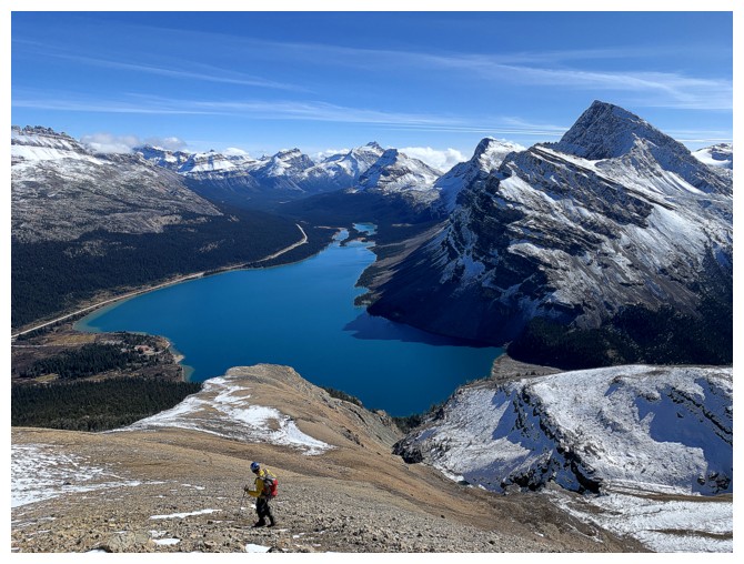
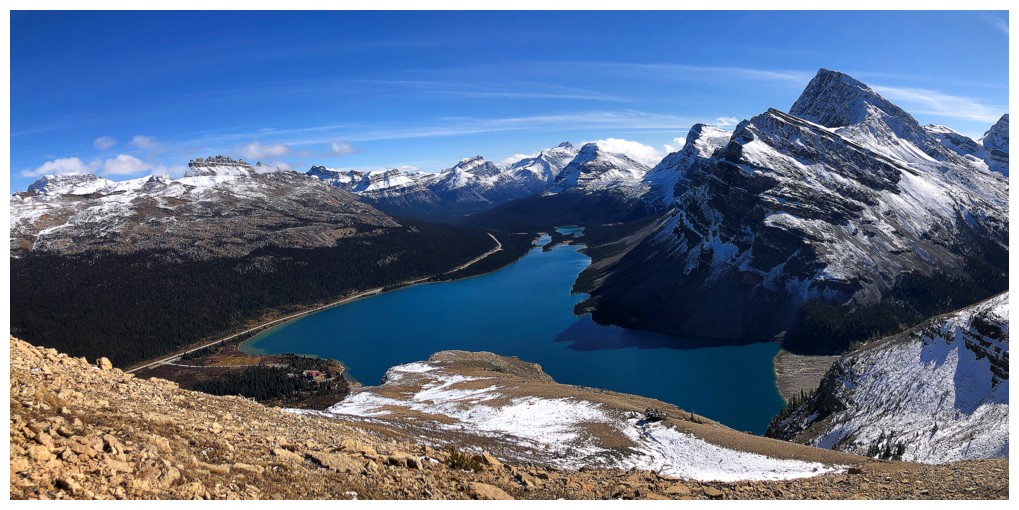
First view where both the tarn and Bow Lake are visible - and there will be many more!
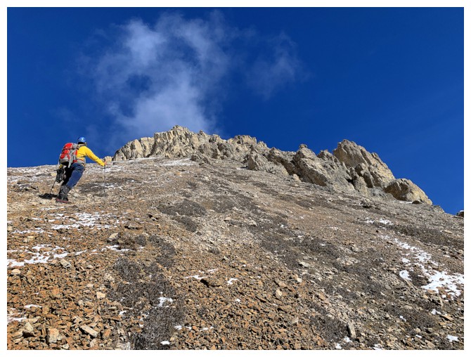
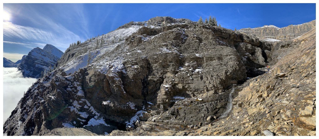
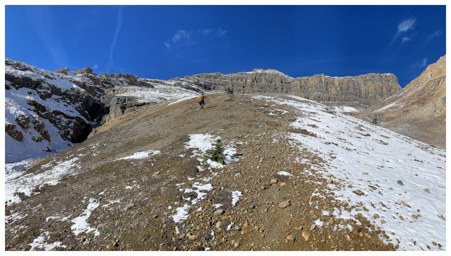
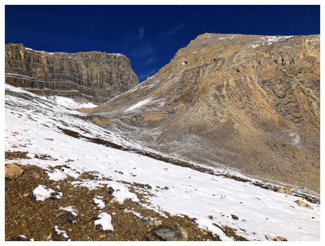
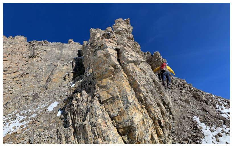
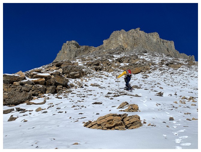
Steep grind up to some interesting rock bands
View #2
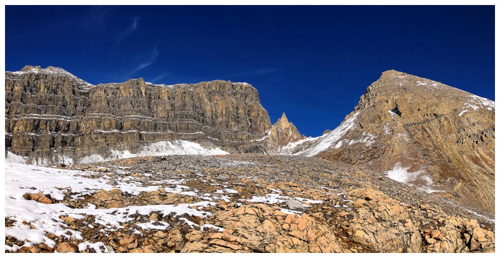
At the base of the rock bands. The terrain around them is quite steep and loose. We took the easiest route.
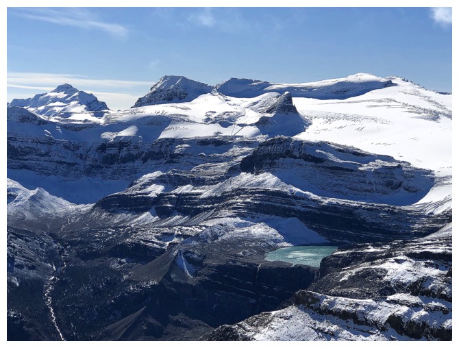
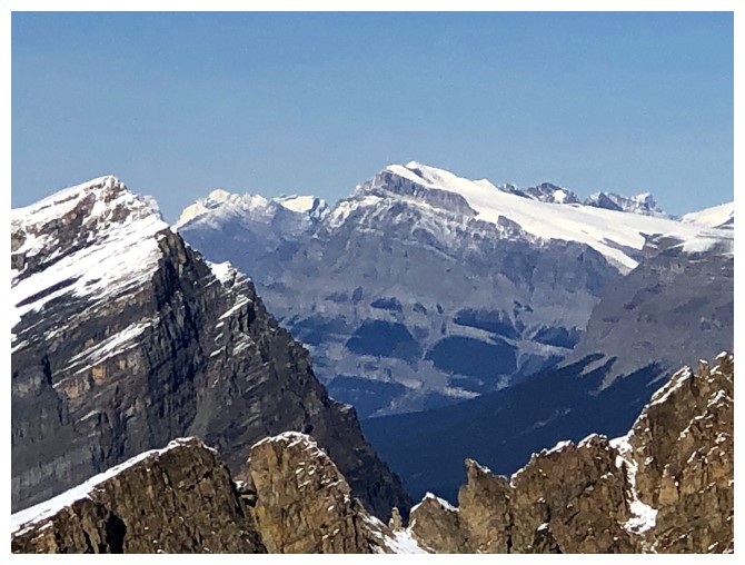
The tarn and some of the Wapta Icefield
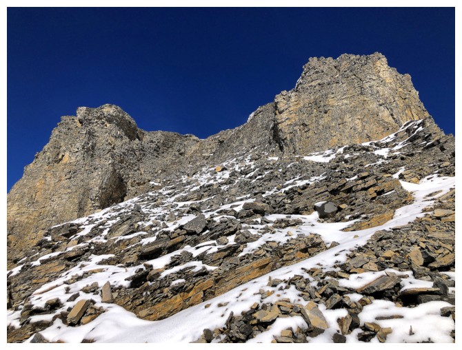
Traversing right for a easier line
View #3
Still getting pushed to the right
View #4
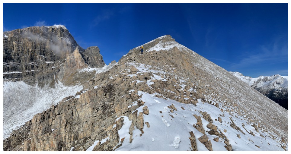
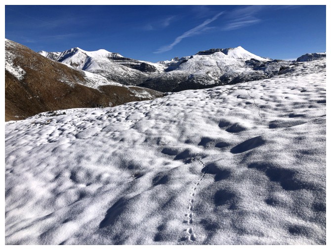
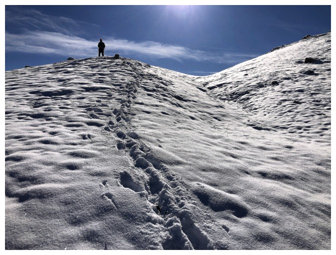
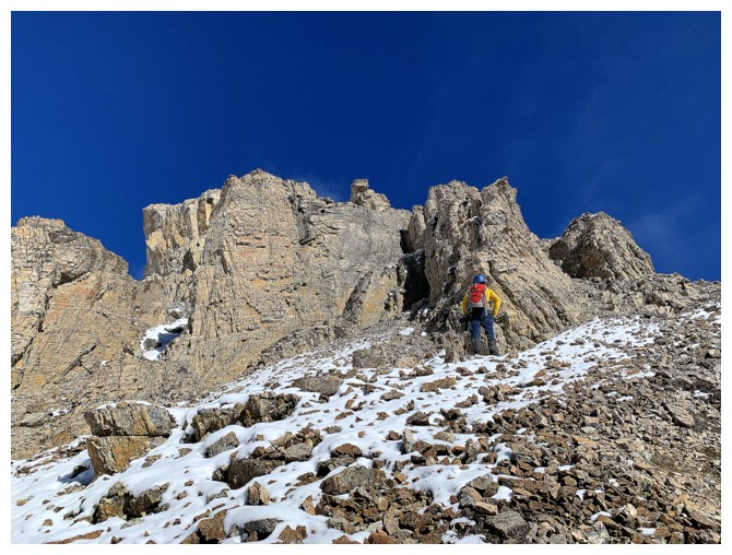
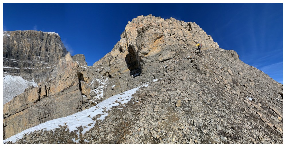
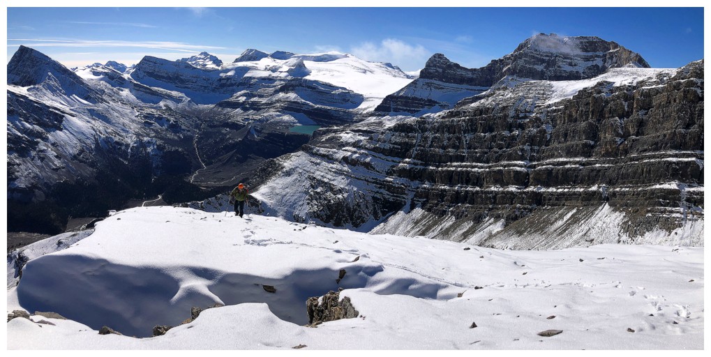
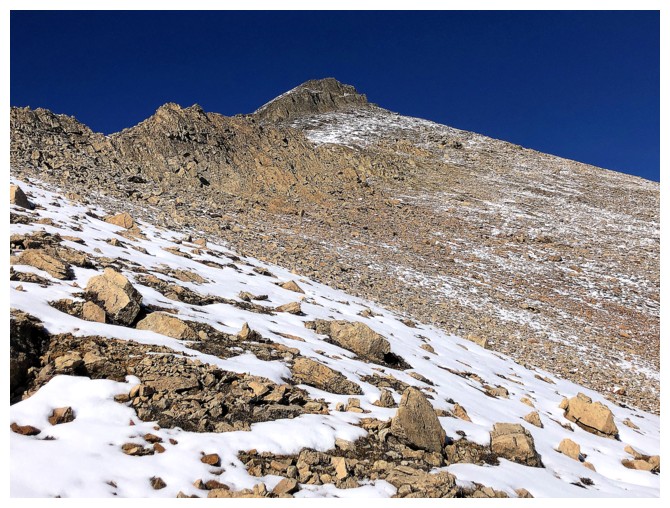
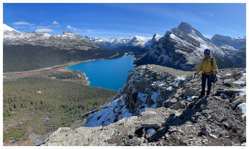
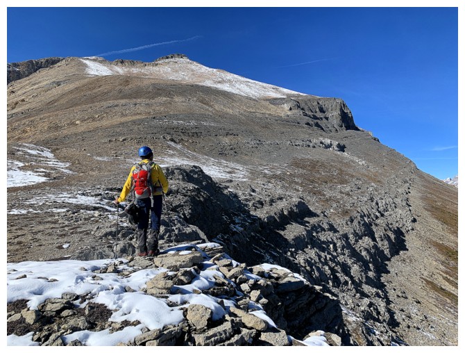
On the ridge and heading towards the summit
Easy travel all the way to top
There is an easy path up through these rock bands
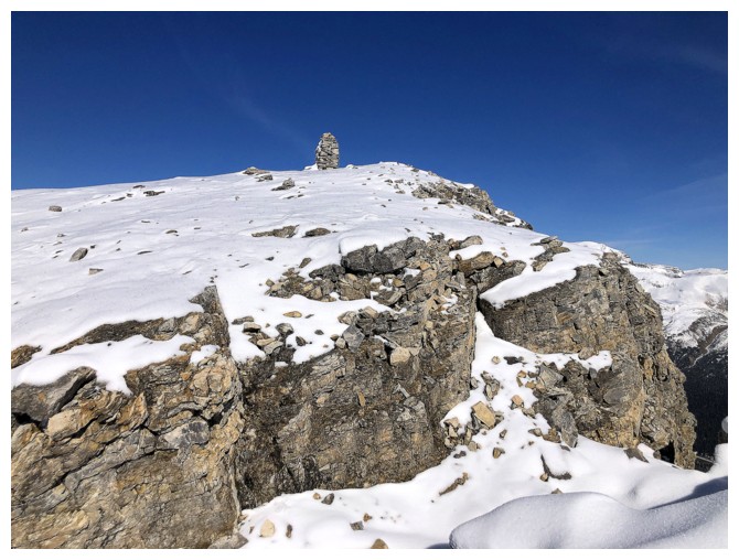
Big summit cairn ahead
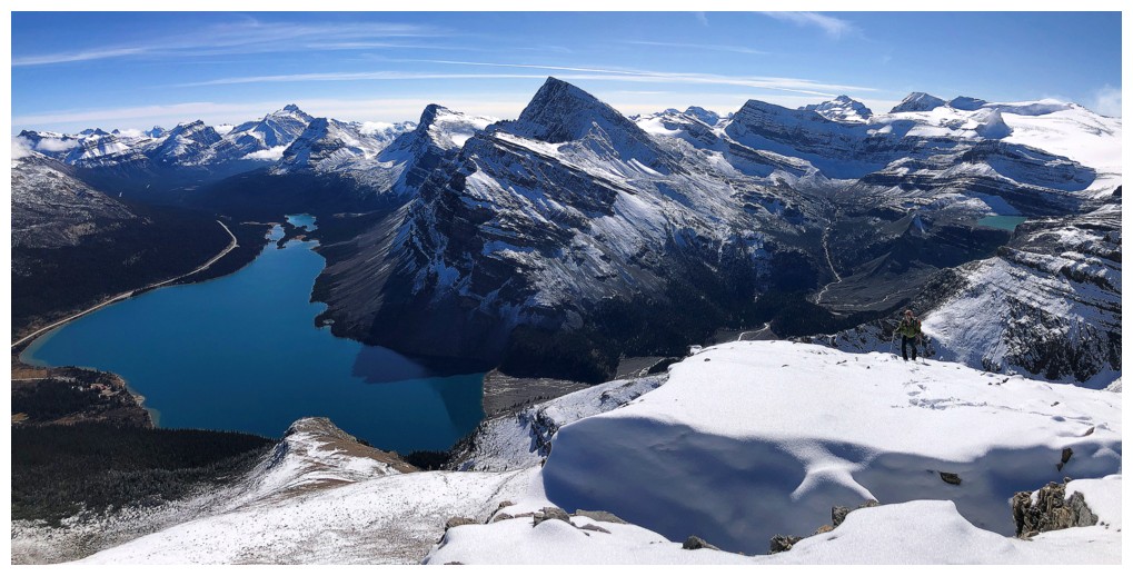
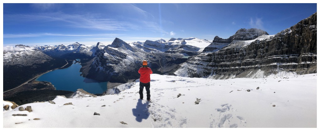
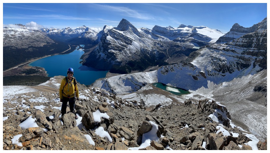
View #5. The tarn is no longer visible but Iceberg Lake is, near the right.
Mark takes the last few steps to the top
West Bow Peak - an odd title for the northeastern outlier of Jimmy Simpson, given that it lies northwest of Bow Lake and Bow Peak
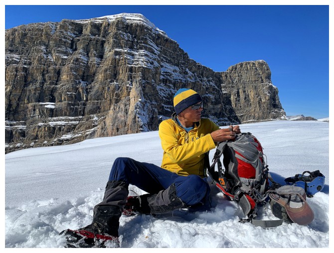
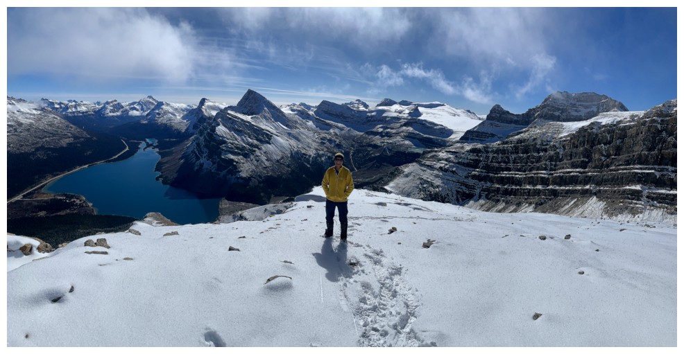
Time for food
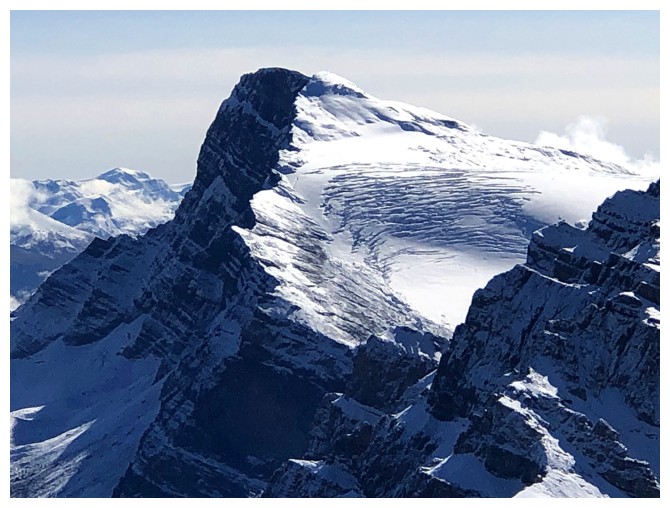
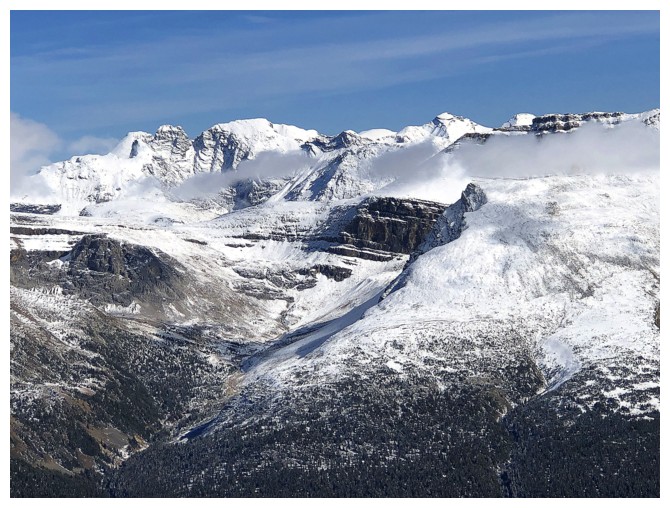
Bowcrow Peak has quite the glacier
Mount Hector and Little Hector
OXO Peak
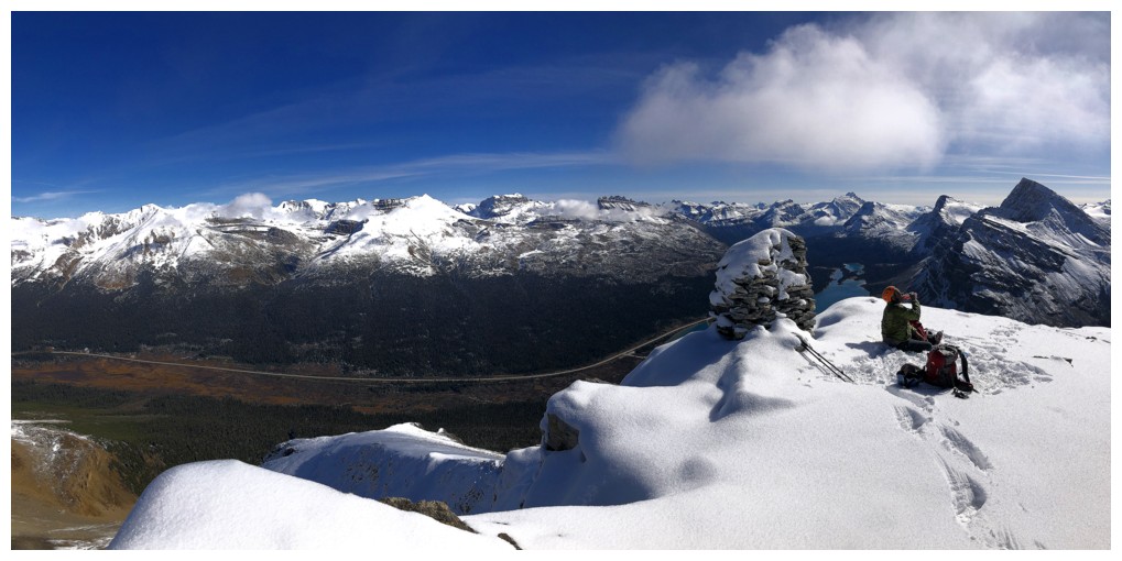
Mark at the cairn
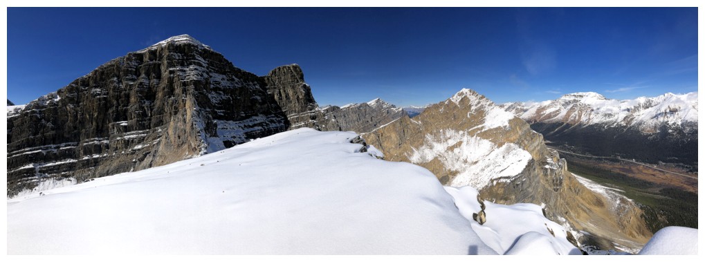
View to the north
View to the east and south
View to the south and southwest
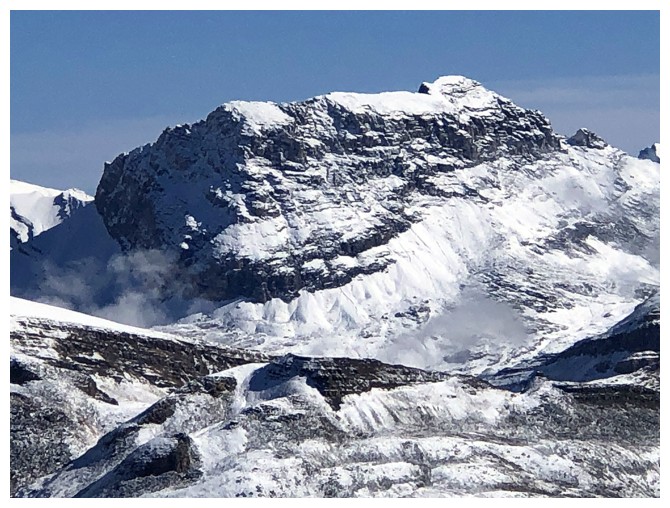
Mount Balfour
Balfour, Olive, St. Nicholas, and Gordon
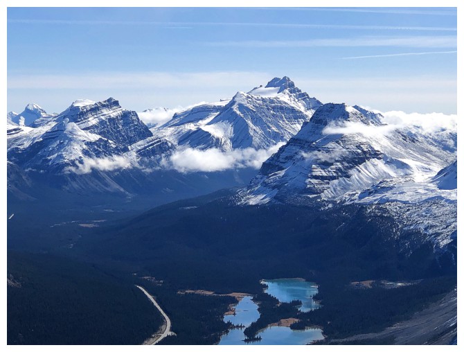
Hector again and the south end of Bow Lake
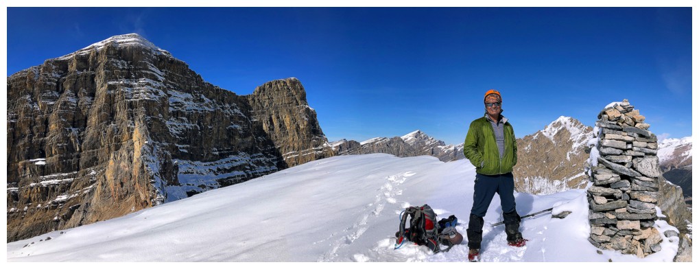
The cairn is almost as tall as Mark
View to the northeast
More summits shots
Same as above
Same as above
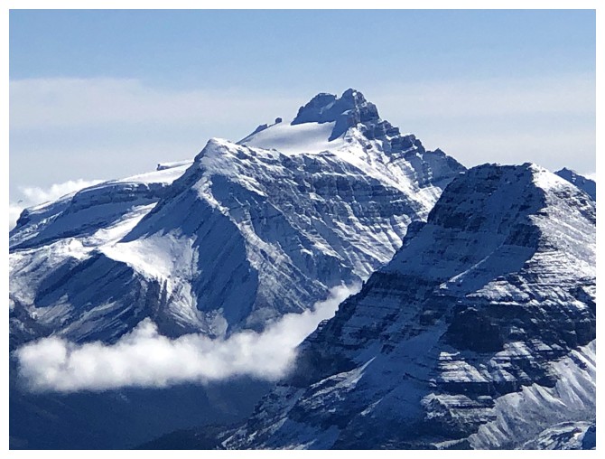
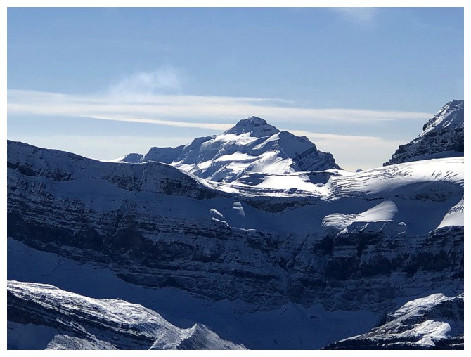
Mount Patterson
Mount Murchison
Mount Wilson
Bobac and Watermelon
Descending
View #6
Me ruining it
Stunning blue skies
Bow Lake looks better as better as Earth rotates
Same as above
Near the end of the south ridge
Backtracking a little to find the easiest route down
Mount Weed and Silverhorn Mountain
Still getting sweet views of Bow Lake
Crowfoot Mountain towering over the lake
Some random reflections in the lake
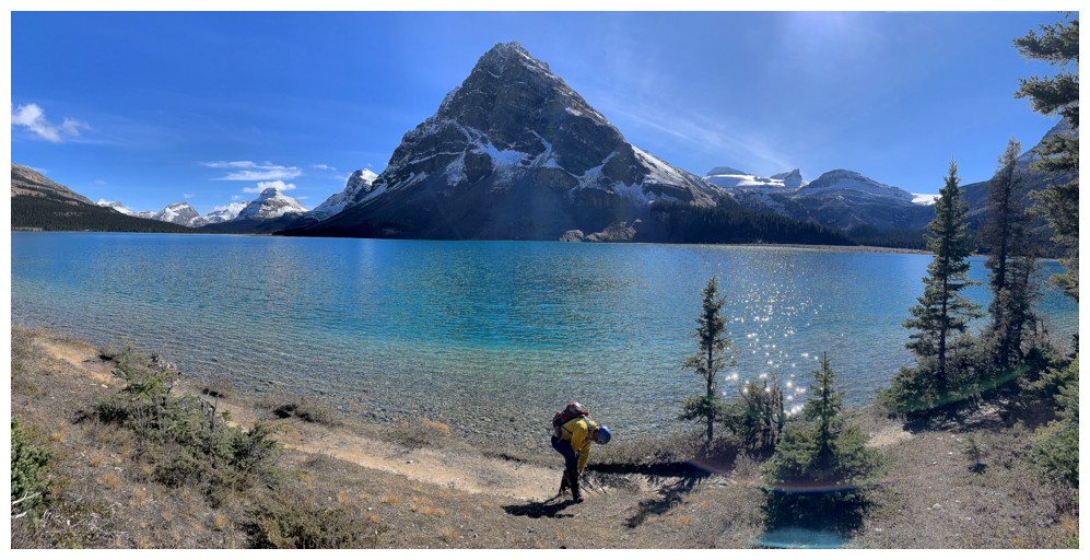
Back at the lakeshore
Looking back to Jimmy Junior (centre) and West Bow (right)
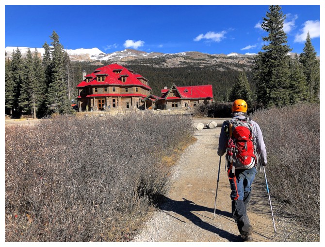
Approaching Num-Ti-Jah Lodge and the end of the trip
The End
LOG