Little Odaray
attempt
June 26, 2024
Elevation gain: 910 m
Round-trip
time: 3:20
Snowshoeing and mountaineering
with Mark.
 When Doug
Robson offered me two bus tickets to Lake O’Hara, saying no wasn’t an option. The
area is as spectacular as all the hype (even more so, in fact!), but walking
the 11 km road, there and possibly back, is about appealing to me as a lukewarm milkshake! Of
course, we were going to be the mercy of the weather, and the relatively early
date meant the area could still be quite snowy.
When Doug
Robson offered me two bus tickets to Lake O’Hara, saying no wasn’t an option. The
area is as spectacular as all the hype (even more so, in fact!), but walking
the 11 km road, there and possibly back, is about appealing to me as a lukewarm milkshake! Of
course, we were going to be the mercy of the weather, and the relatively early
date meant the area could still be quite snowy.
On the first
point, the forecast turned out to be decent in the morning but completely
cloudy from noon on, similar to our last trip there with Natasha and Kasey. We
could live with that. On the second point, not only was the area snowy, but the
Parks person at the bus starting point announced the only viable hike was
around Lake O’Hara and perhaps up to Victoria Lake. 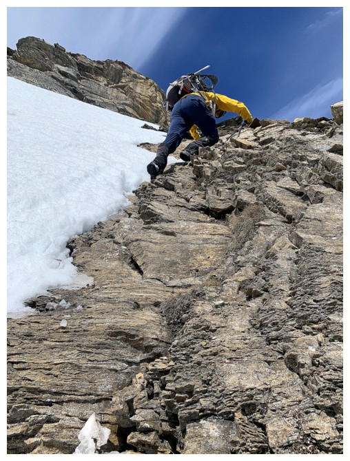 Every other trail was completely
snowbound and not recommended.
Every other trail was completely
snowbound and not recommended.
That fact was
not about to stop us from trying something more ambitious than a short romp
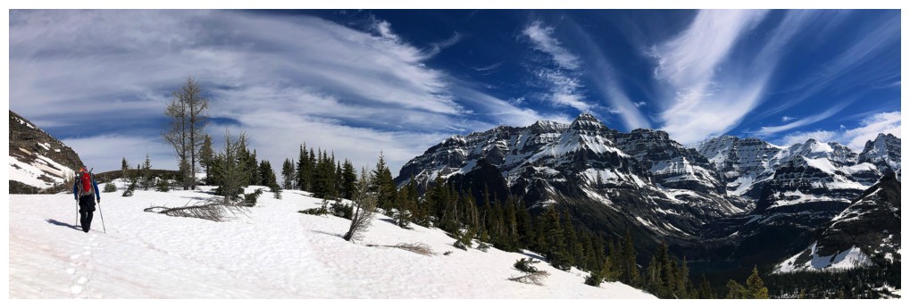
around the lake. While most stepped onto the bus with only boots (some with
sneakers) and small backpacks, we boarded wearing full-on winter gear,
snowshoes, and an ice axe on our packs, and crampons inside.
Once
off the
bus, we decided to make our way towards Little Odaray, a prominent
outlier of Odaray Mountain, and then assess conditions as we approached
the peak. The Parks
person did not exaggerate the magnitude of the snowpack – it was snowy
and that
snow was deep!
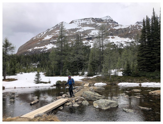
Following the
tracks of some brave soul who had postholed his/her way almost all the way to
Schaffer Lake, we had the snowshoes on within 10 minutes. They worked
perfectly, allowing us easy travel to the base of Little Odaray. We were able
to proceed on foot from here, though the snowshoes stayed on our backpacks,
just in case. The ‘shoes would not return to our feet until we were back at the
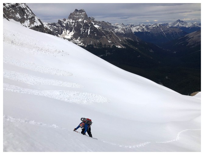
base of the mountain, several hours later. However, crampons and an ice axe were
soon employed once the dry ground gave way to steep, snowy slopes.
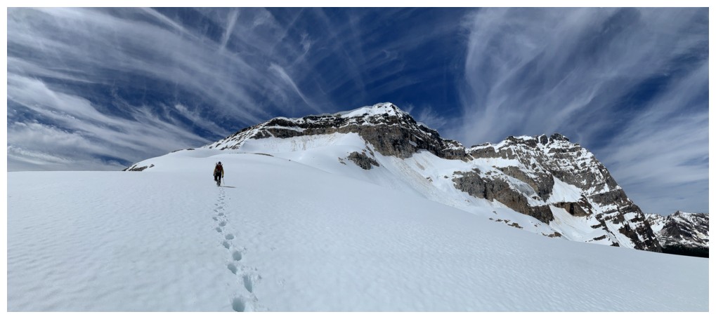
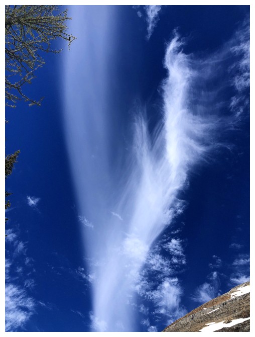
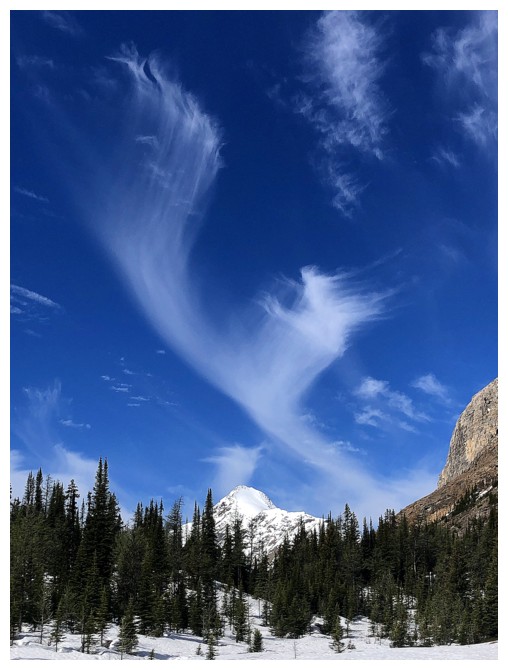
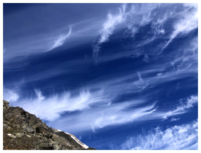
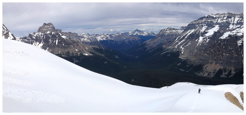
Besides exponentially
improving views of the surrounding area, the most interesting aspect of the
ascent was the clouds – wispy, arching formations created some amazing scenes.
Sadly, those wispy clouds eventually multiplied to create something less
desirable – a wall of white! Not a favourable turn of events, but exactly as
predicted.
We
continued to
push on, avoiding avalanche terrain, and also cognizant of our time
restriction. Progress was generally a little slow because of the snow
and missing the last
bus out was not an option! When the terrain became more serious
(steeper and icier)
a decision had to be made. We decided that the risk wasn’t worth it and
backed
down.
A terrific third
trip to the Lake O’Hara area. No summit, but we felt privileged to enjoy these
sublime environs once again. Many thanks to Doug for giving us this opportunity.
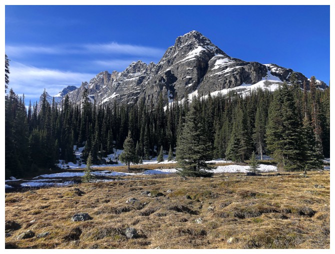
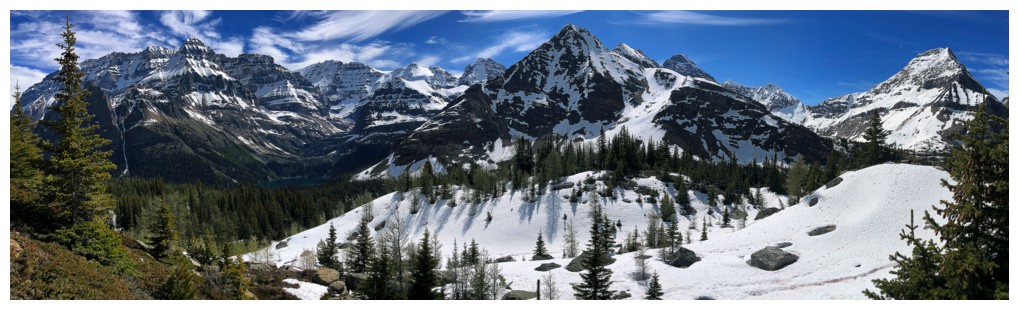
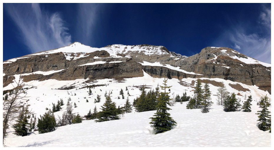
Little Odaray (centre) and Odaray Mountain (right)
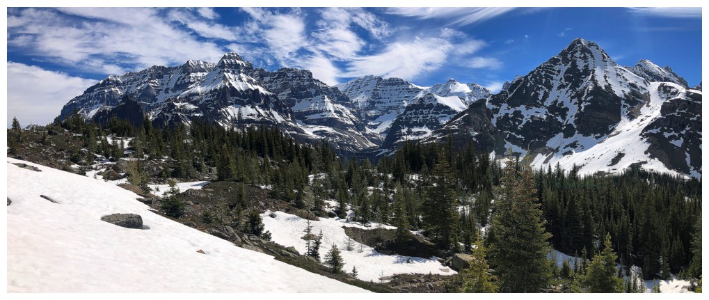
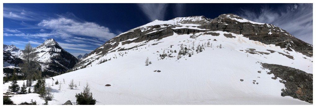
Mount Schaffer
Looking back to Mount Huber (left) and Mount Lefroy (centre)
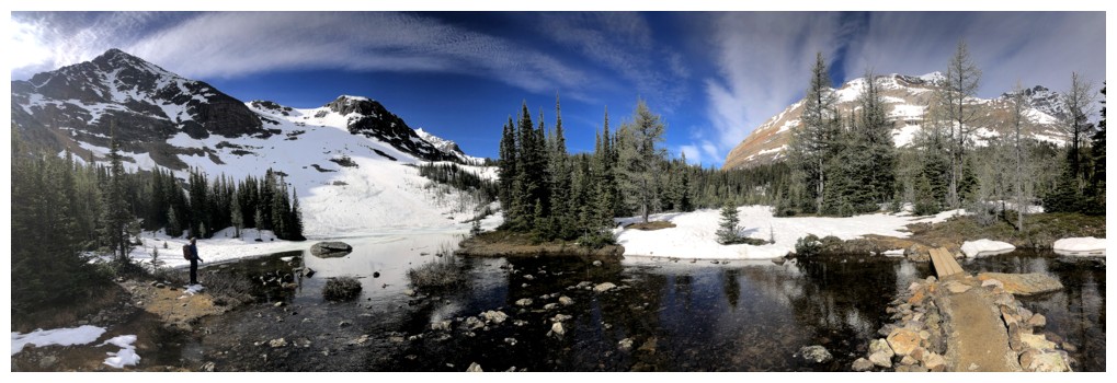
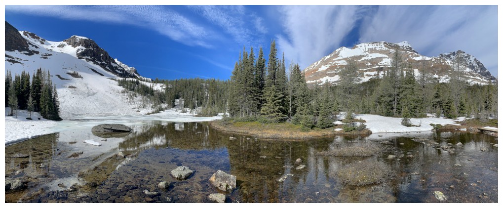
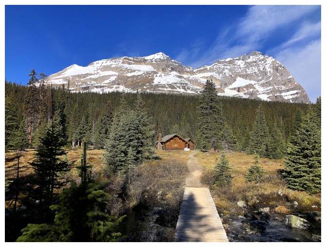
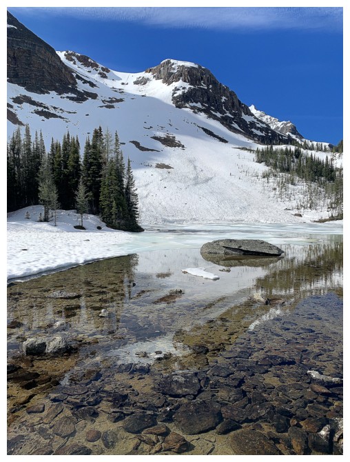
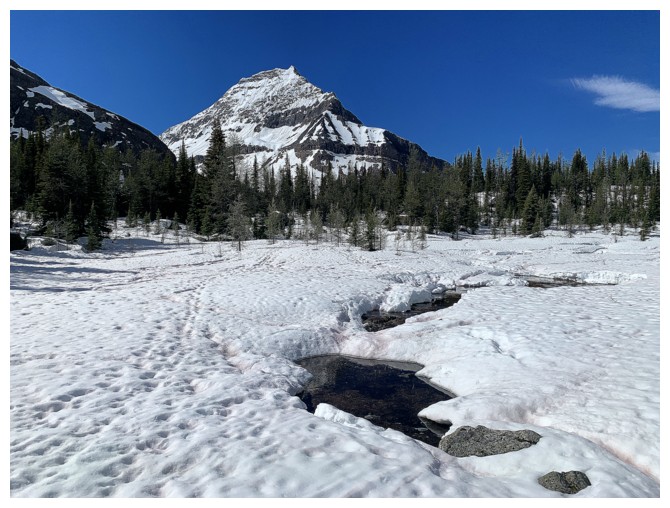
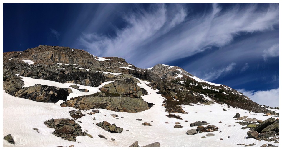
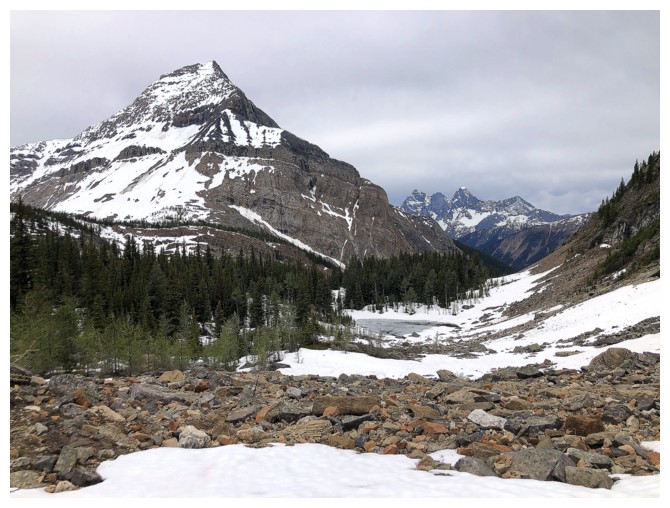
Schaffer Lake
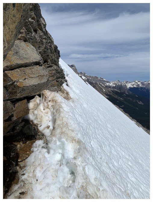
Looking up the alternate (and not recommended) descent route we took down Schaffer
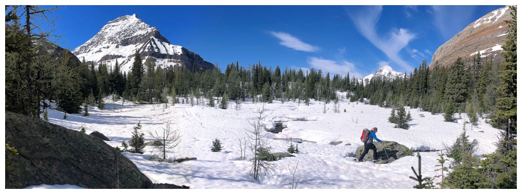
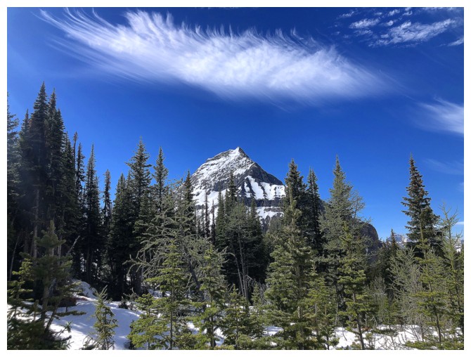
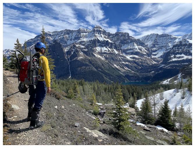
Stunning Park Mountain will receive the most amount of photo attention

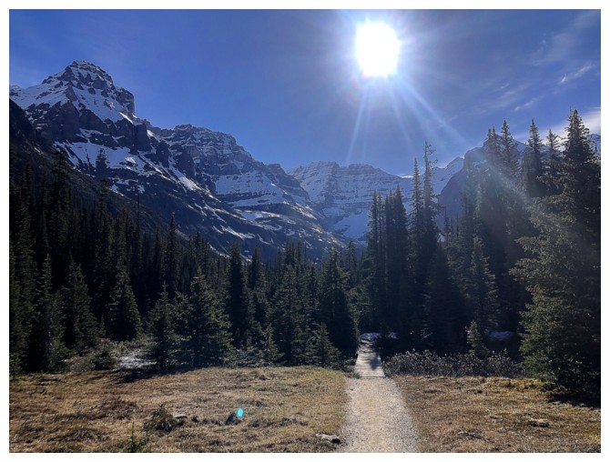
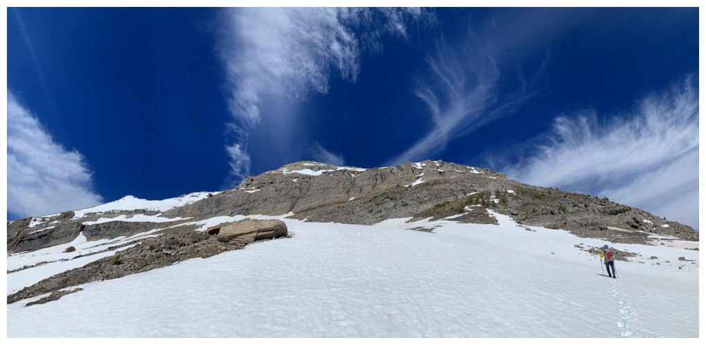
First good view of the objective
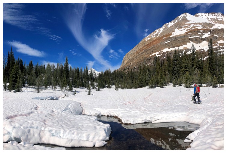
Here come those cool clouds
Distant Mount Owen and the wispy clouds
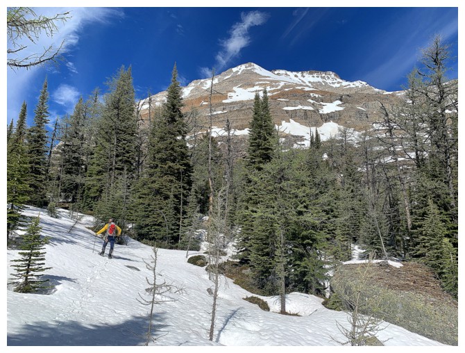
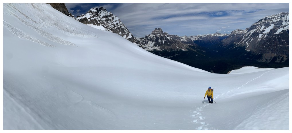
The snowshoes were perfect here
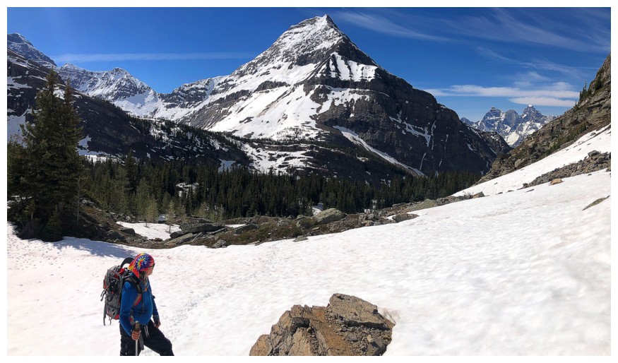
At the base of Little Odaray
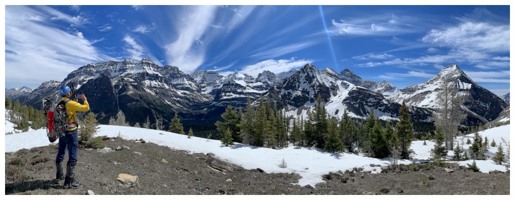
Park again, but the Goodsirs are also visible to the right
No snow and great clouds
The view starts to open up
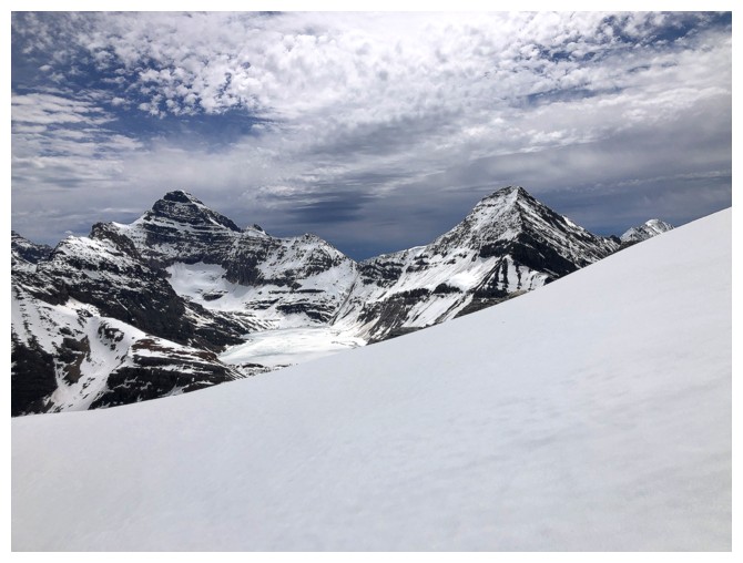
Victoria, Huber, and Lefroy
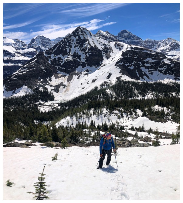
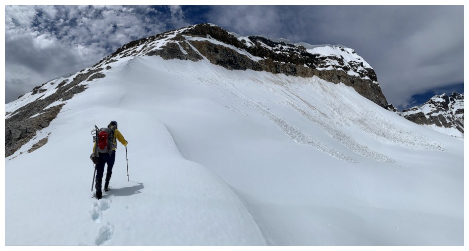
Back onto snowy terrain
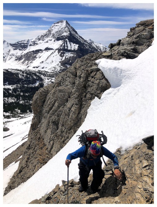
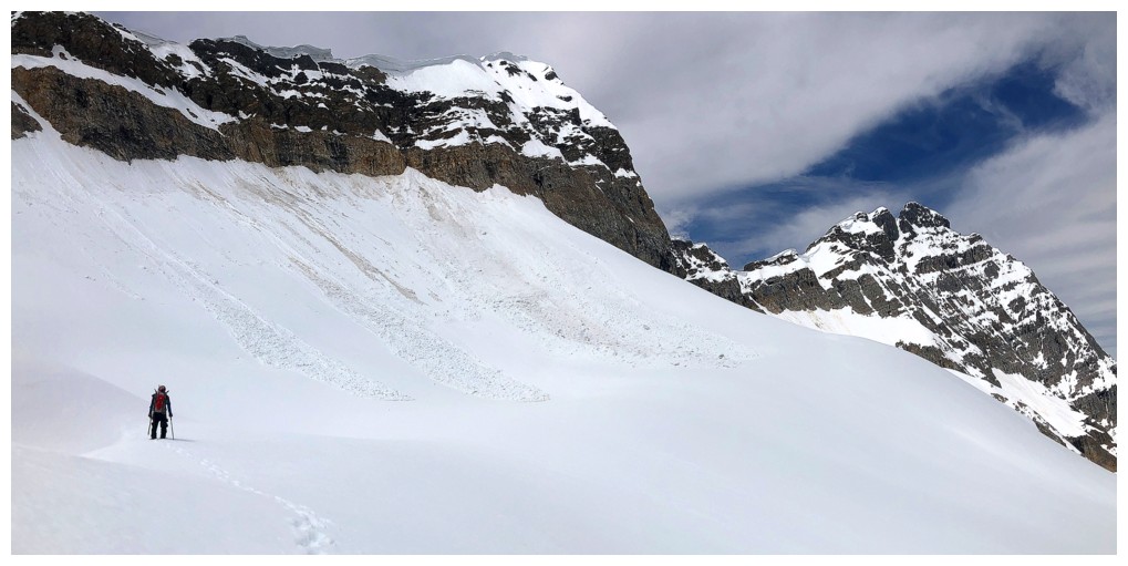
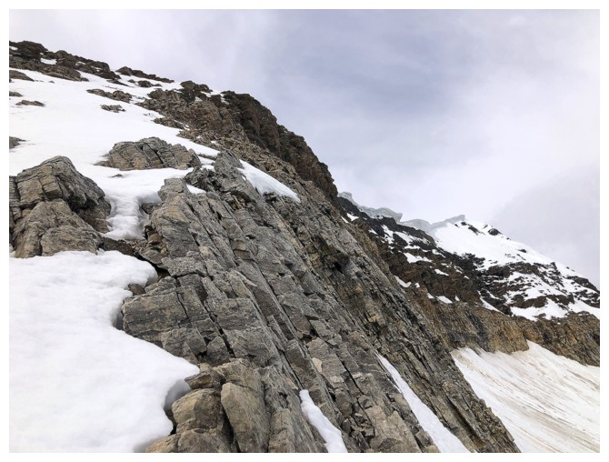
No direct route up Little Odaray here; the route goes around the right side.
Thankfully the snow here was supportive and didn't require snowshoes
And then there was no snow!
Still enjoying the clouds...
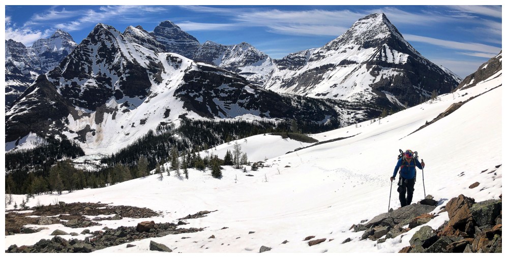
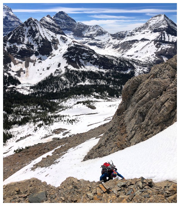
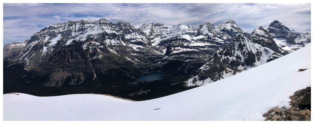
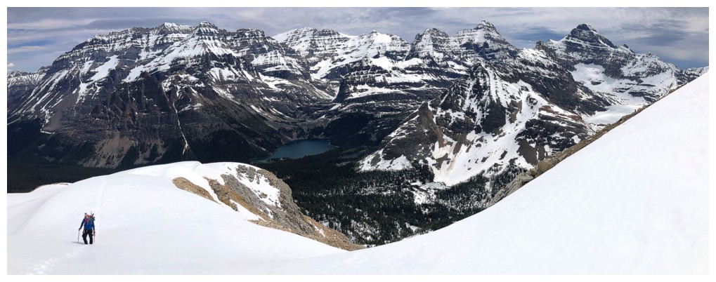
...and the view of the horseshoe massif surrounding Lake McArthur, comprised of Schaffer, Biddle, and Park
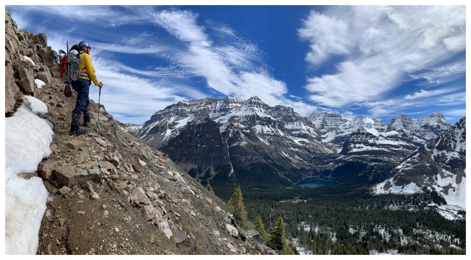
Lake O'Hara is now visible
Stumbled onto the Grandview Trail
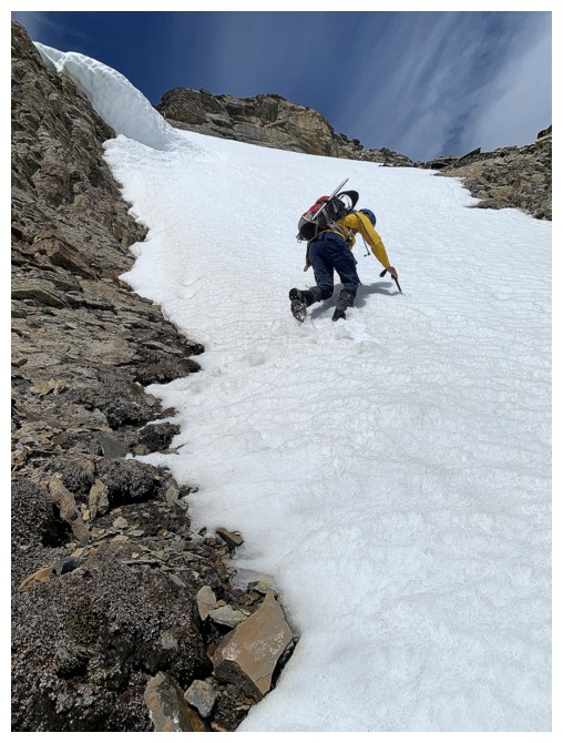
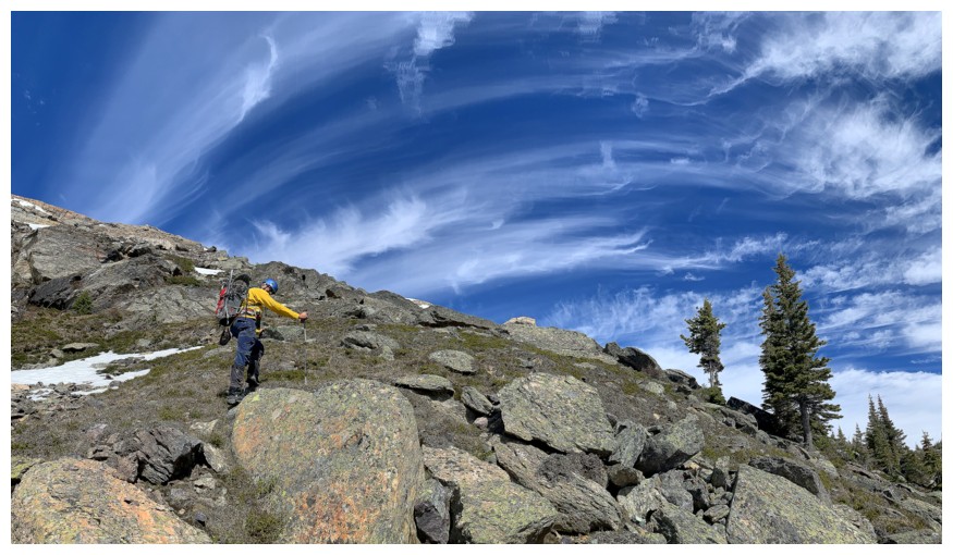
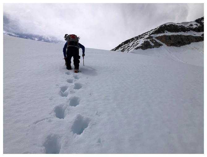
Ice axe required here
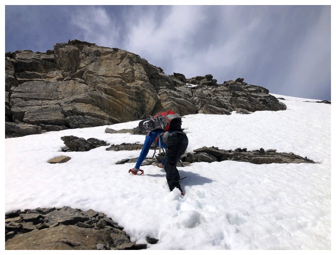
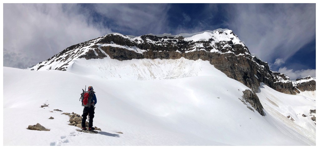
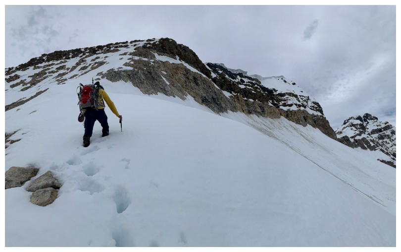
This slope was much steeper than it appears. We got to the rock band above then backed down.
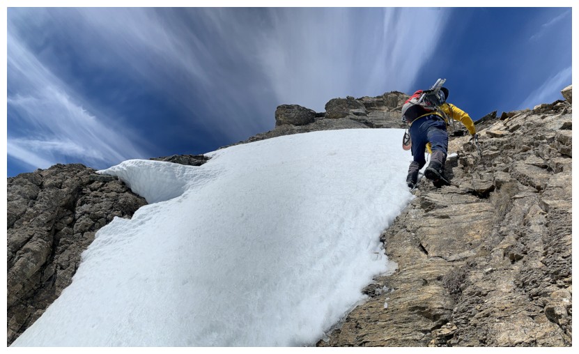
At the rock band and cringing at the prospect of stepping onto that (left photo). Backing down.
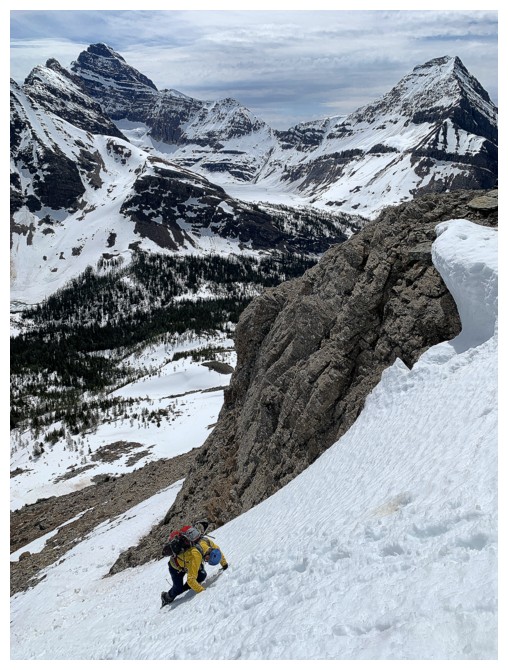
Another steep slope is around the corner but way less intimidating than the previous one
The snow disappears again
But only for a short distance
It's all snow from here on in (and the cool clouds are still with us)
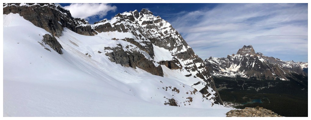
Odaray Mountain (left) and Cathedral Mountain - another of our most memorable days
The clouds to the east are not so cool
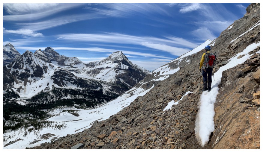
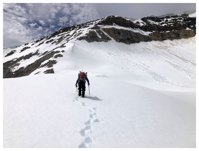
Getting closer
The route goes up the ridge near the left
Odaray. There's a big notch before that summit that apparently pushes the ascent beyond the realm of scrambling.
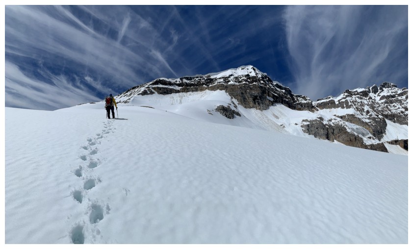
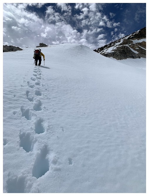
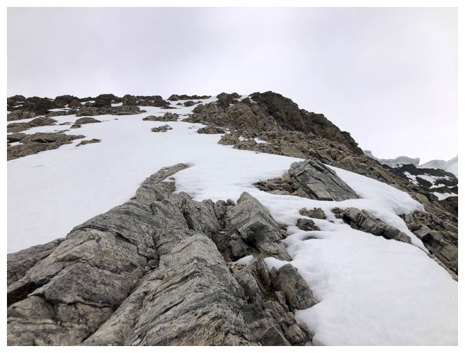
Deeper snow, but still manageable without snowshoes
Much of the route to the summit is now revealed
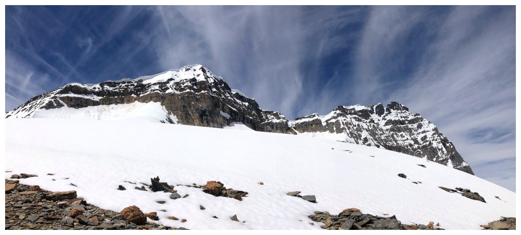
Clouds over Biddle and Park
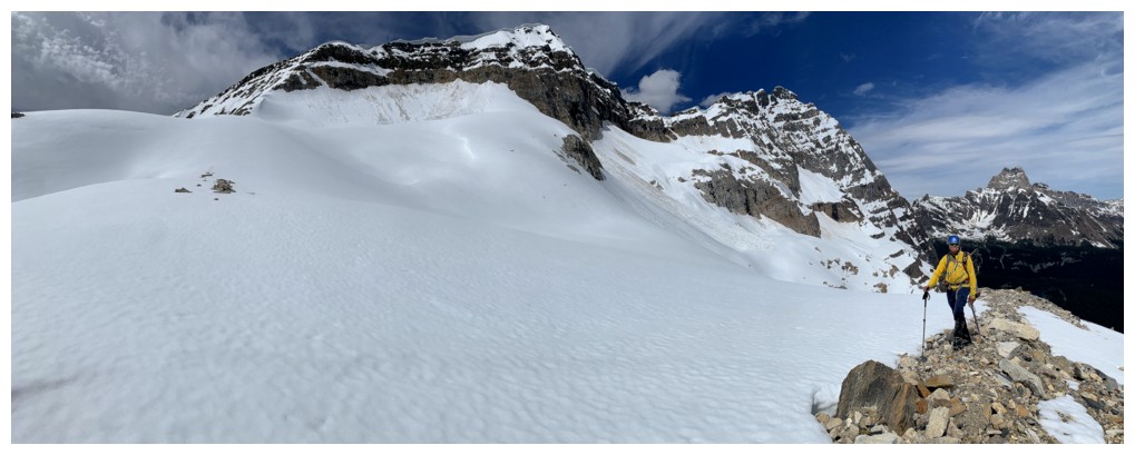
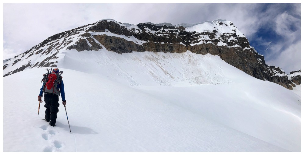
Big terrain
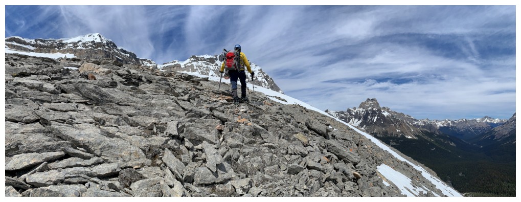
The terrain is about to get more serious
Happy to get onto some rock
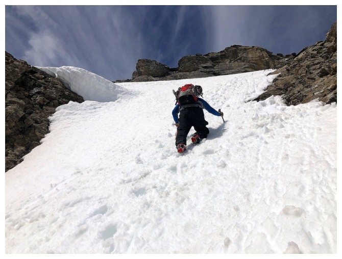
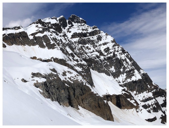
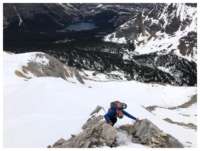
The route ahead is fairly steep and the layer of ice below the snow
made travel more precarious than anticipated. We retreated here.
Cautious downclimbing
Big terrain again
Park and the Goodsirs don't look as good with that wall of white behind them
Back to Schaffer Lake, with Little Odaray behind. Bye for now.
The End
LOG