Mount Schaffer
July 30, 2023
Mountain height: 2692 m
Elevation gain: approximately 1000 m
Round-trip time: 7:30
Scrambling with
Mark, Natasha, and Kasey.
Many would tout
the Lake O’Hara area as the “Jewel of The Rockies” – that description is well
justified.
Natasha (bless
her soul) had managed to get 4 bus tickets to Lake O’Hara for July 30, and
she graciously invited Mark 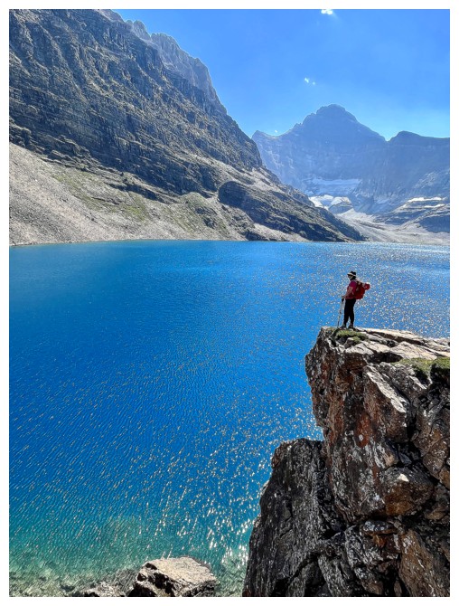 and I to join her and Kasey. Mark had never been to
the area and I had enjoyed but a solitary visit back in 2009.
and I to join her and Kasey. Mark had never been to
the area and I had enjoyed but a solitary visit back in 2009.
Earlier in the
week we did discuss cancelling the tickets because of a poor weather forecast for
the area, but in end decided that taking a chance was worth it – after all,
riding the bus to O’Hara is the hiker’s/scrambler’s equivalent of winning the
lottery!
Even though
Natasha had already ascended Mount Schaffer, she also very graciously offered
(bless her soul again) to take our little crew up, sacrificing an opportunity for her to do something
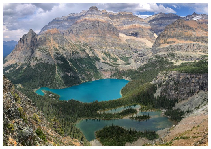
new. 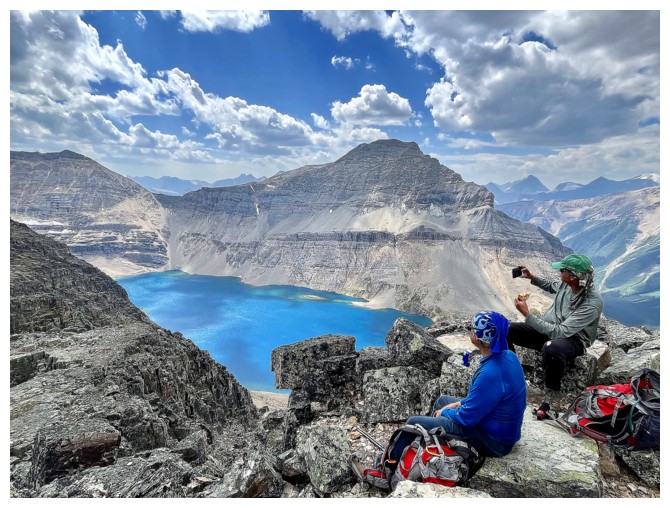 Boasting stunning views of the surreal blue of McArthur Lake and emerald
green of Lake O’Hara, as well as fantastic mountains all around, Schaffer’s
popularity has exploded in recent years.
Boasting stunning views of the surreal blue of McArthur Lake and emerald
green of Lake O’Hara, as well as fantastic mountains all around, Schaffer’s
popularity has exploded in recent years.
In addition to
boasting incredible views of Mount Odaray, hiking the trail to McArthur Lake
was full of anticipation. “I hope the Pacific is as blue as it
has been in my dreams......I hope”, are the last spoken words in one of my favourite
movies of all time (and Mark’s too), The Shawshank Redemption.
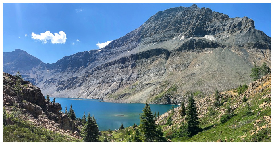
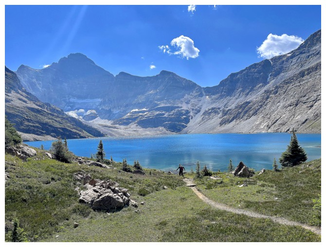
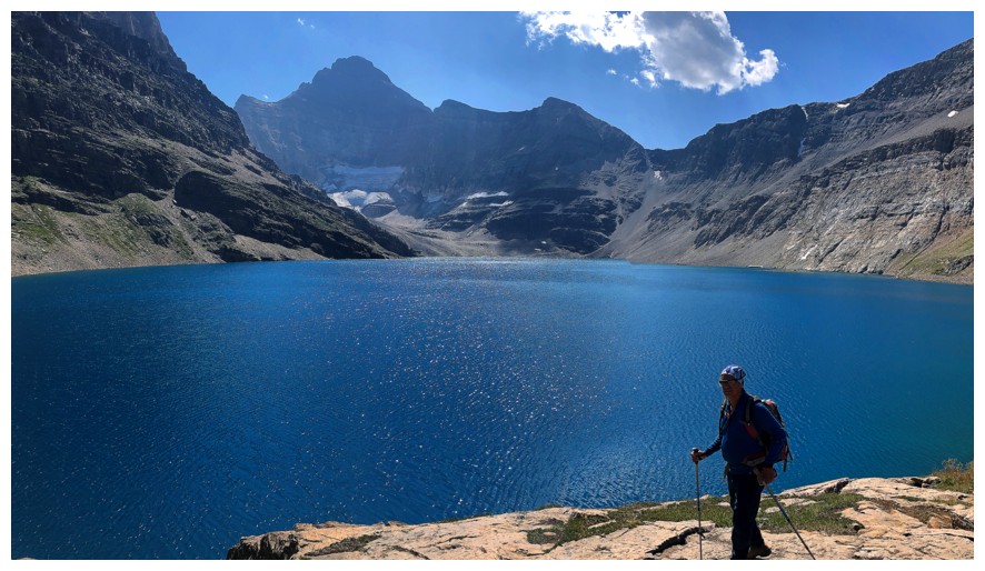
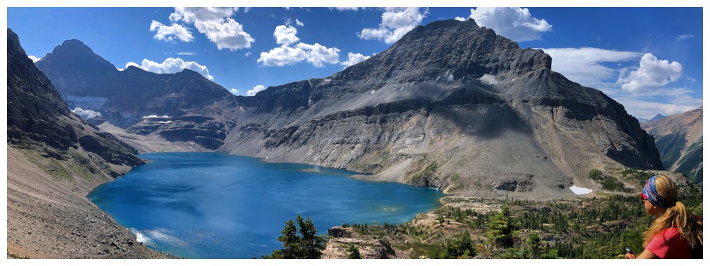
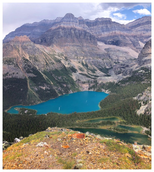
McArthur has a reputation
for its striking blue colour; would it measure up to all the hype,
would it be as blue as it has been in my dreams (or more accurately,
the zillion Instagram photos!) – heck yes!!
What a stunning body of water! The lake reminded me very much all an
equally beautiful
blue lake – Carnarvon – the difference being that McArthur sits below striking mounts
Biddle and Park, while Carnarvon has to settle for the more understated forms of
Strachan and MacLaren.
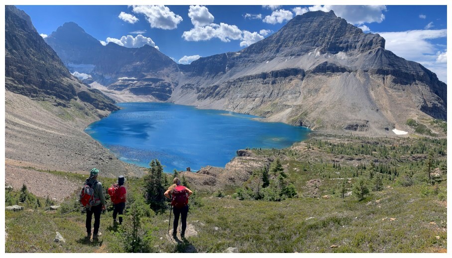
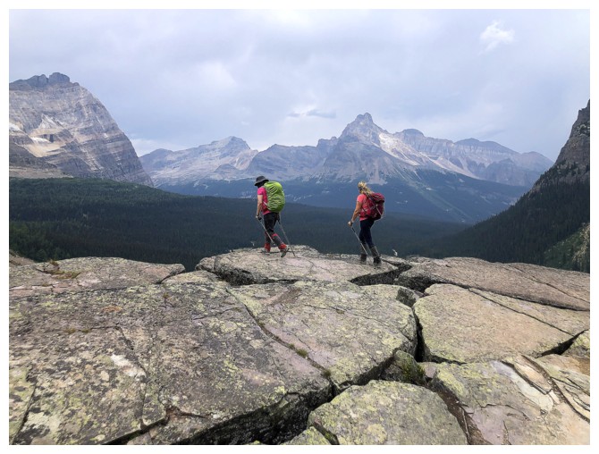
After gawking
at the lake for way too long, Natasha led us up Schaffer; a generally easy and straightforward
ascent on colourful quartzite terrain. Unfortunately, the weather started to deteriorate
at this point, but we were happy to have enjoyed more Sun than expected, up to
that point.
Schaffer’s
summit view was exactly as advertised – wicked! Our summit stay was long and
gratifying.
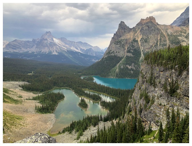
The plan after Schaffer
was to hike the All Souls’ Alpine Route to Opabin Lake and then take the Yukness
Ledges Alpine Route to Lake Oesa. Threatening weather and time concerns forced us
to cut out a visit to Oesa. However, we all felt quite satiated, enjoying
amazing (though cloudy) views from All Souls’ Prospect and Opabin Prospect, as
well as phenomenal scenery at every turn.
Of course, the 11
km bus ride back to the parking lot was more than welcome at the end. Hats off
to any individual who has hiked that dull section on either end of a Lake O’Hara
visit.
A fantastic day
with wonderful company! Thank you so much Natasha for making it happen and for
your selflessness.
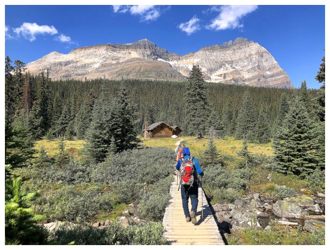
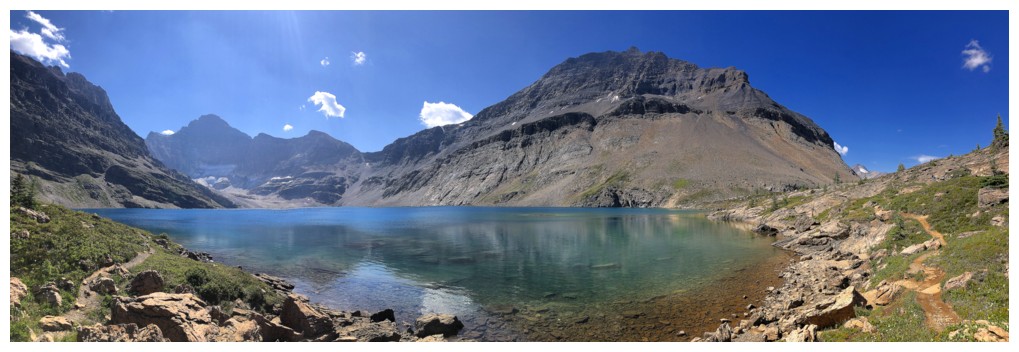
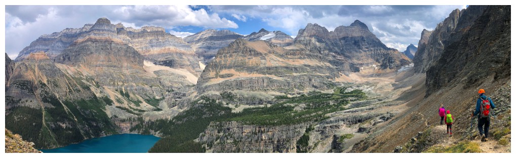
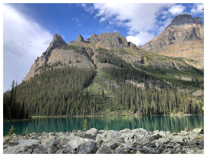
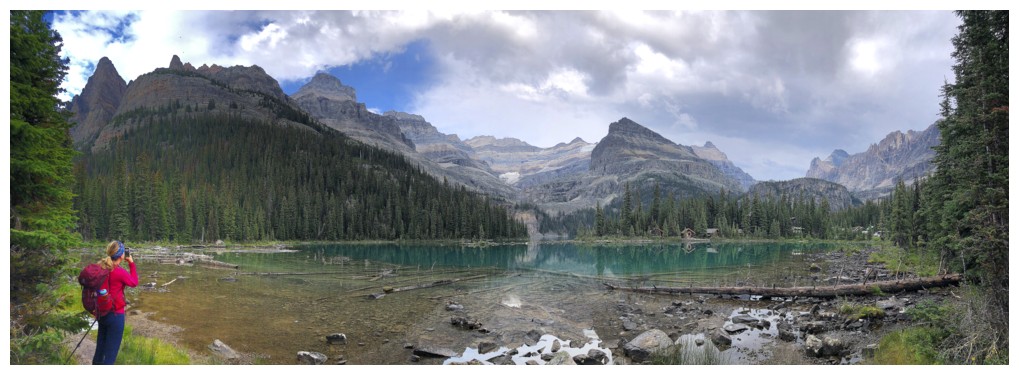
At the shores of Lake O'Hara and the beginning of the trip
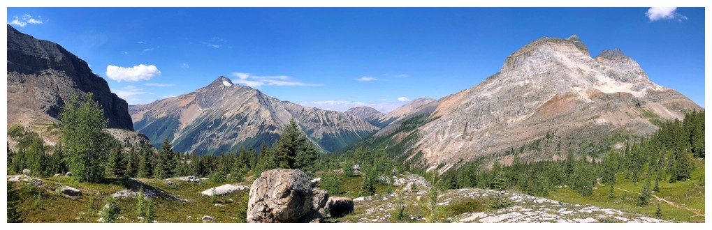
Wiwaxy Peaks
Mount Odaray (right) and Little Odaray
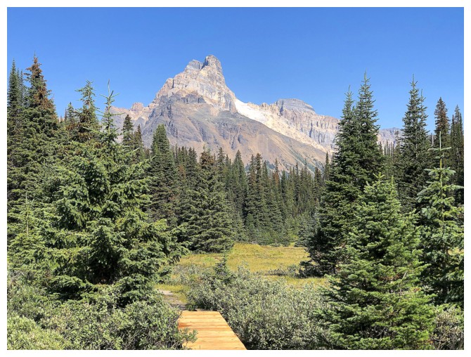
The impressive south end of Cathedral Mountain
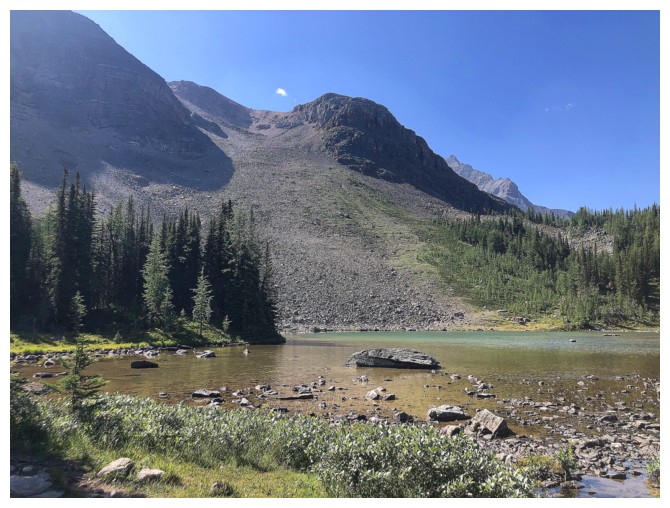
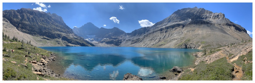
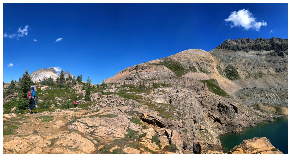
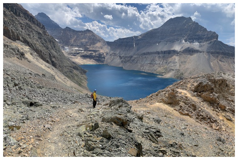
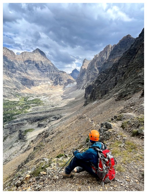
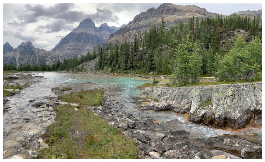
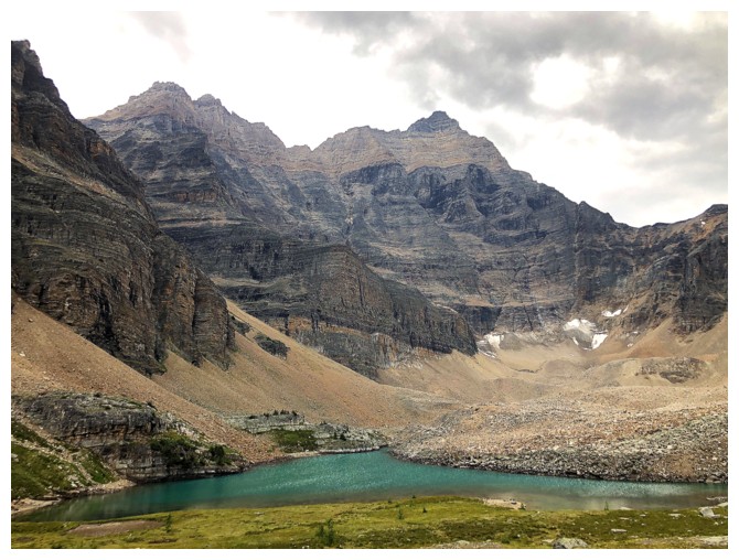
Schaffer Lake and the alternate (but not recommended) descent route
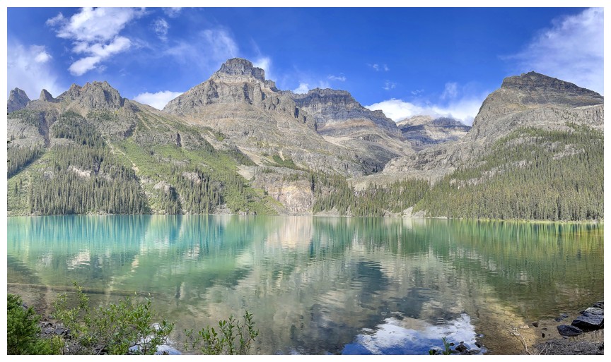
Schaffer Lake and Mount Huber
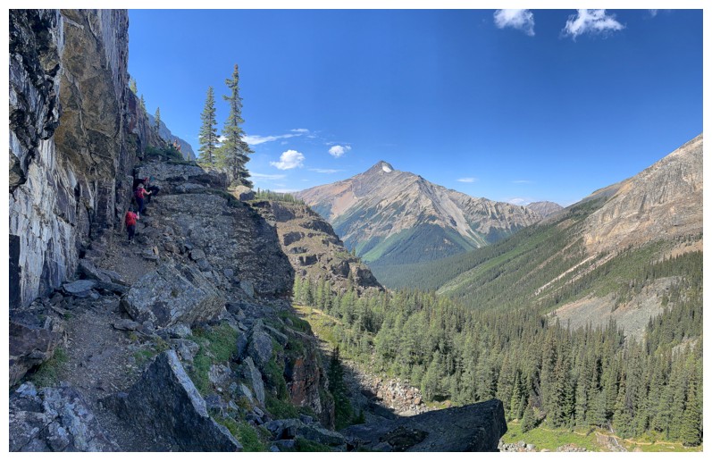
The trail neatly winds its way up a rock band here
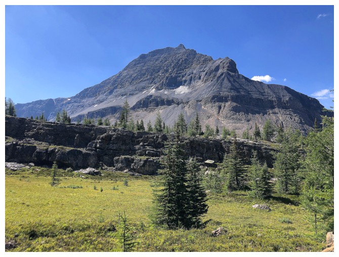
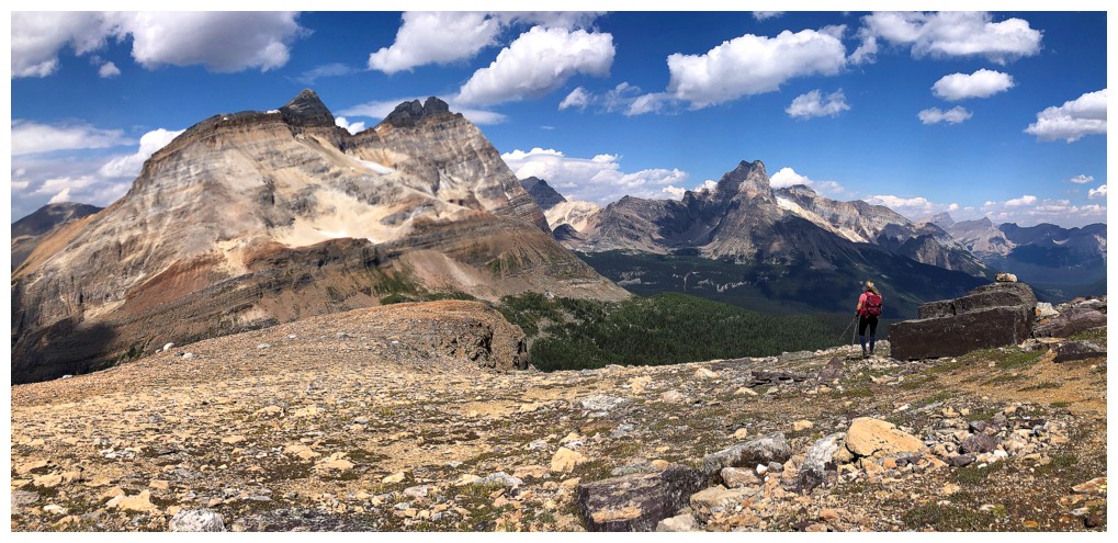
Park Mountain
Odaray continues to garner a ton of photo attention (photo by Natasha)
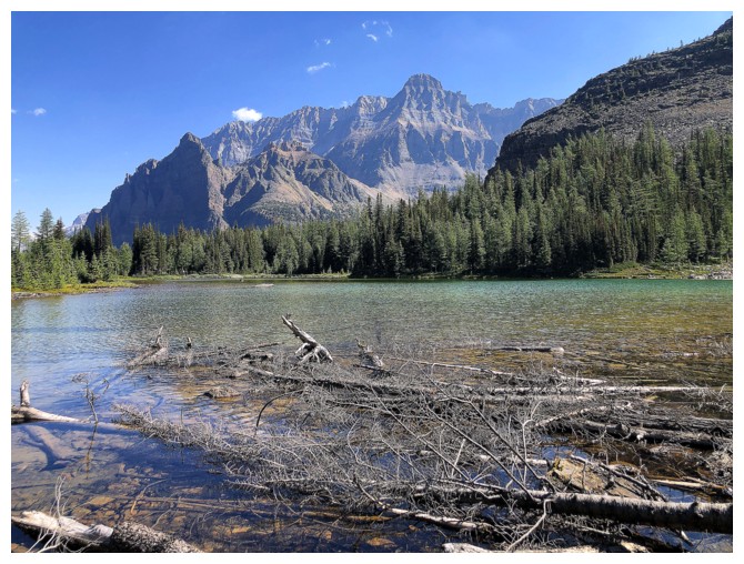
Biddle (far left) joins Park, as we get our first glimpse of McArthur Lake
Mount Owen to the left of Odaray
Natasha leads us to glory! (Star Trek/Klingon reference)
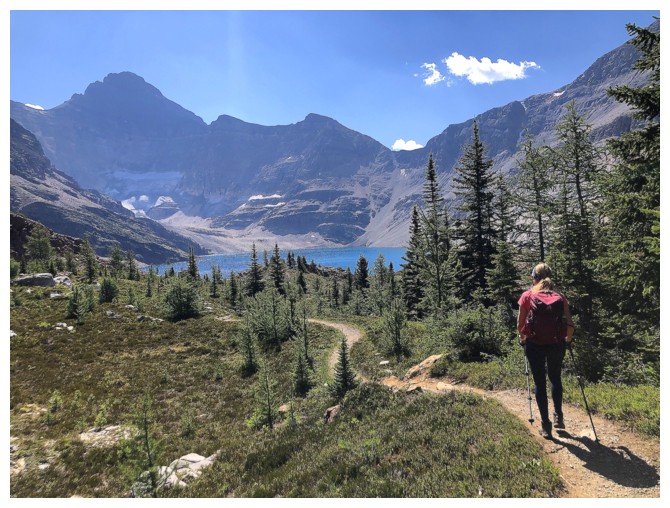
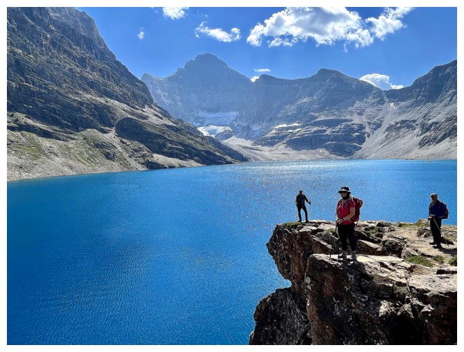
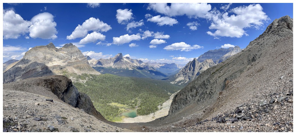
A much bigger glimpse of the lake
At this point, I was so excited to see the lake I rushed on ahead (photo by Natasha)
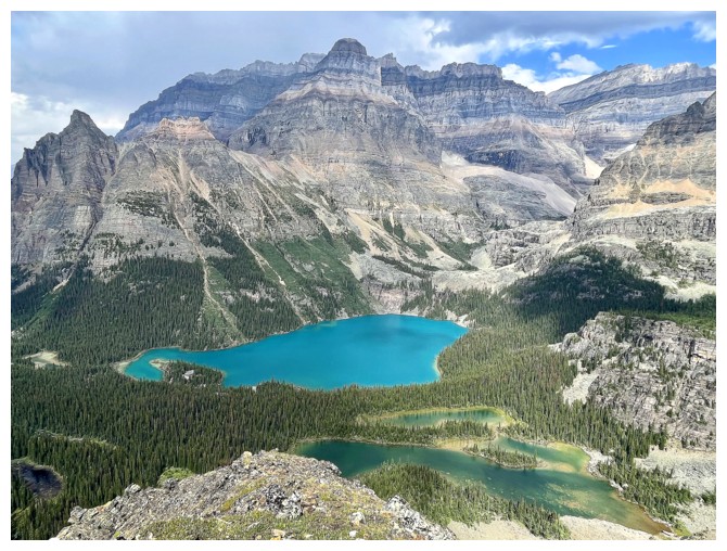
There it is - sweet McArthur Lake
Once again reminded of that awesome Marillion lyric, "There's a piece of green in the blue of her eyes" (hope you know Spanish!)
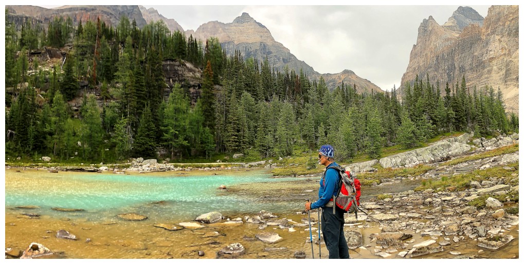
Mark and McArthur
"...as blue has it has been in my dreams..."
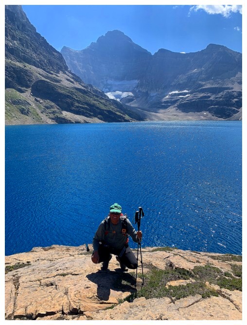
Me and McArthur
Yada, yada, yada....
Love this photo by Natahsa! I feel it should be a promo shot for a band named KAM (Kasey, Andrew, Mark).
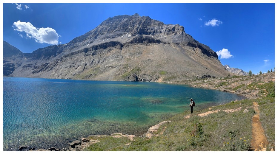
Begrudgingly dragging myself away from the alluring waters
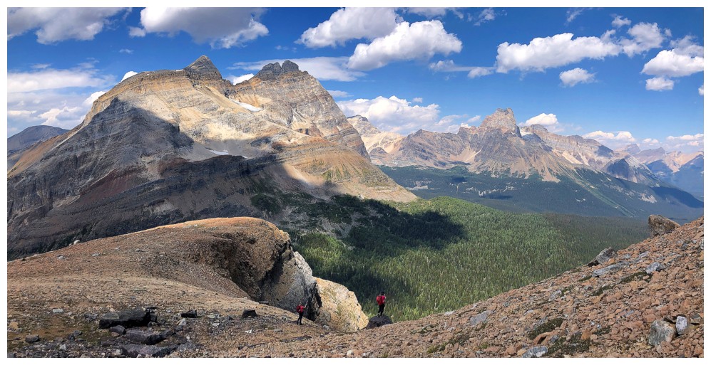
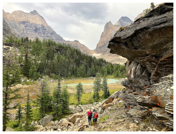
Starting the Schaffer ascent. Summit near the right.
However, views of McArthur Lake will be the cause of lots of head turning
And body-turning!
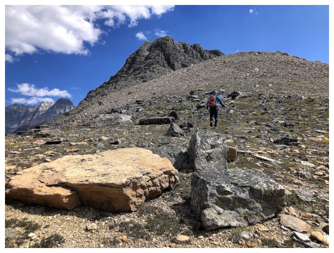
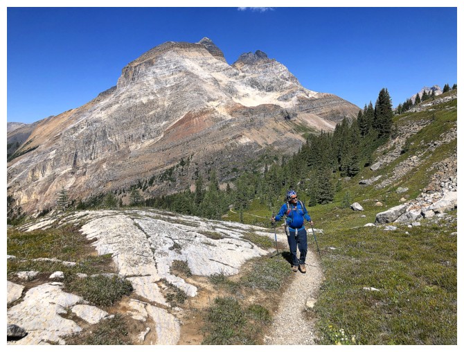
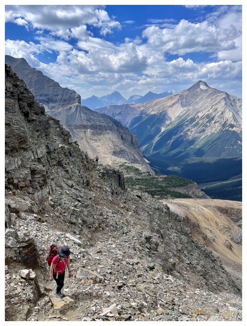
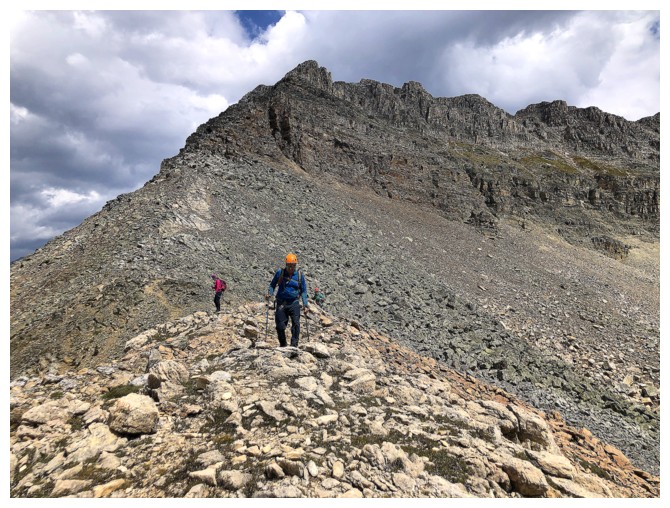
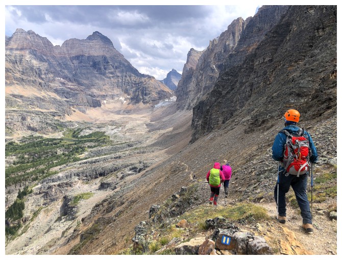
Mark is super motivated to get to the summit before the clouds roll in. He led most of the way.
Natasha and the view to the north
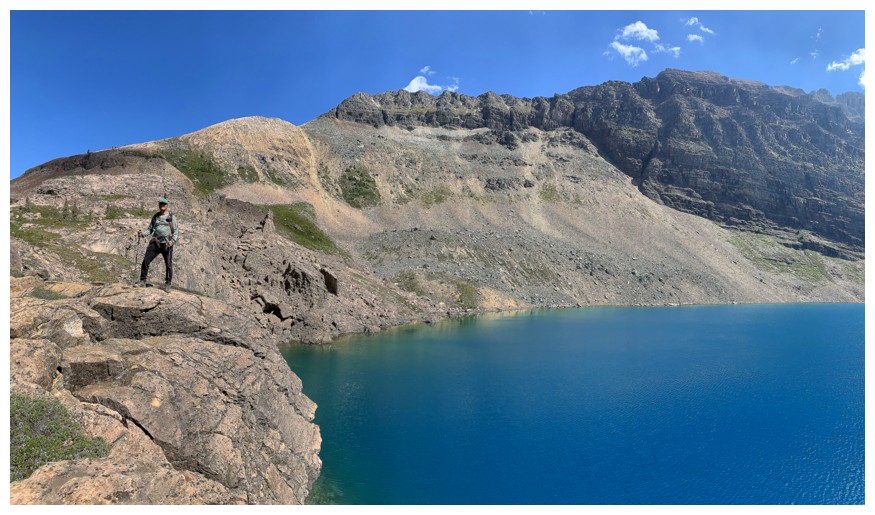
Natasha's view to the north, with Schaffer Lake below (photo by Natasha)
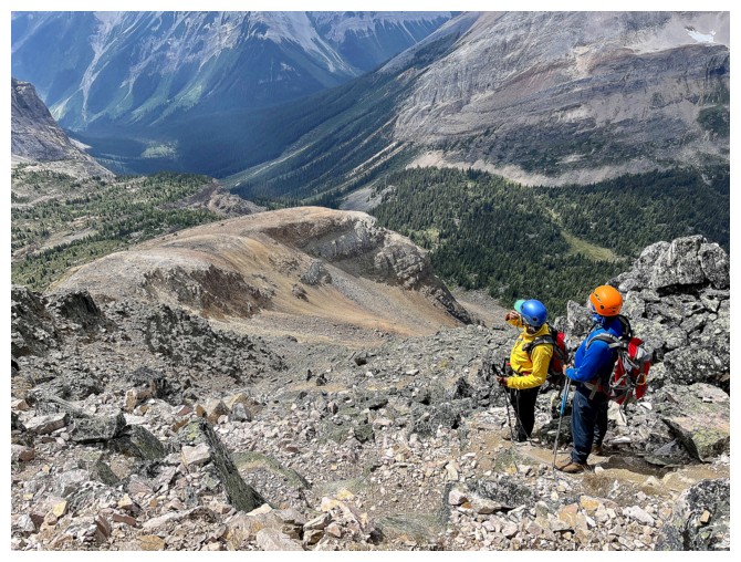
Natasha and Kasey checking out the shortcut descent route
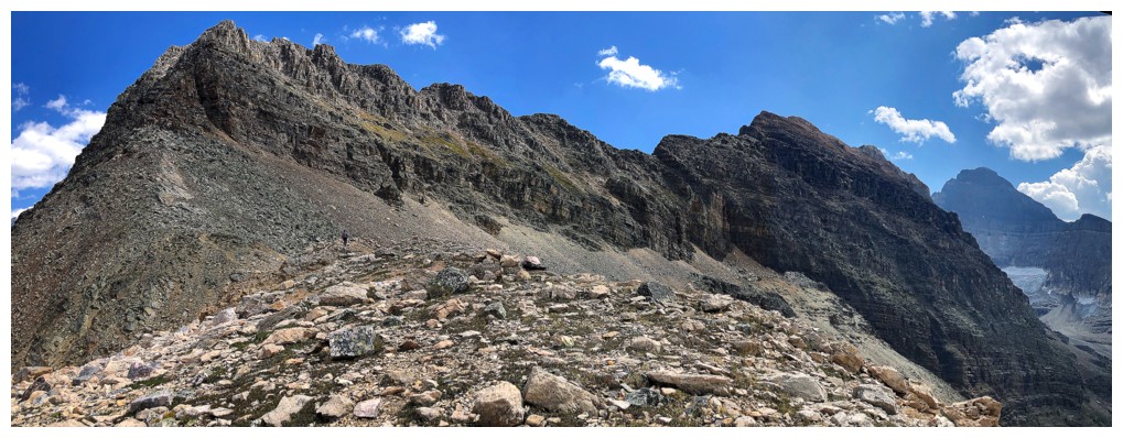
Schaffer at the far left
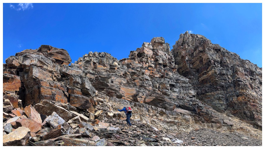
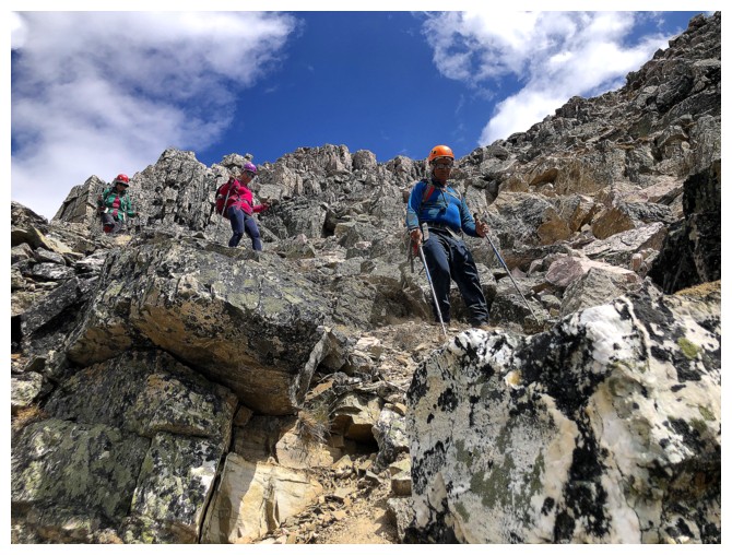
The ridge is all beautiful quartzite - it's not the east ridge of Edith Cavell quartzite, but it is quartzite!
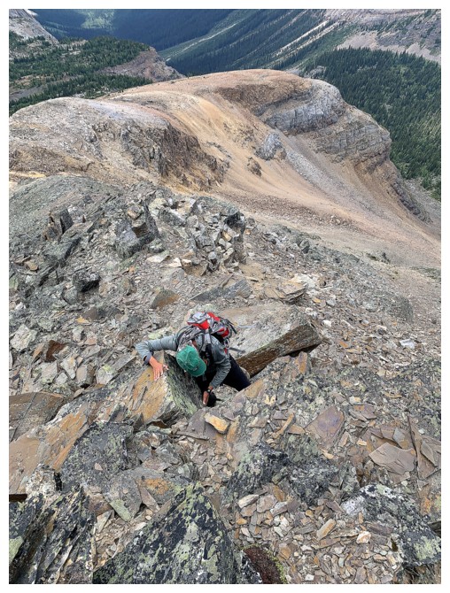
Stepping over a small gap
Saying goodbye to some of the Sun
Kasey on the main trail (photo by Natasha)
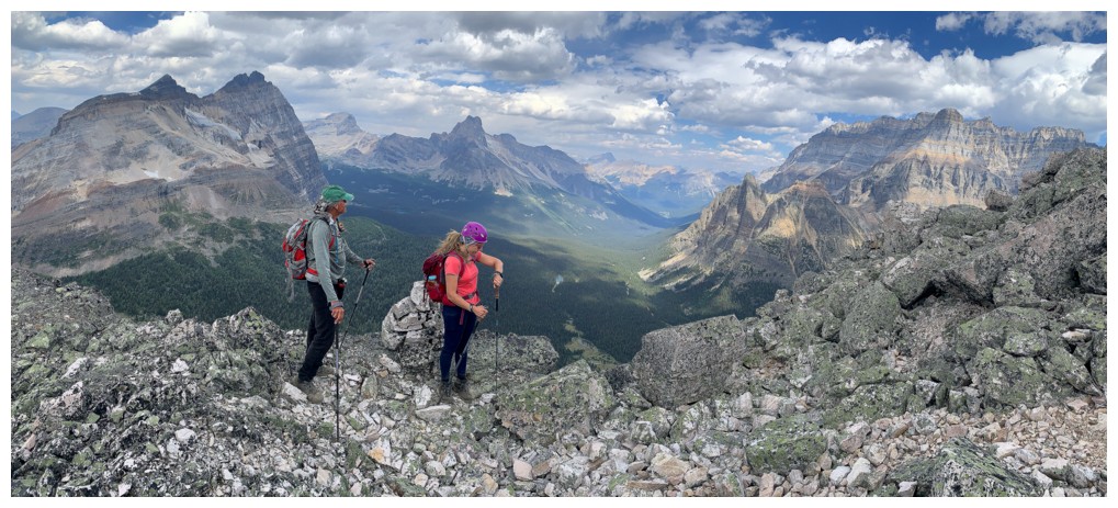
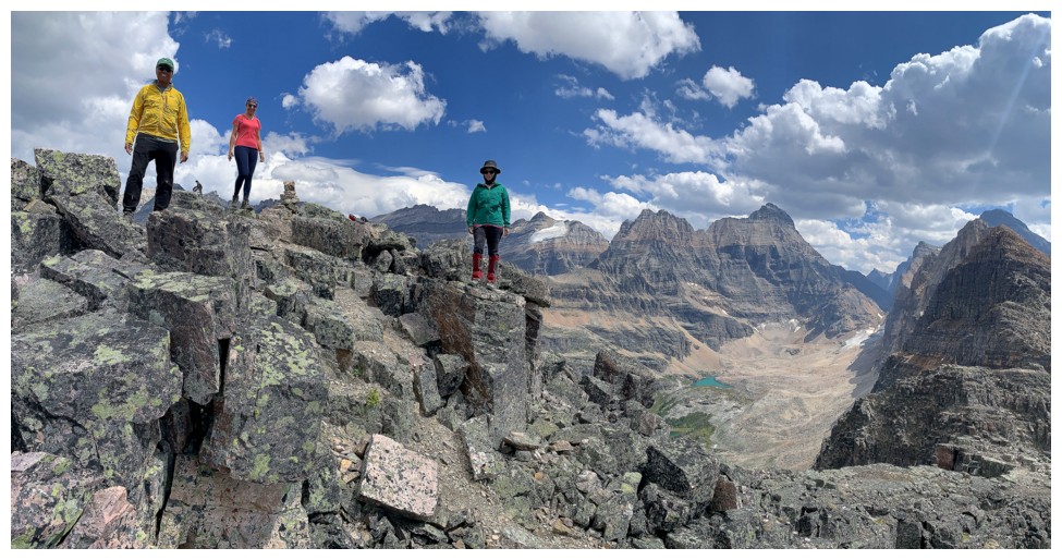
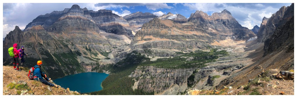
Natasha and I hit the summit ridge
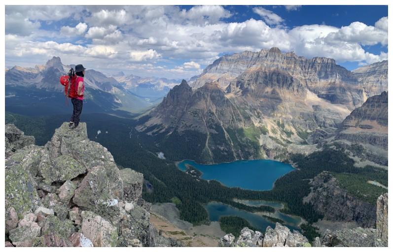
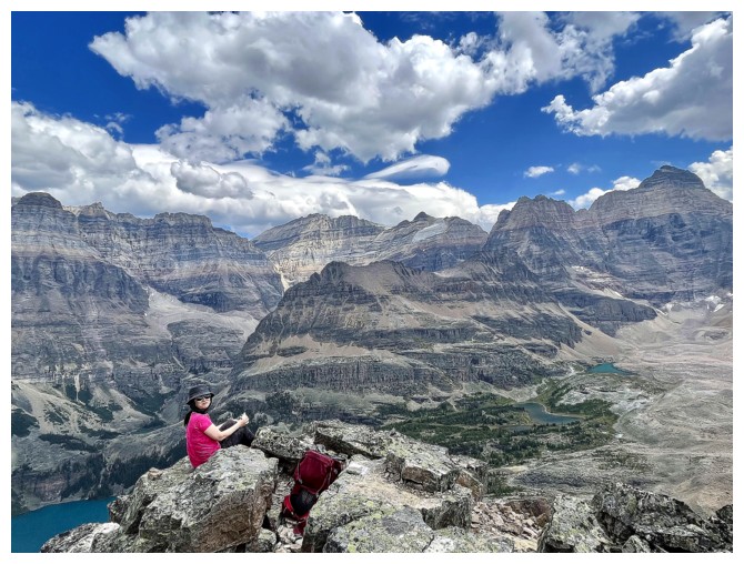
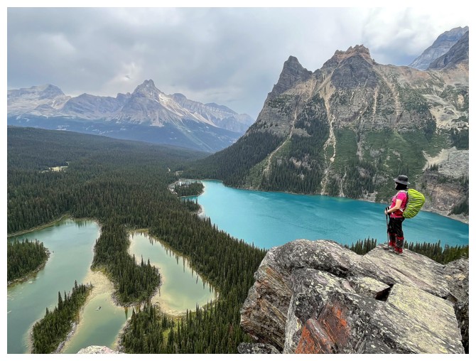
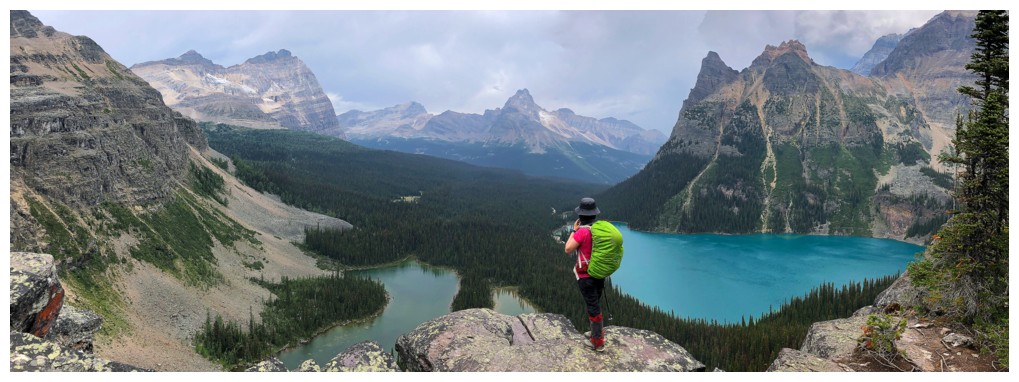
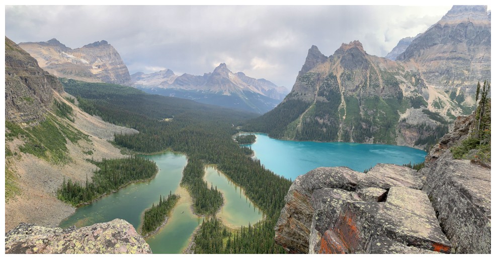
Kasey finds a great spot to check out Lake O'Hara; she's a terrific scrambler and eats up exposure like its chocolate!
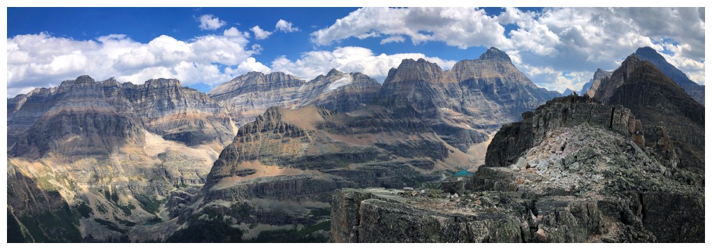
Tons of cool peaks to the east and southeast
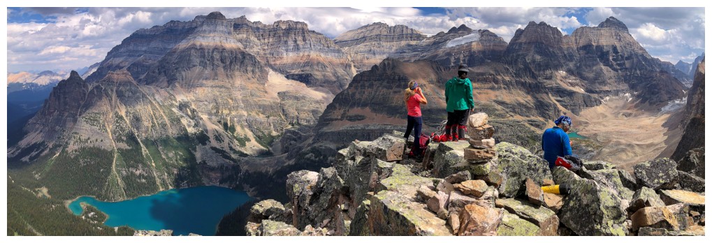
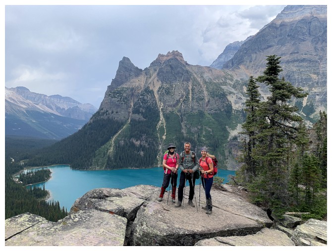
The troops make their way over to the true summit
Kasey and the view to the east (photo by Natasha)
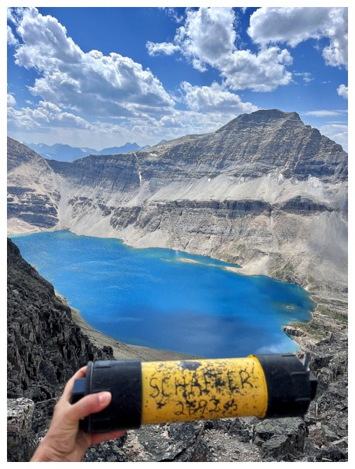
Natasha finds the summit register (photo by Natasha)
My view (still obsessed with McArthur)
Pink and turquoise - a combination that only works in the mountains!
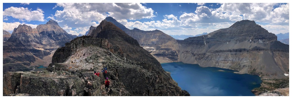
Glacier Peak is aptly named.........for now!
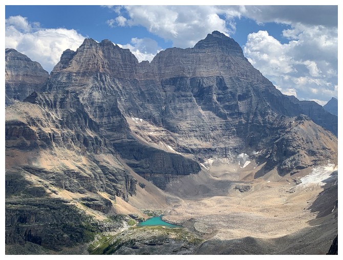
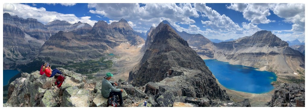
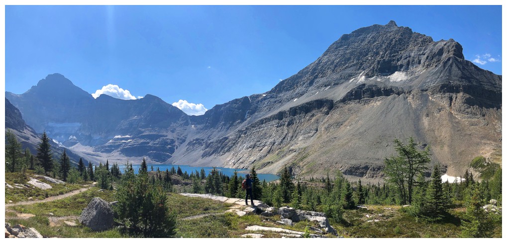
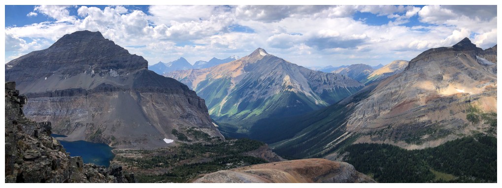
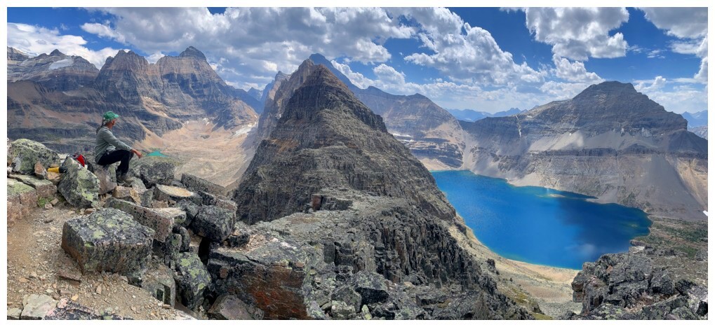
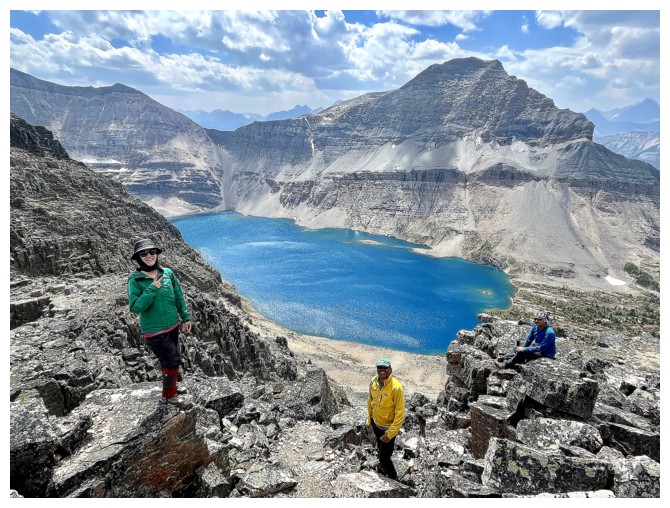
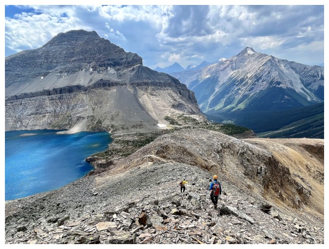
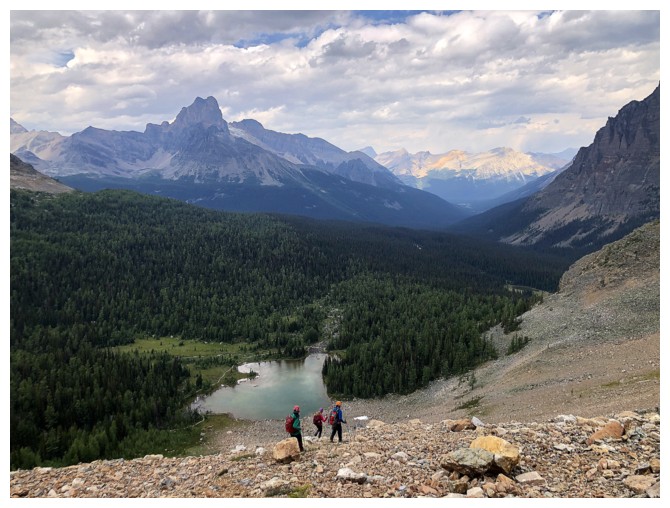
Ringrose Peak (left) and Hungabee Mountain, with Opabin Lake below
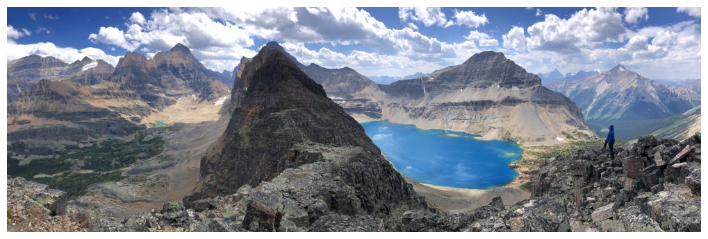
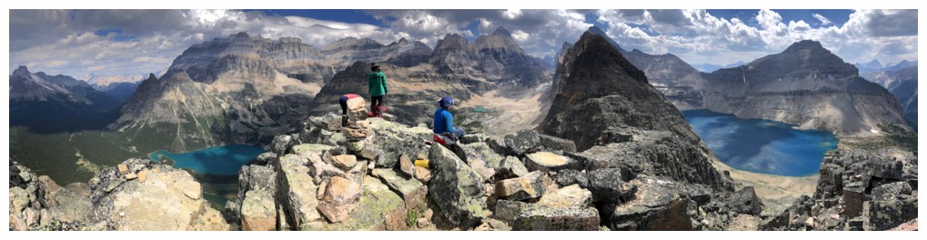
There were many photos of this view!
Maybe this should be the band photo, but NKAM is hard to pronounce and KNAM requires the dreaded silent "K"! (photo by Natasha)
No...this one! NAK or KAN, though KAM has the nice climbing gear parallel with "cam"
Yes, we are back to KAM (photo by Natasha)
Finally, Lake O'Hara is getting some Sun (photo by Natasha)
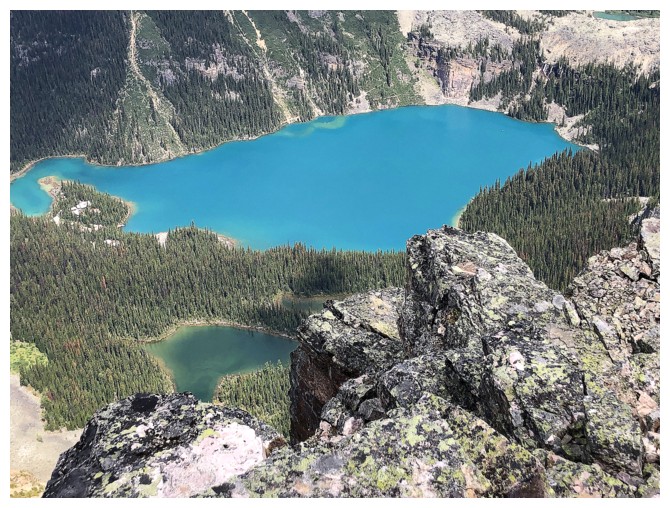
O'Hara's beautiful hue is nothing to sneeze at
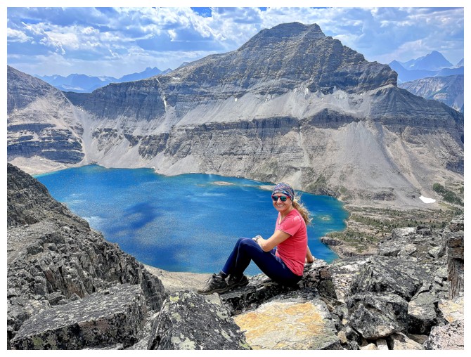
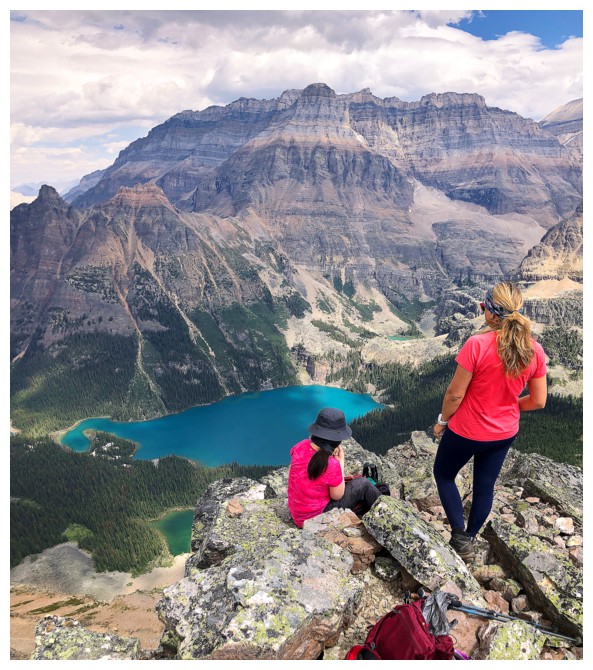
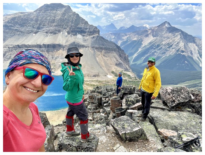
Model pose for the hero of the day (photo by Kasey)
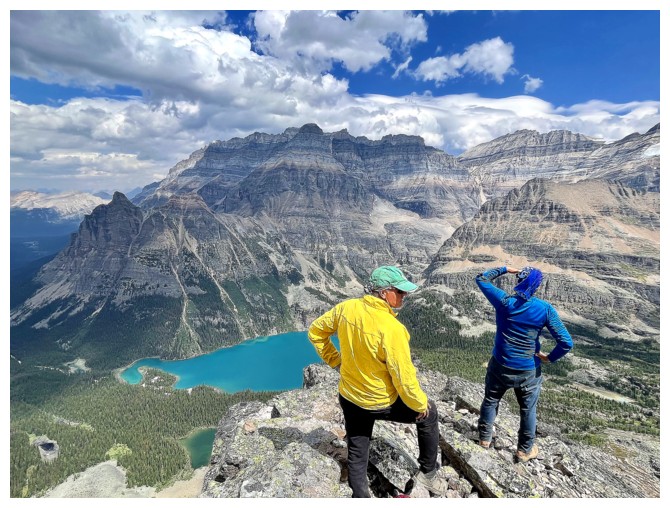
More summit views
Same as above
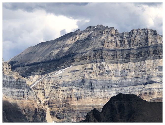
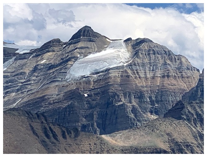
The alarming sight of a snow- and ice-free west face of Mount Lefroy.
Sobering to think how many other glaciated peaks (routes) in the
Canadian Rockies will lose that designation ("glaciated") within the next decade.
Descending (photo by Natasha)
Same as above
Same as above (photo by Natasha)
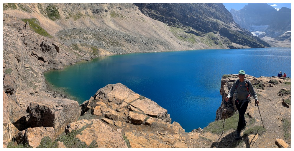
Last look at Lake McArthur
Looking back up the route
We used the shortcut route down to Schaffer Lake, but in retrospect it
hardly saved time and was tedious and precarious at times
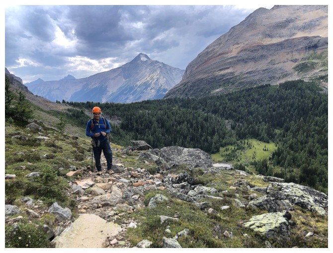
On the All Souls' Alpine Trail
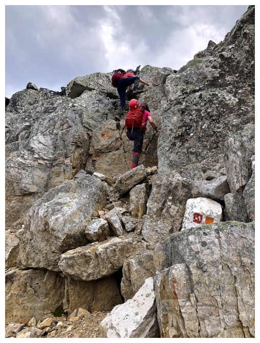
There is some minor scrambling on this route
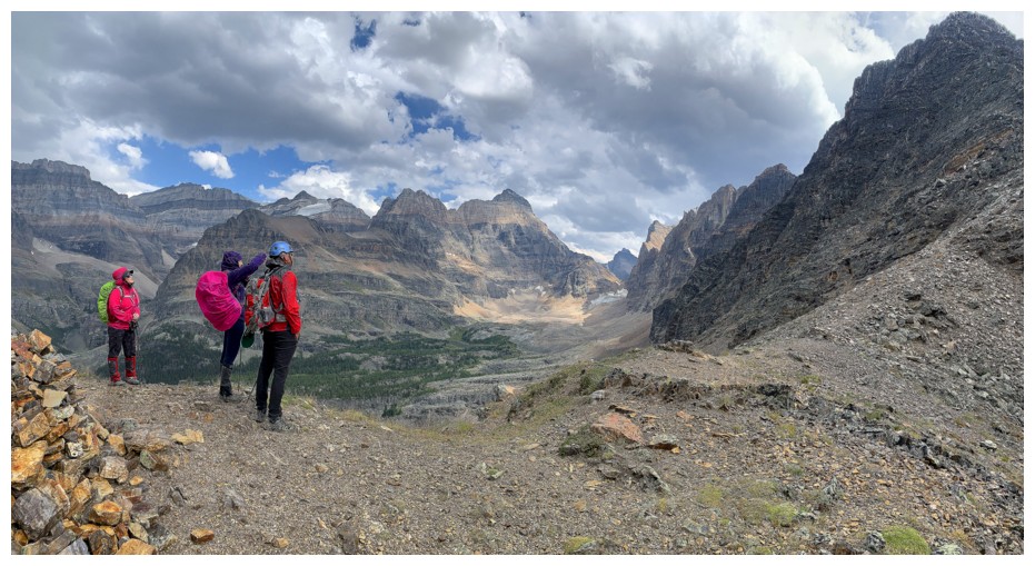
Checking out Schaffer's north ridge from All Souls' Prospect. We are all wearing rain jackets at this point.
O'Hara's turn to be front and centre
Someone with great taste for views! (photo by Natasha)
Mark and the route down from All Souls' Prospect (photo by Natasha)
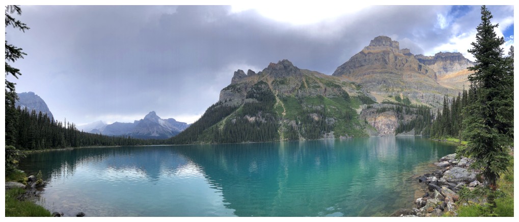
Mary Lake provides a nice colour contrast with O'Hara (photo by Natasha)
Enjoying the fantastic view
Leaving the viewpoint
Bigger view
Lakes O'Hara and Mary again
Same as above, with Wiwaxy Peaks and Cathedral Mountain (photo by Natasha)
Kasey and Natasha approach the Opabin Prospect viewpoint
There is it (photo by Natasha)
This viewpoint is going to demand another round of mad photos
KAN at the viewpoint
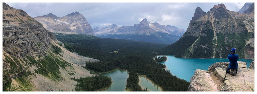
Even in overcast conditions this is one of the best viewpoints I've ever visited
Descending into the Opabin valley
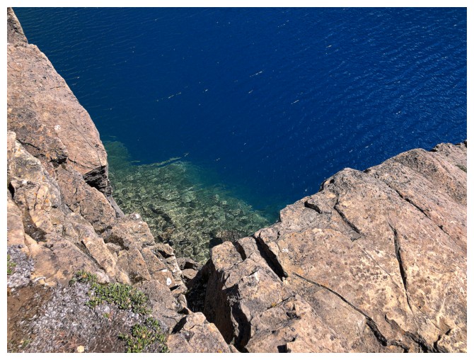
The water colours here are remarkable too
Same as above
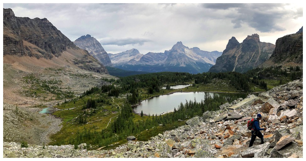
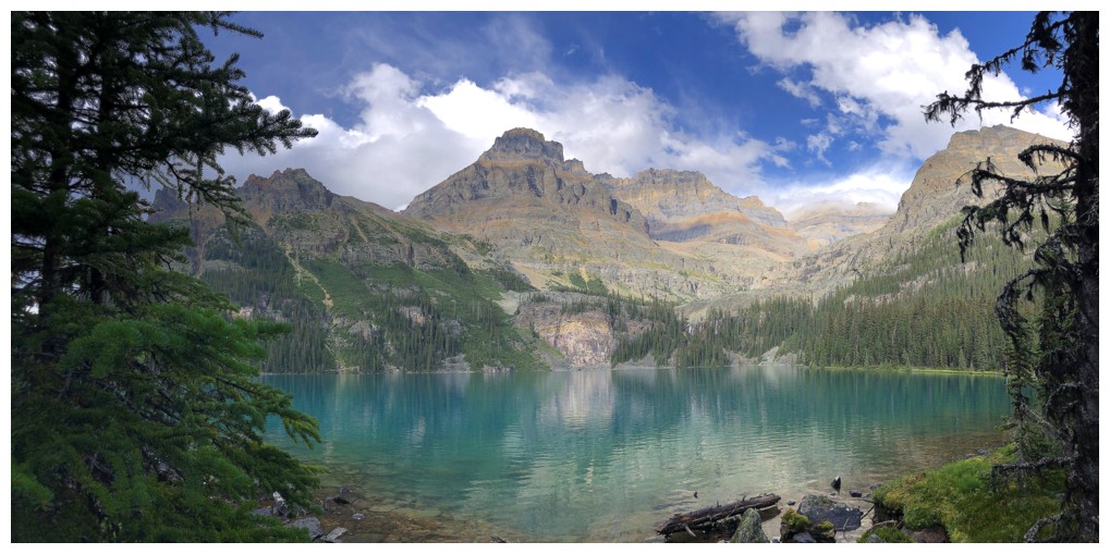
Ascending the valley to Opabin Lake. Hungabee Lake behind.
Opabin Lake and Hungabee Mountain. Last of the photos for a while as the rain started coming down here.
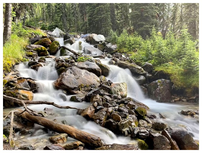
Nice stop for a long exposure photo (photo by Natasha)
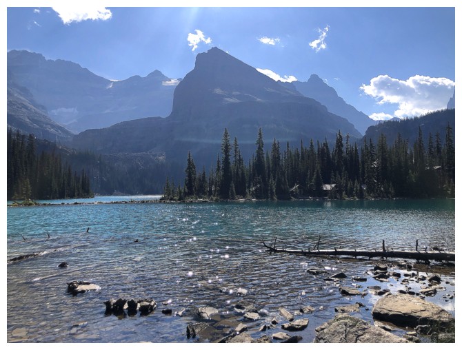
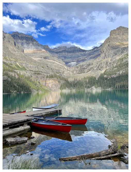
At the southeast end of Lake O'Hara
Mounts Huber, Victoria, and Yukness provide an awesome background
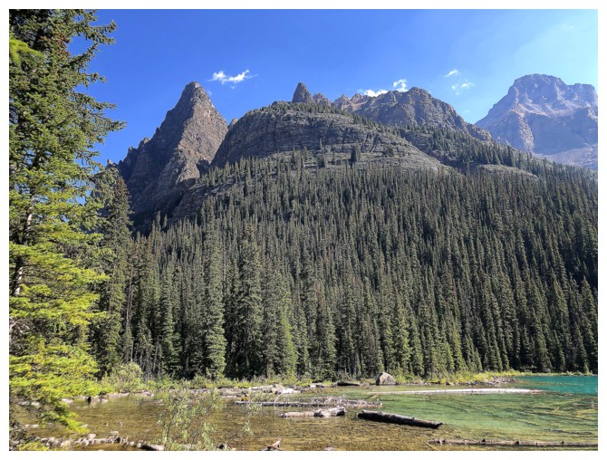
Wiwaxy Peaks
Nice composition, Natasha! (photo by Natasha)
Another great view from near the lake outlet
Natasha gets yet another great shot! (photo by Natasha)
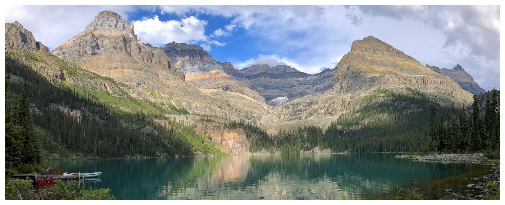
Parting look before we hop onto the bus
The End
LOG