Penny’s Peak
 Marvel Peak
September 3, 2022
Mountain heights: 2560 m, 2708 m
Total elevation gain: 1350
m
Ascent time to
Penny: 3:20
Time from Penny
to Marvel: 1:25
Descent time:
4:40
Scrambling with
Mark.
Inspired by Matt
Hobbs 2017 ascent of Penny’s Peak and Jake Finnan’s 2020 Facebook post,
describing a relatively easy route up Marvel Peak, this trip was catapulted to
the top of our “trips to do on a cloudless day” list. 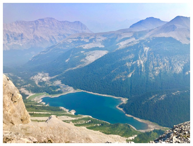 Unfortunately, as luck
wouldn’t have it, the first cloudless day when our schedules aligned was also one of the smokiest days of the summer.
Unfortunately, as luck
wouldn’t have it, the first cloudless day when our schedules aligned was also one of the smokiest days of the summer.
Nevertheless, we
took the chance that the forest fire smoke wouldn’t be too bad and embarked on
the long drive to the trailhead. The last time Mark and I visited this area, our
combined age sat comfortably at exactly three quarters of a century – that number is
now well into triple digits!!
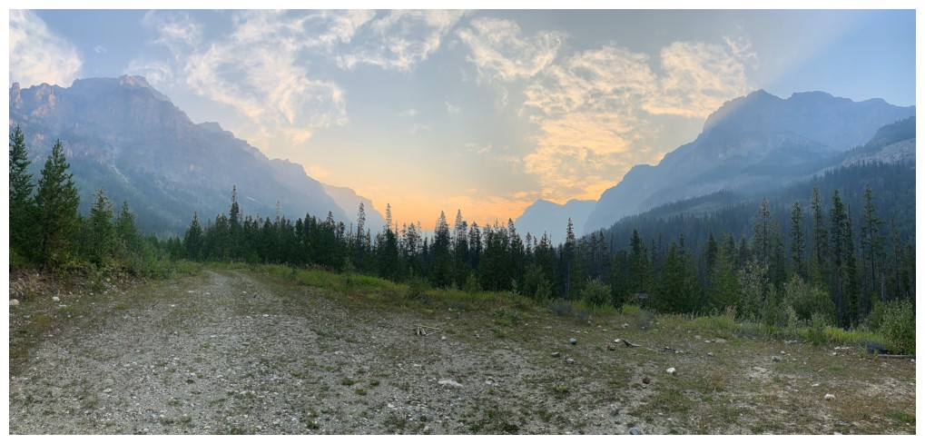
The skies didn’t
look great from the start, but we had seen much worse and you don’t drive the long
Settler road and then turn around with nothing to show for it. 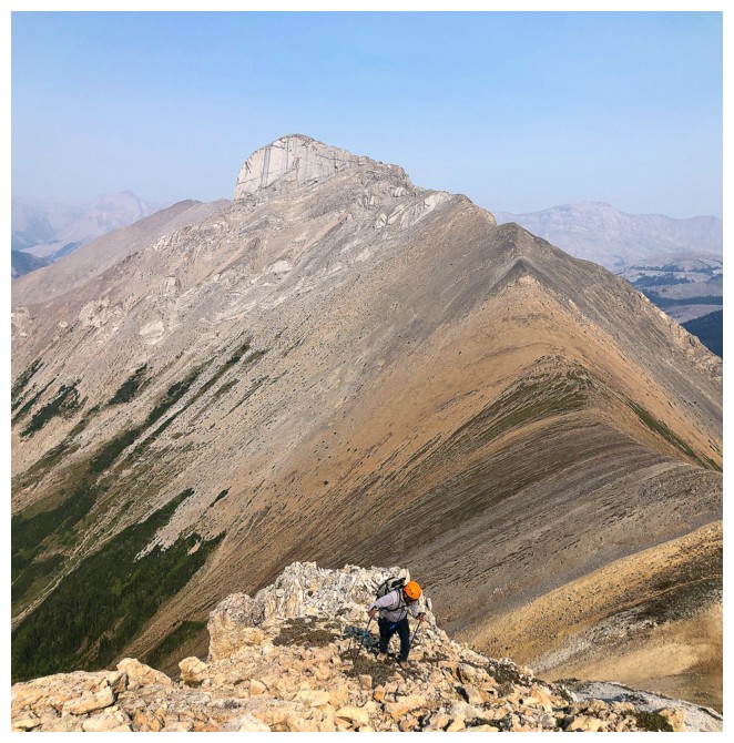 The hike to
Aurora Lake went with ease along an excellent trail, but as expected,
potentially outstanding views at the lake were very much muted by the smoke.
Nevertheless, it was still great to be in this incredible part of the Rockies.
Onto to Penny’s Peak…
The hike to
Aurora Lake went with ease along an excellent trail, but as expected,
potentially outstanding views at the lake were very much muted by the smoke.
Nevertheless, it was still great to be in this incredible part of the Rockies.
Onto to Penny’s Peak…
Penny’s Peak sits
immediately above Aurora Lake and has earned a couple of unofficial names. My
favourite is definitely “Penny’s Peak”, named by Matt Hobbs in tribute to his
and Brianna’s second daughter, Penny. As a cold-hearted, childless bachelor, I
don’t get the “warm, fuzzies” often, but I can’t help but be moved in seeing
the incomparable love a parent has for his/her children expressed in this way
– gives me hope for our species as a whole!
Back to the
trip. Penny Peak’s was ascended with ease and provided spell-binding views of
the Assiniboine area, but again marred by the smoke. This viewpoint alone is
well worth the effort of the long drive. After a short break we descended steep
slopes to Penny/Marvel col and then started up the other side.
With the help of
Jake’s photos and those from several other sources, ascending Marvel was fairly
straightforward. We did try to gain the ridge earlier than suggested, but hit
an impasses upon reaching it. The final section to the summit, though short,
was very scenic and very rewarding, the full scope of the view almost upon us.
Even with the
smoke, the summit view was fantastic, and we took a fairly long break to soak
it all in. Of course, there was some degree of disappointment with the
conditions, but neither of us were cursing, swearing, or kicking rocks around
so I’d call it a win!
Nothing
particularly earth-shattering about the descent to report. We simply followed our
route in reverse.
An amazing day
in a spectacular setting, however, a return to both summits on a cloudless AND smokeless
day is a forgone conclusion.
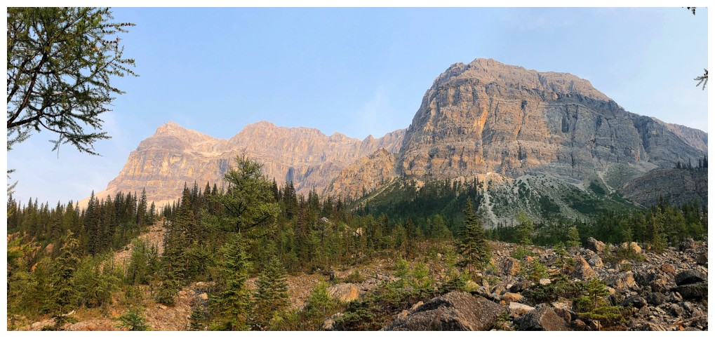
The start of the trip. Eon Mountain on the left and Mount Alcantara at the right.
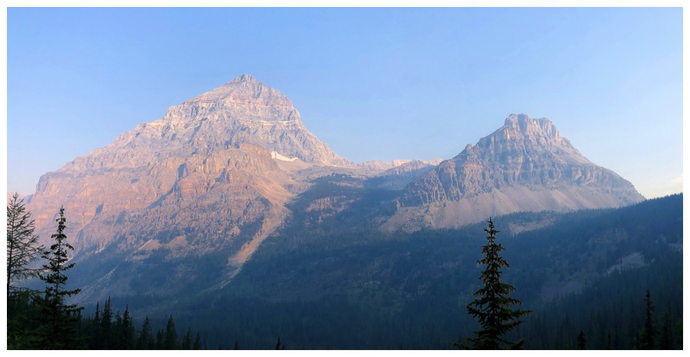
Eon (left) and the east peak of Mount Gloria
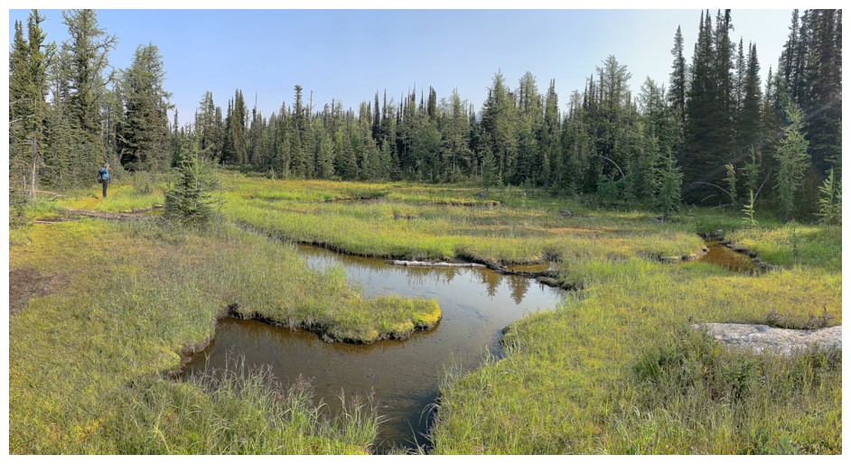
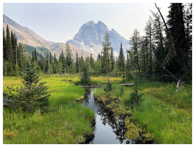
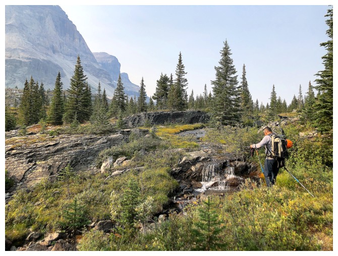
Pleasant swampy area just before reaching Aurora Lake
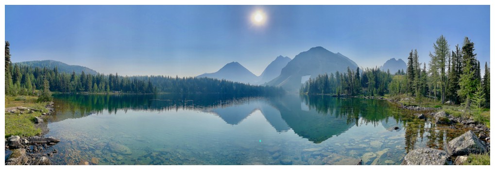
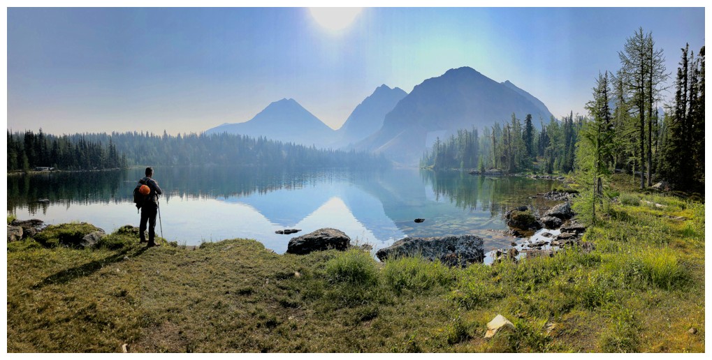
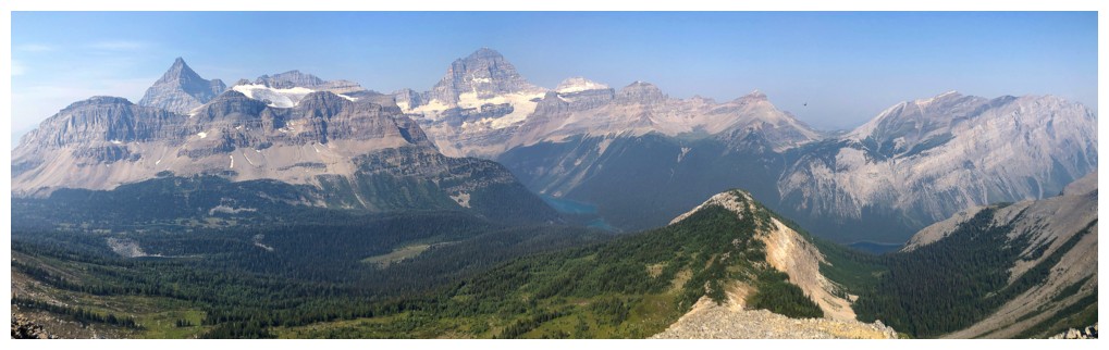
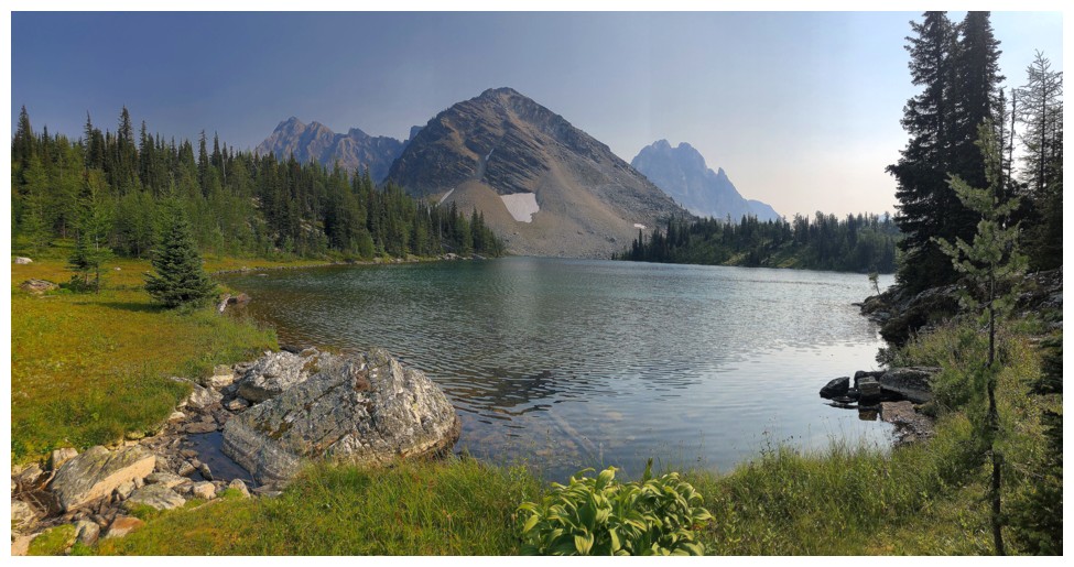
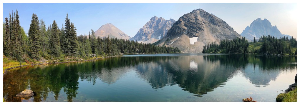
Aurora Lake is a real gem. Too bad about the hazy/smoky conditions.
The lake reflects a couple of unnamed summits in addition to Mount Byng and Aurora Mountain
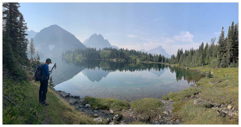
At the east end of the lake
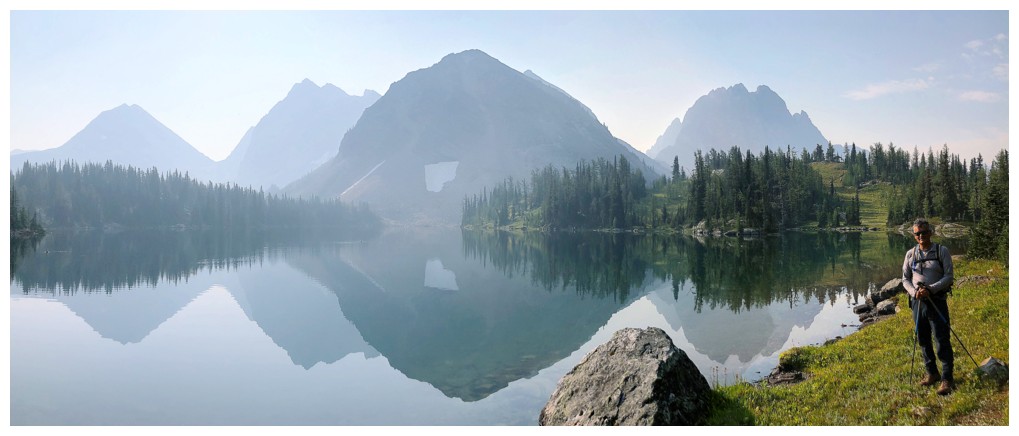
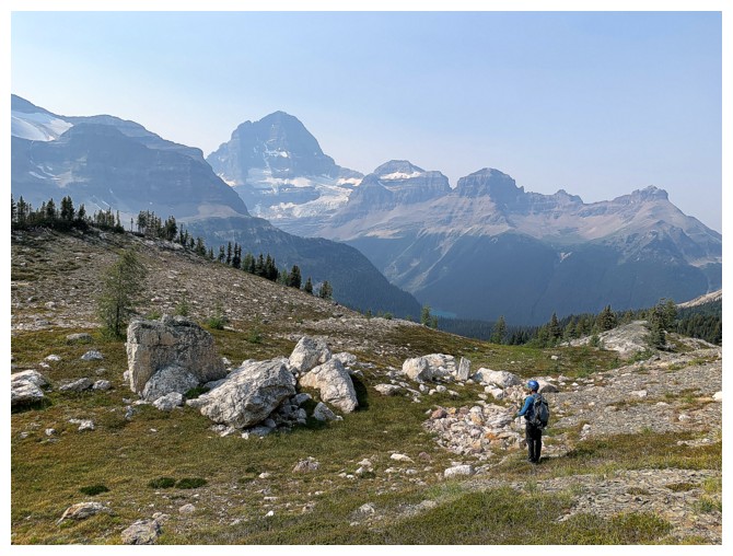
Penny's Peak, dead ahead
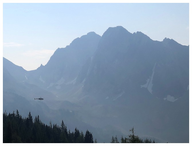
A low-flying helicopter whizzes by
Eon Mountain is a very aesthetic-looking peak when viewed from the east
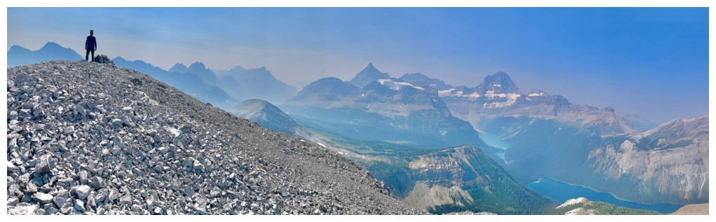
Starting to get the view we came to see. Minus the smoke would have been nice - and there ends my whining about the smoke!
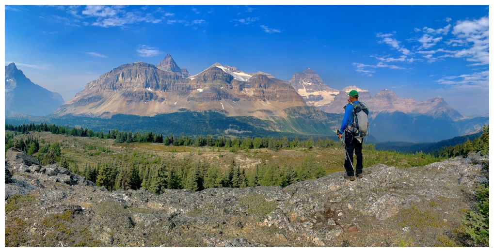
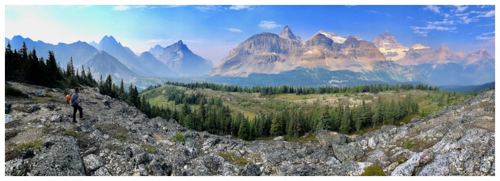
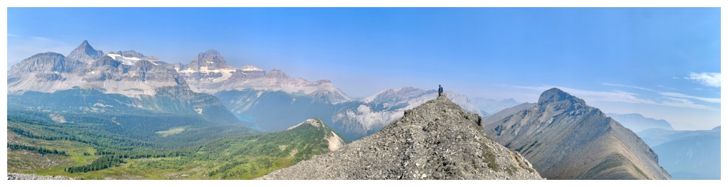
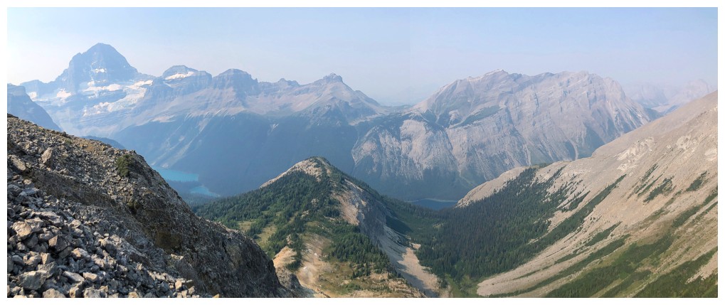
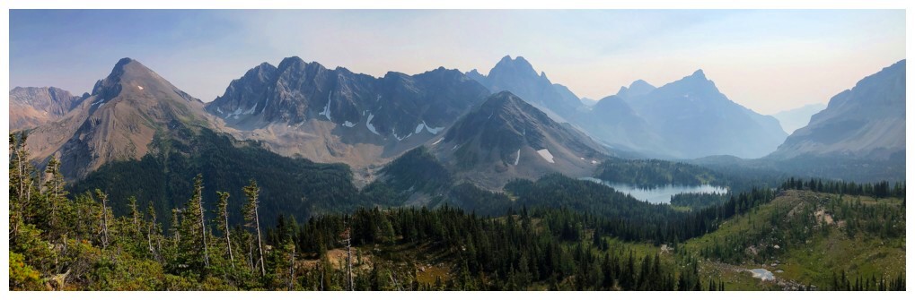
Assiniboine and the surroundings mountain are spectacular from this vantage point
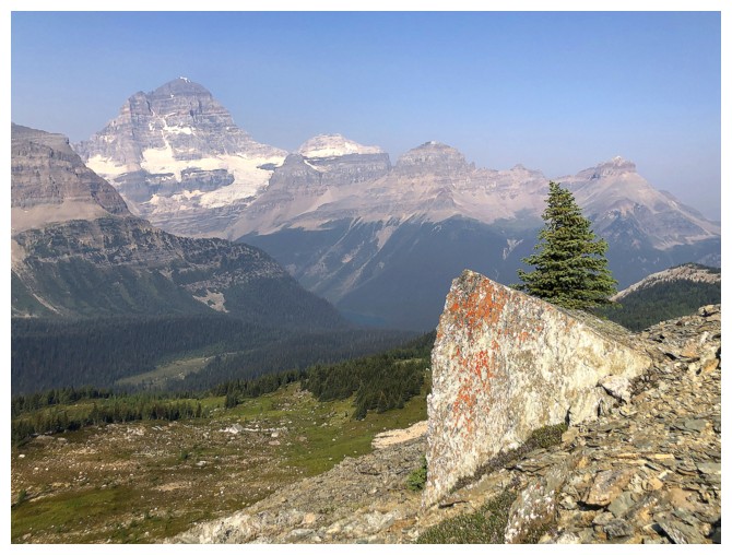
A cool rock and tree to go with Assiniboine
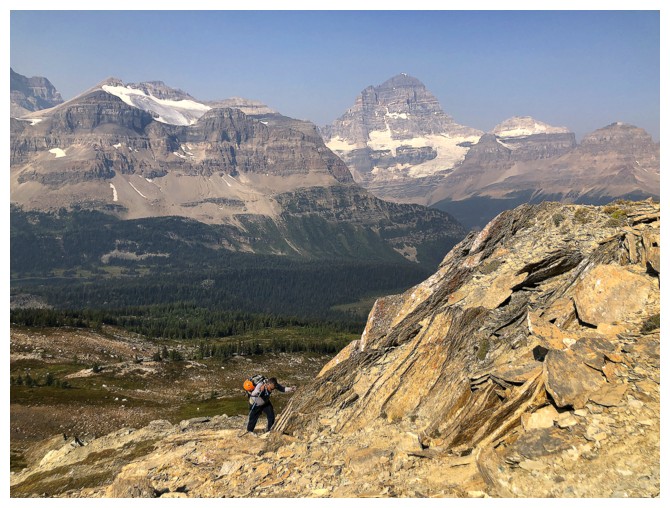
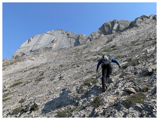
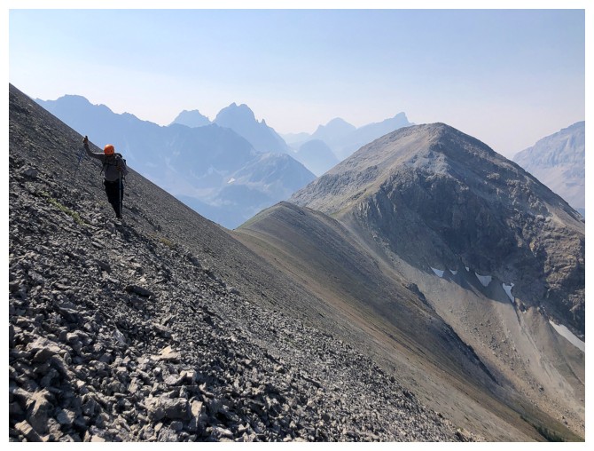
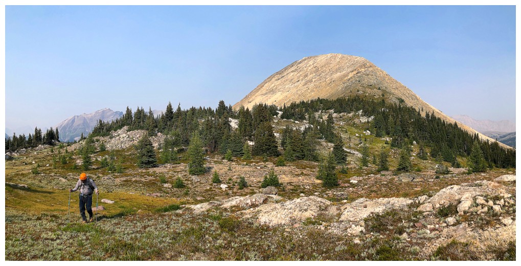
Mark grinds his way up Penny's Peak
As do I
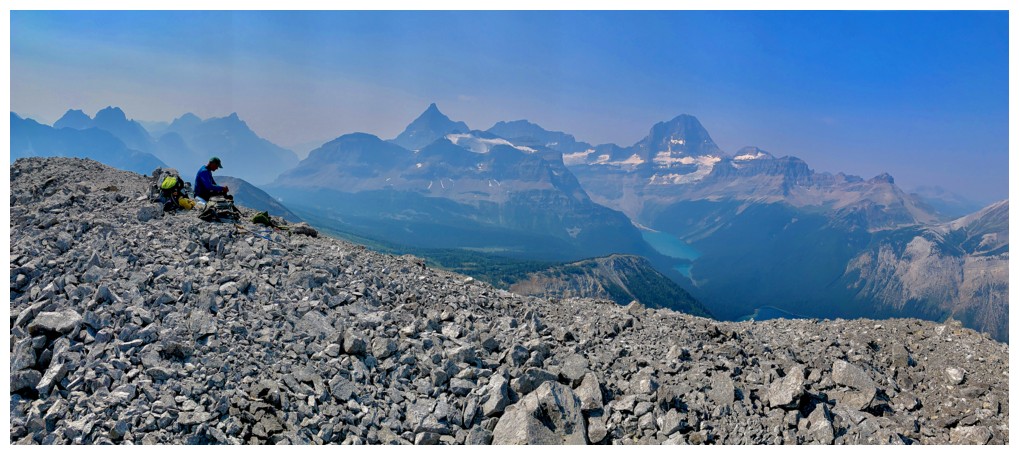
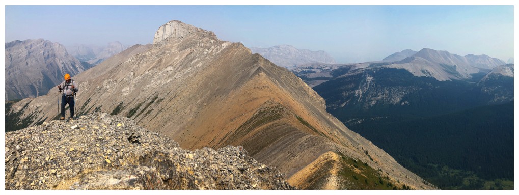
Approaching the summit of Penny's Peak. Marvel Peak at the right.
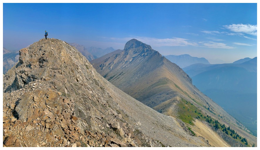
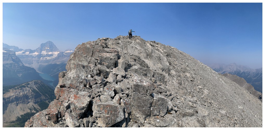
Summit
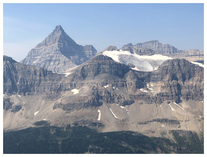
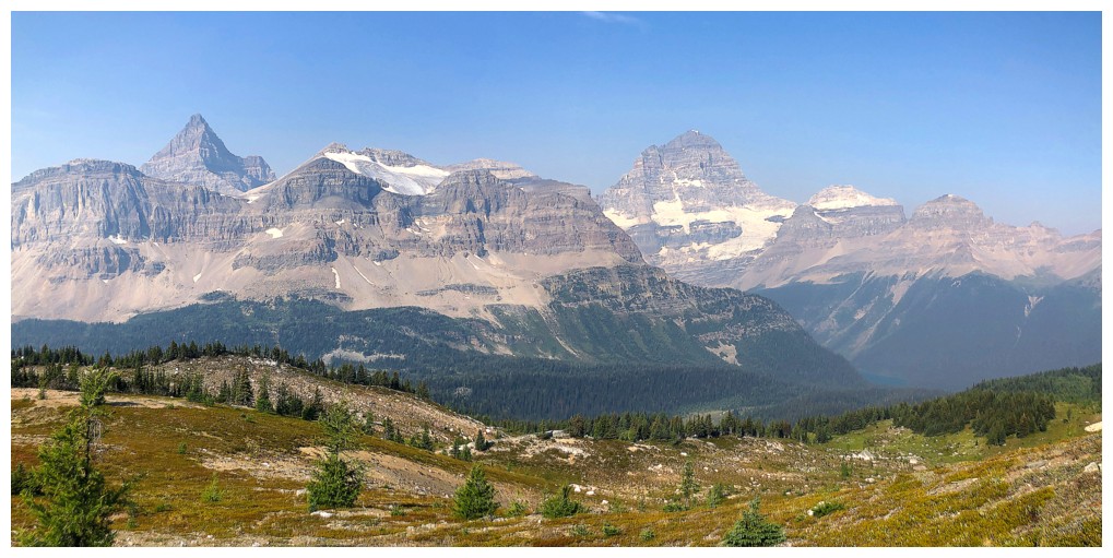
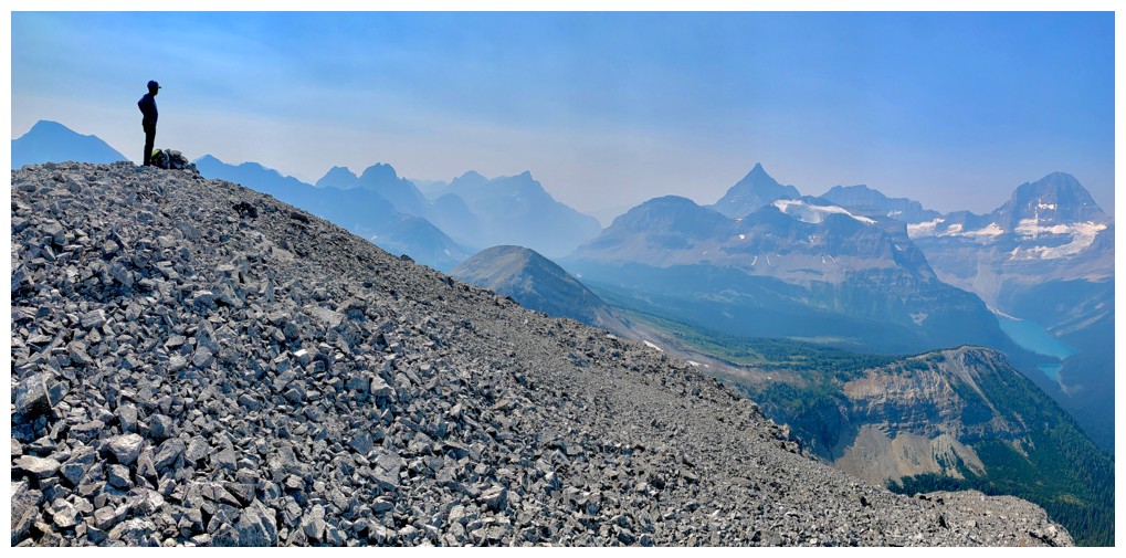
Of course Eon and Aye look great
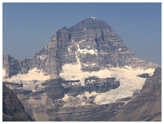
As does Assiniboine
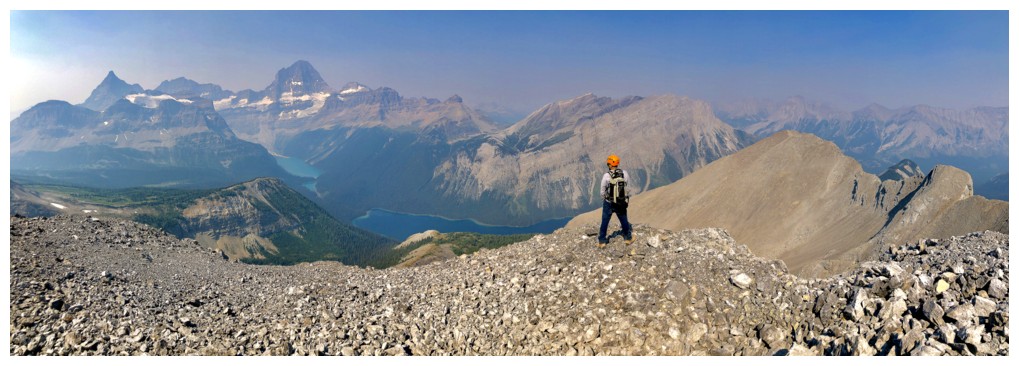
The whole lot of them and more
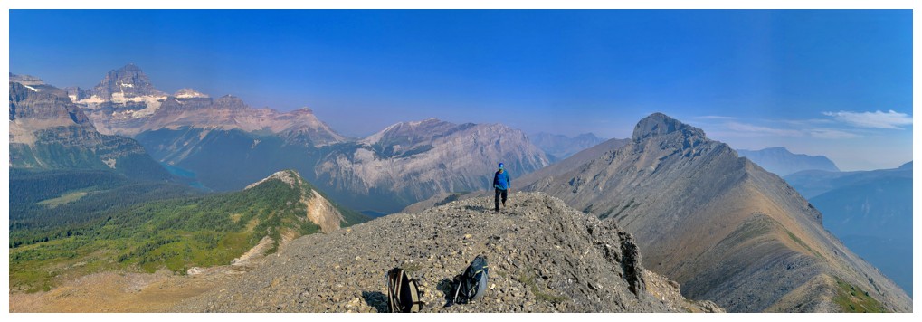
Lounging around on Penny's Peak
Descending to the Penny/Marvel col
At the col
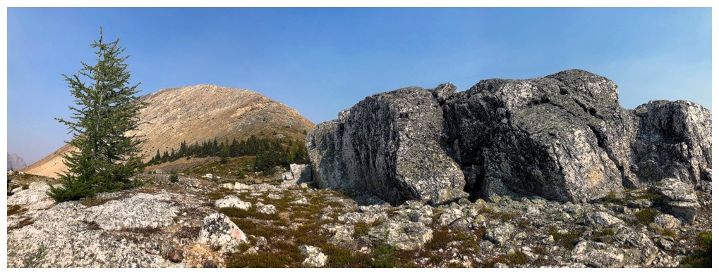
Pretty cool views from the col too
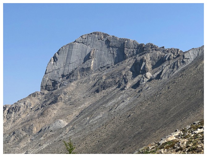
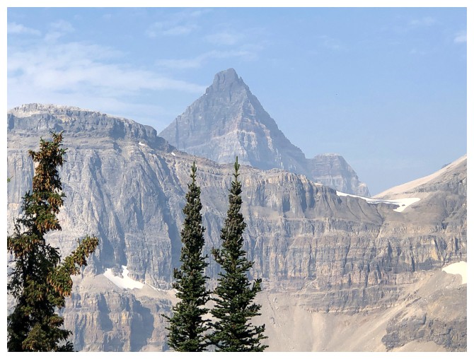
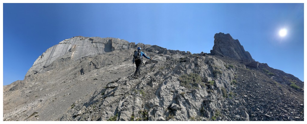
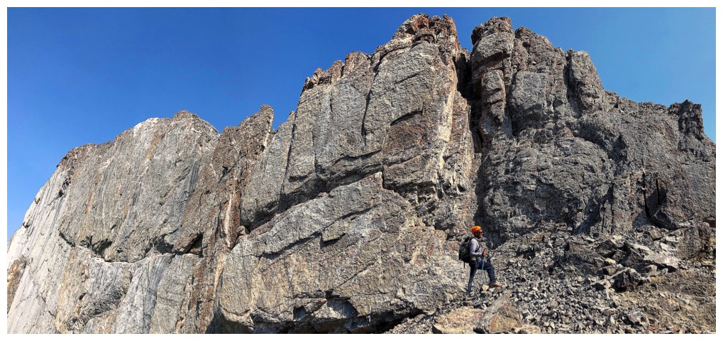
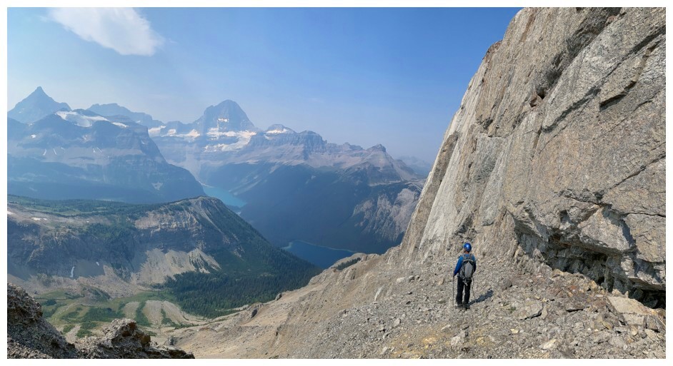
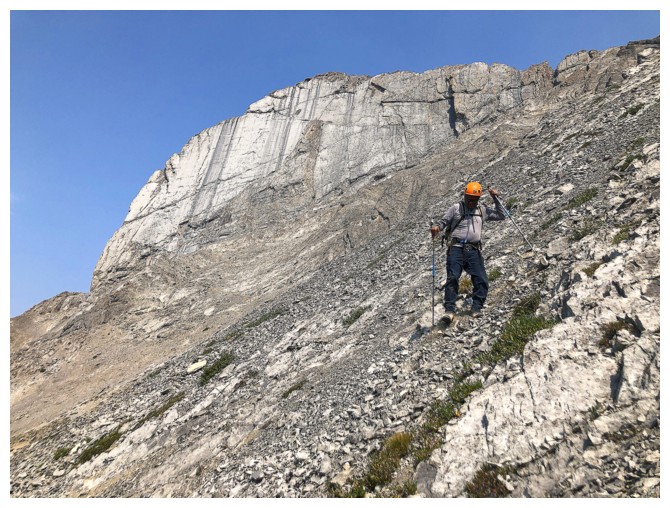
The super cool and distinctive west face of Marvel Peak. The ascent
route traverse over to the left side of the face then takes a diagonal
line below the slabs and up to the right side.
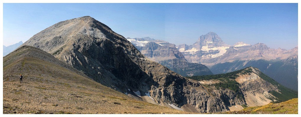
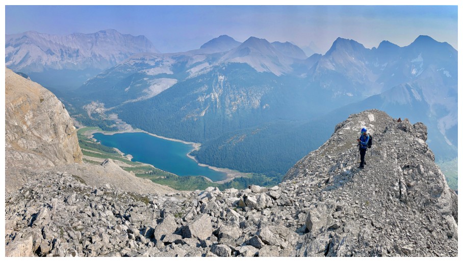
Looking back to Penny and Assiniboine
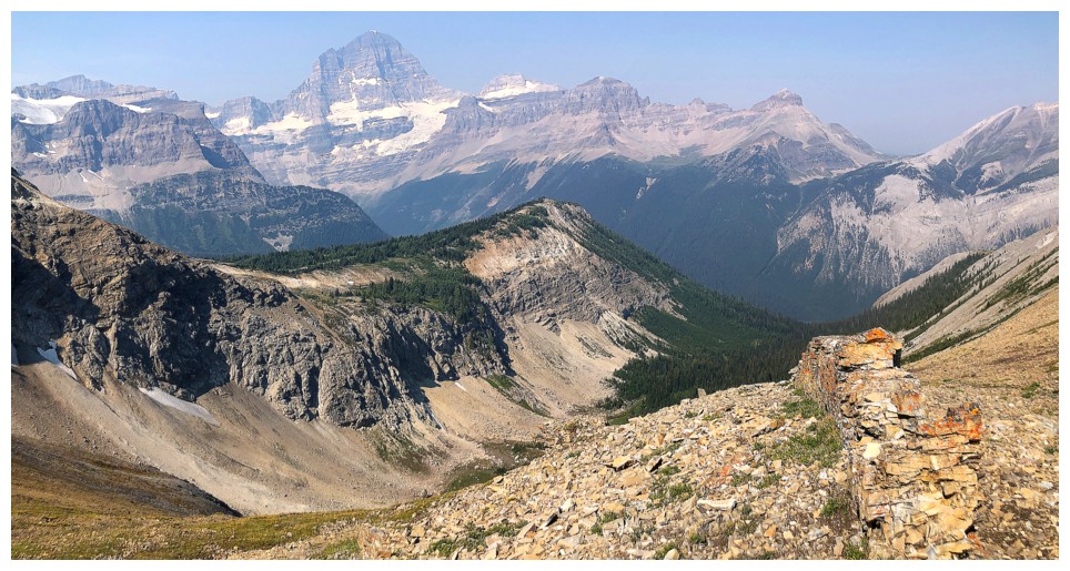
Obviously most of the attention is going to the west
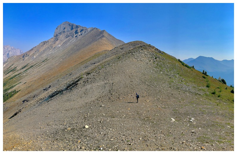
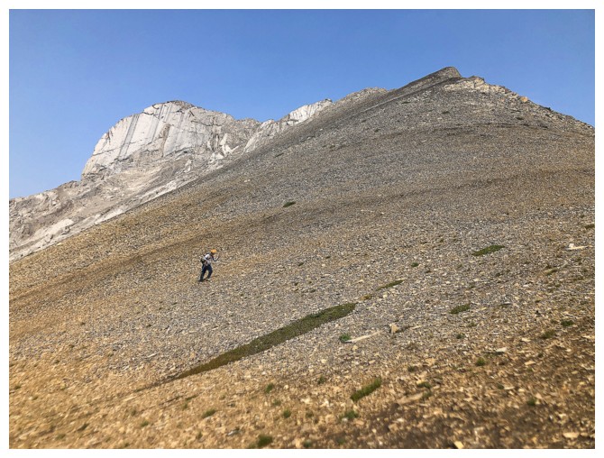
The start of a somewhat lengthy traverse towards the west face
The typical angle of the traverse
Heading up to the ridge too early
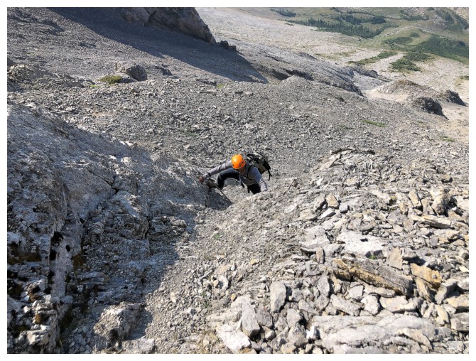
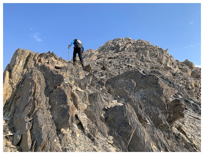
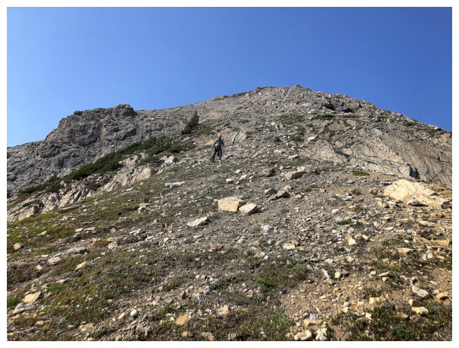
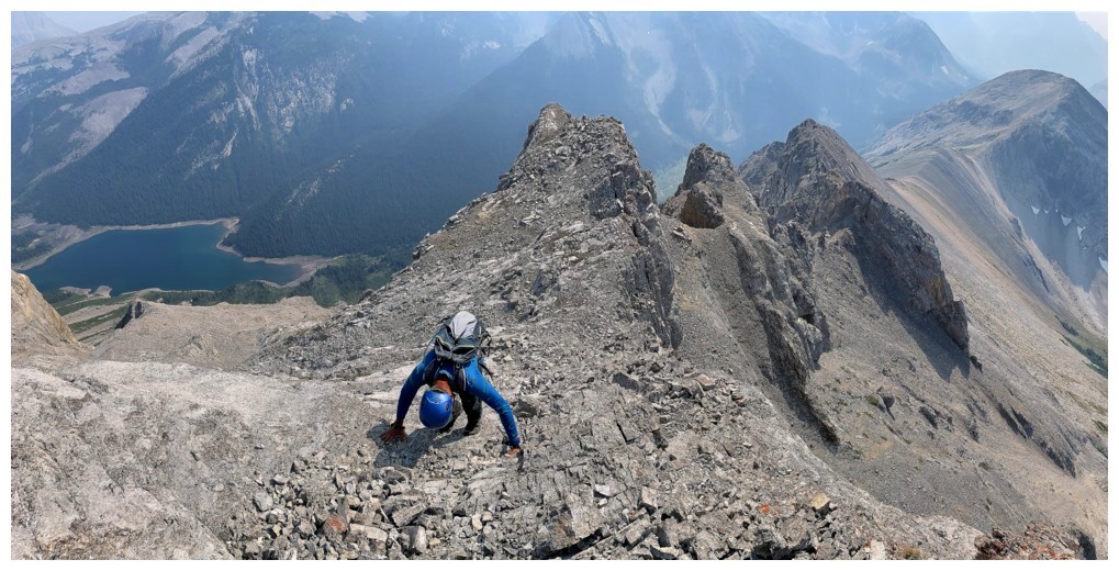
Mark scrambles up a steep section of loose rock to get us back on track after the failed attempt along the ridge
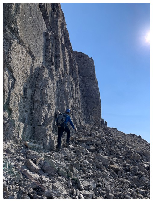
Below the slabs
Mark is almost at the end of the slabs. The summit is over to the left.
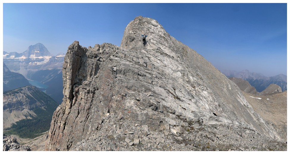
Having turned the corner, the summit is a short, but enjoyable scramble away
Last few steps
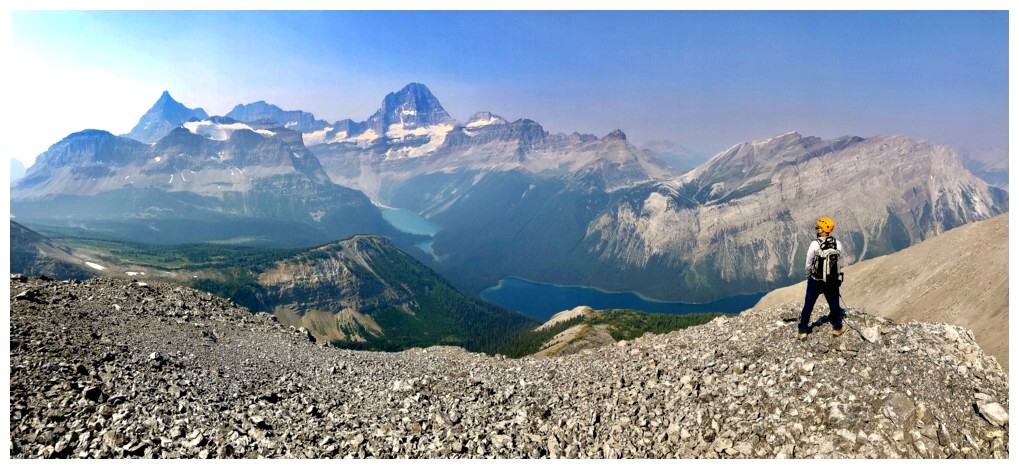
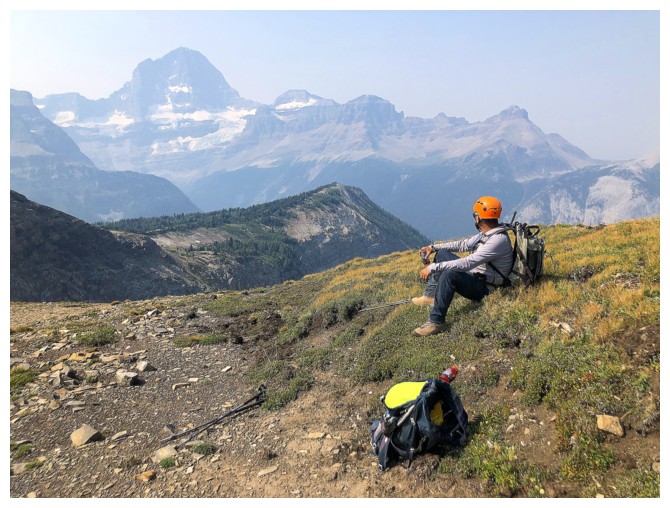
Mark takes in the view we came to see
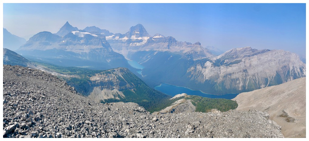
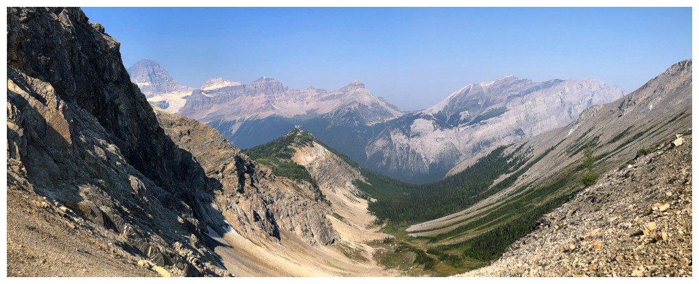
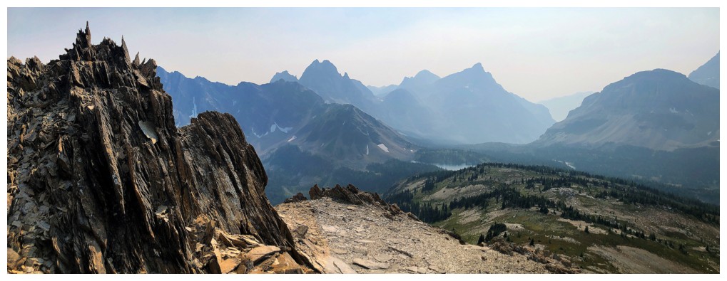
Marvel Lake and Lake Gloria add tremendously to the view
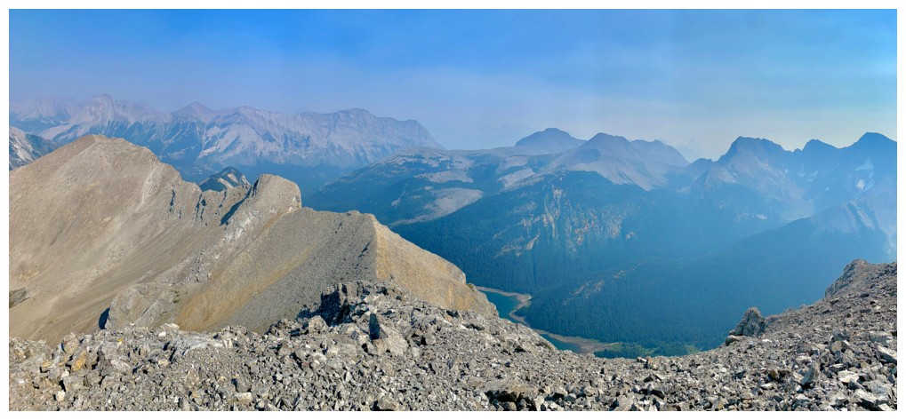
Hazy view to the east
Heading down
Owl Lake - definitely a body of water I'd love to visit someday
Back at the slabs
Back to traversing - at least it's downhill this time
Almost back at the col
Quick break at the col
Sometimes smoky skies clear during the day...and sometimes they get worse!
Back at the summit of Penny
Vertically tilted, crumbly shale
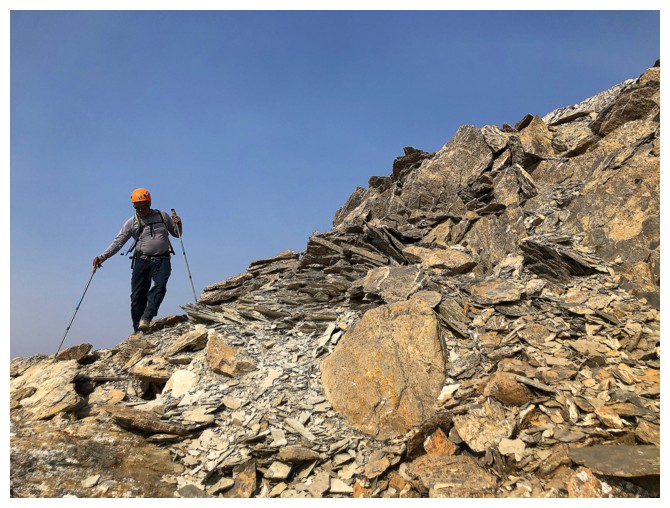
Mark descends it
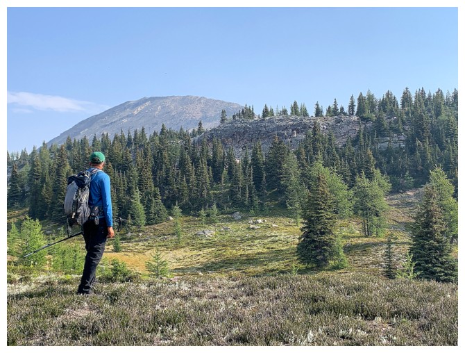
Mount Byng is on the agenda for a future trip
Last view of Assiniboine and company
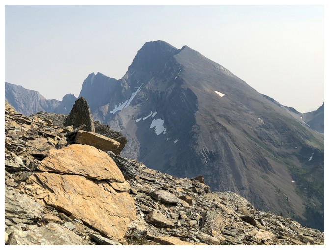
Looking back to Penny
Same as above
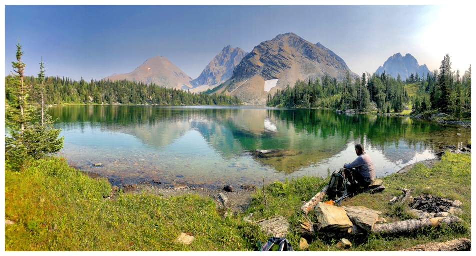
Aurora Lake and its surrounding mountains
Back at Aurora Lake
It's still gorgeous, even with the haze
Last break of the day before the easy hike back to the trailhead
At the swampy section again
Water refill
Alcantara has many unnamed outliers to the northeast
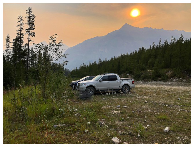
The trailhead is a welcome sight at the end of a great trip that could be been stupendous!
The End
LOG