“O Peak”
August 20, 2021
Mountain height: 2800 m
Elevation gain: approximately
1000 m
Round-trip
time: 7:15
Solo scramble.
 This trip was a mistake. I foolishly
rationalized that since I had completed nearby and higher “OXO Peak” in near
perfect weather conditions, I wouldn’t be too disappointed if I checked out
OXO’s lower outliers in less than stellar conditions. Given the insanely scenic
nature of the Mosquito Creek area in general, I should have known that any
exploration in the vicinity should only take place under clear, blue skies. At
least I now know better for when I return to repeat this trip in the future –
and that, I will!
This trip was a mistake. I foolishly
rationalized that since I had completed nearby and higher “OXO Peak” in near
perfect weather conditions, I wouldn’t be too disappointed if I checked out
OXO’s lower outliers in less than stellar conditions. Given the insanely scenic
nature of the Mosquito Creek area in general, I should have known that any
exploration in the vicinity should only take place under clear, blue skies. At
least I now know better for when I return to repeat this trip in the future –
and that, I will!
I took the same route up to the hanging
valley, southeast of Dolomite Peak and southwest of OXO, as for my OXO trip. The
childish scowling and whining (to myself) began shortly after and continued through
much of the trip. Though there were a few sunny breaks, the general theme of
the day was heavy cloud cover.
 Once in the hanging valley, the trip took on
a “play it by ear” approach. I did toy with the idea of trying to ascend the
outlier immediately south of “OXO Peak” (which I decided to call “OX Peak”),
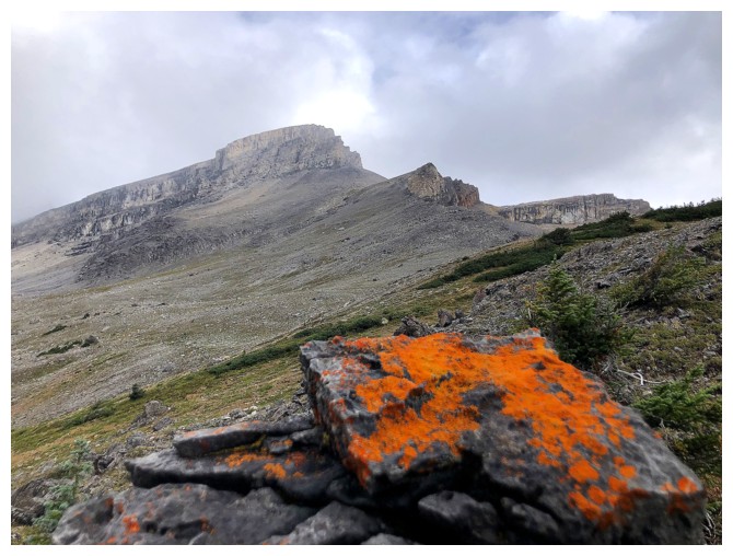
but instead was drawn to a distant splash of red on a wall of rock that was
part of OX’s lower outlier (which must be called “O Peak”!). Recalling a
similar experience on Molarstone Mountain, several years earlier, I was not
going to be denied a closer look at the rock.
Once in the hanging valley, the trip took on
a “play it by ear” approach. I did toy with the idea of trying to ascend the
outlier immediately south of “OXO Peak” (which I decided to call “OX Peak”),
but instead was drawn to a distant splash of red on a wall of rock that was
part of OX’s lower outlier (which must be called “O Peak”!). Recalling a
similar experience on Molarstone Mountain, several years earlier, I was not
going to be denied a closer look at the rock.
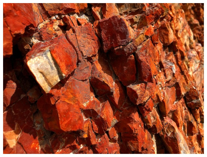
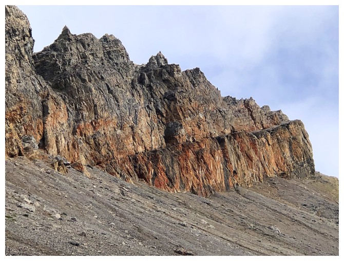
While the rock wall was not a striking as the
Molarstone’s rock pinnacles, the colours of the highly oxidized rock were every
bit as vibrant and pleasantly out of place. Once past this eye-catching
section, the ridge was easily reached. From there, a somewhat precarious
traverse on the exposed east side of the ridge allowed me access to the
highpoint below OX Peak.
This is where the real scowling started! On a
clear day the view from this location would have been extraordinary – much better
than I originally thought it would be. Unfortunately, the cloud cover
persisted, along with my bad attitude!
Not wanting to retrace my steps across the dicey
east face, I descended a fair distance towards the approach valley, downclimbed
a weakness in the aforementioned red rock band, and slogged my way back up to
the ridge. There was still plenty more to explore and the lousy weather, fortunately
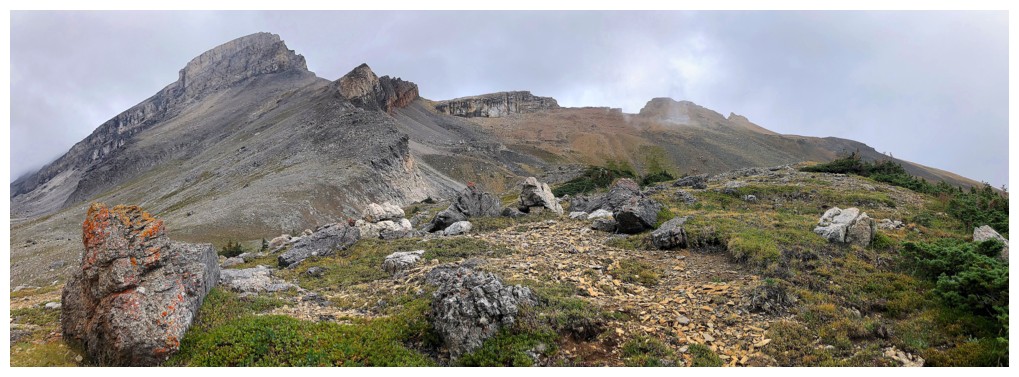
would not be dampening that spirit. Another minor highpoint resided at the southeast
end of the ridge, and it too sported a magnificent panorama.
The last order of the day was a finding a
descent route. Following the ridge down in the southwest direction towards the
Mosquito Creek Trail appeared to offer a straightforward path and it did. As always,
the final few kilometres of the Mosquito trail seemed to drag on longer than expected.
A great day of exploration, but I’ll definitely
be returning when the skies are clear.
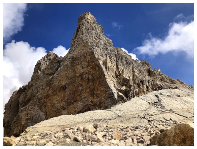
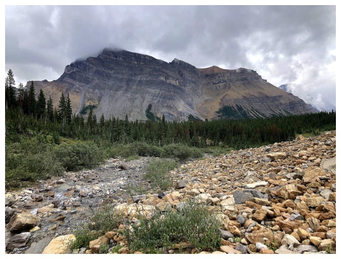
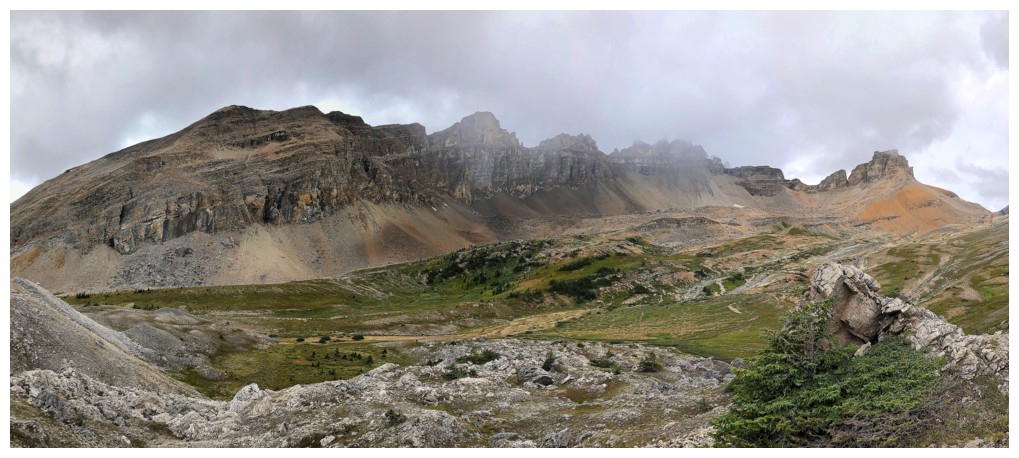
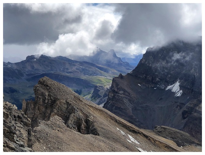
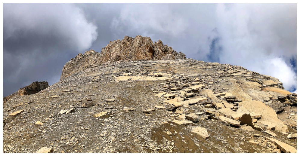
First and distant look at the objective
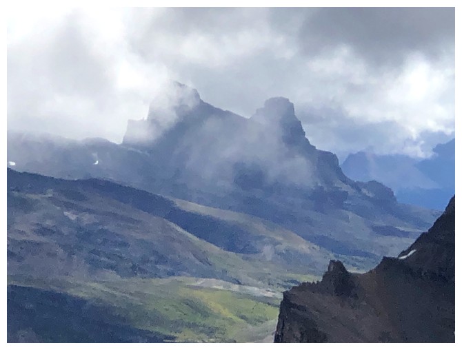
Closer. The peak at the far left is OX Peak. O Peak is second from the right.
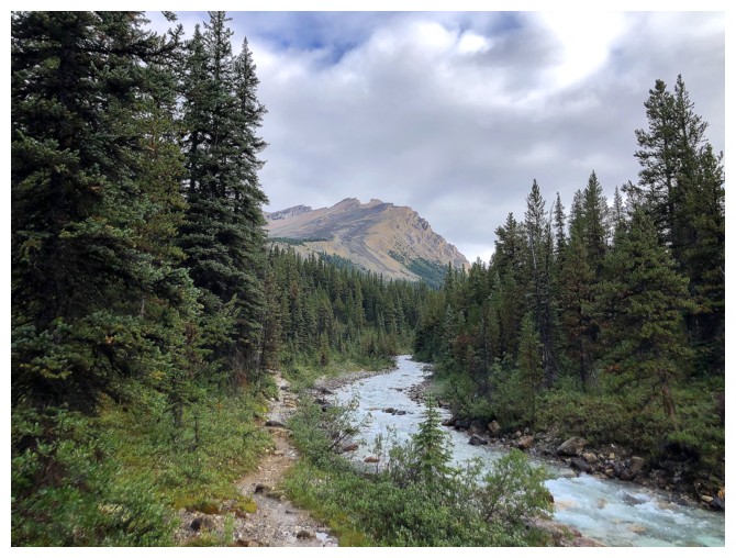
The creek that leads to the hanging valley
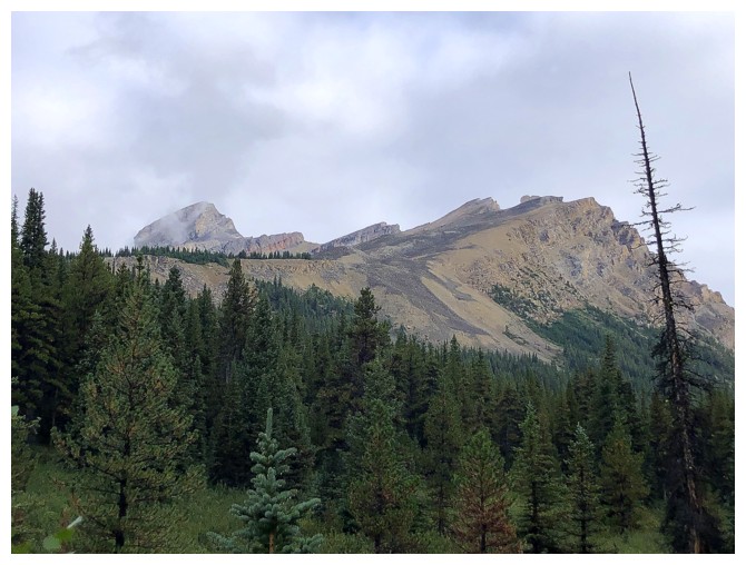
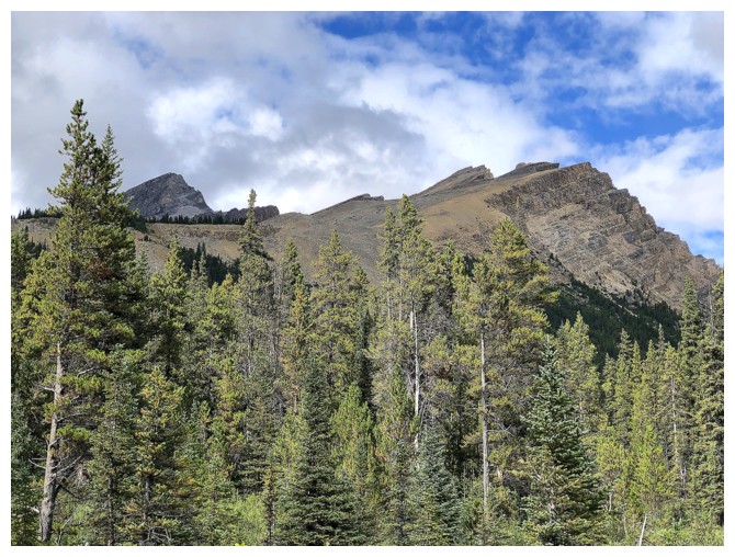
Noseeum Peak
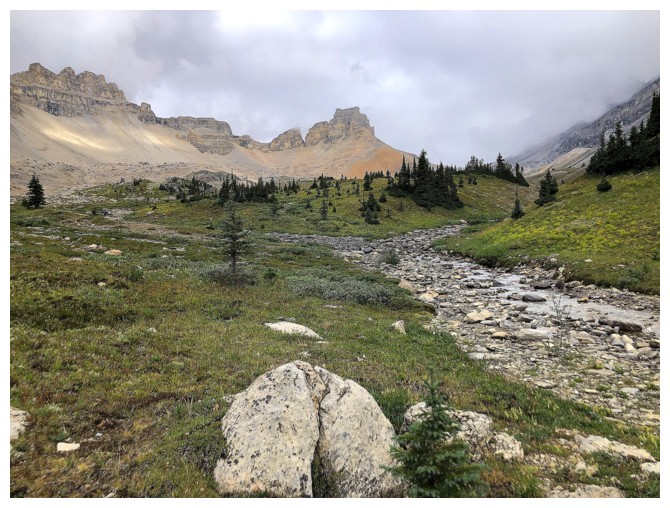
In the hanging valley
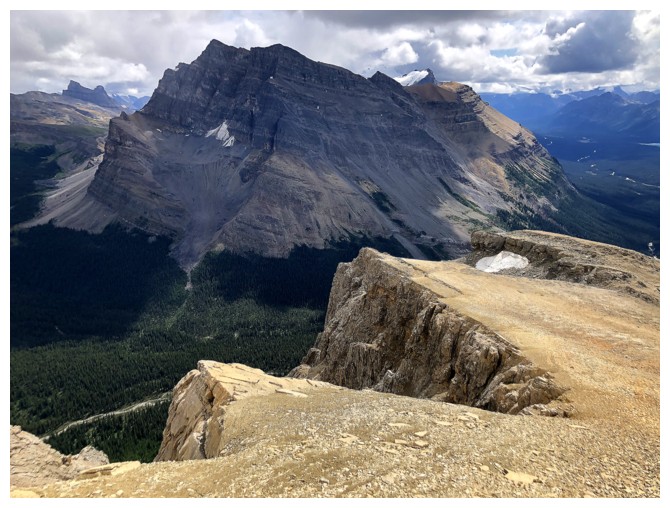
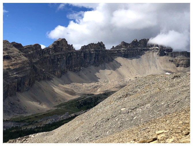
The impressive northeast outlier of Dolomite Peak
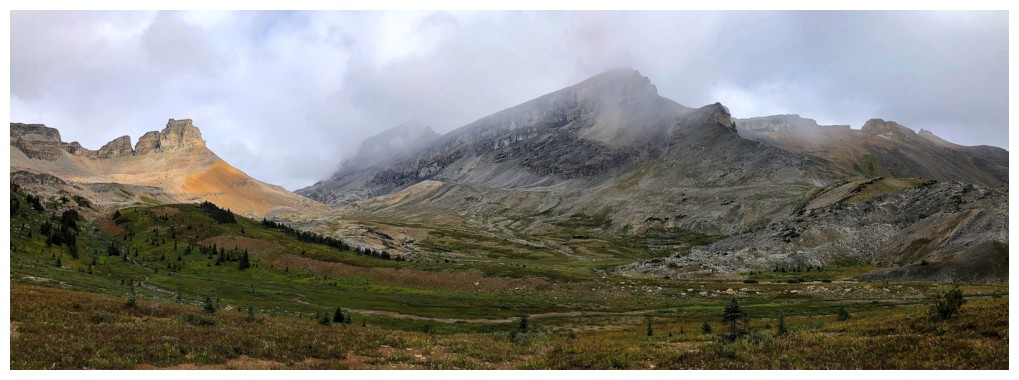
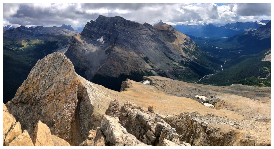
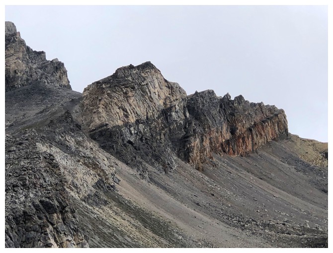
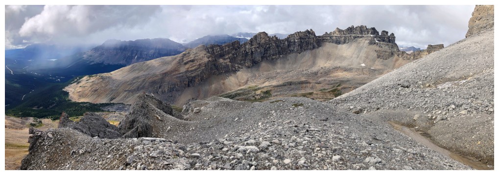
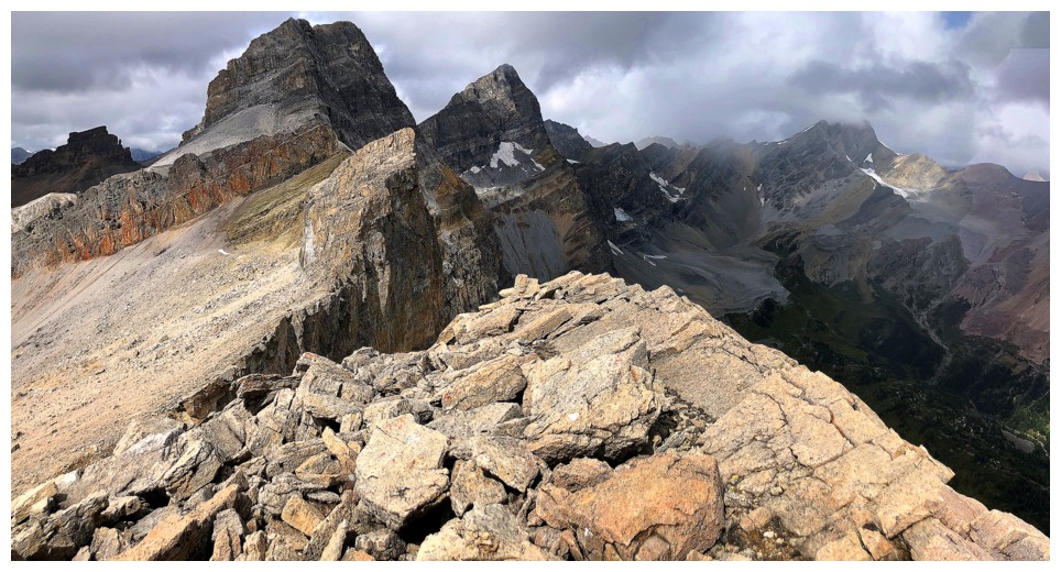
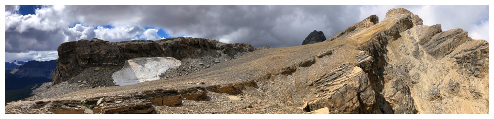
OXO Peak (just left of centre), OX Peak (just right of centre), and O Peak at the right
The long and jagged ridge of Dolomite Peak
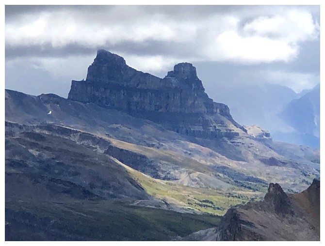
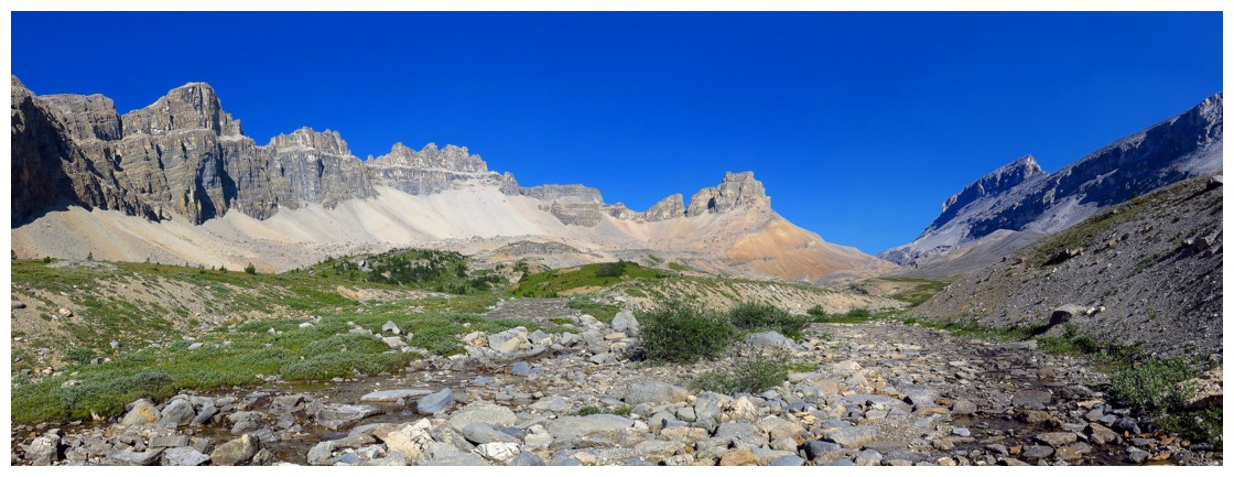 Similar photo taken on a perfect weather day in 2015
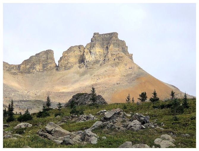
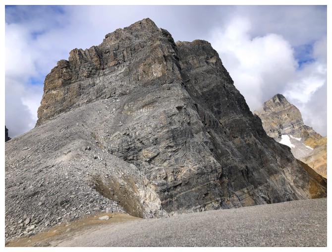
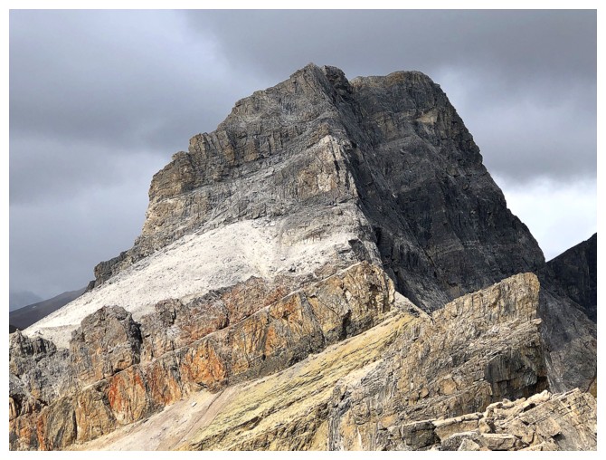
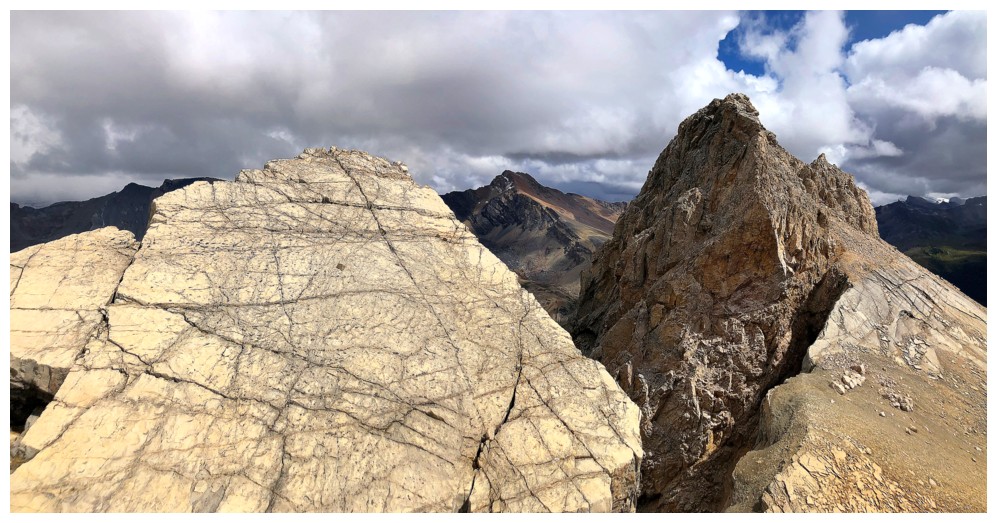
OX Peak
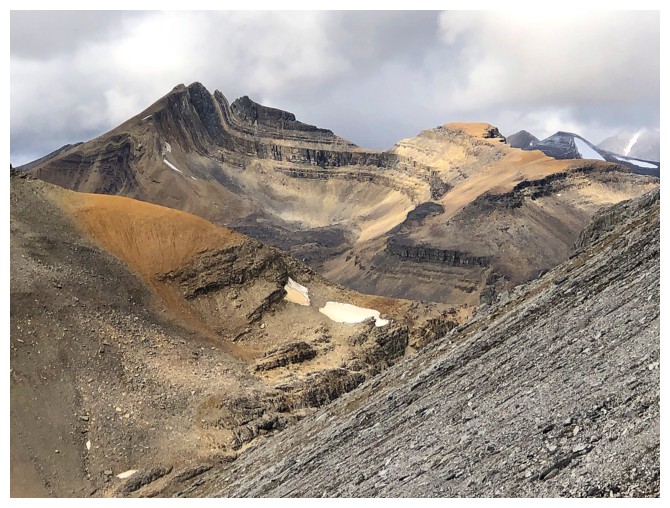
OX and O
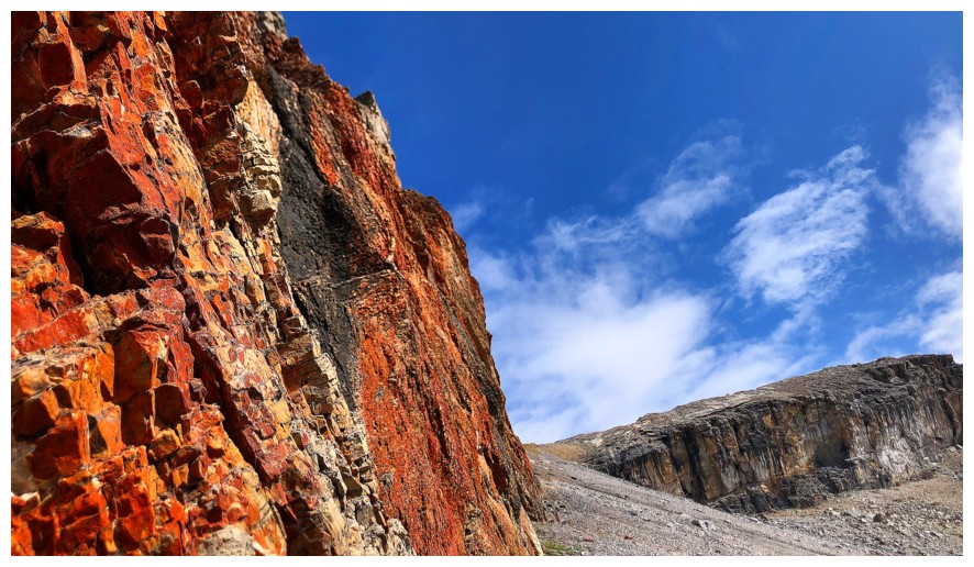
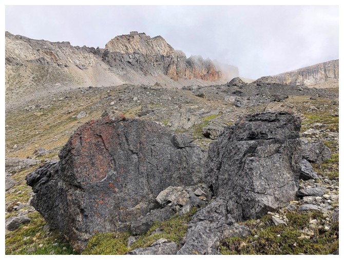
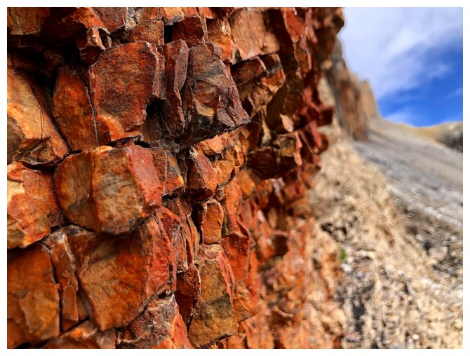
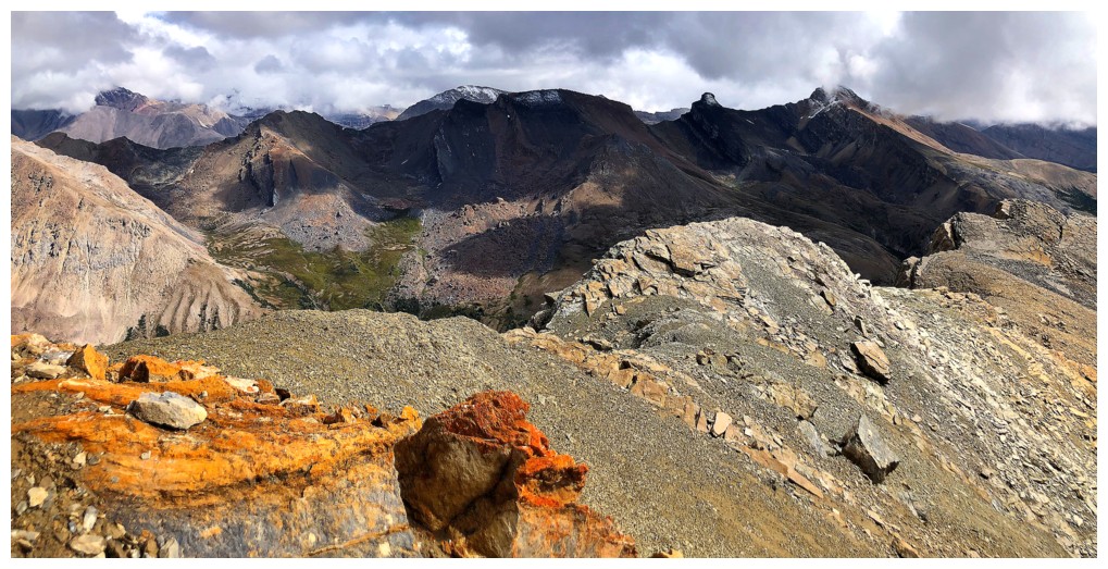
The splash of red rock that drew my attention
Heading up towards it
Looking better
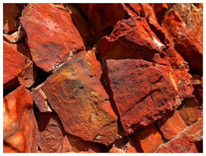
At the base of the red rock wall and ready to see what it has to offer
Ooo!
Ouch!
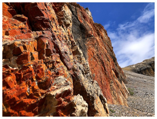
Luckily, for this stretch of the trip, the Sun was out and shining on the colourful rock
You'd think I was in Waterton!
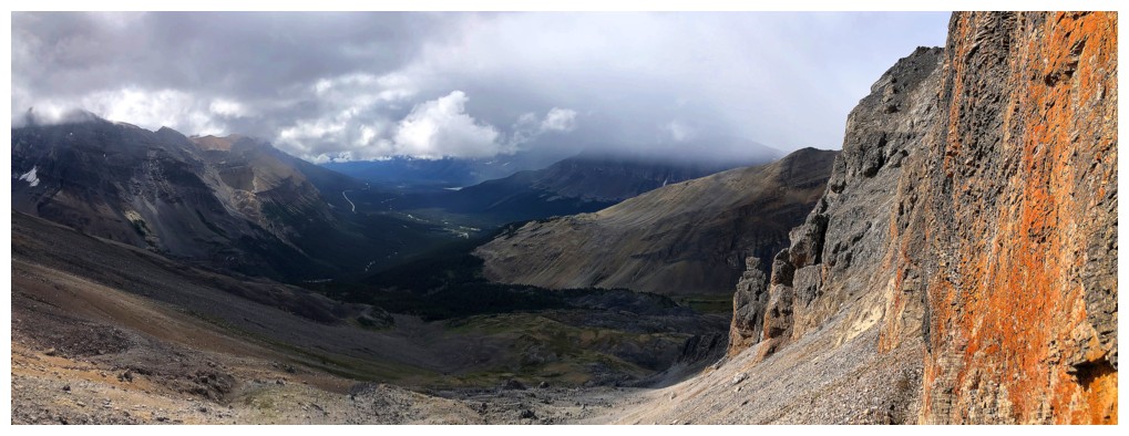
Gloomy conditions still persisting to the southwest
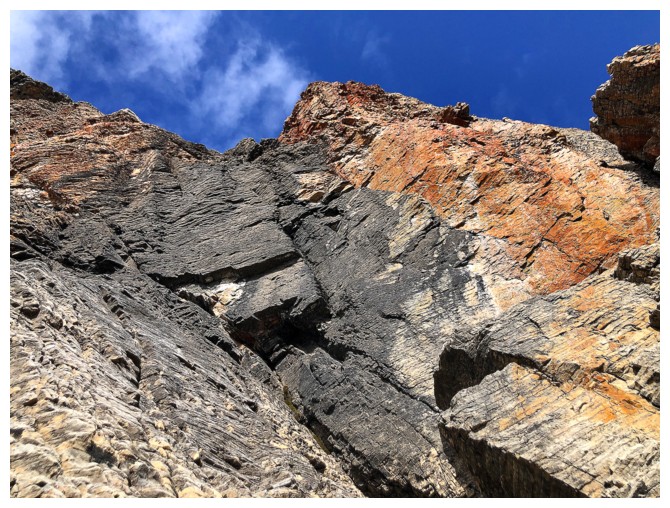
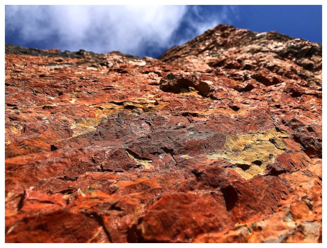
Nice contrast of oxidized and non-oxidized rock
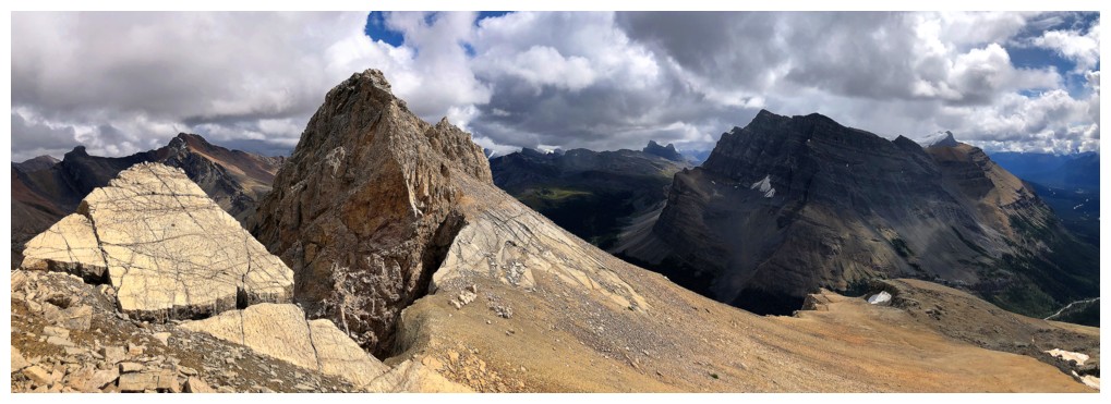
Approaching the ridge at the far left
On the ridge, looking down into the valley to the northwest
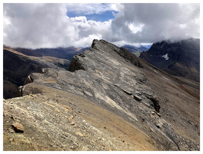
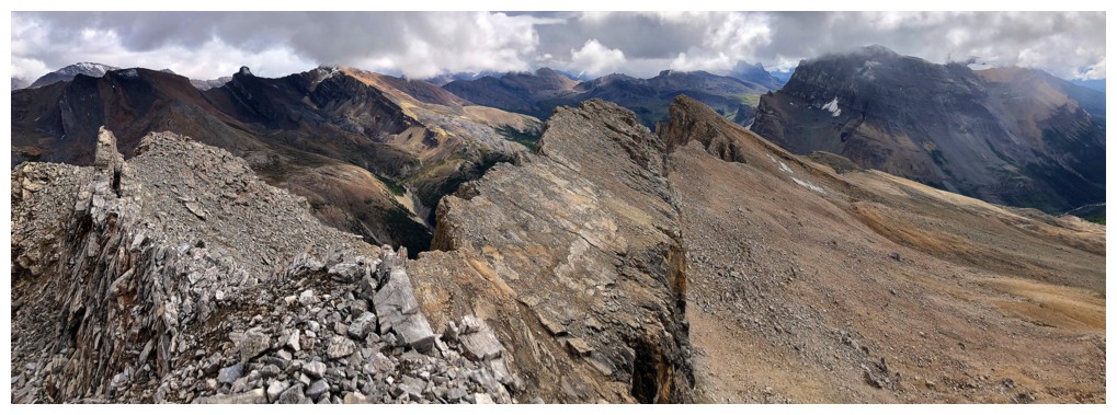
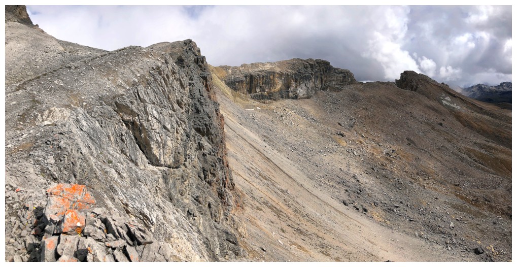
Looking south along the ridge
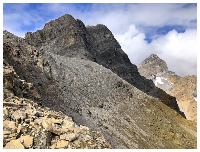
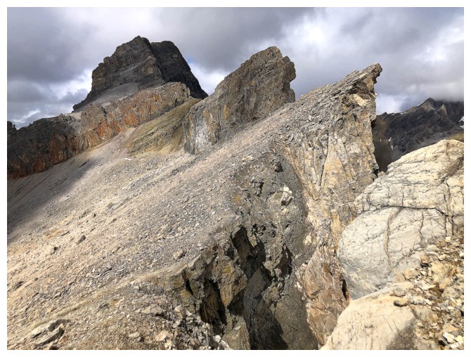
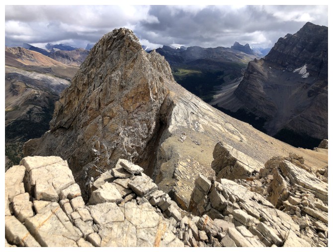
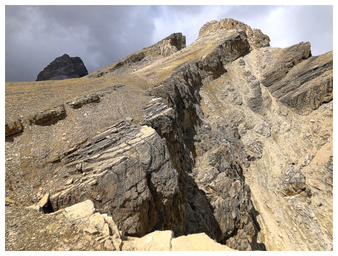
Looking north to OX Peak and OXO (right) and the sketchy traverse on the east side of the ridge
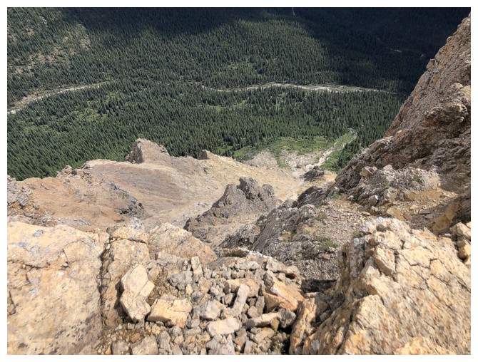
The reason why I had to do the sketchy traverse
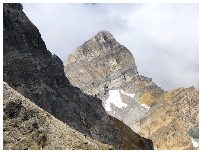
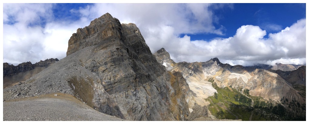
OXO
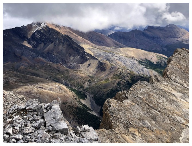
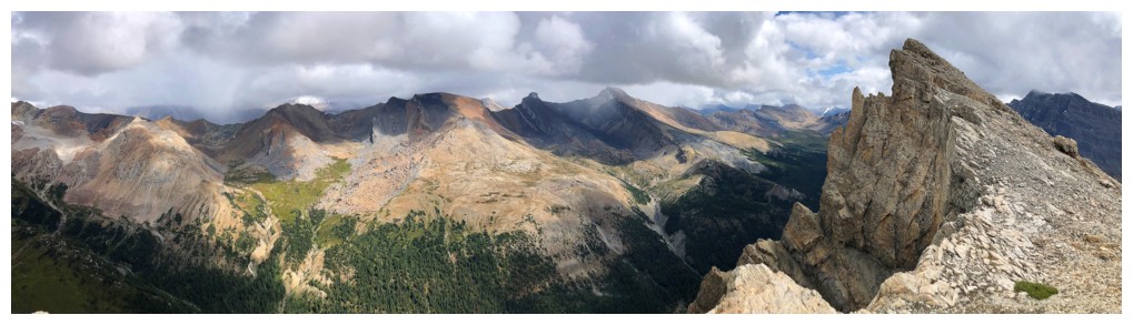
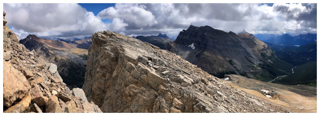
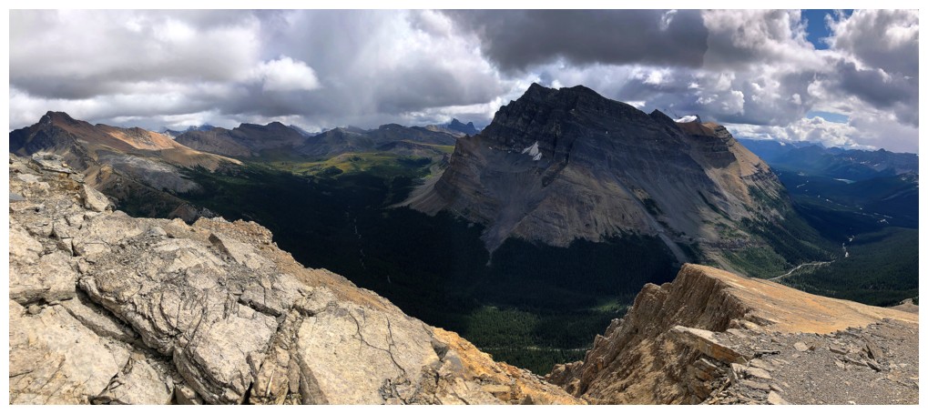
Great view to the east that would be remarkable if the skies were clear
I considered attempting OX from here, but chickened out
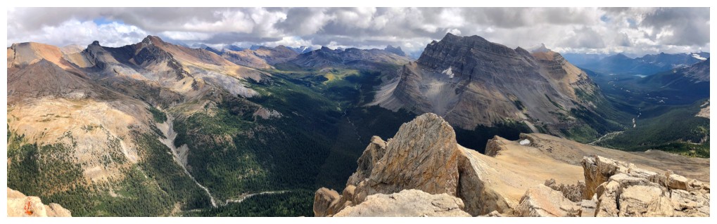
View to the southeast

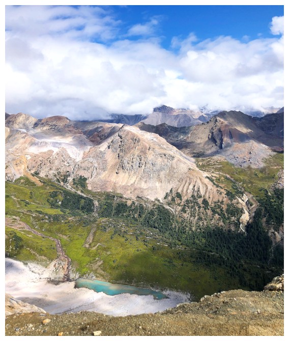
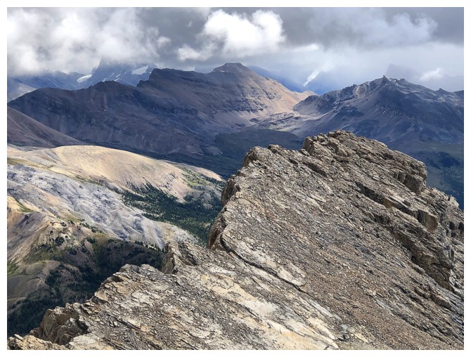
Quartzite and Ramp peaks
Mosquito Mountain
Distant Molar Mountain in the centre
Close-up of Molar Mountain (left) and Molar Tower (right)
Molarstone Mountain
Another patch of blue sky to the north was cause for optimism
The view to the west was not!
Cirque Peak
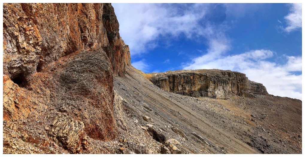
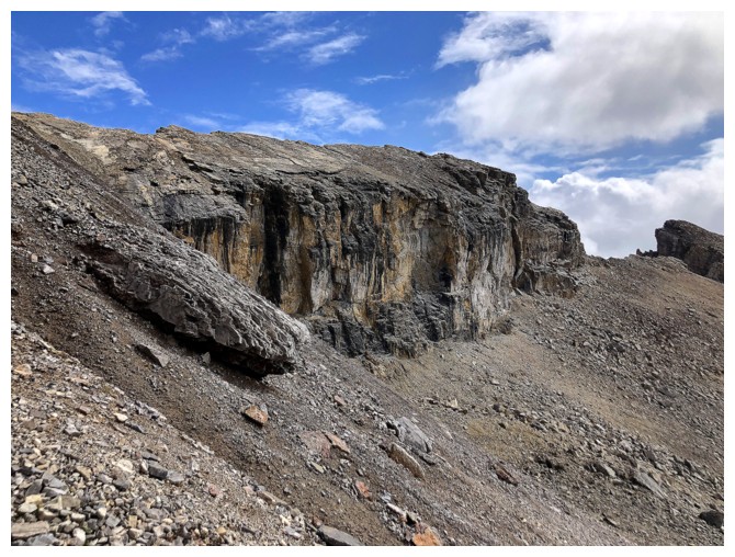
Trying to find an easy way back down to the red rock so I can return to the ridge

Found one
Parting look at the highlight of the trip
Back on the ridge. It's straight down on the east side.
Heading for the summit of O Peak at the right
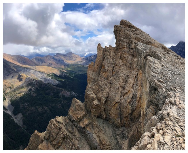
Almost there
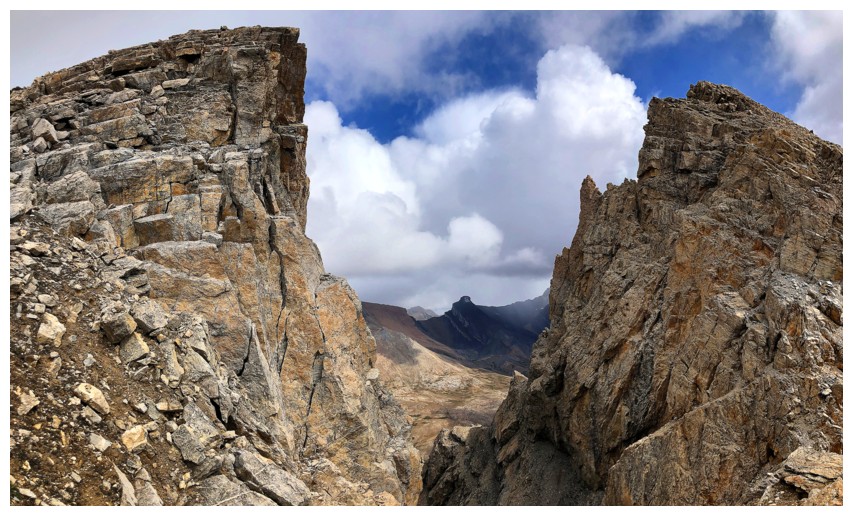
Big gap in the ridge between two highpoints
Looking back
Same as above
A little clearing below Molar Mountain, but it was short-lived
Still a little obsessed with OX
The next highpoint is reached with ease
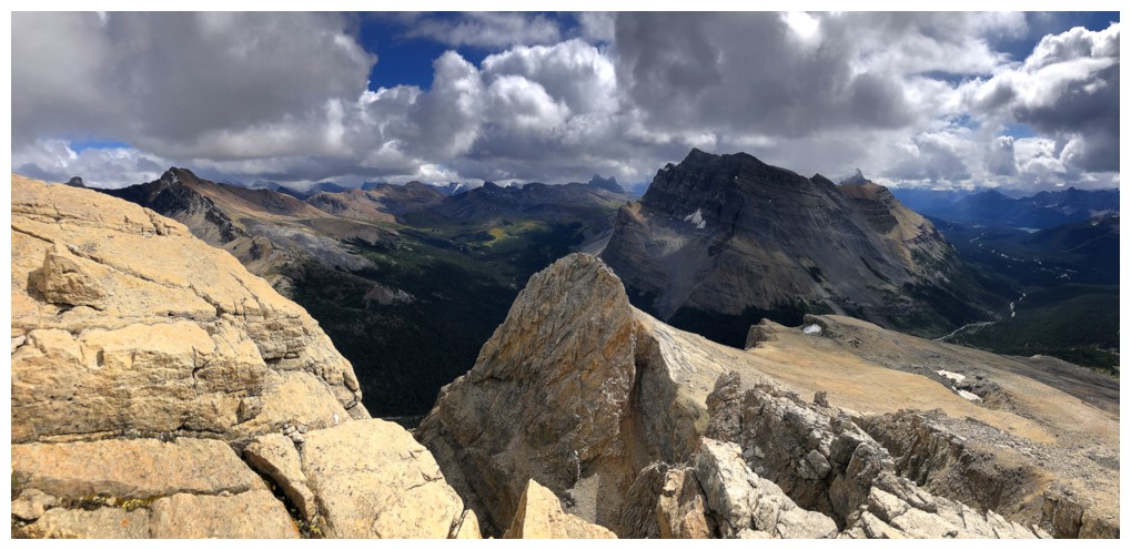
View to the south from this highpoint
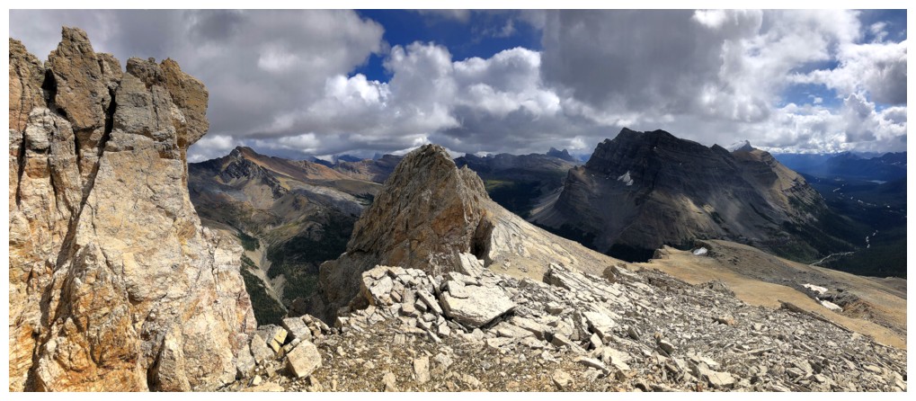
There are still a few more highpoints and points of interest along the ridge to check out before descending
More unnecessary blue sky teasing!
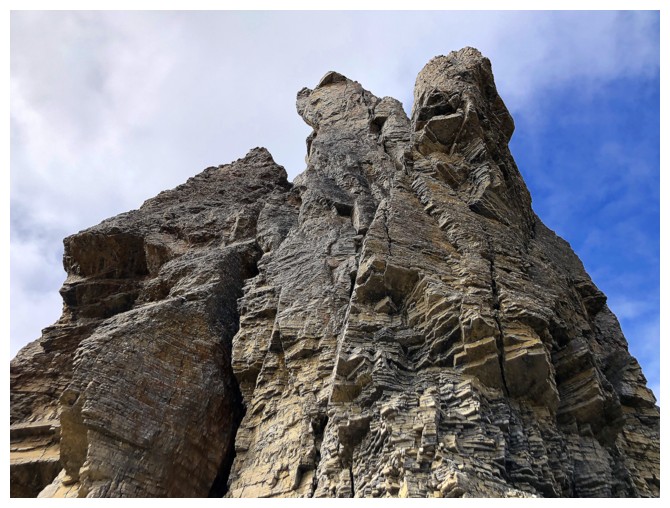
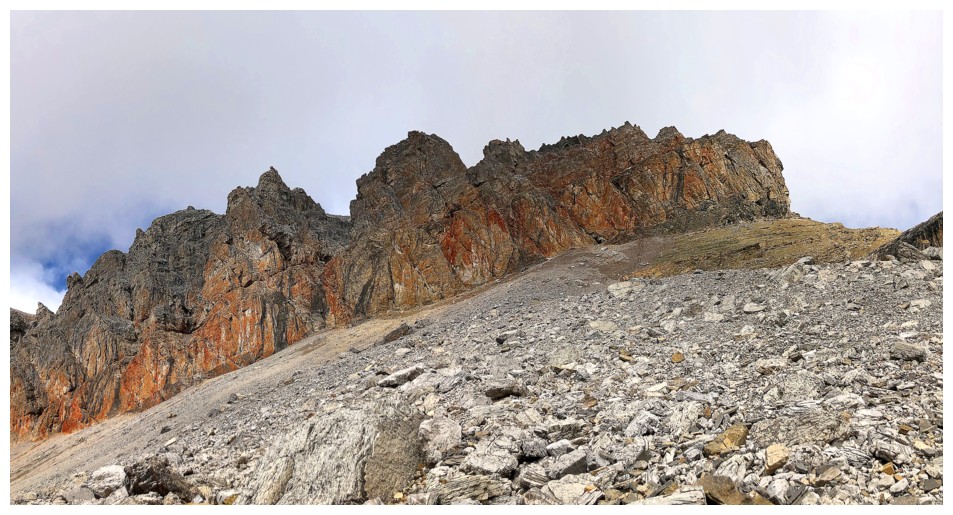
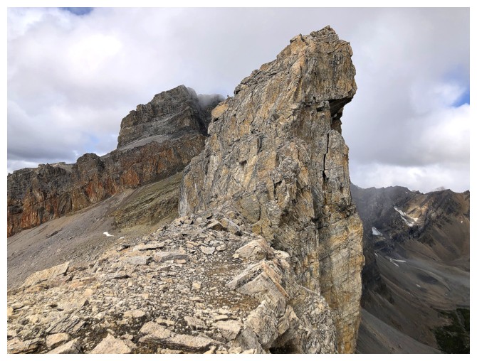
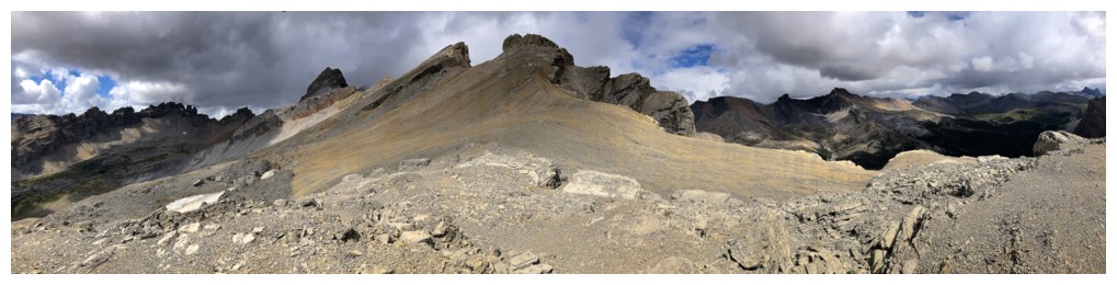
Approaching a very striking feature on the ridge
Super cool rock along the way
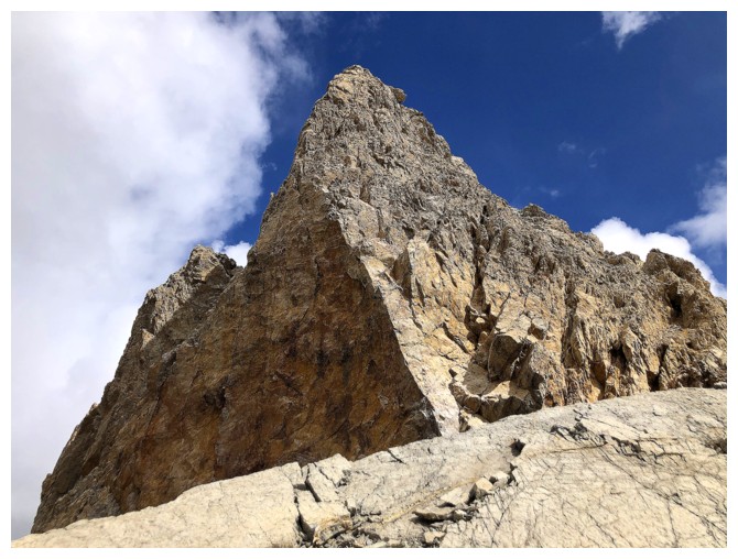
The feature looks very impressive from this angle
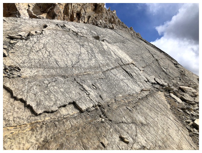
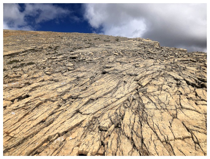
Cool, slabby rock
Looking back up at the striking feature
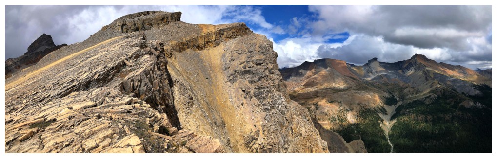
The descent route follows the ridge
Looking up the descent ridge to OX, O, and other highpoints
Same as above but close-up
There was a scree ramp that appeared to offer an easy descent on the
southeast side of the ridge, but I stuck to the southwest side
Threatening clouds over Noseeum
The south side of the mountain is very steep
More interesting rock
Clearing over Dolomite, but it's too late!
Looking back at the O Ridge
The End
LOG