The Orphan II
February 28, 2021
Mountain height: 2576 m
Elevation gain: 870
m
Ascent time: 3:40
Descent
time: 1:55
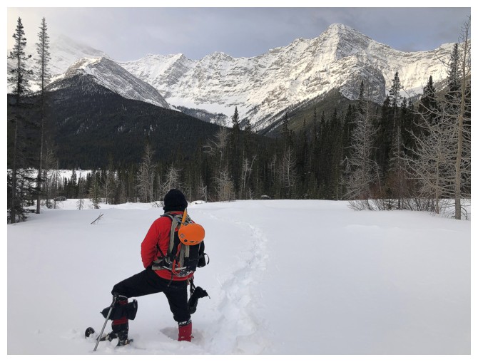
Snowshoeing with Mark and Dan.
Having failed to the make the summit of The
Orphan several years ago, due to extreme winds, another attempt was in order.
The trip is well described in Gillean’s Daffern’s Kananaskis Country Trail
Guide and although the 2013 floods pretty much obliterated the trail, the route
is straightforward and easy to figure out.
 Mark suggested we give it a go and his
instincts were bang on. Windy conditions were a forgone conclusion but looking at
the forecasts I didn’t think we would be seeing a single ray of sunshine –
while we didn’t enjoy perfectly clear skies, they were clear enough to render
it an exceptional trip.
Mark suggested we give it a go and his
instincts were bang on. Windy conditions were a forgone conclusion but looking at
the forecasts I didn’t think we would be seeing a single ray of sunshine –
while we didn’t enjoy perfectly clear skies, they were clear enough to render
it an exceptional trip.
What else could contribute to our enjoyment
of this trip – how about a trail-breaking machine named Dan Carreiro! Dan had
completed his first trip on snowshoes last year – a spectacular day on
Commonwealth Ridge. Mark and I were delighted to have his company and his mad
trail-breaking skills.
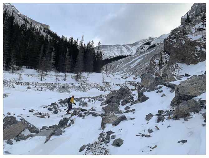
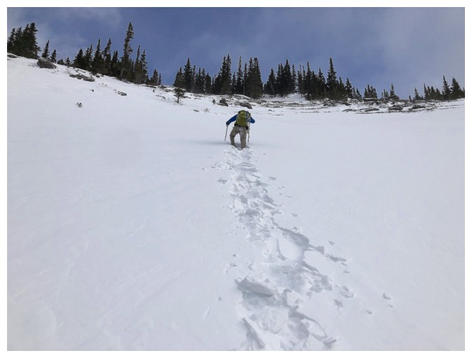
And they were needed almost right from the start! I
broke trail for a whopping 200 m before Dan volunteered to take over. From that
point on he did almost all the trail-breaking, including up a long and particularly
steep section of very deep snow – definitely the crux of the trip. Cloudy skies
persisted to the west, but things were looking good in the direction we were
heading.
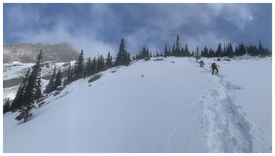
We didn’t stop for a break at Boulder Pass,
the wind and very cold temperatures prompting us to keep moving. Reaching the
summit of The Orphan was easy from the Pass, save a minor detour to get around a hard
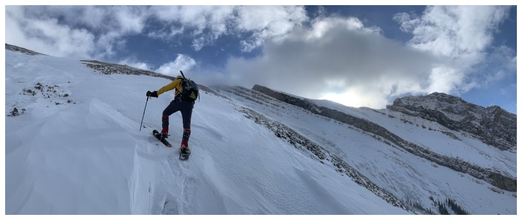
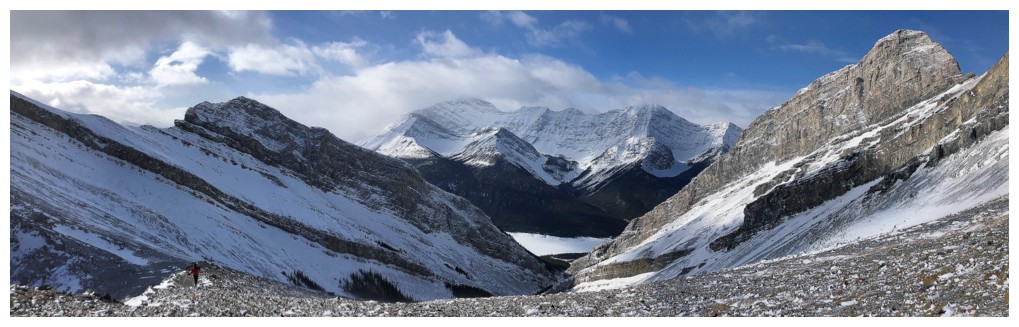
snow patch above a significant drop-off. At this point the views and scenery
really reached the next level. Highlights: the striking form of an outlier of “Big
Rim Ridge”, beautiful curves of wind-blown snow, the dramatic outline of The Rimwall,
and a stunning view of The Three Sisters. Summit views were likewise spectacular
and far exceeded our expectations.
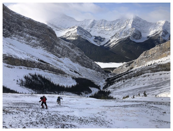
For descent we decided to avoid the aforementioned
steep snow slope and instead stay on the generally snow-free slopes to the
west. We then traversed into another snow filled gully that was far less steep
than our ascent route. This route was scenic, fast, and allowed snowshoe-free
travel all the way back to the main ascent drainage. We finished the trip
back on snowshoes and all in great spirits, having enjoyed every element of
the trip.
Awesome day out and big thanks to Dan for leading
the way.
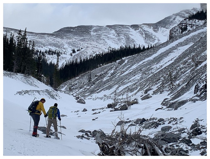
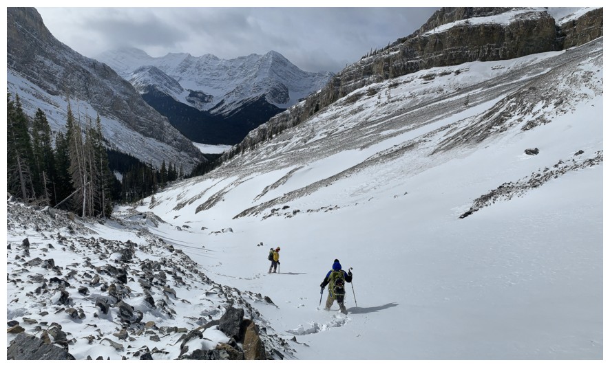
Dan takes over the trail-breaking duties only a few hundred metres from the start
Looking behind us to an old foe - Smoat Peak
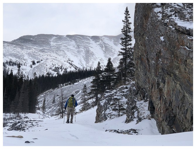
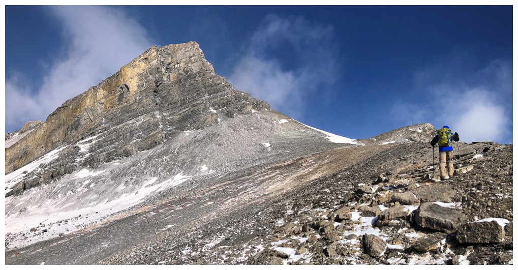
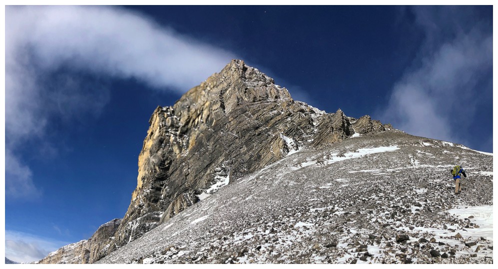
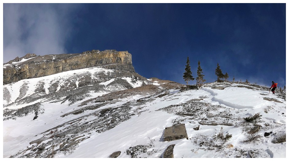
Dan passes an impressive rock face
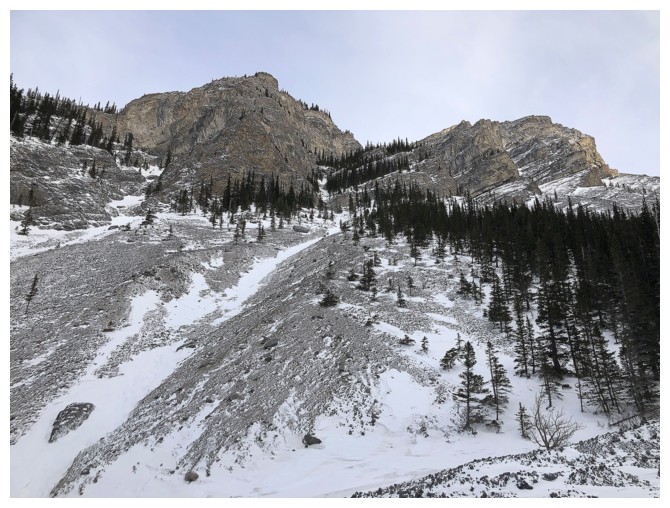
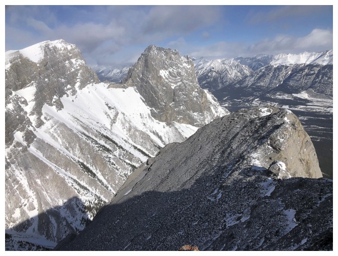
In fact, the ascent features tons of impressive rock faces on both sides of the main drainage
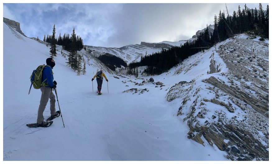
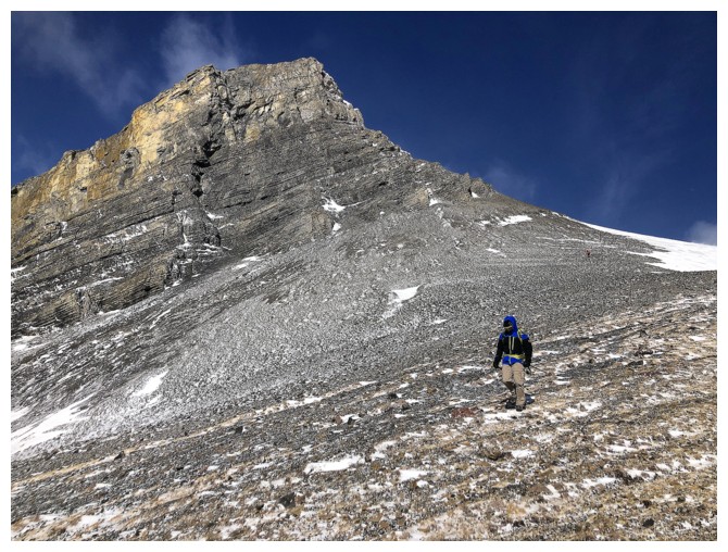
For the most part the snow made the ascent easier than my snow-less first attempt
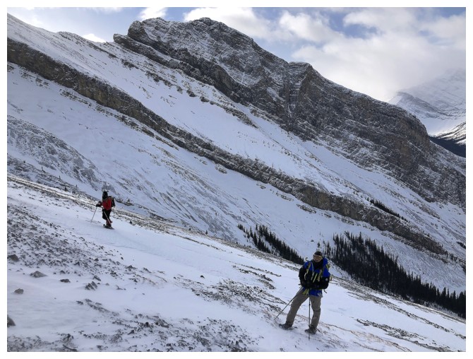
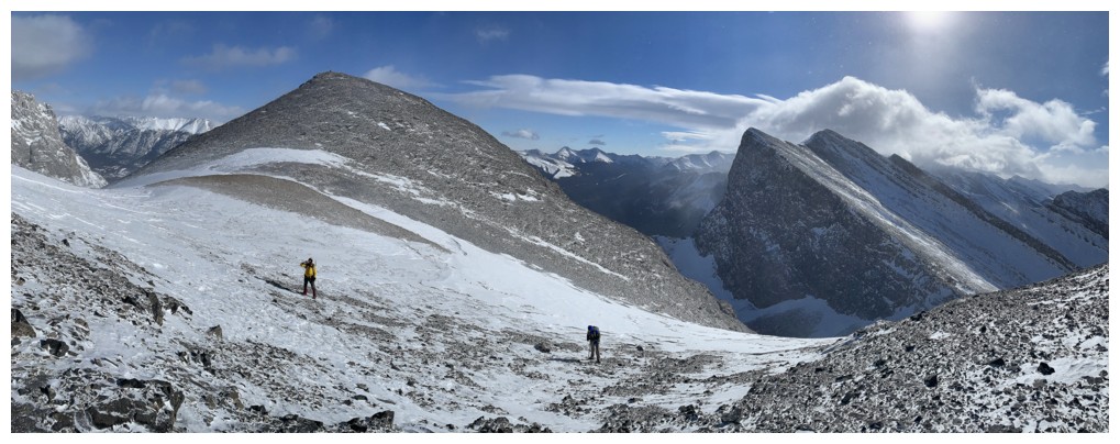
The first destination, Boulder Pass appears at the left
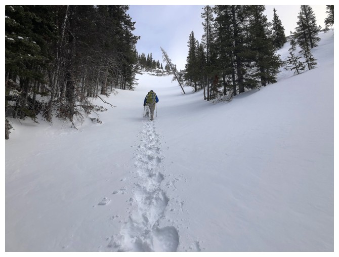
Now onto hard, 100% supportive snow, I graciously (???) resumed trail-breaking duties!
Looking at Smoat again
Post-holing again and Dan is back in the front, doing all the hard work - what a guy!
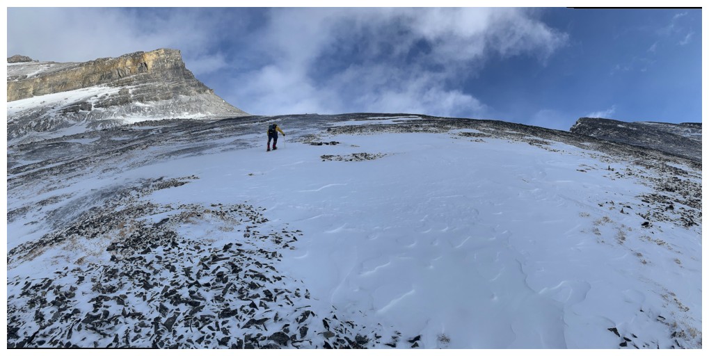
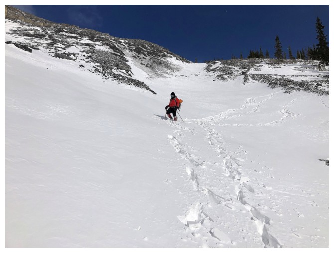
Getting quite steep here
Dan leads the way up the steepest and deepest section
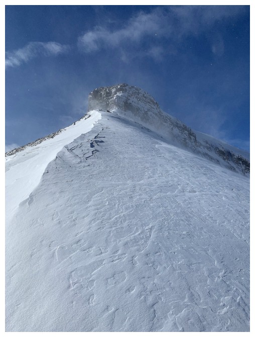
The snowshoes were perfect on this extended section of hard snow above treeline
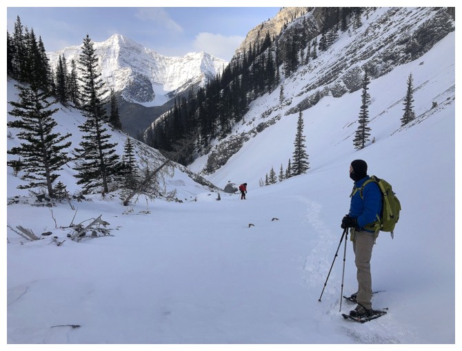
Part of Spray Lake is now visible
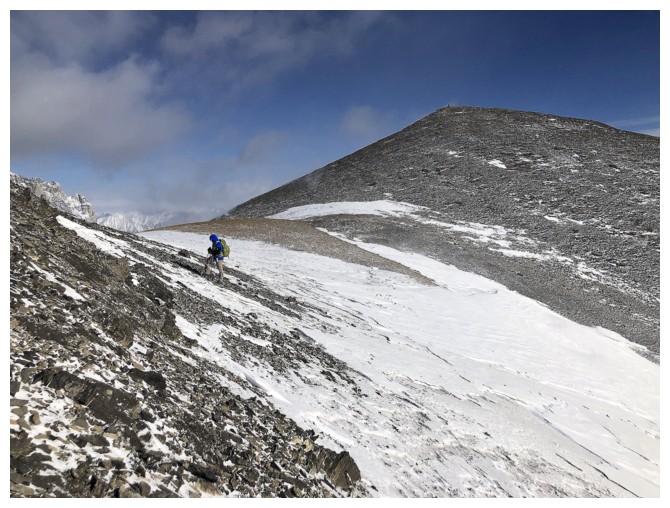
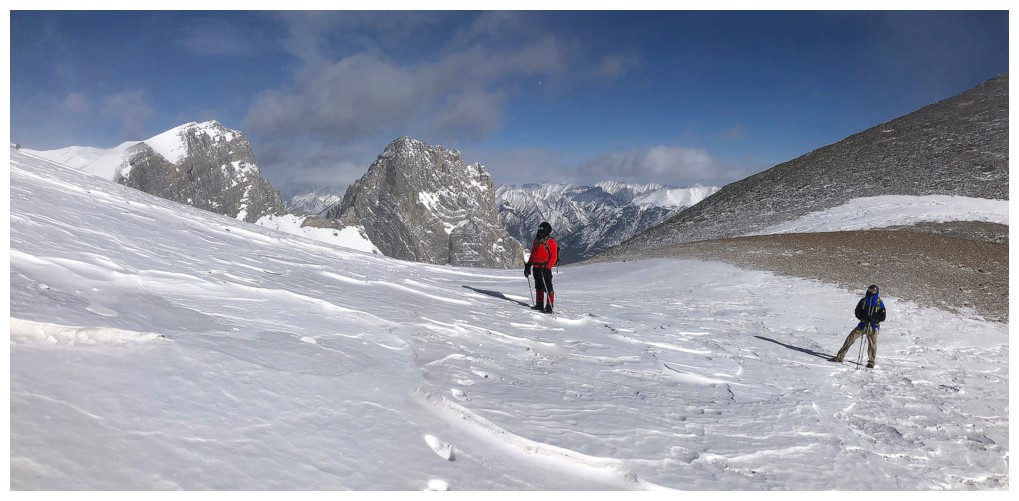
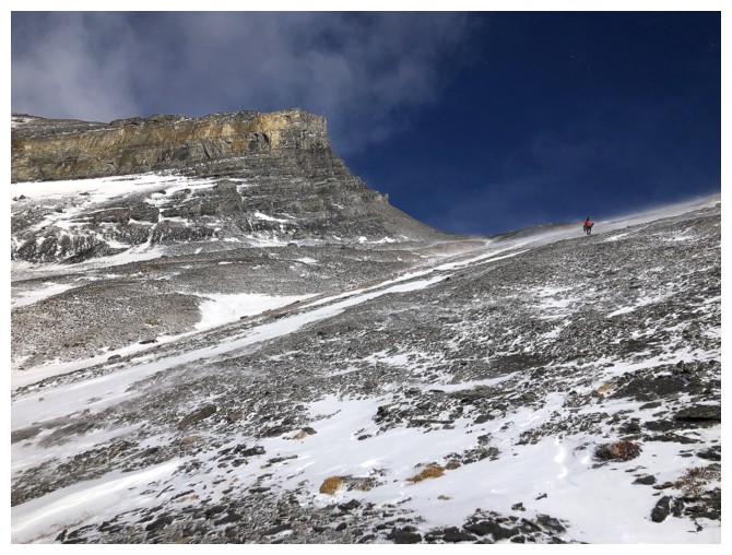
Staying on the snow for easy snowshoe travel. Boulder Pass ahead.
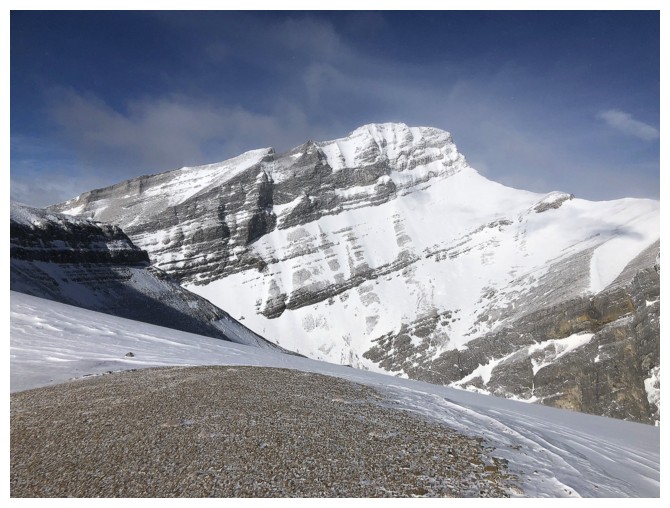
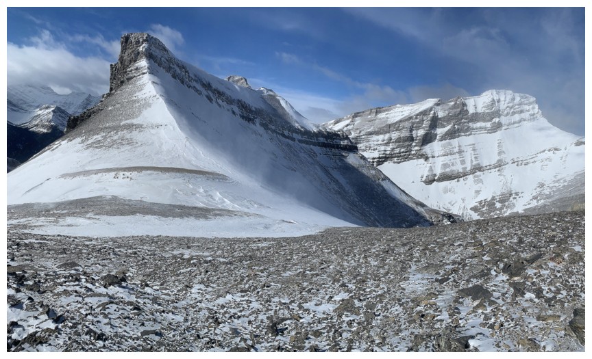
The western outlier of The Rimwall behind us
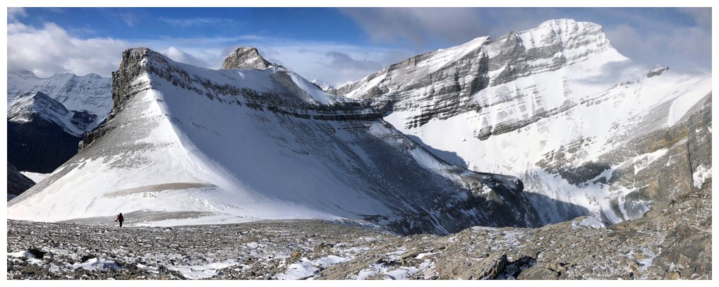
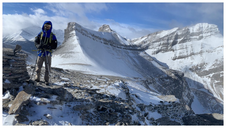
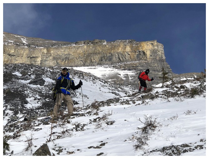
Boulder Pass,The Rimwall, and Mark
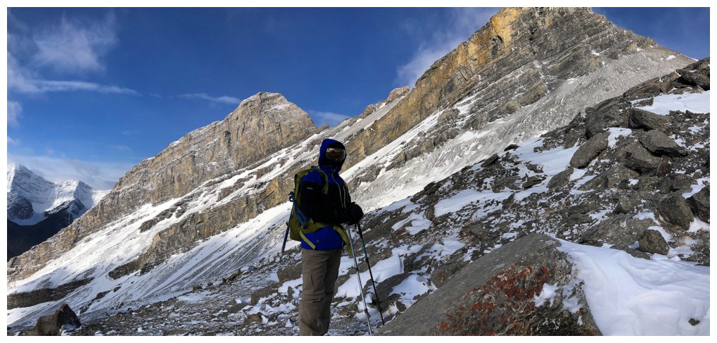
Dan is all wrapped up and well prepared for the vicious wind we will
soon encounter. The peak to the left of Dan is the one we called "Big
Rim Ridge"
Continuing up. The peak at the left is an outlier of "Big Rim Ridge"
and looks quite feasible to reach, using a scree ramp lower down.
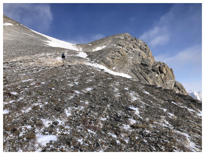
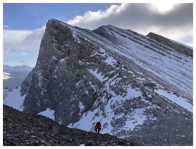
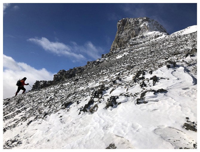
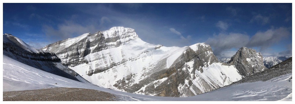
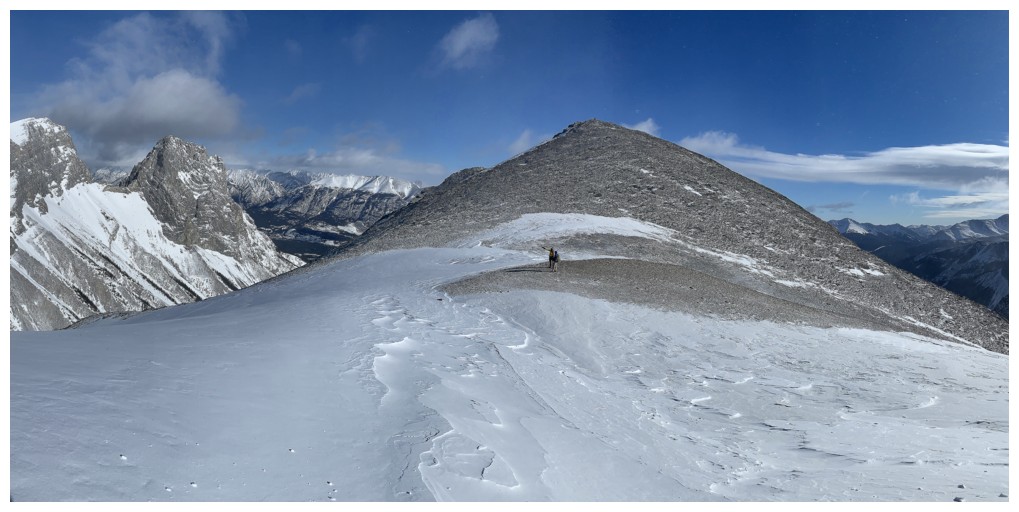
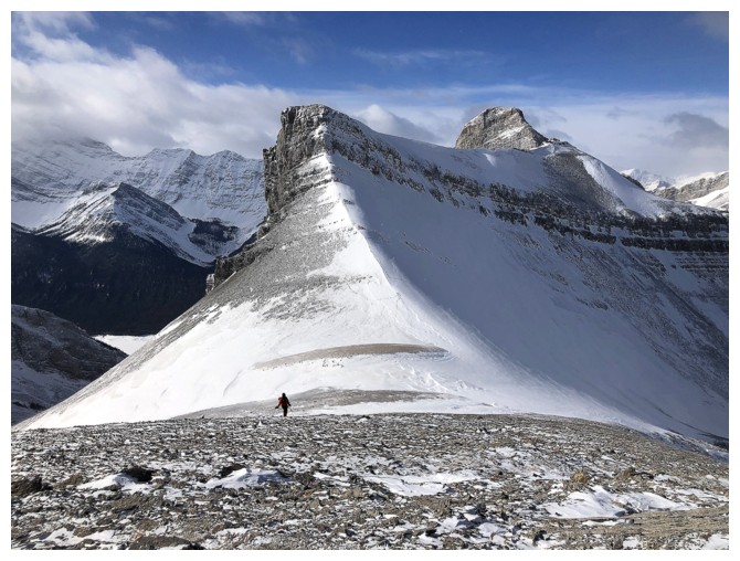
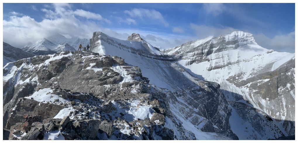
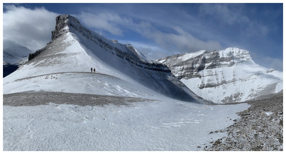
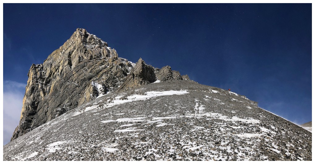
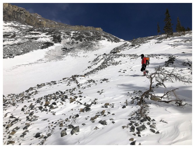
The Orphan dead ahead and looks to be straightforward from here
Views to the west continue to improve
Still looking straightforward but the snow at the left would present an obstacle
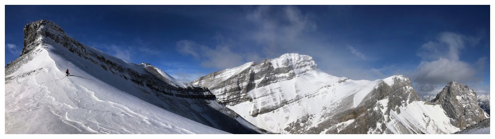
The outlier of Big Rim looks quite dramatic from certain angles
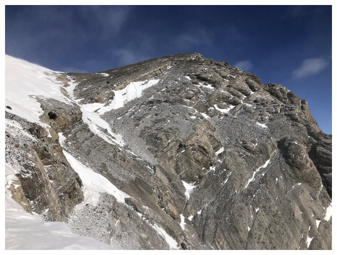
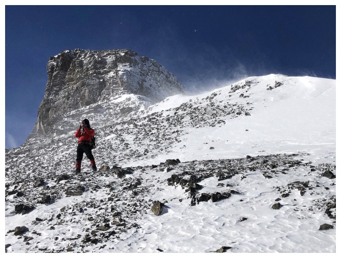
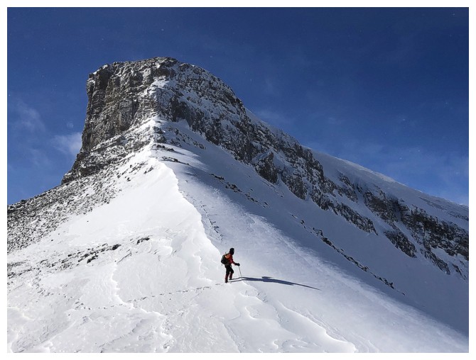
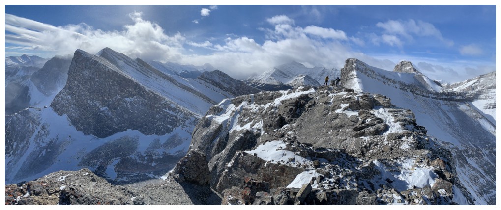
Dan leads us above the snow patch that prevented us from taking a direct route to the summit
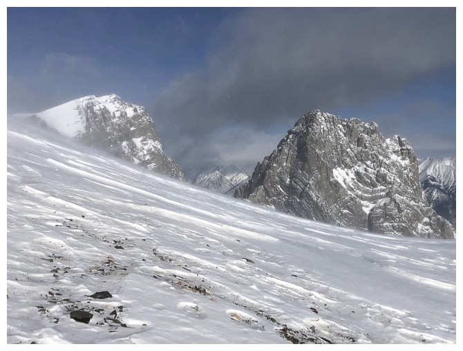
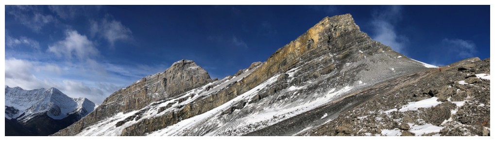
More dramatic views; this time of The Rimwall
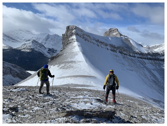
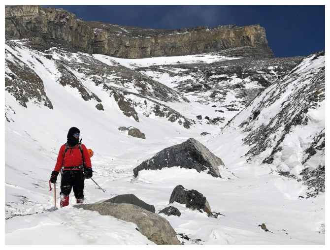
A little bit of scree slogging, but generally the footing was decent (for this part of the Rockies)
The Orphan and The Rimwall
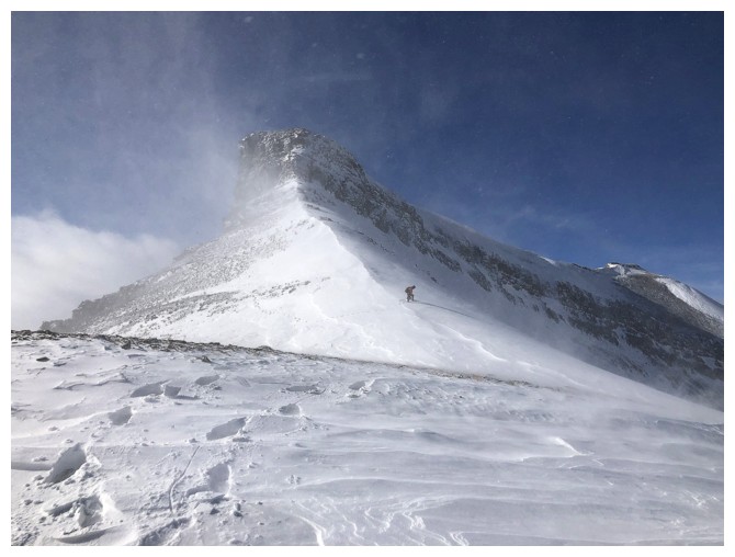
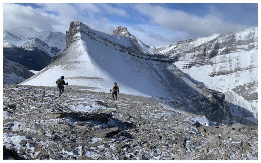
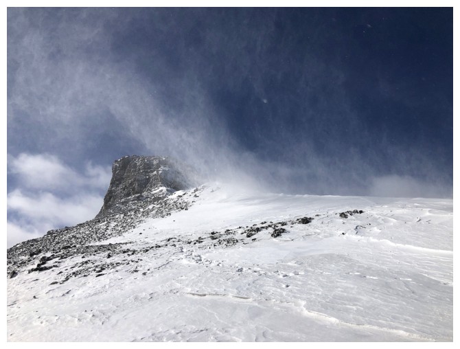
The wind is starting to kick up the loose snow
First enticing view of Middle Sister (left) and Little Sister
Mark was more enticed than I and hiked over the snow shoulder to get a better view
Big Sister
All three Sisters
....with Mark
Dan is heading for the summit
More blustery weather as Mark takes the photo below
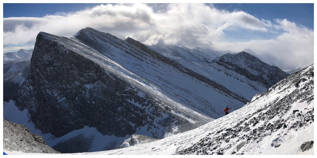
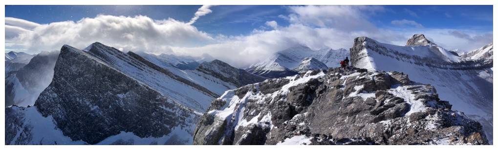
Speaking of dramatic, the view of Big Rim's outlier provided some of the best views of the trip
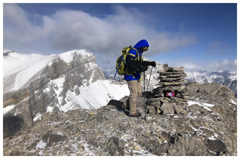
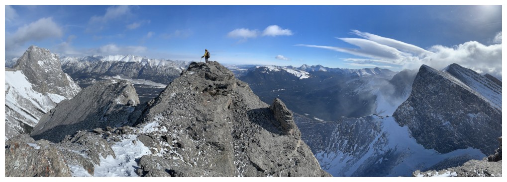
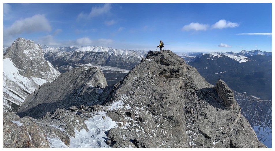
Dan at the summit
Mark completes the ascent
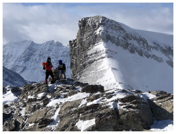
Reunited
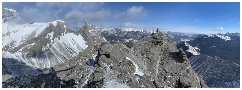
I took a short detour over to a slightly lower summit to check out the view to the east
Little Sister looks like a daunting ascent from every side
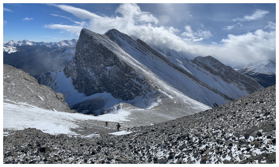
Dan and the striking form of Big Rim Ridge. Big Sister at the far right.
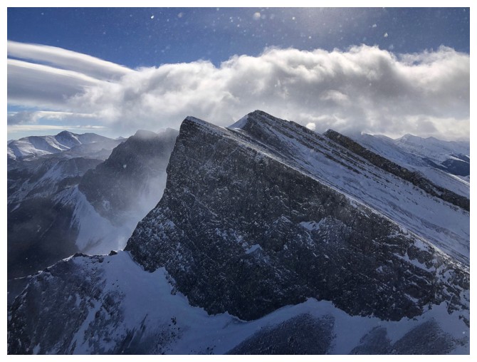
Blustery weather and The Rimwall
Looking back to Dan and Mark from the other summit
Mark and I are trading photos from each other's summit!
But the corresponding views justify it!
Last one
Heading down
Couldn't get enough of this view to the west
The wind picks up
Mark and Dan admiring the outlier of Big Rim Ridge
Loved the views of The Rimwall throughout
Big Rim outlier and Mark (barely visible near the right)
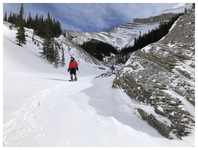
Some gentle terrain before things get steep again
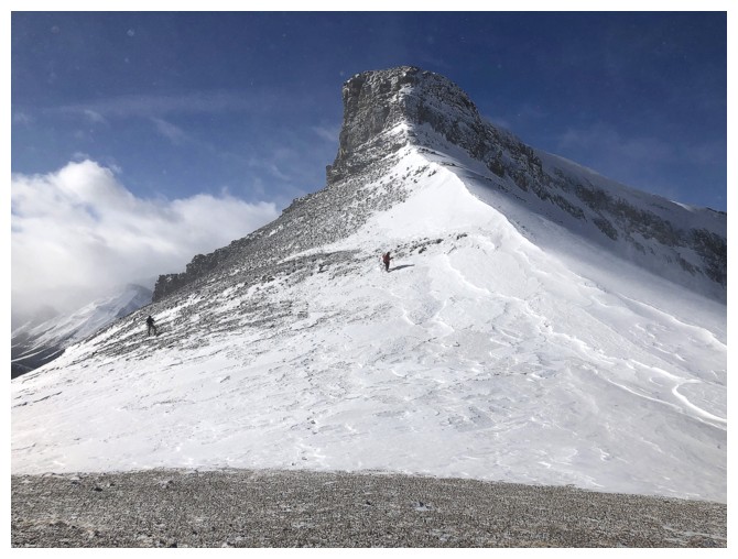
Big Rim Ridge (just left of centre) and its outlier. The outlier is
lower than the true summit, despite appearances from this angle.

Dan leads the way down steeper terrain. We came up the left side but will descend the right side.
The outlier also looked dramatic throughout
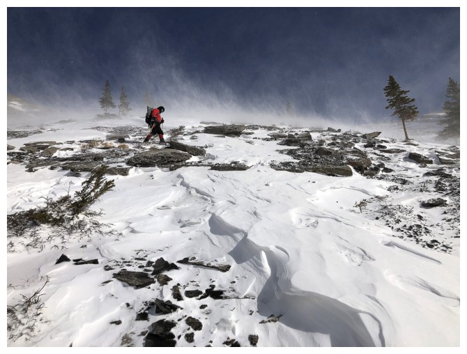
We haven't escaped the wind and blowing snow yet
Carefully picking our way down steeper and sometime slippery terrain
Mark traverses into the other gully
Dam and I are already in the gully and heading down
Unfortunately it wasn't steep enough to glissade.
Near the bottom
Snowshoes are back on
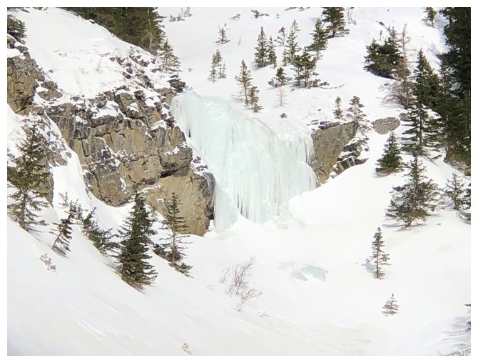
A small frozen waterfall.
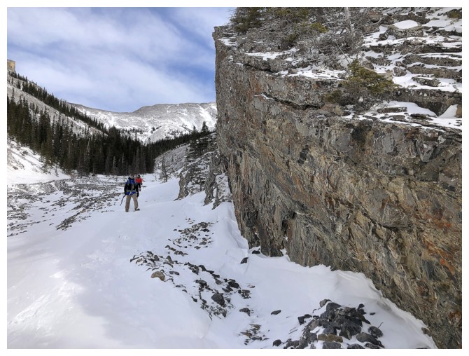
That impressive rock face again
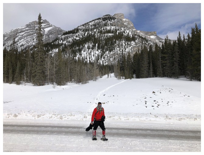
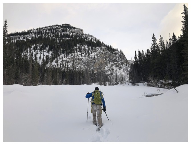
Back at the start of a super rewarding trip.
The End
LOG