Prairie Bluff
April 13, 2008
Mountain height: 2258 m
Elevation gain: 700 m
Ascent time: 4:30
Descent time: 1:50
Scrambling and a little mountaineering with
Mark.
Prairie Bluff could very well be the most
interesting mountain in the entire Castle Crown area….that’s right!!! That
lowly, nondescript, lump of rock sitting right at the front of the Front Ranges
is definitely a little gem of the Southern Canadian Rockies…..I kid you not!!
Perhaps the above is a little dramatic, but
we certainly didn’t expect much from this trip and got infinitely more than
that. After the previous day’s 12 hour stint on Victoria Peak/Ridge, something
short and easy was our preference. Prairie Bluff seemed perfect. Although there
is a gas road going almost all the way to the summit, on the way to Victoria Peak the previous day, we had seen a
potentially more interesting route directly up the face of one of several
outliers of Prairie Bluff’s main summit. From a distance there appeared to be
some interesting layers of rock and we were both keen to get a closer look.
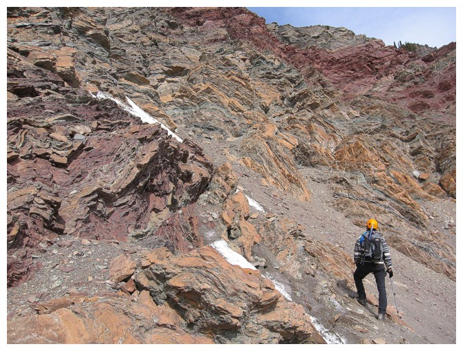
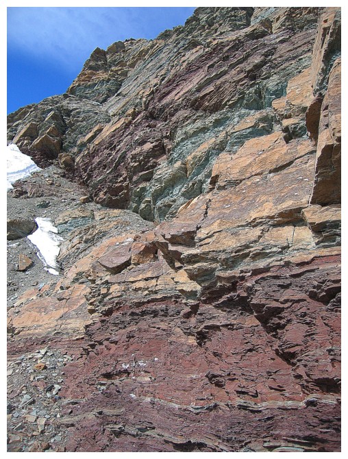
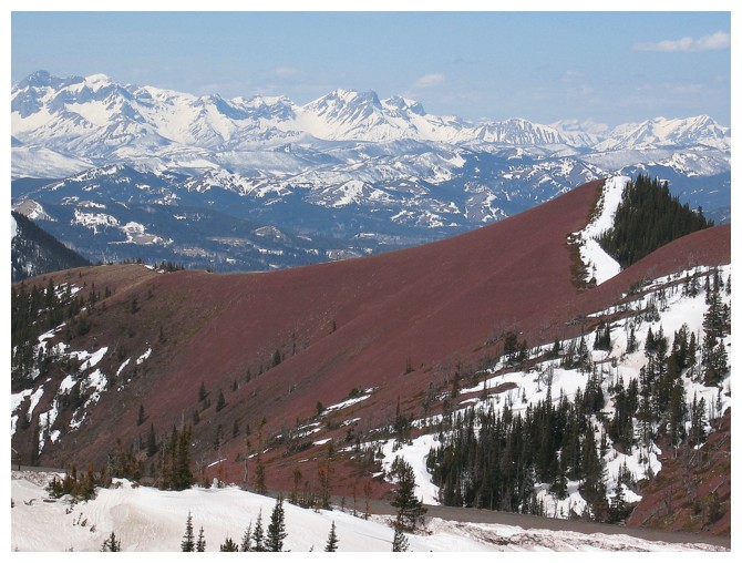
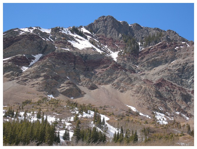
Approaching the base of the outlier, our
observation about the colorful rock layers was confirmed. In June of 2006, on
an ascent of Pincher Ridge, we
had run into the most interesting and colorful band of rock we’d ever seen. The
bands on Prairie Bluff seemed to be the northern equivalent of those on
Pincher, but on a much larger scale. In fact, on a significantly larger scale! The
rock scenery on the lower section of the peak was actually quite unbelievable:
the usual and stunning assortment of red and green argillite in strikingly
defined layers, a few extreme examples of rock folding, and enough colour
variety to put a rainbow to shame – it was hands-down the best we’d ever seen.
Our only source of disappointment was an obstinate cloud that blocked the sun
directly above us. The cloud refused to move, even though the west wind was howling.
Only several hours later, when the sun had moved to the west of the cloud, were
we treated to the sun’s light and warmth.
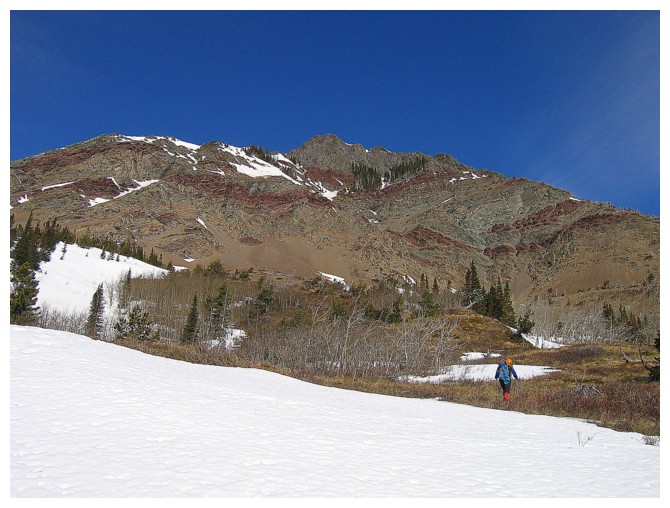
We tried to ascend several gullies to gain
elevation on the outlier, but all were full of ice and running water. Not that
we were complaining – this just allowed us to explore more of the outstanding
south face. Eventually we did find a scramble route to reach the upper slopes.
There, Mark led us up a steep snow slope in hopes that we could find a weakness
up the very steep summit block. One did not reveal itself and so we lost some
elevation and then snuck around the west side of the block. The summit of the
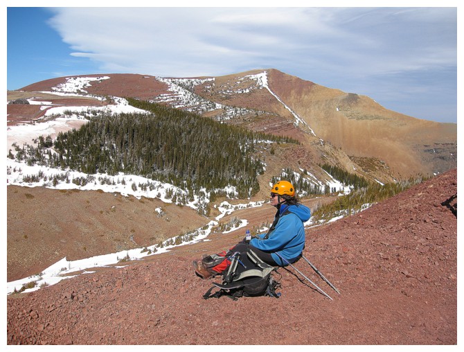
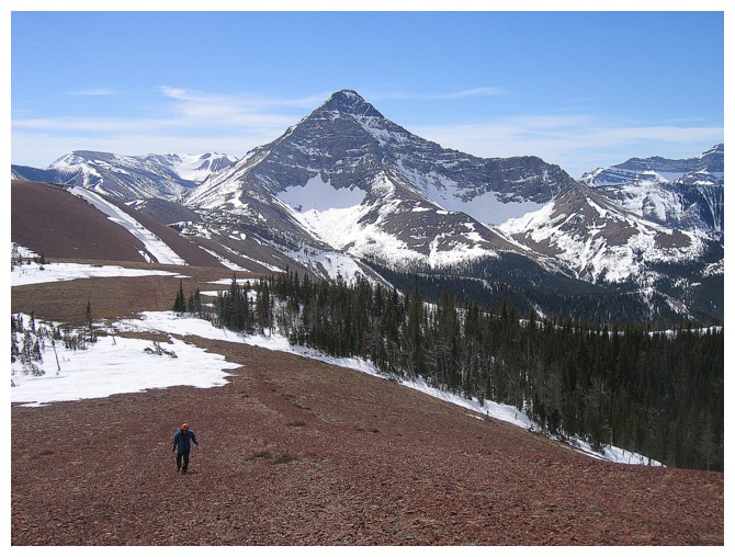
outlier was only a few minutes from there. The summit panorama was unexpectedly
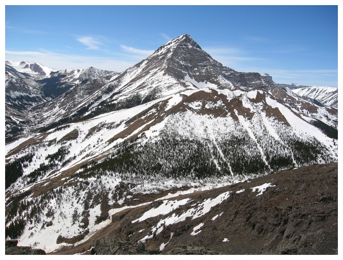
pleasant – especially the distinctive, pyramidal form of Victoria Peak
to the west.
We now had a dilemma. The true summit
appeared a fair distance away and we were supposed to be back in Calgary by 6 pm. We were
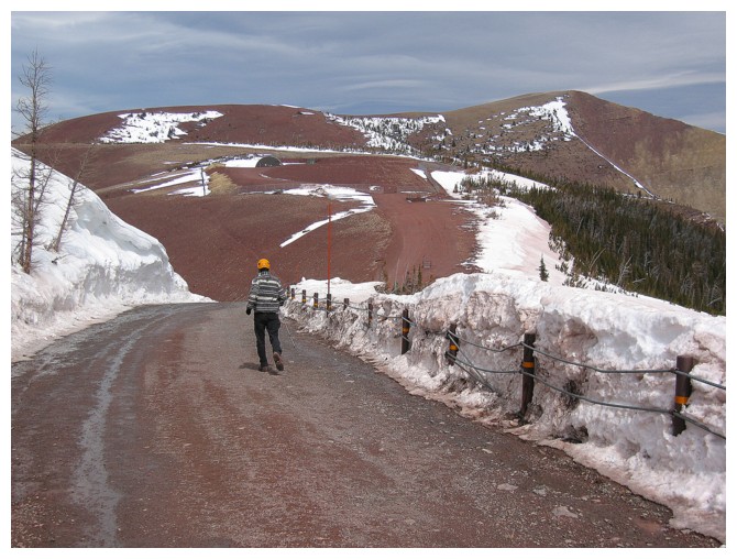
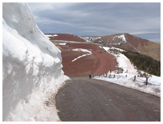
also only a short distance from the gas road and decided to hike along it at a
pretty fast pace in order to try to make the summit. Even hiking up this road
was enjoyable. There aren’t many red argillite roads in the province and so
walking atop the red rock was a somewhat unique experience.
At some point, we opted to leave our
backpacks and jog to the summit, to make up some time. The jogging lasted all
of 45 seconds and then it was back to a brisk walk. We reached the summit at
2:15 pm, to take in a wonderful panorama – snowy to the west, clear to the
east, and beautiful colours all around – yet another pleasant surprise.
For descent we simply followed the gas road.
Though circuitous, we couldn’t have asked for an easier and more stress-free
descent. A totally outstanding day to complete an even better weekend in The
Castle Crown.
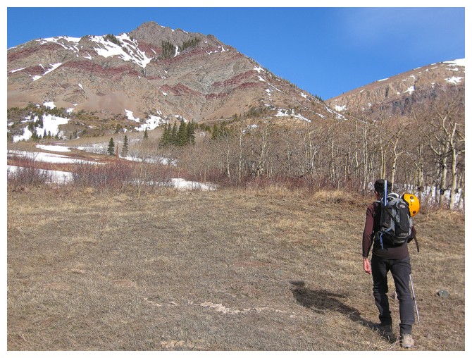
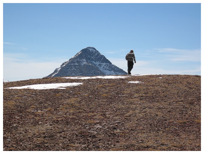
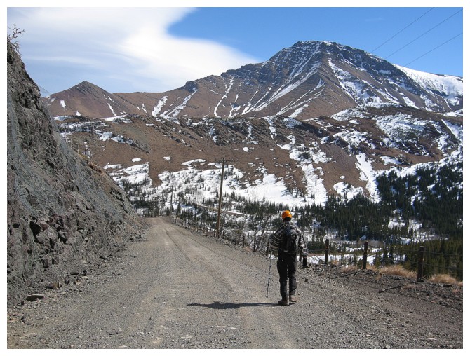
Hiking to the outlier
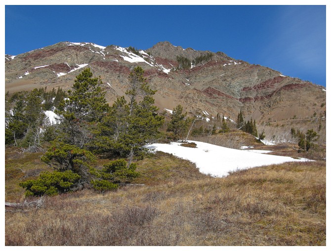
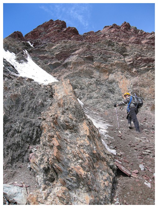
Certainly looks like some interesting rock
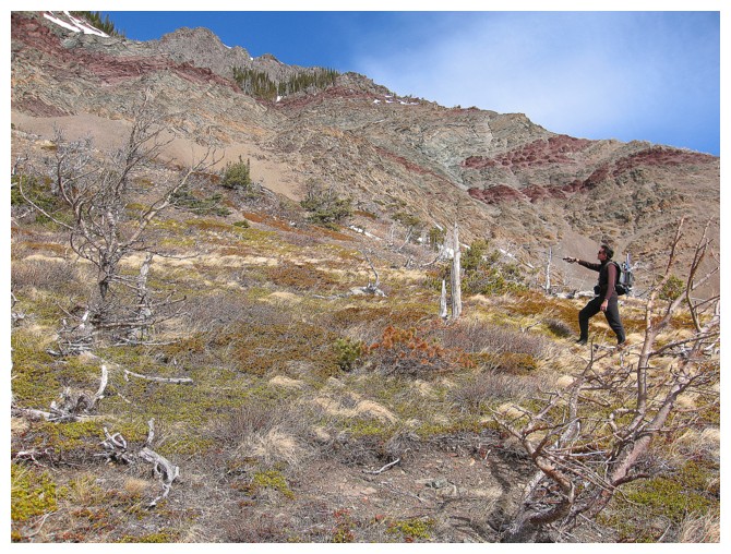
Pointing out the ridiculously obvious route to the base
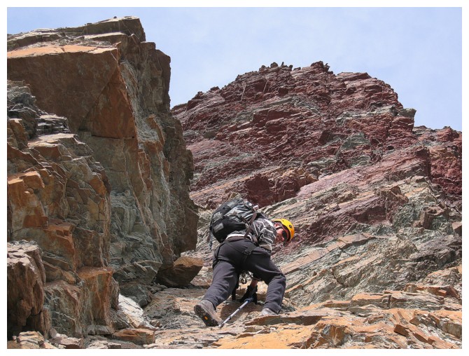
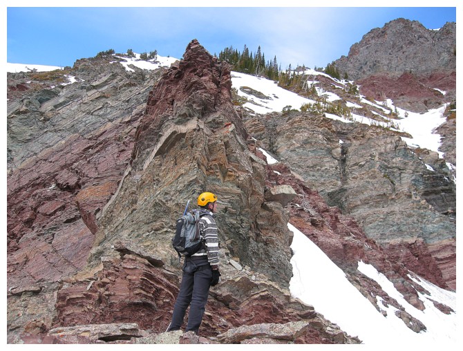
Mark at the base and checking out the fascinating layers of folded and colourful rock
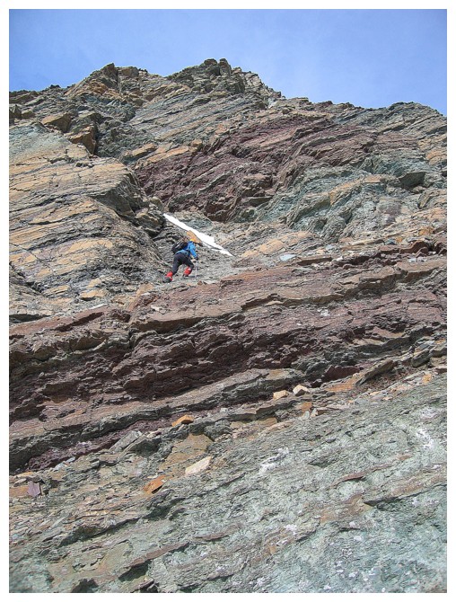
....and then ascending it
My turn
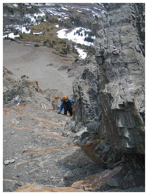
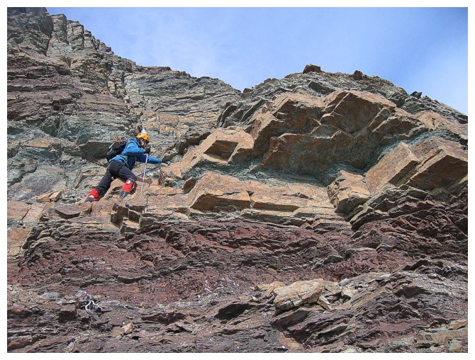
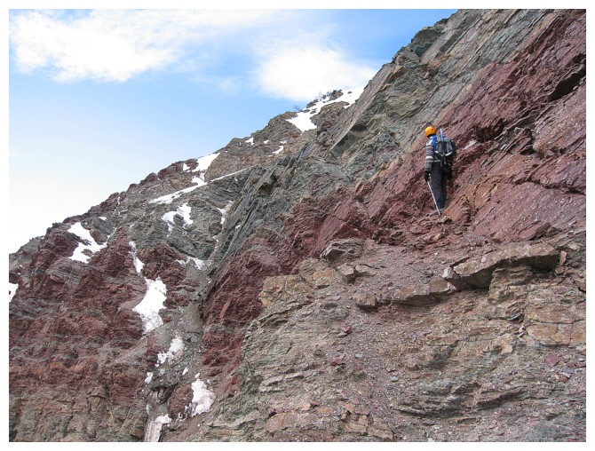
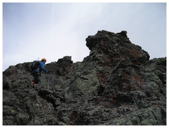
Mark ascends some steep terrain
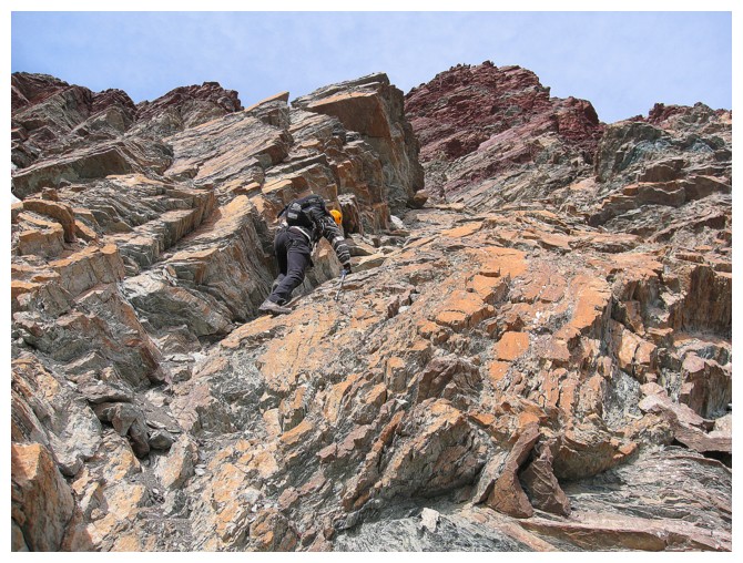
The route we took to get above some almost vertical terrain
Several dead-ends along the way
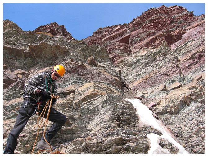
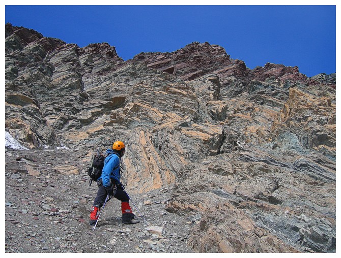
Time to rope up - just in case!
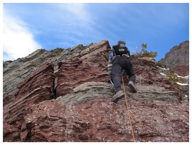

Turns out the terrain was moderate to difficult scrambling only
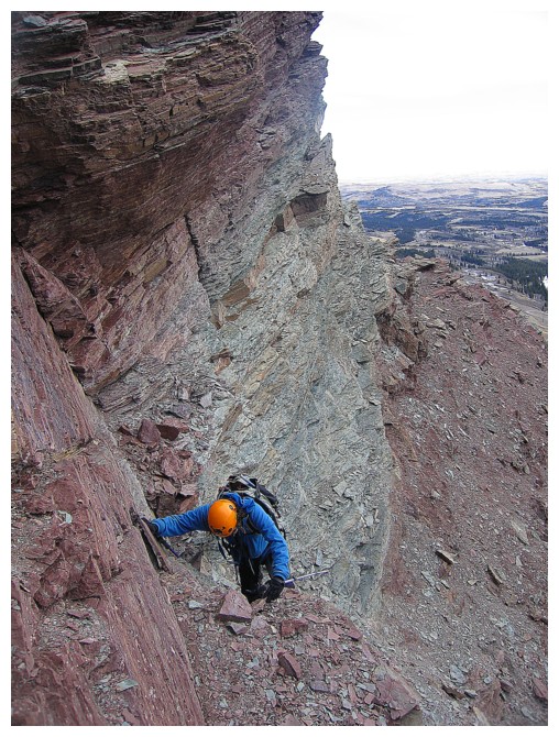
Out of the rock bands and onto steep scree
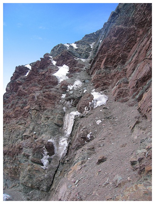
Then steep snow
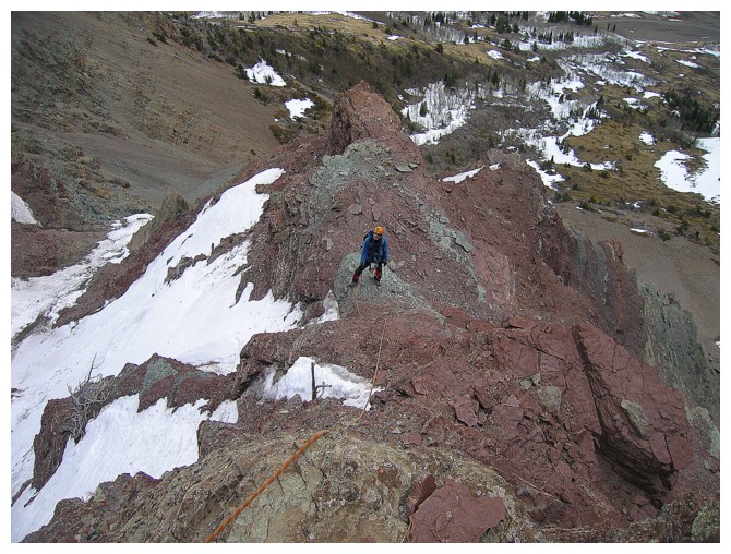
Going around the upper rock band to the summit of the outlier
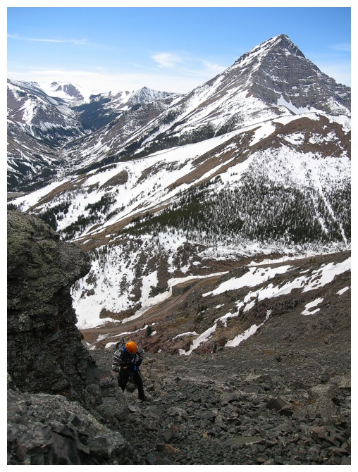
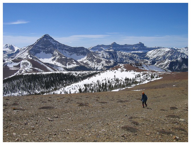
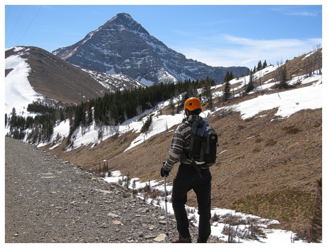
Views of Victoria Peak were consistently amazing
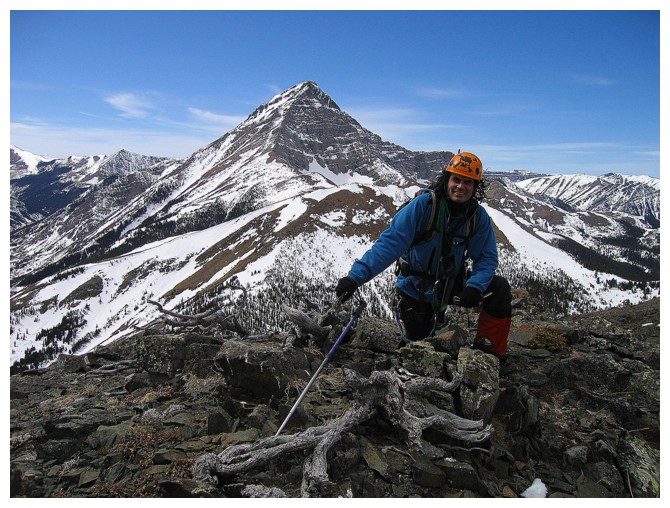
Mark at the summit of the outlier
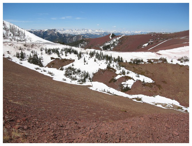
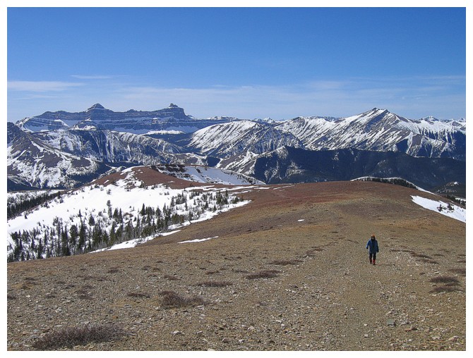
Onto the red argillite slopes that lead to the true summit
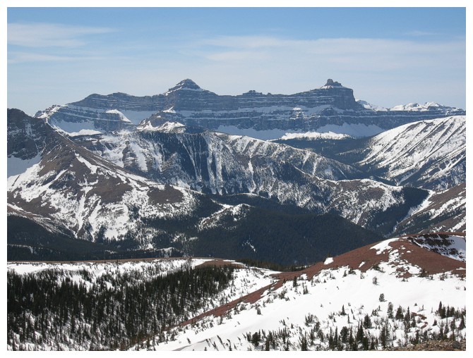
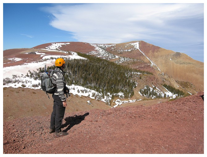
Parts of the Flathead range are clearly visible to the northwest
Jogging the gas road
Walking a few seconds later!
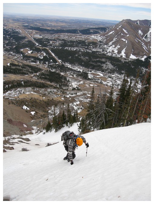
Final ascent to the summit
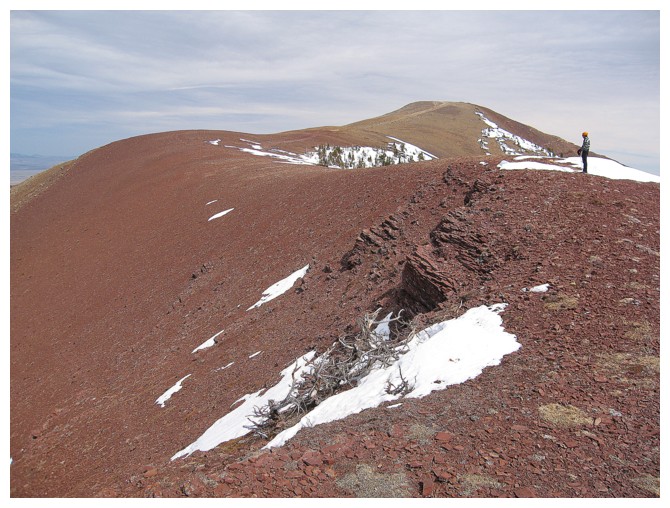
Windsor Mountain and Castle Peak look great too
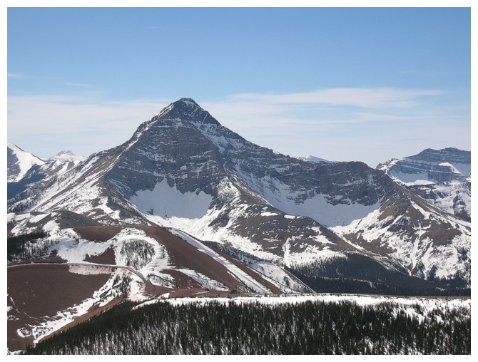
...but Victoria Peak still looks better!
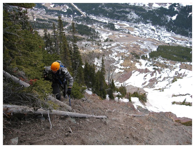
Heading home

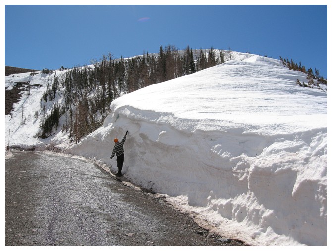
This area gets some serious amounts of snow over the winter
Looking back to the summit
Good views of Pincher Ridge too
Parting look at the outlier we ascended
And one more
The End