Sofa Mountain Reconnaissance II
June 5, 2021
Round-trip time: 7:35
 Solo scramble.
The objective of this trip was simply to hike
into the basin between the two main ascents routes of Sofa Mountain. Of course,
it turned into a little more!
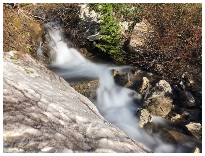
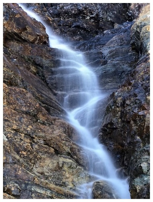
Before going up into the basin, I wanted to
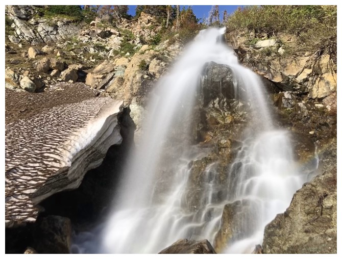
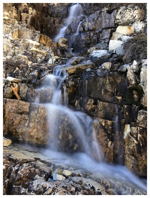
check out the waterfall near the end of the Sofa Mountain trail. At this time of
the year, I suspected that a significant volume of water would be pouring down
the rock and fortunately it was. This definitely required a closer look, as
the fall is only partially visible from the hiking trail. Getting down to the base
of the fall required some tricky downclimbing but was very much worth the
effort. It’s a beautiful waterfall in late Spring. I did find an easier route back
up to the trail and then continued on and up to the basin.
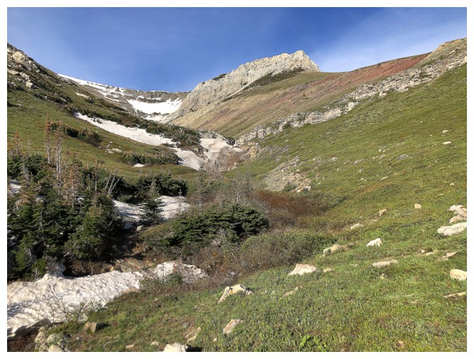
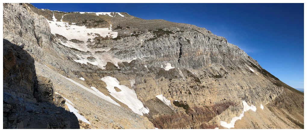
Even several trips up Sofa Mountain did not
prepare me for the stunning beauty of the basin. And, of course, it was largely
the result of remarkably colourful rock and also some pronounced examples of rock-folding.
 With
deep blue skies above, turning around at
this point was not an option. I was surprised to see several potential
routes
up to the ridge between the two primary Sofa ascent routes. From most
angles,
the slopes above the basin appear to be impossibly steep, but such is
not the
case. I found a wonderful route up to the ridge (crampons and ice axe
mandatory for the snowy parts), leaving me at the top of the
difficult scramble route.
With
deep blue skies above, turning around at
this point was not an option. I was surprised to see several potential
routes
up to the ridge between the two primary Sofa ascent routes. From most
angles,
the slopes above the basin appear to be impossibly steep, but such is
not the
case. I found a wonderful route up to the ridge (crampons and ice axe
mandatory for the snowy parts), leaving me at the top of the
difficult scramble route.
Here,
there were three options:
1. Go to the
summit;
2. Descend the difficult route;
3. Go check out the ridge to
the north.
My scrambling abilities have declined somewhat over the years, but
thankfully
my desire to explore is still fully intact. As such, I obviously picked
option 3, having already completed the other routes and having never
seen the ridge to the north.
Unfortunately, blue skies had given way to
cloudy ones at this point. Nevertheless, the north ridge proved to a wonderfully
entertaining excursion, with super interesting terrain, route-finding, and once
again, superb rock. Getting back to the hiking trail was likewise a pleasant experience,
requiring an easy high-level traverse above another basin, between the north
ridge and the difficult scrambling route.
Although this route will likely never become a
popular one up and/or down the mountain, it did provide yet another amazing and unique
Waterton experience on a familiar peak.
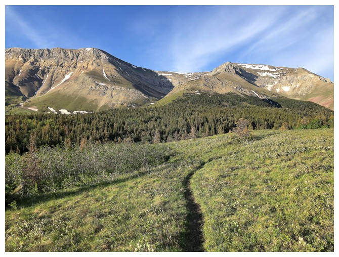
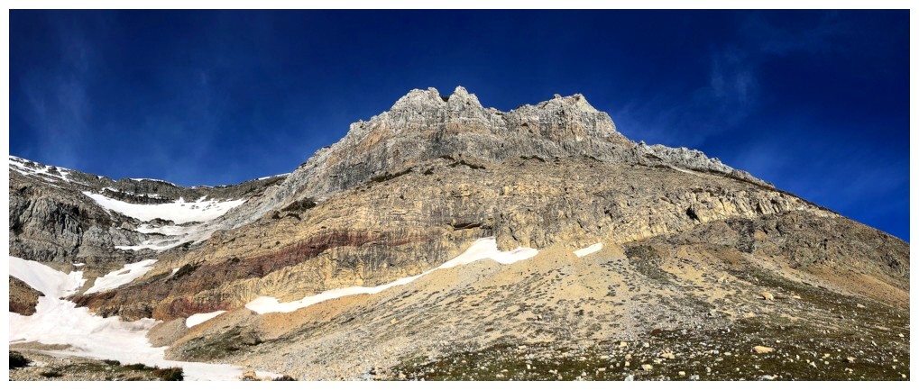
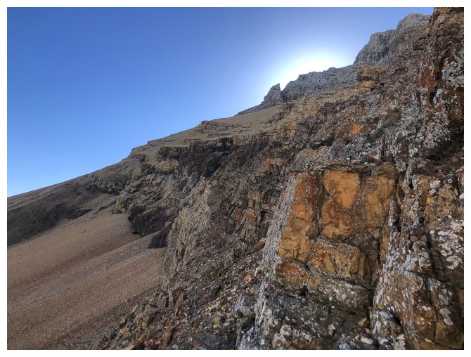
Out of the first forested area, with a good view of Sofa Mountain and
its many route options. For this day I ended up ascending the back of
the bowl in the centre and then coming down the ridge on the far right.
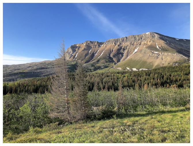
Looking over, with some nostalgia, to a route Mark and I completed in June of 2020
The "normal" route up the mountain
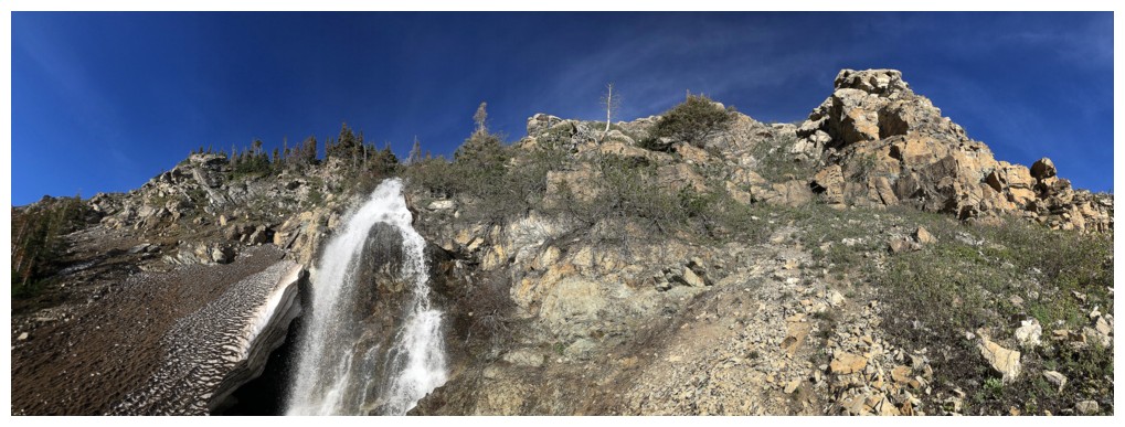
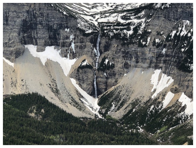
Approaching the end of the formal trail and the hidden waterfall
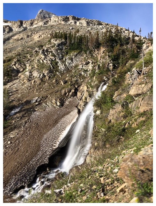
The waterfall
Beautiful but tricky terrain to descend if you want see the waterfall in its entirety
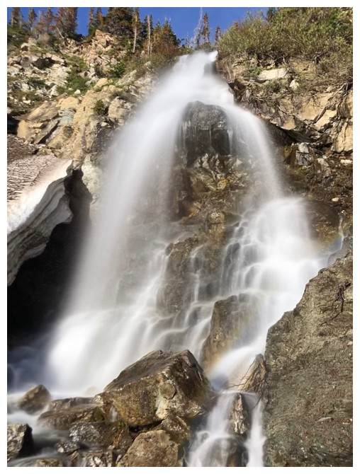
At this time of the year the fall is impressive, but usually dwindles down to a trickle by summer's end
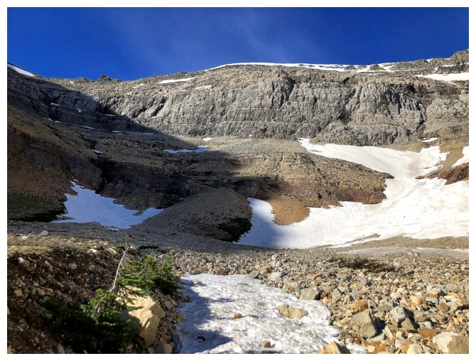
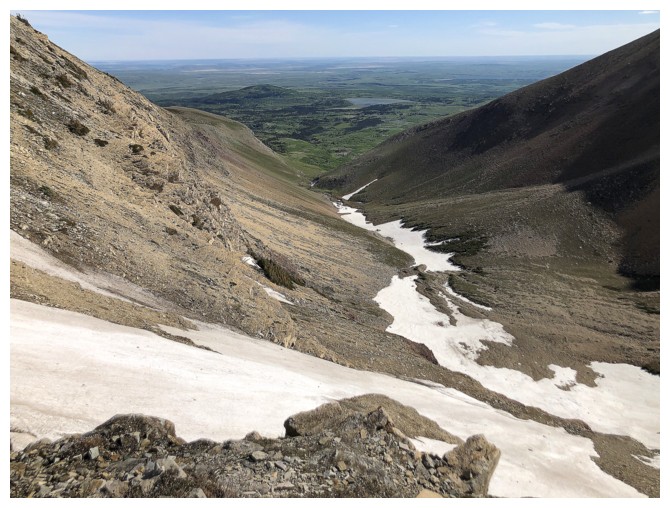
Continuing up the valley
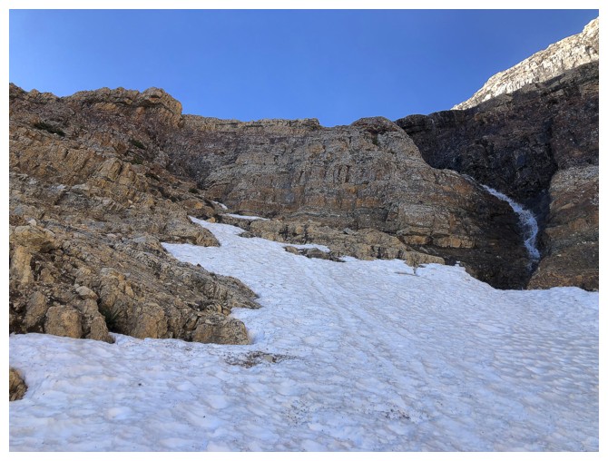
The source of the waterfall
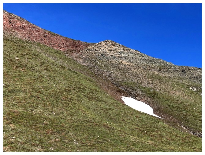
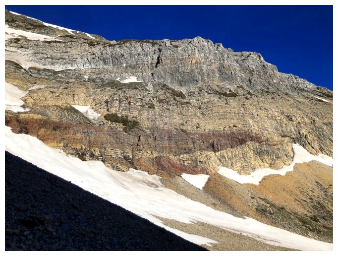
Some of the great colours of southern Alberta are starting to show up
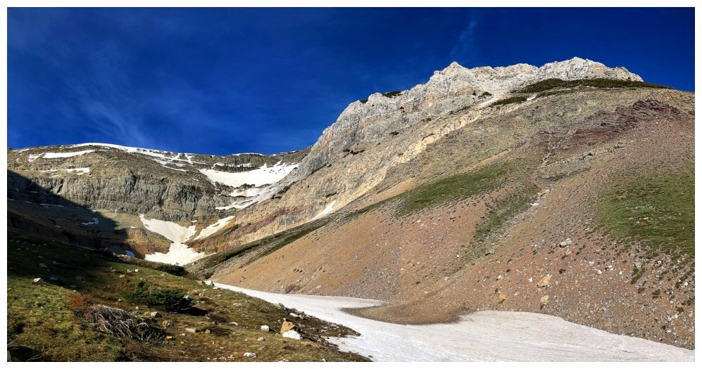
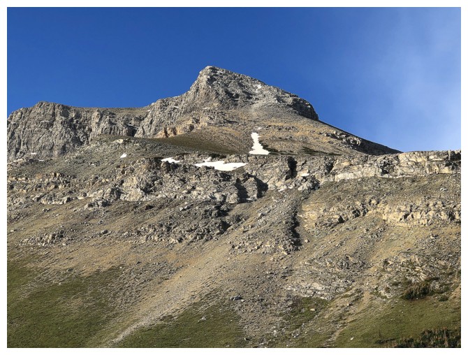
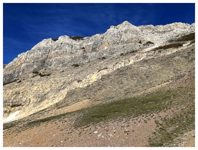
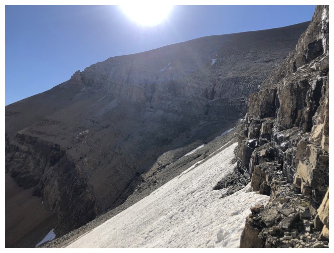
The longer and more difficult scramble route up Sofa goes up on the right side
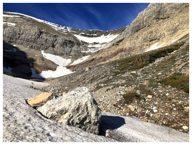
Big boulder
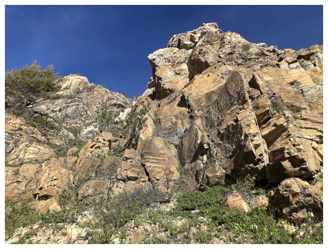
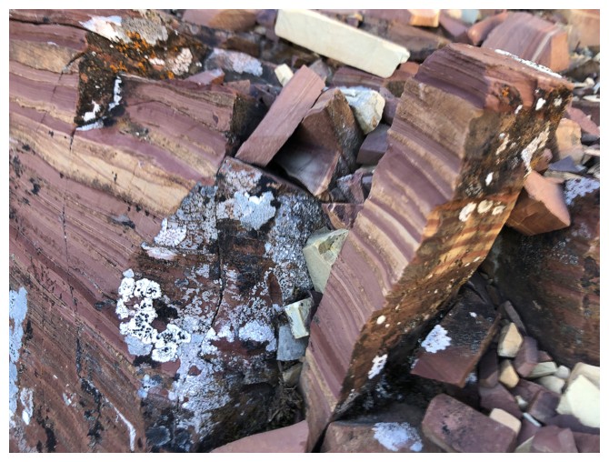
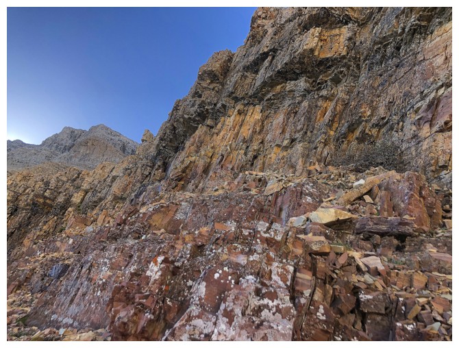
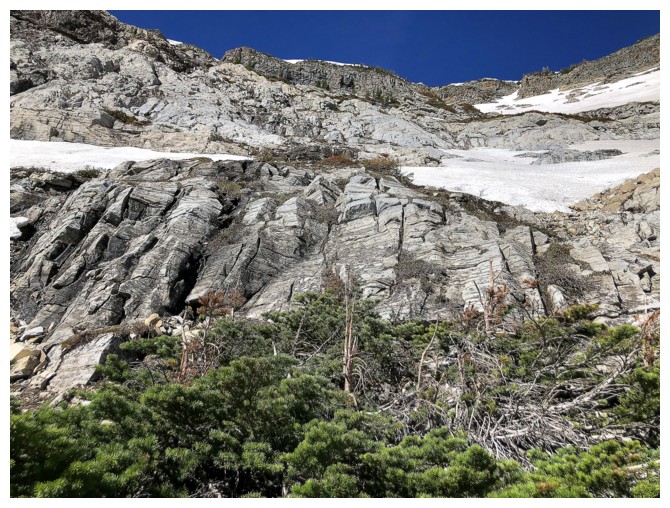
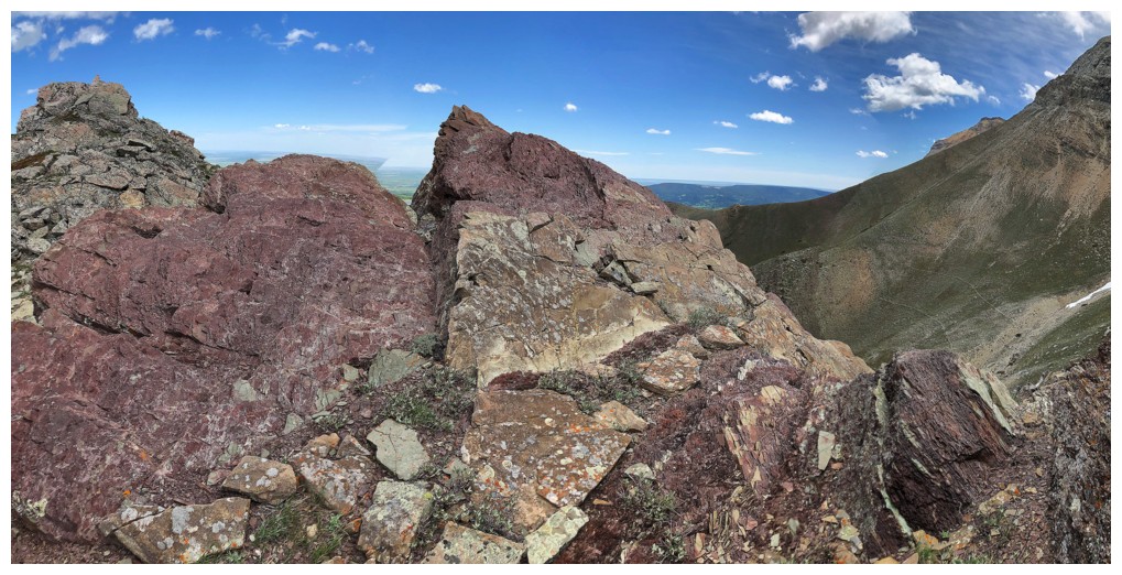
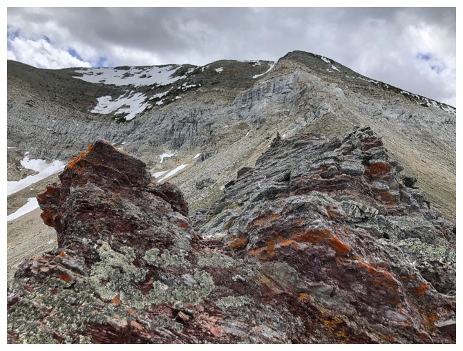
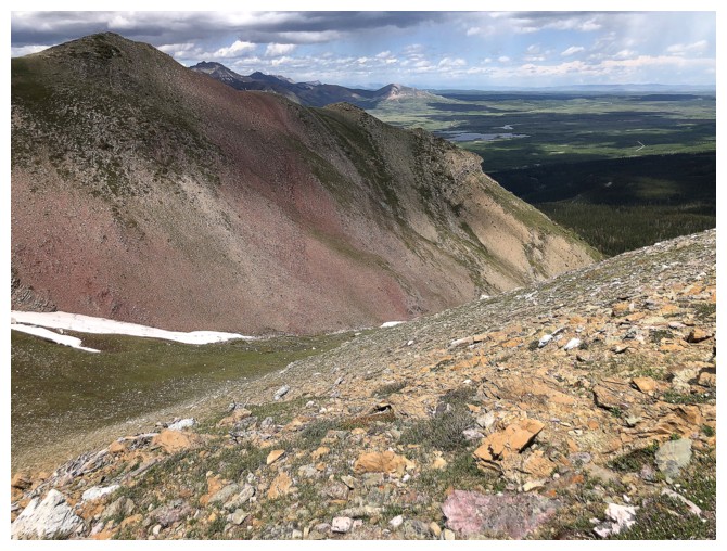
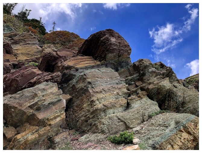
The obvious layer of red argillite took centre stage in the basin
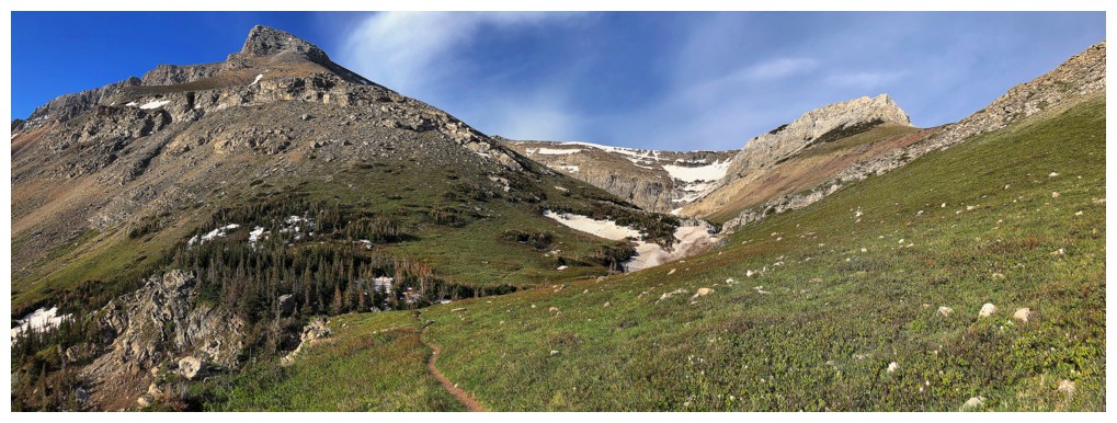
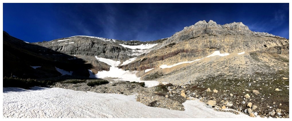
Approaching the end of the basin
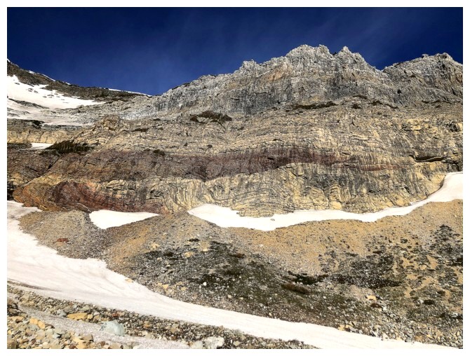
Stunning rock
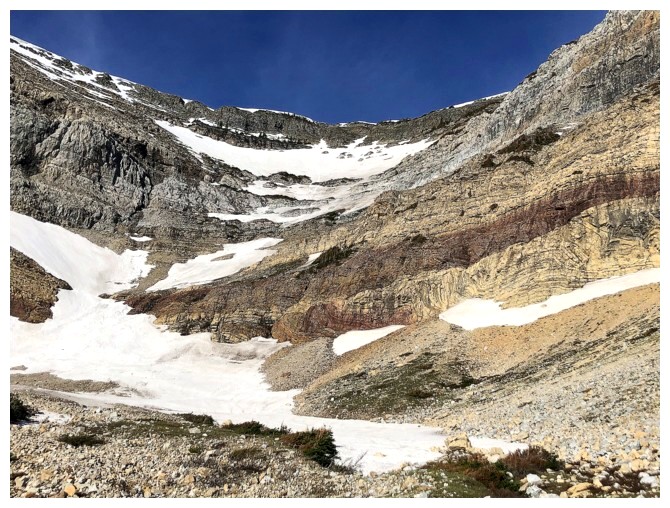
I considered going up and to the left here to gain the ridge, but eventually decided that right would be more interesting
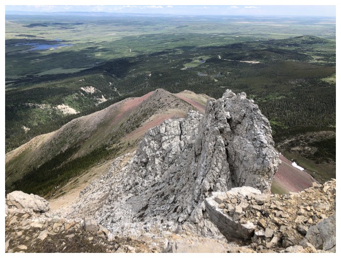
The ridge to the right
Exploring the left side of the basin first
This could actually be the source of the waterfall farther down the valley, but it would have to be running underground
The Sun is trying to get into the valley
Classic Waterton rock
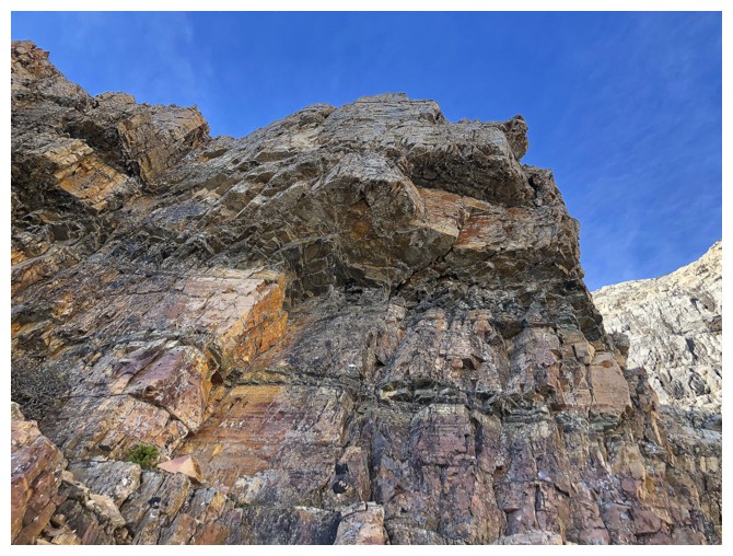
.....and rock formations
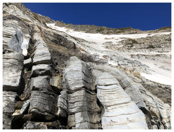
This was another tempting route, as the rock was very step-like
Another mini-waterfalls on the face
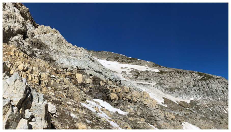
Turning my attention to the right side. The route I ended up taking goes straight up the snow at the left
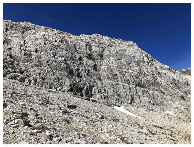
This rock band was solid but too steep to scramble up
Looking back to some of the terrain I had to traverse to get to the ascent line
Still traversing
Looking back down into the basin
Heading up
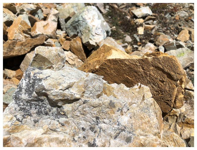
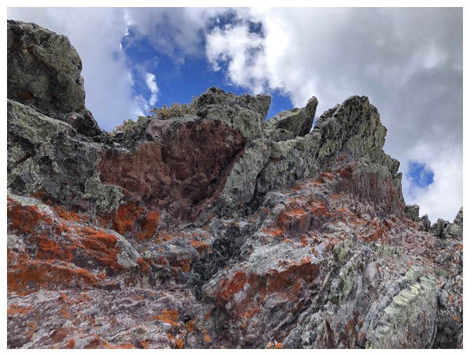
Not all the rock in Waterton is of terrible (climbing) quality
This stuff was super solid and grippy
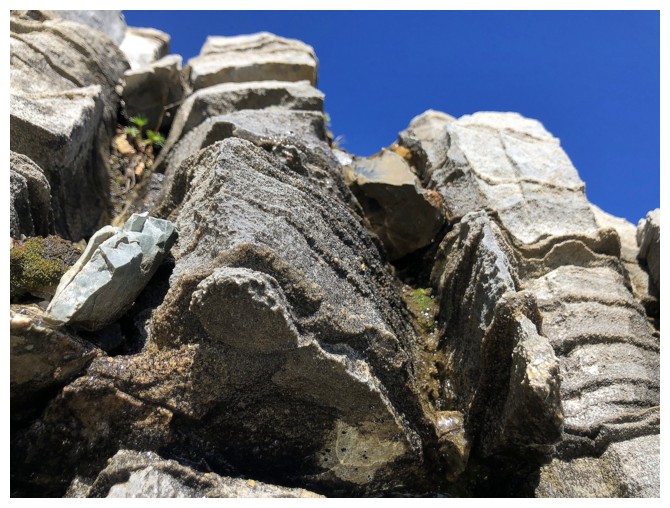
Close-up
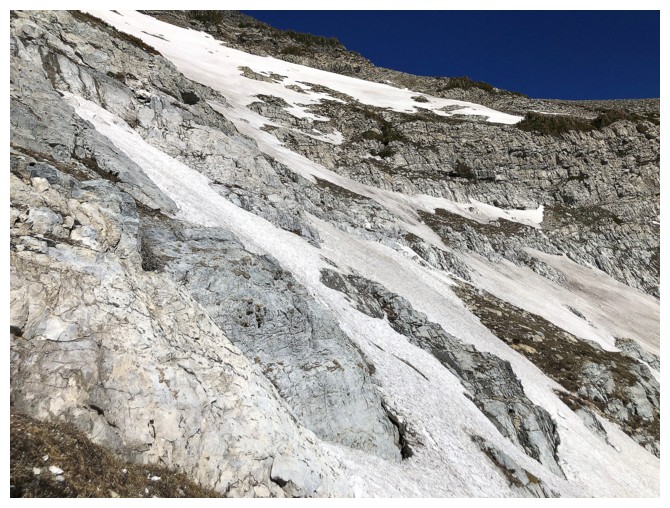
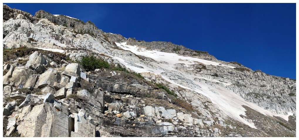
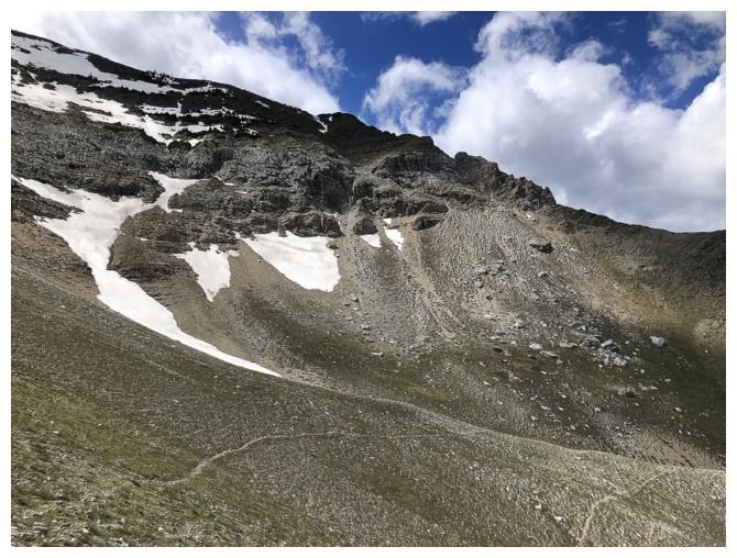
Going to from one section to bare rock to another, trying to avoid having to put crampons on
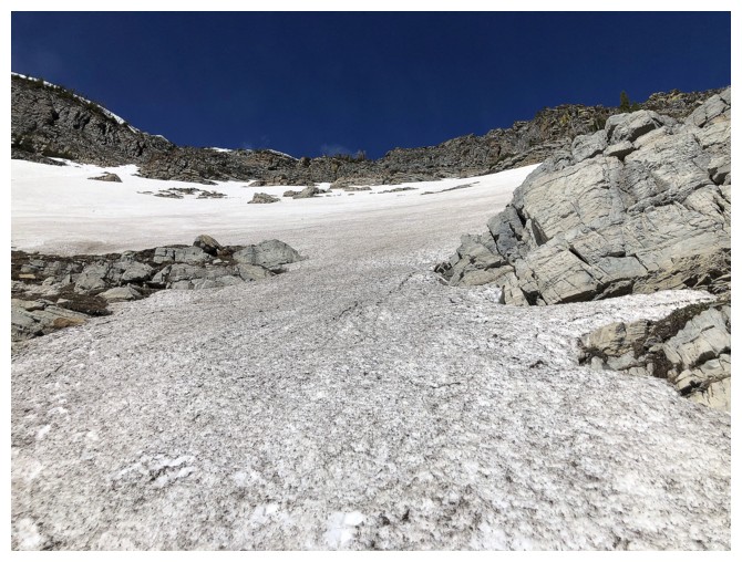
Until
I came to this. It's crampons and ice axe from here to the ridge. The
snow was quite hard and a slip would have been very bad.
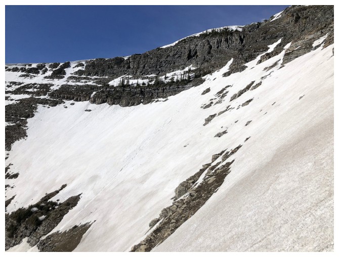
Looking across the slope I'm ascending
The top of the normal route
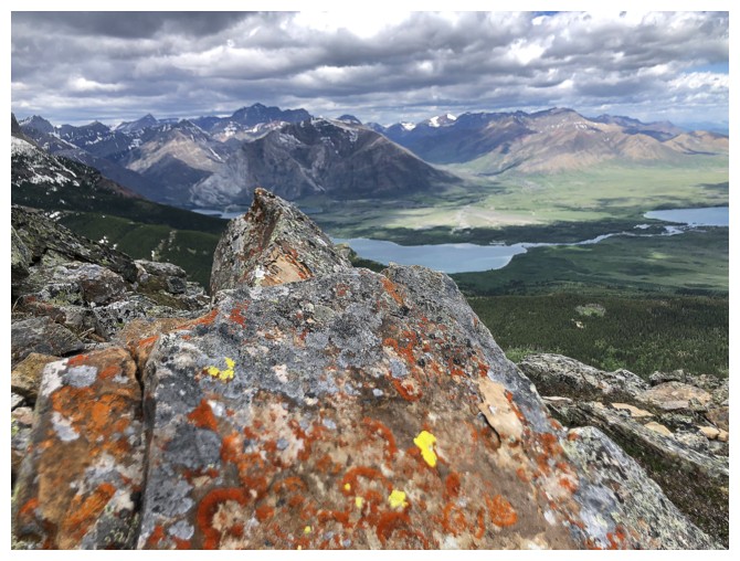
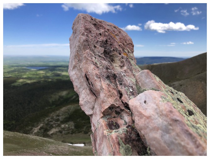
Needing a breather, so I photograph the nearest rock in sight!
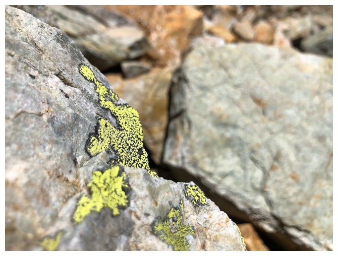
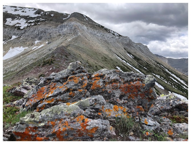
And one with lichen
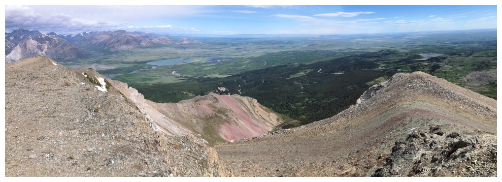
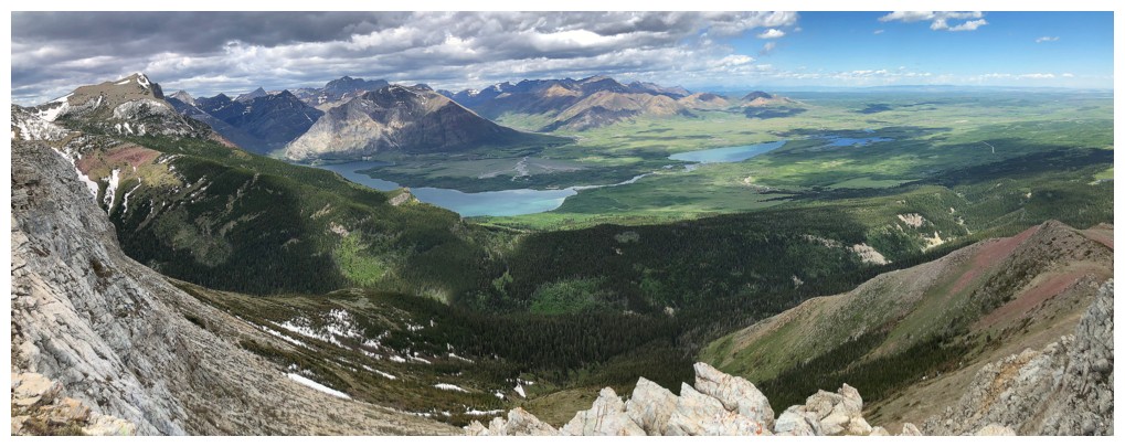
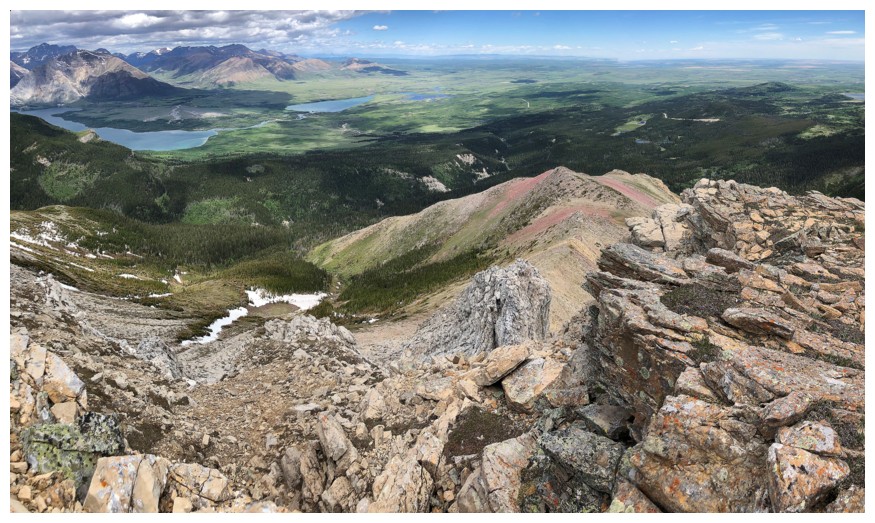
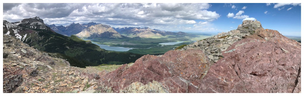
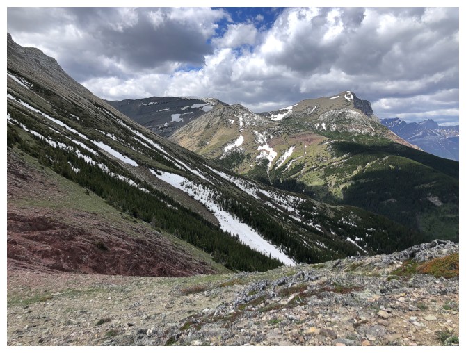
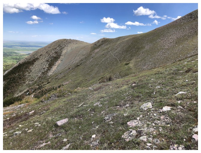
View from atop the ridge. Eventually I would head down the ridge at the left.
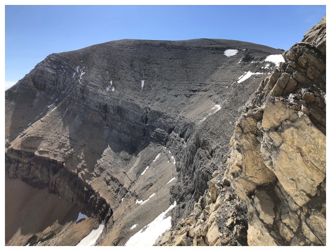
The normal route and the summit of Sofa at the right
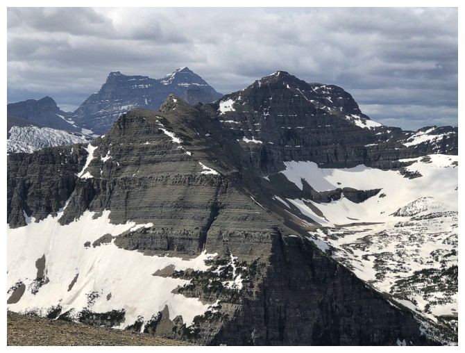
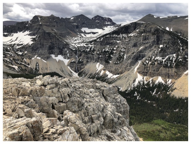
Cloudy over Mount Cleveland
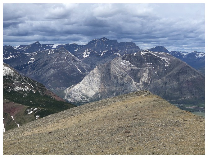
And Blakiston
And Alderson
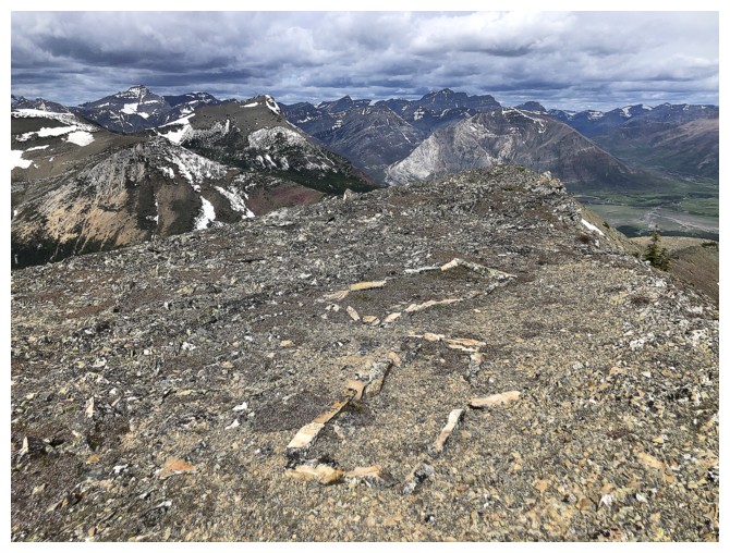
Interesting rock pattern. Clearly I'm not the only human that loves
this mountain and all its ridges. That, or the wildlife is getting very
creative!
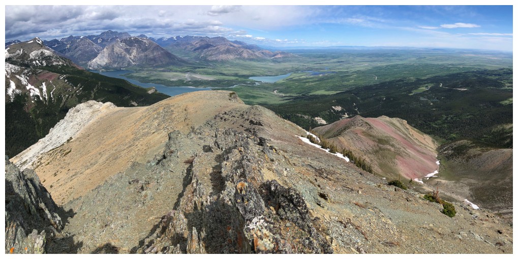
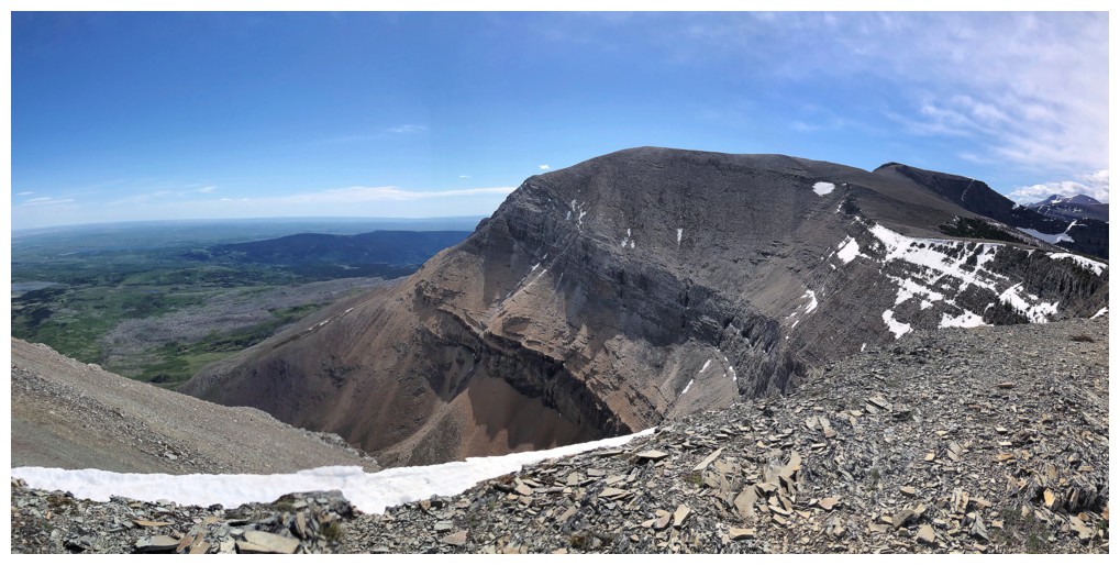
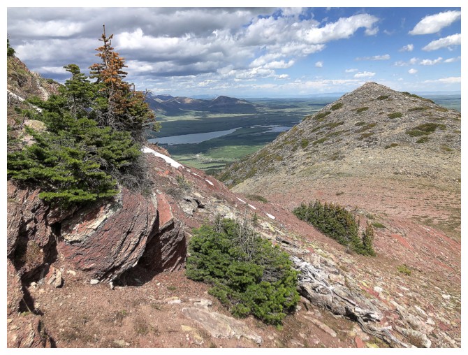
Hiking over to the top of the new descent ridge
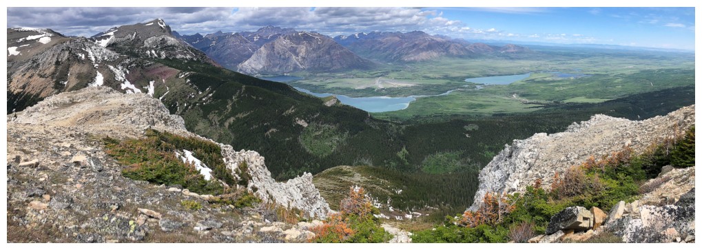
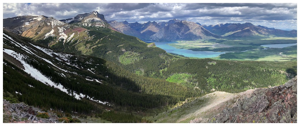
This ridge offers good views of the Lower and Middle Waterton lakes, as well, as the usual glut of great rock
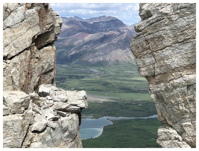
Mount Dungarvan and others, through a gap in the rock
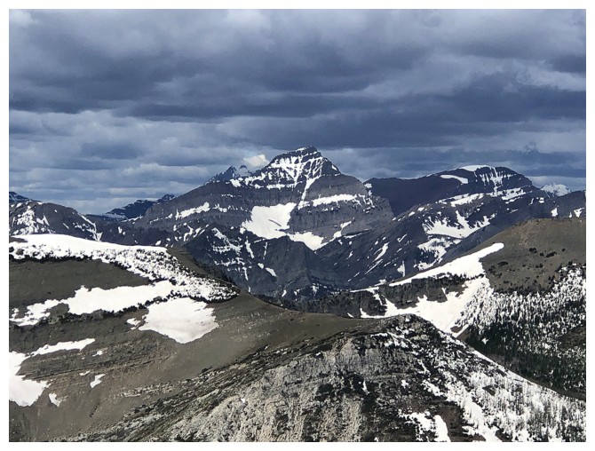
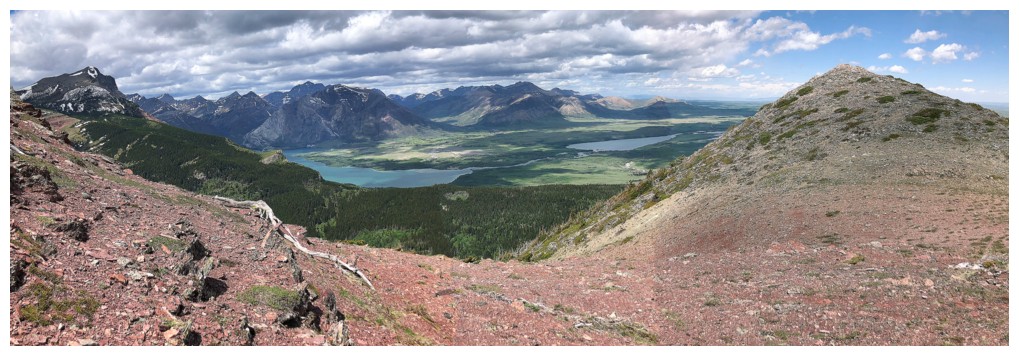
There is a significant waterfall between the true summit of Vimy Ridge (just left of centre) and Arras Peak (to the right). The peak ion the middle os magnificent Crypt Peak.
Close-up. Sullivan Falls possibly?
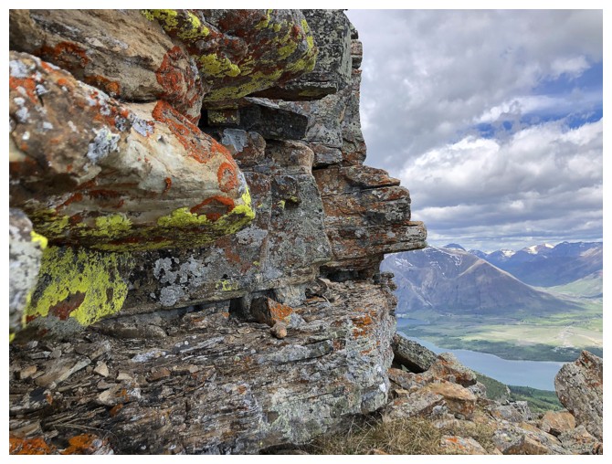
Getting back to the lichen
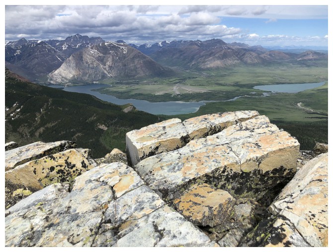
And the views towards Waterton
Going down
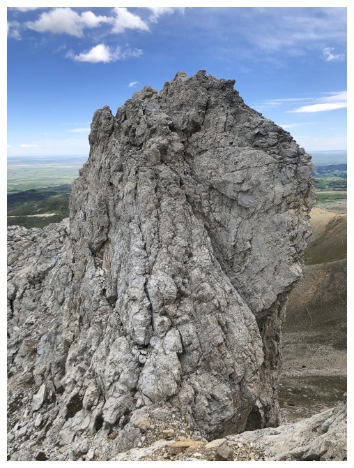
Passing a huge pinnacle
Looking back up at it
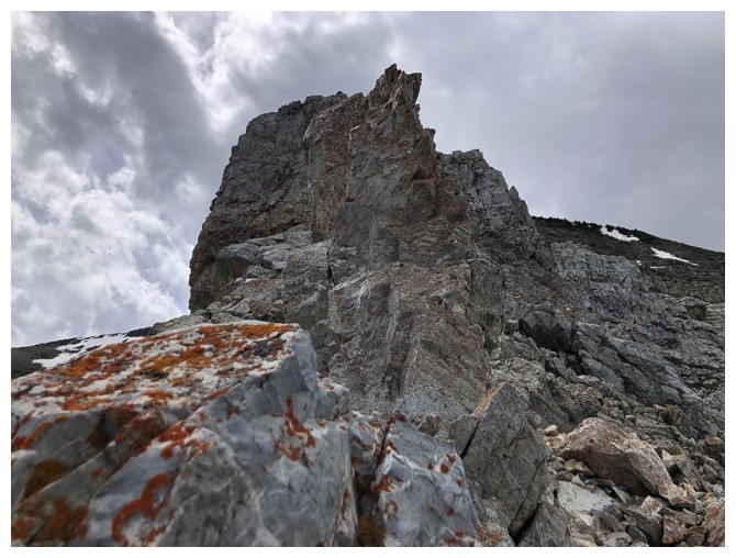
Looking back up the ridge. It's easier than it looks.

On easier terrain and still enjoying good views of the park
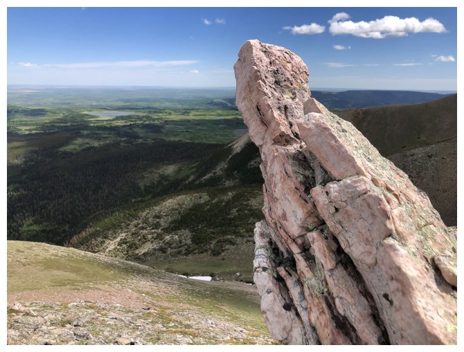
Here comes the red argillite fix for the day
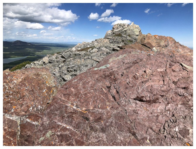
Close-up of an uplift of beautiful pink rock
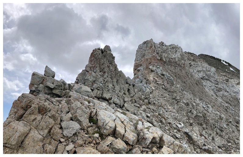
Looking back up the route again
Would love to return to this spot on a perfectly clear day
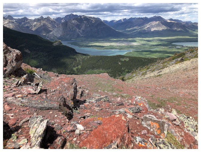
Vimy Peak is definitely a Waterton favourite
Last up look at the ridge I descended before traversing over to the other ridge
Having traversed some distance the highpoint at the end of the descent ridge is now visible
Animal trails certainly made the traverse easier
Still traversing
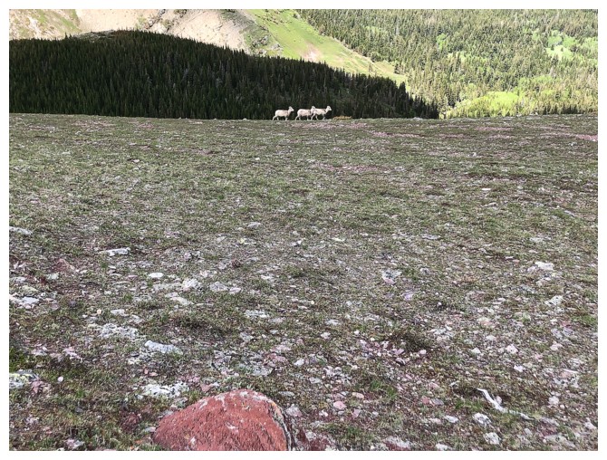
Maybe these guys made the trails!
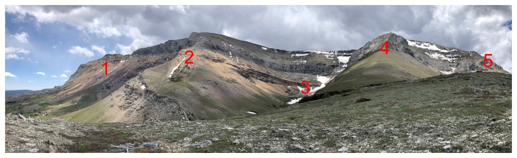
Overview of the north side of Sofa showing all 5 routes I have used:
1. Sofa East; 2. normal route; 3. basin route (this day); 4. difficult route; 5. descent route (this day)
Ending the main part of the descent with some colourful rock
The End
LOG