 Crypt Peak II
Vimy Ridge II
Mountain heights: 2610 m, 2500 m
Total elevation gain: 1600 m
Round-trip time: 14:20
Scrambling with Mark.
A second visit to the summit of Crypt Peak
was not at all necessary to prove what Mark and I already knew – that Crypt was
our favourite trip of all time and is arguably the best scramble in the
southern Canadian Rockies – but this second successful ascent of the red beauty
certainly put the “final nail in the coffin” of both assertions!
Some time ago, Mark had proposed an attempt
of Crypt Peak via Vimy Ridge, from the Crypt Lake trail. However, this would
still require either a boat ride across the lake (with the accompanying time
restrictions) or a 14.2 km approach, followed by a very long hike and scramble.
 As luck would have it, Doug Lutz, Geoff Hardy, Jean-Francois Richy, and Andrew
McCloskey had recently completed an awesome but viciously long route, first
taking the difficult route up Vimy Peak, traversing the entire length of Vimy
Ridge, ascending Crypt Peak, descending to Crypt Lake, hiking about 15 km back
to their bikes and then completing the day with a 7 km bike ride back to the
start – wow!! Feeling quite incapable of such superhuman feats, Mark and I
decided that a similar route would be feasible if we skipped the ascent of Vimy
Peak and then returned the same way instead of via Crypt Lake.
As luck would have it, Doug Lutz, Geoff Hardy, Jean-Francois Richy, and Andrew
McCloskey had recently completed an awesome but viciously long route, first
taking the difficult route up Vimy Peak, traversing the entire length of Vimy
Ridge, ascending Crypt Peak, descending to Crypt Lake, hiking about 15 km back
to their bikes and then completing the day with a 7 km bike ride back to the
start – wow!! Feeling quite incapable of such superhuman feats, Mark and I
decided that a similar route would be feasible if we skipped the ascent of Vimy
Peak and then returned the same way instead of via Crypt Lake.
We started the 7 km bike ride around 7 am
with headlamps, followed by a 4.8 km hike up to the basin below Vimy Peak. The
big surprise here was a fantastic number of yellow larches, their colours
unfortunately muted by completely overcast skies; no worries – the sky was
forecast to clear around noon and therefore we hoped to see the larches bathing
in sunlight on the way back.
We made an unwise decision upon reaching the
minor ridge east of Vimy Ridge. Instead of sucking up the extra elevation gain to
Vimy Ridge, we decided to side-slope the east side of the ridge. 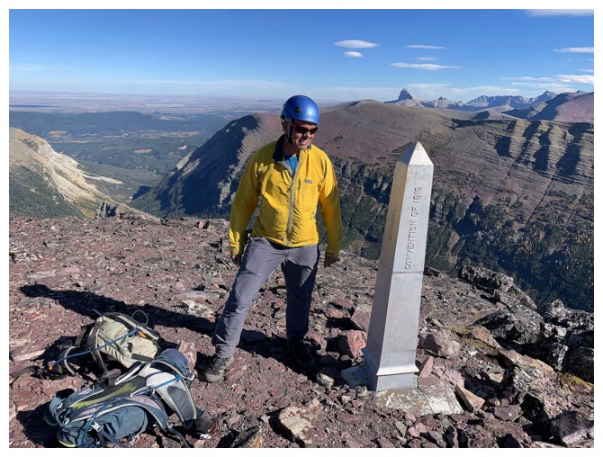 In short, that
route took way longer and actually required significantly more elevation gain than the ridge
route. Once the ridge was finally gained, we agreed to stay on it throughout.
In short, that
route took way longer and actually required significantly more elevation gain than the ridge
route. Once the ridge was finally gained, we agreed to stay on it throughout.
The
skies remained overcast and although we did want a second visit to the summit
of Vimy Ridge, doing the ascent in the present conditions had less appeal. As
such, another round of side-sloping to the Vimy/Crypt col ensued – so much for
sticking to the ridge! We took a break at the col and, right on schedule,
watched the skies clear all around to fully reveal the stunning surroundings –
surroundings that were soon to get way beyond stunning!
Although the next section, from the col to
the north ridge of Crypt looked daunting from afar, such was not the case and
the ascent amounted to very steep hiking with a few easy scrambling moves. Gaining
the ridge put us on familiar terrain again. The entire ascent up to that point
felt surprisingly new, even though the only sections of terrain that we had
never touched previously were the side-sloping ones and the short ascent to
Crypt’s north ridge. At this point, we were both elated, knowing that the
remainder of the ascent was one of the coolest rides in the neighbourhood and
this time it would be under clear, cloud- and haze-free skies.
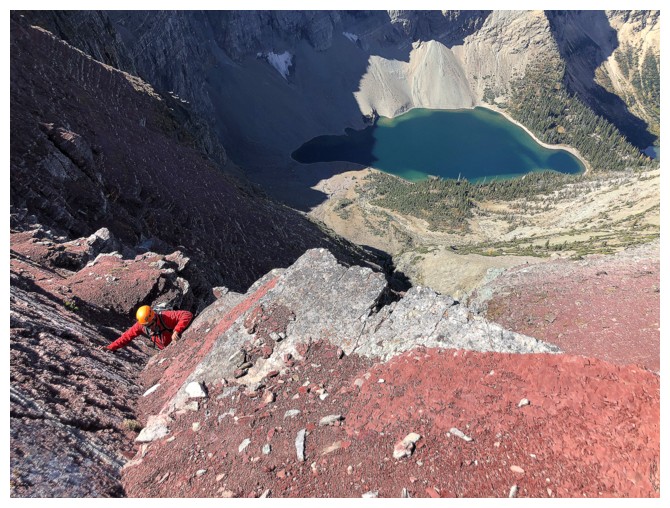
The ascent of the summit block was every bit
as thrilling and visually stunning as the first time – in fact, better! Even
the lack of direct sunlight on beautiful red argillite rock couldn’t detract
from the wonderful experience. Likewise, the summit view on this day outdid its
2018 counterpart, again because of the almost perfectly clear skies.
 Given that the ascent has taken less time
than predicted, we decided to explore the ridge heading towards Mount Boswell
for a short distance. The short detour didn’t end up being so short, as it
granted us different (and equally spectacular) views of Crypt Lake, a whack
load of red argillite scenery, and an unexpected temptation to continue on to
Boswell. That extension would have required a huge elevation gain to get back to
Vimy Ridge or a massively long hike out via the Crypt Lake Trail (ala Doug and
company). We decided against it and returned to the Crypt summit and then down
the same way we came up.
Given that the ascent has taken less time
than predicted, we decided to explore the ridge heading towards Mount Boswell
for a short distance. The short detour didn’t end up being so short, as it
granted us different (and equally spectacular) views of Crypt Lake, a whack
load of red argillite scenery, and an unexpected temptation to continue on to
Boswell. That extension would have required a huge elevation gain to get back to
Vimy Ridge or a massively long hike out via the Crypt Lake Trail (ala Doug and
company). We decided against it and returned to the Crypt summit and then down
the same way we came up.
Fortuitously, the detour now meant the Sun
was shining on the north face of Crypt; the flipside, the Sun was also starting
on its downward trajectory to the horizon. However, we were still confident we
could make it out before dark and therefore took a quick run up to the summit
of Vimy Ridge. After a very short but nostalgic summit break we were off again,
this time sticking to the ridge throughout. It quickly became apparent we would
lose the battle against the setting Sun and would be doing some of the descent
with headlamps. No big deal, but it would have been nice to see the huge swaths
of larches close up, when the Sun was shining on them. The day ended with a
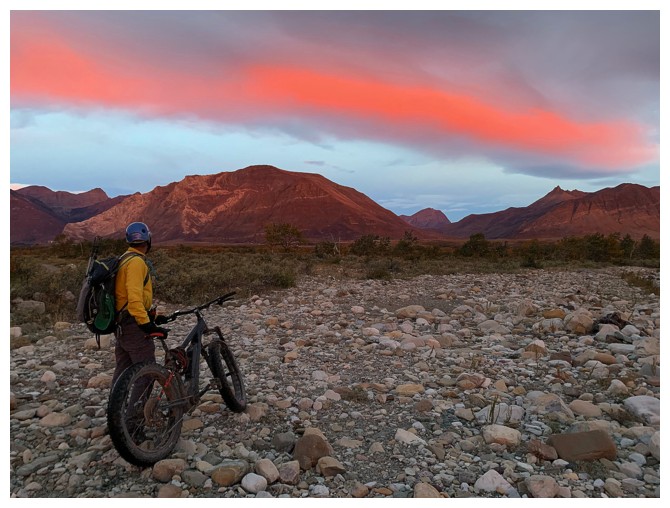
slower than normal but easy, headlamp illuminated bike ride back to the
start.
I can’t rave enough about this trip and Crypt
Peak in general. In our opinion it’s the best scramble in southern Alberta and still
our favourite trip of any type (scrambling, hiking, or mountaineering) since we
started visiting the mountains in 2001. Crypt Peak via Crypt Lake – awesome!
Crypt Peak via Vimy Ridge – equally awesome!! Next up: Crypt Peak via Sofa
Mountain and Vimy Ridge – can’t wait!!!
Click HERE to see route descriptions for both routes.
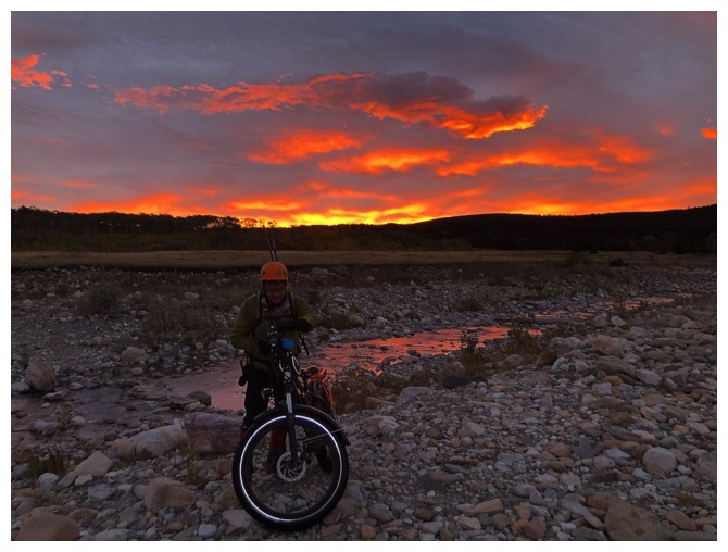
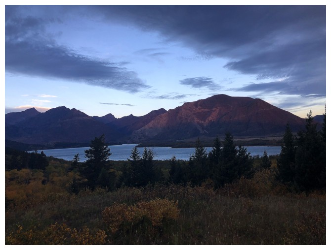
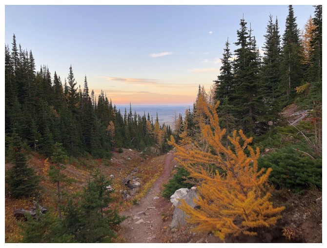
Nice sunrise at the Sofa Creek crossing
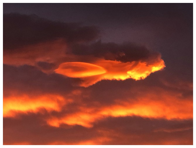
Even better looking east
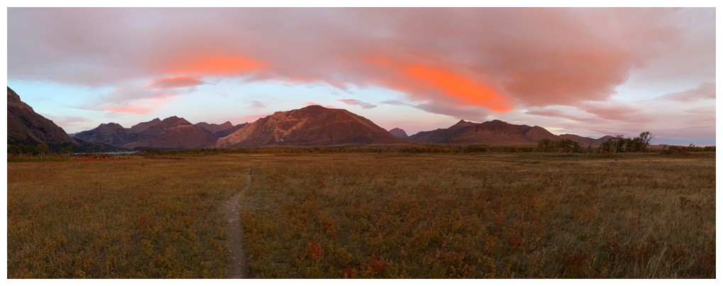
Many of the peaks of Waterton can be seen from the excellent Wishbone Trail
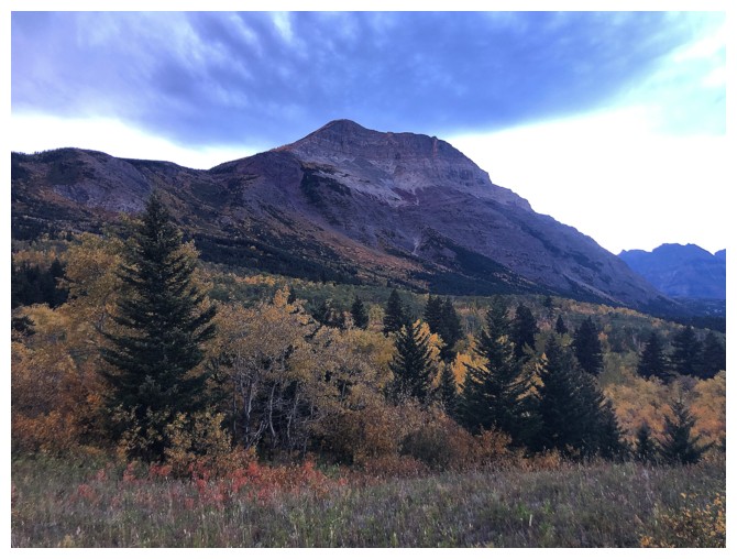
Vimy Peak is a fantastic objective
Pleasant view of Waterton, once some elevation is gained
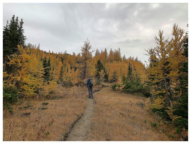
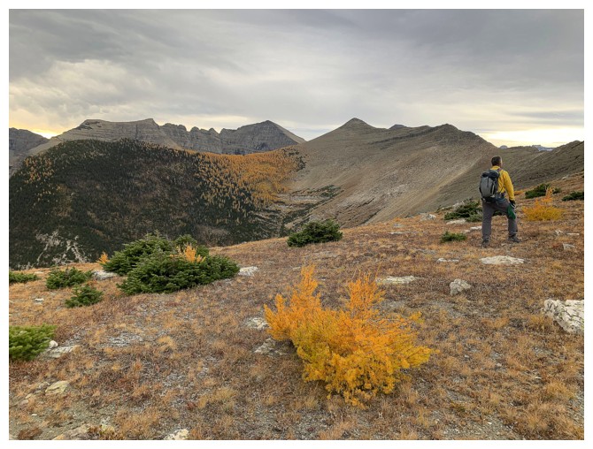
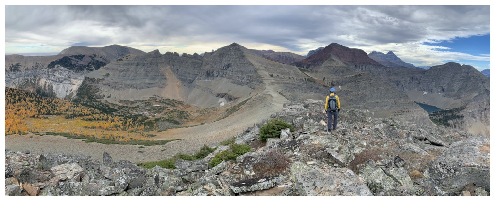
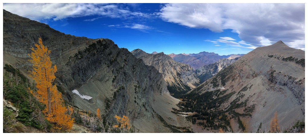
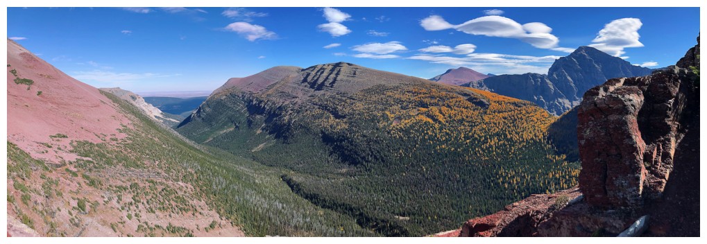
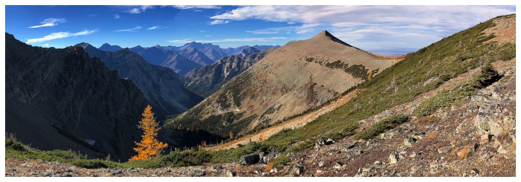
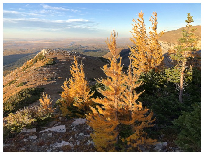
Into larch country. We were both surprised to see so many larches.
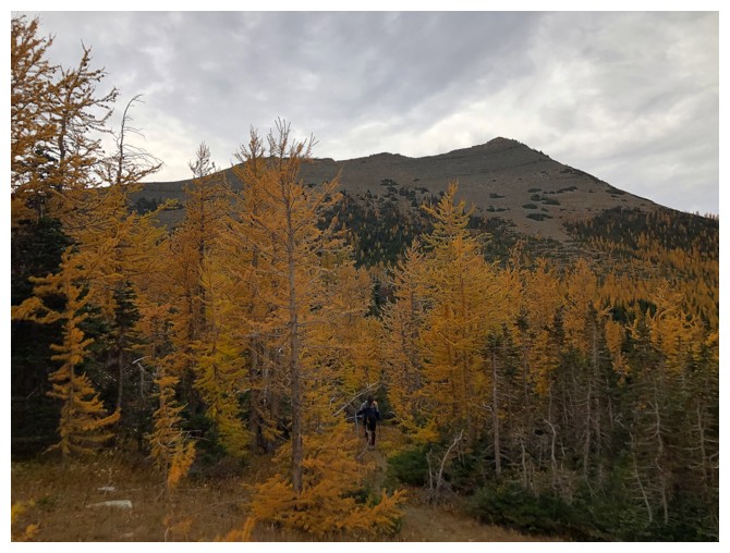
Heading towards the ridge at the left. The peak in front is the first highpoint along the Vimy Peak to Vimy Ridge traverse.
Also surprisingly, there is a well used, switch-backing trail going up to that ridge. Vimy Peak dominates the scene.
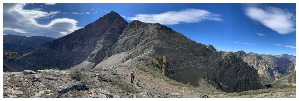
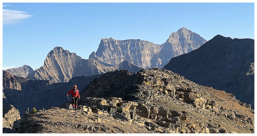
On the ridge and contemplating our next line of ascent. We chose
incorrectly and decided to side-slope here towards the ridge, right of
Arras Peak (just right of centre). The true summit of Vimy Ridge is
just left of centre.
The side-sloping also involved a fair elevation loss, totally negating any advantage over the ridge route
Mark ascends steep slopes back up to the ridge
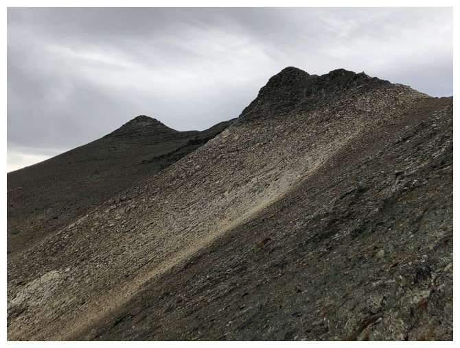
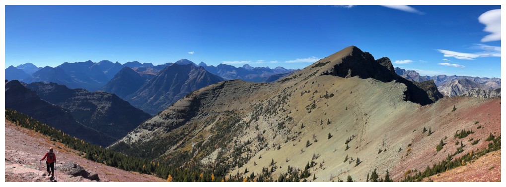
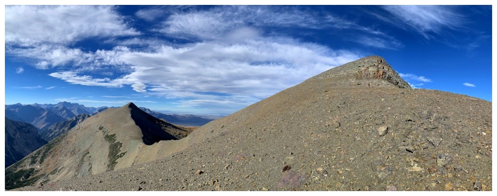
Two of the highpoints along Vimy Ridge. The left is Arras Peak.
Superb rock geometry
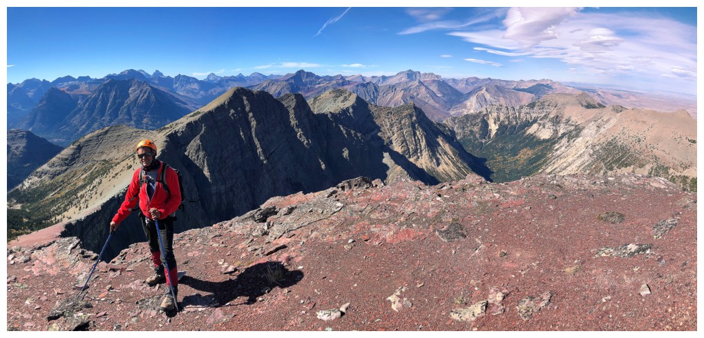
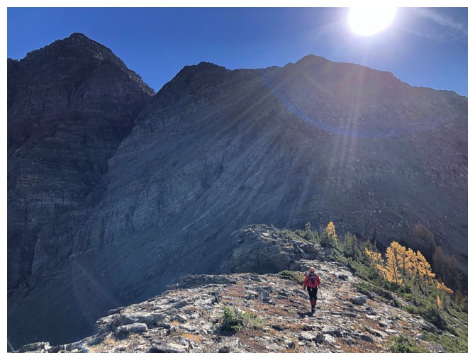
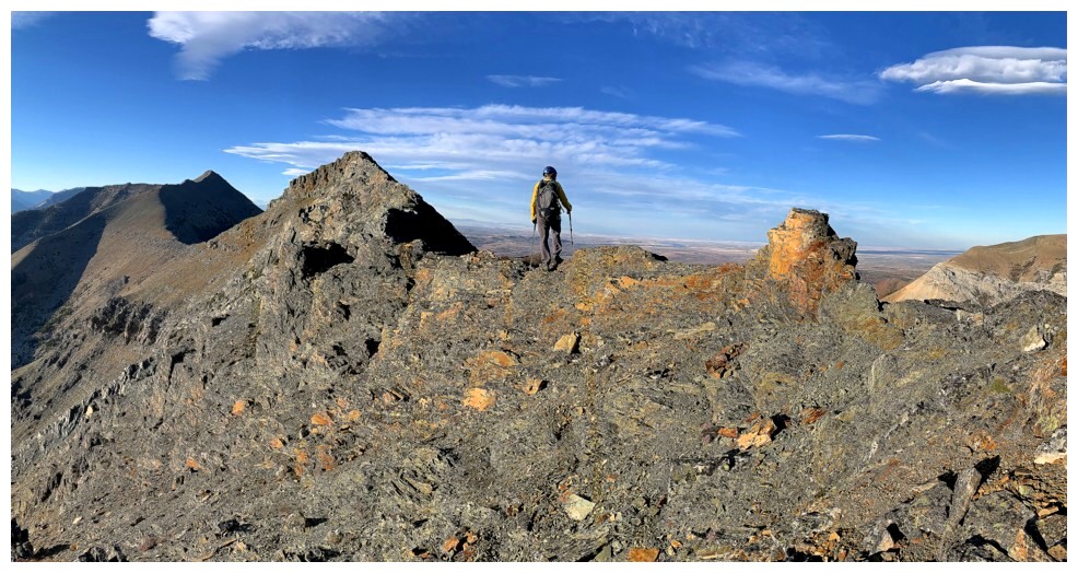
Finally on the ridge, with Waterton behind. The clear skies are on their way but it would be some time later.
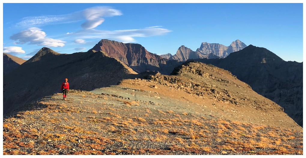
 At the summit of
Arras Peak, looking at the next stretch of terrain. Vimy Ridge is just
left of centre and Crypt Peak is just right of centre.
At the summit of
Arras Peak, looking at the next stretch of terrain. Vimy Ridge is just
left of centre and Crypt Peak is just right of centre.
Someone else liked Arras Peak too
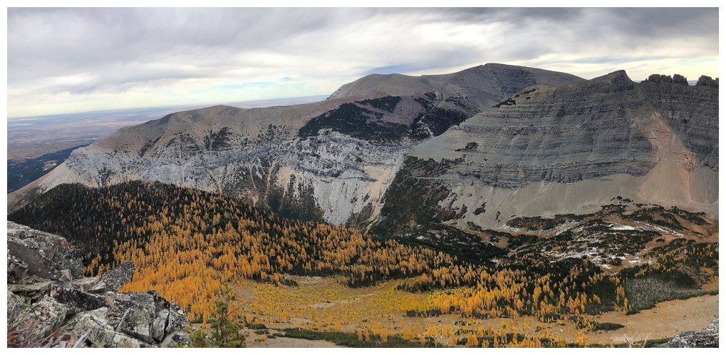
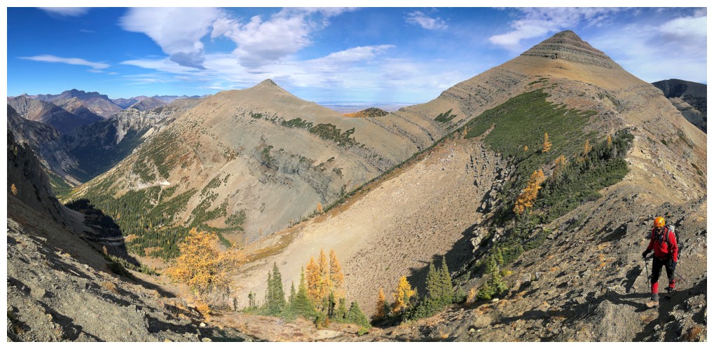
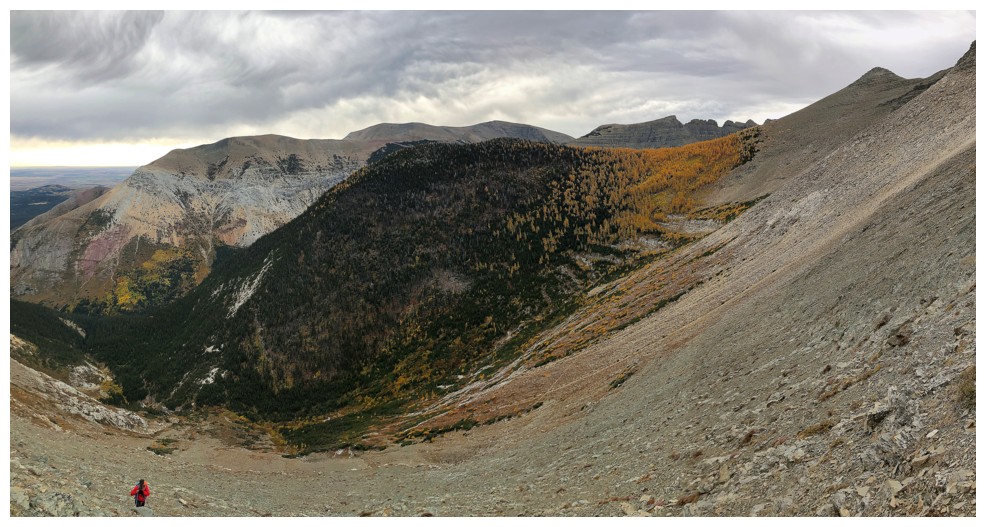
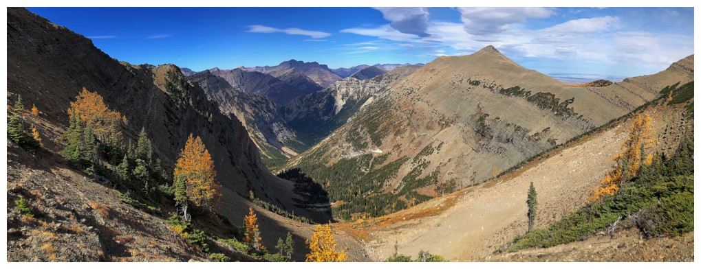
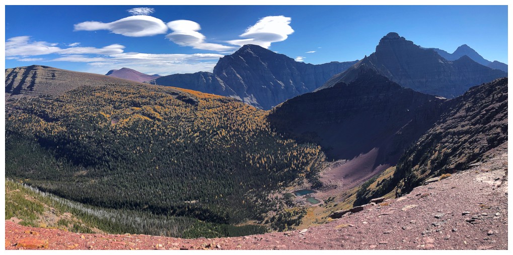
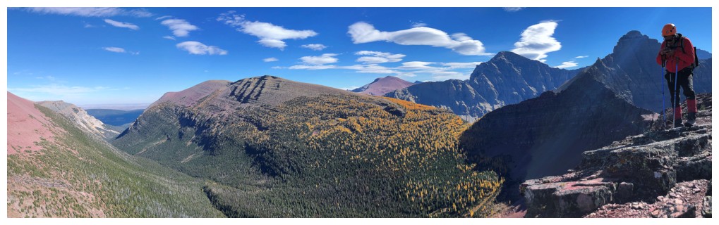
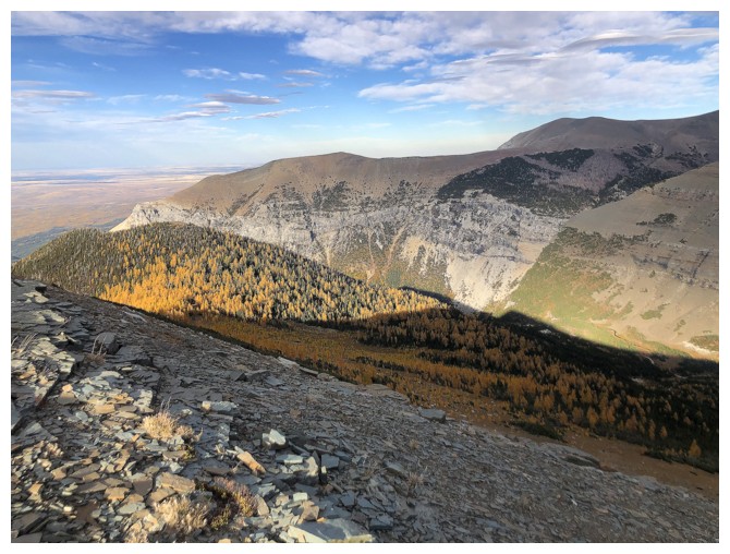
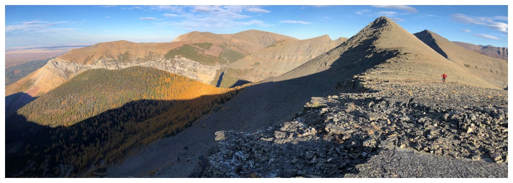
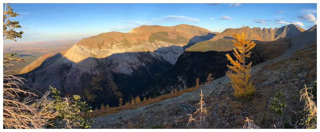
Another large swath of larches in the valley, on the east side of the ridge. Sofa Mountain at the right.
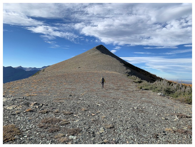
Heading towards Vimy Ridge
On the east side to get a brief reprieve from the relentless wind
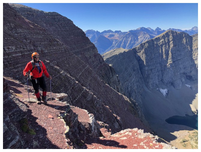
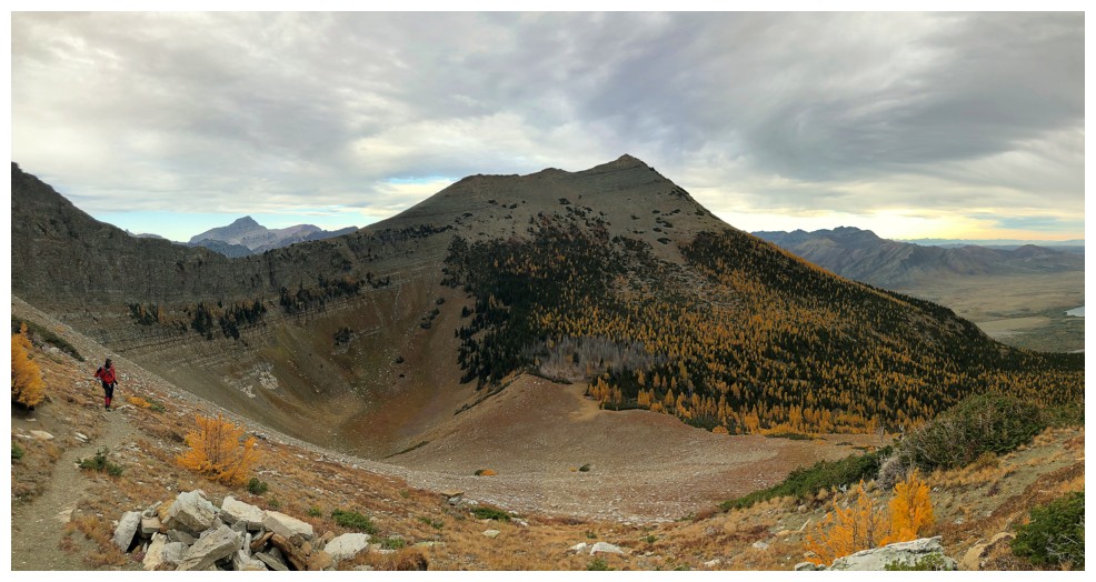
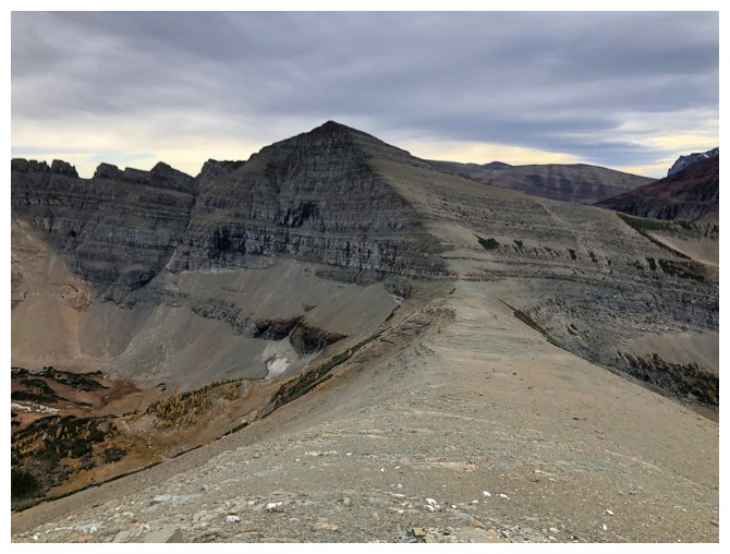
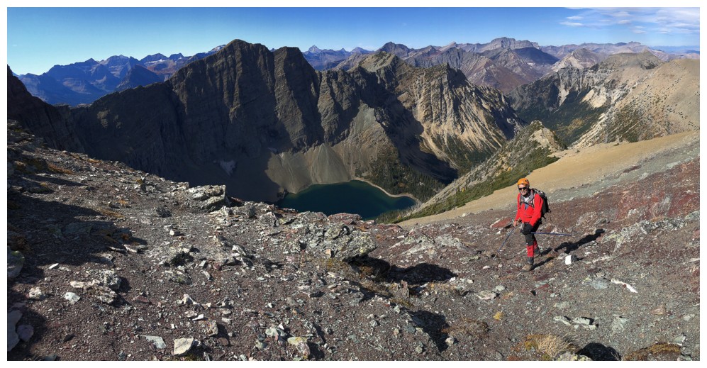
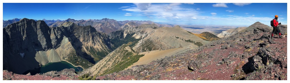
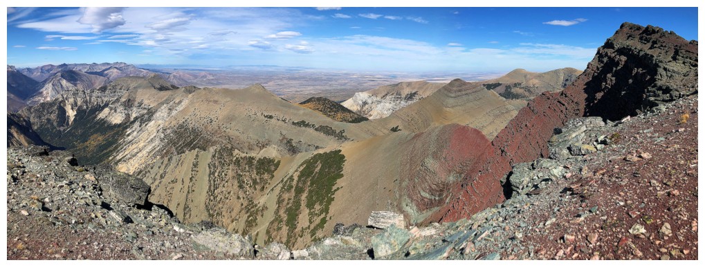
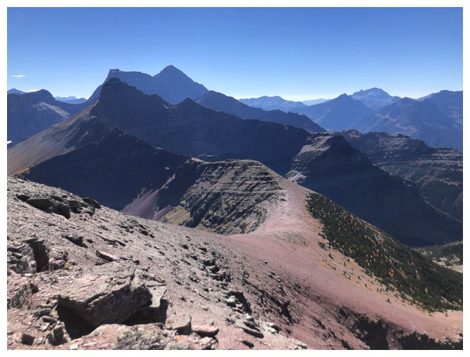
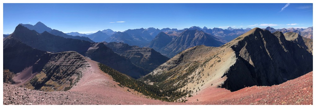
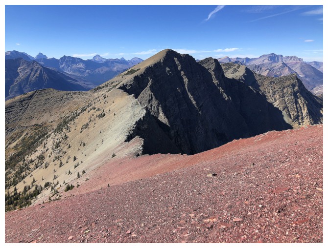
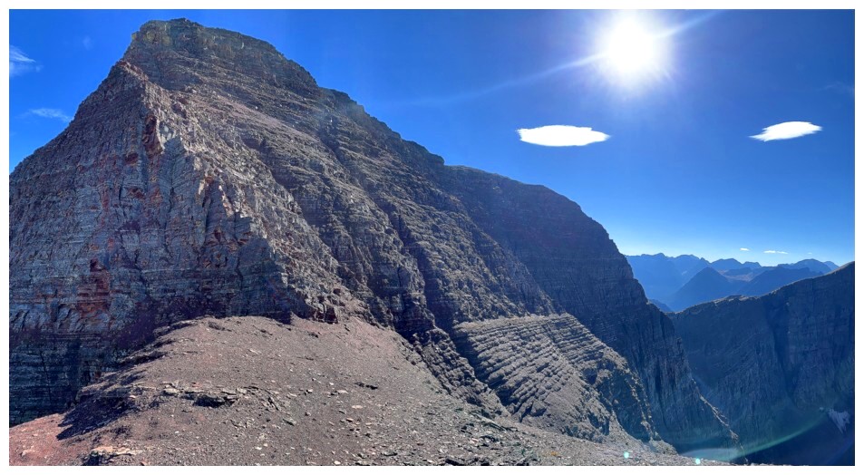
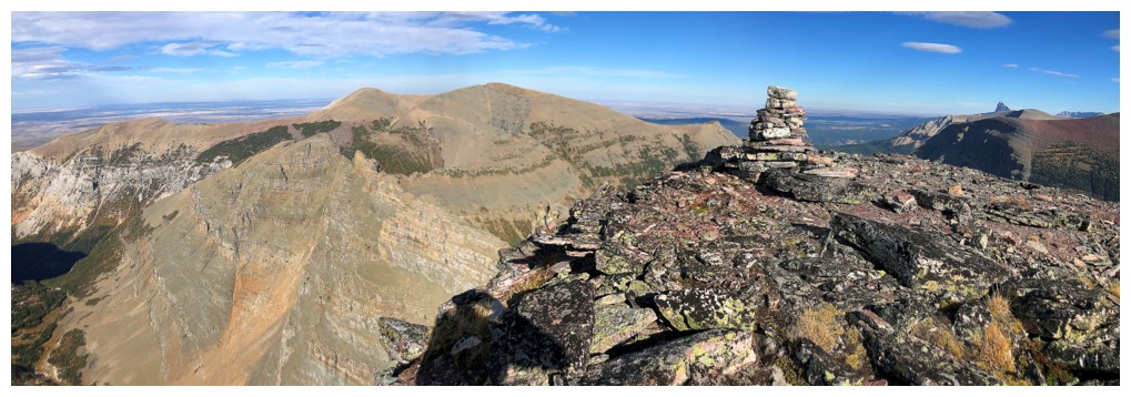
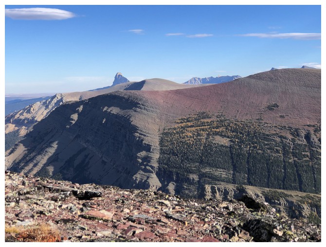
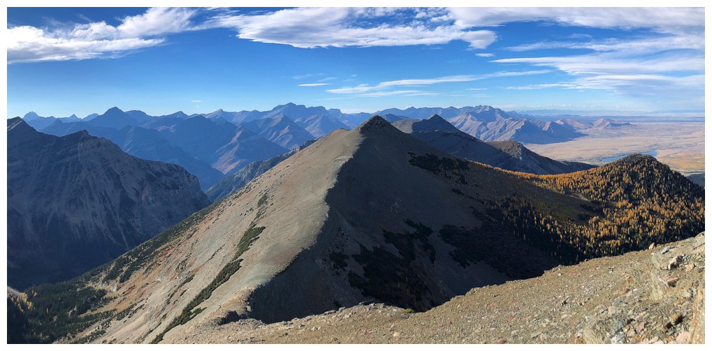
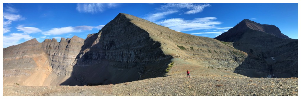
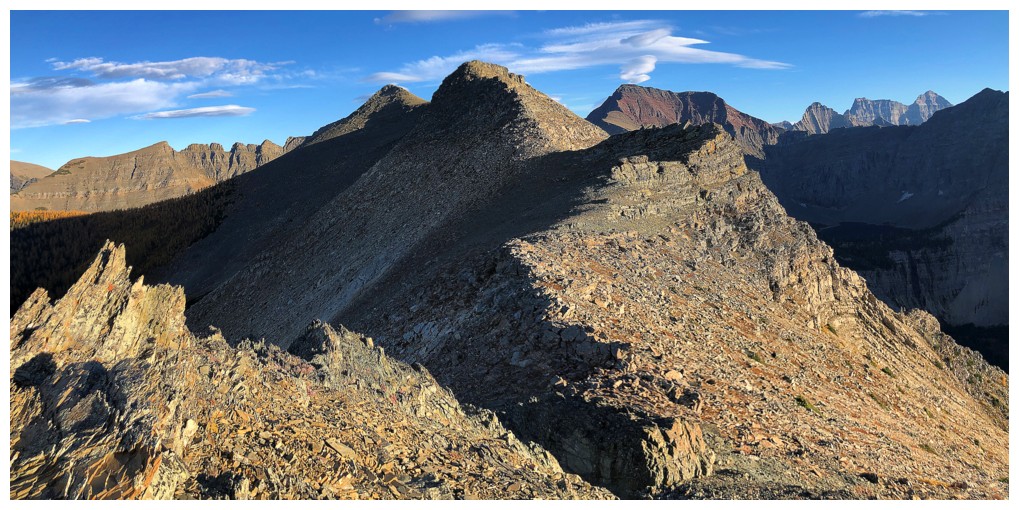
Crypt Peak and the side-sloping route to the Vimy/Crypt col
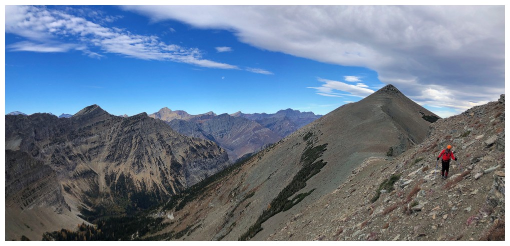
The start of the side-sloping
Not many larches here, but the lone ones sure added to the scenery
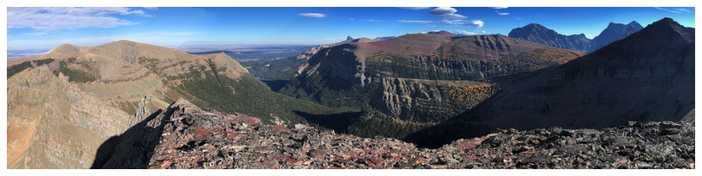
Looking down the valley to the north where the world famous Crypt Lake Trail resides
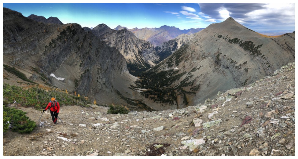
The east side of Crypt Peak from the wind-free sheltered area where we took a break
Ready to resume travel and the Sun is finally out!
The Crypt valley and larches look way better with the Sun out
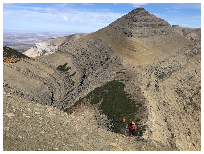
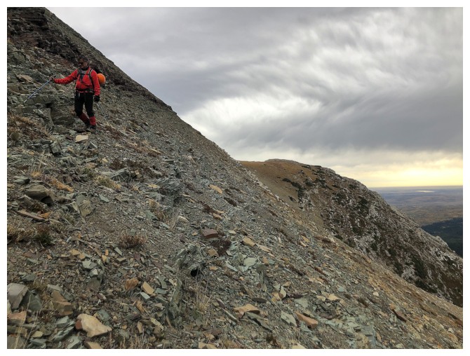
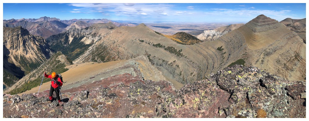
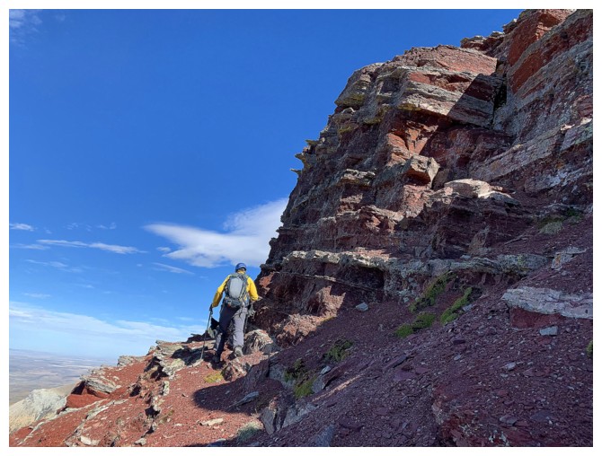
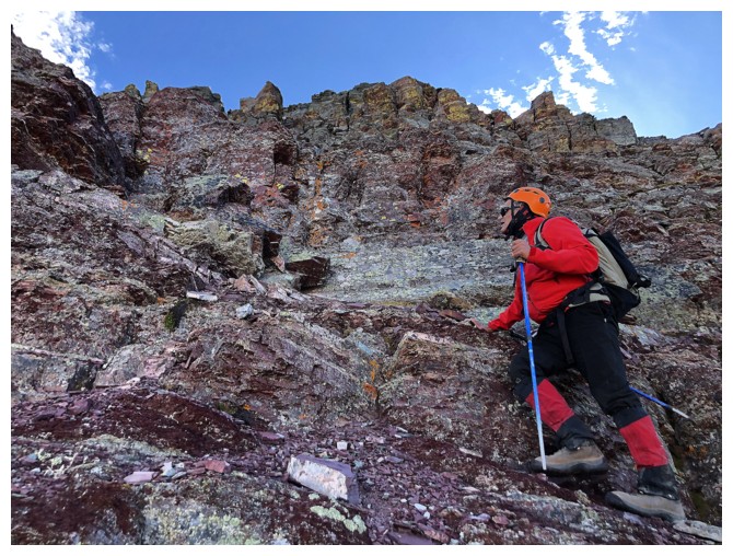
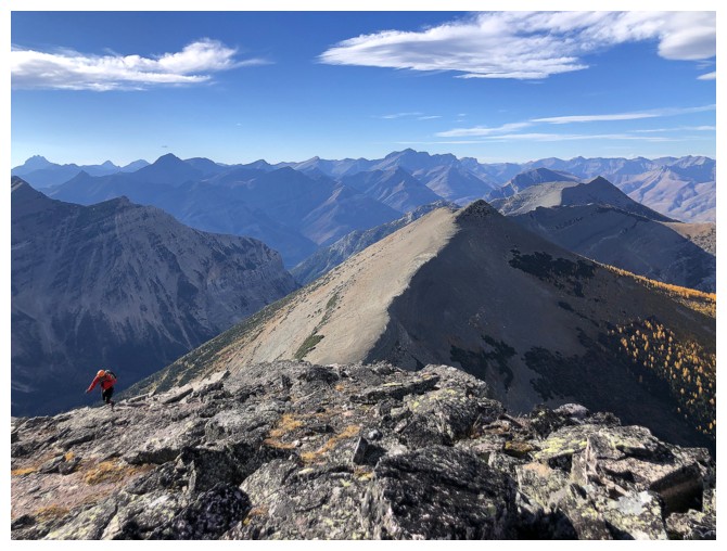
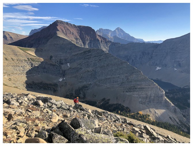
Mark ascends the steep but easy terrain to the Crypt Peak ridge. The tiered look of Vimy Ridge was captivating throughout.
Steep scree, interspersed with small rock bands
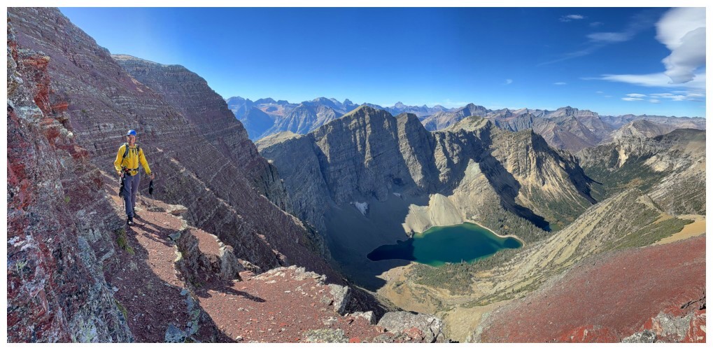
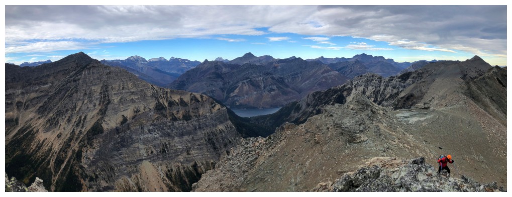
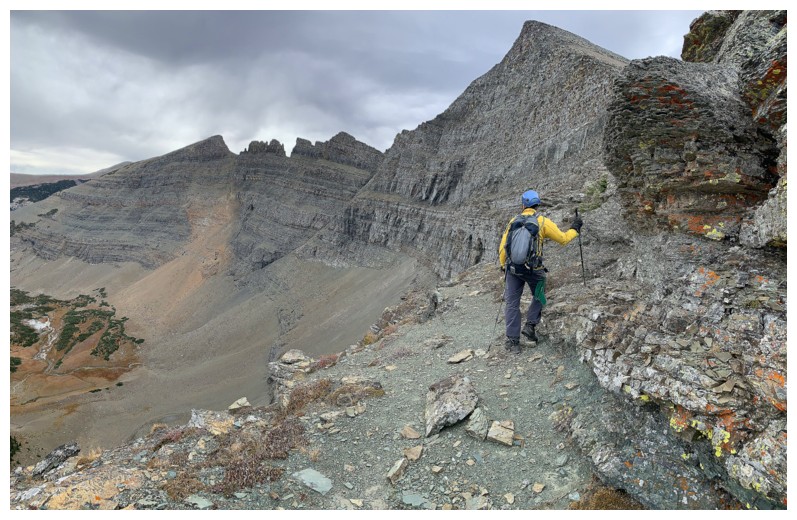
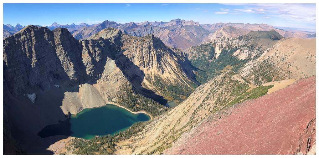
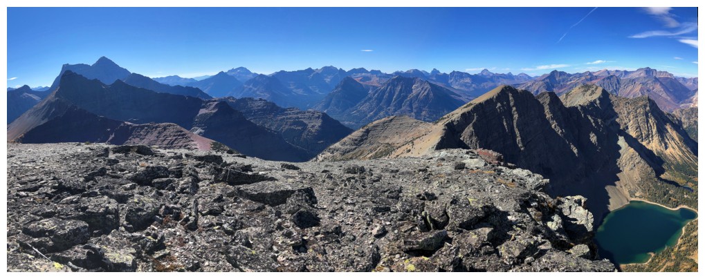
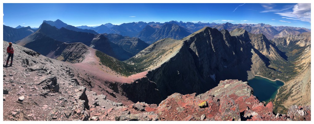
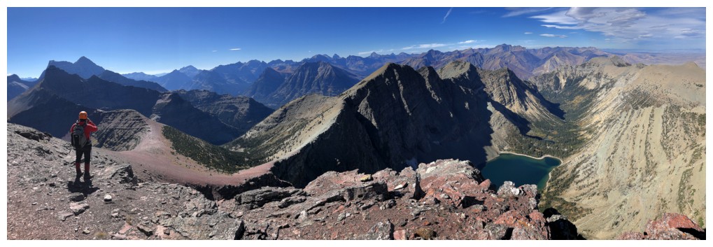
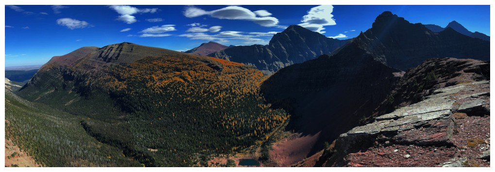
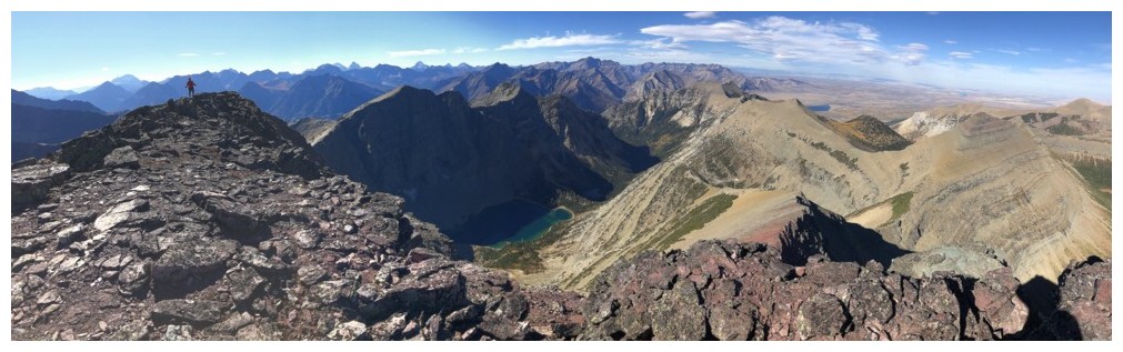
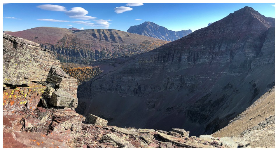
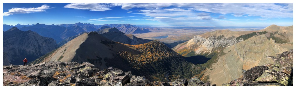
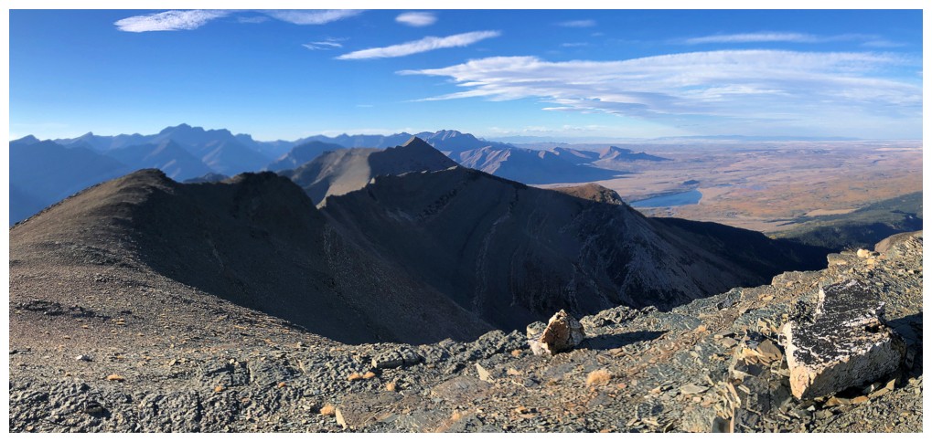
On the ridge with our first look of the day of Crypt Lake and Mount Boswell
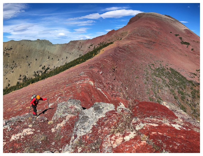
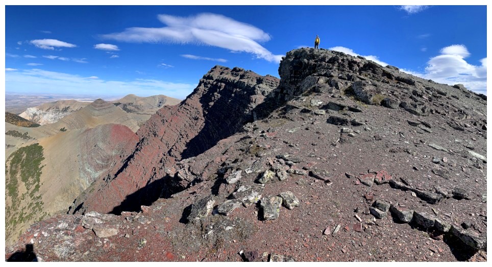
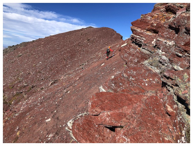
It's going to be red argillite heaven from here on in!
The distant yellow larches really added to the scenery in some sections
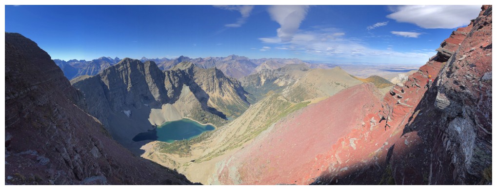
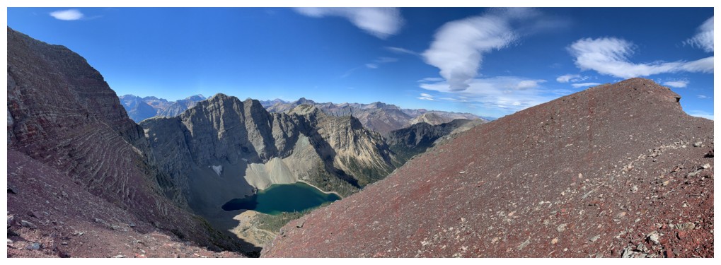
Crypt Lake really added to the scenery too!
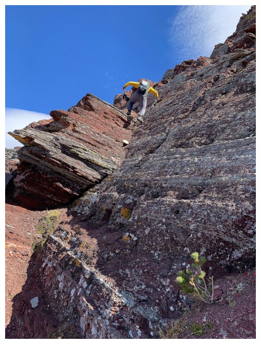
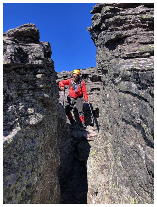
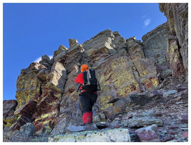
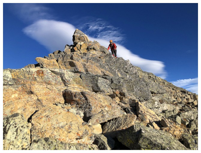
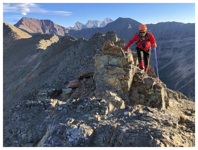
Fun scrambling
Tons of room explore on this face
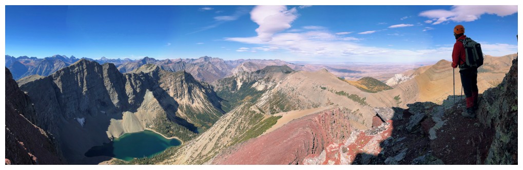
Can't get enough of this view
Still can't get enough of this view!
Recreating a photo of a neat spot from our first ascent
The upper section of the face
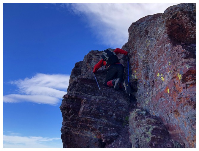
Mark tackles another step of enjoyable scrambling
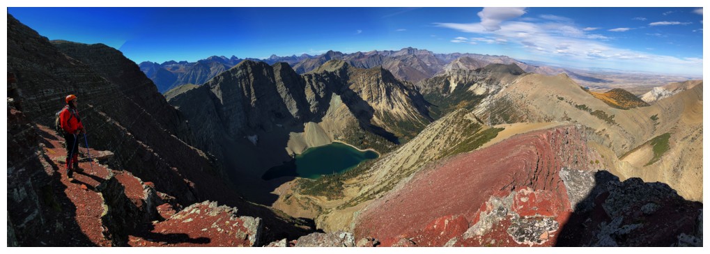
Still can't get enough of this view: The Sequel
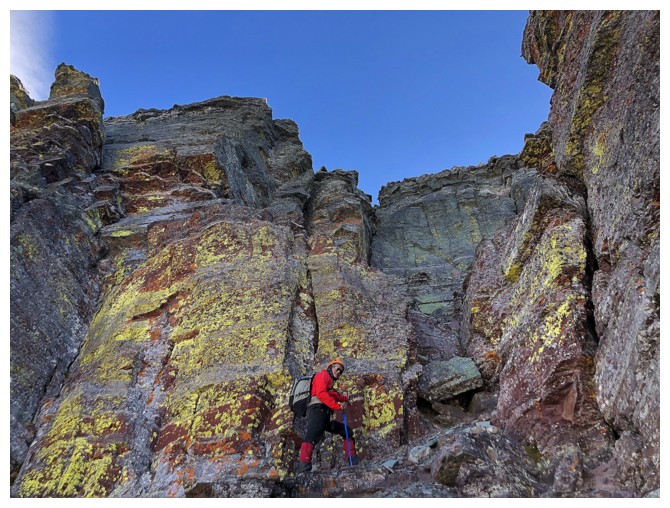
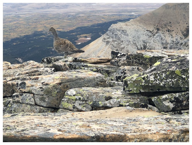
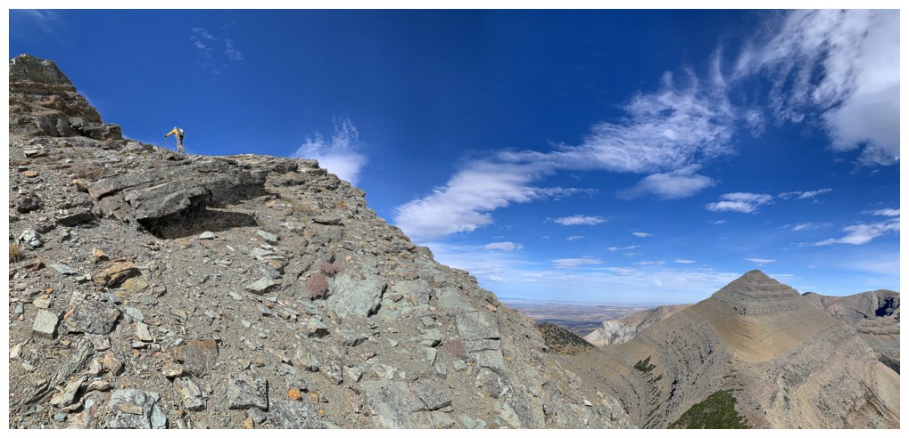
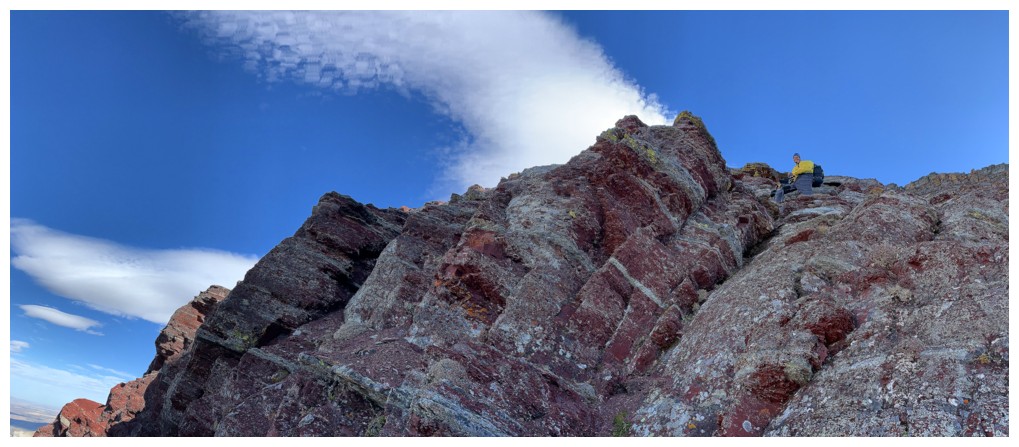
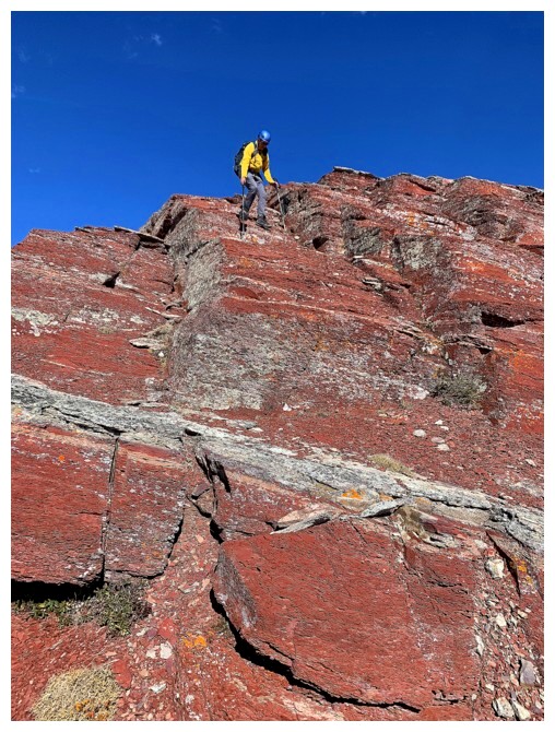
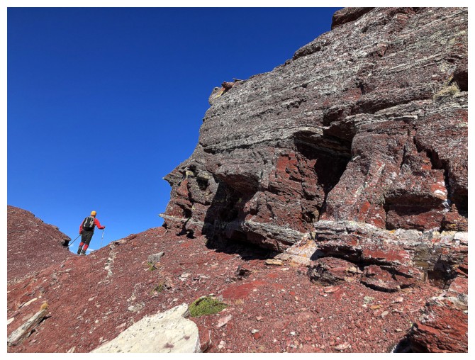
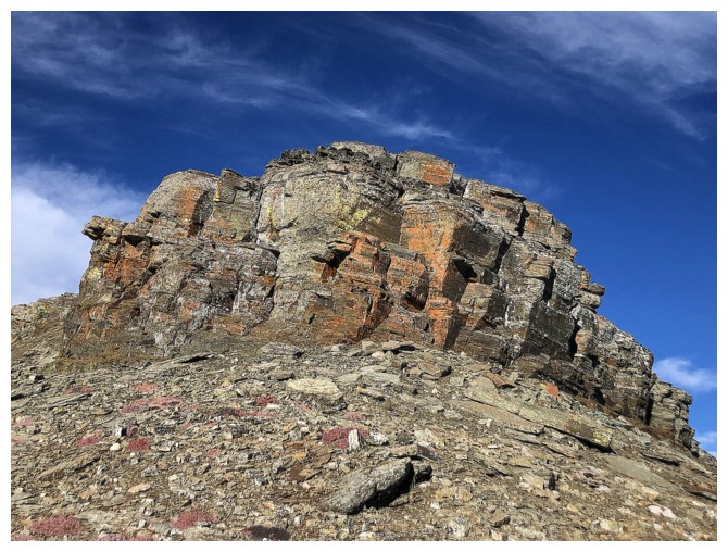
The summit appears to be guarded by the sweet, lichen-covered rock bands
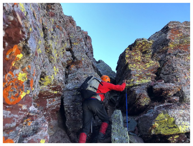
But there's a weakness through them
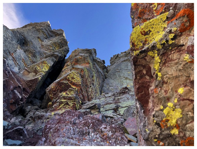
As stated - sweet!
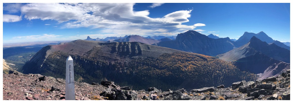
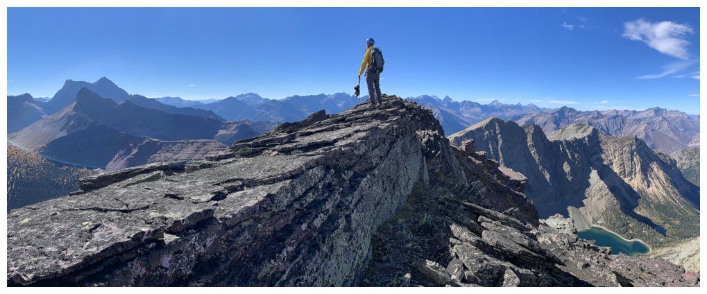
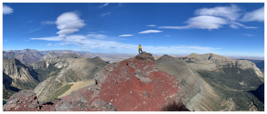
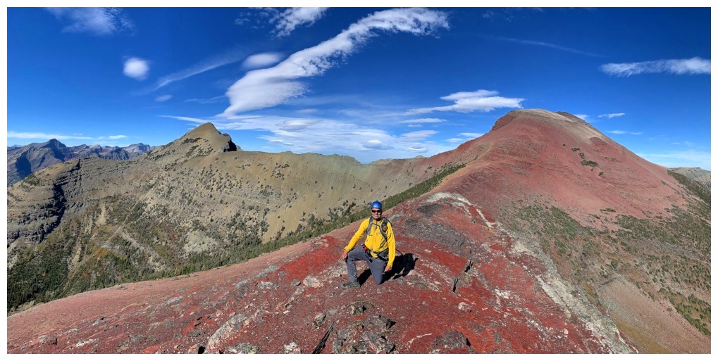
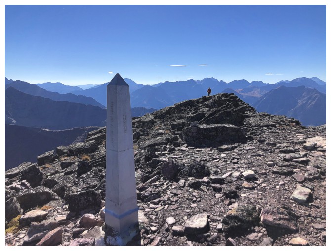
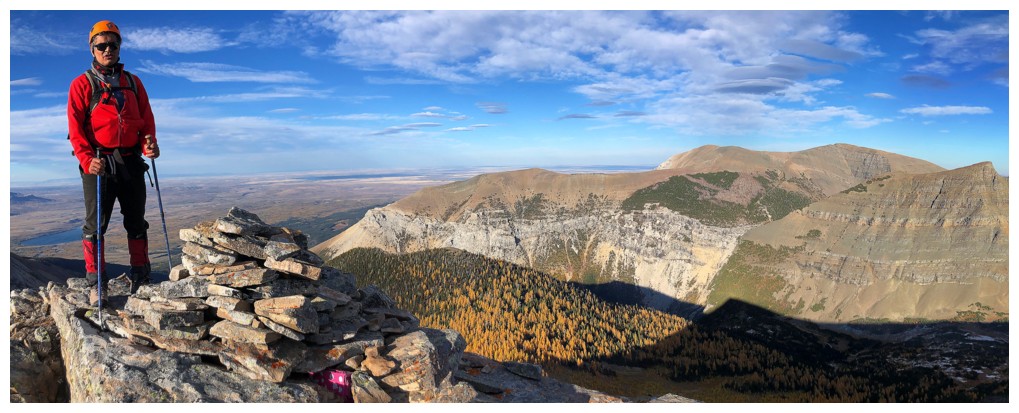
The summit!
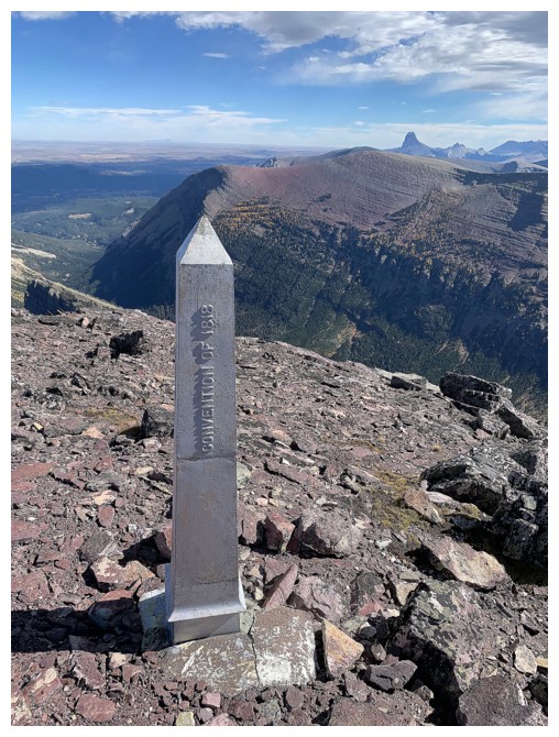
Great boundary marker
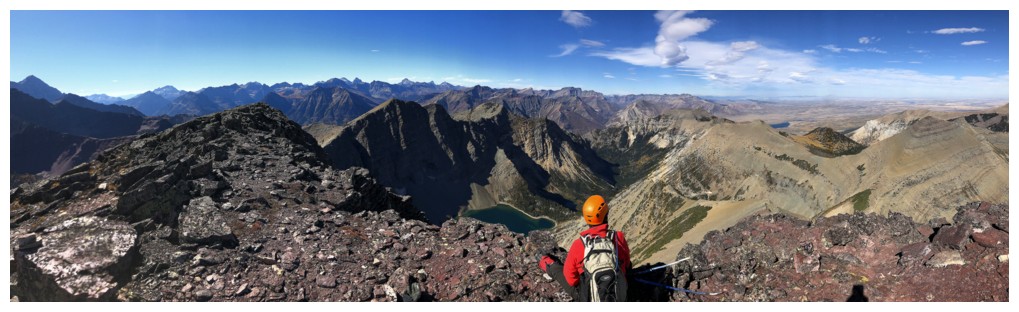
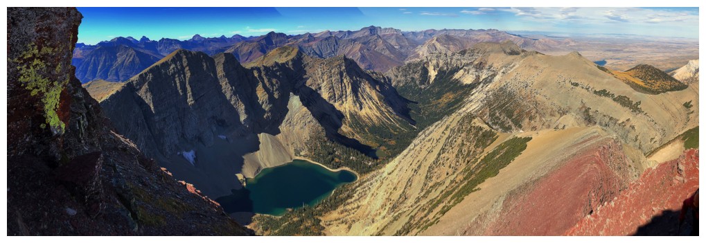
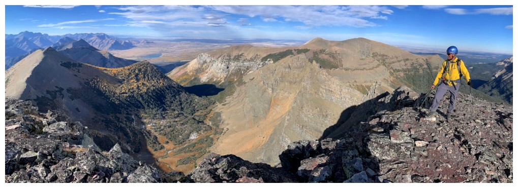
Summit view...
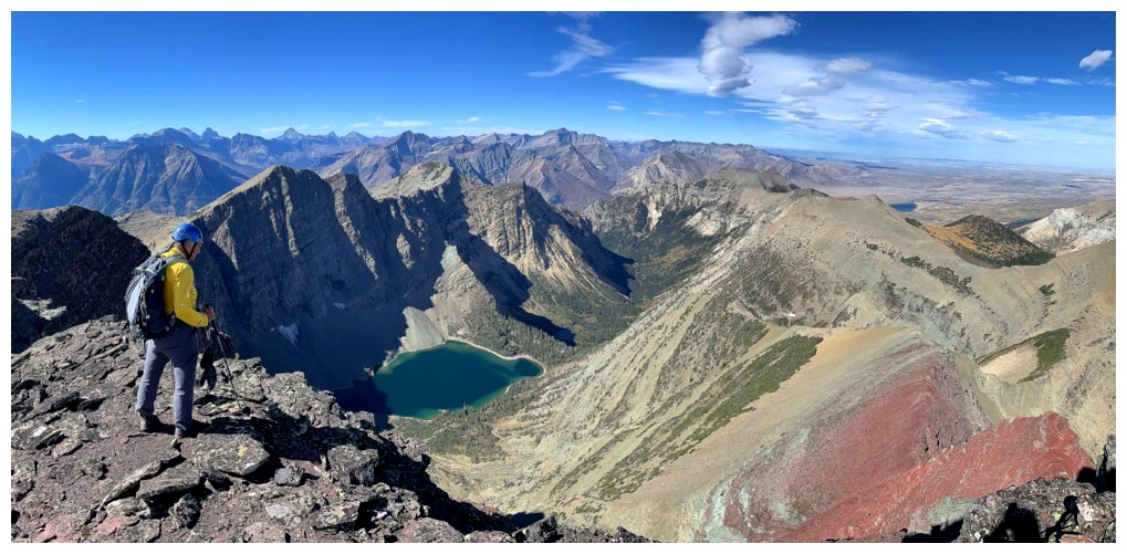
...one that's hard to beat
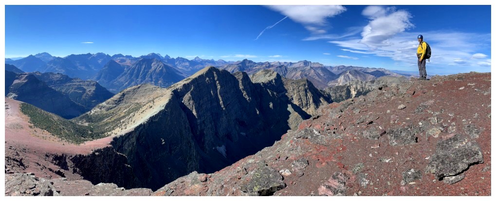
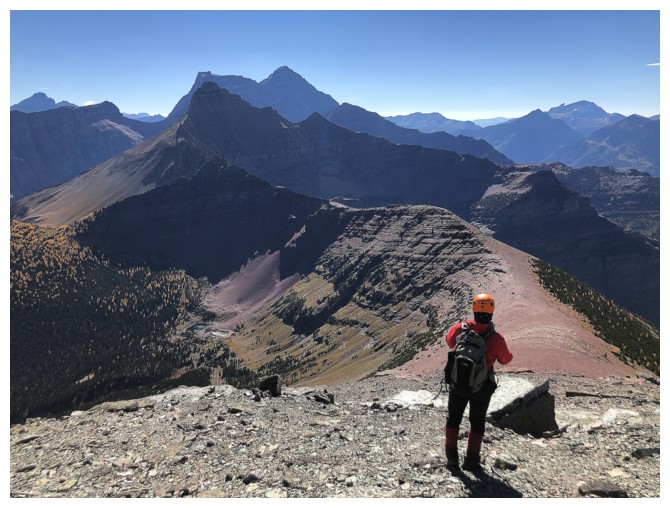
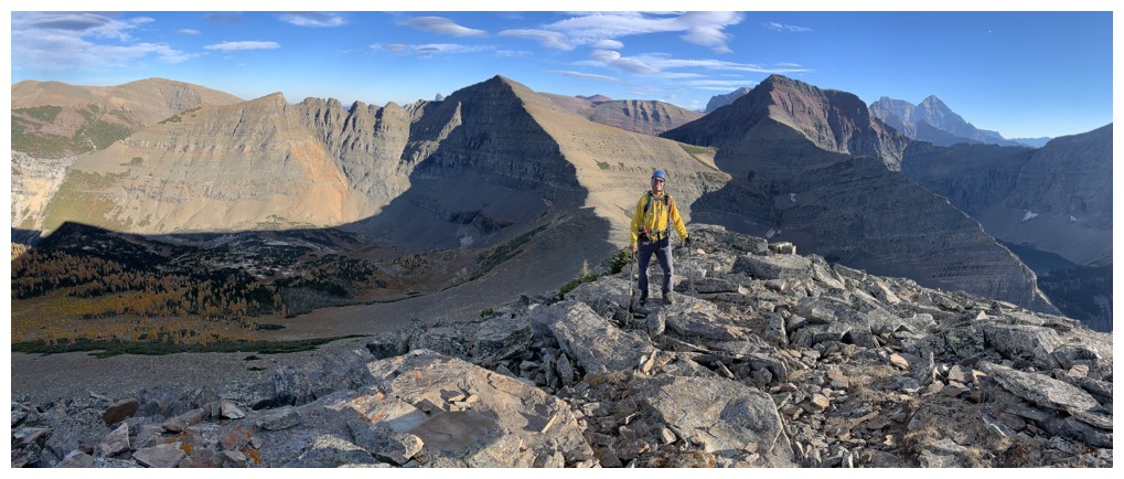
Exploring the ridge towards Boswell
Nice to see the face of Crypt (at the right) from a different angle (and all the other cool stuff too!)
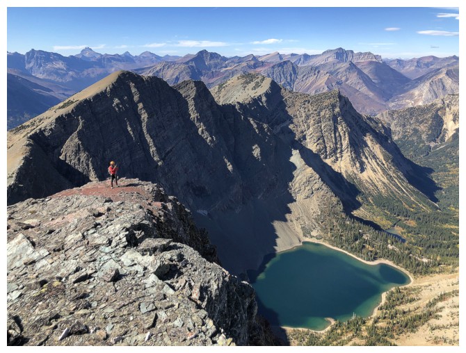
The ridge offers slightly different perspectives of Crypt Lake
Still going
The view towards Mount Cleveland was also captivating throughout
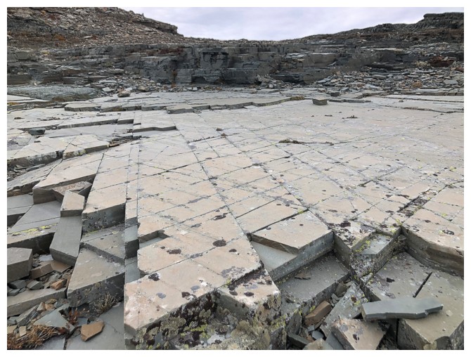
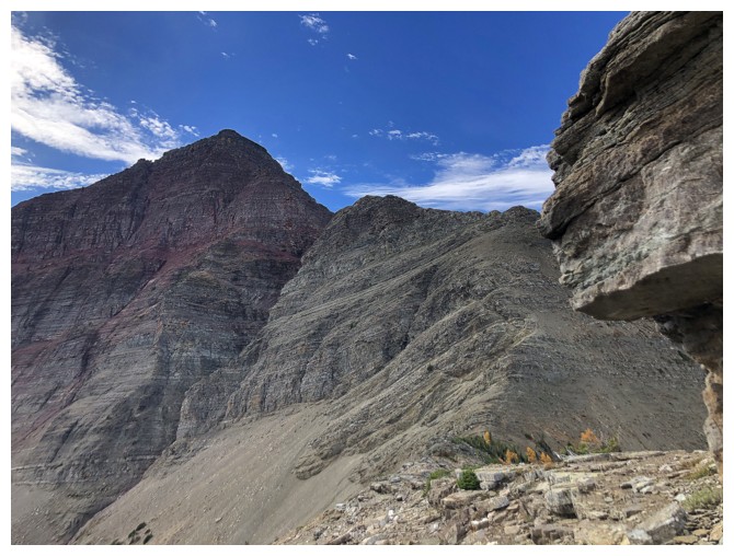
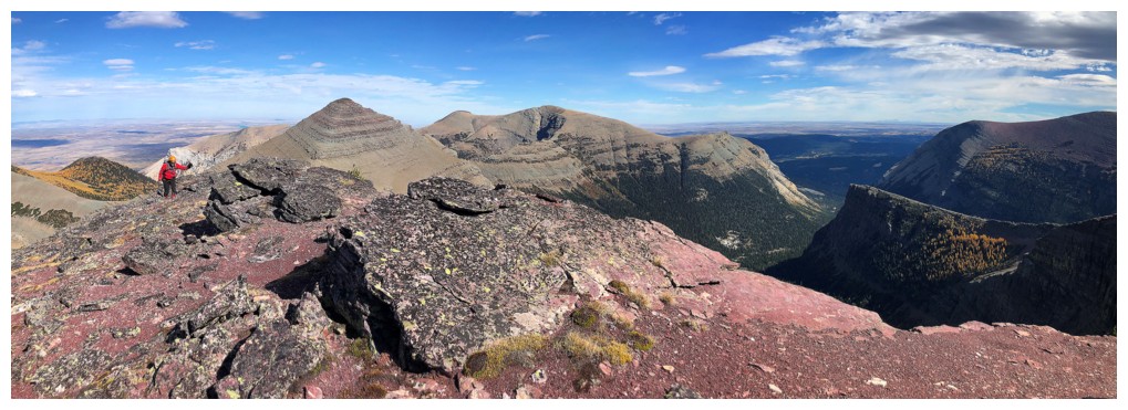
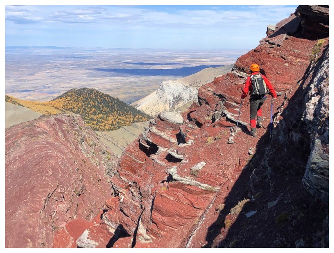
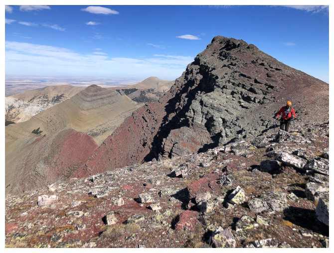
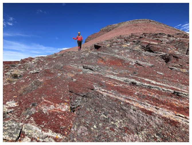
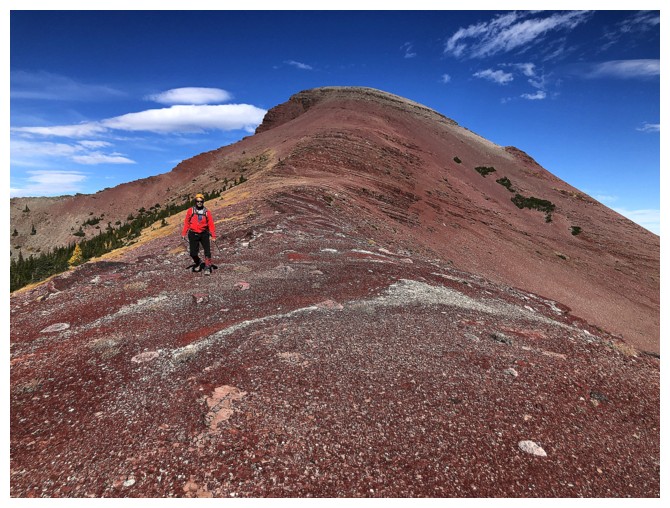
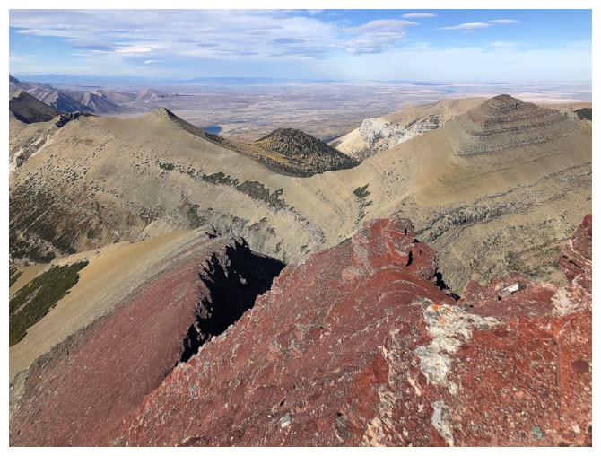
Not surprisingly, the entire summit block is comprised of brilliant red
argillite. If there ever was an Achilles Heel for us, it would be this
stunning rock.
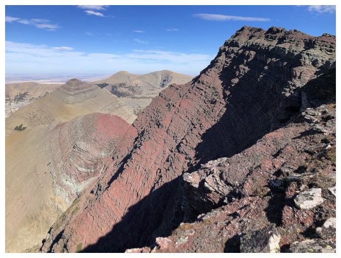
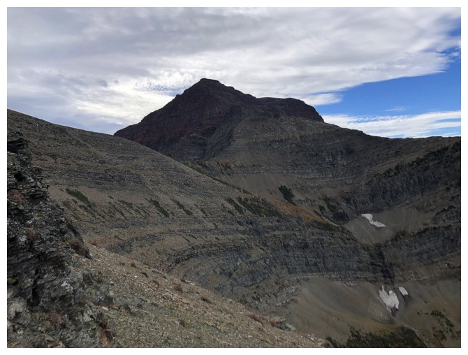
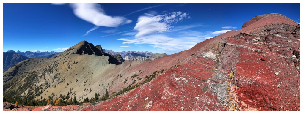
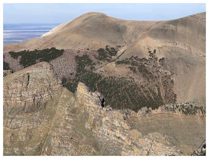
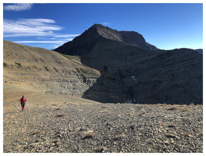
The north face of Crypt looks steep from this angle, but the terrain is ledgey and easier to ascend than appearances dictate
The red argillite ridge in front was irresistible
Clear delineation of rock types between Crypt and the southern outlier of Mount Boswell
But we'll stick to the red argillite
Not hard to see why
Ditto!
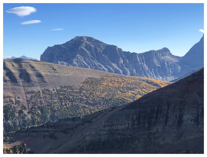
Striking peaks in Glacier National Park, Montana. Left to right: Kaina
Mountain, Miche Wabun Peak, and Mount Cleveland behind. We certainly
miss visiting that remarkable part of North American a d can't wait until the border opens again.
Sarcee Mountain has its fair share of larches
End of the line and time to return to Crypt Peak
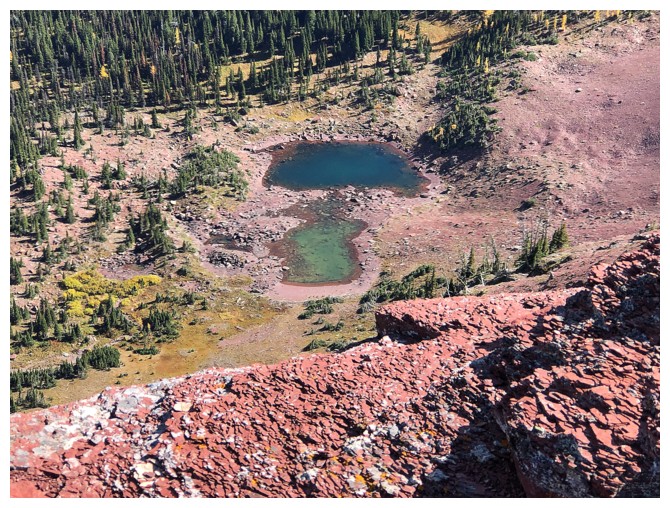
A couple of small but colourful tarns
That cool outlier of Boswell again
Back to the boundary marker
Last look from the summit
And last look at the lichen-covered rock
The Sun is now on the face and doing justice to the brilliant red argillite
Enjoying the last of the red argillite scenery for the day
Looking back at the awesome summit block of Crypt
Back down to the Crypt/Vimy col
Sometimes a single, yellow larch can be as eye-catching as a forest of them
Heading to the summit of Vimy Ridge. Arras Peak at the left.
Needless to say, Vimy has tons of colourful rock
Sarcee, Kaina, and Crypt
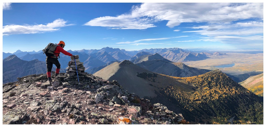
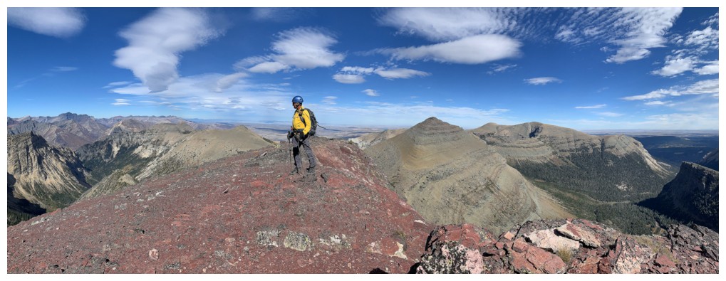
The Vimy Ridge summit cairn
Sofa Mountain at the left and all that cool Montana stuff to the right
Mark takes the final few steps to the summit
Kaina Mountain could be described as the Eon Mountain of Glacier - it's
a huge mountain that is significantly overshadowed by its infinitely
more popular neighbour, Mount Cleveland
Distant Chief Mountain is always distinctive and always present
Mark takes the final few steps, again!!
The ridge that connects Vimy Ridge to Sofa Mountain looks intriguing and terrifying
Mark makes it to the top. The larches on the outlier of Arras were spectacular at this point.
My summit pose
From this angle it's easy to see why Arras Peak has been named
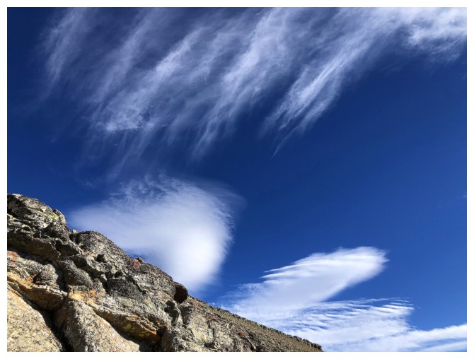
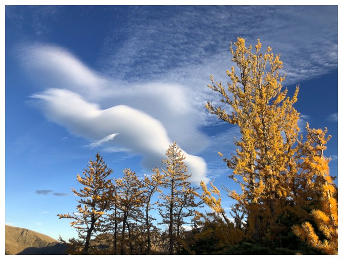
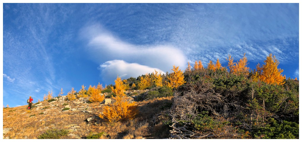
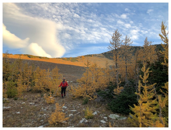
Interesting clouds

Mark at the base of Vimy
Heading back up to Arras Peak
Crypt and Mark
Crypt, Mark, Vimy, and that terrifying ridge
Sweet larch views, but the Sun is going down
The famous tunnel of the Crypt Lake Trail is barely discernible at the lower right
Summit poses on Arras
Same as above
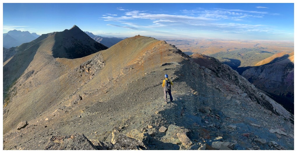
Looking along the next part of the return trip
Still lots of distance to cover but travel is easy and the scenery is magnificent
Cool rock is not he sole domain of Crypt Peak on this trip
The terrain between Arras and the next highpoint is the most interesting of the traverse
Pleasant ridgewalking
Almost at the highpoint we should have hit on ascent
Miche Wabun Peak and Mount Cleveland look so close when you zoom in, but are quite far away
They don't look so close now
Losing our battle with the setting Sun
We did manage to see a few larches in Sunlight
And some cool clouds
Back to the basin
Last of the larches in waning daylight
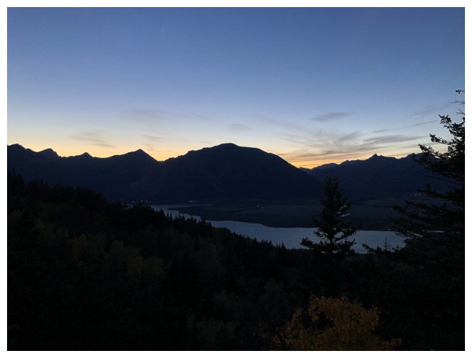
Waterton again. We weren't expecting this level of darkness when
passing this area about 13 hours earlier, but we wouldn't change a
thing.
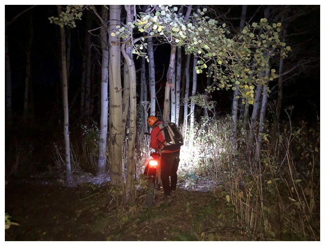
Preparing the bikes for a headlamp, illuminated ride out. 7 km of easy riding to end our best day yet in the mountains!
The End
LOG