"Sugarloaf Mountain”
(“The Sphinx”)
October 3, 2021
Mountain height: 2500 m
Elevation gain: 2000
m
Round-trip time: 11 hours
Solo scramble.
After an awesome first visit to the Egypt
Lakes area in late August, a “soon as possible” return was in order. Given the
abundance of more statuesque objectives in the area, the lowest of them all,
Sugarloaf Mountain, might have seemed like an odd choice. However, the topo map
indicated that Sugarloaf could possibly grant the best view of three of the
area lakes (Egypt, Scarab, and Mummy) simultaneously. Better than that from
Greater Pharaoh Peak though? Again, possibly. The only knock on the Pharaoh
view is that the lakes lie to the south of the peak and so the Sun is generally
in front of the viewer. This can often produce glary lake views that obscure
the colours of each lake. On Sugarloaf’s summit, the Sun would be behind the
viewer, hopefully revealing the true colours of the lakes. And since views and scenery are always my
primary motivation for going to the mountains, Sugarloaf was clearly the best
choice for me.
 In addition, I wanted to check out the Dewit
inspired approach from Healy Pass, as opposed to the Hobbs inspired Redearth
Creek approach. The Healy Pass route is shorter, and reported to be more
scenic, but requires far more elevation gain and the entire route must be
hiked, not biked, whereas 10.5 km of Redearth can be biked each way. My only other visit
to the Pass was a fantastic winter ascent of Healy Pass Peak. The Pass is also
famous for its abundance of larches, providing more motivation to use this
route.
In addition, I wanted to check out the Dewit
inspired approach from Healy Pass, as opposed to the Hobbs inspired Redearth
Creek approach. The Healy Pass route is shorter, and reported to be more
scenic, but requires far more elevation gain and the entire route must be
hiked, not biked, whereas 10.5 km of Redearth can be biked each way. My only other visit
to the Pass was a fantastic winter ascent of Healy Pass Peak. The Pass is also
famous for its abundance of larches, providing more motivation to use this
route.
The trip started with a bit of a downer. Due
to construction car access to the trailhead was blocked, necessitating an extra
kilometre of hiking to get there. A paltry kilometre doesn’t seem like much,
but it adds up when you are talking about a 30+ km day with approximately 2000
m of elevation gain.
I reached Healy Pass in about 2 hours.
Though the skies were not perfectly clear, the views at the Pass were as
impressive as advertised. 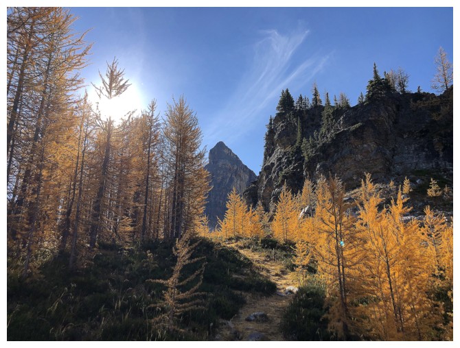 I would have loved to have descended to the nearby lake
under the beautiful form of The Monarch, however detours and diversions would
have to be kept to a minimum on what was bound to be a very long and physically
demanding day.
I would have loved to have descended to the nearby lake
under the beautiful form of The Monarch, however detours and diversions would
have to be kept to a minimum on what was bound to be a very long and physically
demanding day.
Of course, the next section, a gentle 350 m
elevation loss down to the Pharaoh Creek valley, was super easy and fast. Like
many, I was probably thinking about the agony of regaining this elevation near
the end of the day already!
I managed to resist the diversion to Egypt
Lake, quickly (a relative term for me these days!) arriving at the beautiful
shores of Scarab Lake. The more than pleasant surprise at this point was the
weather. Having checked the forecasts and satellite imagery the night before, a
mix of sun and clouds was the best I expected. Such was not the case. The
weather was perfect! Clear and calm. As such, I hurried on towards Mummy Lake,
hoping the sky would remain cloud-free.
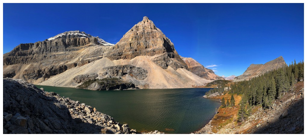
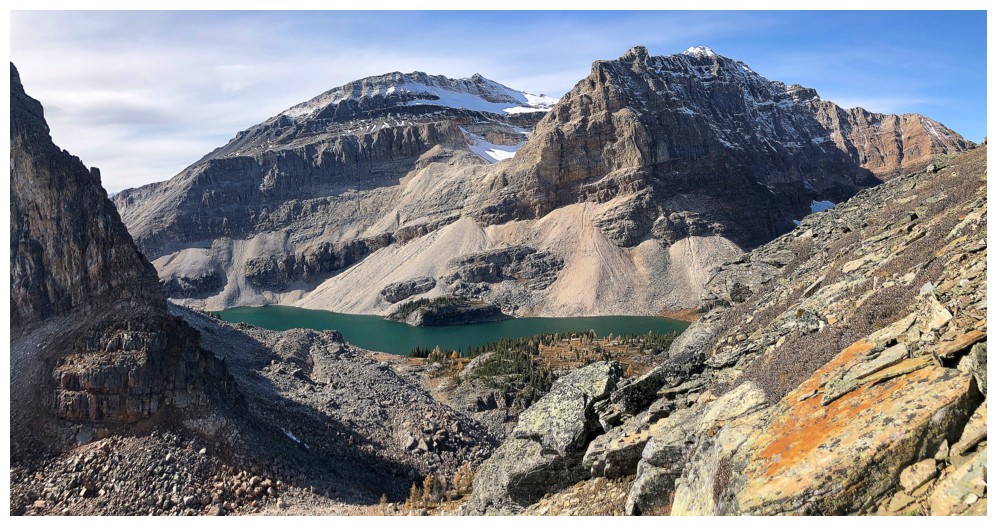
If there was one detour I would not be
denied, it would be to the shores of Mummy Lake. That side-trip required a
little extra elevation loss and regain but was totally worth the effort. Like
Egypt and Scarab, Mummy is a stunning lake amid stunning surroundings. The
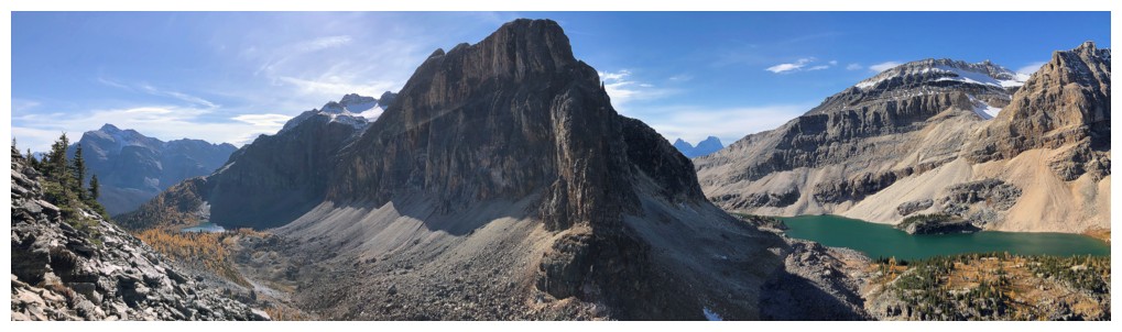
profile of Scarab Peak above the lake was amazing.
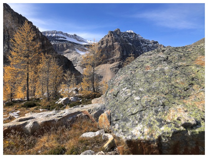
Back on track for the Sugarloaf ascent, I
initially took a direct line towards the summit via the west face, as suggested
by Liam Mercer. The route did provide sections of steep
hands-on scrambling up solid Gog Quartzite. When the terrain became more
serious, I bailed onto the southwest face and completed the ascent on easier
terrain.
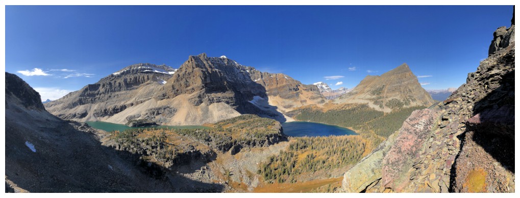
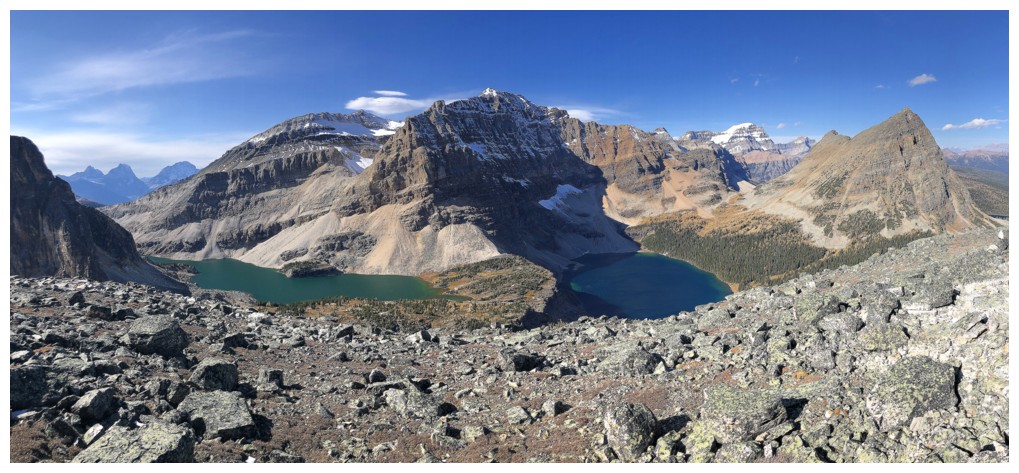
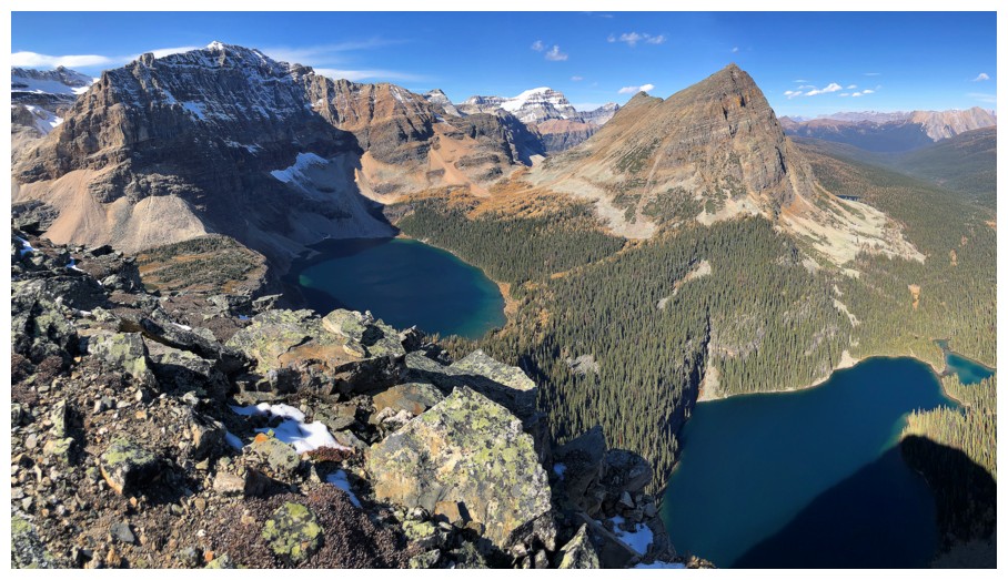
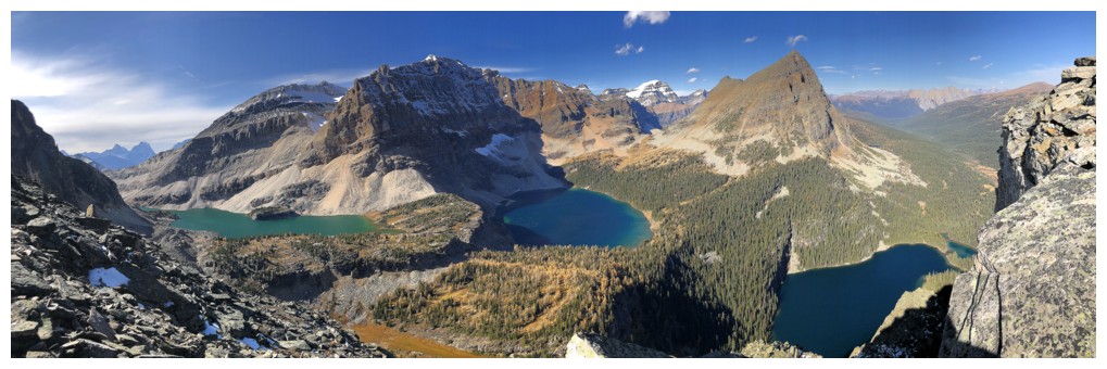
And then the moment of truth – would I get
the best view of the three lakes? Yes and no. From the summit, the view of
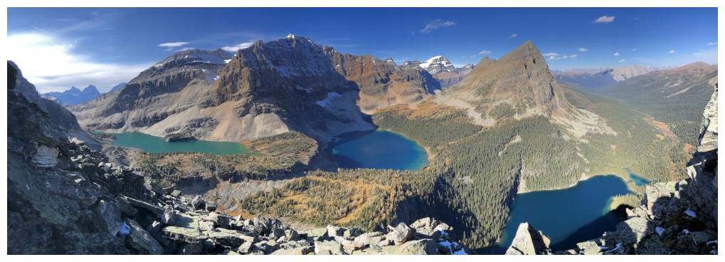
Mummy and Scarab was phenomenal; but Egypt was not to be seen. This shortcoming was
easily rectified by descending to the northwest for some distance where most of
Egypt Lake joined the spectacle. This location yielded one of the best views
I’d ever seen, period!
For descent I had already decided to follow
one of Vern’s suggestions and go down to Talc Lake. This route has two huge
advantages over returning the same way: 1. Visiting the shores of yet another
magnificent lake; 2. It’s all downhill (except, of course, for the unavoidable
ascent back to Healy Pass).
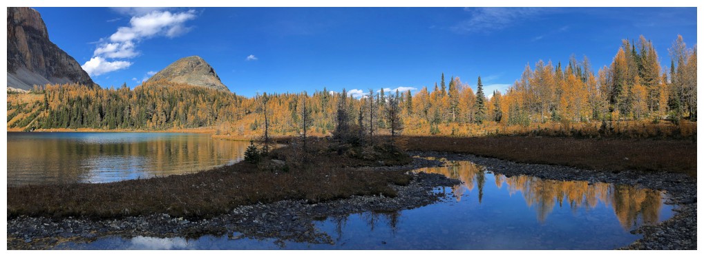
Getting down to Talc Lake was easy, scenic (tons
of larches), and the lake itself pleasant and serene. After a much-needed food
break, I followed the Talc Lake trail down to Redearth Creek and then back to
the Healy Pass junction – great descent route! With a very slow but steady
pace, getting up to the Pass was not as excruciating as expected. Another quick
stop to take in the superb, larch-filled environs of Healy Pass and then a long
but easy hike back to car to end an outstanding day of breathtaking scenery and
views. Magnificent!
First view of The Monarch
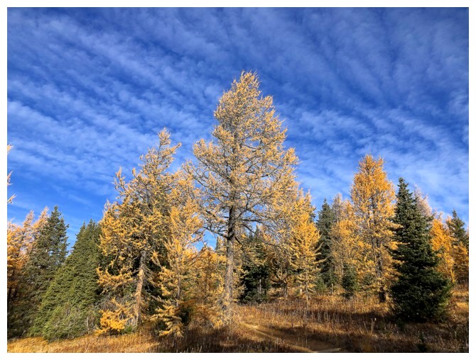
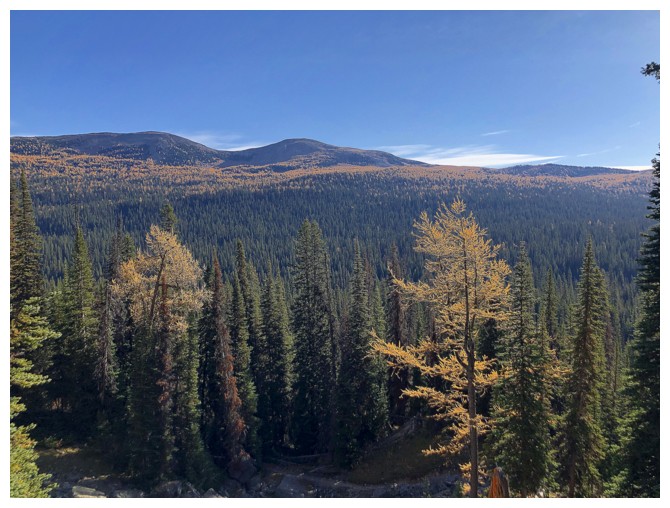
Getting excited to see the larches
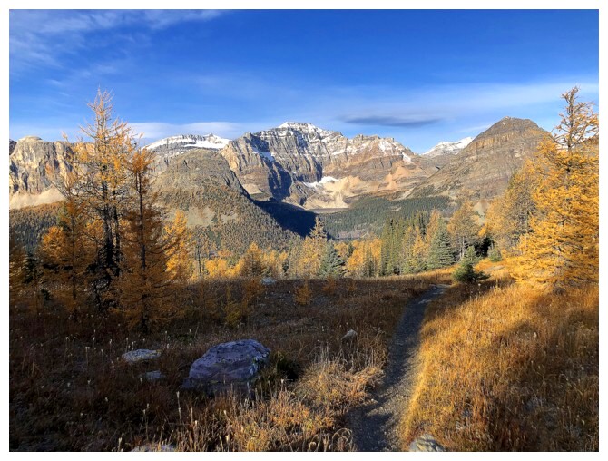
Approaching Healy Pass and things are getting golden
The Monarch and the lake I would have liked to visit but didn't
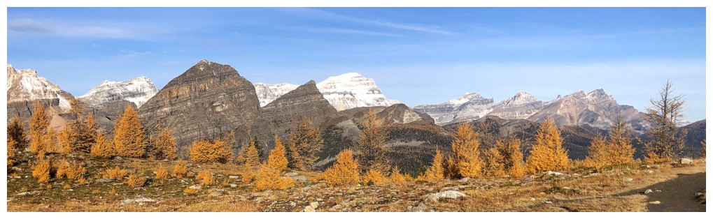
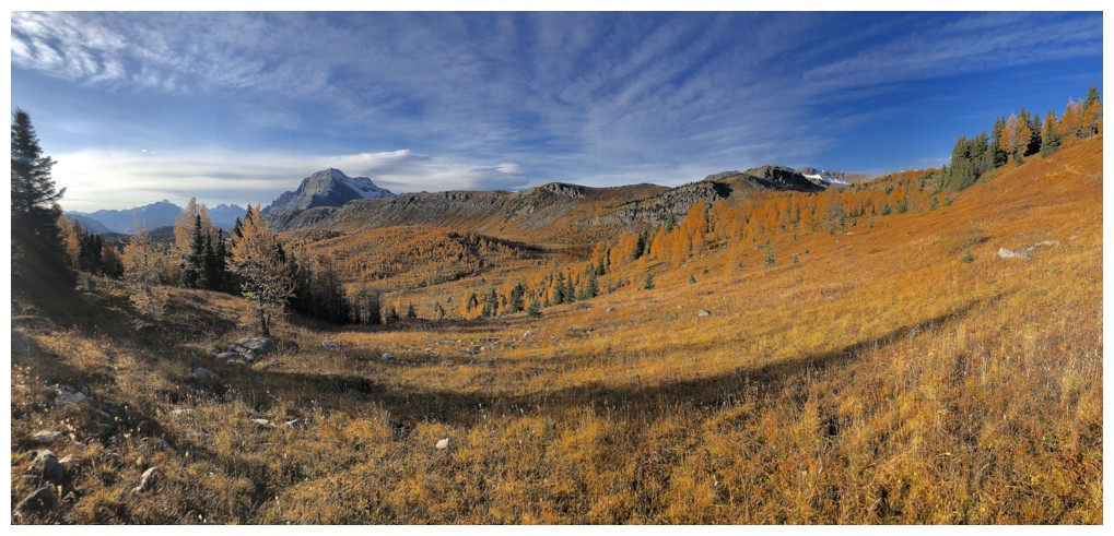
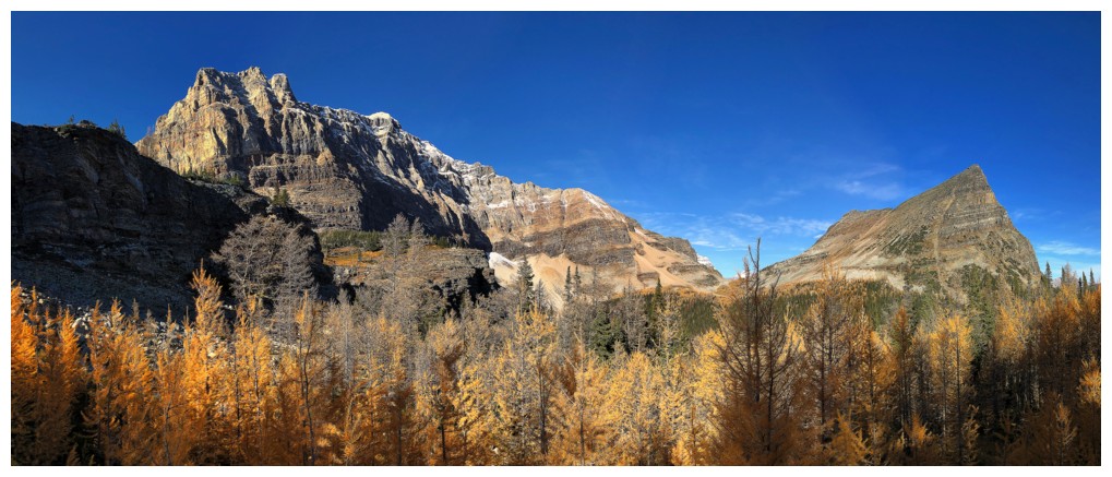
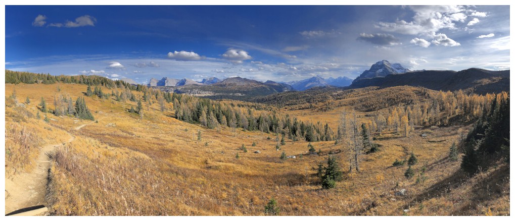
The view towards the Egypt Lake area from Healy Pass. Greater Pharaoh near the left and snowy Mount Ball in the centre.
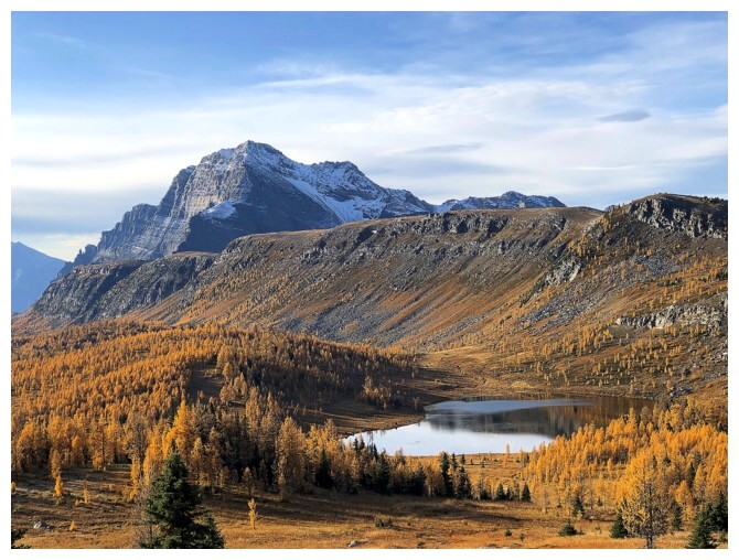
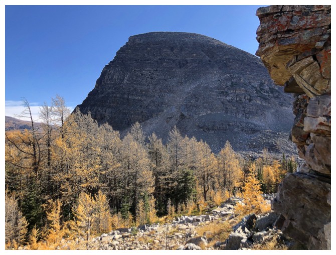
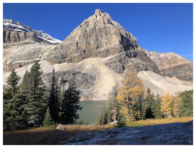
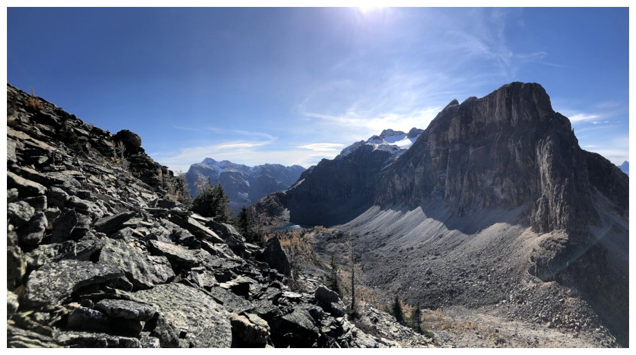
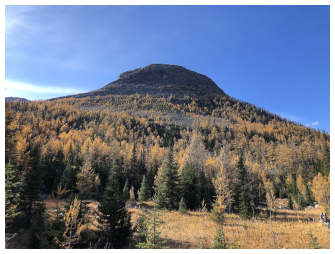
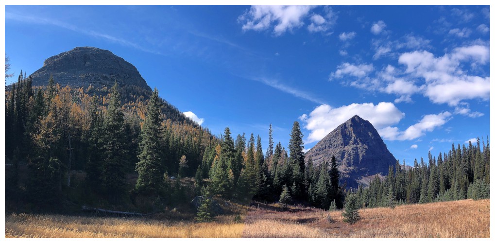
Rounded Sugarloaf Mountain sits inconspicuously in the centre, overshadowed by much bigger Scarab Peak, right of centre
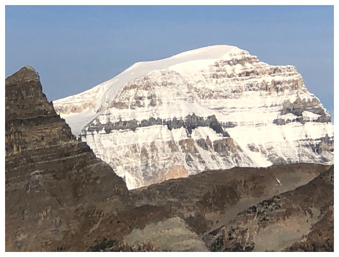
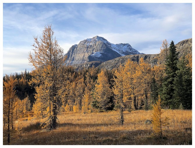
Mount Ball
The many outliers of Storm Mountain
Descending easily to the Pharaoh Creek valley
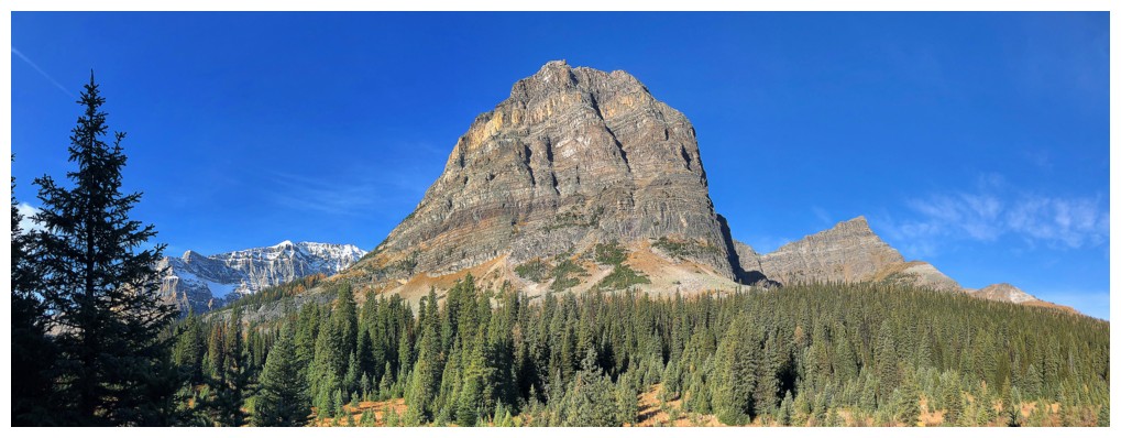
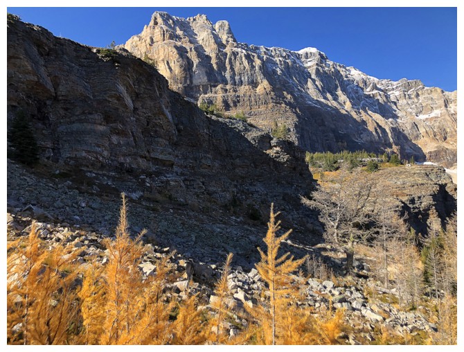
The near vertical east side of Greater Pharaoh Peak
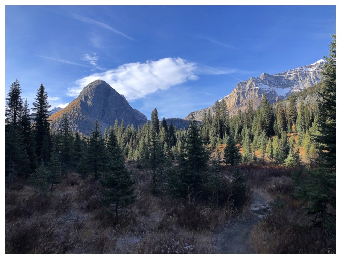
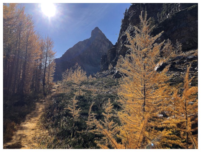
There's Sugarloaf
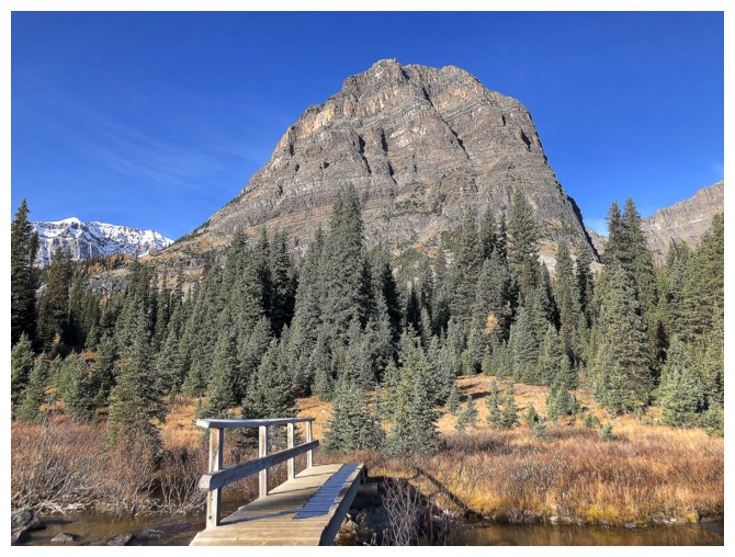
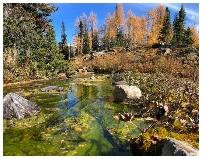
Crossing the creek
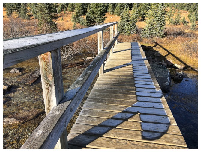
First time I had seen this: a pattern of frost on the bridge that outlines the rails
Looking back to the Healy Pass area and already dreading the 350 m of elevation gain to get back there
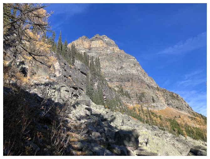
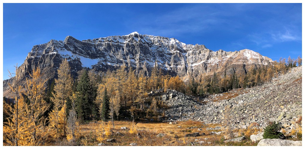
The southeast side of Greater Pharaoh
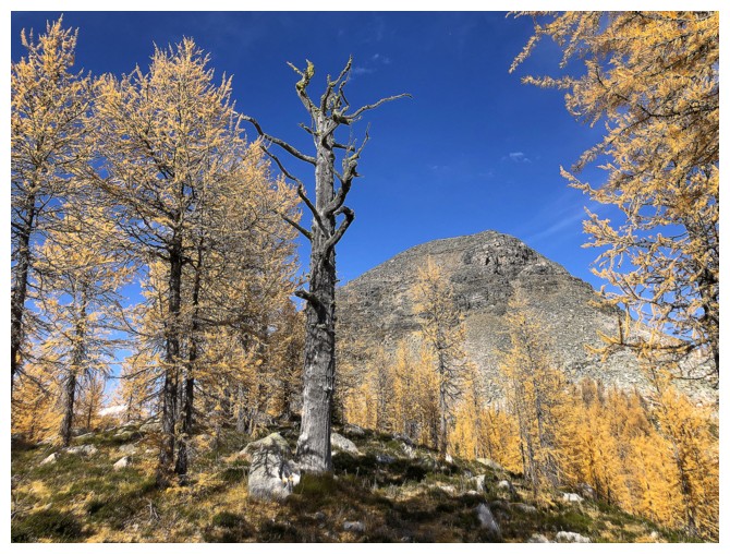
The south side and larches
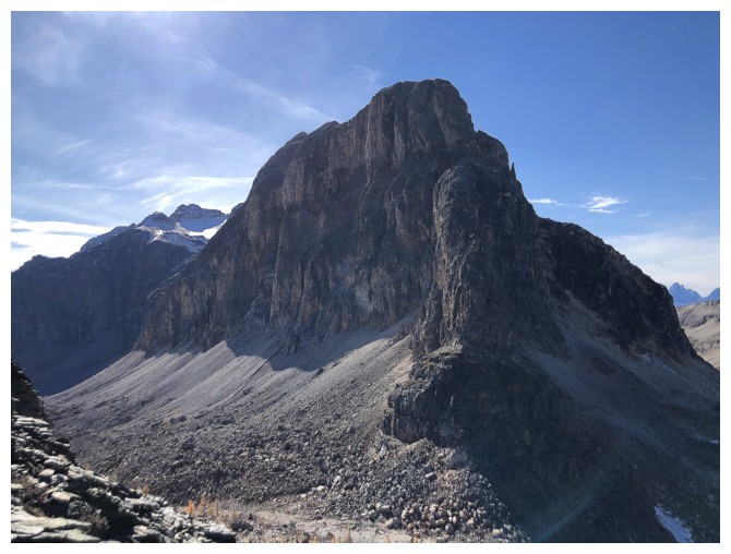
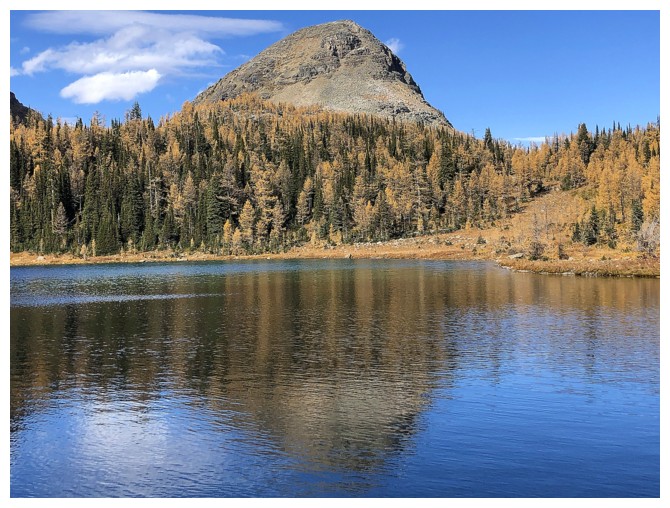
Scarab Peak is super impressive and will hopefully see me someday
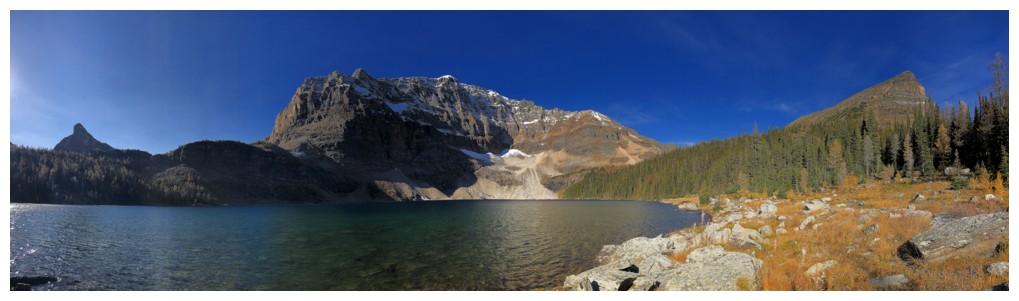
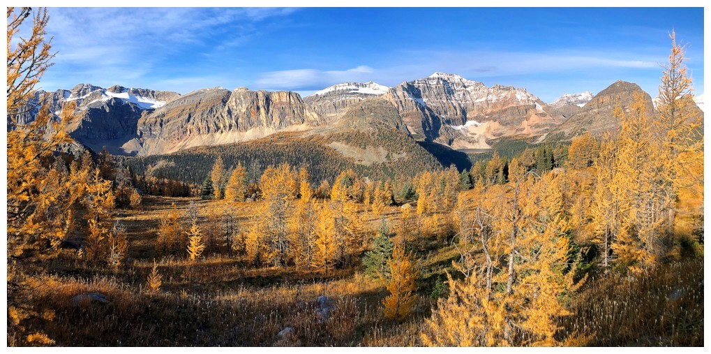
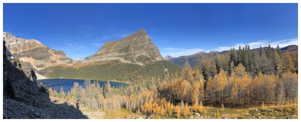
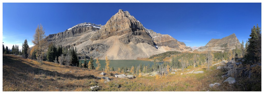
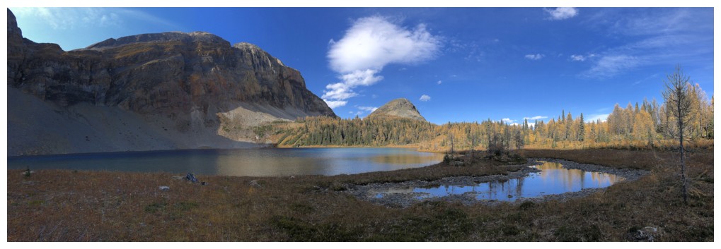
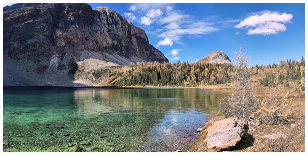
Scarab Lake, Scarab Peak, and Greater Pharaoh
Sugarloaf Mountain ("The Sphinx") (centre) and the north end of Natalko
Peak. Natalko looks way more Sphinx-like than Sugarloaf, which makes me
wonder about these unofficial titles
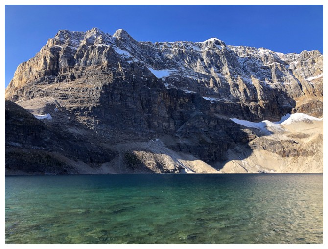
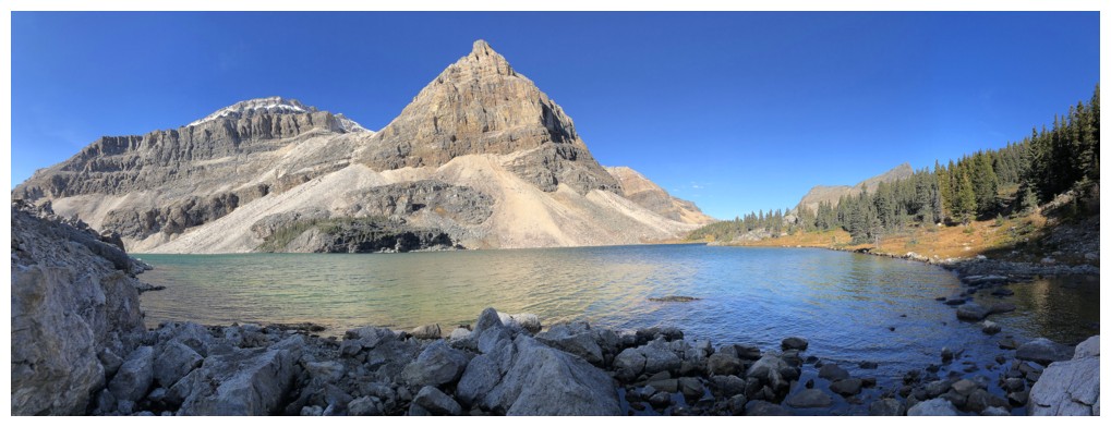
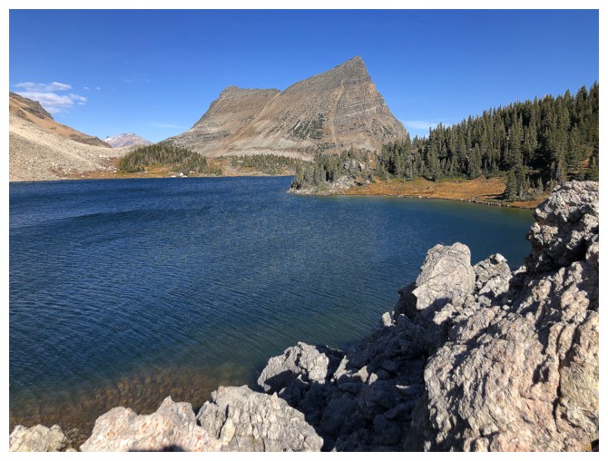
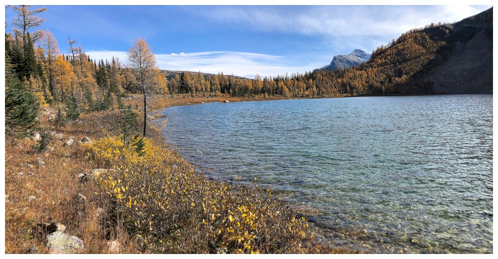
The crystal clear waters of Scarab Lake below Scarab Peak
Scarab, Pharaoh, and more larches
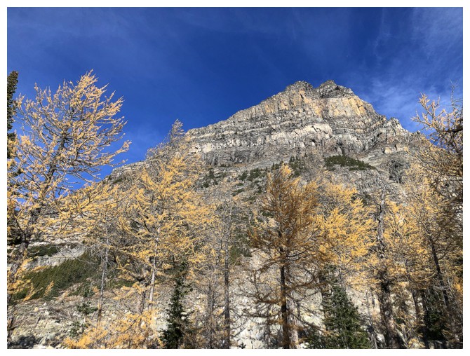
Larches and Scarab
Larches and Natalko (again looking somewhat Sphinx-like)
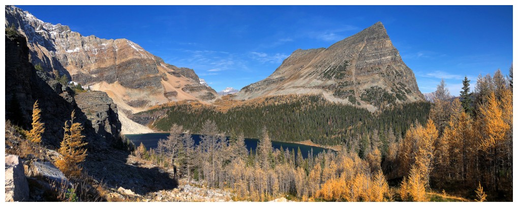
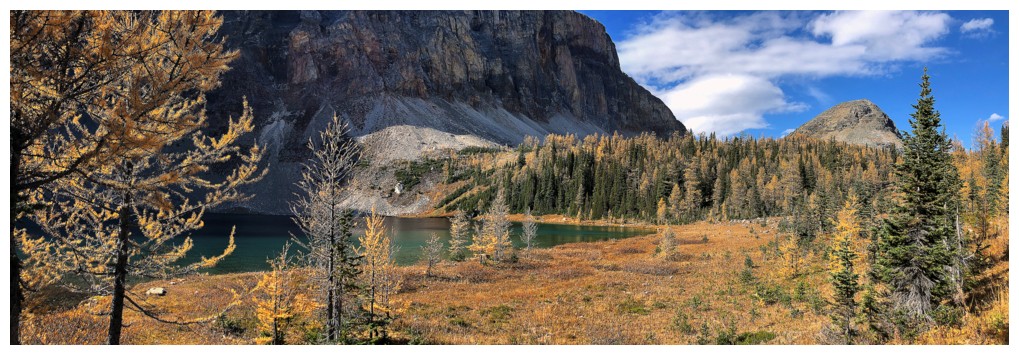
The first of many photos featuring one or more of the lakes, Scarab and Pharaoh
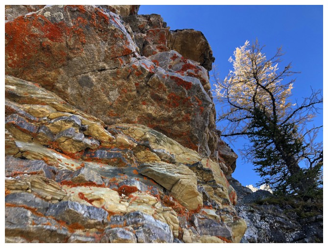
Colourful, lichen-covered rock - my favourite!
Sugarloaf Mountain - I assume the name is a reference to the similar shaped mountain in Brazil
The second
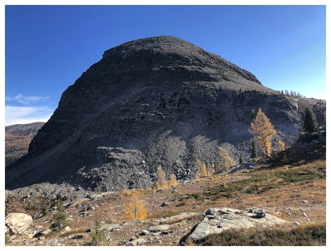
It does look like a loaf
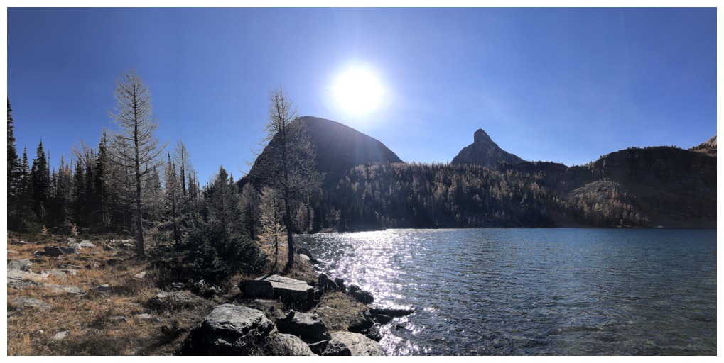
Approaching Mummy Lake
North end of Natalko again
Scarab is a beaut!
At the shores of Mummy Lake
The distinctive forms of Greater and Middle Pharaoh
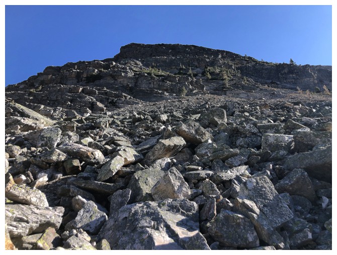
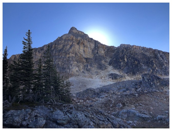
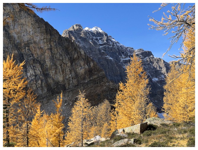
Heading up the west side of Sugarloaf
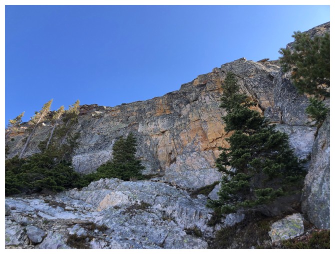
Approaching the solid quartzite rock. Lots of options for exploration here.
The third
Natalko is getting lots of photo love too
Lots!
Talc Lake can now be faintly seen on the east side of Natalko
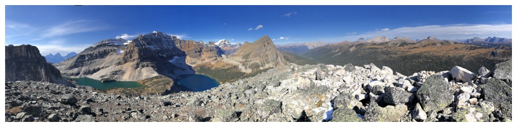
Summit view
Only Mummy and Scarab lakes are visible from the top
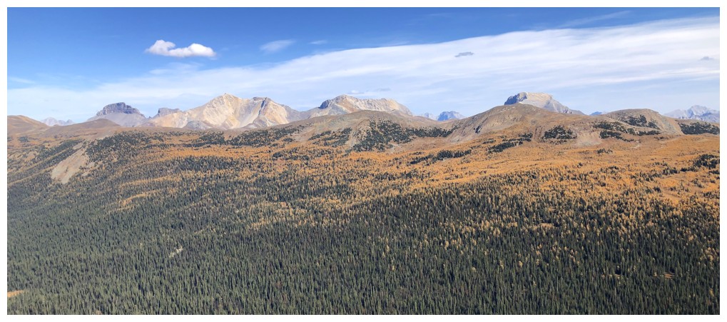
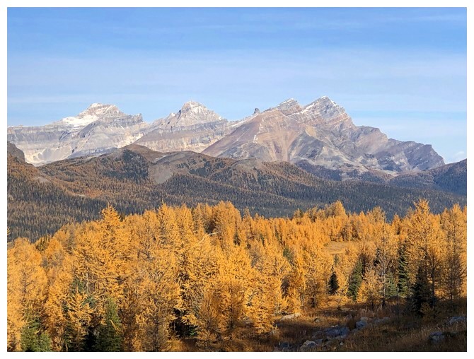
Pilot, Brett, Black Brett, and Bourgeau to the east
Descending the north side reveals Egypt Lake, but now Mummy is missing
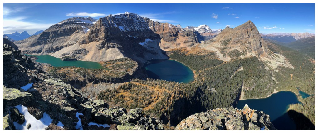
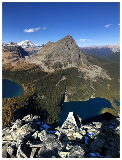
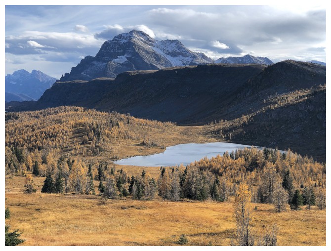
The northwest side is the sweet spot, where all three lakes are visible
Greater Pharaoh
Last look before descending
Stunning Scarab Peak is going to receive as much attention as possible until it is no longer visible
Still visible, as are the larches and lichen-covered rock
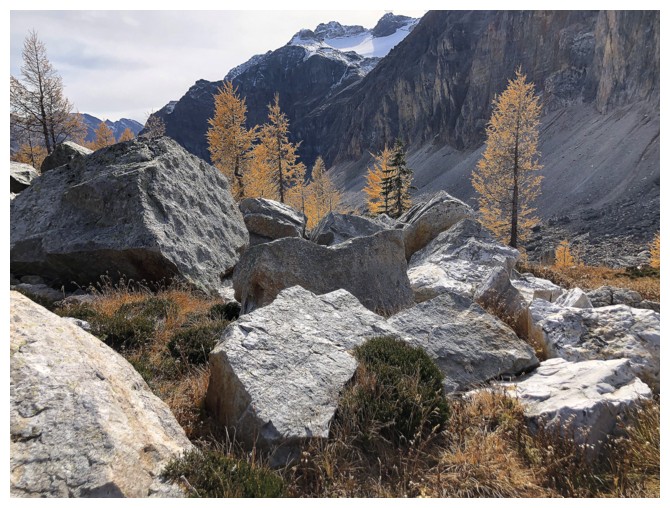
The descent route down to Talc Lake features a ton of white quartzite boulders
Looking back at Sugarloaf
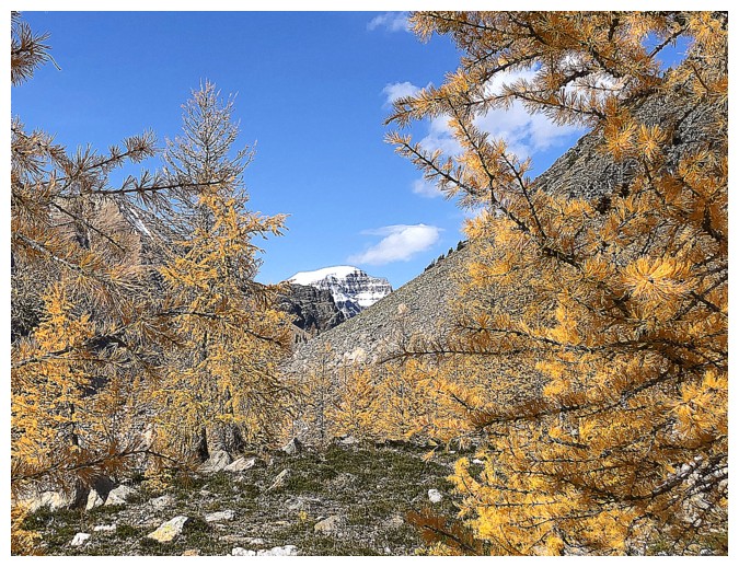
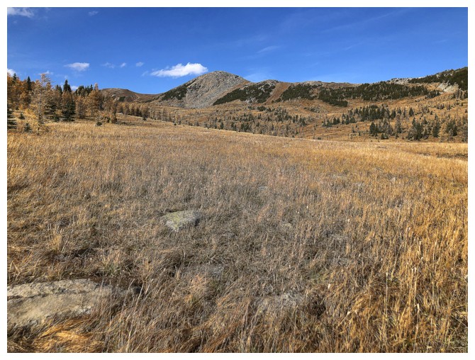
At almost 11,000 feet Mount Ball can almost always be seen!
The last of the Scarab fixation
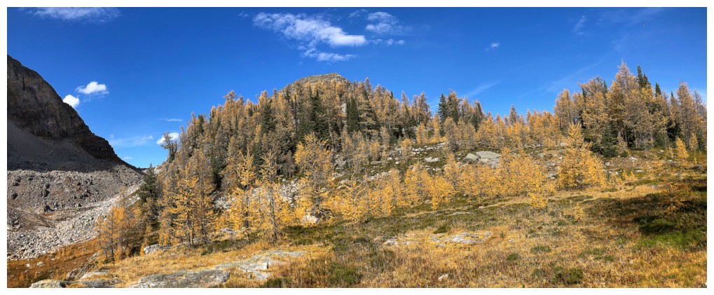
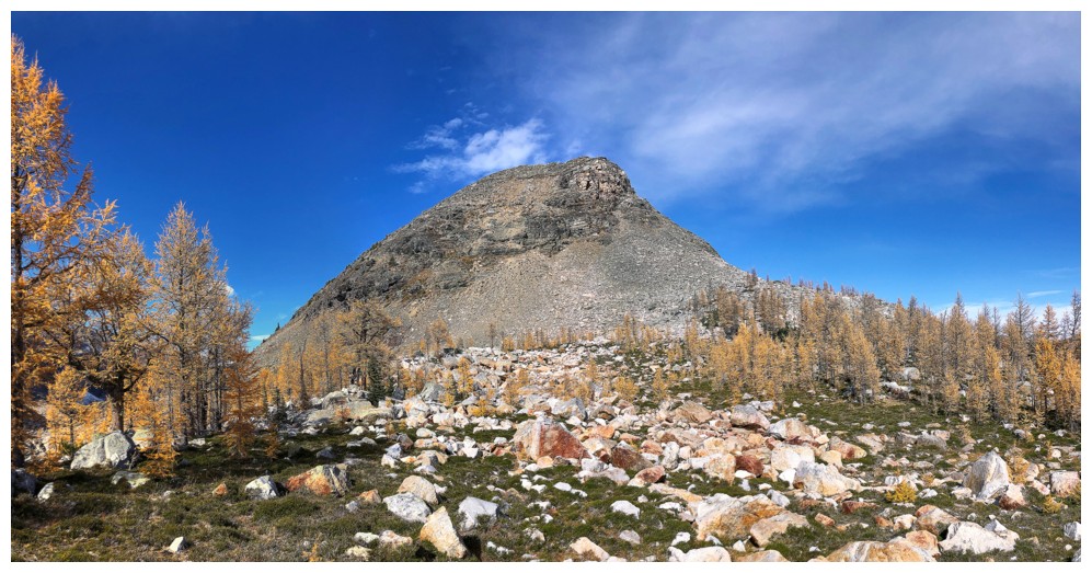
Outstanding terrain
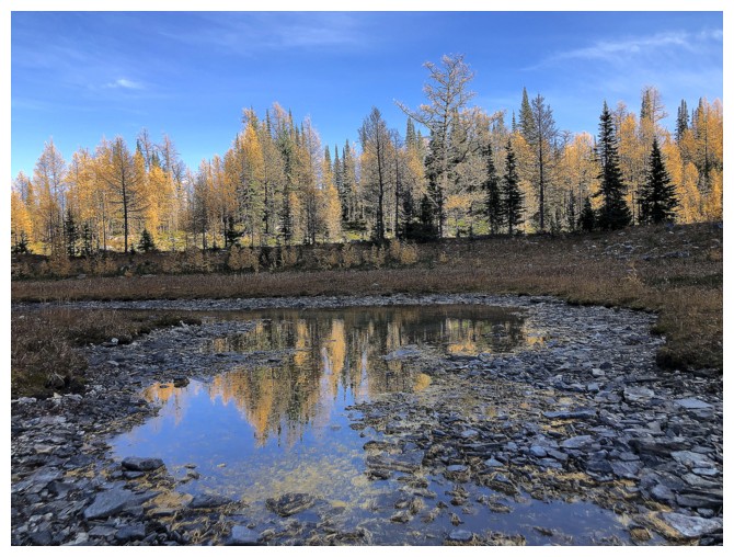
Talc Lake
The southeast side of the lake is a great place to see where you have come from, as well as great views of Natalko
Reflections
Talc Lake is shallow but has wonderful blue/green hues
The Talc Lake outlet is full of vibrantly coloured algae
Last look at the lake
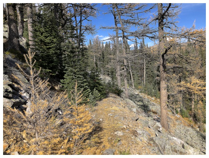
Typical travel on the Talc Lake trail
Passing by the east side of Sugarloaf
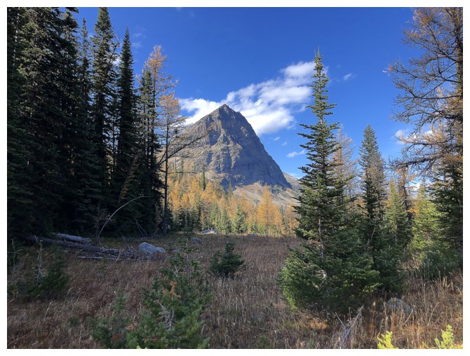
Greater Pharaoh pops up everywhere!
Sugar and Greater
Back to Healy Pass
Heading down the other side of the pass. At least it's all downhill from here.
Looking nostalgically over to Healy Pass Peak
The End
LOG