May 18, 2009
Mountain heights: 2214
m, 2375m
Elevation gain: 1050
m
Ascent time to Whistler: 3:10
Traverse time to Frankie: 1:10
Descent time: 2:15
 Solo scramble.
(Recently a friend asked me how I name unnamed peaks (unofficially, of course). After explaining my logical, but lacklustre method of using nearby peaks and combining their names, Nicole then asked why I don’t name them after people who are important to me. I had no answer and thought this to be a great idea. Since I often talk about how great my Mum is, I decided I would break from my standard naming methodology).
Craving a small degree of redemption, after a
disappointing
failed attempt of Bluerock Mountain 24 hours earlier, I drove south,
hopefully to
escape the terrible weather conditions plaguing the north half of the
Canadian
Rockies. I arrived in The Castle area to the dismal realization that
the
The first part of the ascent was easy, but the
lack of views
quite frustrating. 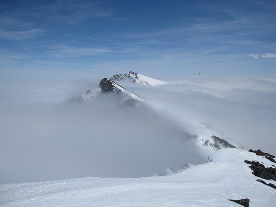 Eventually, many of characteristics that make The
Castle,
Waterton, and
Eventually, many of characteristics that make The
Castle,
Waterton, and
With a sudden rush of increased motivation, I
hurried to the
false and then to the true summit of
The traverse east to next highpoint was an easy
affair,
again highlighted by the surrounding peaks suddenly emerging from the
clouds
and then disappearing again. From the summit, I got a decent look at
the next
two highpoints, the closest one now having the unofficial title of
“
After a short break, I started down to the col. This was the most eerie part of the day. I descended into the clouds almost immediately and suddenly visibility was down to several metres. The terrain was snow covered and were it not for the odd rock sticking out of the snow, I would have had no idea if there was solid ground beneath the snow. Throughout the traverse visibility ranged from 50 metres to a few metres. Almost an hour later, I could still see barely 3 metres in front of me. It seemed that the clouds had now consumed the entire mountain and I would spend the rest of the day in a whiteout.
Fortunately, fortune was still on my side and I
reached the
upper level of the clouds about 50 vertical metres from the summit. An
attempt
at quickly sprinting to the summit, before the clouds formed above me,
lasted
for all of 6 seconds and then I just slogged my way to the summit and
one of the
most unique summit panoramas I’ve ever seen. The cloud layer
was absolutely
astonishing – a thick and clearly defined blanket of
whiteness.
Leaving the summit was particularly difficult. One experiences this type of meteorological phenomena very, very infrequently and, like the other two times (Loomis attempt and Middle Kootenay Mountain), I wanted to savour the experience for as long as possible.
I had already decided on an alternate descent route, but looking at it scared the heck out of me. That was because there was nothing to see. The descent slope simply vanished into the clouds. Luckily, a brief moment of clearing revealed that at least the initial part would be easy. That was in fact the case and though at times tedious, the descent route was straightforward.
A totally outstanding day on a decent mountain – Whistler – and a seriously cool mountain – Frankie.
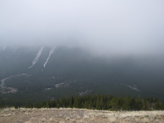
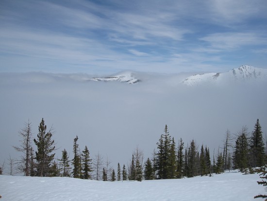
Typical views at the beginning of the trip
A brief moment of clearing
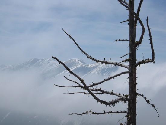
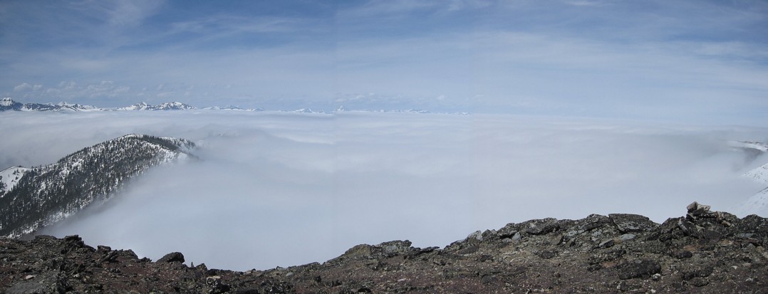
Barnaby
Ridge and a tree
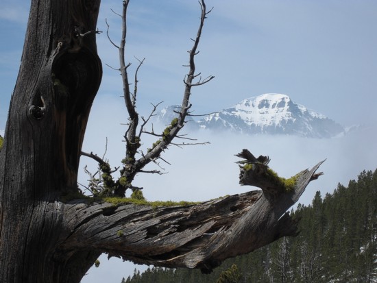
The remains of another tree
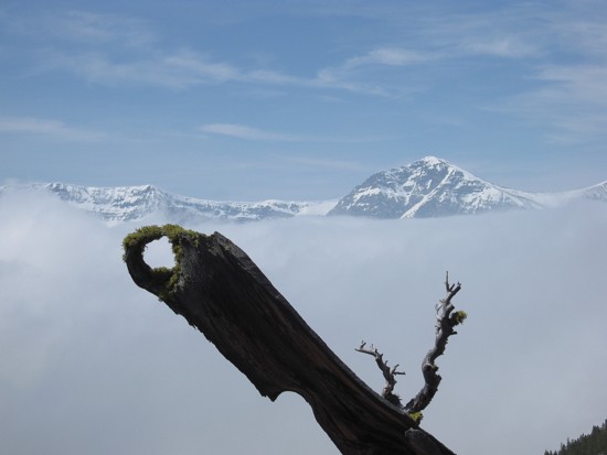
Same as above
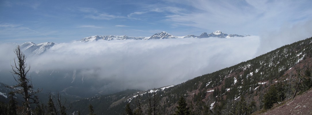
Looking at the cloud bank to the west
Same as above
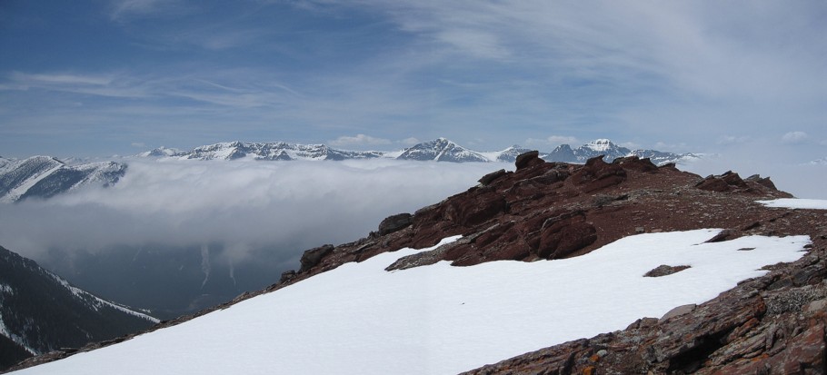
Clouds from the east pouring over the ridge
Another view to the west
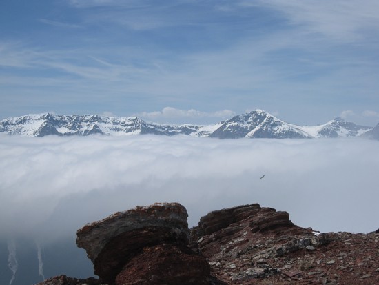
Same as above; the block dot just right of centre is a bird that was
circling in and out of the clouds
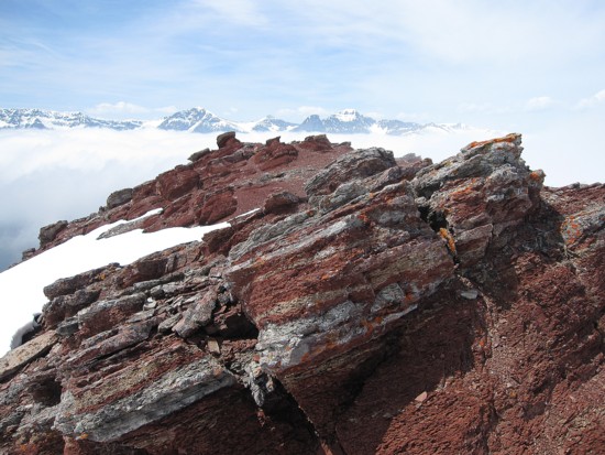
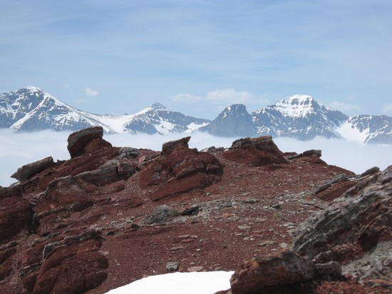
Red argillite
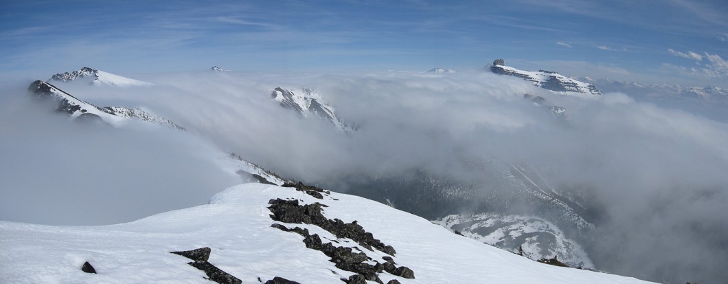
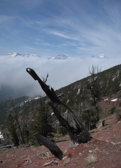
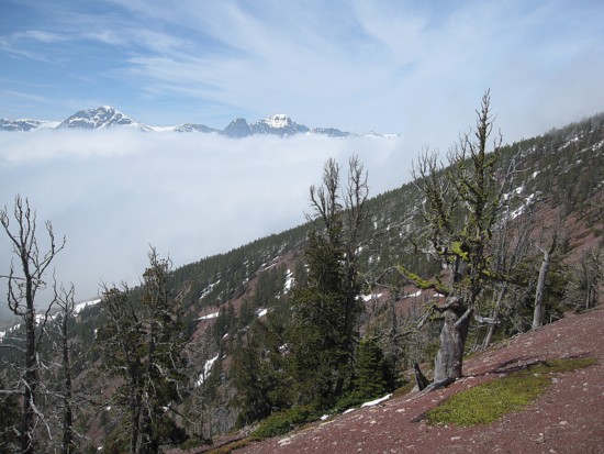
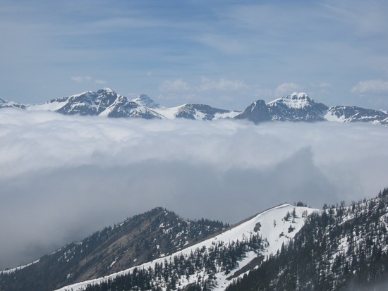
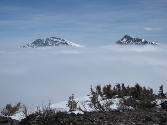
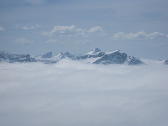
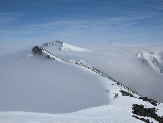
Peaks to the east poke above the cloud layer
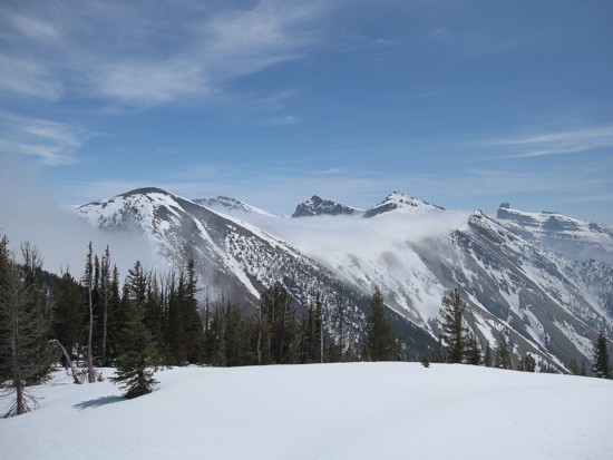
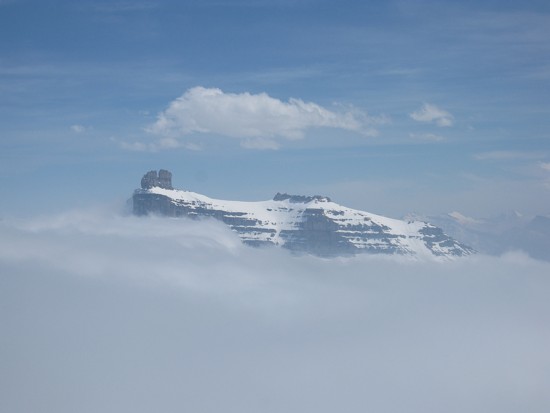
Looking southeast to the next highpoint (left); Frankie Peak is just right of centre; Castle Peak to the right
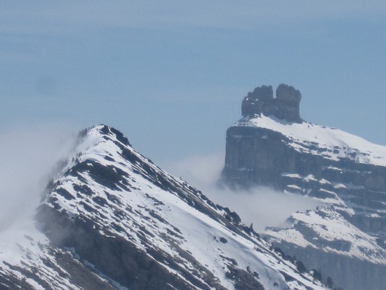
The false summit of Frankie Peak (left) and Castle Peak
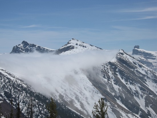
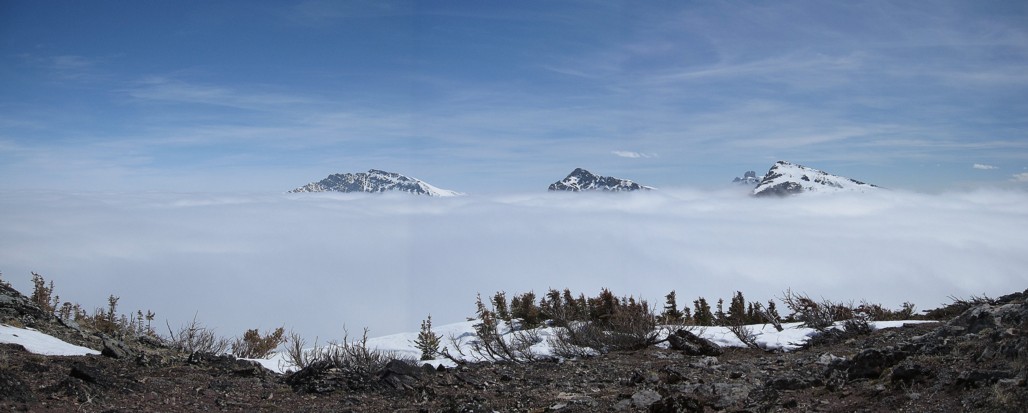
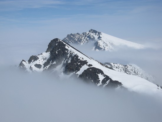
Unnamed
(soon to be "Larry
Mountain"), Frankie,
and Castle Peak;
the connecting ridge is shrouded in clouds
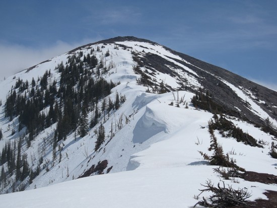
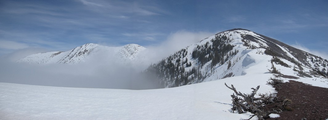
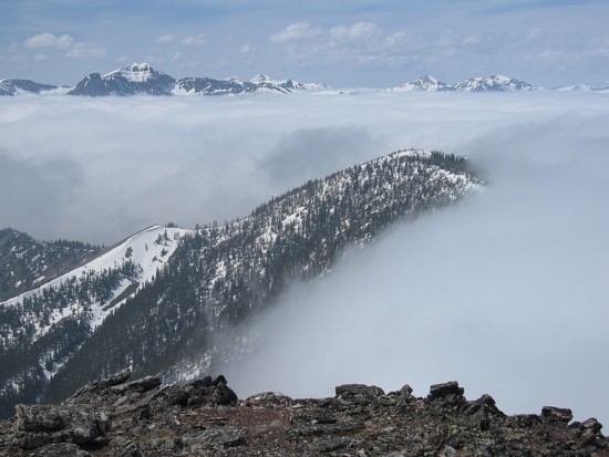
Approaching the second highpoint
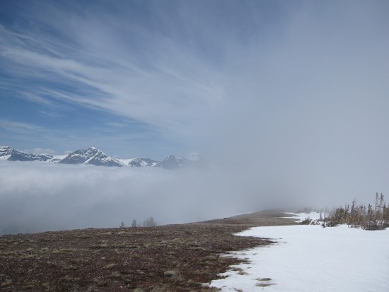
The clouds thicken to the west
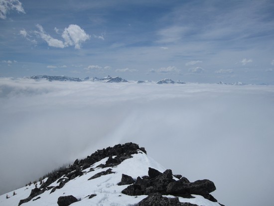
From the summit of the second highpoint; Whistler Mountain,
at the left, is soon to be comsumed by the clouds
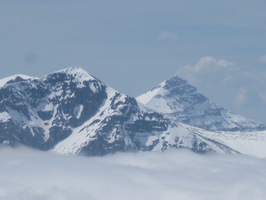
Mount
Gladstone (left), unnamed,
and Frankie
Mount
Haig (right)
Gladstone
and unnamed
A last look at Whistler
before it disappears
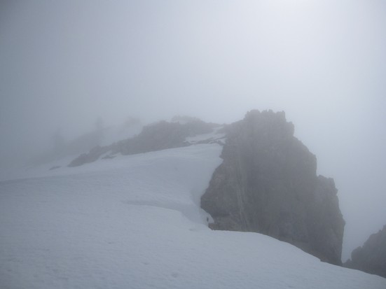
Typical visibility on the traverse to Frankie
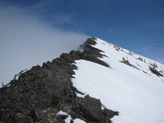
Approaching the summit of Frankie
Castle Peak
Whistler
is now gone

Looking south, down the alternate descent route
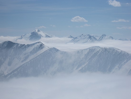
Tombstone
and Haig
to the west
Unnamed
and Gladstone
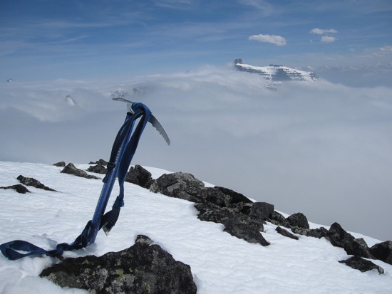
Cheesy ice axe photo
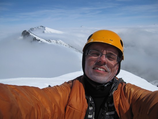
Cheesy self portrait, with too much sunscreen
Victoria
Peak is barely visible to the right
A last look west before descending into the clouds
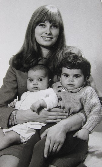
The namesake
of "Frankie Peak";
that's Mark on the right;
not sure who the odd duck on the left is, but I'm sure he grew up to be a
remarkably intelligent and well-adjusted individual