Bobac Mountain
Watermelon Peak
(Doug
and Luigi)
September 10, 2023
My stats:
Mountain height: 3088 m
Elevation gain:
approximately
2000 m
Ascent time:
6:30
Exploration and
descent time: 6:25
Doug and Luigi’s
stats:
Mountain heights:
3088 m, 3094 m
Total elevation gain: 2850 m
Ascent time to
Bobac:
6:30
Traverse time to
Watermelon and descent: approximately 10 hours
Scrambling with
Doug Lutz and Luigi Ferragamo.
I cannot emphasize
enough about how much I enjoyed this trip, primarily because of the two humans
who were with me; the outrageously stunning scenery and views were but a pleasant
afterthought (a very, very, very pleasant afterthought, though!).
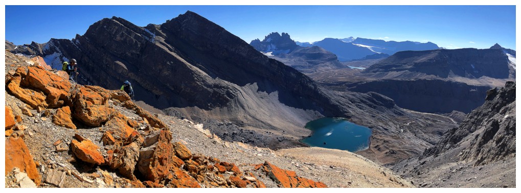
Doug suggested
a route up a steep headwall and then a sharp turn towards the ridge. We could
see the headwall but the terrain up to the ridge was hidden. Nevertheless, we
all agreed it was worth a try. In short, his route was fantastic! Encountering
minimum scree and rubble, some awesome hands-on scrambling on solid rock, and
then a short trek up a totally hidden scree slope, that granted great access to
the ridge, we were soon on easy terrain below the summit. Doug’s path had avoided
all the scree and rubble tribulations we had heard were common to the other
routes. All that remained was a longish but easy plod to the summit, again on solid
rock. We were to later find out that this was essentially Rick Collier’s route
described on Bivouac.
 As well as,
once again, being blown away by Doug’s uncanny mountain sense, I was also
delighted to get to know Luigi throughout the ascent – an extremely modest,
humble, introspect and thoughtful man of excellent character – must run in the
Durante/Ferragamo genes! (plus, he’s fit as heck and could hike circles around
me!)
As well as,
once again, being blown away by Doug’s uncanny mountain sense, I was also
delighted to get to know Luigi throughout the ascent – an extremely modest,
humble, introspect and thoughtful man of excellent character – must run in the
Durante/Ferragamo genes! (plus, he’s fit as heck and could hike circles around
me!)
Back to the
trip and the moment of truth. How would the summit view compare to that of slightly
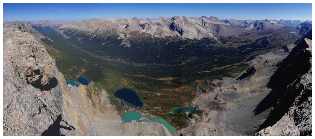
higher Watermelon Peak? Definitely better, but primarily because of six
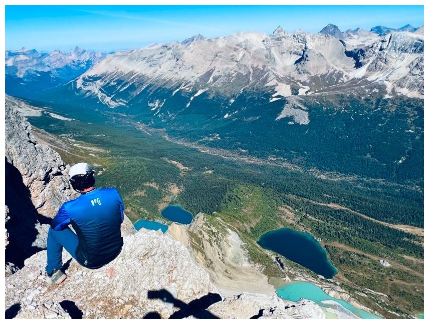
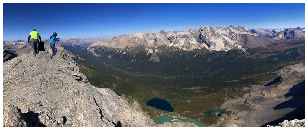
stunning lakes directly below the summit, each sporting its own unique hue. Between
the three of us we must have taken over a hundred photos of the stunning bodies
of water! We all thoroughly enjoyed a long summit stay, absorbing the views and
reliving and laughing about the ups and downs of our ascent.
Descending our
ascent route made little sense and so we followed the obvious line down towards
a small glacier, south of our line. 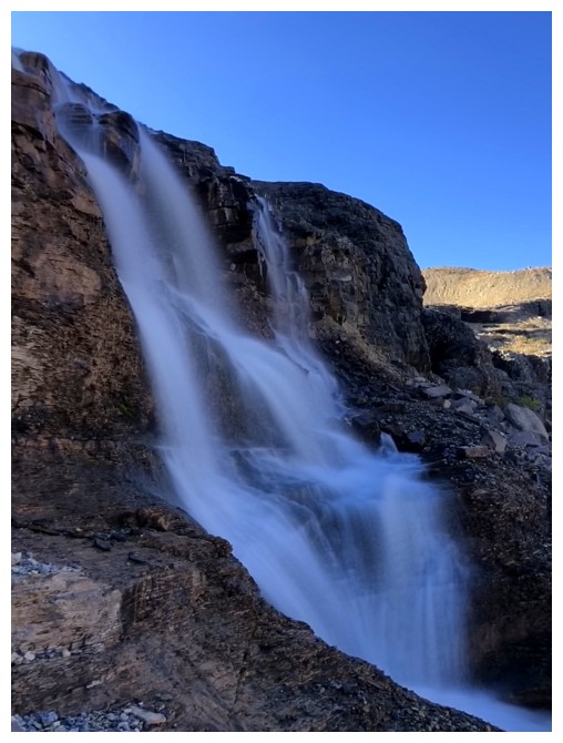 This was a terrific descent route, with
decent surfable scree underfoot. Past the glacier, the route back down to Lake
Alice was obvious. We took a short break here to discuss options. Doug was hungry
for Watermelon, I was hungry for a comfortable bed to lie in, what about Luigi?
As stated, Luigi is insanely fit and so energy levels were not an issue for
him. I was delighted when he opted to join Doug for Watermelon – not because I
didn’t enjoy their company, but because conditions and circumstances were perfect
for an attempt, and they may each have regretted not taking advantage of that.
I told them to take their time as likely I would return very slowly, spending
some time at Lake Alice, and possibly doing some exploration. We had spotted a
few tarns on a high bench, northwest of Cirque Peak that could potentially be
accessed.
This was a terrific descent route, with
decent surfable scree underfoot. Past the glacier, the route back down to Lake
Alice was obvious. We took a short break here to discuss options. Doug was hungry
for Watermelon, I was hungry for a comfortable bed to lie in, what about Luigi?
As stated, Luigi is insanely fit and so energy levels were not an issue for
him. I was delighted when he opted to join Doug for Watermelon – not because I
didn’t enjoy their company, but because conditions and circumstances were perfect
for an attempt, and they may each have regretted not taking advantage of that.
I told them to take their time as likely I would return very slowly, spending
some time at Lake Alice, and possibly doing some exploration. We had spotted a
few tarns on a high bench, northwest of Cirque Peak that could potentially be
accessed.
We parted ways,
each going down a different side of the ridge and I made my way down to the
lake. Recalling the very tiresome return trip Raff and I had when we did
Watermelon, 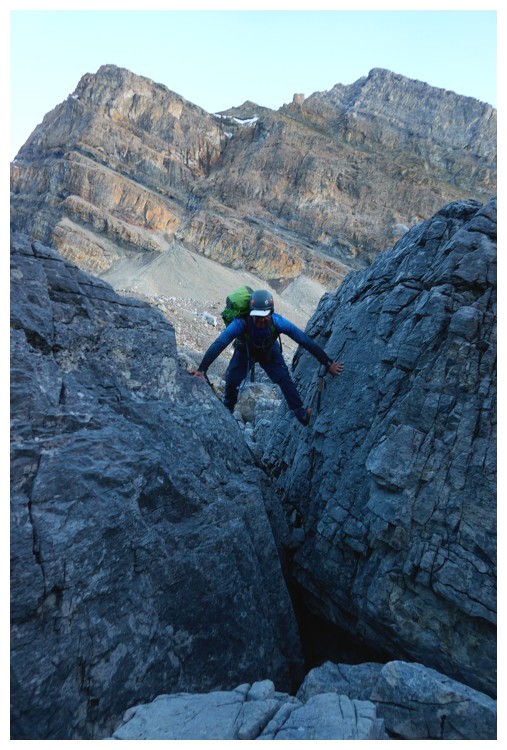 I decided against stopping at the lake or doing any exploration,
and just continued the descent. However (there’s always a “however”!), those
tarns started calling as I reached the Dolomite Creek valley bottom and a feasible
route to gain the bench that didn’t involve a huge elevation loss suddenly
appeared. The route would involve ascending alongside a couple of
waterfalls/cascades – talk about adding a carrot (cake) to the end of the stick
– game on!
I decided against stopping at the lake or doing any exploration,
and just continued the descent. However (there’s always a “however”!), those
tarns started calling as I reached the Dolomite Creek valley bottom and a feasible
route to gain the bench that didn’t involve a huge elevation loss suddenly
appeared. The route would involve ascending alongside a couple of
waterfalls/cascades – talk about adding a carrot (cake) to the end of the stick
– game on!
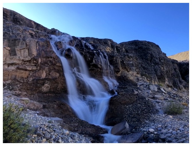
I thought the
tarns would be the highlight of this part of the day, but the waterfalls were equally
interesting and thrilling to be alongside. Gaining the bench, I visited each
tarn and then continued heading southeast, in the hopes I could avoid
losing a significant amount of elevation, back to the Dolomite Creek valley. Nearing
the end of the bench I should have committed to going up to a higher bench or
down to a lower one. Instead, I stubbornly continued side-sloping ugly, steep
rubble, amassing more frustration than progress!
Eventually I
was able to find easier terrain and took a slightly different route back to the
highpoint above Helen Lake. The remainder of the descent was straightforward,
and I arrived at the parking lot at 8:30 pm, just as darkness set in. Luigi had
given me his car key, so I was able to wait for he and Doug in the comfort and warmth of his vehicle; good
thing, as the temperature plummeted over the next 3.5 hours.
Doug and Luigi
returned around midnight, having successfully reached the summit of Watermelon
Peak. They reported the summit view from Watermelon to be quite inferior to
that of Bobac, though the lateness of the day and position of the Sun may have
had something to do with that.
I can’t rage
enough about this trip and as frequently alluded to it was the company that
made it so memorable. Given that I do the majority of my trips solo and care
only about the views and scenery, that’s a fairly strong statement! Thanks a
million Doug and Luigi!
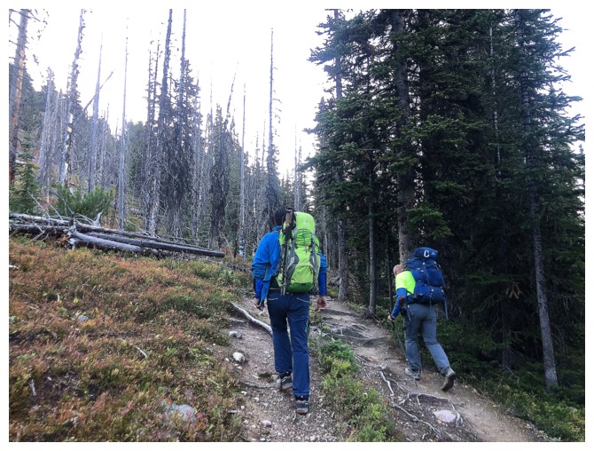
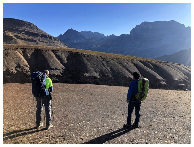
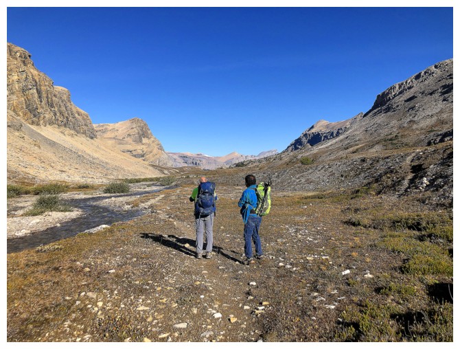
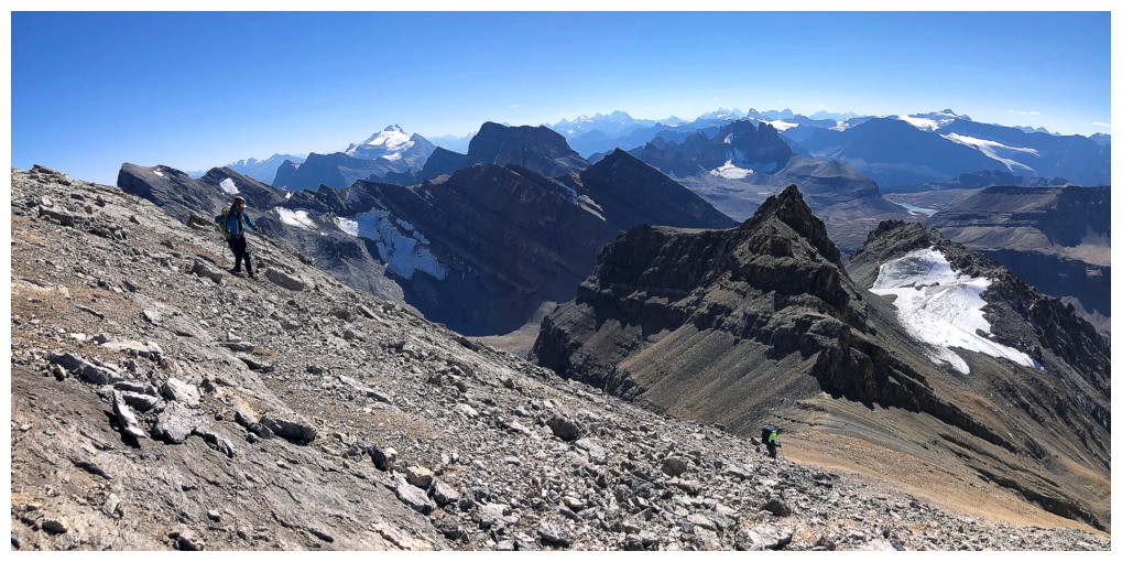
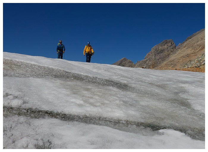
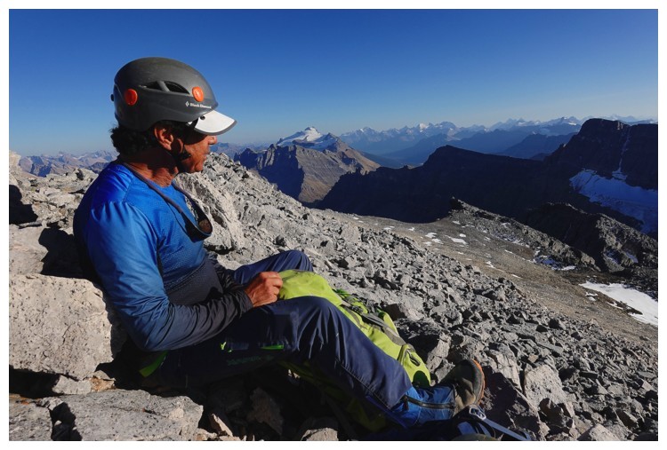
You would think my hiking partners had coordinated their wardrobes:
Luigi with the neon green backpack and blue top layer, Doug with the
neon green top layer and blue backpack!
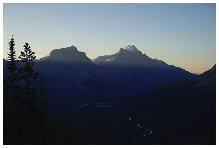
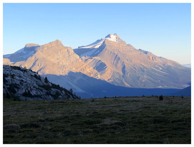
Early morning view of Andromache, Little Hector, and Mount Hector (photo by Doug)
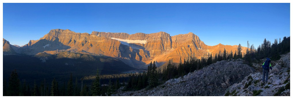
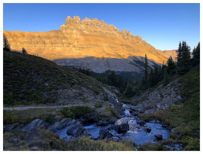
The Sun's rays hit the lengthy ridge of Crowfoot Mountain
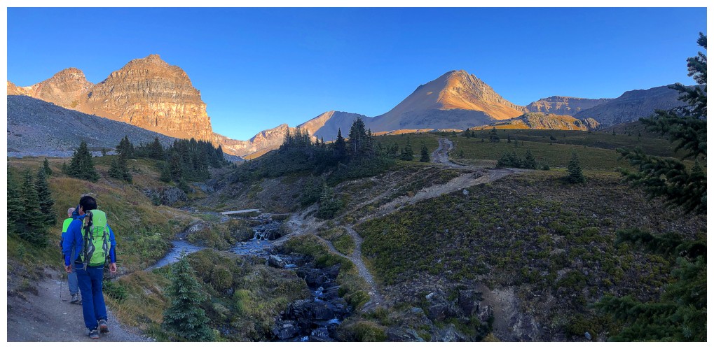
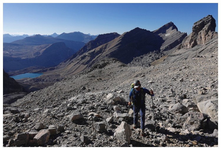
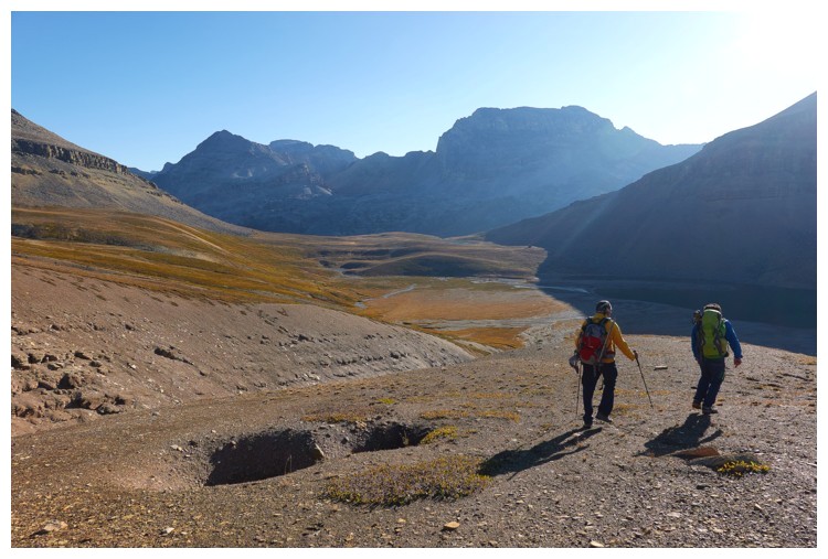
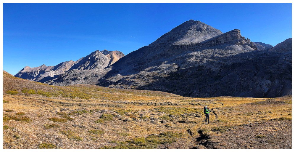
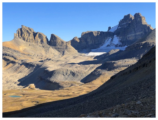
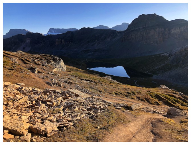
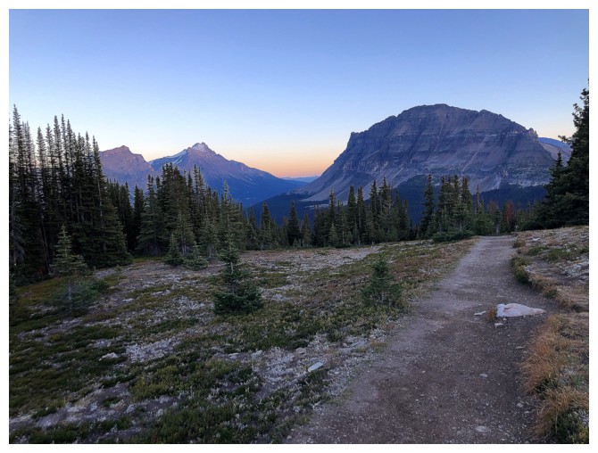
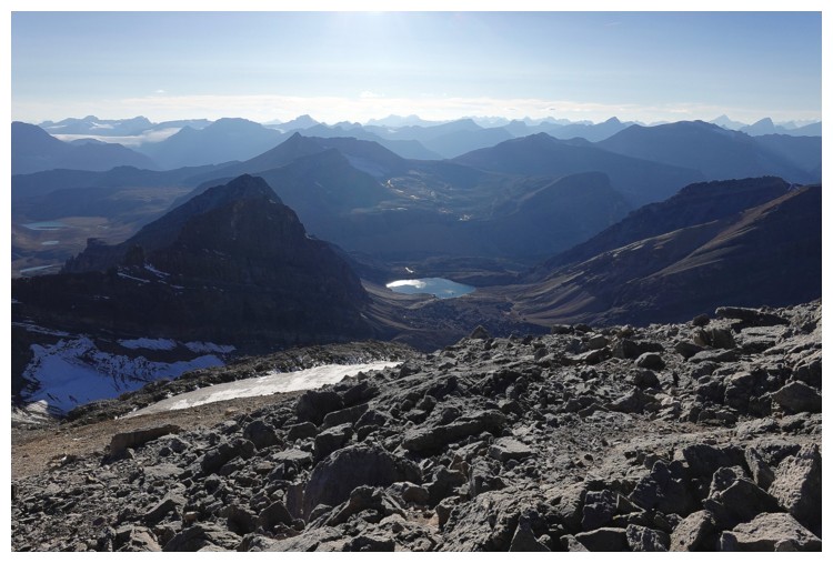
Now in the Helen Lake valley. Cirque Peak near the right.
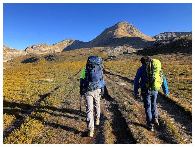
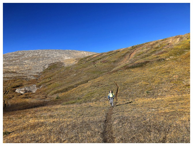
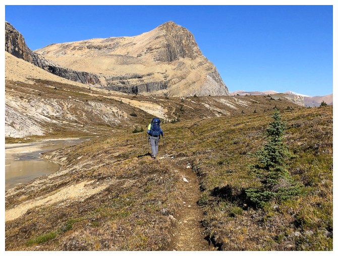
The trail is obvious!
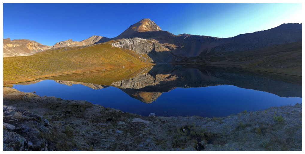
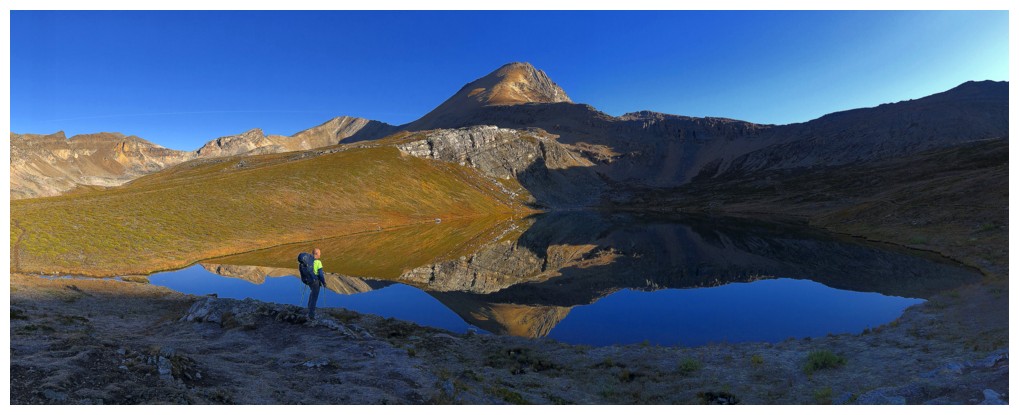
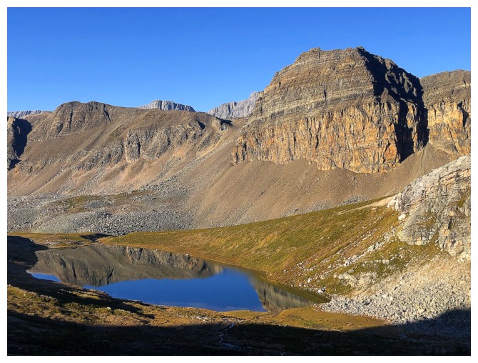
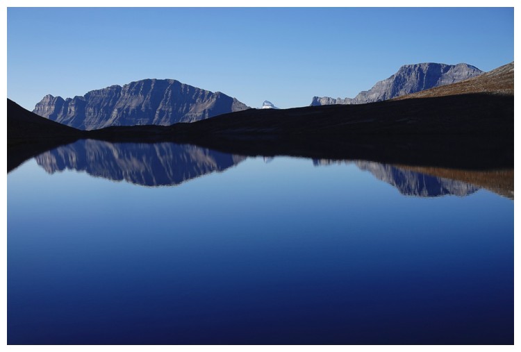
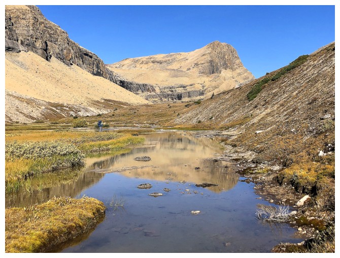
Cirque Peak reflected in Helen Lake
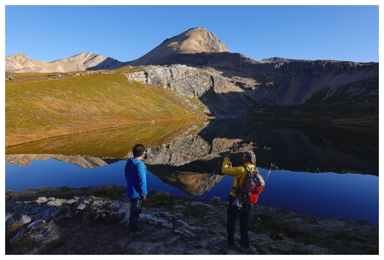
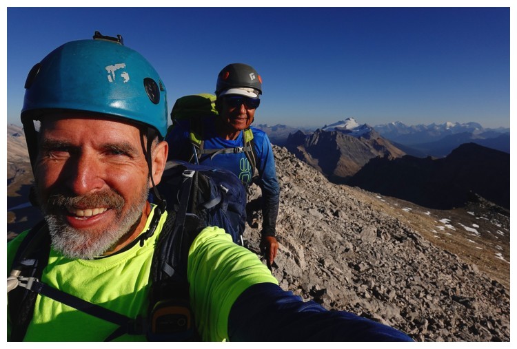
Same as above with a couple of sketchy-looking dudes (photo by Doug)
And again with only one sketchy-looking dude (photo by Luigi)
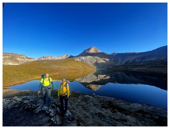
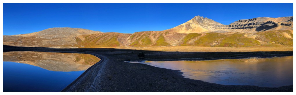
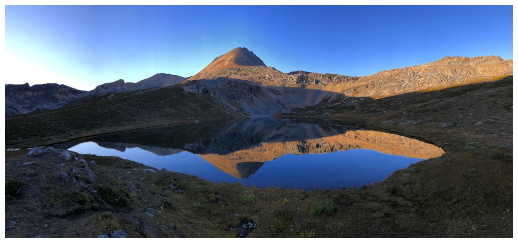
Looking back to Helen Lake
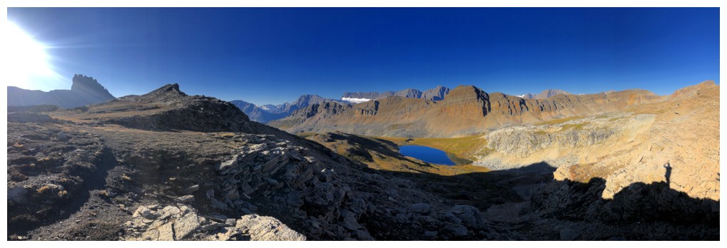
Same as above with way more of the view
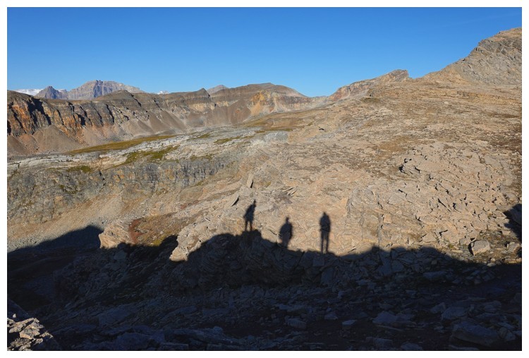
The Three Amigos - this is how we felt at this point of the day (photo by Doug)
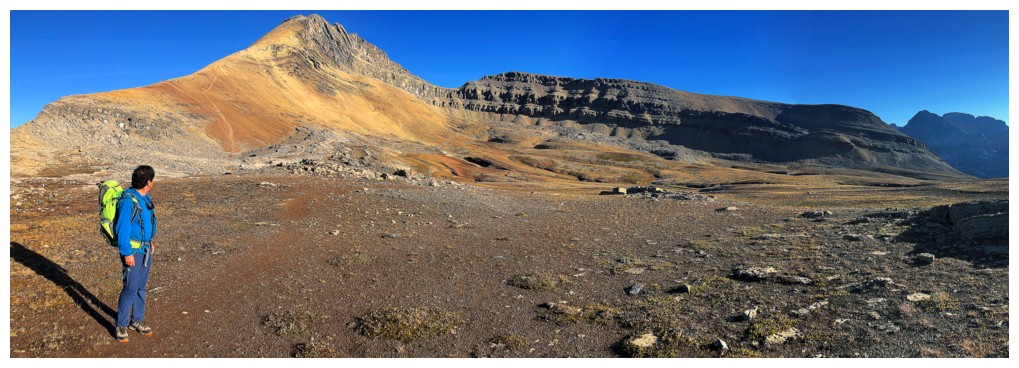
Luigi checks out Cirque Peak and its beautiful colors
Super interesting terrain as we start the descent to Lake Katherine and the Dolomite Creek valley
Someone else has gone that way (photo by Doug)
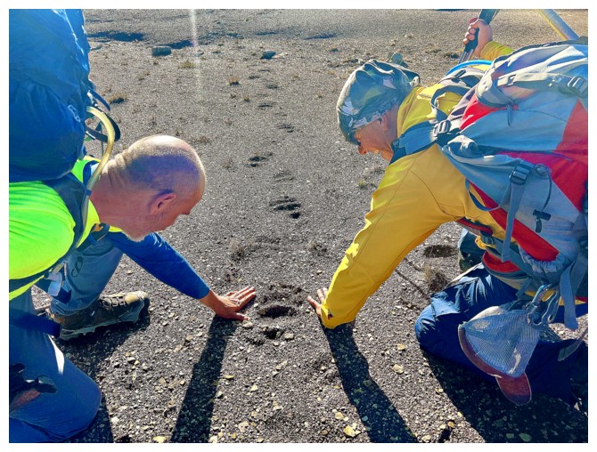
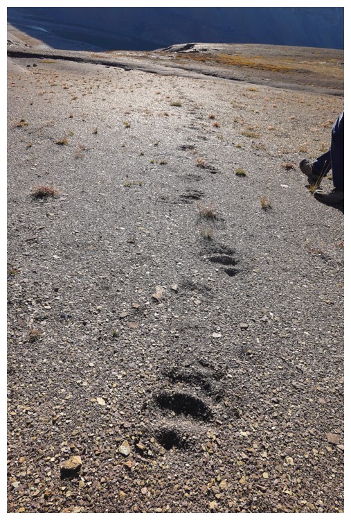
Comparing our hand sizes to the bear paw prints. It was a BIG animal! (photo by Luigi)
Apparently the sketchy-looking dudes have no fear of an animal that
could separate their heads from their necks with a single swipe of the
paw! (photo by Doug)
Part of the descent and still lots of elevation to lose
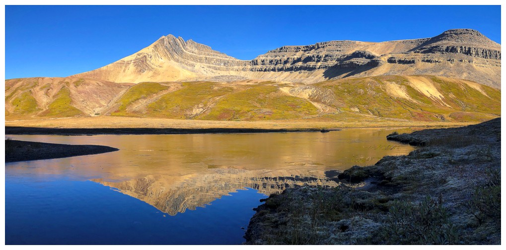
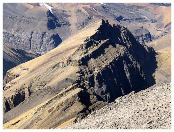
Lake Katherine and the imposing form of Dolomite Peak
Bow Peak, the tip of Mount Daly, and some of Crowfoot Mountain (perhaps
Bowcrow Peak) reflected in Lake Katherine (photo by Doug)
A narrow land bridge allows easy passage past the lake
Cirque Peak's reflection is interrupted by a thin layer of ice on the lake - here comes fall!
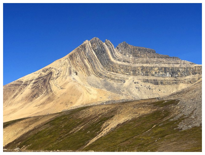
Close-up of Cirque's strikingly folded southeast side
This tarn below the north ridge of Dolomite has dried-up considerably
Doug leads us further down into the valley
The impressive northeast side of Dolomite Peak (photo by Doug)
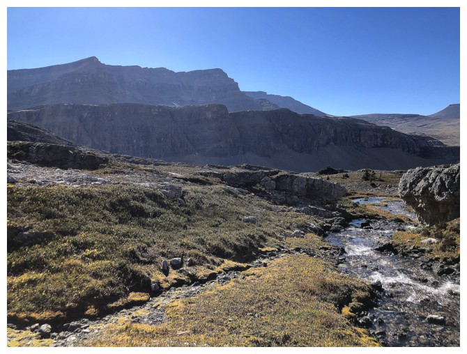
Following Dolomite Creek downstream
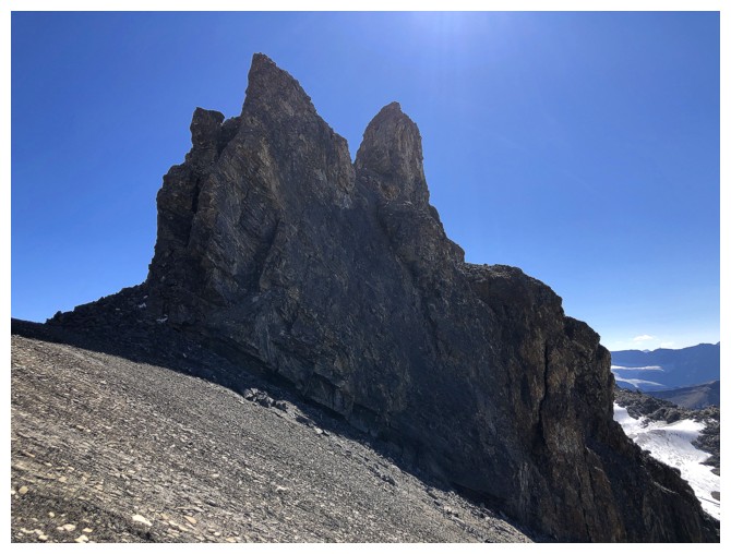
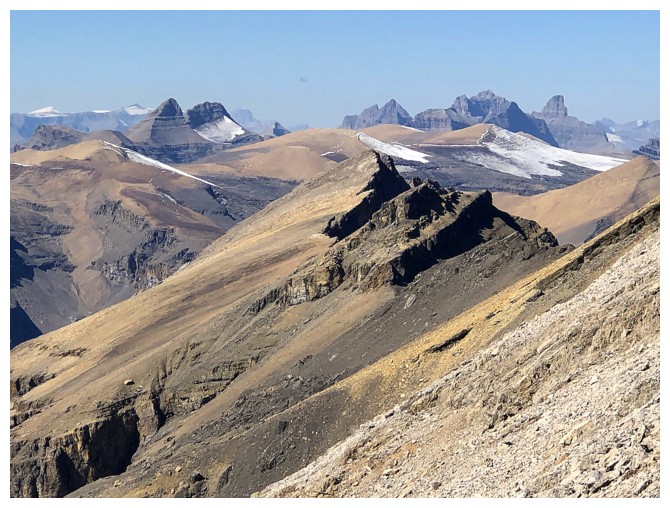
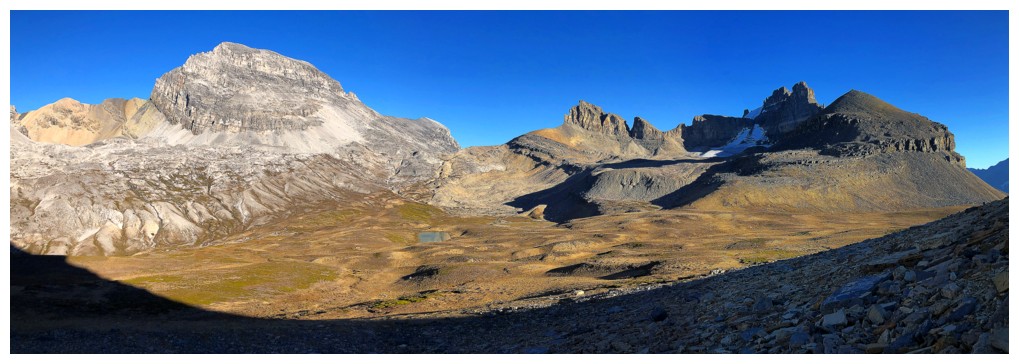
A prominent outlier north of Cirque Peak
Same as above with Doug

Now heading up, towards Lake Alice (photo by Doug)
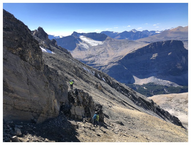
The bench I would later explore is behind Luigi and Doug
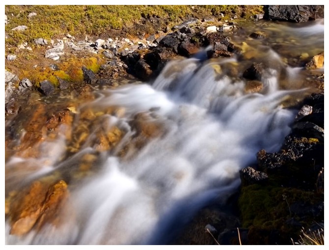
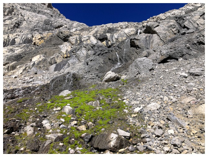
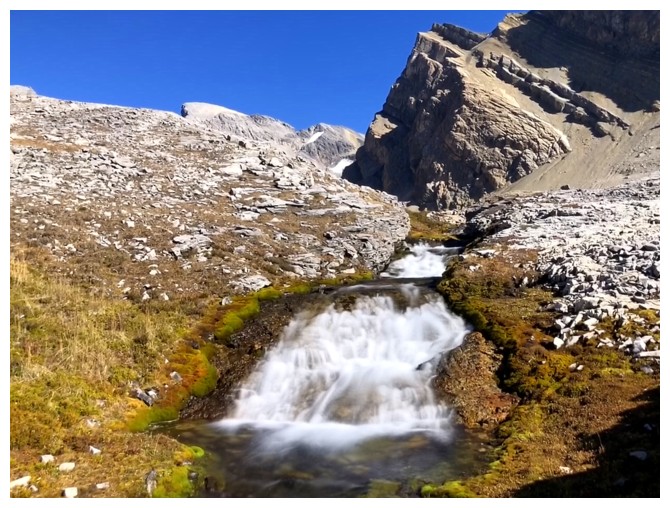
Where there is flowing water, there will be long exposure photos!
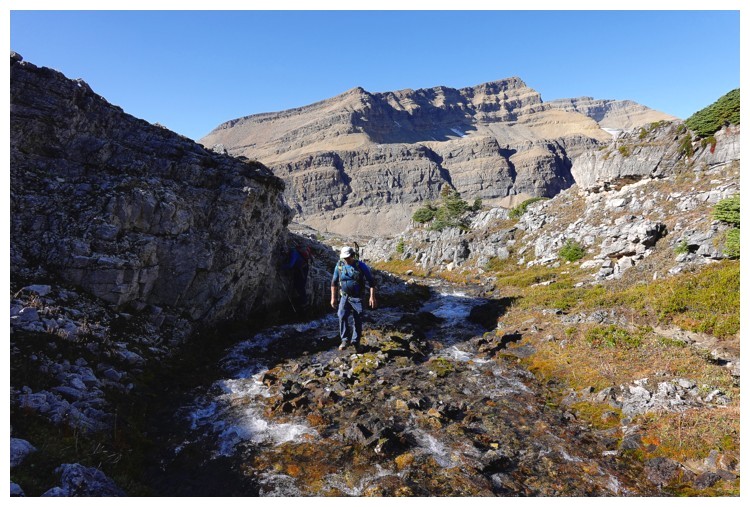
Luigi negotiates the creek (photo by Doug)
It's easier to stay well left of the creek, but what fun would that be?!
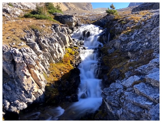
You'll miss all this
Same as above
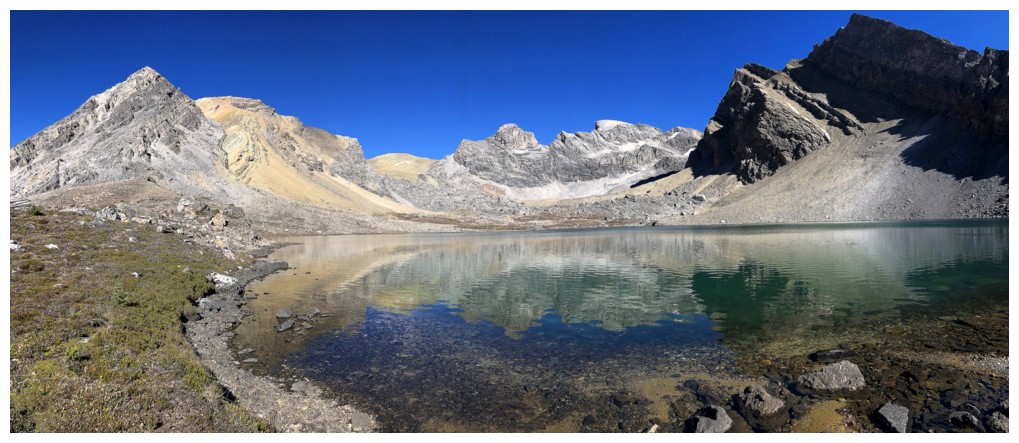
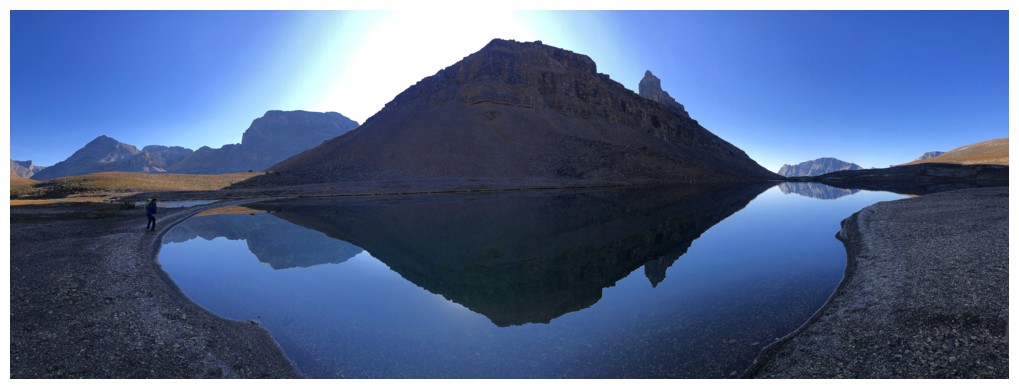
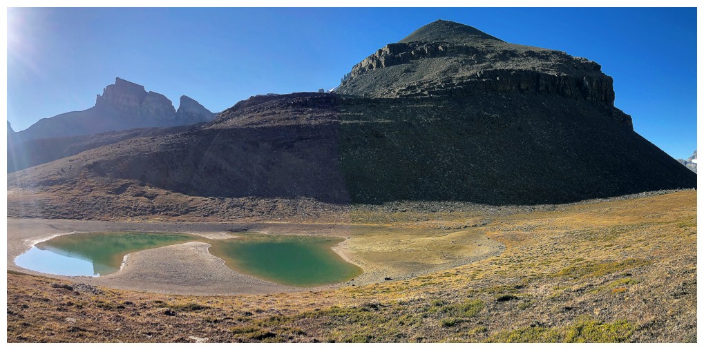
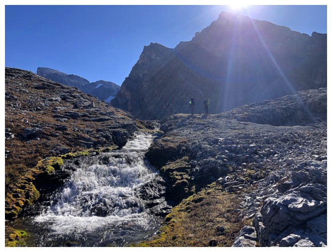
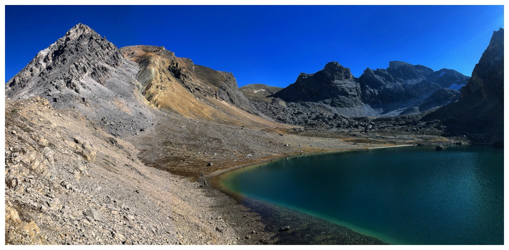
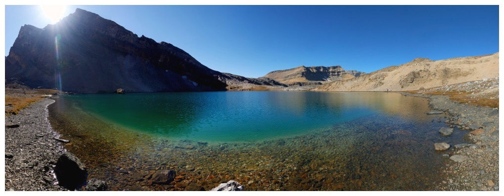
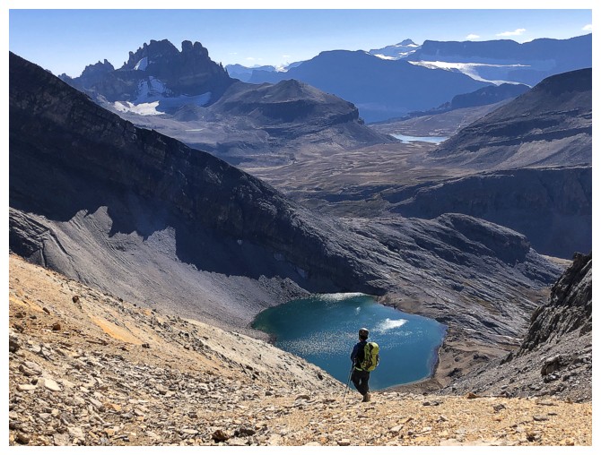
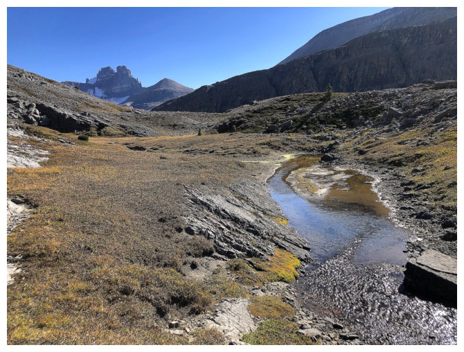
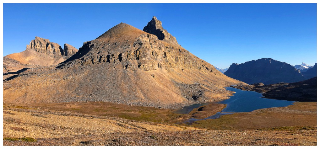
Lake Alice - a stunning body of water in stunning surroundings
Doug leads us around the lake (photo by Luigi)
I'm lagging behind as usual
Doug reaches the north end of the lake first (photo by Doug)
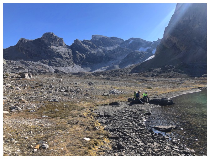
Short break here
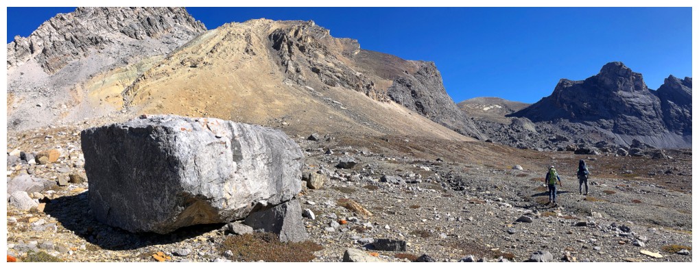
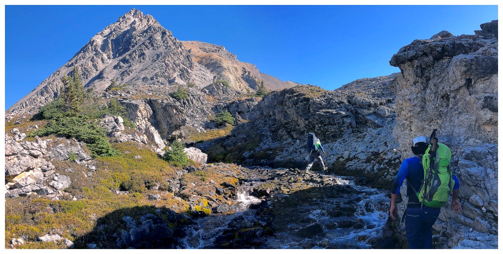
We are off again and looking for a route up
I ended up coming down the ramp at the far left, Luigi and Doug came
down the one in the centre, en route to Watermelon, and we all went up
near the right side
Our route would go up the centre, but we stuck to the boulder field to the right for better footing (photo by Doug)
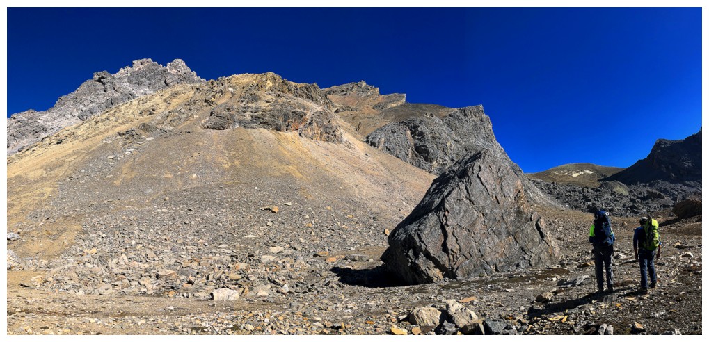
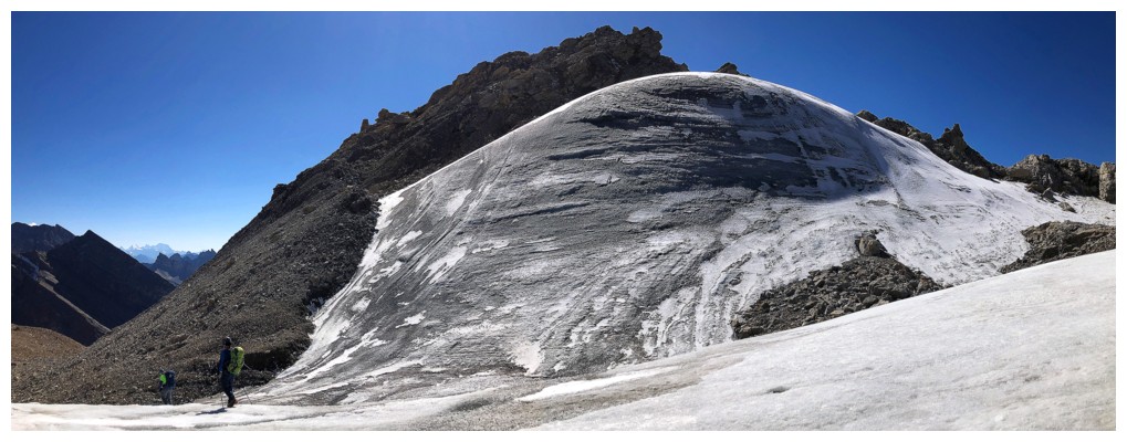
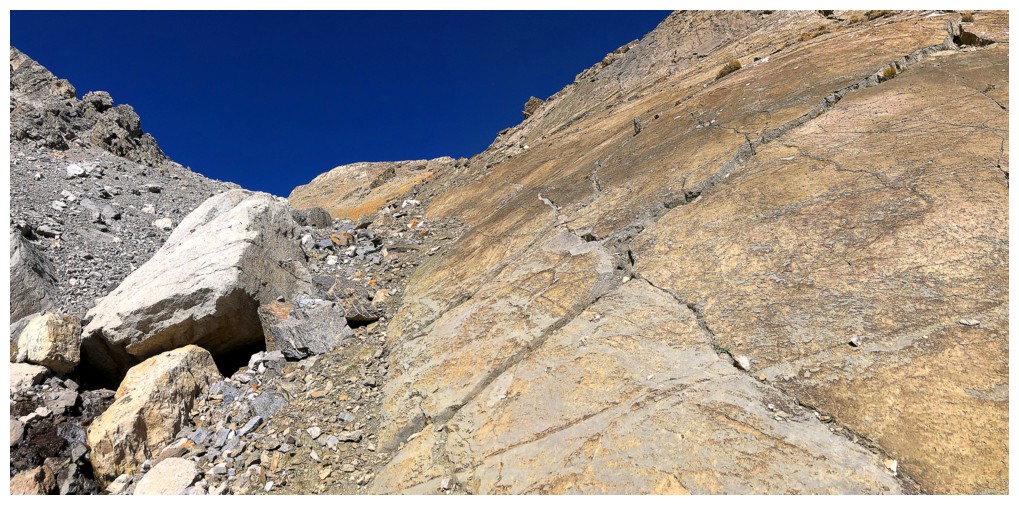
Part of the stable boulder field we ascended
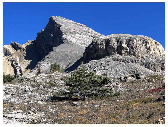
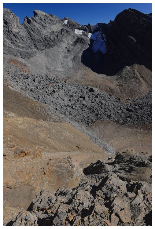
Almost at the top of the field. Watermelon is the second peak from the left.
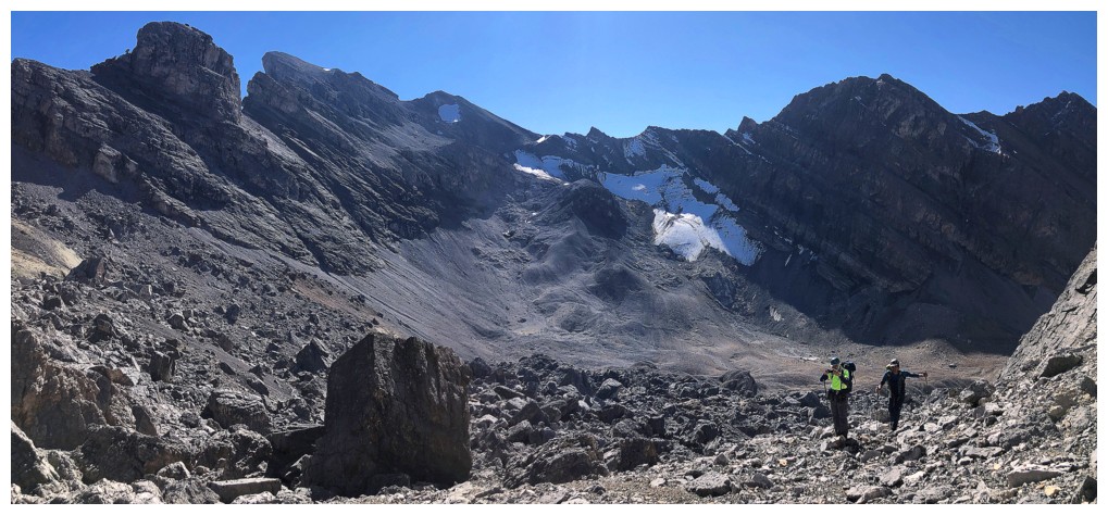
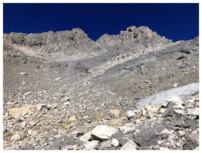
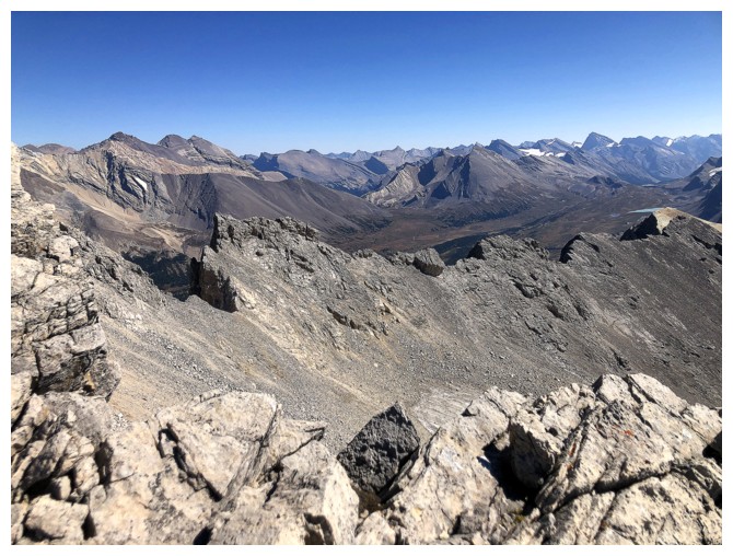
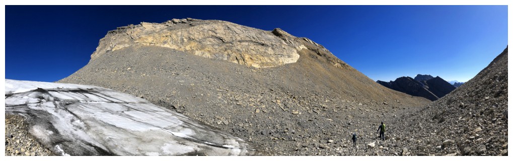
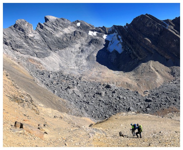
The discouraging view from the top of the boulders. This is how we felt at this point.
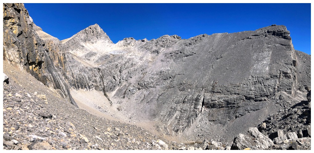
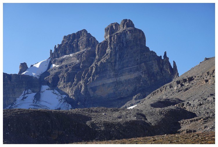
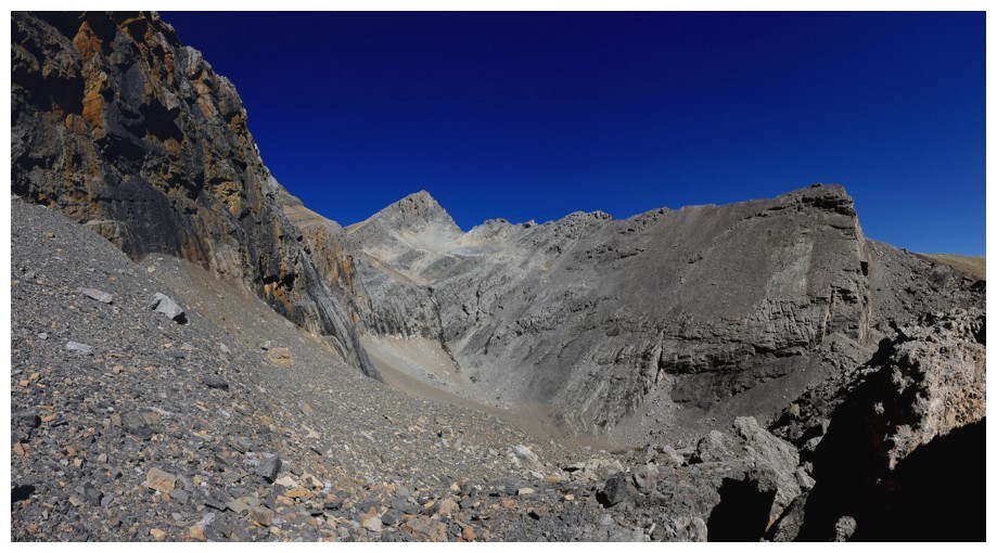
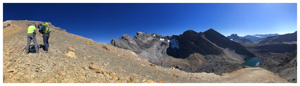
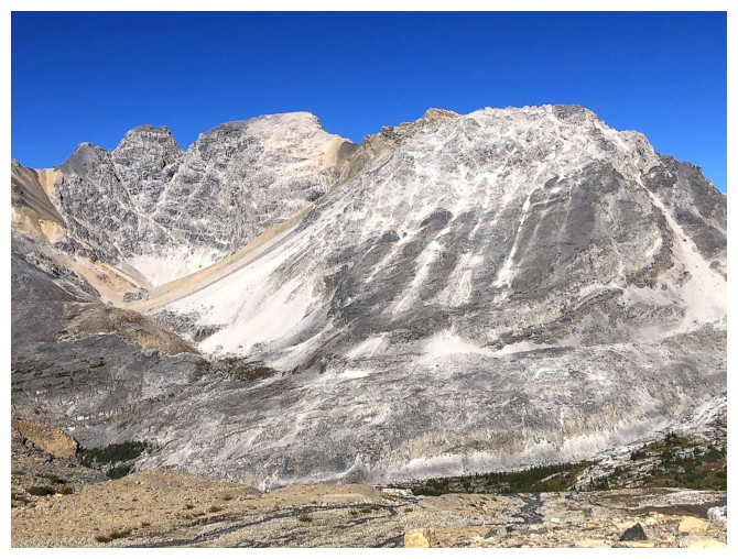
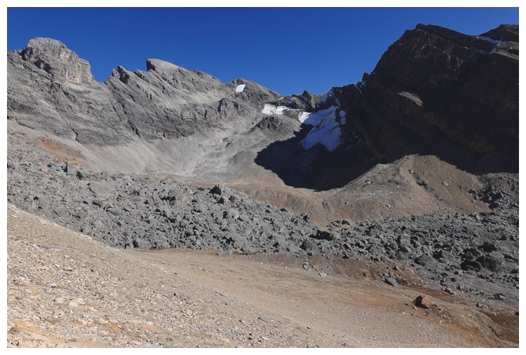
The summit of Bobac is just left of centre but the terrain between
looks improbable. Fortunately, Doug suggested a potential route up the
headwall in the centre and then an unseen ramp at the left. And it
worked wonderfully! (photo by Doug)
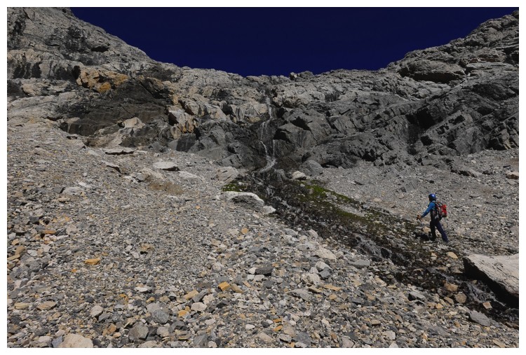
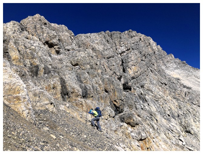
Approaching the headwall (photo by Doug)
Same as above with a little green
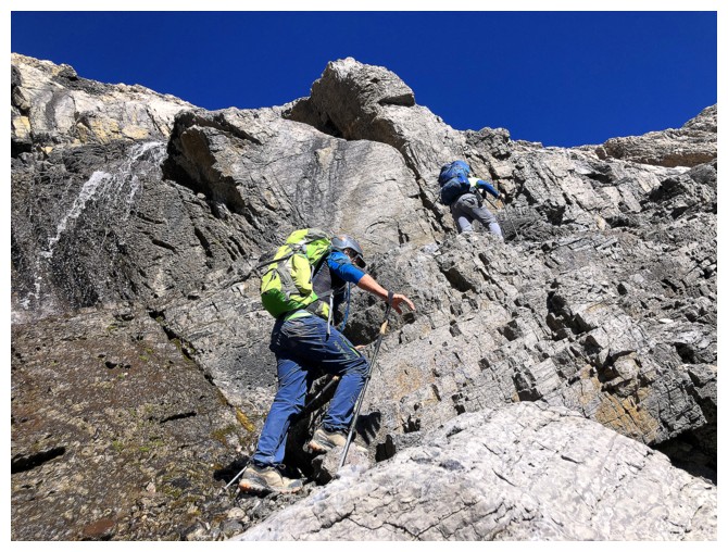
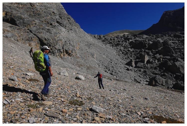
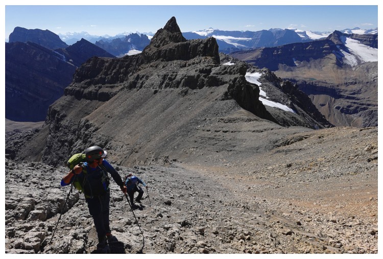
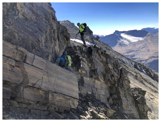
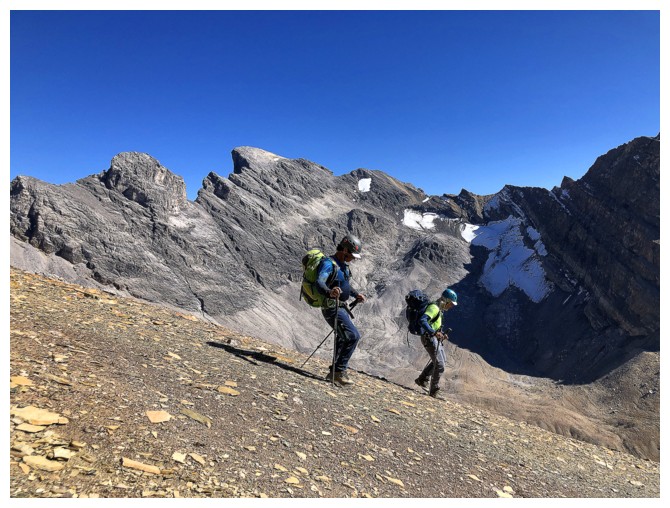
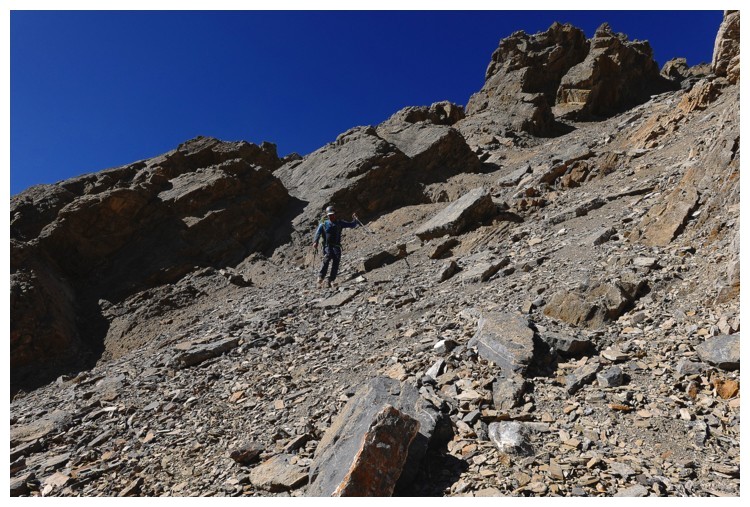
Doug leads the ascent of the headwall
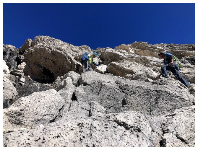
Making good progress
Doug watches Luigi and me ascend the route (photo by Doug)
Easier terrain above the headwall
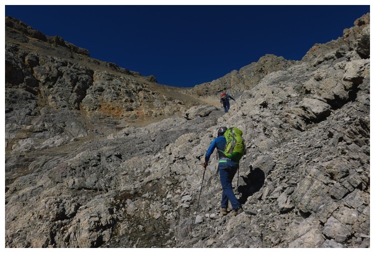
There is it - the easy scree ramp Doug predicted would lead us to the ridge (photo by Doug)
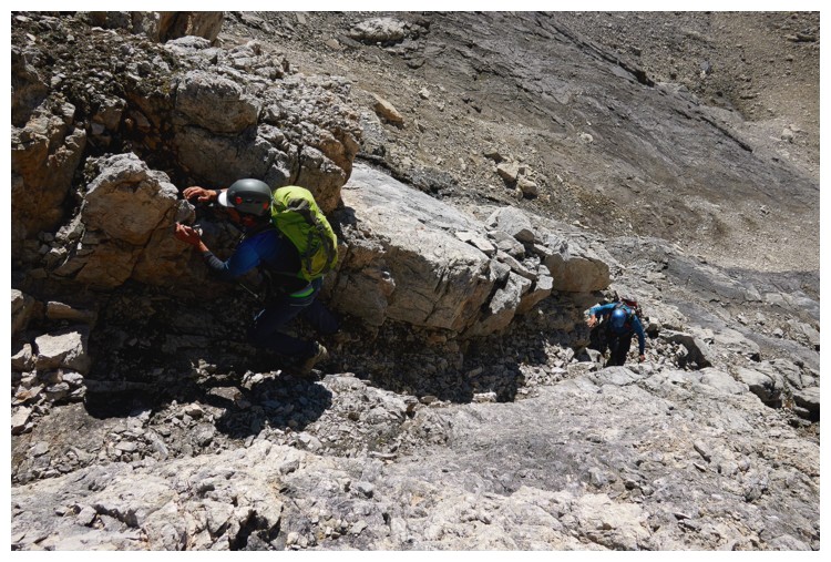
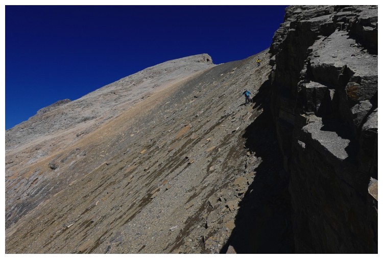
There is some steep terrain to get to the ridge
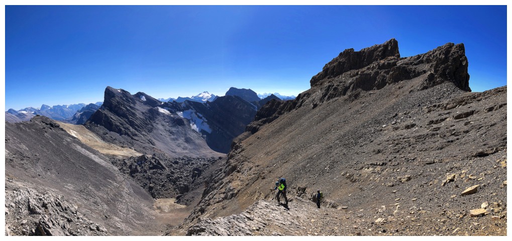
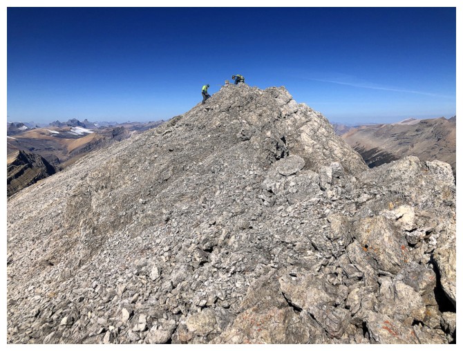
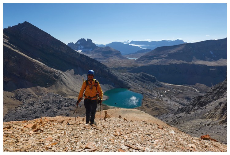
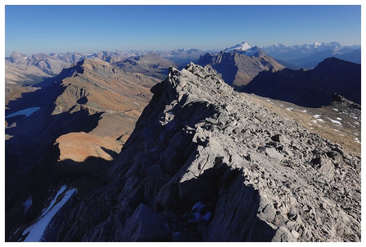
On the ridge and excited that the summit is within reach
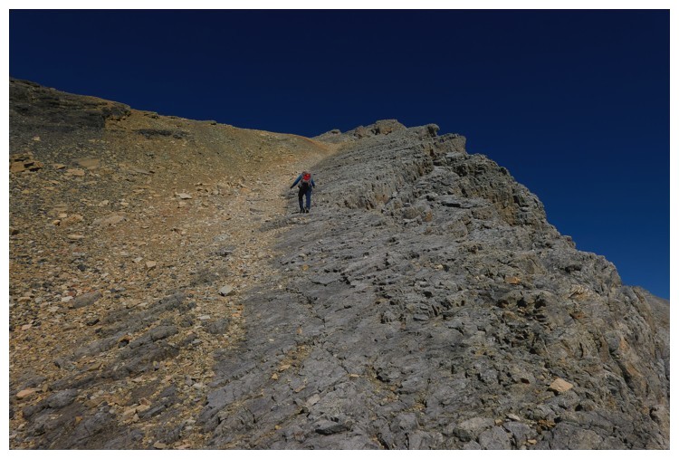
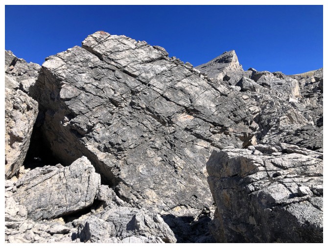
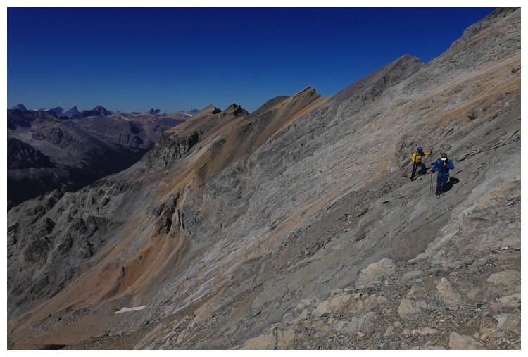
The rock was solid and terrific to walk up (photo by Doug)
The boys take the lead again
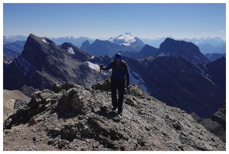
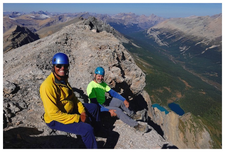
I'm catching my breath while enjoying views to the southeast
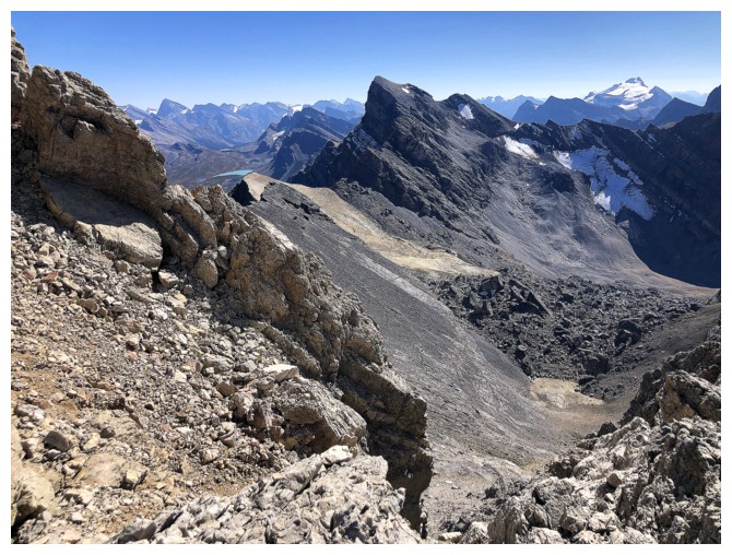
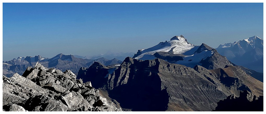
Watermelon is looking scrumptious from here!
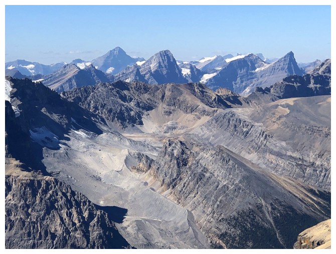
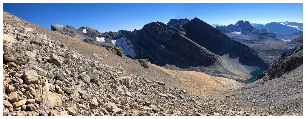
View to the southeast also includes Cataract Peak (left) and a scenic tarn below Quartzite Peak
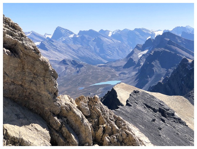
The
pointed peak in the centre is the outlier of Watermelon that you see
throughout the approach. You can just see the tarns I would visit
later, near the upper right (photo by Doug).
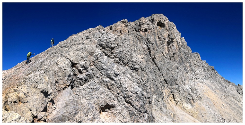
Doug and Luigi are already at the top.....
....and gawking at this view on the east side (photo by Doug)
Final few steps for the slow-poke (photo by Doug)
Luigi and I appear to be entranced by something (photo by Doug)
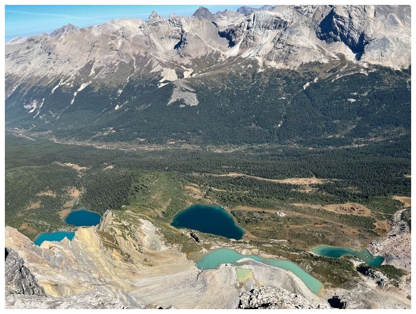
It was the view of the six lakes below, each a different colour (photo by Luigi)
Close-up of Cataract
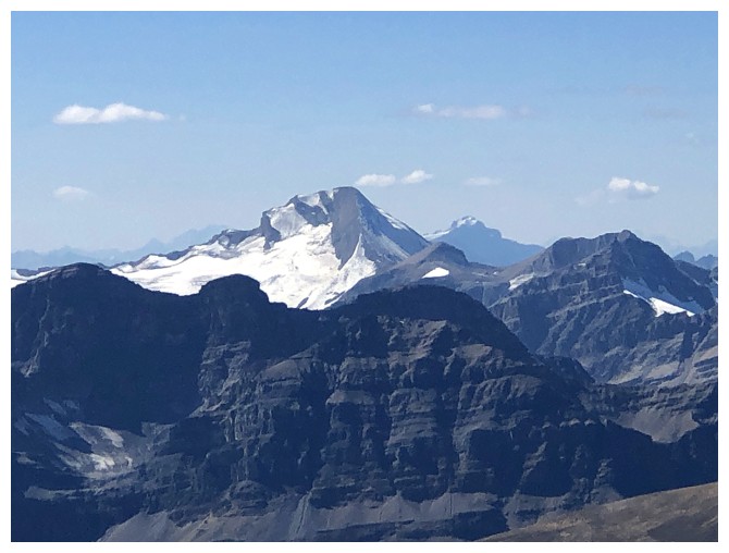
Mount Baker
The view to the northwest features Forbes, Howse, White Pyramid, and Chephren
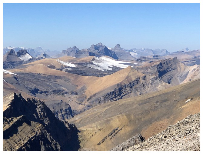
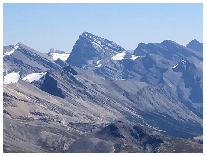
Mount Murchison and its many towers
A northwest outlier of Bobac
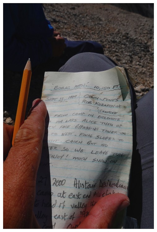
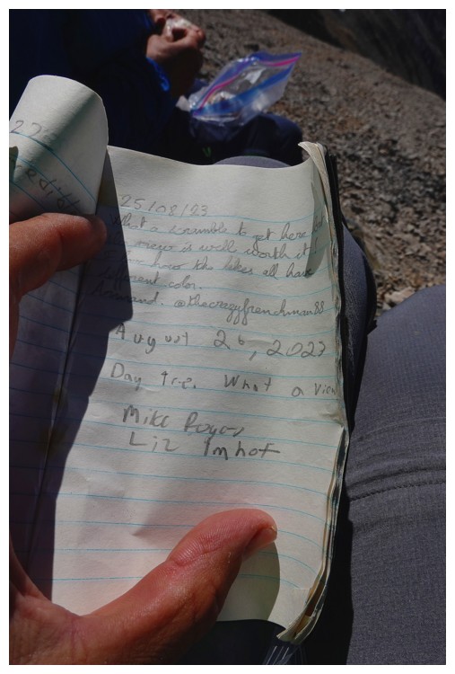
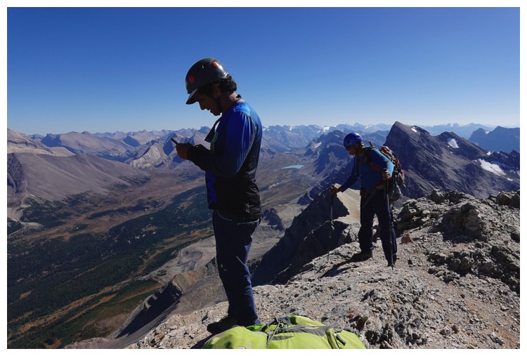
A couple of the summit entries (photo by Doug)
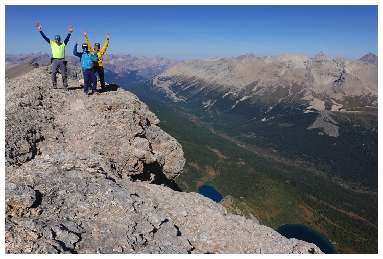
The Amigos at the top. We didn't feel like this but it's one of my favourite scenes! (self-timed photo by Doug)
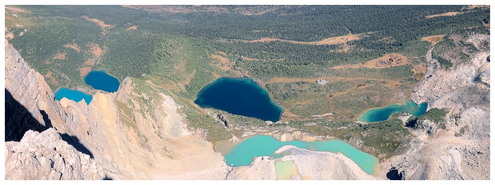
Another of the hundred or so photos we took of the lakes
We took turns trying to photograph ourselves with the lakes and without the photographer's shadow. It was hard!
Luigi's turn (photo by Luigi)
Doug got a good one of Luigi (photo by Doug)
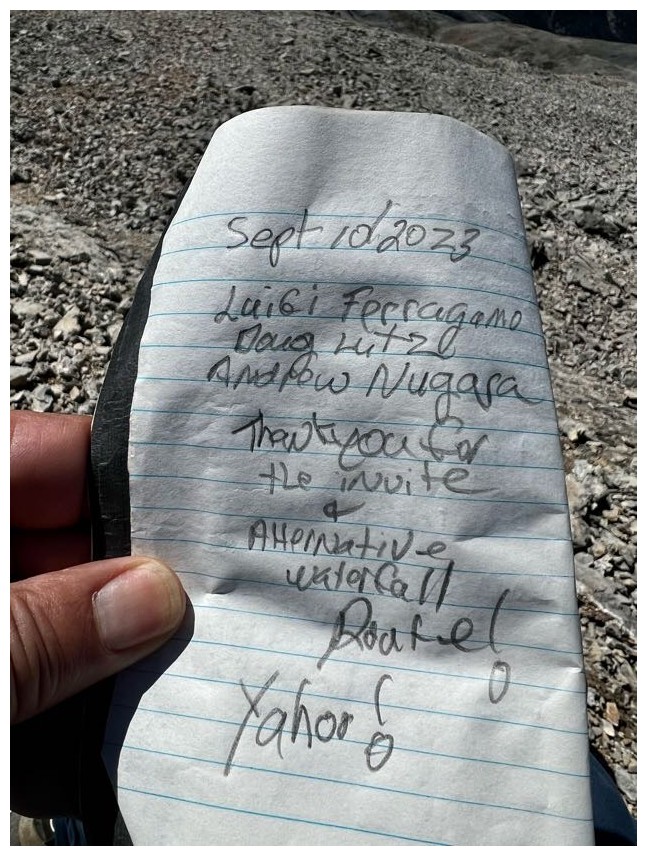
Our summit entry (photo by Luigi)
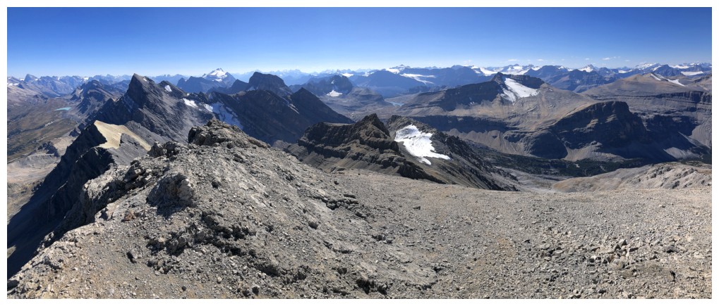
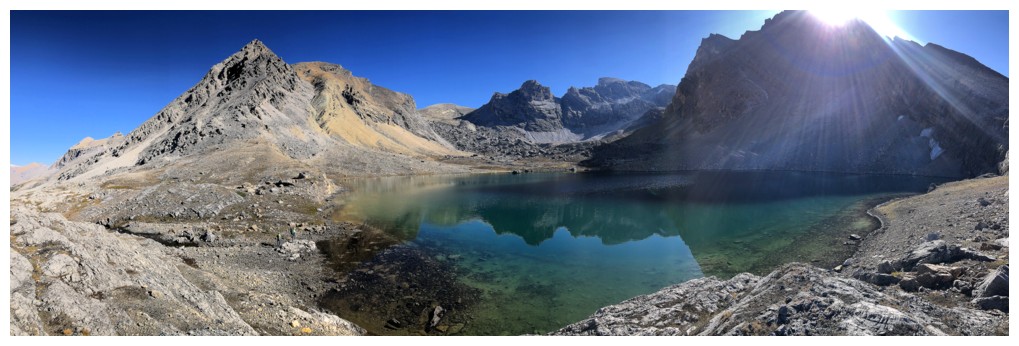
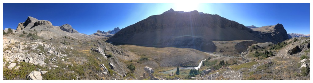
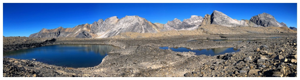
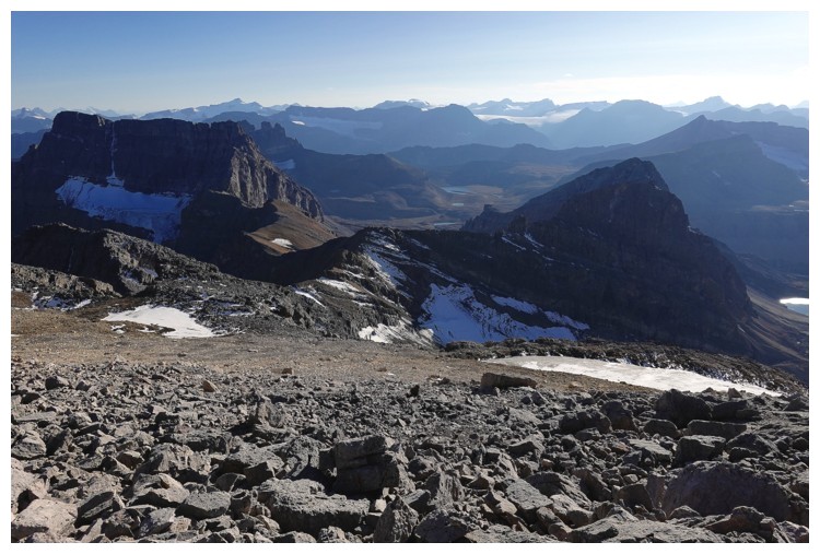
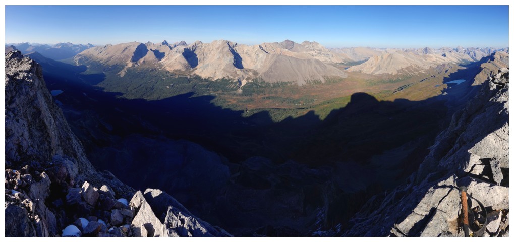
Pano to the south
Pano to the north and east
Starting down
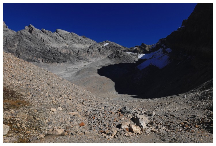
And aiming for the small glacier to the southwest
Still mesmerized by the view to the northwest
The outlier of Bobac looks like a separate peak in itself
Doug's view of me and Luigi descending the scree. Great route down, but would be a laborious one going up (photo by Doug)
Traversing over to a weakness
Doug has found a little shortcut to reach the glacier
Luigi follows
Cool slabs of the outlier
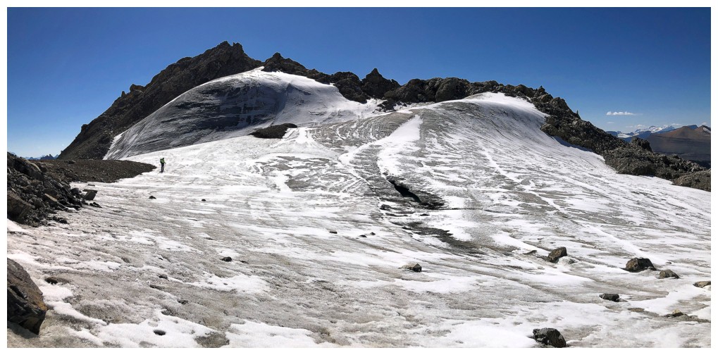
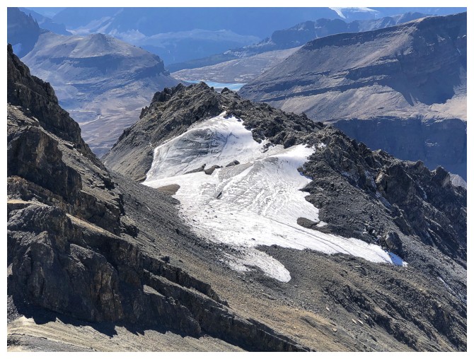
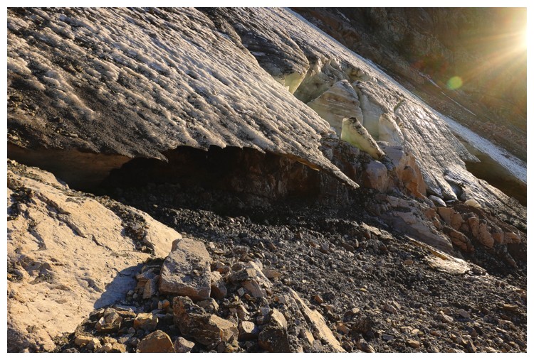
Gaining the glacier
Luigi and the colourful slopes of Bobac
Doug crosses the edge of the innocuous glacier
Luigi and I follow (photo by Doug)
Even small glaciers are so beautiful and so interesting
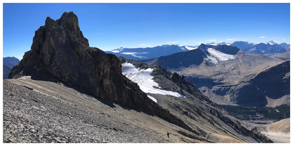
Leaving the glacier and heading for the descent gullies back to Lake Alice
There's the one I would go down
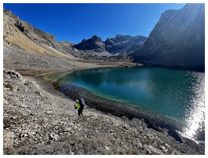
Luigi and Lake Alice
Looking back at where we came from
Me and the lake (photo by Doug)
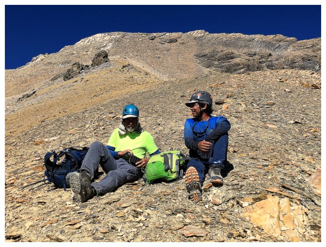
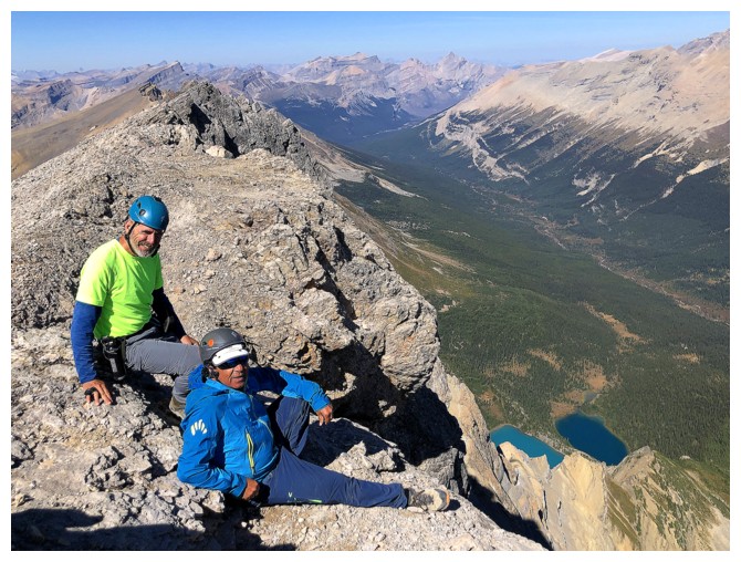
Short break to discuss options
Doug
and Luigi in the huddle. Doug is calling, "I-Right 26 Power", but Luigi
thinks, "Wing T 69 Bootleg Left" will provide a more aesthetic route.
In the end they
settled for, "Let's just get to the top".
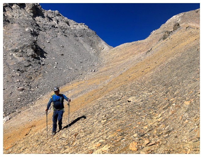
Good scree to start with
Doug and Luigi are off for Watermelon - yummy!
My exploration and descent
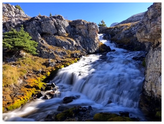
The descent gully was super interesting
With tons of cool rock and great views towards Lake Alice
Looking back up
And again, with some water
Back at Lake Alice
Another round of long exposure photos of the Lake Alice drainage
Looking west towards the bench and Cirque Peak
I took a slightly different route down to the valley bottom. Dolomite Peak in the distance.
I
considered going up this outlier of Watermelon, but it would have
required a significant elevation gain and looked relentlessly steep
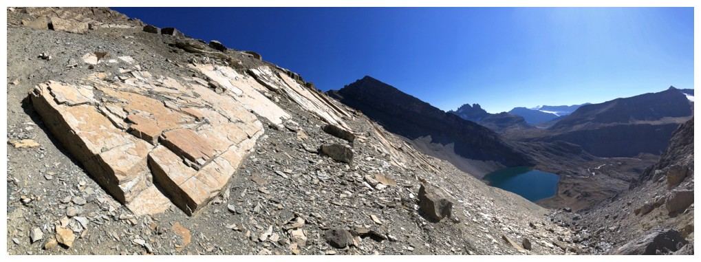
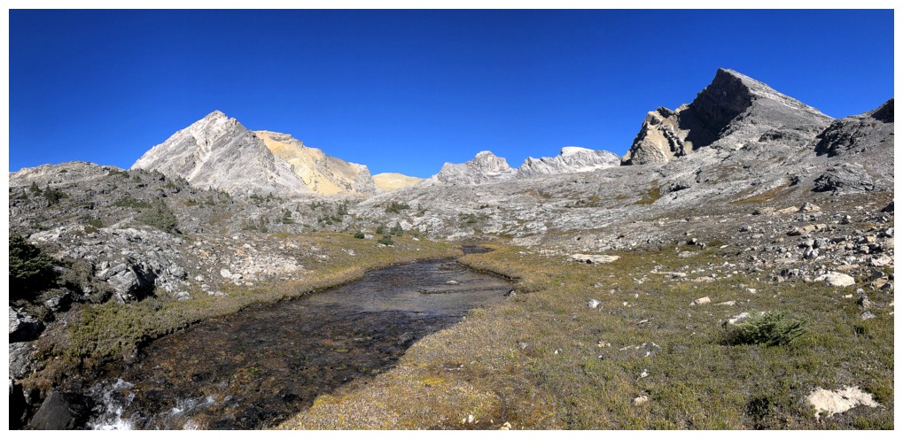
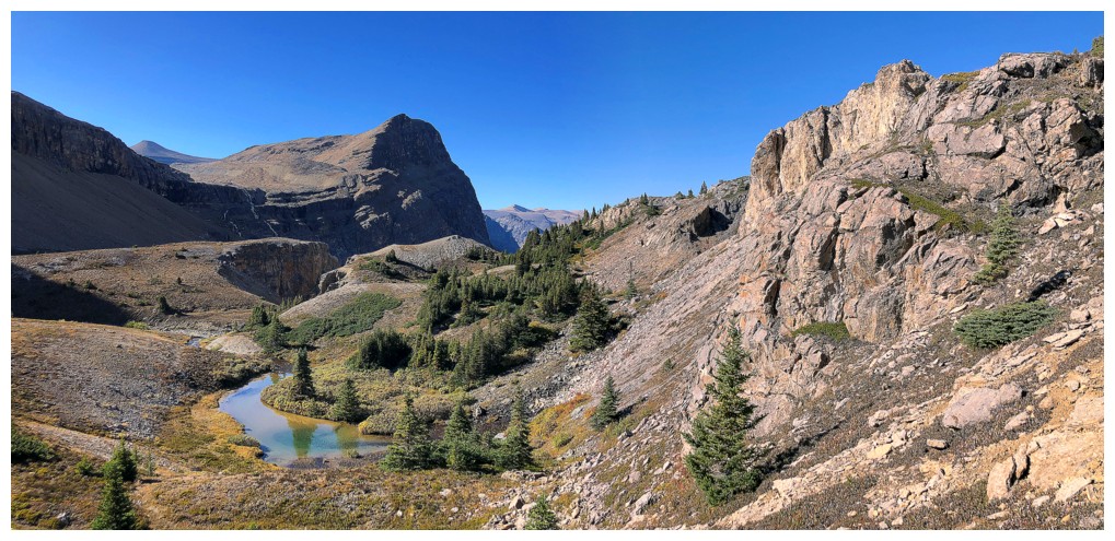
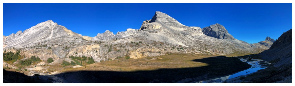
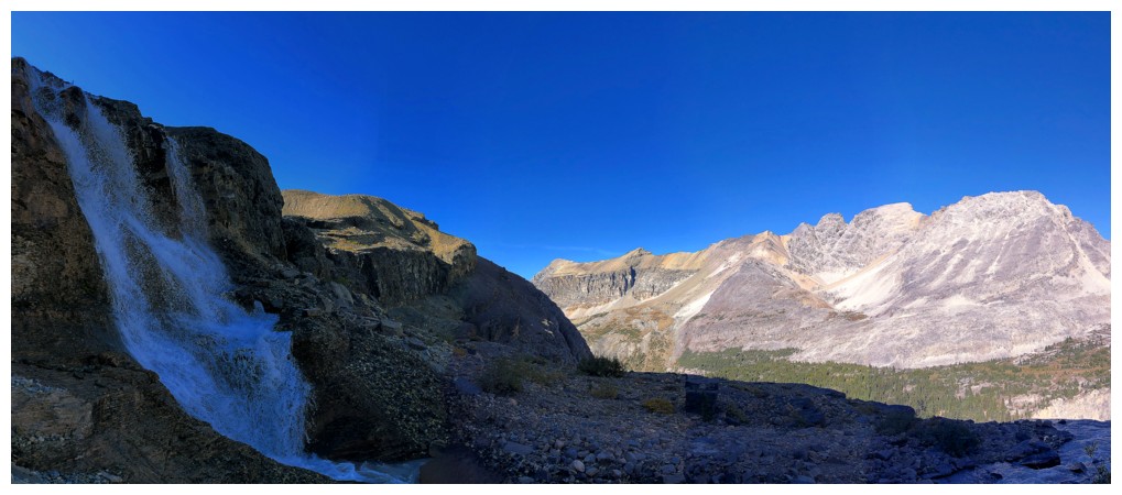
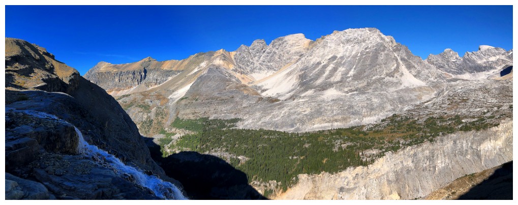
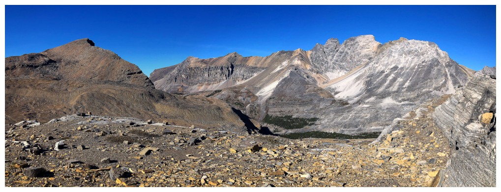
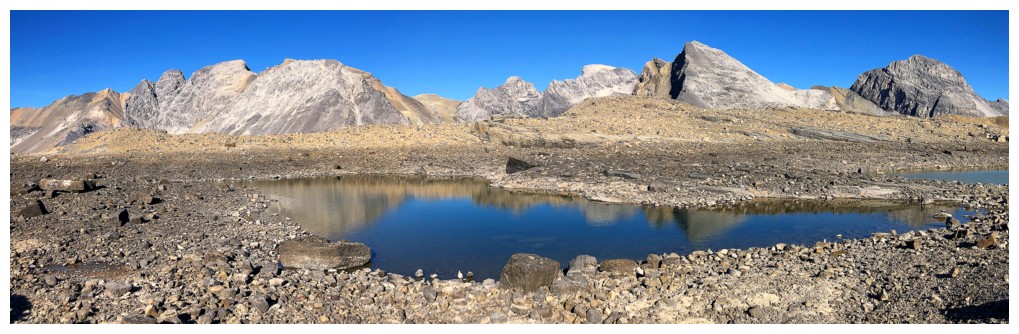
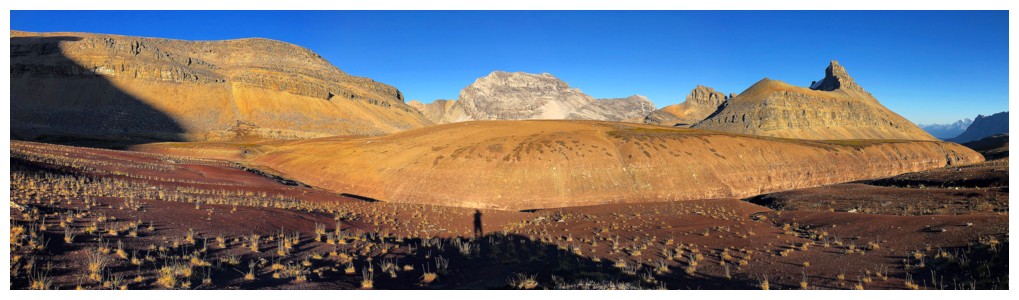
Pano of the whole area
The alternate route boasted some beautiful scenery
Looking back to outliers of both Bobac (left) and Watermelon
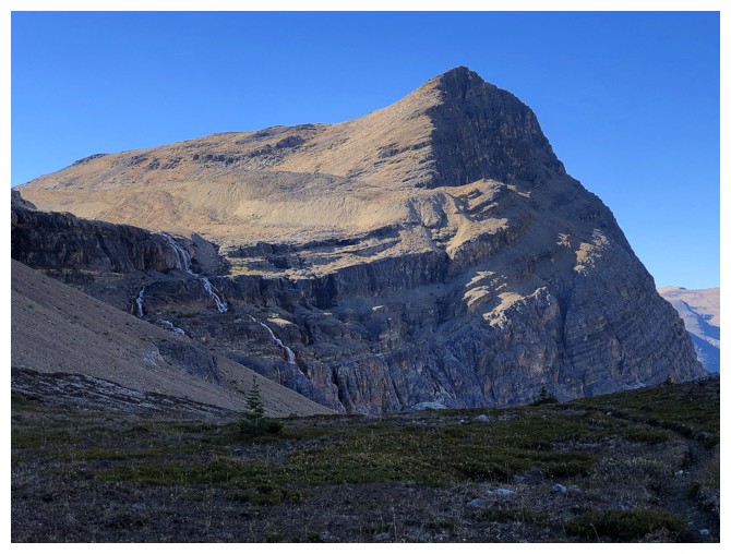
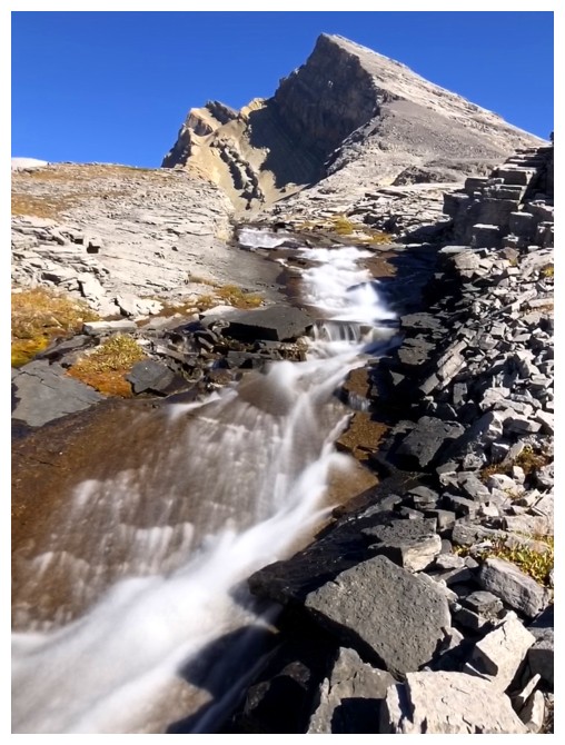
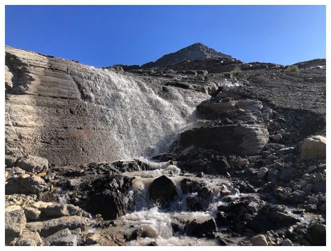
The point where I decided to go to the bench and the tarns. The route
traverses over to the waterfalls and then follows them up to the hanging
valley.
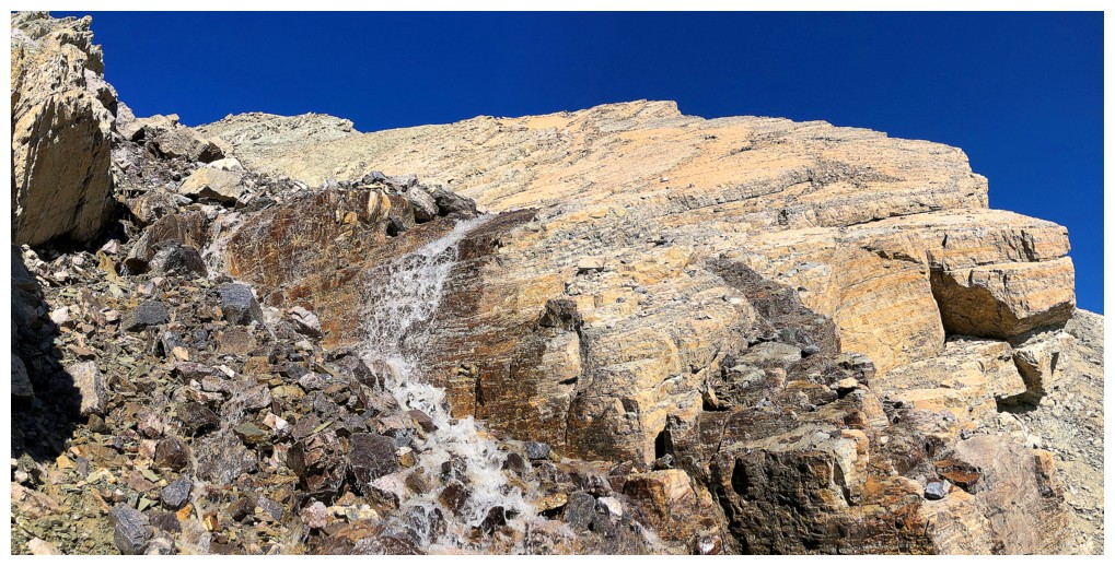
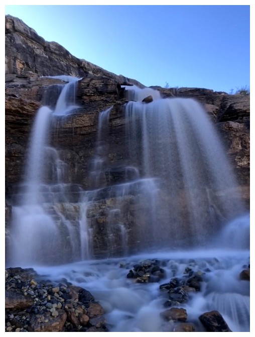
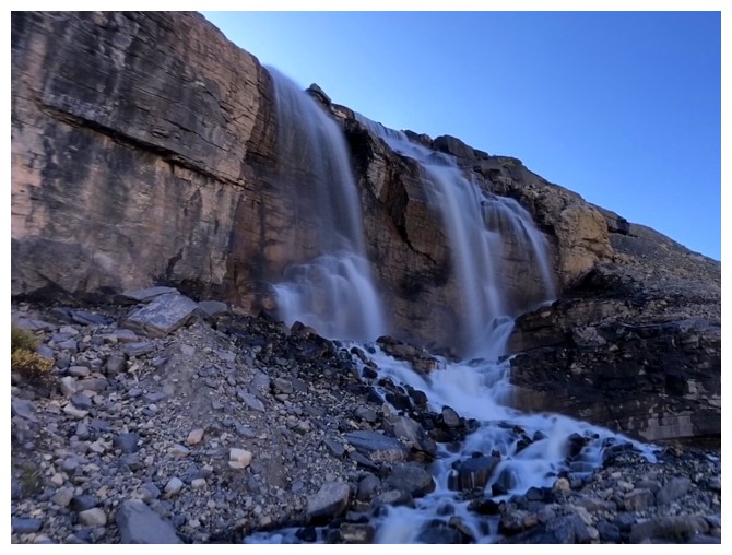
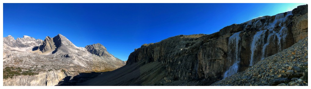
Approaching the waterfalls
Round 3!
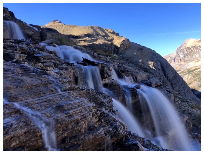
And it's a good one!
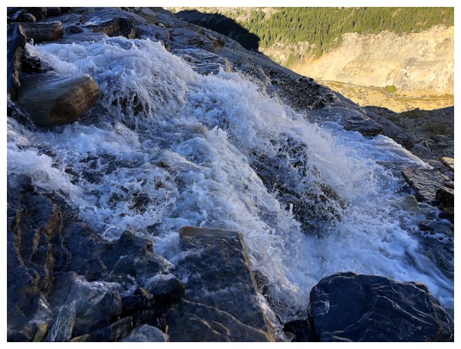
Except that one
Back on track
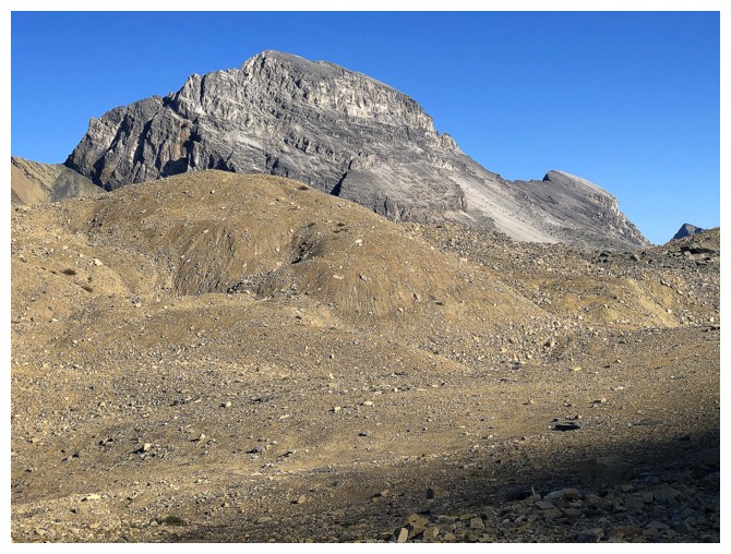
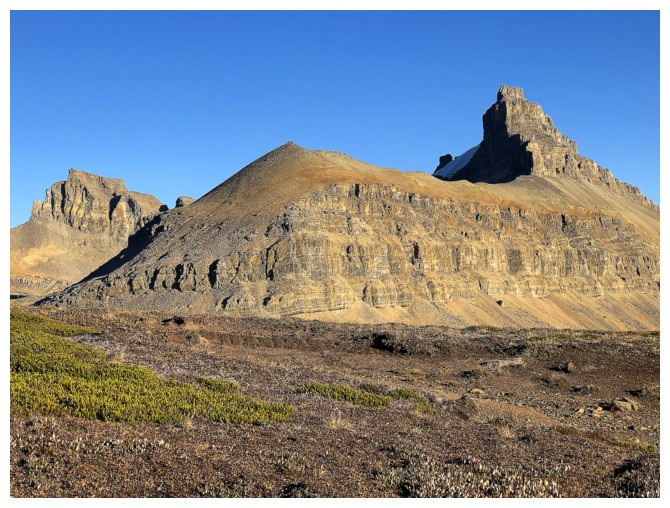
The summit of Bobac (second from the right) is now visible again
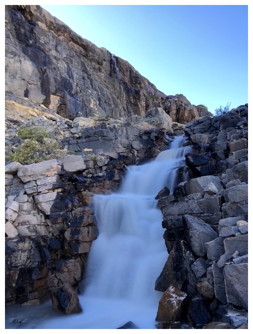
And so are innumerable cascades
Views towards Bobac are going to be show-stoppers for the next little while
Back to the waterfalls
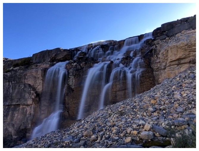
My favourite of the lot
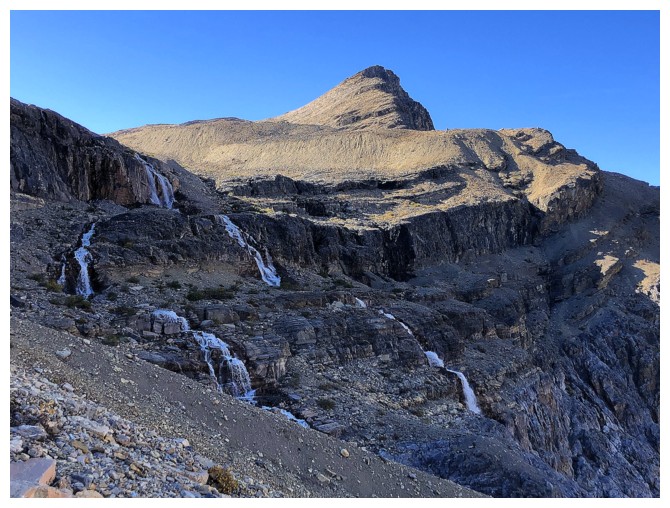
Almost to the hanging valley
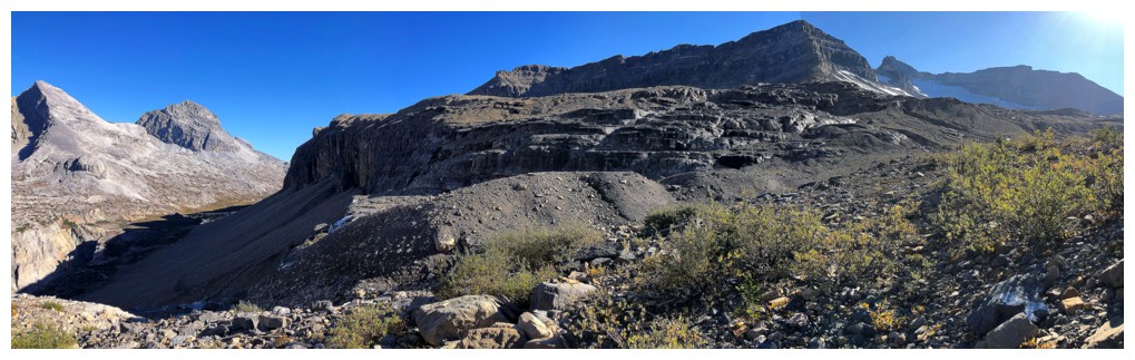
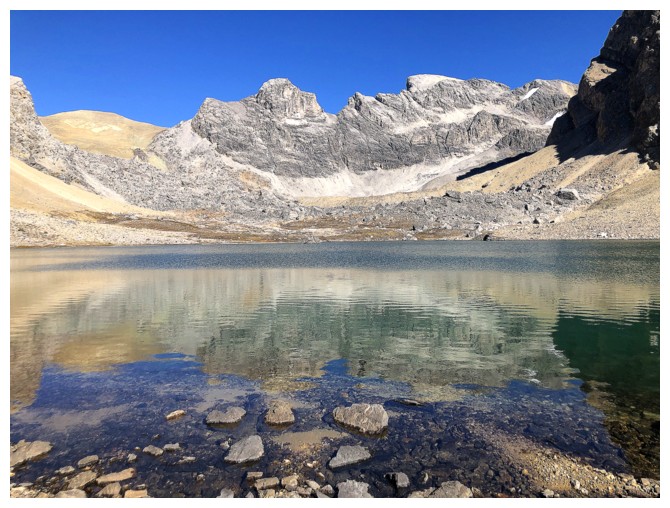
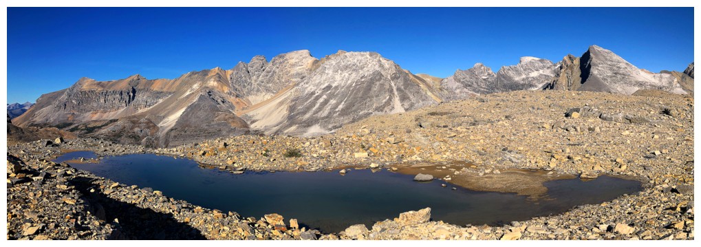
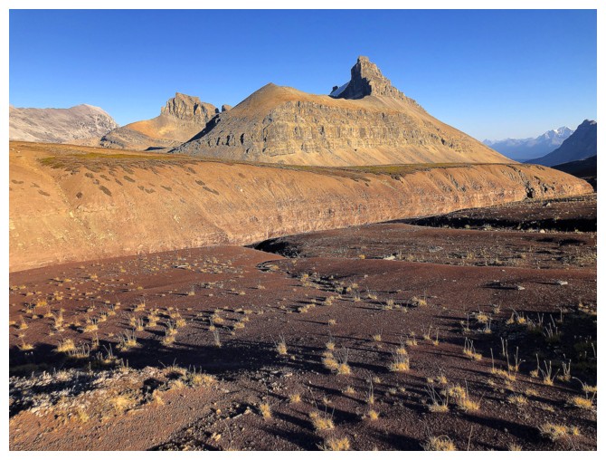
Arrived. Cirque Peak just right of centre.
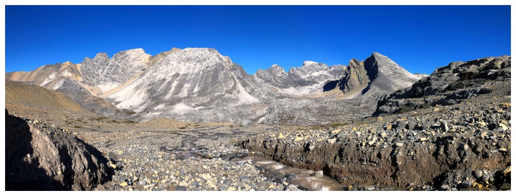
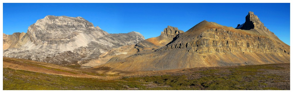
Bobac, Watermelon, and their many outliers
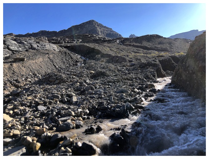
Following a glacial-melt stream
Bobac again
Still following, but eventually the stream goes in the wrong direction
I did briefly consider going over to the outlier at the far left but came to my senses!
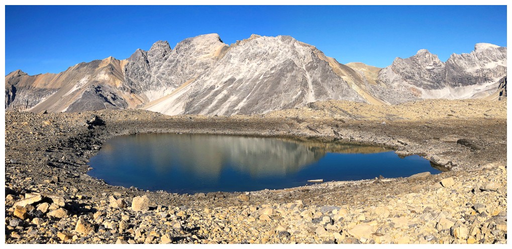
One of the tarns
Another two
A third
OXO Peak - a challenging ascent, with insane rockfall danger. This is how I felt while descending it (at 3:15).
The Watermelon outlier - glad I didn't try that one either
Dolomite (right) and its northeast outlier
OXO and Dolomite
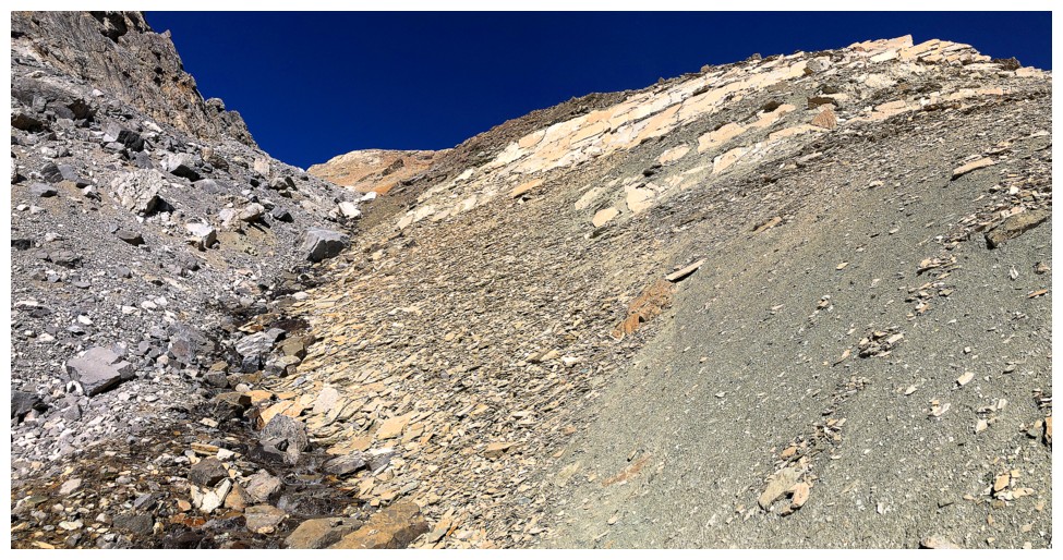
After an excruciatingly long bout of side-sloping nasty rubble I'm
finally on easy terrain with a great view of Dolomite and Lake Katherine
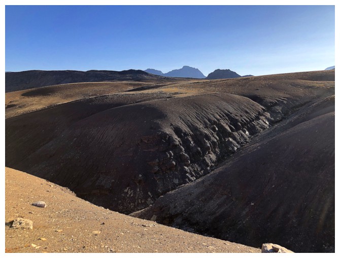
Back to that interesting canyon-like landscape
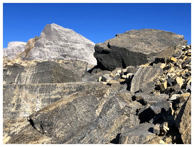
The geological differences between OXO and Dolomite are quite evident
Dolomite only
The descending Sun lights up the landscape in beautiful hues
Couldn't get enough of this scene
Back to the highpoint above Helen Lake
The Helen Lake reflection view at the end of the day looks remarkably
similar to that seen in the morning, except the Sun is lighting up the
opposite side
Hector and company look very different in the evening
Mountain shadows rising on Dolomite - time to make haste!
Seeing Bow Peak indicates it's all downhill from here to the end
Doug and Luigi's Watermelon Adventure (all photos by Doug, unless otherwise noted)
From near where we parted ways, looking down their descent route
Still descending
Luigi on easier terrain
Almost down to the valley
Up they go
On the ridge
Success!!!
Fantastic view of Mount Hector (photo by Luigi)
OXO at the far left
Luigi takes a well-deserved break
View towards Lake Alice
View to the northeast, but Watermelon is already casting its long shadow
The edge of the glacier on Watermelon
Some fun stemming for Luigi in the boulder field at the bottom of Watermelon
The End
LOG