The Eaglet II and The Raptor II
January
26, 2019
Mountain
heights: approximately 1978 m and 2055
m
Elevation gain: approximately 700 m
Roundtrip
time:
4:30
Scrambling with Dave McMurray.
 As Dave pointed out during the trip, these
easily accessible outliers of bigger peaks in The Castle make for ideal winter
trips – not that we’d even had a winter up to this point in 2018/19!
As Dave pointed out during the trip, these
easily accessible outliers of bigger peaks in The Castle make for ideal winter
trips – not that we’d even had a winter up to this point in 2018/19!
Dave, once again, pulled this trip out of his
hat and I was more than happy to give it a go, especially after our amazing
adventure on The Muffin and company, 3 weeks earlier. I had visited these
summits way back in 2006 with Mark, as part of an ascent of Mount Roche (Spread
Eagle Mountain). As such, my recollection of the peaks was pretty hazy –
hopefully this trip would feel more like a first ascent for me.
And it did – in every way.
We decided to leave our snowshoes in car. If I
didn’t have the best trail-breaker in southern Alberta with me, I probably
would have taken mine with me! There was little to no snow on the upper half of
the peaks, but getting there was going to involve some forest travel,
potentially with deep, powdery snow.
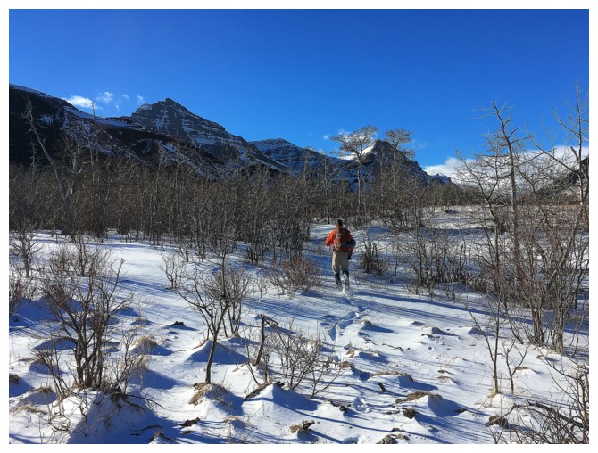
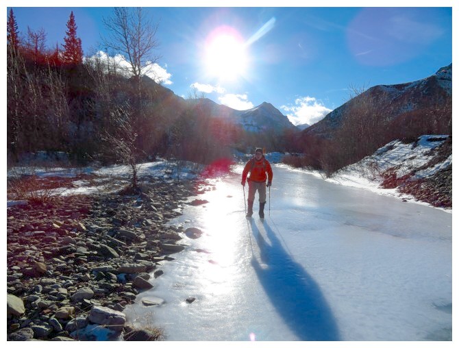
 The first section of the ascent and last of the
descent was one of my favourite parts of the day, hiking and sometimes gliding
on the frozen creek – we even got the rare and highly sought after mountain
reflection in a frozen creek shot!
The first section of the ascent and last of the
descent was one of my favourite parts of the day, hiking and sometimes gliding
on the frozen creek – we even got the rare and highly sought after mountain
reflection in a frozen creek shot!
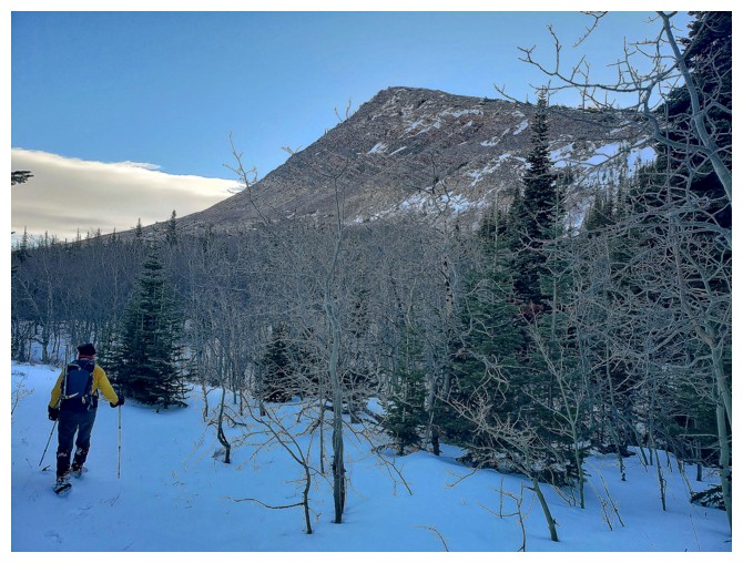
Although there is a trail going all the way up
to the first highpoint, the snow made that trail difficult to find. We were not
particularly worried, as we had both picked out the approximate location of the
trail from across the valley, while ascending The Muffin. Unfortunately it
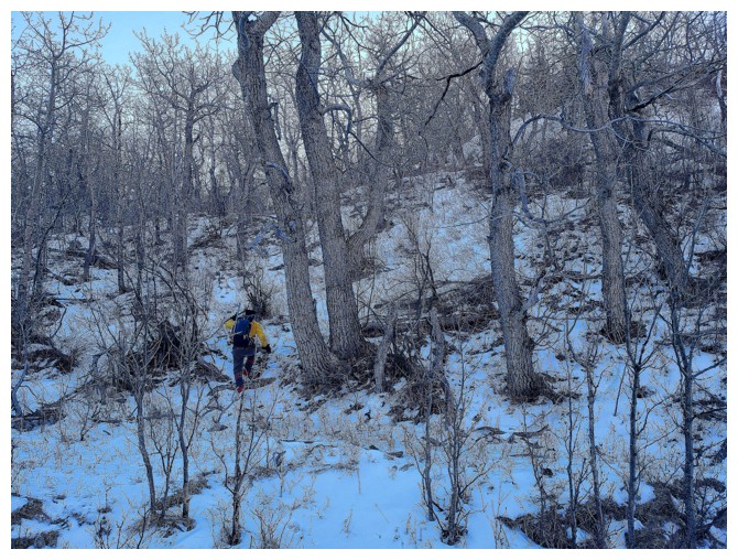
quickly became evident the snow was going to be deep until we gained a significant
amount of elevation. The good news: not only was Dave the Trail Breaking
Machine up for the challenge but a moose had already paved the way forward. We
took full advantage of his/her tracks, although that animal had a huge stride!
Eventually, we did find the trail, almost bare
in places and covered with half a metre of snow in others. Above tree line, the
snow disappeared almost completely. At this point we had fortuitously arrived
at the north end of the northeast ridge. While the trail went up around to the
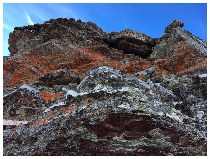
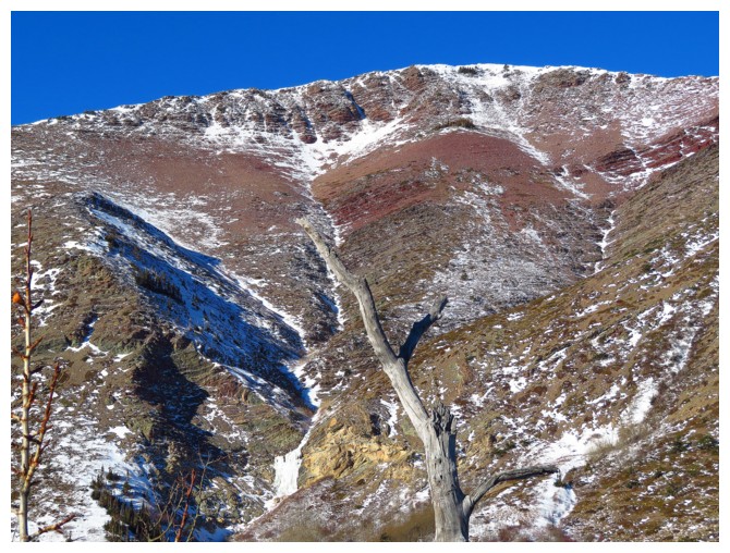
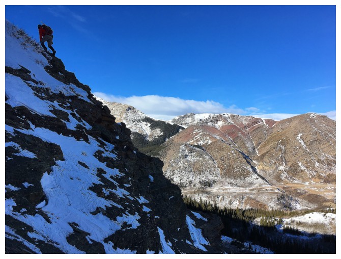
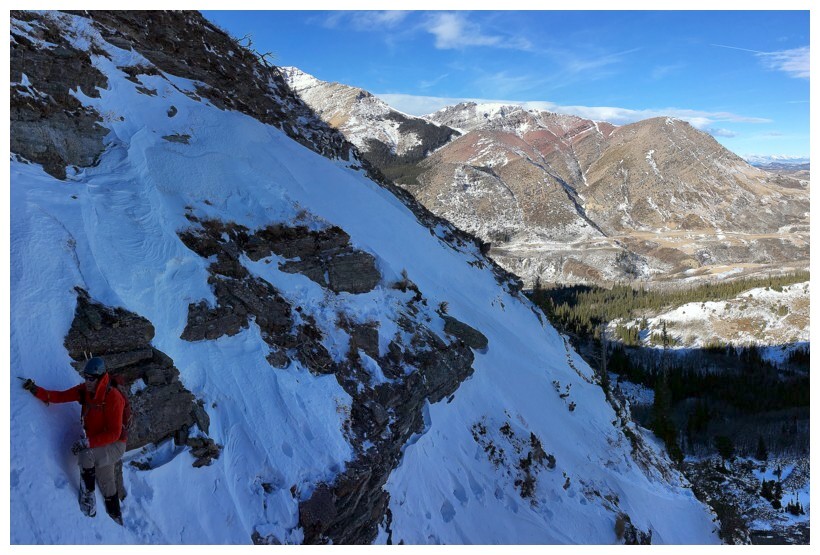
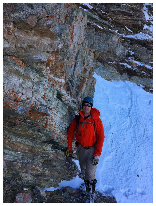
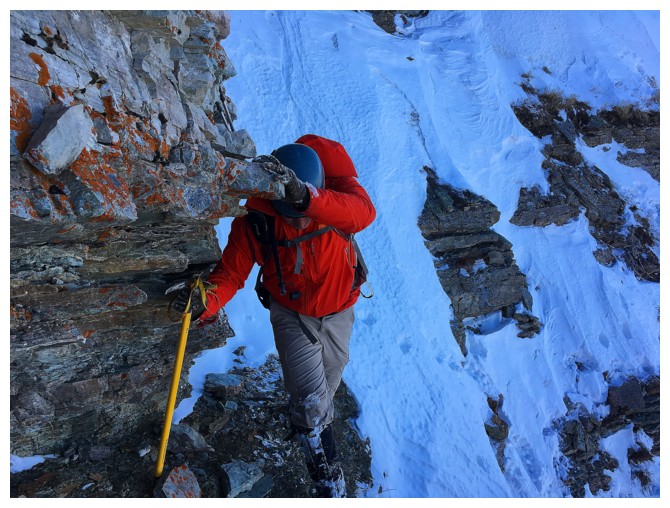
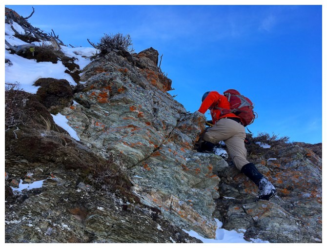
west side, the steep and colourful rock face above looked to be way more fun.
And it certainly was for me, picking the line of least resistance. Dave got a
good dose of fun, but also an even better dose of “What have I gotten myself
into!”, as he took a line up a snow filled gully that turned out to be
horrendously steep and exposed. He skilfully negotiated the slope and then made
his way over to the gentler terrain I was on.
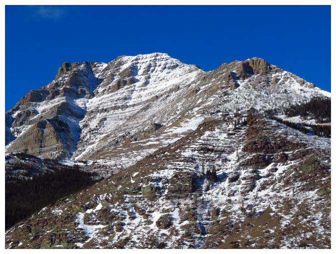
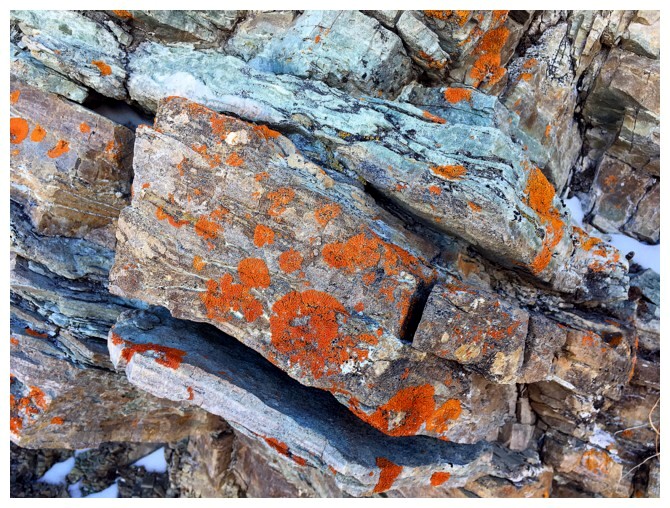
 The remainder of the ascent to the summit of
“The Eaglet” was much easier and equally scenic. Several remarkable colourful
rock bands were cause for extended photo breaks and general “oohing” and
“aahing”! Those breaks also afforded us a little reprieve from the wind, which
was as horrendous as Dave’s sojourn up the snow gully!
The remainder of the ascent to the summit of
“The Eaglet” was much easier and equally scenic. Several remarkable colourful
rock bands were cause for extended photo breaks and general “oohing” and
“aahing”! Those breaks also afforded us a little reprieve from the wind, which
was as horrendous as Dave’s sojourn up the snow gully!
Given the higher summit to the southwest was
our end objective, we stayed at the summit of The Eaglet for less than 2
minutes and then made our way, with relative ease to that highpoint. Dave named
this one “Raptor Peak” – strangely fitting, given the spectacle of a huge bird of
prey that swooped right by us on descent.
Standing atop The Raptor was wonderfully
nostalgic and certainly made me yearn to repeat an ascent of Mount Roche (Spread
Eagle Mountain) via this route – but not today!
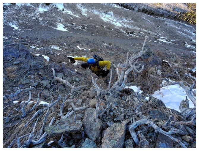
In addition to his mad trail-breaking skills, I
also admire Dave’s willingness and intrigue in exploring unknown descent
routes. As such, we took a line due north from the summit, in hopes of
descending more or less directly to the gas road between Roche and Loaf. The
route initially looked quite promising, however, ridiculously
steep terrain lie ahead and we veered off to the northeast, in hopes of finding
our uptrack – success, but not after wading through a few hundred metres thigh-deep
snow! Back on track we had little
trouble following the trail in its entirety back down to the creek. A
combination of shuffling and marginally graceful gliding down the slick, frozen
surface brought an end to a truly magnificent day out!
Click here to see Dave’s superb report!
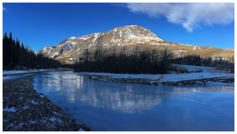
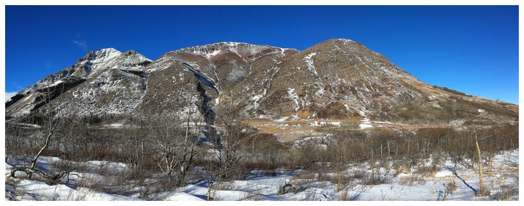
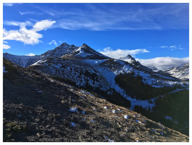
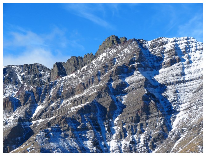
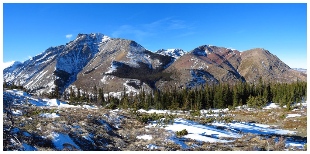
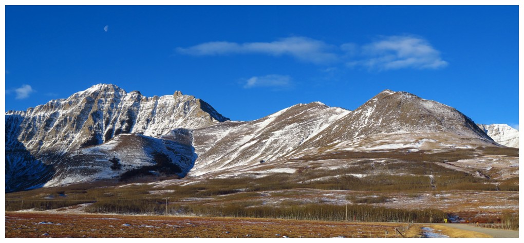 From the approach road, The Eaglet (right), Raptor Peak (centre) and Mount Roche (left) are beckoning
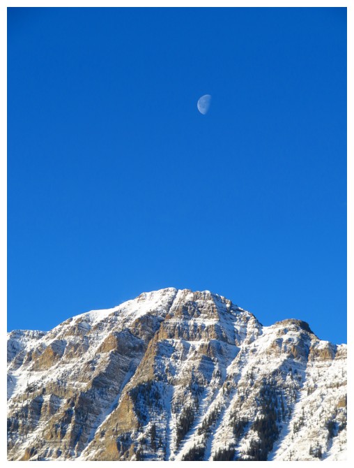 The Moon over Roche
 The Muffin vaguely reflected in frozen Spionkop Creek
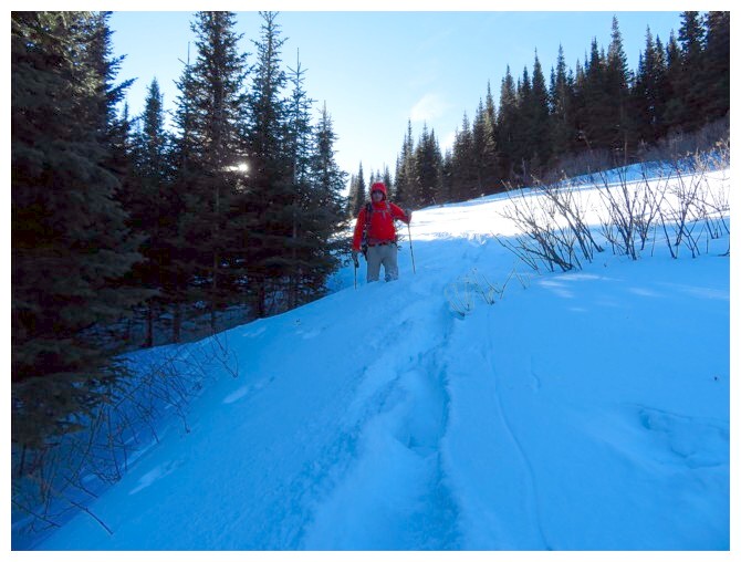
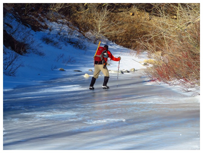
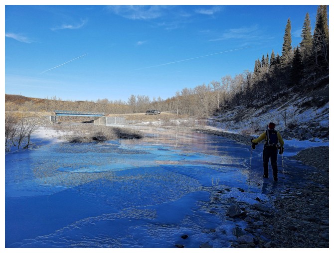
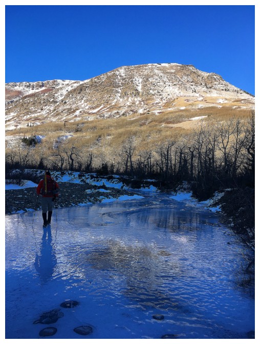 Dave walks frozen Spionkop Creek
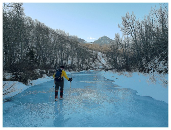 Enjoyable hiking on ice (photo by Dave)
 This is where we thought the trail was (photo by Dave)
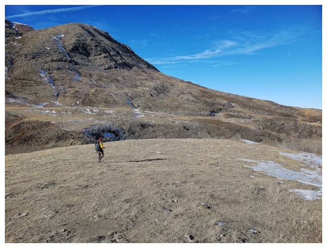
 Out into the open on easier terrain (photo by Dave)
 What I am looking at?..... (photo by Dave)
 ....the wonderful colours of The Muffin
 Remembering a recent, terrific day on The Muffin, The Croissant, and Bakery Peak (right to left)
 Bakery Peak - cannot wait to attempt that one again
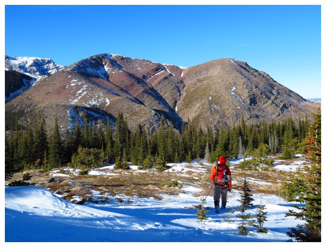
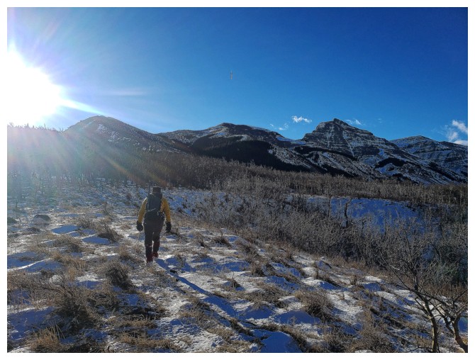
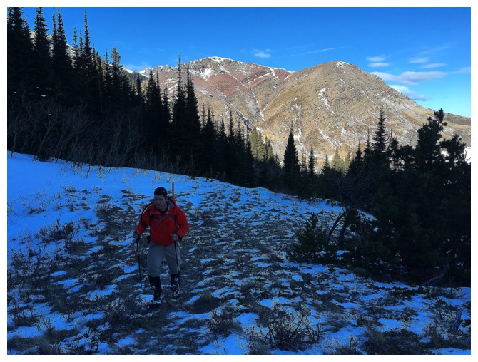
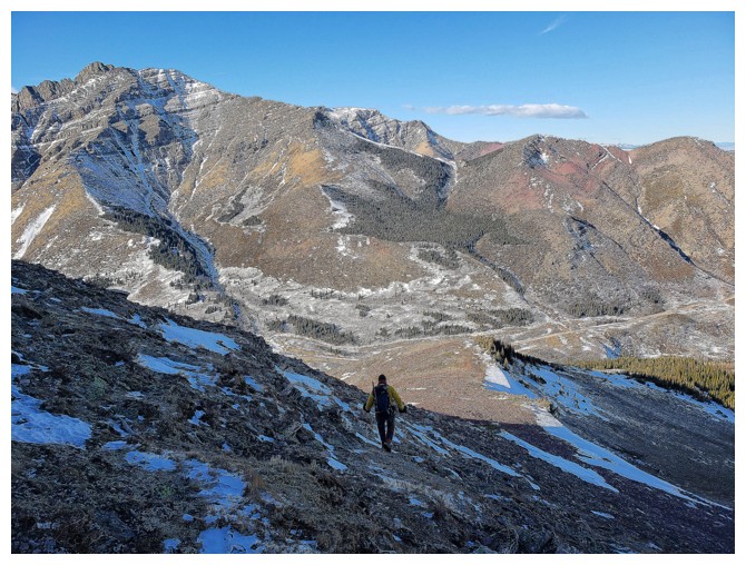
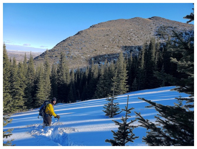
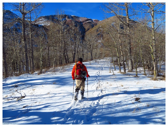
 More easy, pleasant terrain before the slogging through deep snow begins
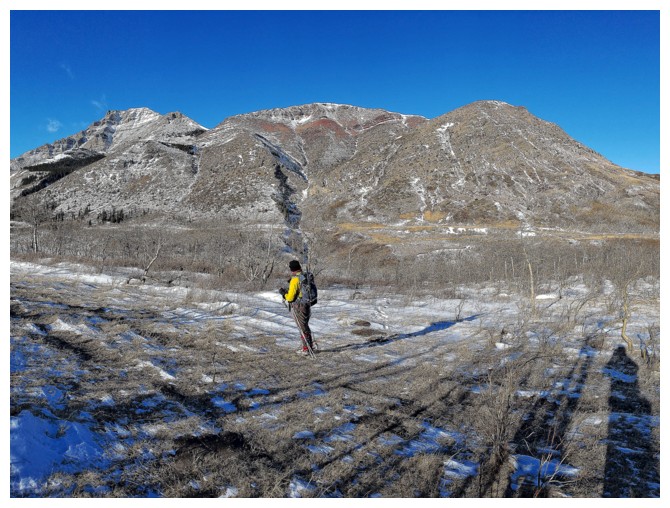
 After the snow slogging we arrive at the northeast end of The Eaglet (photo by Dave)
 Dave, The Croissant and The Muffin
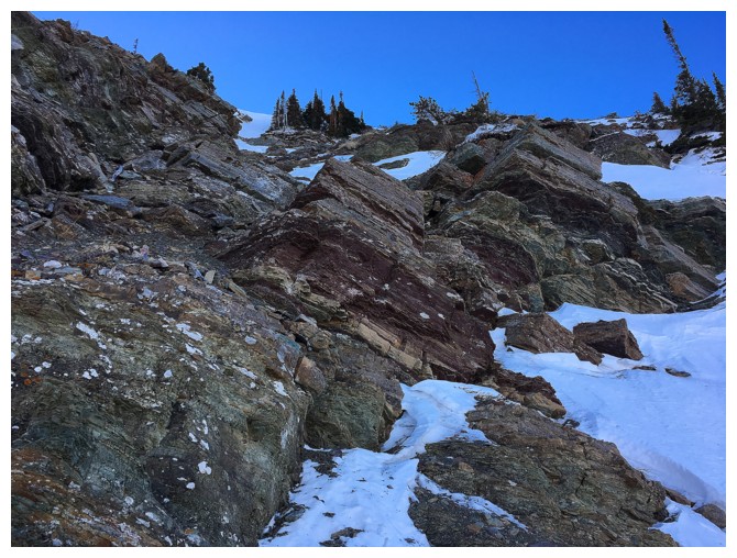
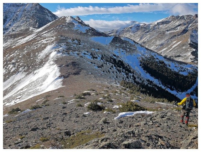
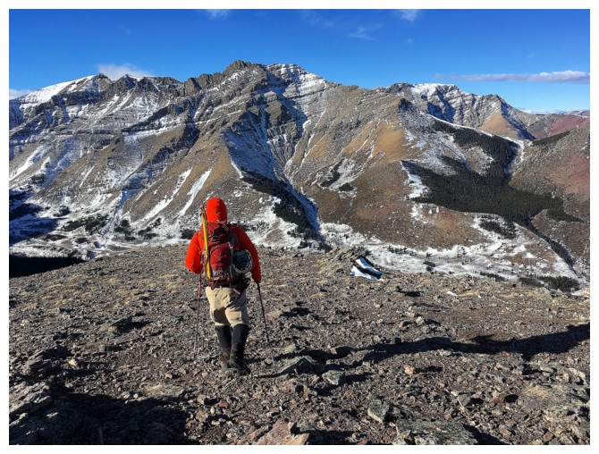
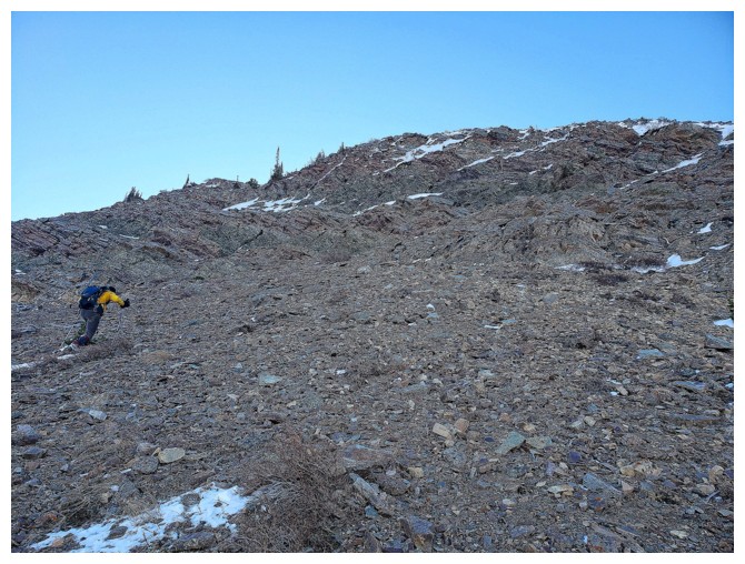 Scree slogging up to the cool rock of The Eaglet's northeast side (photo by Dave)
 Dave picks a very steep line
 Dave checks out the route ahead - the one that turned out to be viciously steep
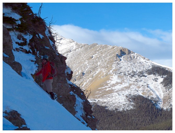
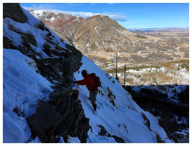
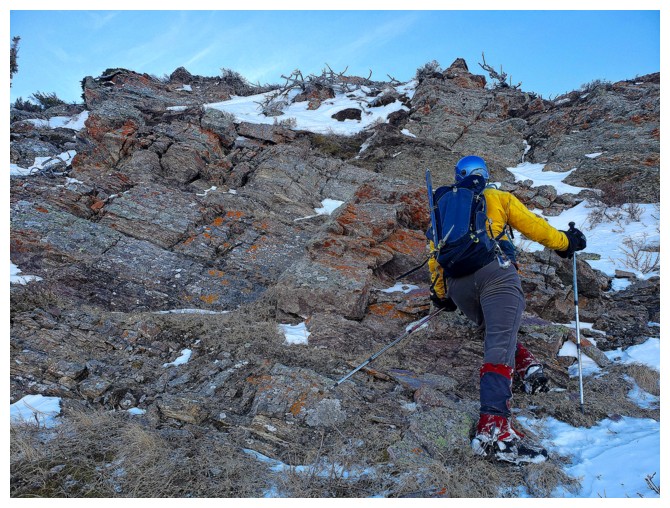
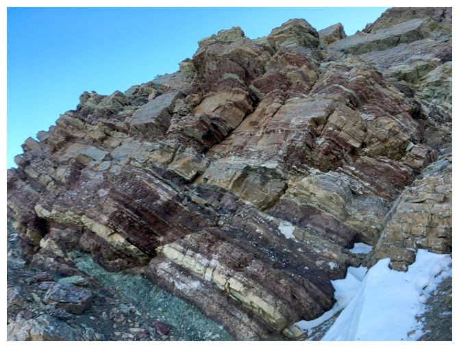 I went farther left to check out the colourful layers of rock
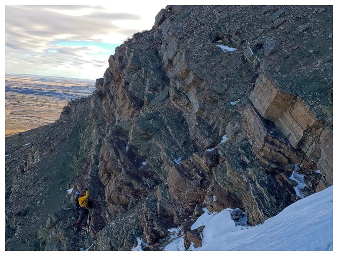
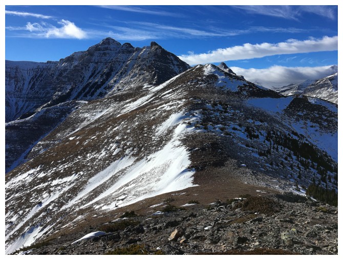
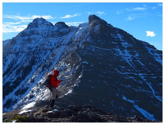
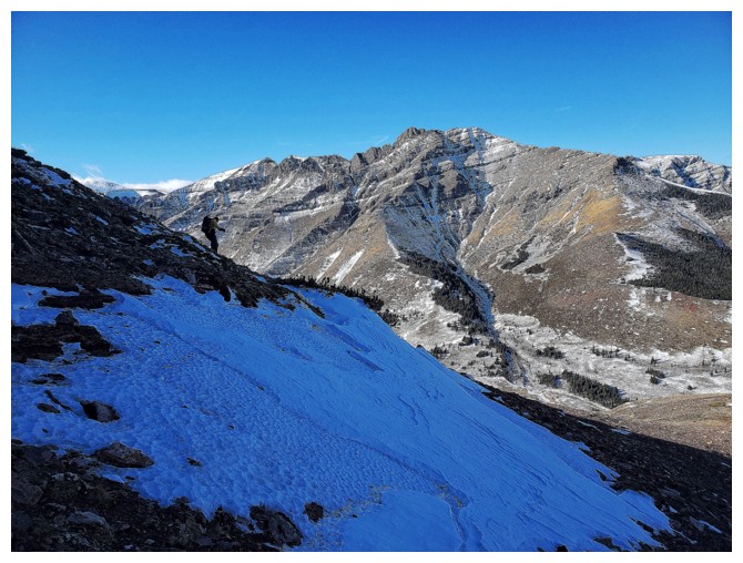
 The route ahead looks relatively straightforward
 What am I photographing?......(photo by Dave)
 This!
This!
 Dave gets ready to tackle some very challenging terrain up a steep snow gully
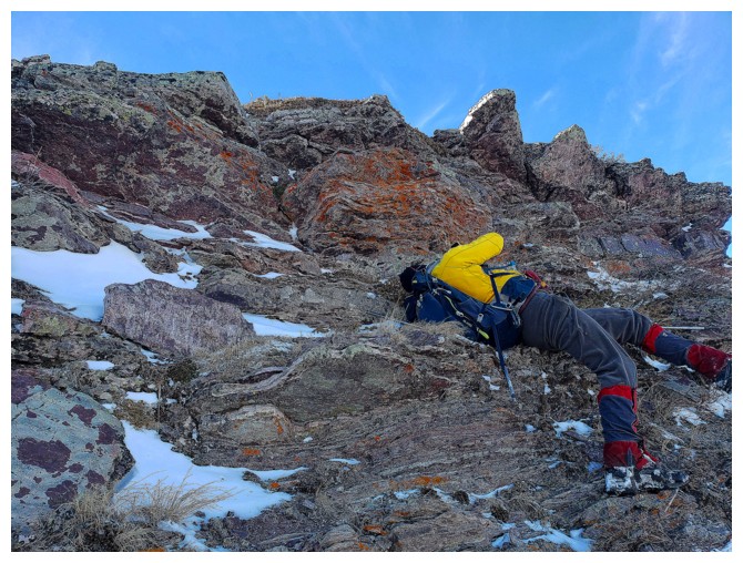
 I just stuck to the rock (because it was super cool!)
 After escaping the snow gully, Dave traverses over to the rock - that wasn't easy either!
 I came over to make sure Dave hadn't perished (photo by Dave)
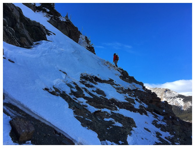
More traversing on steep, snowy slopes
Dave is finally onto easier terrain
And I am still fascinated by the sweet rock
Continuing up (photo by Dave)
Dave scrambles up a small rock band
Coming up the same band (photo by Dave)
Dave comes up to join me, as I take shelter from the strong wind, behind a rock wall
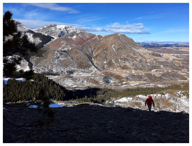
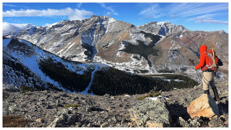
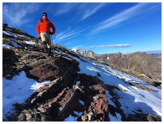
Looking southwest to Raptor Peak and Mount Roche
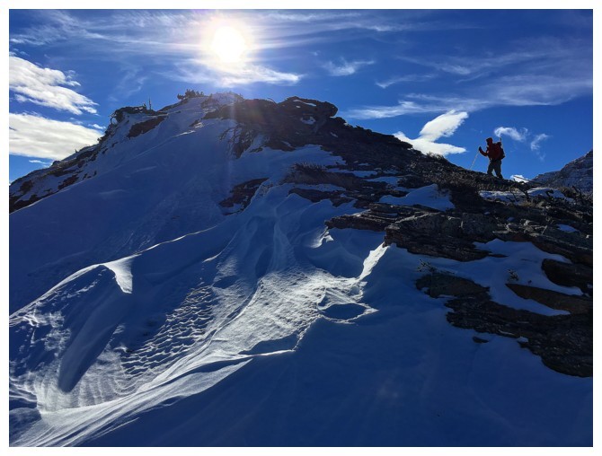
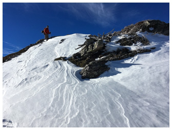
Lots of beautiful, wind-sculpted snow on the north side of the peak
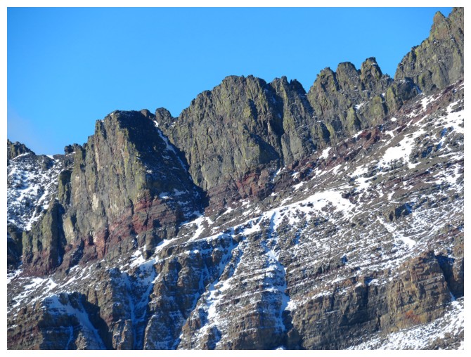
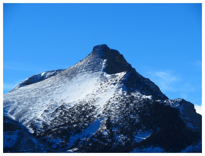
Passing by a Castle staple (photo by Dave)
There it is (photo by Dave)
The summit of Bakery Peak - I've actually been there before on a failed attempt of a complete traverse of Loaf Mountain
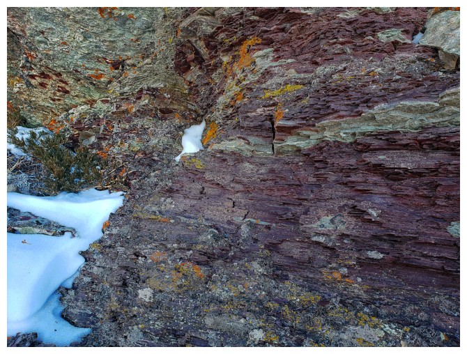
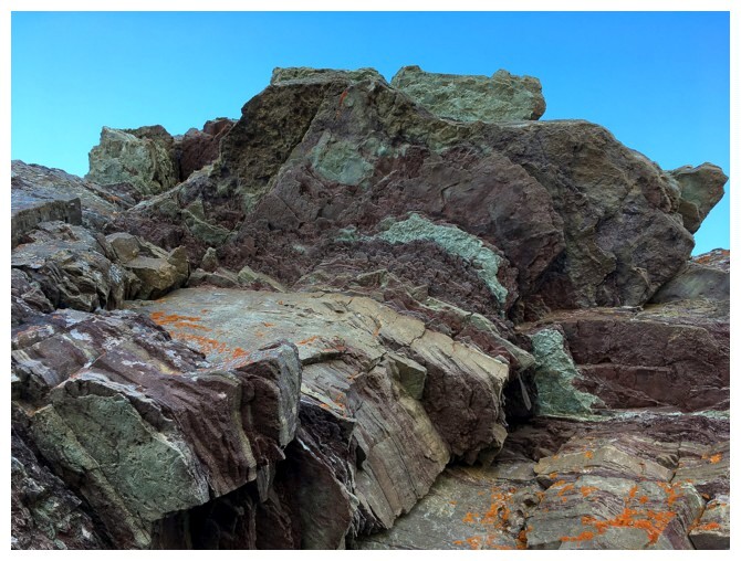
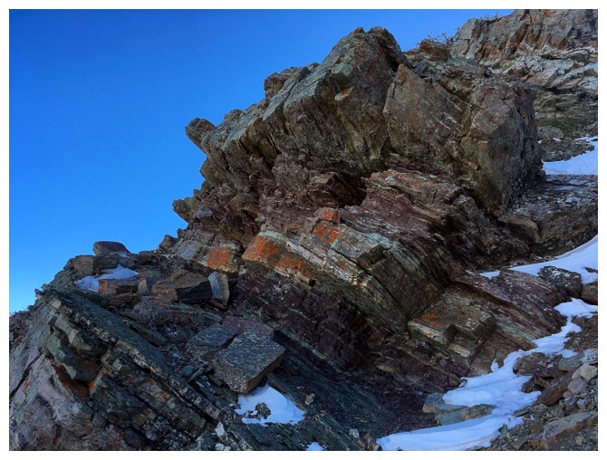
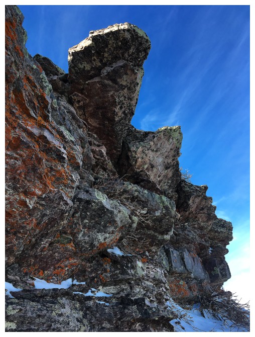
This rock, an amazing shade of magenta, would have been unreal had the Sun been shining on it (photo by Dave)
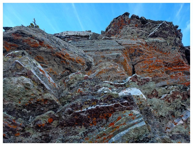
More great rock scenery (photo by Dave)
And more! We both agreed that we would return in June when the morning Sun would reach this side of the mountain
Man down!? (photo by Dave)
No - I just needed to be in that position to get this photo
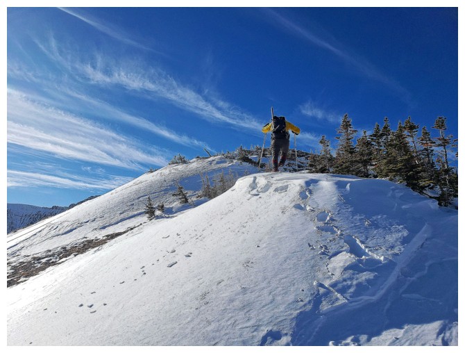
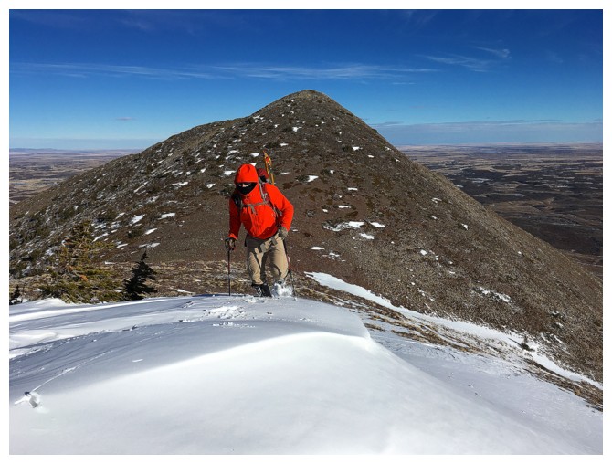
Almost at the first summit and getting pushed around by the wind (photo by Dave)
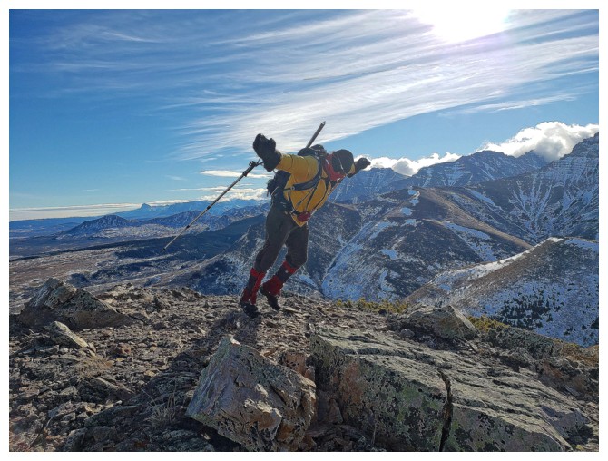
Another classic Castle staple - insane winds! (photo by Dave)
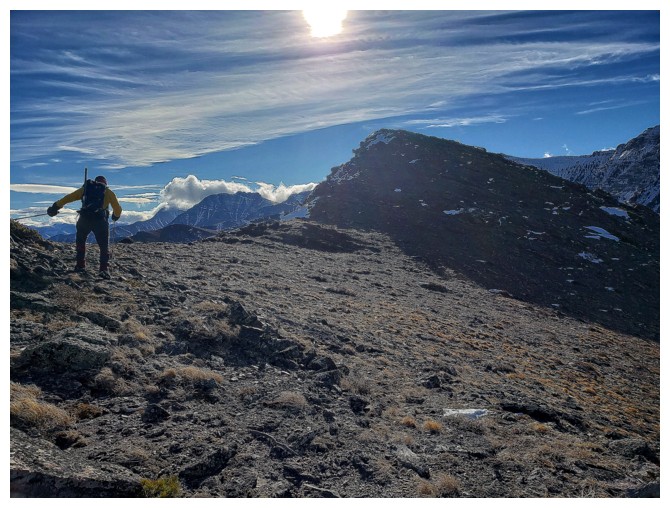
Looking ahead to Raptor and Roche
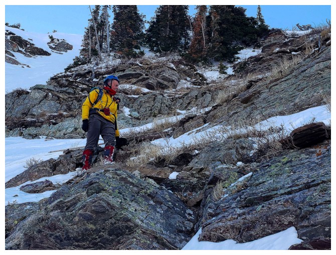
Dave at the summit of The Eaglet
Heading down to the col (photo by Dave)
And heading up the other side (photo by Dave)
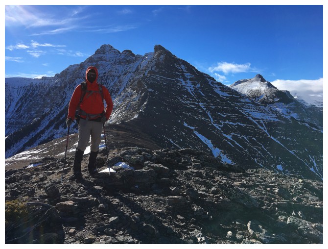
Dave with The Eaglet behind him
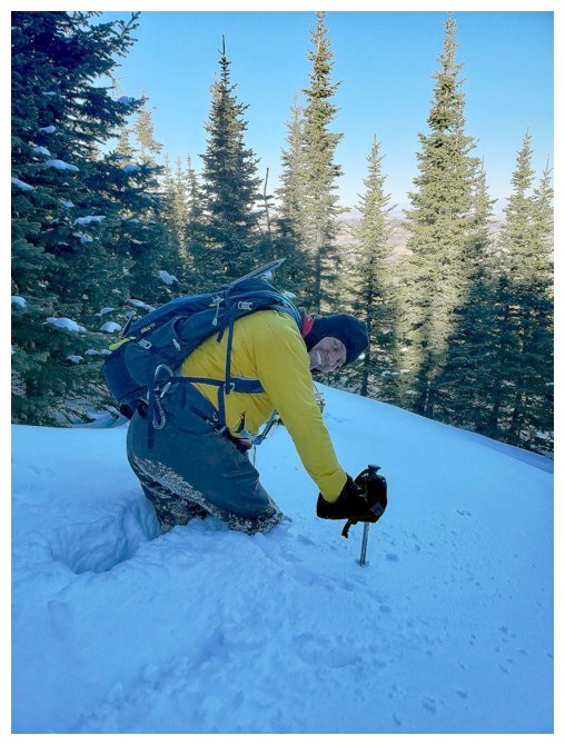
Why is Dave holding his foot up?
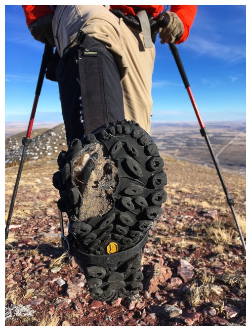
That's why! A big chunk of Dave's boot went AWOL. Haven't seen anything like that in 18 years of hiking.
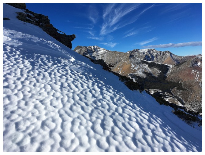
Sun cups - can't get enough of geometry in nature
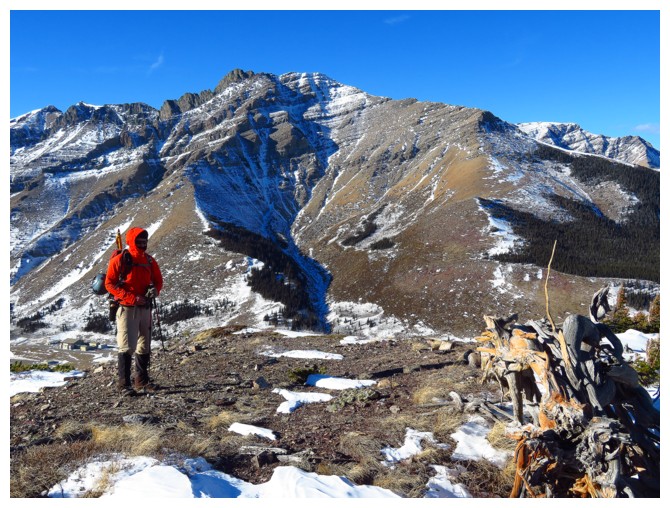
Dave at the summit of Raptor Peak
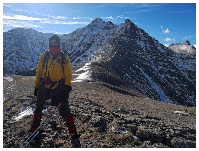
My turn (photo by Dave)
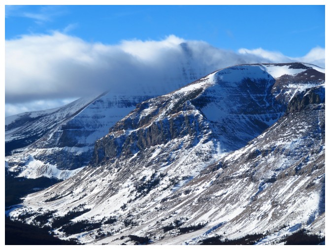
Loaf Mountain was shrouded in clouds most of the day
The serrated northeast ridge of Loaf looks absolutely fascinating
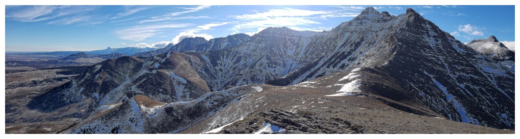
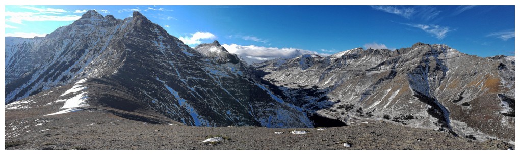
Dave captures a couple of sweet summit panoramas (photos by Dave)
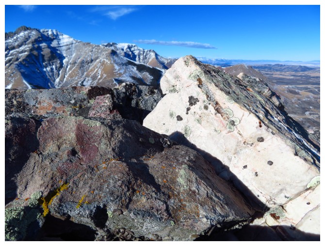
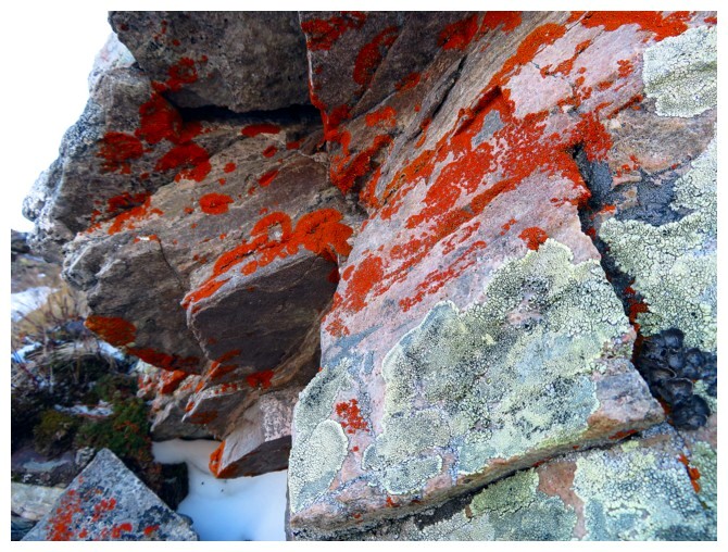
Super cool rock everywhere in the Castle!
One more summit photo before we leave
Dave starts down the north side of Raptor Peak
The east side of the ridge provided a little shelter from the relentless wind (photo by Dave)
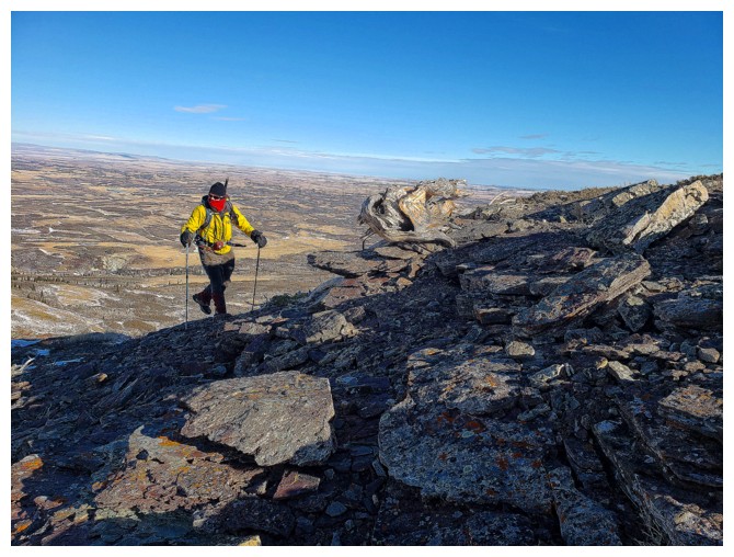
Dave checks out the strange patterns in the scree (not visible here)
The significant highpoint west of the true summit of Roche
I returned to the ridge to be back in the Sun (but of course also in the wind) (photo by Dave)
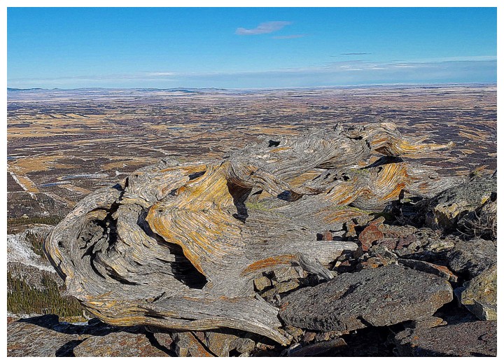
What is Dave looking at now?
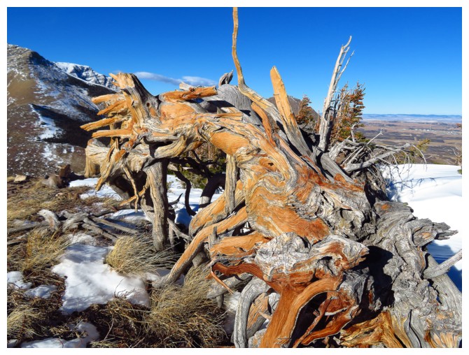
This incredibly cool, twisted dead tree
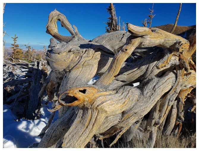
Dave's view of the tree. Note the branch that looks like the head of an eagle - that's eerie in a good way! (photo by Dave)
Drywood Mountain can be seen, peeking over the gap between The Muffin and The Croissant
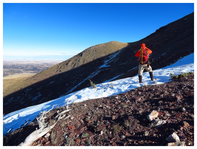
Into the deep snow. Dave said this would be a great photo opportunity (photo by Dave)
"Go
a little farther", he said. By the time the photo op was done, we were
back onto an almost snow free trail - hmmmm?! (photo by Dave)
Dave follows
Dave leads us out
Shocking lack of snow down here (photo by Dave)
Dave glides home
The vehicles are in view (photo by Dave)
The End