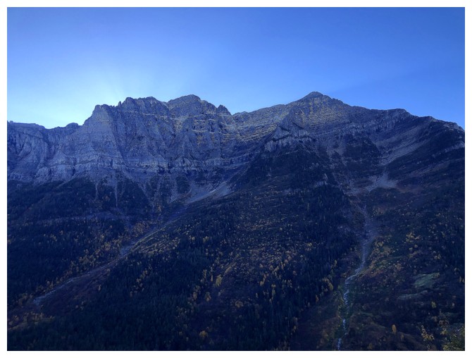
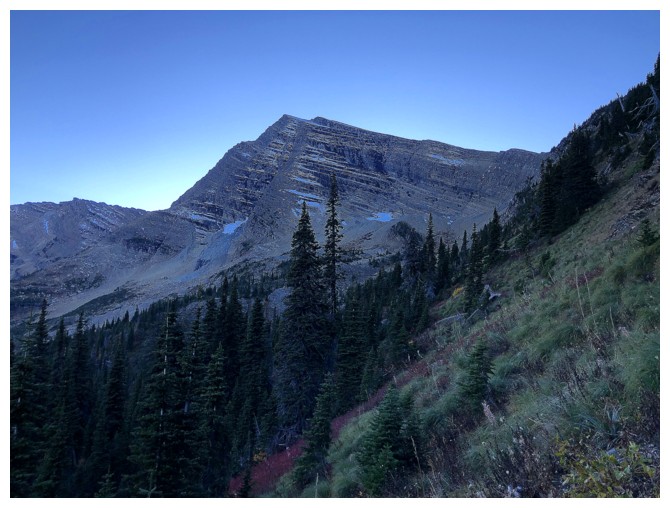
Heavens Peak
October 8, 2023
Mountain height: 2697 m
Elevation gain:
1676 m
Ascent time: 7:10
Descent time: 5:50
Scrambling with
Doug and Raff.
I guess the
universe determined we were overdue for an “epic”!
A third and
final day in Glacier National Park, Montana, and we chose Heavens Peak as an
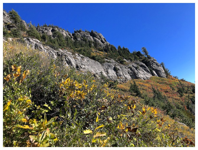
objective. Having never been in this part of the park Heavens seemed to be a
good choice. The intriguing appearance of the mountain also provided plenty of
motivation. 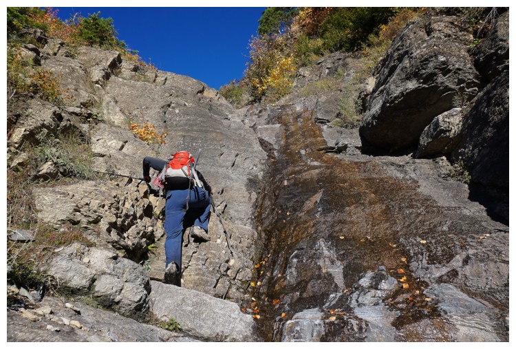 Like Red Mountain, 24 hours earlier, we had two route options: the
standard route described by Edwards and Passmore, or a slightly longer route up
a drainage, advertised to minimize the unavoidable bushwhacking of the standard
one (thank you to Keegan Siebenaler again for this one). Given the bushwhacking
was likely to be intense, partly because of the peak’s extremely low starting
elevation (only 30 m above Calgary's elevation!), we decided the longer route would be preferable, perhaps taking the
shorter one on descent – bushwhacking downhill is much easier than uphill.
Like Red Mountain, 24 hours earlier, we had two route options: the
standard route described by Edwards and Passmore, or a slightly longer route up
a drainage, advertised to minimize the unavoidable bushwhacking of the standard
one (thank you to Keegan Siebenaler again for this one). Given the bushwhacking
was likely to be intense, partly because of the peak’s extremely low starting
elevation (only 30 m above Calgary's elevation!), we decided the longer route would be preferable, perhaps taking the
shorter one on descent – bushwhacking downhill is much easier than uphill. 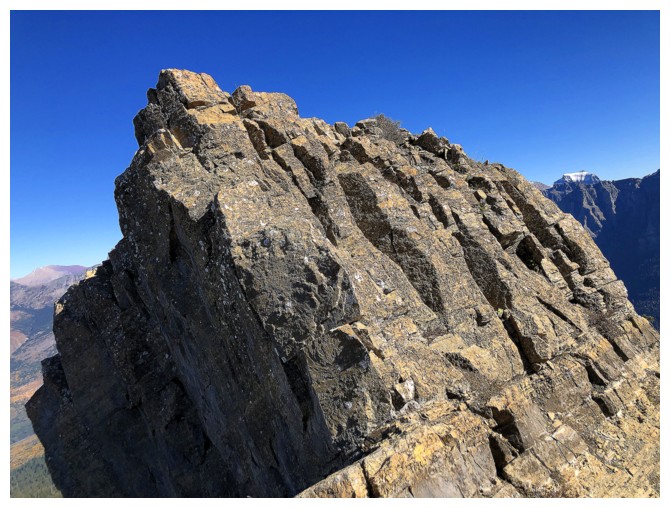 That
decision would eventually lead to the “epic” part of the day.
That
decision would eventually lead to the “epic” part of the day.
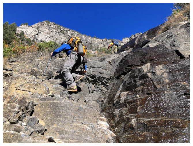
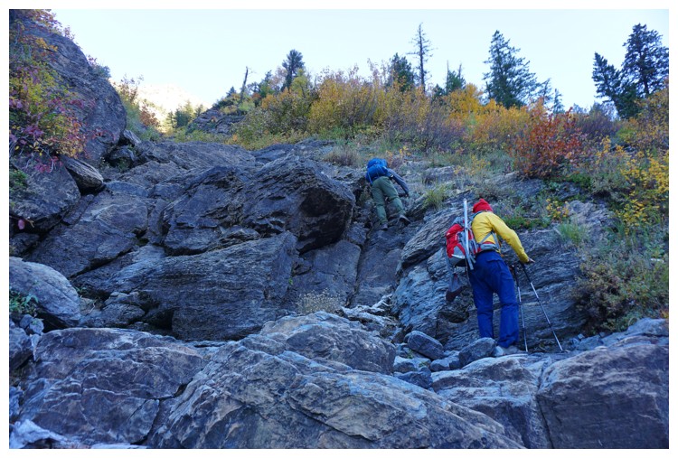
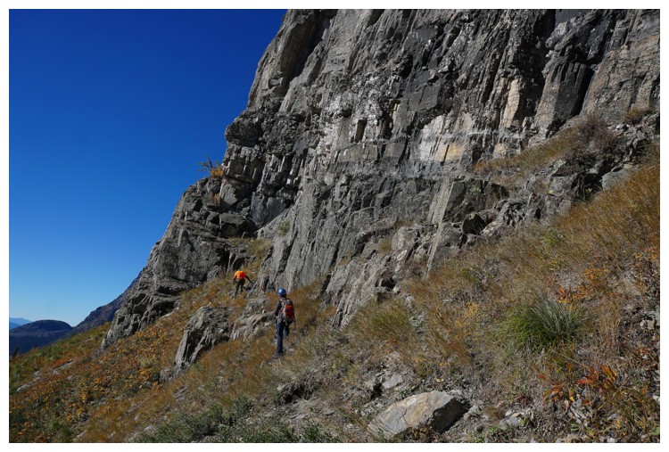
After crossing MacDonald
Creek and then bushwhacking upslope for a while, we found the correct drainage
and started up it. This drainage was absolute gold – solid, positively oriented
rock, that was a sheer joy to scramble up. Here, we gained a sizable chunk of
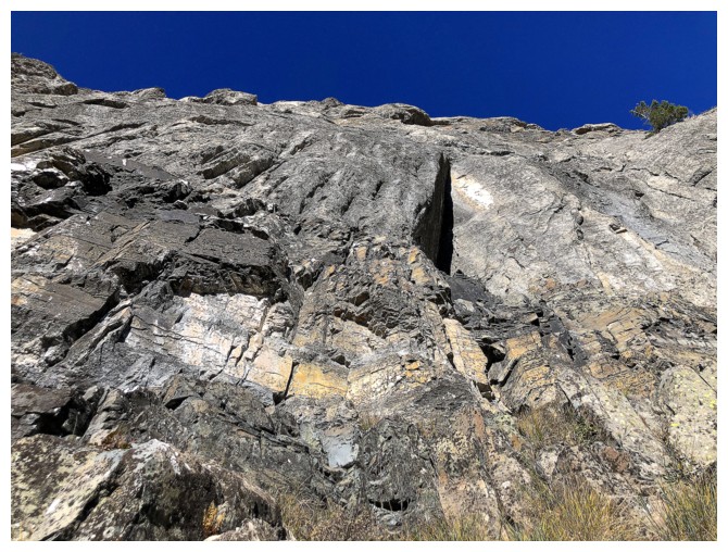
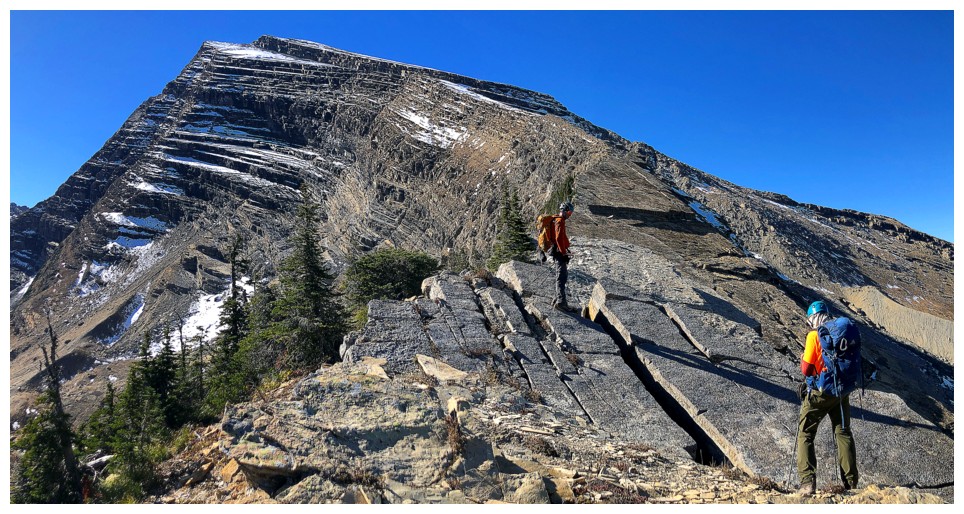
the almost 1700 m of total elevation gain. The drainage eventually ended at an
impressive headwall that was clearly not in the realm of scrambling. Keegan’s
GPS track told us to go left and that’s what we did, soon arriving at an
obvious weakness in the headwall. Shortly after, we were finally on the ridge
and ready to make (or I should say “start”) our summit bid. The top was still a
decent horizontal distance and over 700 vertical metres away.
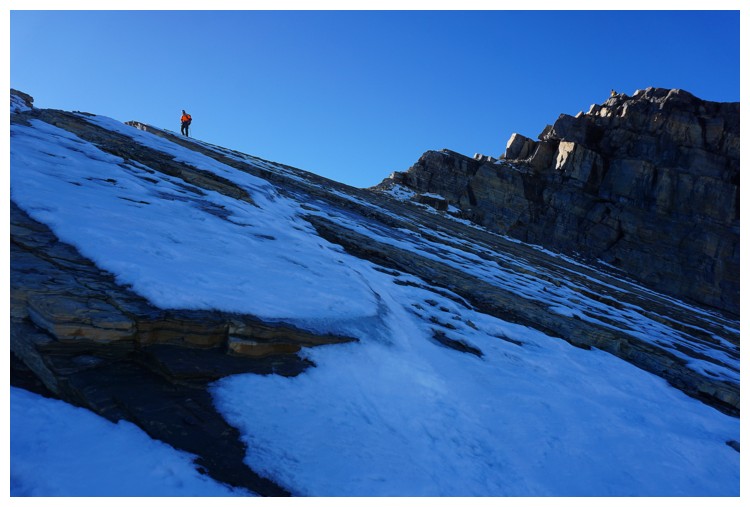
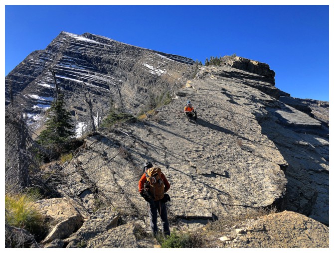
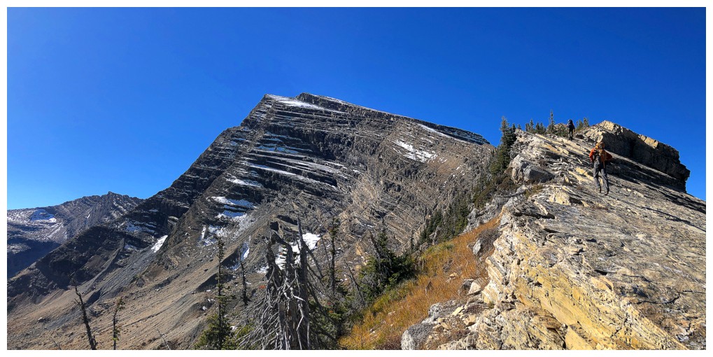
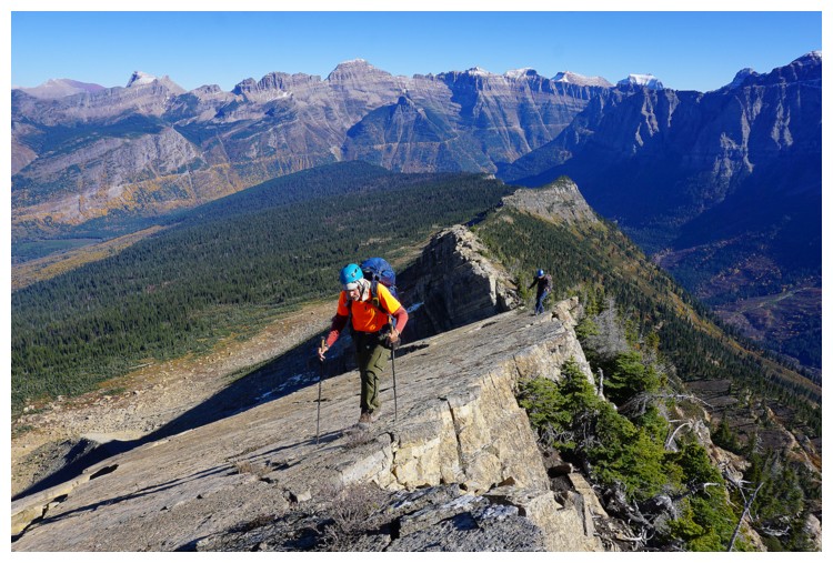
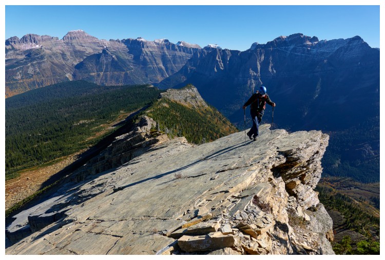
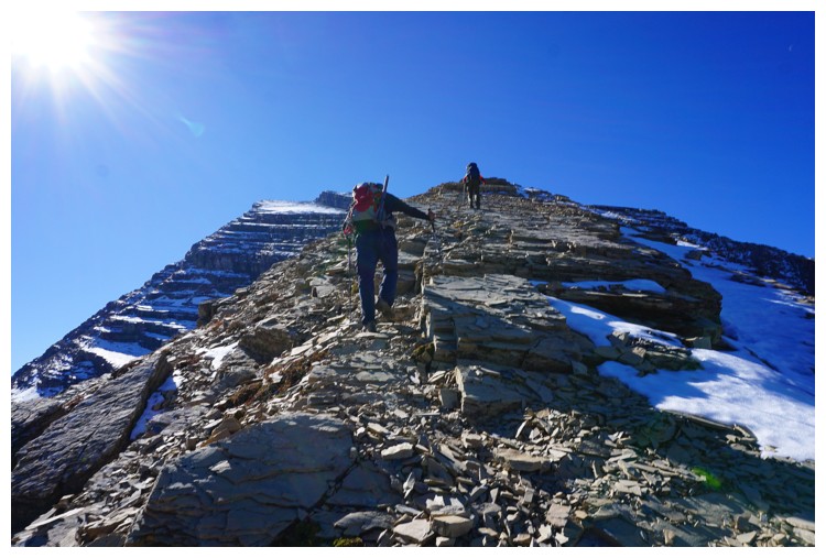
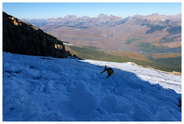
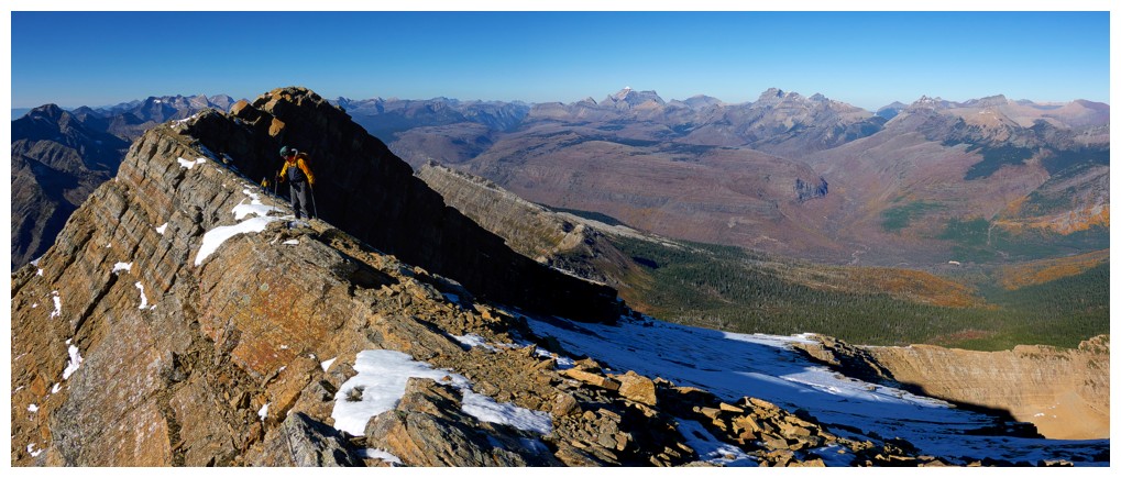
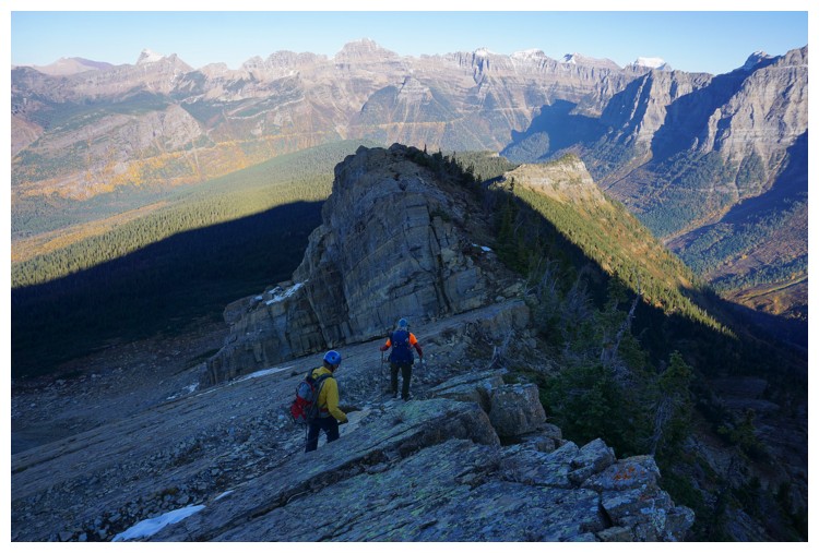
Easy, forested
ridge soon gave way to super cool tilted slabs with big drops-offs on the left
side and, at times, chilling exposure to the right (but only if you slipped and
couldn’t stop before sliding over the cliff below). Doug led the way, tackling
all the varied terrain with skillful ease.
It was at this
point we all started to become a little weary of the time. The Passmore route was
estimated at 7-10 hours round-trip. Accounting for the extra distance of
Keegan’s track we were expecting to complete the entire route in no more than 11
hours and hopefully less. We were already past the 6-hour mark of the trip and
the summit was still some distance away. Nevertheless, we kept going,
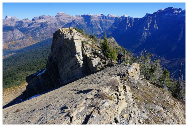
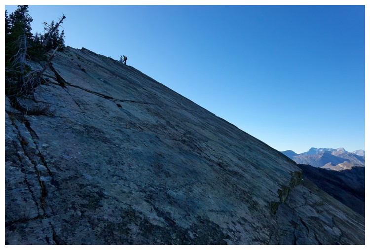
eventually reaching the super awesome, clean slabs that are such a unique
feature of the mountain’s summit block.
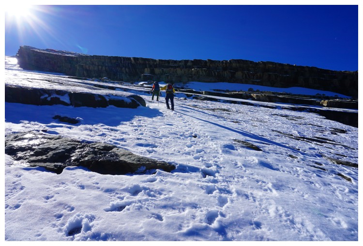
The slabs were
mostly snow covered and there was even a big section of avalanche debris. Raff
and I put microspikes on here but Doug chose not to. 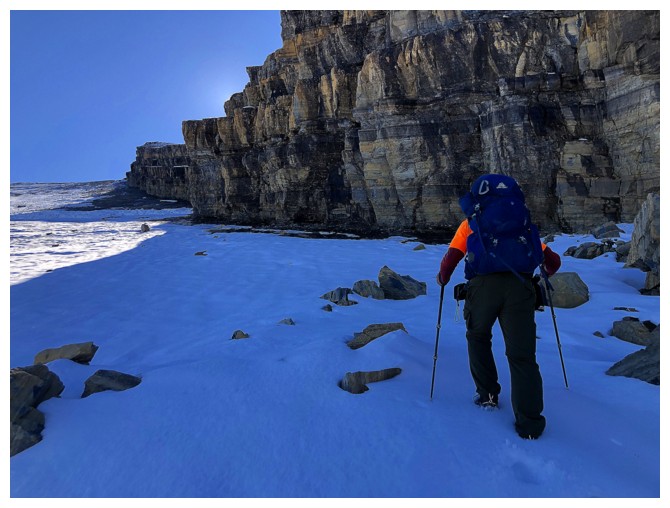 As such, Doug stayed to
the right where the snow had melted, and I took a line left of Doug’s, in the
thin snowpack. At one point I had a microspike on one foot and nothing on the
other, to account for areas with and without snow – an unorthodox and not
necessarily recommended technique but it worked! Raff ended up going far to the
left and found the least steep and safest route up. Even so, this was
challenging terrain where a slip could have had serious consequences. Going off
a cliff was unlikely, but sliding down a huge section of slab before self-arresting
would have been, at best, very unpleasant!
As such, Doug stayed to
the right where the snow had melted, and I took a line left of Doug’s, in the
thin snowpack. At one point I had a microspike on one foot and nothing on the
other, to account for areas with and without snow – an unorthodox and not
necessarily recommended technique but it worked! Raff ended up going far to the
left and found the least steep and safest route up. Even so, this was
challenging terrain where a slip could have had serious consequences. Going off
a cliff was unlikely, but sliding down a huge section of slab before self-arresting
would have been, at best, very unpleasant!
Doug
made
excellent progress up the slabs and was suddenly turning the corner
high above. He quickly let out a huge holler of triumph – the summit
was only a minute away
from the top of the slabs. Raff and I eventually joined Doug at the top
and
congratulations were extended, while quickly taking in an outstanding
summit
panorama. Quickly, because we had taken 7.25 hours to ascend a mountain
that apparently
could be done round-trip in less time! It was time to leave. 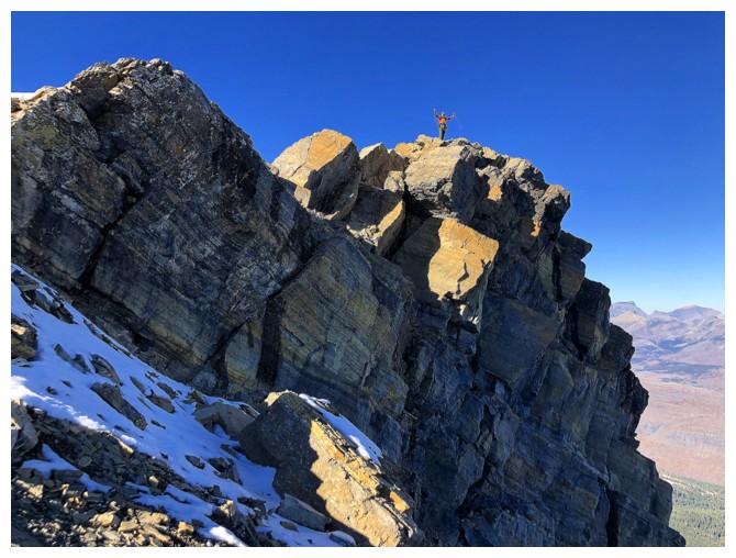 Surprisingly, as
we were getting ready to descend, we spotted four individuals on their way up.
Surprisingly, as
we were getting ready to descend, we spotted four individuals on their way up.
I left the
summit first, taking Raff’s ascent route down. Doug took the same route down
that he ascended, running into the other group and having a quick chat with
them en route. Reunited on the ridge, an important discussion ensued – which
way down from here? We all agreed that the shortest route possible would be the
best way to get down before day gave way to night. On the way up we had
spotted what appeared to be a much easier route down to the valley directly
below us, as opposed to a somewhat sketchy-looking route down a steep cliff
face. Although we all tried the steep route, Doug was the only one comfortable
completing it. Raff and I chose to take to the easier route farther along the
ridge.
The jury is
still out and will likely remain that way forever on whether splitting up led
to what was going to be an “epic” descent or prevented it from being even more
epic than it turned out to be. That is, because we took different routes, by
the time we were reunited in the valley, a huge amount of daylight had been
wasted. Conversely, that wasted time allowed the other group, who had ascended
this route, to catch up with us. There is almost zero doubt we would have been
benighted on the mountain were it not for these four fantastic individuals from
Whitefish, Montana, who not only showed us the way down, but waited for us when
we took slightly different routes. 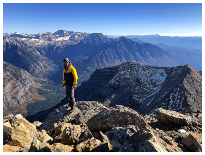 The group leader even held my foot as I
descended a particularly nasty step of super slick terrain – a class act.
The group leader even held my foot as I
descended a particularly nasty step of super slick terrain – a class act.
Doug, Raff, and
I quickly realized that even with a GPS track, coming down this route (that we
had not come up) was a near impossible task. This was especially evident as
night fell, and we were relegated to route-finding unknown and complex terrain
using headlamps. Without going into all the gory and hair-raising details, the
last couple of hours were some of the most intense I’ve ever experienced in the
mountains, and that was with the guidance of the other group. The seven of us
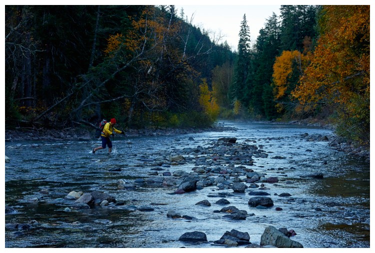
were relieved beyond measure to arrive back at MacDonald Creek. We forded the
river, thanked our new friends profusely and then walked back to our vehicle.
Of course, since we had crossed the river in a different place, we now had to
go back over to retrieve our footwear, but that was nothing compared to the
events preceding it.
I’m not sure
what to make of this trip. In hindsight, I don’t think any bad decisions were
made. It’s one thing descending a completely unknown route, but when the route
is a tried and tested one and you have a GPS track, it’s a stretch to think
anything could go seriously wrong. And it didn’t, but it did! I think I’ll conveniently
chalk our difficulties up to being an anomaly! Yet again, an enormous thank you
to the four, fine people from Whitefish – you saved our bacon!!
Besides the epic
descent, however, Heavens was all heaven! In fact, only a day later I was
thinking I would repeat the trip, taking the Edwards/Passmore route up and the
longer route down. We missed some incredible waterfall scenery using the longer
route on ascent. Not anytime soon, but someday!
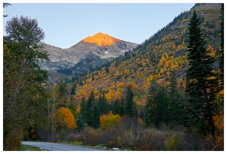
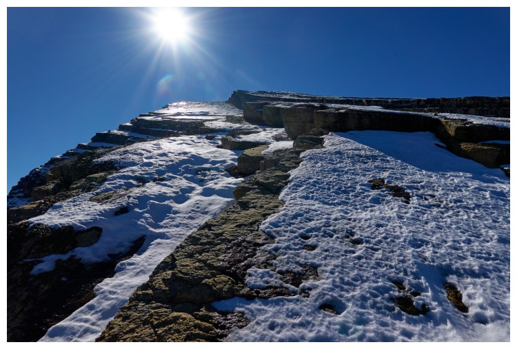
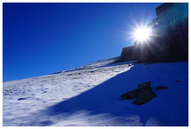
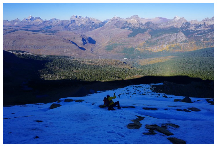
Heavens Peak gets its first rays of Sun (photo by Doug)
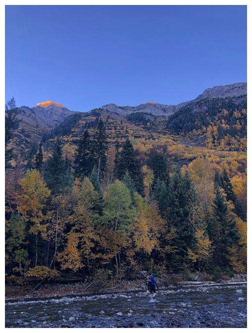
Doug is the first across MacDonald Creek
I'm
last because I procrastinate and treat crossing rivers like they are the bubonic
plague wrapped up in severely moldy bread (photo by Doug)
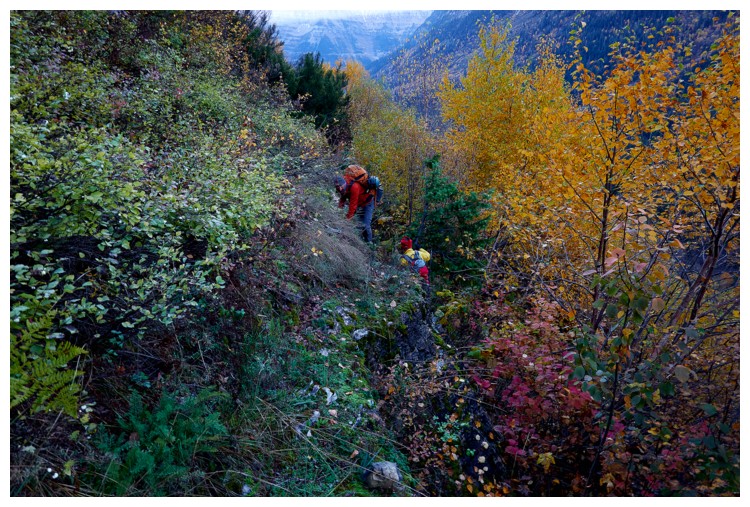
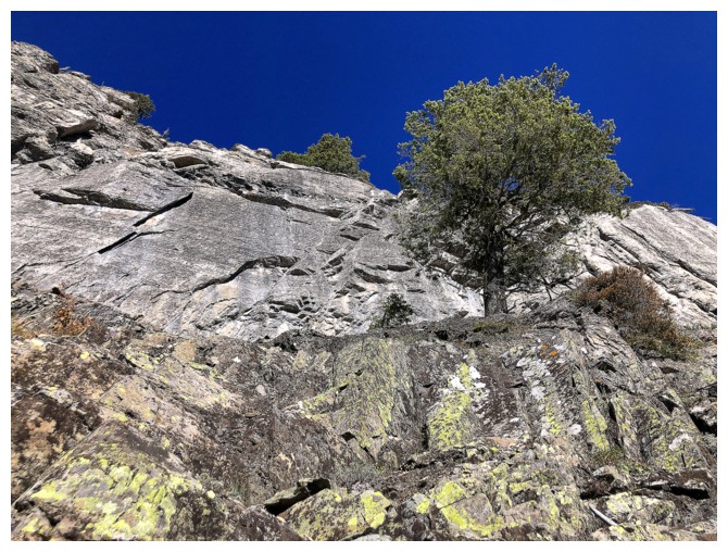
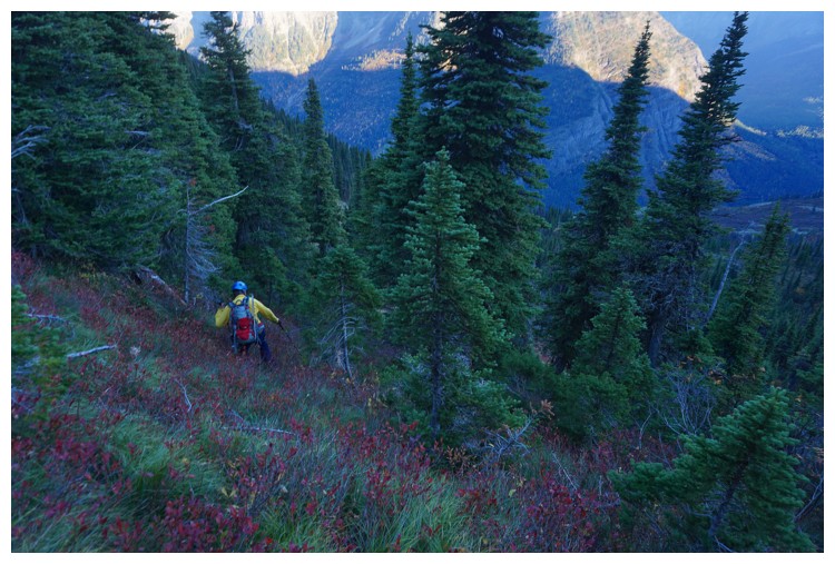
Some steep bushwhacking before we found the ascent drainage (photo by Doug)
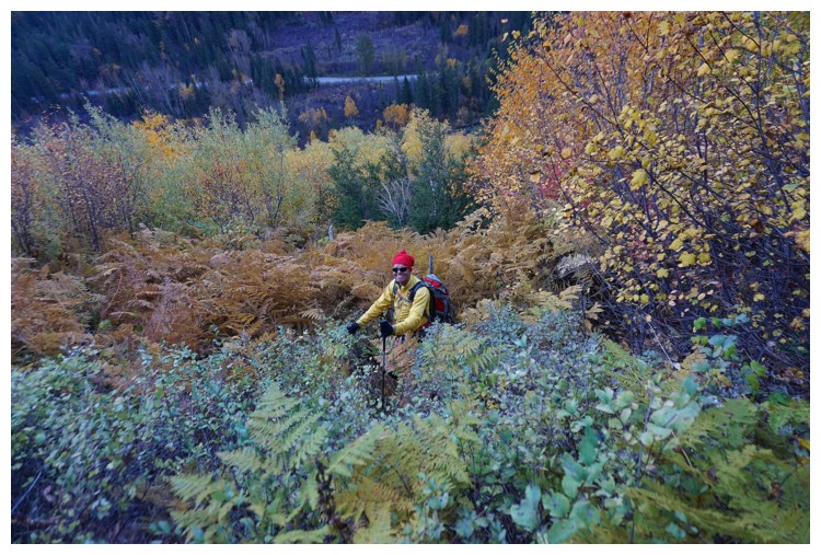
Smiling now but the bush grabbed my $15 sunglasses a few minutes later - I searched but didn't find them! (photo by Raff)
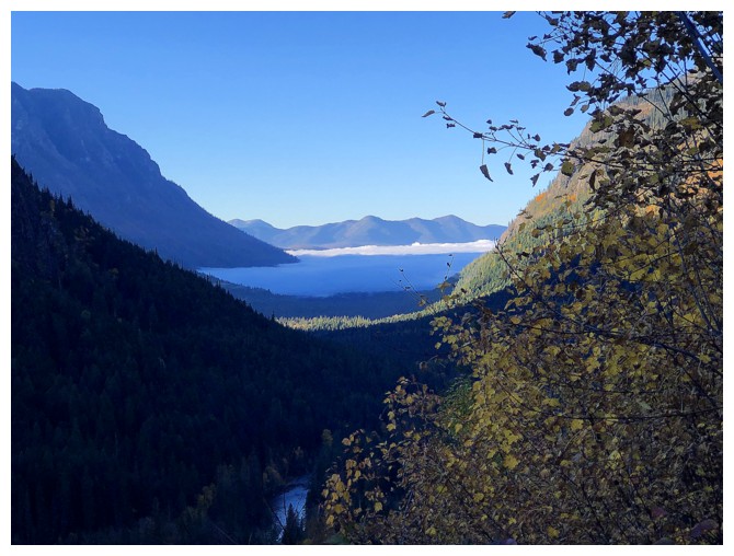
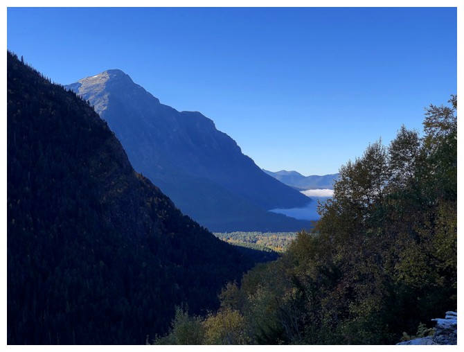
Cloud layer over Lake MacDonald
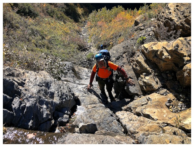
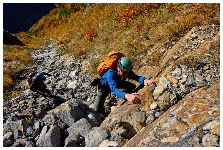
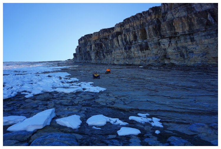
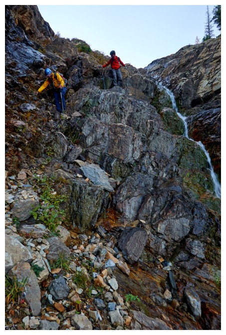
In the drainage and ready for endless, awesome, hands-on scrambling
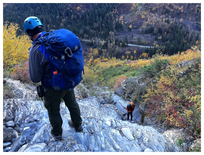
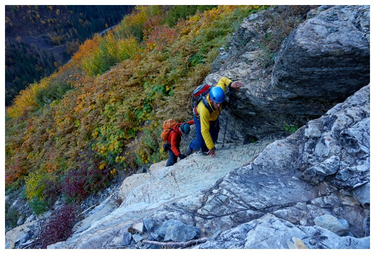
Photo by Doug
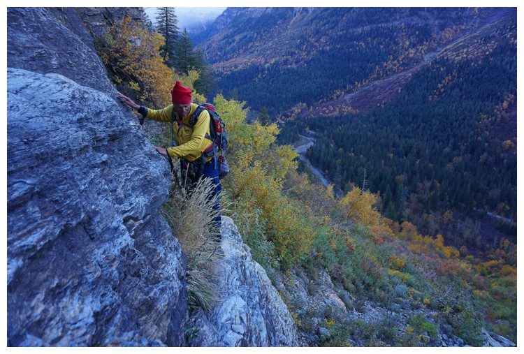
Photo by Raff
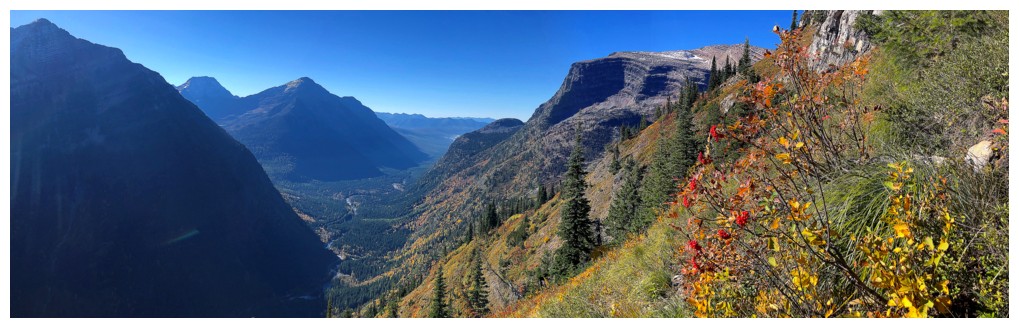
Mount Cannon sits across the valley to the east
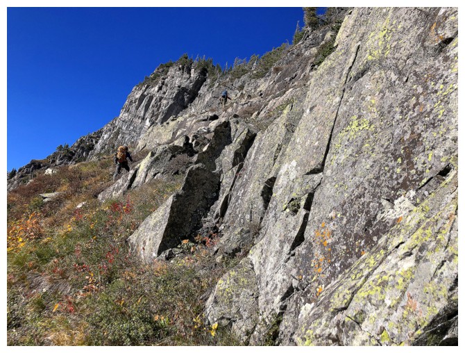
Back to the scrambling (photo by Raff)
Mount Brown to the south
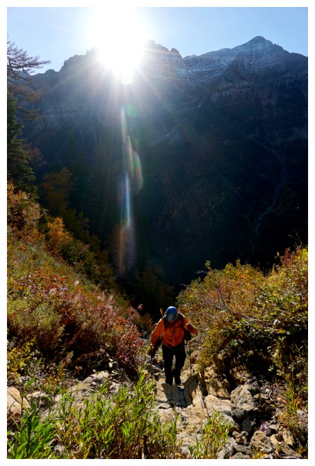
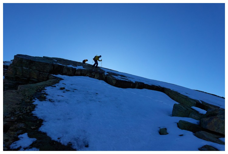
Finally into the Sun (photo by Doug)
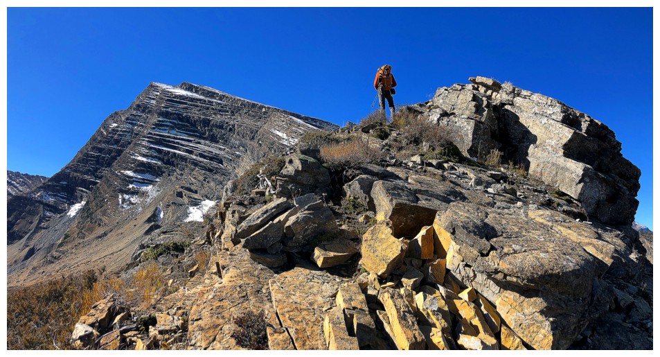
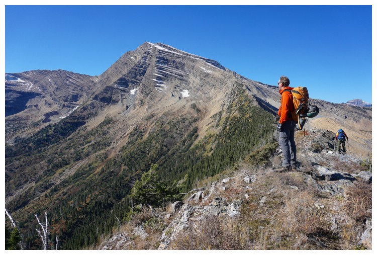
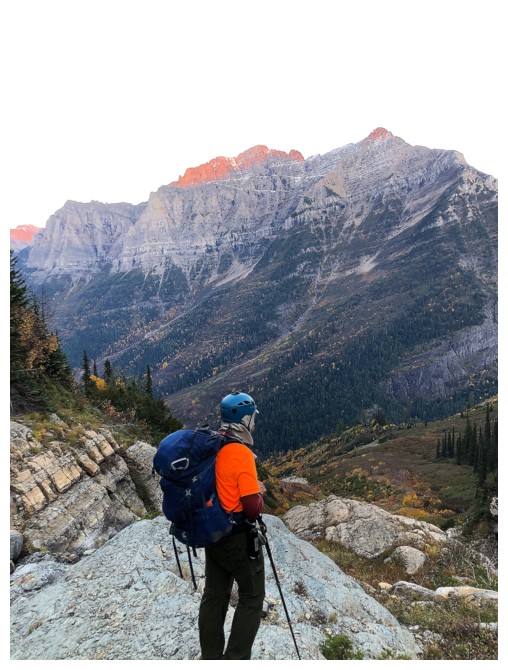
What's Doug looking at?
Raff scrambling up a cool step (photo by Doug)
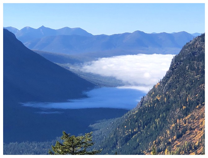
The cloud layer persists over the lake well into the day
As stated, endless hands-on
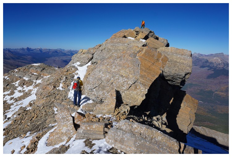
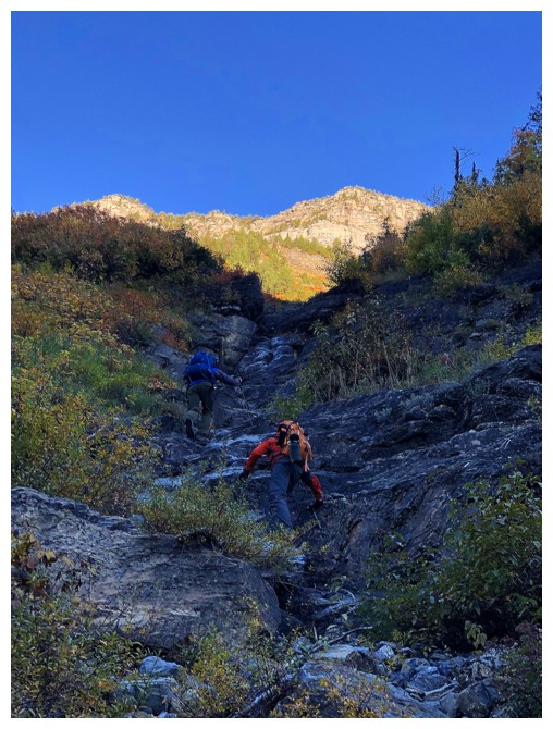
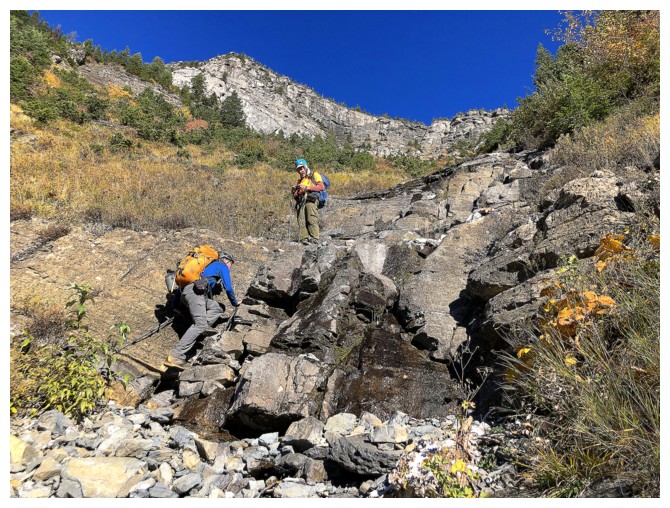
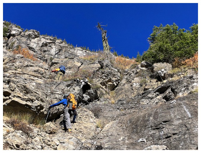
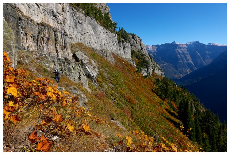
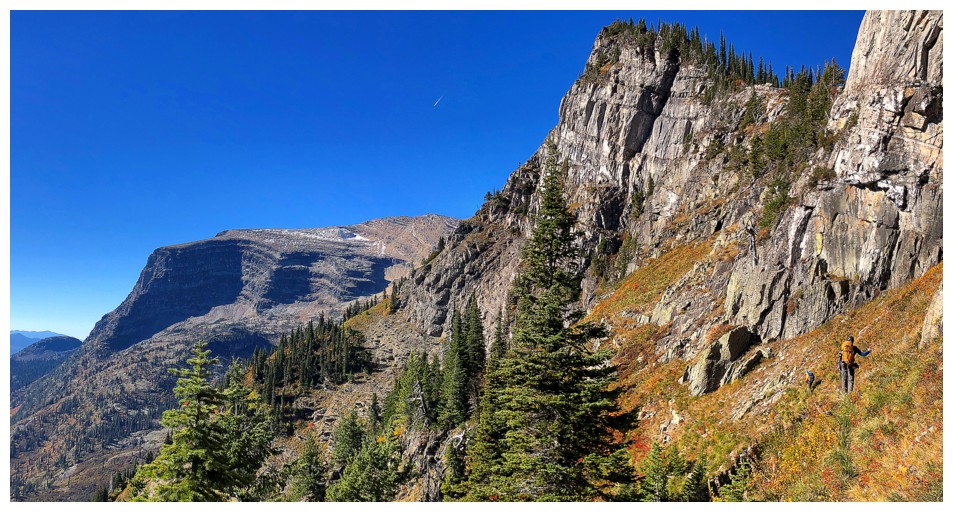
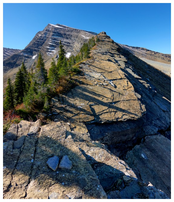
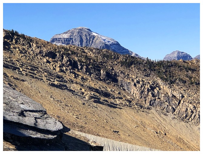
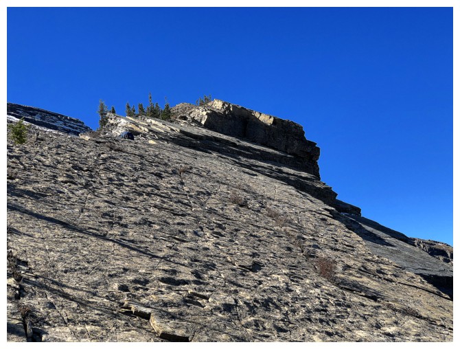
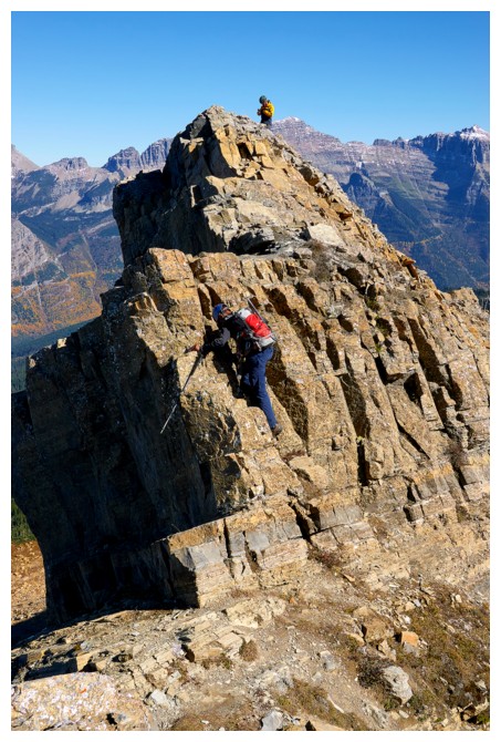
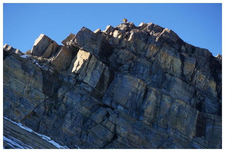
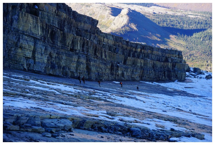
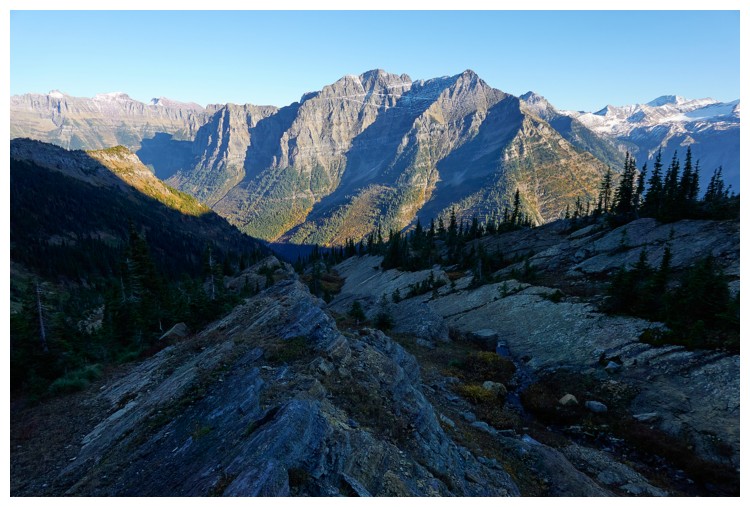
Approaching the headwall that guards the east ridge
I thought a route to the right may work but I was wrong
Straight up is definitely wrong!
Left works great (photo by Raff)
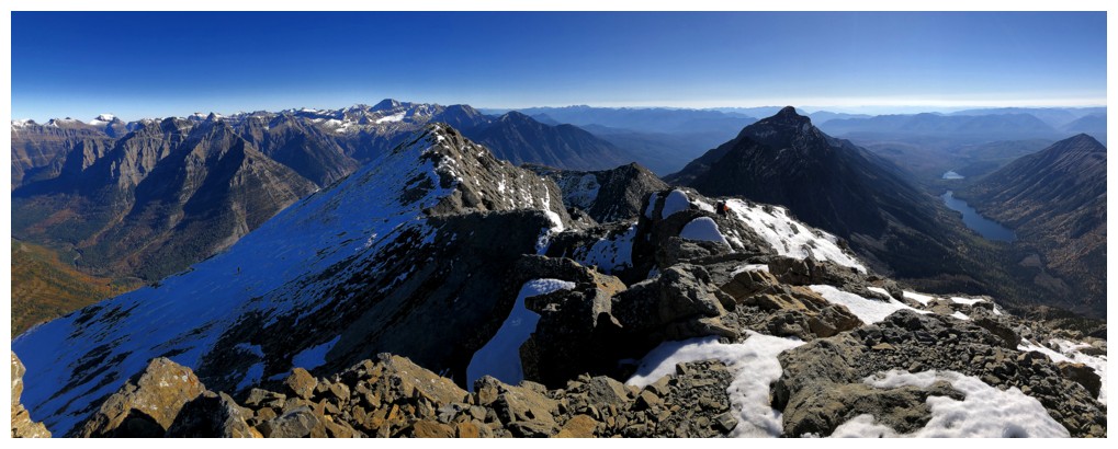
Deceiving panorama photo - Raff (left) and Doug (right) are actually in a straight line relative to each other
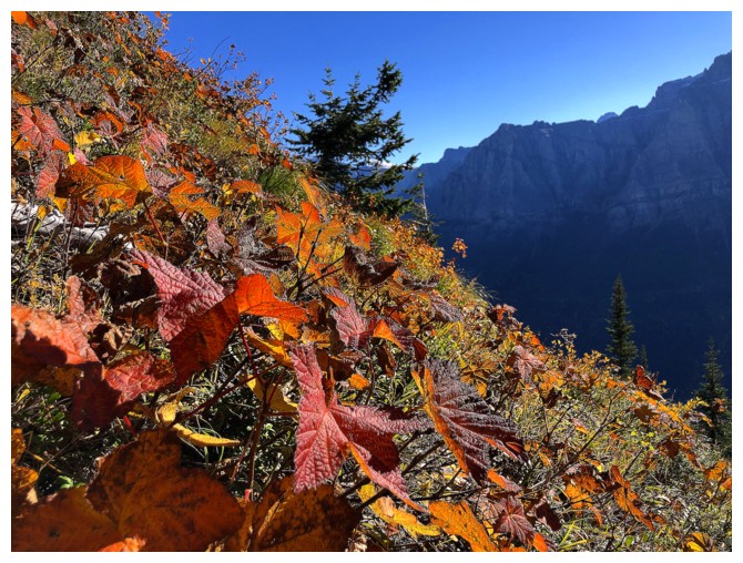
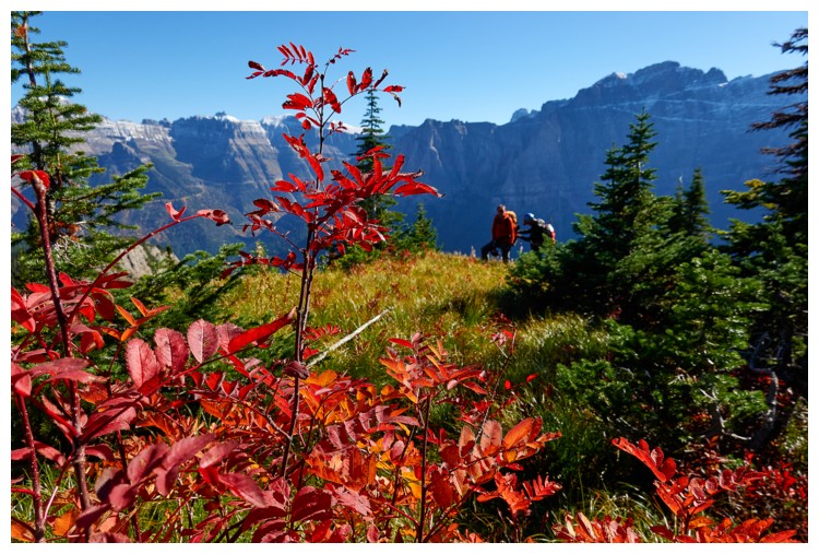
No deception here, just terrific views and colours
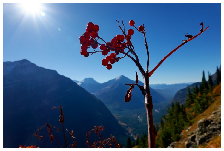
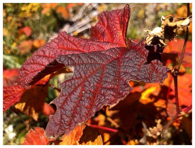
I'm glad I'm not the only one who likes to photograph colourful berries (photo by Doug)
Autumn (before the snow falls) is easily the best scrambling season of the year (photo by Doug)
Ditto

And again
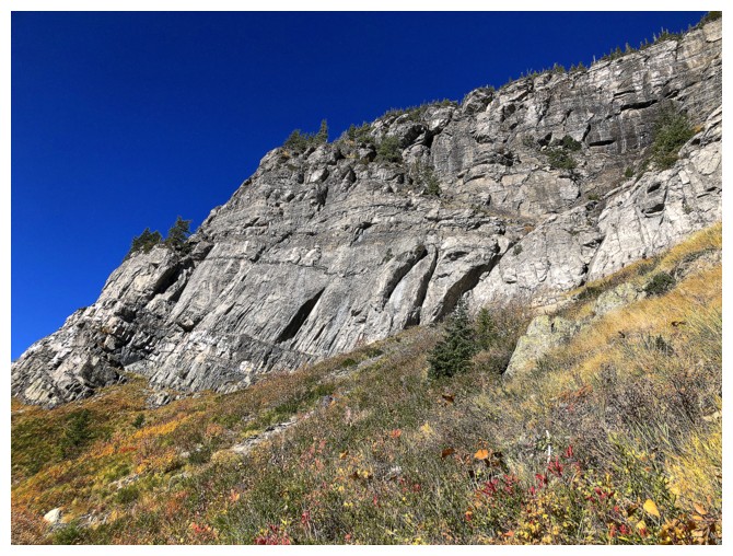
Lots of impressive, near vertical rock
Looking back at our traverse
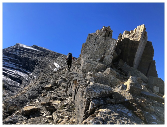
Looking forward - the weakness to get up to the ridge is just around the corner
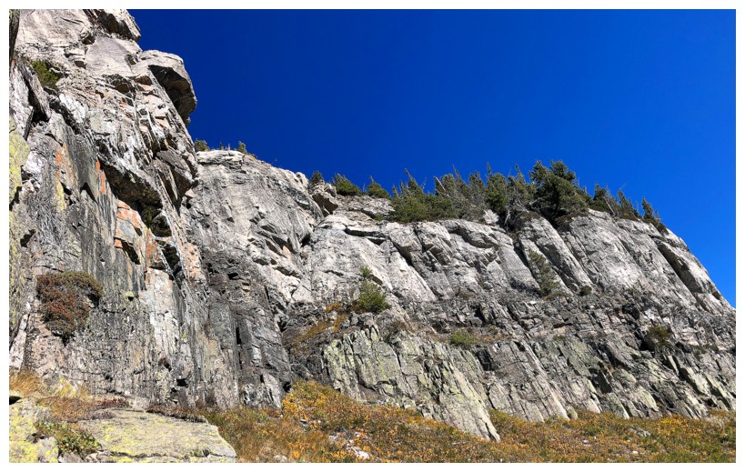
Still admiring the headwall
Doug has found the weakness and is on his way up, with Raff behind, and me, really behind!
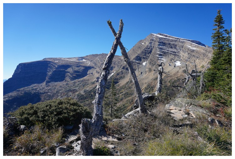
Interesting configuration of dead trees on the ridge (photo by Raff)
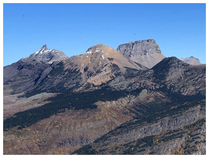
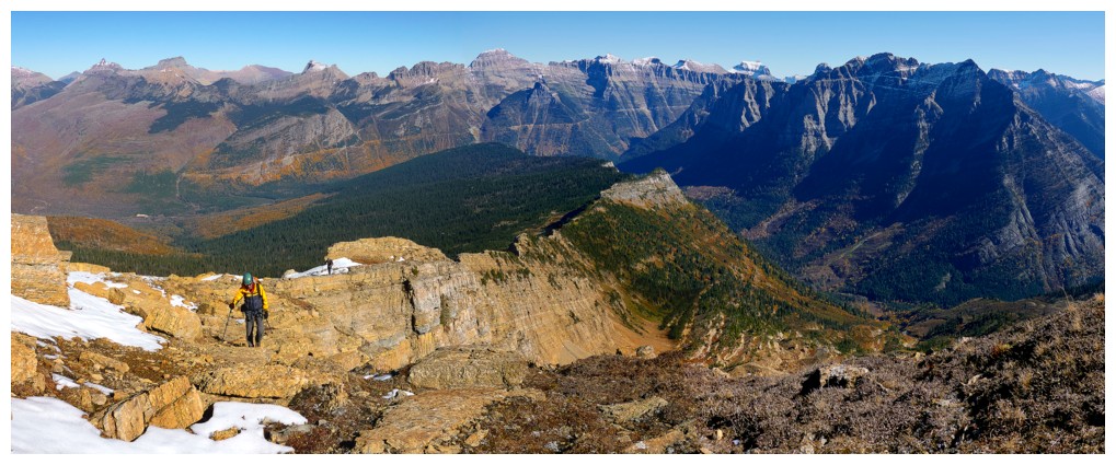
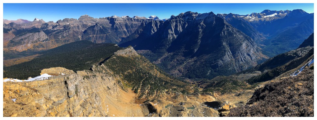
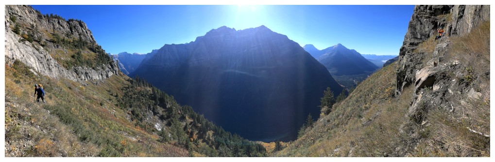
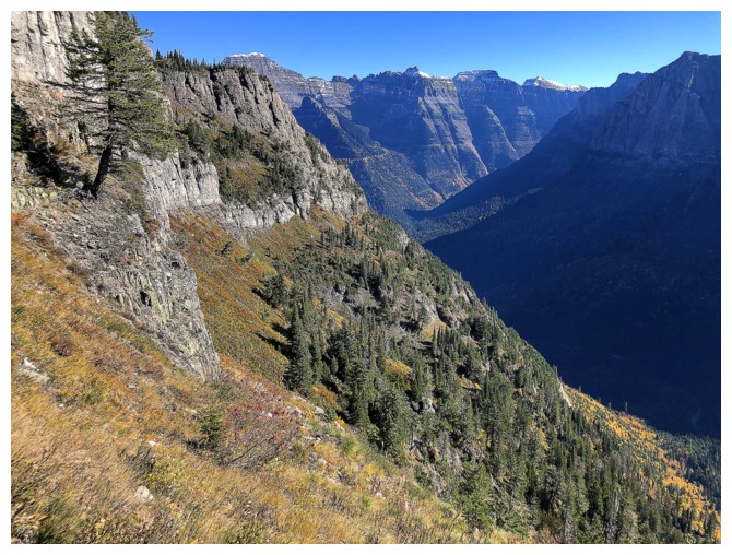
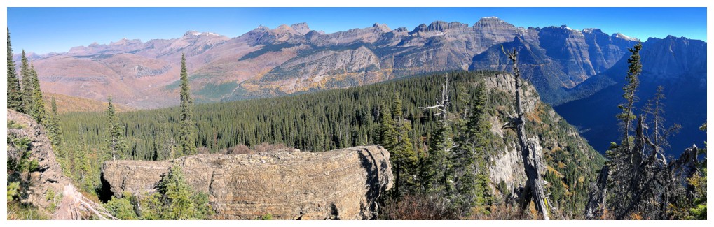
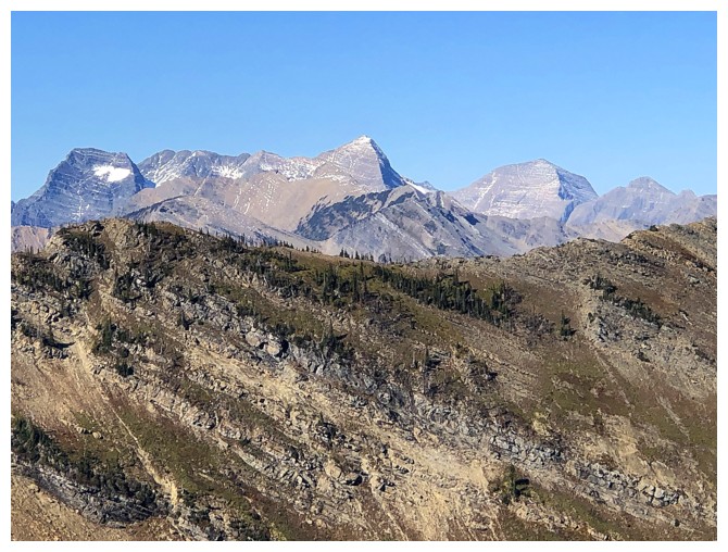
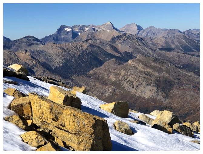
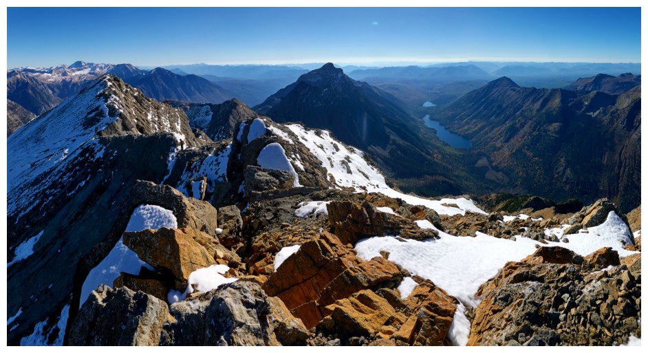
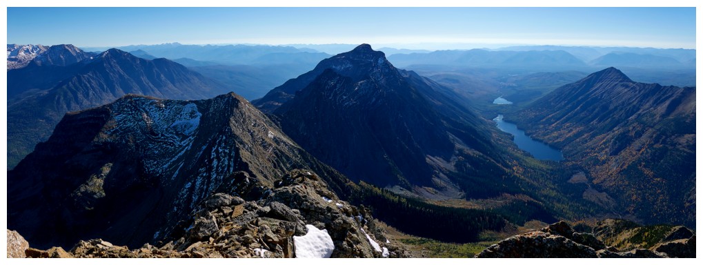
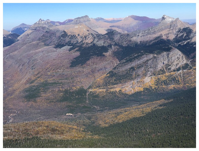
Three of the string of awesome mountains to the northeast: Iceberg, Swiftcurrent, and Wilbur
Admiring the view to the east (photo by Doug)
Same as above
There are very few larches in Glacier National Park, but the abundance of yellowing aspens more than compensates
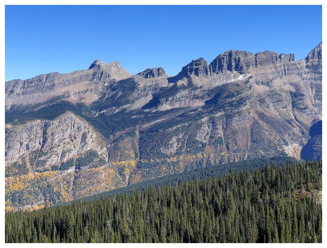
Mount Grinnell (left) and part of The Garden Wall
Mount Gould
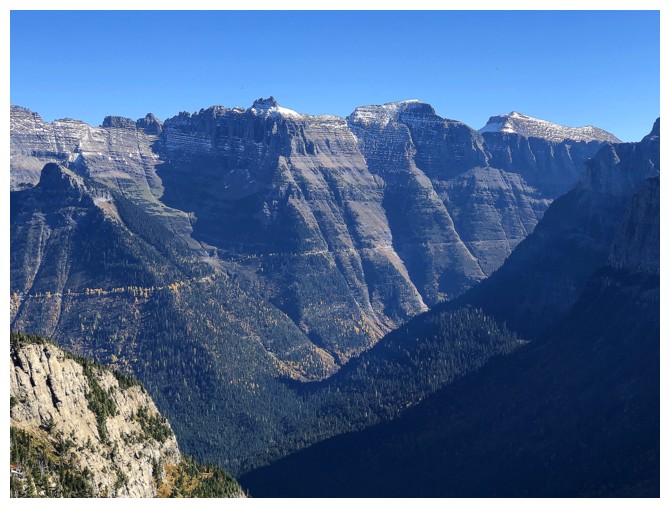
Bishop's Cap, Pollock, and Peigan
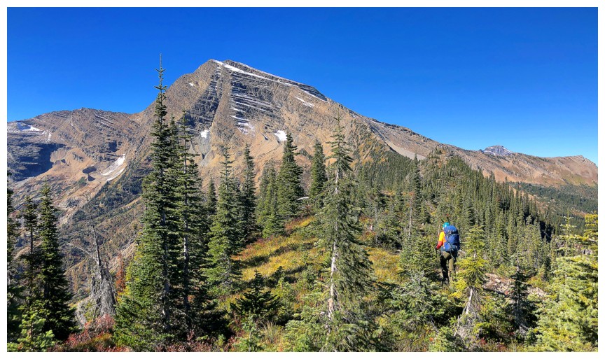
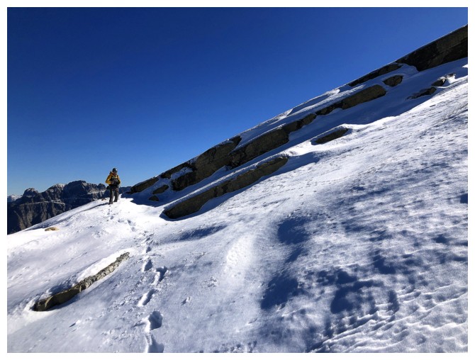
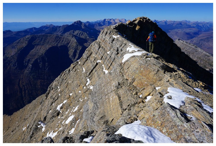
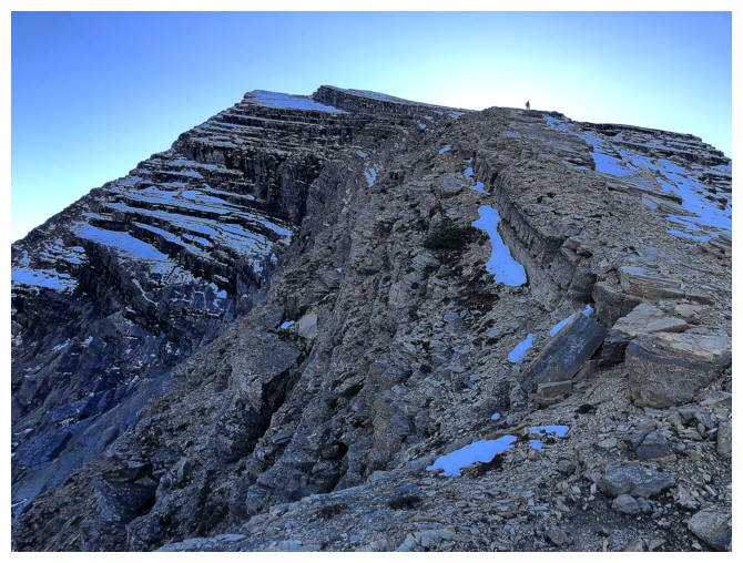
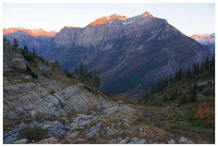
There's the summit of Heavens, but it's still quite far away
Another sweet taste of autumn (photo by Doug)
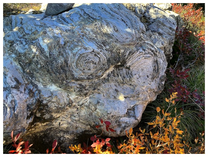
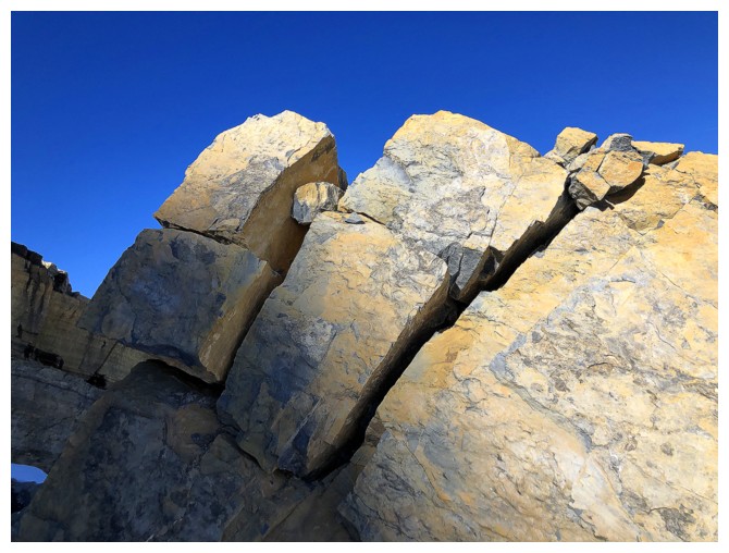
Circles in the rock
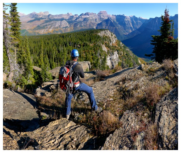
Raff is sizing up the route ahead
Iceberg again - one of the best summit views I've ever seen
Doug checks out the peaks to the northeast
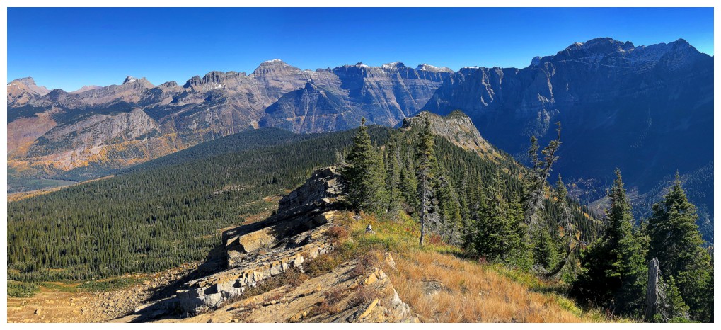
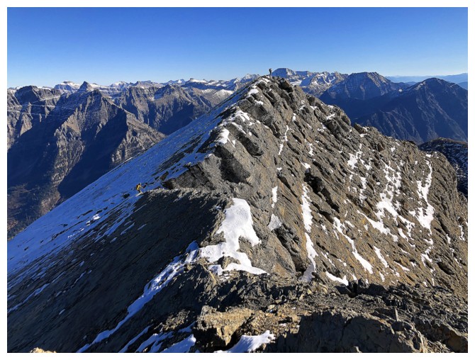
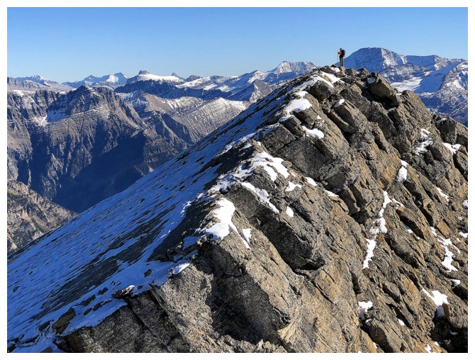
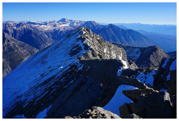
Looking back down the ridge
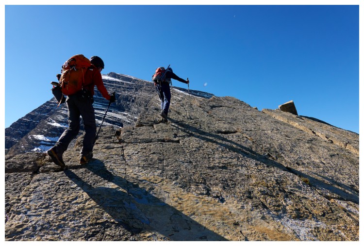
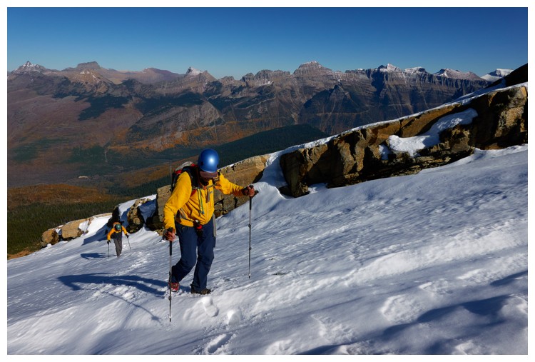
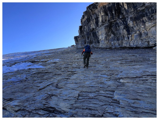
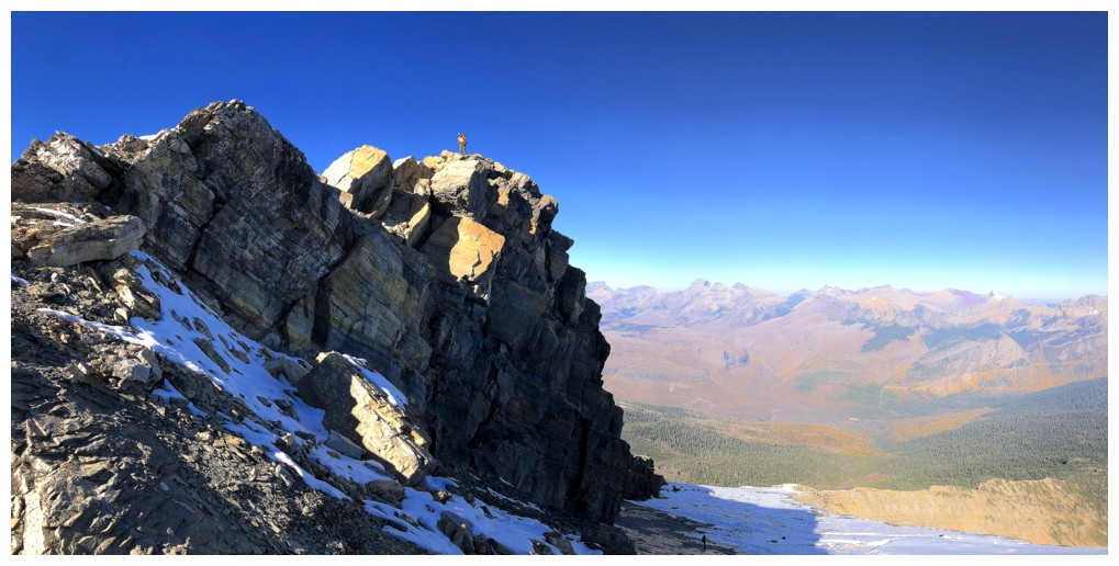
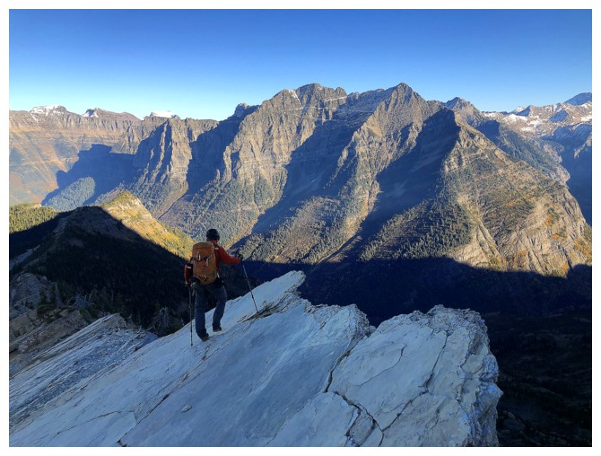
Looking up the ridge. The next section involved hiking up clean slabs of super cool rock (photo by Doug)
Doug has a brief rest on the slabs
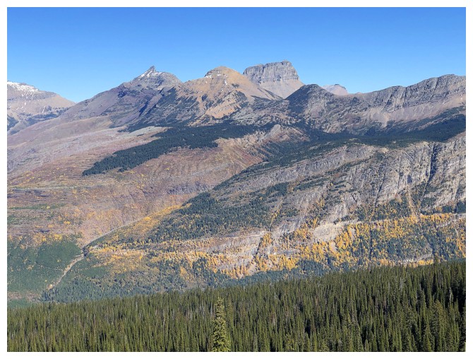
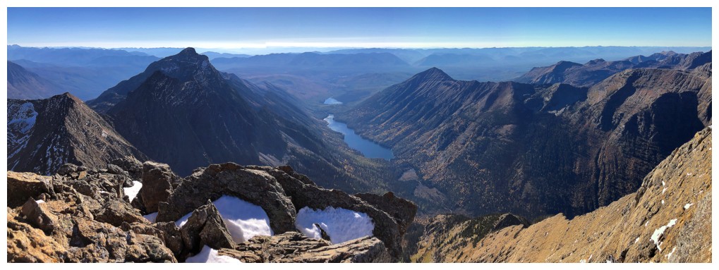
I think the big peaks are Rainbow and Carter
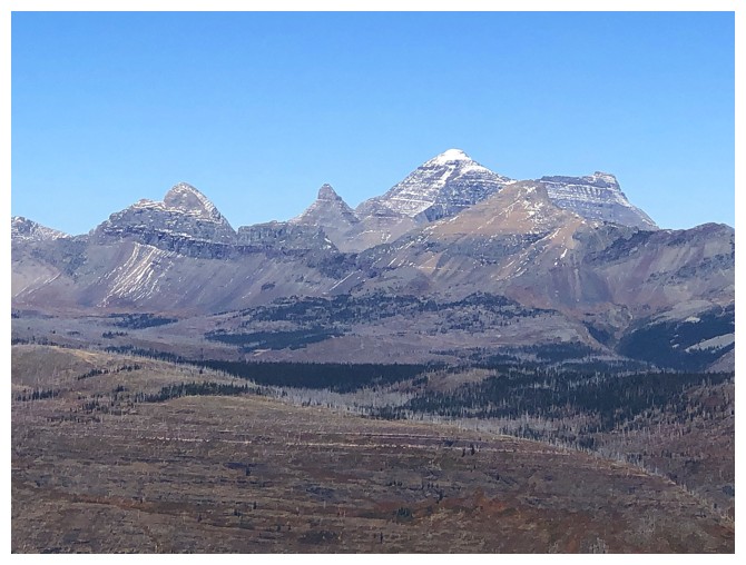
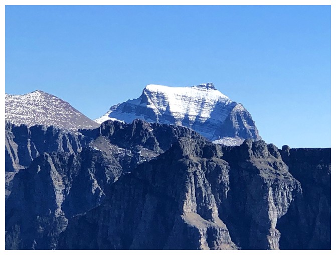
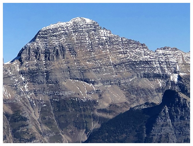
Mount Cleveland
Longfellow Peak
More slabs
Same as above
I'm lagging behind, yet again (photo by Raff)
Raff has taken the lead (photo by Raff)
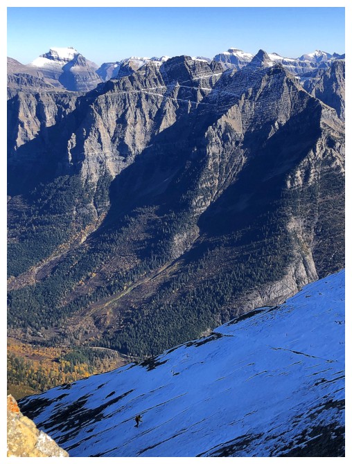
Glad these slabs are snow-free - there's quite the drop on the right and a cliff on the left (photo by Doug)
Cool fissure between the slabs
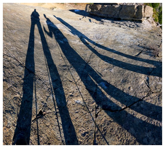
In addition to being an ace scrambler, Doug is an expert at long-legged shadow photos! (photo by Doug)
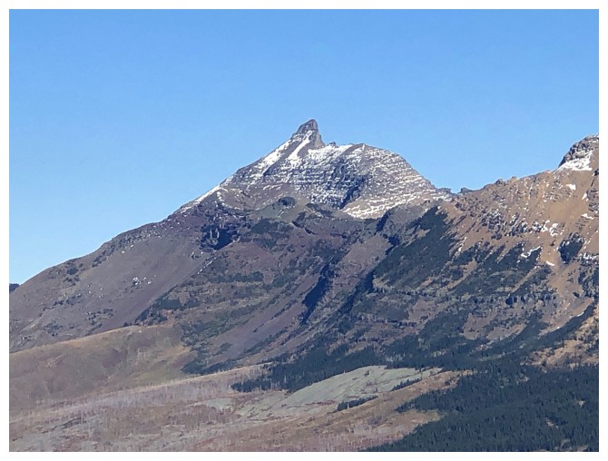
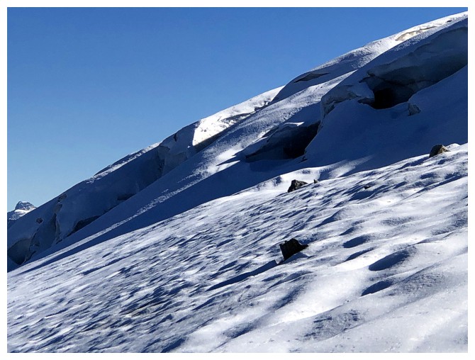
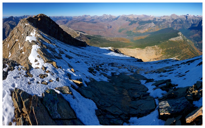
The barren but intriguing northwest side of Heavens. Many maps depict a huge glacier here - not there now!
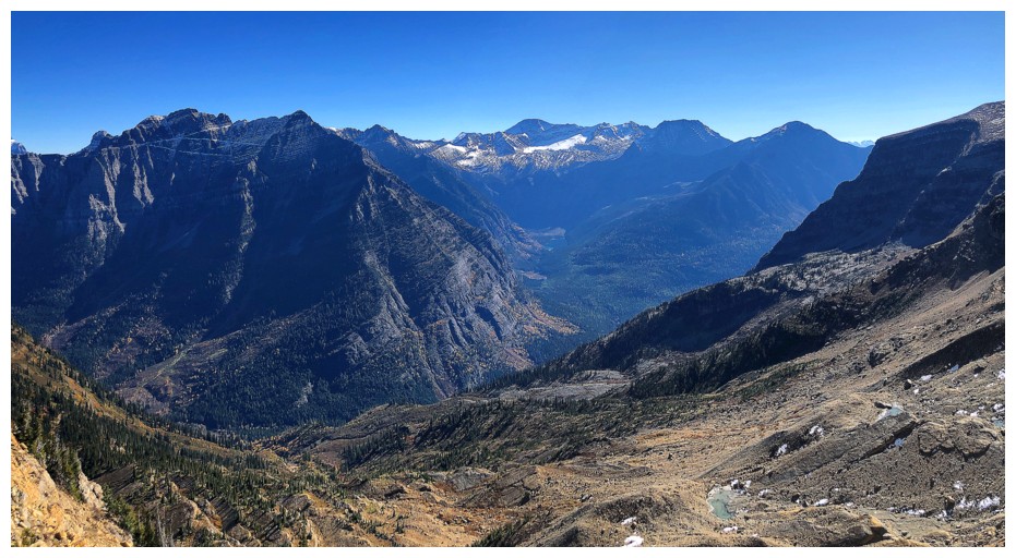
The east side
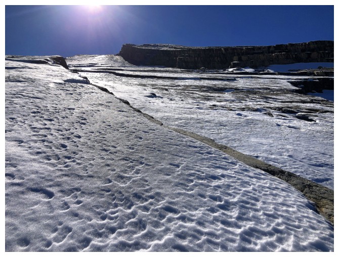
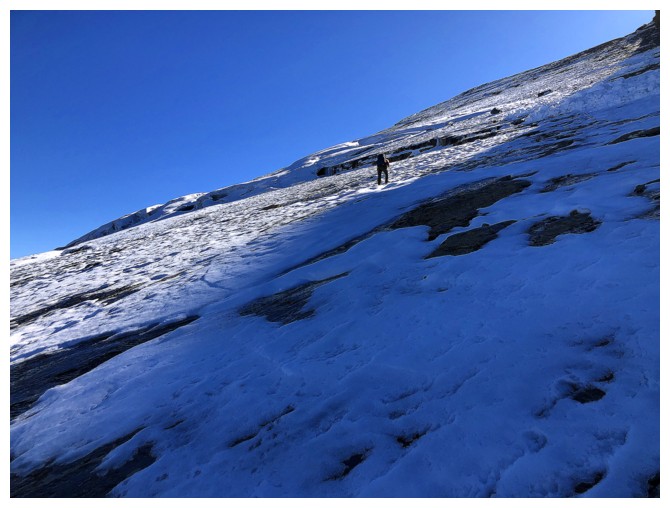
The slab hiking goes on for a surprisingly long time.... (photo by Doug)
...interrupted occasionally with the odd rock outcrop
Little bit of a downclimb here (photo by Doug)
The most awkward mountain name to type: Going-To-The-Sun Mountain (if you don't believe me, type it!)
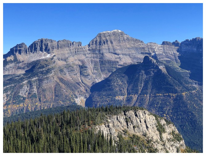
The west face (and easiest ascent route) of Gould
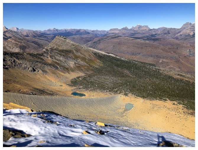
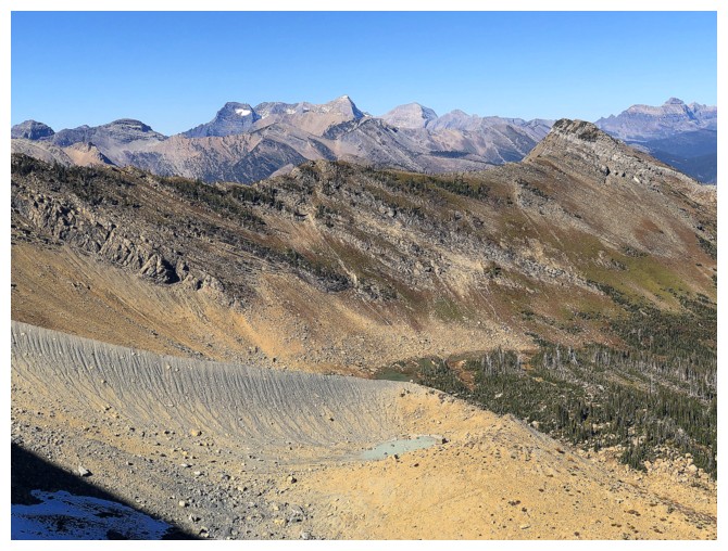
The only things left by the glacier are the moraine and three small tarns
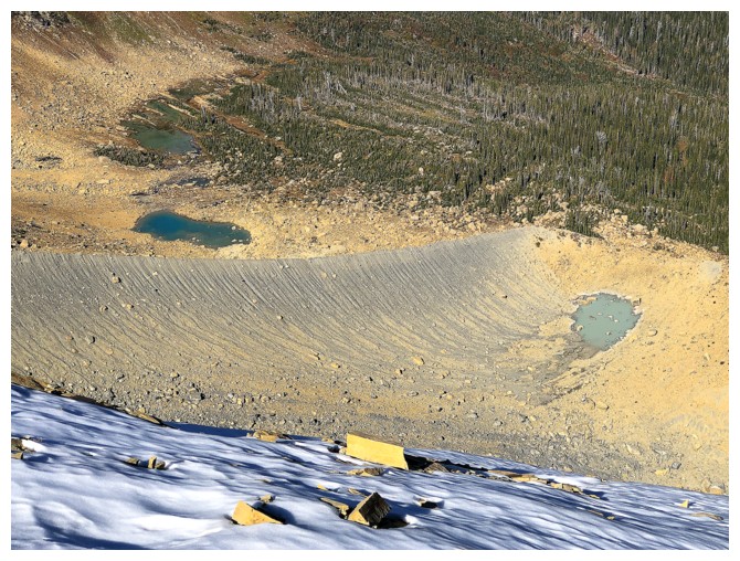
The tarns
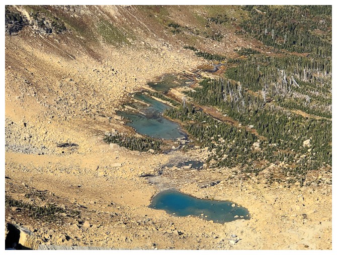
Two of them
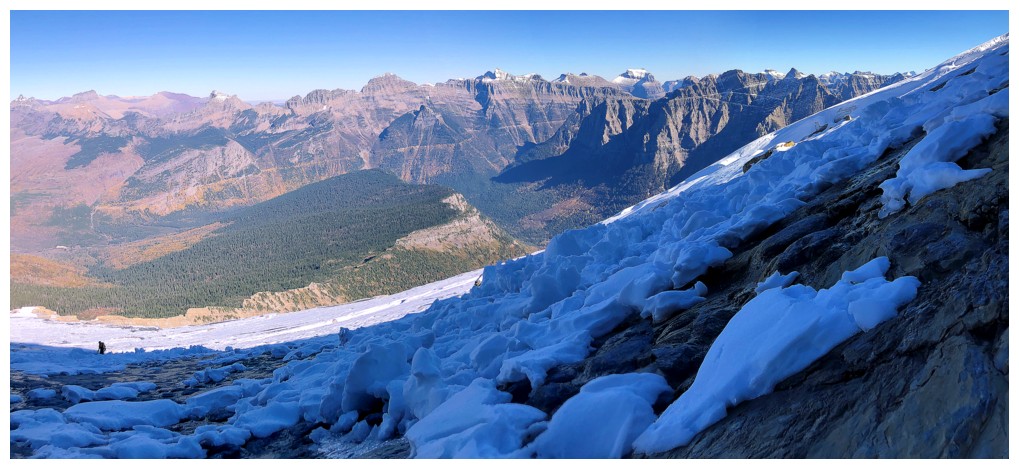
A little more rubble here, but still this was some of the cleanest terrain I've ever been on (photo by Raff)
A few colourful boulders always spice things up!
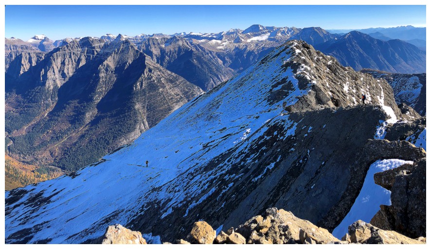
We initially stayed on the left side of the mountain (photo by Doug)
Heading more left
At
this point I had a microspike on one foot and nothing on the other -
not a technique I would necessarily recommend! (photo by Doug)
Back onto clean slabs, but they are covered in snow
Doug leads again (photo by Raff)
Another random outcrop
Avalanche
debris after a single snowfall. Clearly the snow slabs that form over
the rock slabs are very prone to release - no winter ascents of this
peak! (photo by Doug)
Doug stays on the snow for now
Nice Sun shot Raff! (photo by Raff)
There IS a glacier on the left side of the ridge. Any snow hides it very well.
Raff at the lower left, approaching the avalanche debris
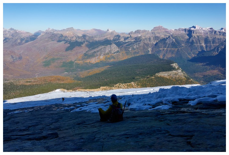
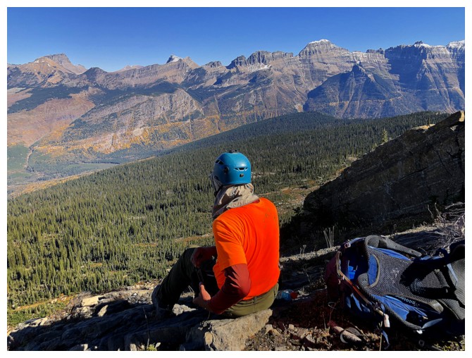
Doug and I picked a nice spot to sit on the slabs (photo by Doug)
There we are (photo by Raff)
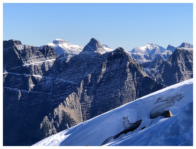
Mount Logan (still one of our best failures) just left of centre and Mount Reynolds (centre)
The terrain steepens for the final push. Doug picks a snow-less line.
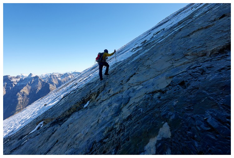
How steep? About this steep (photo by Doug)
Success! Doug's summit view (photo by Doug).
Doug at the top
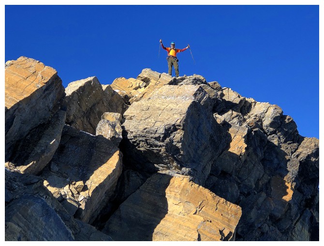
Close-up
Mount Vaught in the centre and Trout Lake at the right (photo by Doug)
Raff is making his way up
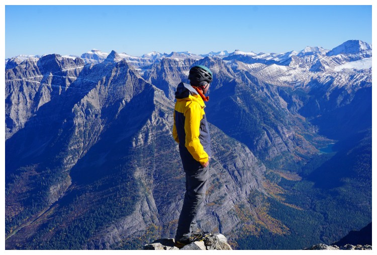
My summit view
Doug is heading over to the lower south summit (right), while Raff nears the top of the slabs
Raff's view of me at the summit (photo by Raff)
The view now also includes Crowfeet, Henkel, and very distant Yellow Mountain
Doug is now on the lower summit and Raff is on the ridge
Close-up of Doug
Doug's view looking down the slabs. Summit at the left (photo by Doug).
Raff visits the lower summit first (photo by Doug)
I've made it over to the lower summit
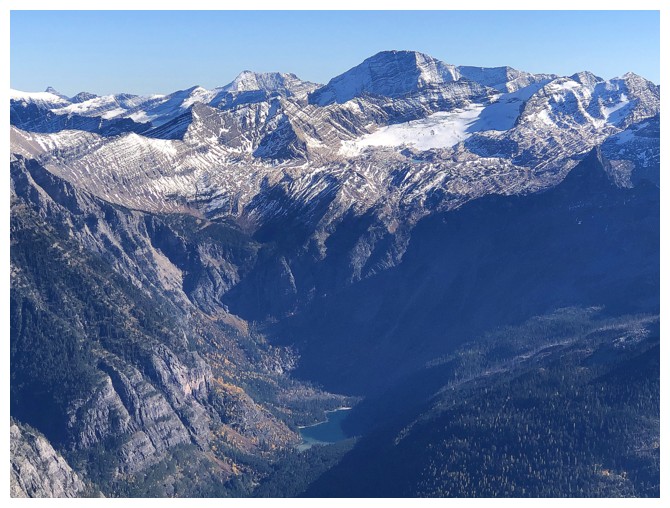
Mount Jackson, with Avalanche Lake near the bottom
Raff takes in the view (photo by Doug)
We all returned to the true summit for a group shot (photo by Raff)
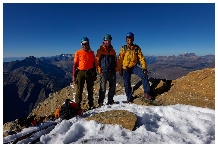
This one (photo by Doug)
I'm already on my way down. Raff stayed at the summit for a few extra minutes to enjoy the incredible view (photo by Raff).
The group of four from Whitefish and Doug (photo by Raff)
Stepped into the huge hole here (photo by Raff)
Carefully descending a tricky step (photo by Doug)
Raff on the skyline
Back on the slabs
Same as above (photo by Raff)
Good representation of the angle of the slabs (photo by Doug)
Looking down the route Doug took (photo by Doug)
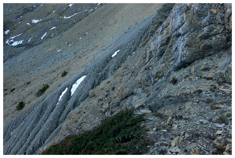
Raff and I descended grassy slopes farther down the ridge
These grassy slopes (photo by Raff)
Doug's view from the valley he is in. He had to traverse quite a ways off route to reconnect with me and Raff (photo by Doug).
Reunited with Doug
Descending the correct drainage. We all thought we were home-free at this point (photo by Raff).
Lots of slippery terrain to descend (photo by Doug)
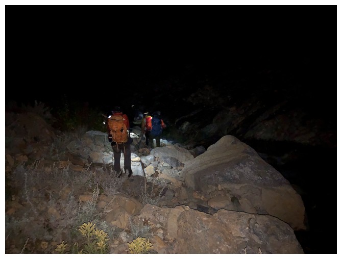
Several hours later and we are still making our way down, but by headlamp
The End
LOG