"North Kootenay Point II"
Hollebeke
Mountain
July 17, 2020
Mountain heights: 2223 m, 2400 m
Elevation gain: 1554 m
Roundtrip time:
9:23
Scrambling with Dave and Brad.
Back for Round 2 of the North Kootenay Pass
Adventures, with Hollebeke Mountain as the primary objective. The downside of
this trip was that the forecasted good weather never materialized; the upside –
9 hours and 23 minutes with two of the coolest mountain dudes in the south!
 We
approached the mountain the same way I did
for Round 1 – biked about 4 km to the trailhead and then another 4 km
alongside
the Carbondale River (highlighted by a very pleasant surprise encounter
with Vern Dewit), where we ditched our bikes near the river crossing.
Although many before us have ascended Hollebeke from the east via
MacDonald
Pass, we chose to follow in the footsteps of All Stone Adventures and
approach
the summit from the west, via North Kootenay Pass. Several kilometres of
easy hiking,
after leaving our bikes, and we found ourselves at the pass.
We
approached the mountain the same way I did
for Round 1 – biked about 4 km to the trailhead and then another 4 km
alongside
the Carbondale River (highlighted by a very pleasant surprise encounter
with Vern Dewit), where we ditched our bikes near the river crossing.
Although many before us have ascended Hollebeke from the east via
MacDonald
Pass, we chose to follow in the footsteps of All Stone Adventures and
approach
the summit from the west, via North Kootenay Pass. Several kilometres of
easy hiking,
after leaving our bikes, and we found ourselves at the pass.
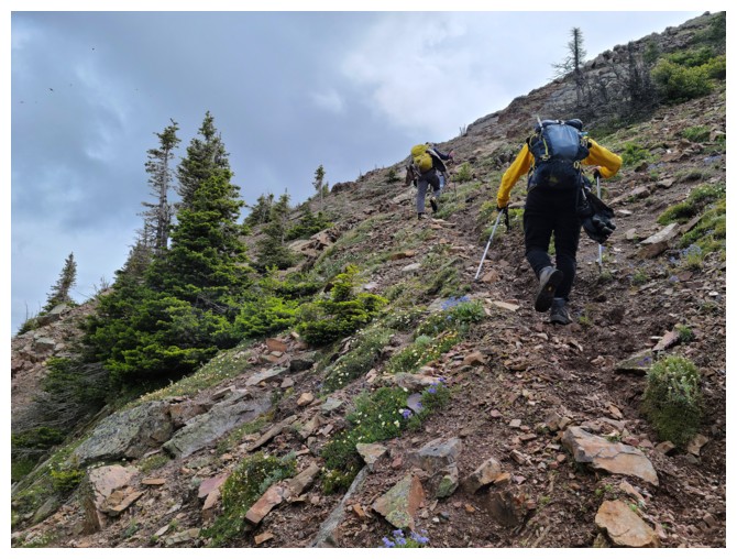
A short break followed and then it was off
to Hollebeke Mountain. Of course, I wasn’t about to try Hollebeke without
dragging Dave and Brad up “North Kootenay Point” first. Even the dismal weather
couldn’t dampen our spirits for this one – it’s one of those small peaks that
packs a big punch in terms of scenery and views.
 As much as I loved the repeat ascent of North Kootenay
Point, the trip from there to Hollebeke was far superior, characterized by super
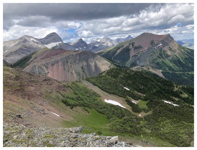
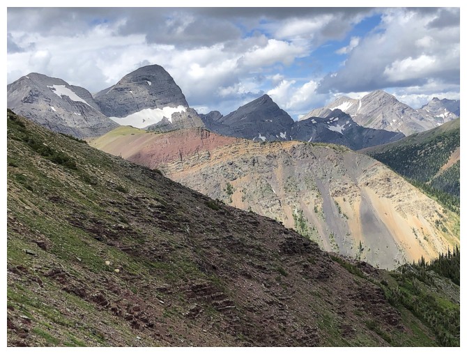
cool and unique rock scenery, the magnificent colours of the Lewis Thrust
fault, and fun ridgewalking beside the vertiginous east side of the mountain. Dave and Brad seemed equally
enthralled by the experience – as always, it was great to hang-out with these
two adventurous young lads!
As much as I loved the repeat ascent of North Kootenay
Point, the trip from there to Hollebeke was far superior, characterized by super
cool and unique rock scenery, the magnificent colours of the Lewis Thrust
fault, and fun ridgewalking beside the vertiginous east side of the mountain. Dave and Brad seemed equally
enthralled by the experience – as always, it was great to hang-out with these
two adventurous young lads!
We reached the summit without difficulty. That
is except for a huge and bizarre wipeout I took walking the easy and wide
summit ridge – definitely an unforced error! The fall left me limping a little
but was not going to be career-ending.
After taking in a wonderful summit view and
Dave graciously sacrificing his Nalgene bottle to replace the damaged summit register
container, we wandered over to a lower high point about 700 m to the south.
This turned into a very pleasant and worthwhile detour.
For descent we had already decided to try
looping back to where we left our bikes, via the valley immediately east of
Hollebeke. There was a trail marked on the topo map and so optimism for a
straightforward descent was high. From our highpoint we traversed steep slopes
over to the col between Hollebeke and the next high point to the east. At that
point Dave and Brad decided to tag that high point. My wounded leg was giving
me problems, so I opted to skip the high point and instead slowly made my way down
to the valley below.
Dave and Brad reached the high point with ease
and we were reunited in the valley in short order. From there, we found the
trail and followed it with relative ease right back to our bikes. “Relative”
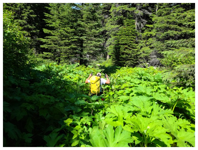
because there was a fairly long stint of travel where alders and vegetation had
overgrown the trail – good thing it was all downhill! Needless to say, the bike
ride back to the start was easy and at times thrilling.
A most outstanding day and one of those
mountains that delivers infinitely more than you expect from it. Hollebeke II
(on a perfectly clear day) will happen as soon as possible.
Click HERE to see Dave's report.
Biking a very driveable section of road (photo by Dave)
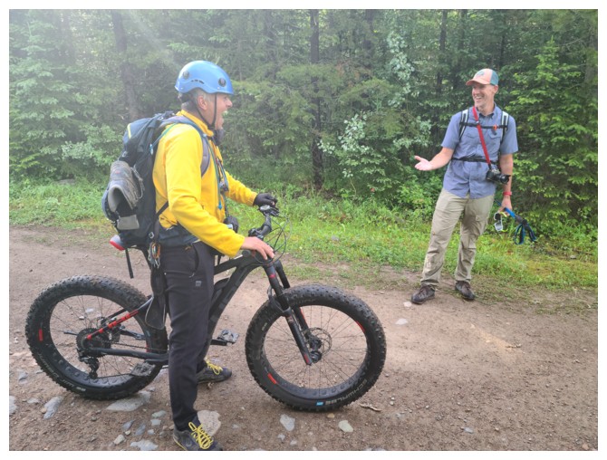
Wonderful encounter with The Man himself - Mr. Vern Dewit! He's on his way to Mount McCarty (photo by Dave).
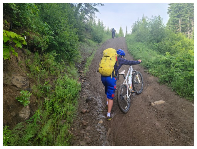
Very steep hill. No way I could have rode up it without the motorized assist from the ebike (photo by Dave)
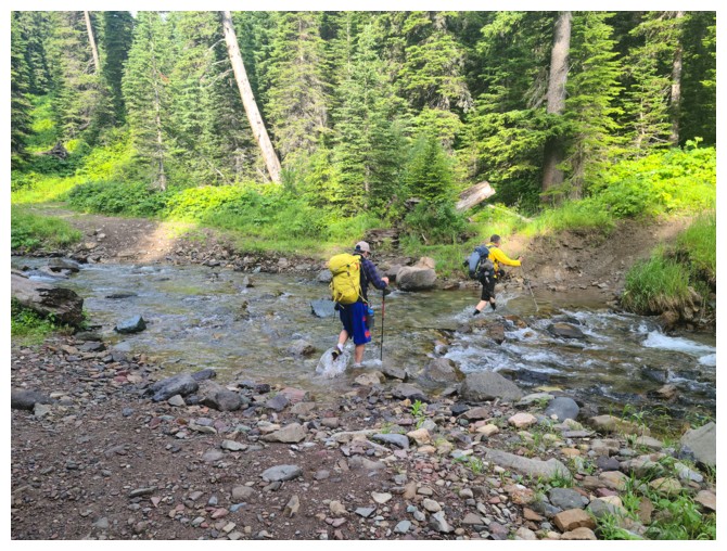
Crossing the Carbondale River after ditching our bikes (photo by Dave)
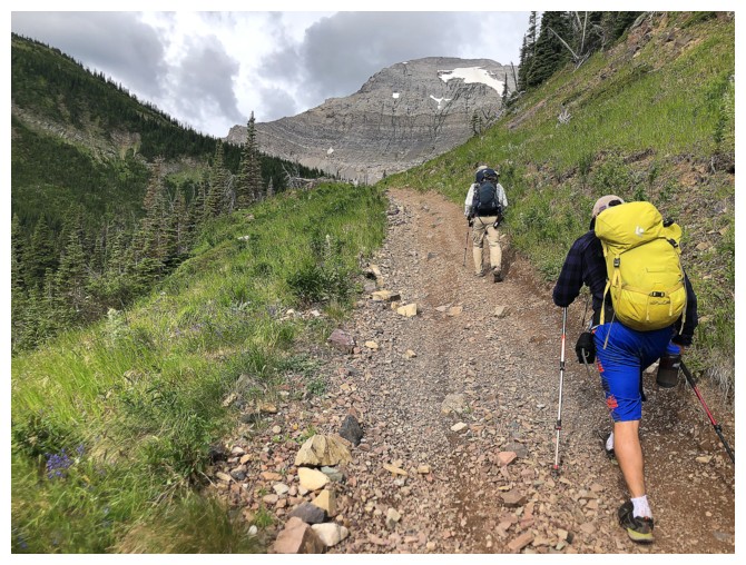
Easy hiking towards North Kootenay Pass
This unnamed peak immediately north of the pass looks very tempting (photo by Dave)
North Kootenay Mountain in the background - a significant peak, equal in height to Hollebeke
Dave checks out the tribute plaque to explorer Thomas Blakiston. As he
astutely pointed out, it would also be nice to see some
mention of the indigenous groups that used the pass, long before
Blakiston arrived.
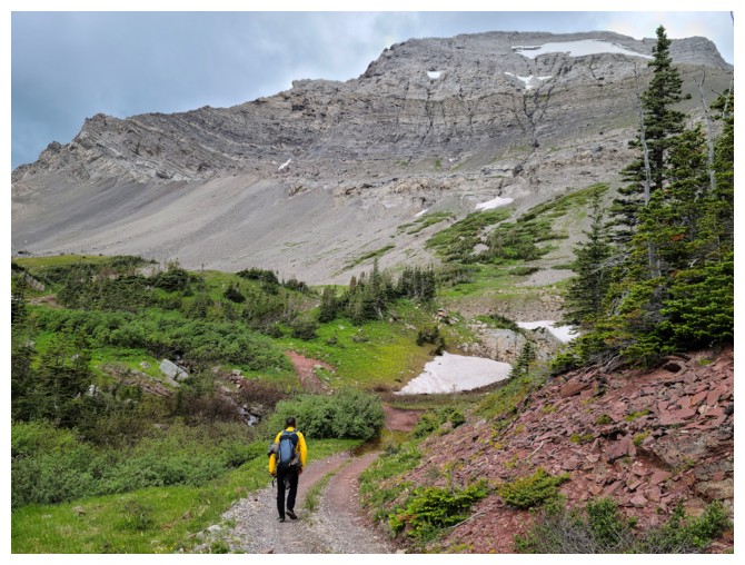
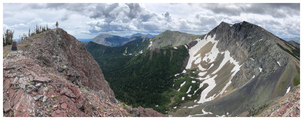
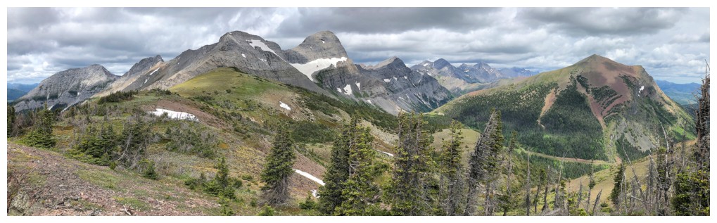
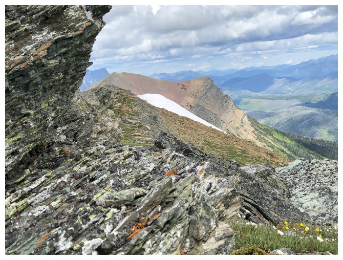
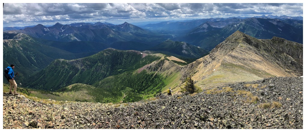
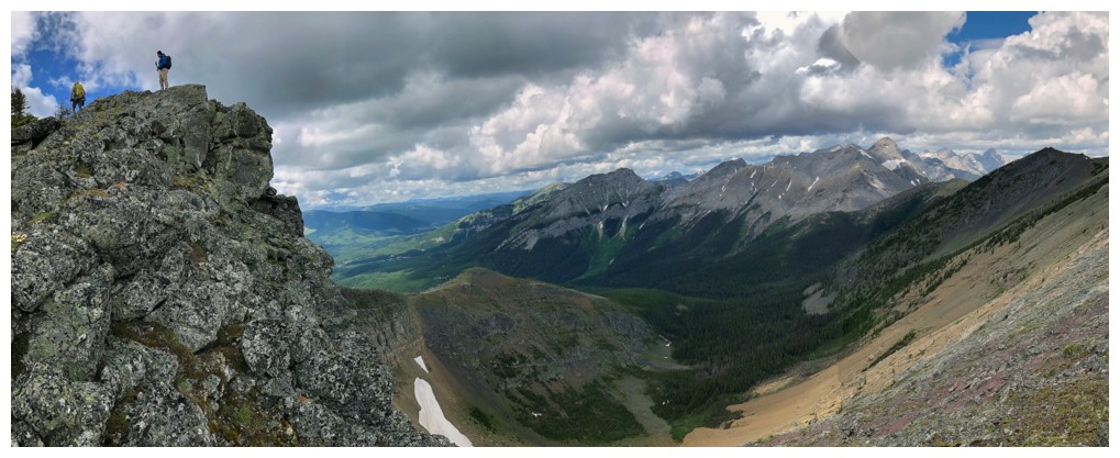
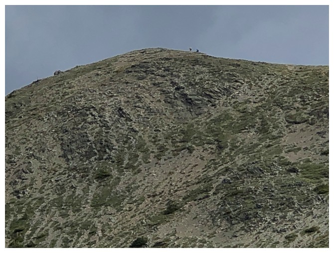
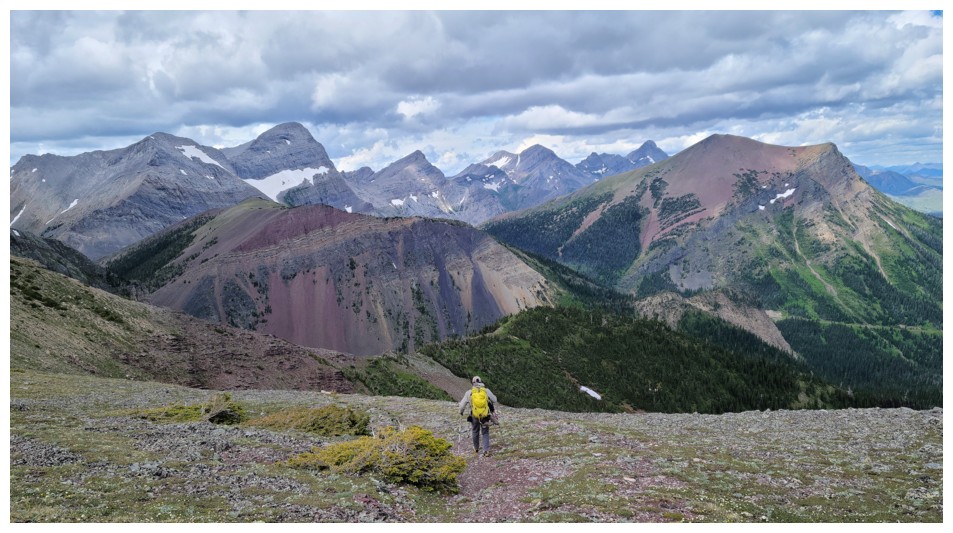
Last few metres to the pass. North Kootenay Point is just left of centre and Hollebeke at the right.
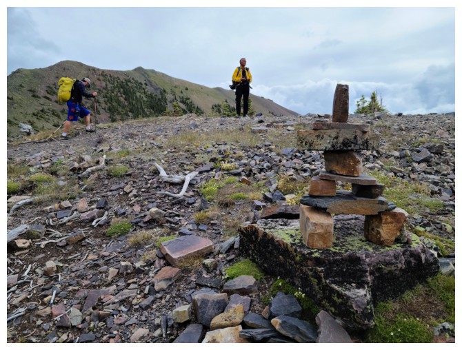
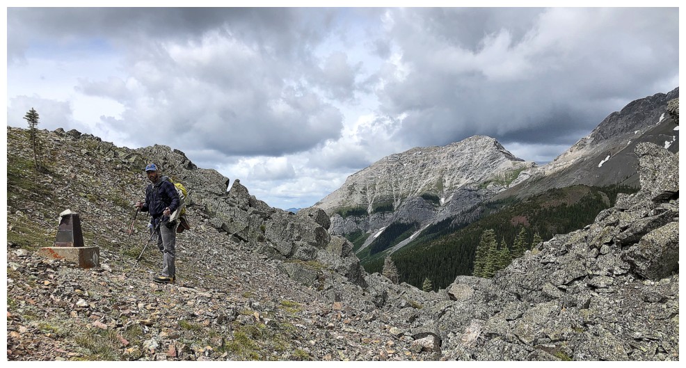
Terrific cairn at North Kootenay Pass (photo by Dave)
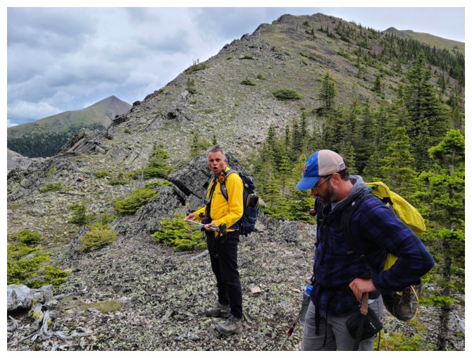
Looks like a modeling photo shoot is going on at the pass - work it Brad!!
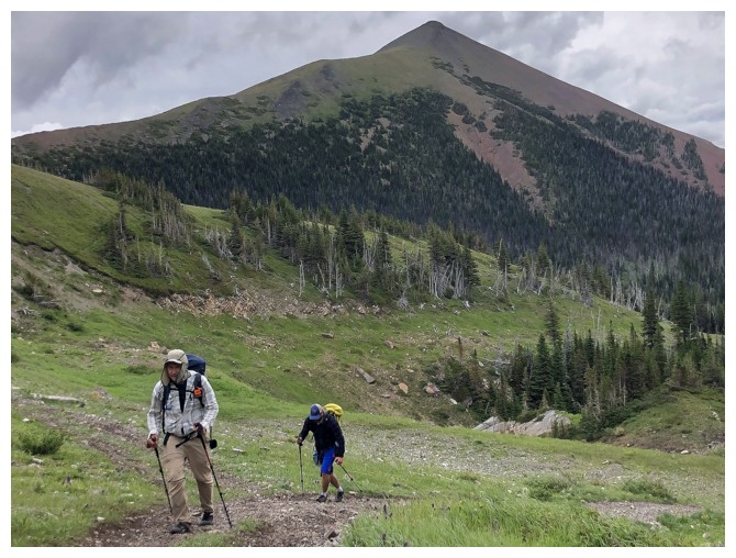
Brad, Dave, and some of the unnamed peaks north of the pass. Mount Borsato at the left.
Who doesn't secretly dream of being a pirate? Dave is living that dream!
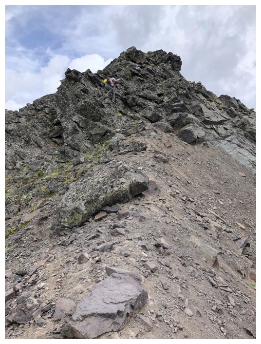
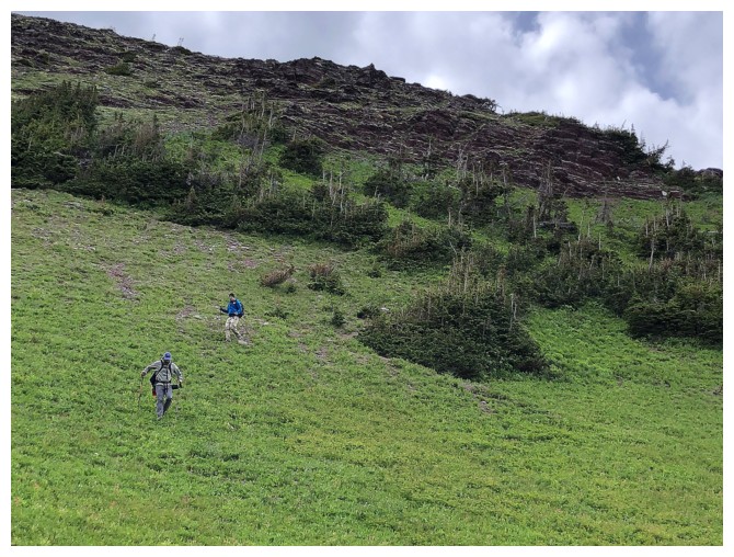
Starting up North Kootenay Point (photo by Dave)
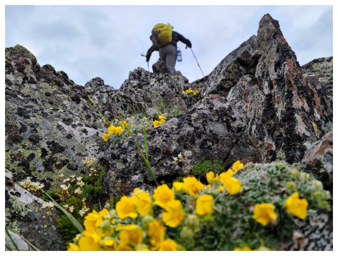
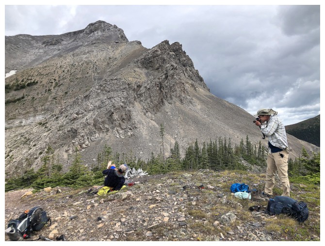
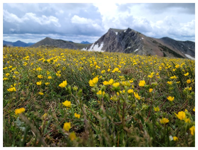
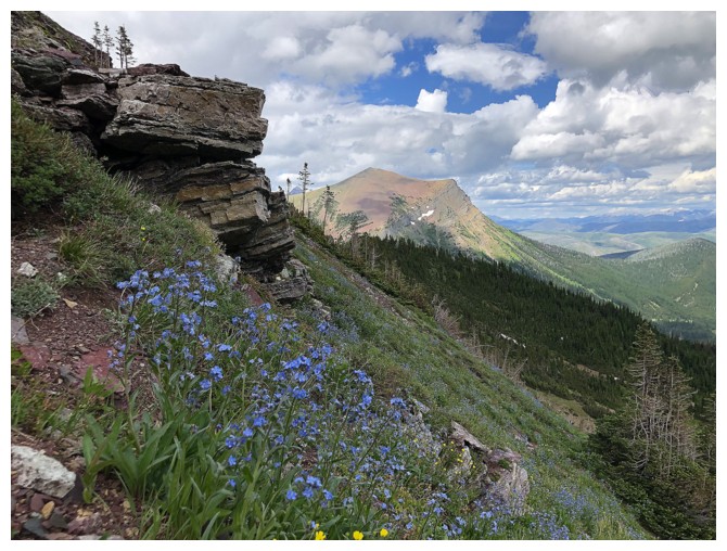
Another great flower shot by Dave (photo by Dave)
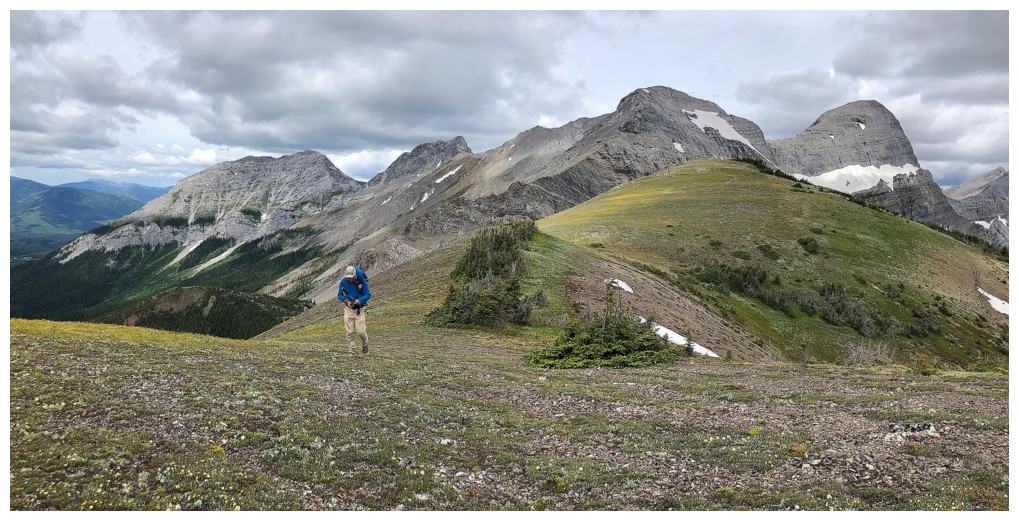
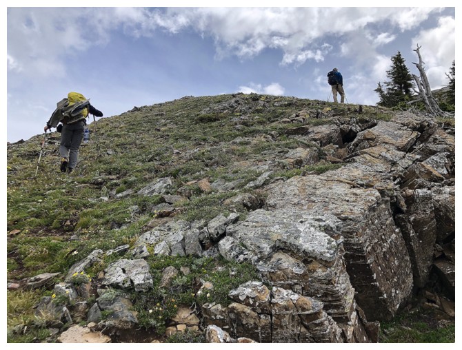
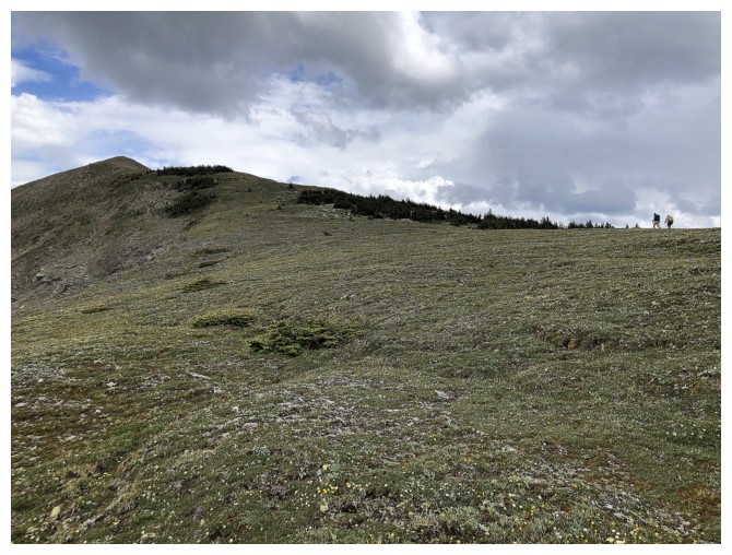
More easy travel and improving views
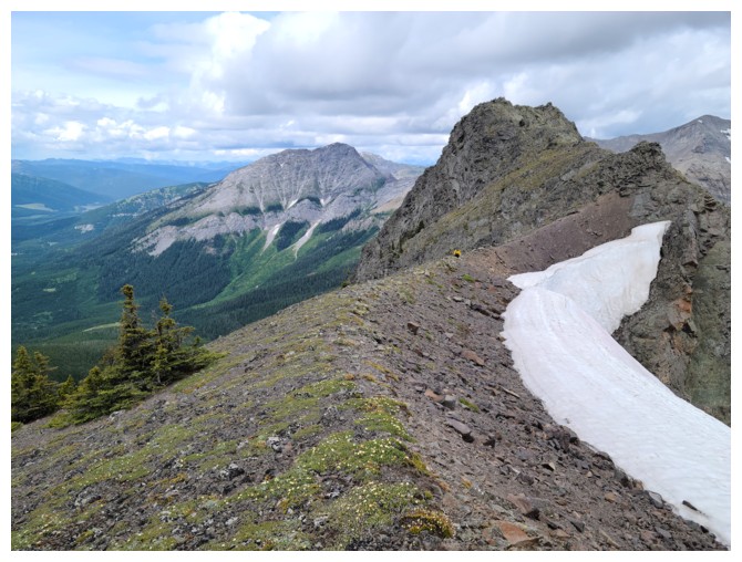
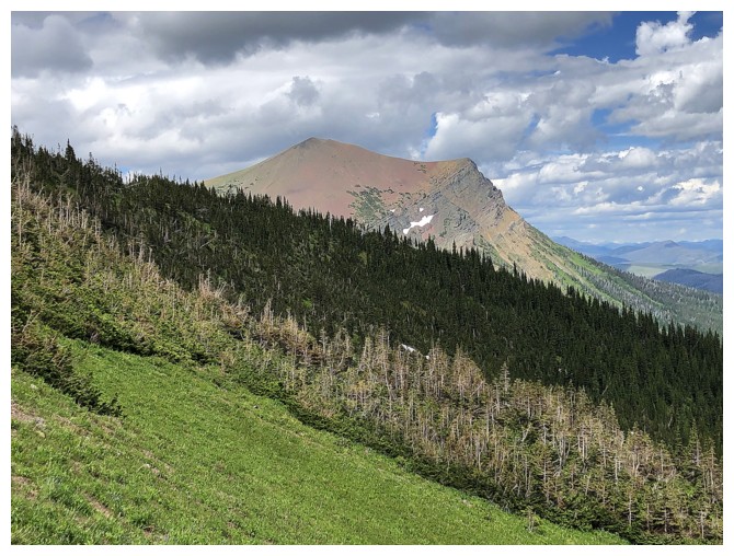
Looking over to Hollebeke
More outliers (unnamed peaks) of Centre Mountain and Mount Borsato (far left) are revealed to the north
Alberta/B.C. boundary marker (photo by Dave)
Dave is down!!
Nope......he's just taking another flower photo (photo by Dave)
Good one Dave!! (photo by Dave)
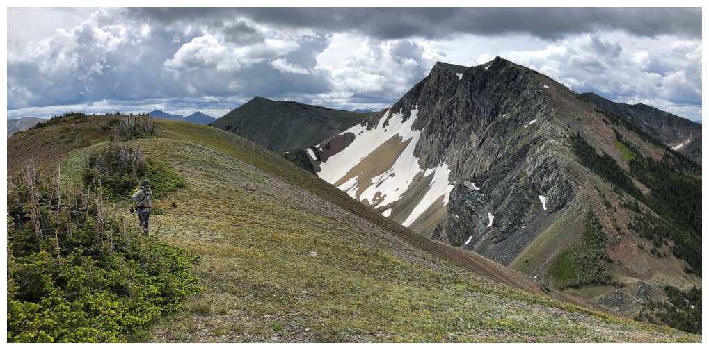
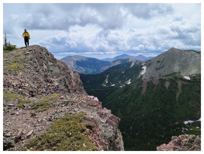
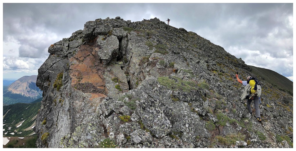
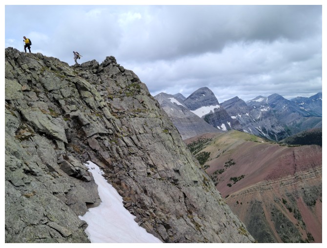
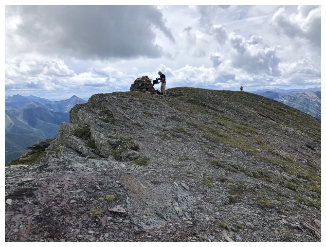
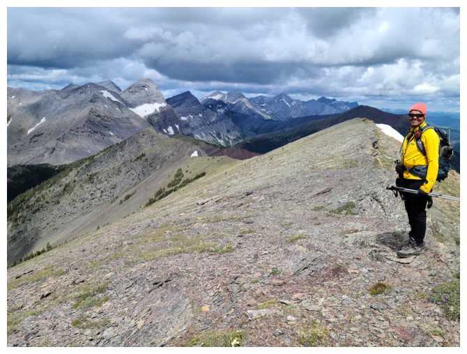
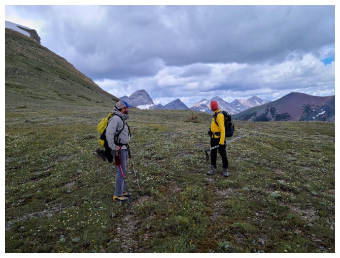
Brad leads the way to a slightly lower summit of North Kootenay Point. This was one of the highlights of the trip for me.
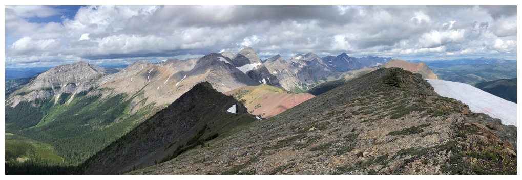
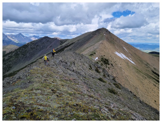
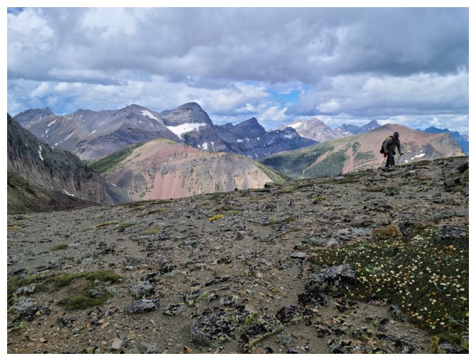
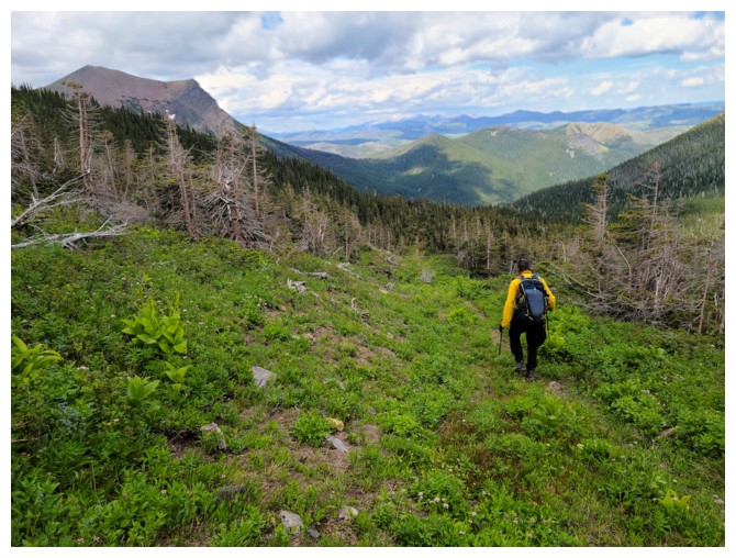
Spectacular high-level travel
Brad at the summit. Note: another boundary marker at the left.
Summit view to the east. North Kootenay Mountain at the left and Mount McCarty at the right.
Leaving the summit (photo by Dave)
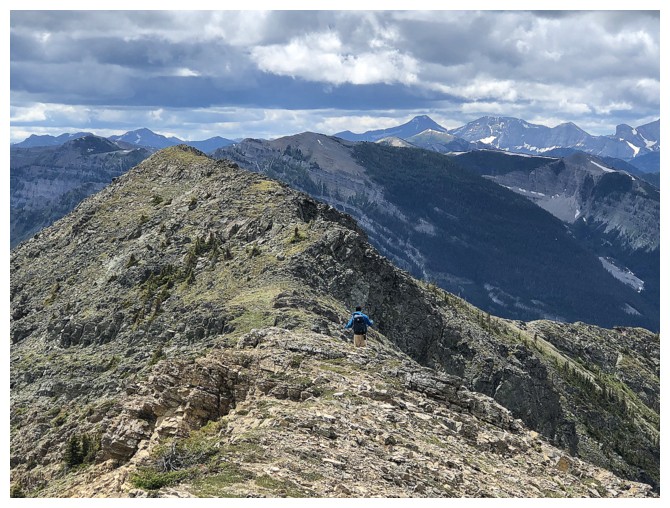
Dave and Brad follow the beautiful ridgeline down towards the North Kootenay Point/Hollebeke col
Still mesmerized by the summit view, I fell far behind
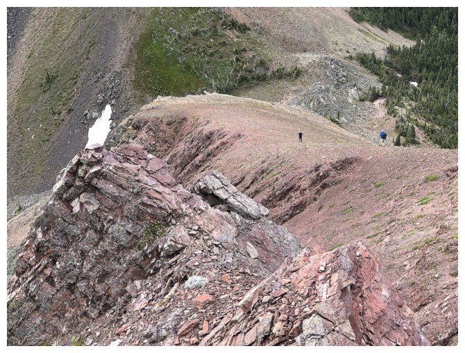
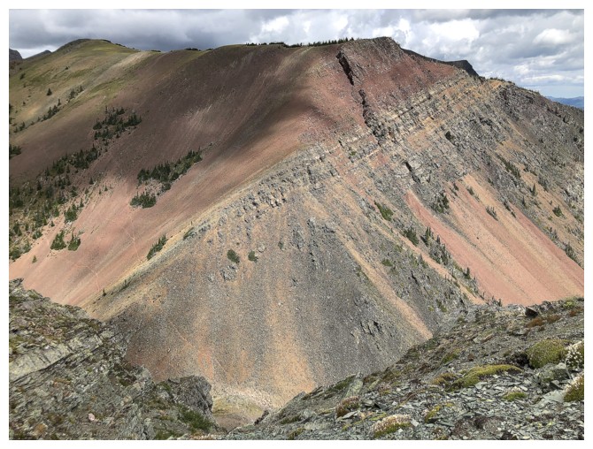
The Boys descend the burgundy argillite ridge
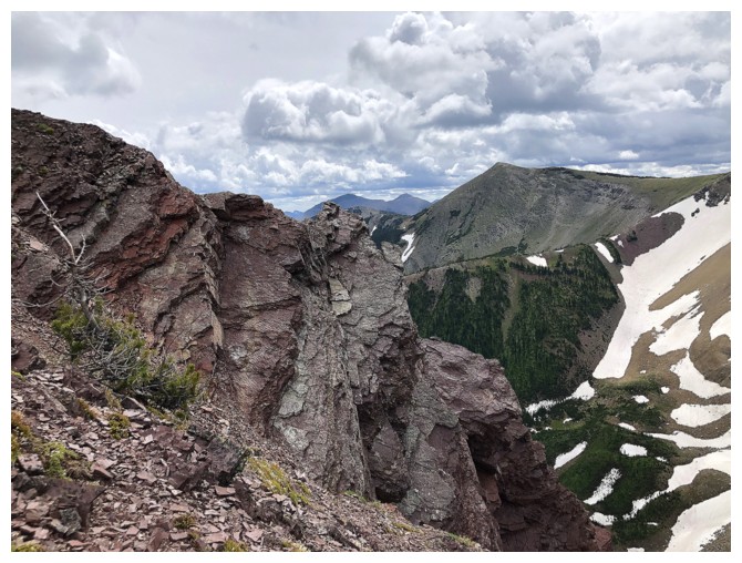
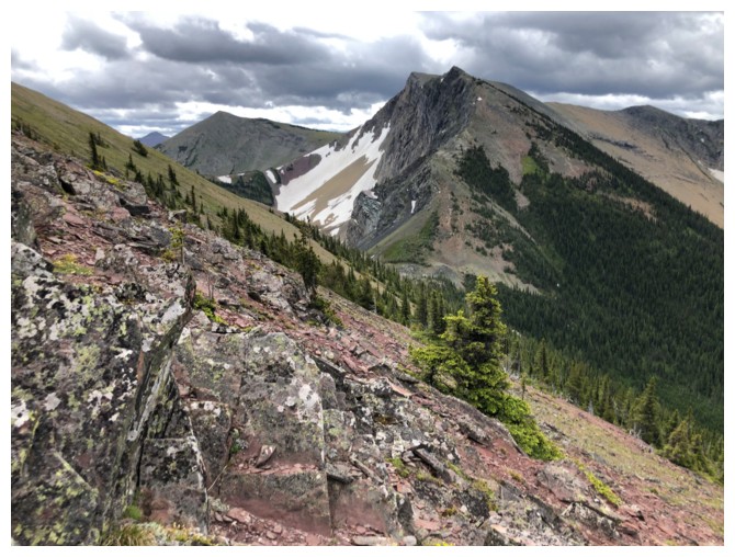
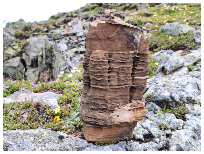
Tons of fascinating rock on North Kootenay Point
One of the many reasons I will someday return to this mountain on a clear day
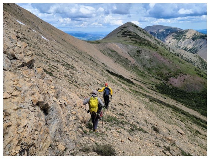
Catching up to the Boys
At the col, looking up the first part of the ascent route to Hollebeke
Brad encounters yet another boundary marker. There's no way anyone could be
confused as to what province they were standing in on this mountain!
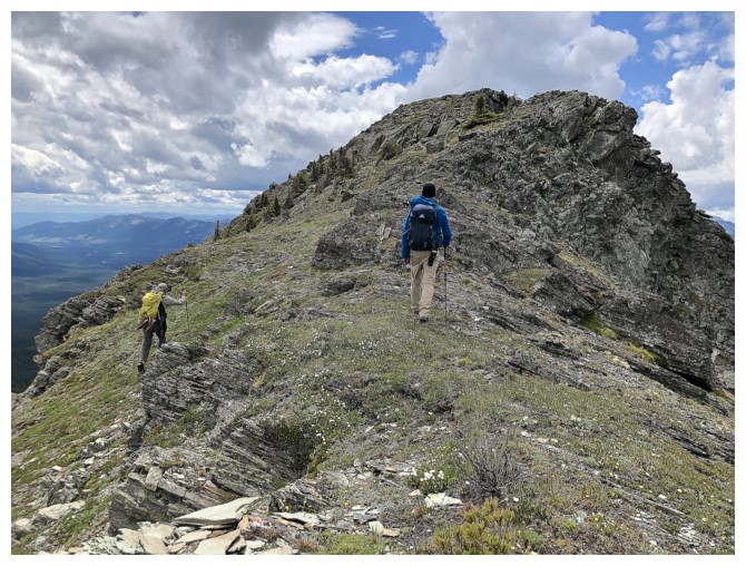
We were surprised to find this good trail going up the first section of Hollebeke (photo by Dave)
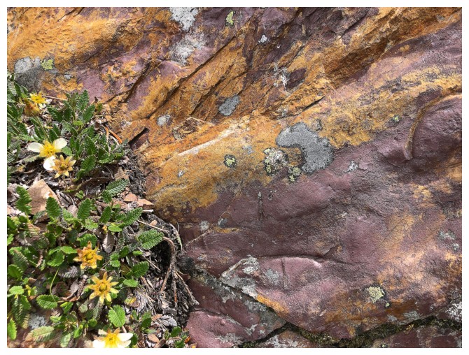
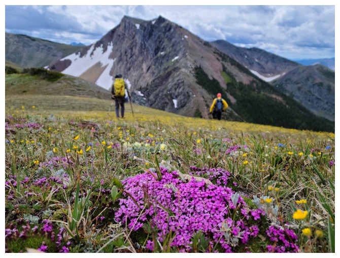
Colourful rock and flowers - a good combo
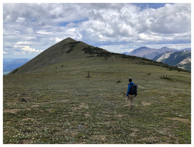
The trail disappears but travel remains easy
The single biggest reason I will return. North Kootenay Point is a
sweet mountain to ascend and an even sweeter mountain to behold!
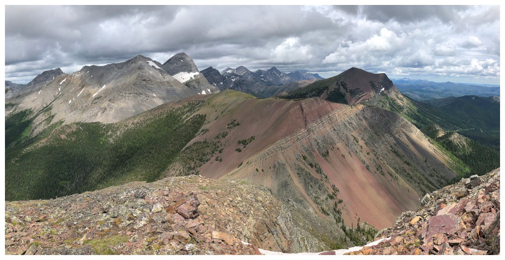
Lots of interesting rock on Hollebeke too
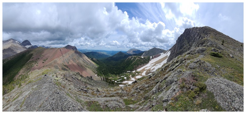
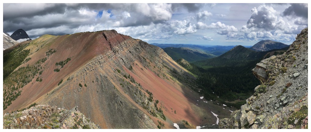
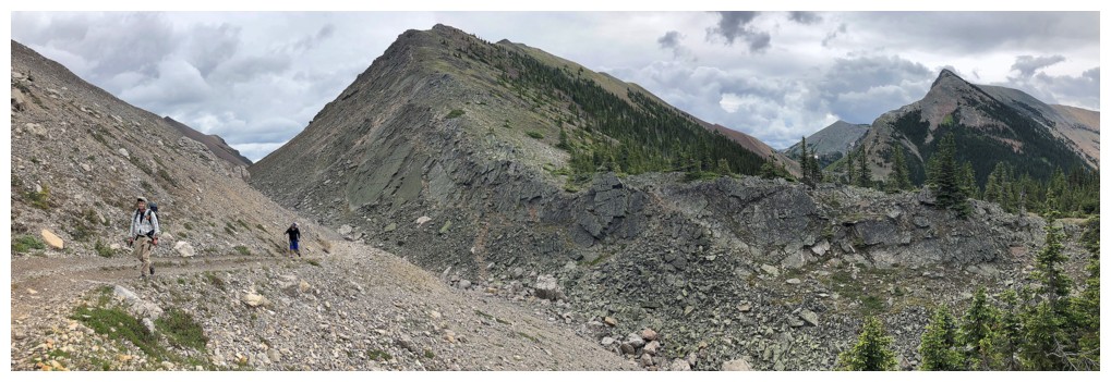
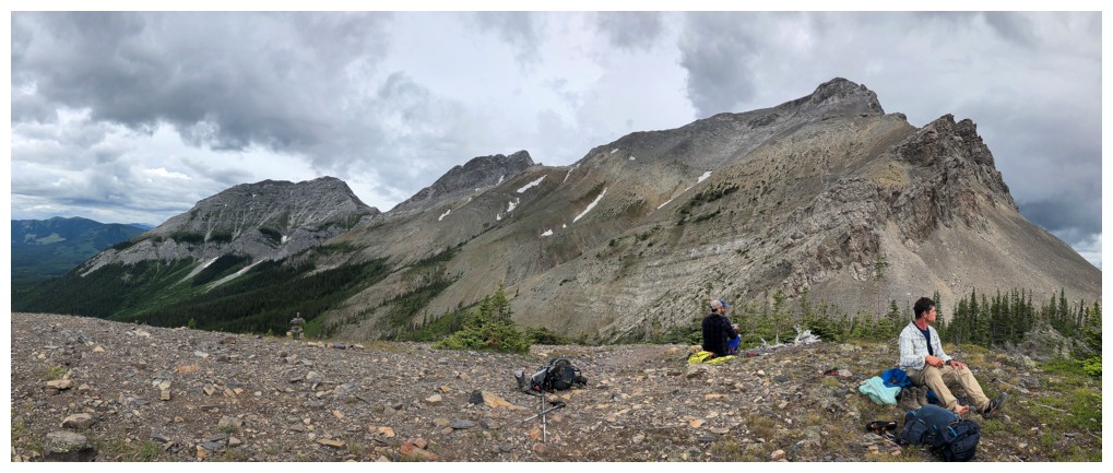
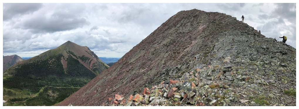
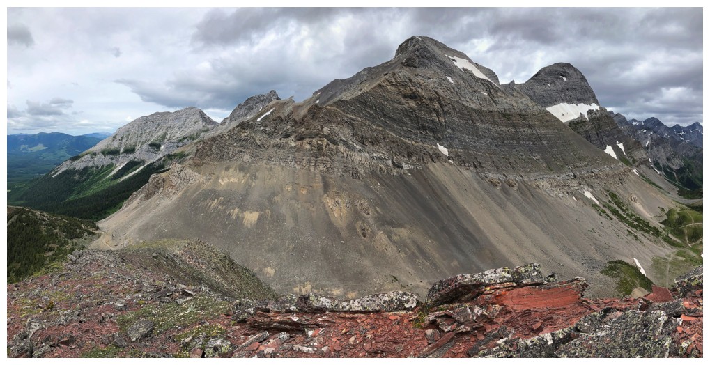
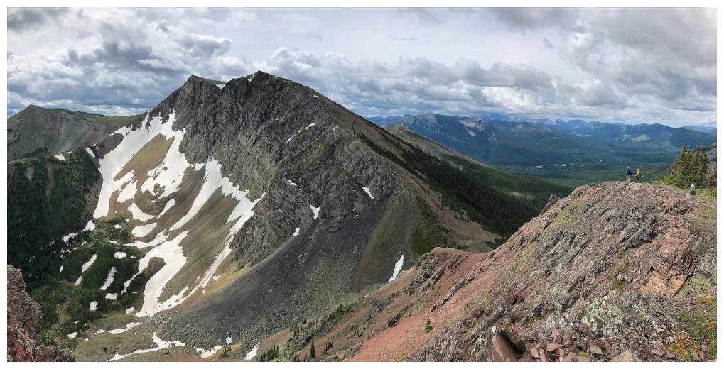
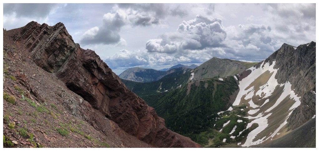
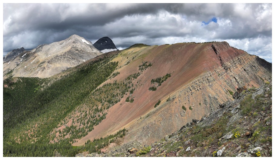
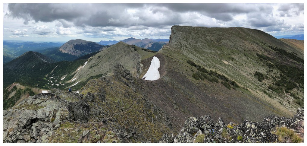
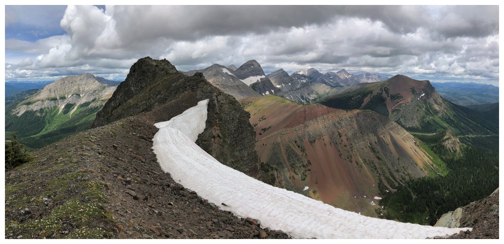
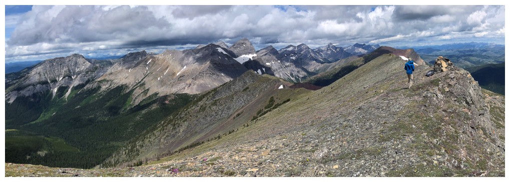
Cool
pano by Dave - makes it appear that North Kootenay Point (left)
and Hollebeke (right) form a horseshoe shape, but in fact they
are in a straight line, north to south. Great clouds too! (photo by
Dave)
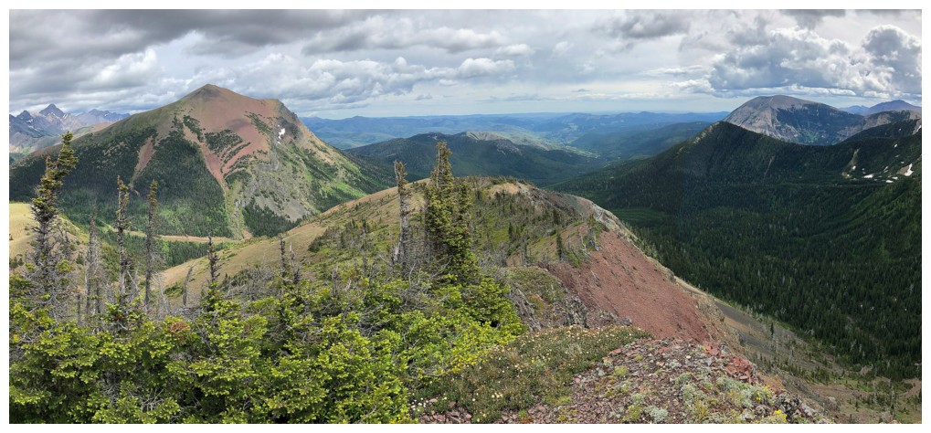
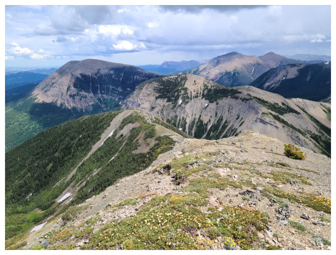
The view to the north continues to impress
A very interesting rock that looks like hockey goalie blocker! (photo by Dave)
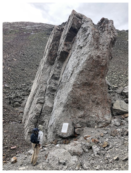
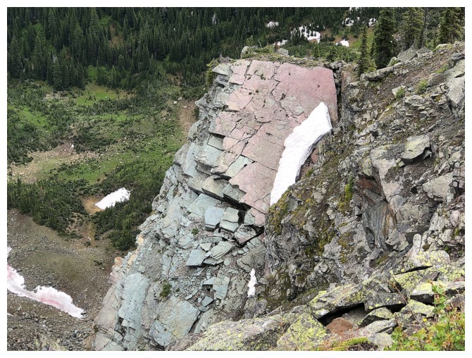
Looks like a big chunk of rock fell from the mountain recently (in relative geological terms of course)
Still can't get enough of this view
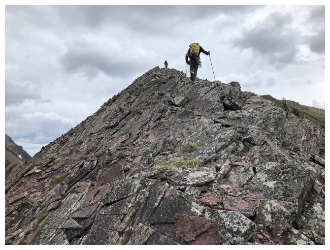
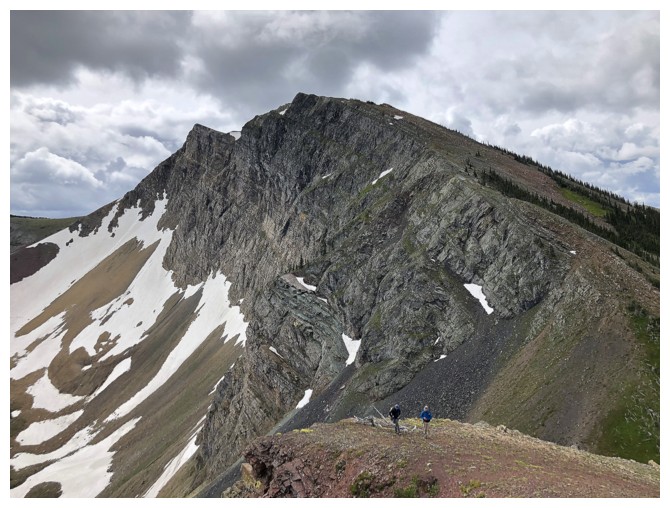
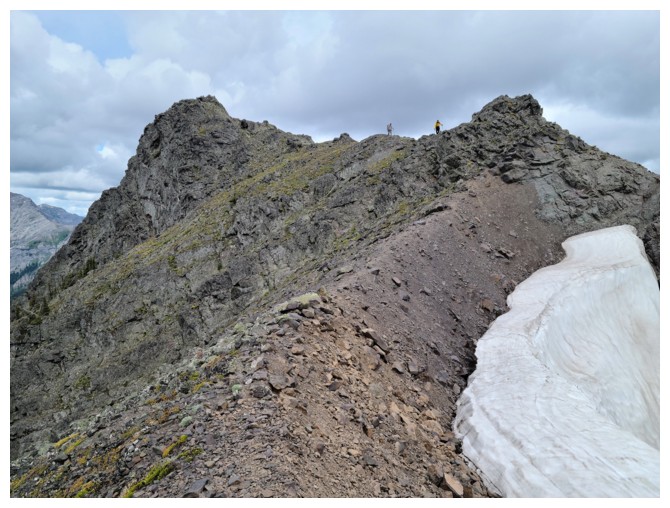
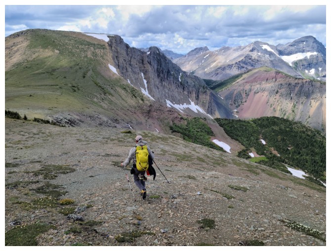
Dave on the fantastic up and down ridge of Hollebeke
Me and Brad are still up (photo by Dave)
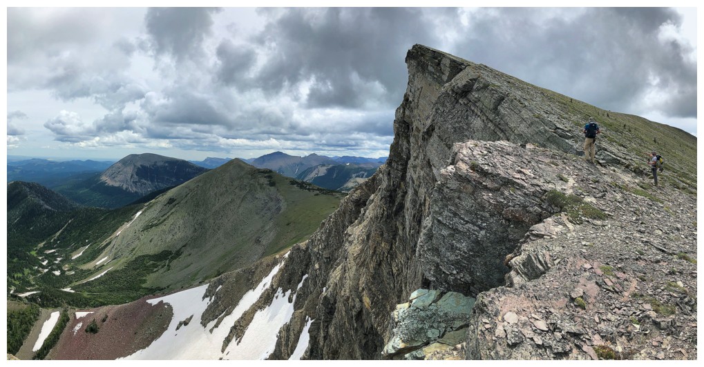
Dave leads the way. The summit of Hollebeke is at the right end of the flat section.
Here come the stragglers (photo by Dave)
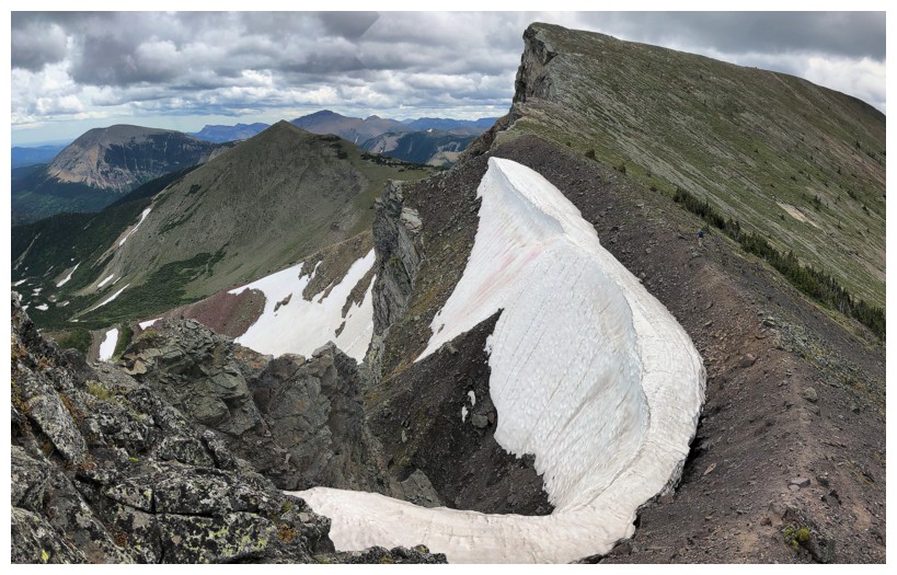
Remaining snow in mid-July is never a bad thing
Brad scrambles down a fun section of the ridge
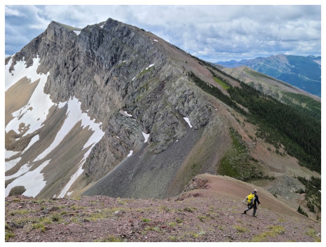
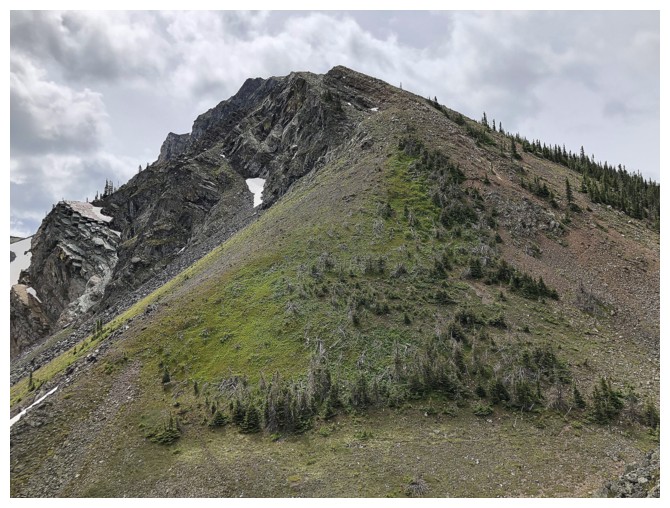
Looking back to the false summit of Hollebeke (photo by Dave)
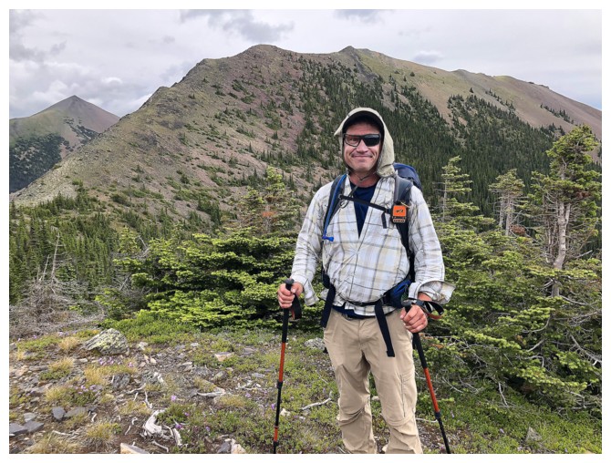
Dave is looking forward to an awesome "hike alongside the vertiginous edge" ascent to the summit
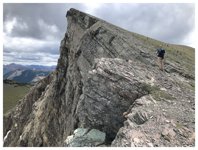
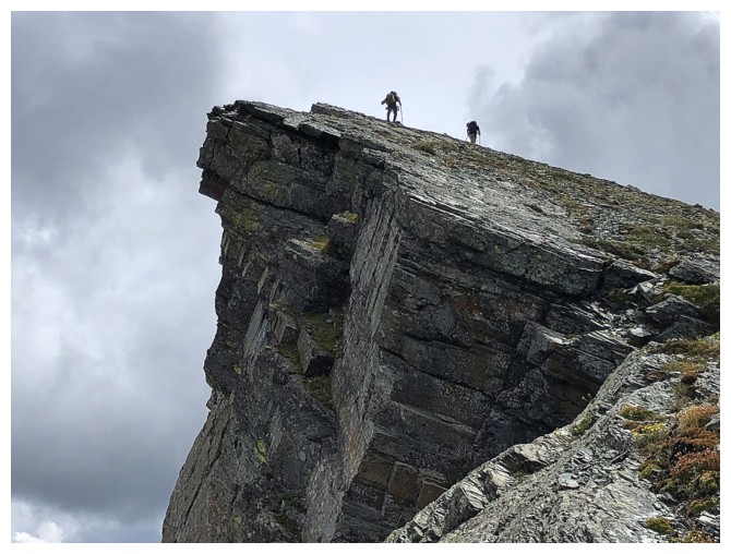
Oh my!
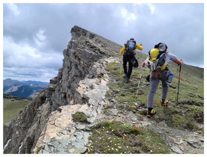
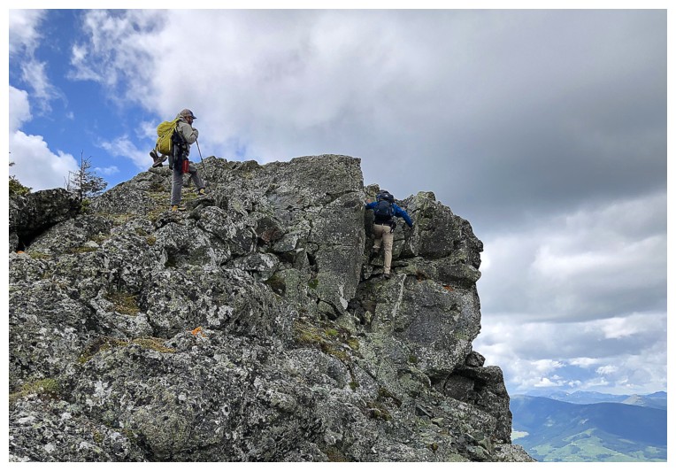
Up we go. This section was another major highlight of the day (photo by Dave)
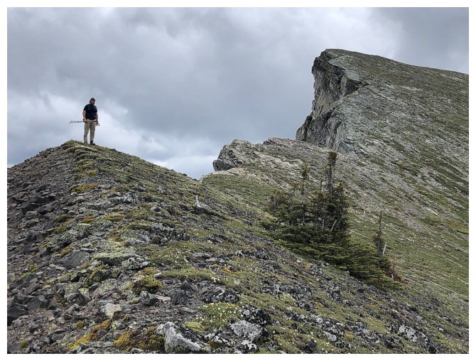
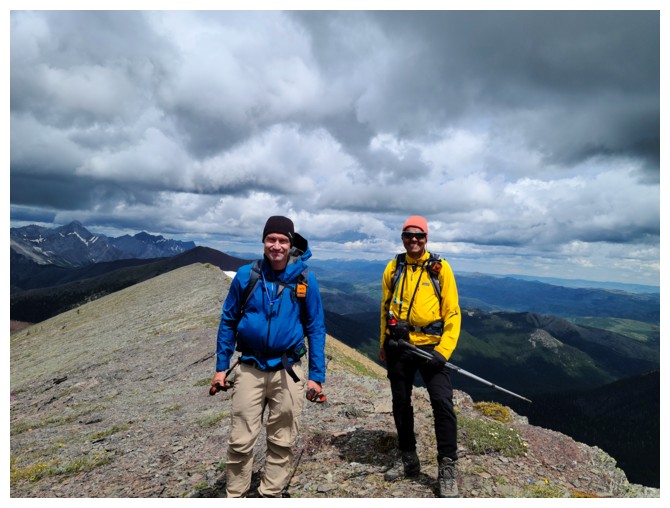
Brad and Dave reach the top
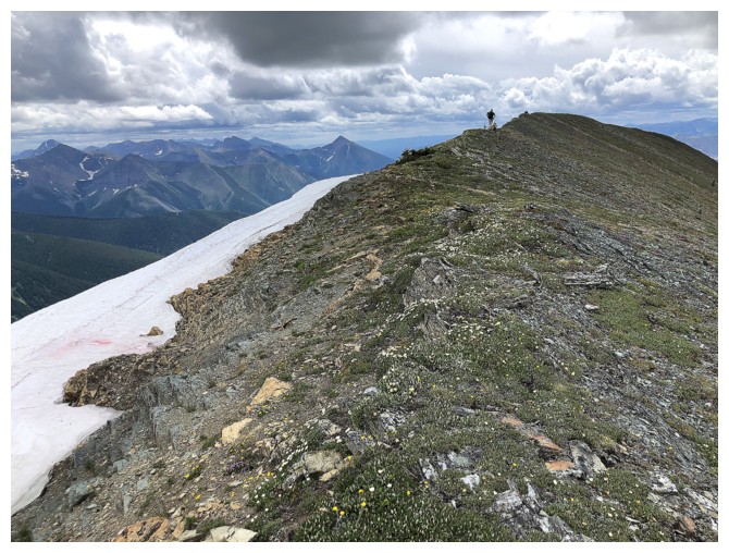
From there its an easy ridgewalk to the summit
Dave at the summit. Brad is already checking out the extension to the south.
Summit view to the north
Again, but with Dave
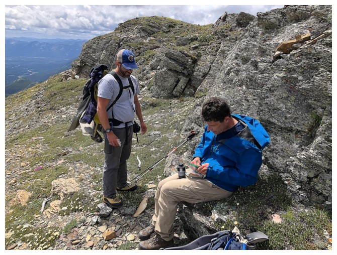
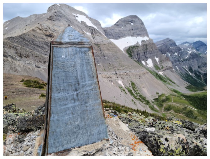
Dave checks out the summit register
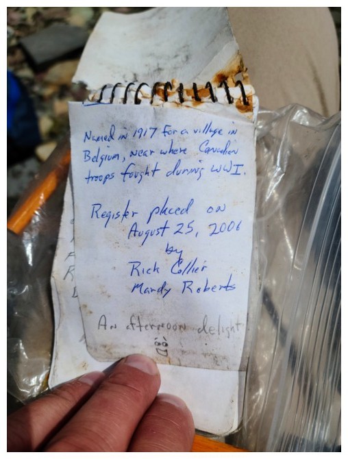
Two Canadian Rockies' icons: Rick Collier and Mardy Roberts (photo by Dave)
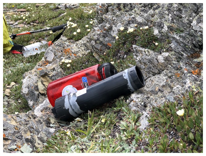
The old and new summit register containers, the red donated by Dave
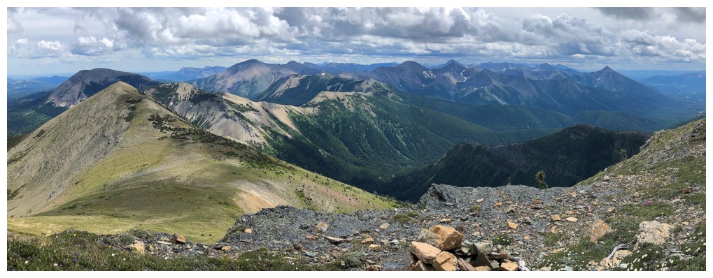
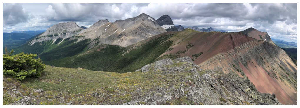
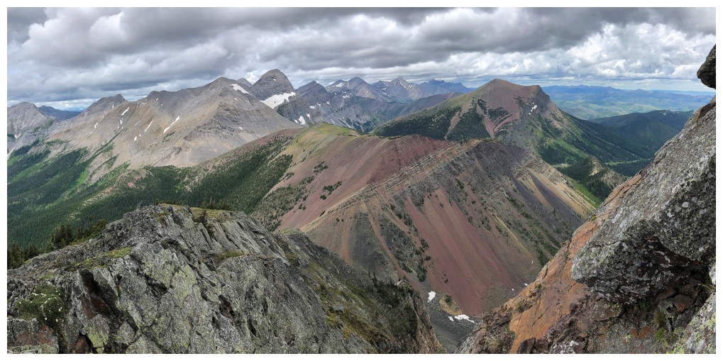
Summit view to the east and southeast
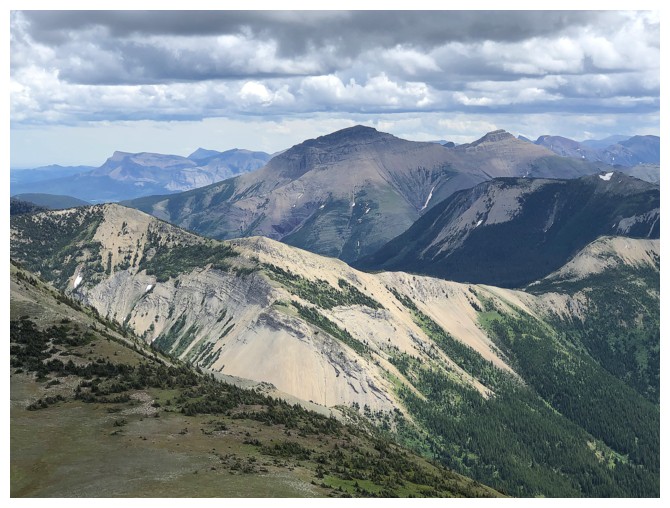
Two of the three summits of Syncline Mountain. The highest peak is in the centre.
North Kootenay Mountain. The right skyline looks very interesting.
Summit shot (photo by Dave)
Summit shot by Brad! (photo by Brad)
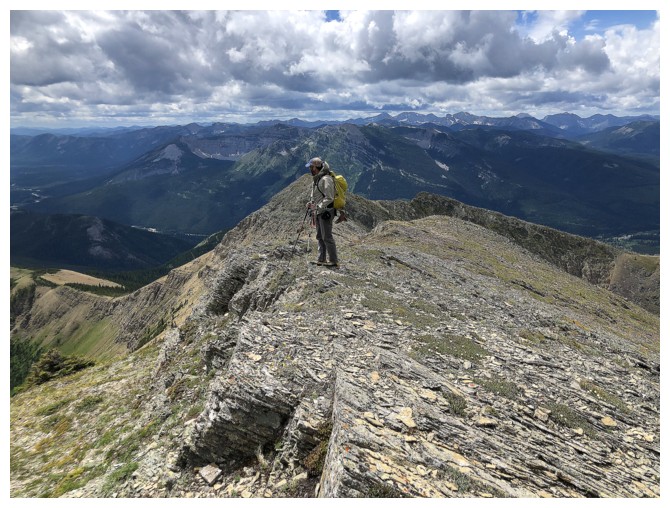
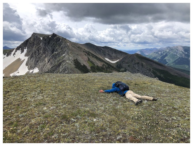
Brad leads the detour over to the other summit
The lower summit is at the right
Approaching the highpoint
Dave takes a more daring route to get to the top
At the top
Heading back (photo by Dave)
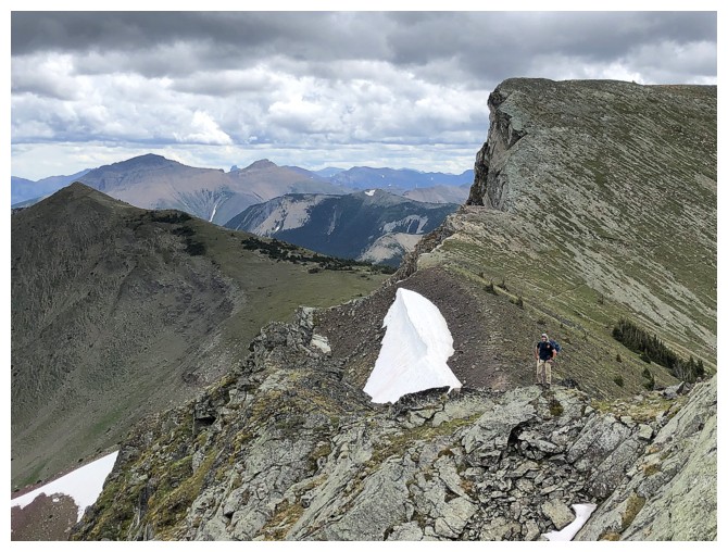
The side-sloping traverse to the Hollebeke/eastern outlier of Hollebeke col (photo by Dave)
Dave at the col, with the next objective ahead
A teary goodbye with Brad! (photo by Dave)
Dave and Brad ascend the outlier
I had lots of time to enjoy and photograph the views
North Kootenay Point getting lots of Sun
The Boys, almost at the summit
Brad takes the last few steps to the top (photo by Dave)
Summit view to the east from the outlier (photo by Dave)
Heading down (photo by Dave)
Same as above (photo by Dave)
I'm still working my way down to the valley
And still scoping out the southeast face route up North Kootenay Mountain
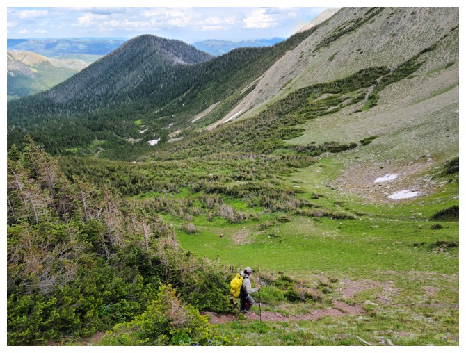
Brad leads the last stretch of travel down to the valley (photo by Dave)
Here they come
Starting the unknown route back to our bikes (photo by Dave)
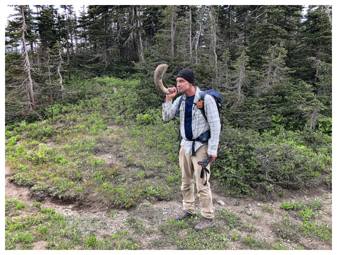
Dave finds a good substitute for his bagpipes
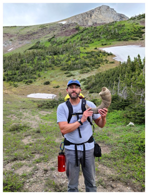
Brad's pipe makes playing the "horn" a challenging proposition (photo by Dave)
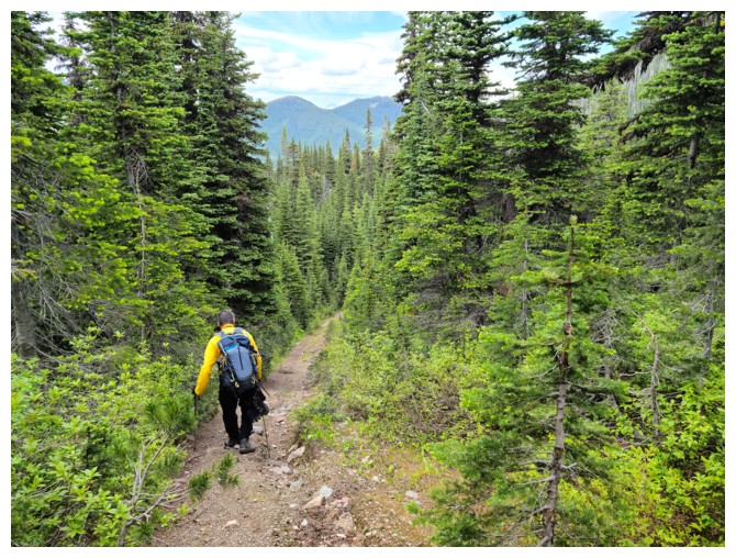
Great trail to start with (photo by Dave)
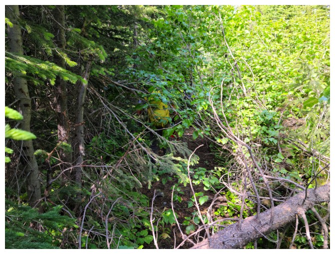
Still a good trail, but quite overgrown (photo by Dave)
Same as above (photo by Dave)
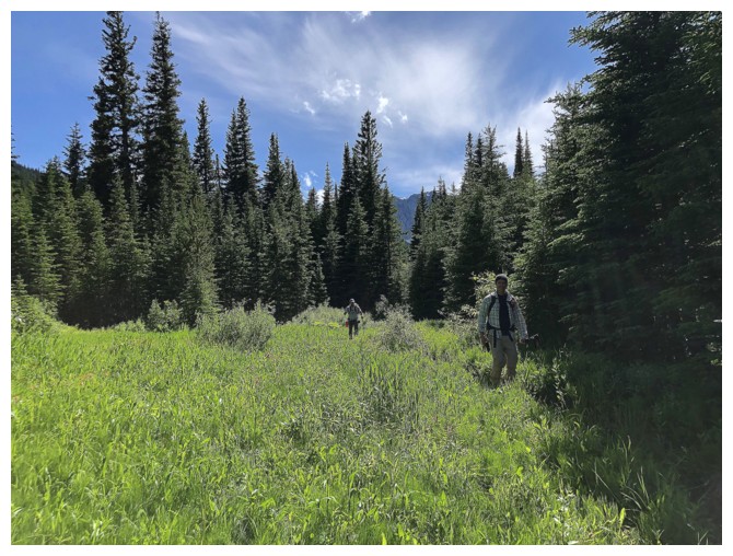
We emerge from the brush right where we left our bikes
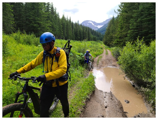
Even the ebike couldn't make it through these puddles (i.e. I was too chicken to try!) (photo by Dave)
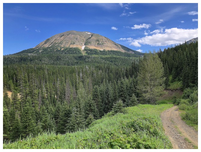
The clearest skies of the day over McCarty
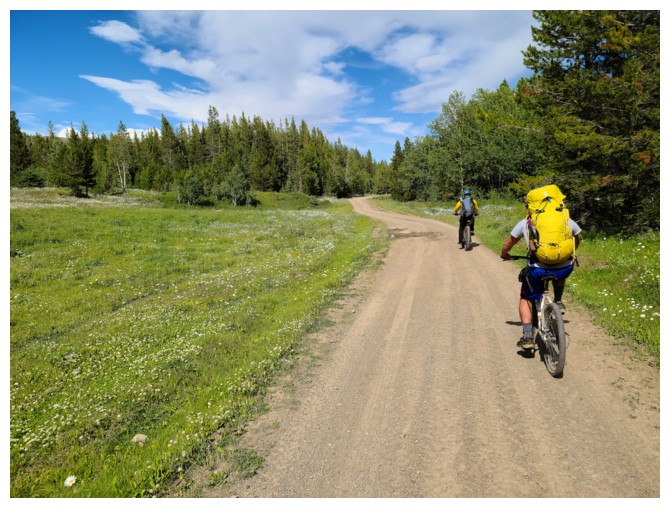
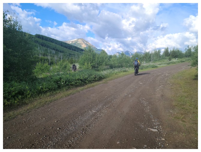
A sweet ride on sweet roads to end a sweet day (photo by Dave)
The End
LOG