August
2 and 10, 2011
Solo scramble.
Introduction
Where
the heck are Mount Miles and Krowicki Peak?? That is the first
question! The
answer: two unofficial peaks southwest of also unofficial Middle
Kootenay
Mountain in the Castle Crown area of the southern Canadian Rockies.
How
the heck did they get these unusual names?? That is the second
question! The
answer: when you are one of the coolest guys on the planet, eventually
someone
is going to name something after and/or in honour of you.
Then
who the heck is Miles Krowicki?? That is the third (and hopefully
final)
question! The answer: who ISN’T Miles Krowicki!!
 Perhaps
a less cryptic answer is required. Miles Krowicki is my friend and the
drummer
of the rockband Talking Dog. He is also (and more importantly) a
husband and
father of the highest quality. And because he is a good man, in the
best
possible sense of the word, he gets a couple of mountains named after
him.
Perhaps
a less cryptic answer is required. Miles Krowicki is my friend and the
drummer
of the rockband Talking Dog. He is also (and more importantly) a
husband and
father of the highest quality. And because he is a good man, in the
best
possible sense of the word, he gets a couple of mountains named after
him.
Mark
and I had spotted these two peaks from the summit of Middle Kootenay
Mountain
on a glorious January day in 2009. At the time, I thought if I ever
ascend
those peaks I will call them “Bo Peak” and “Diddley Peak”, after the
legendary
blues musician Bo Diddley (okay…. maybe the “Bo Peak” was a little play
on
words, alluding to the famous nursery rhyme).
I
don’t know Bo Diddley personally, nor will I ever since he passed on in
2008,
but I do personally know another legendary musician (at least,
legendary within
the confines of my basement) and his name is Miles Krowicki. I have
known Miles
for 32 years, since my family and I swam across the pond in 1979
(strong
swimmers in my family). Miles and I went to the same junior and senior
high schools
and then both ended up in the now defunct rockband
Shark Sandwich (watch the movie
Spinal Tap), which subsequently has turned into Talking Dog, also
featuring David
Sparks and Jeff Kushner. I’ve come to respect and admire Miles in ways
I cannot
effectively put into words so I will refrain from trying and offer this
tribute in place of.
The
Trip
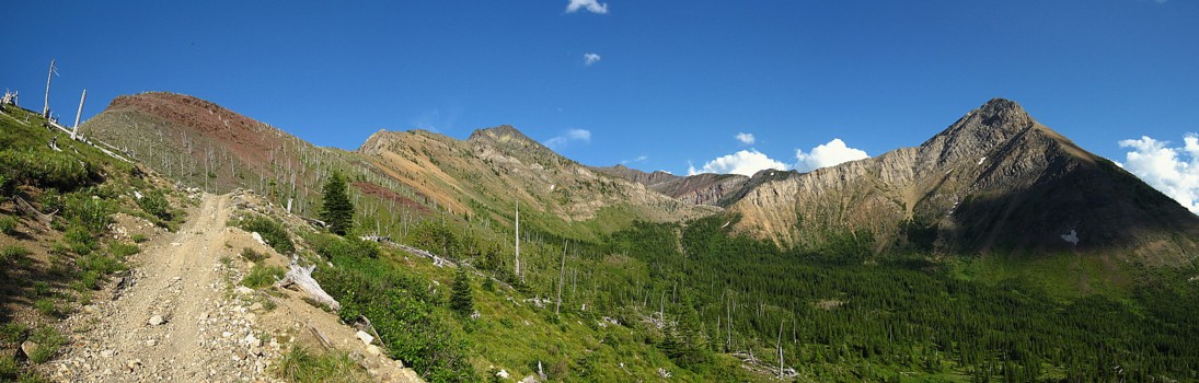
As
easy-going a guy as Miles is, his namesake mountains did not yield with
ease. I
decided to try the most obvious route, from the southeast sides of the
peaks. An
hour and a half of biking and hiking preceded a depressing 300 vertical
metre
elevation loss down Middle Pass Creek, after gaining 500 m en route to
Middle
Kootenay Pass.
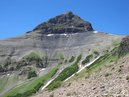
Although
the topo map indicated Krowicki Peak (the furthest away and more
striking of
the peaks) to be higher than Mount Miles, I suspected from previous
trips that
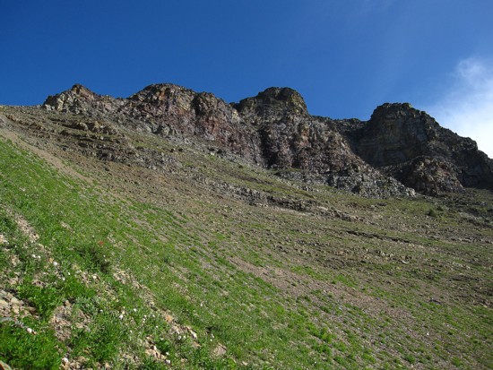
Miles was slightly higher and so I opted to attempt Miles first. 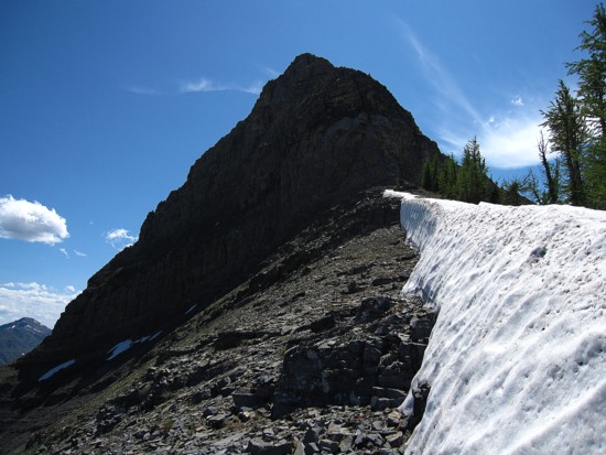 The route up
Miles was straightforward but foreshortened and very grueling.
Thankfully, the
beauty of the lush, green lower slopes and ruggedly colourful upper
slopes, as
well as improving views of the surrounding mountains provided plenty of
motivation to keep me heading upward.
The route up
Miles was straightforward but foreshortened and very grueling.
Thankfully, the
beauty of the lush, green lower slopes and ruggedly colourful upper
slopes, as
well as improving views of the surrounding mountains provided plenty of
motivation to keep me heading upward.
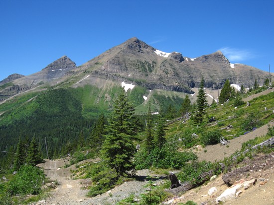
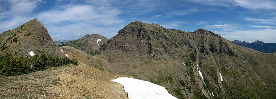
The
reward for 1300 m of elevation gain to reach the summit was a
magnificent
panorama of the Castle, Waterton, and Flathead regions. Views of Rainy
Ridge,
Three Lakes Ridge, Jake Smith Peak, Scarpe Mountain, Boot Hill and
Tombstone
Mountain brought back terrific memories of the summer of 2010.
Unfortunately,
in my absentmindedness I left the register I made for Miles in the car
and so
for now the summit would remain register-less and cairn-less. The
summit view
rejuvenated me in a big way and so I set my sights on the shapely form
of Krowicki
to the southwest.
This
ascent of Krowicki was definitely more interesting. After an easy trek
down to
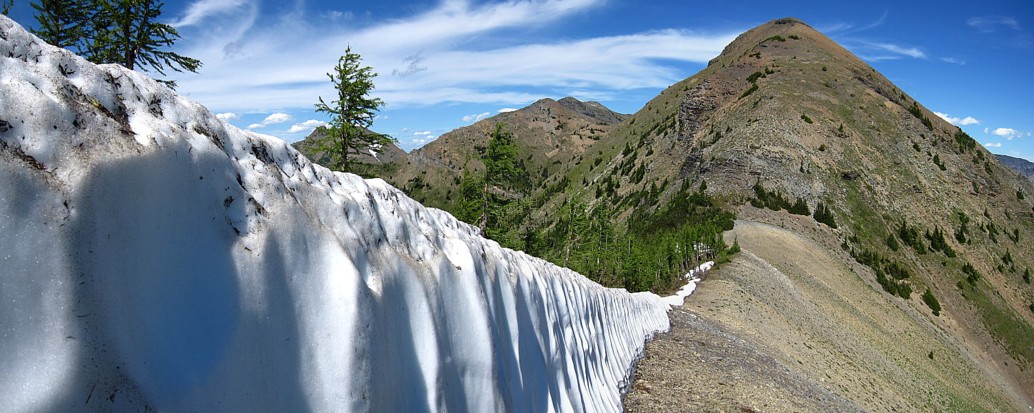
the Miles/Krowicki col, the highlight of which was a small, but very
cool wall
of snow, I had to choose between circling the peak around the left or
the right
side to find a way to the top. The left appeared to offer a
straightforward
ascent and so I went to the right – that’s what Miles would have done!
A
short distance around the right side I spotted a potential scramble
route to
the summit. Things started well but higher up the terrain became
dangerously
steep and committing. I wisely backed down and then continued the
side-sloping
traverse around the right side. As soon as I was able, I took a sharp
turn and
started up the southwest side of the peak towards the summit.
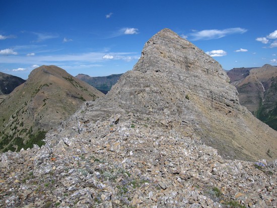
This part of the route was a more than pleasant surprise. I expected to encounter a wide swath of hideous rubble and scree, but instead was treated to a beautiful ridge, narrow in places, but not desperately exposed. Along the way, one difficult and exposed scrambling move was required to ascend the ridge and then an enjoyable jaunt to the top completed the circuit. I was very happy to name the peak with Miles’ surname: Krowicki Peak. (I conveniently neglected to check what Miles’ middle name was – he’s of Polish descent and as much as I like the ring of Mount Wojciech, I think most people would probably say, “Mount What The @*%# !”)
After
chugging down a deliciously refreshing Tangerine Fanta in honour of the
man,
Miles Krowicki, and his newly named mountains, I started down the easy
east
side of the mountain. A
drainage below
Krowicki made easy work of the decent (more or less) and then came the
dreaded trudge
back up to Middle Kootenay Pass. It was actually easily than expected,
though
in the midday heat, I was sweating Miles – that
didn’t work!! The
descent from the pass was expectedly easy.
Epilogue
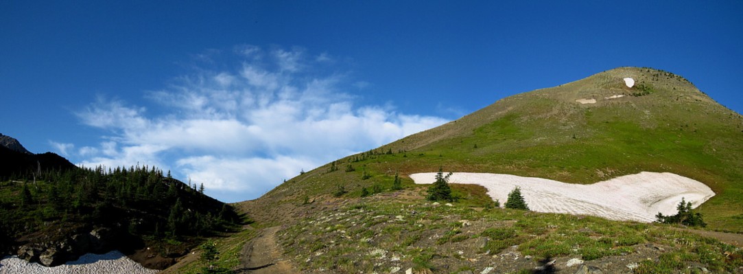
Although I felt great about completing these two peaks as a tribute to Miles, I was extremely disillusioned that I didn’t place the register at the top and vowed to return as soon as possible.
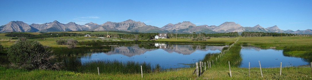
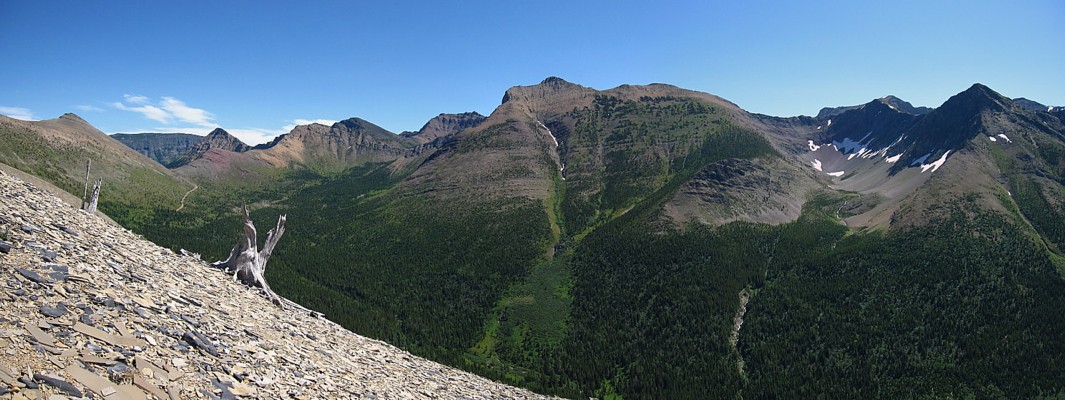
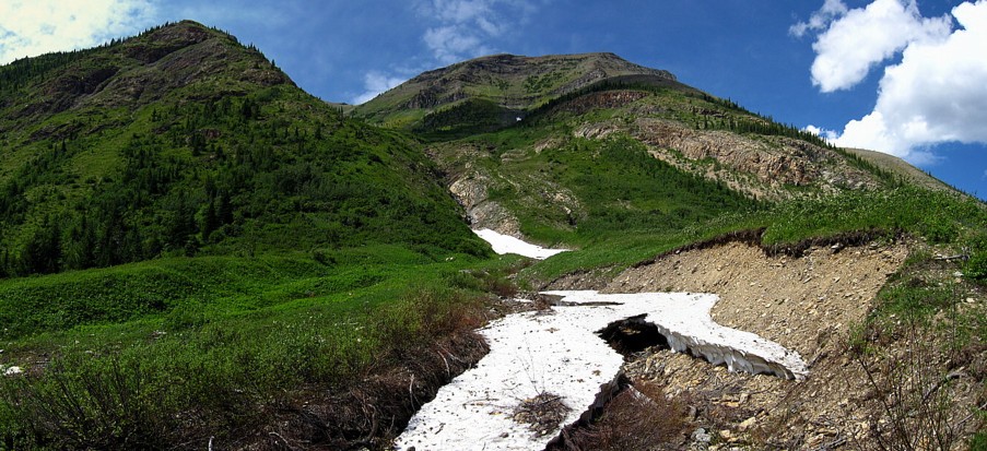
I
couldn't resist taking this photo of the Waterton and Castle areas on
the drive in
The first summit of Middle Kootenay Mountain; unusual to see snow at
this time of the year
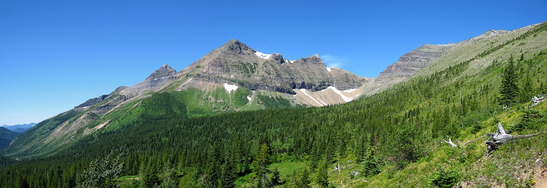
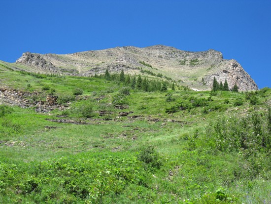
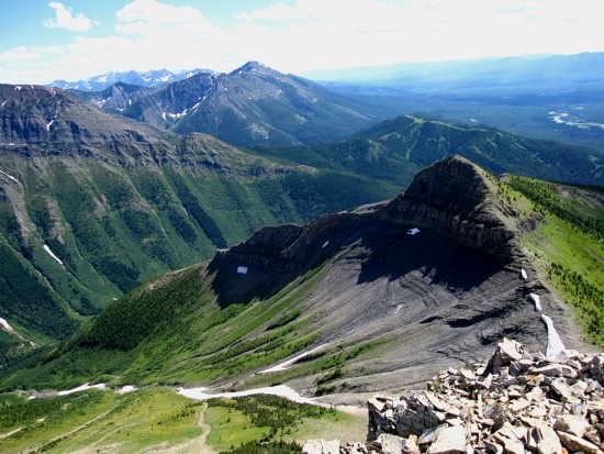
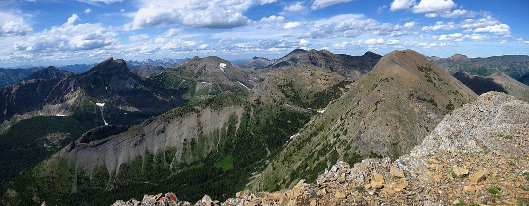
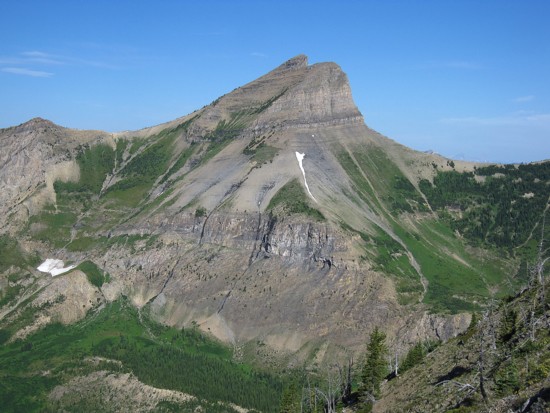
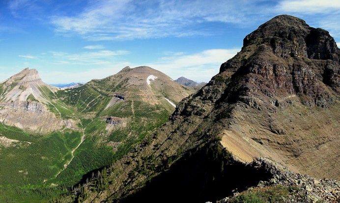
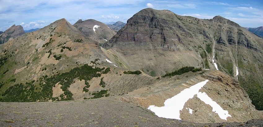
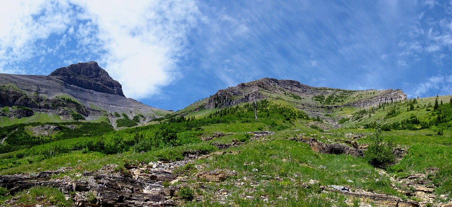
There they are! Mount Miles is in the centre and Krowicki Peak lies to
the left of Miles
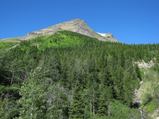
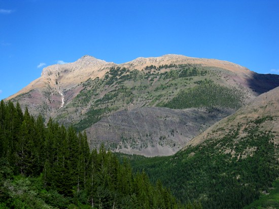
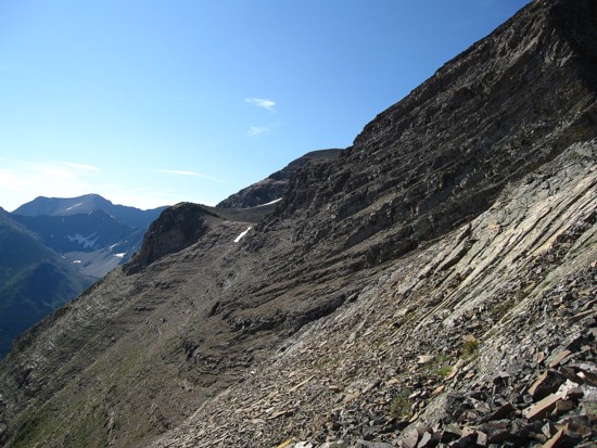
The southeast side of Miles
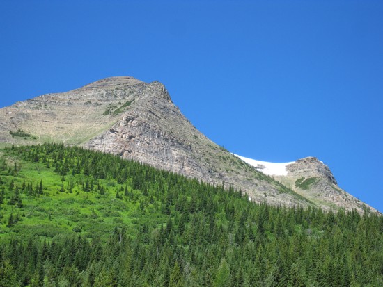
A closeup of the same side
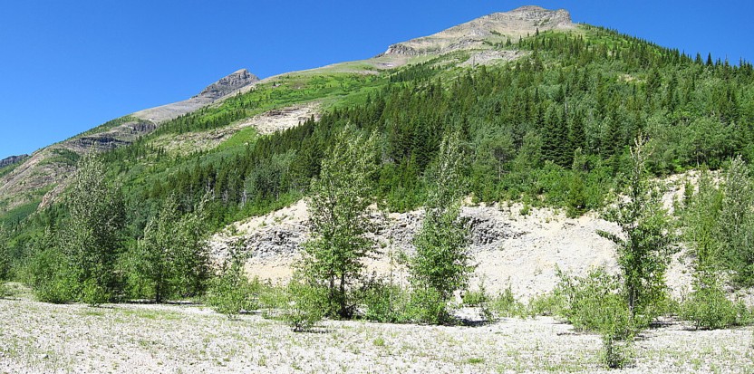
The
point where I started the ascent; 20 minutes of excruiating
bush-bashing could have been avoided if continued along the trail for 2
extra minutes!
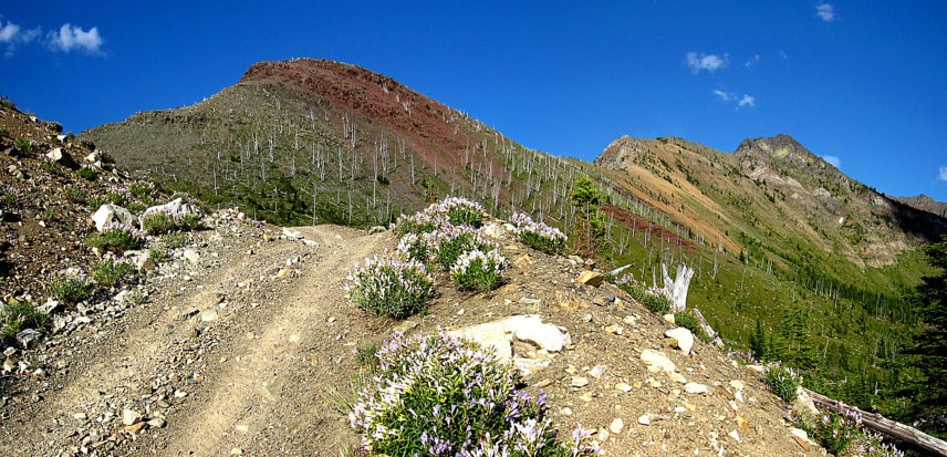
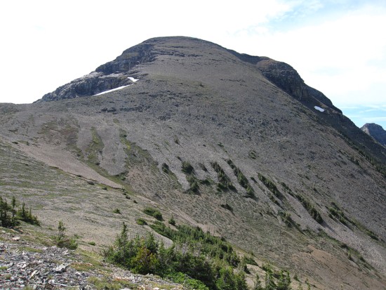
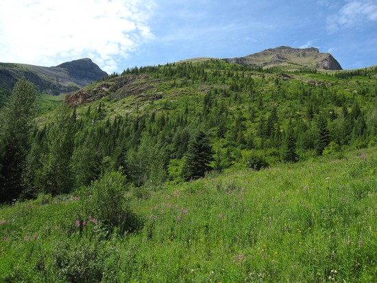
The middle and upper slopes of Miles
Typical terrain
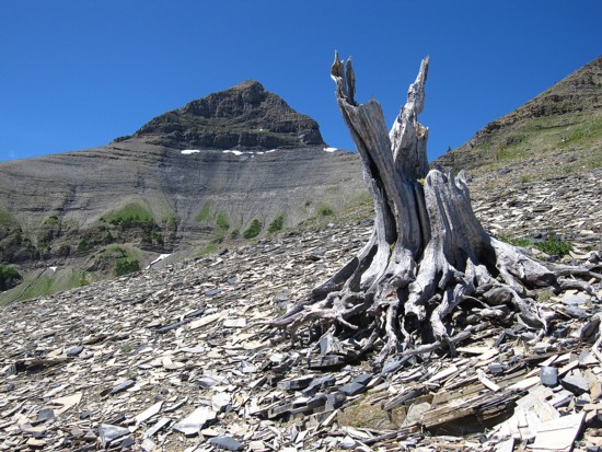
A
tree stump with Krowicki
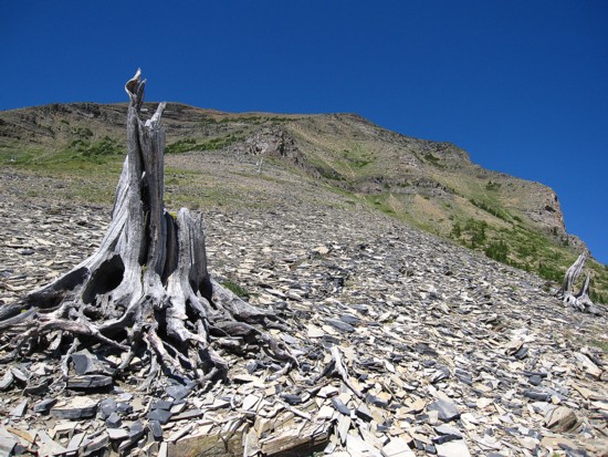
The
same tree stump with Miles
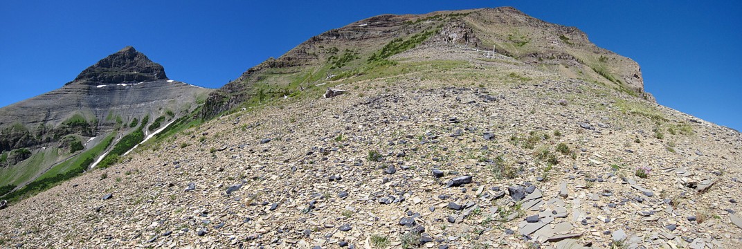
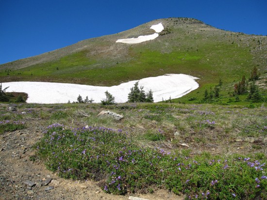
Getting higher; Miles is a slog from here, but Krowicki looks exciting
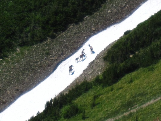
White-tailed deer on a snow patch on the slopes below Krowicki
Same as above
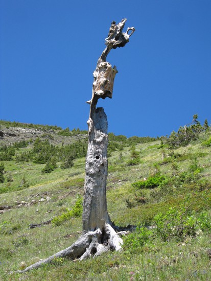
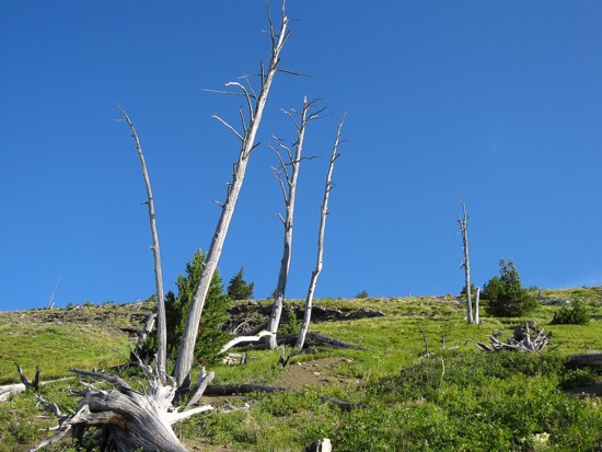
A lone, not-so-healthy-looking tree
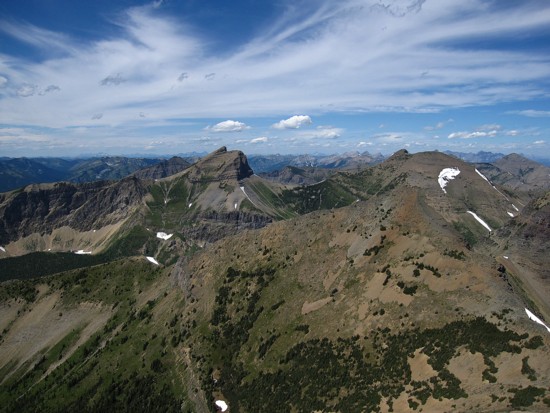
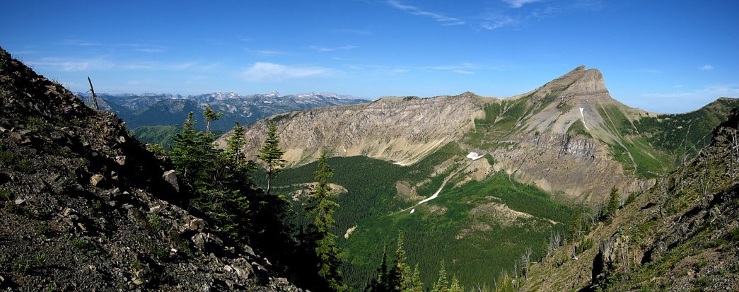
The view to the east starts to improve; Rainy Ridge and Three Lakes
Ridge are prominent
Tombstone Mountain (left) and Boot Hill as seen from the summit of Miles
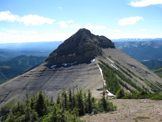
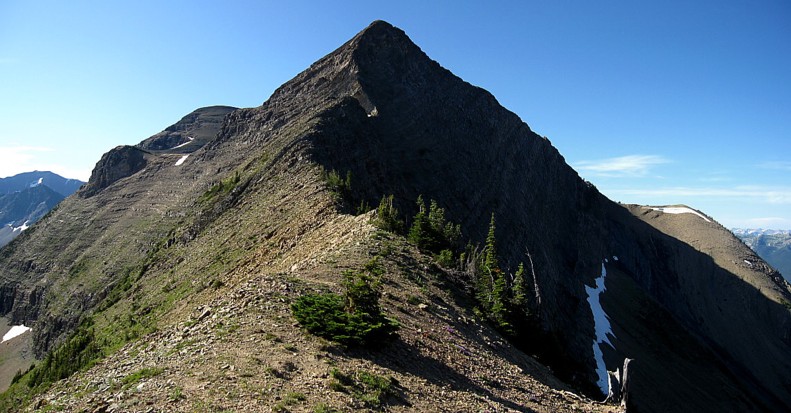
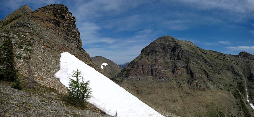
Heading down to the Miles/Krowicki col; Krowicki Peak is dead ahead
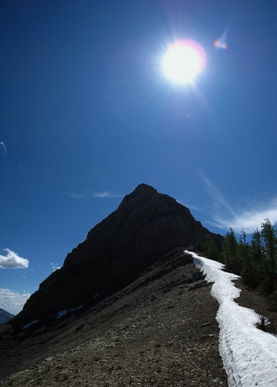
Approaching the base of Krowicki
Looking back to Mount Miles
An outlier southwest of Krowicki
A different perspective of Miles (left) and Krowicki
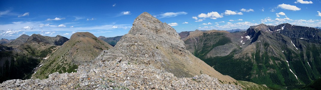
Same as above, with a whole bunch of other stuff thrown in
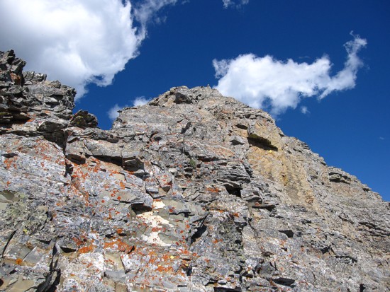
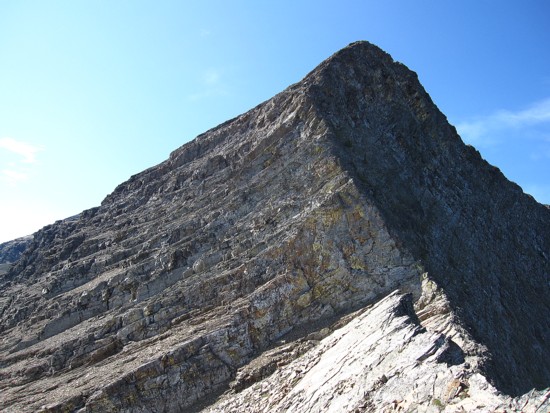
Typical rock on the southwest ridge of Krowicki
Jake Smith Peak (left) and Scarpe Mountain
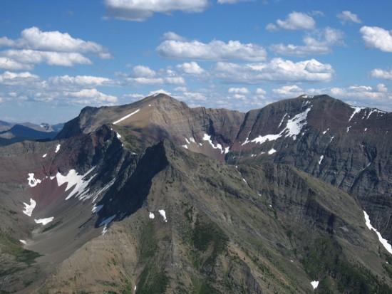
The summit view from Krowicki, with Miles at the right
The colourful hues of Three lakes Ridge
Returning to Middle Kootenay Pass; the three colourful humps all belong
to Rainy Ridge
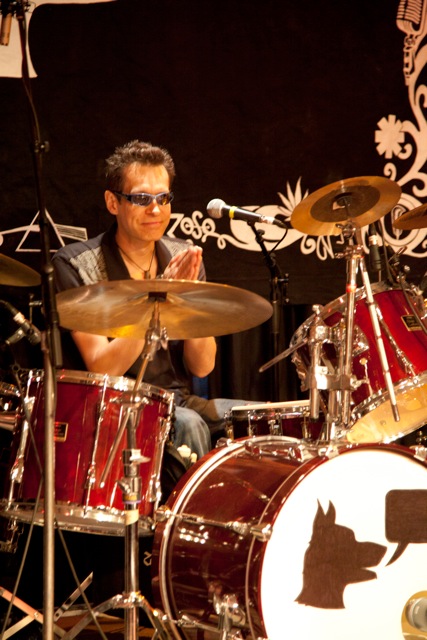
The
namesake of Mount Miles and Krowicki Peak; note the talking dog Miles
designed on his kick drum
Round
II
The
"soon as possible" came 8 days after the initial ascent. On August 10,
I started
up towards Middle Kootenay Pass armed with the summit register and 20
solid Miles
of determination – that didn’t work either!!!
 Upon
reaching the Pass, with the sting of losing 300 vertical metres of
elevation
upon me, I decided an attempt at an alternate ascent route was in
order. From
the Pass I would side-slope the south side of Middle Kootenay Mountain
to the
Middle Kootenay/Miles col. At that point I would go over the first
highpoint
and follow the ridge to the summit. If going over the highpoint wasn’t
possible
I would side-slope around it.
Upon
reaching the Pass, with the sting of losing 300 vertical metres of
elevation
upon me, I decided an attempt at an alternate ascent route was in
order. From
the Pass I would side-slope the south side of Middle Kootenay Mountain
to the
Middle Kootenay/Miles col. At that point I would go over the first
highpoint
and follow the ridge to the summit. If going over the highpoint wasn’t
possible
I would side-slope around it.
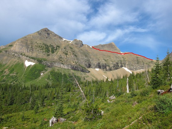
The
side-sloping
towards the col was easier than I thought it would be. The slog to the
col was
also easy but somewhat foreshortened. Then the fun began.
It
quickly
became clear that going over the first highpoint was way beyond
scrambling so I
would have to go around it. 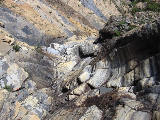 This involved a seemingly easy traverse on scree
slopes below the highpoint to highpoint/Miles col. Easy my butt!!! It
turned out
to be 45 minutes of heart-thumping, teeth-grinding, nerve-wrenching ,
testicle-shrinking,$%#*!%^-clenching
travel across some of the most precarious terrain imaginable. The
several hundred
metres of distance took 45 minutes because I had carefully place each
step to
make sure I had stable footing and didn’t start any scree avalanches
underfoot.
A slip at any point may have sent me plummeting over the cliffs below,
the
slope been deceivingly steep.
This involved a seemingly easy traverse on scree
slopes below the highpoint to highpoint/Miles col. Easy my butt!!! It
turned out
to be 45 minutes of heart-thumping, teeth-grinding, nerve-wrenching ,
testicle-shrinking,$%#*!%^-clenching
travel across some of the most precarious terrain imaginable. The
several hundred
metres of distance took 45 minutes because I had carefully place each
step to
make sure I had stable footing and didn’t start any scree avalanches
underfoot.
A slip at any point may have sent me plummeting over the cliffs below,
the
slope been deceivingly steep.
Thankfully,
I safely arrived at the col, where I took some time to allow my
testicles to
descend back to their correct home. I then immediately put the
aforementioned route
onto my list of “Routes recommended for serial killers, terrorists, and
people
who think Star Trek is for geeks.”
The trek to the summit of Miles from there on was mercifully easy. I constructed a fairly lame cairn, made a couple of really lame movies, took a few self-timed, intensely lame photos, and placed the register - the first register, I might add, I’ve ever left at a summit. Another Tangerine Fanta was consumed and a lengthy summit rest to take in the excellent view followed.
I
decided to forgo another ascent of Krowicki and settled for the fastest
route
down to the Middlepass Creek Trail. This route simply went straight
down the
southeast face of Miles. As luck would have it, after trying three
different
routes up and down this mountain, the fourth would turn out to be best,
thanks
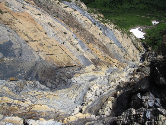
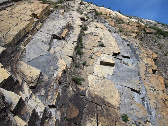
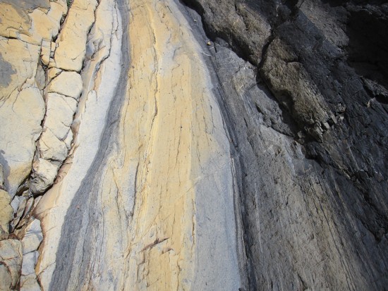
to an extraordinary water-worn gully near the bottom of the slope.
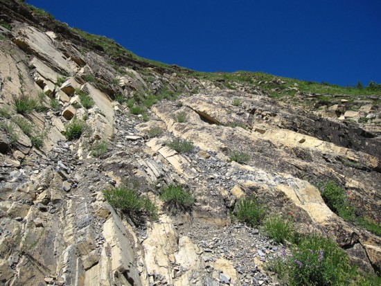
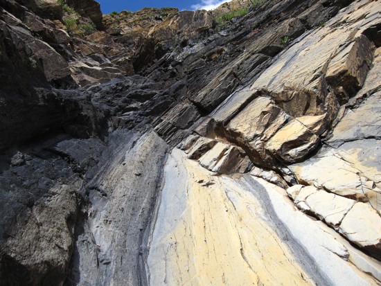
Scrambling
down the gully was fun and a wonderful visual treat, with beautiful
layers of colourful
rock. Scrambling up it would be a downright blast!
Another
unique surprise appeared further on in the form of a snow cave spanning
the drainage.
Though perhaps a questionable decision to go into the cave (I
suppose if I had the worse luck in the entire universe, it could have
collapsed on my head),
my life has been one questionable decision after another and look
how well it’s turned out!!
I
found the hike back up to the Pass to be remarkably easy, as I was
still riding
the high from placing the register and the terrific gully on descent. A
tiring,
but satisfying downhill stroll ended a truly memorable day out on a
truly memorable mountain.
Epilogue
II
It’s
official (but really unofficial!): Mount Miles and Krowicki Peak are
now part
of this beautiful planet. Here’s to you Miles!
P.S.
Coming soon: "Sparks
Hill" and "Jeff - A
Resident Of Ramsey - Mountain"
Approaching
Middle Kootenay Pass yet again!!
Simplicity
The red line represents the "Death Traverse" from a distance
Getting closer to the col and another view of the Death Traverse
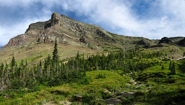
The southwest side of Middle Kootenay Mountain
The one-of-a-kind form of Tombstone Mountain
....and some more stuff
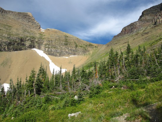
At the col, looking towards the first highpoint
Near the base of the highpoint
The Death Traverse; looks innocuous, but trust me it's nasty with
capitals N-A-S-T-Y
Looking back to Tombstone, Boot Hill, and Middle Kootenay
The easy stroll to the top of Miles
The highpoint and Middle Kootenay; in retrospect I should have walked
to the top of the highpoint
and named it Mount Wojcieh
just to see people's reaction
Another similar view to the northeast
CLICK HERE TO SEE THE SUMMIT MOVIE
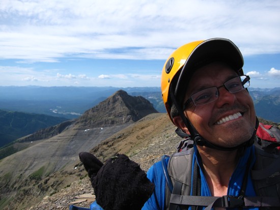
Mount Miles gets the thumb up
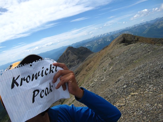
Pointing out Krowicki Peak
CLICK HERE TO SEE THE FANTA MOVIE
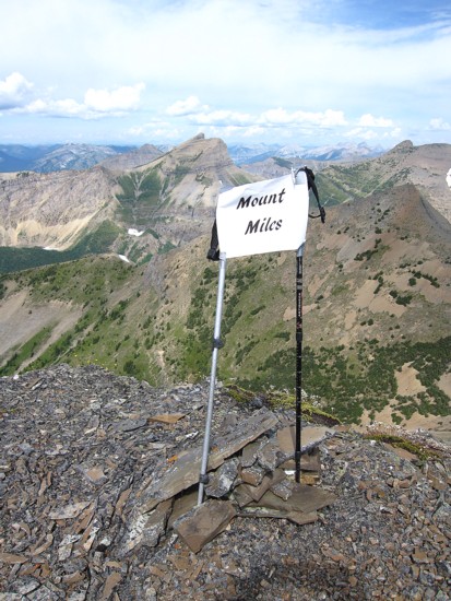
The intricately designed plague at the summit; note the cool, matching
hiking poles
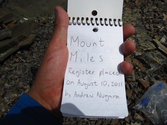
The first page of the summit register
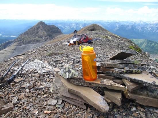
The water bottle where the register will reside; bottle courtesy of
Kevin Barton - thanks Big Guy!
CLICK HERE TO SEE THE SUMMIT REGISTER MOVIE
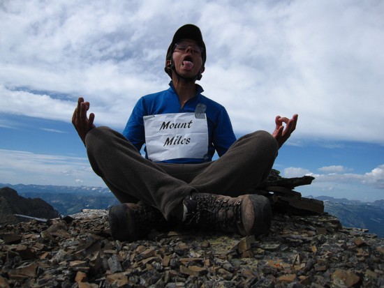
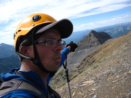
A master yogi practitioner at the summit;
Hiding my face in shame because I was too lazy to make another trip to
Krowicki
On descent, a good look at the two peaks
The severely cool descent drainage
Yikes!!
Ooooooo!!
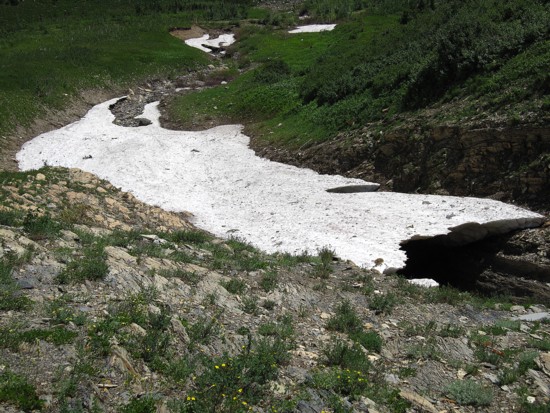
The snow bridge over the drainage; it's difficult to see the scale
here, but you can easily walk upright into the cave
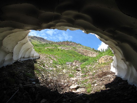
From the inside looking out
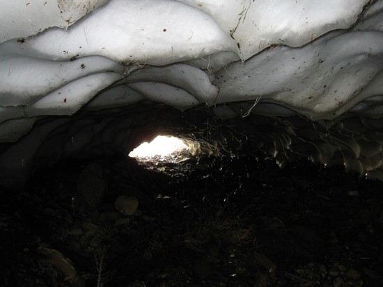
The end of the cave; the cave entrance was about 2 metres high
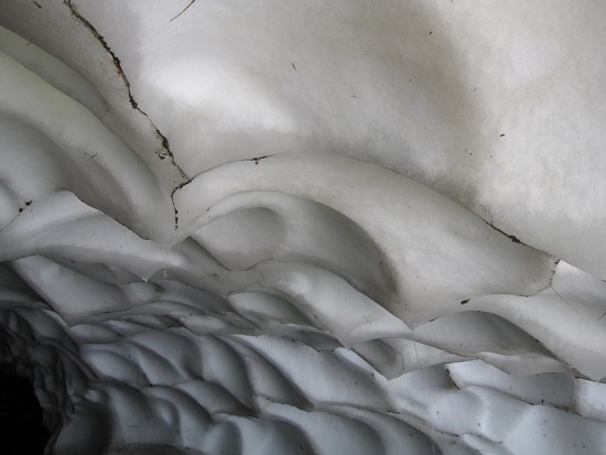
The roof
The cave and Mount Miles
A last look at Miles and Krowicki
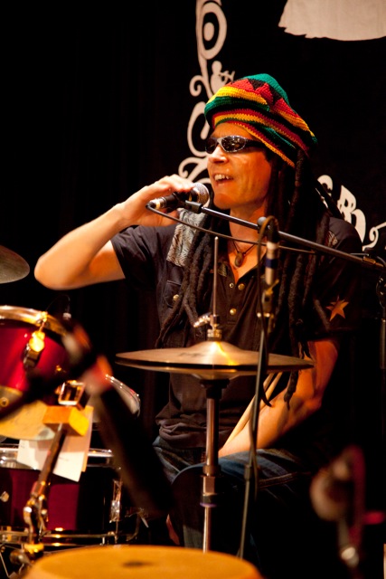
...but another look at Miles Krowicki; i-ree, i-ree mon!

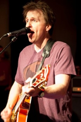
Sparks
Hill
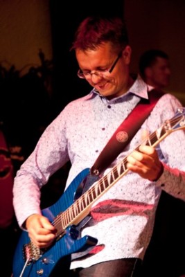
A
Resident of Ramsey Mountain
Mount Needs A Better Haircut
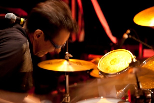
Miles given' er' as he always does; there's no half-ass with Miles, he
goes all the way, all the time
You're the BEST buddy!