Mount Richards III
July 16, 2021
Mountain height: 2416 m
Elevation gain: 1452
m
Ascent time: 4:50
Descent time: 4:00
Scrambling with Dave.
My
third ascent of Mount Richards would hopefully
string together the best sections of several different routes I'd taken
over
the years into one glorious route! Dave and I also discussed the option
of
traversing from Richards to Alderson, though this would make for
an
exceedingly long day. Doug Lutz had recently completed the traverse,
reporting
it to require significant elevation losses en route to Alderson and
a very lengthy descent route - a decidedly Herculean effort! We would put
that idea in our back pocket for the time being.
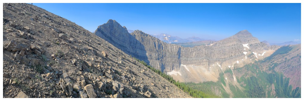
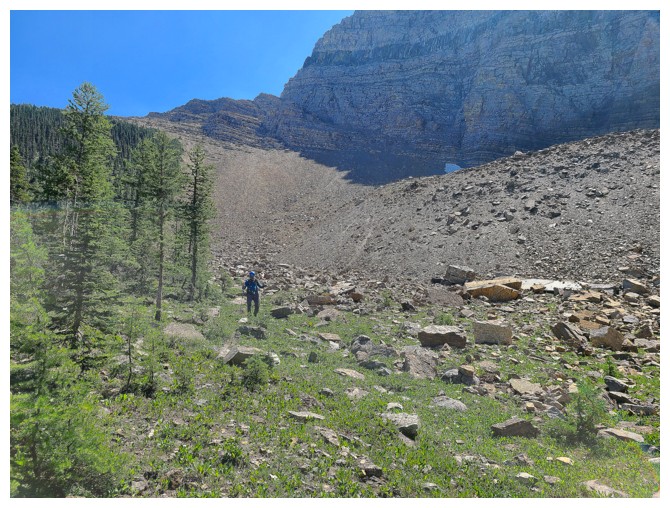
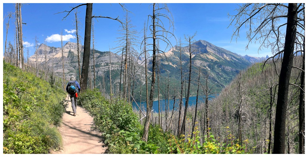
After
hiking to Bertha Lake and then around the
east side of the lake, we walked right by the intended ascent gully.
The gully
is not obvious from the trail. A little backtracking brought us to
the start
and from that point on we enjoyed wonderful rock, scrambling, and views
almost
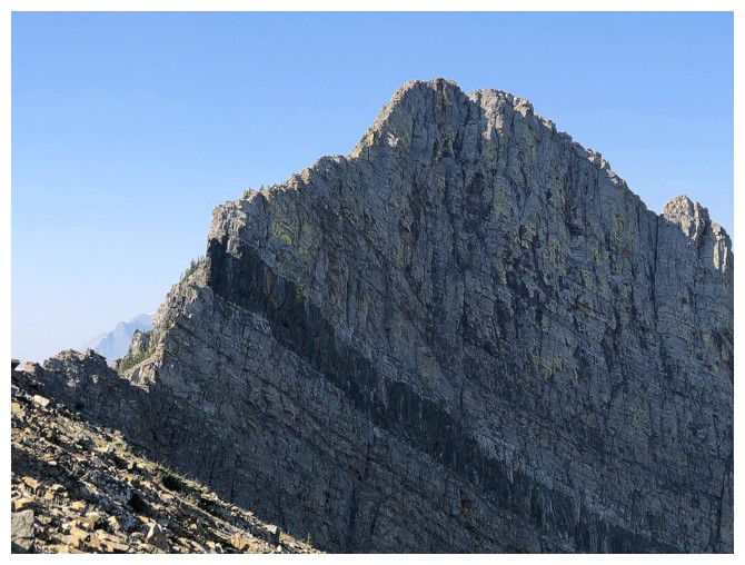
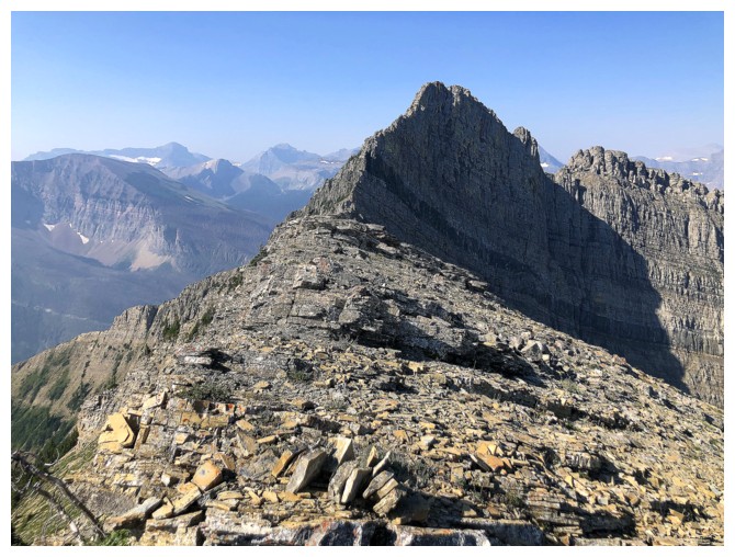
all the way to the false summit of Richards (a significant peak on the
ridge that I like to
call "Little Richards"). The upper-mid section of the gully gets
fairly steep, but I had once ascended most of the terrain wearing
snowshoes, so we weren't
overly worried. The only disappointing aspect of the trip at this point
was the smoky skies, though they could have been much worse.
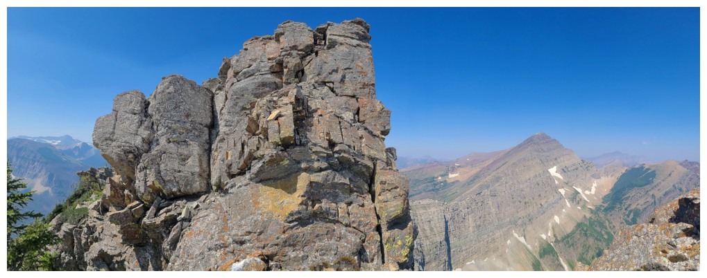
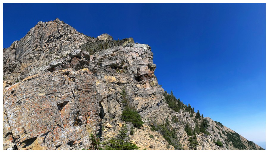
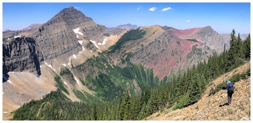
The ascent of "Big Richards" was all fun
and games too! The northeast side offers excellent scrambling and route-finding
opportunities and is a blast from the get-go. However, the mountain is not to
be taken lightly. If not careful, you can quickly get onto serious
terrain. Even though Richards appears to be a relatively short trip, from
Bertha Lake to summit had taken 3.5 hours (almost 5 hours from parking lot to
summit). We both agreed that attempting Alderson would probably make for a 12–16-hour
day with an epic amount of elevation gain. Better to enjoy the view from Richards and then
retrace our steps.
We did exactly that, except for choosing the easier
route down to the lake. From the lakeshore we followed the good trail around
the west side, thus circumnavigating the entire lake. The rest of the trip was
(and always is) mercifully easy.
Mission accomplished - a glorious route up a glorious mountain, with a glorious scrambling partner!
Click HERE to see Dave’s report.
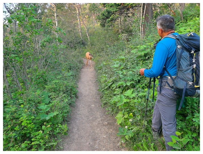
Someone is getting is someone's way and it's not the furry, four-legged dude!
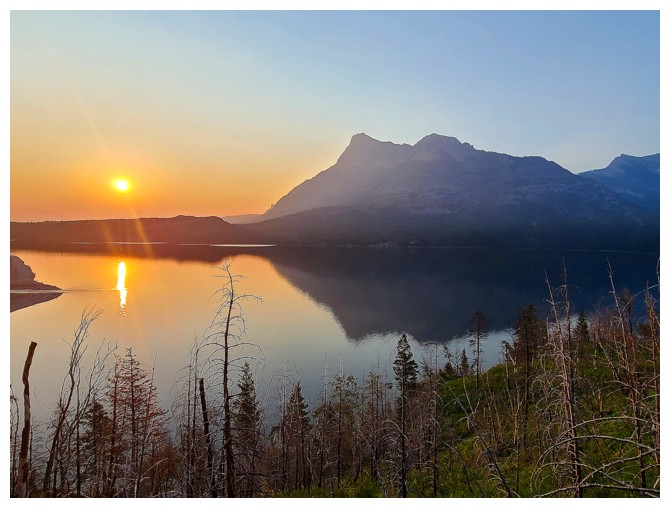
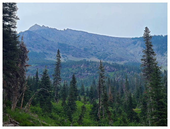
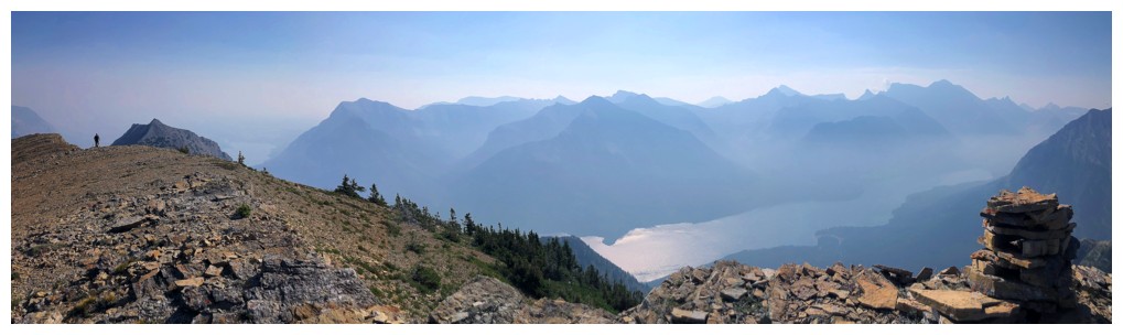
Morning Sun and Vimy Peak
Approaching the first viewpoint (photo by Dave)
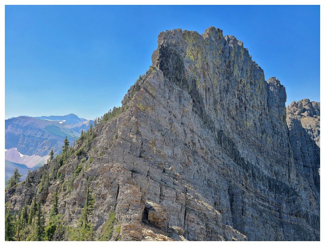
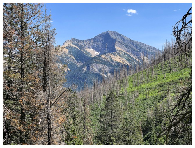
First good view of the north summit of Mount Richards (photo by Dave)
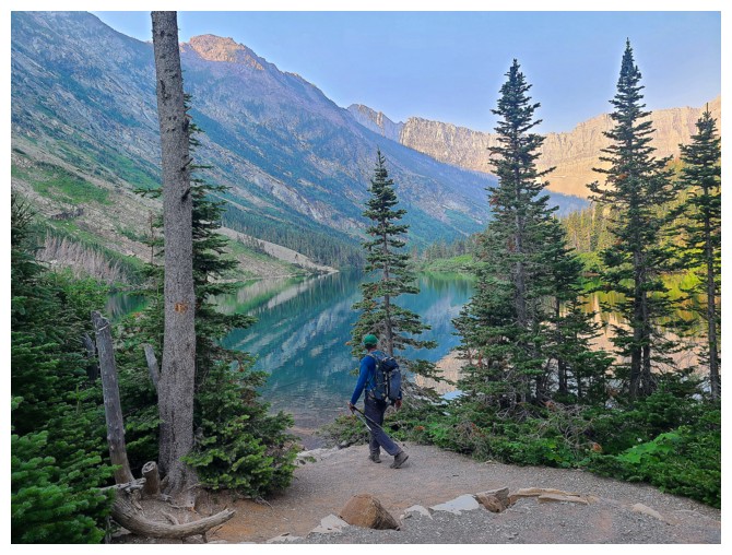
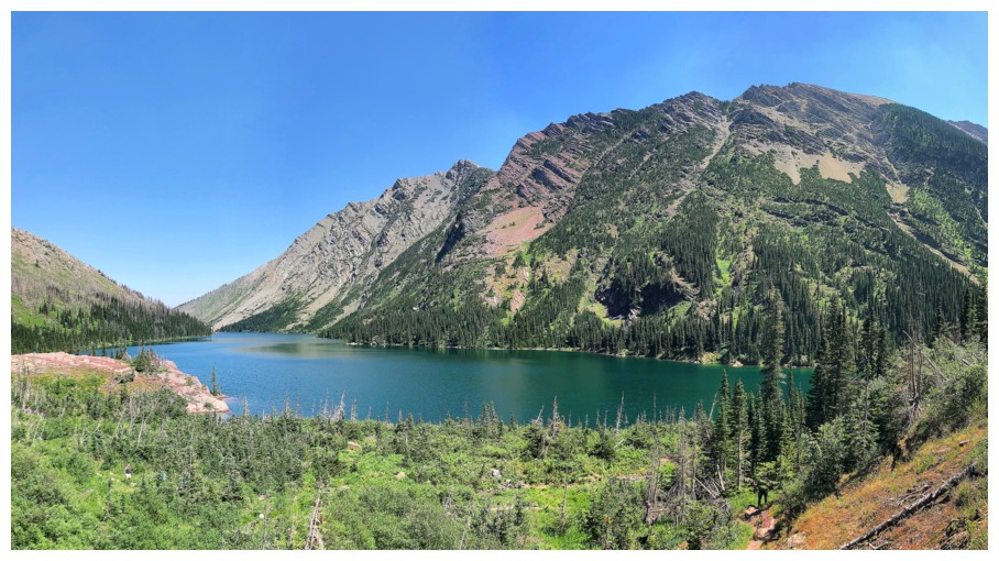
Arrival at Bertha Lake (photo by Dave)
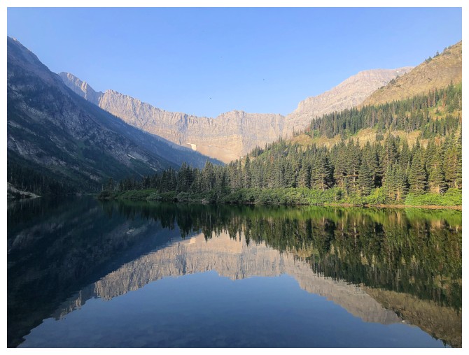
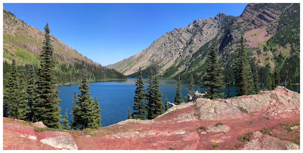
Mandatory reflection shot
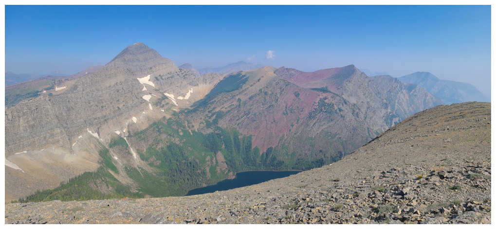
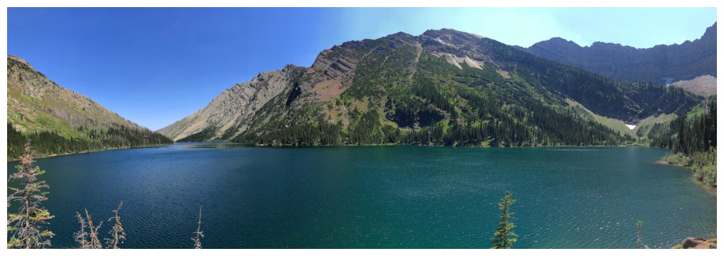
Another reflection with Mount Alderson in the centre
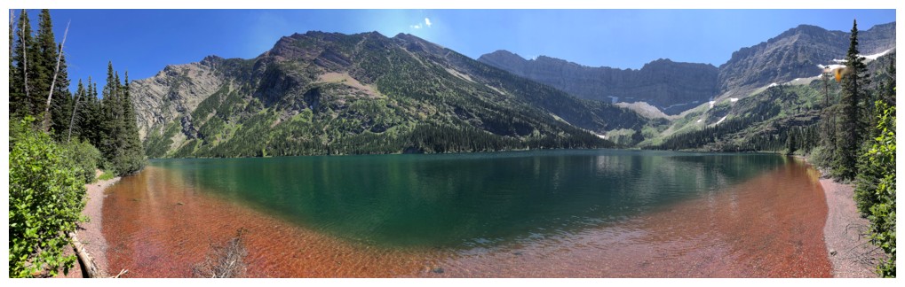
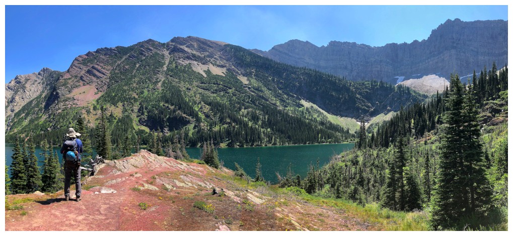
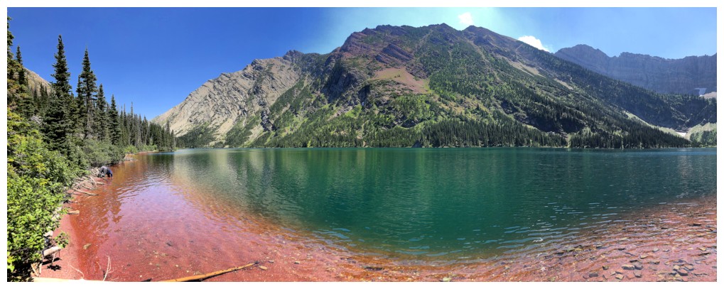
On the red argillite beach - a favourite spot along the lakeshore (photo by Dave)
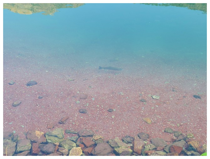
A rainbow trout (photo by Dave)
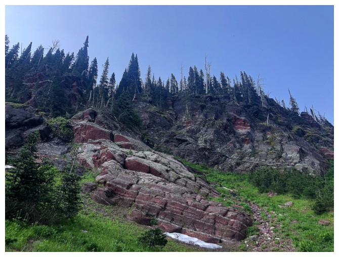
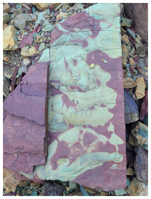
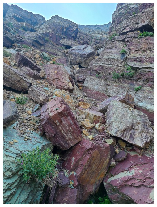
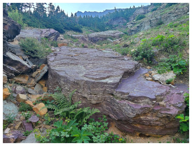
The west side of the north ridge of Richards is littered with red argillite
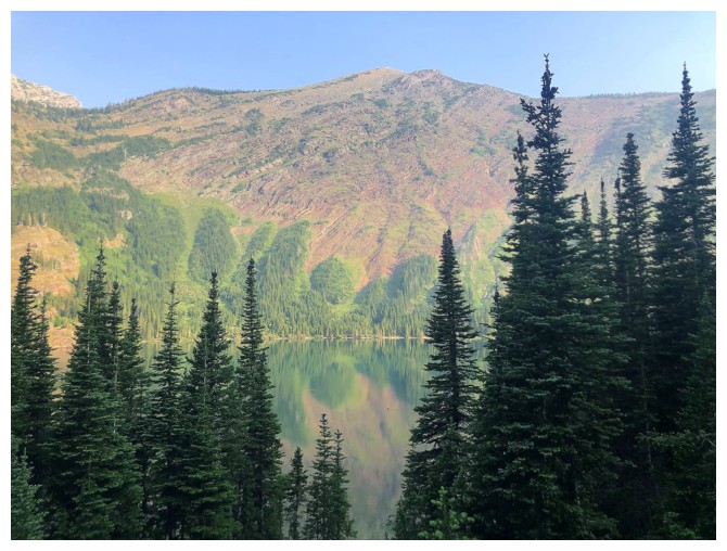
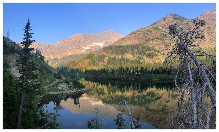
Still getting good lake reflections
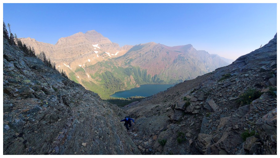
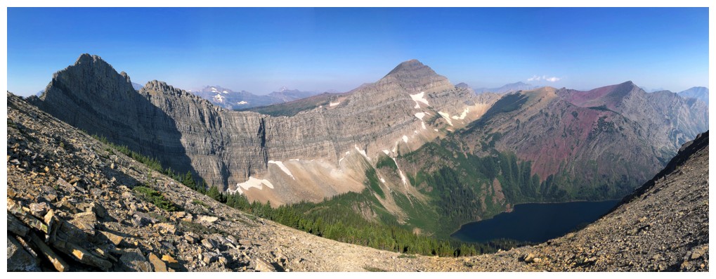
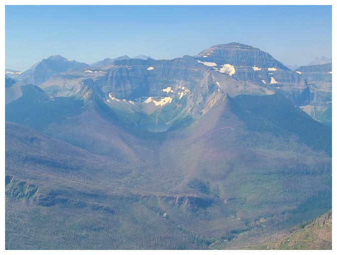
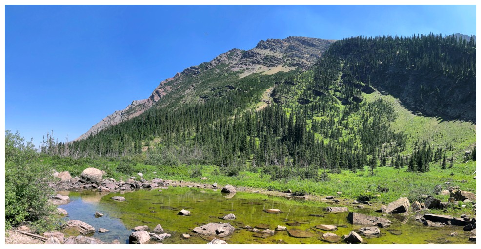
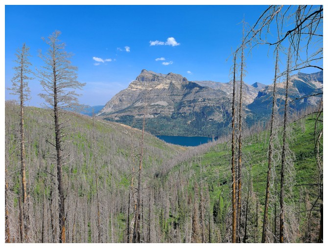
Eventually we would end up ascending the gully at the right (photo by Dave)
But
first we are going to hike right past the gully (unintentionally) to
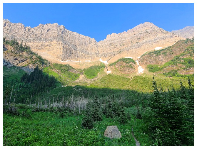
get a great view of Alderson's imposing east face (photo by Dave)
Heading up (photo by Dave)
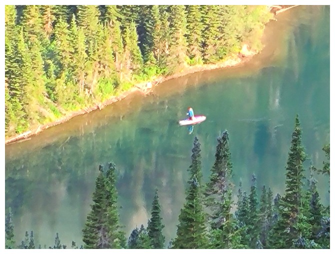
Dave zooms in on a very dedicated fisherperson (photo by Dave)
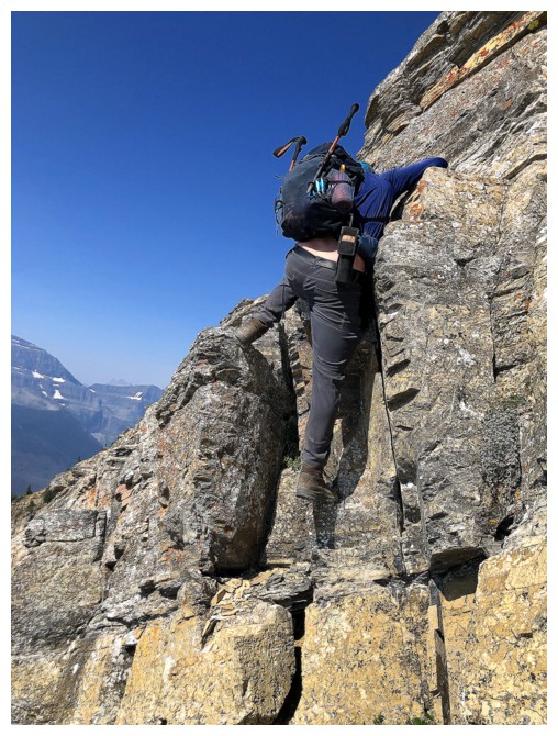
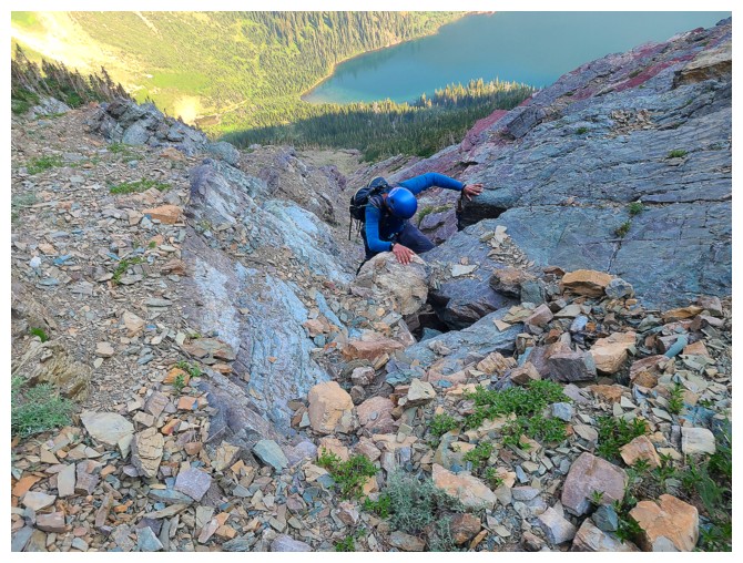
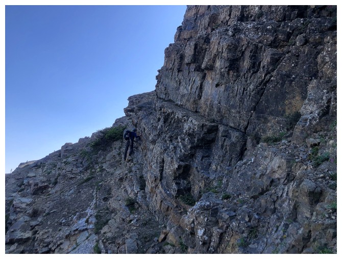
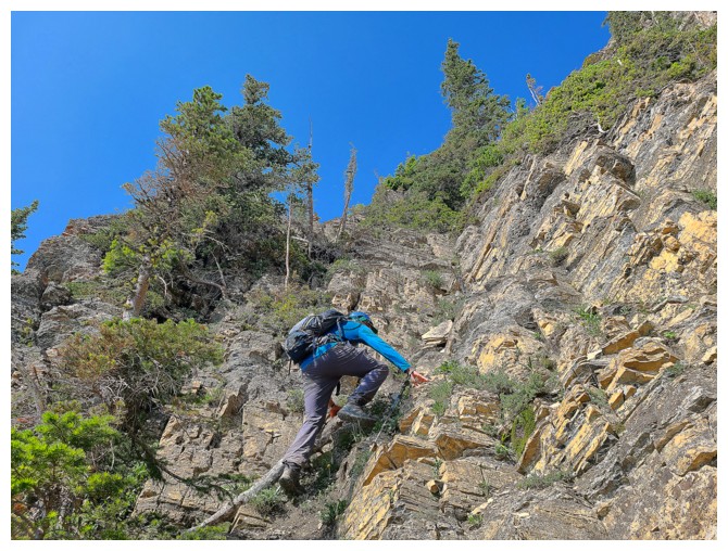
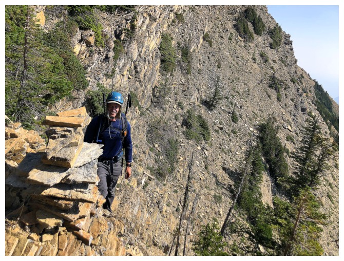
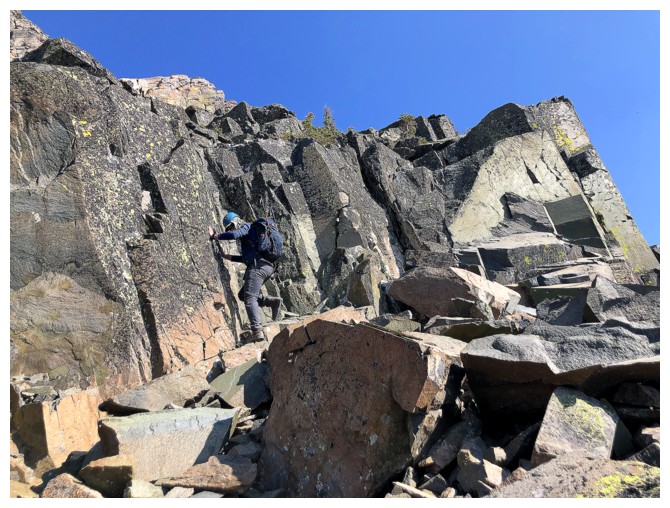
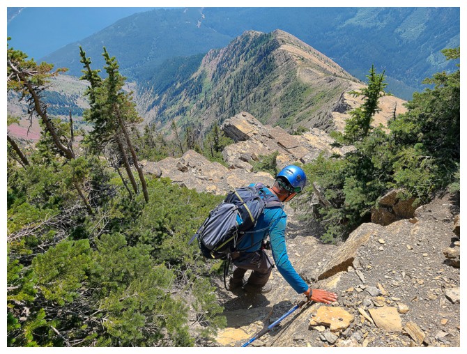
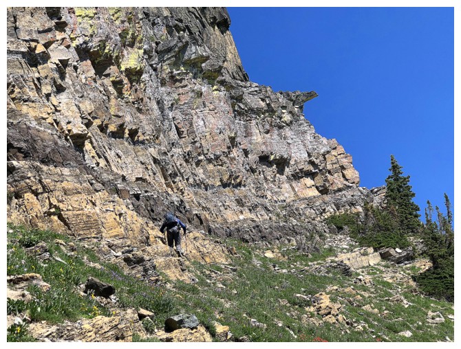
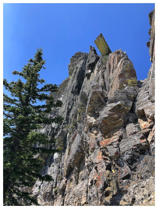
In the ascent gully and ready to enjoy the colourful rock and terrific hands-on scrambling (photo by Dave)
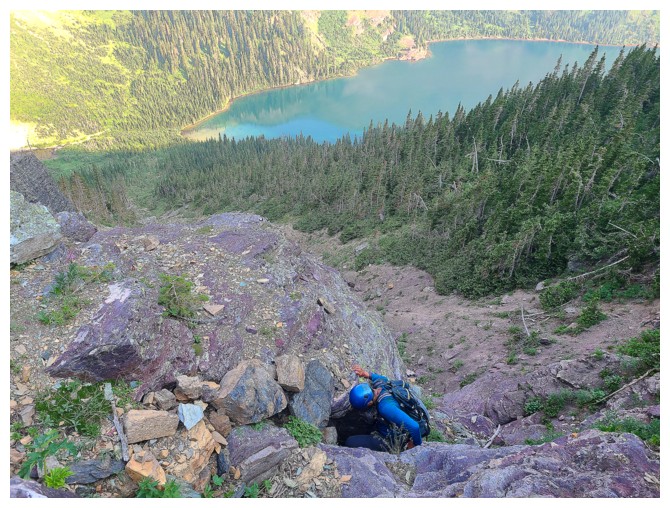
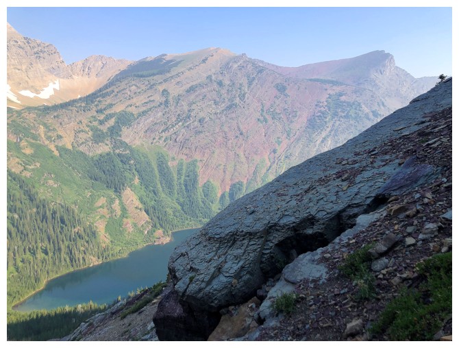
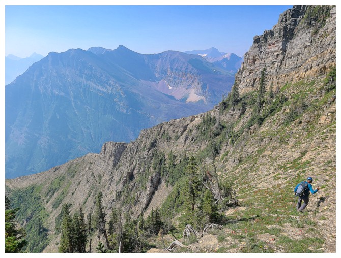
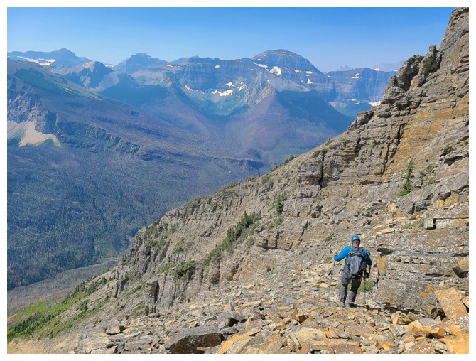
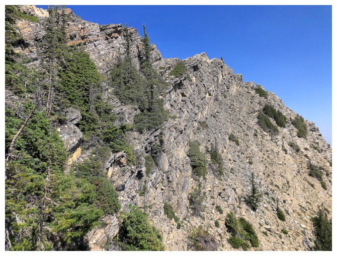
Views of Bertha Lake improve throughout (photo by Dave)
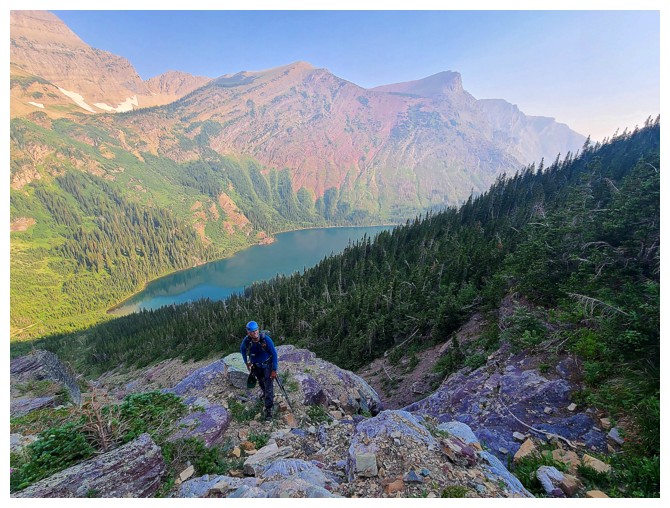
Same as above (photo by Dave)
Too bad the Sun's rays haven't yet reached the gully
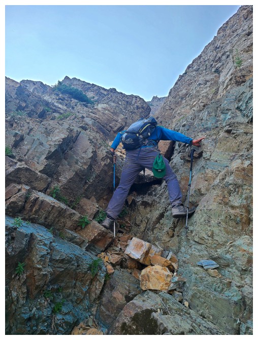
Another easy step (photo by Dave)
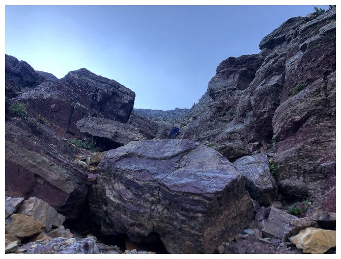
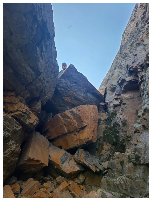
Tight squeeze (photo by Dave)
Bertha Peak (right) is now fully visible (photo by Dave)
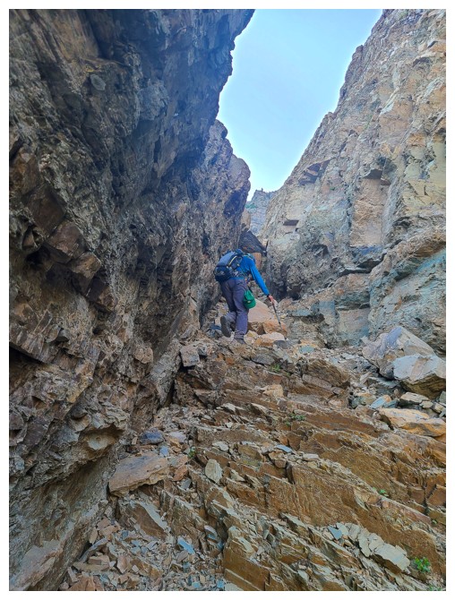
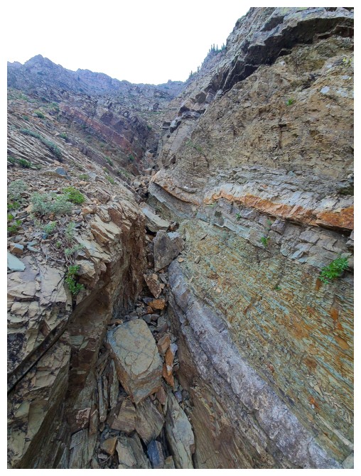
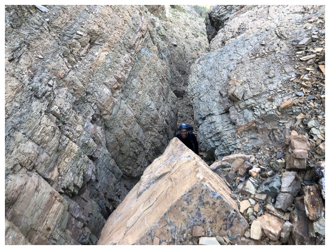
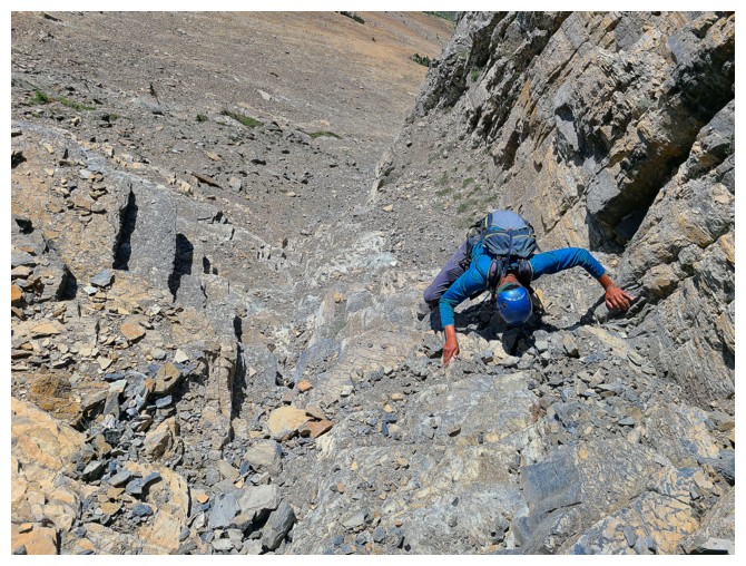
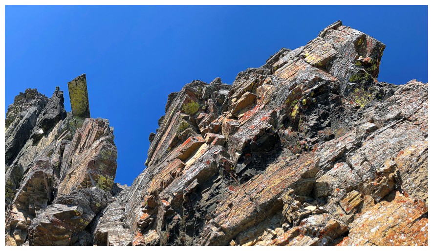
A cool canyon-like section of the gully (photos by Dave)
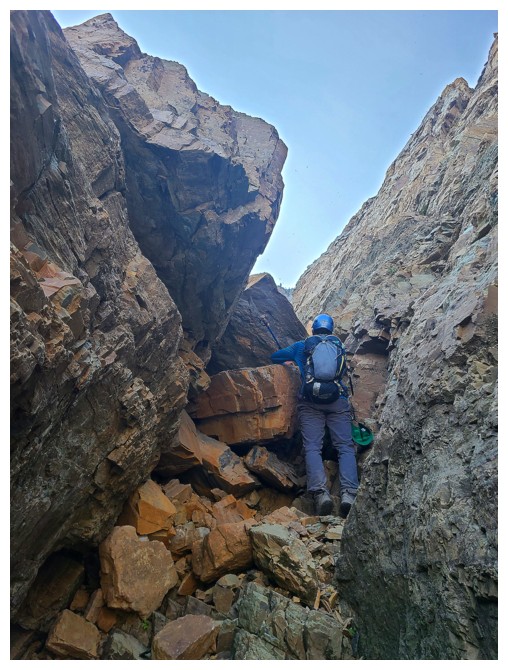

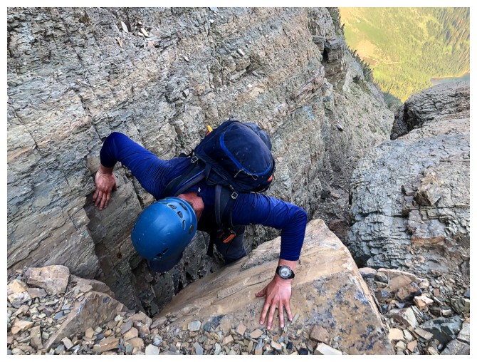
Getting around a few chockstones (photos by Dave)
Up (photo by Dave)
Dave below the chockstones
Almost above
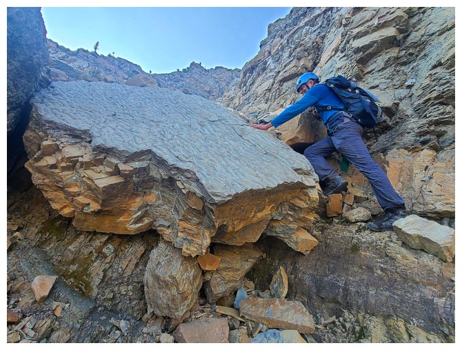
Good thing I only have the arm strength of a 6-year old! (photo by Dave)
Nearing the top of the gully, Dave went left...
...I went right (photo by Dave)
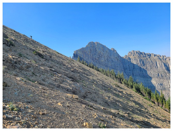
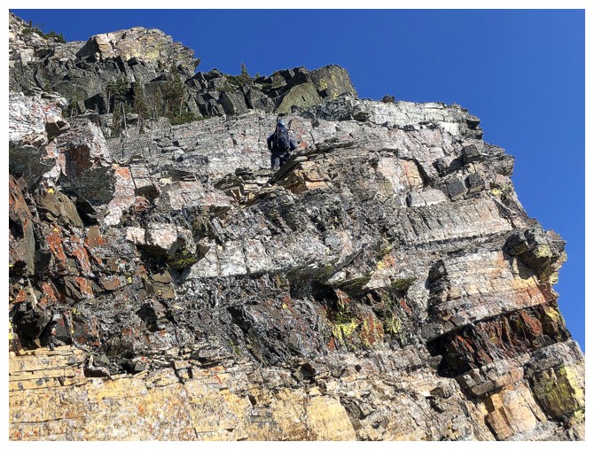
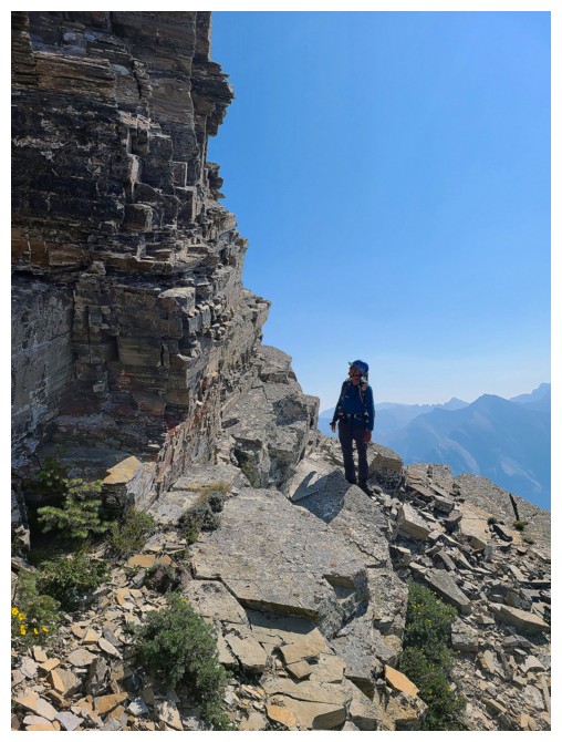
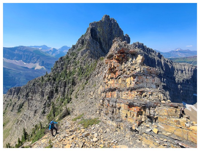
Dave gets a shot of me (upper left) slogging up towards Little Richards (photo by Dave)
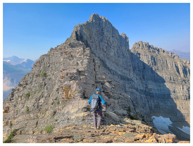
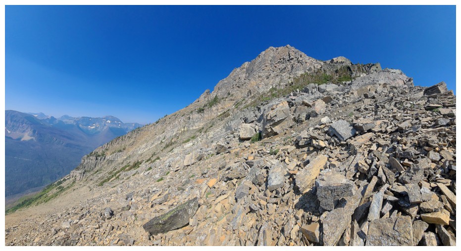
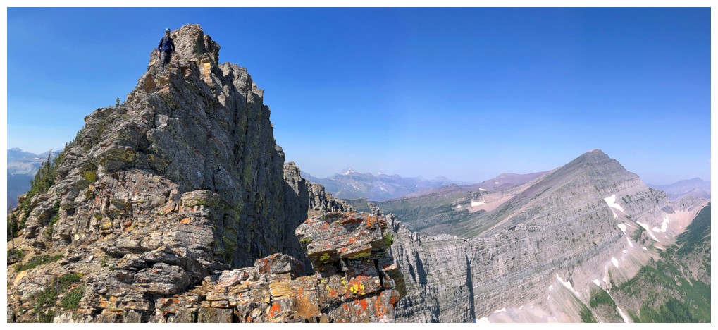
Taking a breather to admire the scary-looking ridge to the summit of Richards
...and much more
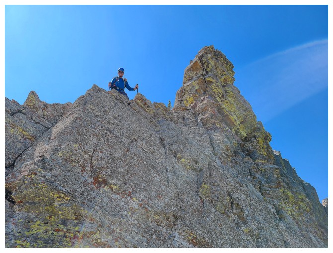
On the ridge
Dave's view from his route (photo by Dave)
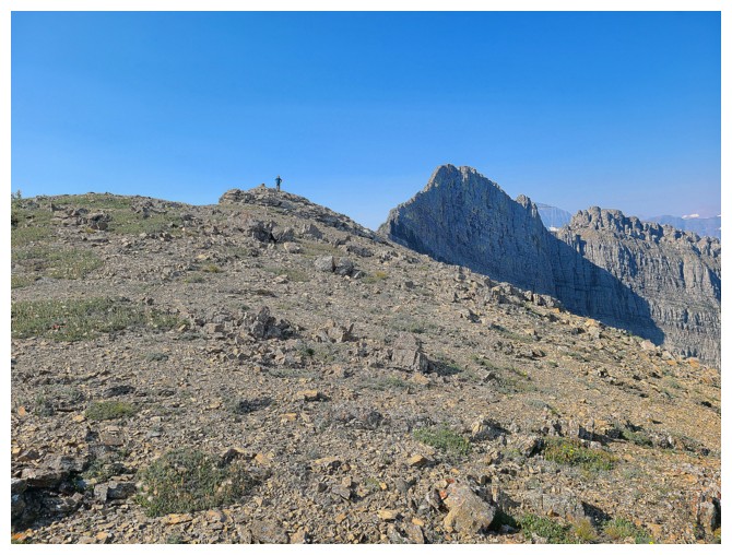
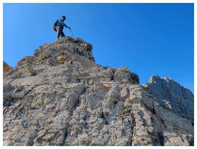
Waiting at the summit of Little Richards (photo by Dave)
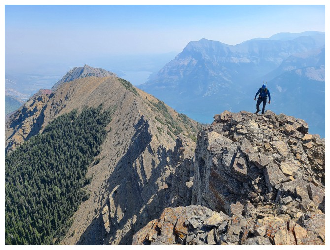
Here comes Dave (far left)
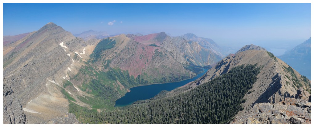
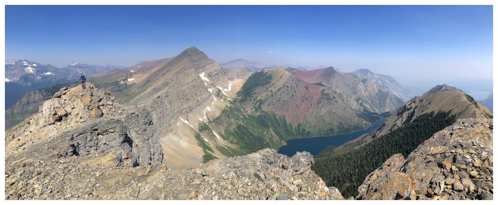
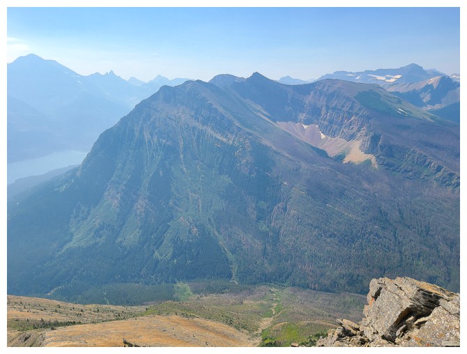
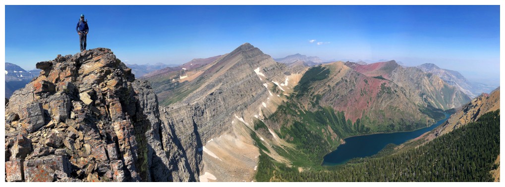
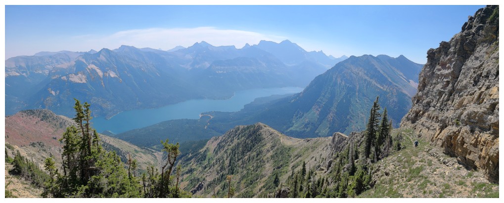
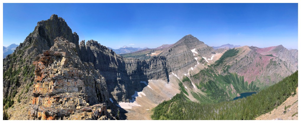
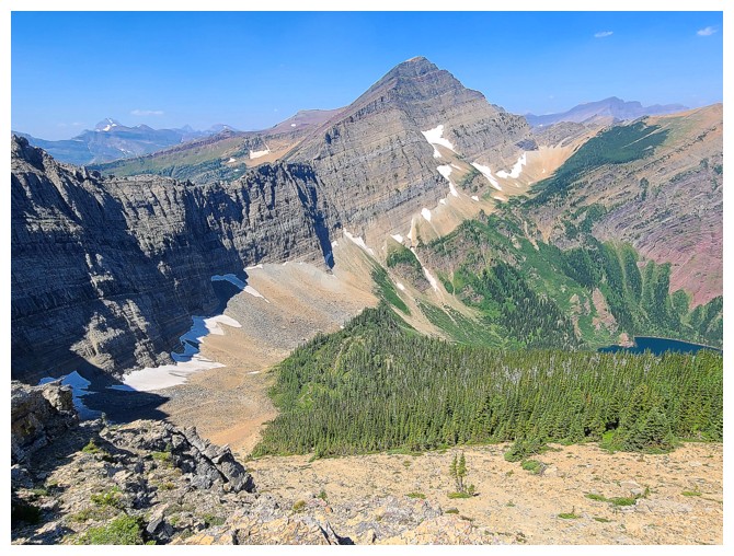
Summit view including Richards and Alderson (photo by Dave)
Another, including Alderson and Bertha (photo by Dave)
Resuming travel towards Richards (photo by Dave)
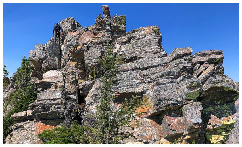
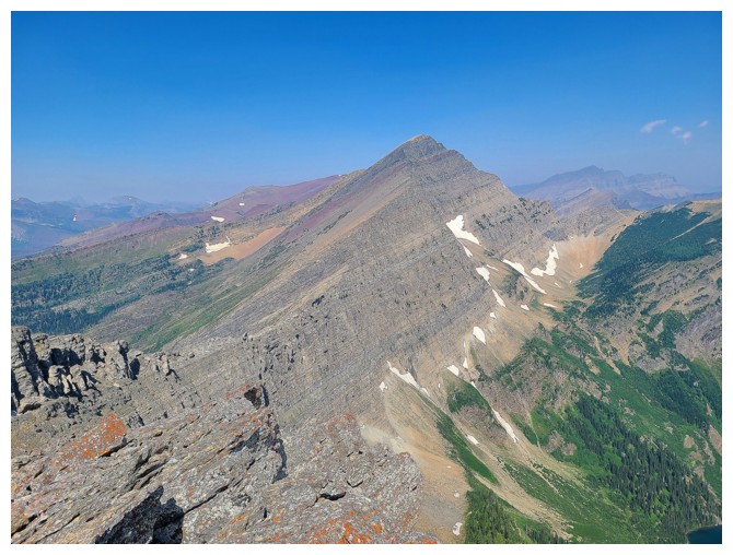
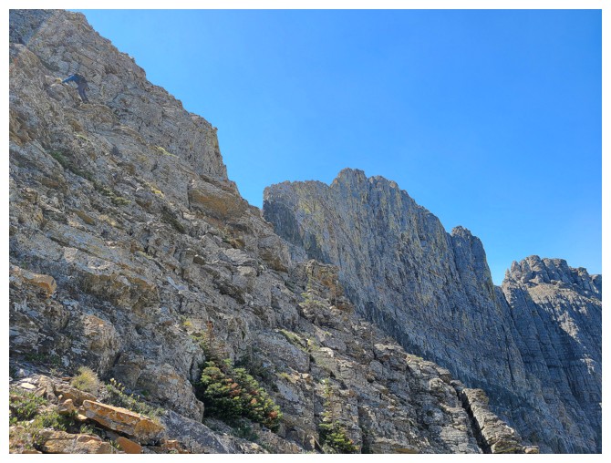
Following the ridge ahead to the summit is not an option for scramblers (photo by Dave)
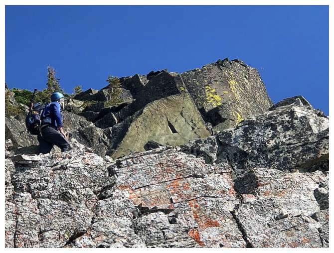
Atop a small rock step (photo by Dave)
Dave climbs it
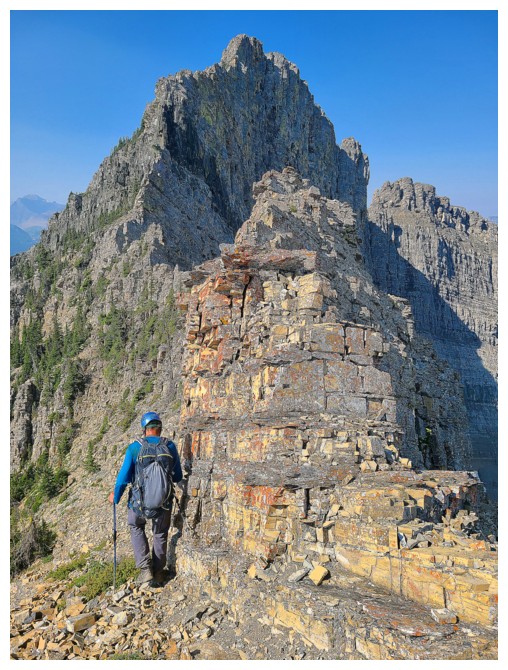
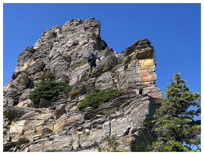
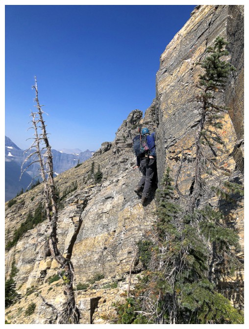
Scrambling up to the ledge that grants access to southeast side of the mountain (photo by Dave)
Dave and one of several cairns that mark the route
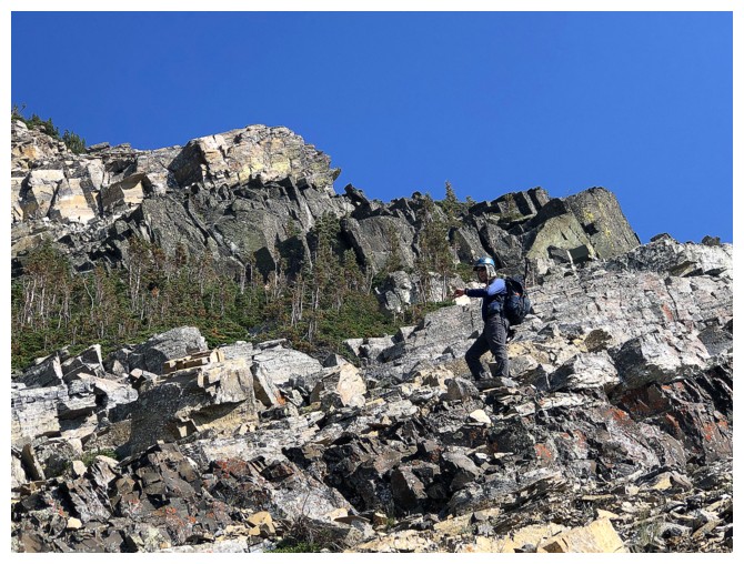
Past the ledge and onto more spacious terrain (photo by Dave)
On the southeast side (photo by Dave)
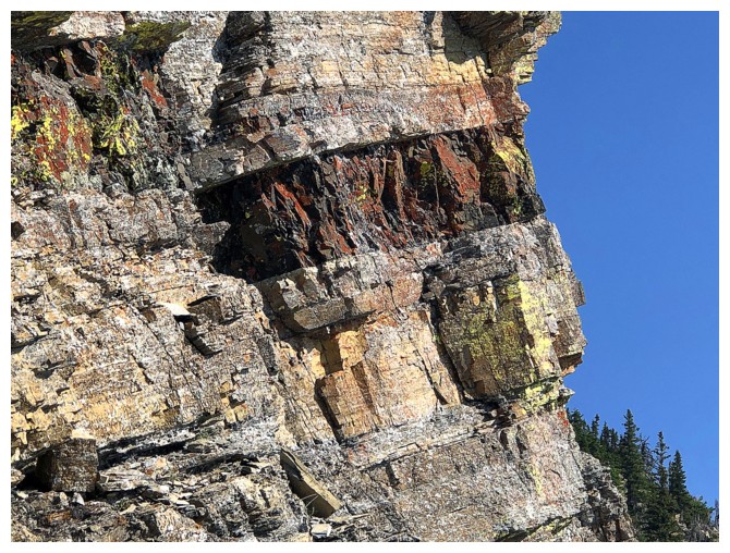
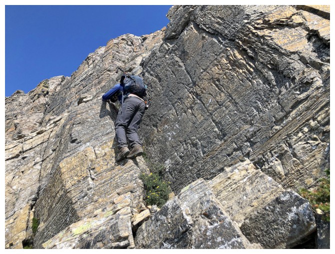
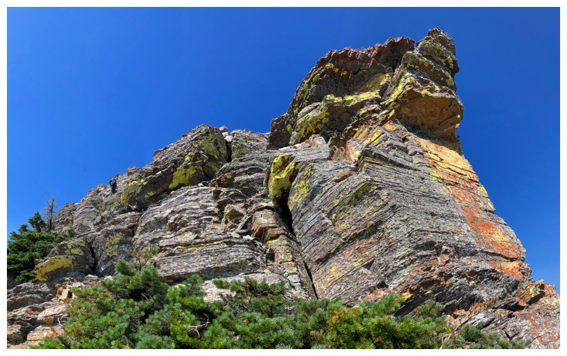
The southeast side offers interesting route-finding and fun scrambling
...plus the rock is amazing throughout
It sure is!
Dave contemplates one of numerous route decisions
More interesting rock
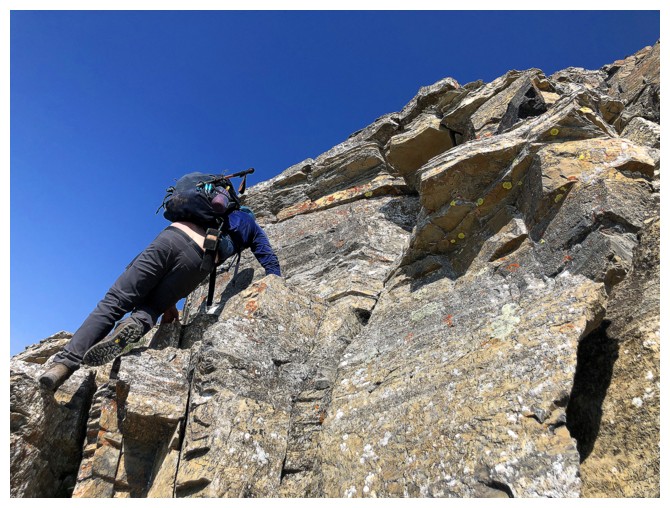
The igneous band provides bit of a challenge
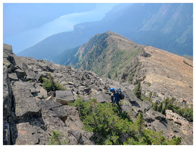
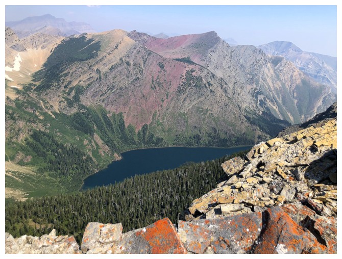
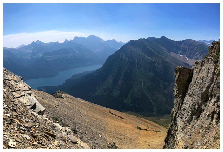
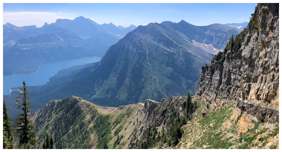
Looking down the route and to Upper Waterton Lake (photo by Dave)
Weaving our way up
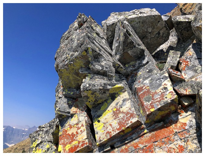
Sweet rock and lichen
Definitely not scrambling up that! (photo by Dave)
Dave finds a route around it
Small but good ledges
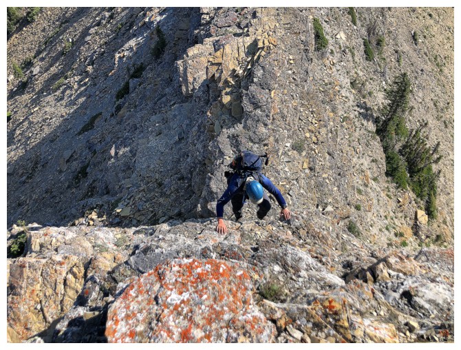
Dave negotiates a tricky move to finish the step
View from near the ridge (photo by Dave)
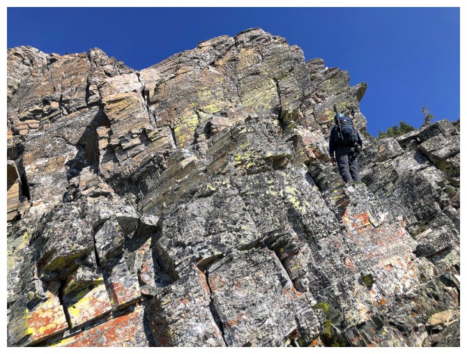
Dave leads the way up super cool terrain
Bertha Lake and Bertha Peak - read the beginning of Dave's Bertha Peak trip report to learn about the colourful historical figure this mountain is named after
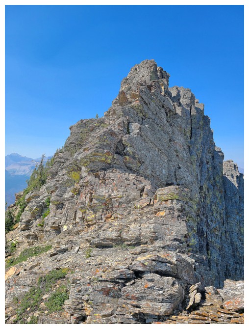
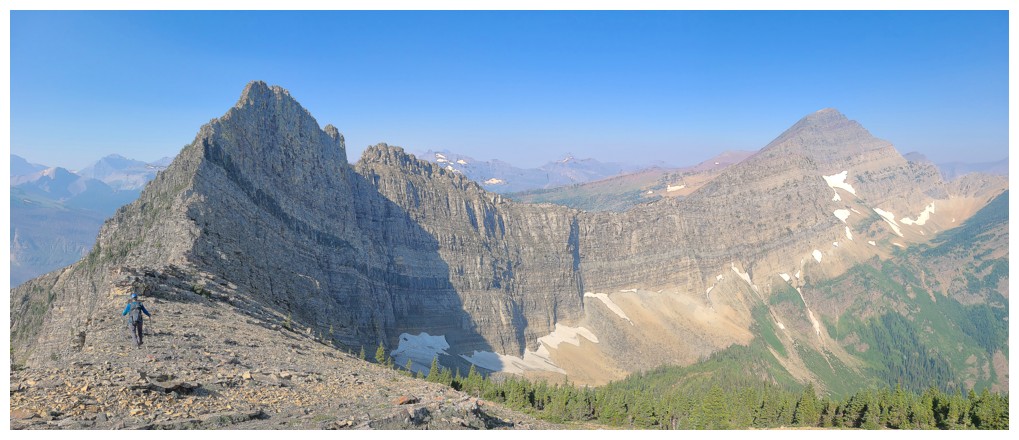
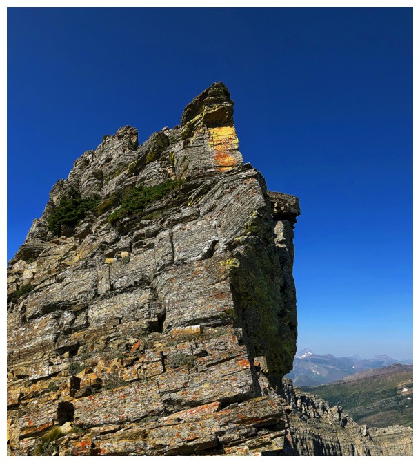
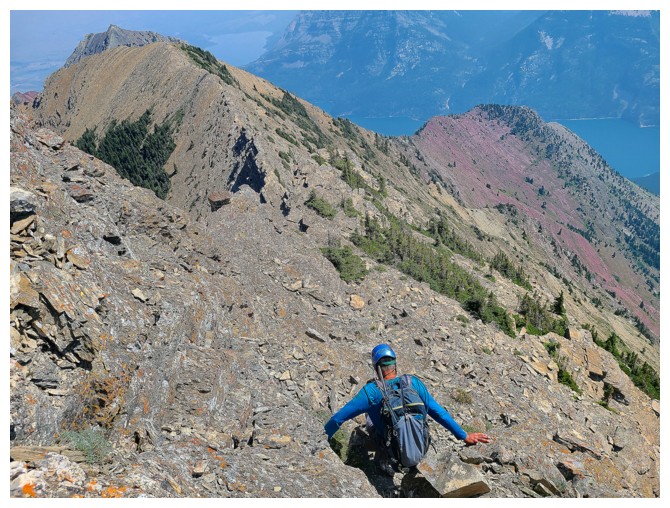
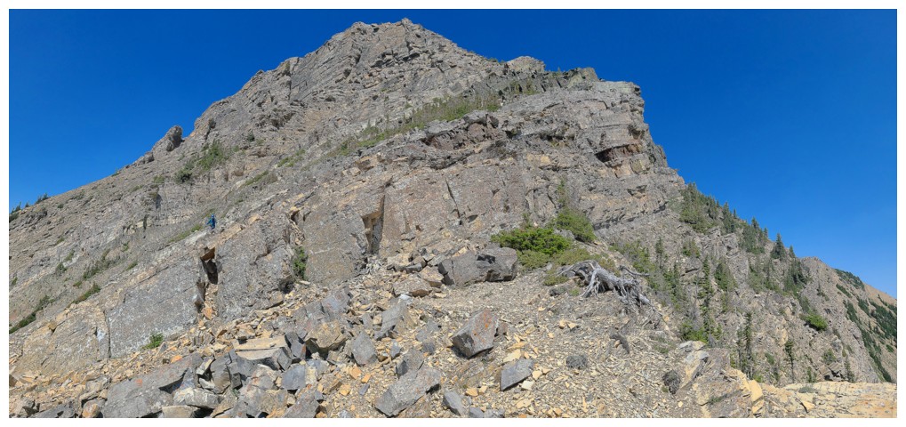
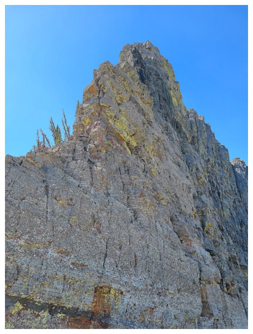
The final stretch to the summit looks more intimidating than it actually is
Dave, the precipitous drop on the east side, and the view towards Alderson
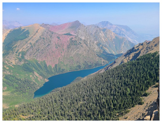
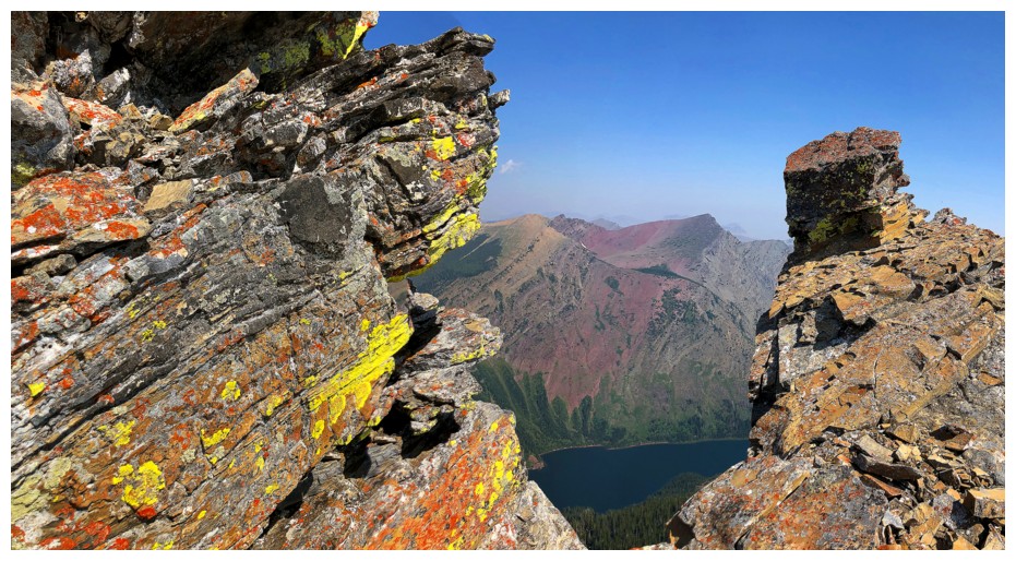
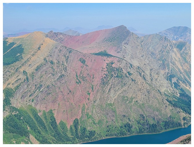
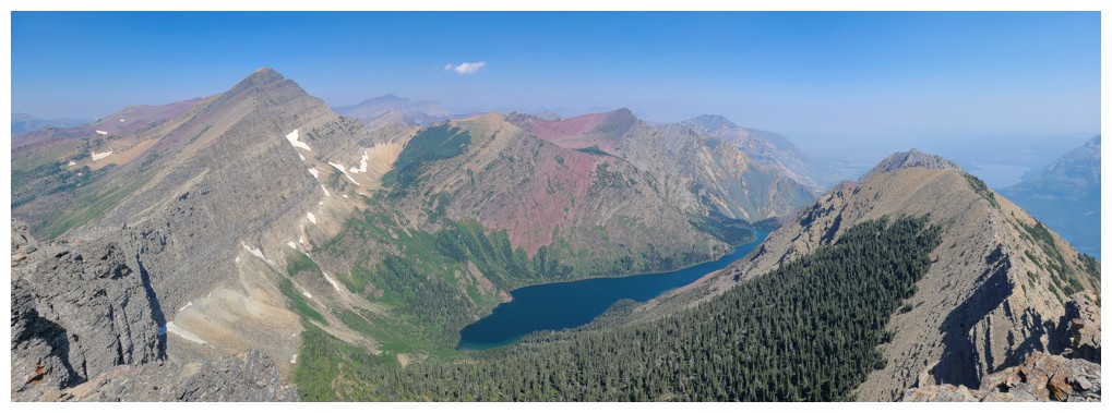
As photogenic a lake and peak as you could find (photo by Dave)
Not getting up that either
...but there's an easy bypass to the left
Everything I love about Southern Alberta
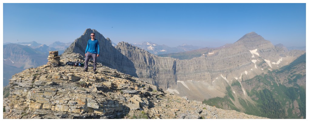
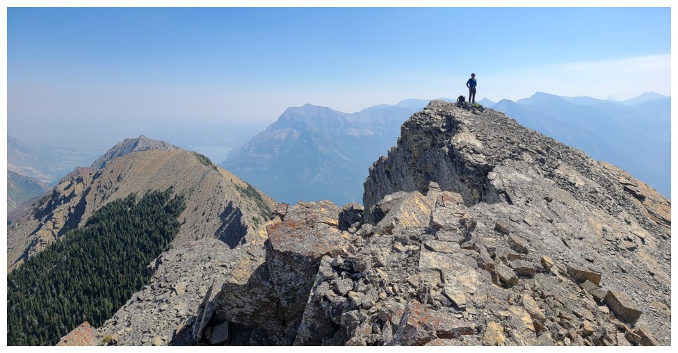
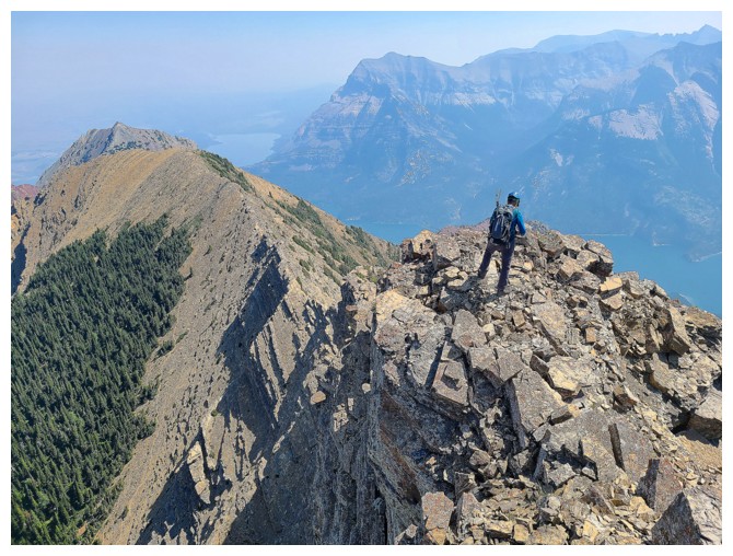
Dave is at the summit already and taking in the fantastic view (photo by Dave)
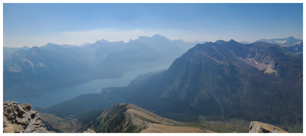
View to the south. Too bad about the smoke (photo by Dave).
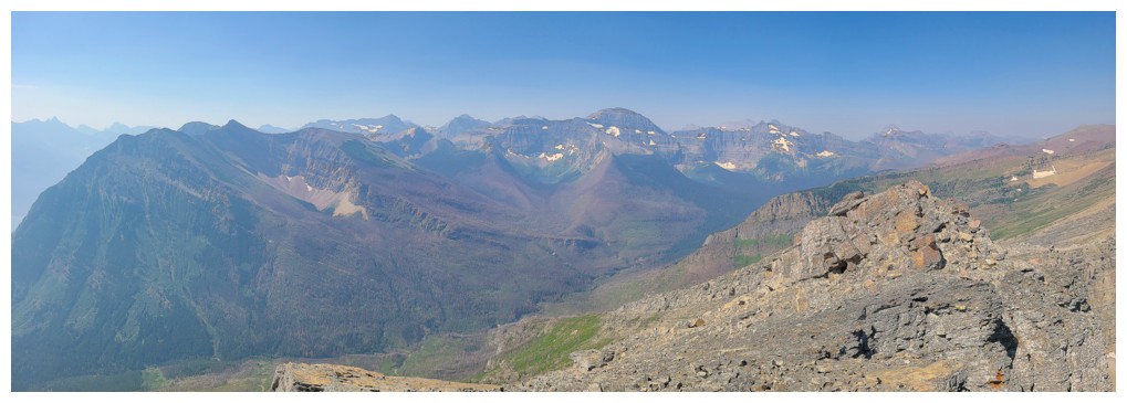
View to the southwest and west (photo by Dave)
Lagging behind as usual! (photo by Dave)
Dave heads over to the nearby highpoint to check out the route to Alderson
Dave and Long Knife Peak
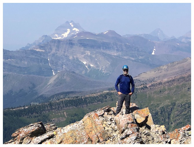
I have arrived (photo by Dave)
Chapman Peak to the right, Carcajou Lake in the centre (photo by Dave)
Dave's view of Alderson (photo by Dave)
...and of Bertha Peak (photo by Dave)
Smoky view of Mount Cleveland (photo by Dave)
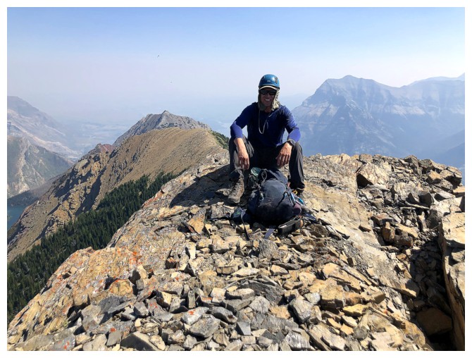
Back at the summit
Campbell Mountain is close by but in another country (photo by Dave)
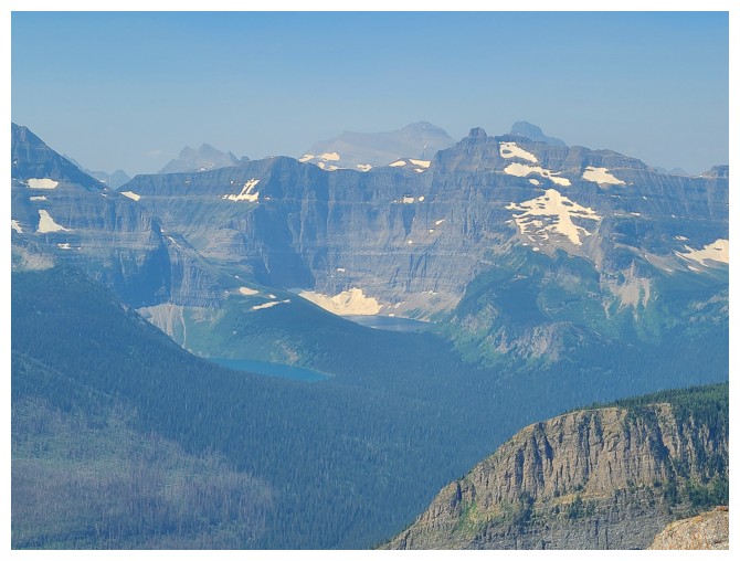
Lake Nooney under Mount Custer and Lake Wurdeman to the left (photo by Dave)
Still reveling in that view to the north and east (photo by Dave)
Heading down (photo by Dave)
But not before a parting summit shot
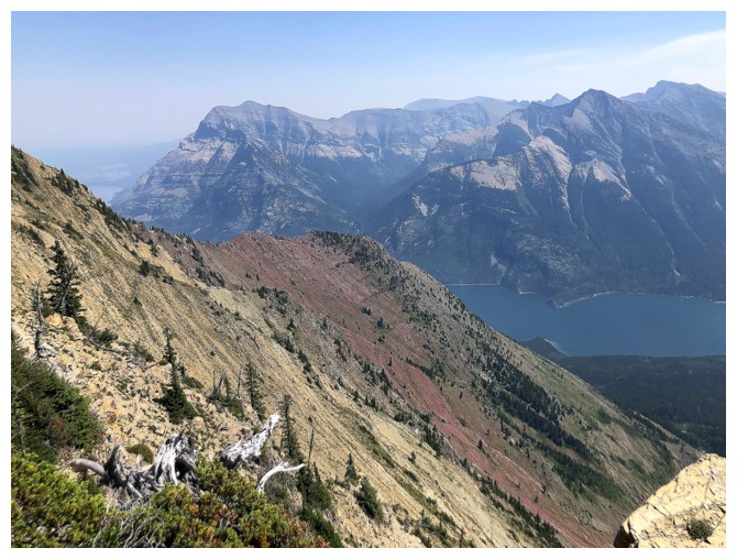
Looking down some of the route. Little Richards at the left (photo by Dave).
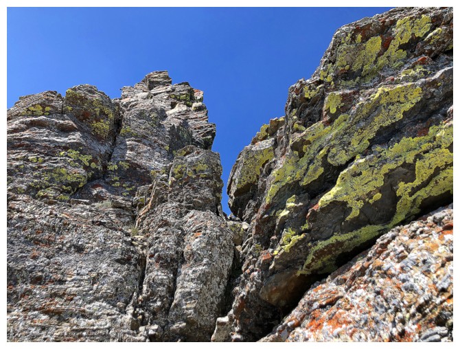
Never a shortage of lichen in Waterton
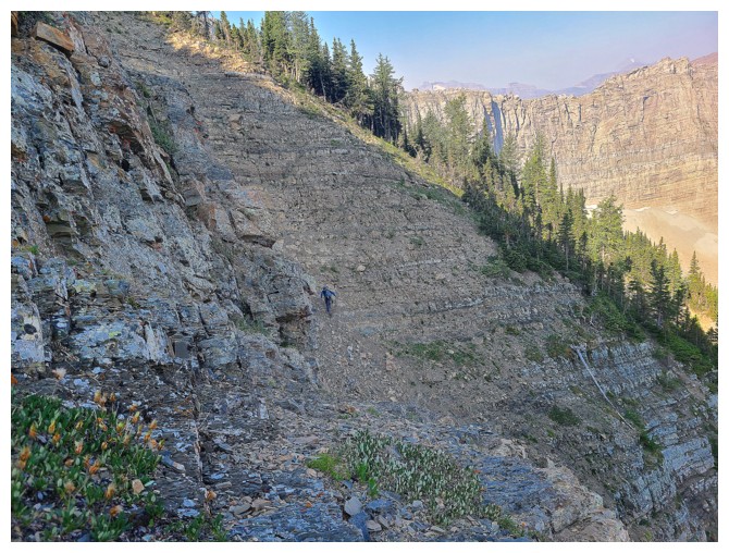
Short scrambling steps.....(photo by Dave)
....followed by steep hiking...(photo by Dave)
... and more steps (photo by Dave)
Dave tosses his pole down before descending
In
2006, Mark and I used the orangeish descent slopes to intersect the
North Boundary Trail. The hike out from there was long - a route I
would not repeat.
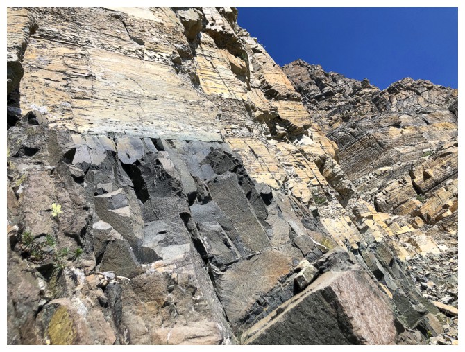
Back to that beautiful igneous band
Parting look at the southeast ascent route (photo by Dave)
That little spur on the east side looks inviting and may be accessible from Little Richards
Ready to return via Marko Stavric's wonderful shortcut route
Another view that never fails to impress, even with the smoke (photo by Dave)
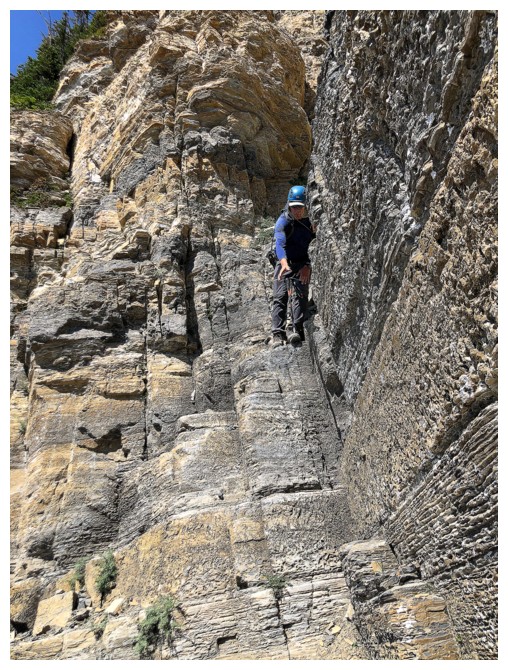
Dave under the amazing layers of rock
Never fails!!
Under the very narrow east ridge
Same as above
Back on that ridge (photo by Dave)
Such an impressive sight (photo by Dave)
From farther back (photo by Dave)
Dave is just visible, right of centre. I still have to traverse the ledge.
Traversed (photo by Dave)
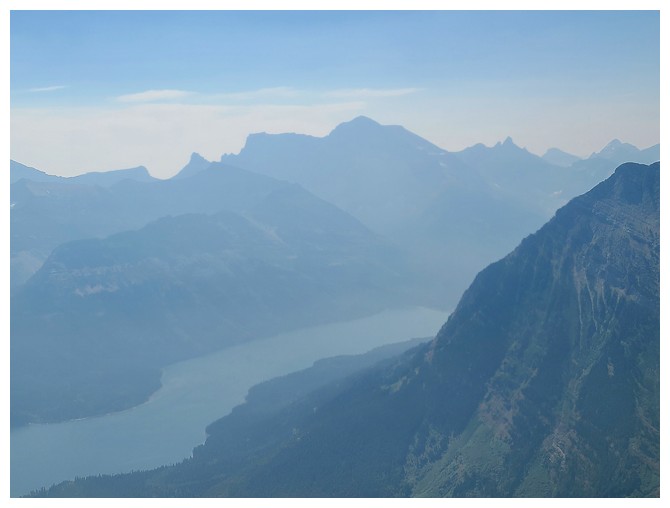
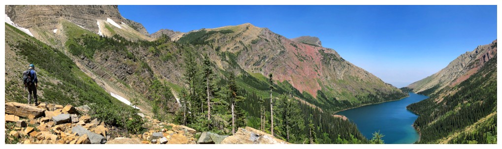
Can't get enough of this view
Looking down our descent route (left) (photo by Dave)
Some steep scrambling (upper left) to get down to the scree (photo by Dave)
Dave gets ready for a decent section of scree surfing
Off the scree and onto the grass (photo by Dave)
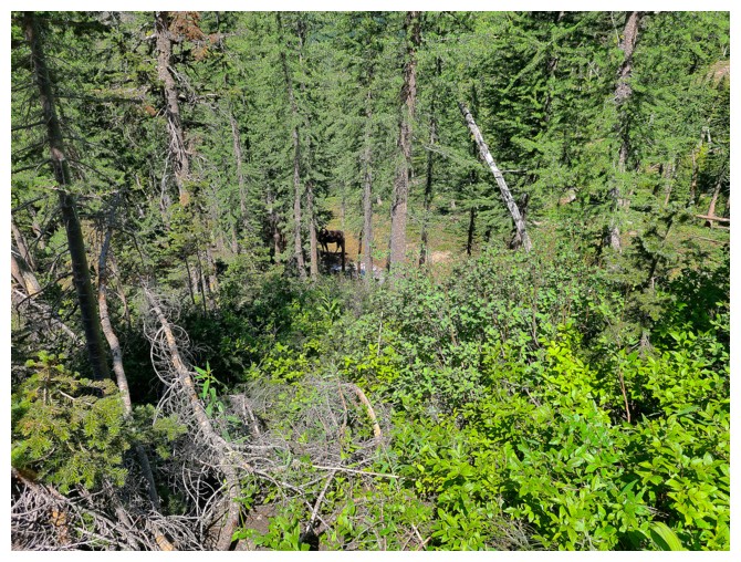
A moose that gave us a real scare (photo by Dave)
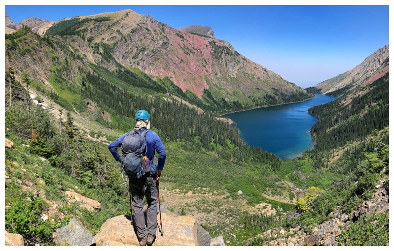
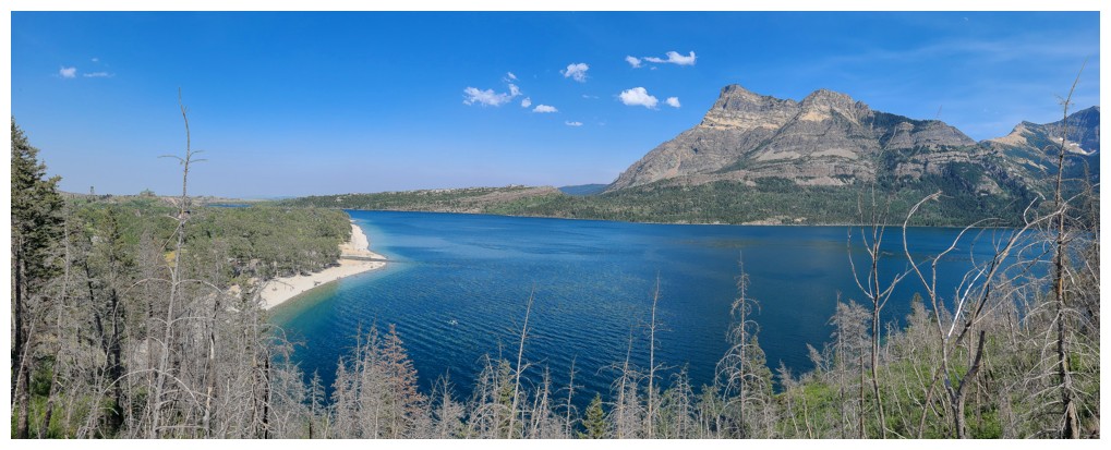
Great view of the lake
Same as above
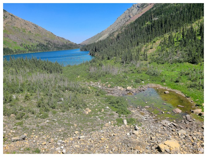
A small tarn and the lake (photo by Dave)
The tarn and our ascent route to Little
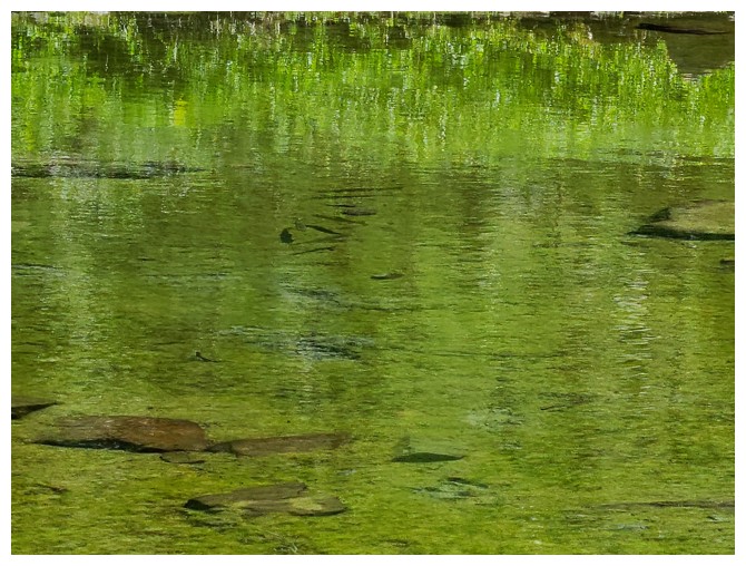
The trout trapped in the tiny body of water would be easy pickin's! (photo by Dave)
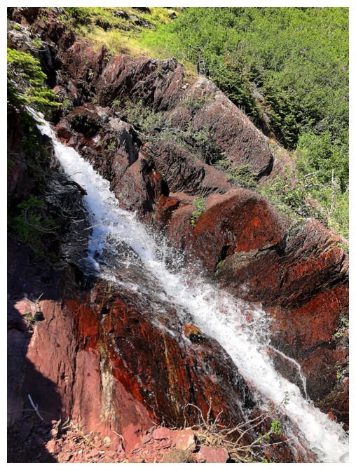
Water falling down red argillite - always a treat!
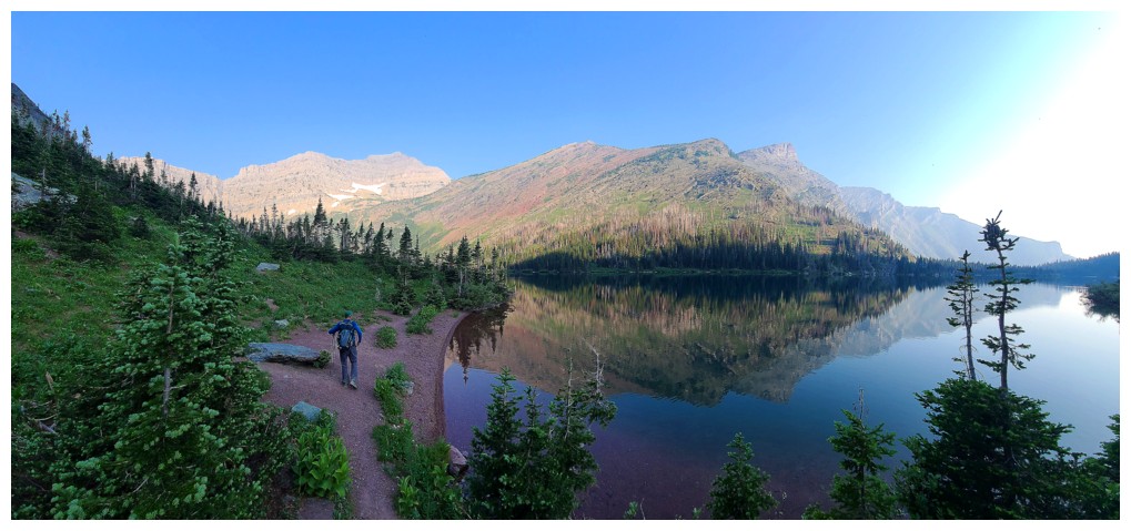
Following the trail around the west side of the lake
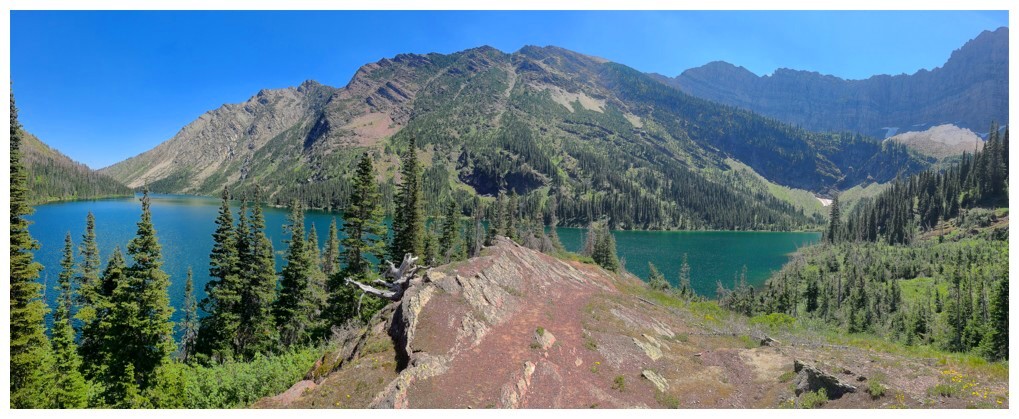
Great red argillite viewpoint and a sign of things to come (photo by Dave)
Same as above with Dave
And again, but without Dave
No argillite or Dave :(
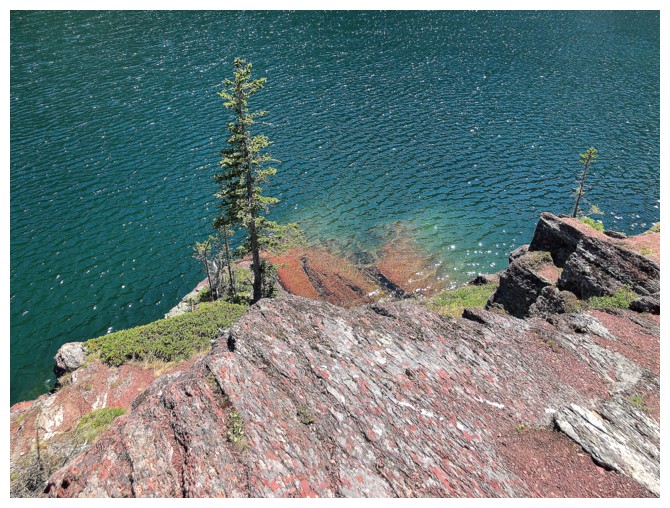
Like Natahki Lake in Glacier National Park, Bertha's shores are comprised of brilliant red argillite
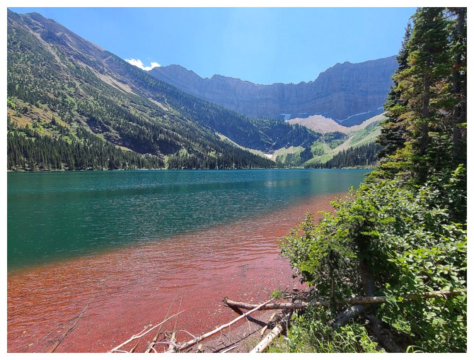
A striking contrast of water and rock (photo by Dave)
Hard to see, but Dave is cooling off in the lake at the left
Checking out the Kane route up Bertha Peak (photo by Dave)
Vimy Peak looks much different later in the day (photo by Dave)
Mount Boswell
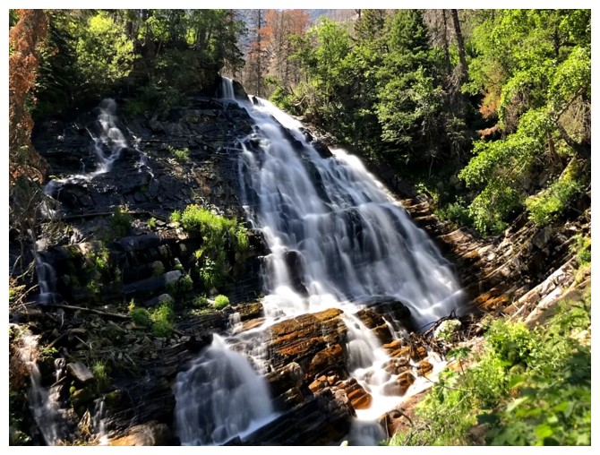
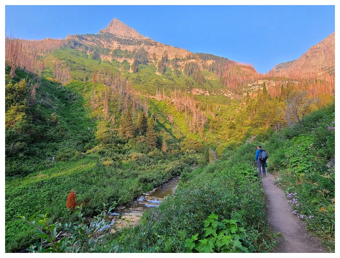
Lower Bertha Falls
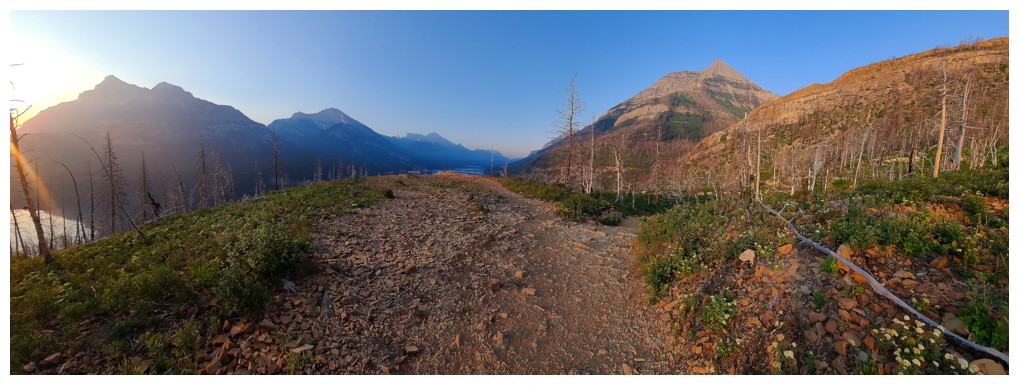
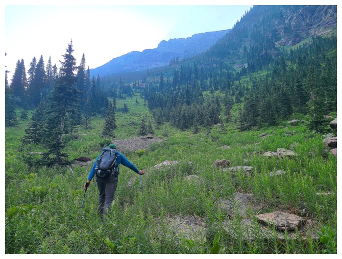
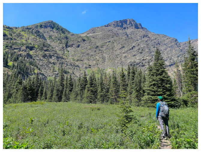
Hiking the awesome Bertha Lake Trail
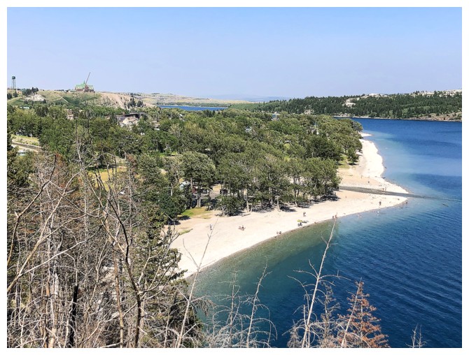
Who knew Waterton had a white sand beach?
It's actually a pebble beach, but come back in about 100 million years and it could very well be sand! (photo by Dave)
The End
LOG