Southfork East
Southfork Mountain III
September 11, 2022
 Mountain heights: 2305 m, 2345 m
Total elevation gain: approximately
1100 m
Round-trip time: 6:40
Solo scramble.
I needed an
excuse to return to the scenic Southfork Lakes and a trip report by Bob Spirko
gave me just that. Bob and company had attempted an eastern outlier of Southfork Mountain but had been turned around by
gale-force winds. The objective of the day became to reach that summit and see
if the true summit of Southfork could also be reached via a high-level
traverse.
The first
highlight of the trip occurred very early when faced with the crossing of the
sometimes waist-deep West Castle River. Since my last visit, Alberta Parks had
installed a beautiful bridge over the waterway, taking all the drowning
potential out of the crossing – two thumbs up for Alberta Parks! As well, the
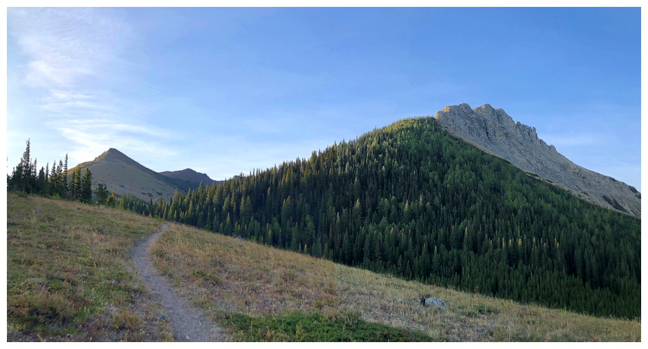
trail to Barnaby and the Southfork Lakes had been resigned and improved. Though
still a relentlessly steep trail, it’s a straightforward affair getting to the
lakes.
Upon arriving at
the Southfork Lakes and crossing the land barrier between the two, I hiked
around the second lake and started up the scree slope leading to the col
between the outlier (Southfork East) and pinnacled ridge between the true summit and the
outlier. 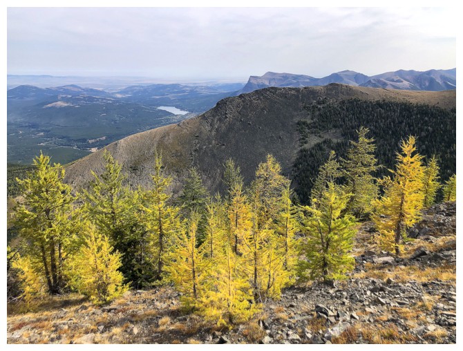 In retrospect, I should taken the route Bob’s party took, that would
have gained the ridge northwest of the summit and then followed that ridge easily
to the top. My route was quite the foreshortened and steep slog.
In retrospect, I should taken the route Bob’s party took, that would
have gained the ridge northwest of the summit and then followed that ridge easily
to the top. My route was quite the foreshortened and steep slog.
Reaching
the col, I turned northeast and, with a little route-finding to avoid the steepest
sections, scrambled up to the summit. The weather was far from stellar, but good
enough to allow an enjoyable break and the respectable view.
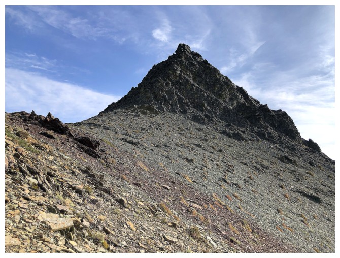
From the summit
of East Southfork, the traverse to the true summit looked daunting at best and
downright impossible at worst. Staying on the ridge throughout was not going to
be an option and so after scrambling back down to the col, I started traversing
below the ridge on its right side. Although I expected to reach an impasse at
some point, such was not the case and eventually an easy route back to the
ridge revealed itself. A repeat ascent of “The
Amoeba” was on the agenda (provided I made it that far), but overcast skies made me
rethink that plan and I simply settled for the summit of Southfork Mountain.
For descent I
traversed the ridge north to the highpoint at the end (simply for exploration purposes)
and then made my way back to the Southfork Lakes and out.
Besides the
disappointingly gray skies towards the end of the day, an excellent day of revisiting old and exploring new terrain.
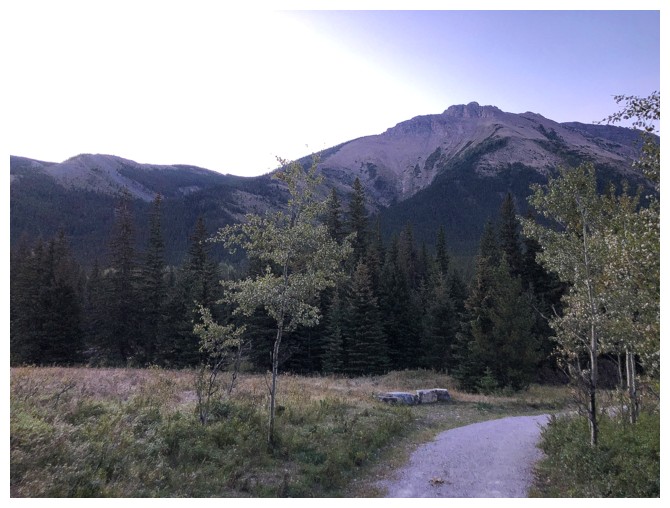
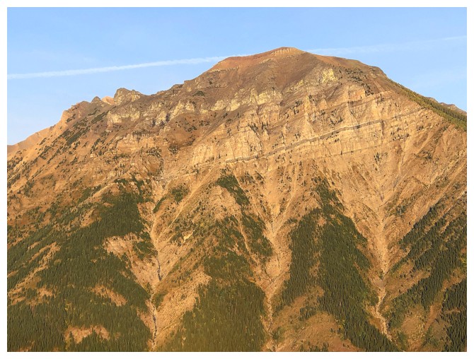
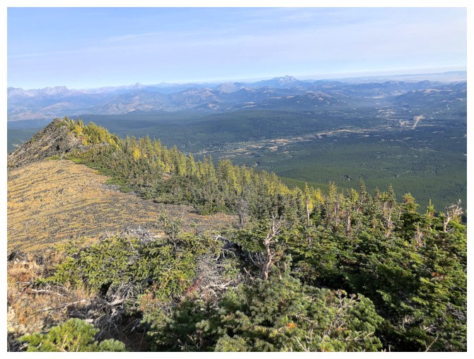
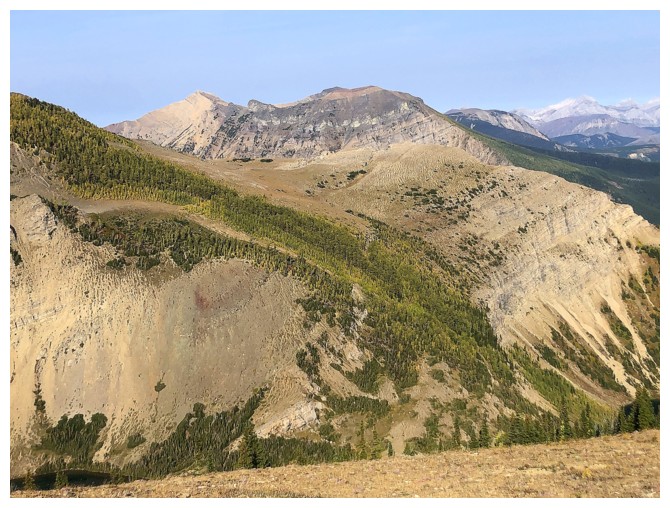
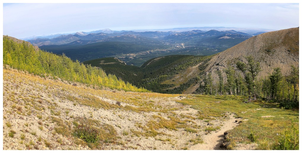
The north end of Southfork Mountain is visible from the new approach trail, which starts at the Syncline Brook trailhead
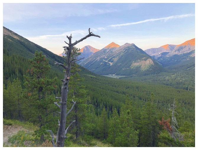
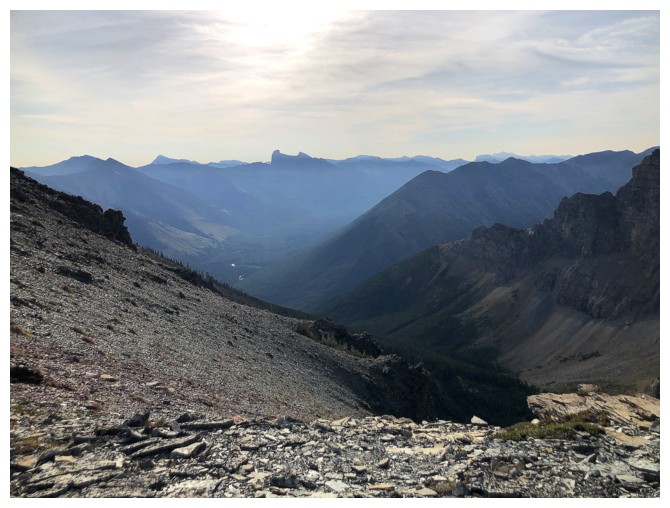
The Sun rises on Mount Haig, Gravenstafel Ridge, and St. Eloi Mountain
And Syncline Mountain
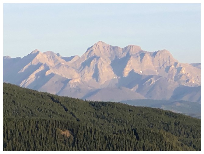
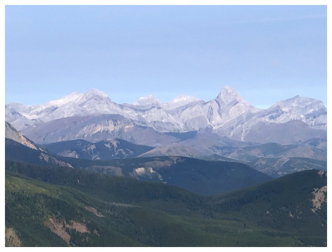
Peaks of the Crowsnest area in the distance. The peak in the centre is
the second highest peak in Crowsnest (smaller only than Ptolemy)
and is unnamed. Much smaller Mount McGladrey at the far left.
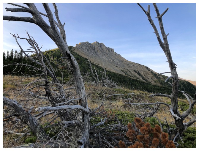
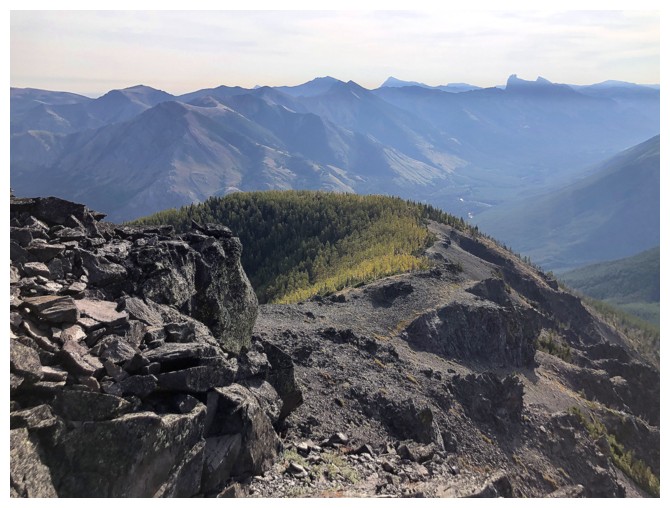
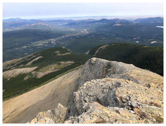
Getting closer to the north end of Southfork Mountain. Unfortunately, a direct route appears to be improbable.
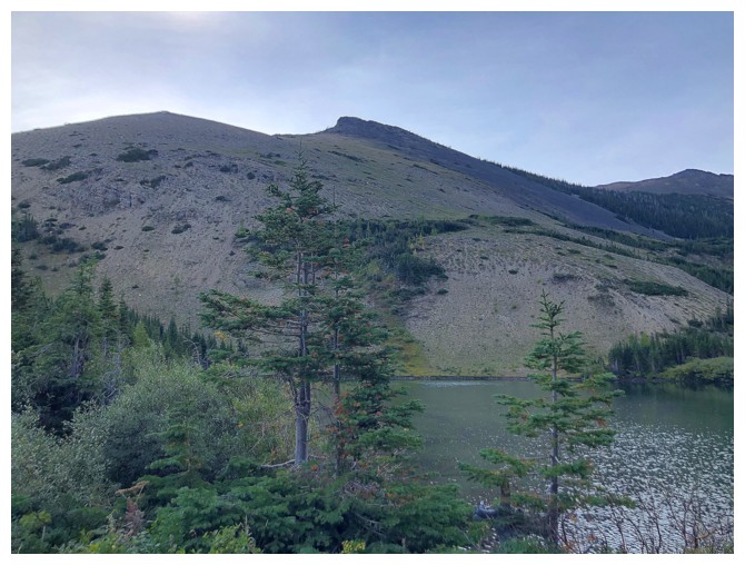
The lowest but closest of Syncline's three summits
The two highpoints at the left are the northern end of Southfork East and Southfork East
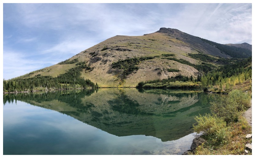
Barnaby Lake
Another potential route to Southfork East would be try to gain the far
north end, above Barnaby Lake and then hike/scramble to the summit
Looking back at Barnaby
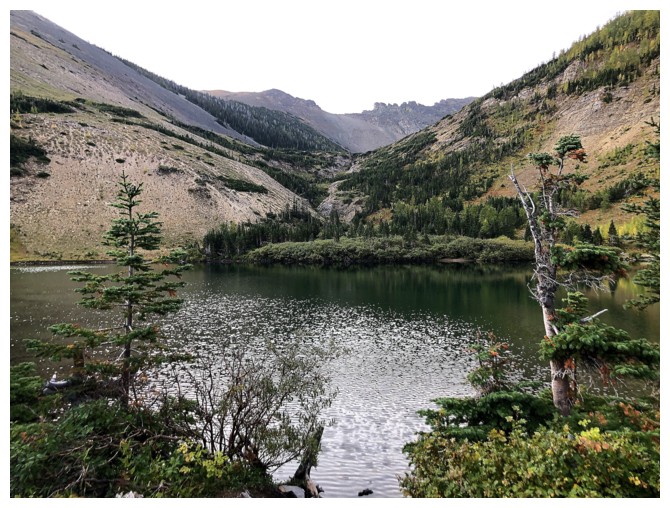
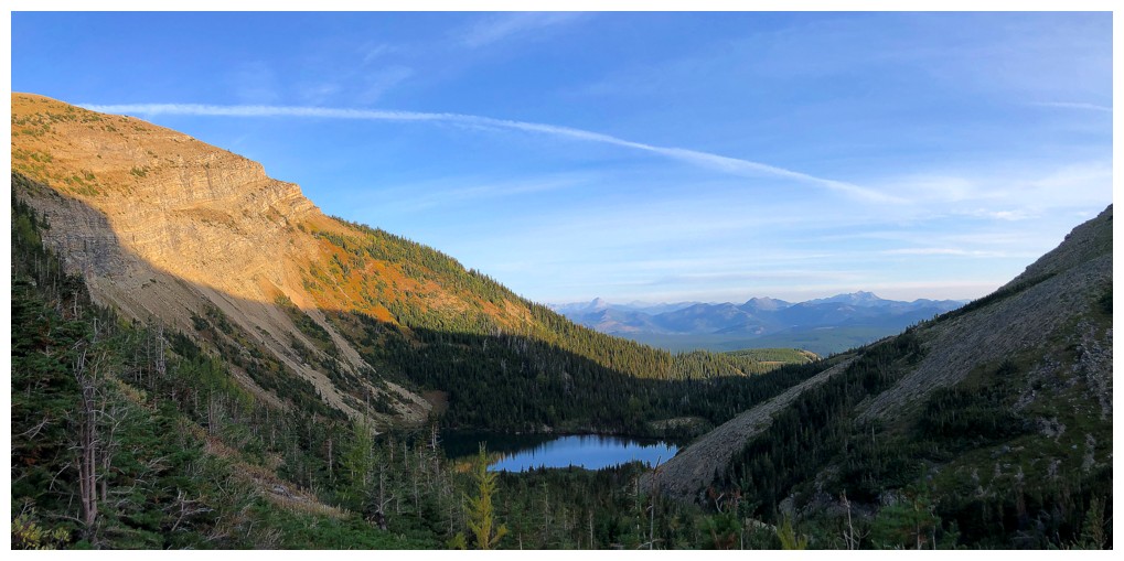
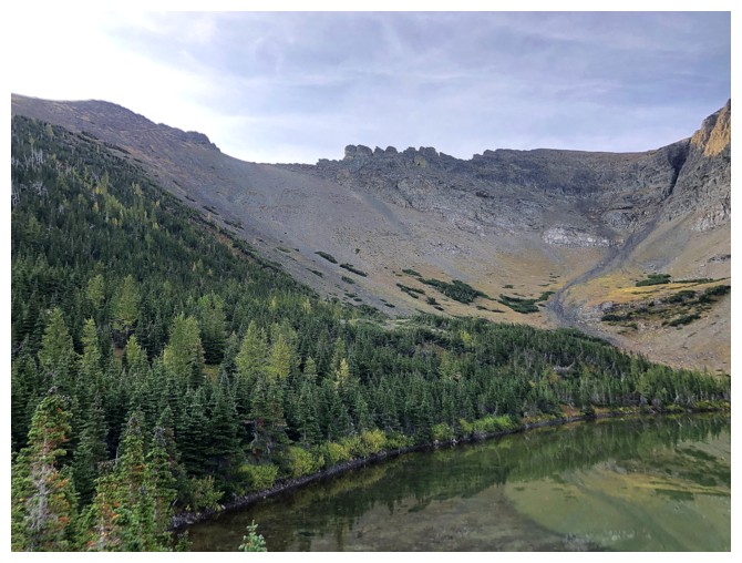
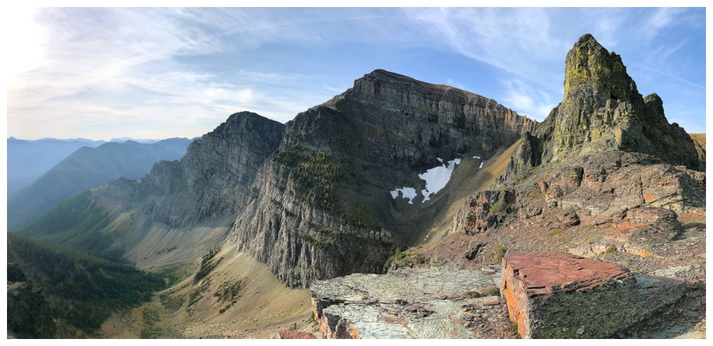
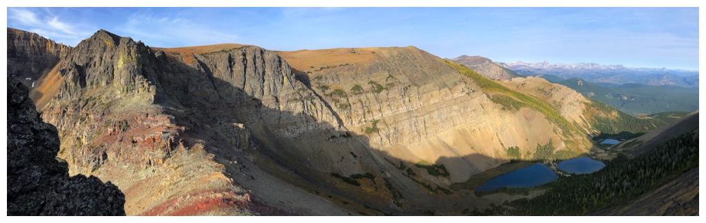
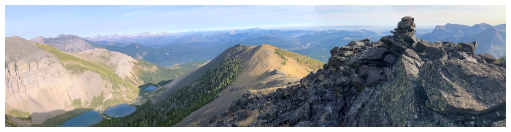
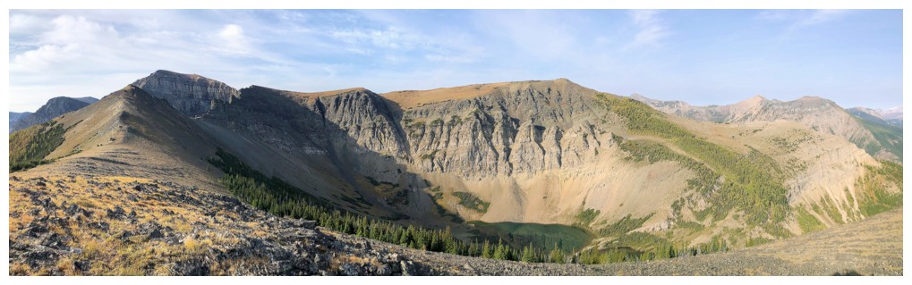
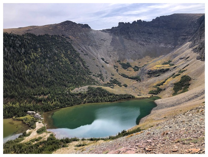
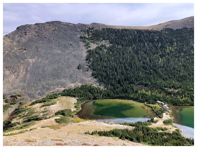
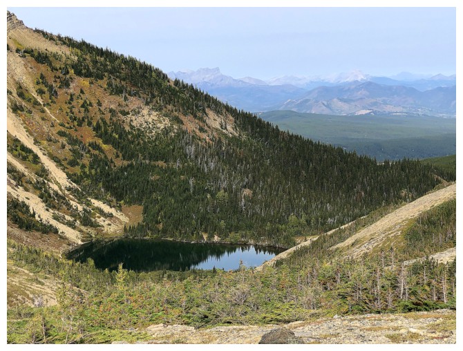
The second Southfork Lake. Southfork East at the left, Southfork
Mountain at the right, and the scary, pinnacled ridge between them.
Bob's party went up the scree slope left of the line of trees. Probably a better route that the one I took.
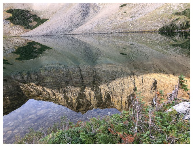
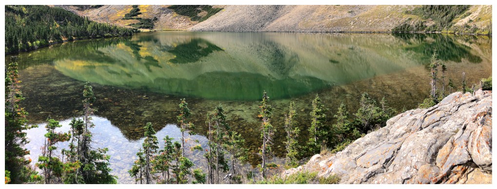
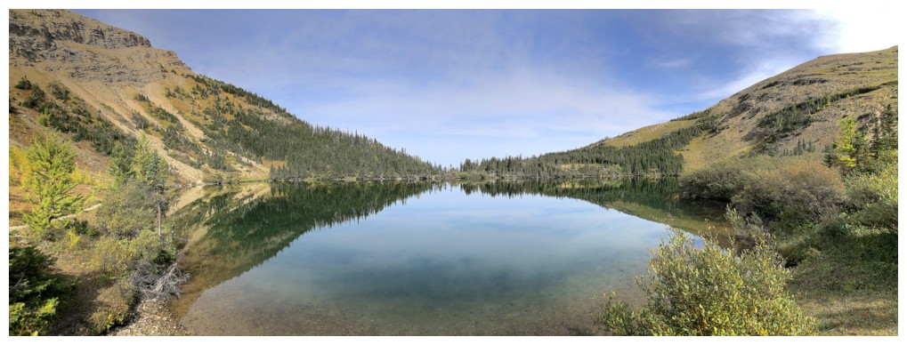
Nice reflections in Southfork Lake
I went to the end of the lake then up the scree slope from right to left to the low col
The three lakes are still in shade as I slowly ascend the foreshortened slope to the col
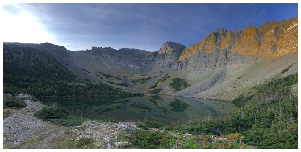
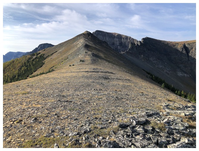
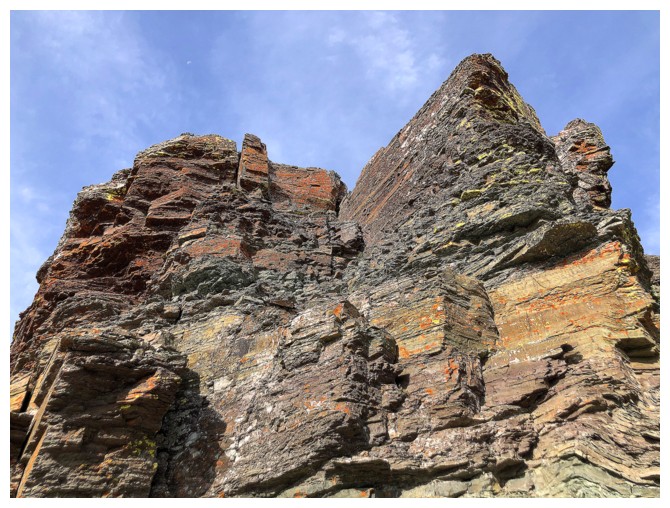
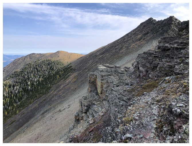
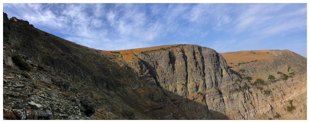
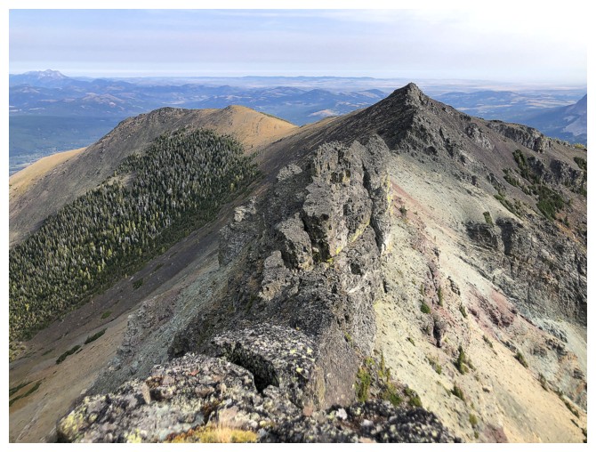
It's already quite obvious that the ridge connecting Southfork East to Southfork Mountain is not a scramble
At the col looking west
Castle Peak and Windsor Mountain are distant, but always stand out on the horizon
Looking east to Southfork East
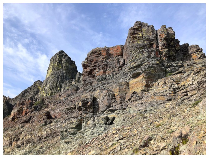
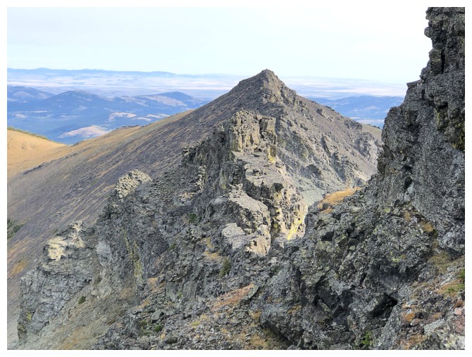
The next highpoint to the south is The Amoeba, with a lower outlier of The Amoeba to the left
The lichen-covered rock definitely caught my attention
So did this geometrically-pleasing rock in the foreground
View to the northwest
View to the west
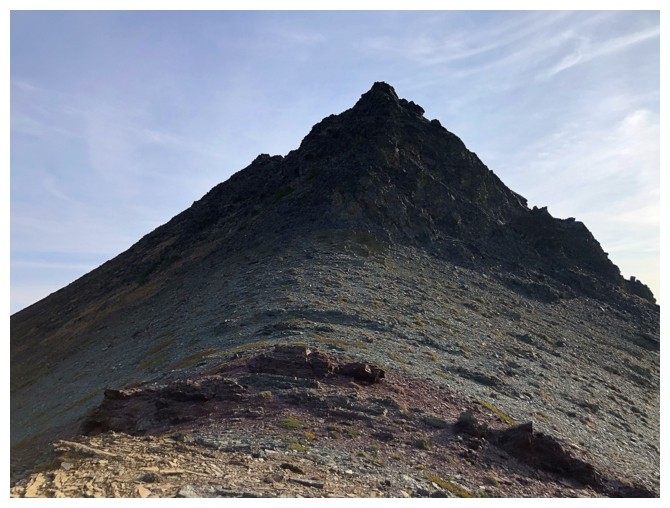
Approaching the summit of Southfork East. I went around the left side here.
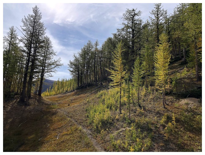
Field of larch trees on the east ridge of Southfork East
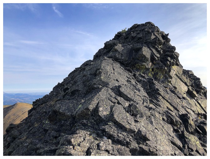
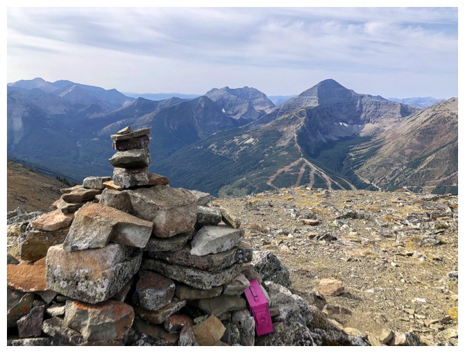
 Approaching the summit cairn
Summit view to the north. The ridge in front would have made for a very easy ascent route.
A more comprehensive view to the north
I wandered down the north ridge for a short distance to check out the terrain there
Another more comprehensive view
Would have liked to go to the end of the ridge but the traverse attempt to the true summit of Southfork was calling
Mount Darrah (just right of centre) is usually the most striking and prominent peak in the view to the distant northwest
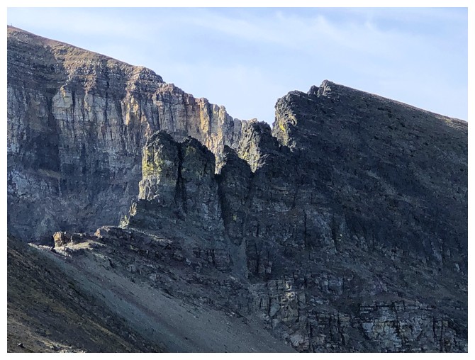
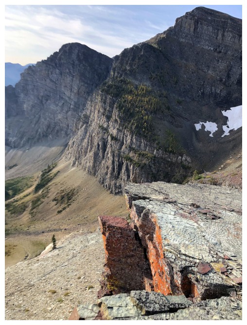
More clear evidence that the connecting ridge is not going to go as a scramble
Mount Syncline pokes over the end of Southfork Mountain
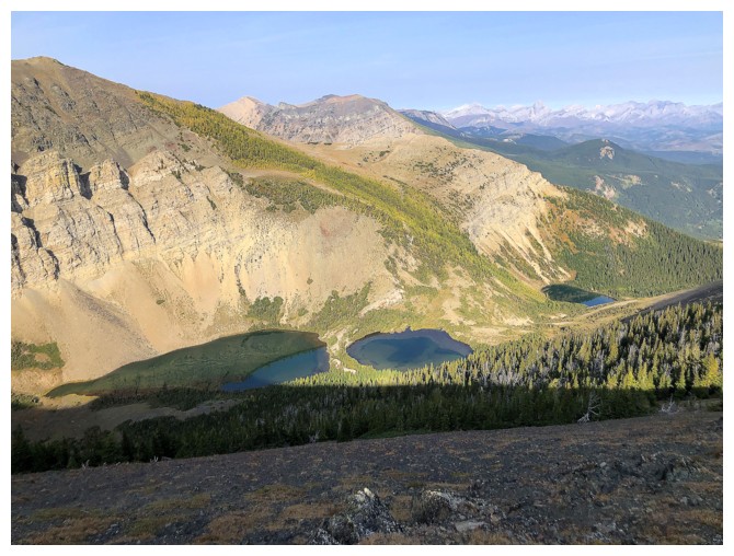
The Southfork and Barnaby lakes are finally escaping the shadow of the mountain
A little exploring on the left side of the ridge before I switch to the right
Not surprisingly, there's lots of colourful rock to check out
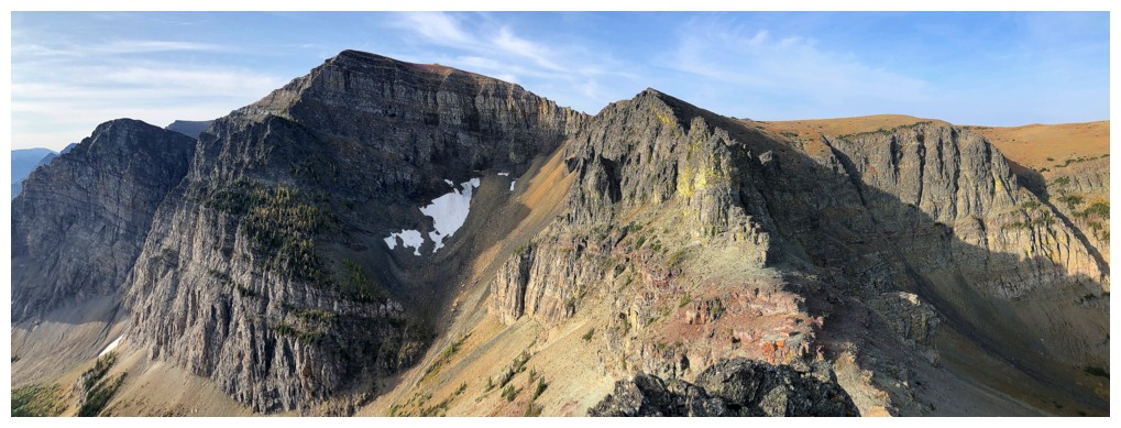
Looking back at Southfork East
And again
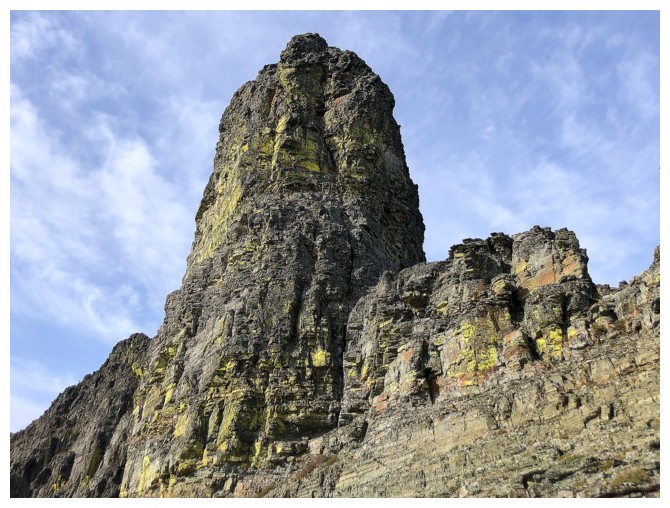
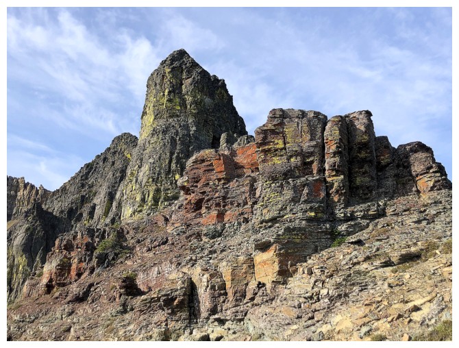
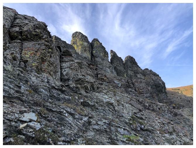
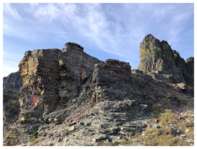
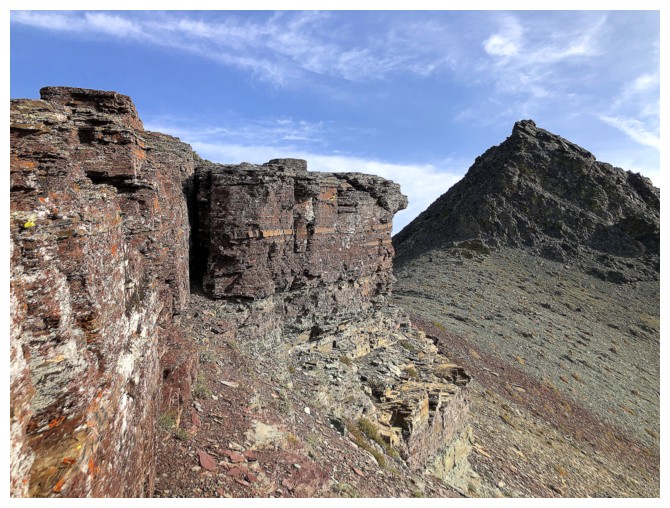
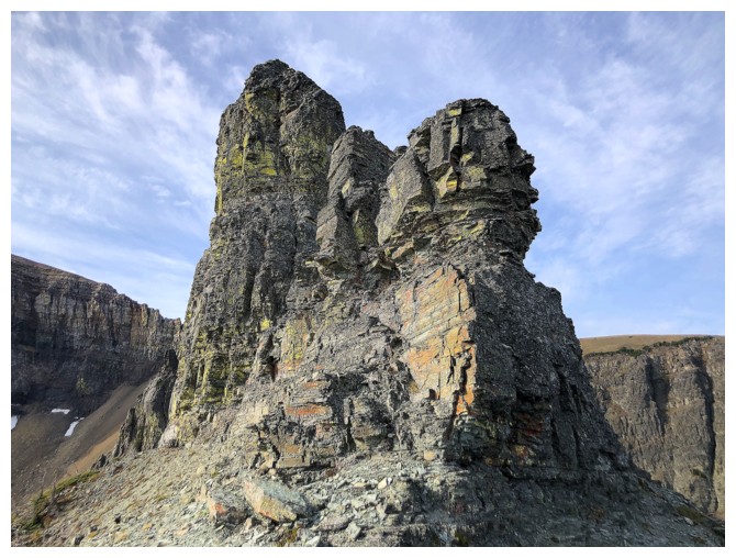
The second pinnacle on the connecting ridge is massive
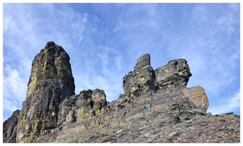
And it's connected to others
Back at the col and looking in the wrong direction
Heading over to the right side
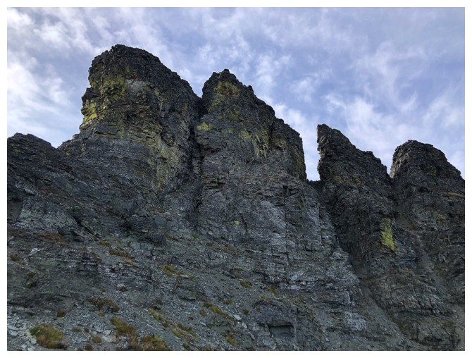
A string of pinnacles to bypass
Looking back at the first of terrain I traversed
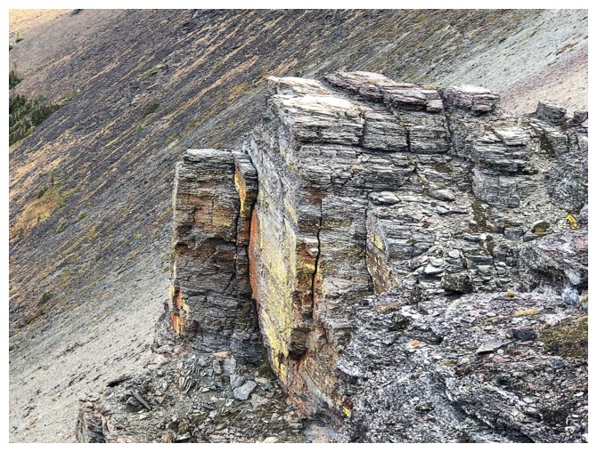
Cool rock face
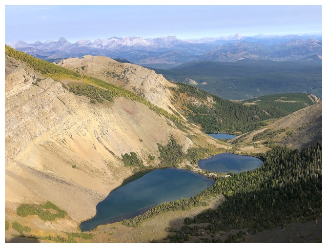
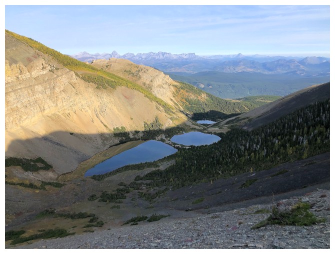
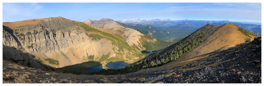
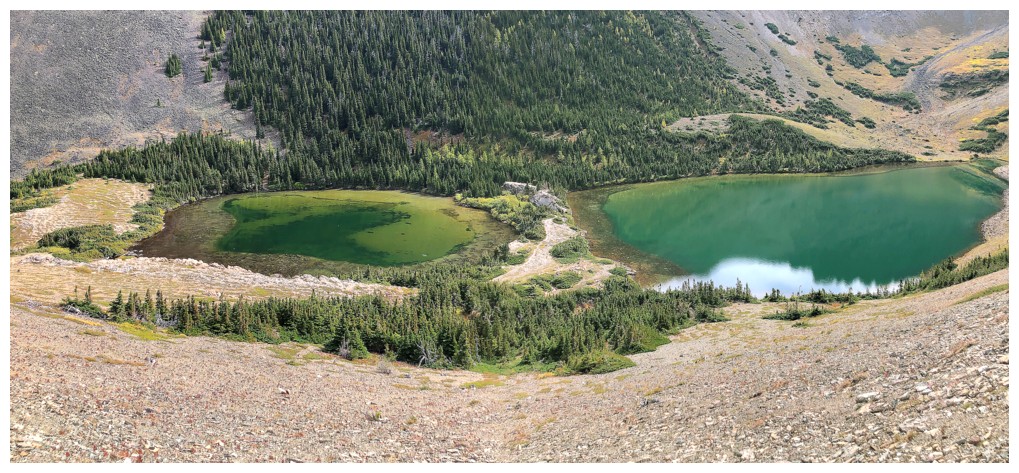
The three lakes are quite photogenic
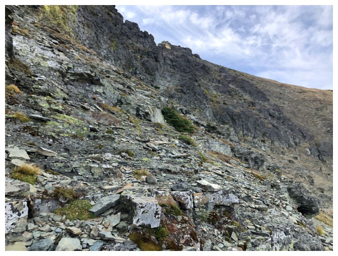
More traversing
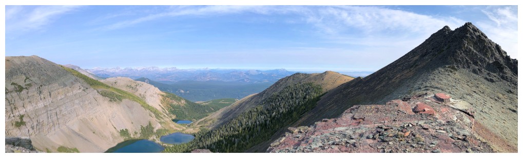
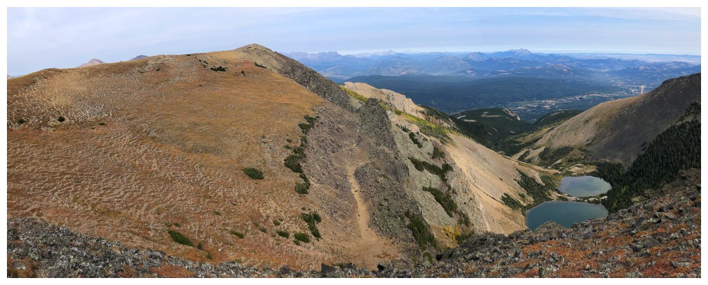
The objective at this point was to gain the ridge at the far left. Southfork at the right.
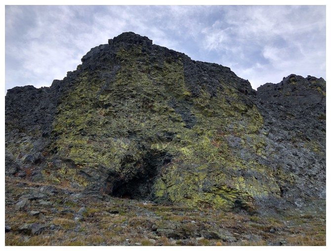
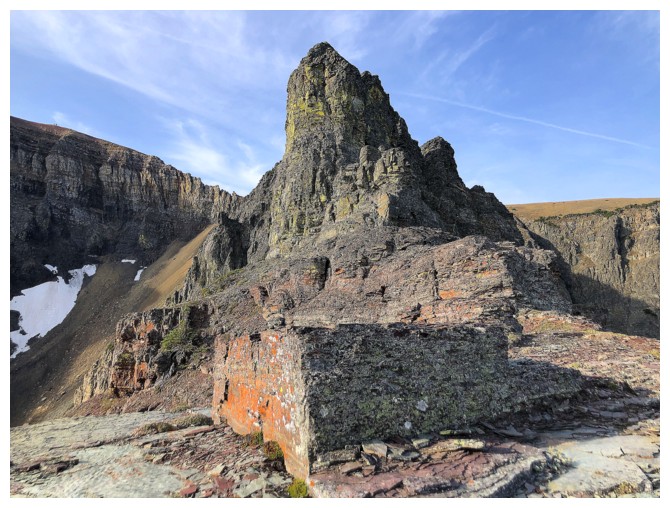
I thought about checking out this cave, but opted not to on the premise the cave may be inhabited by someone big with claws!
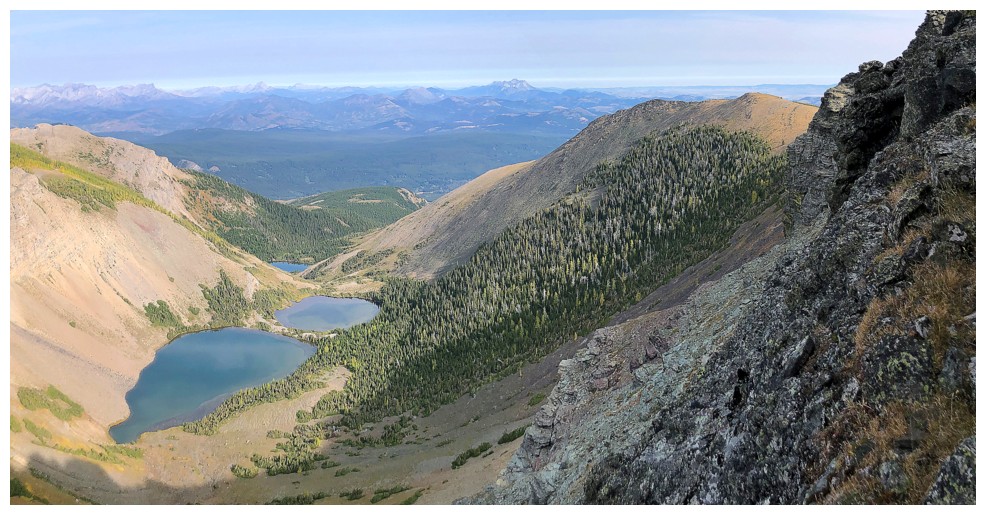
More good views of the lakes and Southfork East
Southfork East
On the ridge and looking back to the pinnacles and Southfork East
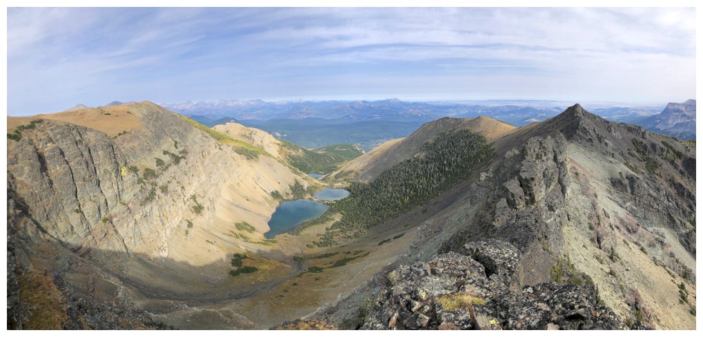
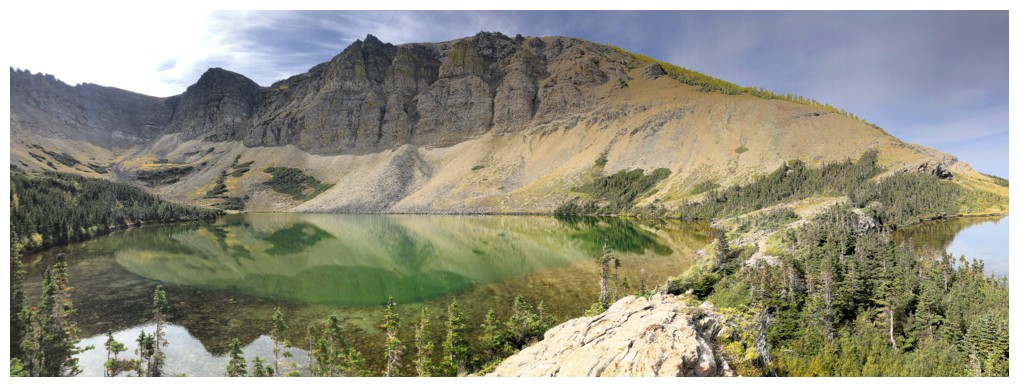
Same view with the lakes and Southfork
The Amoeba - love the unofficial name for this peak!
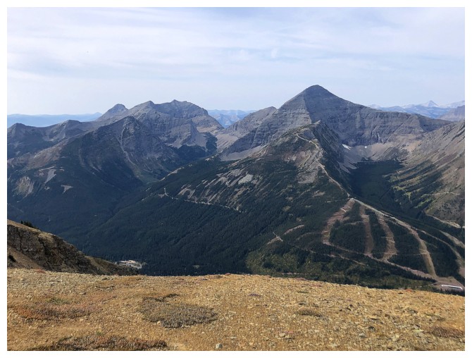
Mount Haig (right) and part of the Castle Mountain Ski Resort
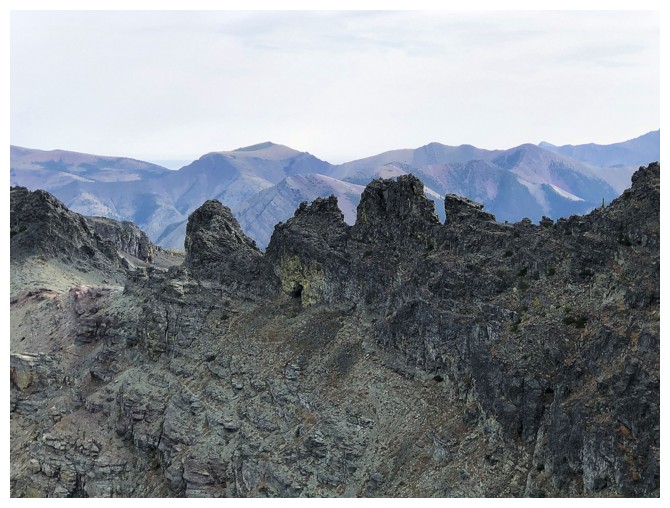
Looking back at the pinnacles and part of the traverse route
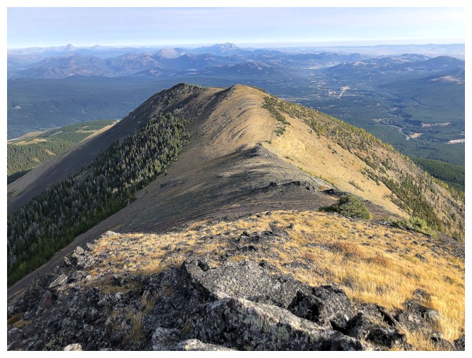
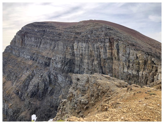
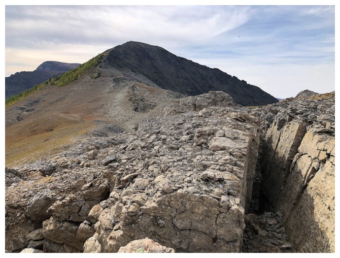
The summit of Southfork Mountain (left) is somewhat unremarkable
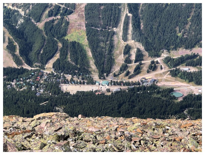
The ski resort and some ski runs
The Southfork Lakes
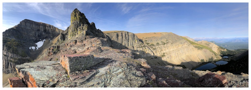
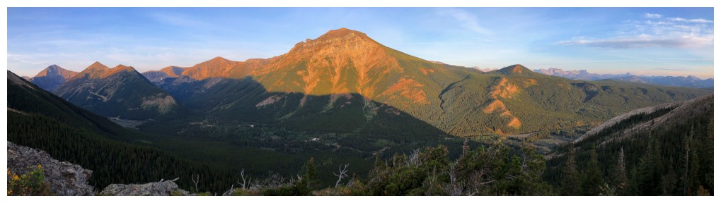
Summit of Southfork Mountain
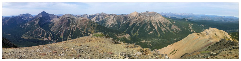
Summit pano #1
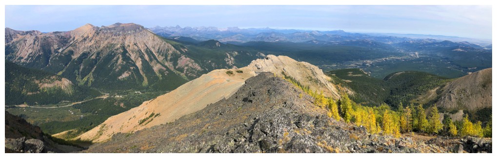
Summit pano #2
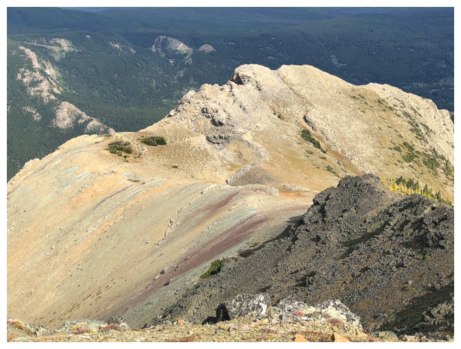
Close-up of the north ridge I would explore next
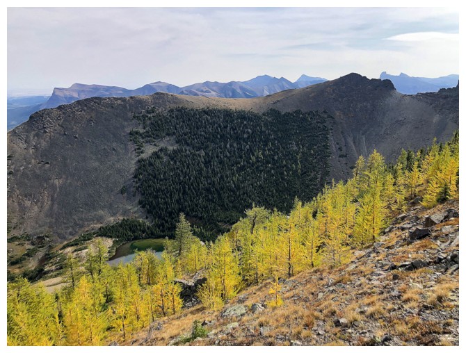
Unusual is to see the larches this degree of yellow on September 11 of any year
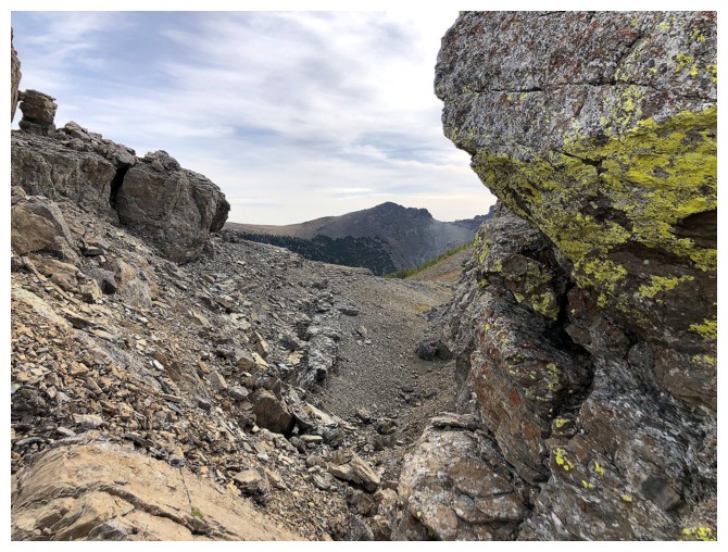
There is some very interesting terrain at the north end of Southfork
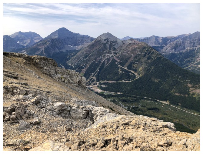
The bulk of the Castle Mountain Ski Resort resides on Gravenstafel Ridge
A fissure and the summit of Southfork
As stated, there is no direct route down the north ridge and back to
the main trail by Barnaby Lake (unless you jump or have wings!)
Cutting back to see the larches and Southfork Lakes
The larches
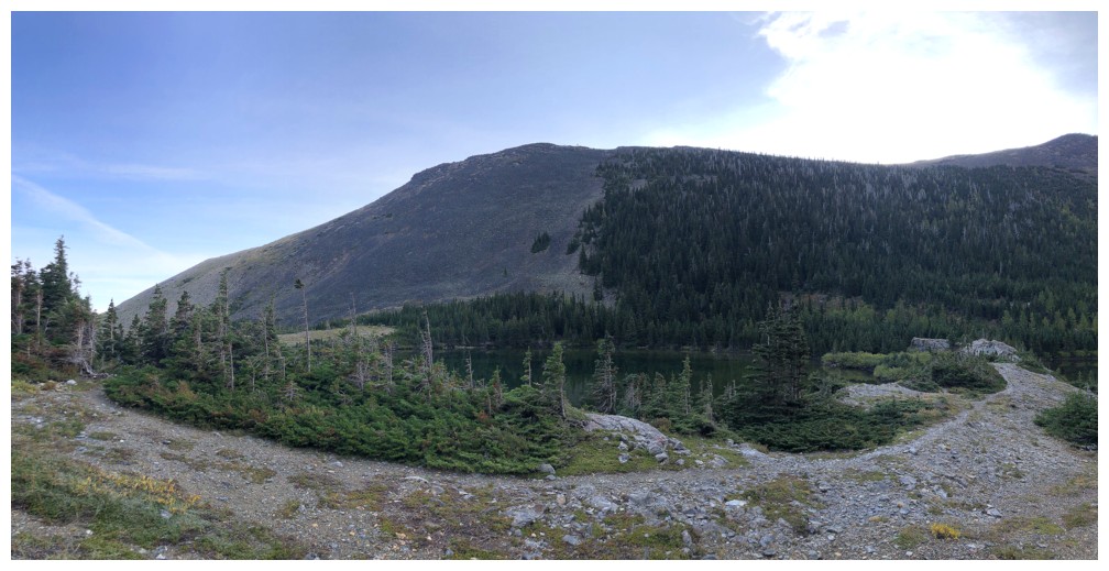
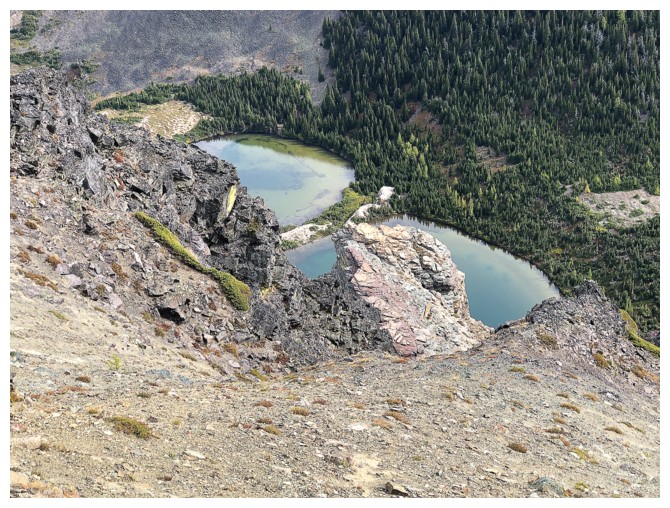
The northern lake
The southern lake
Both
Reflections in the northern lake
Crossing the land barrier between the lakes again, to check out the northeast side of the northern lake
Looking down on Barnaby Lake
Back at Barnaby
The route I would probably try, were I to repeat Southfork East
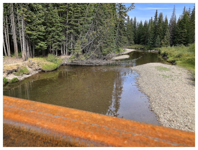
The rail of the new bridge and the West Castle River. Hard to believe the river can be waist-high as certain times of the year.
The End
LOG