Spreading Ridge
 and beyond
June 28, 2022
Mountain heights: 2442 and 2673 m
Elevation gain: 1000 m
Round-trip
time: 7:25
Solo scramble.
After seeing the
Matt’s excellent reports for this ridge along the Icefields Parkway, the trip
was immediately put on my to-do list. I was hoping to do it as a winter snowshoe
ascent with Mark, but it never seemed to pan out. Noting that Bob Spirko and
company had completed the trip several months after the Matts as a summer
ascent I was also open to a snow-less trip.
 Spreading Ridge
was not the objective as I drove north on Highway 93. I was hoping that the
outlier north of Jimmy Junior would be sufficiently snow-free to warrant an
attempt. It was not and so I settled on Spreading Ridge, generally following
Bob’s route.
Spreading Ridge
was not the objective as I drove north on Highway 93. I was hoping that the
outlier north of Jimmy Junior would be sufficiently snow-free to warrant an
attempt. It was not and so I settled on Spreading Ridge, generally following
Bob’s route.
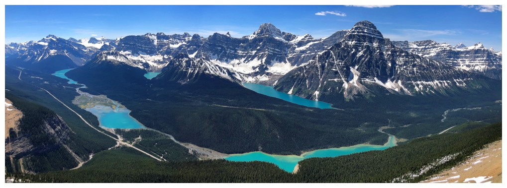
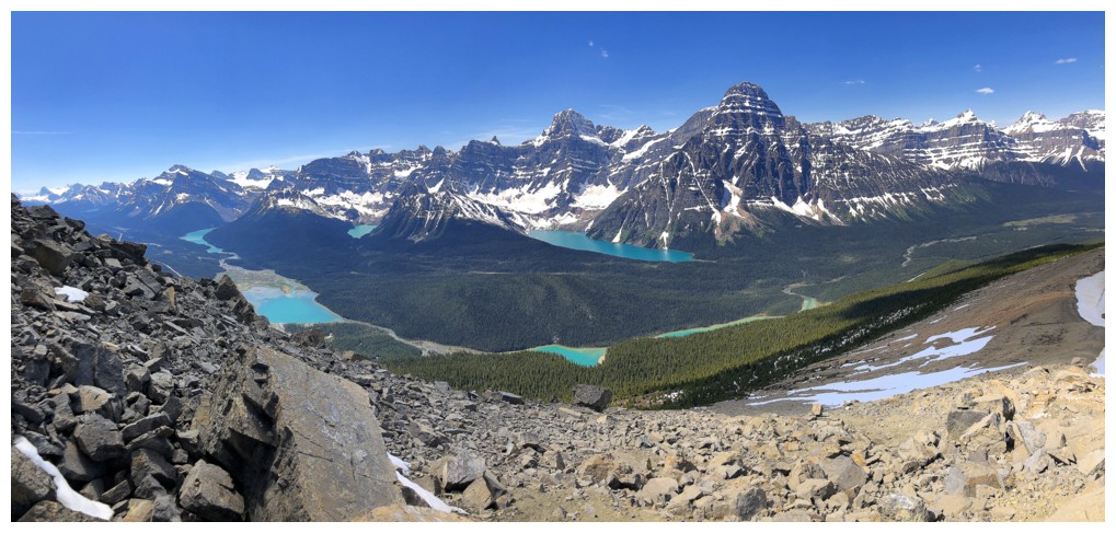
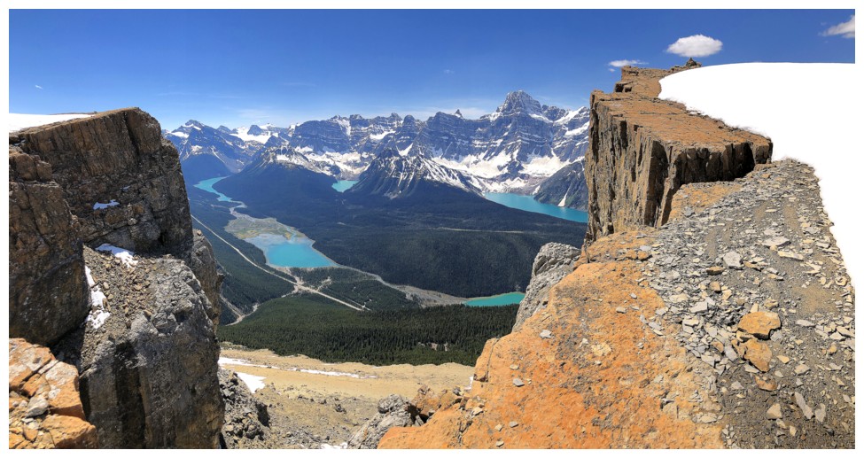
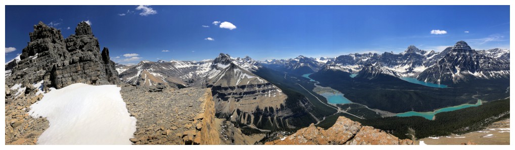
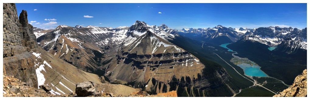
Except for some
good views of Mount Chephren and the northern Waterfowl Lake, early on in the
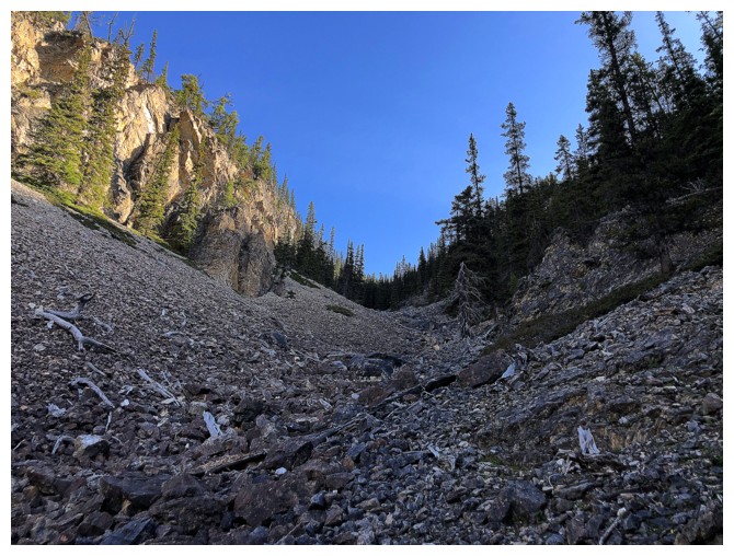
trip, the first few hours were tedious and not terribly inspiring, due to the
lack of views. However, that changed dramatically upon breaking treeline. This
trip goes from no views anywhere to amazing views everywhere within a few
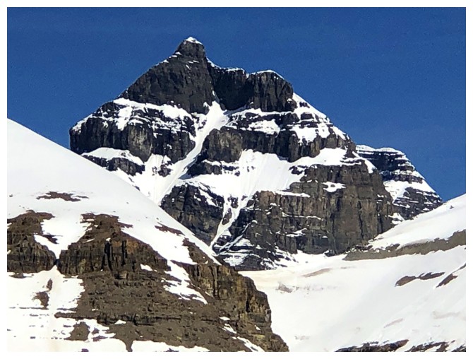
minutes. And spectacular views they are: first, the striking towers of Mount
Murchison, then the aesthetic forms of South Totem Peak and Spreading Peak, and
most noticeably an array of several of the Rockies finest and most colourful
lakes, below an array of the several of the Rockies most striking mountains.
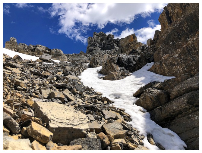
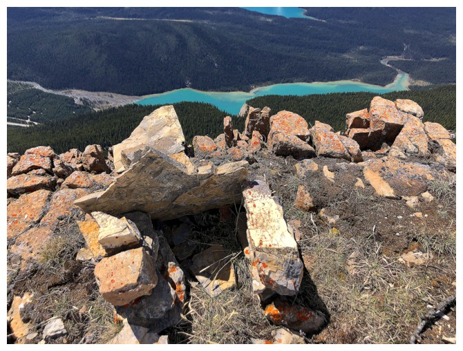
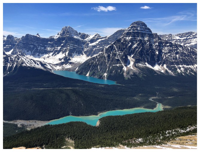
 Above treeline
the pinnacled summit was a mere 15-minute scree slog away. As stated, the lakes
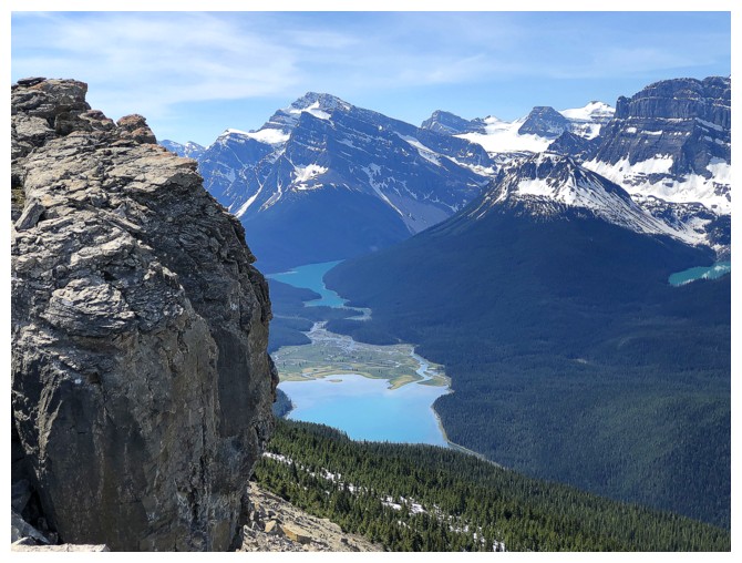
were the highlight of the summit view: Chephren, Cirque, the southern
Waterfowl Lake, and Mistaya, all sporting their unique and beautiful
green/blue/turquoise hues. To my surprise, however, the larger and northern Waterfowl
Lake was hidden from view.
Above treeline
the pinnacled summit was a mere 15-minute scree slog away. As stated, the lakes
were the highlight of the summit view: Chephren, Cirque, the southern
Waterfowl Lake, and Mistaya, all sporting their unique and beautiful
green/blue/turquoise hues. To my surprise, however, the larger and northern Waterfowl
Lake was hidden from view.
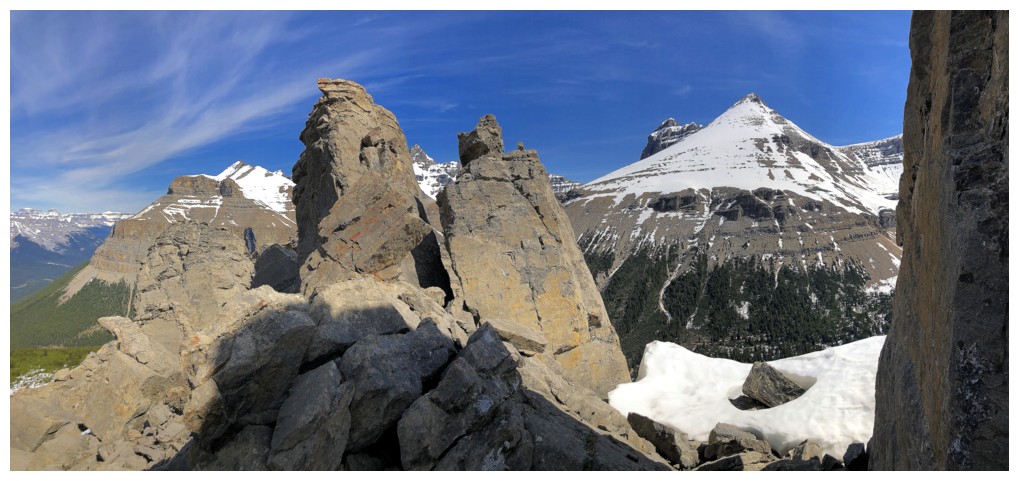
Enjoying perfect
weather and stellar views, I couldn’t resist continuing along the ridge,
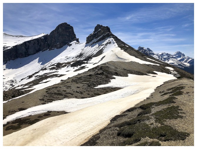
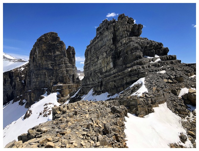
towards two awesome and very distinctive outliers of Spreading Peak. Both
looked to be impregnable but getting a closer couldn’t hurt. As well, the lower
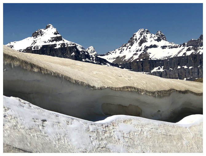
ridge of the first outlier was holding onto a significant cornice (if I ever
had another “kryptonite” in addition to red argillite it would cornices!).
The cornice
scenery was excellent, and views improved even more. The unexpected
part of the continuation was finding a weakness in the southwest side of the
first outlier. I ascended it with ease and was even cautiously optimistic that
the summit could be reached – that optimism was short-lived! At the top of the
gully the summit blocked appeared and it clearly was not going to yield. Even with
ropes and gear, the looseness of the terrain would probably repel even the most
skilled climbers.
Nevertheless,
there were two closely spaced sub-summits, each boasting a fantastic view and I
took a long break to enjoy both. A small cairn at one of the summits indicated
I was not the first to make it to this point.
If there was a
crux to this trip, it would have been choosing a descent route. I really wanted
to attempt a descent down to Noyes Creek on the south side of the peak. The
route appeared to be straightforward and would be an excellent opportunity to
explore. However, there were also many unknowns, such as potential cliff bands,
hidden in the forest, and a possible (actually probable) very high-water level
in the creek itself. After much self-debate, my ever-growing conservative side won
over and I decided to return the way I came.
Aside from the
tedious few first hours, one of the best trips I’ve ever done in this part of
the Rockies.
Looking up the boulder ascent gully
Great view of the north Waterfowl Lake, but that's the last view you get until almost at the summit
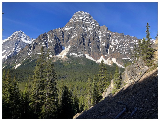
I lied - Mount Chephren
Great rock on the left side of the boulder gully
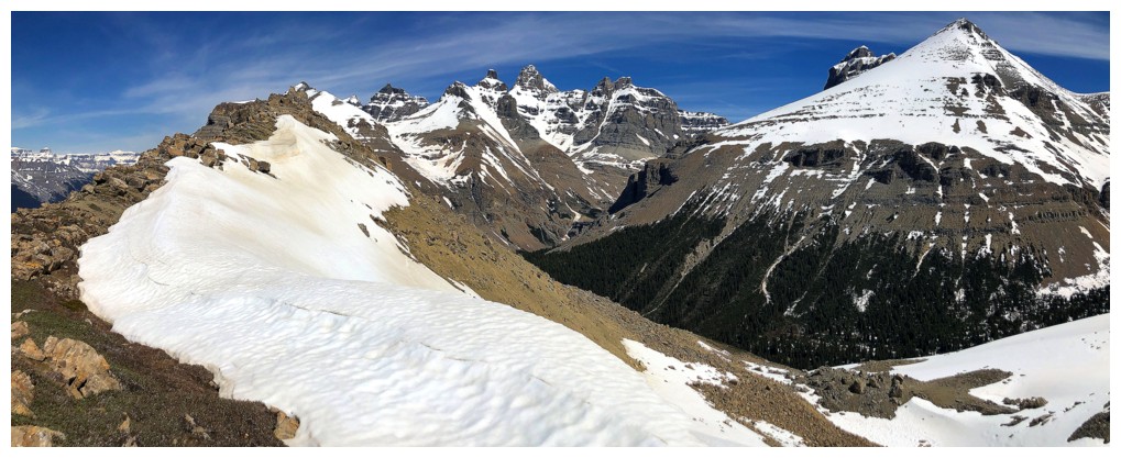
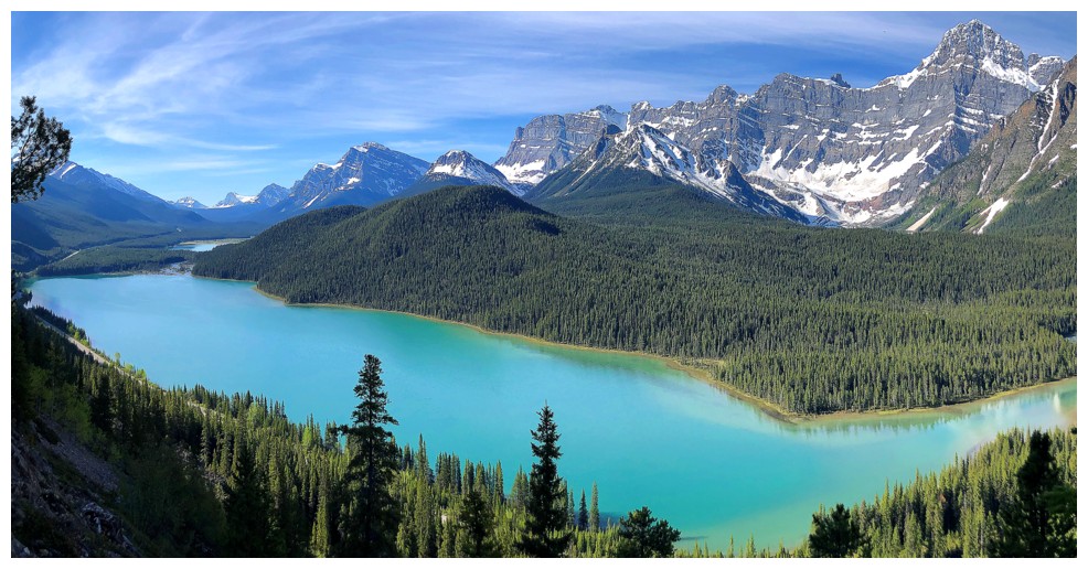
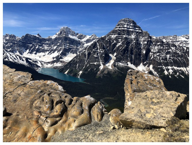
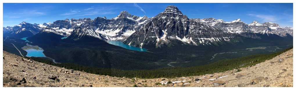
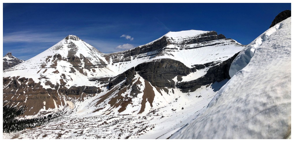
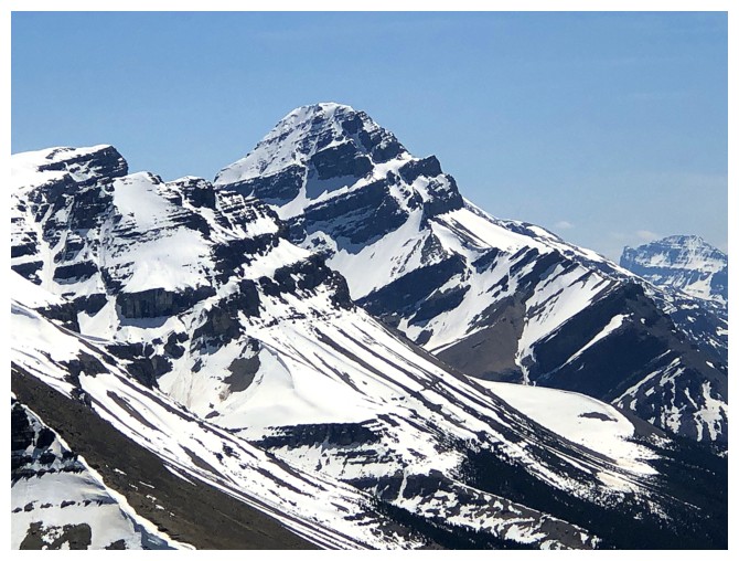
The first thing you see upon breaking treeline. Bison Peak at the left and several of the Murchison Towers.
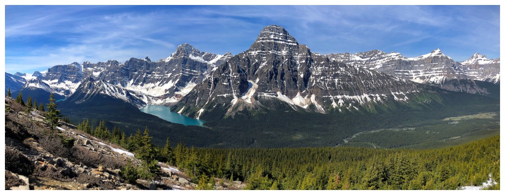
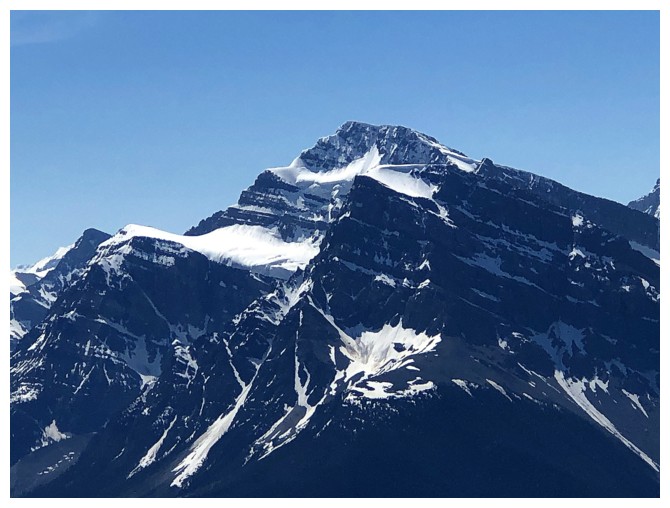
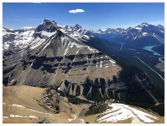
Then you can turn around to see Mount Chephren above Chephren Lake and a whackload of other impressive peaks
The east side of Howse Peak attracts only the highest level climbers in the world - not hard to see why.
Close-up of two of the Murchison towers
And another
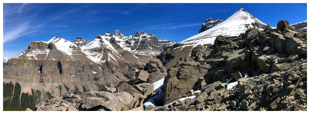
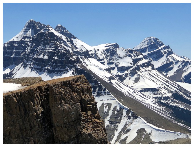
All of the above plus a slither of Totem Tower and South Totem Peak (the snowy one)
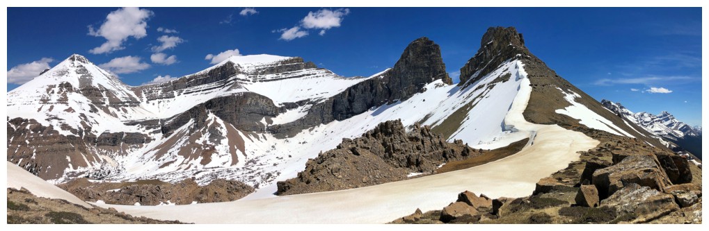
First good view of South Totem Peak and Spreading Peak, commonly done as a single trip
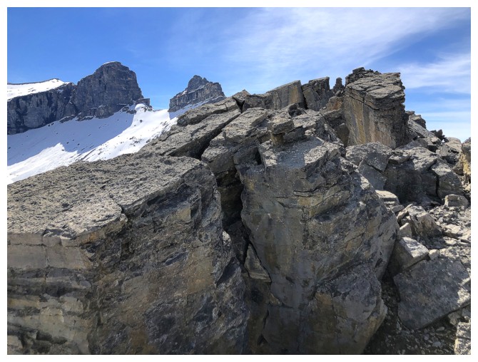
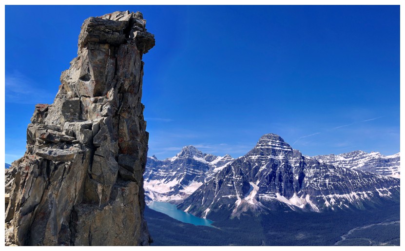
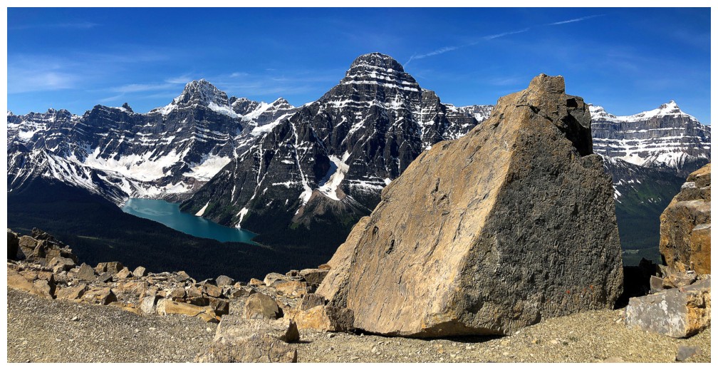
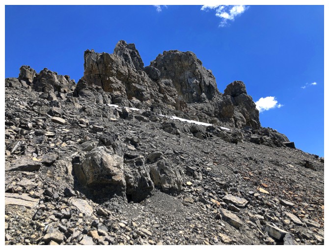
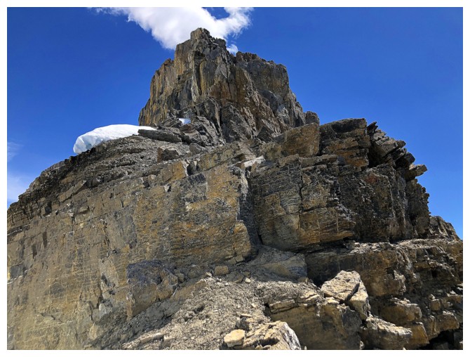
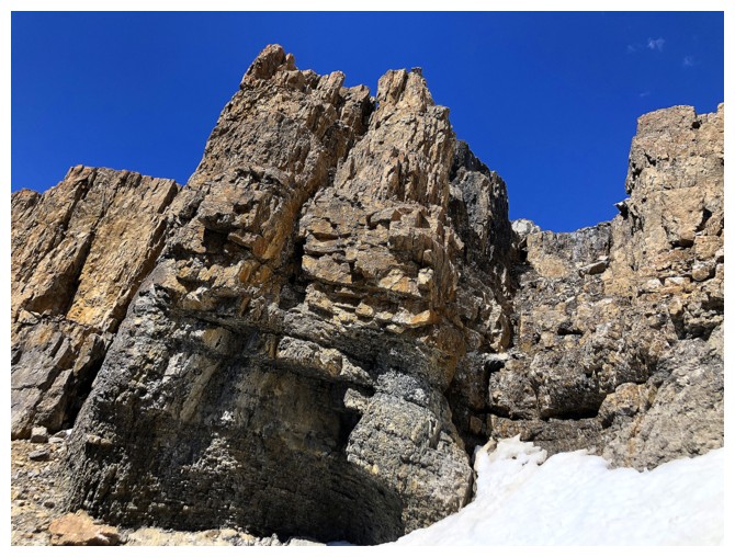
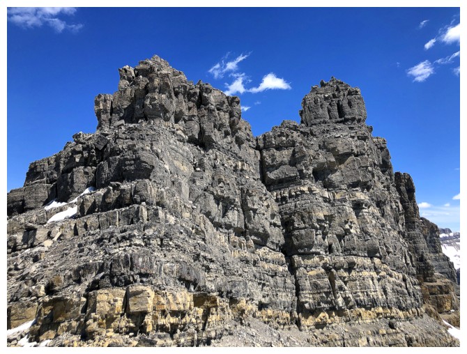
The summit block of Spreading Ridge is littered with cool pinnacles, massive boulders, and rock formations
Case in point
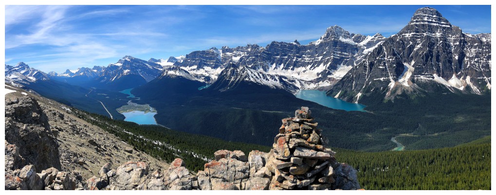
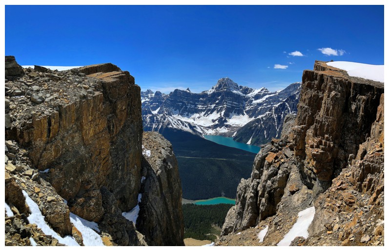
Big summit cairn and even bigger summit view
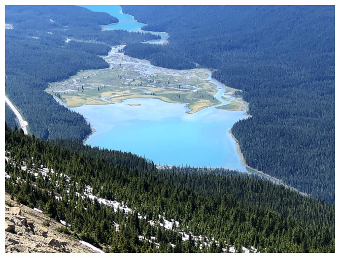
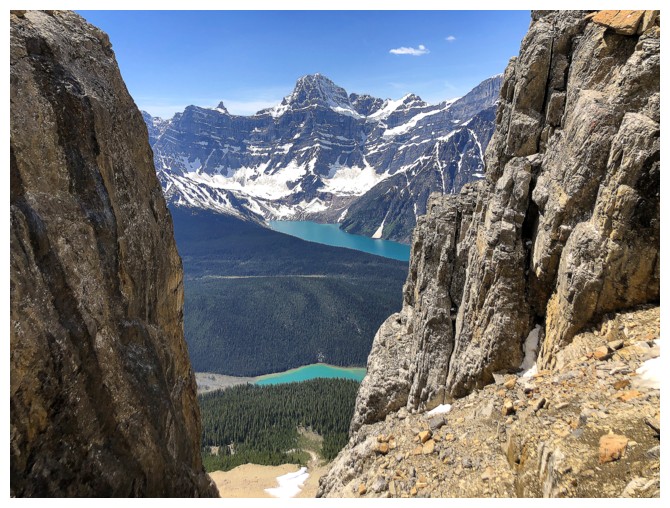
Close-up of the southern Waterfowl Lake
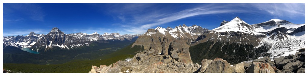
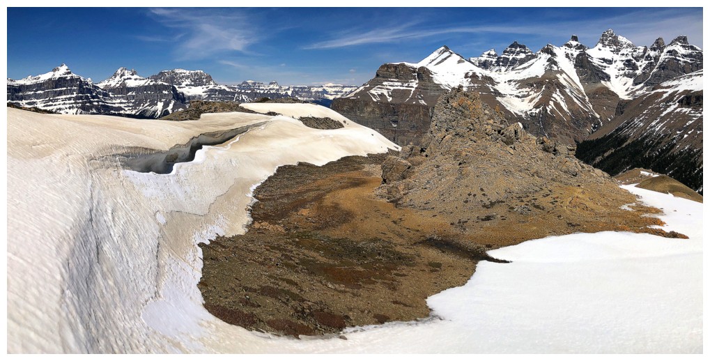
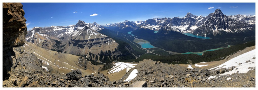
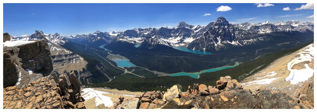
Summit pano 1
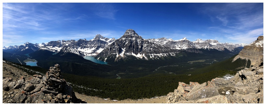
Summit pano 2
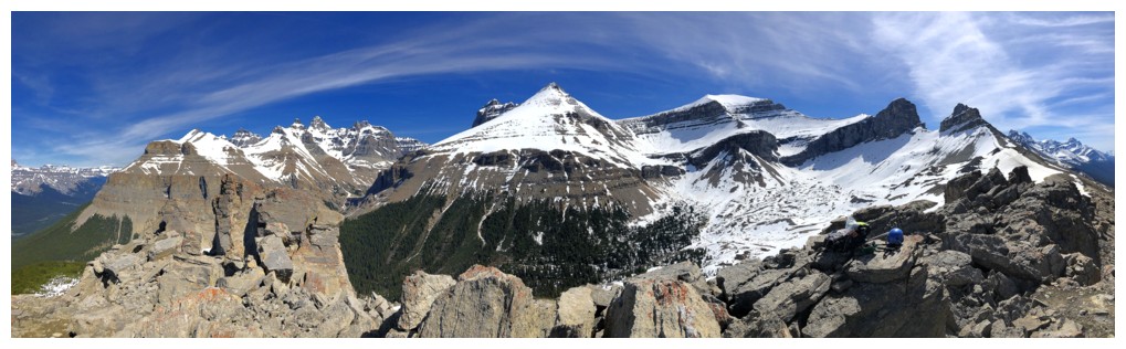
Summit pano 3
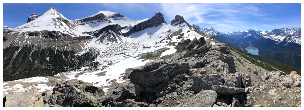
Summit pano 4
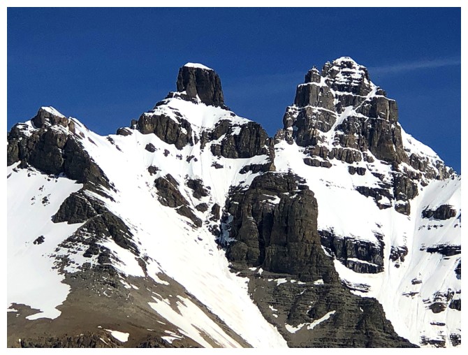
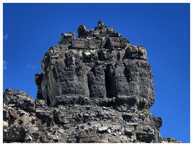
Another cool pinnacle near the summit
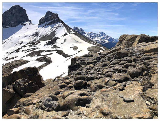
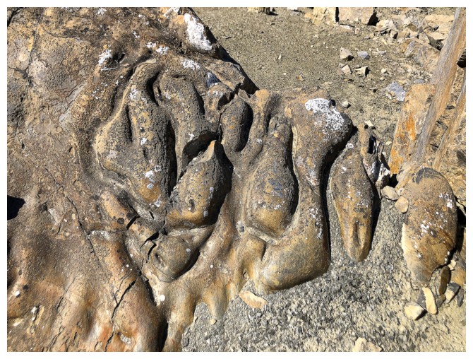
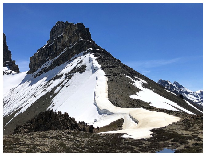
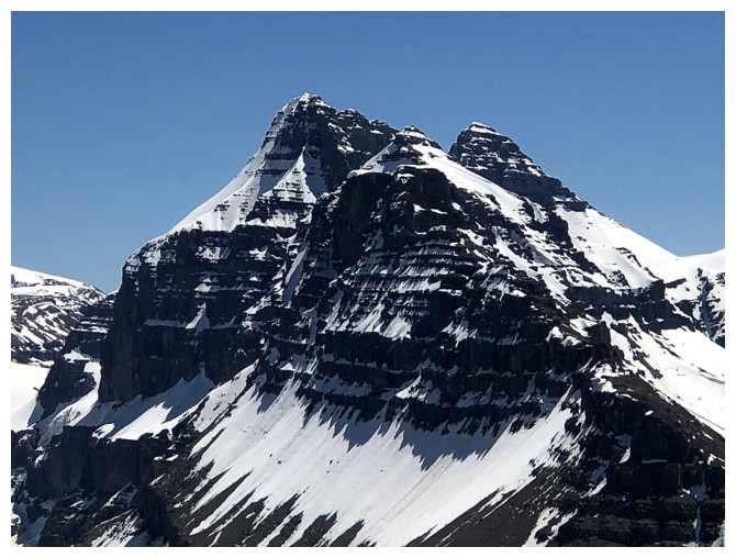
Some very weird eroded rock and the two distinctive outliers of Spreading Peak
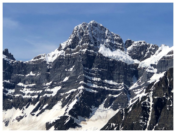
Same as above, with Chephren and Howse instead
Close-up of them
A big boulder tries to imitate Chephren (and does a pretty good job of it!)
Easy travel towards the first outlier
The farther you go along the ridge, the better the views of the various lakes get
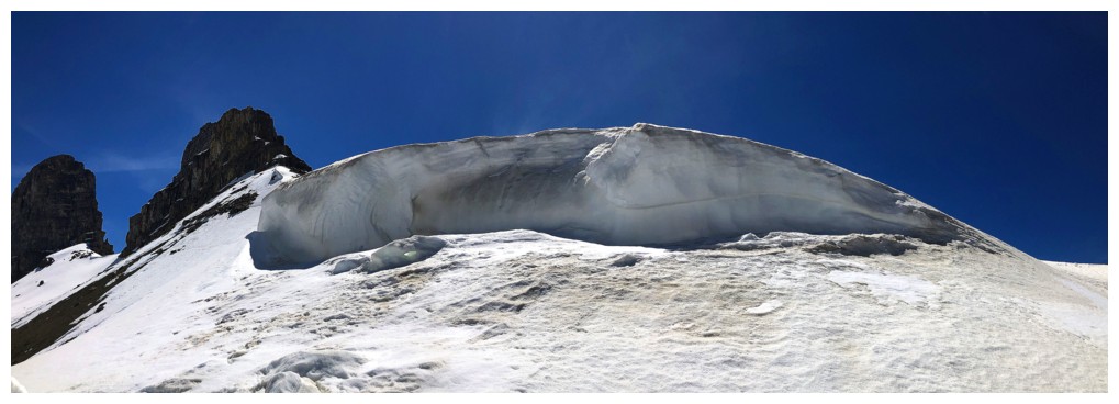
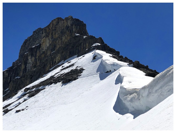
Here comes the cornices!
And a few behind too
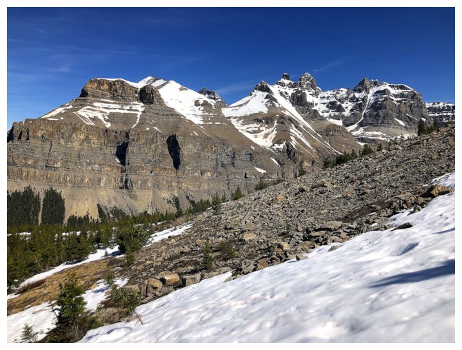
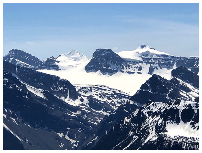
Kaufmann Peaks and Mount Sarbach
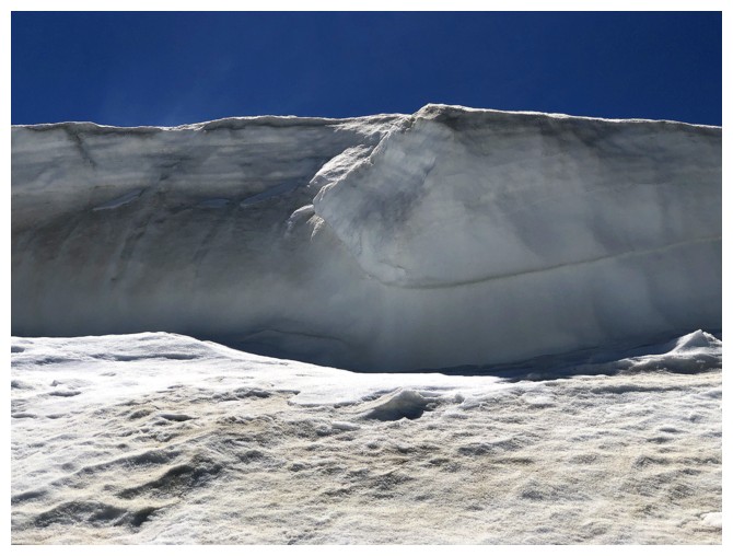
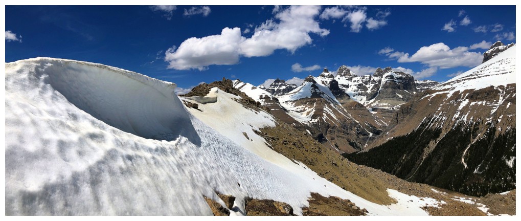
Big wall of snow
With the outliers
And Spreading Peak
A little of everything
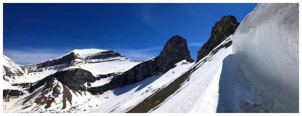
The outlier looks daunting from this angle
Hard to get away from this stunning section of the mountain
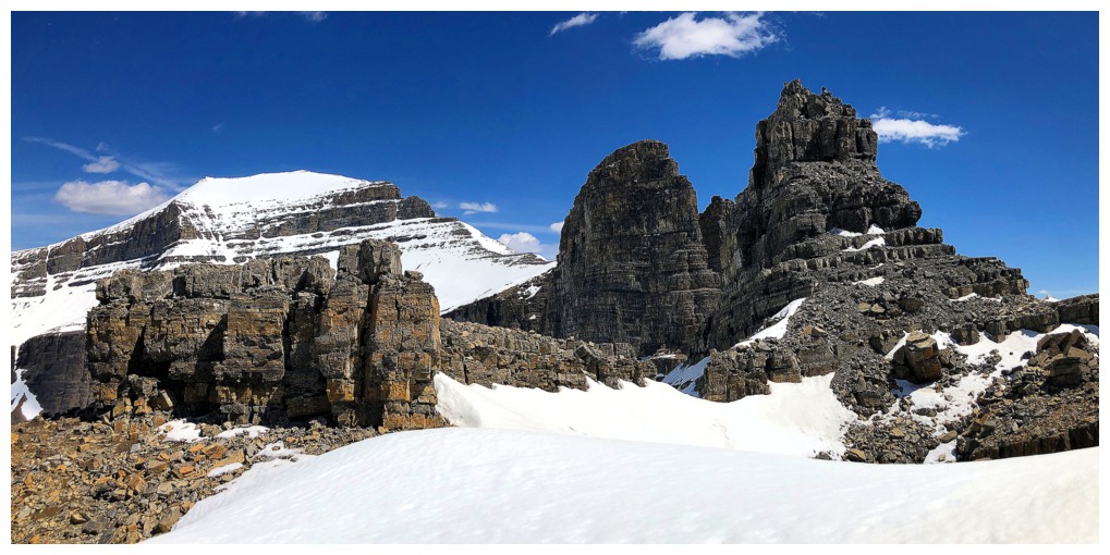
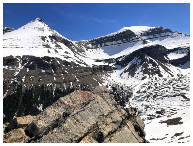
Mount Patterson
Definitely not stepping onto that!
South Totem Peak and Spreading Peak again - someday
Views of the lakes continue to improve as I approach the outlier
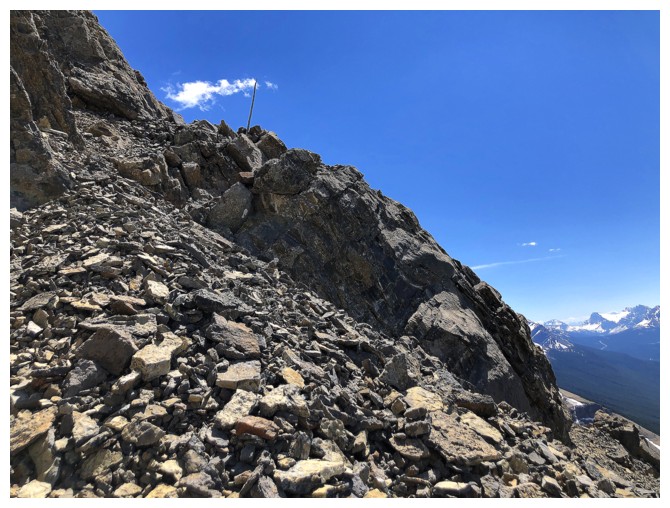
A stick protruding from the rocks. Unless sheep have miraculously improved their hoof dexterity, humans have been here!
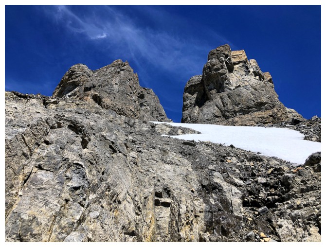
The southwest side of the outlier
Interesting route-finding to gain elevation, but the peak still looks impenetrable
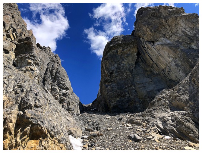
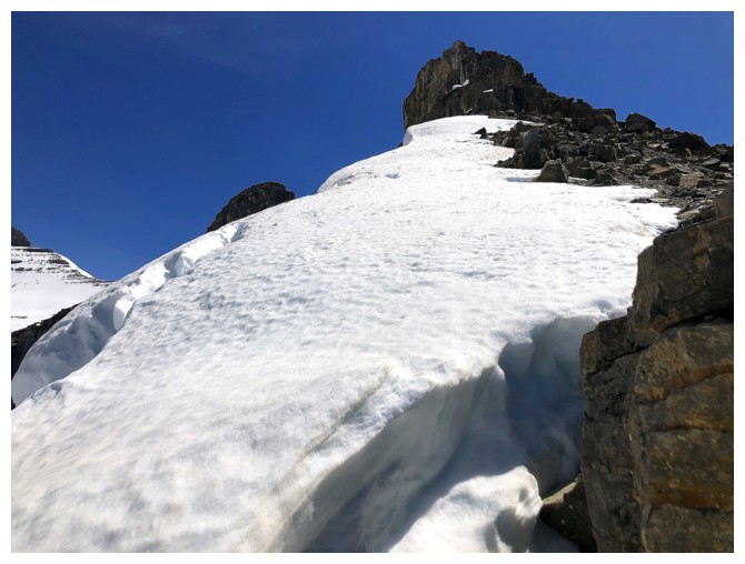
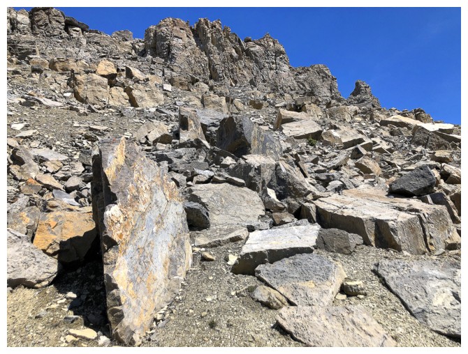
Eureka! The gully that grants access to the upper reaches of the outlier.
Mount Noyes at the left - seems like a lifetime ago we did that trip
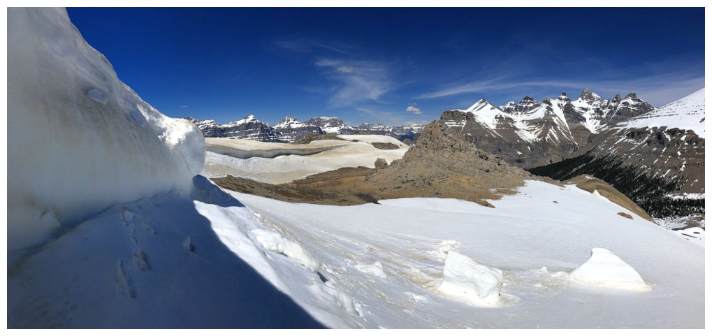
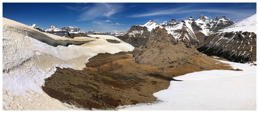
Bigger view of the area
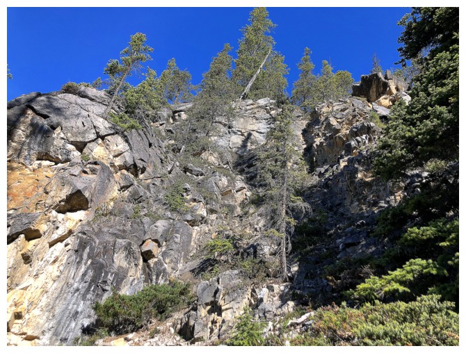
Lots of cool rock, but very crumbly
Steep walls on either side of the gully
Nearing the top of the gully
The good news and bad news: great view of both outliers, but I'm not getting up either
The two sub-summits of the outlier
Nice cairn on the north sub-summit
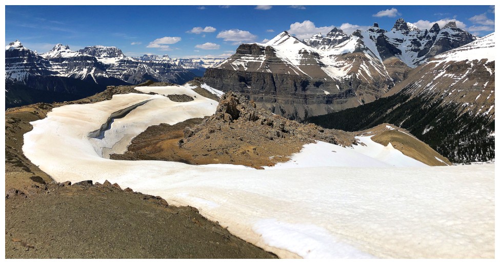
And an amazing view
Mistaya, south Waterfowl, and Cirque lakes
The outliers and Spreading Peak
Noyes (left) and Mount Weed (right)
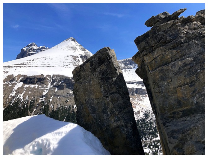
Looking through the gap between the sub-summits while traversing over to the south one
The ridge and summit of the outlier
The scary summit block of the outlier. No dice!
View to the south from the south sub-summit
The northern Waterfowl Lake is now visible
Another view to the south
East Barbette and Barbette Mountain
Mount Weed
Close-up of Noyes. The summit is the peak at the right.
Descending
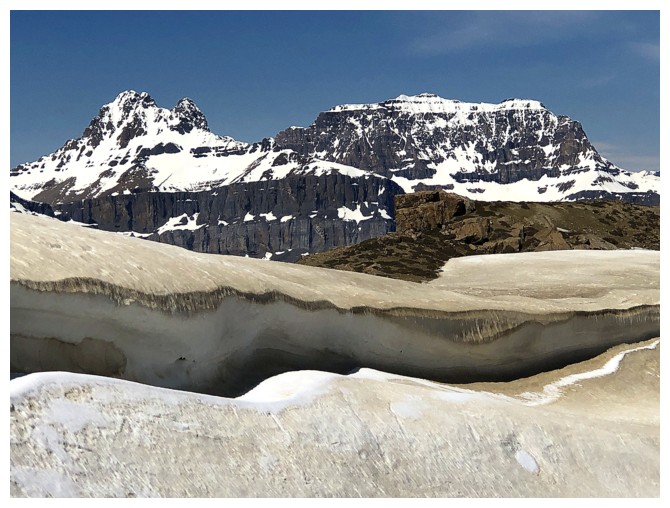
Back at the beautiful snow section
A look back to South Totem, Spreading and the outliers
I'm going to the miss the winter snow (but not the cold temperatures!)
Traversing the west side of the ridge on return
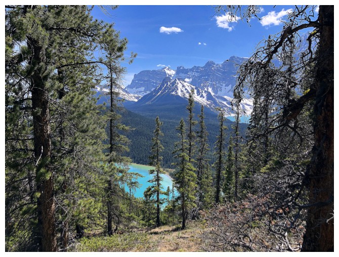
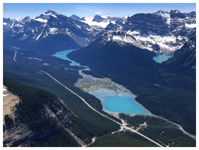
Little glimpse of the northern Waterfowl Lake
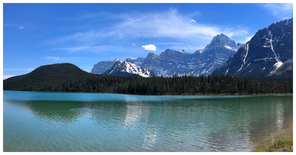
At the shores of Waterfowl Lake
The End
LOG