Mountain height:
3260
m
Elevation gain:
2000
m
Ascent time:
8:30
Descent time:
3:45
Mountaineering with Ferenc.
Admittedly, when Ferenc suggested an attempt of
Due to several unfavorable reviews of the long
approach via
Rampart Creek, we chose the shorter route that basically starts at the
Saskatchewan River Crossing, ascending a long gully on the south side
of the
mountain. The approach to the ascent gully was relatively easy and an
early
start rewarded us with some great views towards 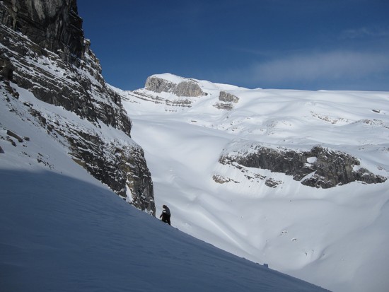 I’ve
ever been in –
fresh snow covering the spherical remnants of avalanche debris,
gorgeous, steep
rock walls all around, and the bluest of blue skies. And the snow was
bomber -
cramponing up it a sheer joy. Atop awaited a magnificent view of the
expansive
snow and icefields of
I’ve
ever been in –
fresh snow covering the spherical remnants of avalanche debris,
gorgeous, steep
rock walls all around, and the bluest of blue skies. And the snow was
bomber -
cramponing up it a sheer joy. Atop awaited a magnificent view of the
expansive
snow and icefields of
The supposed crux of the trip followed: descending a 40 degree snow slope to the bowl below. Ferenc led the descent. Once again, the snow was stable and supportive and Ferenc provided an easy path for me to follow down. The pristine scenery on the way down and throughout the ascent continued to be a source of sheer amazement. And thank God it was, because the next 4.5 hours were beyond physically strenuous. I would not have had a hope in Hades of making the summit had it not been for the Ferenc’s determination and physical strength and stamina. He broke trail for about 95% of the remaining trip, while I suffered behind him, breathing as heavily as I ever have on any trip. The snowfields were extremely foreshortened and what appeared to be 15 minutes away was typically an hour in travel time.
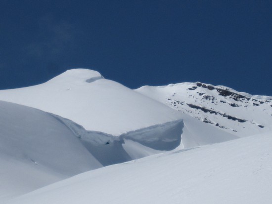
Given the significant snow cover of the glacier, we opted to go unroped – perhaps a questionable decision, but since we still both here, also a moot point. Unfortunately the weather started to deteriorate as we approached the summit. Below the summit ridge, a huge slab of snow (perhaps 10 m in height) had broken off and slid down the slope – a chilling sight.
The actual crux of the trip occurred just before
the summit.
Here, the ridge steepened significantly, with an immense drop-off on
the right
side and a 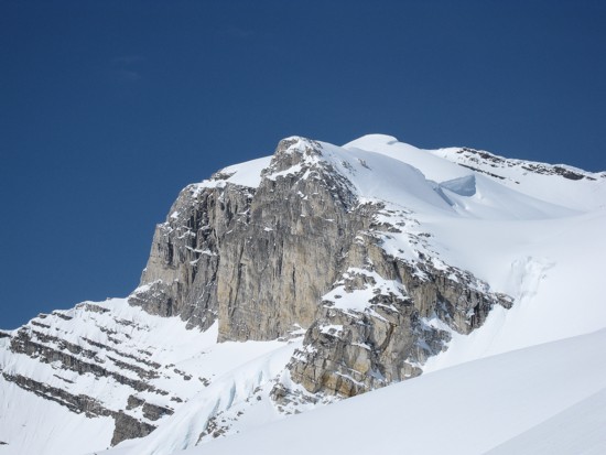 cornice
on the left. Staying
on the ridge was out of the questions
due to the huge cornice and so Ferenc led us across and up the right
side. An
avalanche earlier on the 40 degree slope would have sent you less than
150 metres
down into the bowl; an avalanche at this point could have sent you all
the way
down to the road – almost 2 full kilometres below. We were both
happy that the section
was short-lived and the snow again bomber.
cornice
on the left. Staying
on the ridge was out of the questions
due to the huge cornice and so Ferenc led us across and up the right
side. An
avalanche earlier on the 40 degree slope would have sent you less than
150 metres
down into the bowl; an avalanche at this point could have sent you all
the way
down to the road – almost 2 full kilometres below. We were both
happy that the section
was short-lived and the snow again bomber.
A short walk brought us to the summit, 8.5 hours
after
leaving the car. With clear skies, the
Our descent was surprisingly fast, taking less then half our ascent time. Only the 150 m elevation gain back to the top of the ascent gully proved to be strenuous. Not wanting to spend a second more on that slope than was necessary, we powered up it in pretty good time. Ferenc then managed to glissade a good portion of the main gully, while I walked down.
Overall, an outstanding day on a stunning mountain. A big thanks to Ferenc for suggesting the trip and for breaking all that trail.
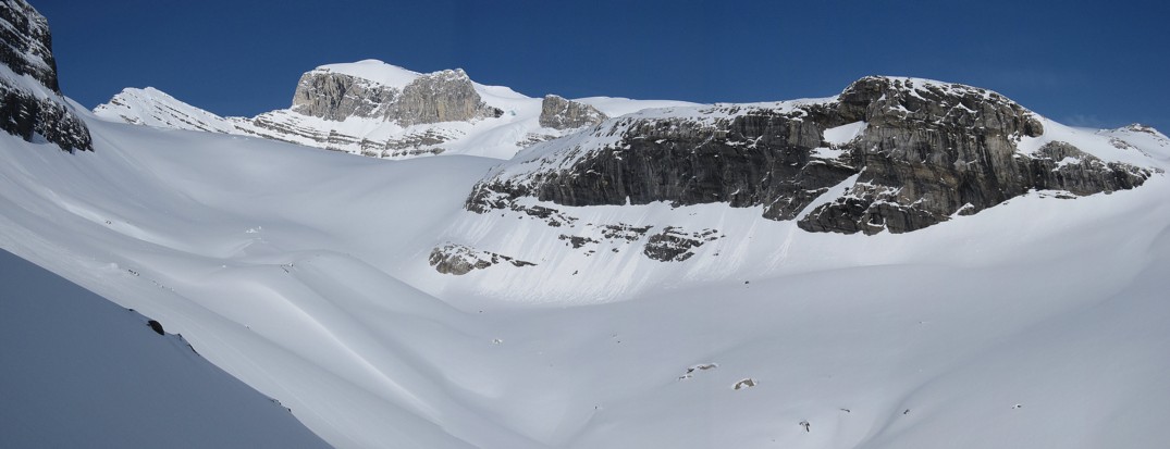
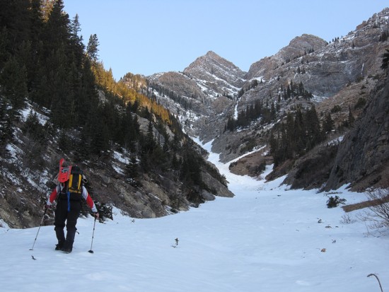
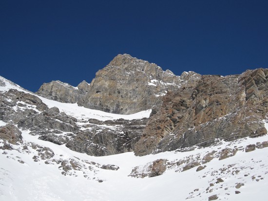
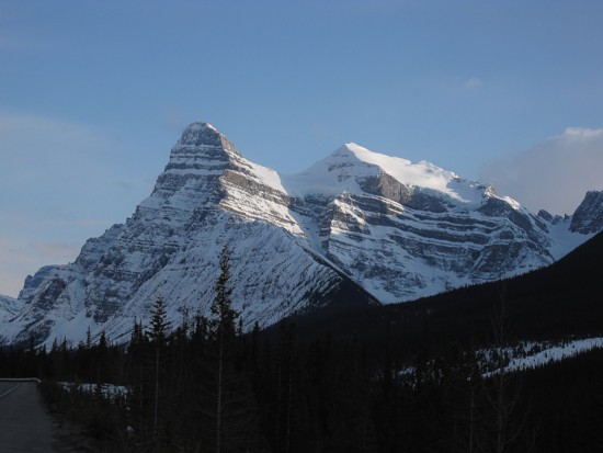
The south side of Mount Wilson;
the ascent gully is just left of centre
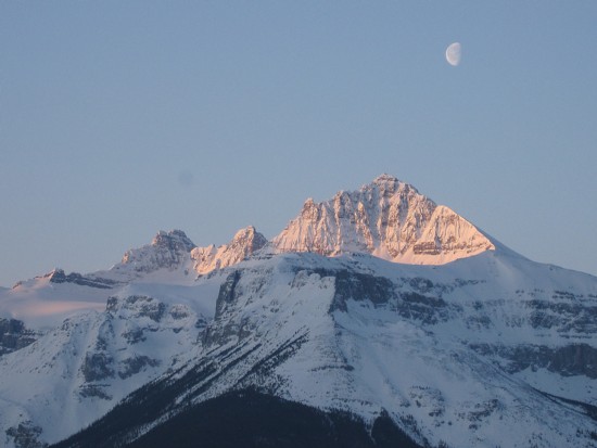
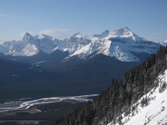
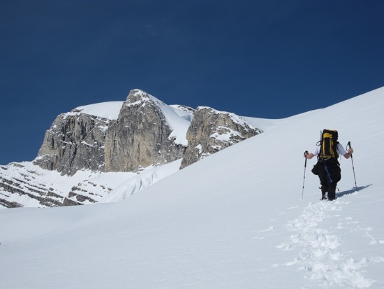
Mount
Sarbach and the Moon
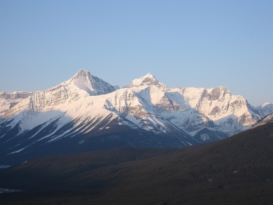
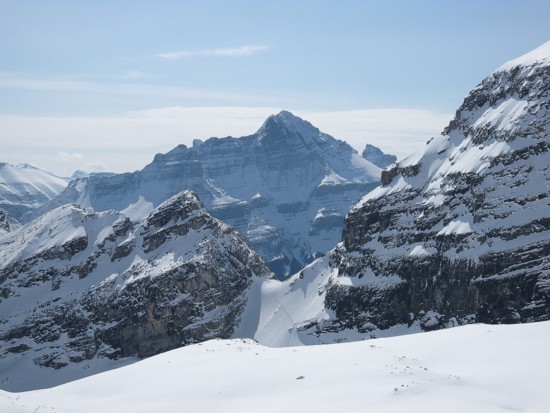
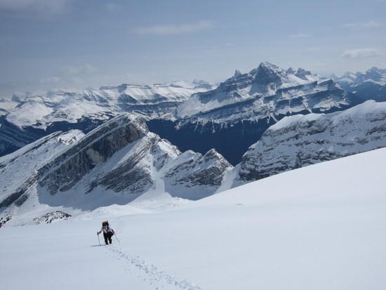
Mount Outram
(left) and Mount
Forbes (centre)
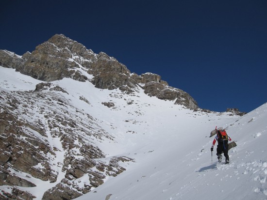
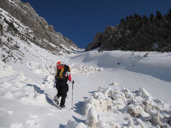
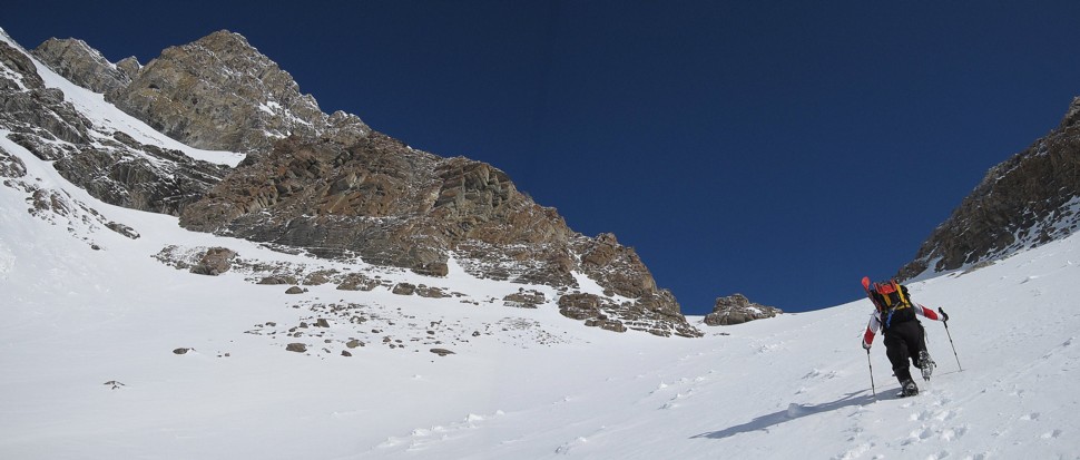
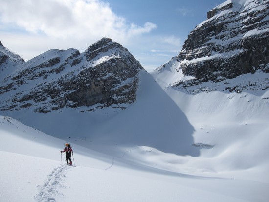
Ferenc starts up the lower section of the ascent gully
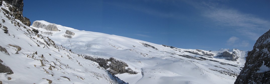
The beautiful upper section
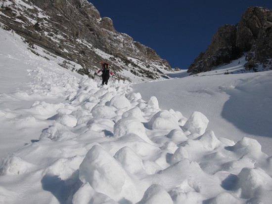
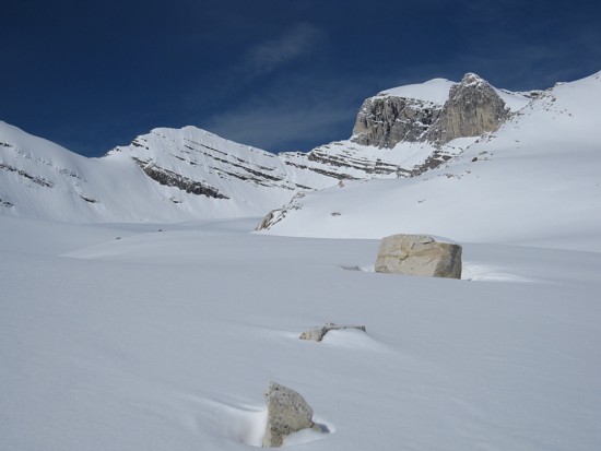
Avalanche debris
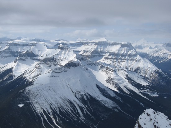
Looking southwest to Chephren,
White Pyramid,
Epaulette,
Kaufman,
and Sarbach
Blue sky, rock, and snow
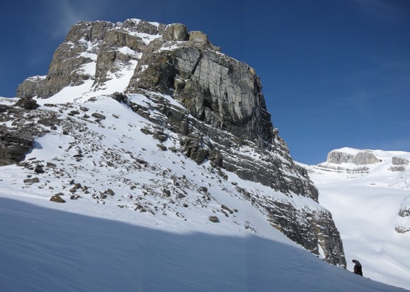
Ferenc tackles the final few hundred metres of the gully
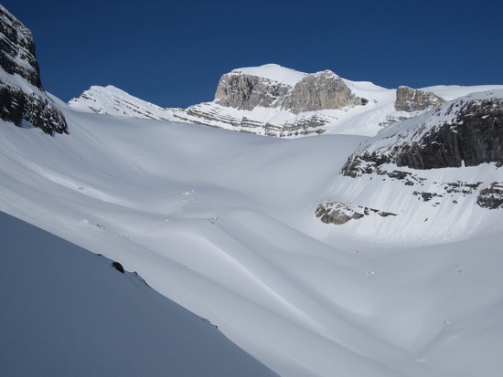
The enormous Wilson
Icefield
Ferenc prepares to descend the 40 degree slope
Beautiful scenery on the way down
Looking back to the descent route
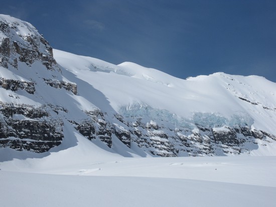
Glacier
Some of the 5% where I broke trail; Mount Murchison in the centre
More incredible scenery
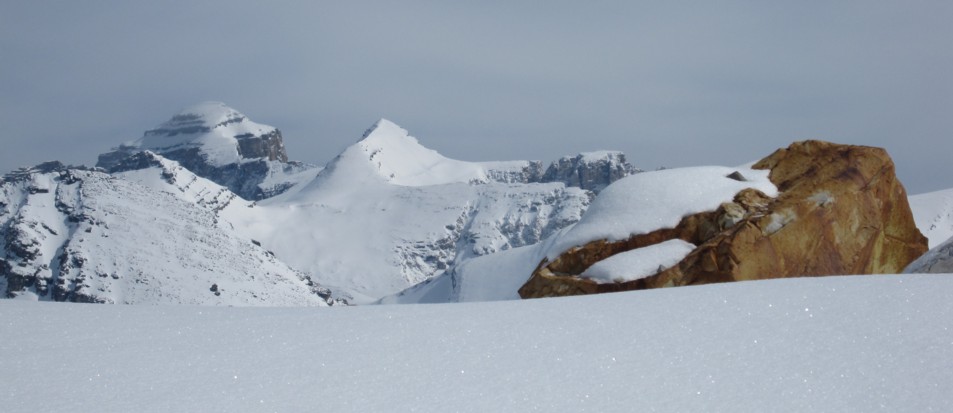
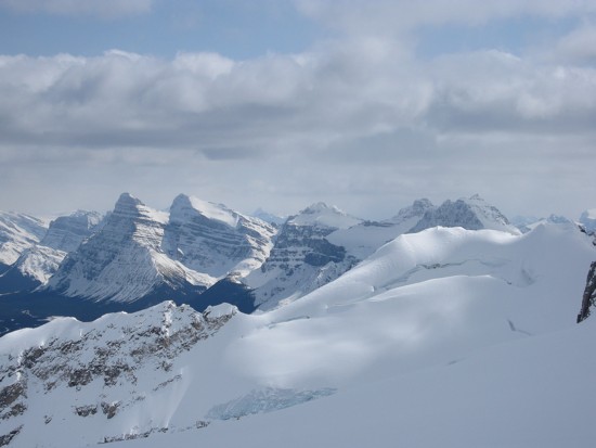
Mount Cline (left) and a colourful rock
Again, looking back to the notch and Murchison
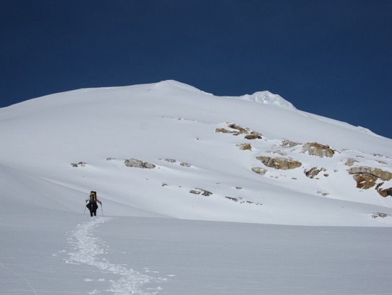
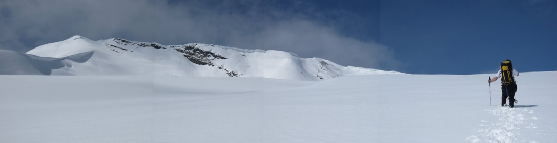
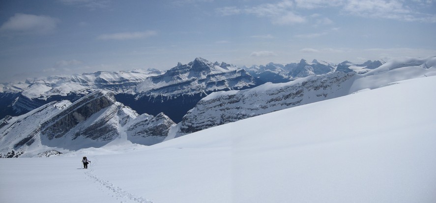
Ferenc leads us over seemingly endless kilometres of snow
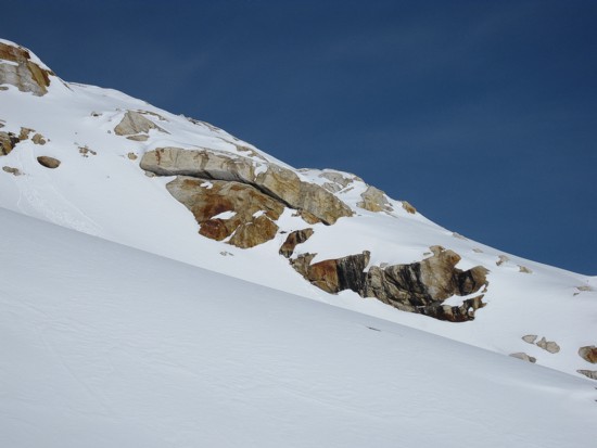
More colourful rock
Some of the pleasant scenery to take our minds off the grueling travel
Same as above
My last lead of the day
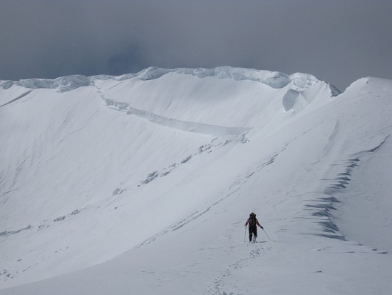
Approaching
the summit ridge; note the enormous cornice and fracture line
below;
the fracture was about 10 m high
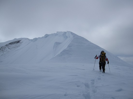
Approaching the crux; the terrain ahead is far steeper than it
appears
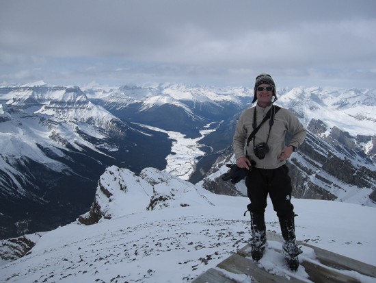
Ferenc at the summit (helicopter pad)
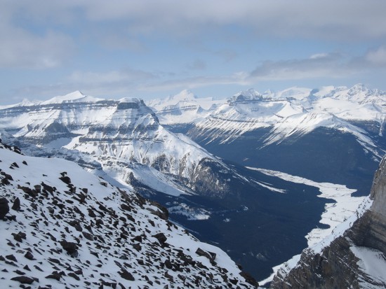
The view to the northwest; Mount
Columbia in the distant centre, Mount Amery to
the left
Mount Amery
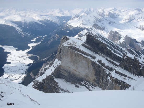
One of the distinctive vertical faces of the west side of Wilson
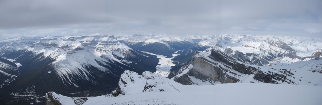
A partial panorama
Chephren
and company
Chephren
and White Pyramid
from the road