 Mountain height:
2700
m
Mountain height:
2700
m
Elevation gain:
900
m
Ascent time:
5:00
Descent time:
3:10
Climbing with Mark, Raff, and Grant.
On the heels of a relatively
successful reconnaissance up
the east side of Wintour, we set out, with Raff and Grant, to hopefully
finish
the job. The hike around to the east side of the mountain was
infinitely more
picturesque than that of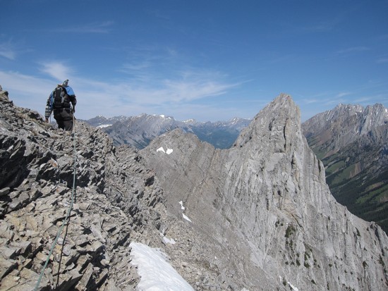 a week earlier, courtesy of a clear, blue sky.
Especially noteworthy were the impressively, vertical limestone slabs
of the
east face, sunbathed in brilliant sunlight; below these slabs were
several
layers of different coloured rock, eroded by water into a beautiful
curve of
sloped land; and to top things off, the green of grass and trees
outlining the
slope –
outstanding!
a week earlier, courtesy of a clear, blue sky.
Especially noteworthy were the impressively, vertical limestone slabs
of the
east face, sunbathed in brilliant sunlight; below these slabs were
several
layers of different coloured rock, eroded by water into a beautiful
curve of
sloped land; and to top things off, the green of grass and trees
outlining the
slope –
outstanding!
Reaching the bottom of the ascent
slope, we were treated to
another outstanding vista: the majority of peaks of the
Back to the task at hand! Grant led
the ascent to the ridge
at a breakneck speed. All was going extremely well (perhaps too well)
and we
hoped that once on the ridge, an easy ridgewalk would lead quickly to
the
summit (“easy going to the summit” - the
Green book). The news upon reaching
the ridge was good and bad. The good news was that the ridge sported
yet
another wonderful panorama, featuring peaks around the
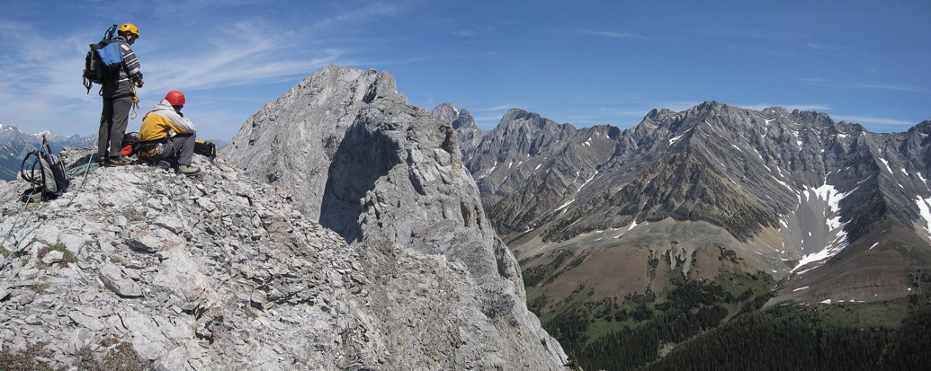
Mark and I decided to short-rope right away, while Grant and Raff headed north along the ridge unroped. Though there were many narrow sections and the rock quite loose, the scrambling was never too difficult throughout the first section. Mark and I soon caught up with Grant and Raff, who had negotiated the ridge with surprising speed and ease.
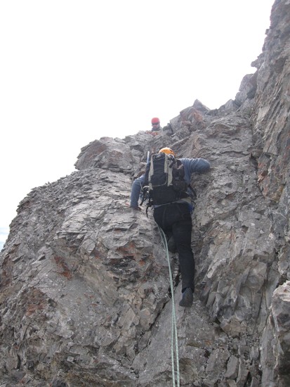
The second section of the ridge looked far more serious and Grant and Raff also opted to short-rope at this point. We also all switched to either approach shoes or rock shoes – good thing we brought them along – the scrambling quickly graduated to 4th and low 5th class, with a fair amount of serious exposure. Grant and Raff quickly made their way to the steep wall barring access to the summit. Thankfully, the wall was not as steep as predicted and the rock excellent. Grant skillfully led us up the face and then to the summit, a short distance away.
Needless to say, the summit view was terrific. The descent went very well and with the appropriate shoes we were all able to downclimb the crux sections. Yet again, Mark and I were impressed watching Grant and Raff negotiate the exposed ridge with ease.
An outstanding trip in one of the best areas of the Canadian Rockies.
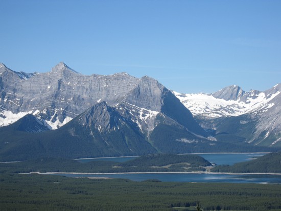
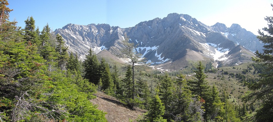
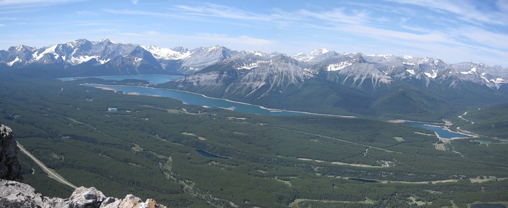
The Kananaskis Lakes, Sarrail (left), Warrior
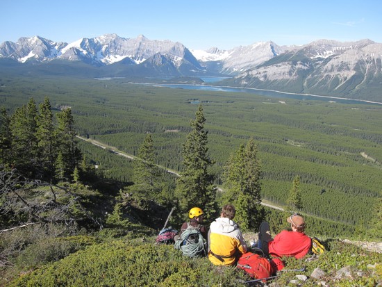
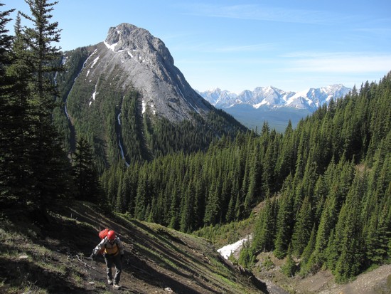
Taking a break after slogging up to the southwest ridge
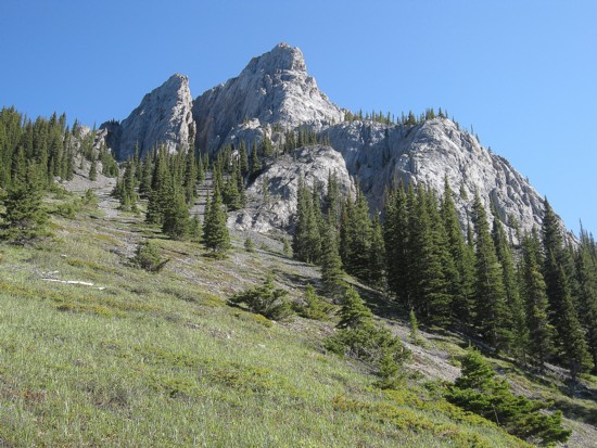
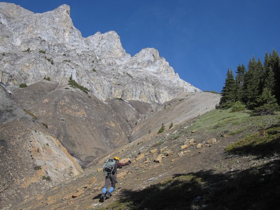
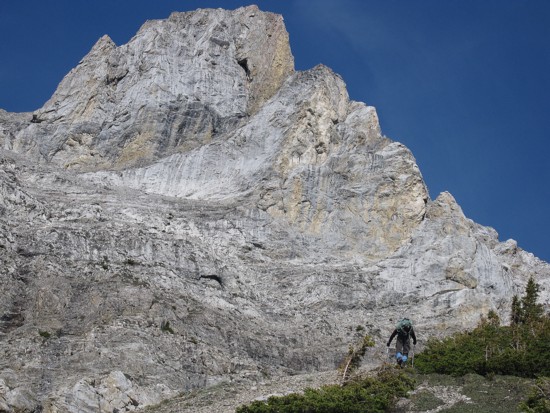
Beautiful limestone on the south side of Wintour
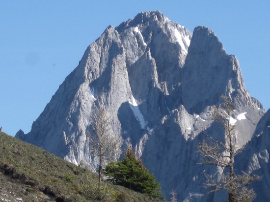
Raff ascends the southwest side of the peak, with an unnamed peak behind
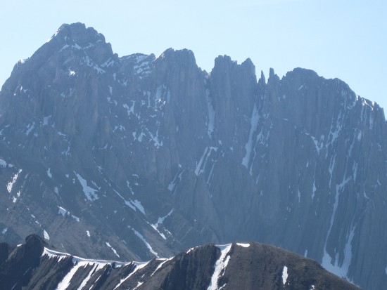
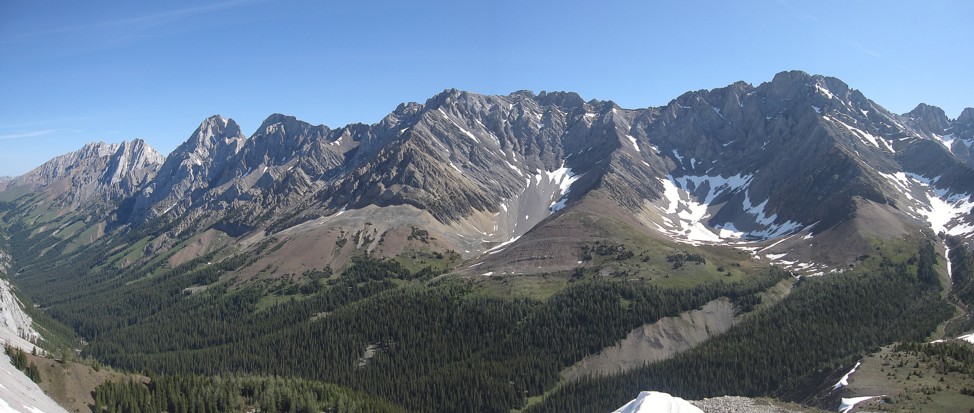
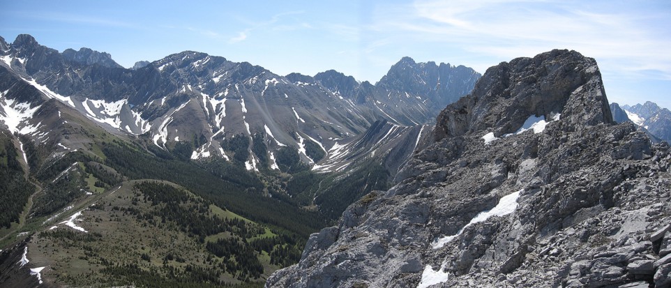
The outstanding, colourful scenery on the southeast side
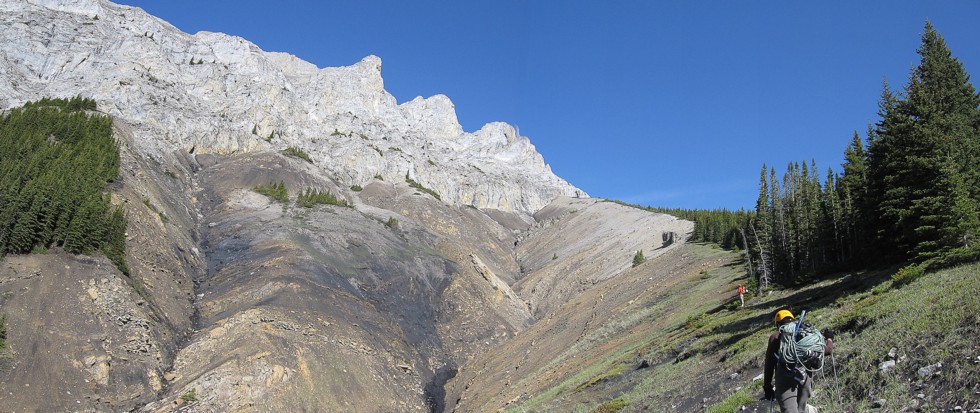
Same as above
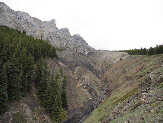
A similar photo taken a week before in cloudy conditions
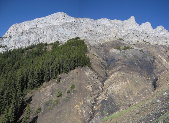
More limestone walls and colourful scenery
Looking east to Mount Jerram; Mount Burney is the non-descript summit at the far left
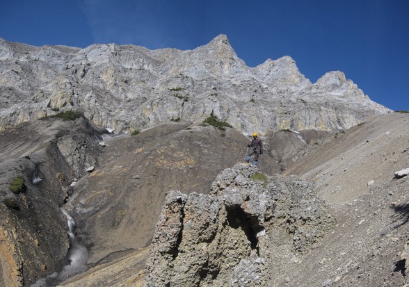
Approaching the ascent gully (not seen here)
Mount Blane and The Blade to the right
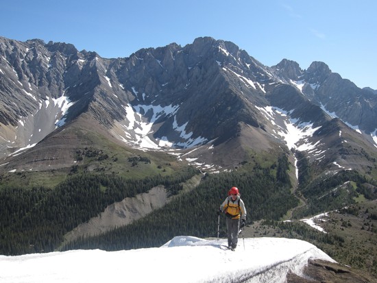
Raff hikes up a snow bank
My turn
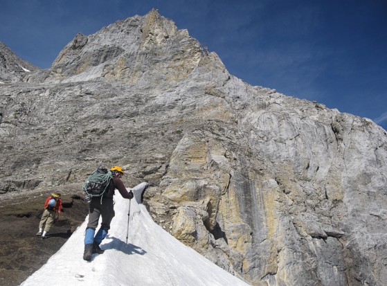
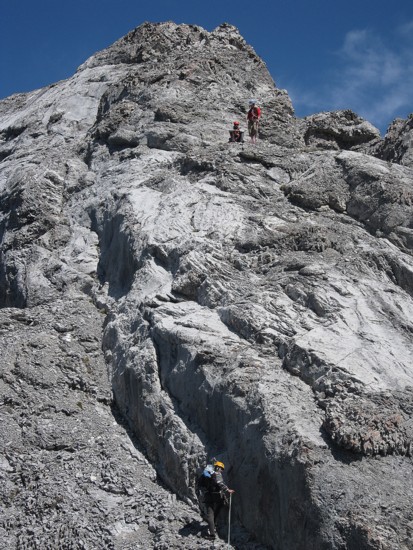
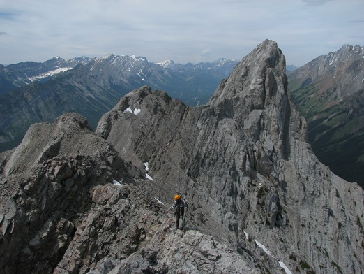
Grant (barely visible to the right) leads the ascent to the ridge, Raff follows
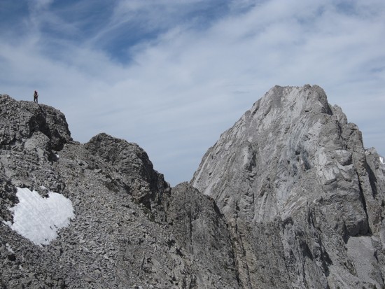
Typical terrain
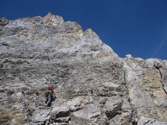
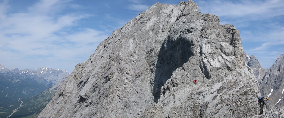
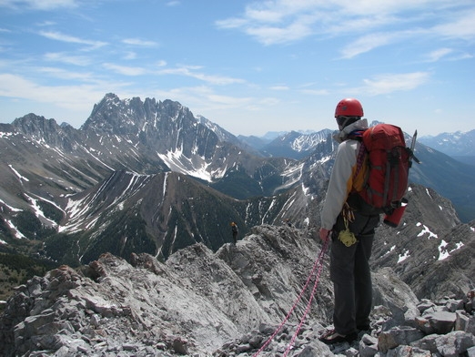
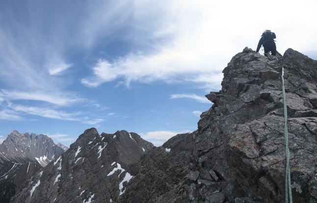
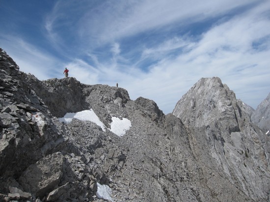
On the ridge looking to the south summit
On the ridge looking to the true summit; Grant leads the way
The view to the southwest
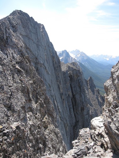
One reason why you wouldn't want to slip down the west side of the mountain
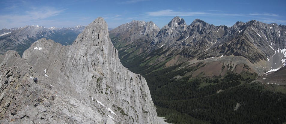
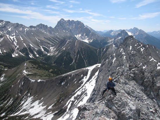
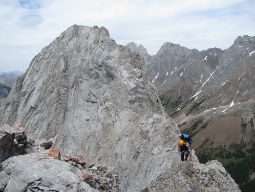
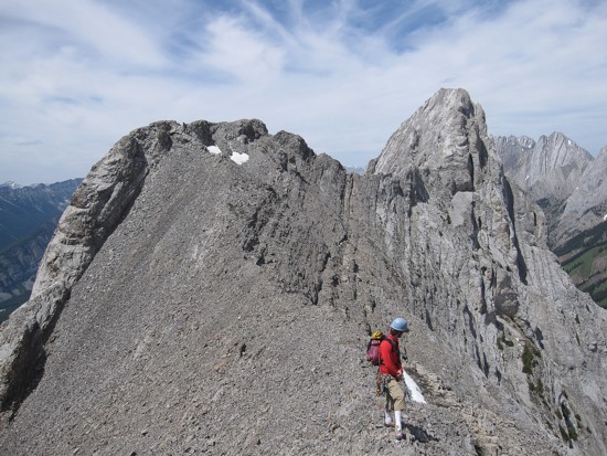
Traversing the ridge, with peaks of the outstanding Opal Range to the right
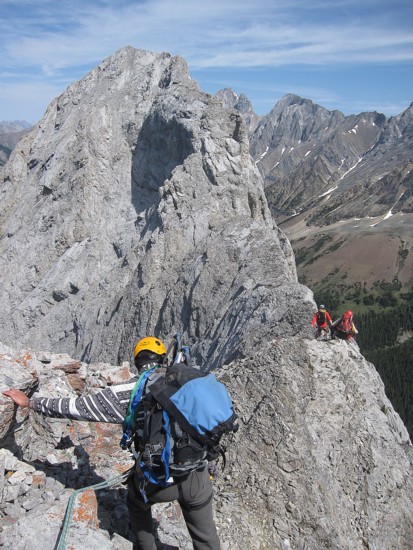
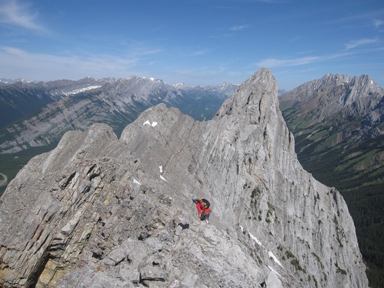
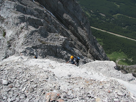
The latter part of the ridge, where we all short-roped
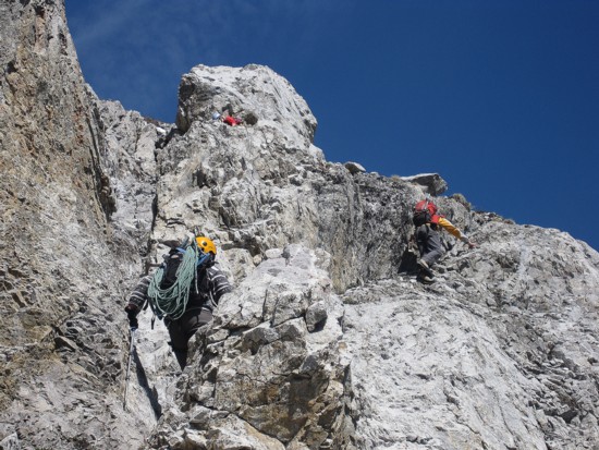
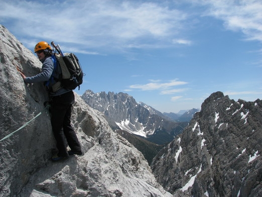
Grant and Raff approaching the crux
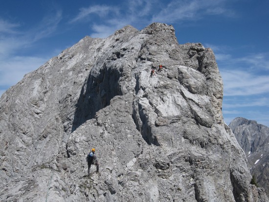
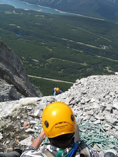
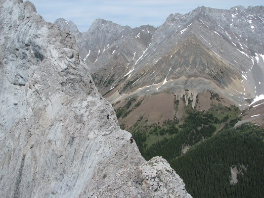
Grant and Raff above the crux, while I watch
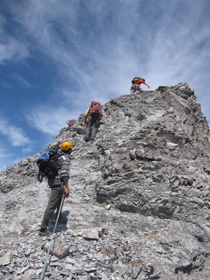
Me approaching the crux, while Grant and Raff help us with the route-finding
Climbing the crux (photo by Raff)
Belaying Mark up the crux (photo by Raff)
Another tricky section before the summit
Mark negotiates the final section of the ridge
Raff waits us for at the summit (photo by Grant)
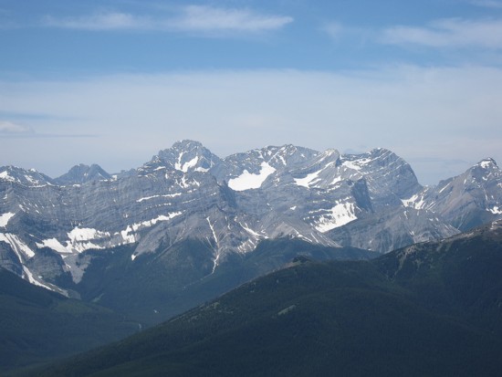
L to R: Sir Douglas, French, Smith-Dorrien, Prairie Lookout, Murray
Mark and Raff at the summit
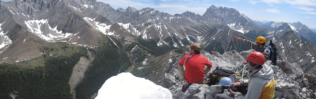
Pointing out the scary descent route Kevin and I took down Mount Burney
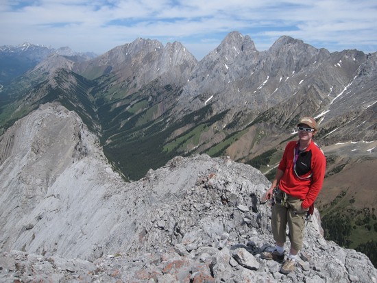
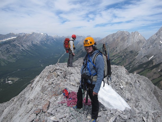
Grant at the summit
Mark at the bottom on the crux (photo by Raff)
Heading back along the ridge (photo by Raff)
Same as above
Mark on the ridge
Mark ascends a short step on return
Looking back at the ridge (photo by Raff)
Grant and Raff on the ridge
Raff and the summit block
Grant takes a last look at a ridge that will probably never see us again