Anderson Peak III
Lost Mountain III
July 14, 2020
Mountain heights: 2698 m, 2509 m
Elevation gain:
approximately 1200 m
Roundtrip time:
10:15
Solo scramble.
With the Red Rock Canyon road open to motor
vehicles for the first time in three years, the first order of business was to
repeat a trip I’ve been wanting to do again for some time – the moderate
scrambling route up the south side of Anderson Peak. Mark and I had stumbled
upon the route in 2007 and discovered it to be one of the finest scrambling
routes in the park.
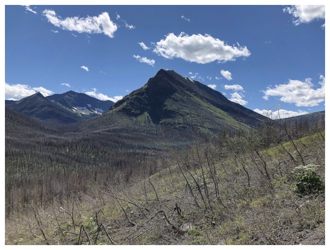
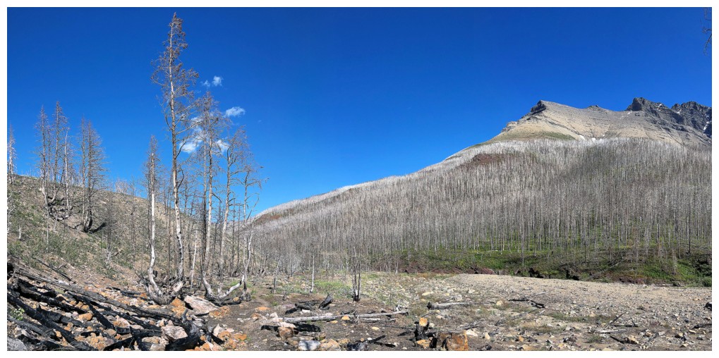
 The big surprise of the day came early with the
first look at the results of 2017’s devastating Kenow fire. I fully expected to
spend the day hiking in a burned out, apocalyptic wasteland. Such was not the
case: most of the burned trees had lost their branches, leaves and bark but
remained standing as silver needles reaching to the sky, amid the lush green of
new growth; the valley was more open and more inviting in general; new
potential routes up the north side of Mount Blakiston revealed themselves, the
deterrent of lengthy bushwhacking ordeals gone. In short, I found the whole
area to be even more scenic than before the fire.
The big surprise of the day came early with the
first look at the results of 2017’s devastating Kenow fire. I fully expected to
spend the day hiking in a burned out, apocalyptic wasteland. Such was not the
case: most of the burned trees had lost their branches, leaves and bark but
remained standing as silver needles reaching to the sky, amid the lush green of
new growth; the valley was more open and more inviting in general; new
potential routes up the north side of Mount Blakiston revealed themselves, the
deterrent of lengthy bushwhacking ordeals gone. In short, I found the whole
area to be even more scenic than before the fire.
 The Anderson ascent was as amazing as I
remembered it to be. I’m a little surprised that the route has not become more
popular, as once above the difficulties at the beginning, you get to enjoy 600
vertical metres of easy to moderate hands-on scrambling up a magnificent
water-worn gully. The easier route that starts up the mountain farther west is
a long, steep slog on less than user-friendly terrain. That route, however,
does boast a very cool waterfall en route and sections of good scrambling if the drainage is dry.
The Anderson ascent was as amazing as I
remembered it to be. I’m a little surprised that the route has not become more
popular, as once above the difficulties at the beginning, you get to enjoy 600
vertical metres of easy to moderate hands-on scrambling up a magnificent
water-worn gully. The easier route that starts up the mountain farther west is
a long, steep slog on less than user-friendly terrain. That route, however,
does boast a very cool waterfall en route and sections of good scrambling if the drainage is dry.
At one point, I did detour over to the left to
explore a steeper route to the ridge. When the terrain appeared to get more
serious higher up, I backed down. A younger version of myself would have
continued up until I actually hit an impasse, but, “That kid is long gone and
this old man is all that’s left.” – classic line from one of the best movies
ever, The Shawshank Redemption.
Back on track, I eventually reached the ridge,
relatively near to the far east end of the mountain. This was quite nostalgic,
recalling a very distinctive pinnacle Mark and I found to pose upon. A quick
visit to the east highpoint and then it was onto the true summit. On the way I
met a couple of friendly scramblers who were heading to the east highpoint
before completing the entire Anderson/Lost/Bauerman traverse. They had ascended
the easier route to the ridge. Their only comment about the route was, “What a slog!”
The summit of Anderson was reached in short
order and I took a short break. Short because since Anderson was my only objective,
I thought I would take a quick look at the north side of the peak. If nothing
else it might offer good views of Anderson’s awesome 5.9 east ridge climb,
pioneered by Jim Everard and Blair Piggot in 2008. Subtract 0.8 from that grade
and it might be within my climbing ability these days!
 Descending a little distance down the north
side I soon reached a good point to stop and then took an extended break,
enjoying the beautiful weather and wonderful views – how awesome to be back in
this corner of Waterton!
Descending a little distance down the north
side I soon reached a good point to stop and then took an extended break,
enjoying the beautiful weather and wonderful views – how awesome to be back in
this corner of Waterton!
My intended line of descent was to traverse to
the Anderson/Lost col and then take the easy route down to the valley. However,
once at the col, a visit to the summit of Lost Mountain is impossible to
resist. With barely 50 m of elevation gain (prominence), the official naming of
this peak is questionable, but such is mountain naming in a few cases in the
Canadian Rockies. Unofficial “Kootenai Brown Peak” to the west of Lost seems
far more deserving of an official title.
Instead of returning to the col then descending
into the valley, from the summit of Lost I simply went straight down towards
the trail. This route, similar but not the same as the route Jodi and I had used
for ascent in 2005, provided plenty of amazing rock scenery and fun route-finding
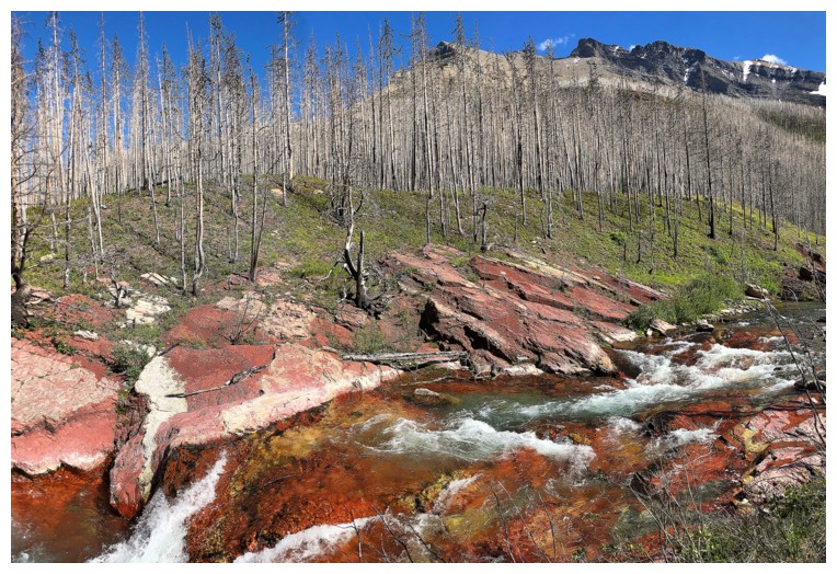
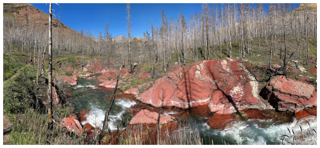
challenges. A usual stop along Blakiston Creek where the creek bed is comprised
of vibrantly coloured red argillite and then the obligatory stop at Blakiston
Falls finished a most gratifying and scenic return to one of my favourite areas
on the planet.
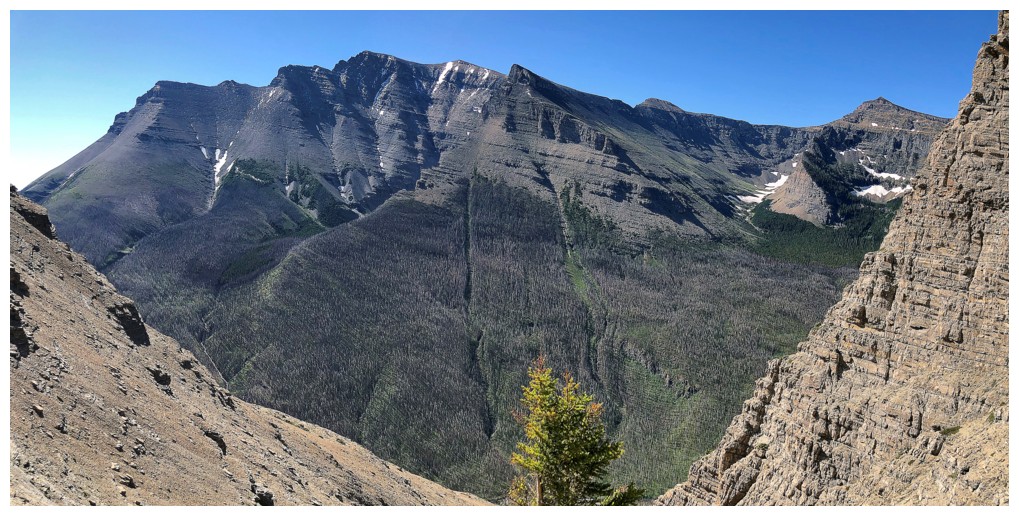
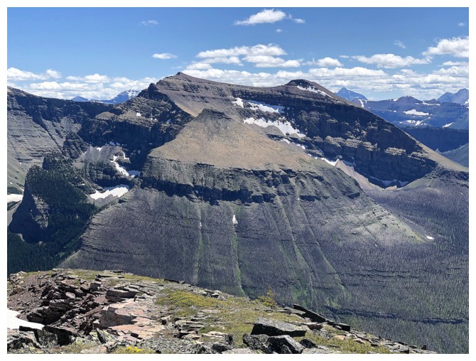
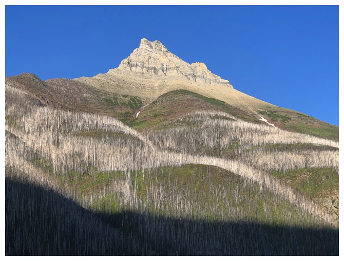 The east side of Mount Blakiston. Note the barkless, white/silver trees amid the green of new growth.
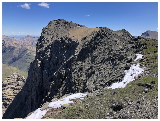
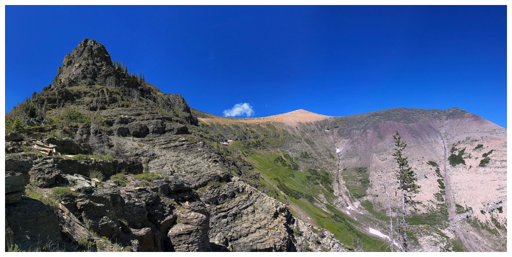
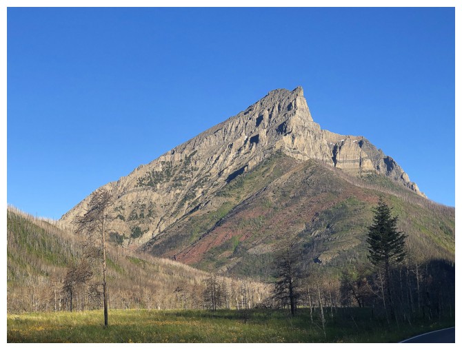 The eastern high point of Mount Anderson
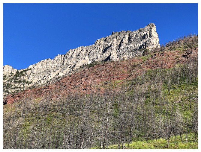
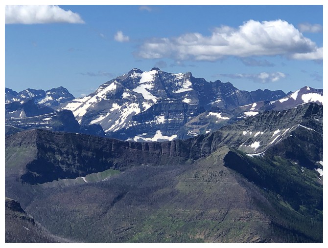
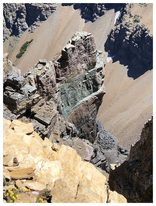
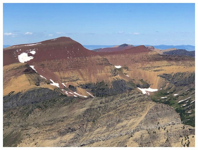
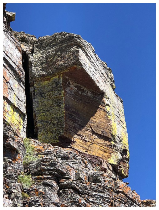
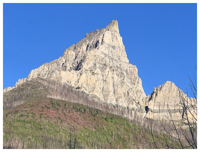 Close-up of the eastern high point. Jim and Blair's 5.9 climbing route basically goes up the right side.
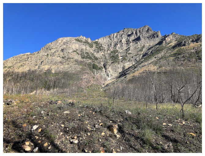
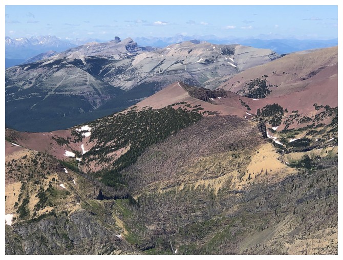
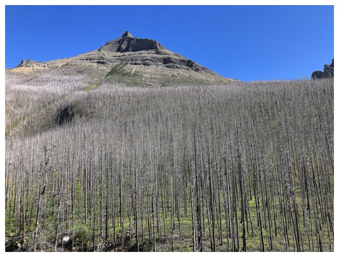
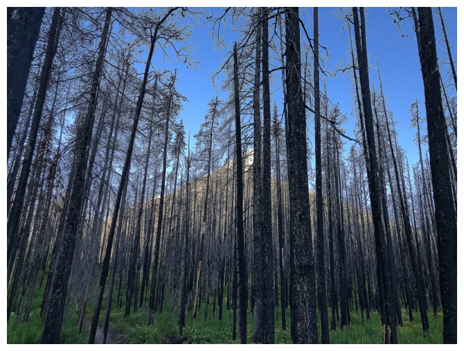 Some of the burned remains of the 2017 Kenow fire
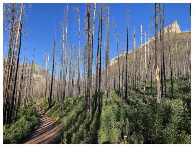
Burned forest, new growth and Anderson at the right
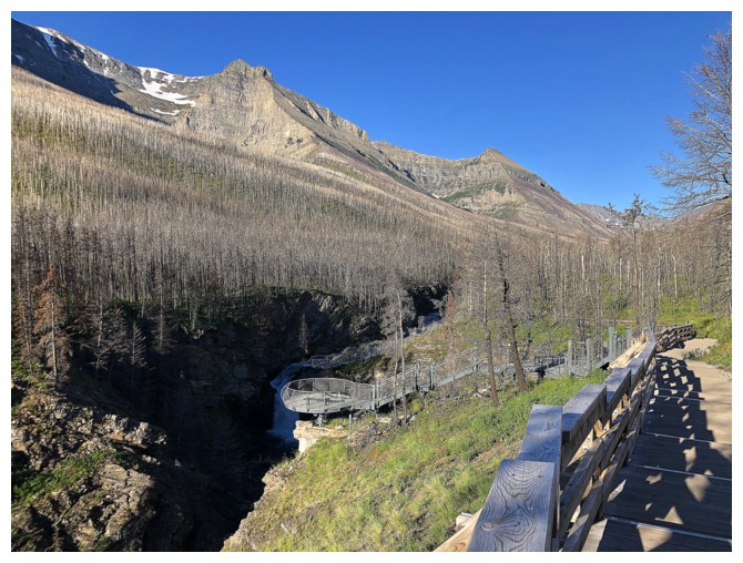
Approaching Blakiston Falls
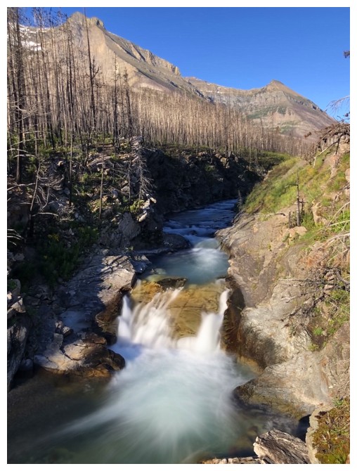
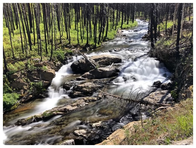
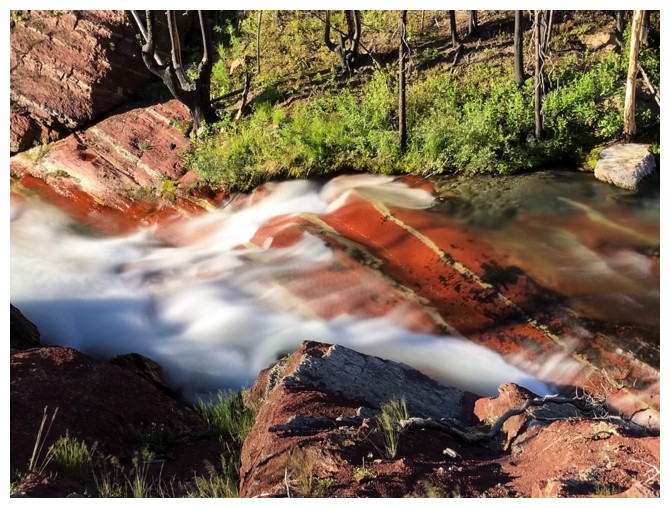
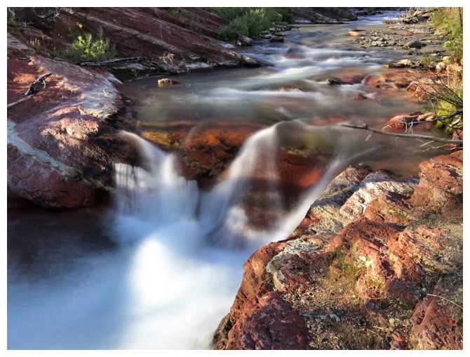
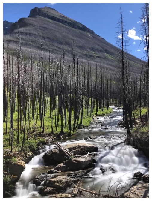
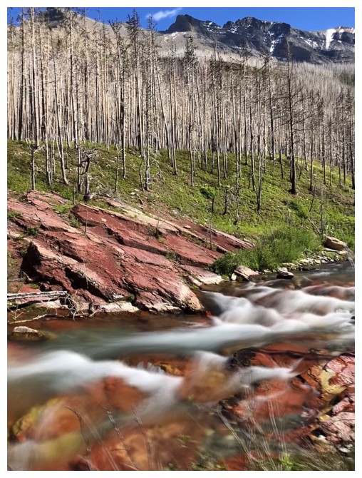
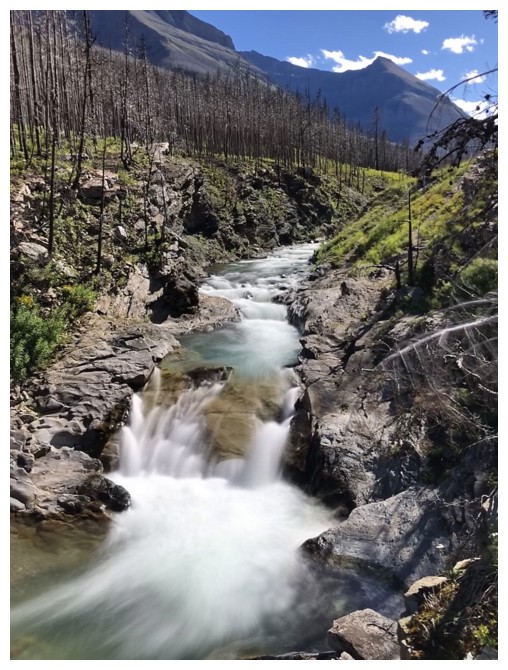
Several of the smaller waterfalls past Blakiston Falls are in some ways more photogenic than Blakiston itself
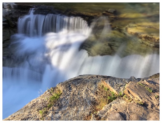
Still going a little crazy with long exposure photos!
Eastern summit again
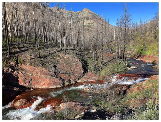
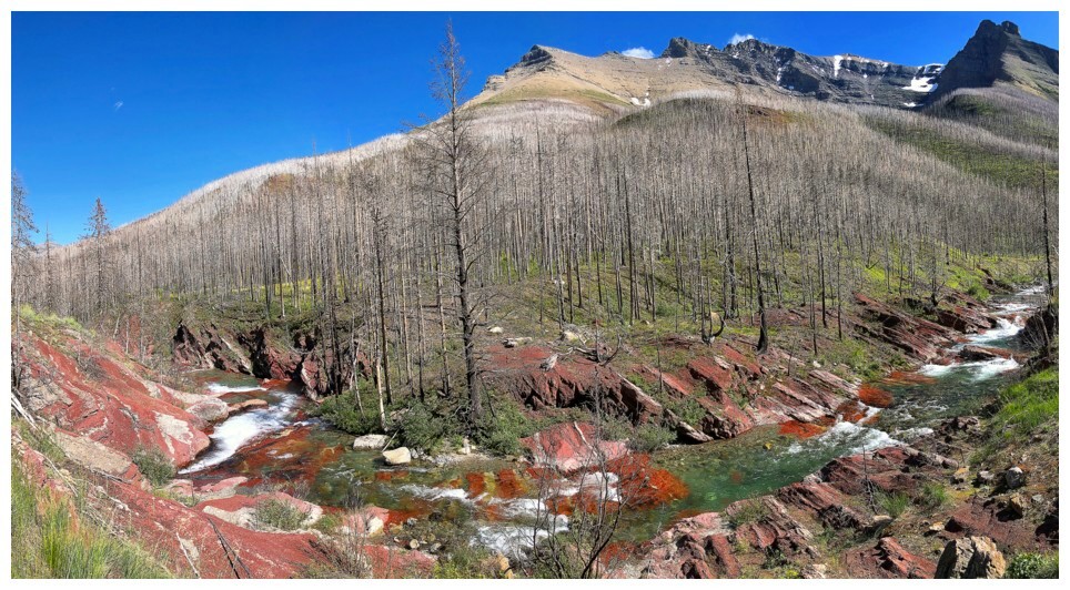
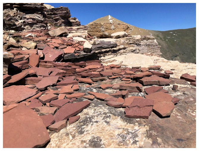
The red argillite section of Blakiston Creek is remarkable
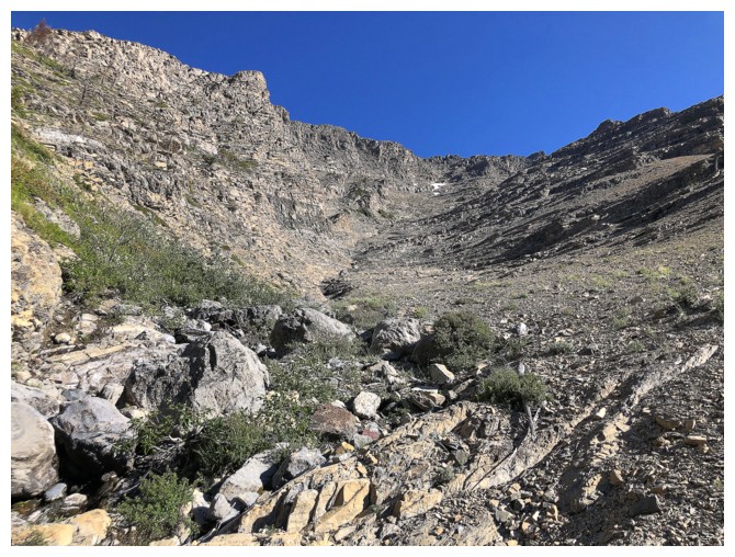
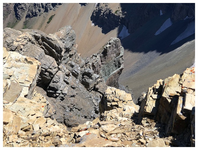
Looking up the first ascent drainage. Jodi and I tried this route but backed down when the terrain became too steep.
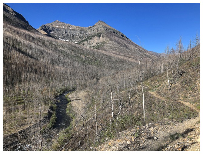
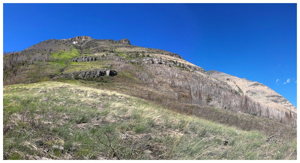
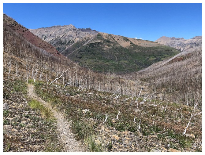
Continuing along the terrific trail. Good views abound.
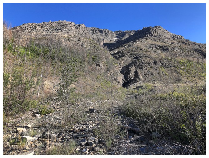
The second drainage and ascent line for the day
Typical terrain in the lower section. It doesn't look too bad, but in fact this section is fiercely steep.
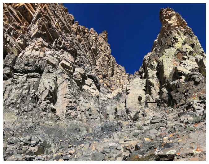
Awesome rock but not a scramble!
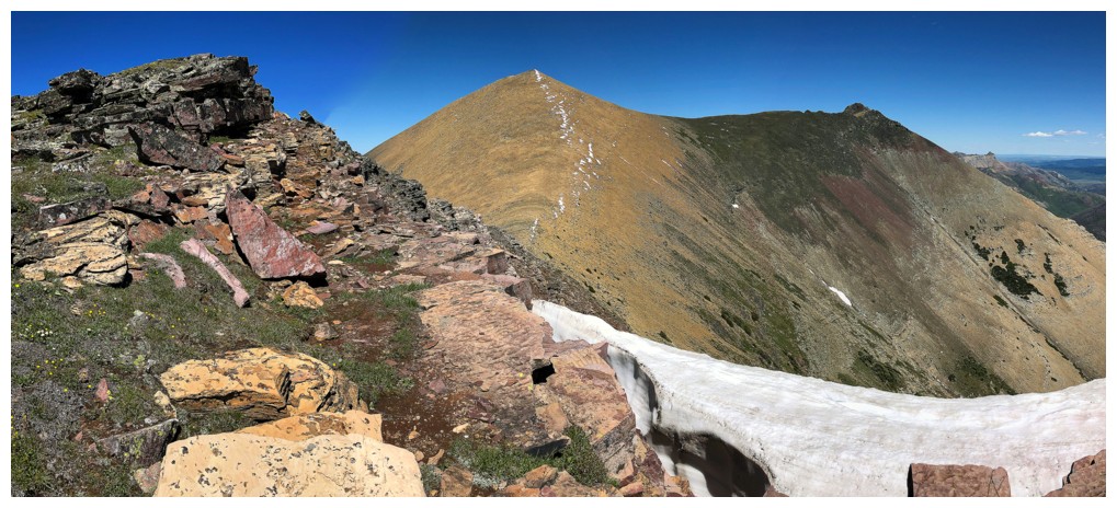
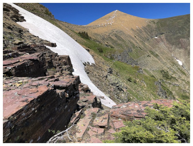
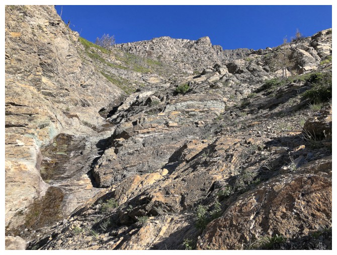
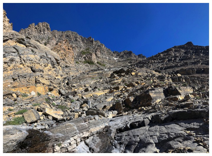
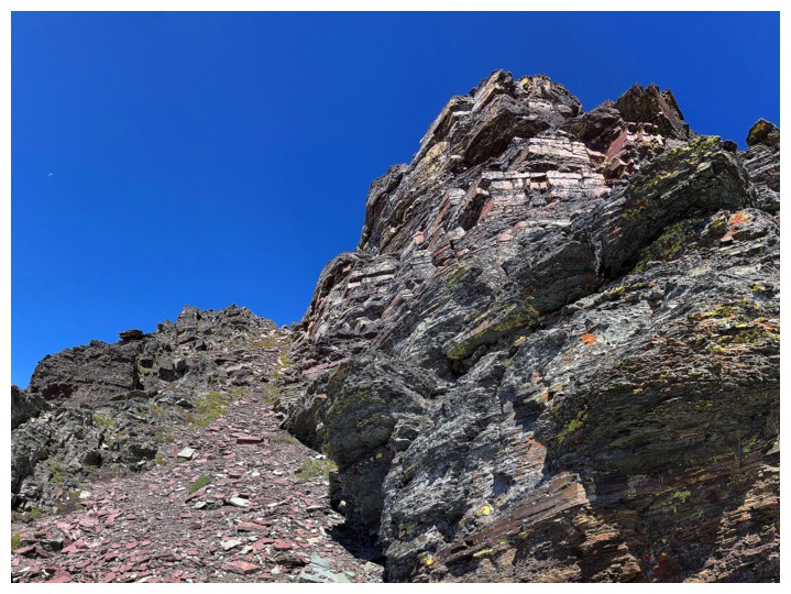
Past the difficulties and getting ready to enjoy 600 vertical metres of fun scrambling
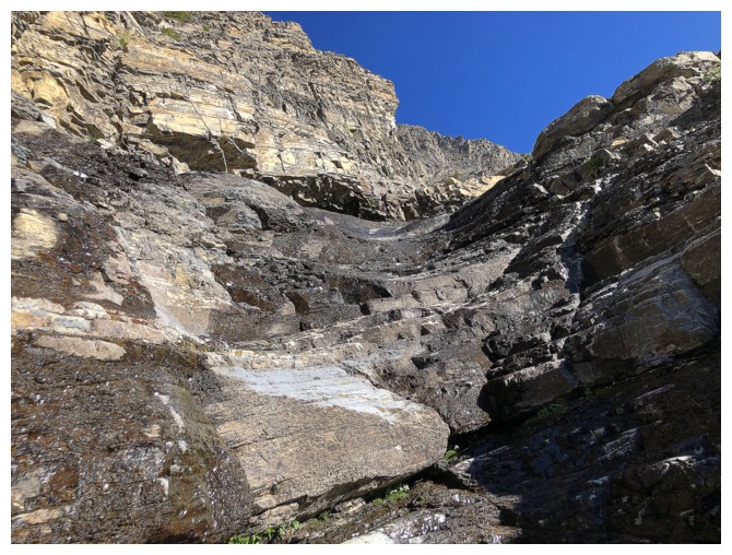
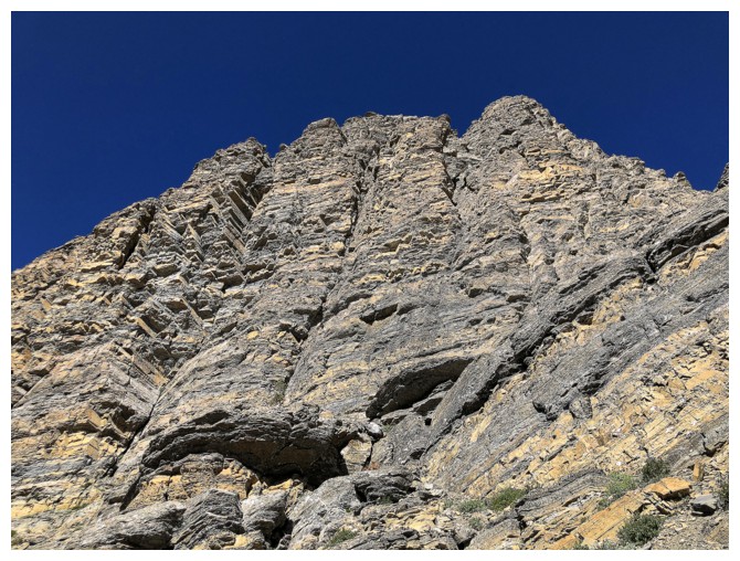
Typical steppy terrain all the way to the ridge
 \
\
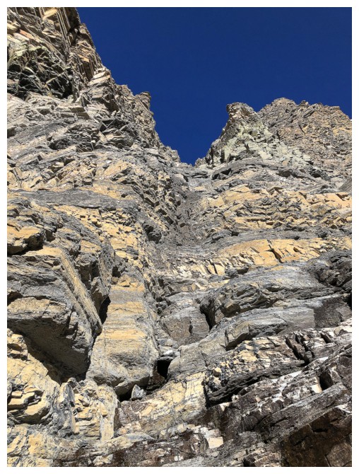
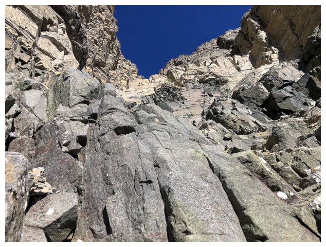
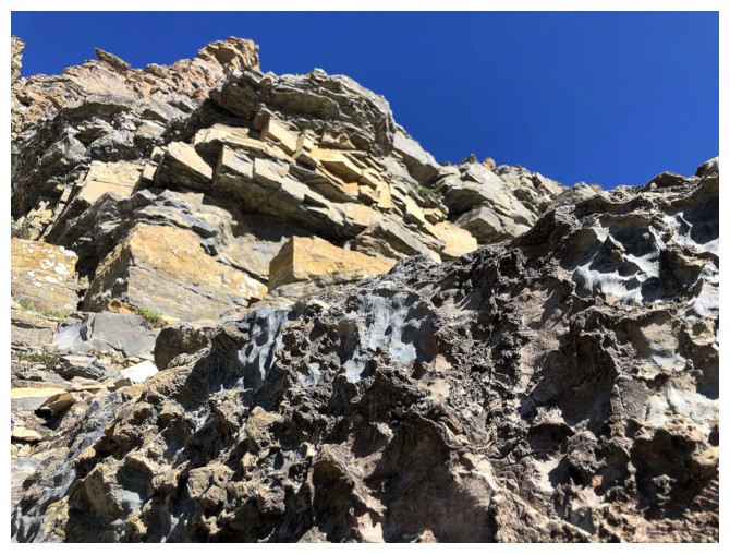
And some really steep stuff on the left side of the drainage
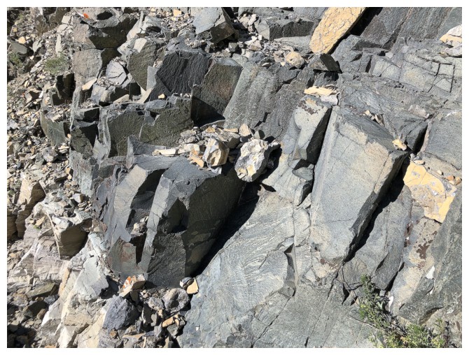
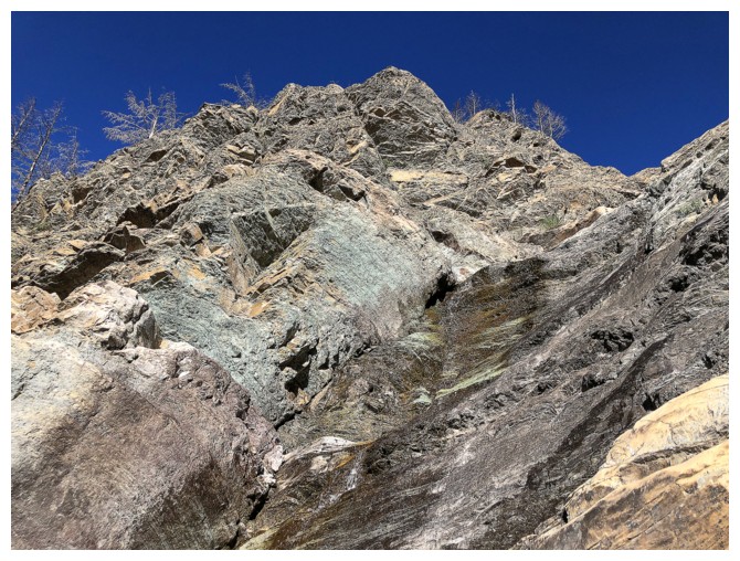
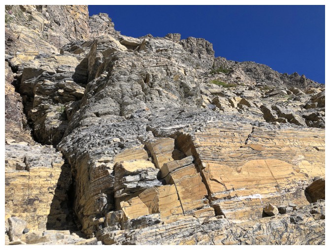
Gabbro, diorite..... I'm not sure what to call this band of rock
anymore but it is some of the most solid and awesome rock in the area
The start of my short detour to the left
Super fun scrambling up this rock
It's getting serious and I'm getting conservative! Backed down shortly after.
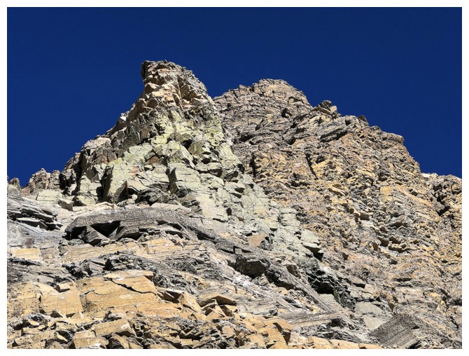
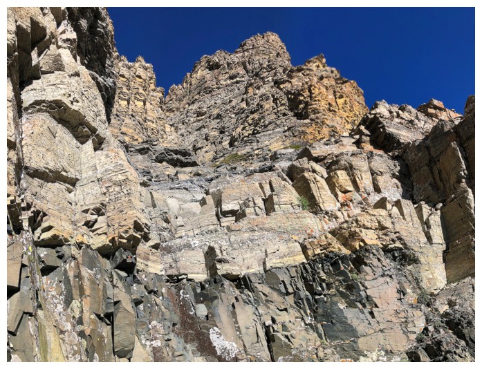
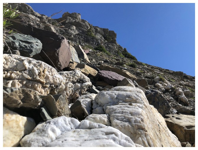
Lots of great, towering rock to look at
Back in the drainage
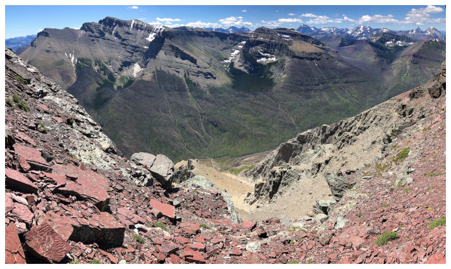
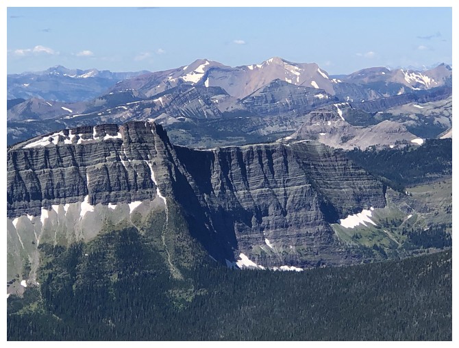
Mount Blakiston on the south side of the valley
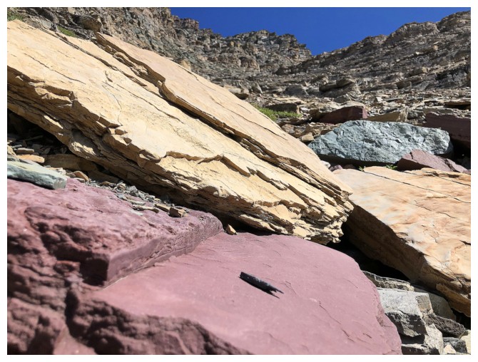
The ascent route has a never-ending supply of fascinating rock
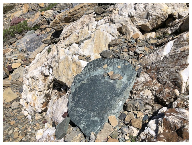
Like this big chunk of green argillite
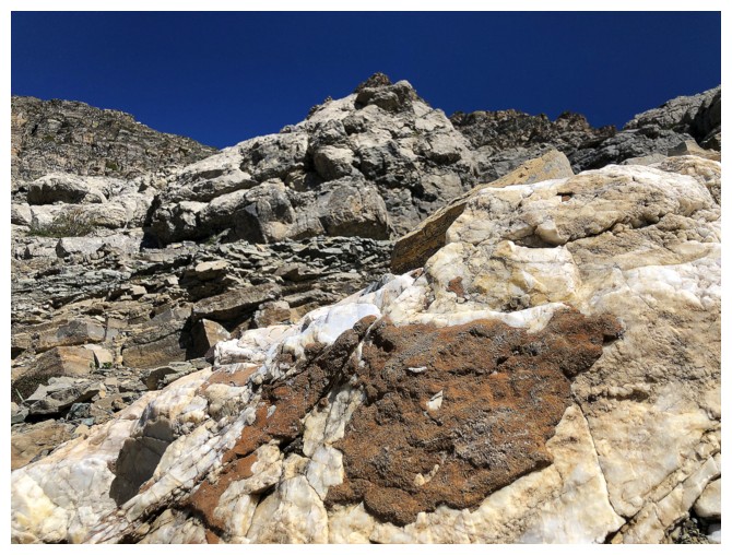
And this white rock (not sure what it is, quartzite maybe?)
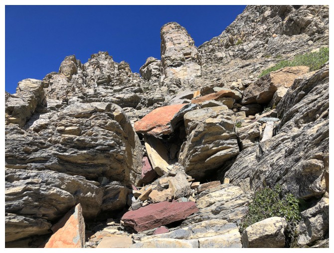
And red argillite and dolostone
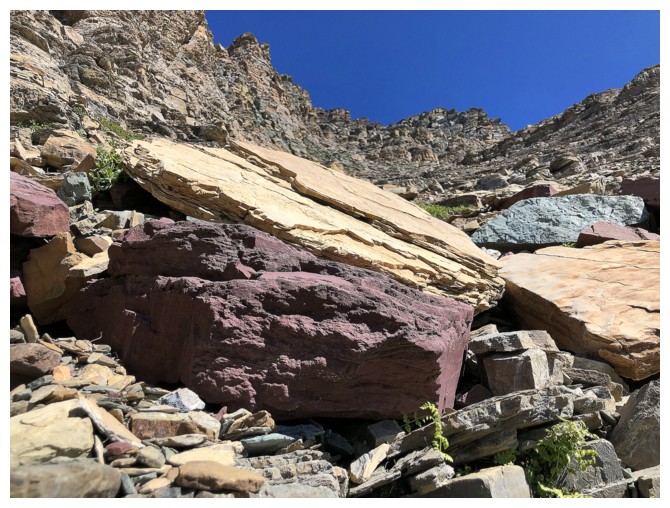
And combinations of all of the above
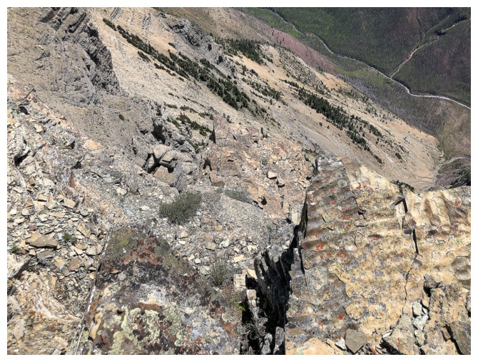
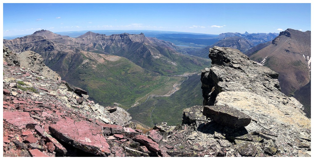
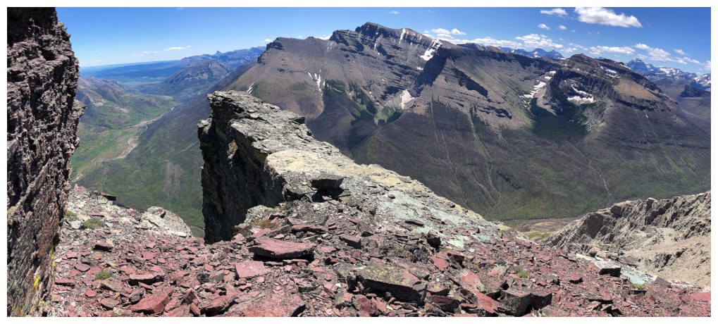
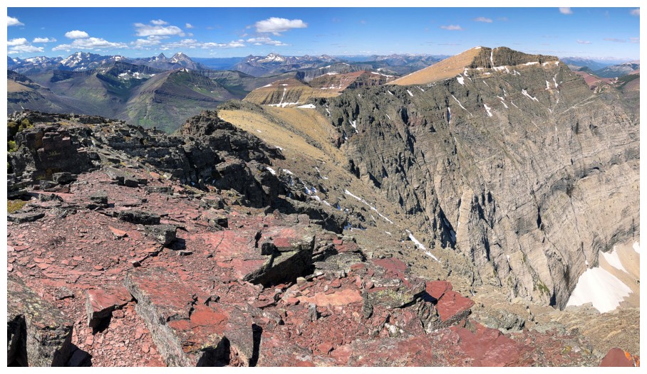
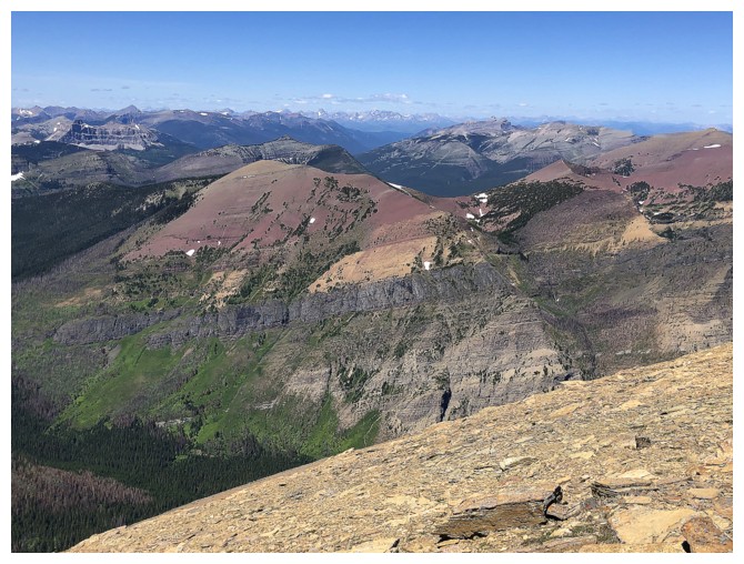
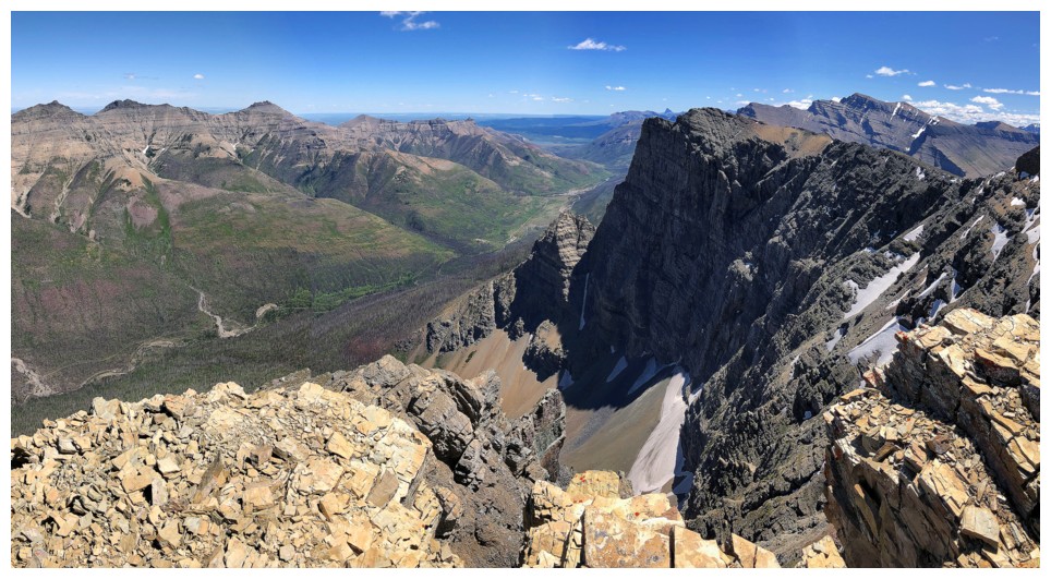
Looking down the ascent route to Blakiston Creek far below
To the east sit some other Waterton favourites: Galwey, Rogan, and Dungarvan
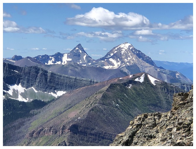
It's impossible to look over to King Edward (left) and Starvation Peak without taking a photo
Same for Long Knife Peak
 Easy route to the left but the right offers more scenic opportunities
Like this one
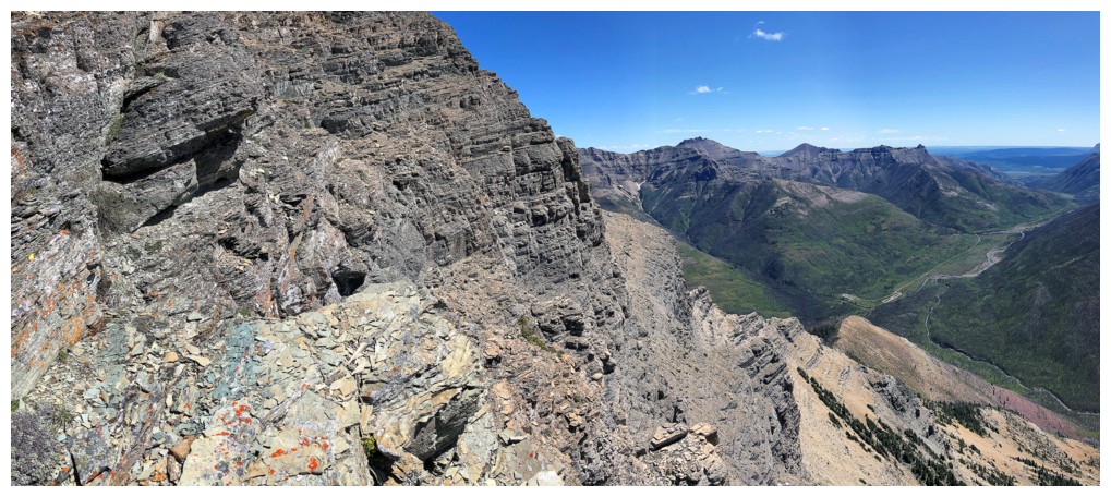
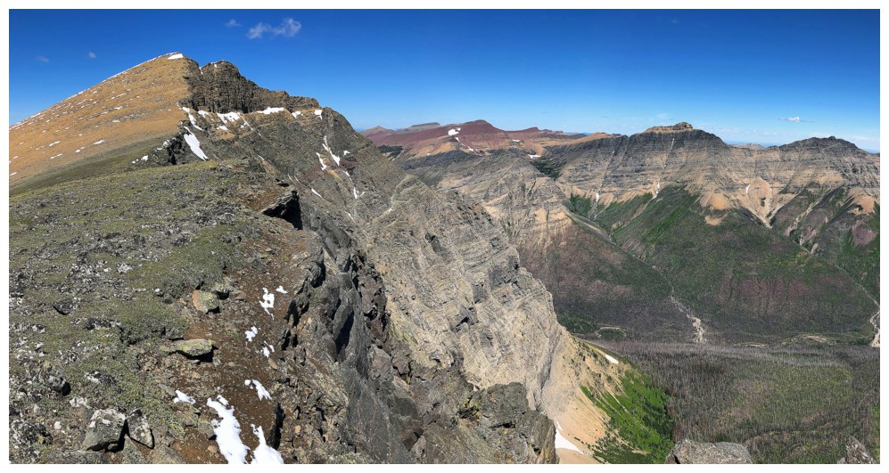
Good views across the valley and down the gully
The southeast side of the mountain has many interesting rock features
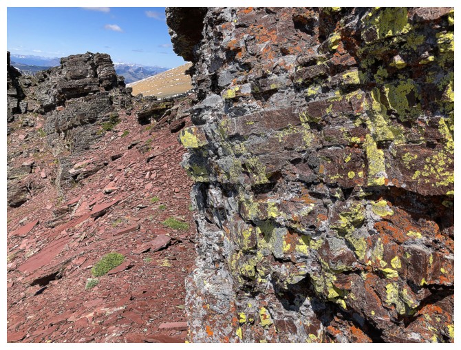
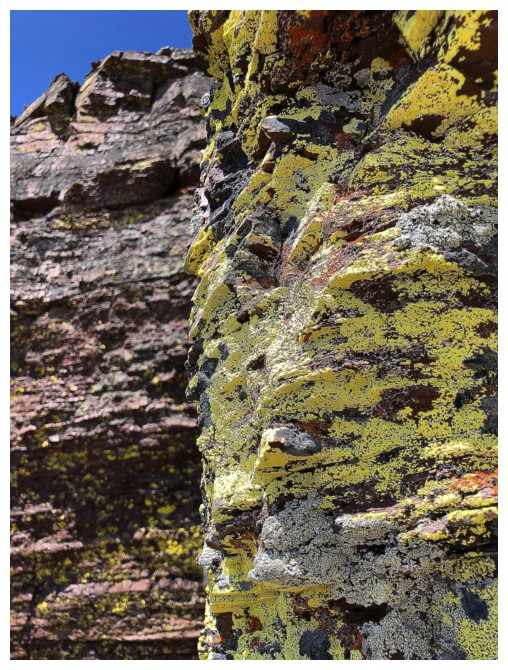
And a few examples of my favourite: yellow lichen on red argillite!
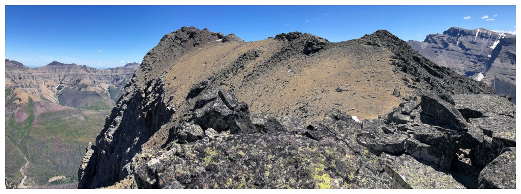
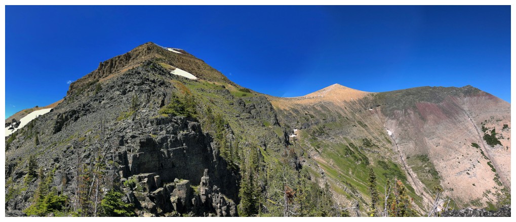
True summit of Anderson and east high point (right)
The red argillite east high point
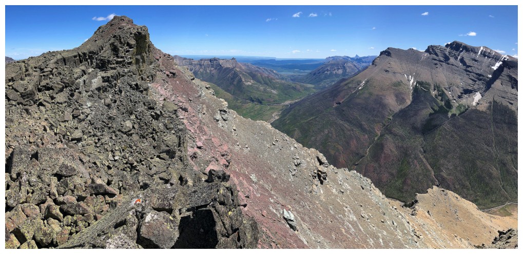
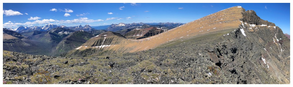
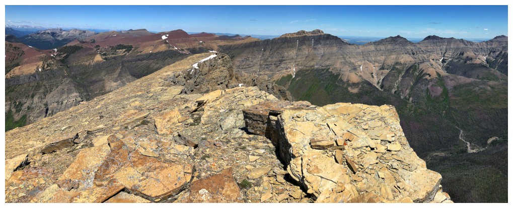
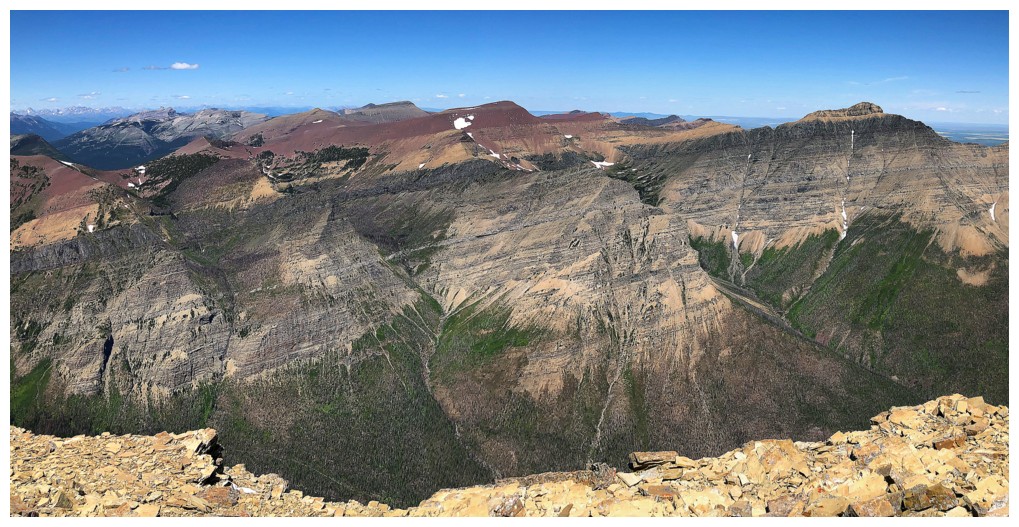
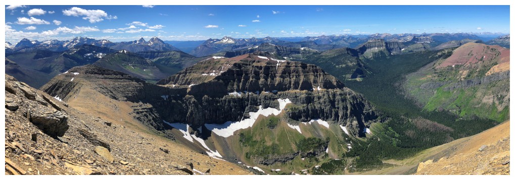
Looking west to a whole lotta' stuff!
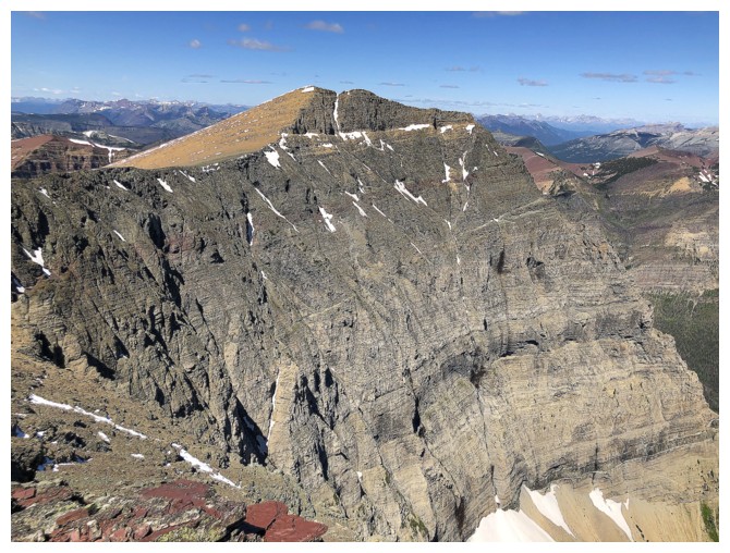
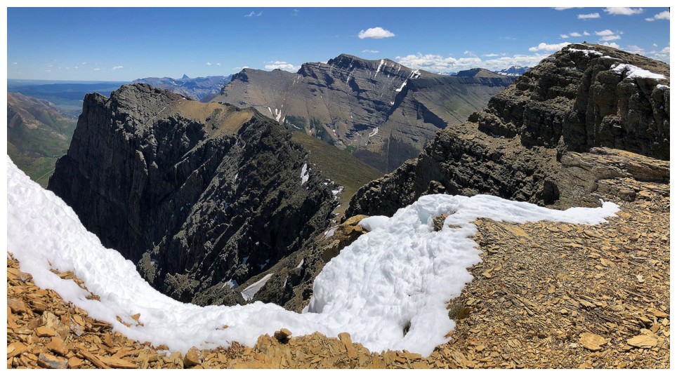
The northeast face of Anderson is impressively scary!
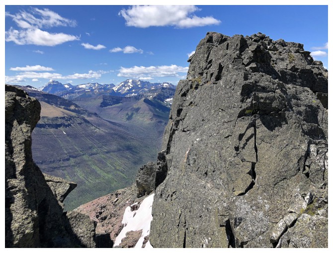
The other side of the pinnacle Mark and I found
The more impressive side
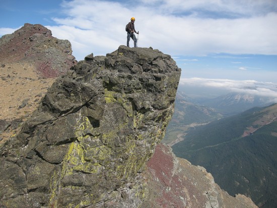
Similar photo from 2007
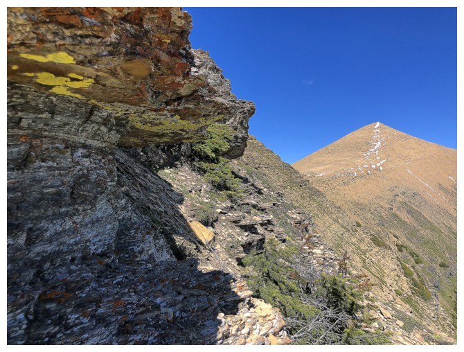
Lots of looking back, en route to the true summit
East high point behind...
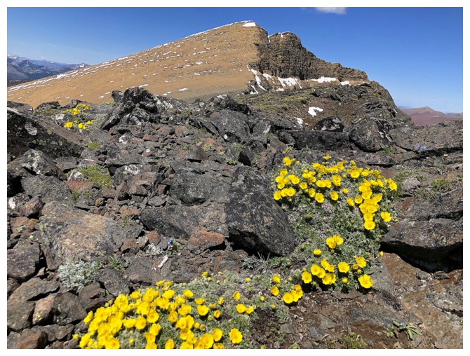
True summit ahead, with a surprising splash of yellow
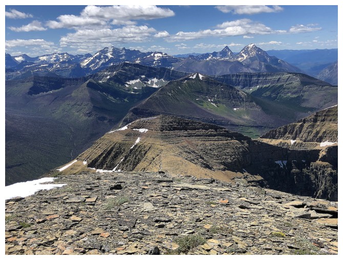
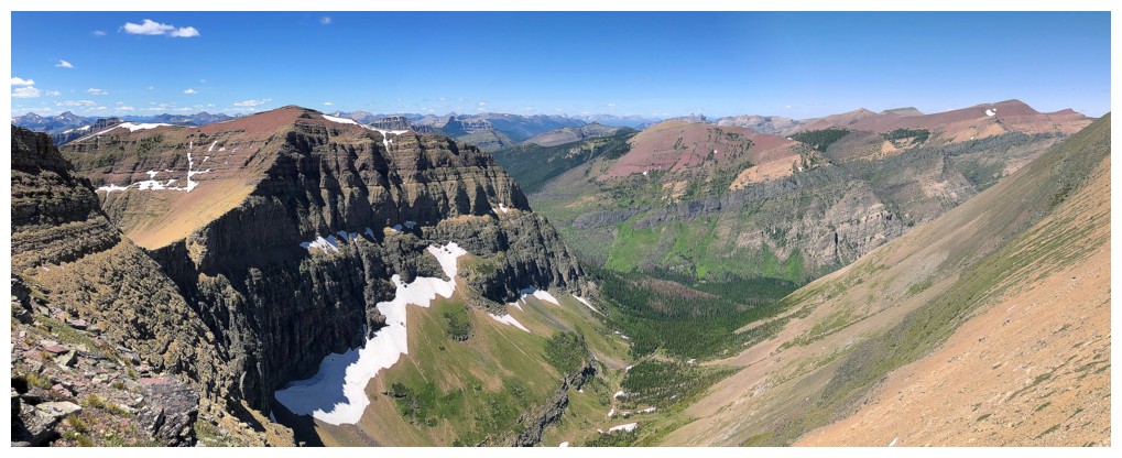
Sweet views to the north
In terms of prominence, even the east high point is more deserving of an official name than Lost Mountain!
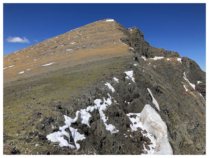
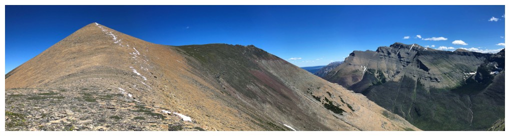
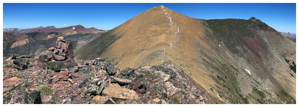
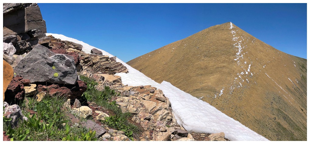
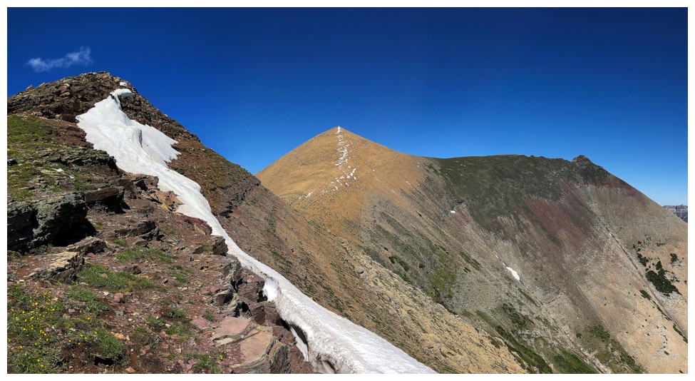
Pleasant, easy hike to the summit.....
....with far reaching views
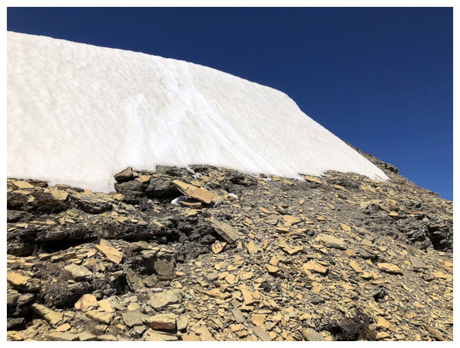
A welcome patch of snow just before the summit
The summit
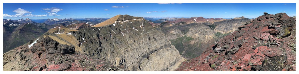
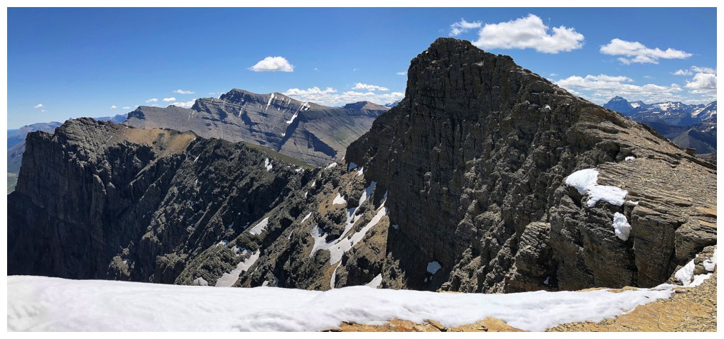
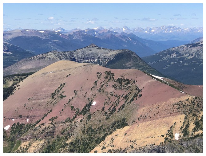
View west to Lost Mountain and others
Heading down the north ridge for a short detour
Red Avion Ridge - I definitely need to go there again
More fantastic ridgewalking with fantastic views
Looking back to the summit
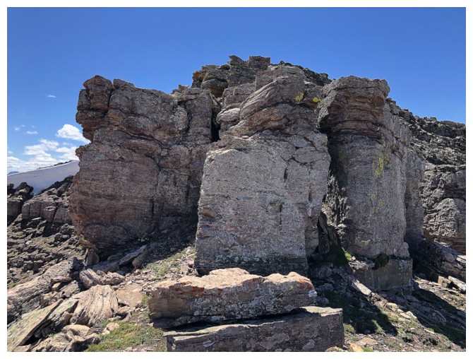
Interesting rock formation down the east face
Close-up
View to the east
Many of the Castle favourites to the north
Scarpe Mountain and Jake Smith Peak
Loaf Mountain
Avion Ridge in front and Castle Peak and Windsor Mountain just left of centre
The west side of colourful Avion
Traversing around Anderson and enjoying another peak-filled view to the west
At the Anderson/Lost col looking back to Anderson
The northeast face of Kootenai Brown Peak is as impressive's as Anderson's
Typical fun terrain on the short ascent to Lost
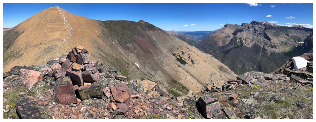 Summit view to the east from Lost Mountain
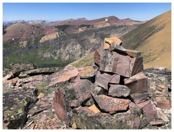
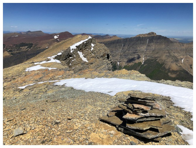
Waterton peaks have the best cairns!
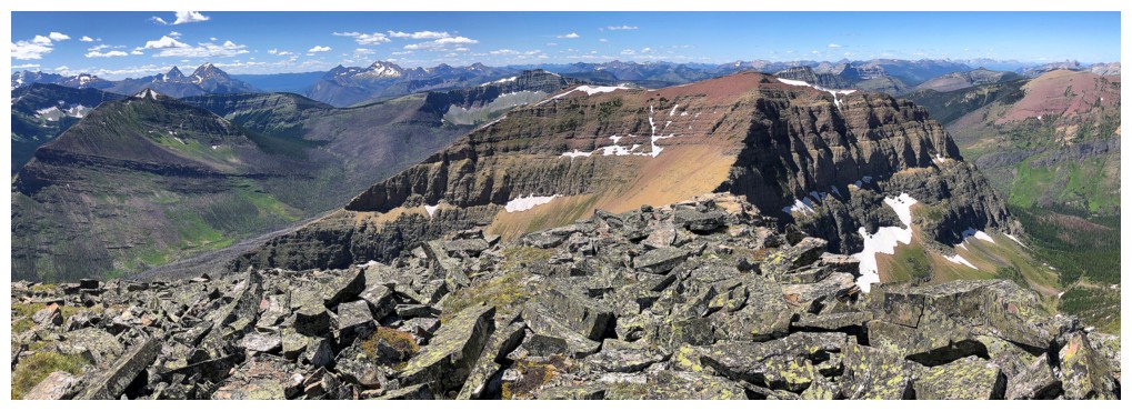
Part of the Blakiston horseshoe route
View west to colourful Kootenai Brown Peak
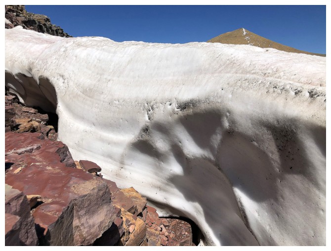
Random snow wall
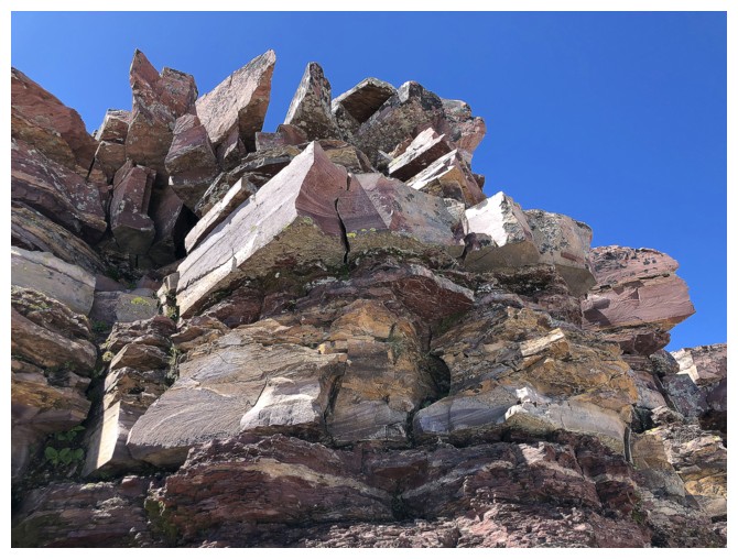
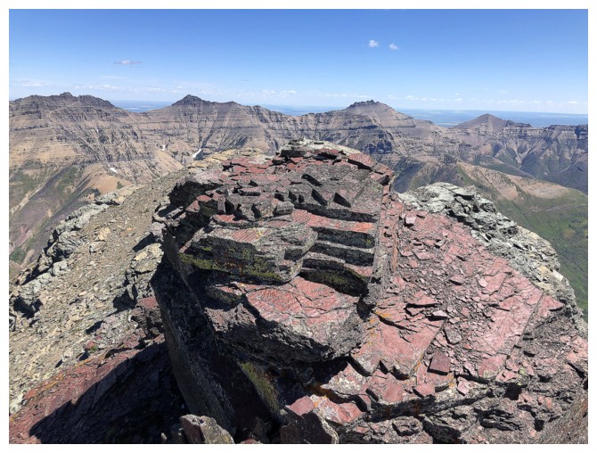
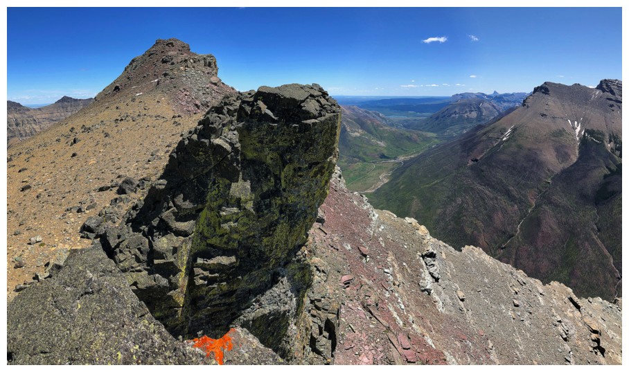
The summit of Lost has tons of cool rock...
...especially when combined with the views of Anderson
My favourite
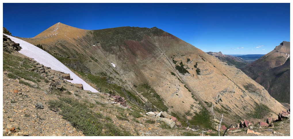
Much of the "slog" route up Anderson is visible from here
Halfway down Lost
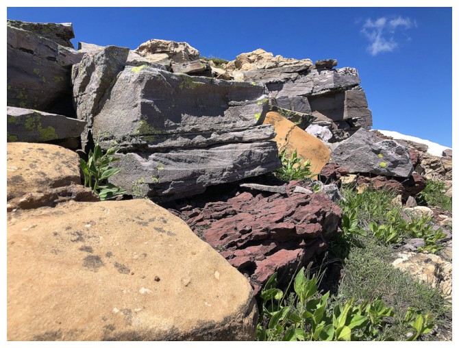
Cool rock everywhere
Two-thirds the way down Lost
Looking back up Lost. I took a route down the skyline from left to right.
Lone Mountain - a very memorable day on that one!
Awed by the destruction of the fire and the rebirth after it
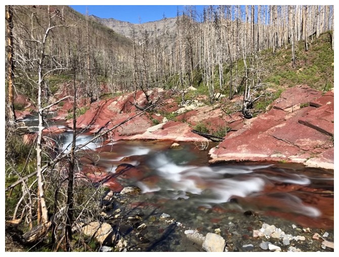
Back at the red argillite section of the creek that is way more scenic and interesting than Blakiston Falls
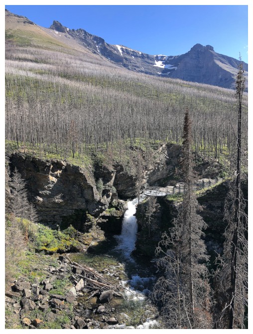
Back at Blakiston Falls
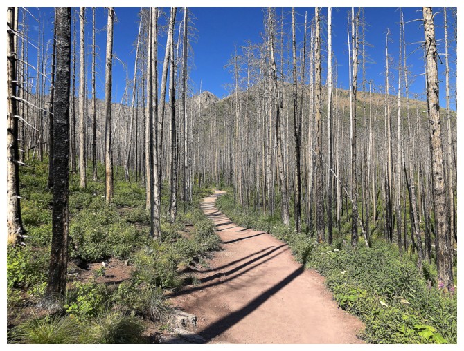
Pleasant hiking on a great trail to end the day
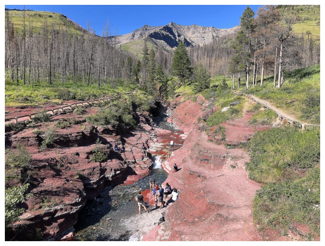
The mandatory shot of Red Rock Canyon
The End
LOG