Black Rock Mountain III
October 17, 2021
 Mountain height: 2462 m
Elevation gain: approximately
1100 m
Round-trip time: 6:25
Scramble with Mark.
A magnificent return to Black Rock Mountain
in November of 2020 inspired Mark and I to look for other ways up or down this beautiful
peak, instead of the normal route and the variation we had taken a year
earlier. We had spotted a potential route down the southeast side but decided
against it because of brutally cold conditions. Good weather forecast in hand,
we set out to attempt an ascent of this route.
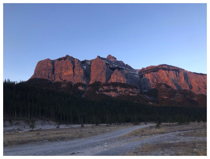
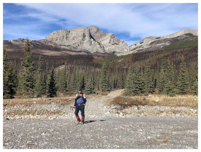
Starting at the usual Black Rock trailhead,
we hiked the trail for a short distance, then left it and headed straight
towards the southeast ridge of the objective. Once again, travel through the
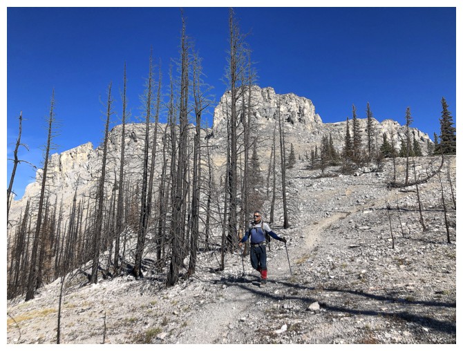
burned-out landscape was fascinating and almost surreal. The ridge was soon reached,
and we started towards the far-off summit. Here we thought we were probably in
an area that saw very few human footprints. Boy, were we wrong! Stumbling onto
a well-used and obvious human trail proved that supposition was clearly out to
lunch!
However,
that trail soon veered off in a direction
we didn’t want to go. We gained the ridge and once again seemed to be
on
terrain that didn’t see much human traffic. Following this ridge was
great, with easy, scenic, and interesting travel. There were a
few scrambly sections, one
up very steep, loose rock, but otherwise the ascent all the way to the
summit
went swimmingly well!
At the summit we met up with two other
parties, both super friendly and one with a super friendly (and apparently
hungry) dog. Enjoying the great view and some food, I put my cheese sandwich
down and it was gone in an instant. The dog’s gain, however, was also my gain.
Her very apologetic owners shared some delicious pepperoni with me – quite a
step up from my two pieces of bread and slice of Swiss cheese now residing in
the dog’s stomach!
We used Daffern’s normal route for descent –
a superb trail that never loses its magic.
Another excellent route and awesome day on Black
Rock Mountain.
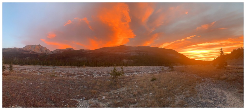
Sweet Sunrise from the parking area
Phantom Crag - a fantastic trip!
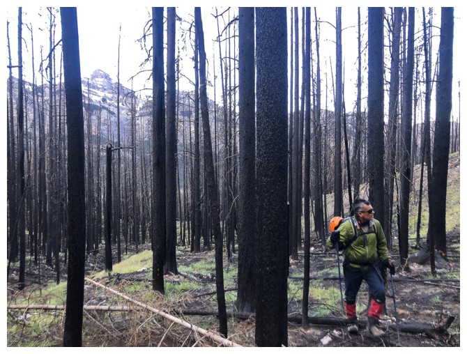
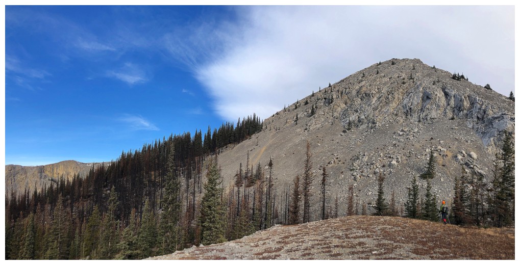
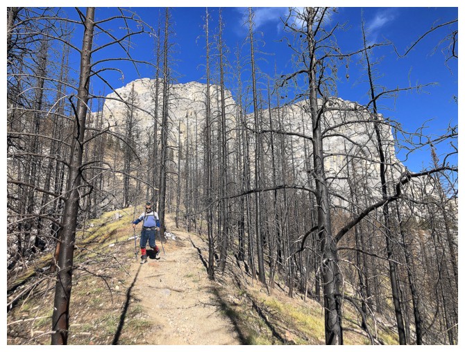
Hiking through the burned-out forest
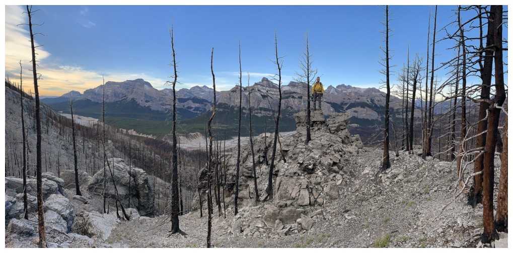
A scenic perch just before the ridge
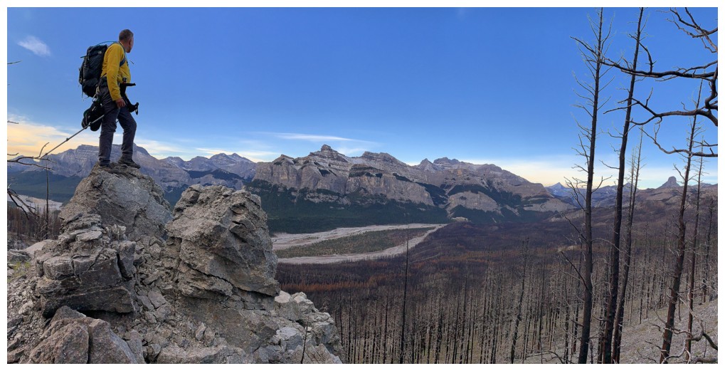
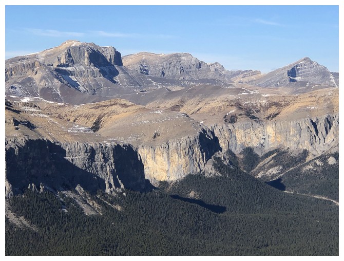
Same as above, with a great view of the south Ghost area
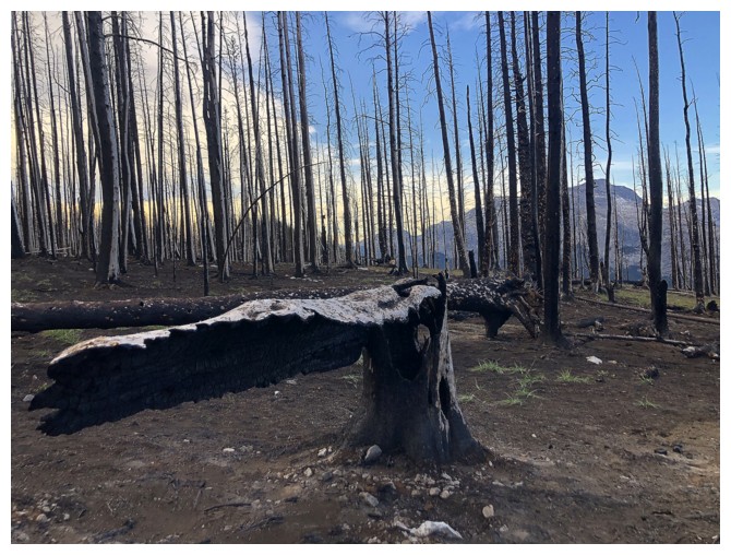
Blackened trees and rock add to the surreal nature of the trip
That tree is actually pointing us in the right direction!
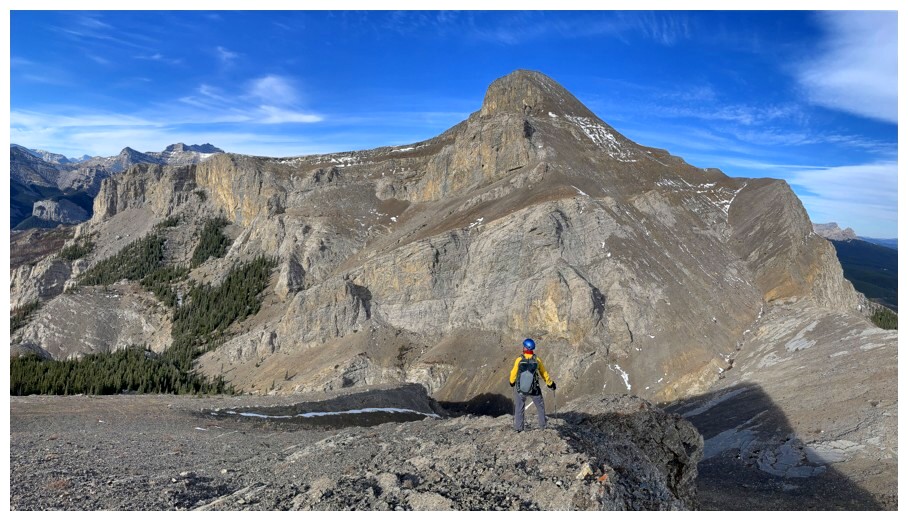
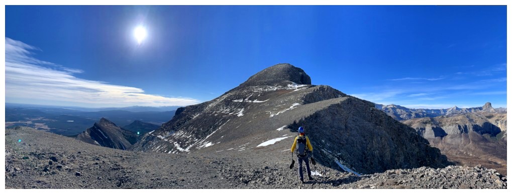
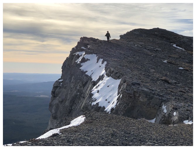
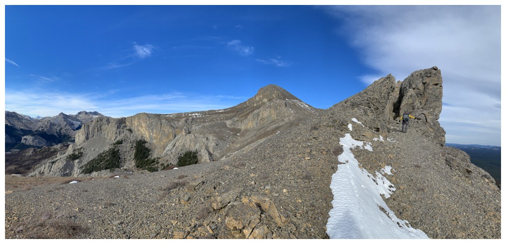
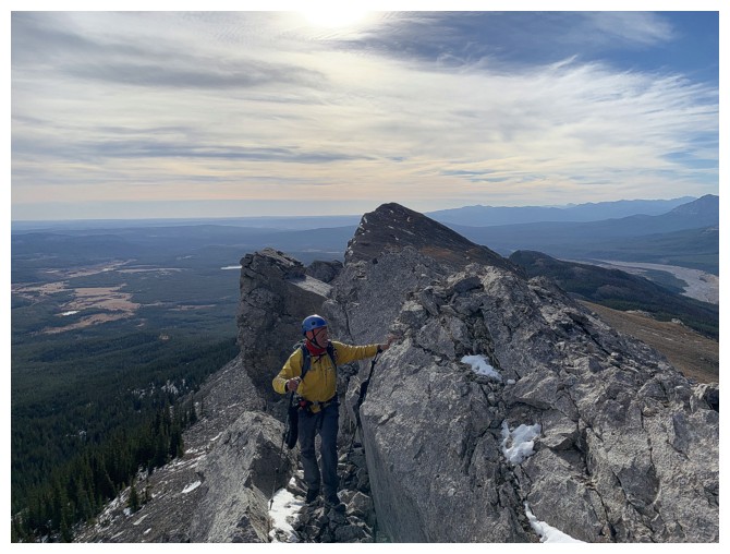
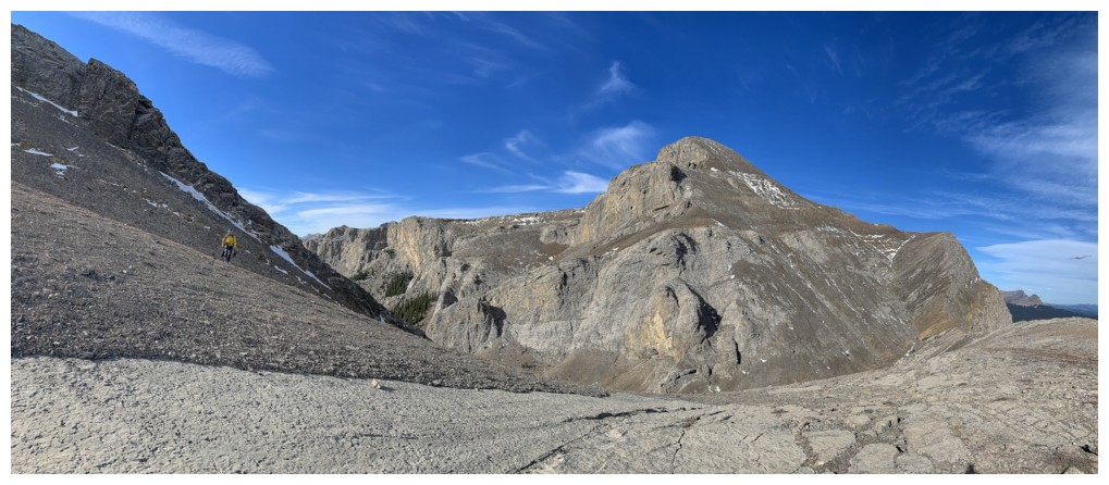
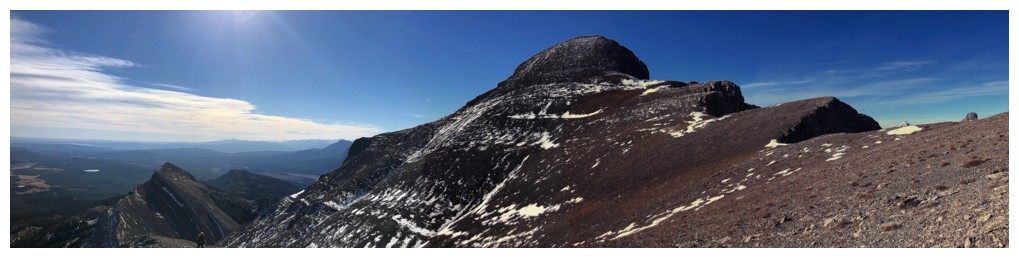
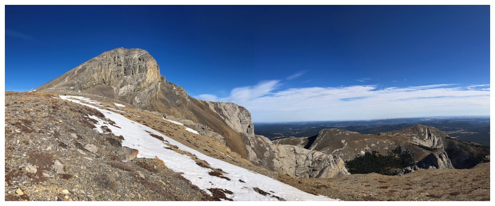
On the wide section of the ridge. The summit block of Black Rock near the right.
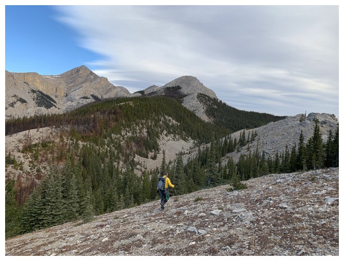
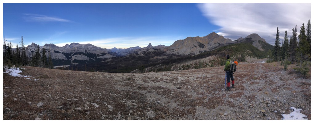
Easy hiking for much of the long ridge traverse
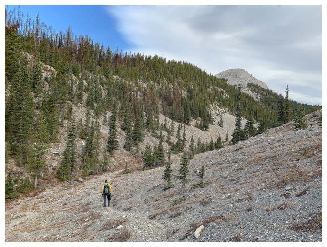
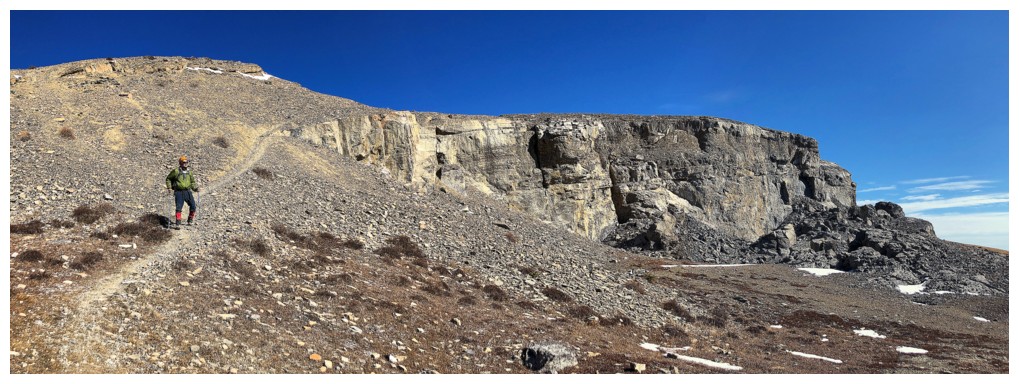
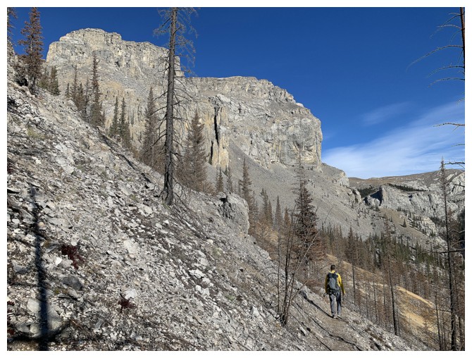
Surprise of the day was finding this great trail that runs between two ridges of Black Rock
Off the trail and back onto the ridge
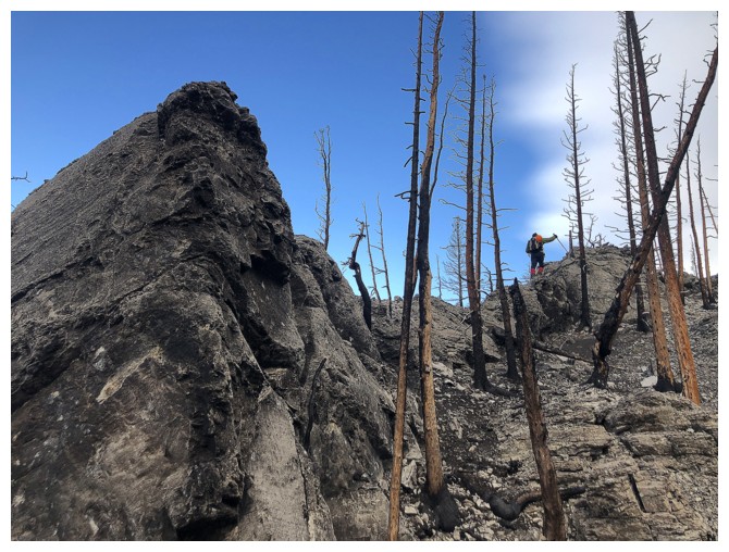
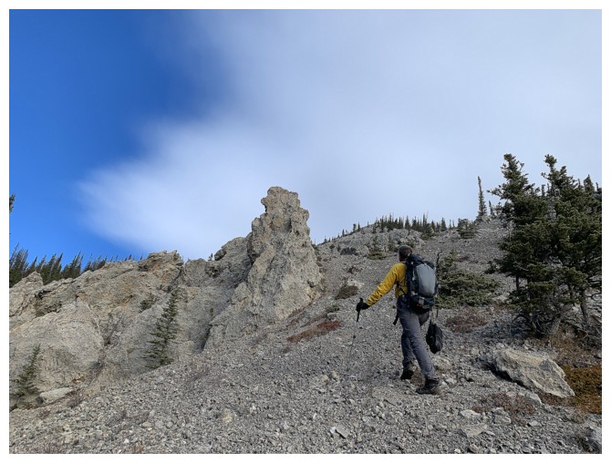
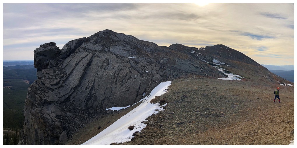
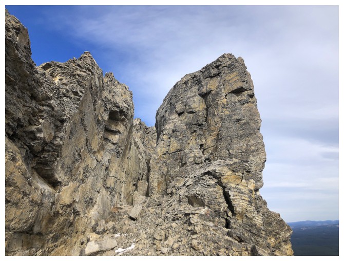
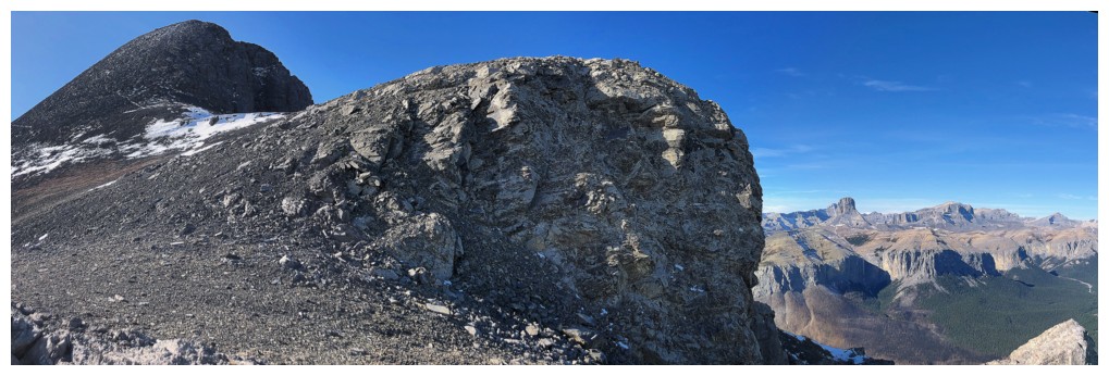
Black Rock Mountain (and all peaks in the area, for that matter) are splattered with cool rock formations
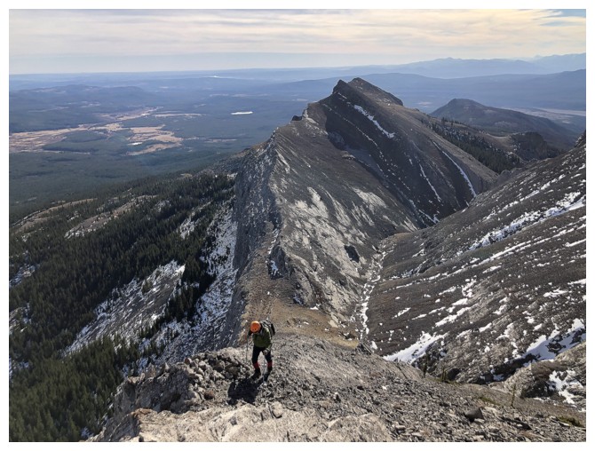
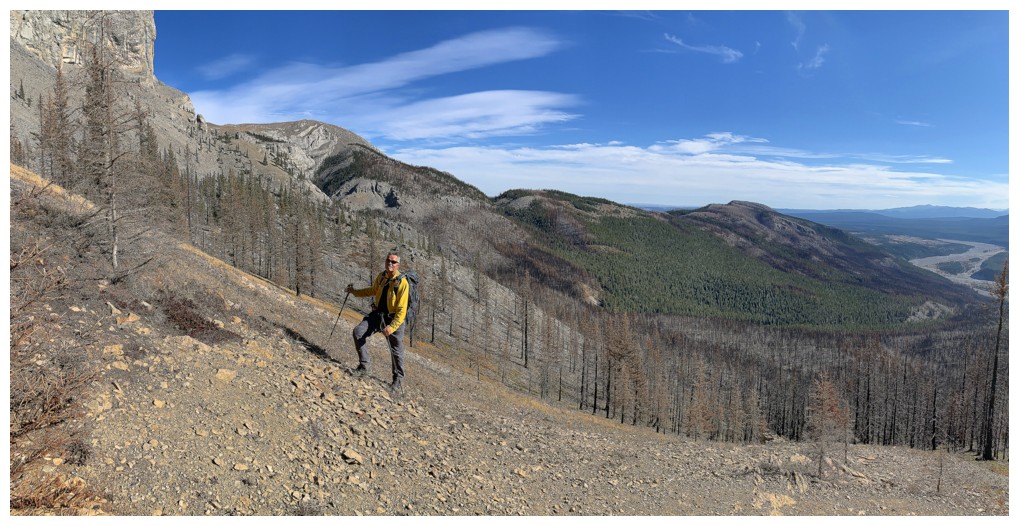
Mark, at the lower right, is dwarfed by the upcoming terrain. There is a trail in the center.
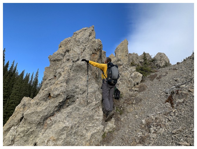
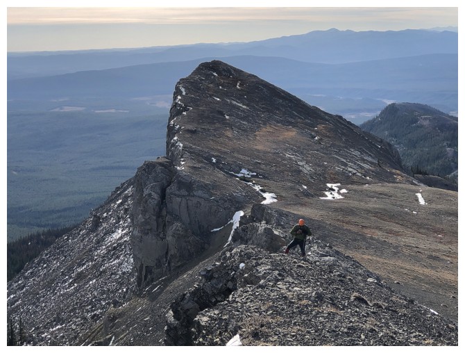
Mark ascends fun terrain to regain the ridge
On the ridge again
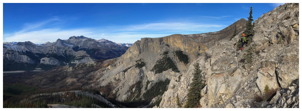
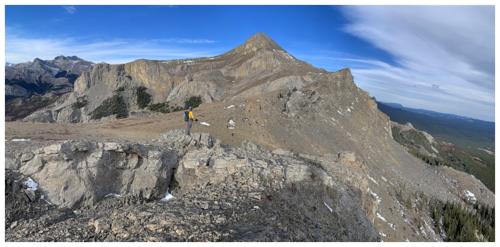
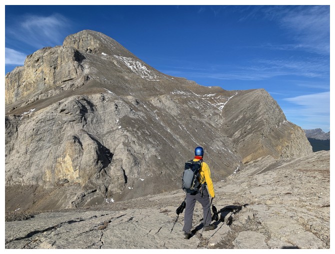
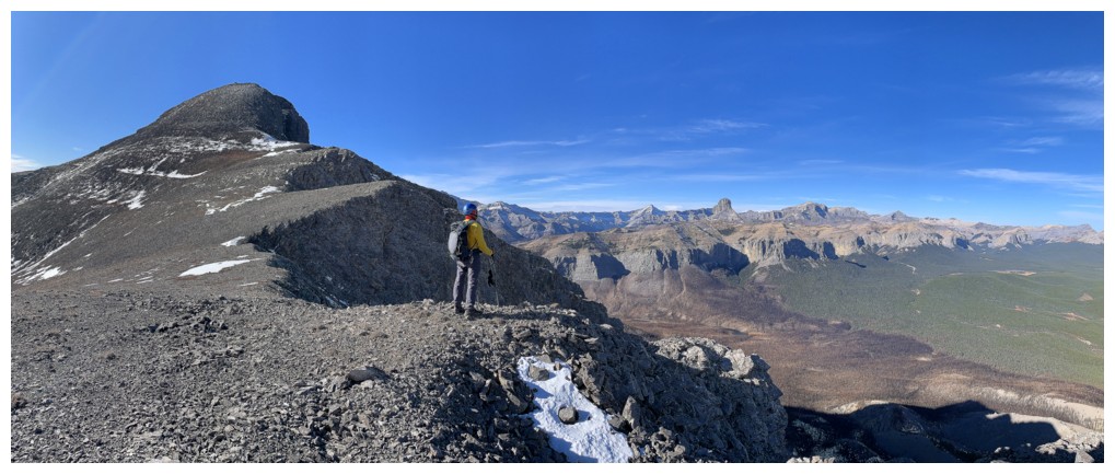
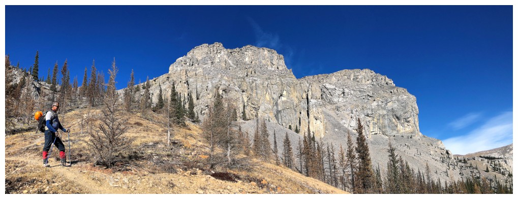
Checking out the objective
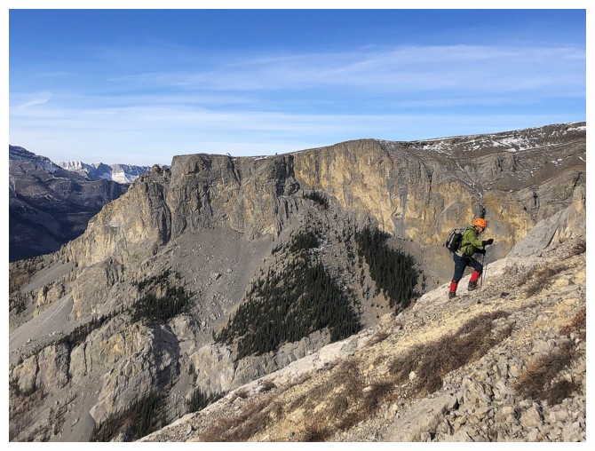
The east side of the ridge is almost vertical in places
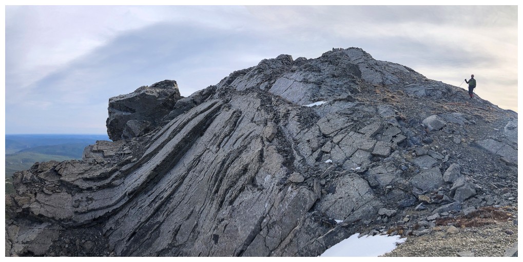
The folded rock at the left was pretty cool
Same as above
A very tempting canyon-like feature
Heading into the canyon. It's basically where the right side of the mountain is peeling away.
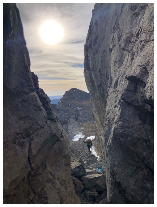
Looking back at Mark from inside the canyon
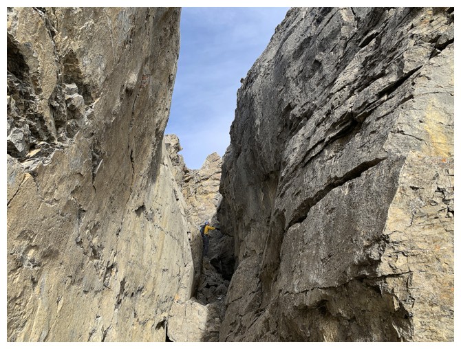
At the back and trying to find a route back up to the ridge
Found one. At some point in history a big chunk of the mountain will fall off. Glad it wasn't today!
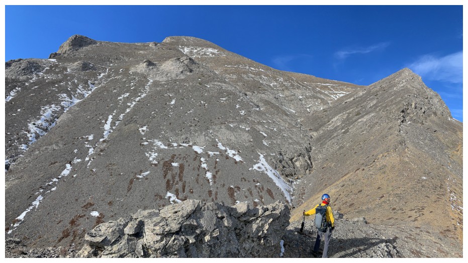
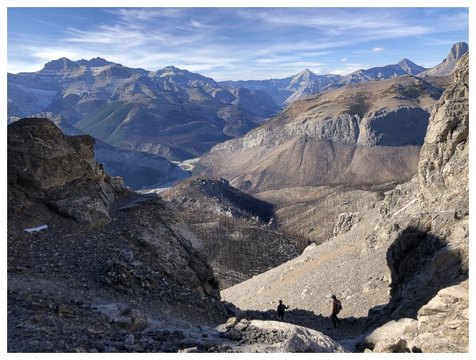
Looking back along the ridge and east face
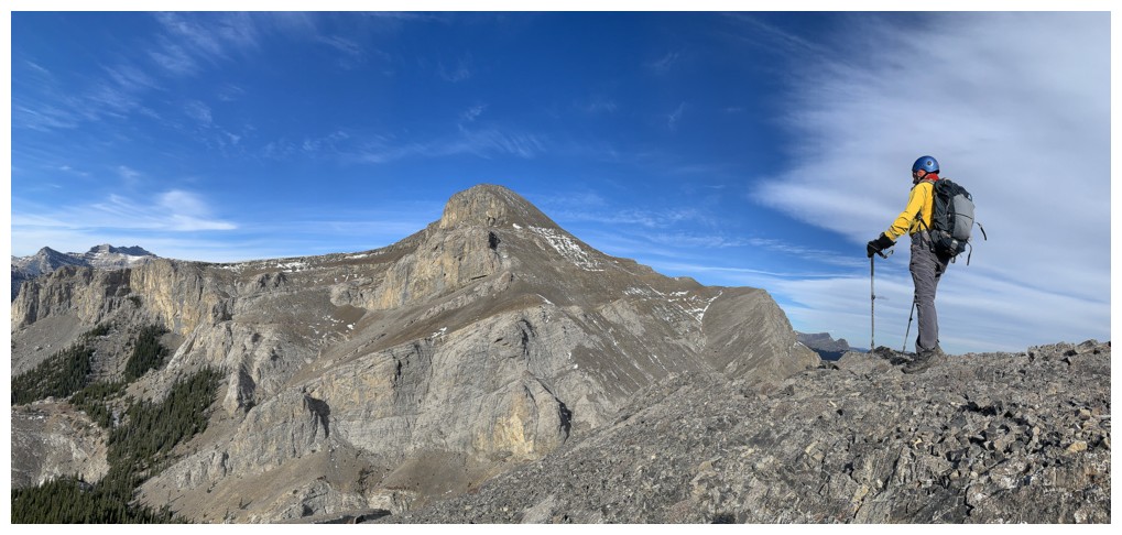
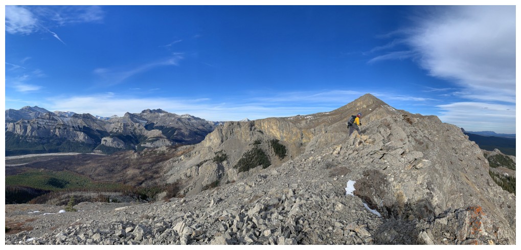
Getting closer
We considered several ascent options from this point and decided to stick to the ridge at the right
Traversing back to the ridge after getting down the rock band at the left
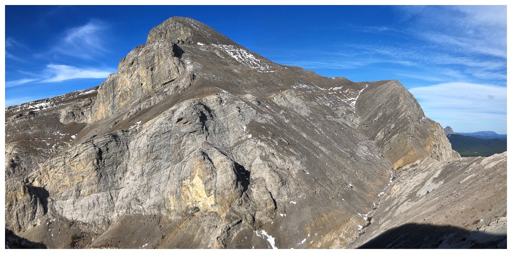
Nice slabs to walk on and nice views of Black Rock
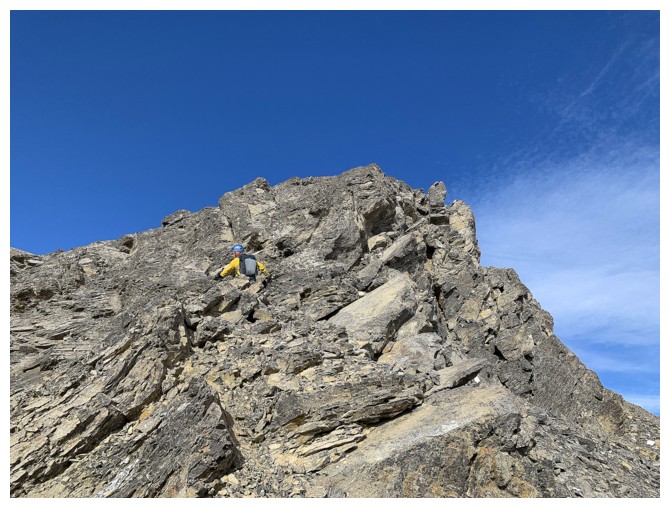
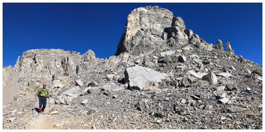
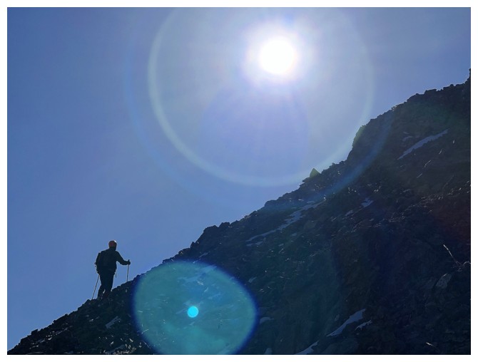
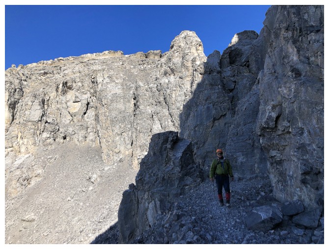
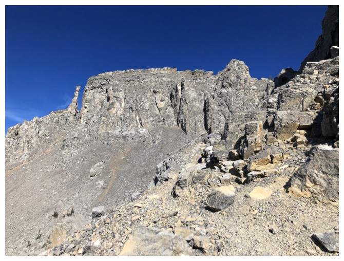
Approaching the crux of the trip - a short, but very steep and loose section of rock
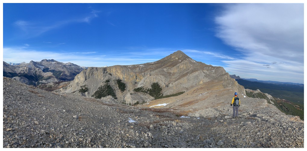
Above the crux and looking back to our ascent route
The terrain ahead is straightforward and with great views
One of the great views
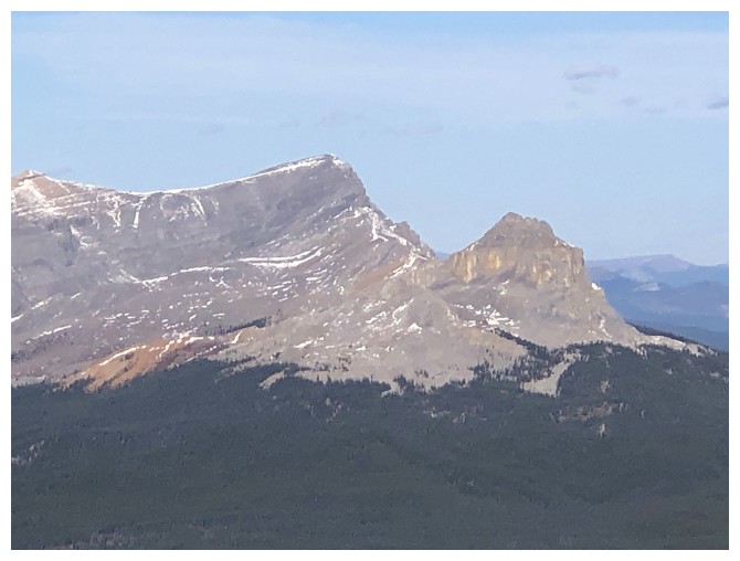
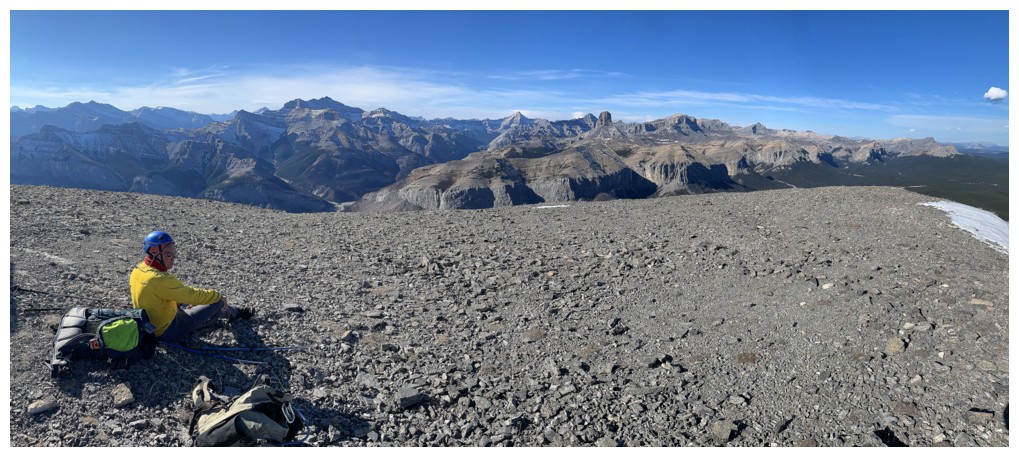
Devil's Head - an absolutely amazing trip!
Other unnamed peaks to the northwest
Ghost Peak. We did that one during the smoky summer of 2021, in the smokiest conditions we had ever encountered.
Enjoying the view
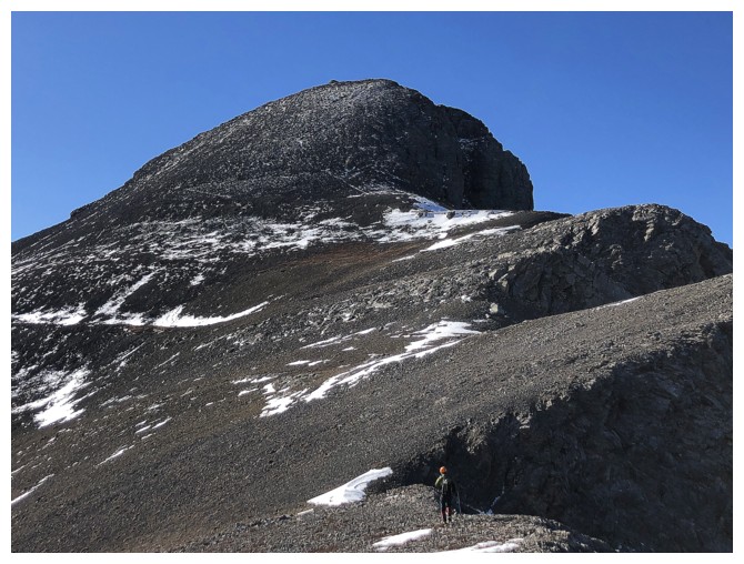
Mark hikes towards the steeper terrain of the summit block
 \
\
I'm lagging behind
A more direct route to the summit was possible but following the ridge was far more interesting
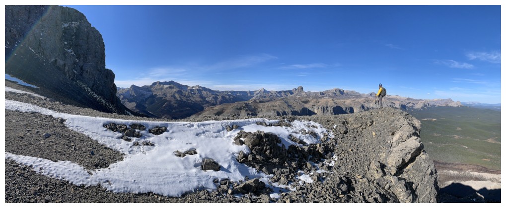
More great views from the edge
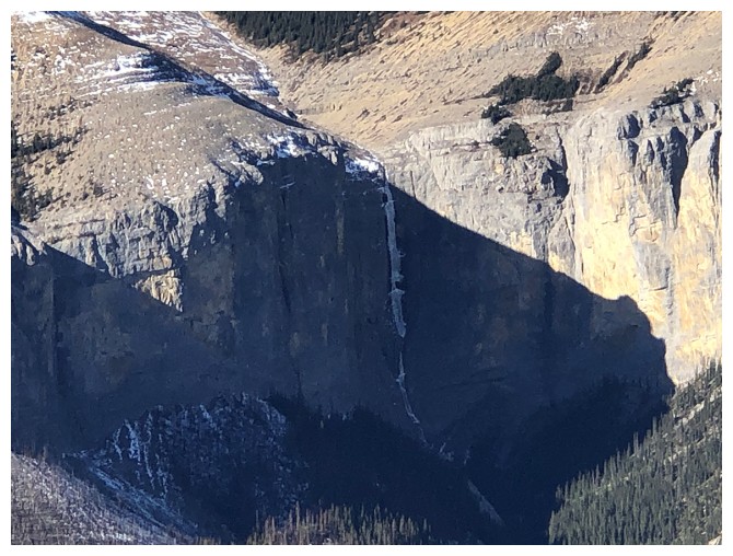
Not sure what ice climb this is, but it looks like it would an amazing when fully formed
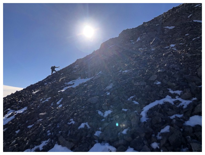
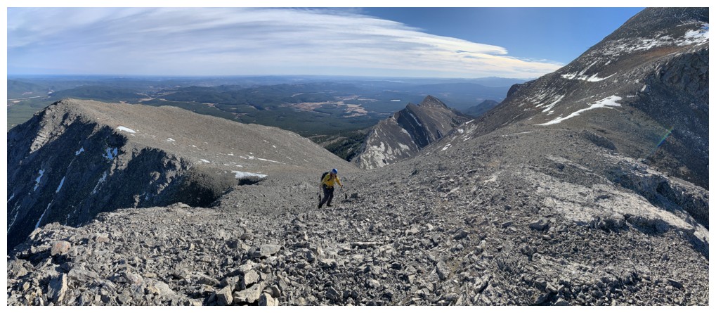
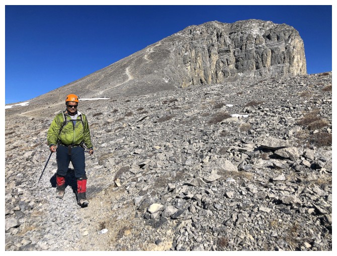
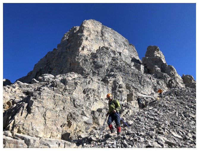
The final push to the summit is rubbly and steep
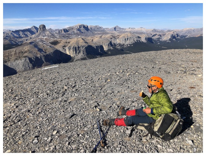
Mark enjoys his summit, swiss cheese sandwich
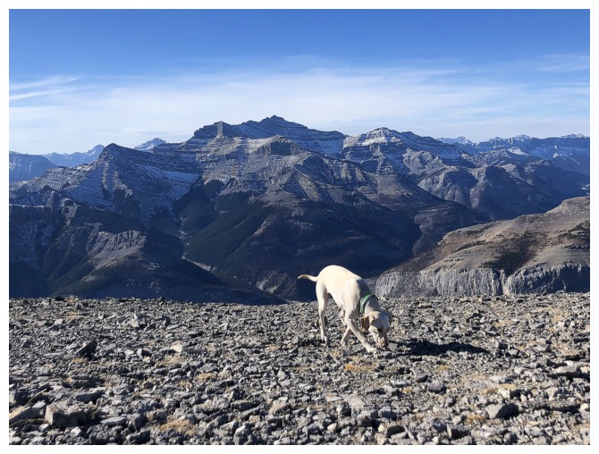
My new buddy enjoys my summit, swiss cheese sandwich
Satisfying summit view. The pepperoni I received from the dog's owner was equally satisfying!
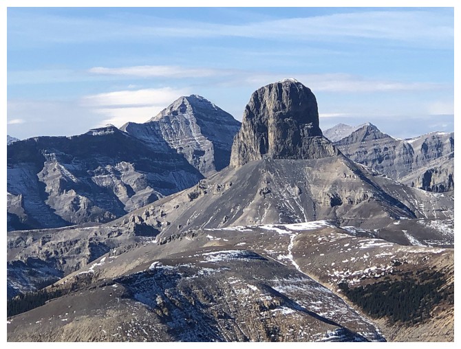
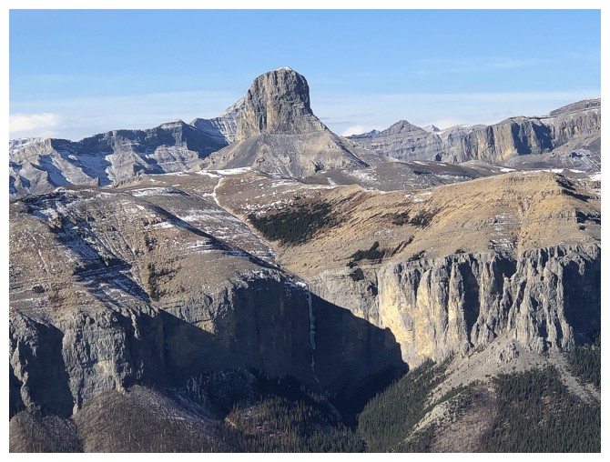
Closer look at Devil's Head
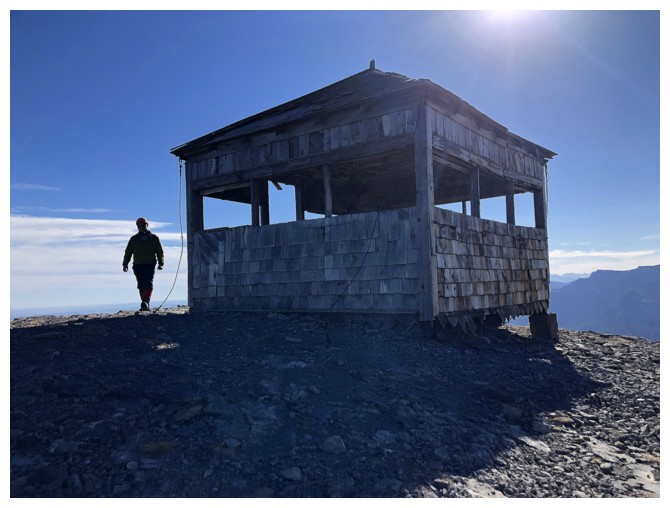
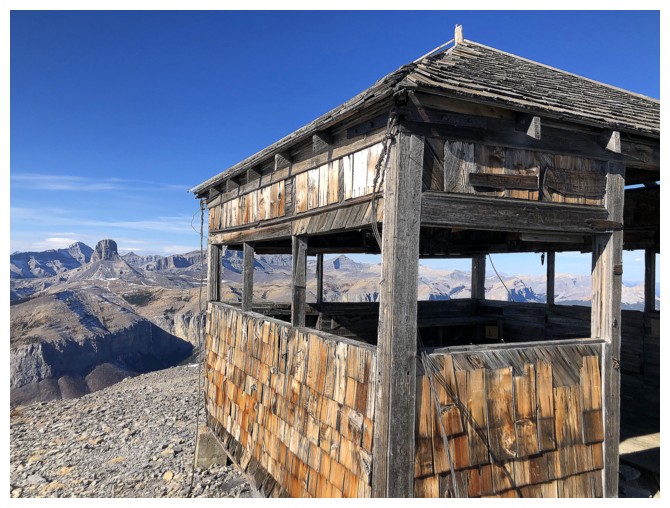
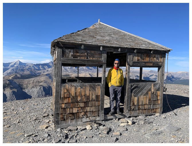
The decommissioned lookout
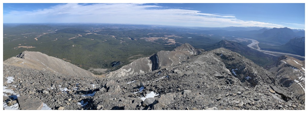
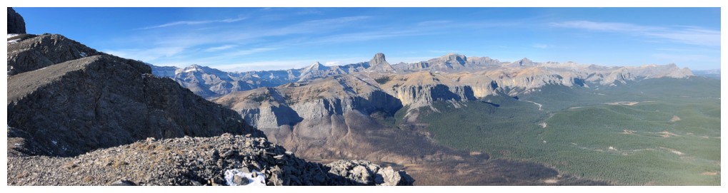
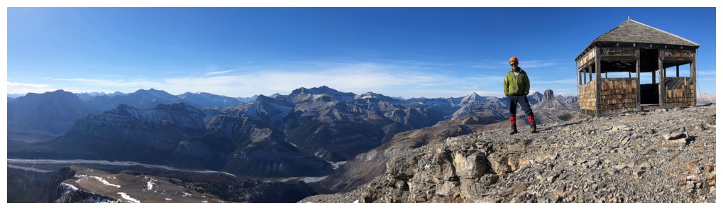
View to the east shows much of our ascent route
Descent
The wonderful summit block of Black Rock and the ridge we used for ascent in the background
Love this trail!
Approaching one of many interesting sections on the trail
Here's the section where we met Chris, Luciana, Leandro, Mike, and Jenny
Super rock scenery everywhere on this mountain
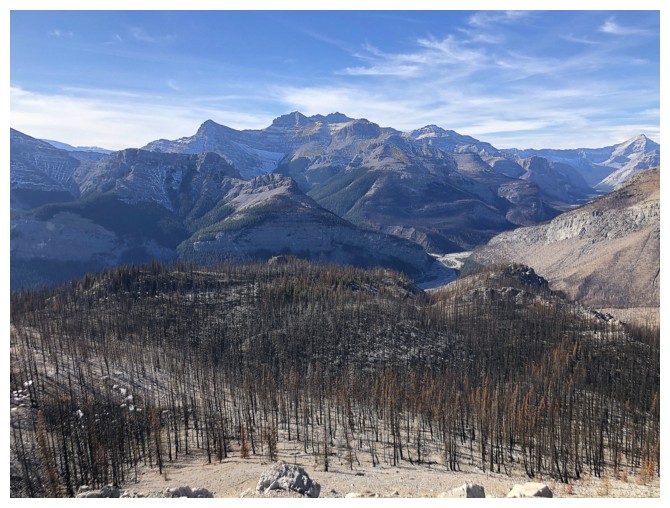
Approaching the descent through the burned-out forest
Stopping at the point where we left the trail on our 2020 trip
Our 2020 route went in between the rock bands
More surreal travel
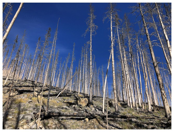
Some of the trees have lost their bark
Last few steps, with Black Rock behind
The End
LOG