“Buchanan Northeast”
November 1, 2020
Mountain height: 2424 m
Elevation gain:
900 m
Round-trip time: 5:20
Solo scramble.
Hard to do five trips up Ruby Ridge without
noticing two significant high points along Buchanan Ridge begging for some
attention. Dave and I had spotted a seemingly straightforward route up the
slightly higher of the two from Rowe Lakes trailhead. However, I thought the
peak at the far northeast end of the ridge would probably offer better views
and so I set my sights on that one. Fortunately, SOISTHEMAN had paved the way,
revealing a good route up to that highpoint.
 I, more or less, used So's descent route as my ascent route, since So had tried to get to the higher summit first. After an easy
crossing of Cameron Creek, I started up the northwest slopes of the peak. While
lacking the awe-inspiring, colourful rock of Ruby, Buchanan was not devoid of
interesting terrain. Unfortunately, the Sun’s rays would never touch these
slopes at this time of the year so the interesting colours be somewhat muted
anyway.
I, more or less, used So's descent route as my ascent route, since So had tried to get to the higher summit first. After an easy
crossing of Cameron Creek, I started up the northwest slopes of the peak. While
lacking the awe-inspiring, colourful rock of Ruby, Buchanan was not devoid of
interesting terrain. Unfortunately, the Sun’s rays would never touch these
slopes at this time of the year so the interesting colours be somewhat muted
anyway.
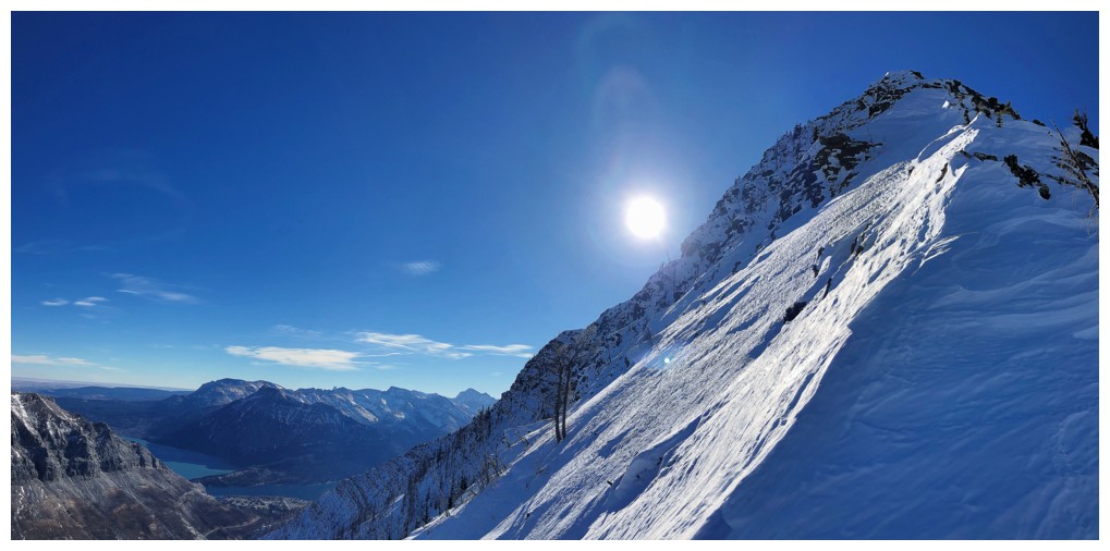
That changed dramatically upon reaching the
ridge: full Sun, perfectly clear skies, and a magnificent 360-degree view that
far exceeded what I had expected to see. Although the summit was close, a
nearby highpoint to the west caught my attention and that’s where I went first
– a little side-trip that provided some of the best scenery of the day.
After that, the summit was easily reached.
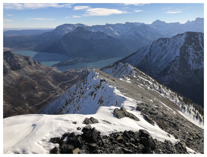
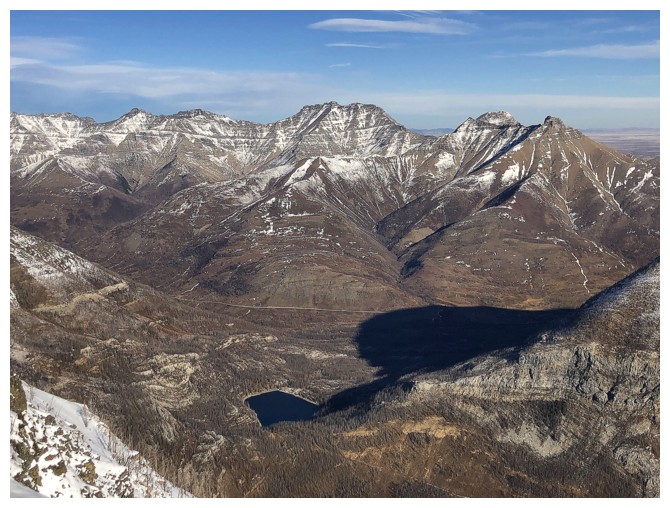
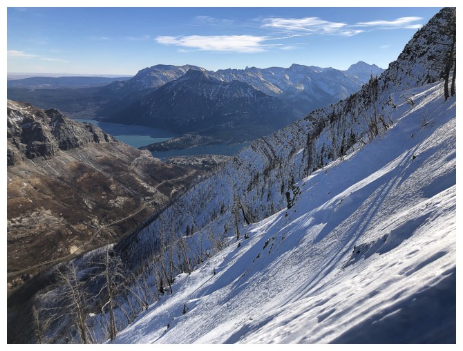
Another short side-trip down the southeast ridge yielded more amazing views,
especially of the snow-plastered east face of the mountain and a unique view
towards the Waterton Lakes and townsite.
Returning to the summit, I couldn’t resist
one last detour a short distance down the north ridge. The short distance
turned into a full-on descent down the terrific north side of the mountain. Crampons
and an ice axe were a nice luxury for the snow conditions, enabling me to
traverse several sections of rock-hard snow. An extremely pleasant and
interesting descending traverse around the mountain brought me back to the
start.
Unexpectedly, one of the cooler trips I’ve
done in this part of Waterton. Big thanks to SO for leading the way on this
one.
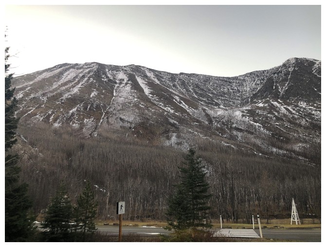
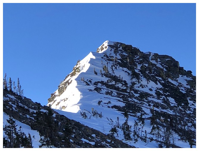
The objective as seen from the parking lot. The summit is at the far left.
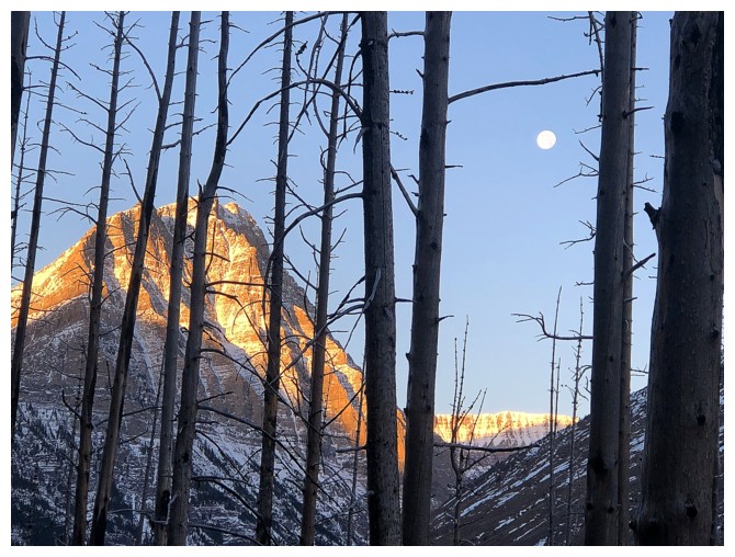
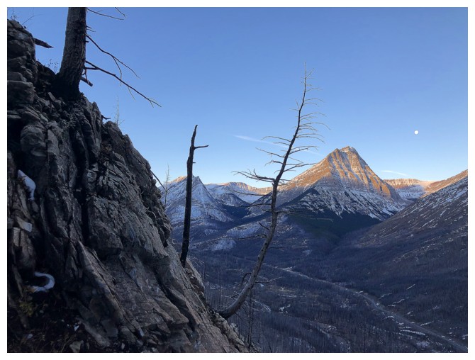
The Moon and Mount Lineham
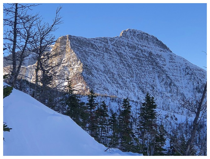
As the 2nd tallest peak in Waterton, Lineham is seeing the Sun much much earlier than Mount Rowe (left)
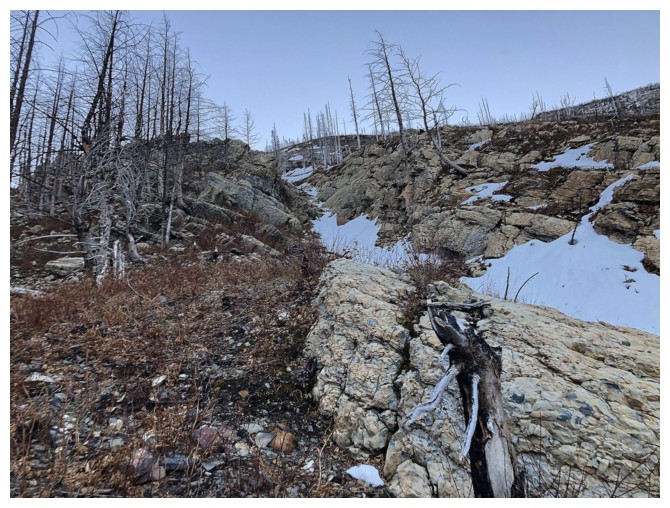
Typical terrain on the lower slopes
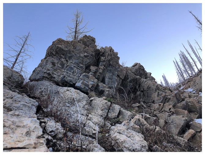
Several sections of solid, scrambly rock
Still mesmerized by the Moon and Lineham
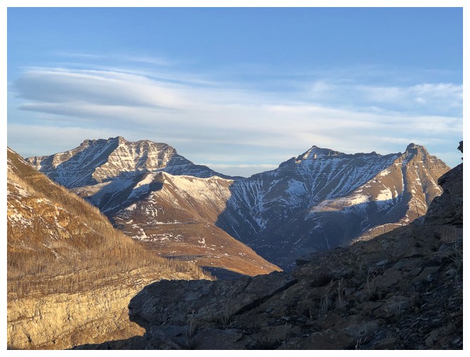
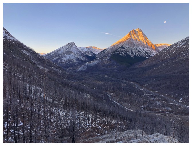
Dungarvan (left) and Galwey (far right) have been bathing in Sun for some time
Still in shadow, but the view to the north continues to improve
A photo favourite: distant Long Knife Peak (left) and much closer Mount Rowe (right)
Close-up of Long Knife
Mount Lineham
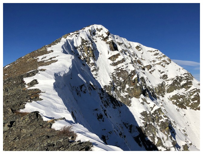
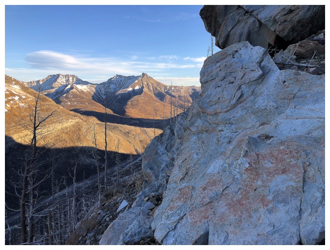
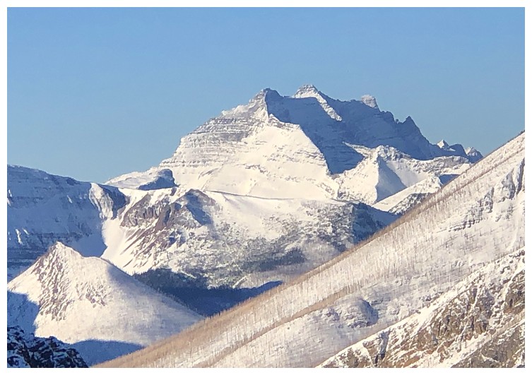
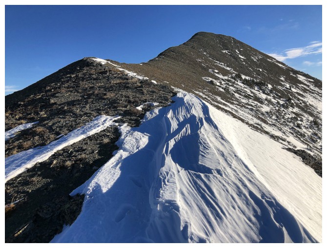
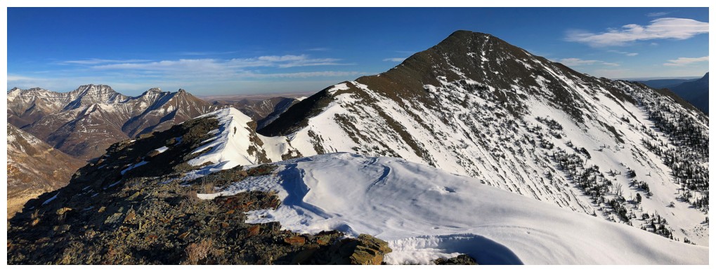
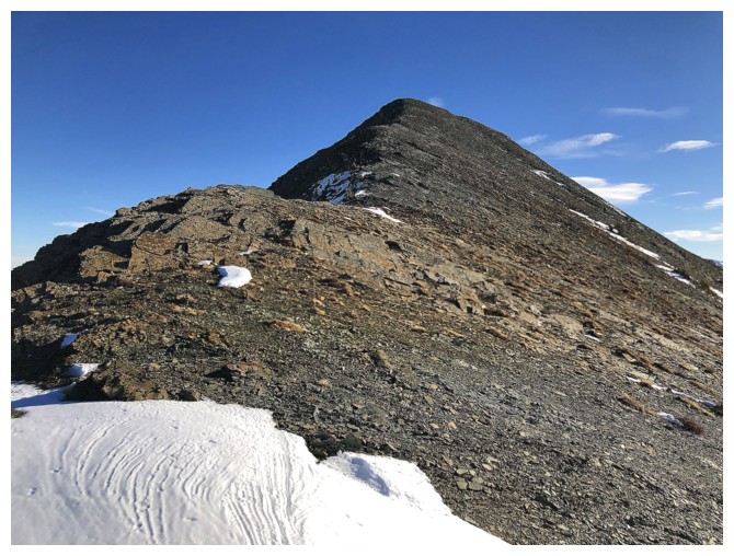
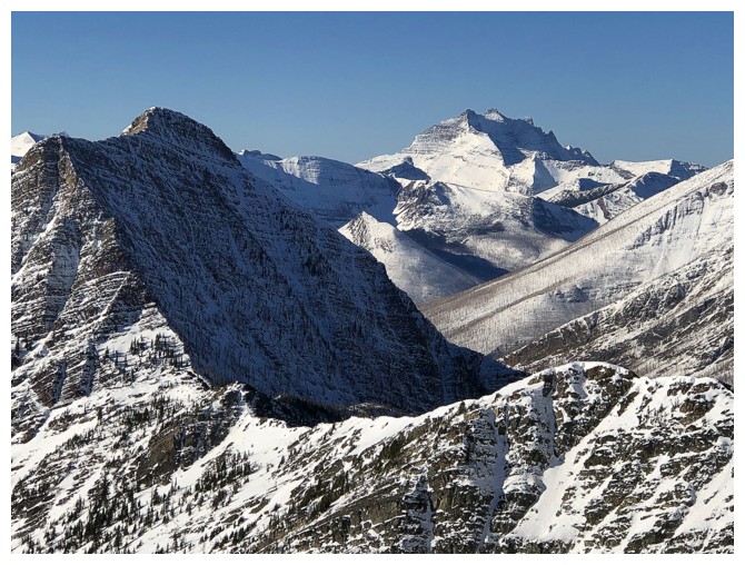
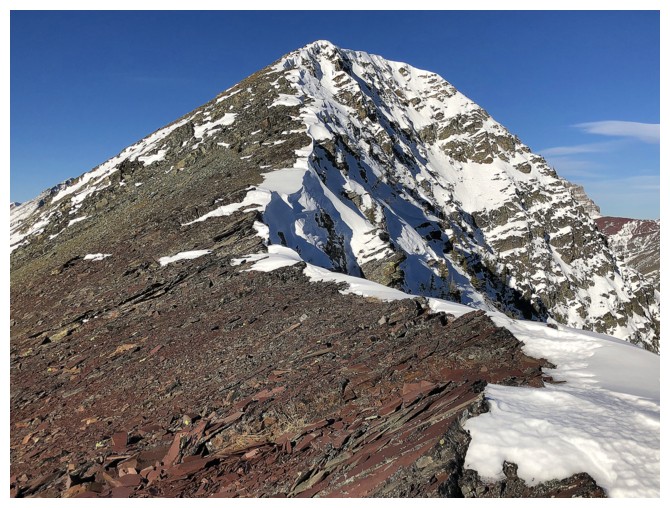
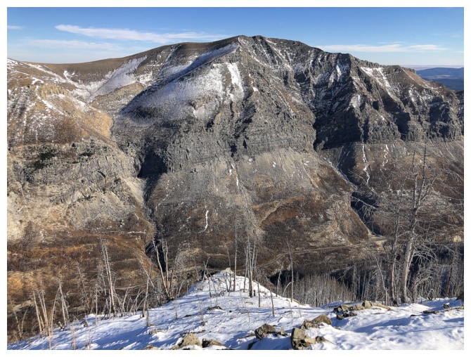
The slightly higher highpoint of Buchanan Ridge - looks challenging!
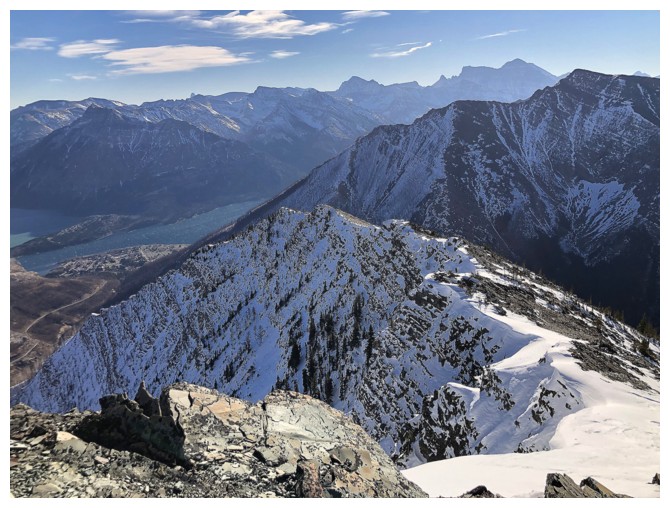
The minor summit to the west I went to first, upon reaching the ridge
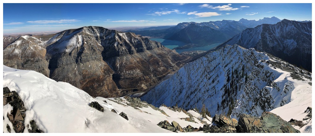
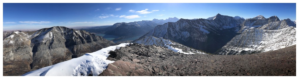
The surprisingly great view to the west from the ridge
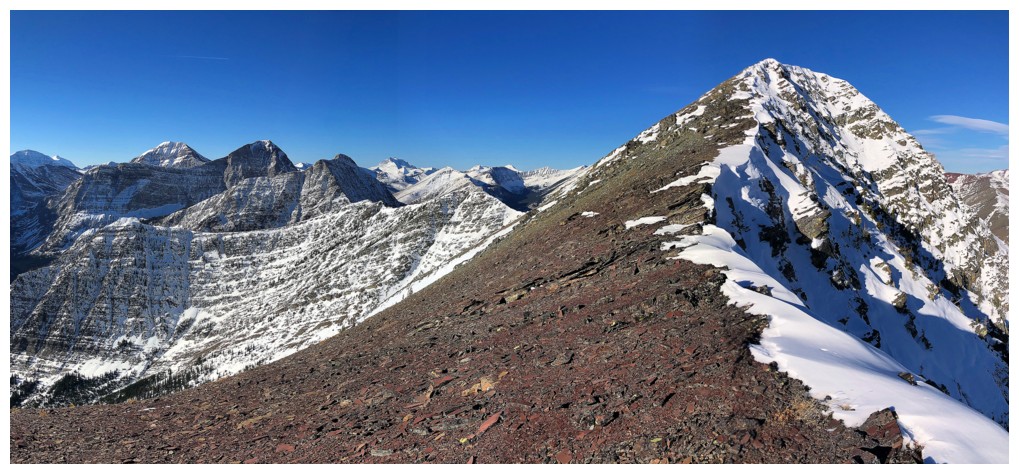
Heading to the minor highpoint near the right
View to the northwest and north
Looking the other way to the summit
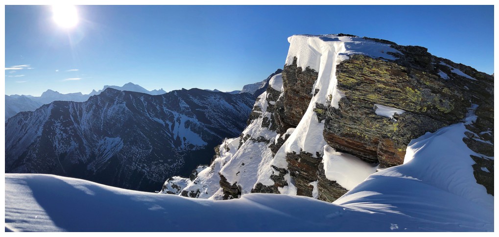
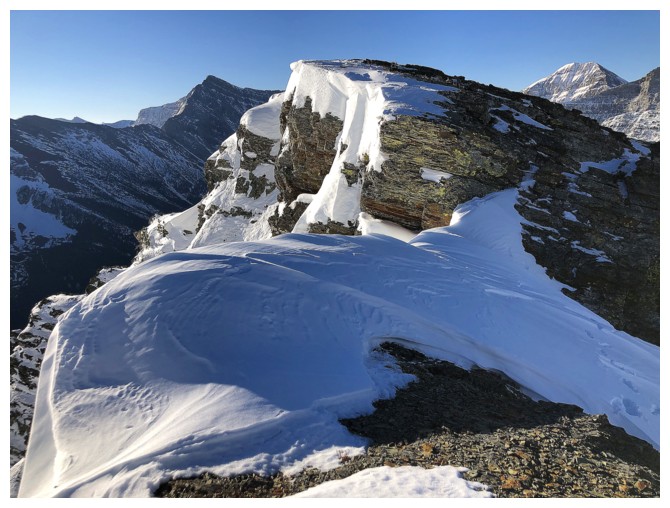
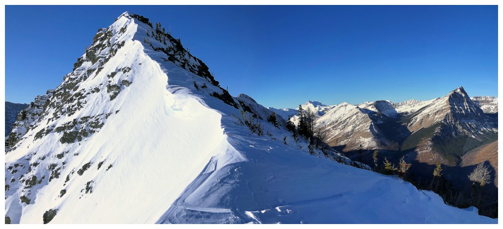
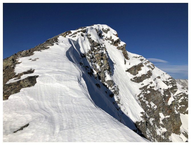
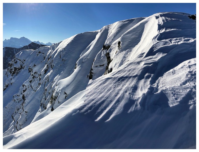
No greater temptation than a corniced ridge!
That's why!!
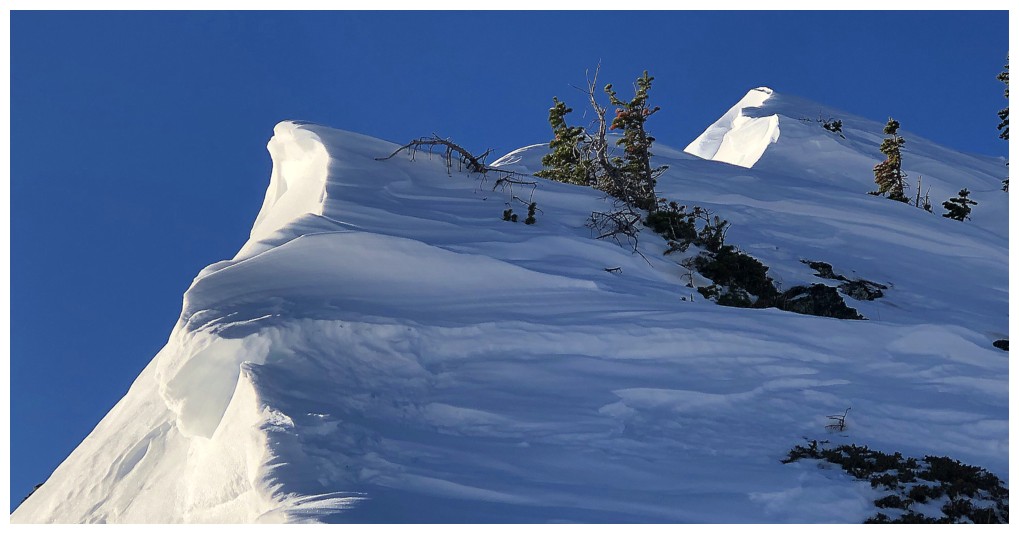
Nearing the highpoint. The rockband at the left was one of the coolest
I've ever seen, thanks to the perfect weather, new snow, and a little
lichen .
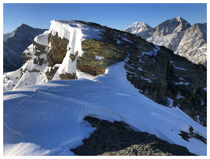
The rock band
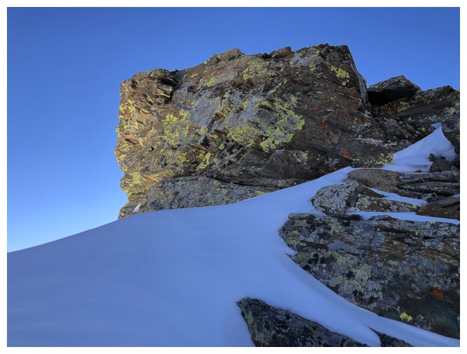
Some of the lichen
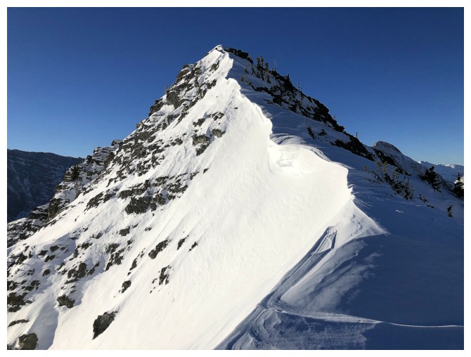
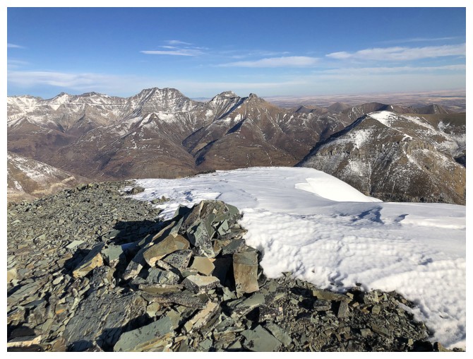
At the highpoint, looking to the true summmit
View to the west
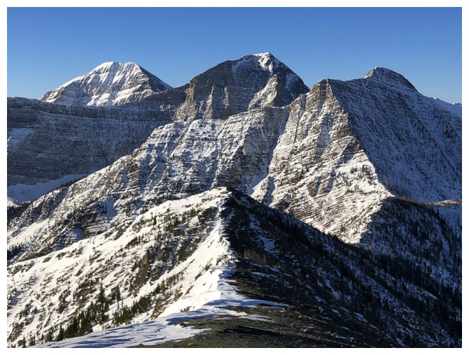
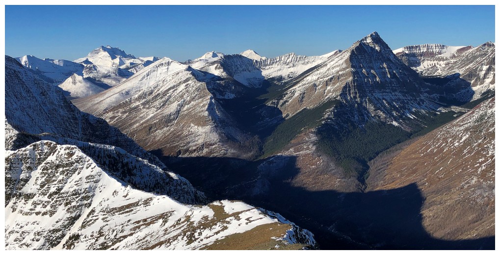
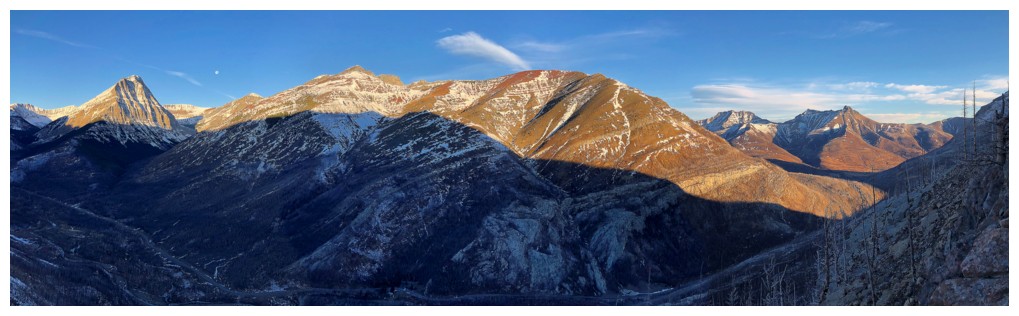
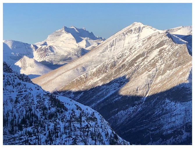
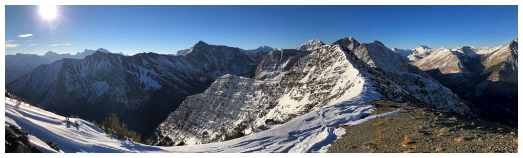
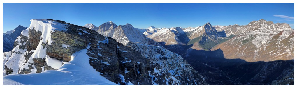
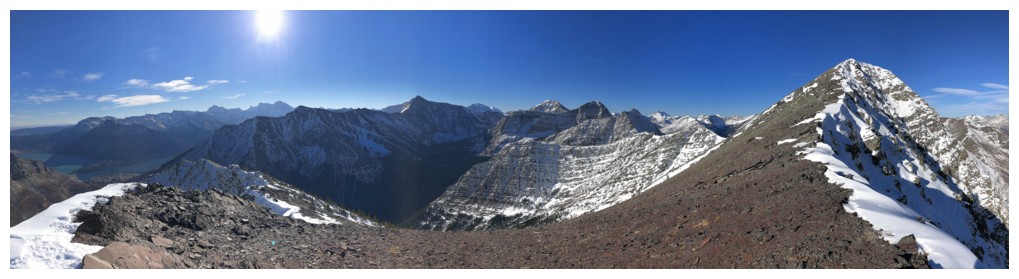
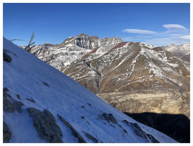
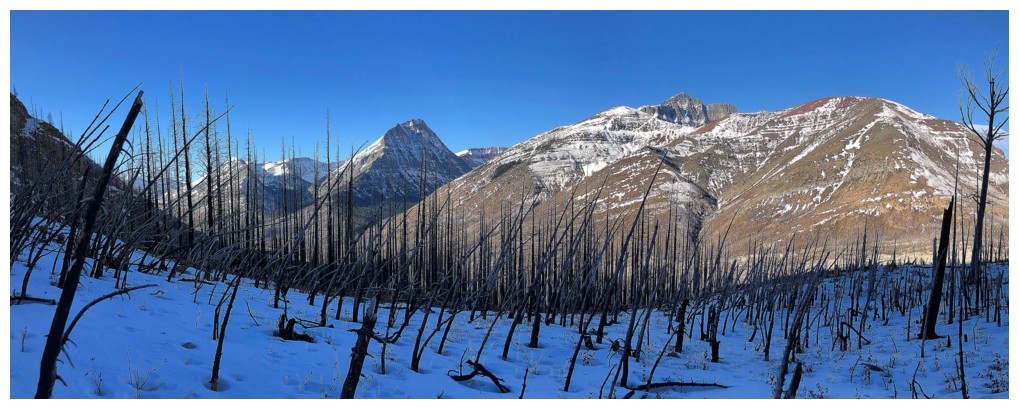
Left to right: Mount Carthew, Buchanan Ridge, the other highpoint of Buchanan Ridge
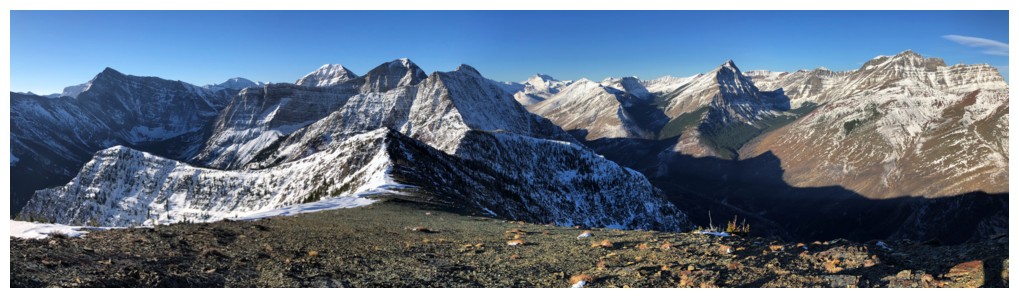
Mount Alderson - hands-down one of the best trips in Waterton (of any part of the Canadian Rockies, for that matter!)
Couldn't resist another look at this amazing scene
Or this one!
Easy hike to the summit
Summit cairn and the view to the northeast
Sweet view to the west
Heading down the southeast ridge
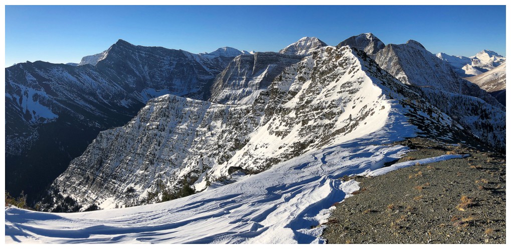
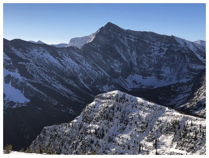
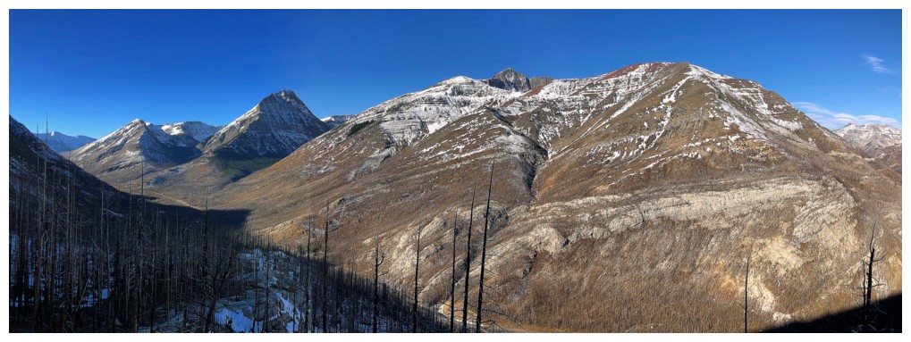
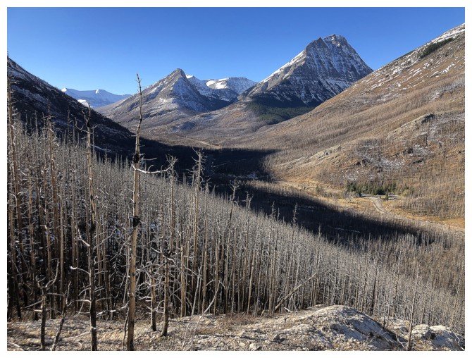
Long Knife and the other highpoint again
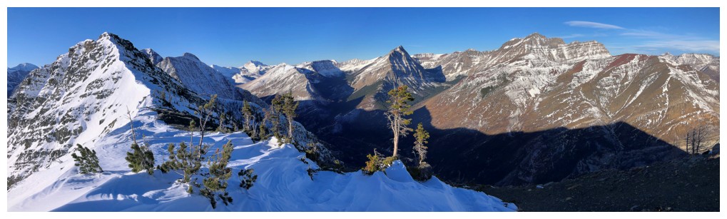
The number of visible peaks to the northwest increases (Rogan Peak,
Dundy Peak, and Cloudy Ridge) and Crandell Lake makes an appearance
Continuing
down the ridge all the way to Cameron Falls and the Waterton townsite
was very tempting, but the 9 km walk back to the car was not!
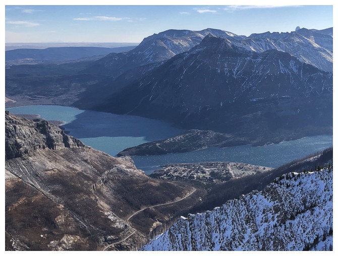
The townsite
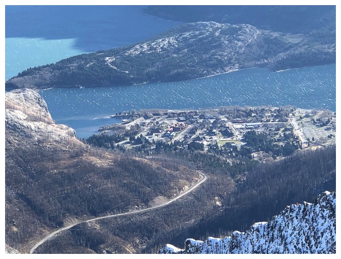
Close-up
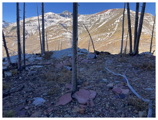
Happy to see a little red argillite
View from my stopping point on the southeast ridge
Looking at up to the summit
Panoramic photos often do strange things to perception; the summit at
the right and the southeast ridge at the left are along the same
straight line
Same as above (but panos are super cool!)
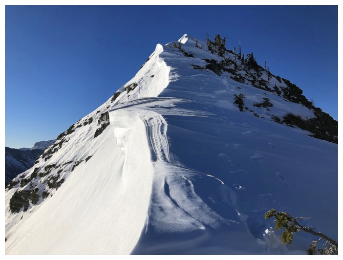
Speaking of super cool - excited about another season of great cornice scenery
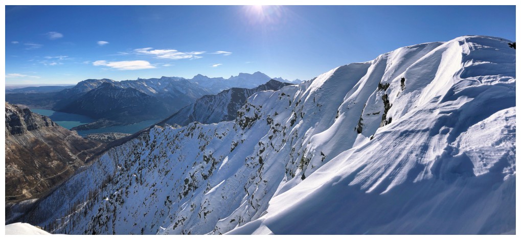
And there's a little taste, heading down the northeast ridge
Looking across the east face of the Buchanan Northeast
And back up to the summit
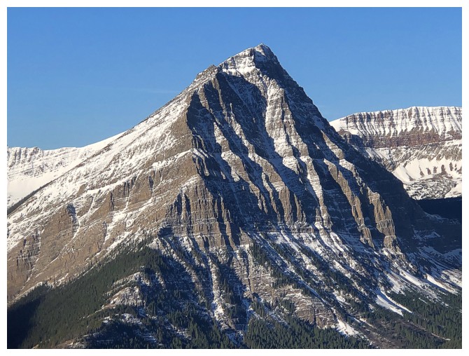
Mount Crandell - lots of cool routes up that one: I, II, III
Mount Blakiston behind Ruby Ridge
This section was steep enough to prompt me to face in and use my ice axe
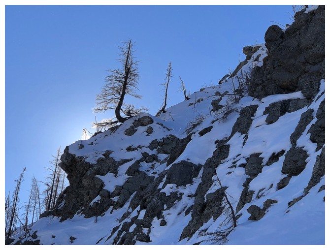
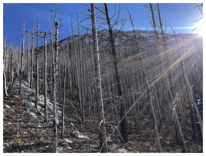
Looking through the burned trees at the summit
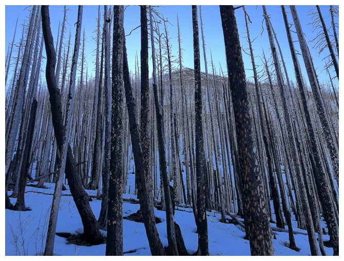
The results of the Kenow fire yield some fascinating scenery
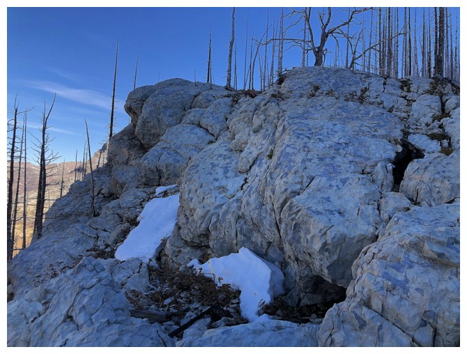
The north side of the mountain features large sections of this super
cool white rock (dolostone maybe). Unfortunately, the Sun's rays do not
hit the rock at this time of the year.
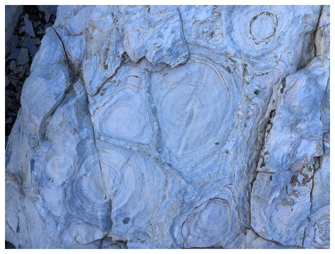
Interesting shapes in the rock
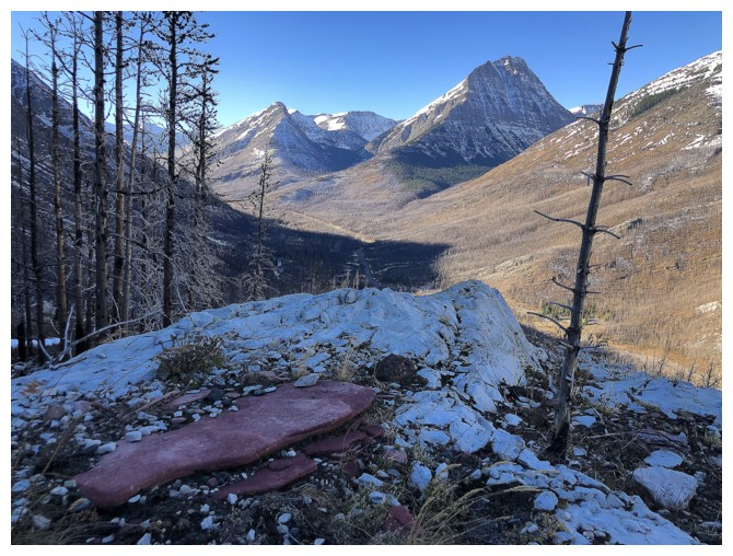
Wish the Sun was hitting that random chunk of red argillite!
Back into the Sunshine
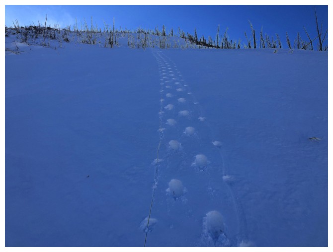
Looks heavily treed for here to the road but travel was easy and very enjoyable
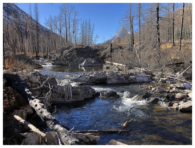
Back to Cameron Creek
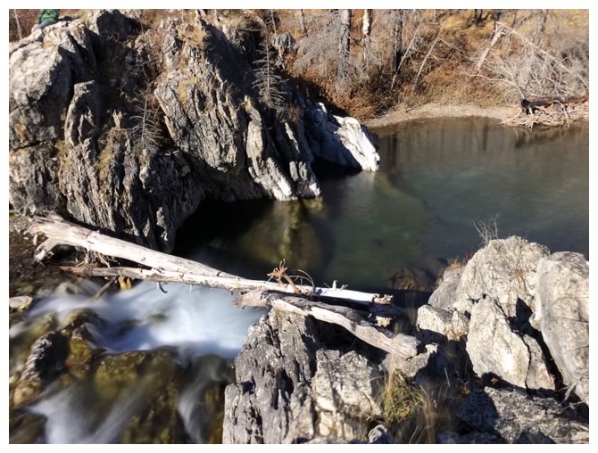
Small waterfall
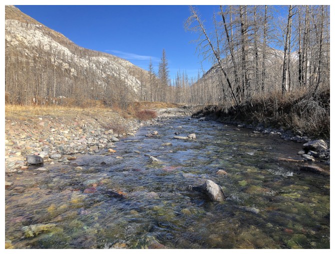
Standing in the middle of the creek, facing west
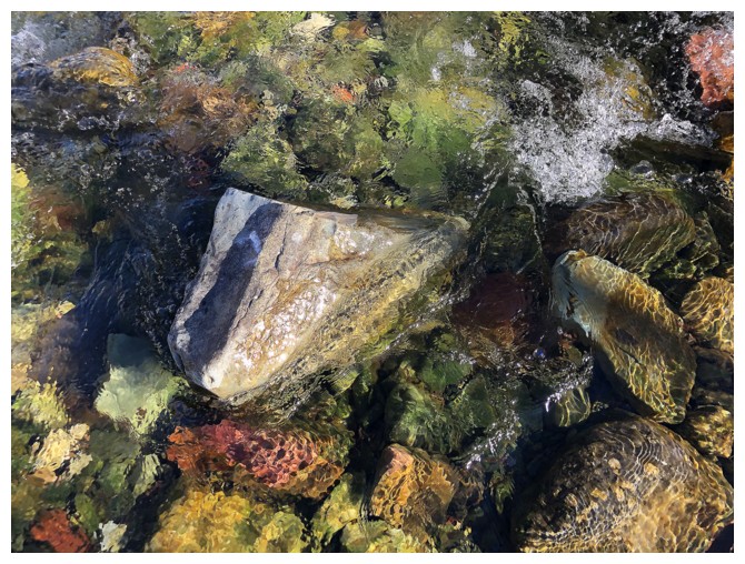
Lots of rock variety in the creek
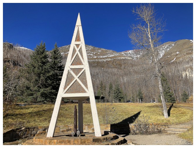
The remnants of western Canada's first oil well. Looks very Star Trekish!!
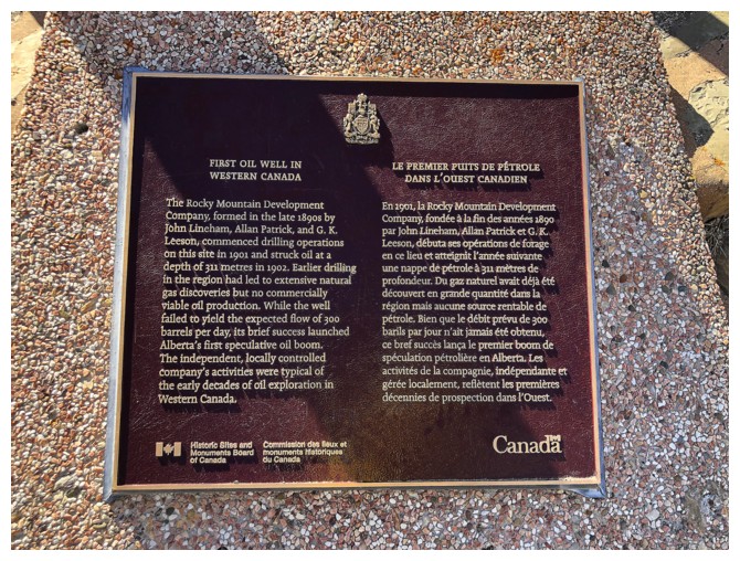
The plaque by the oil well
Looking back up the ascent route at the end of an awesome day
The End
LOG