Cloudy Ridge II
September 6, 2020
Mountain height: 2570 m
Elevation gain:
1100 m
Ascent time:
3:40
Descent time:
3:30
Solo scramble.
Somewhat marred by frustrating weather
conditions for our first ascent of Cloudy Ridge in 2006, a repeat ascent seemed
in order. This trip too would be a chess match with the weather, a nasty system
predicted to arrive in early afternoon. As such, I left the parking lot quite
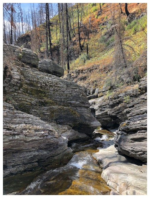
early and did the first part of the incredibly interesting Red Rock Canyon
approach by headlamp.
Gaining elevation on Cloudy’s south ridge I
was pleasantly surprised not only to see cloud-free skies but also haze-free –
in striking contrast to our smoky ride up Bertha Peak, 24 hours earlier. Haze-free
remained constant, cloud-free did not! Upon reaching the highpoint southeast of
the summit I was treated to the always cool weather phenomena of watching
clouds form in the valley below and then crawl up the mountain and over the
ridge. Surprisingly, this weather system was pouring in from the east,
contradicting the satellite photo that showed the system moving west to east.
Aside from a slightly disoriented ridgewalk
back to the highpoint, because of very low visibility, the descent went smoothly,
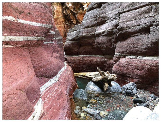
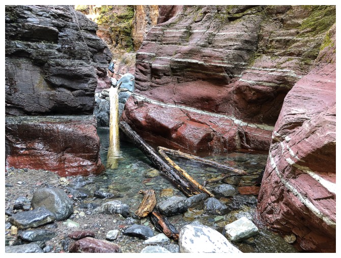
and I was back in Red Rock Creek in no time. Getting back to the parking lot
was anything but expedient, the wonders of the canyon too much for my phone
camera to resist!
Yet another outstanding repeat ascent in my
favourite Canadian National Park.
The start of a somewhat eerie headlamp approach up Red Rock Canyon
Daylight arrives
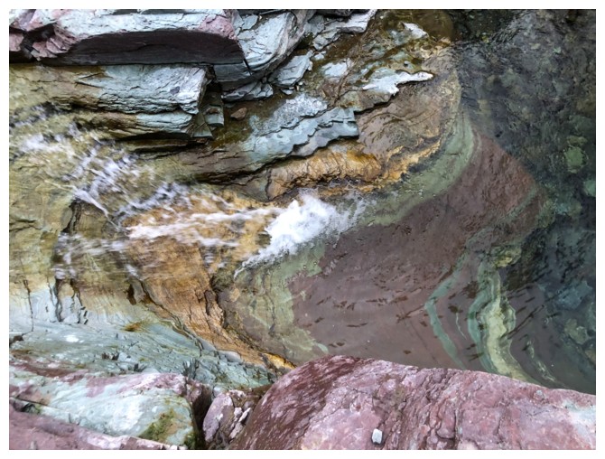
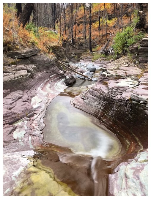
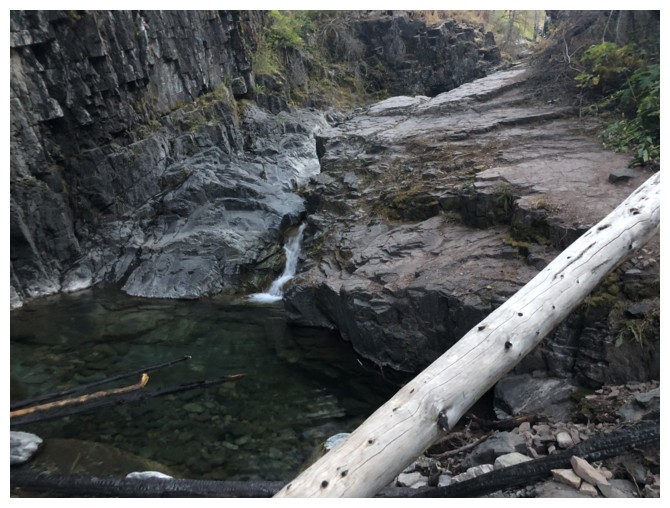
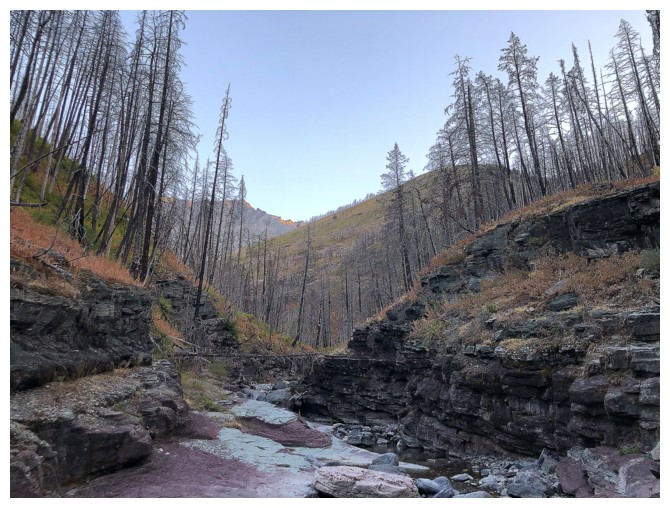
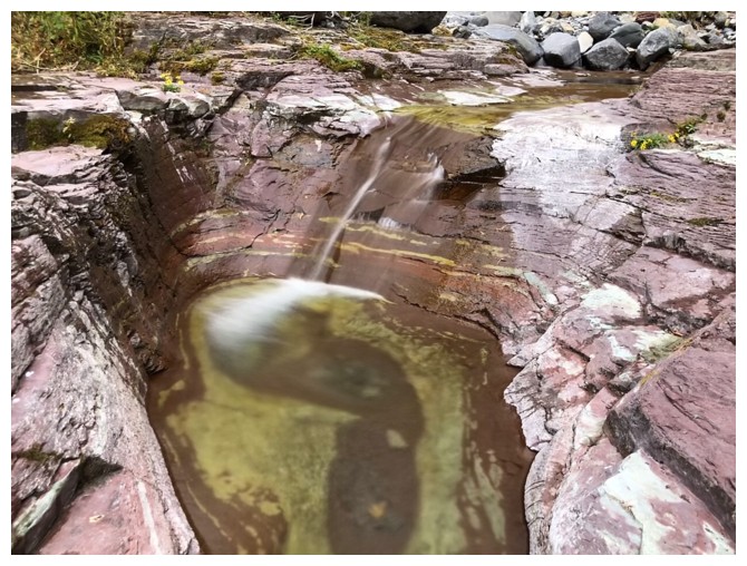
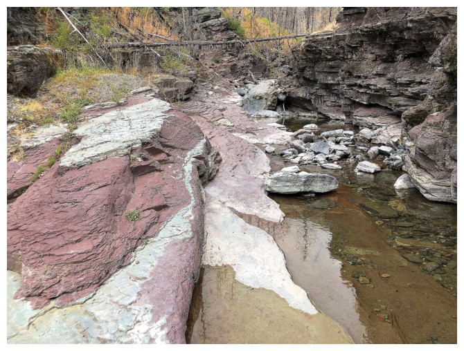
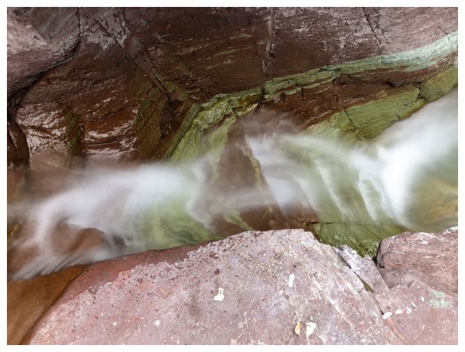
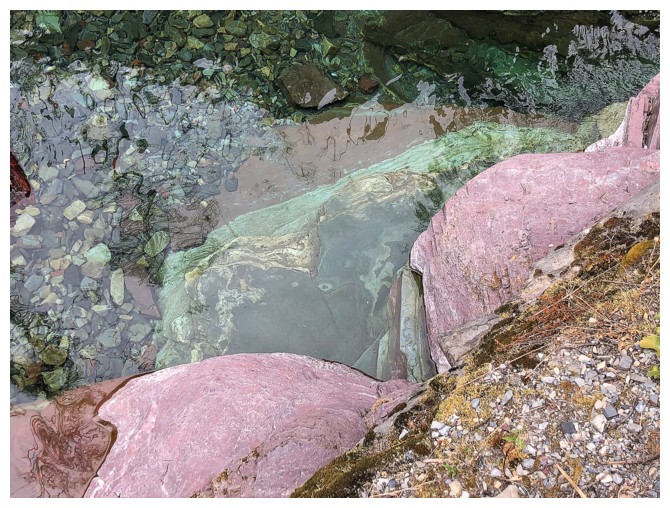
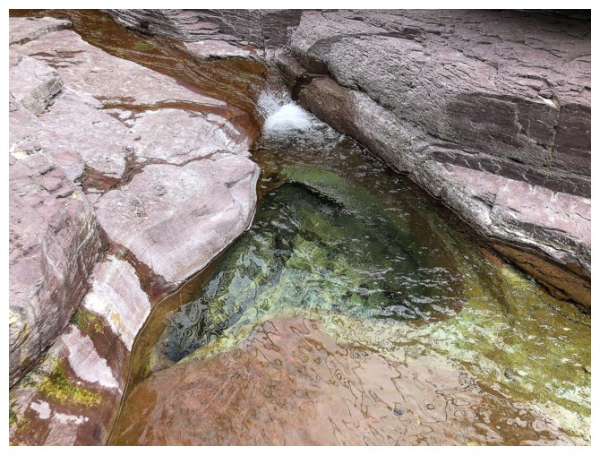
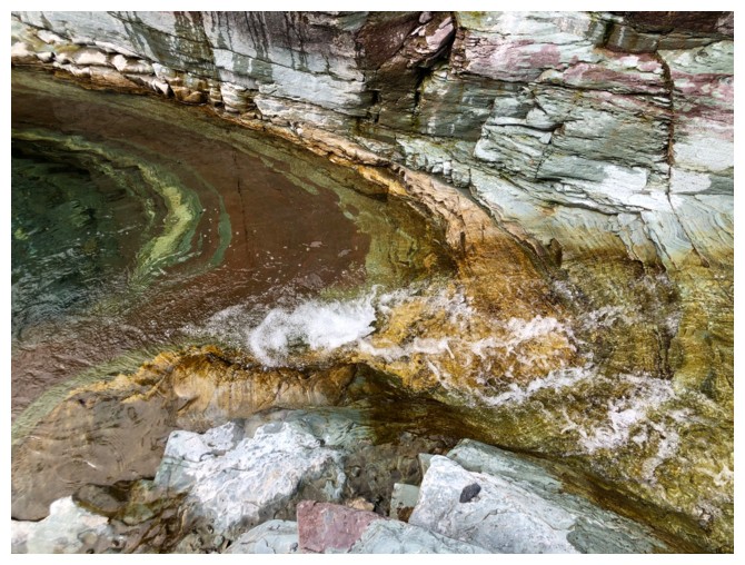
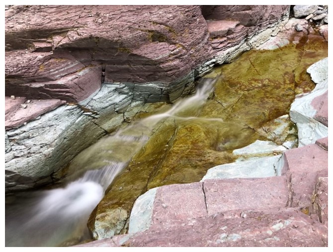
Crazy rock colours in the canyon
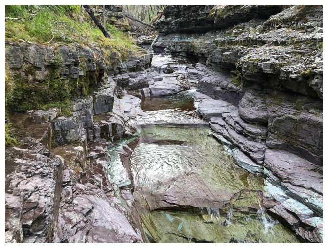
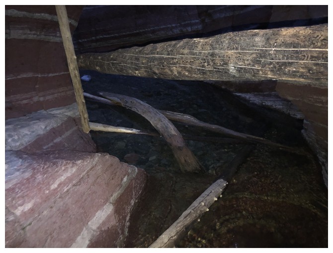
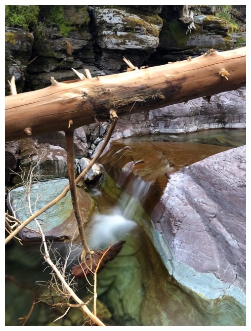
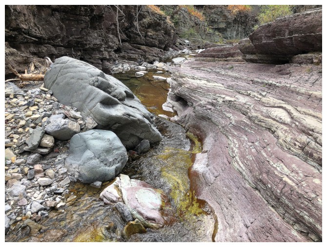
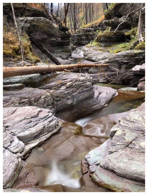
And awesome terrain to negotiate
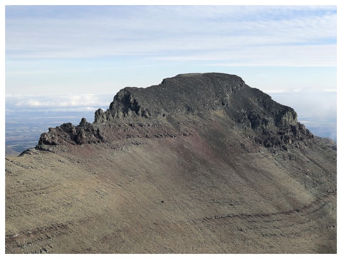
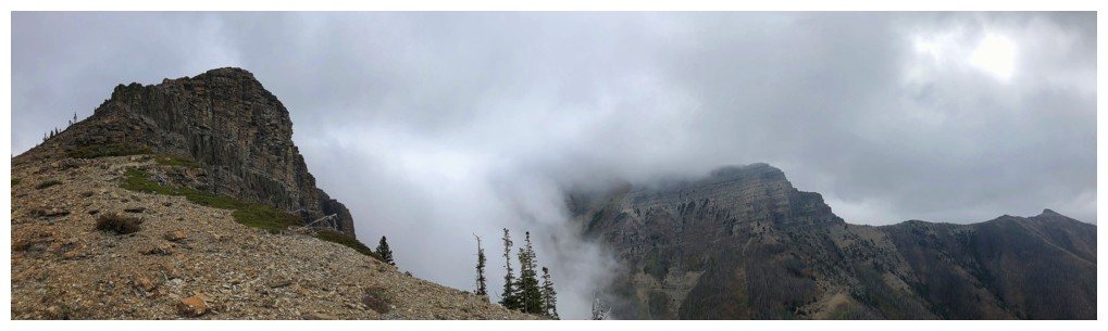
The ascent ridge for Cloudy appears
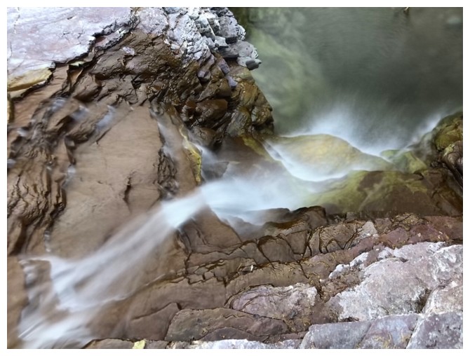
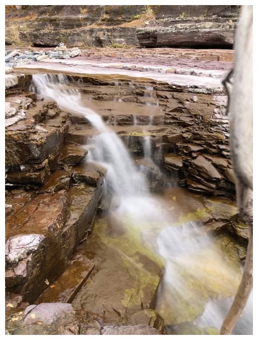
But there's still more cool scenery in the canyon
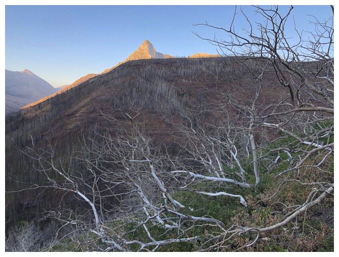
On the south ridge of Cloudy. Anderson Peak enjoys the first rays of Sun.
No Sun for Dundy Peak yet, but it's still a great trip!
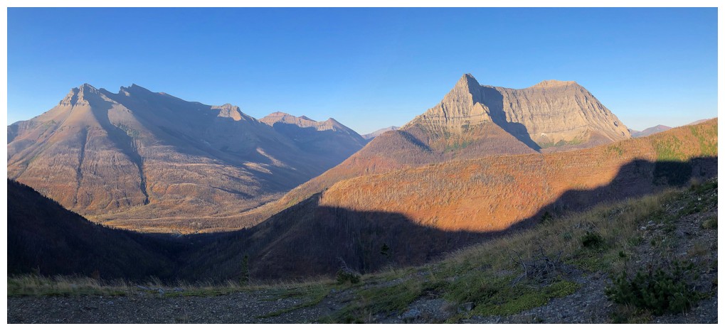
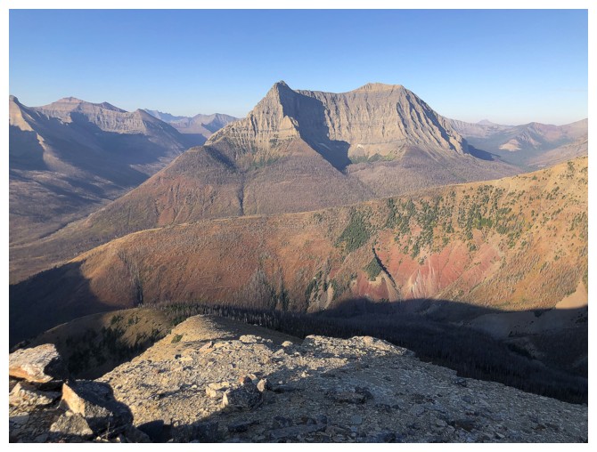
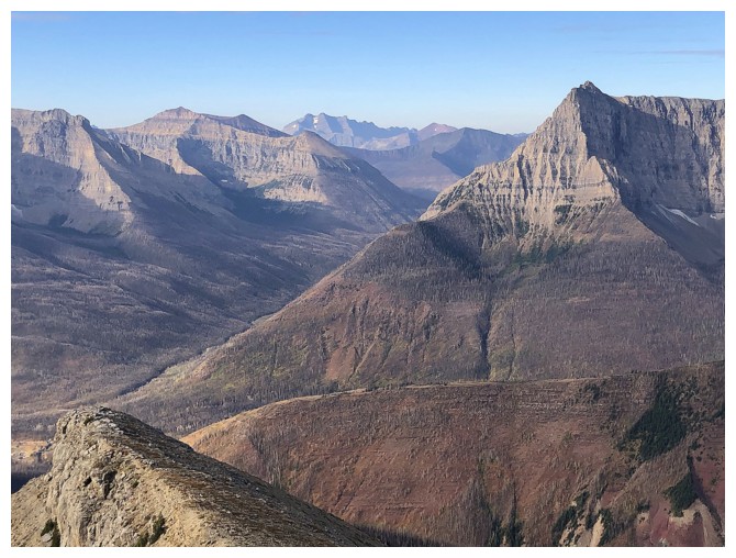
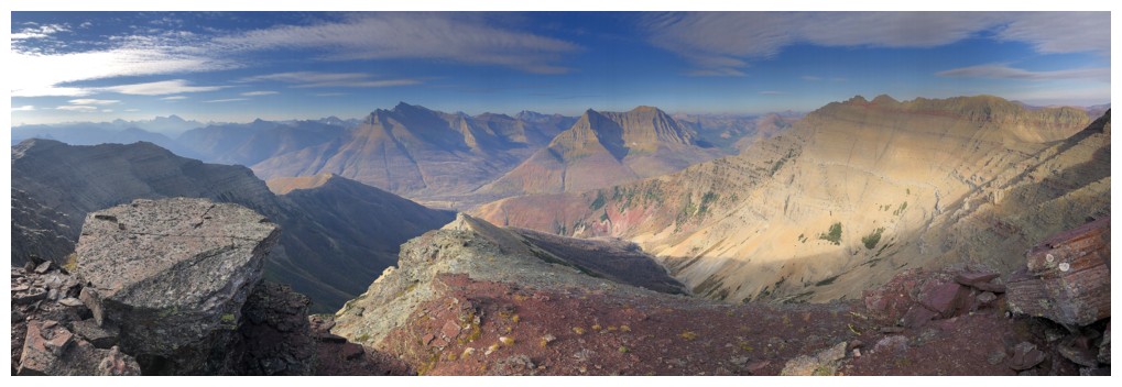
Mount Blakiston (left) and Anderson Peak - two fantastic mountains
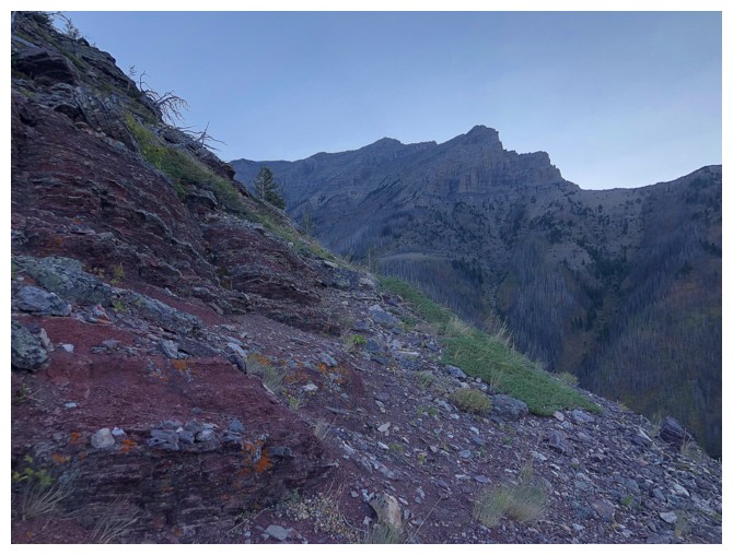
Looking up the middle section of Cloudy's south ridge
Pretty good views already
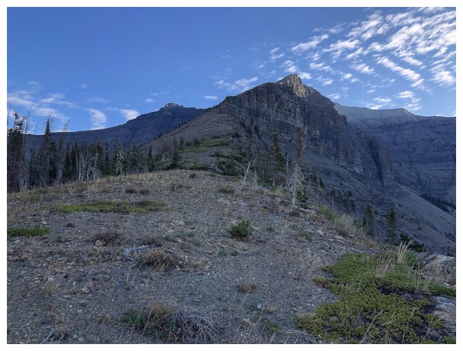
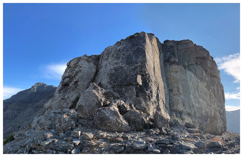
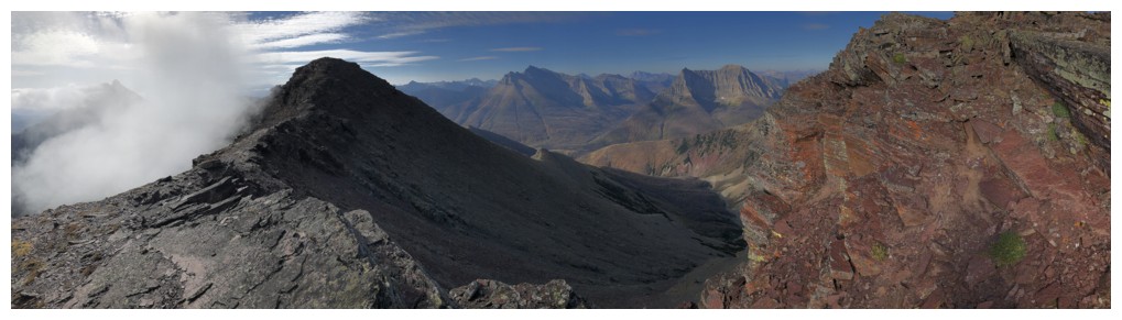
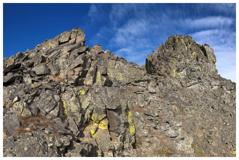
The fierce east face of the upper section of Cloudy's south ridge
Unfortunately, this was the only section of real scrambling and even it can easily be avoided on the left side
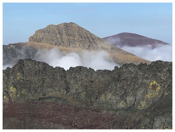
Anderson Peak gets a lot of photo love from this vantage point
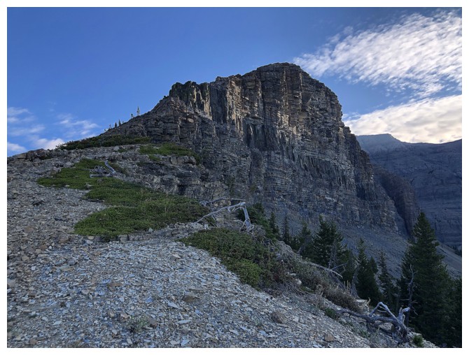
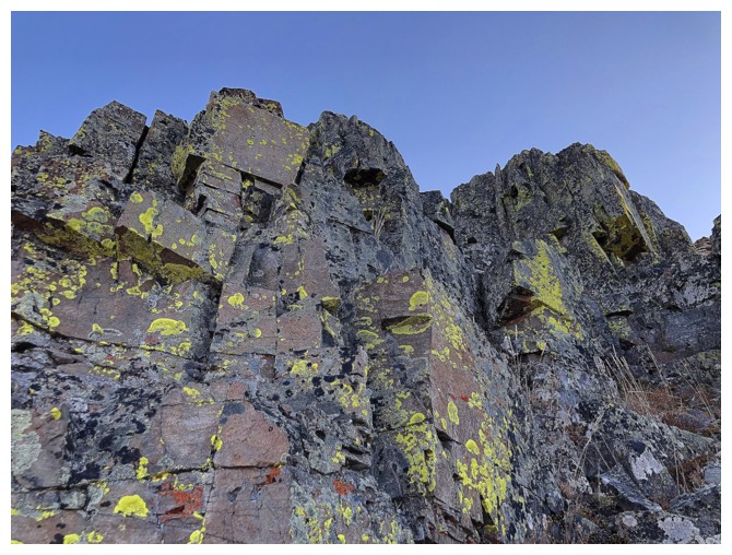
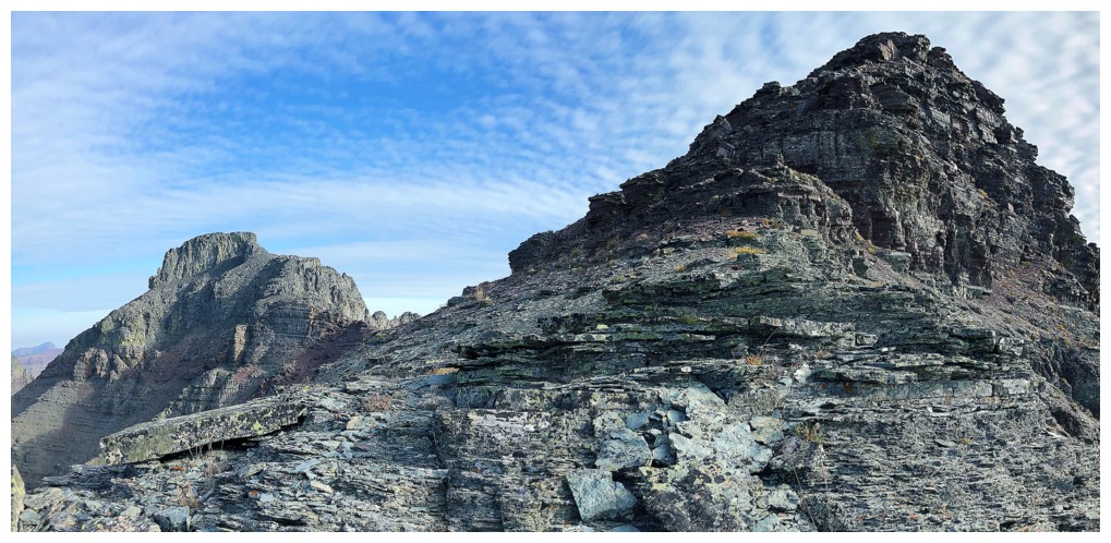
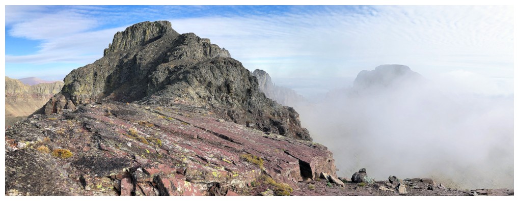
The limestone rock band that lines every peak in the area. It provides
all degrees of challenge, from none (this peak) to significant (Dundy
Peak)
Sweet rock!
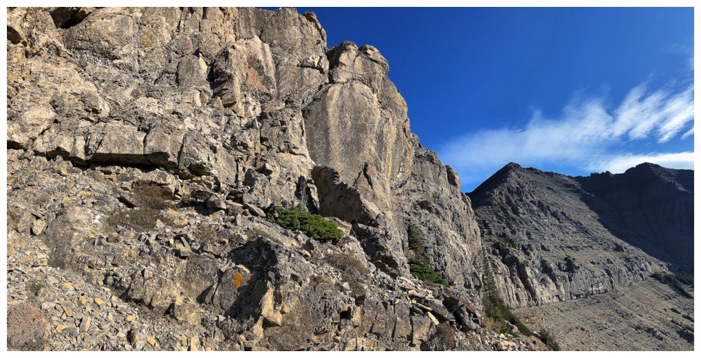
Took a short detour around the right side to check out the rock band, before returning to the easy left side
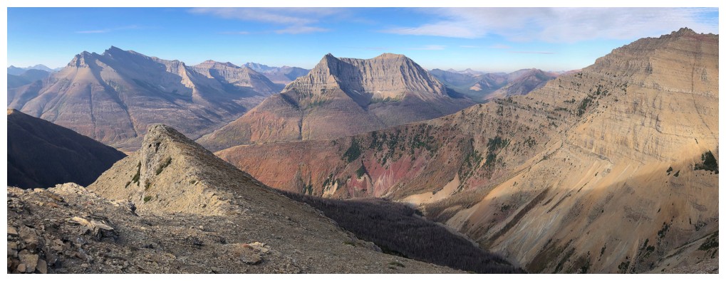
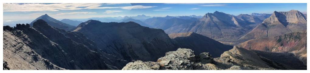
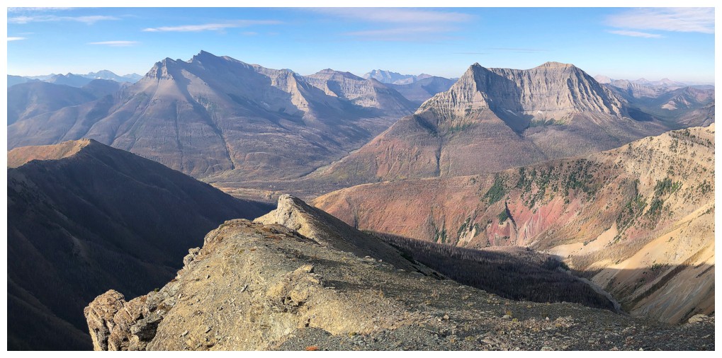
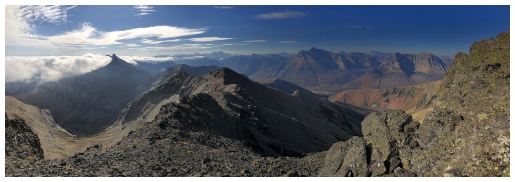
Mount Glendowan (far right) joins the fray
Mount Dungarvan also looks fierce from here
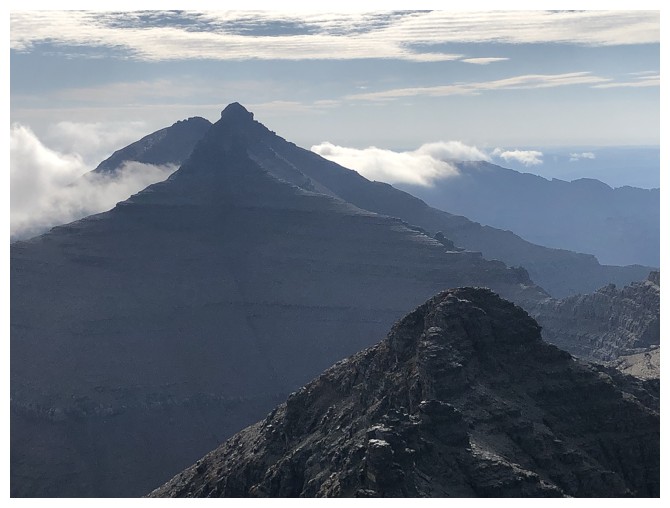
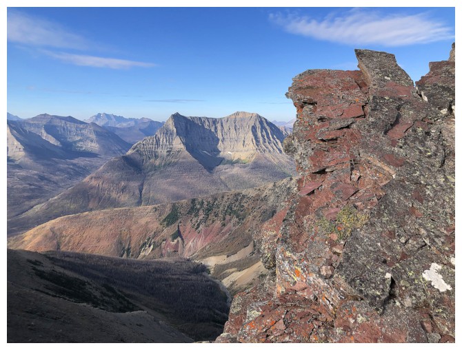
Distant Mount Cleveland. The ridge in front is the hard route up Dundy Peak (also unofficially called Clougarvan). I tired and failed.
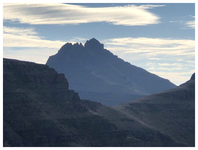
No matter how distant, my phone camera cannot resist Long Knife Peak (centre)
Actually, there are many things my camera can't resist!
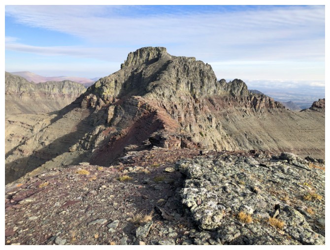
Dungarvan at the left and Dundy in the centre. The ridge between Cloudy and Dundy appears to be quite challenging.
Almost at the false summit. The true summit at the left.
At the false summit, looking west
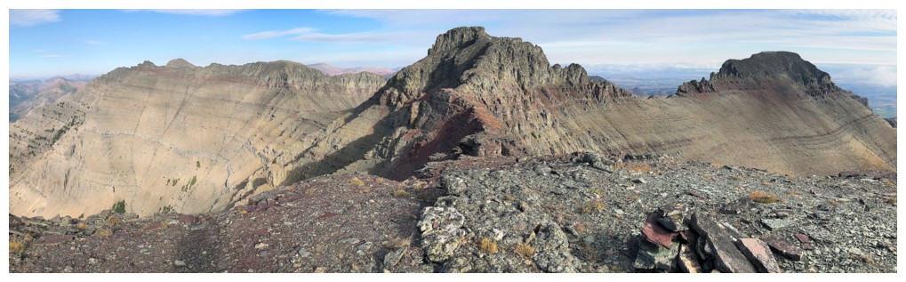
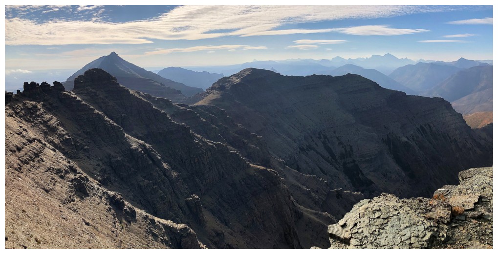
Looking north to the true summit (centre). Cloudy Ridge Junior to the right and Glendowan to the left.
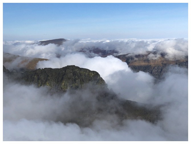
A few clouds form around Dungarvan
Awesome ridgewalk to the summit
Cloudy Ridge Junior again. The challenge of a traverse from Cloudy to Junior is getting down to the ridge at the far left.
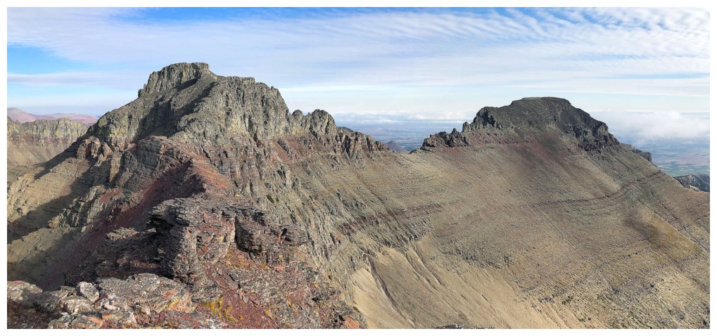
Cloudy and Junior
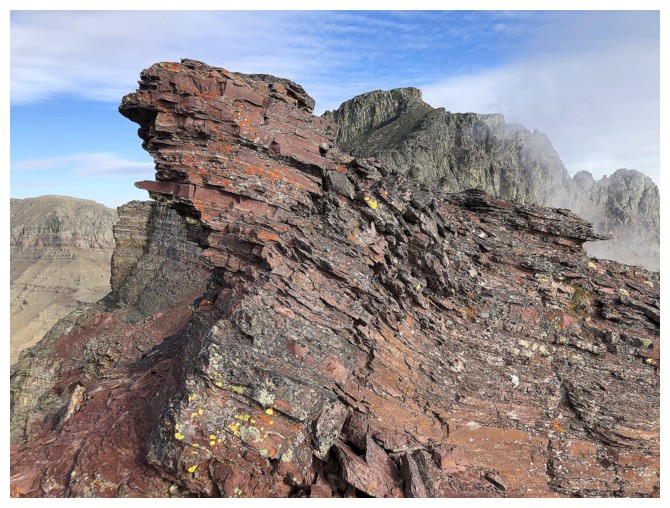
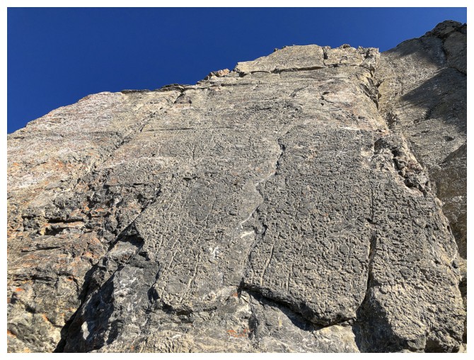
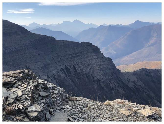
Lots of wind-sculpted and eroded red argillite on the ridge
Still fixated on Anderson
Signs at the left that Cloudy Ridge may soon be living up to its name!
More signs, as I approach the summit block
Still clear to the west though
Dungarvan has almost disappeared
But beautifully clear skies persist to the west
The last I would see of Dungarvan
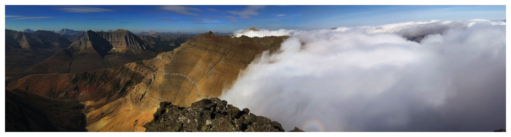
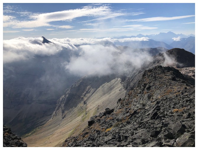
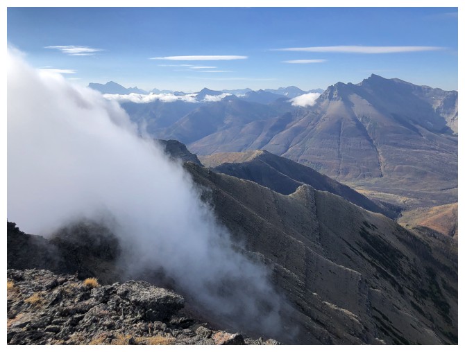
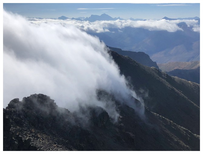
The cloud layer streaming in from the east
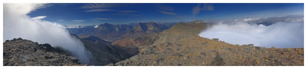
At the summit.
The pano makes it appear as though clouds are coming in from two
different directions, but they were just coming in from the east
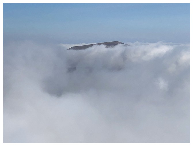
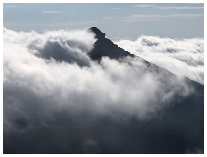
Only the summit of Loaf remains above the clouds
Glendowan (left) and Newman Senior
Glendowan disappears
Bizarre weather! Note the mini rainbow at the bottom, just right of centre.
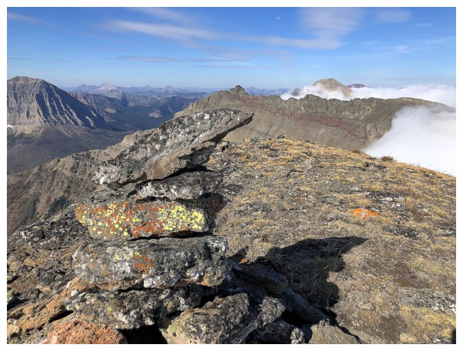
The summit cairn
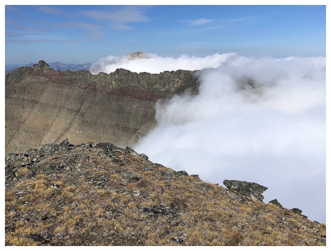
Clouds consume the ridge I just came up. An attempt to traverse over to Cloudy Junior was out of the question at this point.
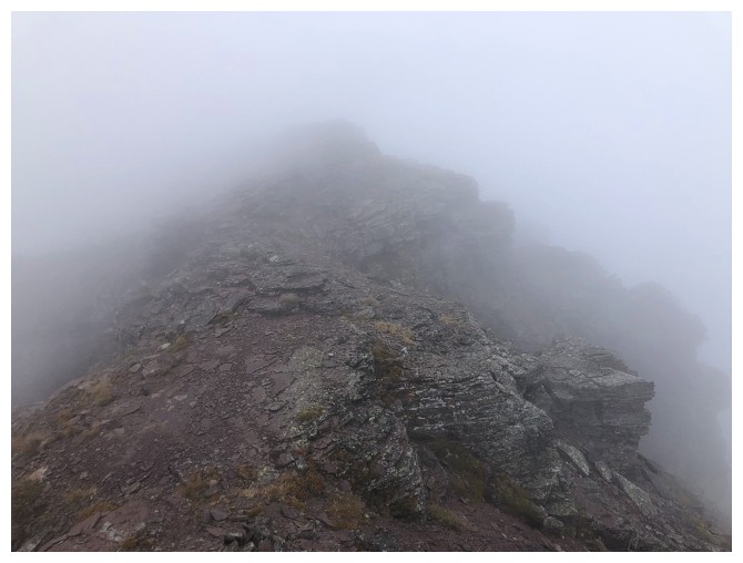
Visibility on the ridge during the first part of the descent
Much better visibility lower down
Looking back up the cloudy ridge (terrible pun!)
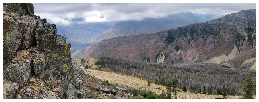
Back at Red Rock Canyon and ready to enjoy a slow exploration of the canyon's fine scenery (with a plethora of photos!)
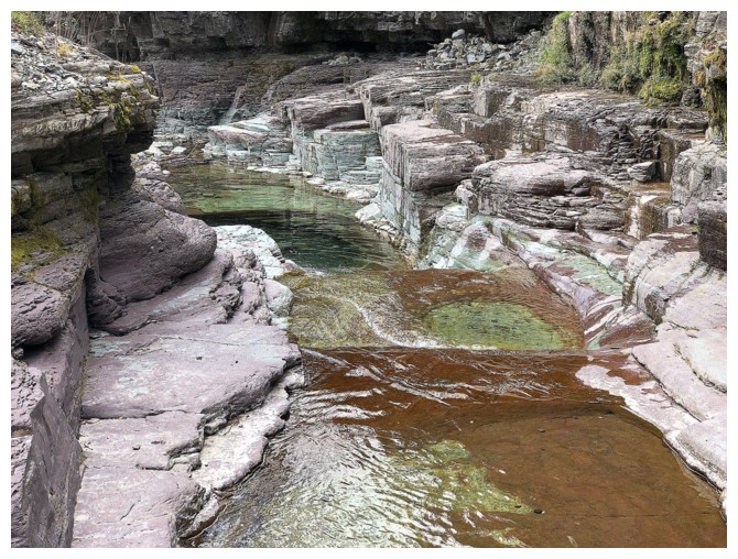
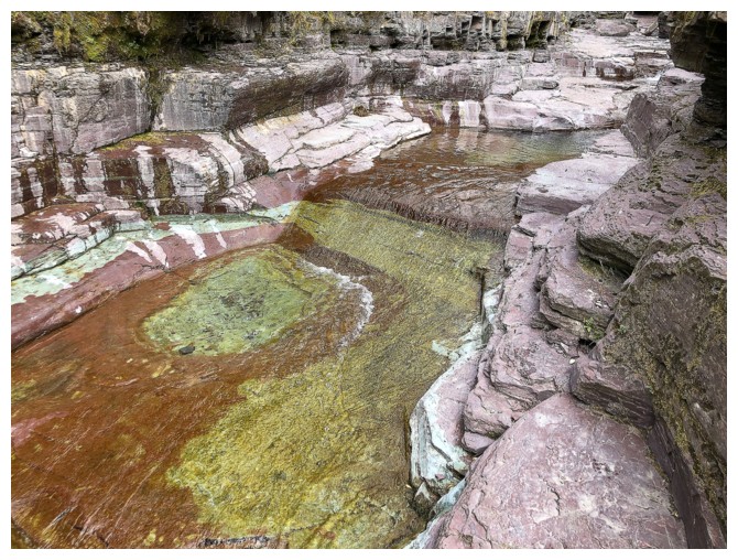
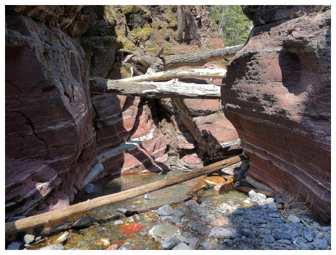
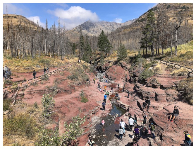
The crowded canyon, as seen from the bridge near the parking lot
The End
LOG