Mount Carthew IV
April 6, 2021
Mountain height: 2630 m
Elevation gain: 1020
m
Ascent time: 3:50
Descent time: 2:35
Solo snowshoe with some mountaineering.
 Three fantastic trips up Buchanan Ridge (and
Peak) and it’s two outliers (Buchanan Northeast and Buchanan, The Middle
Child), prompted me to give nearby Mount Carthew a look from a similar
direction. Usually, Carthew is completed via its south ridge from Cameron Lake
and is one of the more scenic ascents in Waterton. The goal here was to find a
route up the more direct northwest ridge. The topo lines on the map I was using
seemed to indicate there may be a route up that doesn’t get too steep.
Three fantastic trips up Buchanan Ridge (and
Peak) and it’s two outliers (Buchanan Northeast and Buchanan, The Middle
Child), prompted me to give nearby Mount Carthew a look from a similar
direction. Usually, Carthew is completed via its south ridge from Cameron Lake
and is one of the more scenic ascents in Waterton. The goal here was to find a
route up the more direct northwest ridge. The topo lines on the map I was using
seemed to indicate there may be a route up that doesn’t get too steep.
Crossing Cameron Creek required hip waders
and then it on with the snowshoes. Similar to Buchanan, The Middle Child, four
days earlier, the snow conditions were near perfect for snowshoes and I made
good progress up the main drainage and then a short distance up a subsidiary
drainage.
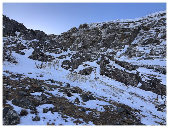
The plan at this point was to gain the ridge
above me, where I hoped an easy route over to the northwest ridge would be
revealed. Unfortunately, that was not the case. A significant wall of rock
stood in between me and the ridge. The only hope appeared as a possible weakness near
the bottom of the wall. Getting to that weakness required a long traverse and big
elevation loss. Drawing closer it became quite apparent that this weakness was
not a weakness at all and would require ascending some brutally steep terrain
that I was not prepared to tackle. The upside was that the traverse now
revealed a potential path up and alongside the rock wall. I couldn’t see all
the way to the top, but it was either try this route or turn around and go
home.
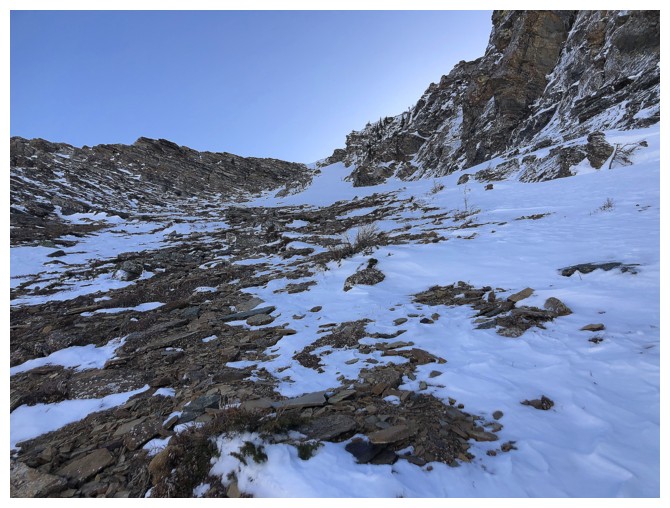
To my delight, this route, up a long snow-filled
gully worked wonderfully. The grade steepened quite a bit near the top, where
crampons and an ice axe were very much needed, but the ascent was
straightforward. At the top of the gully, and finally on the ridge I was aiming
for, all that awaited was an easy, but long slog to the summit.
As well as exponentially improving views,
under perfectly clear skies, the highlight of this part of the ascent was to see the
whopping cornice lining the summit ridge. That cornice also prevented me from
seeing a full view of one of Waterton’s most iconic peaks, Mount Alderson, but
that shortcoming was easily remedied by descending Carthew’s south ridge to its
false summit.
Enjoying spectacular views from the false
summit, I was tempted to descend the mountain via Carthew Minor (one of my
favourite Waterton trips) and then to Cameron Lake. However, that route could
have been a trail-breaking nightmare and so I decided to return the same way I came
up.
A quick return to the summit and then a
mercifully easy descent back to the top of the snow gully followed. Also, similar to
Buchanan, The Middle Child, the lower part of the descent was far more scenic
than the same terrain on ascent, thanks to the Sun reaching the valley.
While this route does not pack the scenic
punch of the “normal” route up Mount Carthew and is unlikely to become popular,
it does offer a direct route to the summit and allows access to the mountain when
the road to Cameron Lake is closed.
A fun and rewarding day of exploration.
The objective, at the left, from the creek crossing
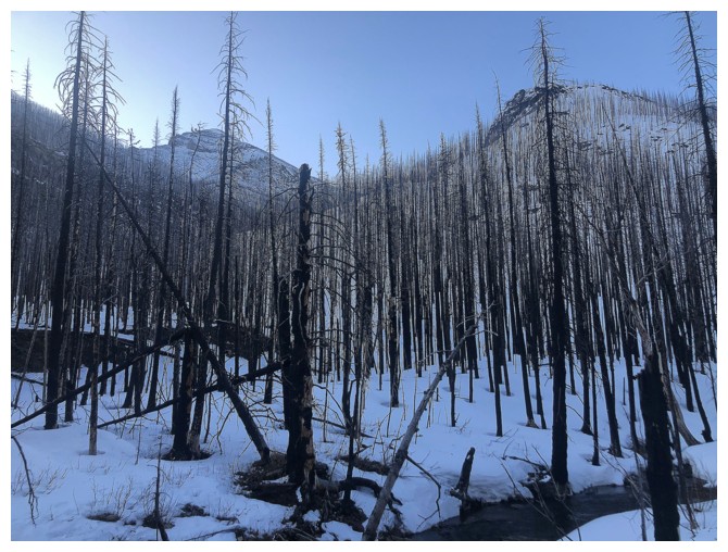
Typical travel up the main drainage, although this was the only place the creek could be seen
Turning around to see Mount Rowe
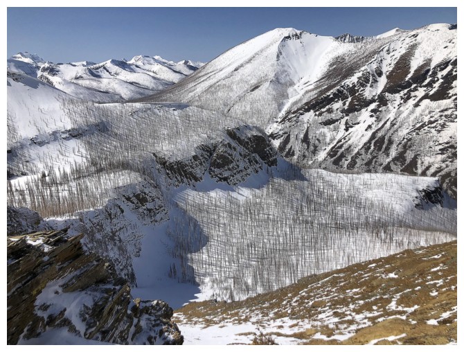
On a ridge, where I was hoping to see a feasible route over to the northwest ridge
The only route up to the ridge appeared as a potential weakness in the rock wall in the centre of the photo
Approaching the rock wall, having given up on the weakness
There's the route up - straightforward but quite steep at the top
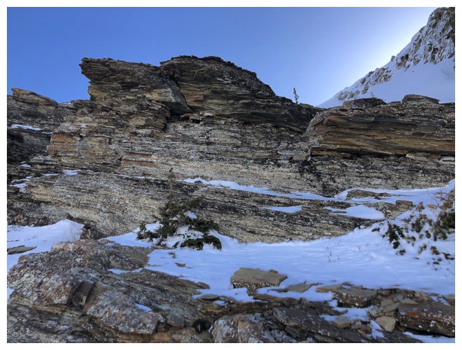
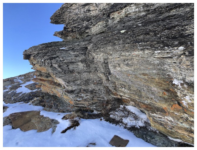
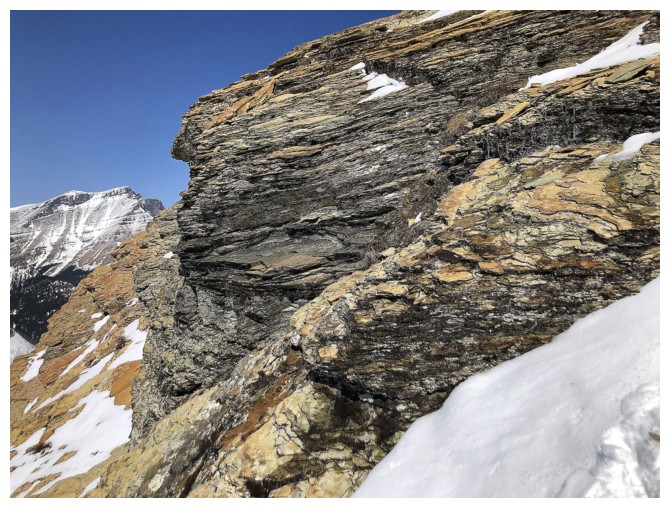
Lots of great rock to look at, but without the Sun's rays at this time of the day
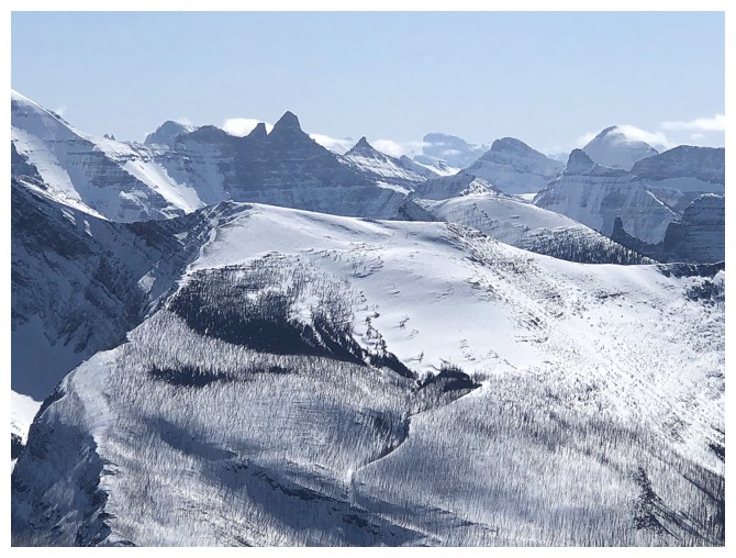
Views to the northwest open up
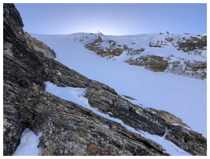
The upper section of the snow gully. It's much steeper than it looks.
As usual, views of mounts Kintla (left) and Kinnerly are irresistible in this part of the park
Same for Long Knife Peak
Mount Custer is likewise an impressive sight
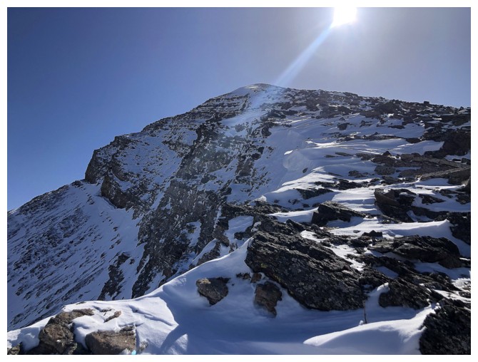
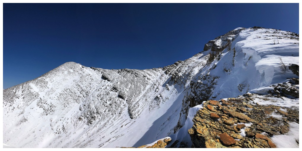
Atop the gully, it's an easy but foreshortened slog to the summit
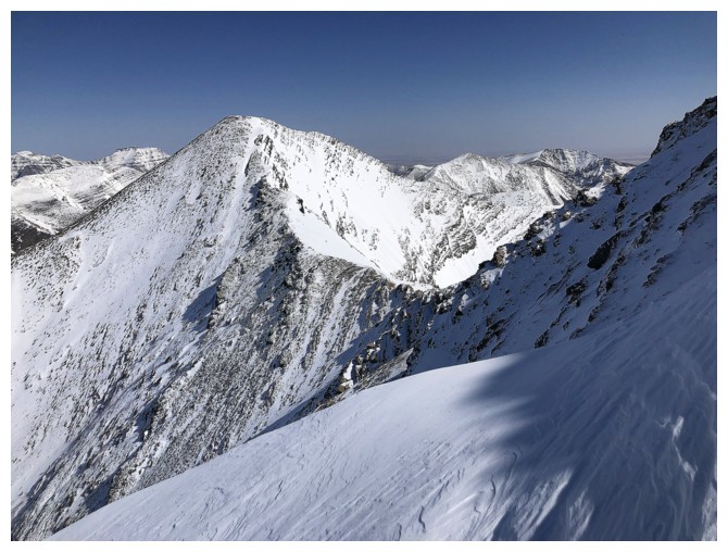
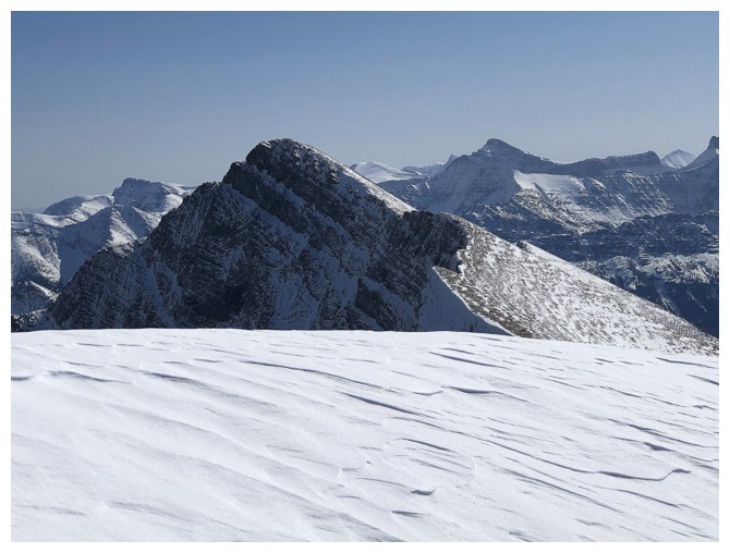
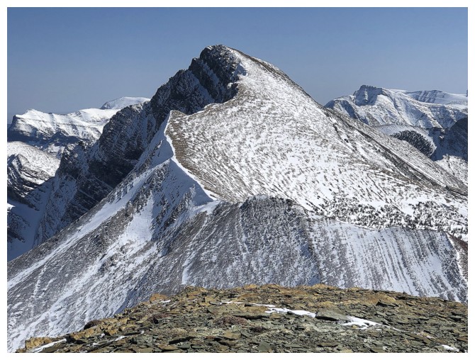
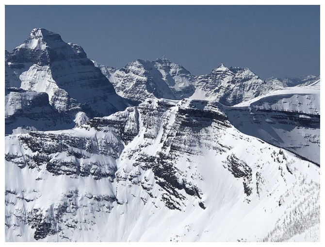
Looking over to the true summit of Buchanan Ridge
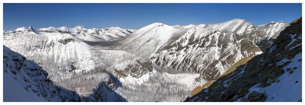
View towards Blakiston (centre) and company from near the summit ridge
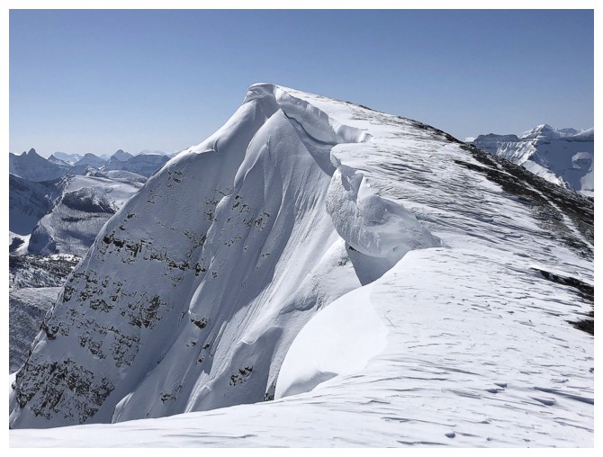
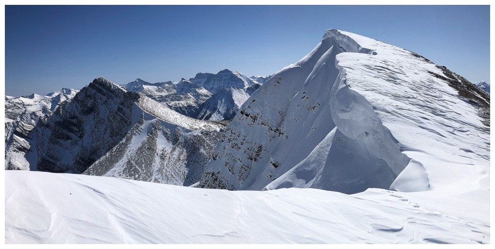
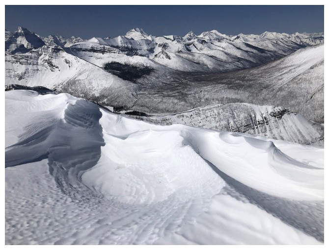
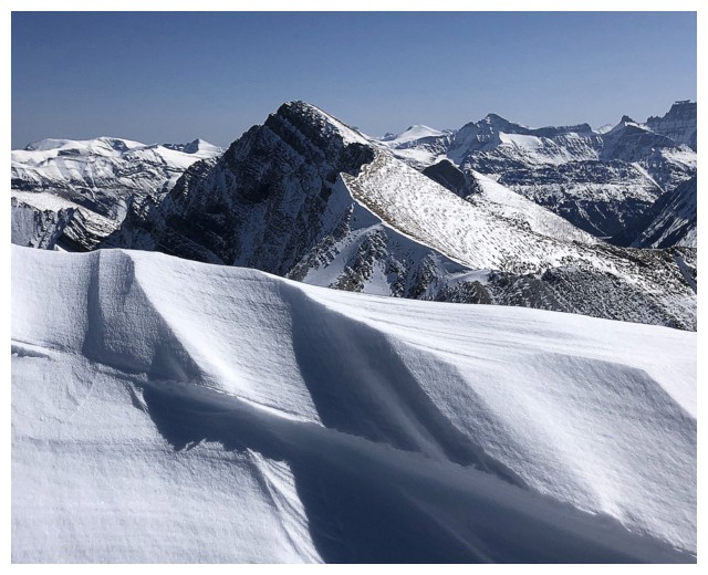
The impressively corniced summit ridge
Naturally, this scene was going to garner a ton of photo attention!
At the summit, looking over to Mount Alderson. The huge cornice prevented me from seeing more of the mountain.
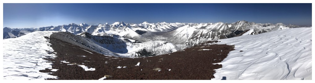
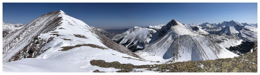
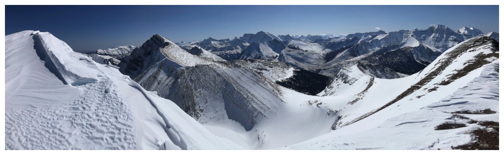
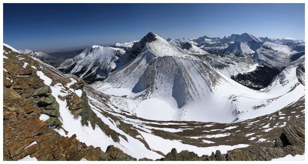
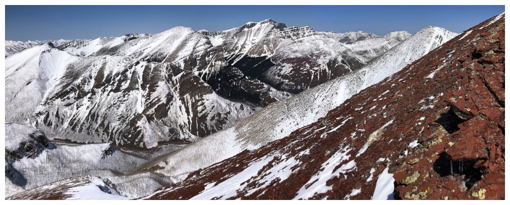
The summit view to the west is quite comprehensive
More Glacier park beauties: Chapman Peak at the far left, Mount Carter and Rainbow Peak in the distant centre
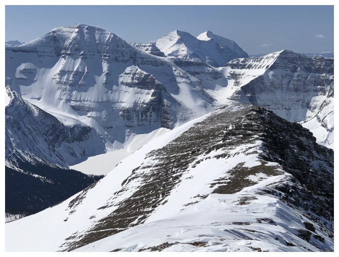
Improving view of Alderson (left) as I head down Carthew's south ridge
Nice snow scenery too
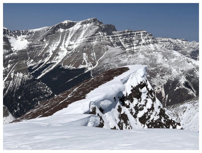
Looking back up to Carthew
Much better view of Alderson with the still snow-covered Carthew Lakes
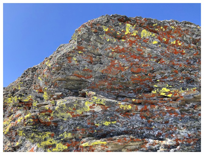
No matter how much snow there is you can always find colourful lichen on rock in Waterton!
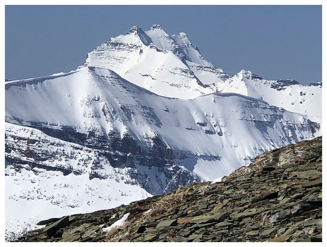
Best view of the day of Alderson
A small section of Cameron Lake makes an appearance under Mount Custer
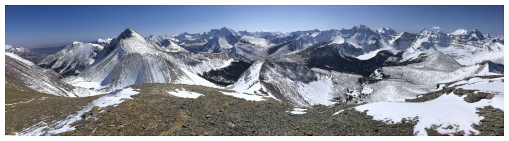
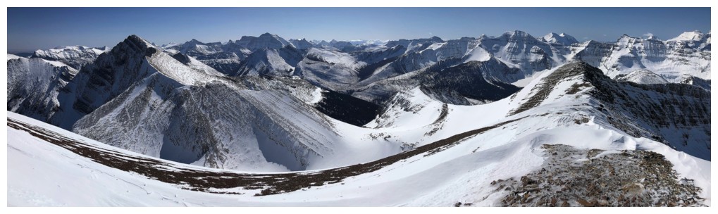
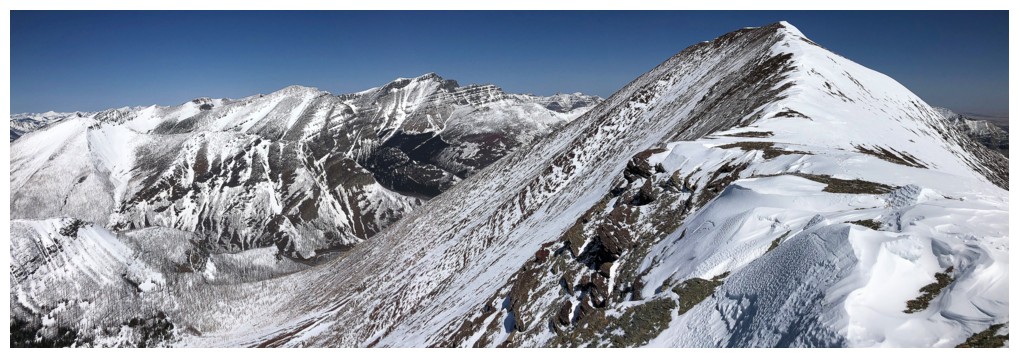
Pano of Carthew (left), Alderson, and others from the false summit of Carthew
As usual, I can't get enough of Kintla and Kinnerly. Forum Peak at the lower left offers a great view of the pair.
Mount Cleveland
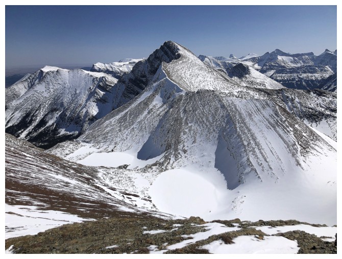
Closer look at Alderson
Glacier boasts a striking array of jagged peaks
Closer look at Carter and Rainbow
Kinnerly, Forum, and others
King Edward and Starvation peaks always get some attention
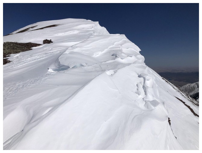
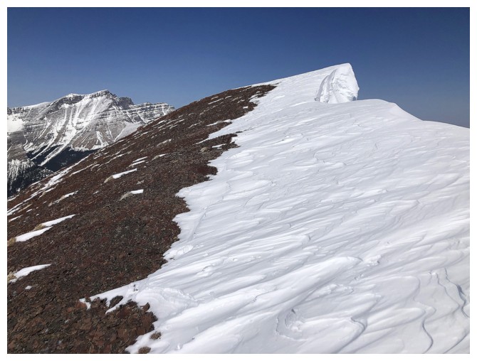
The only spot where it was safe to walk on the cornice - and that's because it wasn't a cornice! (ie. overhanging)
Alderson is disappearing behind the snow again
The section of cornice that was definitely NOT safe to walk on
Blakiston and a clear example of why you should not walk on cornices
It's a really bumpy ride down if you step out onto this one (not to mention a pleasant section of free-fall!)
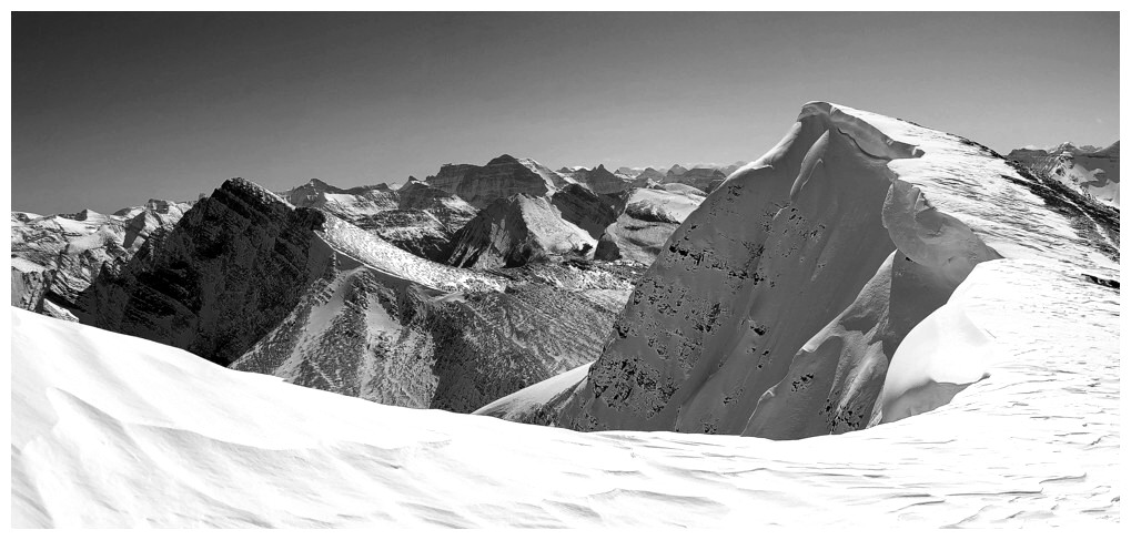
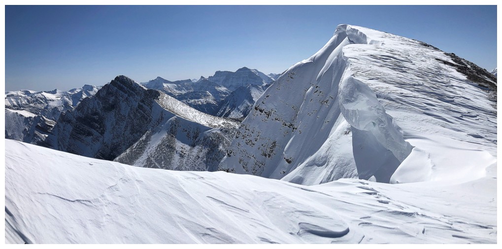
Back at the cornice that was cause for many, many photos - might as well be black and white this time
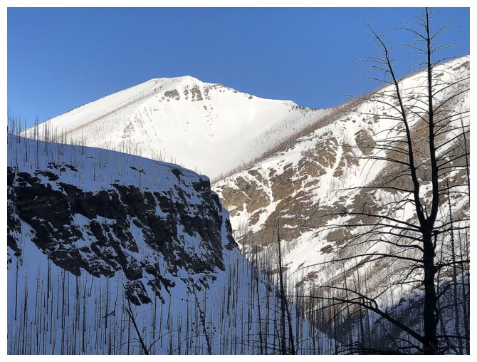
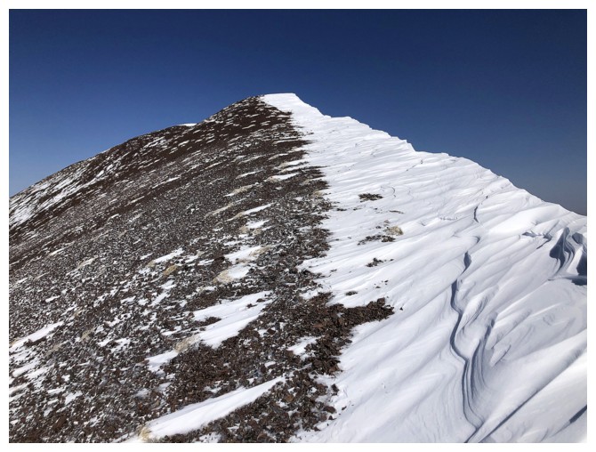
Descending. Mount Carthew is one huge chunk of red argillite.
Looking back up Mount Carthew to the right and Buchanan Ridge at the left
At the top of the steep ascent gully
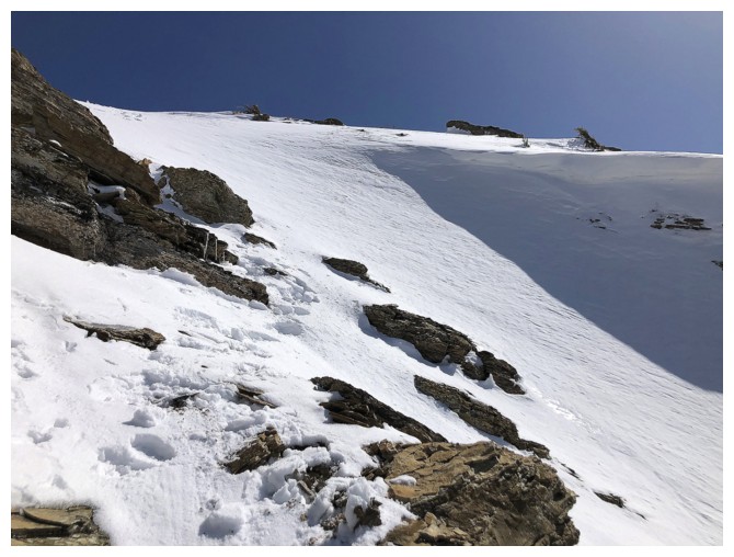
Back to that same place that makes the angle of the snow slope seem gentle
Amore accurate representation of the grade of the snow gully
Much better with the Sun now shining on the colourful rock
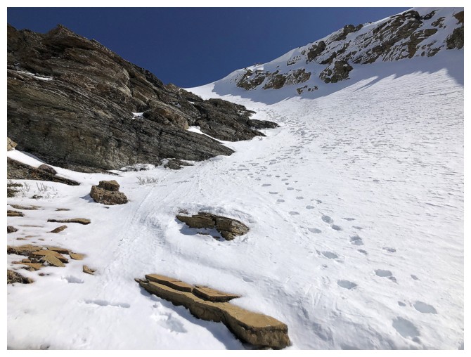
Another view looking up the route
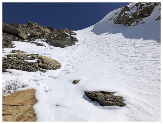
Halfway down
Near the bottom of the gully where I now had to traverse and ascend a bit over to the next ridge
The potential weakness is at the left and is very, very steep
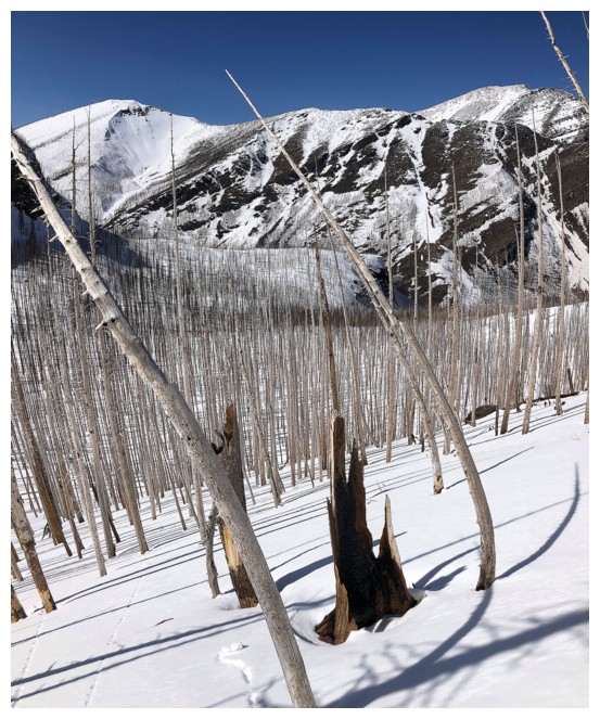
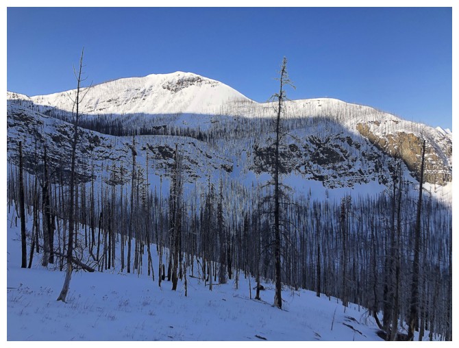
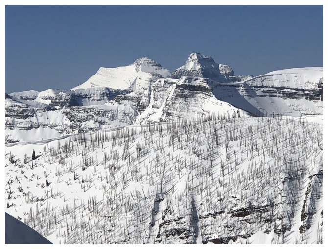
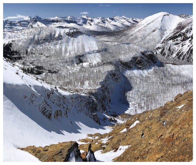
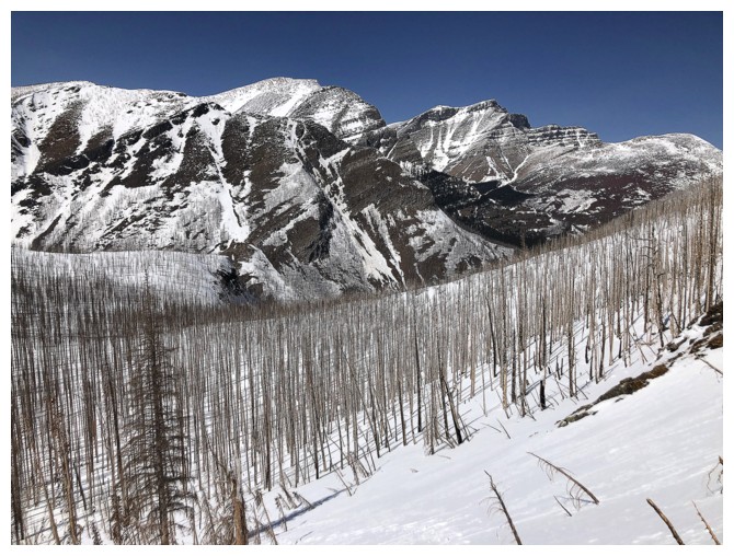
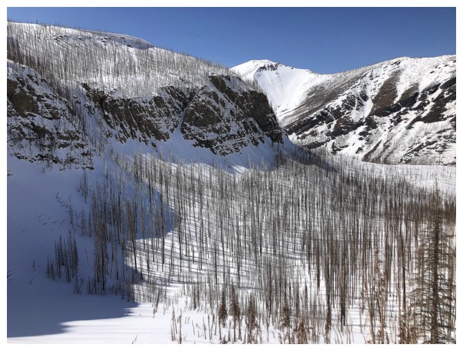
The Kenow fire changed this environment in a big way.
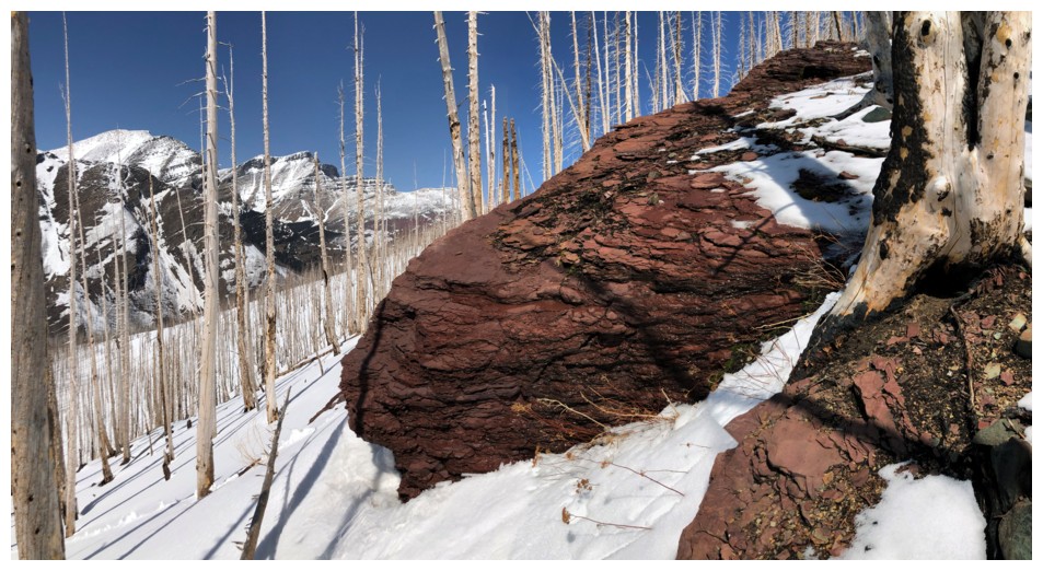
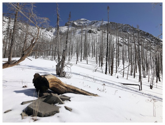
Lots of red argillite lower on the mountain too
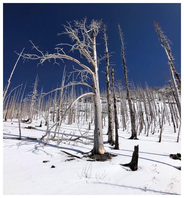
Epic burned-out trees
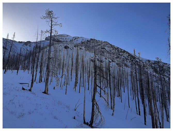
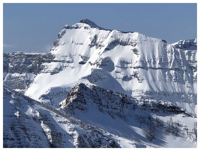
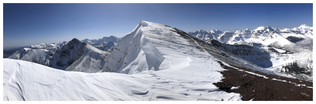
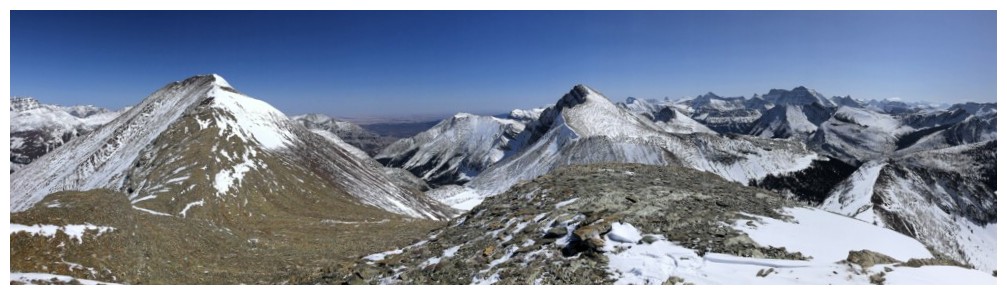
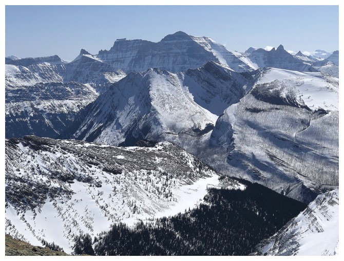
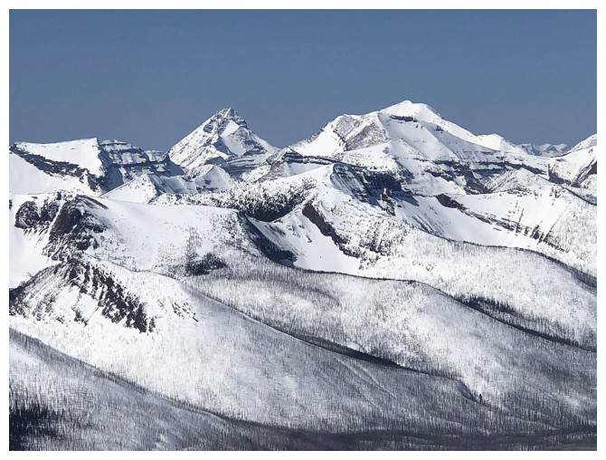
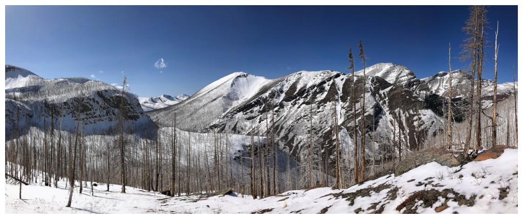
Summit of Carthew in the distance and the northwest ascent ridge at the right
Back to the other ridge and almost ready to get back into the drainages

A western outlier of Carthew that may see an attempt in the future - but not from this side!
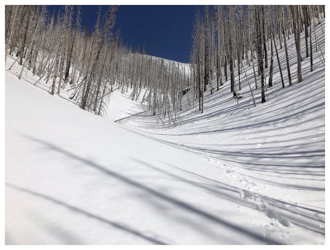
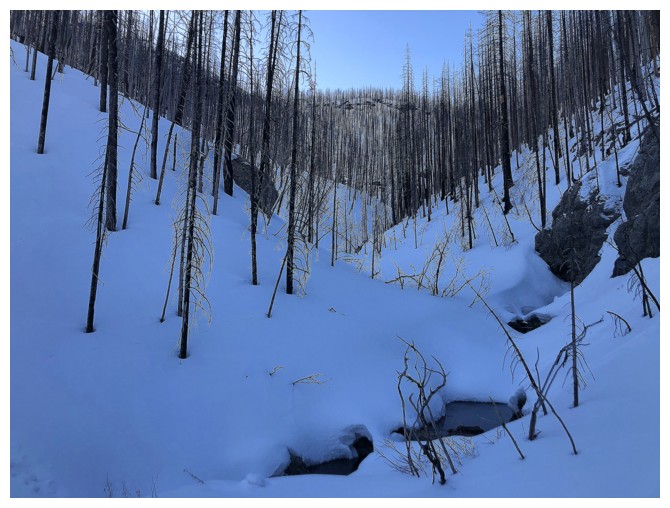
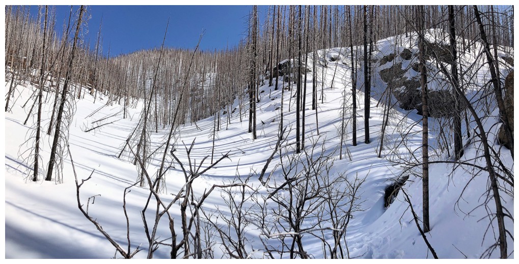
Sweet and easy travel in the drainage
Same as above. Made it almost to the bottom without snowshoes but started to post-hole here.
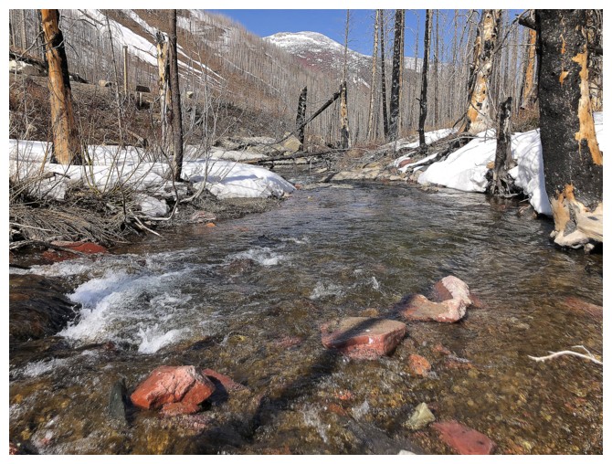
Re-crossing Cameron Creek
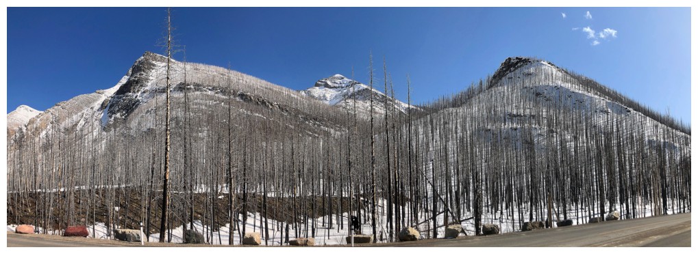
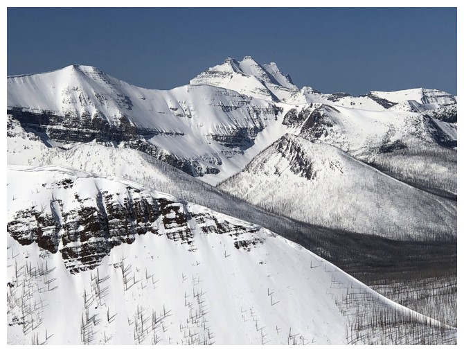
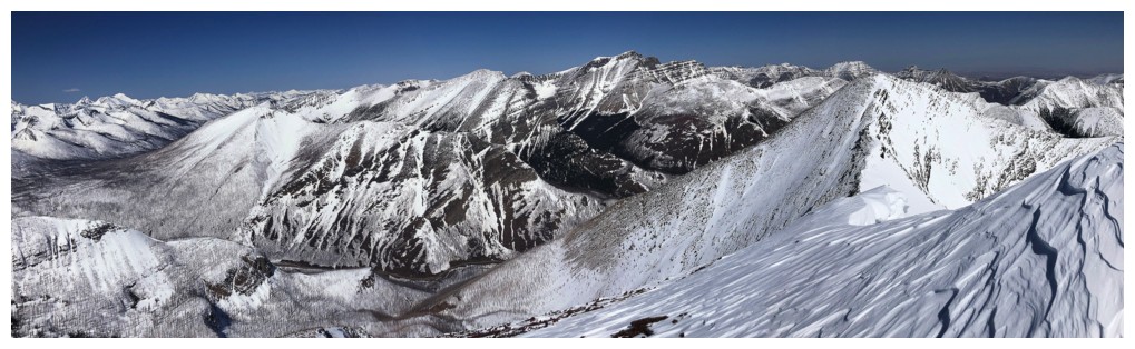
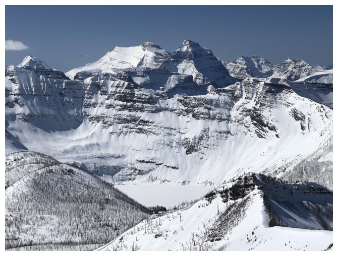
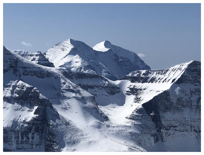
Back at the start. Far left to right: Buchanan Northeast, a slither of Buchanan, The Middle Child, Buchanan Ridge, Mount Carthew, and the western outlier.
The End
LOG