Mount Haffner II
March 21, 2024
Mountain height: 2514 m
Elevation gain: 1180 m
Ascent time: 3:35
Descent time: 2:10
Snowshoeing
with Matt Clay.
I was delighted
when Matt Clay invited me to attempt Mount Haffner. A previous ascent, 14 years
earlier with Mark, had been marred by cloudy skies at the top.  Given the
stunning views the summit affords, returning on a clear day had great appeal to
me. And the last day of March 2024 turned out to be a doozy!
Given the
stunning views the summit affords, returning on a clear day had great appeal to
me. And the last day of March 2024 turned out to be a doozy!
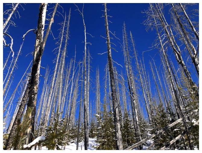
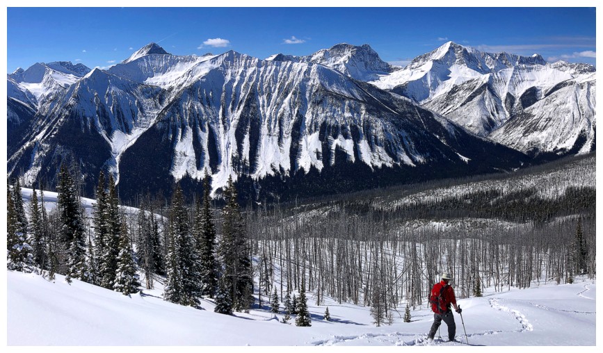
There were a
couple of surprises, however. Firstly, although I expected the new forest growth
to have made significant progress in the 14 intervening years, I wasn’t quite
ready for how much progress. In 2010, all the new growth lay beneath the snow,
and in fact in that year we didn’t encounter any resistance except occasionally
dodging the burned-out remnants of the fires that ravaged the area in previous
years. The story was quite different in 2024,  as thousands of new trees had not
only sprouted, but grown with a vengeance. Of course this made travel
considerably more challenging.
as thousands of new trees had not
only sprouted, but grown with a vengeance. Of course this made travel
considerably more challenging.
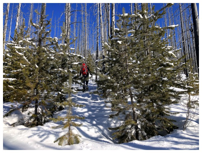
Also adding some
spice to the ascent was the second surprise – a shocking lack of snow on the
lower slopes. Many winter ascents of peaks in this area of the Rockies are only
possible (or least preferable) when deep snow covers the extensive deadfall. Matt had ascended
nearby Vista Peak only a week earlier and reported the snow to be in excellent
condition, with excellent depth. Such was not the case with Haffner. Weaving
around or climbing over the deadfall consumed as much mental energy, as
physical. Luckily, I had Matt! He led most of the ascent, forging an excellent and
sensible path up the steep lower slopes.
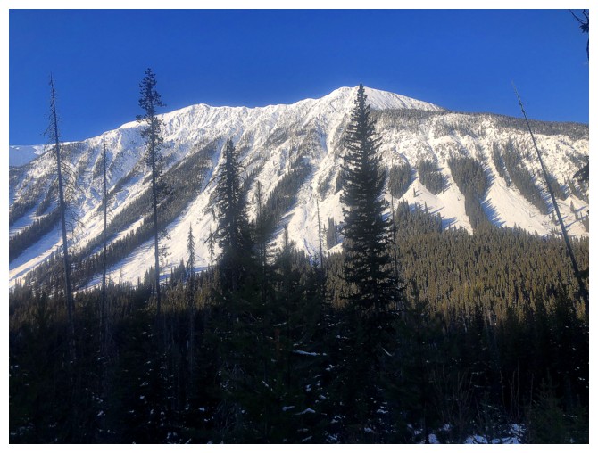
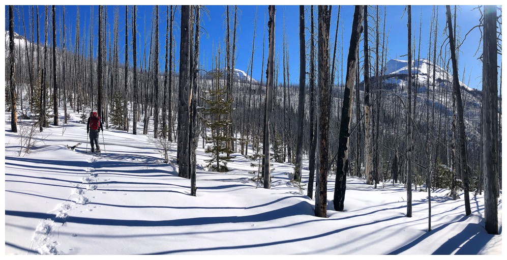
Conditions
improved considerably higher up. Here there was less new growth, more space
between the trees, and the angle of the slope calmed down a little. 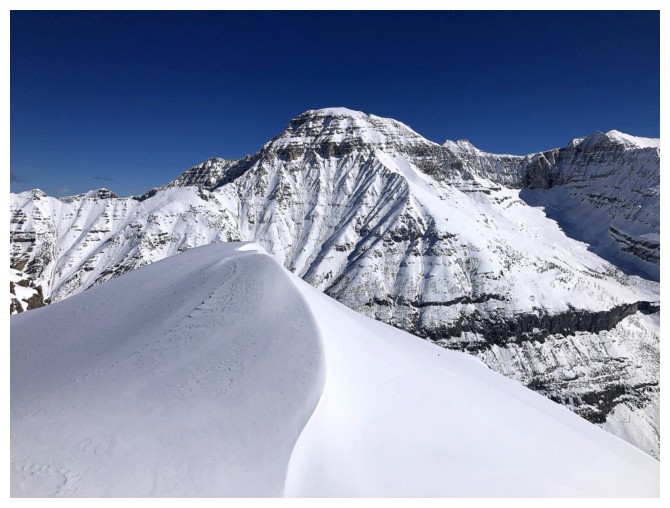 Our
progress improved and we made good time to the Vermilion/Haffner col. As Matt,
and the forecasts he checked, predicted, the weather continued to be perfect.
We were both very excited to get to the summit.
Our
progress improved and we made good time to the Vermilion/Haffner col. As Matt,
and the forecasts he checked, predicted, the weather continued to be perfect.
We were both very excited to get to the summit.
That didn’t
happen with ease either. Trail-breaking increased in difficulty, and several steep
spots along the ridge proved to be more challenging than expected. 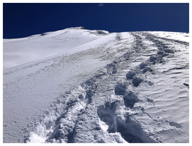 Yet again, Matt
took the lead – I was more than happy to literally follow in his footsteps!
Yet again, Matt
took the lead – I was more than happy to literally follow in his footsteps!
Absolutely phenomenal
would be the best words to describe the summit view – beautiful, snow-covered
peaks in every direction and barely a cloud in the sky. Our summit stay was
long and immeasurably gratifying.
We knew the
descent would be mercifully easy for the first half and mercilessly tedious and
perhaps even treacherous for the second – and such it was. We cruised down the
ridge and through the sparsely treed terrain. The steep, more heavily treed terrain
took far more effort, again becoming as mentally taxing as physically. Nevertheless,
we made it down in just over 2 hours, both a little tired but grateful and fully
satiated.
A big thank-you
to Matt for picking the objective, inviting me, driving to the trailhead (and
back), breaking tons of trail, and simply being awesome company. Hopefully we
will hook up for more trips this summer.
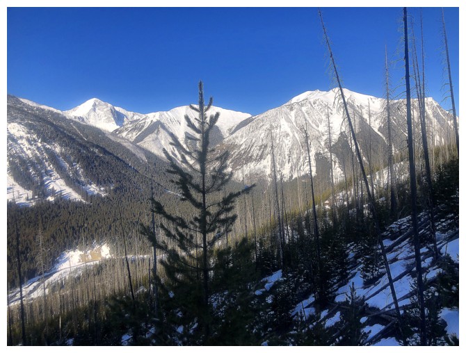
Where's the snow? We were expecting all the deadfall to be completely covered.
There are several inviting outliers across the valley, but as Raff,
Jim, and I learned in 2021, access to them can be difficult if not near
impossible
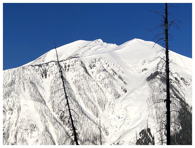
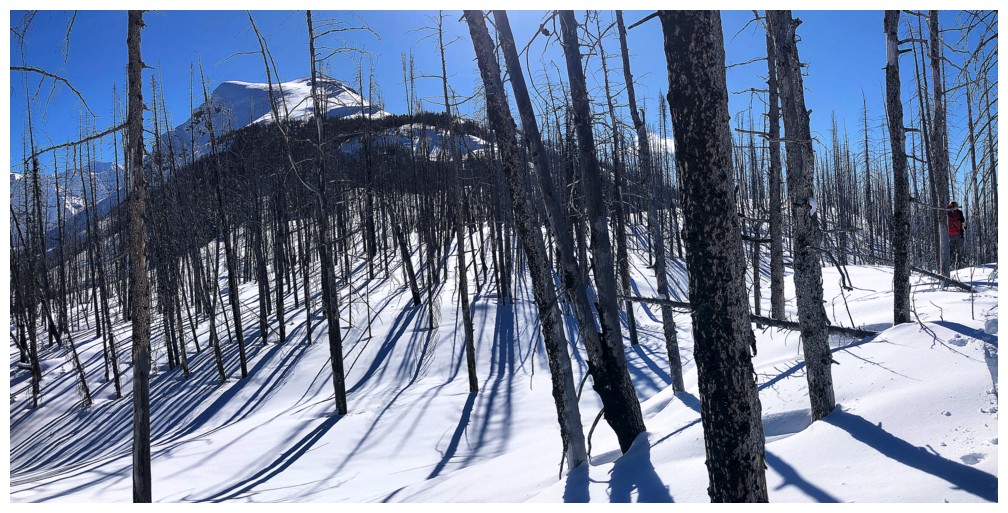
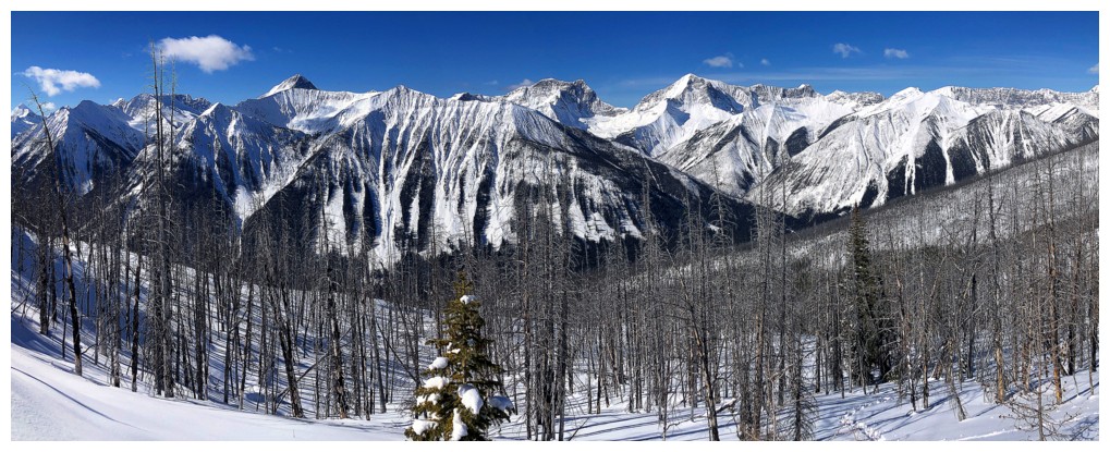
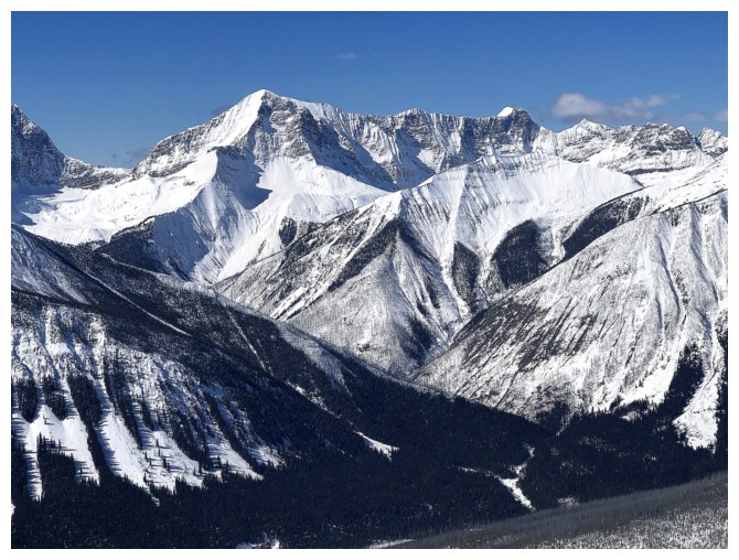
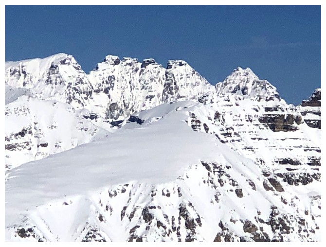
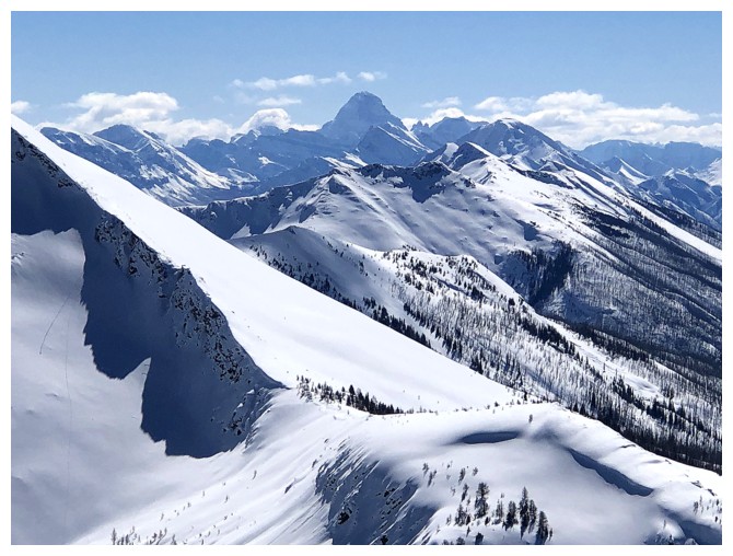
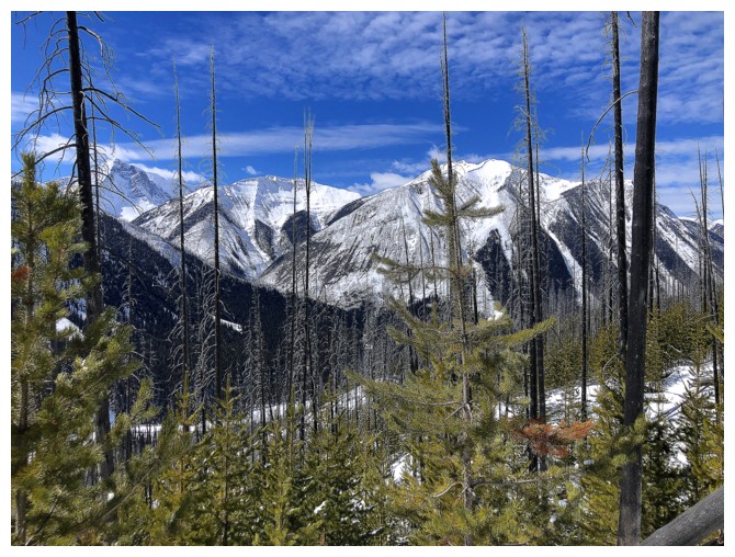
More of the same
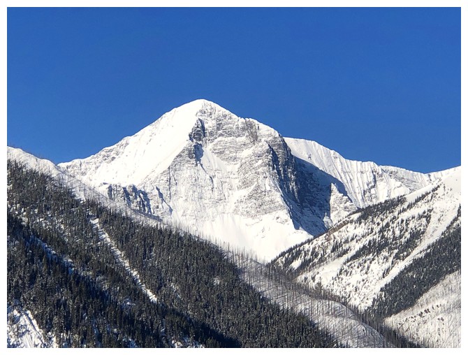
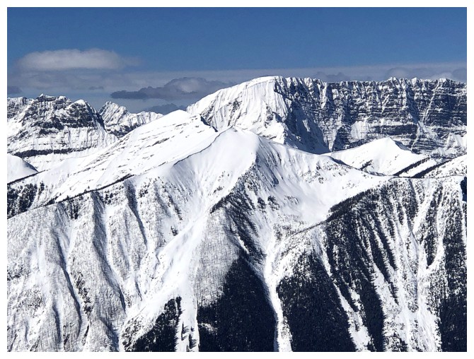
Except that one. That's impressive Tumbling Peak.
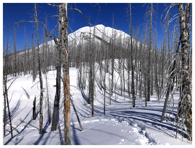
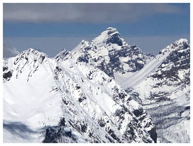
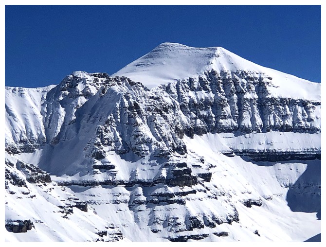
Closer look at "Tumbling Creek Peak"
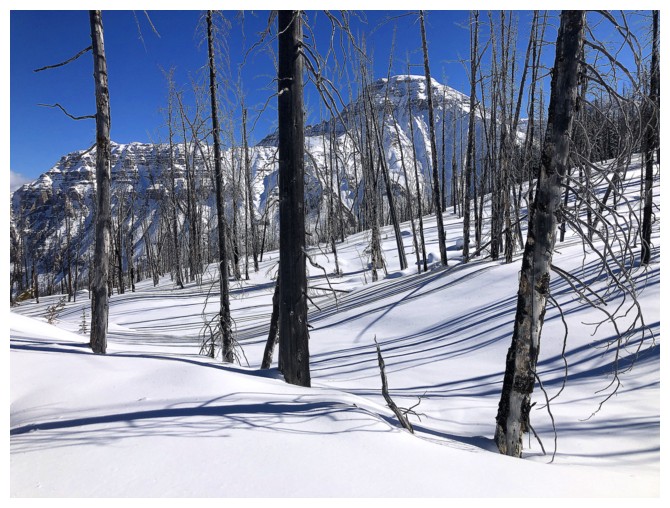
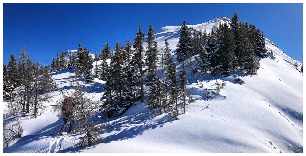
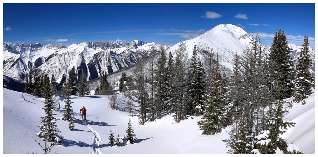
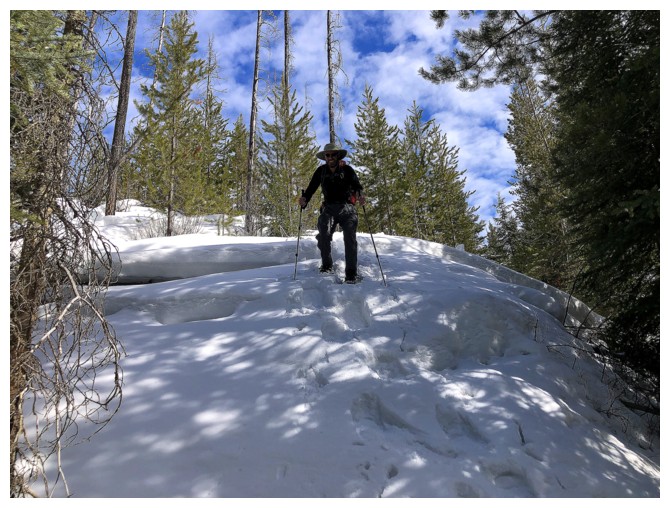
A few hours up and the terrain opens up
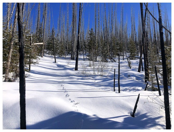
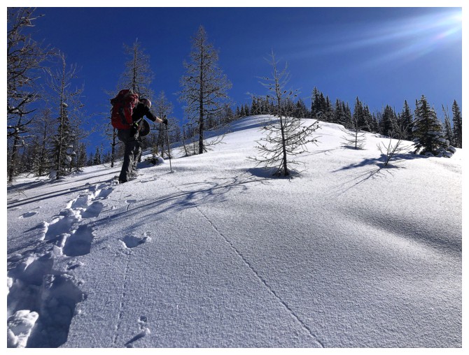
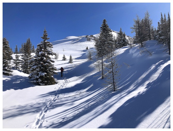
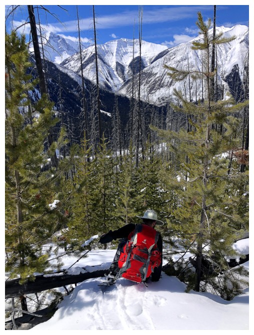
The new growth still has a long way to g(r)o(w)
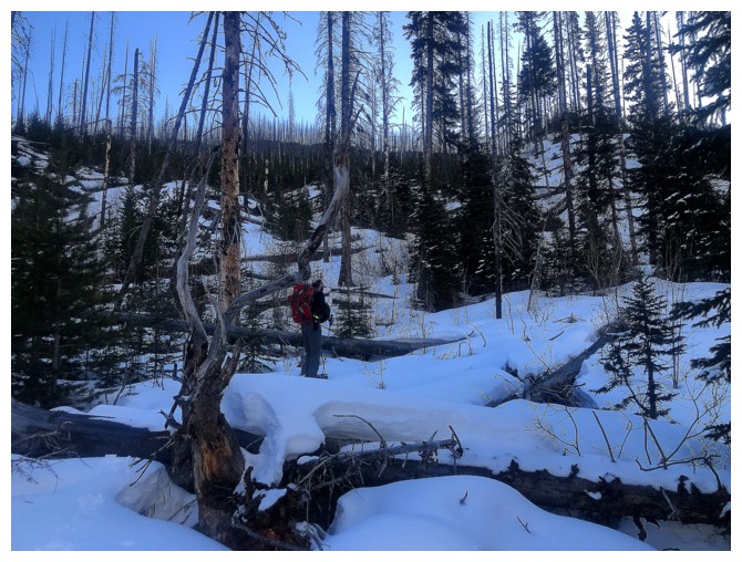
Back into more bushy terrain, but this was very easy to negotiate
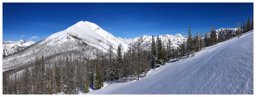
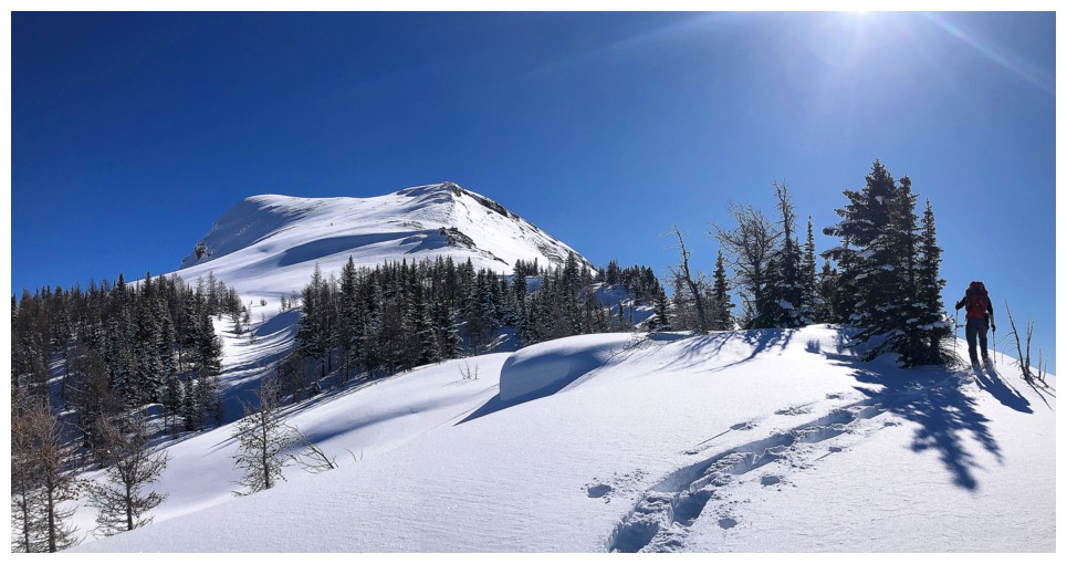
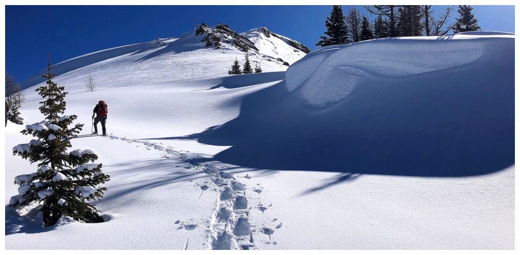
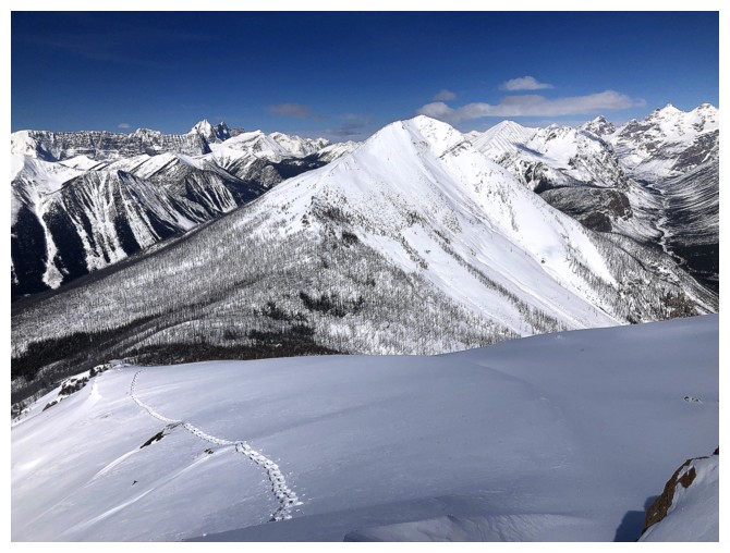
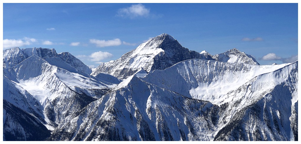
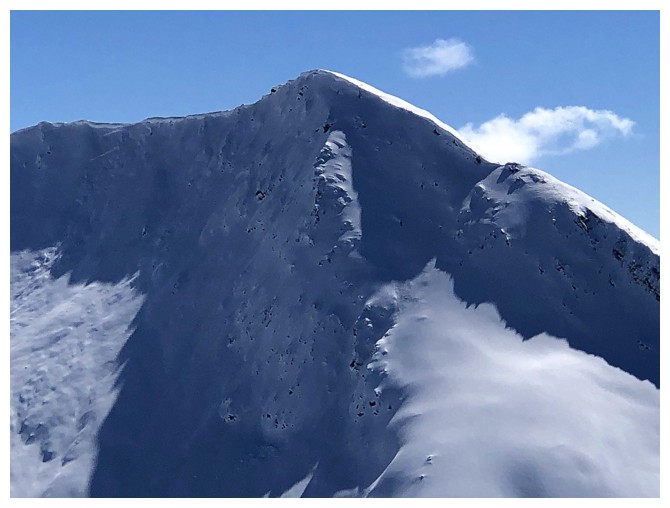
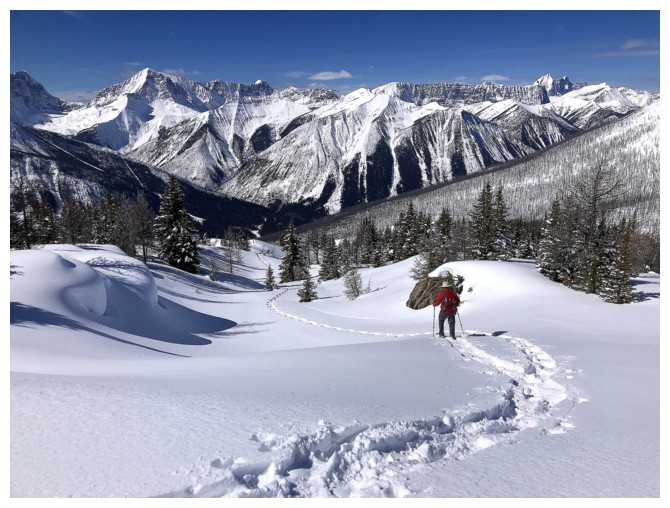
Our objective finally appears to the right
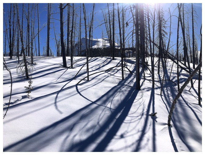
Love the tree shadows here
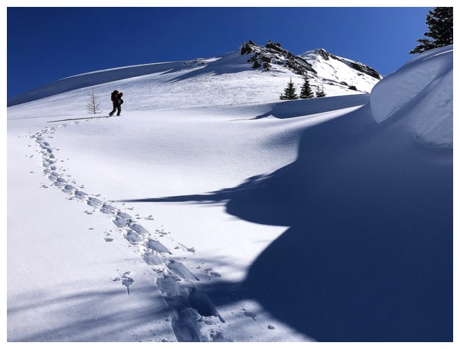
Matt (just visible at the right) leads us over the ridge towards Haffner at the left
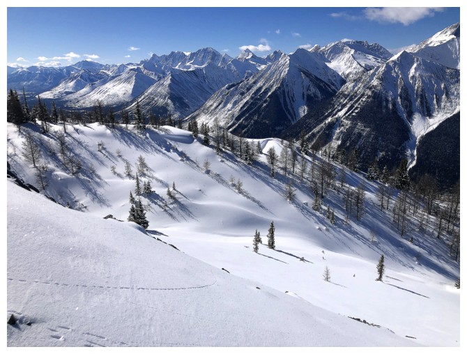
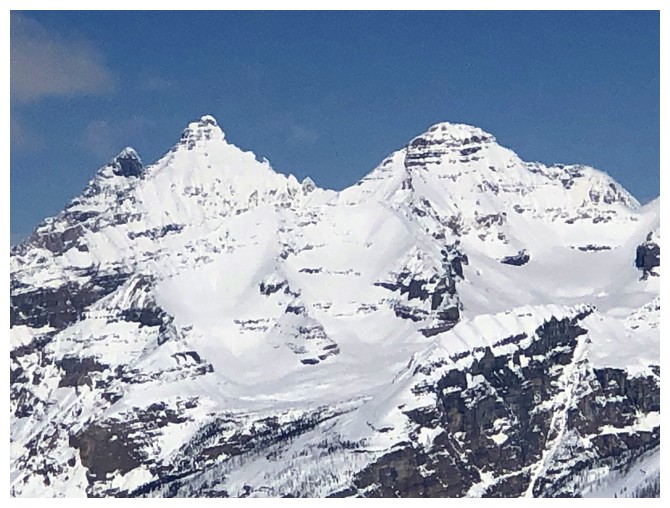
Vermilion Peak always garners tons of photo attention from Haffner
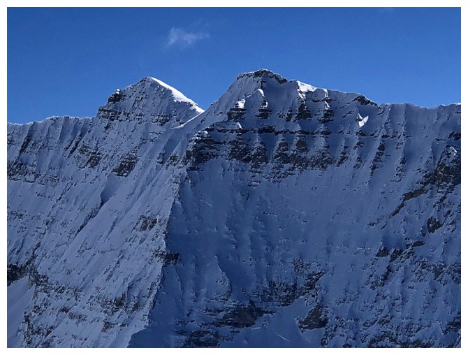
First look at Stanley Peak
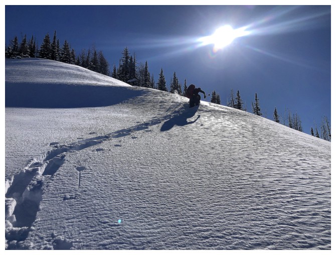
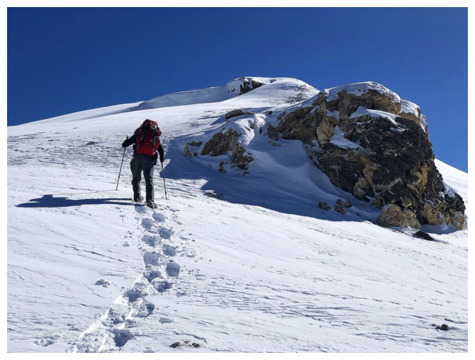
Matt breaks trail towards the summit
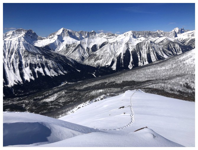
The view is pretty darn good and we have yet to break treeline
Vermilion again
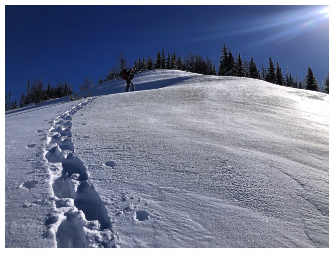
Matt breaking trail again - his cardio was way better than mine!
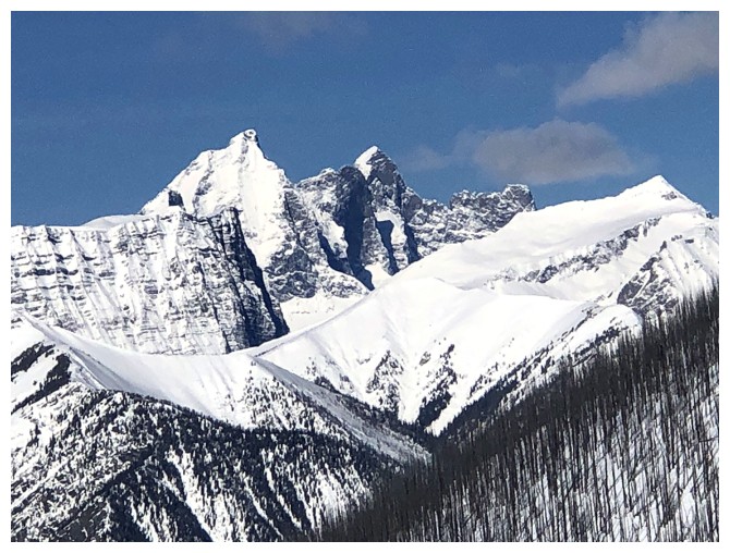
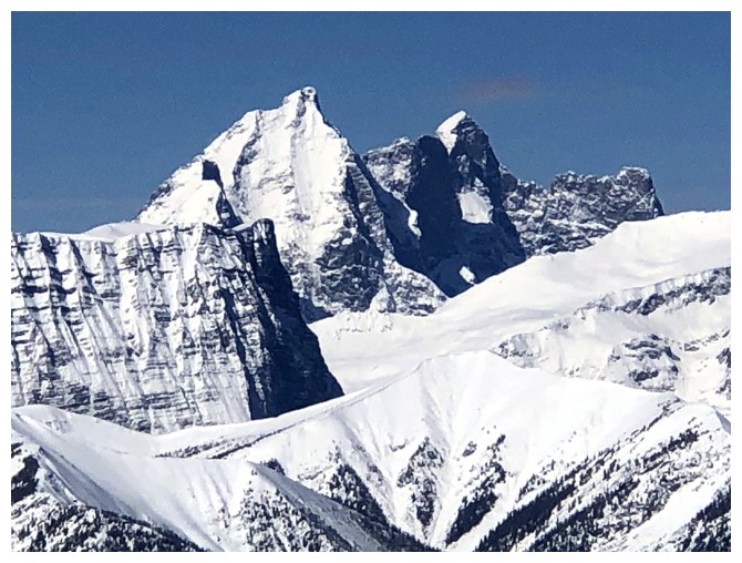
The striking Goodsirs
That's not me breaking trail!
Shockingly, this stunning mountain northwest of Mount Verendrye appears to have no official name
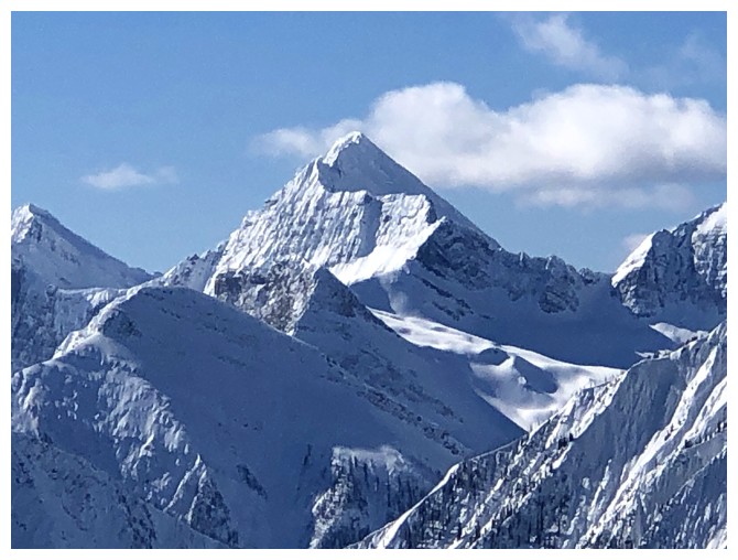
Close-up of the stunner
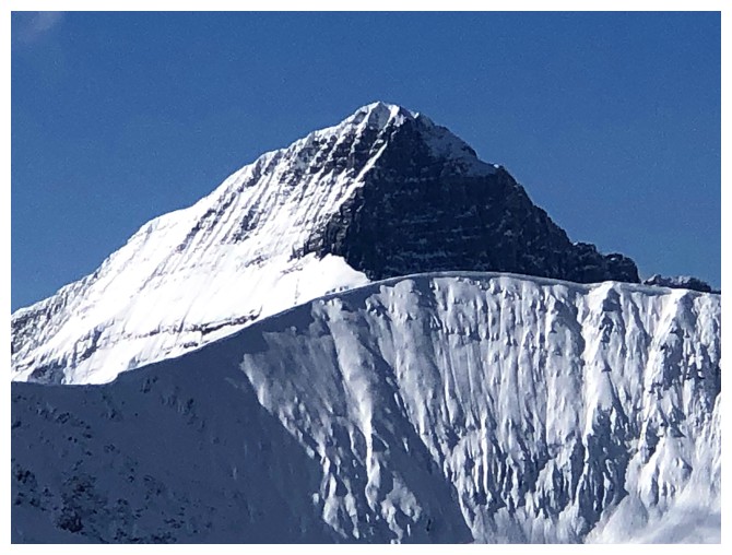
Foster Peak
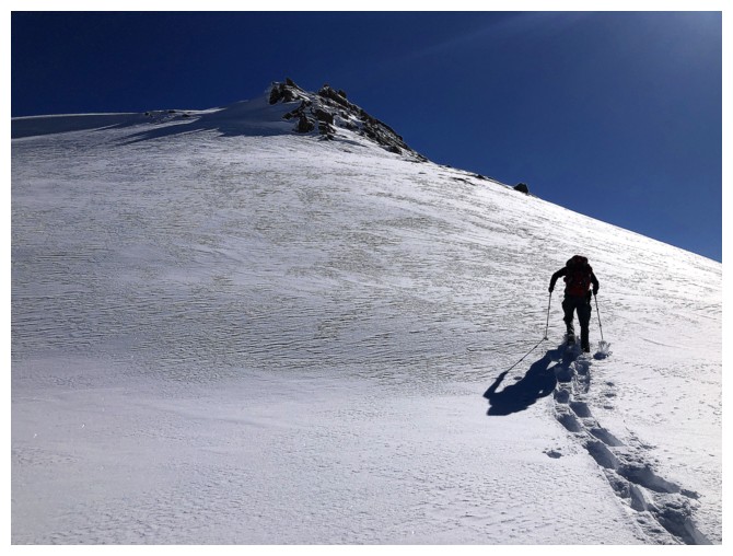
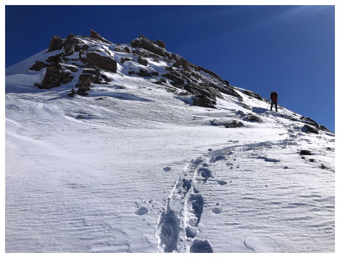
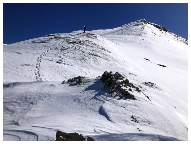
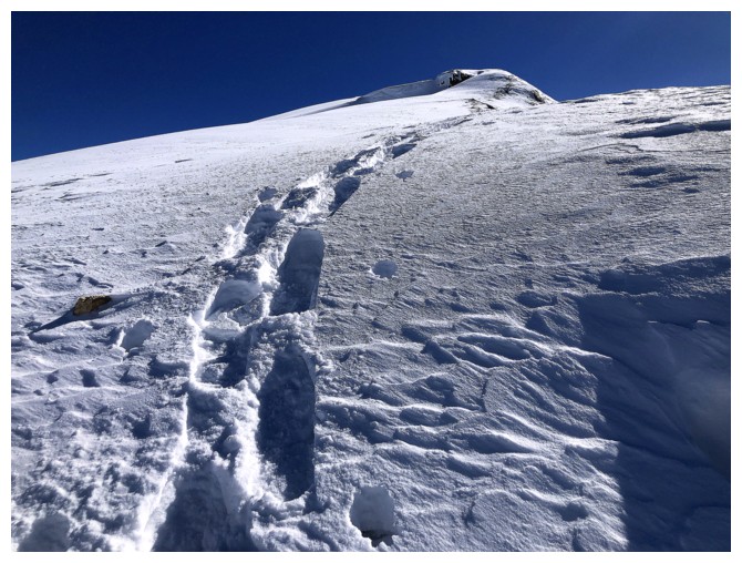
Summit is getting closer
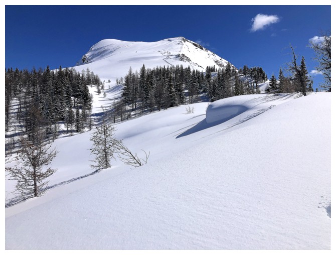
Beautiful meadows below the ridge
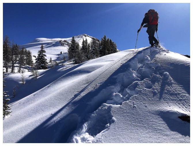
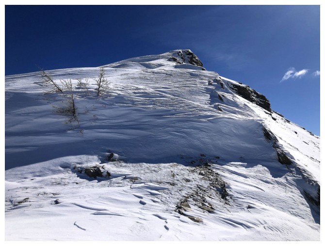
The snow became increasingly deep as we gained elevation
Last bit of treed terrain. Matt wisely chose to veer left here.
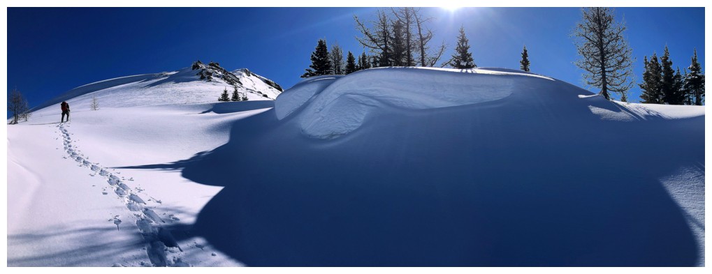
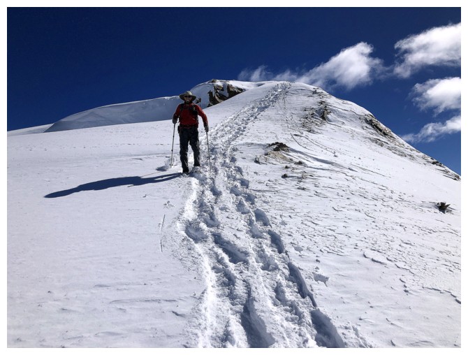
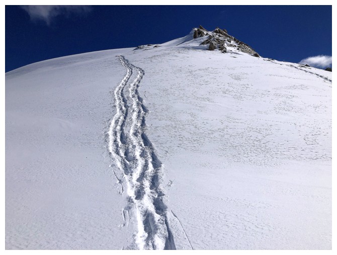
The left variation starts out nicely...
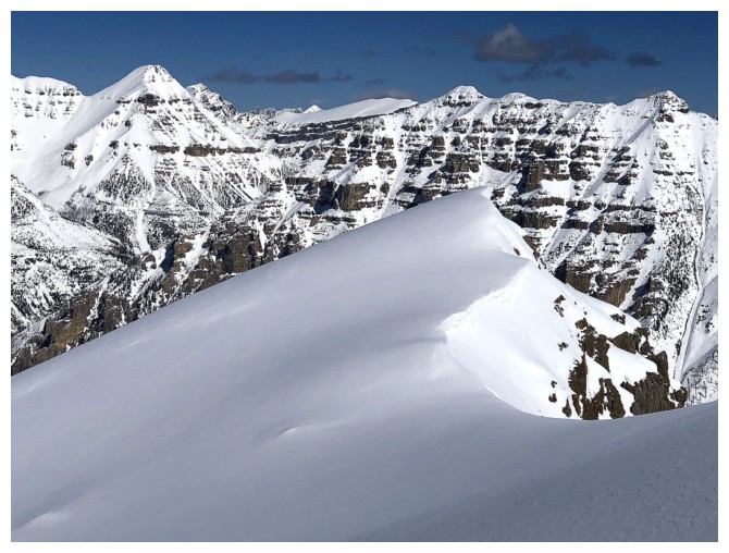
...but then graduates to superb, with a wonderful snow formation at the right
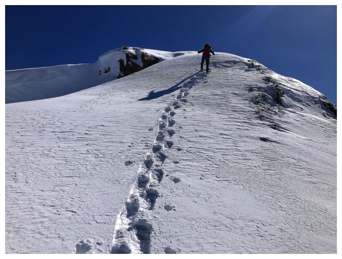
Everything about the final ascent was magical: the shadows, the clear
blue sky, the pristine snow, the snowshoes tracks, and Matt breaking
that trail!
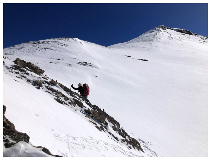
Approaching what I thought would be the crux of the summit ridge
Matt veers right here, to get around a tricky rock band
Same as above
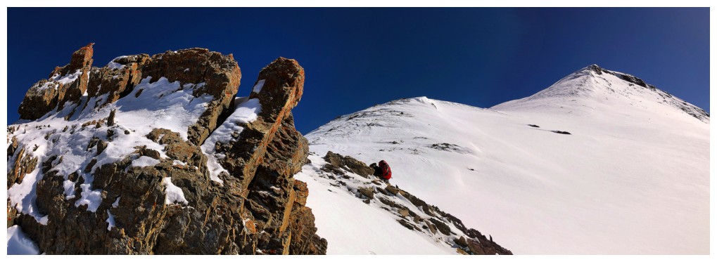
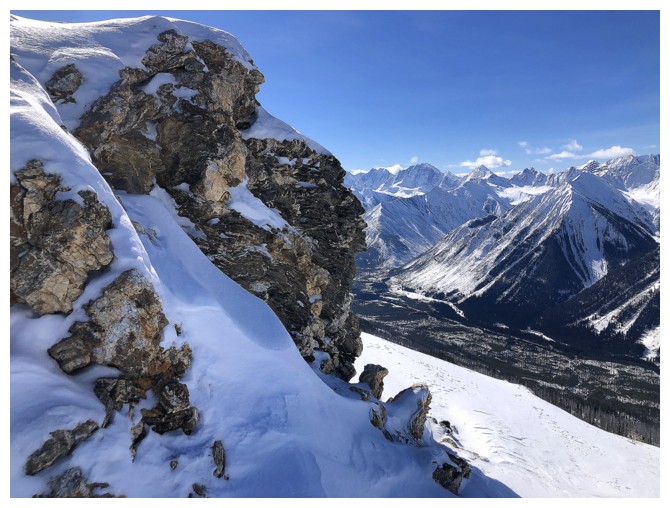
The one and only encounter we had with colourful, lichen-covered, exposed rock was also magical
Same as above, with Matt at the right
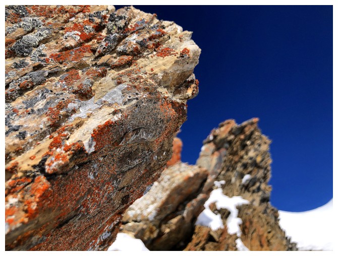
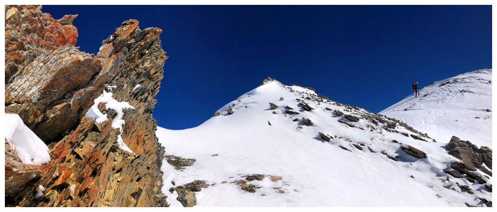
Close-up of the rock
Fantastic view and the rock
Continuing on
This was the crux for me - a short but vertical wall of snow. I
struggled up it while Matt sensibly went around the easy left side.
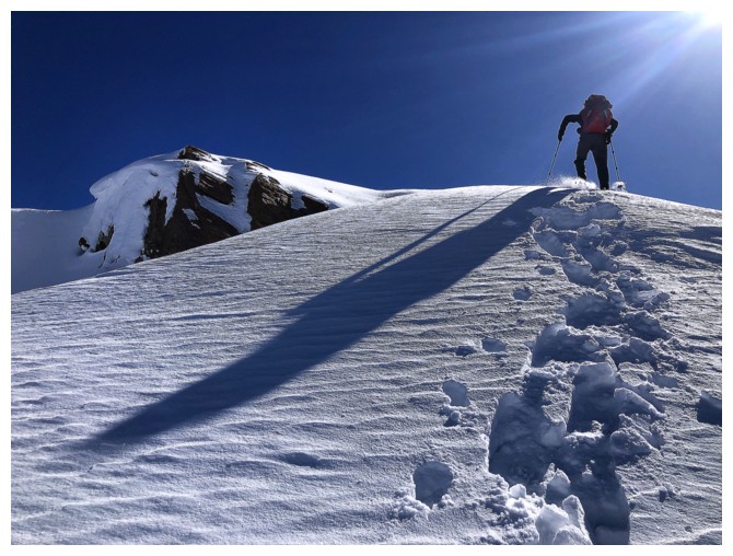
Above the crux (that wasn't a crux) Matt leads the way to the top, only a few minutes away
I guess there were two rock bands
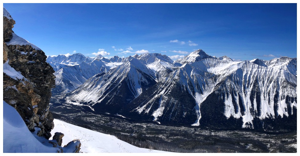
Same as above, with that searing view to the southwest
Matt's tracks
The tracks with their owner
Matt is now only seconds away from the top
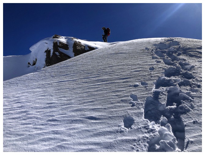
And he's there!
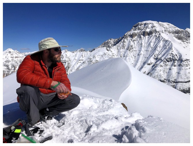
Matt found a sheltered place at the summit, however, the wind died down
almost immediately and we were able to enjoy a lengthy and warm summit
stay at the highest point
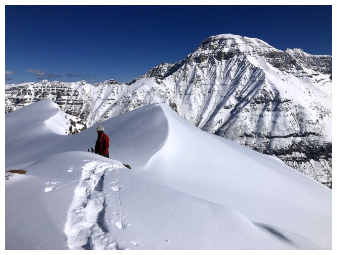
Summit view of Vermilion
Looking down at our tracks
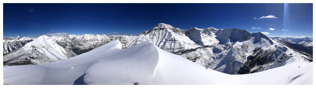
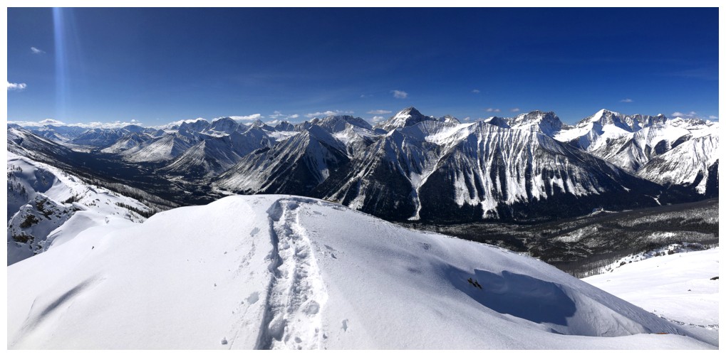
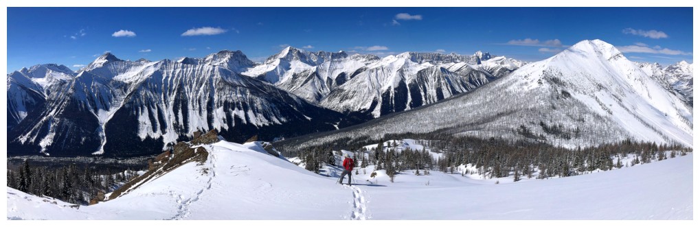
Hard to resist taking a million summit panos on such a perfect day so I didn't (resist, that is!)
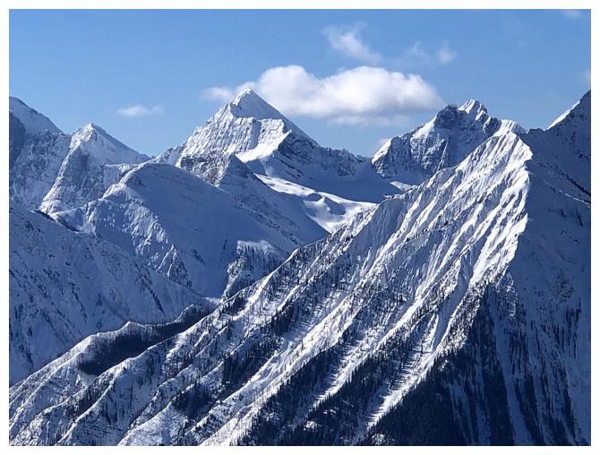
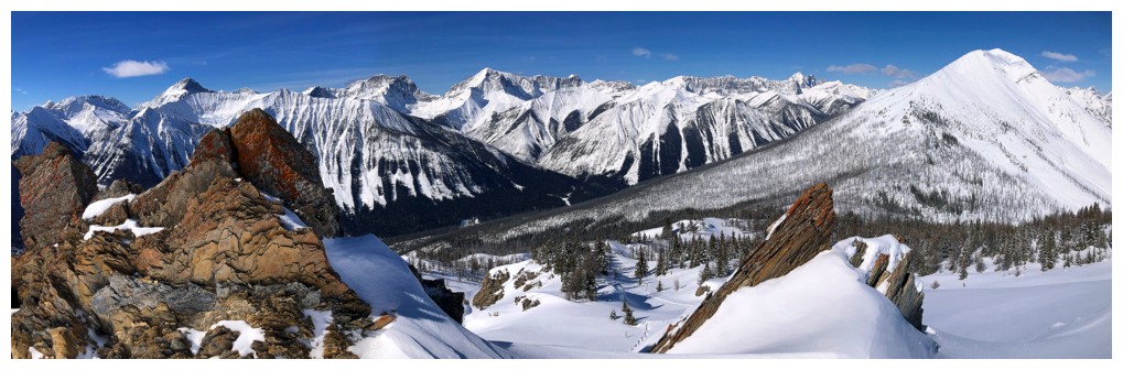
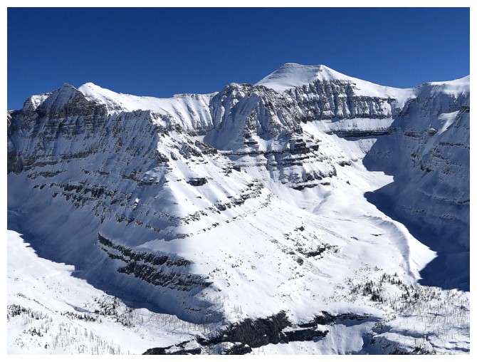
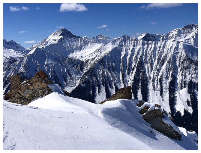
Stanley, Beatrice, Ball, Isabelle, and several unnamed outliers, including "Haffner Senior" at the end
The Goodsirs again
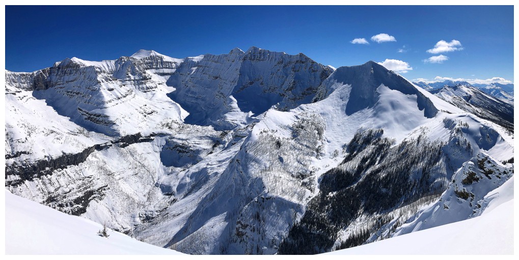
A few big peaks in the Lake Moraine area: Hungabee, Deltaform, and Allan
Bident, Chimper, Whymper, and Boom
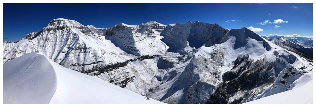
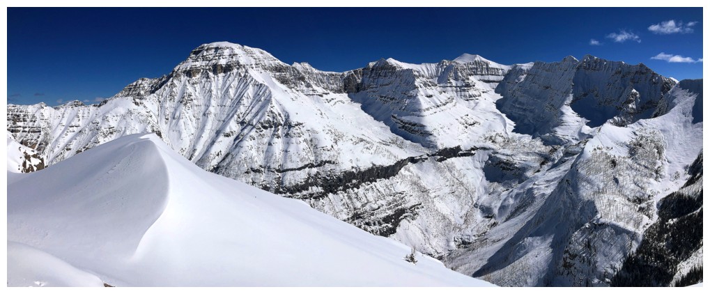
View southwest and west
Tumbling Peak and Mount Gray to the right
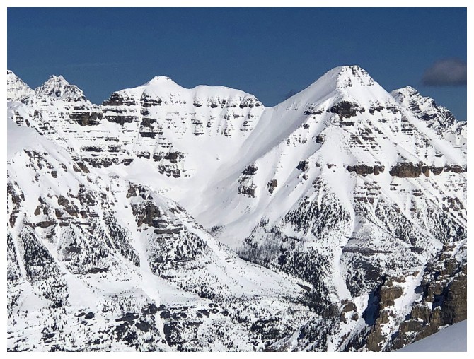
As the tallest peak on the west side of the highway Foster Peak stands out. Numa Mountain in the foreground.
Mount Ball
Closer look at the mountains at the head of Haffner Creek
Quadra Mountain and Mount Bident (right)
Mount Biddle
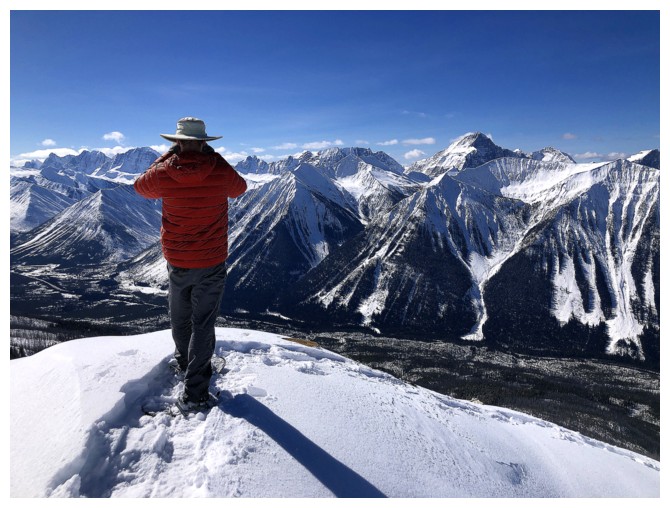
Matt checks out the phenomenal view
Little highpoint to the east Mark and I visited in 2010
Mount Assiniboine
Haffner Senior - would love to do that one again
The summit of Mount Ball
Southern outliers of Ball
Matt and Stanley
Mount Drysdale blends into the Rockwall
Last look before leaving
Easy descent
Same as above
Initially, making a new track down was easier than following the one we (Matt really) forged on ascent
Superb views on descent too
Back to those rocks
Back to the beautiful terrain low on the ridge
Two tracks become one - reminds me of the Spice Girls song
Last look at Vermilion
Same with Haffner - speaking of which, the fourth movement of Mozart's Symphony No. 35, "Haffner" (starts at 15:36), was one of many, many reasons I fell in love with Mozart's music
As many photo ops on descent as ascent
Matt climbs down the deadfall; as stated, sometimes a tedious and treacherous process
Time to head back into the bush
Final few steps of a magnificent trip
The End
LOG