Mount Lougheed IV
May 25, 2025
Mountain height: 3107 m
Elevation gain: 1400 m
Ascent time: 5:30
Descent time: 3:25
Scrambling with
Mark.
 For several
years I had been waiting for the right time to drag Mark up Mount Lougheed.
It’s an amazing mountain, boasting three separate summits, and several routes
up each. We would be using the direct route, via Spencer Creek, up to the
second and highest summit. As a late May ascent, the hope would be for enough
snow to enhance the scenery, but not enough to make for dangerous conditions.
For several
years I had been waiting for the right time to drag Mark up Mount Lougheed.
It’s an amazing mountain, boasting three separate summits, and several routes
up each. We would be using the direct route, via Spencer Creek, up to the
second and highest summit. As a late May ascent, the hope would be for enough
snow to enhance the scenery, but not enough to make for dangerous conditions.
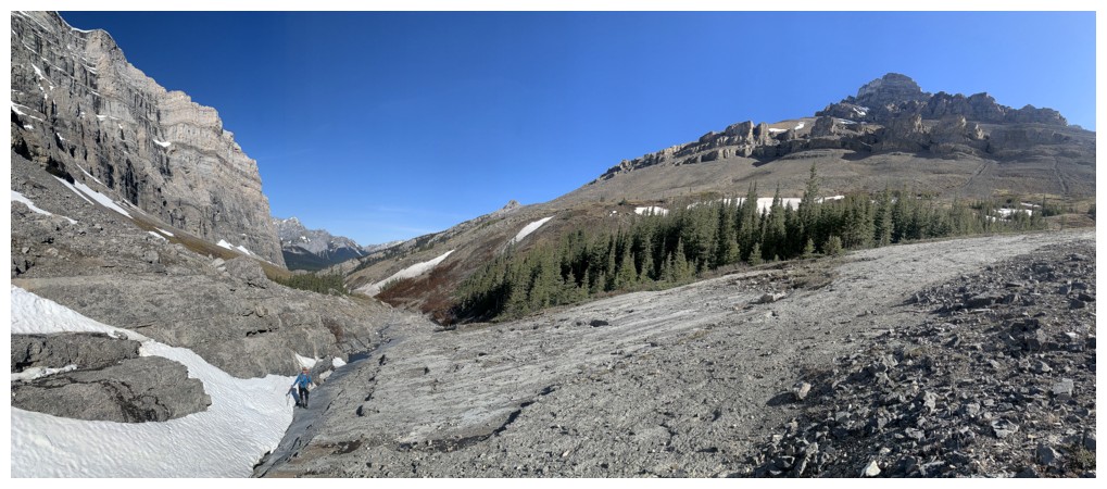
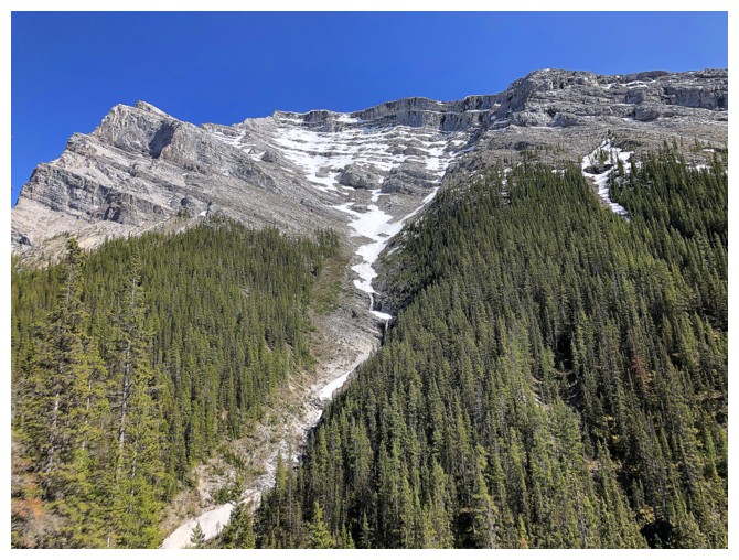
As always, the
hike up Spencer Creek did not disappoint in the least – the super cool mossy
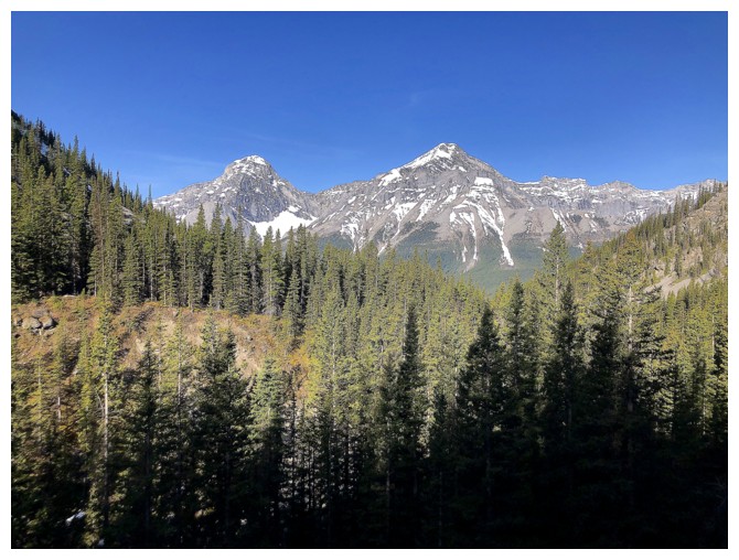
section nearing the beginning, remarkable views of Mount Sparrowhawk’s steep
north face, and the beautiful, water-worn rock in the creek itself. I was a
little surprised about the lack of snow lower down, however, the upper reaches
of the mountain were still relatively plastered.
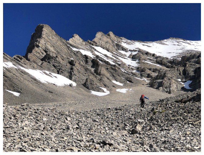
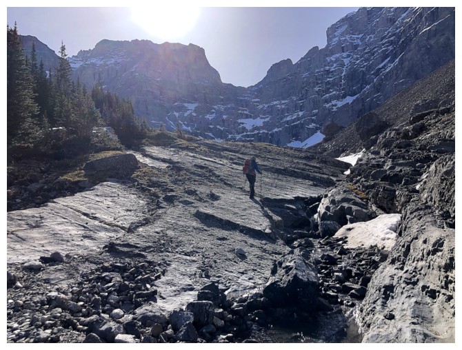
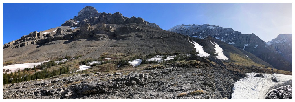
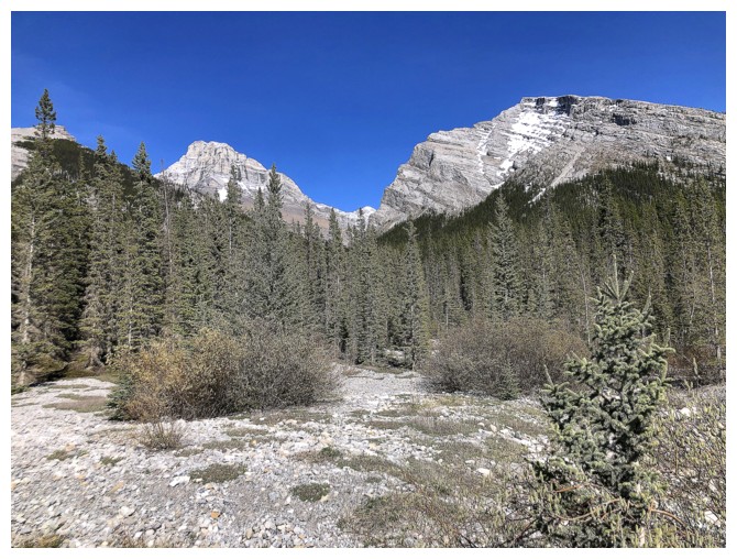
We took a short
break to refuel before starting the slog to the summit. That slog is very
foreshortened, but incredibly scenic, with interesting rock and continually
improving views. Blue skies and the remaining snow added immeasurably to the
experience. 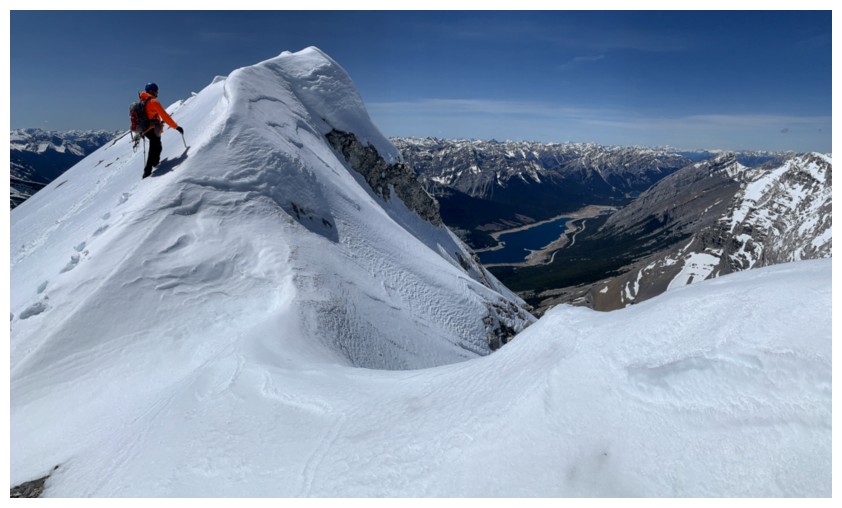 Unfortunately, taking the direct route to the west highpoint seemed
too risky because of the snow. We took a safer line, further to the right.
Unfortunately, taking the direct route to the west highpoint seemed
too risky because of the snow. We took a safer line, further to the right.
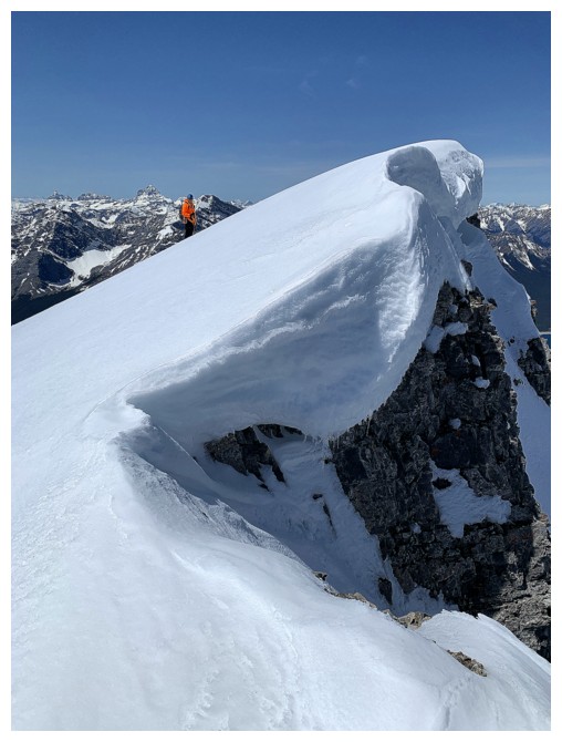
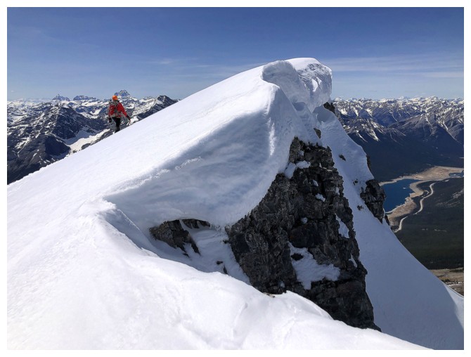
Also too risky
was standing atop what we thought was the summit because of a large cornice
overhanging the ridge. Fortunately, the true summit was further east and a
short but very scenic traverse took us there.
Of course, the
summit view was outstanding, featuring far-reaching snowy views in every direction.
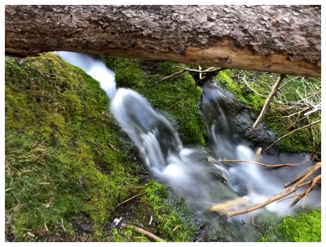
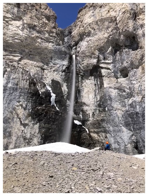
After a long break, we followed the same route down the mountain, stopping at a
very cool waterfall en route.
Another amazing
return to one of Kananaskis’ finest. Mark loved it, I loved it, mission
accomplished!
Mount Nestor and Old Goat Mountain are companions through much of the trip
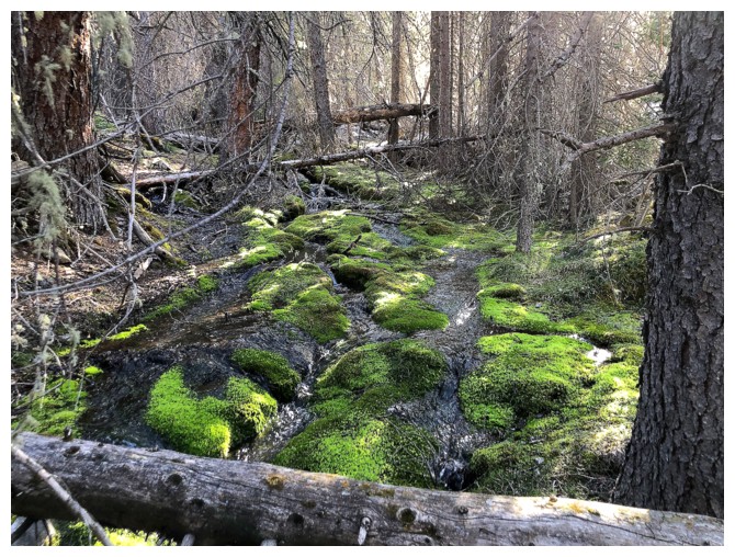
The mossy section
Same as above
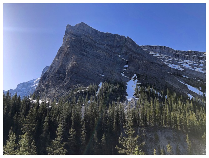
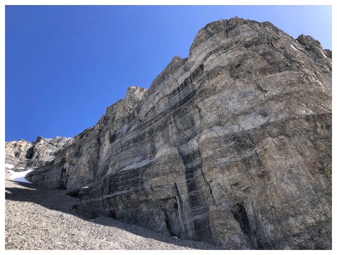
First view of Sparrowhawk's fierce north face
There's the pair again
More comprehensive view of the north face
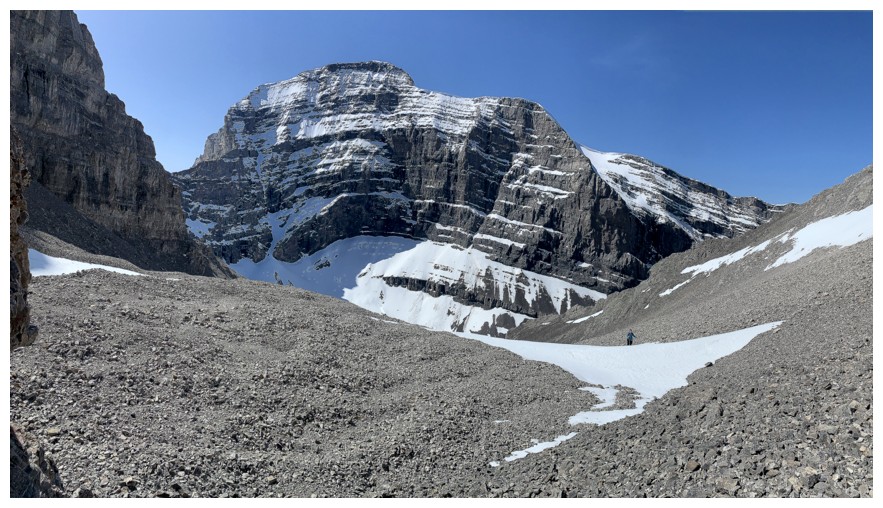
Little Lougheed above
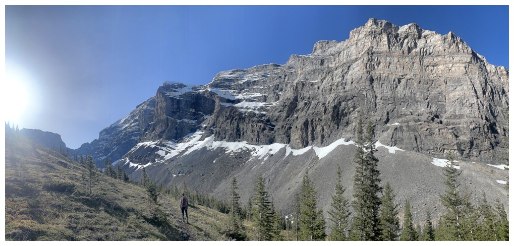
The west side of Lougheed's second peak is always the center of attention further up the valley
There were small snow slides coming off Sparrowhawk all day
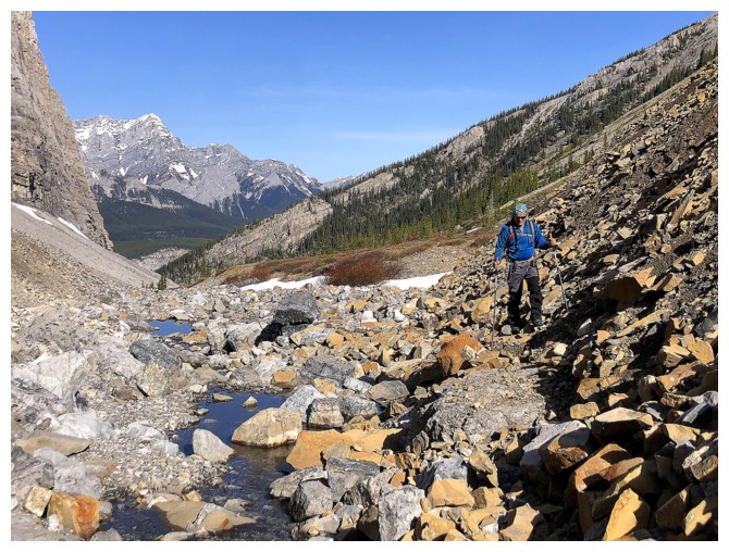
The trail descends into Spencer Creek
The water-worn section of the creek is terrific
Same as above
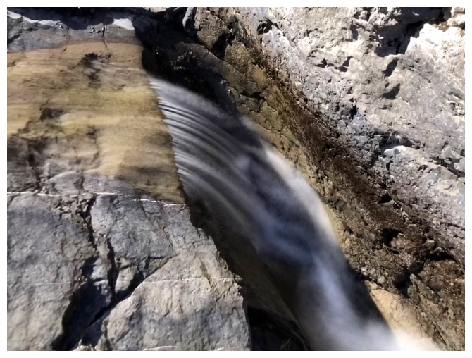
Had to get at least one long exposure photo for the day!
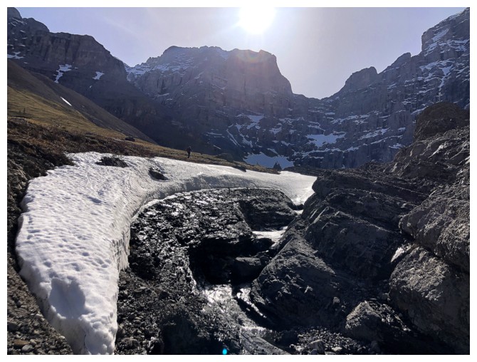
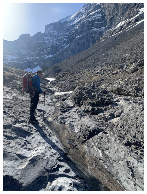
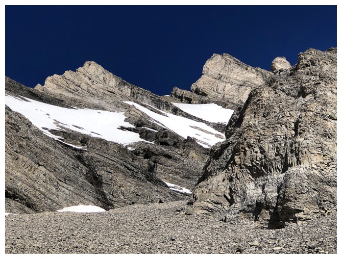
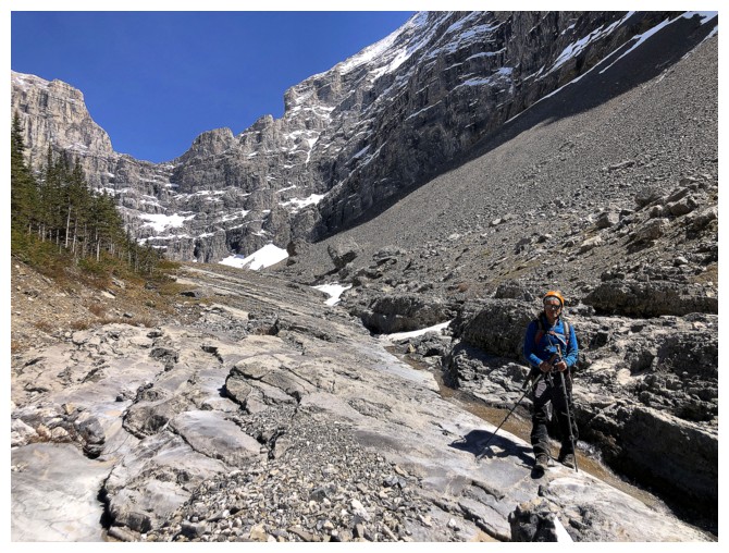
First direct snow encounter of the day
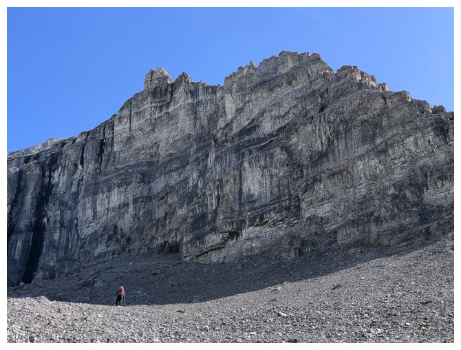
The beautiful west side again, but it looks even better later in the day
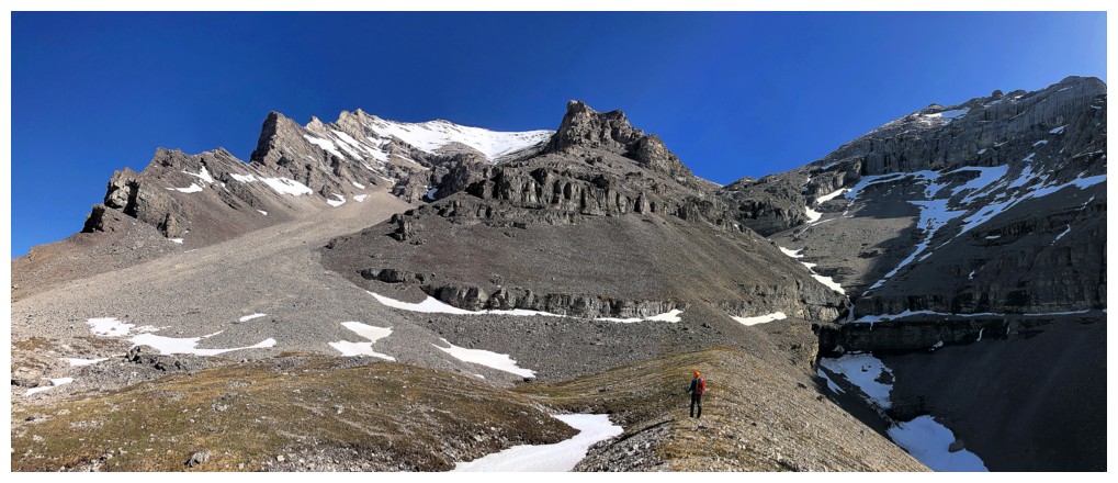
Mark is a little off route near the right
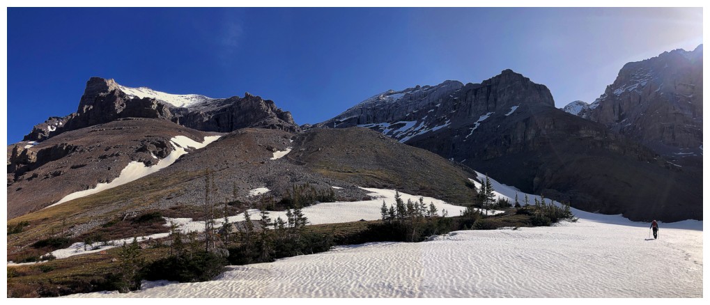
Back on route and heading for the ascent slopes between the peaks
Another avalanche
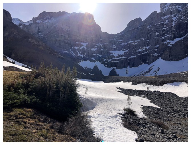
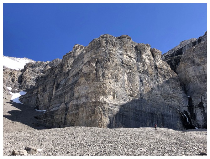
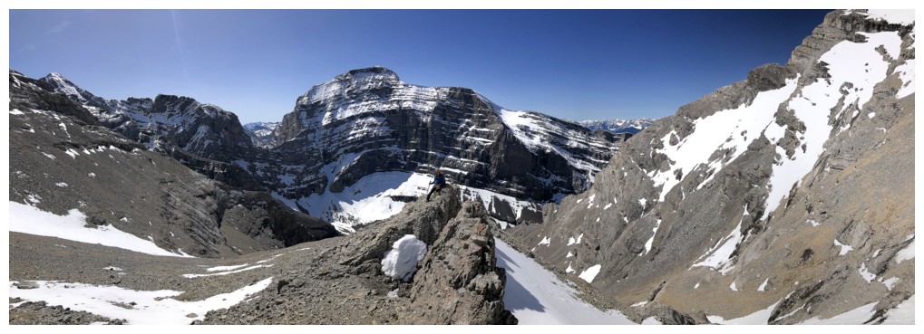
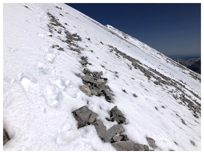
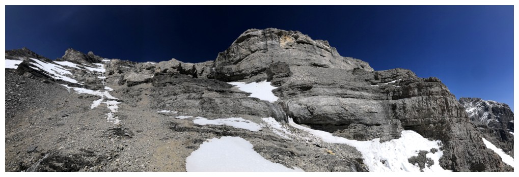
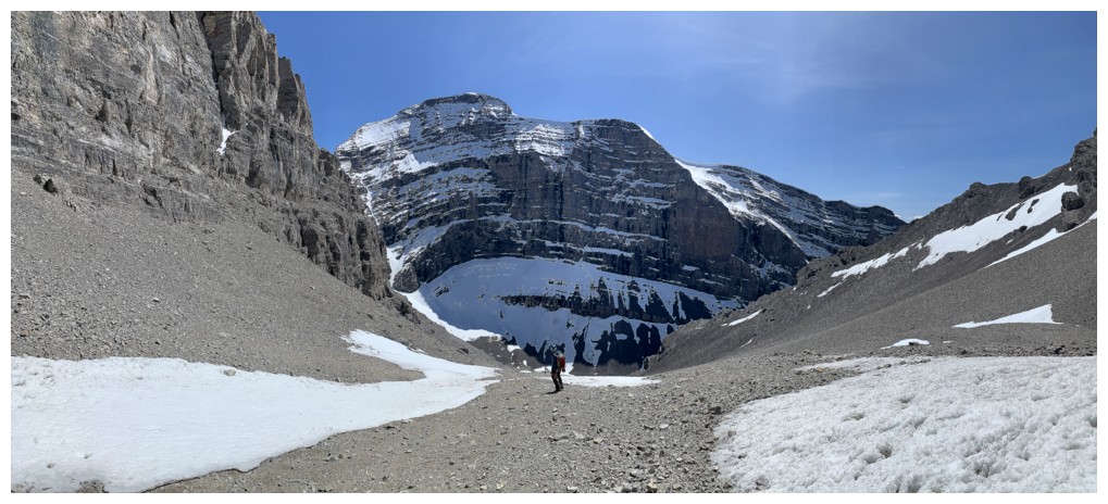
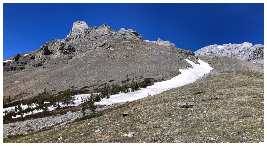
The route goes up the middle, then veers to the right for the upper slopes
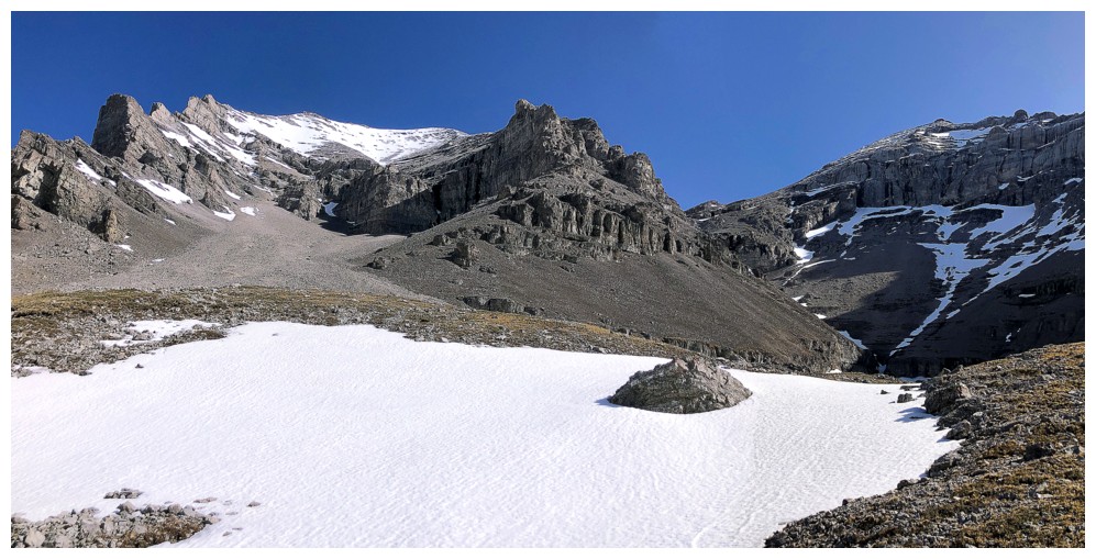
The valley just right of centre looks interesting too, but I've never been up or down that way
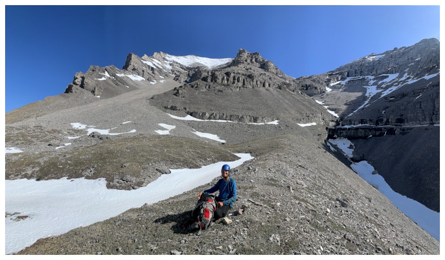
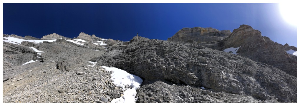
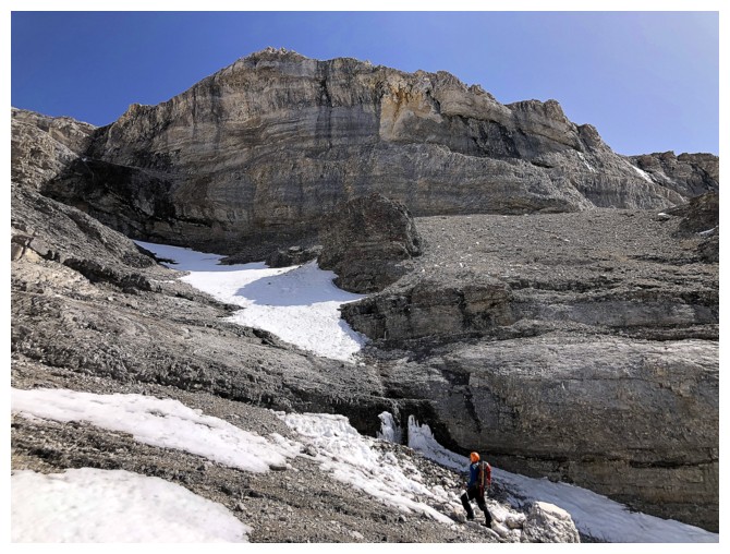
Food and helmet time
Continuing up
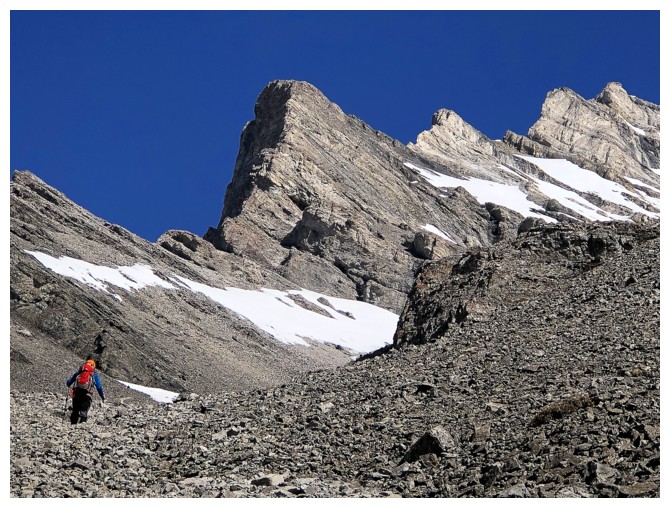
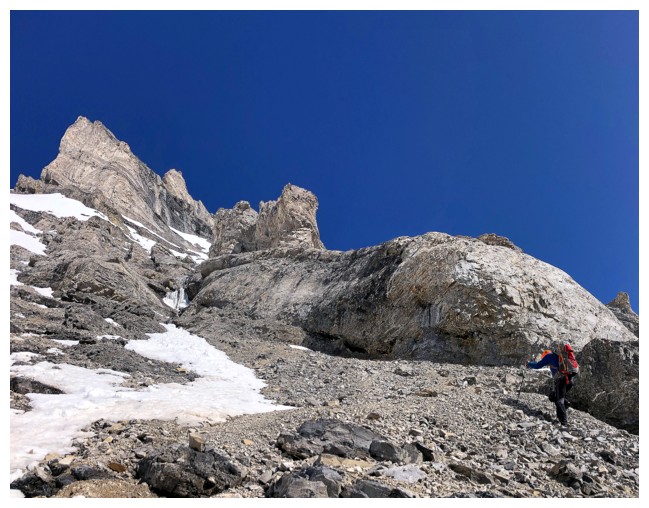
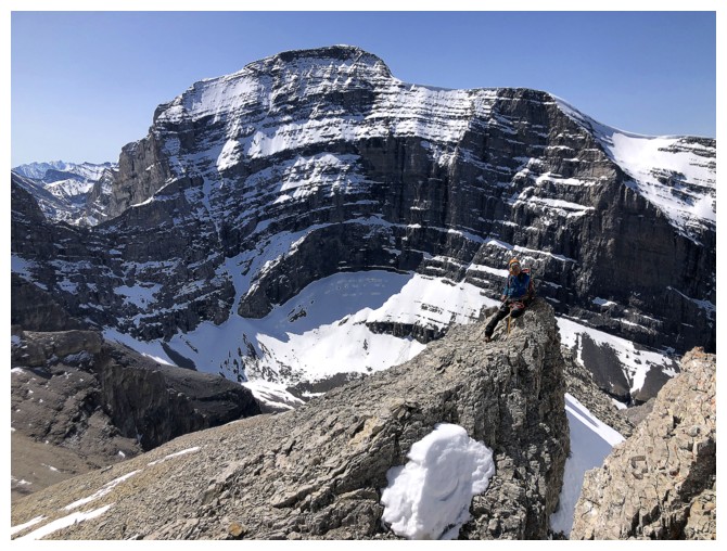
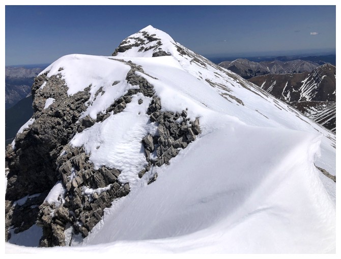
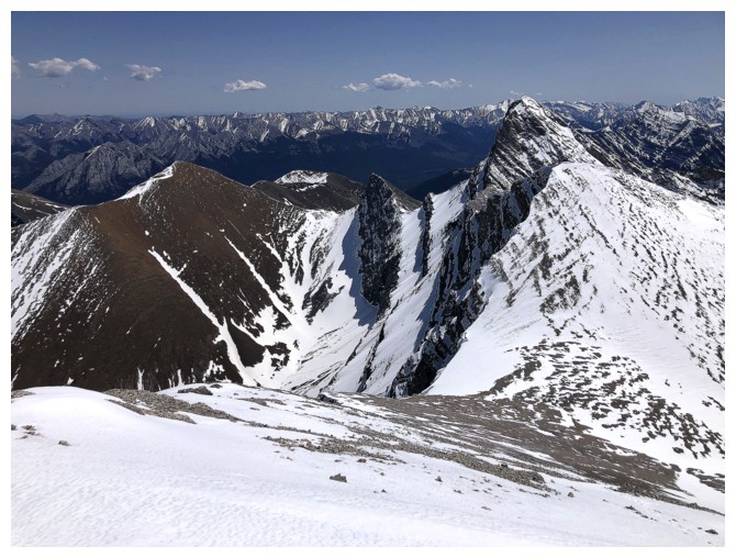
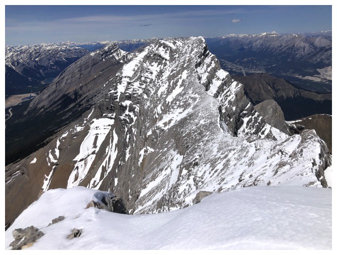
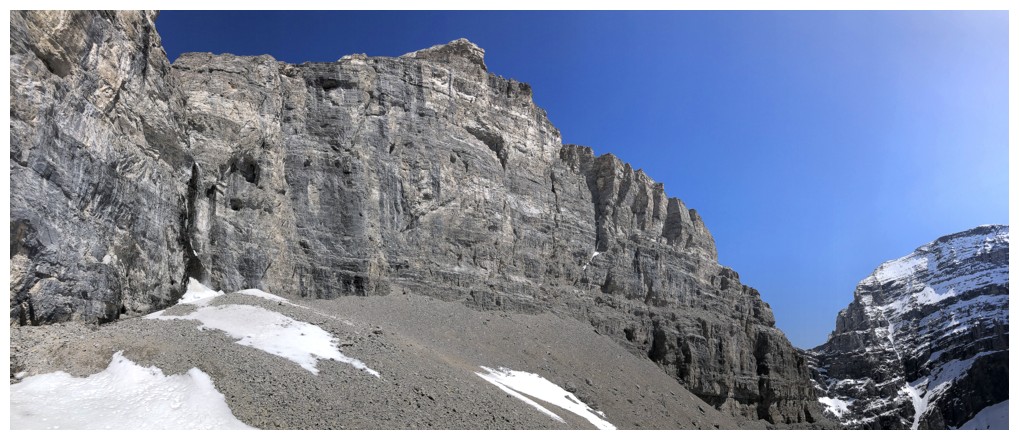
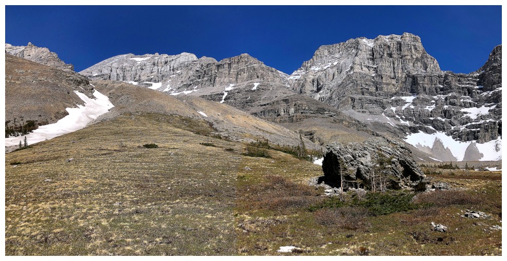
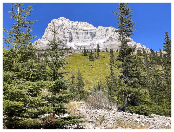
The stunning southwest ridge of the true summit
The ridge on the other side is impressive too
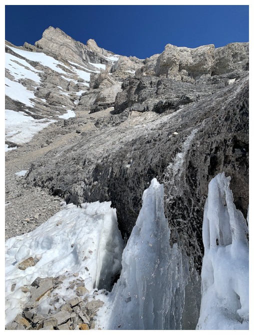
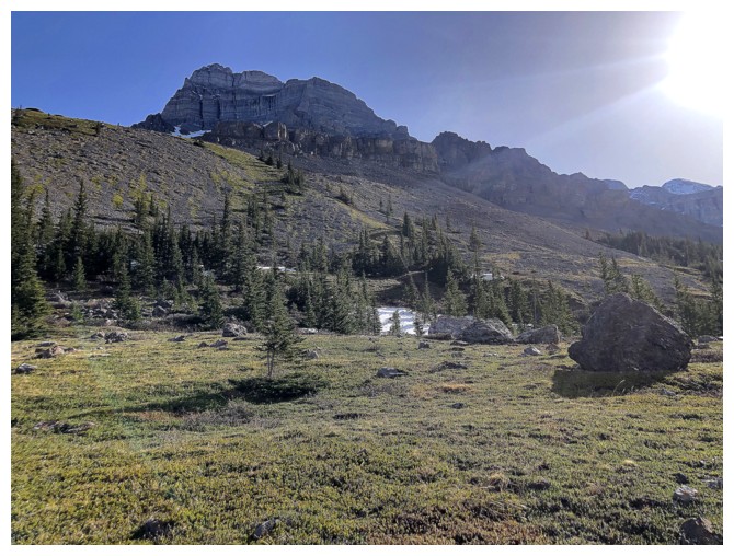
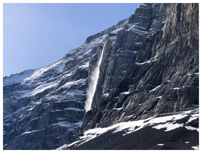
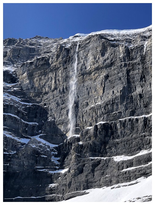
Mark heads to the right to check out a waterfall at the far right
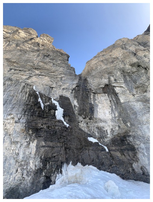
Just a trickle of water is coming down, but that would change later in the day
Now looking due south at Mount Sparrowhawk's north face
Back on track towards the ascent route
That ridge again and a beautiful blue sky
Mark (speck in the middle) waits for me atop a rock band
The view of Sparrowhawk continues to improve and inspire
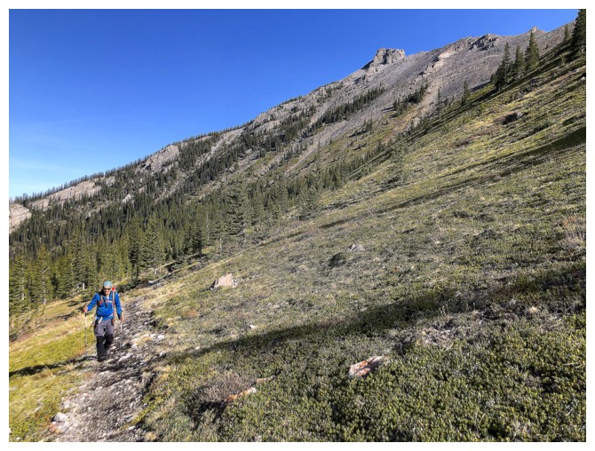
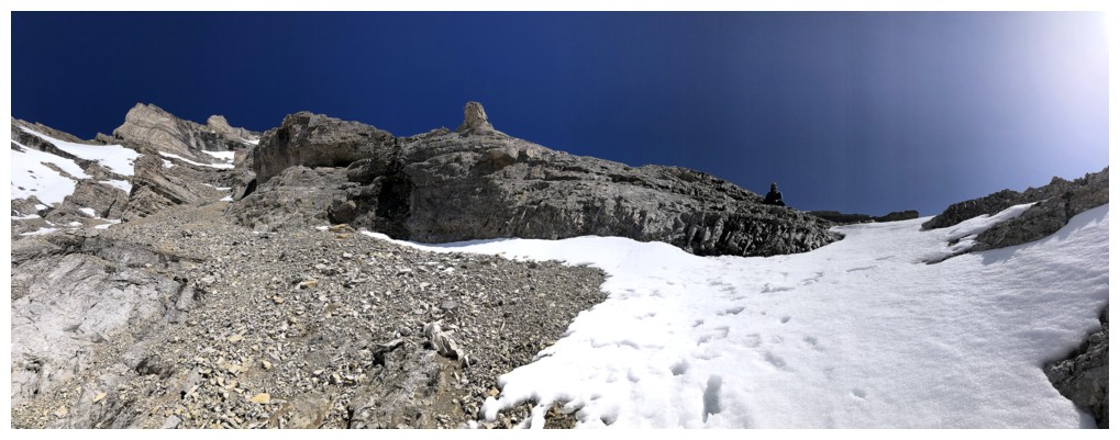
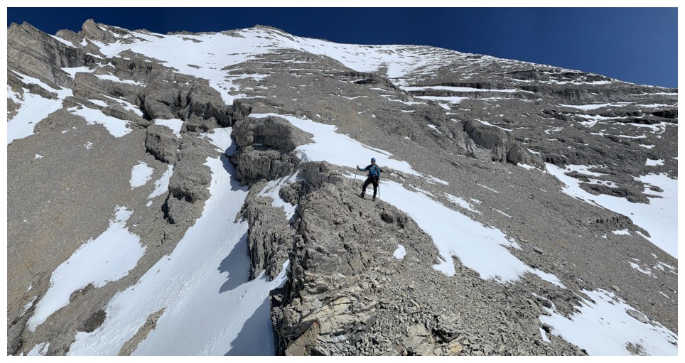
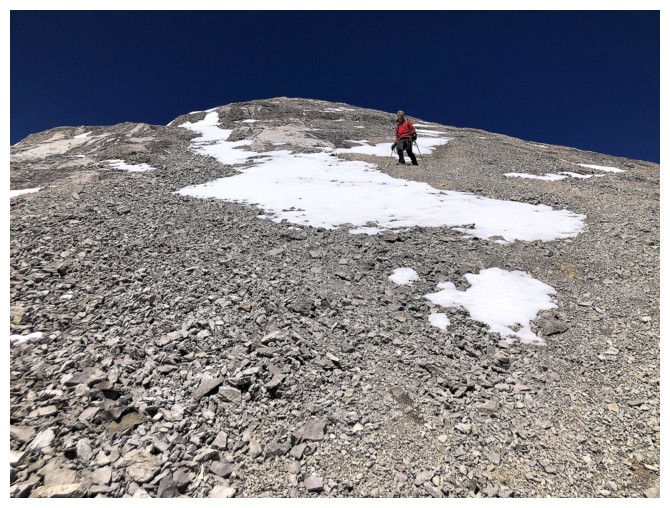
Approaching more complex terrain, although there's only one easy way to go up
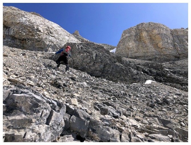
Mark leads us up through the easy route
Same as above
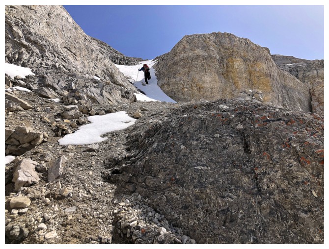
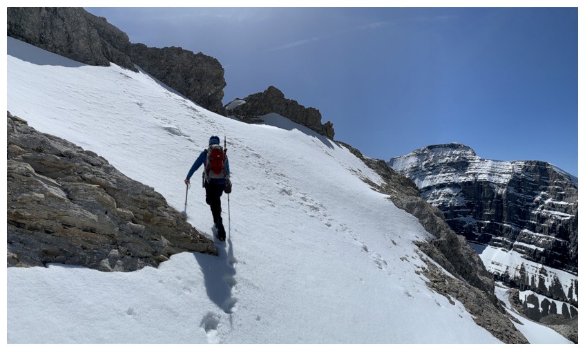
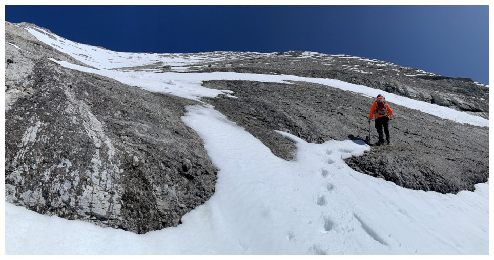
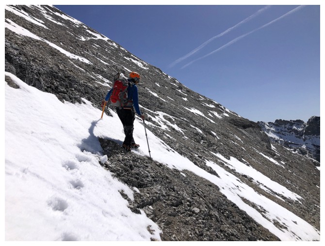
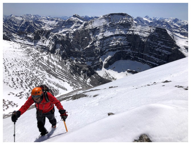
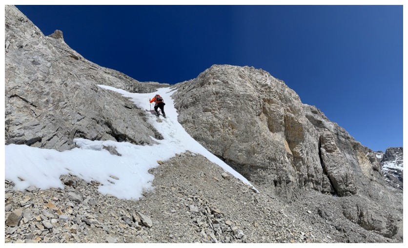
Steep snow
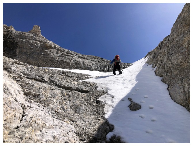
It's steeper than it appears
Mark waits again, but he needs to invest in a bright orange jacket so I can see him!
I guess I do too
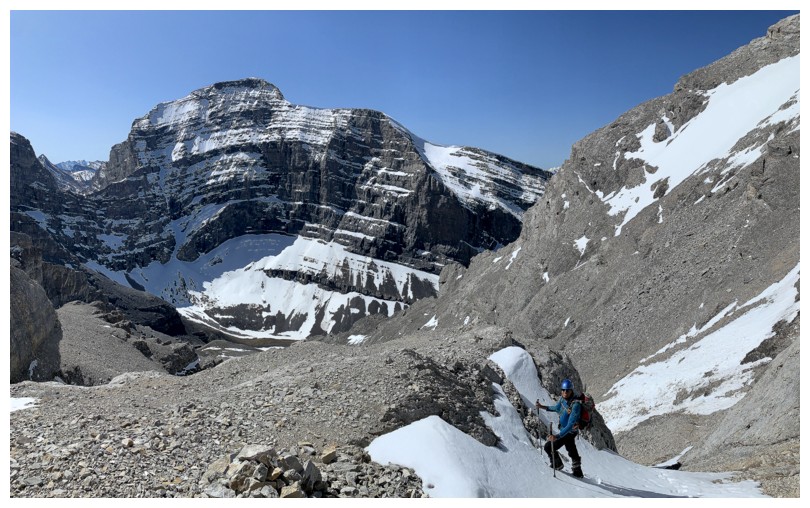
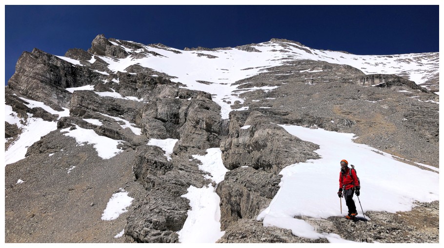
The route will again go over to the right here
More snow, but less steep this time
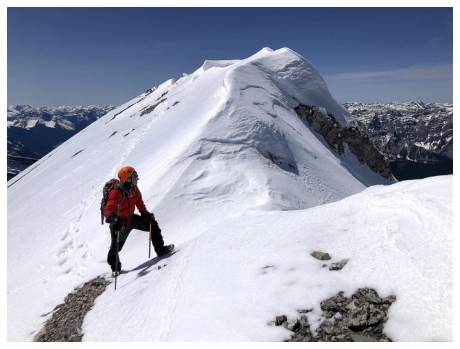
On one of several ridges that go towards the summit
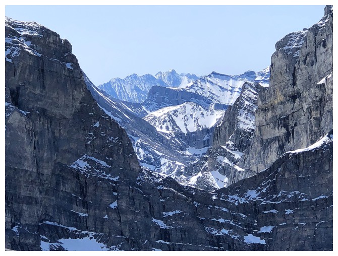
The distant Opal Range (Mount Evan Thomas in the centre) makes an appearance through a gap
Mark is steps away from the ridge
Mark finds another rest spot but is camouflaged
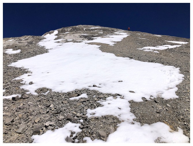
Although going straight up from this point appears to be easy, those
slopes are much steeper than they look and are best avoided when snow
covered
He's visible here
But wait...I do have a bright orange jacket!
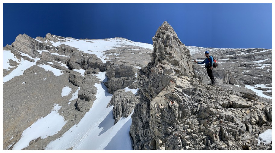
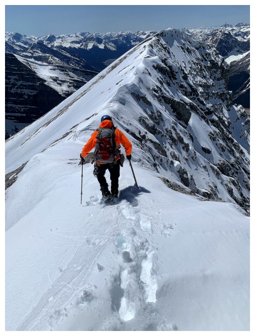
Traversing over to the ridge
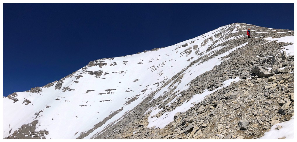
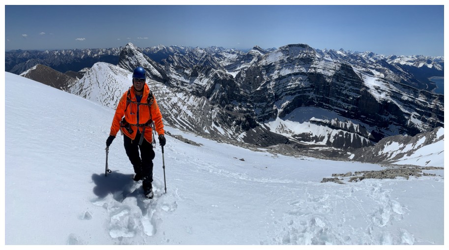
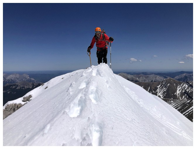
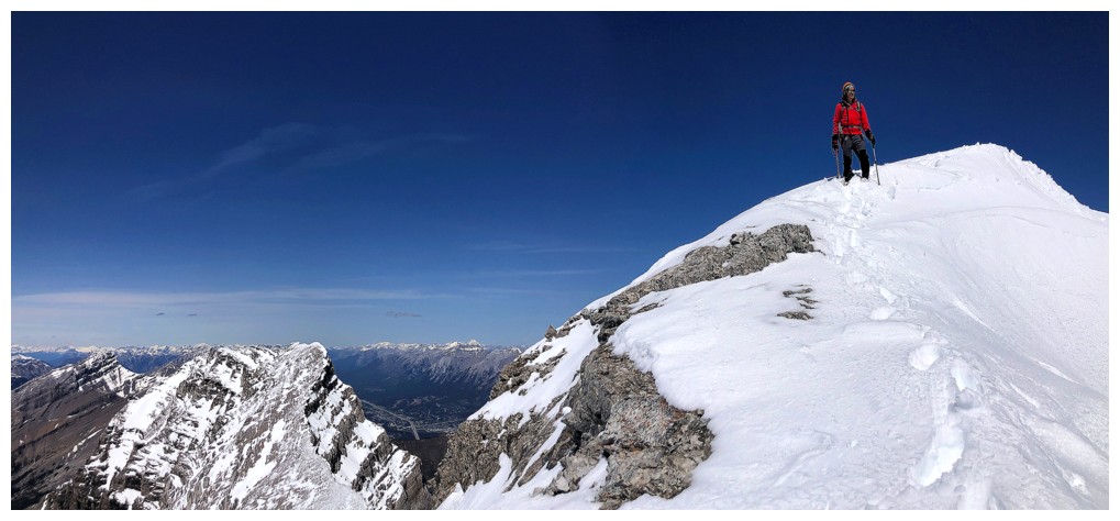
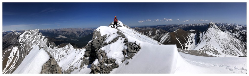
On the final ascent ridge and someone has a bright red jacket!
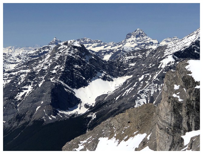
Mighty Mount Assiniboine at the right and less mighty but still very cool Eon Mountain near the left
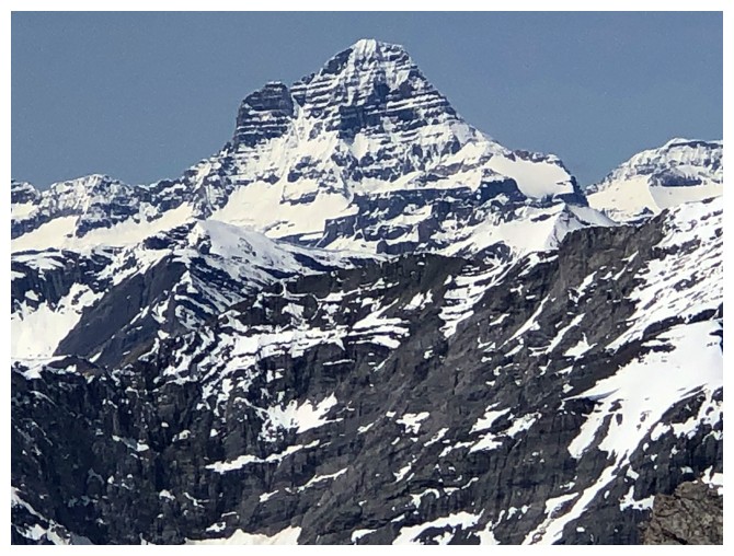
Close-up of Assiniboine
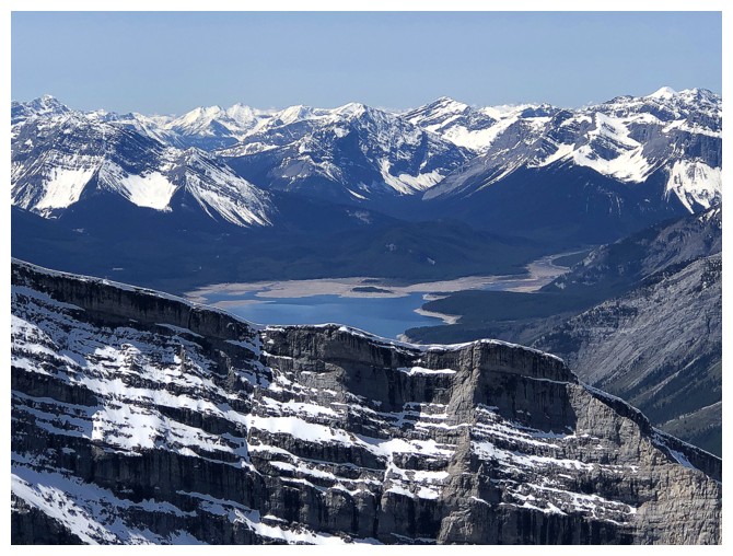
Spray Lake is looking quite low
Mark is way ahead
Wind Mountain
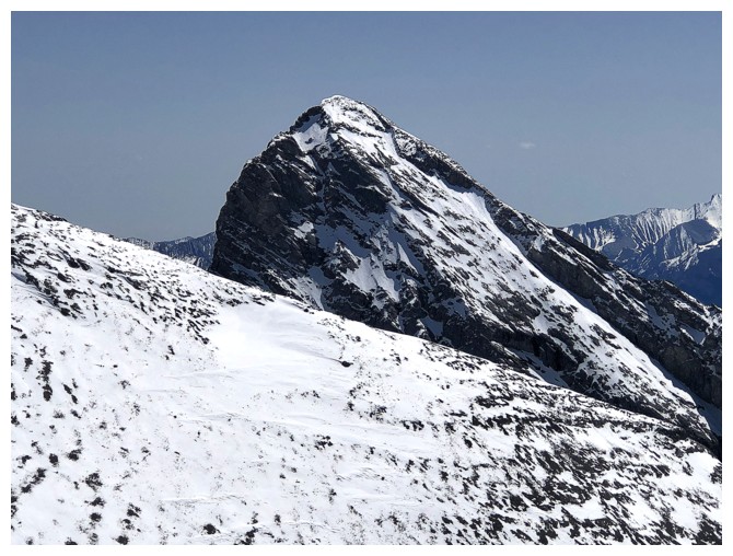
Add the third peak of Lougheed
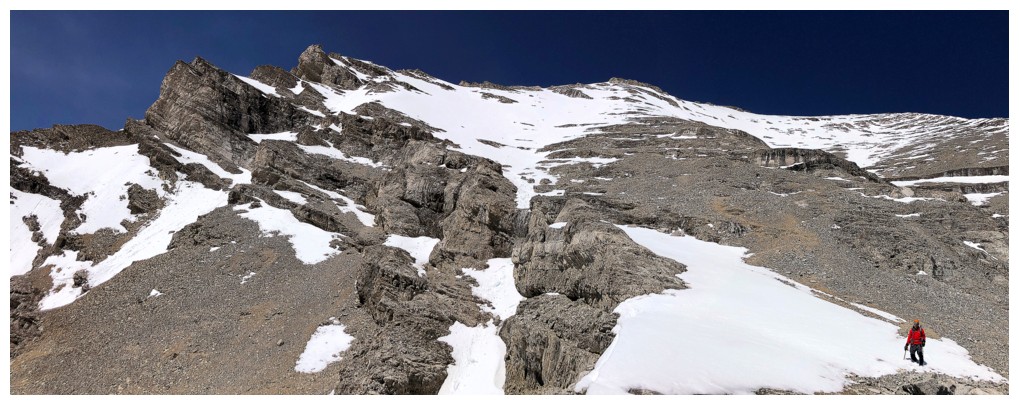
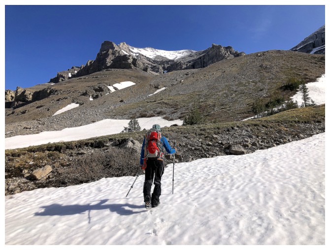
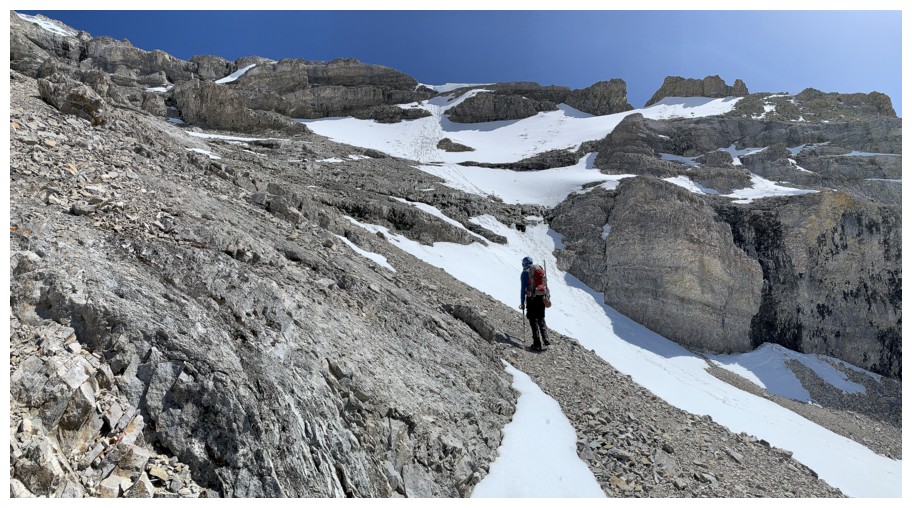
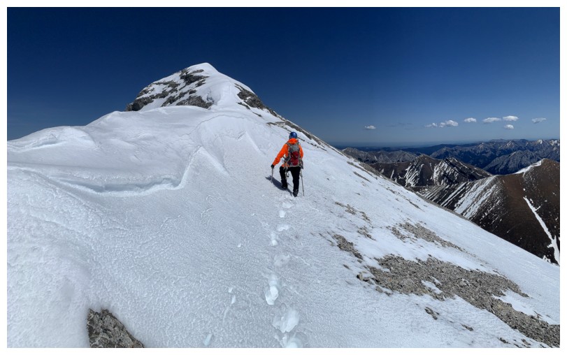
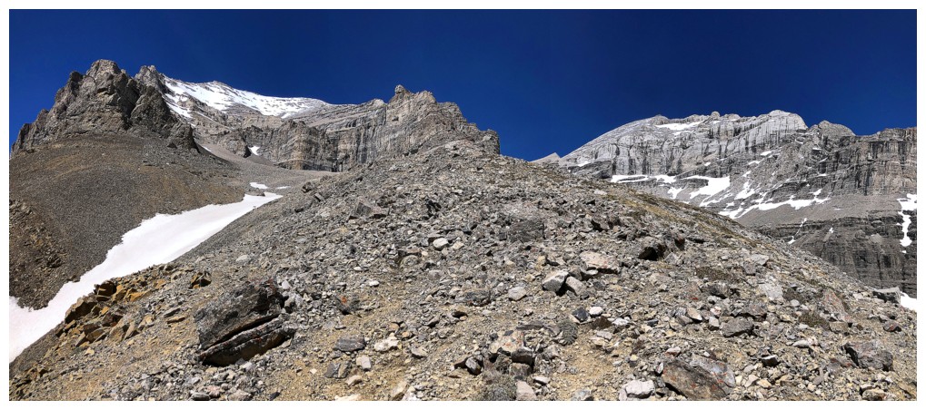
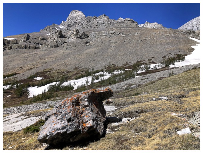
Typical terrain of the foreshortened slog to the summit ridge
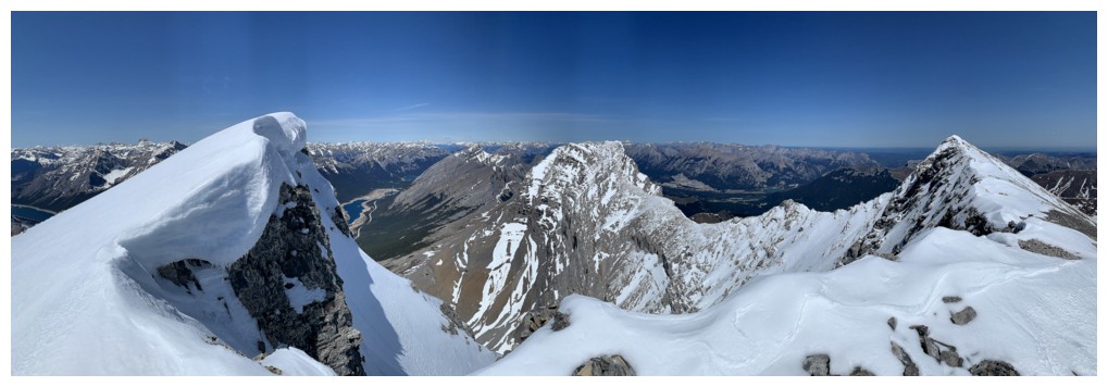
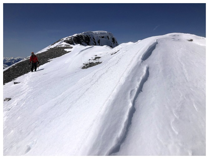
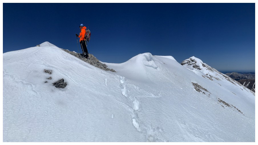
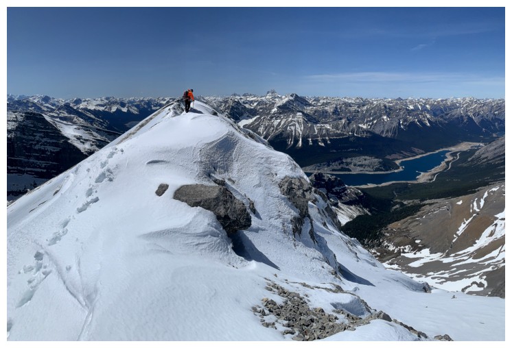
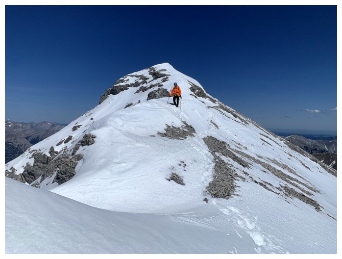
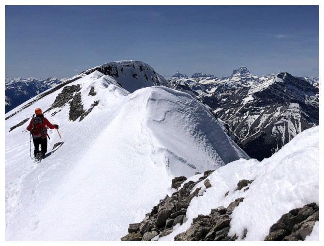
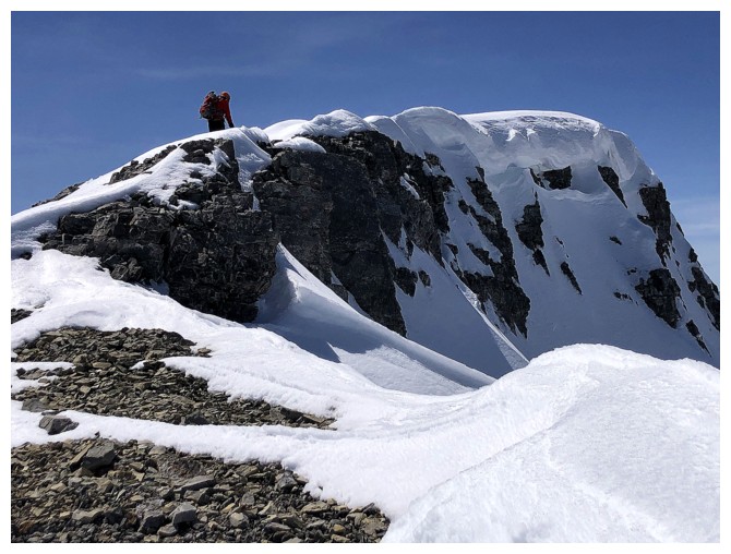
Finally on the ridge. The true summit is at the right but we mistakenly
thought it was the point at the left. Puzzling, given that I've been up
here three times before!
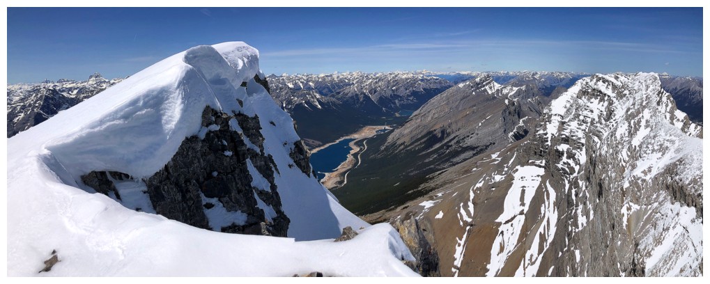
Heading to the heavily corniced incorrect summit
Same as above
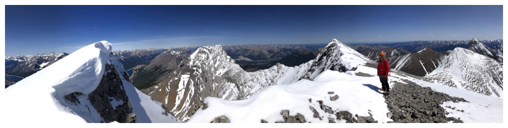
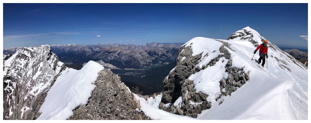
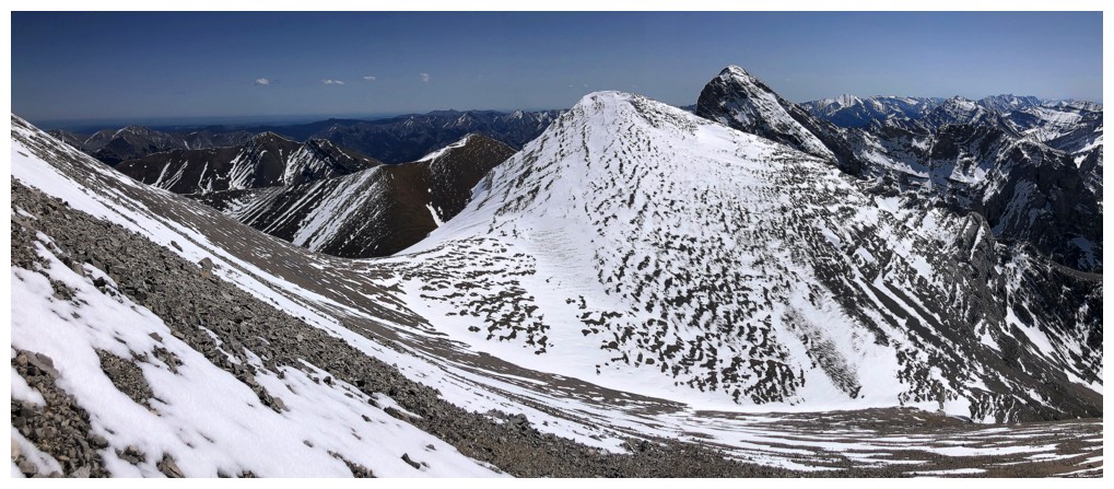
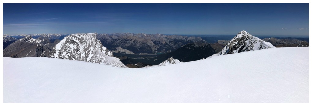
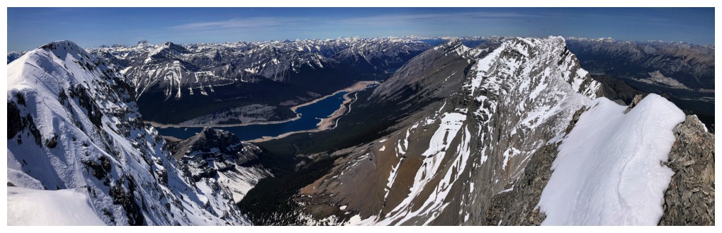
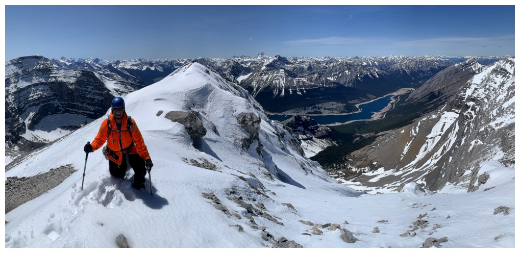
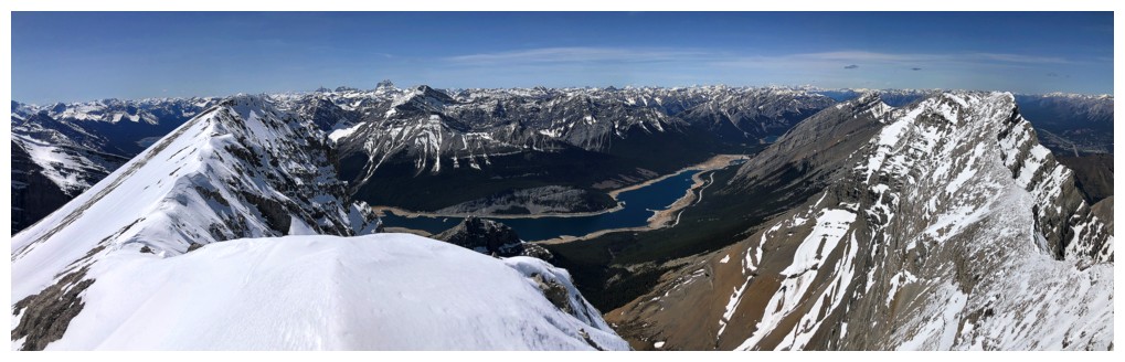
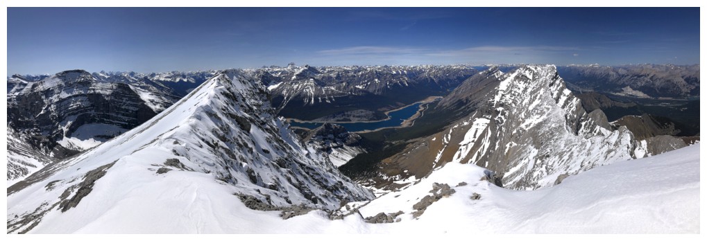
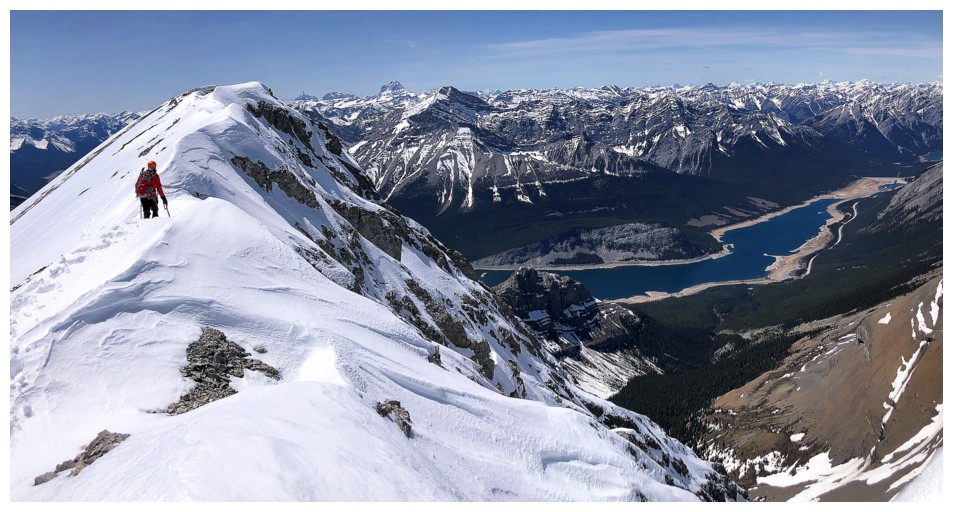
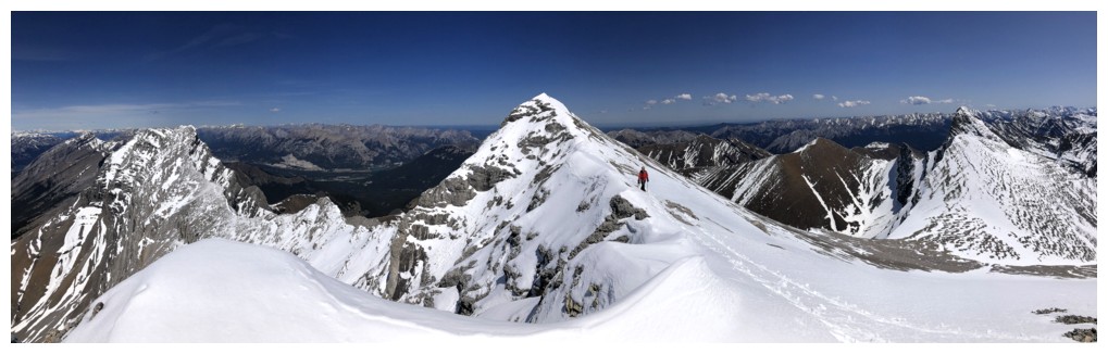
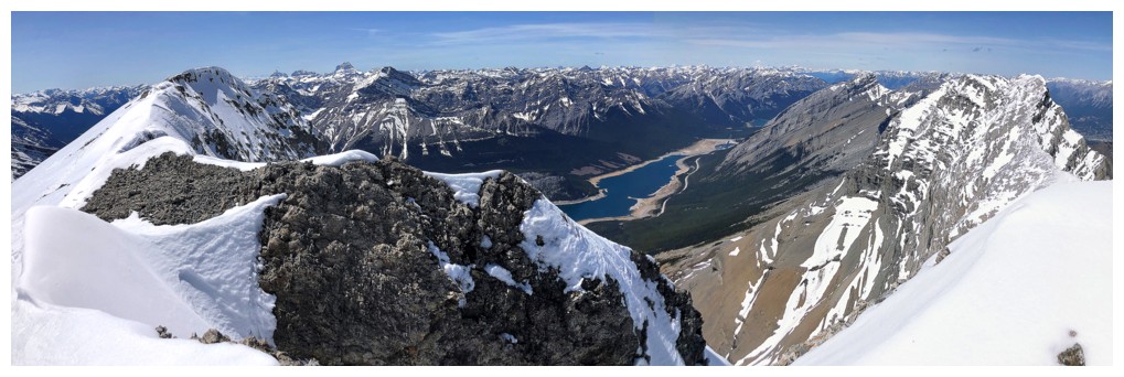
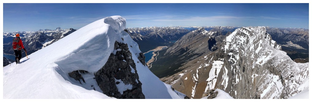
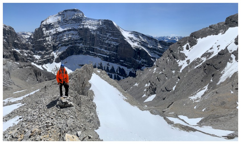
Pano from the ridge
The north end of Spray Lake creeps into the view
The first peak of Lougheed is a stunner from the ridge
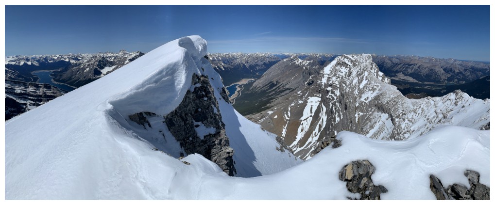
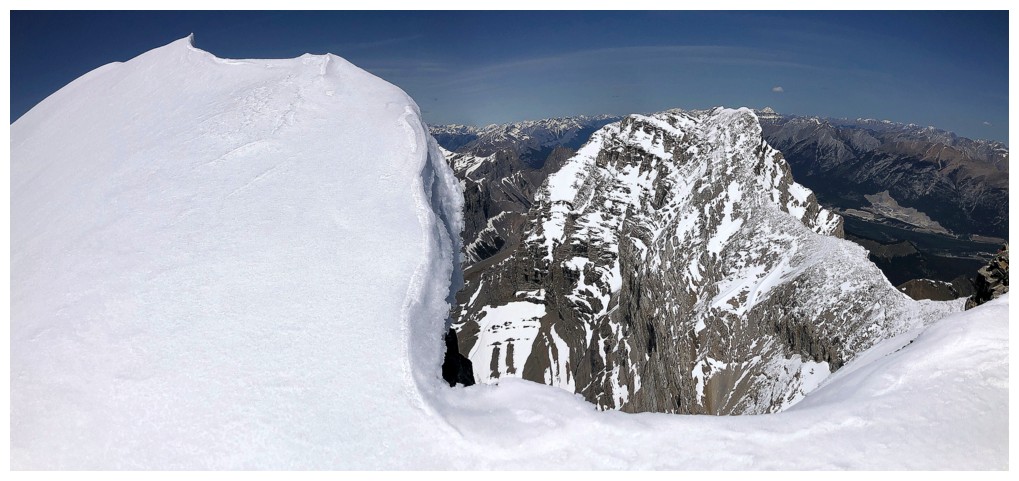
I far as I dared to travel near the cornice
Same for Mark
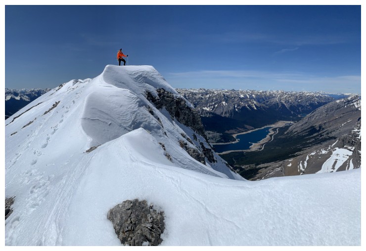
Summit posing at a point that is not the summit
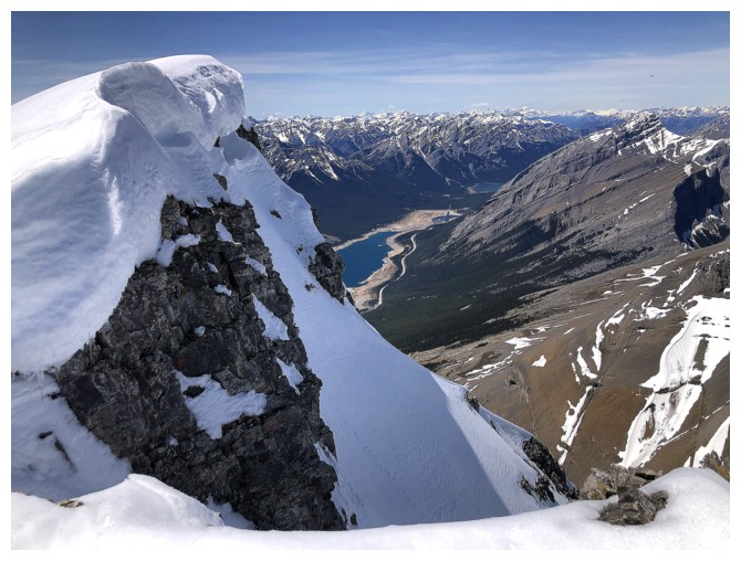
The cornice here limited the view considerably
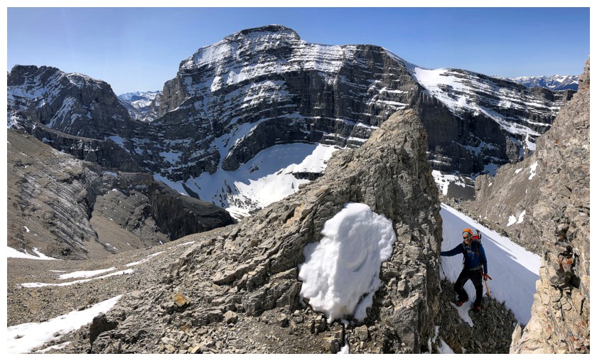
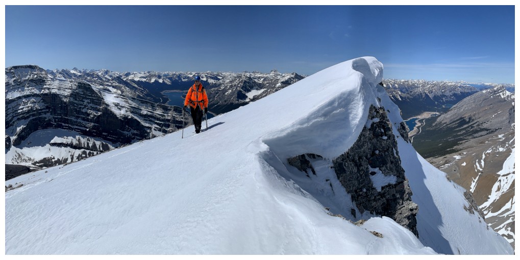
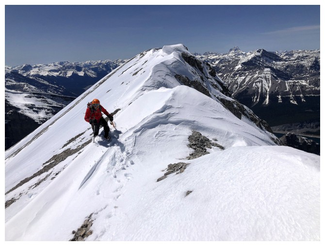
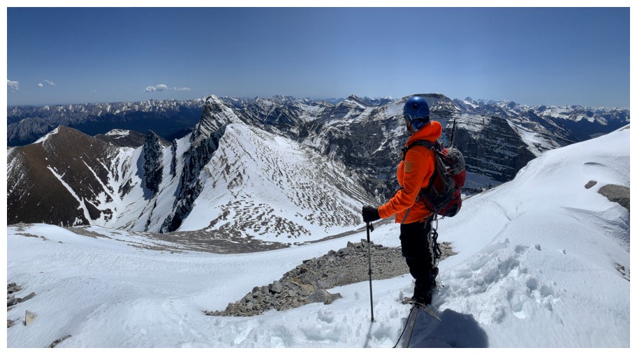
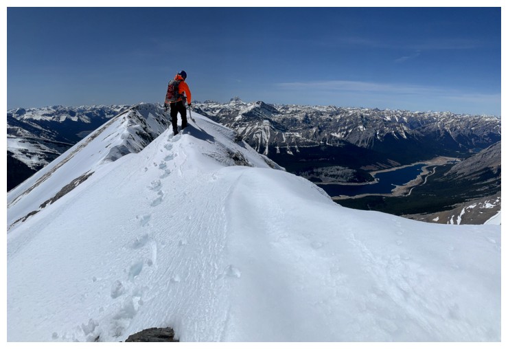
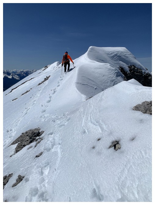
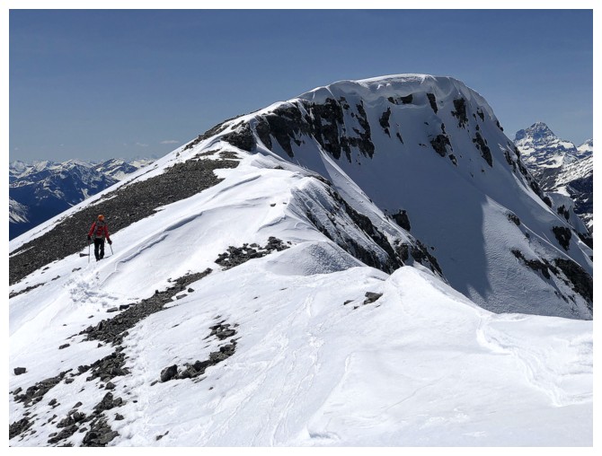
Having realized we were not at the highest point, now heading east towards the true summit
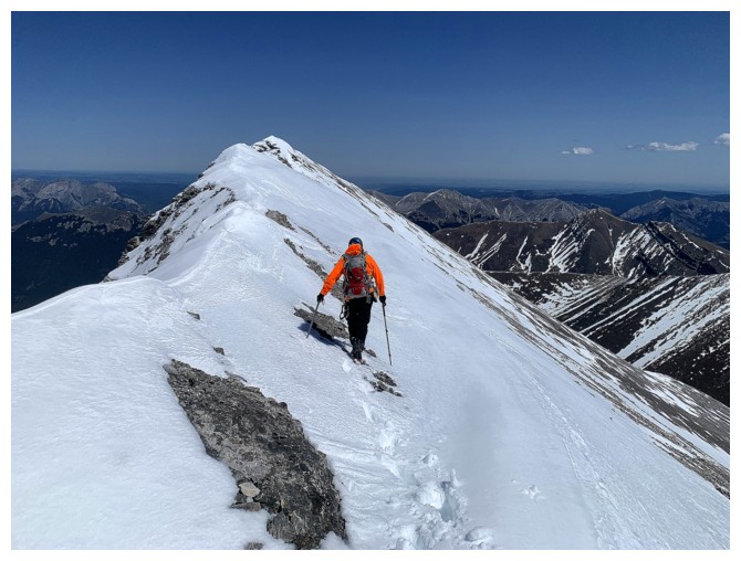
The snow adds a little challenge to the traverse but...
...also has high scenic value
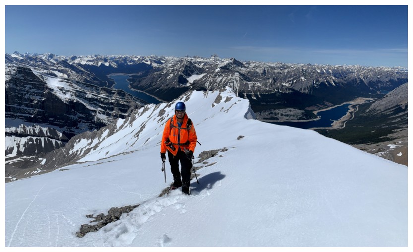
Between the highpoint and the summit
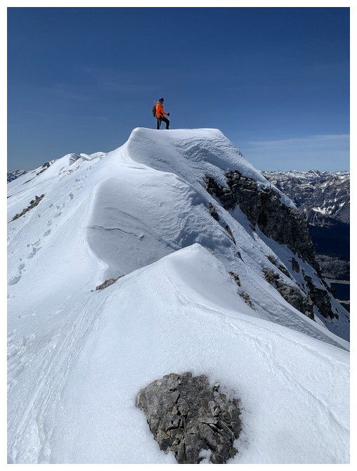
There's the top
Heading there
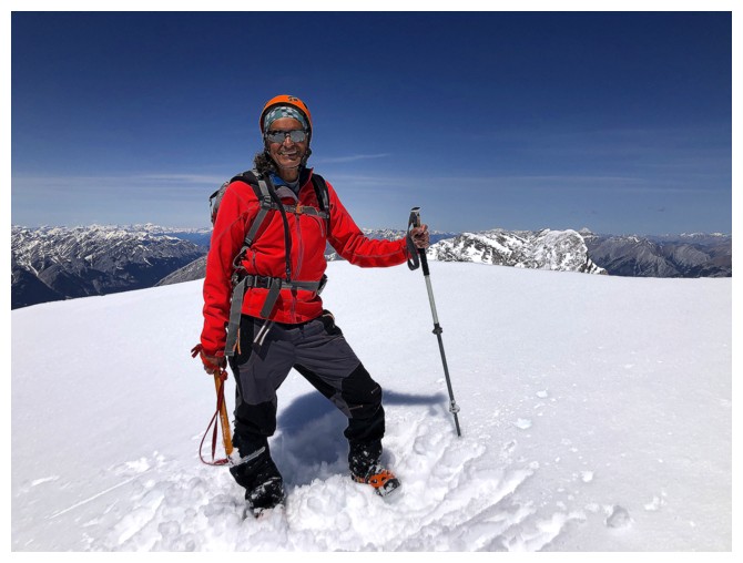
Summit success
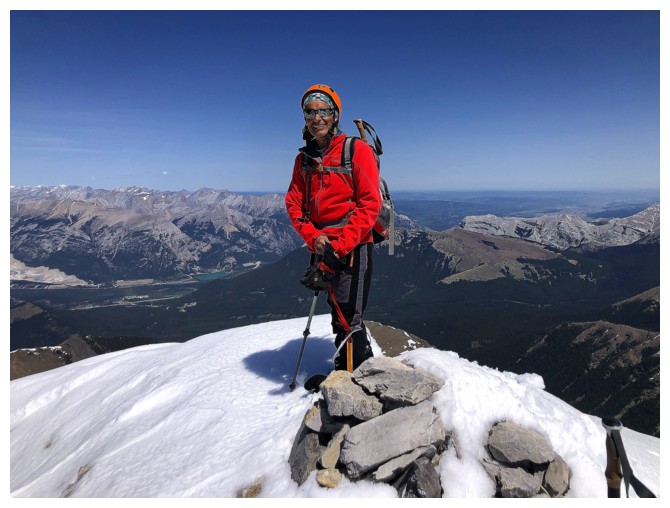
Ditto
View to the south
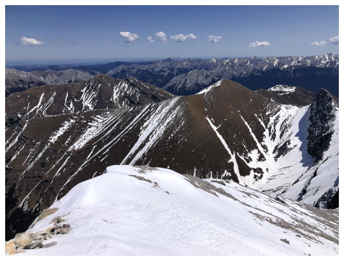
Mount Allan to the southeast
Allan and Wind
Heading back the way we came
The views are too good to resist retaking all the photos!
The snow also adds a little element of danger
Mesmerized by the first peak
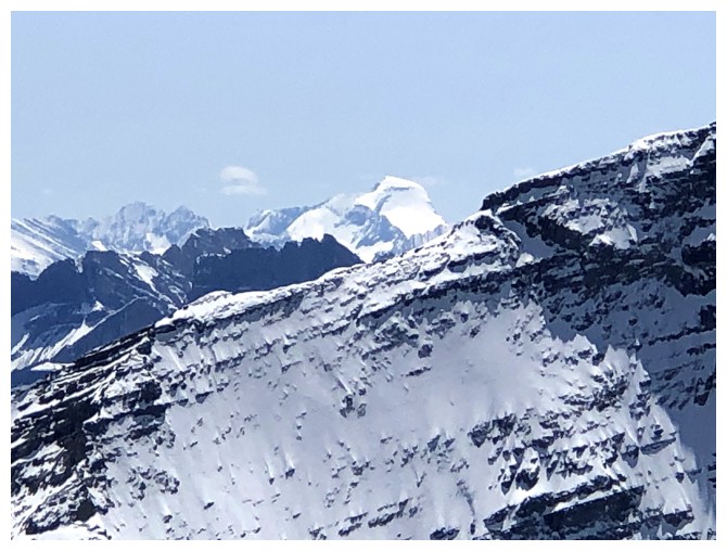
Mount Joffre
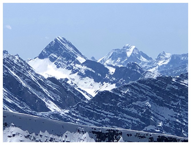
Sir Douglas (left) and King George
Back to the non-summit
Descending
Steep enough to require facing-in
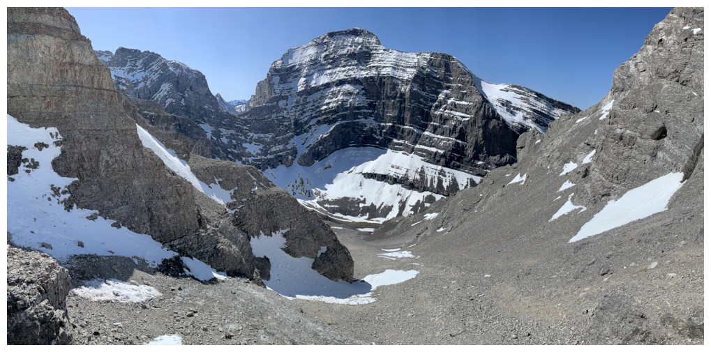
Admiring the steep walls and deep blue sky
Same as above

And again
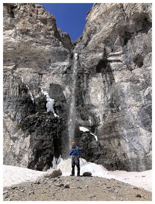
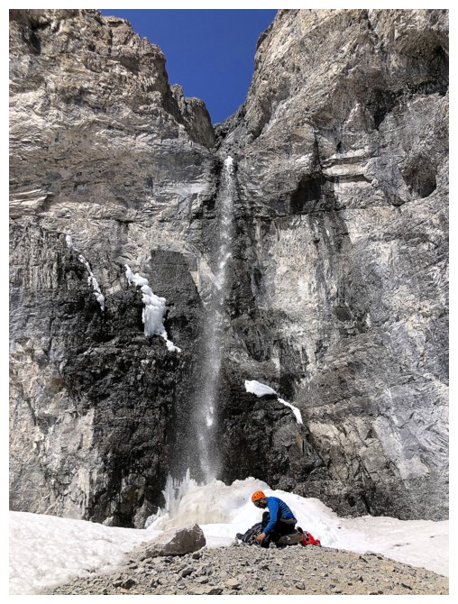 The trickle has turned into a waterfall
Resuming the descent
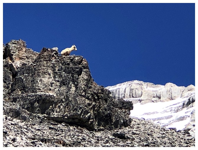 We are not the only ones enjoying this magnificent mountain
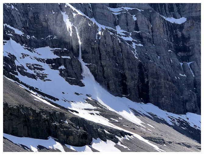
Another avalanche
Better views of the west side, as promised
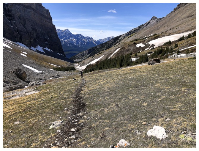
It's a long but scenic hike back to the road from this point
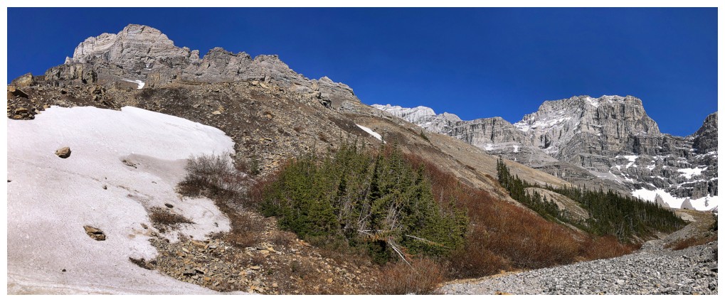
Best view of the west side
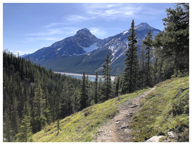
When Nestor and Old Goat reappear you are almost back to the start
Second last look at Sparrowhawk
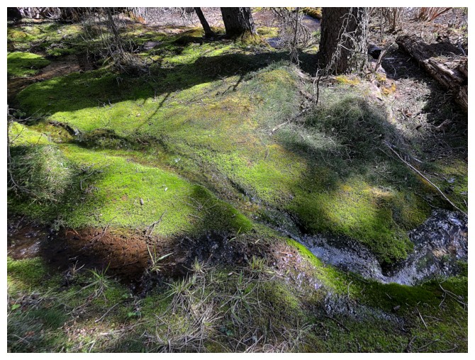
The mossy section means you are really close to the end
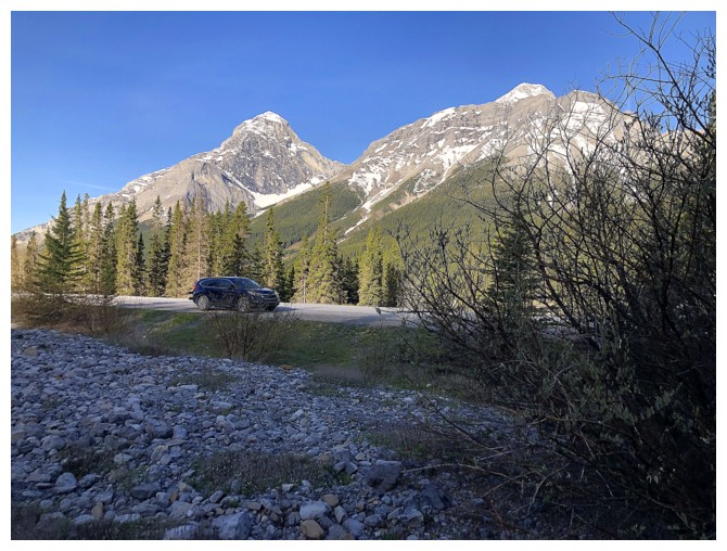
Lougheed (left) and Sparrowhawk from the road
The End
LOG