Mist Mountain II
July 1, 2025
Mountain height: 3140 m
Total elevation gain: approximately 1400 m
Ascent time:
5:00
Descent time:
2:20
Scrambling with
Mark.
Mist Mountain
is one of those peaks that I’ve always wanted to repeat, but via a different
route than the Kane difficult scramble route I used in 2003. I had attempted Daffern’s easier
route via the south side, in 2002 but was turned back when super violent winds
threatened to remove me completely from the mountain! Our plan for the day was
redemption on the Daffern route.
We were
surprised to find the parking area quite full at 8 am. 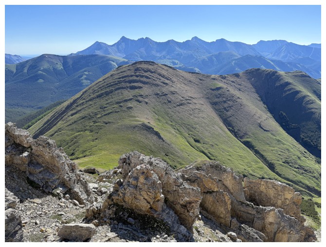 Had Mist become that
popular? Yes and no. Most of the parties we encountered were on their way to the
col between Mist and Nameless Ridge (an outstanding viewpoint in itself), or
the now very famous Mist Mountain Hot Springs.
Had Mist become that
popular? Yes and no. Most of the parties we encountered were on their way to the
col between Mist and Nameless Ridge (an outstanding viewpoint in itself), or
the now very famous Mist Mountain Hot Springs.
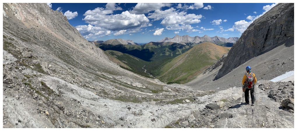
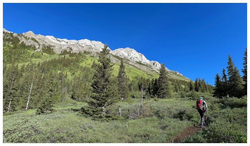
It took us
about an hour to hike from the parking lot to the col, but what a scenic affair
it is, once out of the trees. The lush green slopes on both sides of the valley
and beautiful rock on Mist’s southeast ridge were cause for many photos. Needless
to say, the view at the col was even better, now featuring a host of peaks to
the north and east.
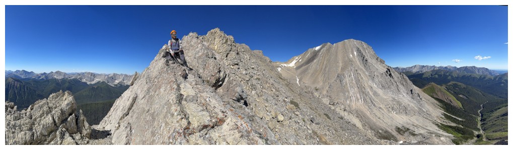
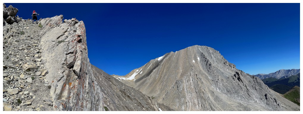
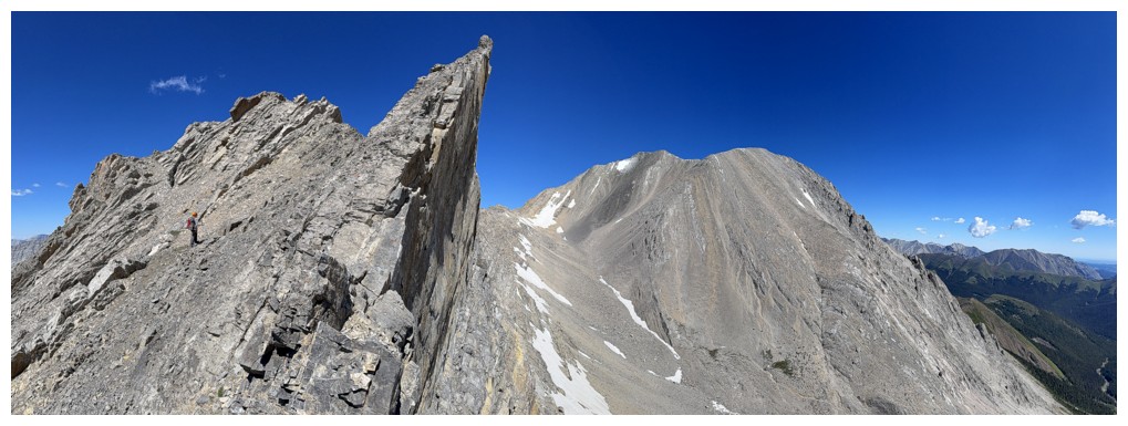
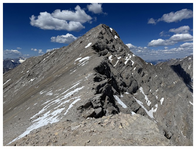
Although intent
on following the Daffern route throughout, that cool rock on Mist’s southeast ridge
got the better of us. Suddenly we were ascending a very steep and very
foreshortened scree/rubble slope towards the ridge. 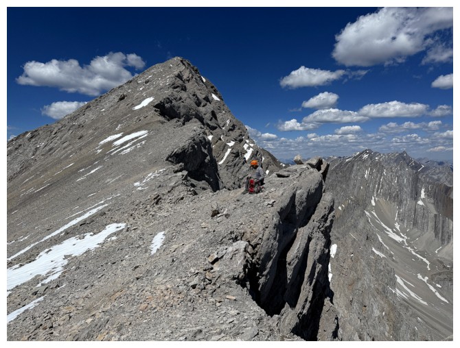 Upon reaching the stunning
ridge, we turned northwest, then north, hoping to be able to follow this ridge all the way to
the summit.
Upon reaching the stunning
ridge, we turned northwest, then north, hoping to be able to follow this ridge all the way to
the summit.
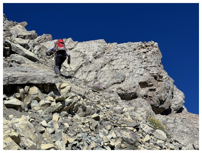
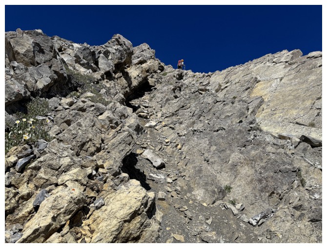
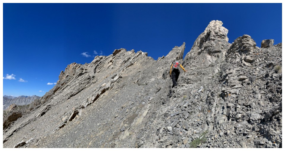
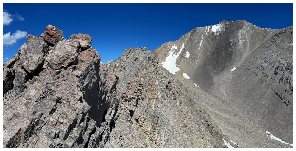
That didn’t
happen. The bipolar ridge alternated between easy and terrifying – at times super
wide and at other times super narrow and exposed. We would make good progress
and then be stymied by terrain beyond our capabilities. The right side of the
ridge worked occasionally to bypass the narrow sections, but a cliffband below
prevented us from escaping down to the valley below, where Daffern’s easy route
sat.
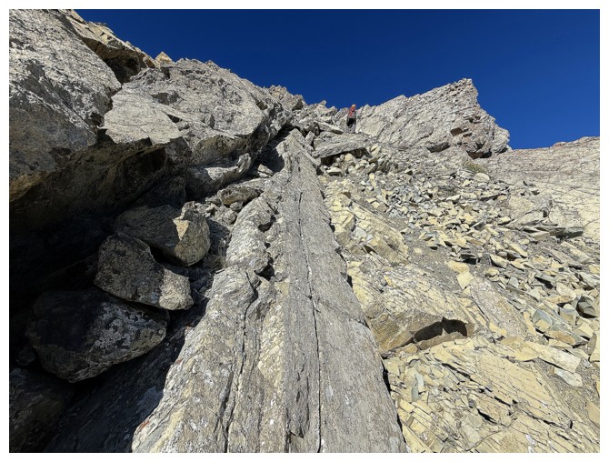
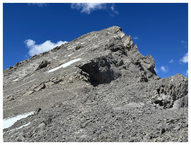
Further along,
the left side allowed us to keep moving, but soon the ridge transformed into a
jagged array of near-vertically tilted rock. Progress on the ridge was an
impossibility and bypassing the difficulties on the left side would have
required a huge elevation loss. Disappointed, we thought we were done here and
considered bailing down the west side of the mountain and perhaps summiting
Mount Lipsett as a consolation. However, a last-ditch effort to find a route on
the right side paid off. Mark led us across and down rubble and snow slopes to
the valley and trail below. Although we were relieved to be back on easy
terrain, it was a little comical to realize we had spent 2.25 hours on that
ridge to eventually make it to a point that would have taken no more than 30
minutes to reach had we stuck to the trail. No regrets, however – that ridge
provided outstanding scenery and certainly a thrilling experience you wouldn’t
get down in the valley.
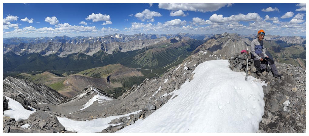
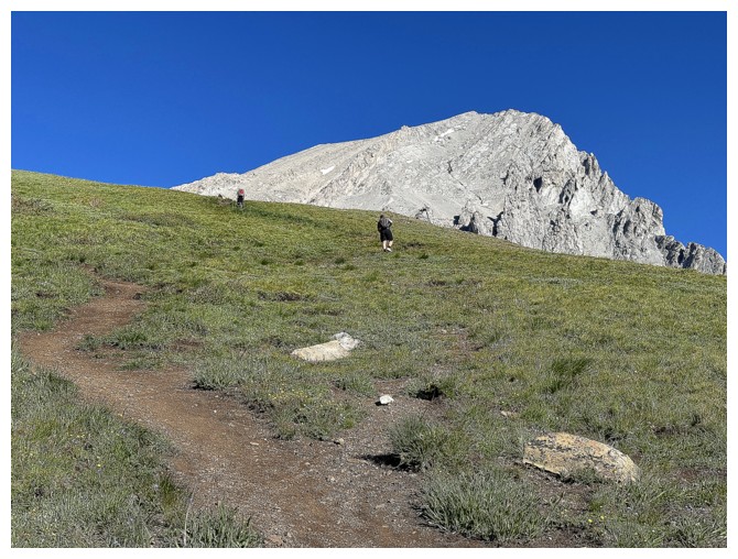
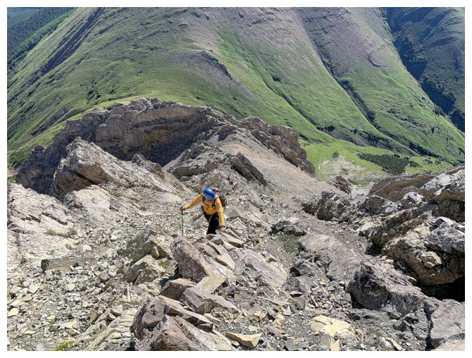
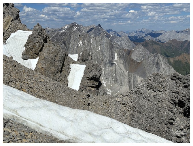
Of course, the
summit of Mist would be attained easily now that we were back on route.
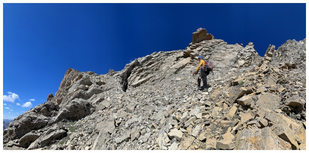
However, a “skipping through flowery meadows” frolic it was not! The slope that
goes up to Mist’s south ridge is steep and brutally foreshortened. Also, the
footing is totally conducive to a rapid, scree-surfing descent, but conversely,
a gruelling “two steps up, one step down” ascent.
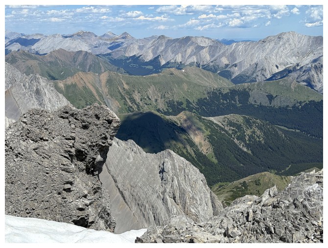
After what
seemed and felt like an eternity we reached the ridge, deciding to leave our
backpacks and run (actually more of a lumbering plod given our energy levels)
up to the summit. First, I quickly went up to the top of a nearby highpoint. A
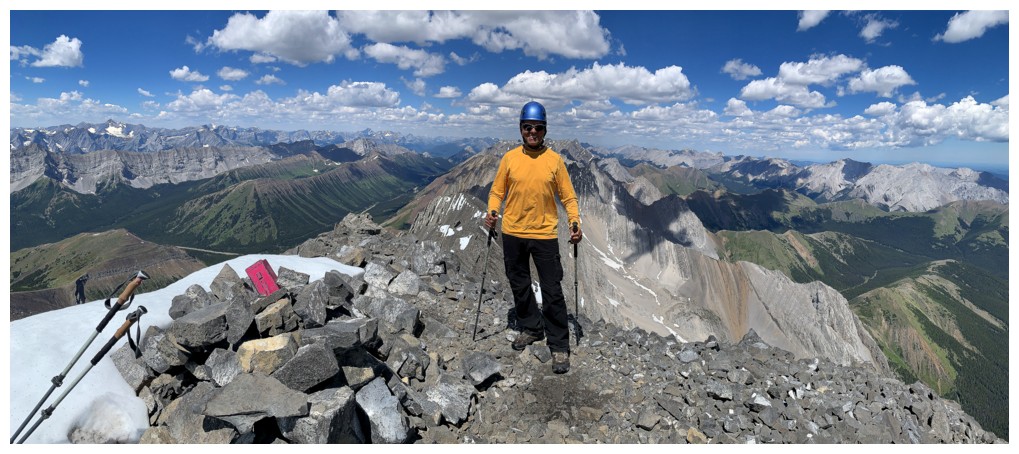
little lighter we arrived at the summit of Mist exactly 5 hours after leaving
the car – not an awful ascent time, in light of the 2 hour detour we took. A
few clouds had moved in by this time, but the summit view was still
outstanding.
There would be
no detours for descent! We followed the Daffern route in its entirety, enjoying
the plunge-stepping scree and then a well-worn trail down the valley, back to
the col, and out to the parking area.
A fantastic
return to a familiar peak. Although Mark and I are both far more conservative
in our route choices in the mountain these days, I’m glad we still have a
little of the adventurous spirit left in us!
Epilogue: after
reviewing our Nameless Ridge trip from 2010, I realized we had gained the first
highpoint of Mist’s southeast ridge on that trip (GR492007). Bewildering that
neither Mark nor I remembered a single detail of any of that!
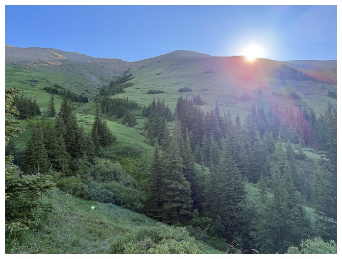
The Sun rises over Nameless Ridge
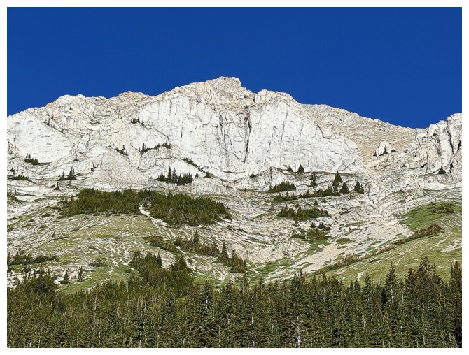
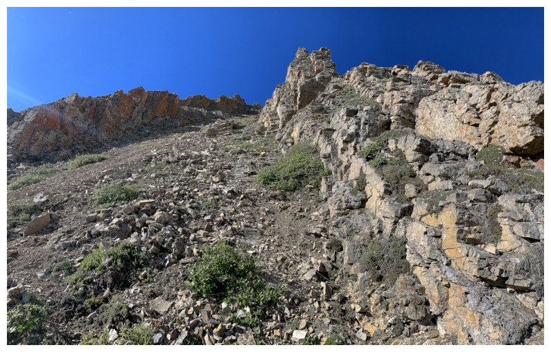
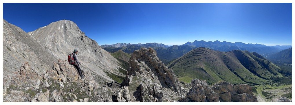
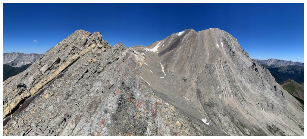
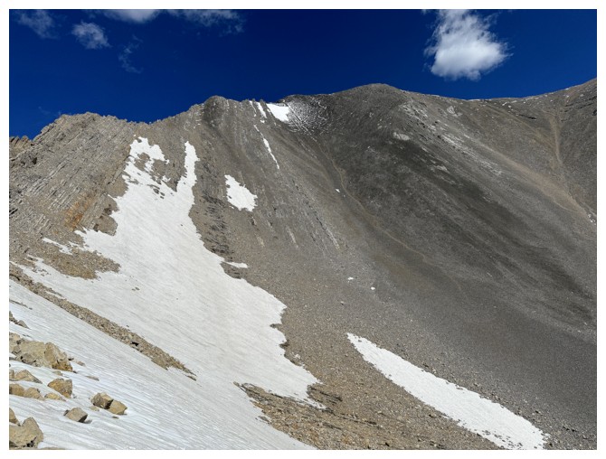
First view of the amazing rock on Mist's southeast ridge
Close-up
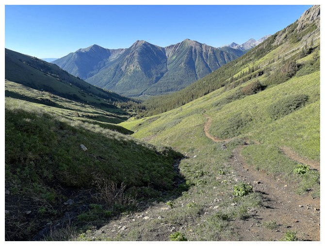
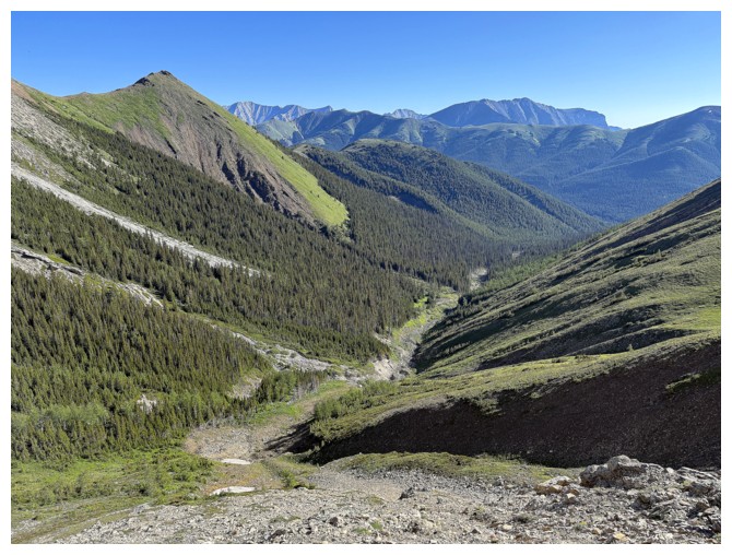
Looking back down the valley we just ascended. Odlum Ridge in the background.
Getting close to the col
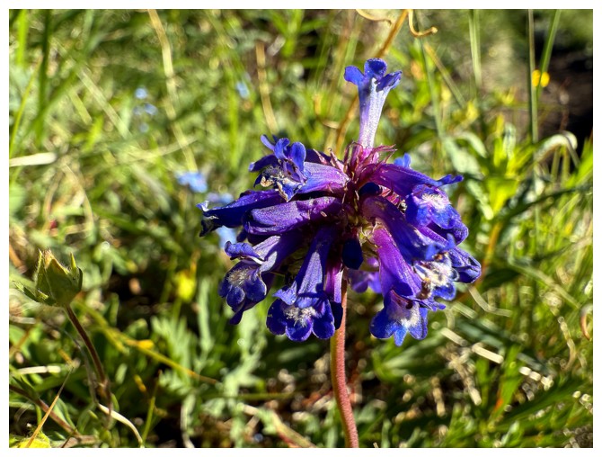
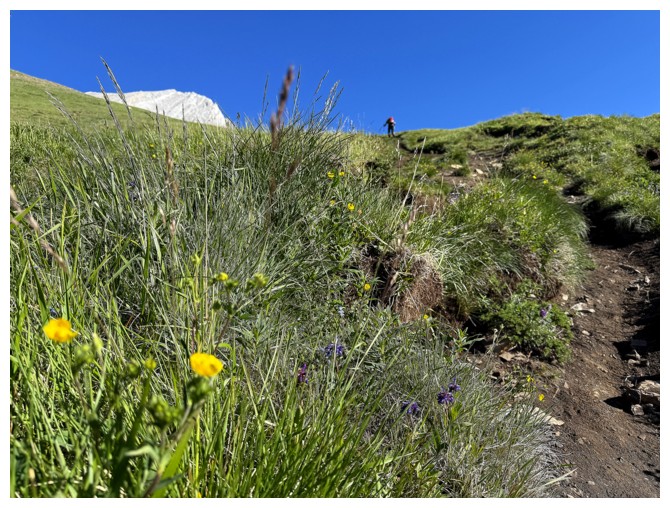
Getting close to an arctic lupine
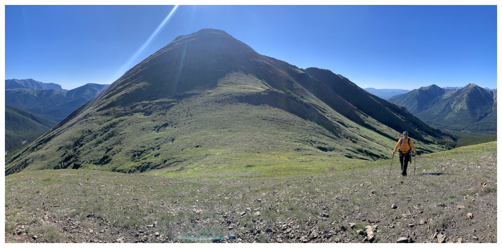
The southeast outlier of Mist Mountain appears
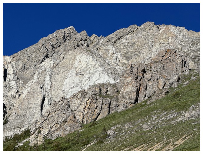
Still obsessed with the rock of the southeast ridge
Steps away from the col. Nameless Ridge behind.
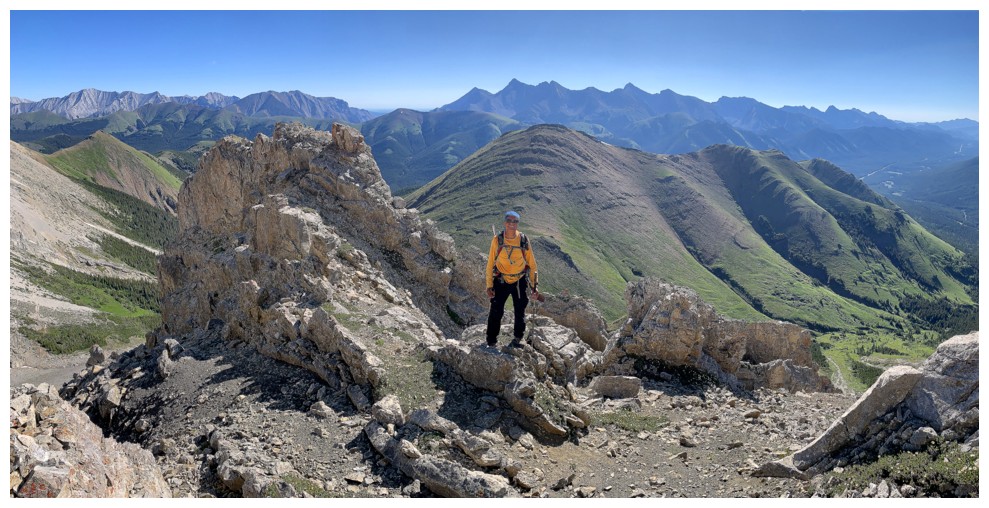
Surveying the routes ahead
Nice view to the northeast
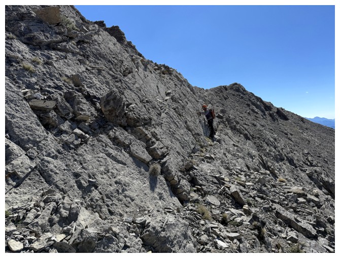
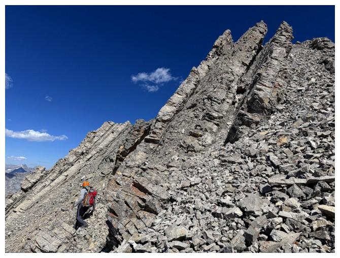
Passing by some cool rock on the left side
So much for sticking to the Daffern route - we are now heading up to the southeast ridge

Tedious terrain to get there
Mark takes a different line up to the ridge
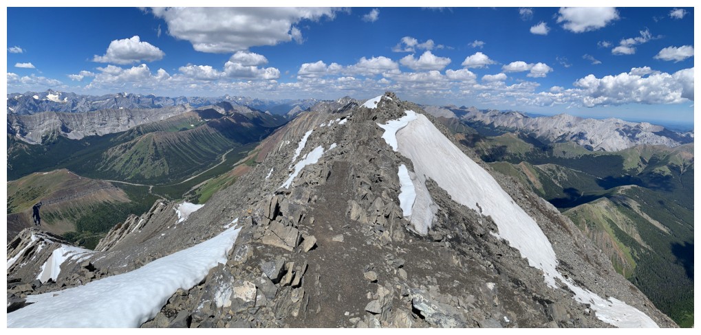
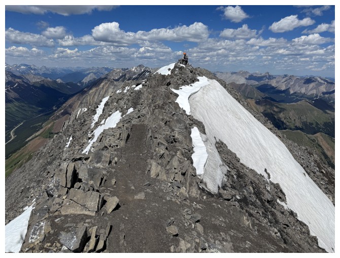
Looks close but the ridge is still far away
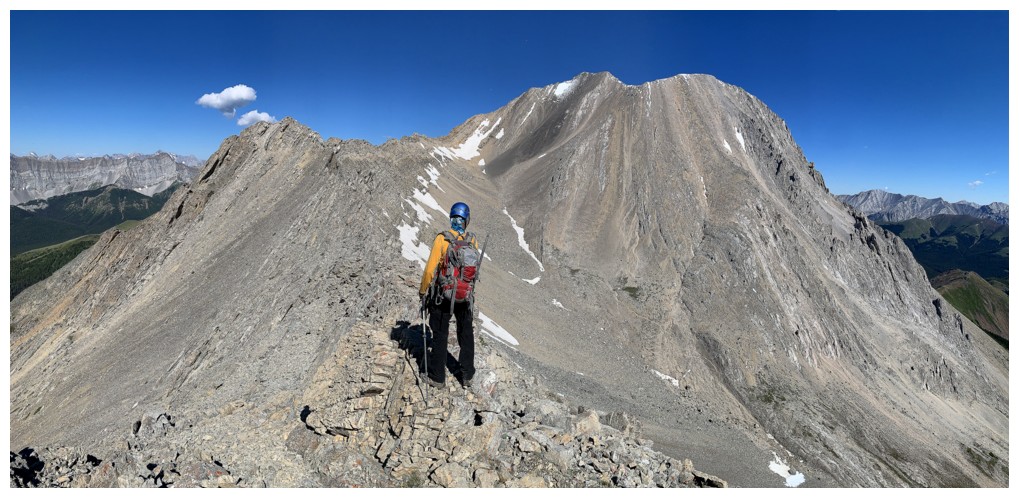
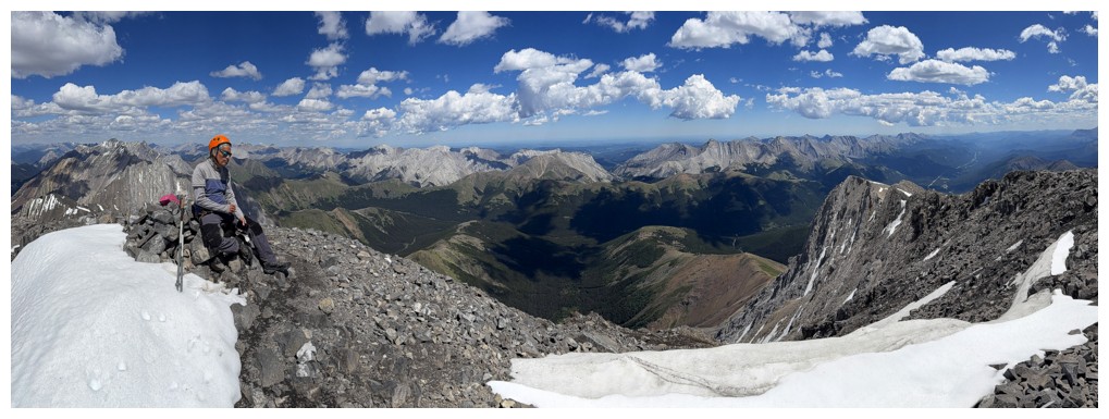
Arrived and taking a much needed break

And time for some unapologetic posing
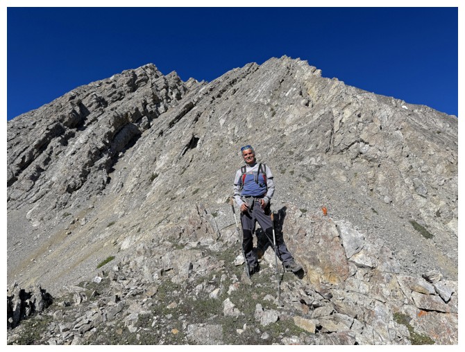
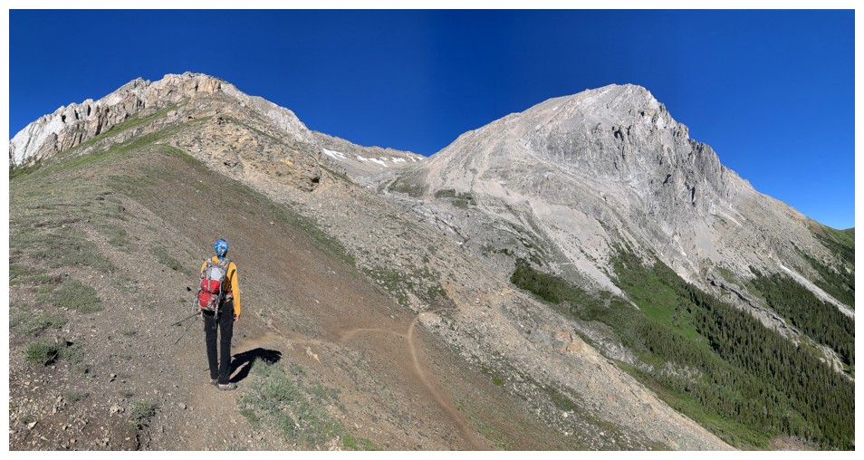
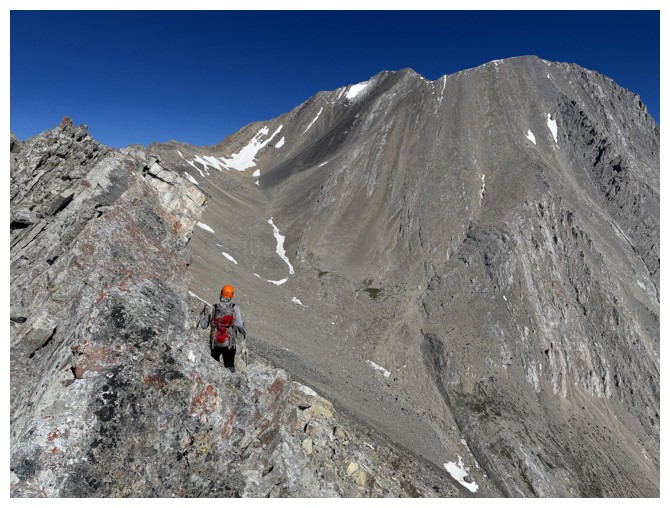
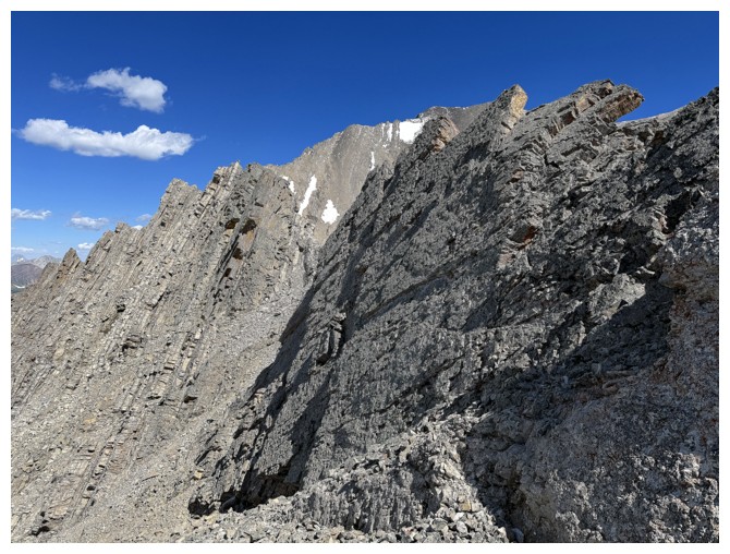
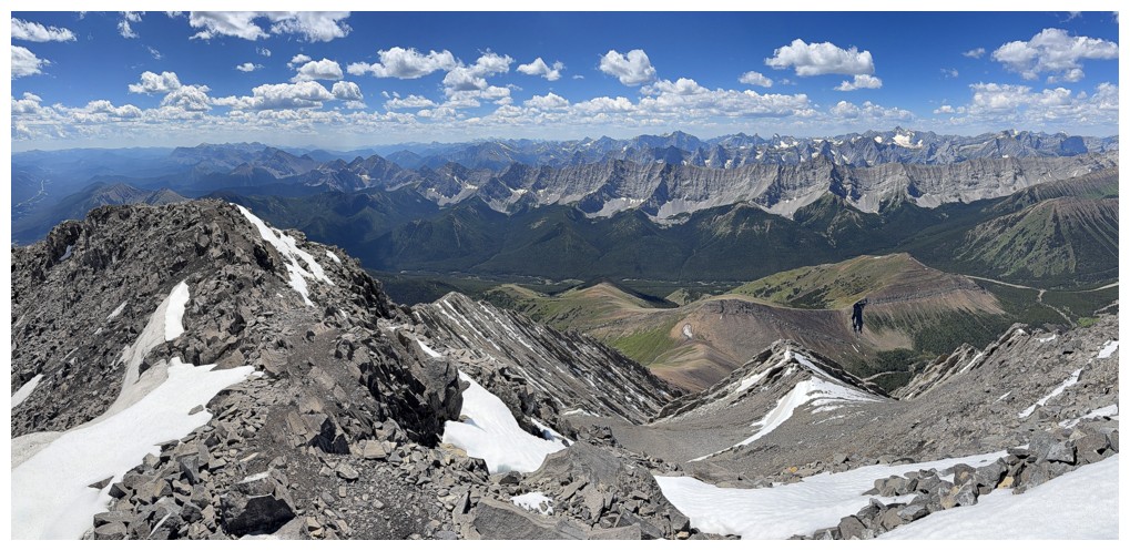
Mark and the next section of the route
Stunning scenery
Just the route ahead
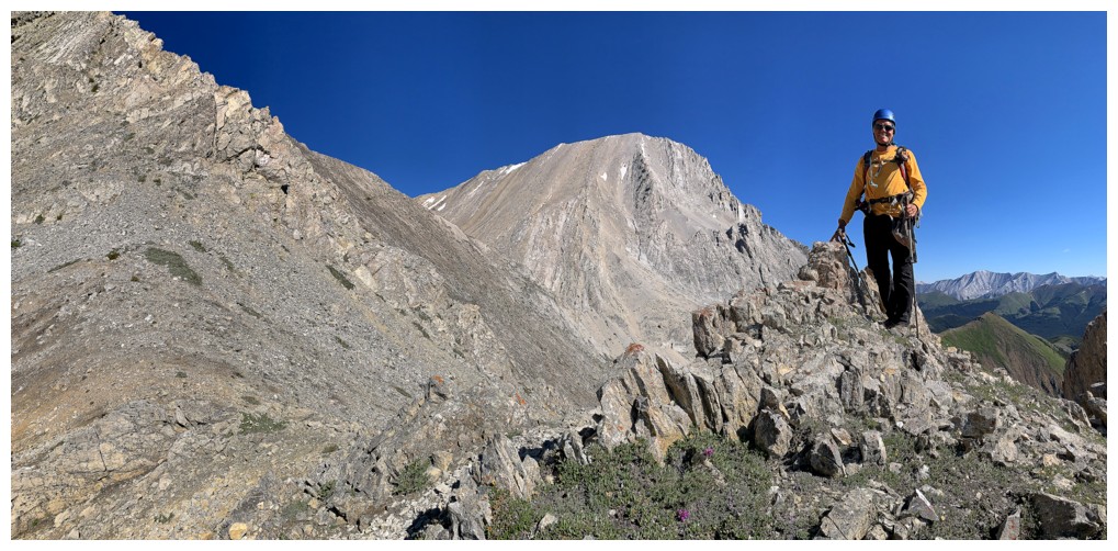
But more posing is needed first!

Mark leads the next part
Same as above with some flowers
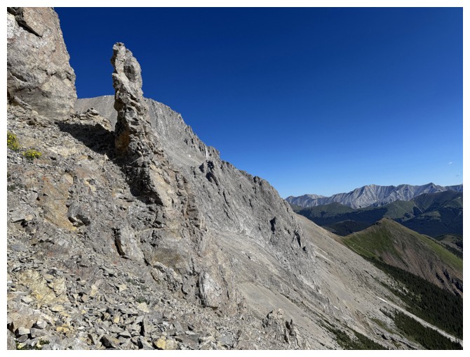
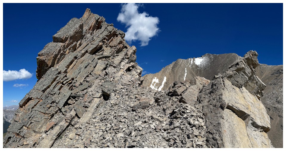
Distinctive pinnacle. You'd think one of us would have remembered passing by this feature in 2010!
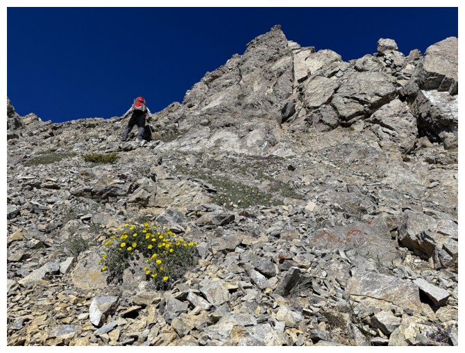
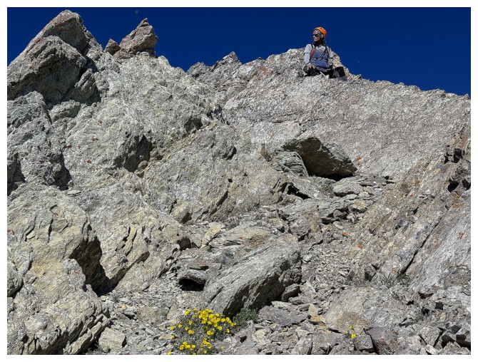
Getting steeper but the rock is fairly solid
My view of Mark
His view of me
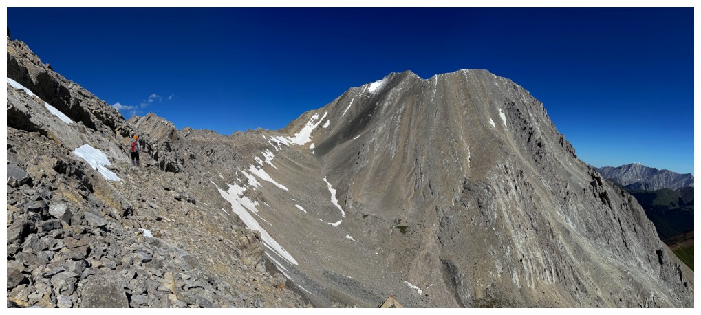
Lots of cool rock to enjoy en route to the first highpoint
Same as above
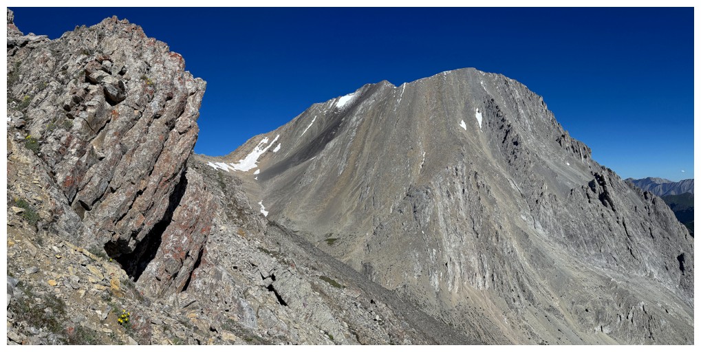
And again. The summit of Mist is now visible in the centre. The highpoint to the right is Mist's southeast outlier.
Mark reaches the highpoint at GR492007. With the new technology we use
to navigate the mountains, grid reference numbers (GR's) have faded
into relative obscurity.
Last few steps for me
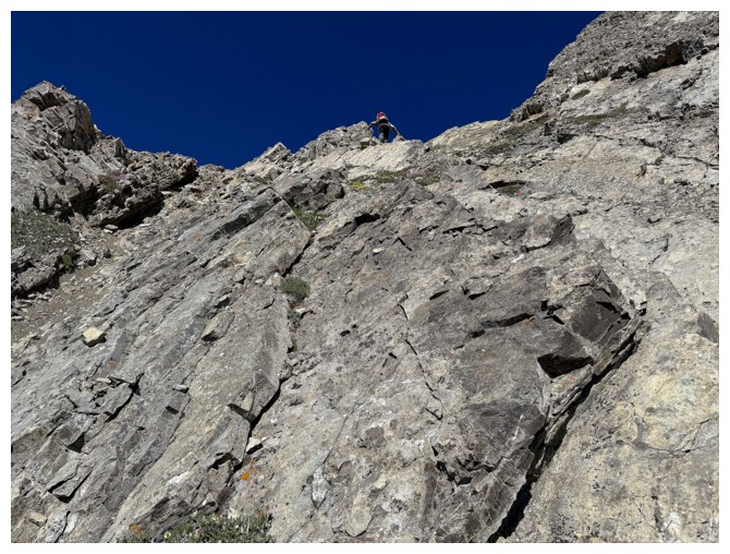
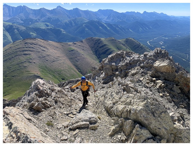
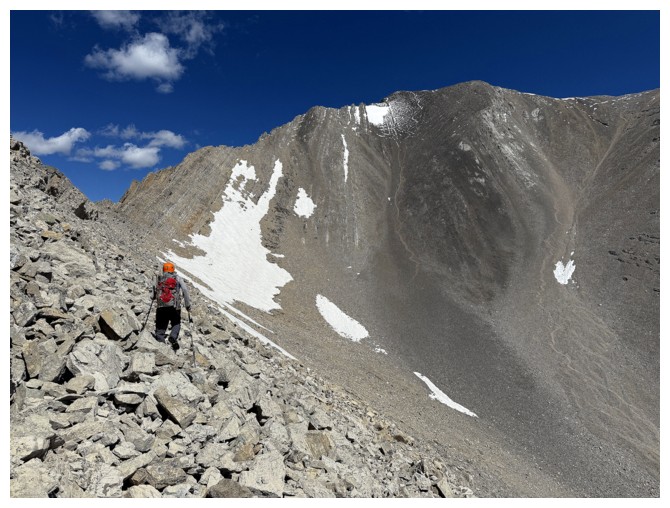
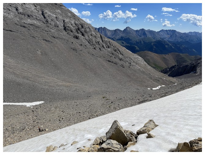
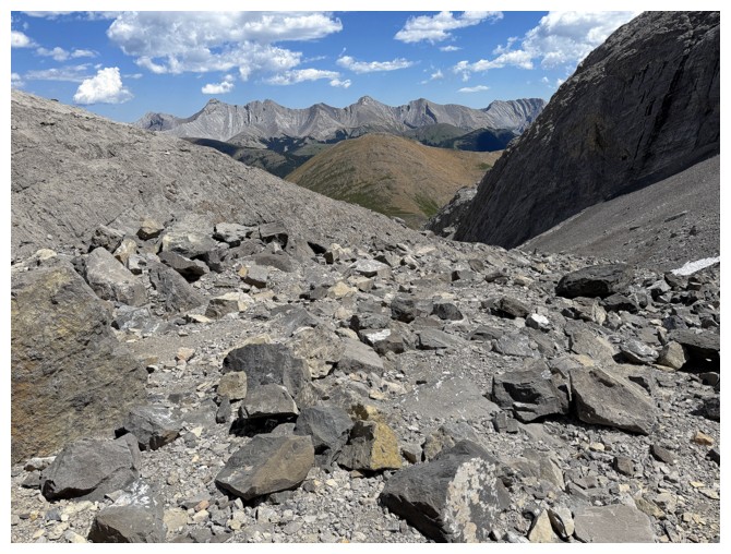
Continuing the trip on easy terrain, but that won't last long
Things are getting more serious already
Bypassing the exposed ridge, by dropping down to the right side of it
Traversing. We looked for a route down to the valley below, but there's a huge cliff below us
Back on the ridge
Now on the left side
Looking down a potential escape route if the ridge doesn't go
Still going forward though
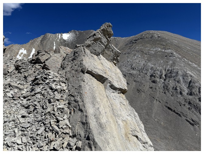
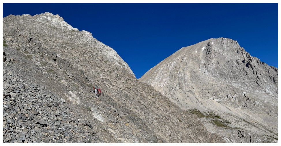
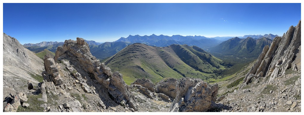
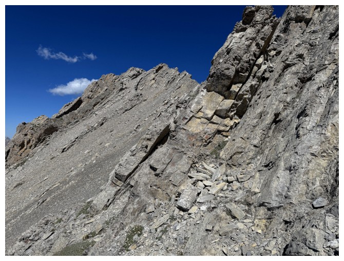
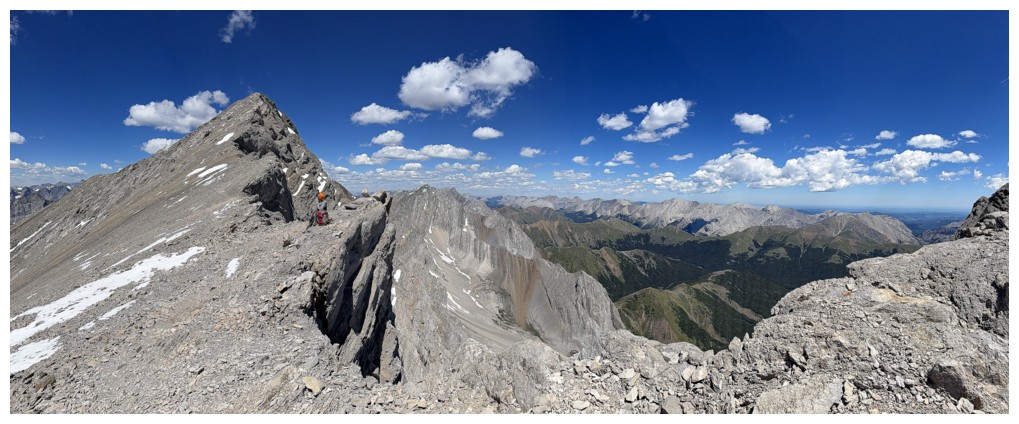
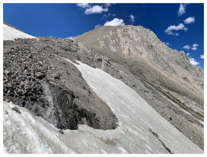
Approaching one of the more dramatic scenes of the trip
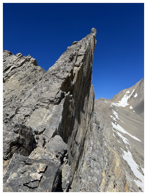
There it is. This overhanging slab is super smooth on its east side and super impressive.
Better view of the surroundings
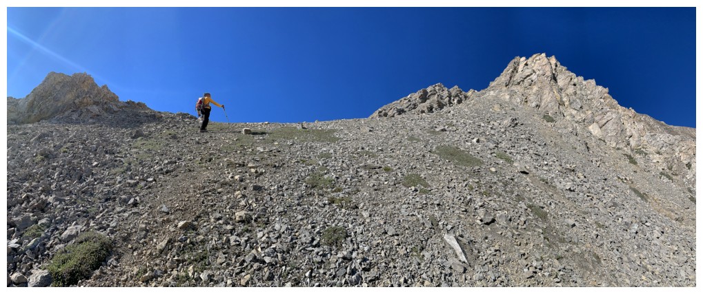
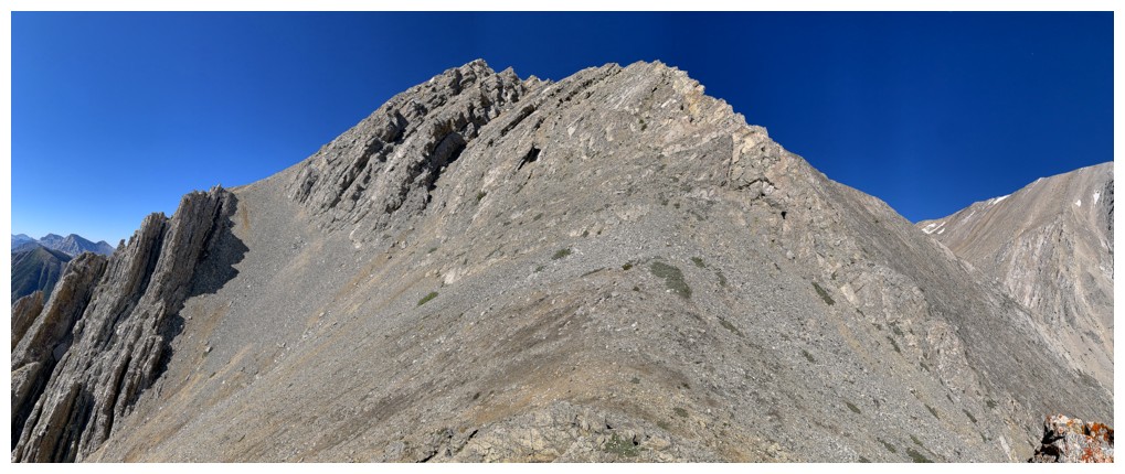
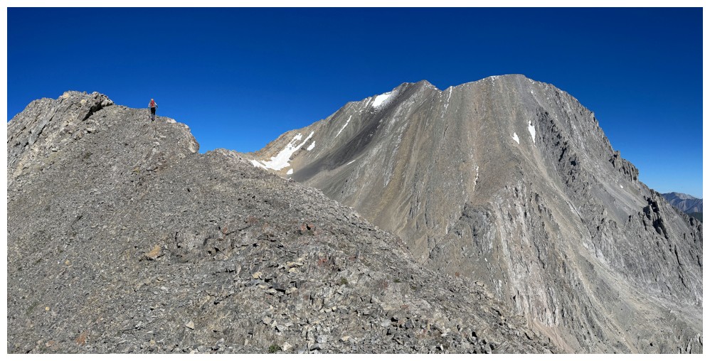
The next highpoint is close by and we are hoping for easier terrain beyond

And yes, it does start off easy...
...but then it's not
Circumventing tough stuff on the left side again
This could be the end of the line. The tilted strata at the left looked way too difficult to get around.
Last-ditch effort to find a route around the right side
There is one!
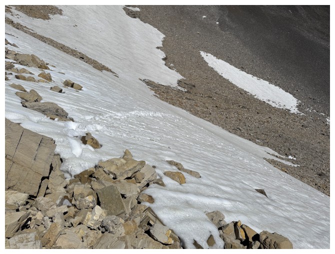
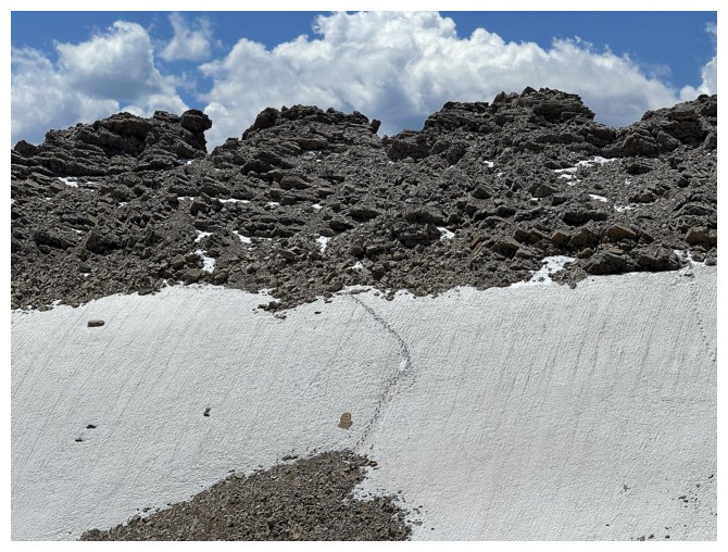
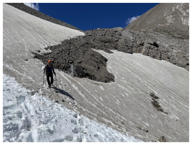
The snow helped a little in getting down to the valley
A comical look at a point on the trail that would have taken us about 30 minutes to reach from the col, but we took 2.25 hours!
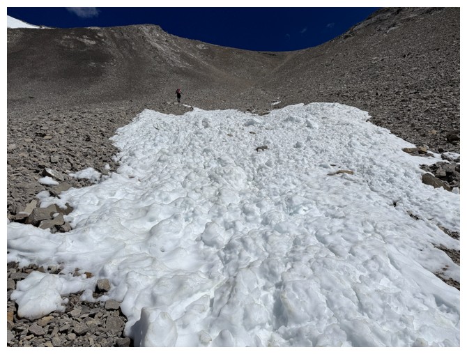
Following Mark's tracks in the snow

And up we go
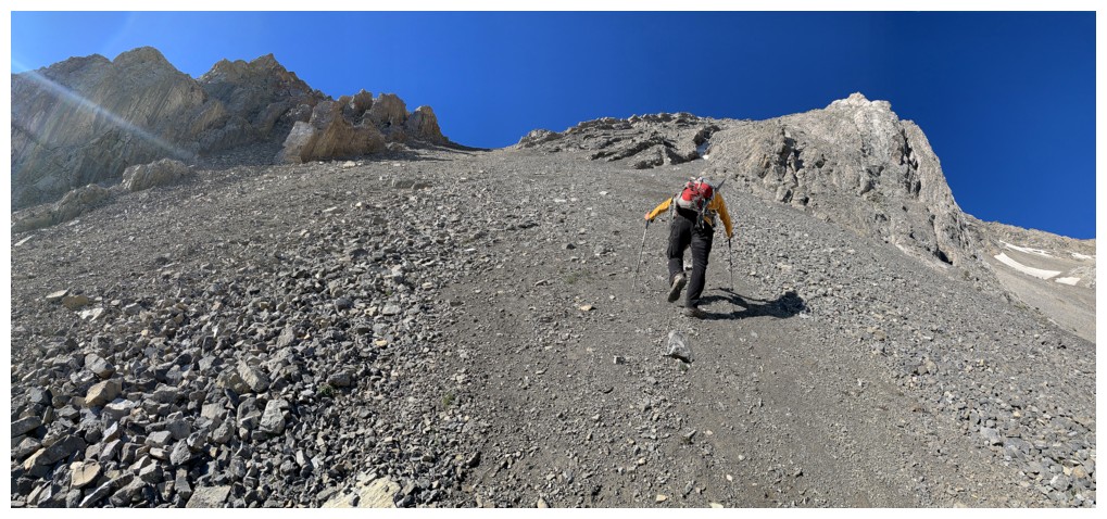
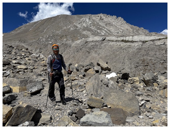
A firm layer of snow all the way to the ridge would have been great
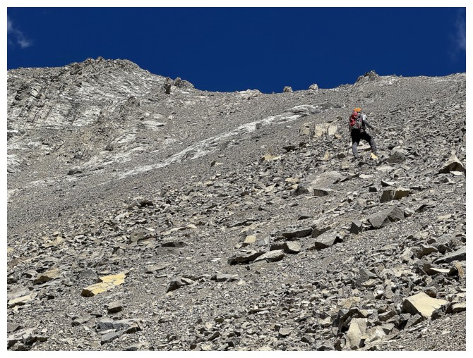
Instead we get a tedious, steep, foreshortened slog
Sometime later (actually much later!) Mark approaches the ridge
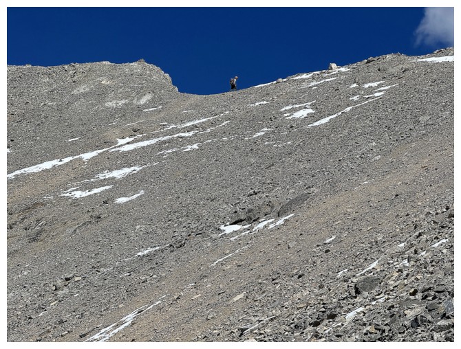
On the ridge, with the summit at the left. Mark ditches his backpack and heads for the summit while I go to the nearby outlier.
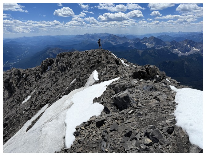
There's someone up there already
Mark is just a dot now

View from the outlier
Now heading for Mist's summit
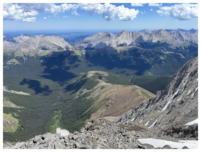
View to the north from the ascent slopes
Northeast
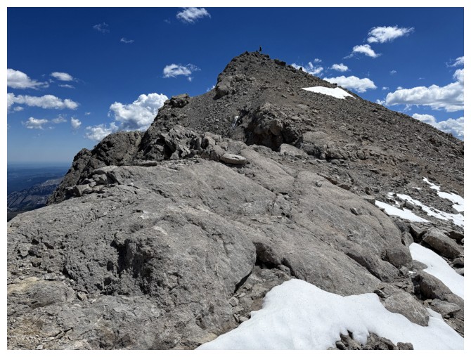
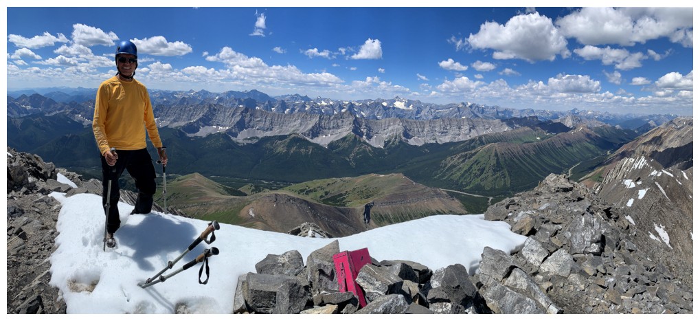
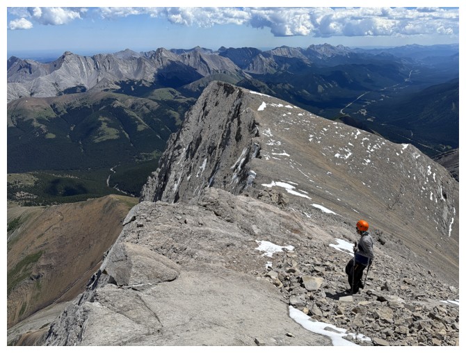
Last 100 m to the top
Mark is already there
A spent older brother. In fairness, I was spent too!
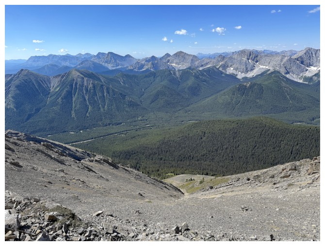
View to the west
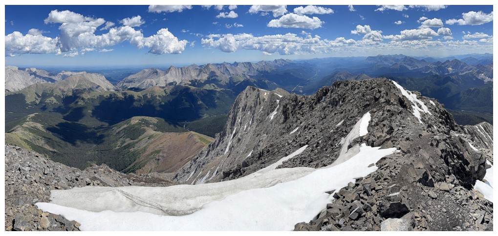
View to the south
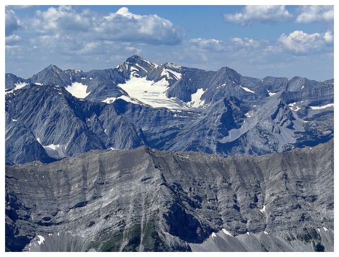
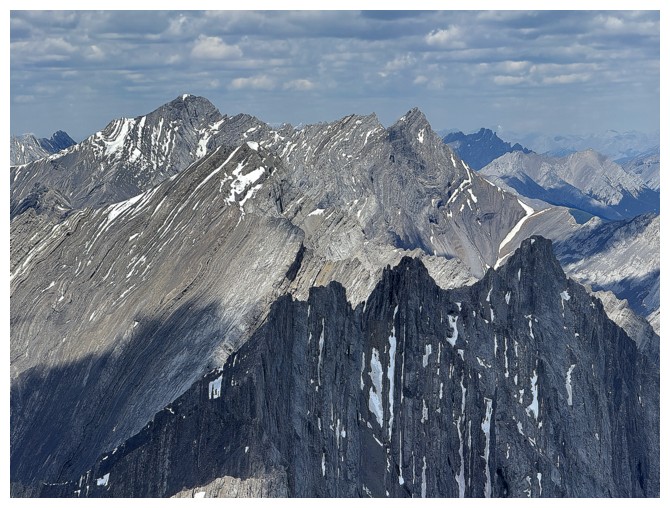
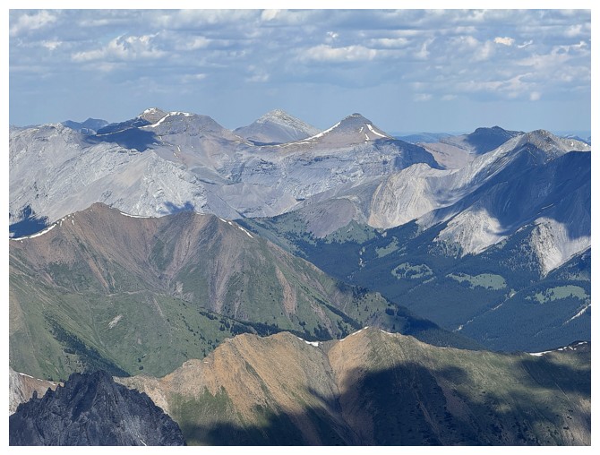
The east side of Mount Joffre
Mount King George, just left of centre
Mount Sir Douglas, just left of centre
A duo of scramblers on their way to join us
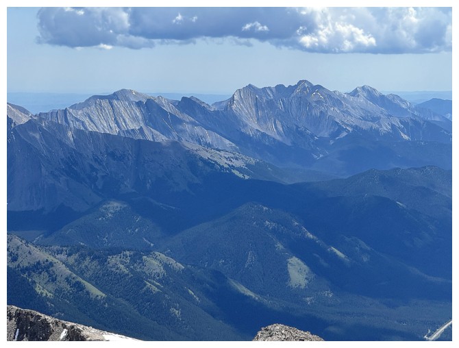
East
Last pose of the day
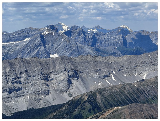
Scary ridges in front and Mount Rae at the left
The Banded/Outlaw/Cornwall/Glasgow quartet
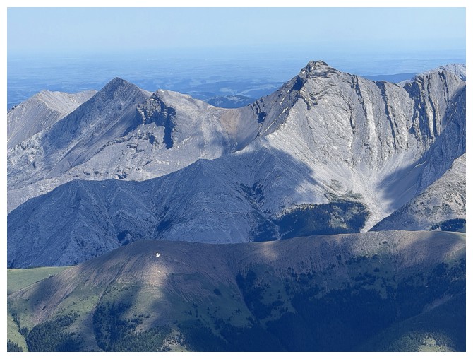
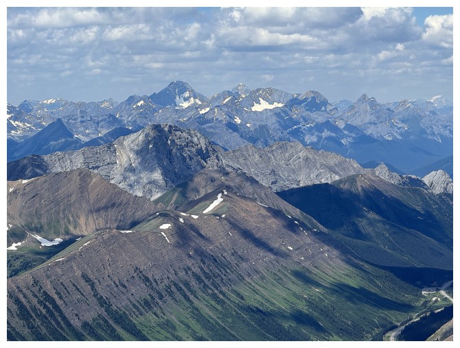
Crumble Peak, right of centre
Mount Head and Holy Cross Mountain to the right
Heading down
A nostalgic look at our track down the snow from a few hours earlier
Mercifully easy terrain to descend compared to our ascent route
Spent, but happy to be on a good trail
The outlier
One section of snow to get by. Clearly the cleaner snow has slid recently.
Almost back to the col
Parting look at Mist
Guess the pose at the summit wasn't the last
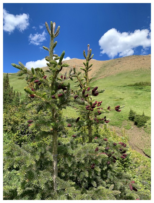
Beautiful pines trees near the end of a beautiful trip
The End
LOG