Rising Wolf Mountain
September 7, 2019
Mountain height: 2900
m
Elevation gain: 1336 m
Ascent time: 5:15
Descent time: 4:10
Scrambling with Mark.
We gambled that the forecasted clear skies would eventually materialize
and lost that bet – sort of.
As the highest mountain in what Gordon Edwards describes as “the most brightly
colourful portion of the park”, an ascent of Rising Wolf Mountain demands
perfect or near perfect weather. The satellite images we checked the morning of
the attempt seemed to indicate that the heavy cloud cover was moving out of the
area quickly and so we just went for it.
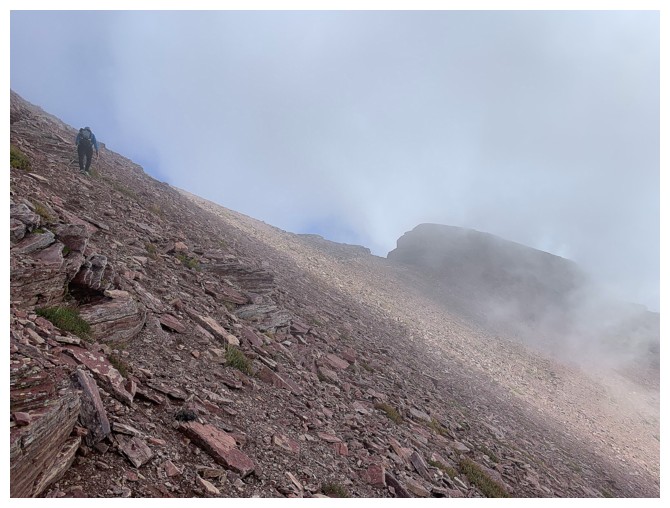
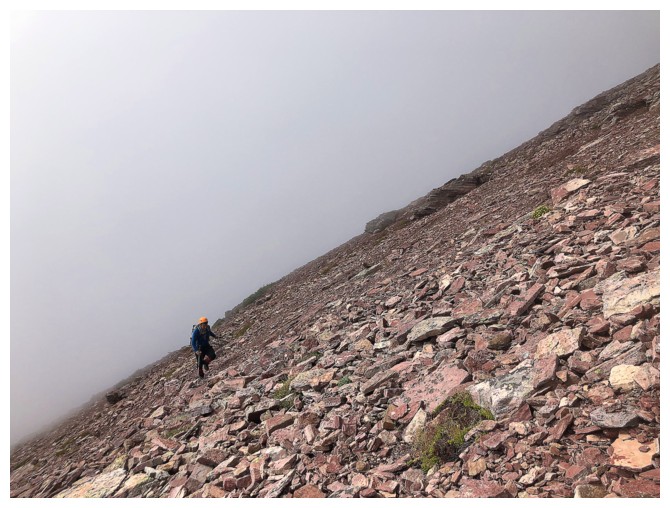
 Visibility for the drive into the area was almost zero, as were the
first several hours of the ascent. We remained optimistic, even though we
couldn’t see more than 20 m of front us. Trying to follow Blake Passmore’s
photo description of the south face route became an exercise in futility. Nevertheless,
we were able to find a relatively easy route up the beautiful red argillite
slopes.
Visibility for the drive into the area was almost zero, as were the
first several hours of the ascent. We remained optimistic, even though we
couldn’t see more than 20 m of front us. Trying to follow Blake Passmore’s
photo description of the south face route became an exercise in futility. Nevertheless,
we were able to find a relatively easy route up the beautiful red argillite
slopes.
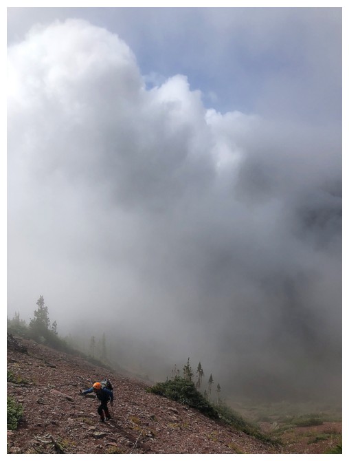
 We were overjoyed when there finally was a break in the clouds and thought
this would be the start of a complete clearing of the skies. And it was –
unfortunately that happened about 8 hours after the first break! Every time the
clouds lifted, a new batch would form in the valley below and cover the
mountain tops we were longing to see. Even with the clouds it was easy to see
that Dr. Edward’s claim of “brightly coloured” was spot on. Rising Wolf itself is home to
almost every colour of rock you can conceive off and the surroundings mountains
are no different.
We were overjoyed when there finally was a break in the clouds and thought
this would be the start of a complete clearing of the skies. And it was –
unfortunately that happened about 8 hours after the first break! Every time the
clouds lifted, a new batch would form in the valley below and cover the
mountain tops we were longing to see. Even with the clouds it was easy to see
that Dr. Edward’s claim of “brightly coloured” was spot on. Rising Wolf itself is home to
almost every colour of rock you can conceive off and the surroundings mountains
are no different.
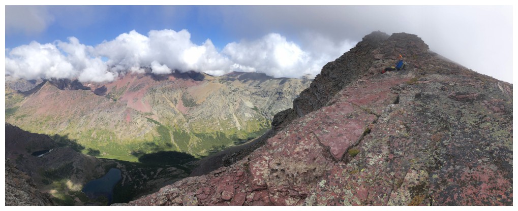
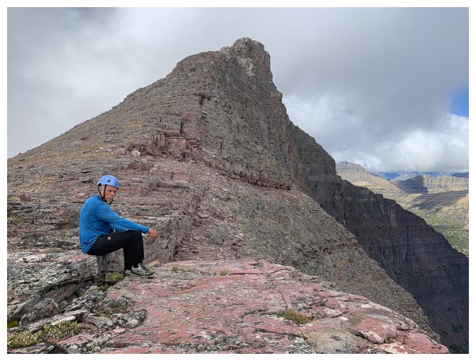
Upon reaching the ridge, we slowly plodded to the summit, enjoying the amazing
variety of rock and some pleasant scrambling (and of course scowling at the clouds
throughout). Although the forming and then dissipating clouds were a source of interest,
we were both ready for clearer skies. As such we waited at the summit for about
an hour. Unfortunately, there was little improvement and, unlike my recent 3+ hour
stay at the top of Mount Siyeh waiting for better weather, we didn’t have the
luxury of that kind of time.
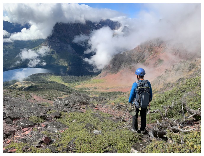
Deciding on a descent route was a tough decision. If the weather did improve
it would have been great to see the colourful scenery we had missed on the way
up. However, the alternate and easier but much longer via the west ridge and Dawson Pass
looked quite inviting and seeing some new scenery (not that we had seen too
much on ascent) had great appeal. We chose the latter and in retrospect were
both delighted with that decision.
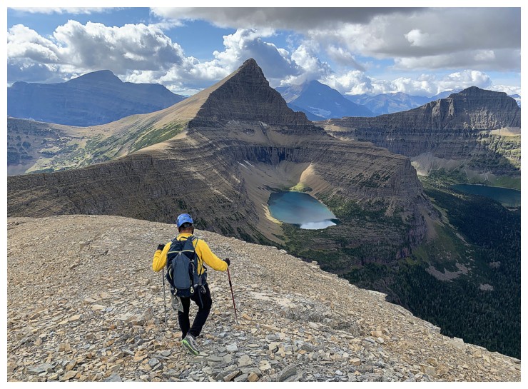
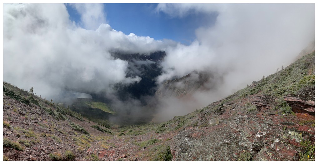
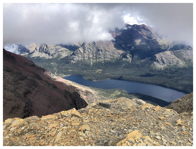
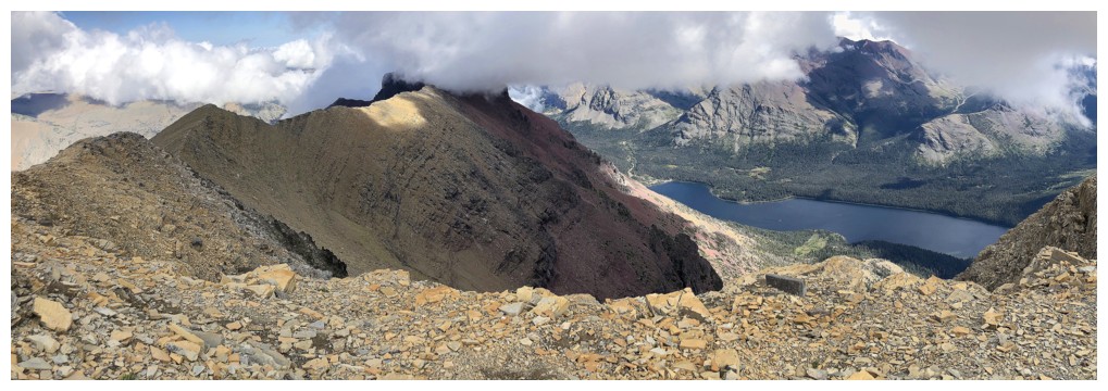
Although the west ridge was not half as colourful as the south face, it
did provide stunning views, especially that of Flinsch Peak above three
gorgeous lakes, humorously named Oldman Lake, Young Man Lake and Boy Lake. It was
then onto Dawson Pass and an easy, very scenic but somewhat tiring 10.3 km hike
back to the start. Along the way the clouds cleared almost completely, revealing
colourful views of Sinopah Mountain and Mount Henry.
Even with the finicky weather this was an outstanding day out, in one
the Montana’s most spectacular mountain areas. Like Mount Siyeh, I hope to return
someday, when the weather is more cooperative, to get a better look at this
awesome mountain.
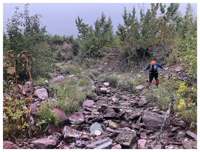
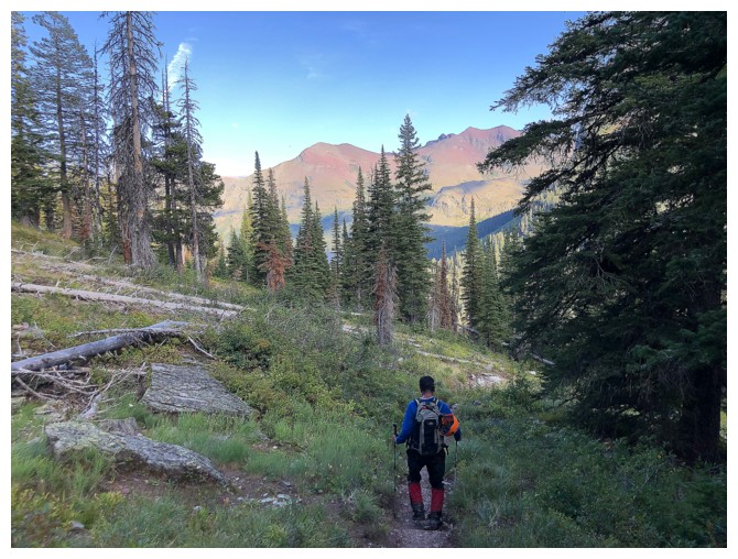
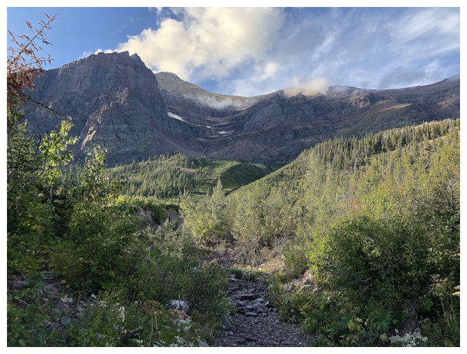
After leaving the main trail, a red argillitte drainage is followed for quite a while
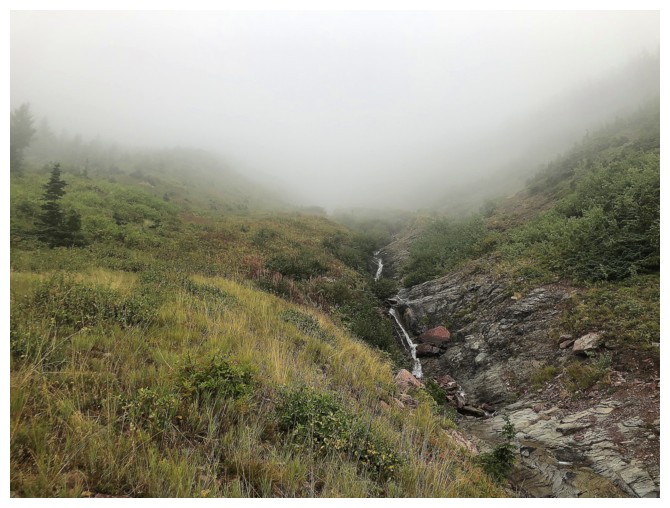
Without the low clouds, the drainage would have been very scenic
At least there's colourful rock underfoot, when you can't see anything in front of you
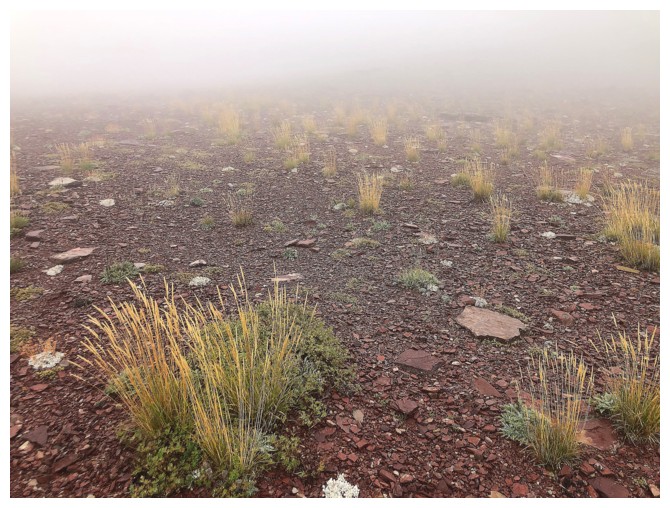
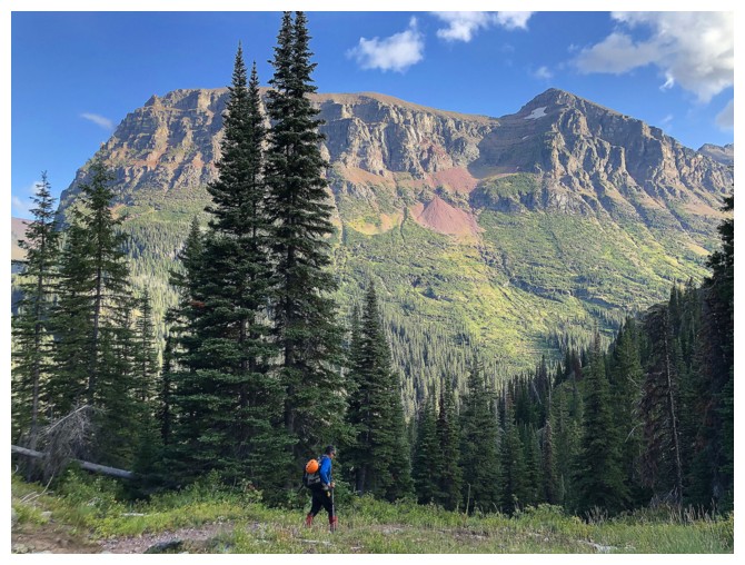
Typical views for the first two hours
Several, colourful rock bands appeared out of nowhere
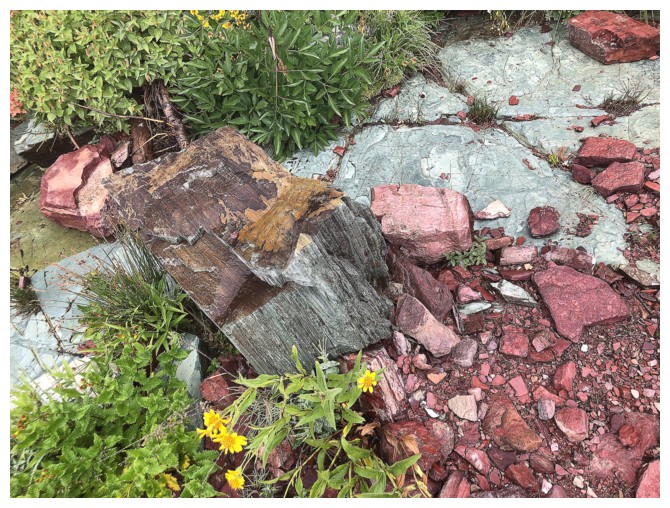
Mark spots an especially interesting chunk of red and green argillite
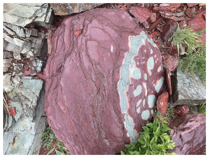
There it is
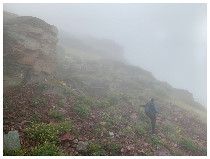
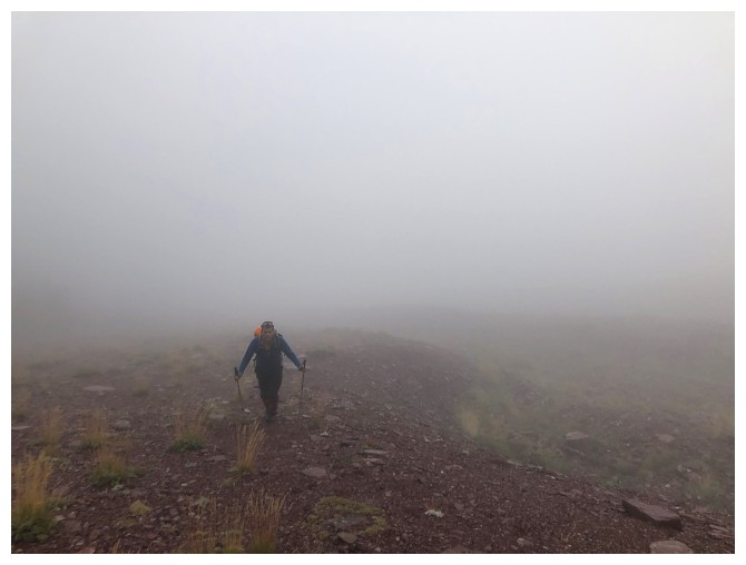
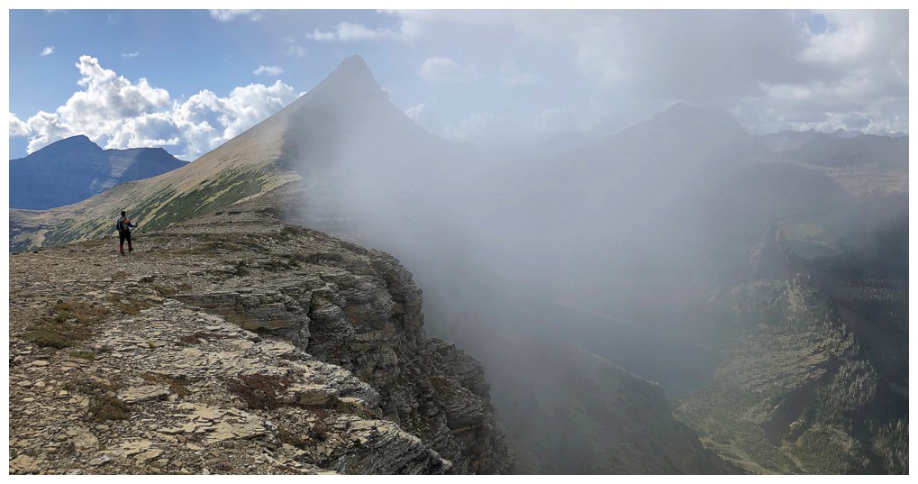
Back to hiking in the mist
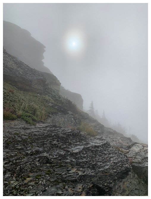
The Sun tries to break through the clouds
The first sign of clearing
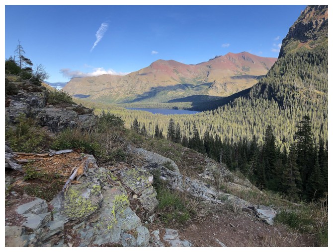
Getting better
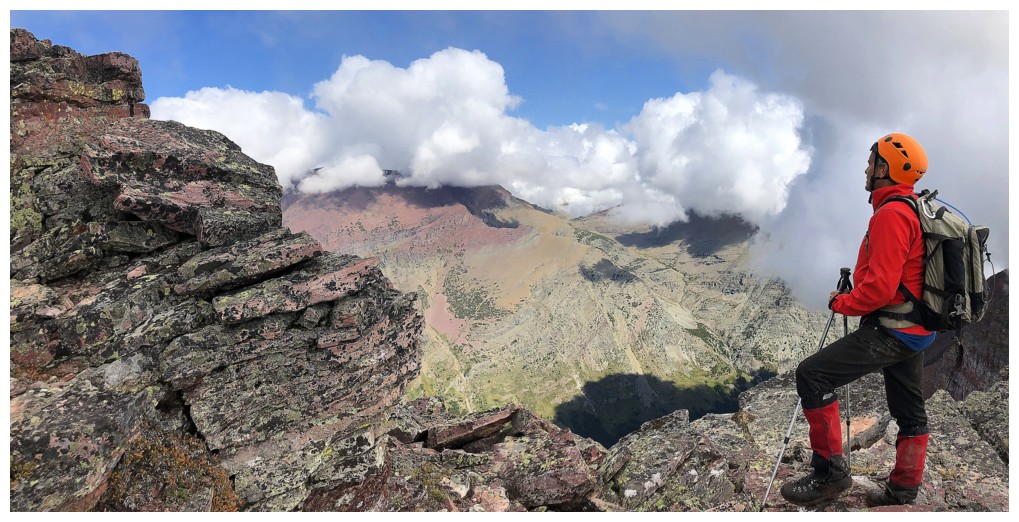
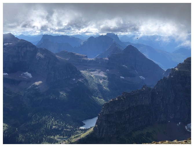
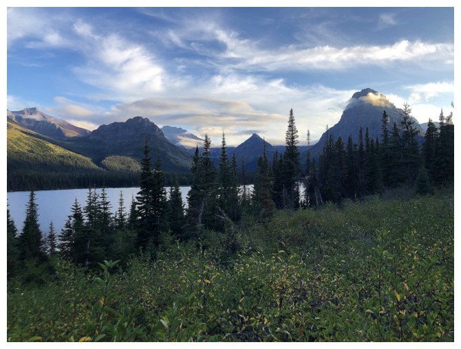
...and better. Our first view of Two Medicine Lake
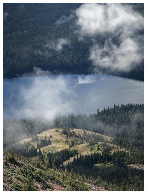
The boat "Sinopah" can be spotted crossing the lake throughout the day
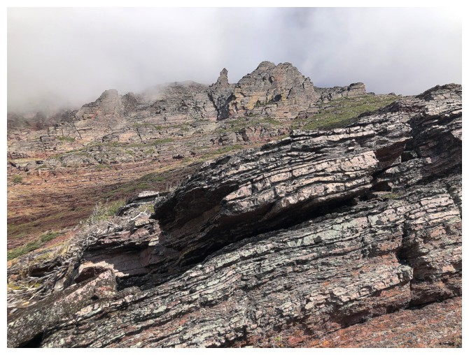
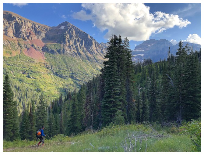
Some of the interesting rock on the slopes is revealed
Would have loved to go up through these rock bands, but weather conditions dictated otherwise
...then conditions indicated it may go
Too wet and cloudy to be negotiating steep terrain, so we stuck to the easy route
A little detour to check out the great rock
Beautiful, atmospheric scenery and conditions
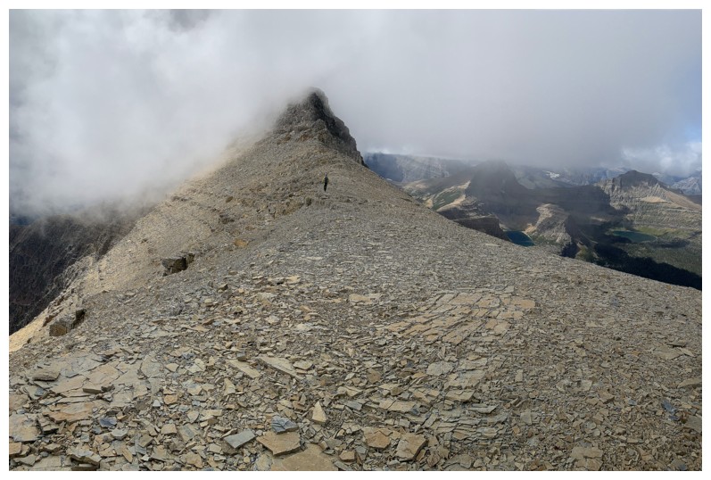
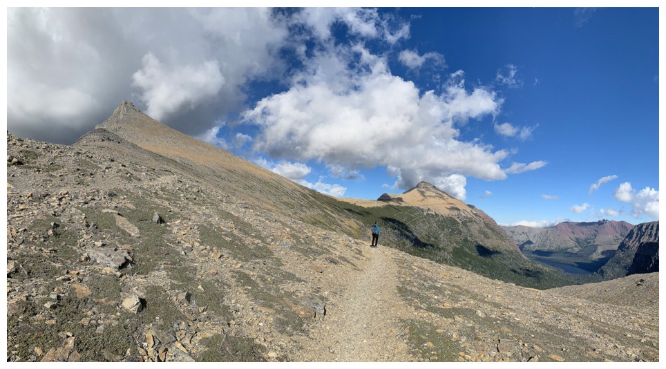
Heading for the ridge
And cloudy again behind us
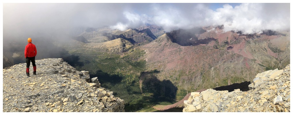
Taking a long break at the ridge, hoping the clouds will clear over Red Mountain to the north
Still waiting. The east ridge of Rising Wolf behind
On the move again, as are the clouds
The clouds refused to move off Red Mountain
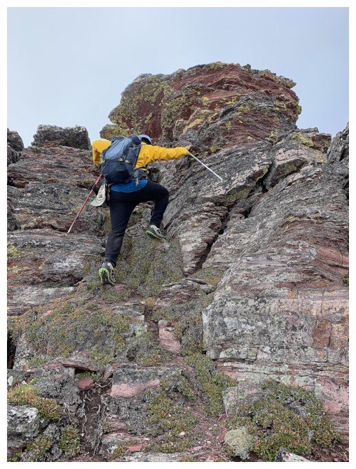
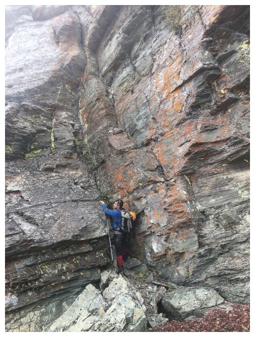
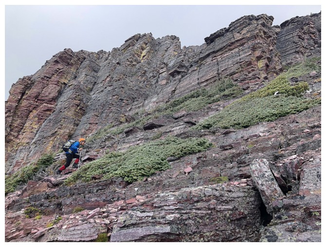
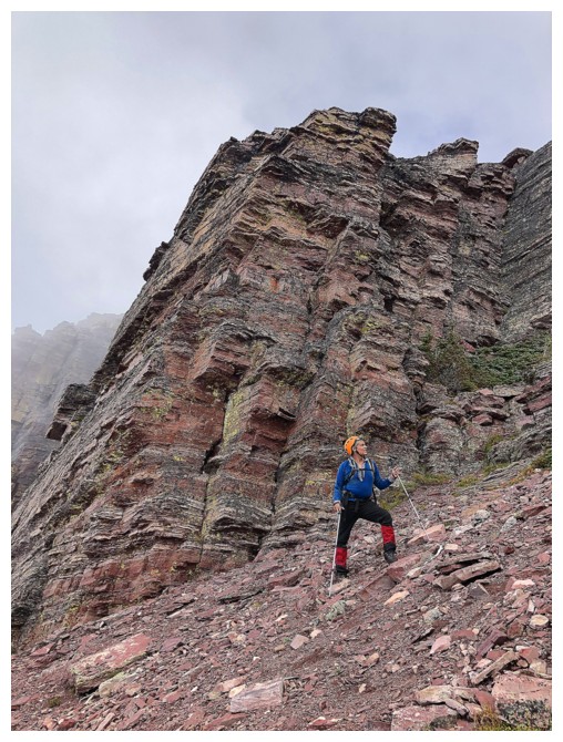
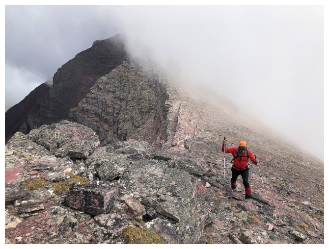
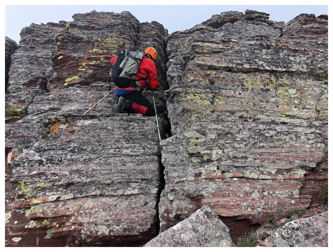
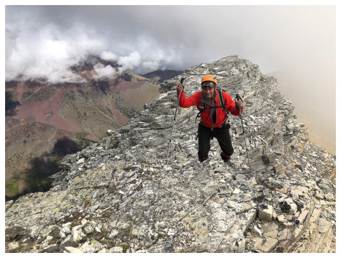
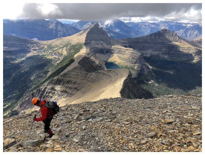
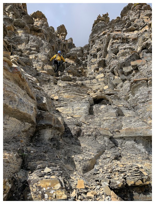
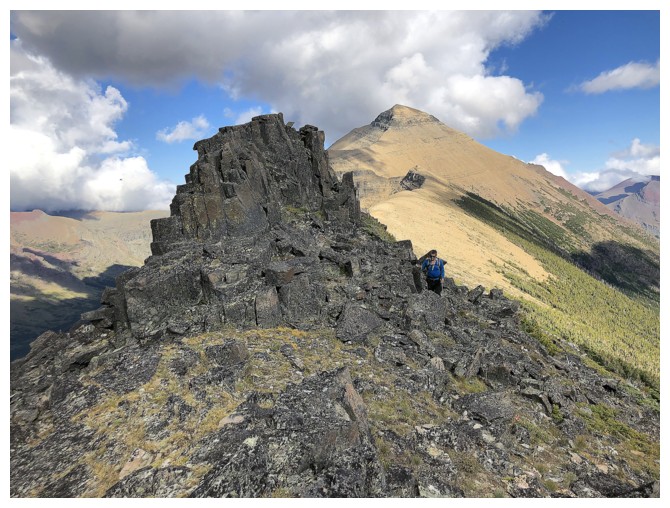
At least the ridge was interesting, with some good scrambling
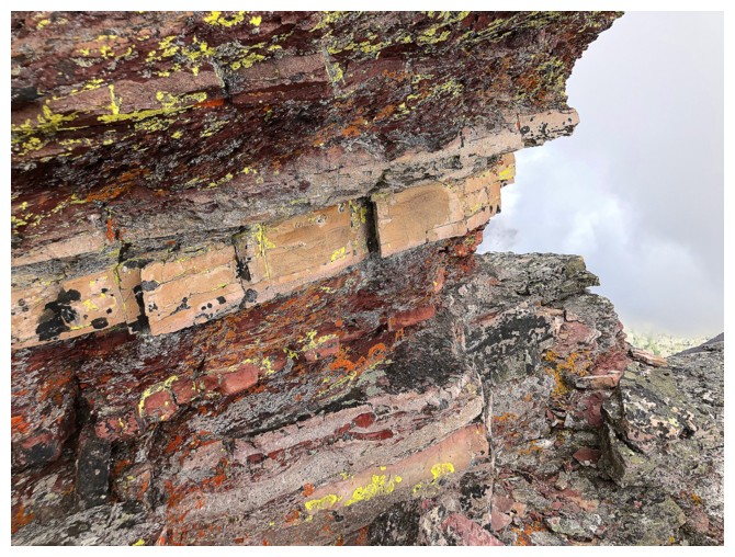
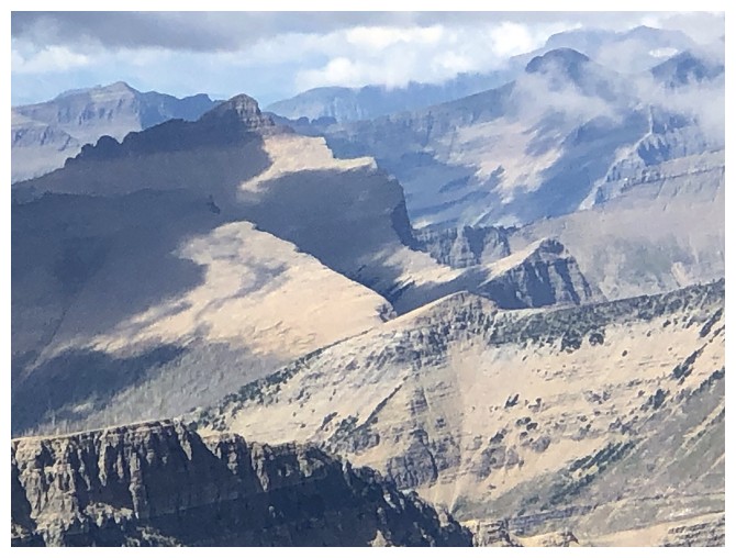
No shortage to colourful rock here
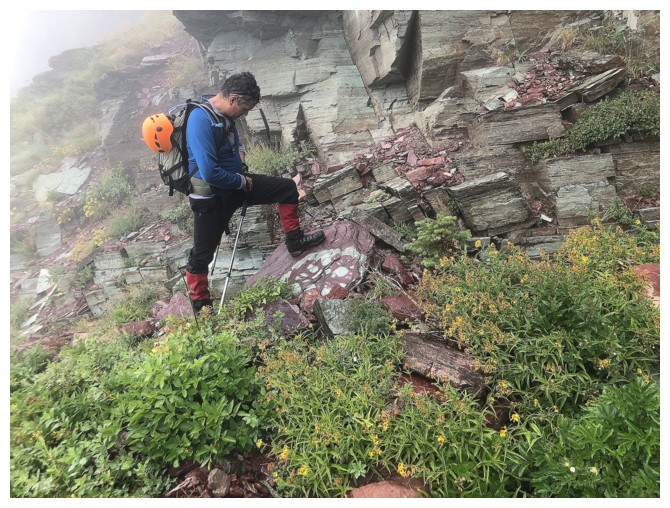
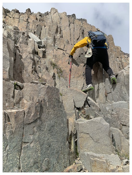
What's Mark doing?
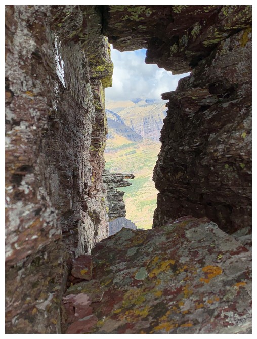
...getting a photo of this hole in the rock
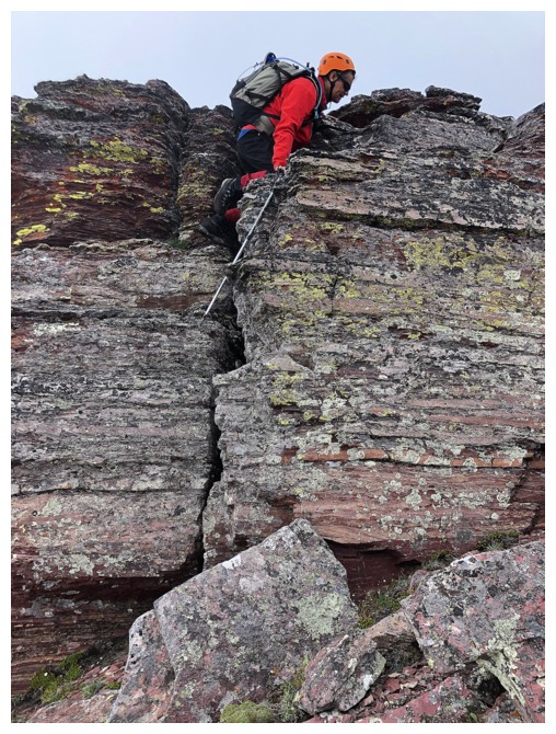
More scrambling
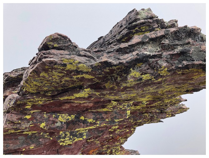
Getting my dose of colourful, lichen-covered rock
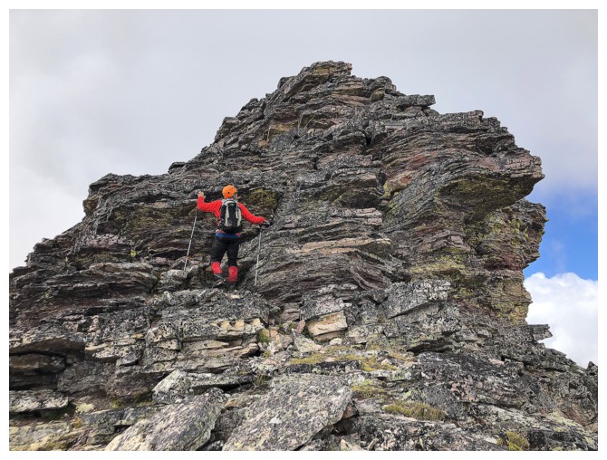
Even More Scrambling - sounds like a good name for a book!
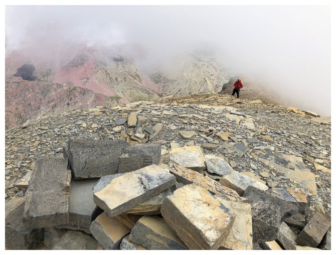
Back into the clouds
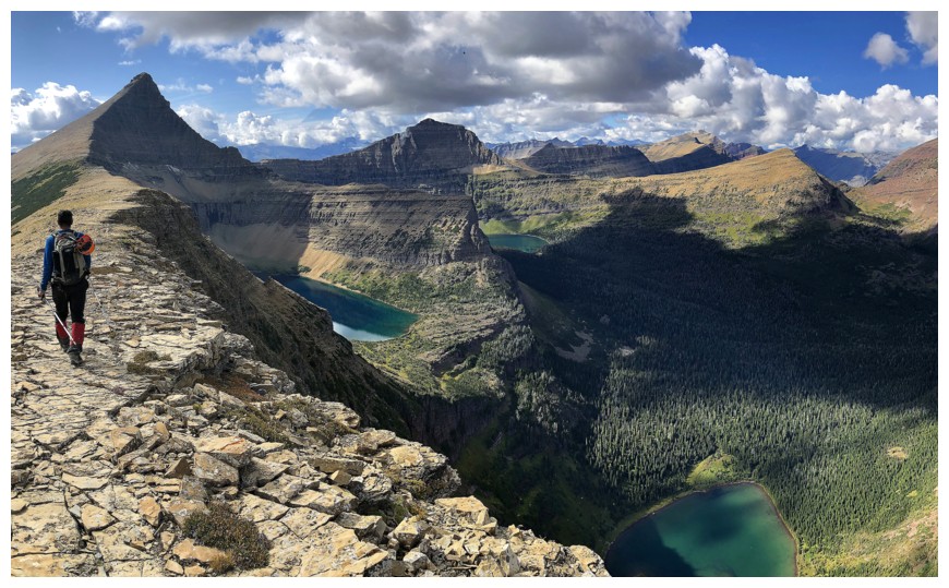
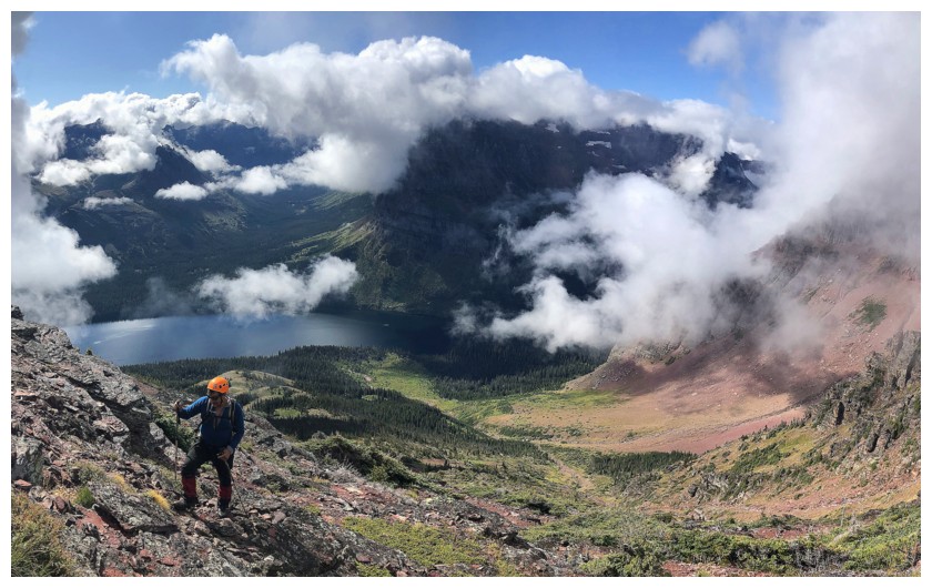
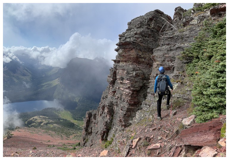
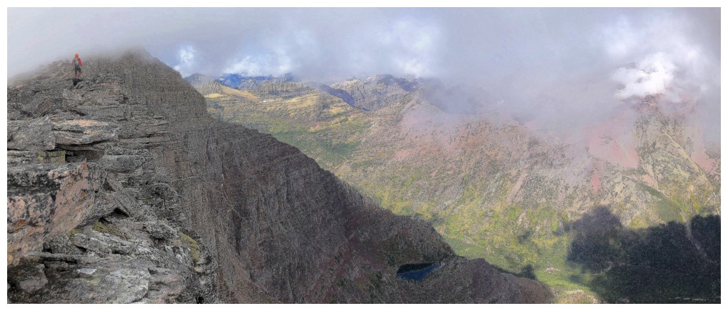
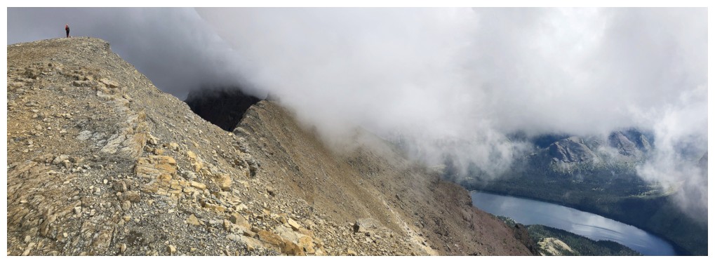
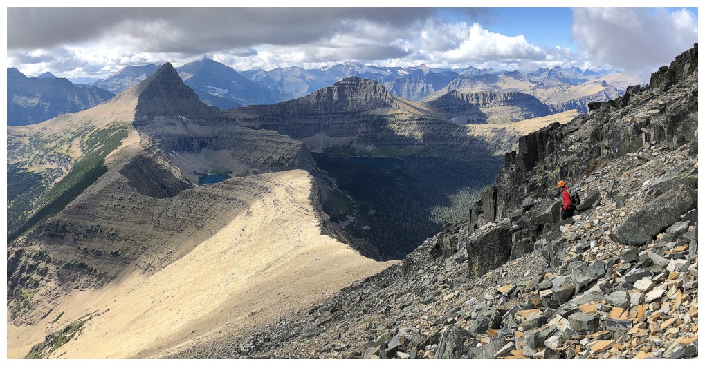
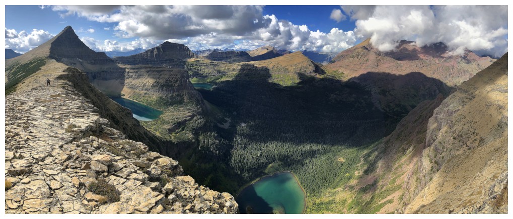
Looking back at the amazing east ridge. This is where we really wanted the clouds to lift
Another boat ride below
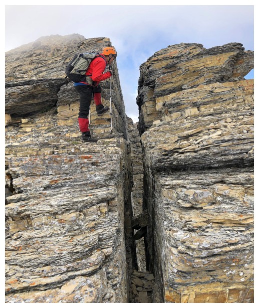
Nice fissure in the rock
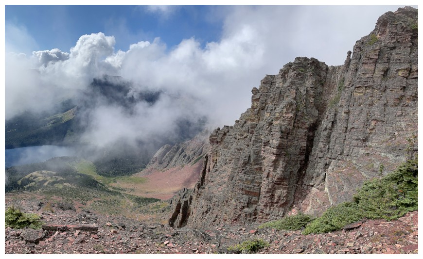
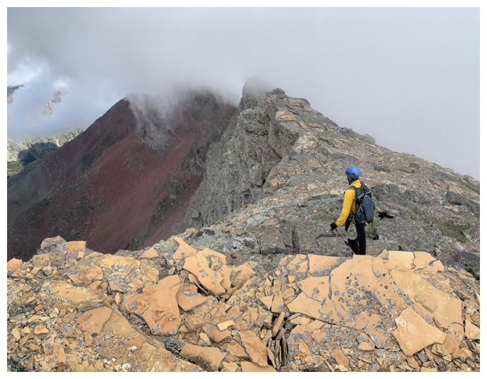
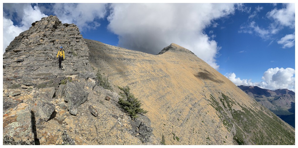
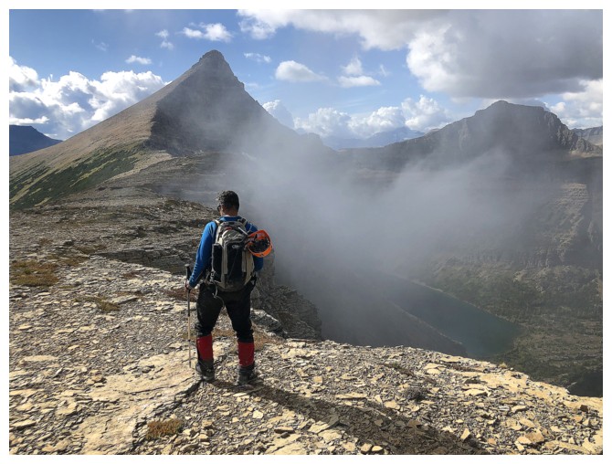
Heading for the cloud-covered summit block
Clouds behind too
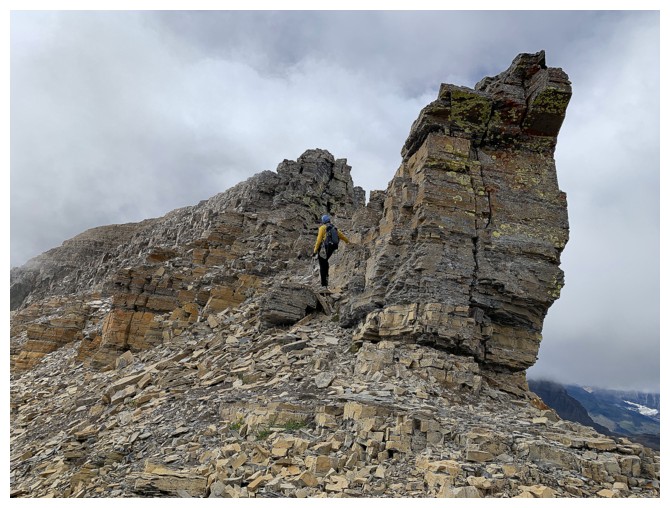
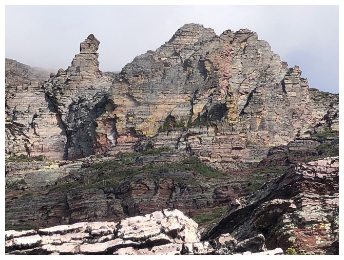
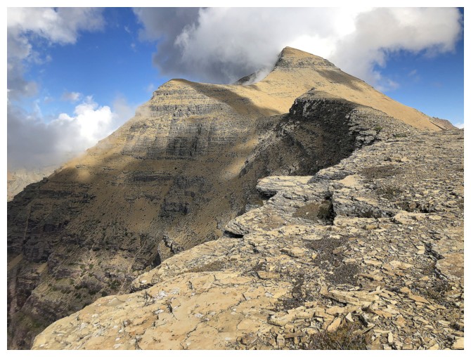
Even More Interesting Rock - not a good book title!
The famous and awesome diorite rock band that is a feature of many of the big peaks of Glacier (see Wilbur)
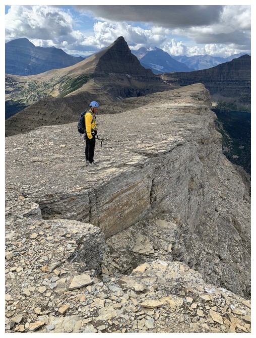
At the summit, with Mark taking the last few steps
Typical views we had
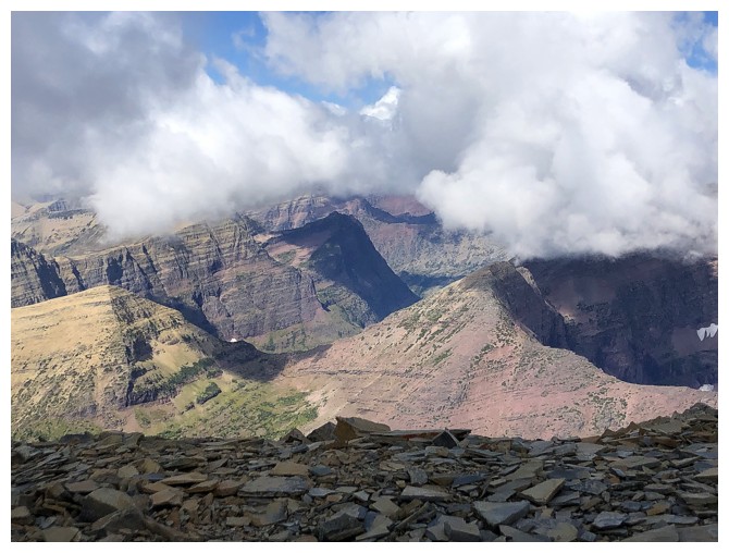
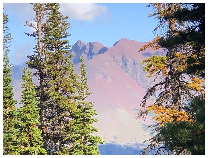
A couple of very new friends to the north: Norris and Triple Divide (low peak at the right attached to Norris)
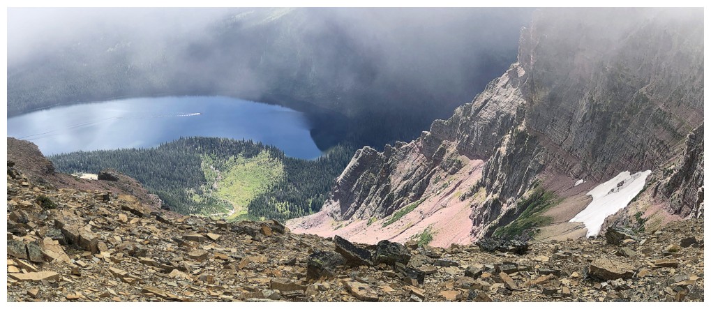
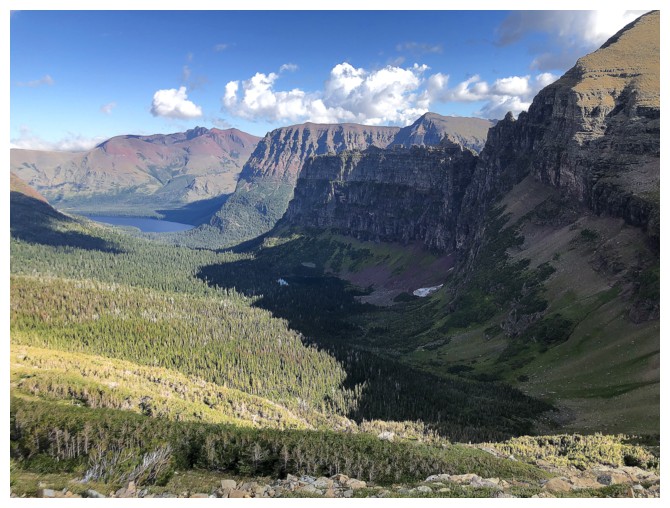
Upper Two Medicine Lake peeks out from behind Pumpelly Pillar
Still getting great views of Two Medicine Lake, but the clouds refuse to lift
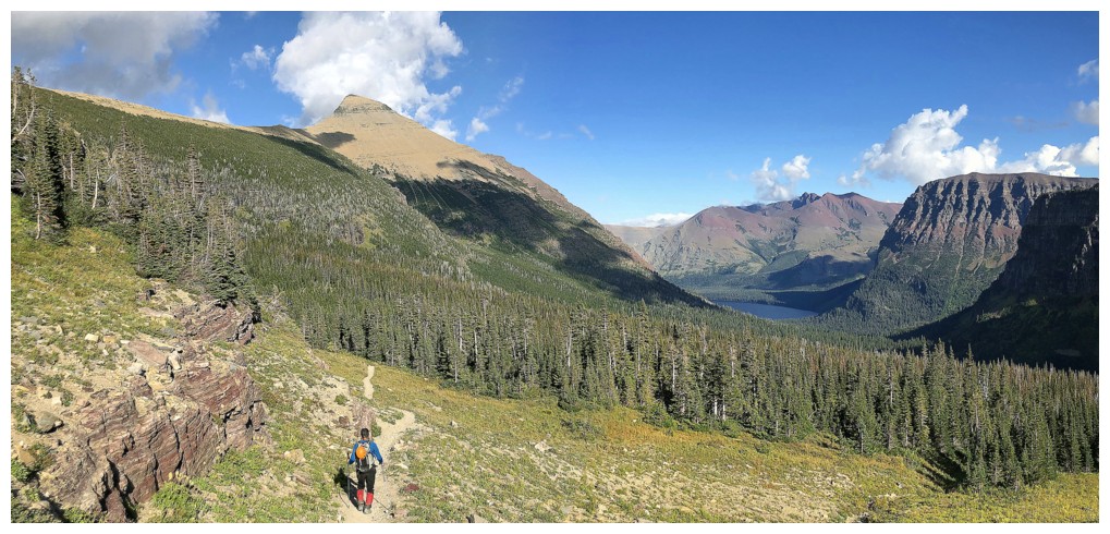
The wonderful form of Flinsch Peak accompanies us throughout the descent
Two of the three lakes can now be seen
Descenidng rubbly terrain on the west ridge
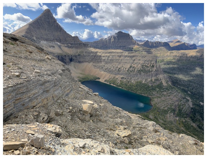
Looking down on Boy Lake
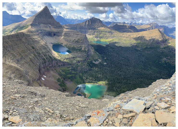
There they are: Boy (front), Young Man (left) and Oldman (right)
Finally the clouds are above the mountaintops
Descending a gully along the ridge
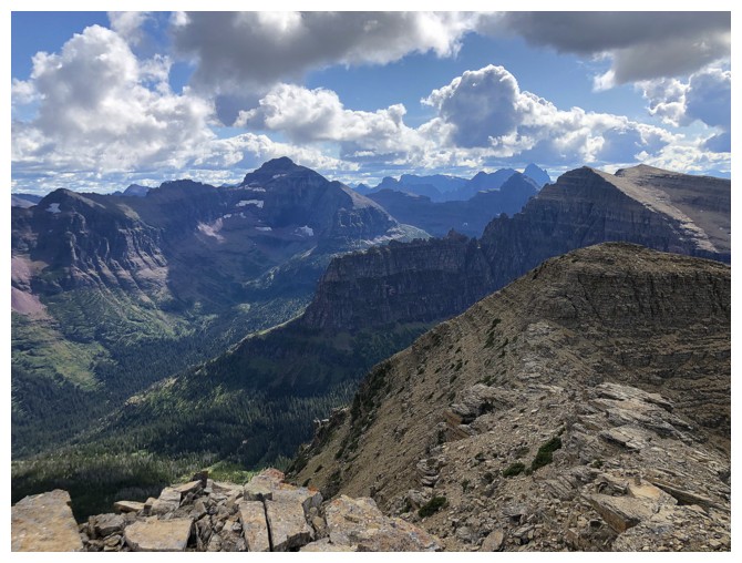
Looking back to Rising Wolf
Views along the ridge continue to command attention
Just when we thought we were done with the clouds!
Looking back to the summit
The clouds clear and Young Man Lake appears
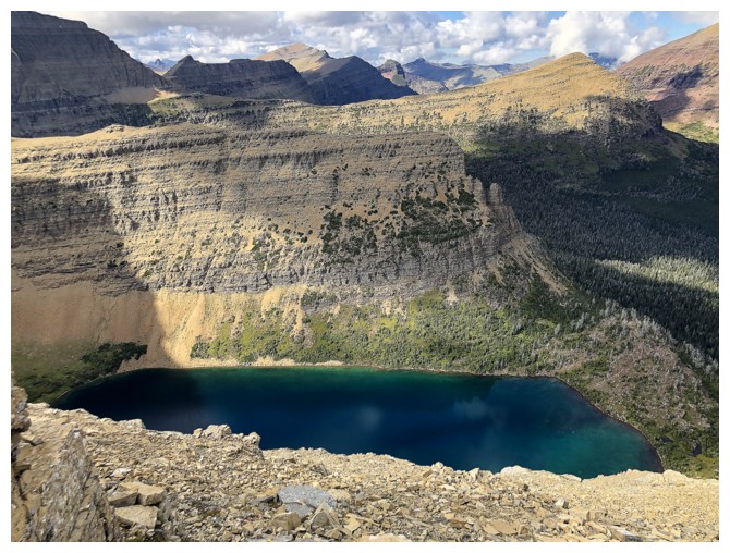
It's a beautiful lake with a red argillite shore! (see Altyn)
More diorite
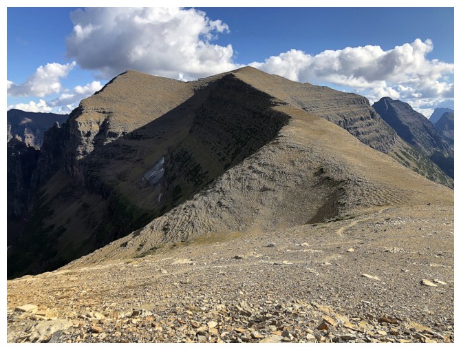
Mount Helen, with Dawson Pass at the right
At Dawson Pass, ready for the return trip
Fantastic valley to descend into
...with a classic, well designed Glacier trail
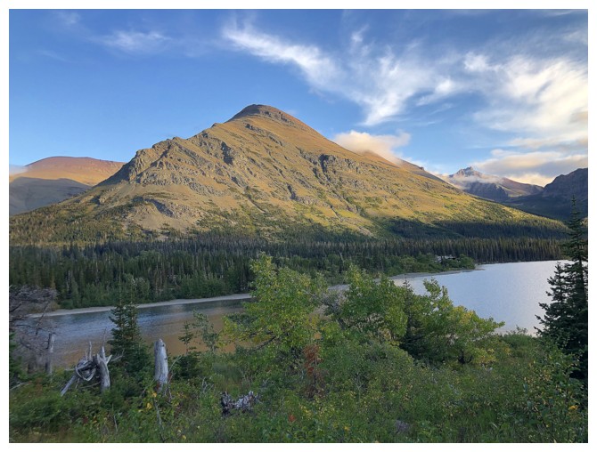
Speaking of red mountains, there's Henry
Definitely clearing up at this point
The northwest side of Sinopah Mountain
Farther along the Sinopah ridge is the highest point of the massif, Mount Rockwell (right)
Great view of the valley, with Two Medicine Lake and Mount Henry
Throw in Sinopah for good measure
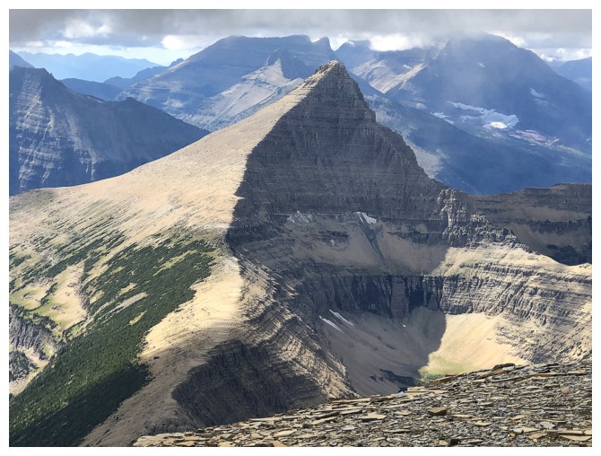
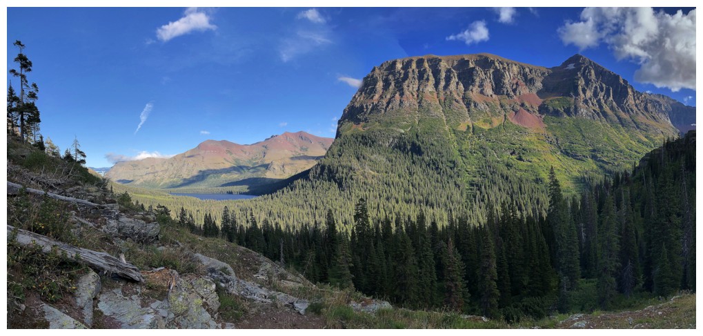
The south face of Rising Wolf and drainage you ascend after leaving the main trail
Sinopah (right) looks far more significant from near the east end of
Two Medicine Lake. The other mountains from right to left are Painted
Teepee Peak, Never Laughs Mountain and Mount Ellsworth
Mount Appistoki
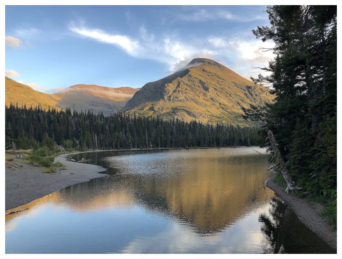
Seeing Appistoki reflected in Two Medicine was a great way to end the trip
The End