Mount Rowe VIII
October 5, 2023
Mountain height: 2464 m
Elevation gain:
approximately 1100 m
Round-trip time: 5:50
Solo scramble.
This
route has
become a winter favourite for me. However, in search of some quick and
scenically rewarding exercise I decided to try it as an autumn trip,
hopefully getting a decent look at the larches around the Rowe Lakes in
the process. The weather was going
to be hit and miss – definitely a miss at the beginning, as I drove
into the
area under fully cloudy skies.
Thanks to the
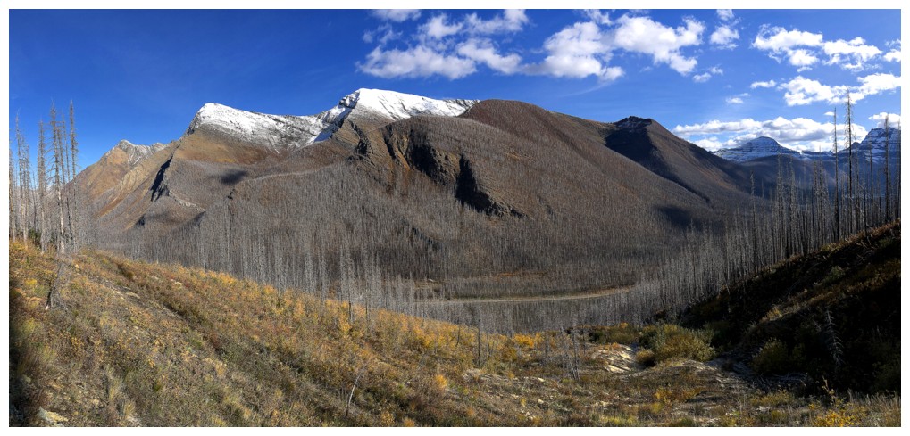
Kenow fire, this direct route to the summit proved to be as easy without snow
as it is once the winter snow firms up later in the season. However, these
favourable conditions may not exist once the dead trees start falling.
Gaining
elevation, it became apparent I was in for some interesting weather conditions.
Unfortunately, a perfect inversion never materialized (one in which completely
blue skies sit above the clouds), but there were many super interesting scenes
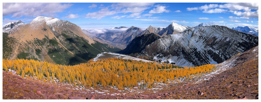
of clouds, mountains and trees, especially when the yellow larches started to
appear.
I didn’t stay
at the summit for long, wanting to go to the next highpoint to the northwest
and then descend to the Upper Rowe Lakes. I could then gain the northeast ridge of
Rowe and descend either the same way I came up or right down the middle, as
Mark and I had done, 17 years earlier.
The route went
exactly as planned, boasted tons of amazing larch and lake scenery and was
relatively easy to boot! I can definitely see myself repeating this exact route
when a shorter day is on the agenda.
Awesome day out!
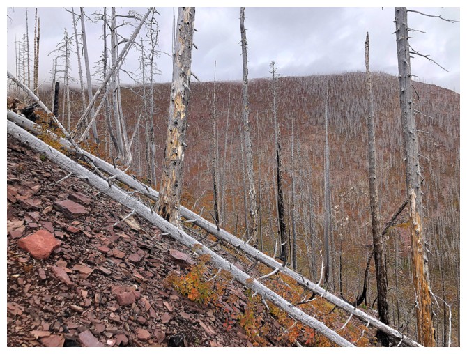
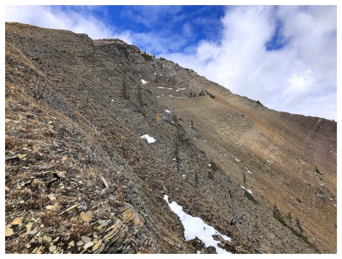
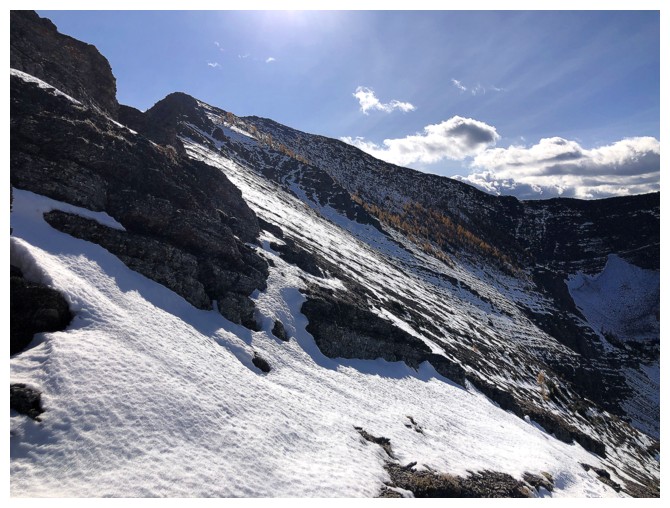
Easy travel up the initial slopes
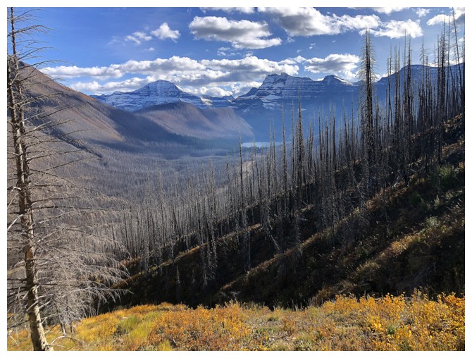
Looking over to the ridge on the other side of the drainage that Mark and I ascended in 2006
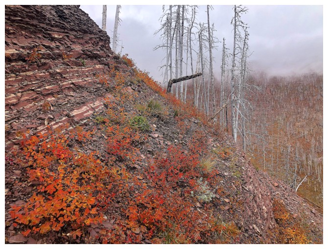
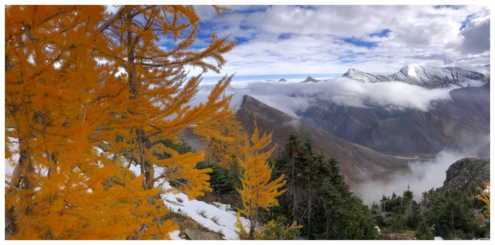
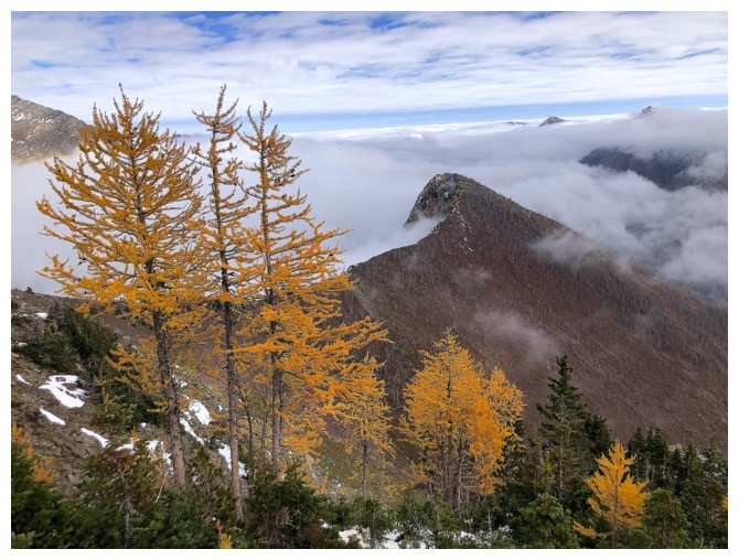
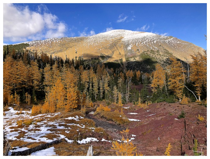
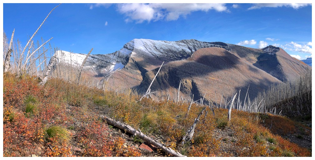
Autumn colours
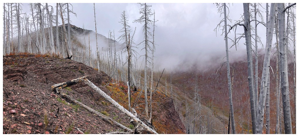
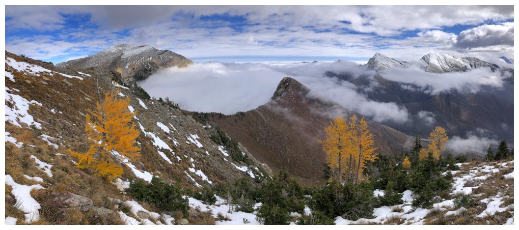
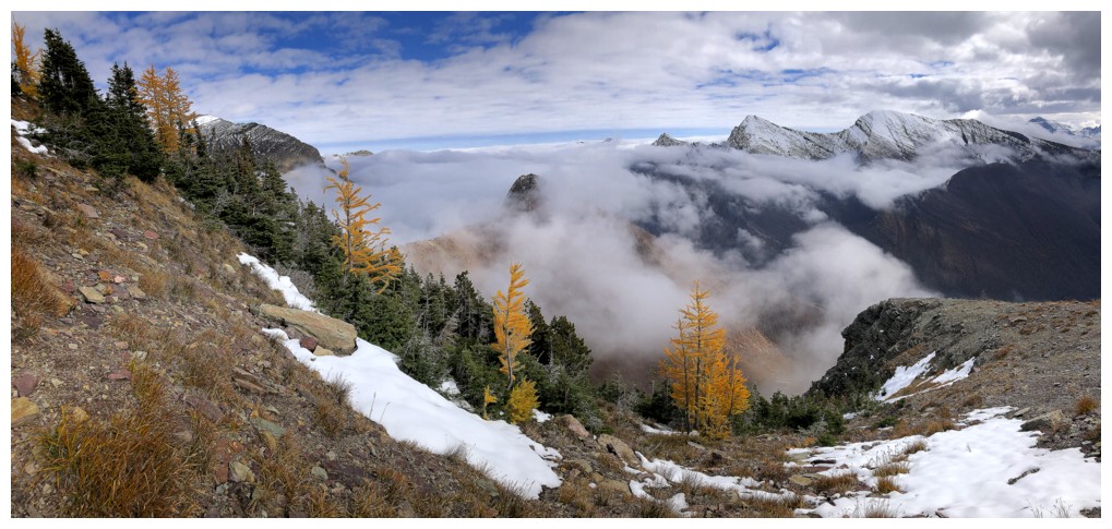
Lots of low-lying clouds
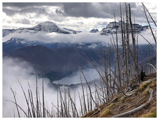
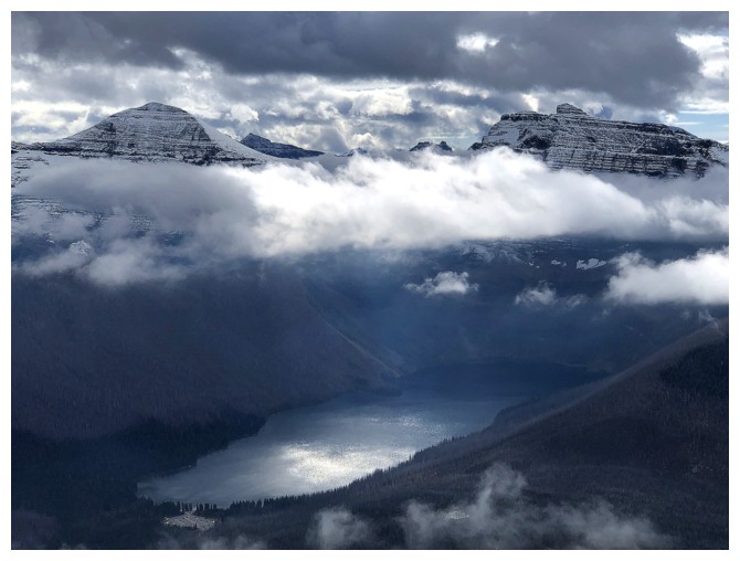
Cameron Lake, with Chapman Peak and Mount Custer above
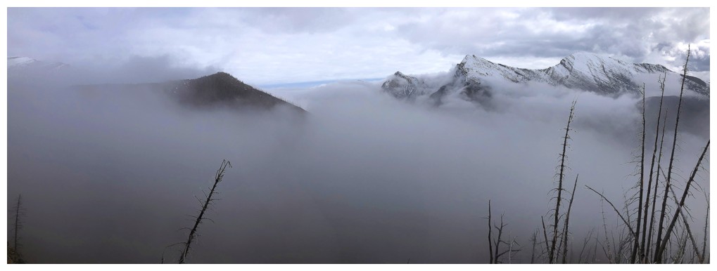
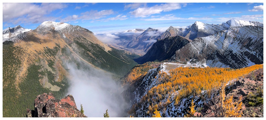
The valley is consumed by clouds
Mark and I tried to reach the summit by going up this slope but hit an impasse just before the ridge
The Sun's rays hit a cloud above the Cameron Lake
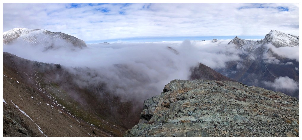
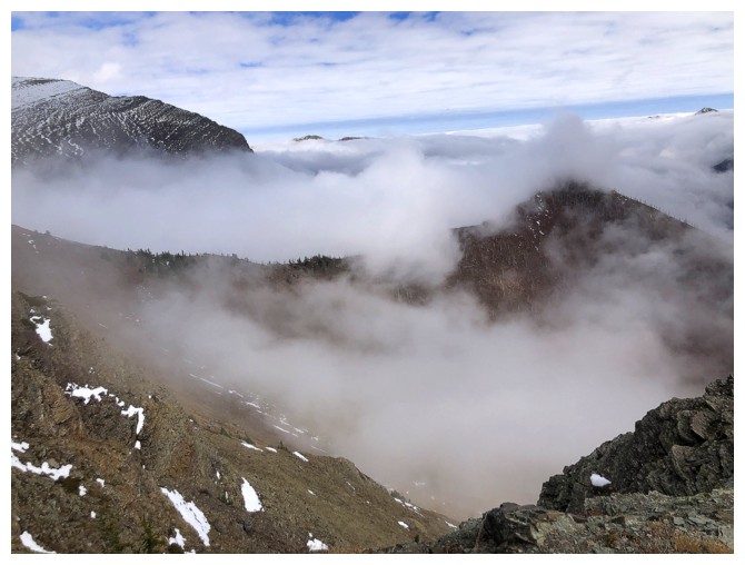
The clouds in the valley are starting to dissipate
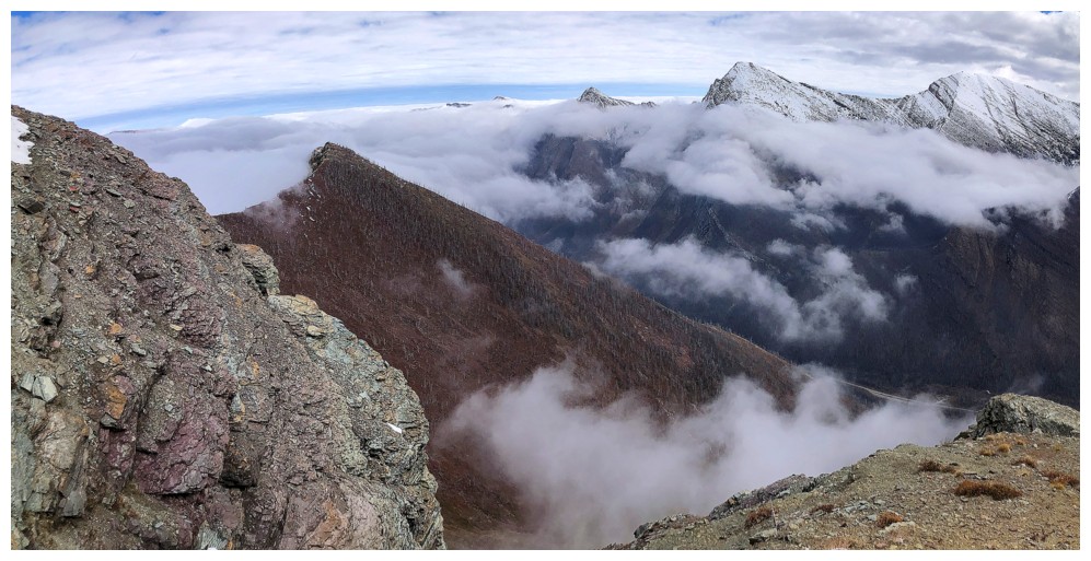
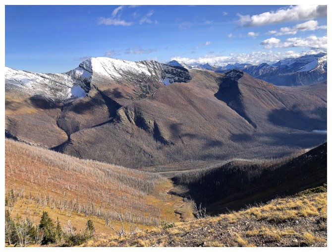
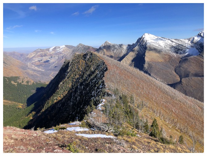
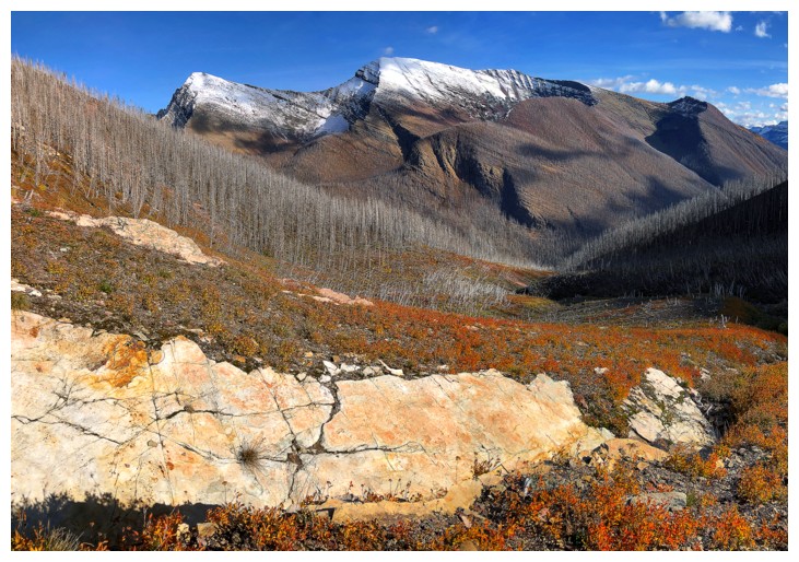
The red peak near the left is the northeast outlier of Rowe
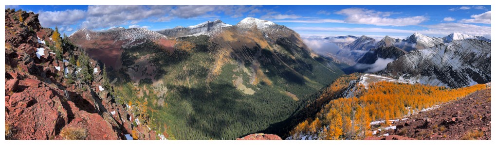
More clearing to the south and west. Too bad about the high clouds blocking the Sun.
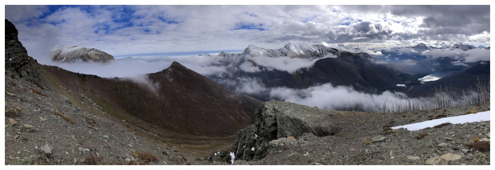
Still very cloudy to the east
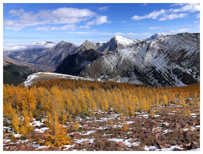
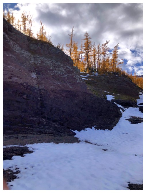
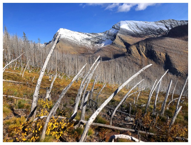
The route has a few larches
Clearing again
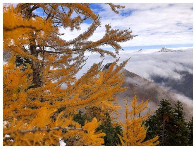
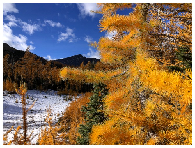
Lots of close-ups of larches on this trip
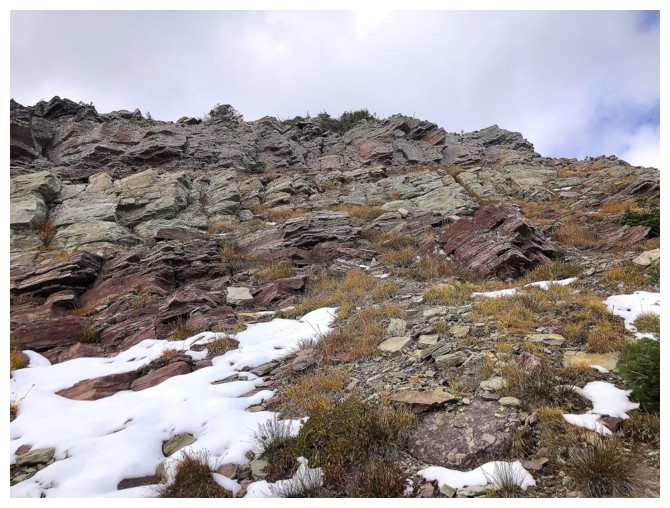
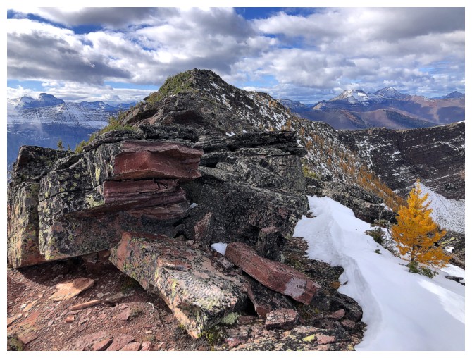
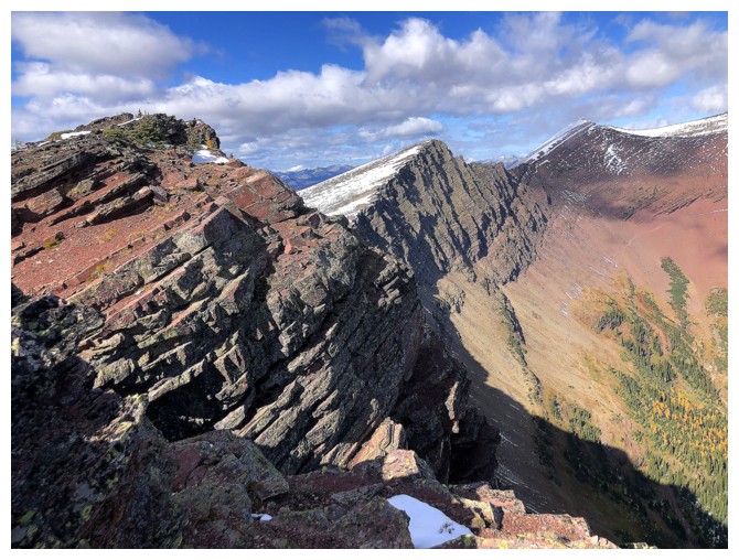
The rock band that lines the upper ridge
There's a close-up
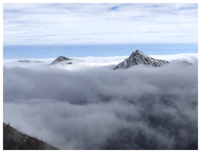
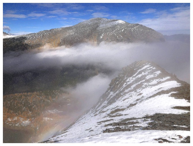
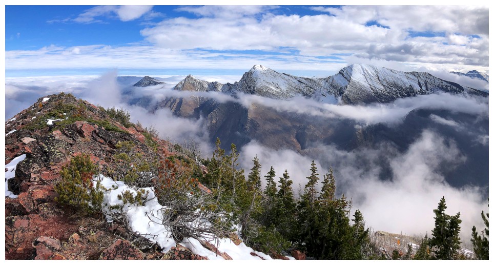
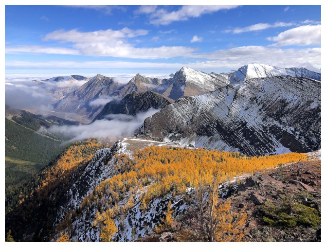
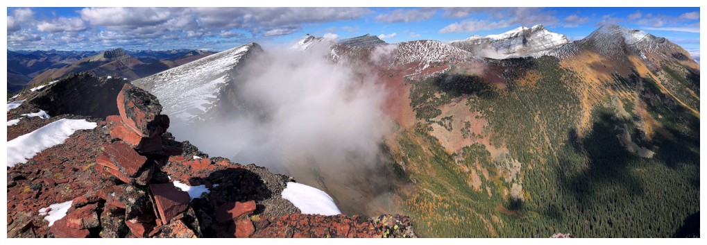
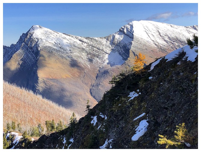
Sweet inversion to the east, though clear skies above would have been awesome. Buchanan Northeast at the right and Mount Crandell at the left.
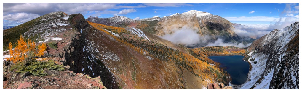
On the northeast ridge and the first view of the higher Upper Rowe Lake at the left
The lake
Mount Lineham
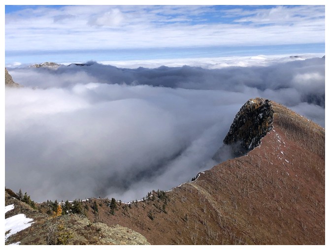
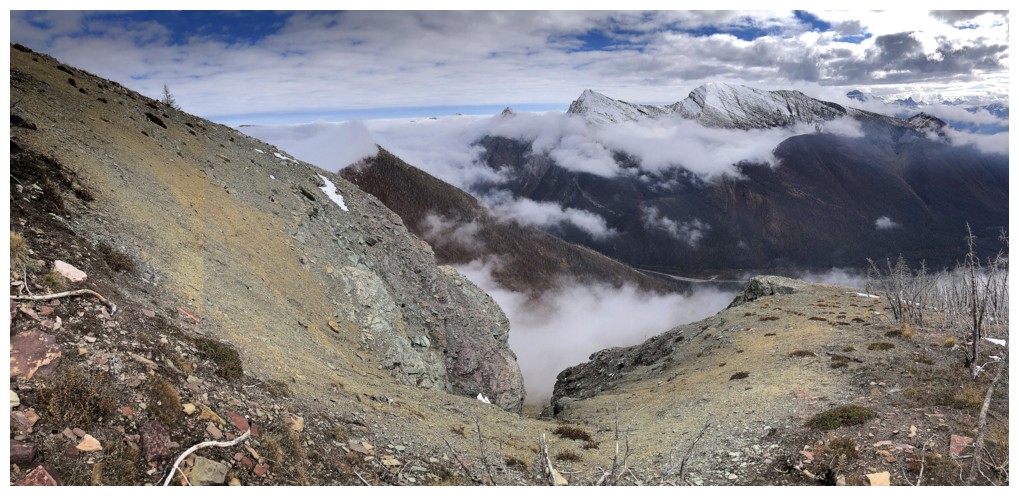
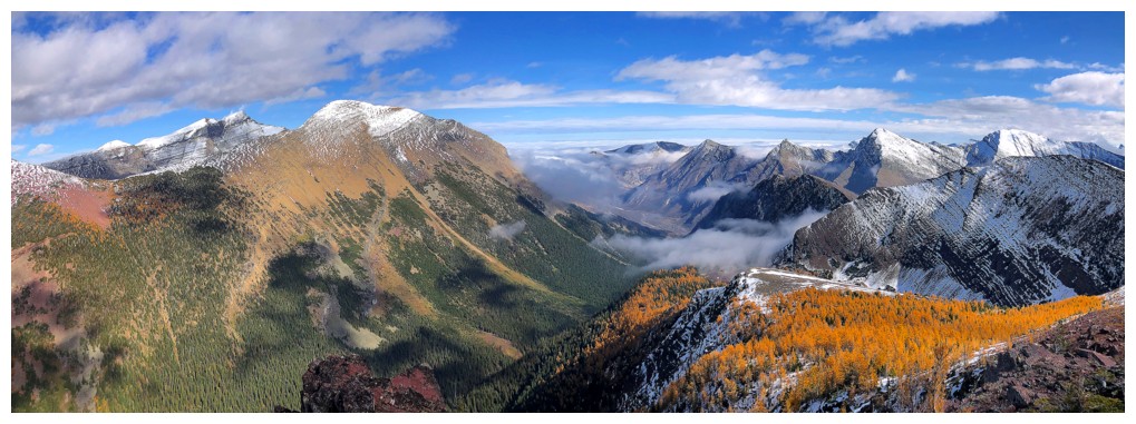
The northeast outlier is cloud-free but everything to the east is swimming in the clouds
Heading for the summit
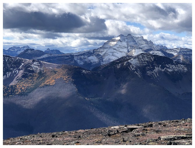
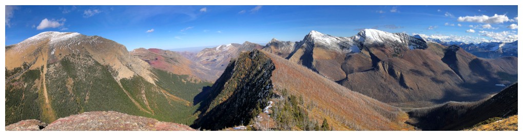
Three of the four Buchanan's, Northeast, The Middle Child, The Ridge, and Mount Carthew
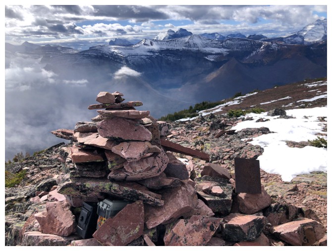
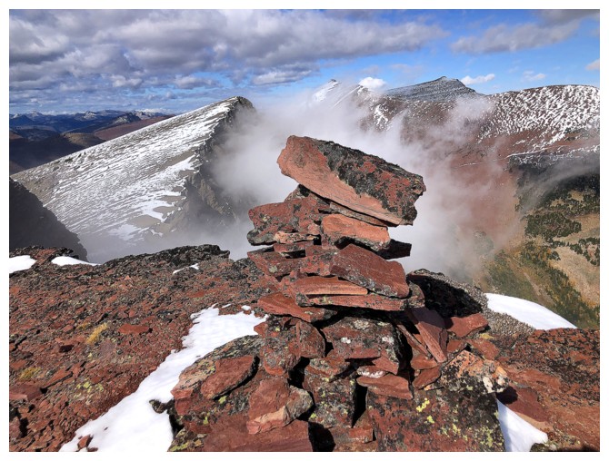
Summit cairn
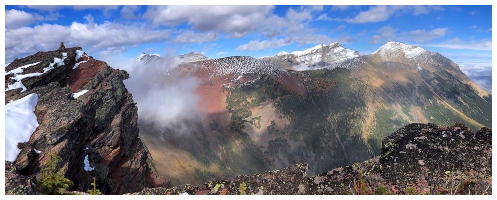
View to the north, northeast, and east
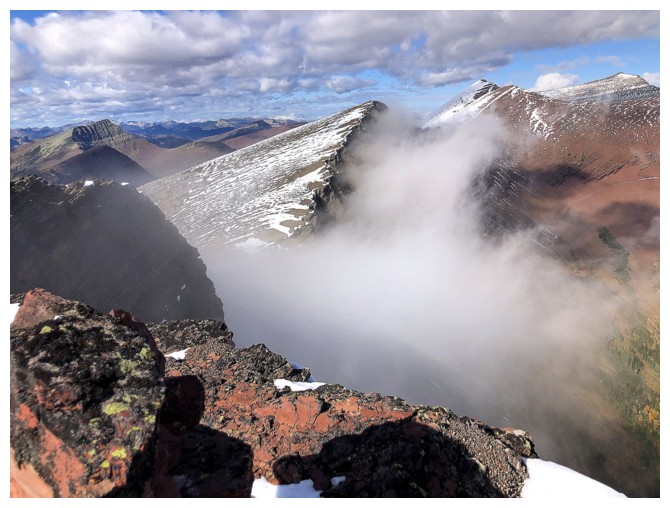
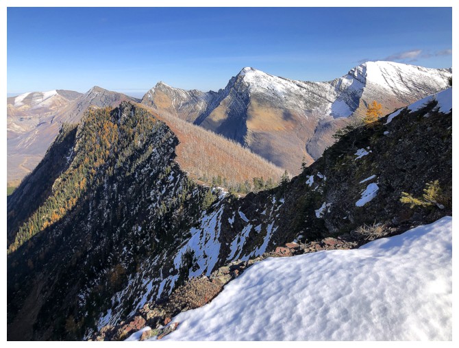
Starting the traverse to the next summit
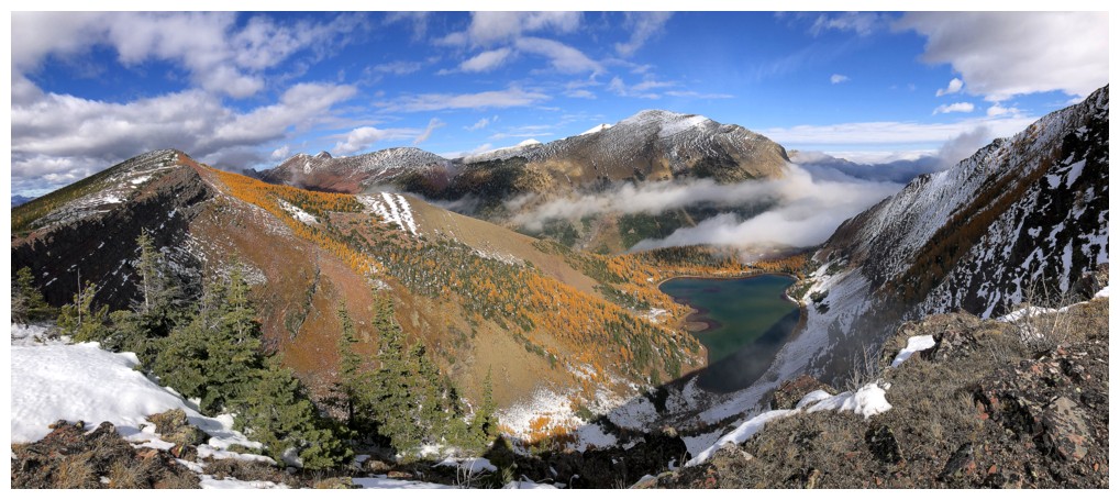
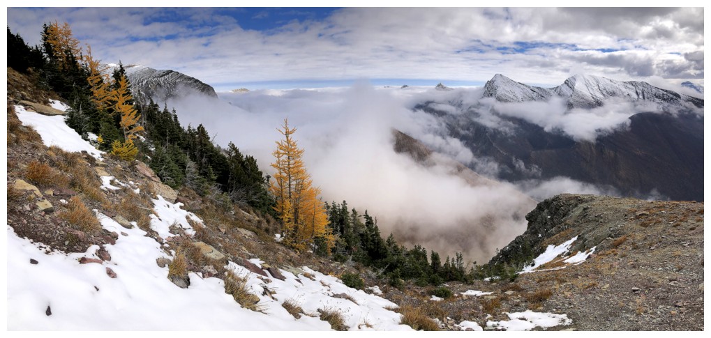
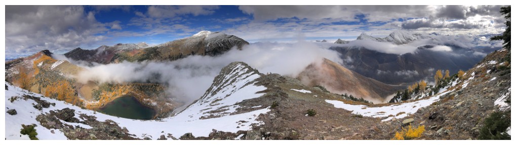
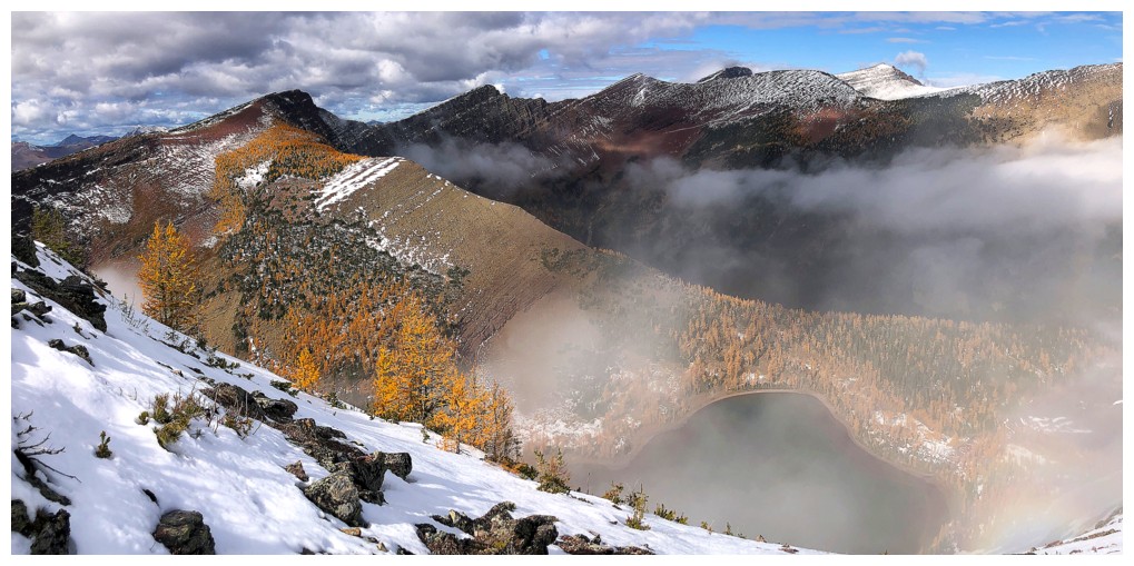
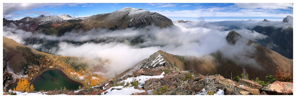
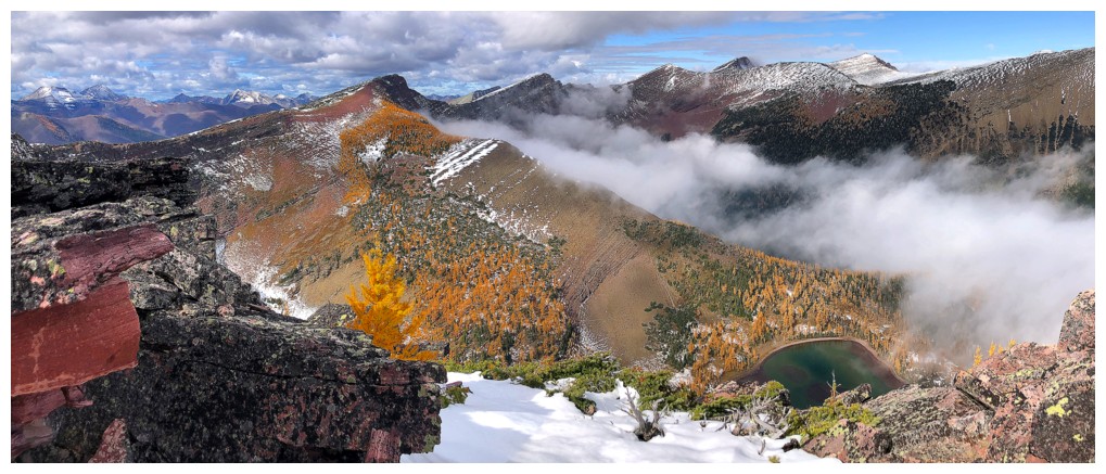
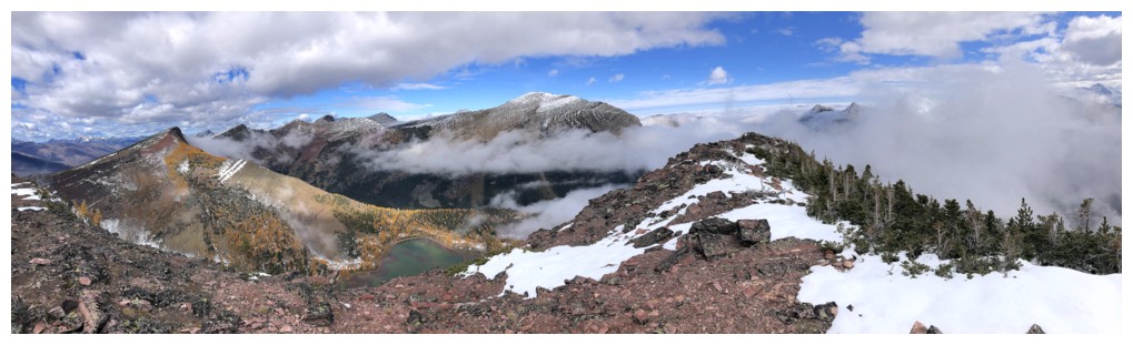
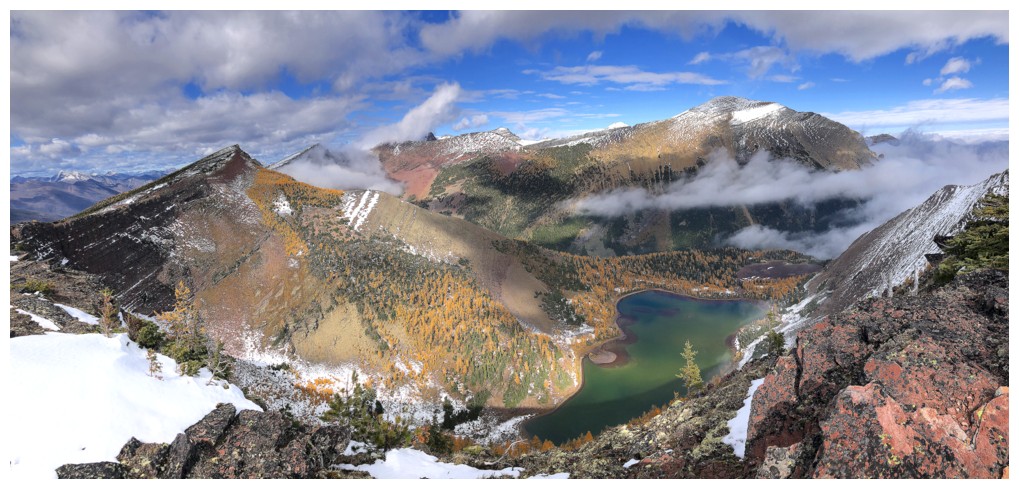
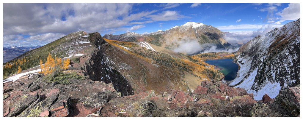
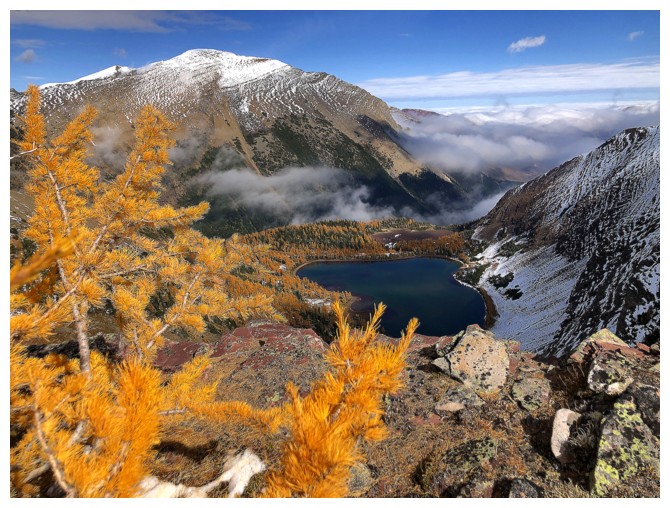
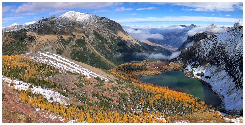
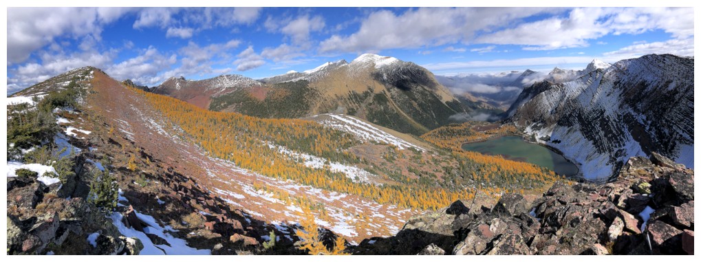
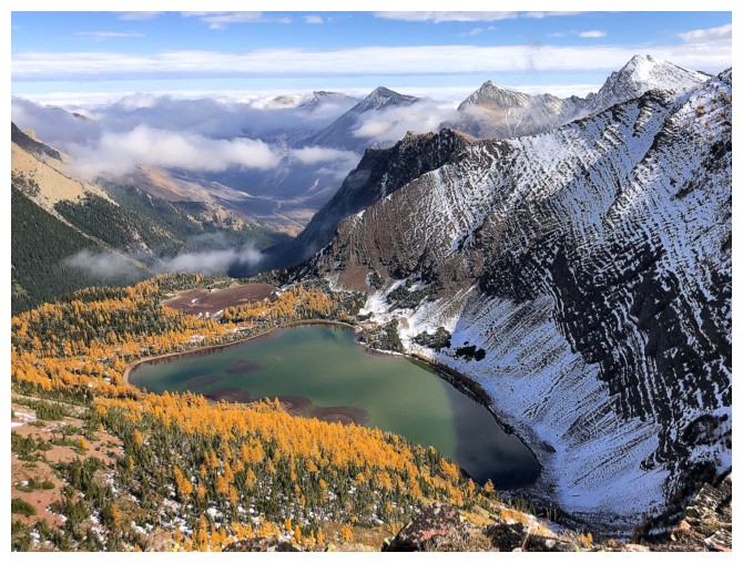
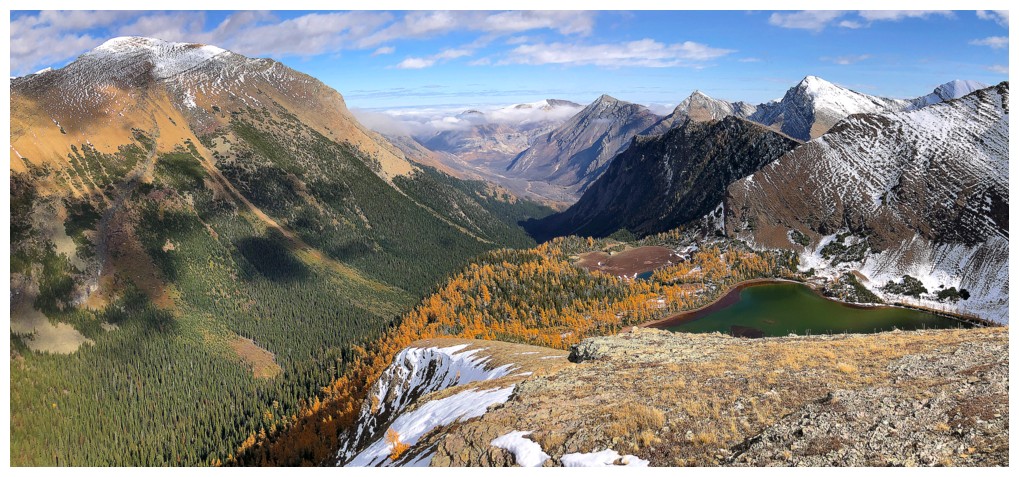
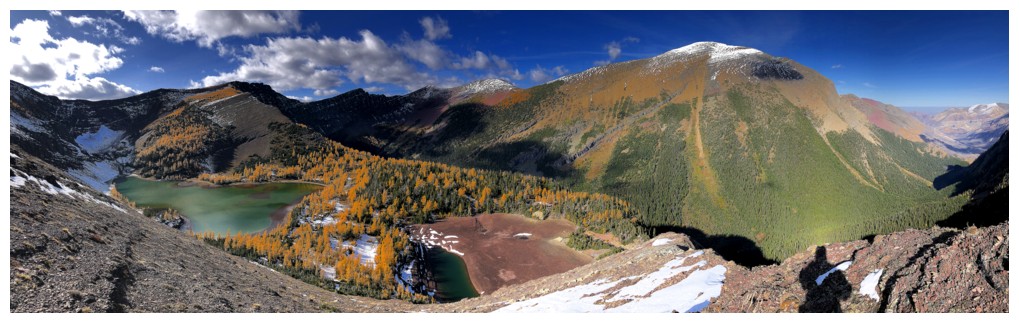
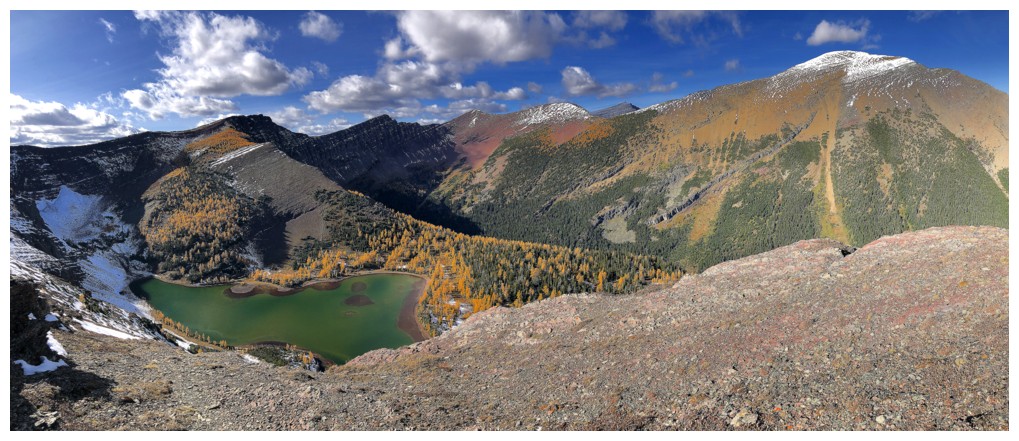
Views of the Upper Rowe Lake are going to be the highlight of the traverse
...as are the clouds forming then dissipating around Mount Lineham
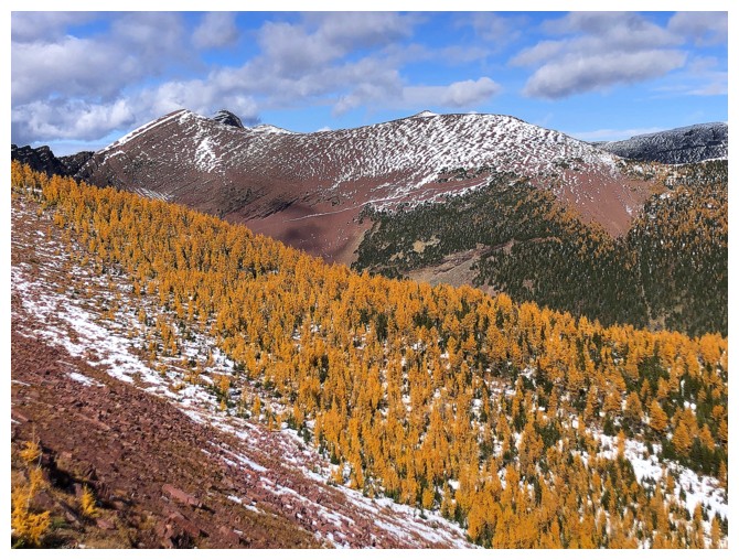
There are a few random larches on the connecting ridge
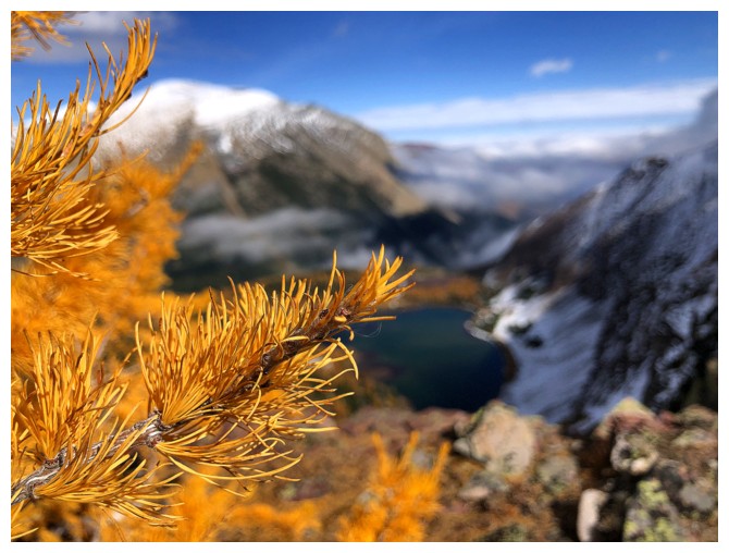
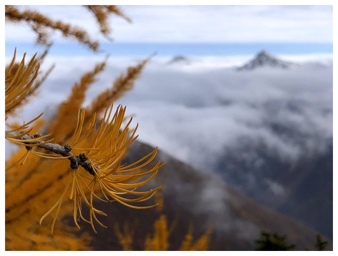
Close-up
#2
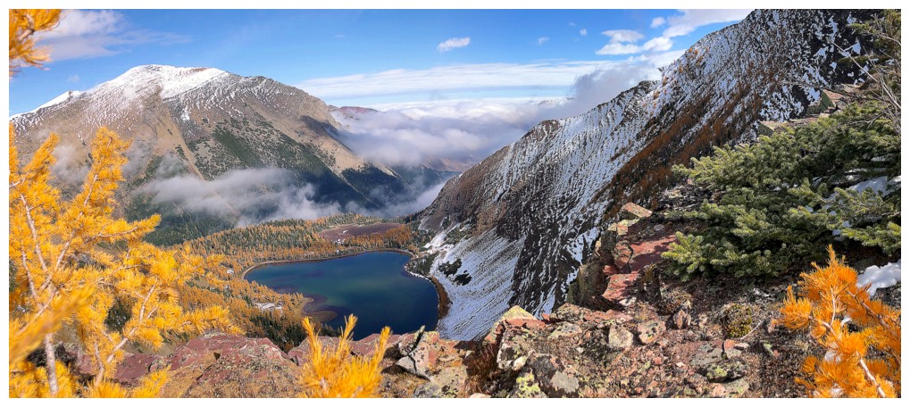
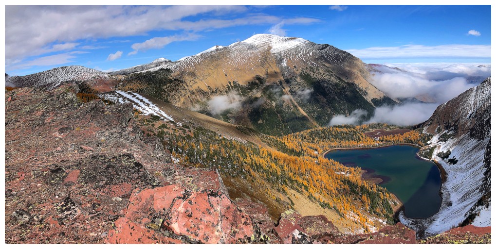
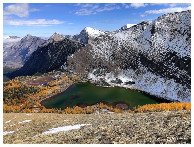
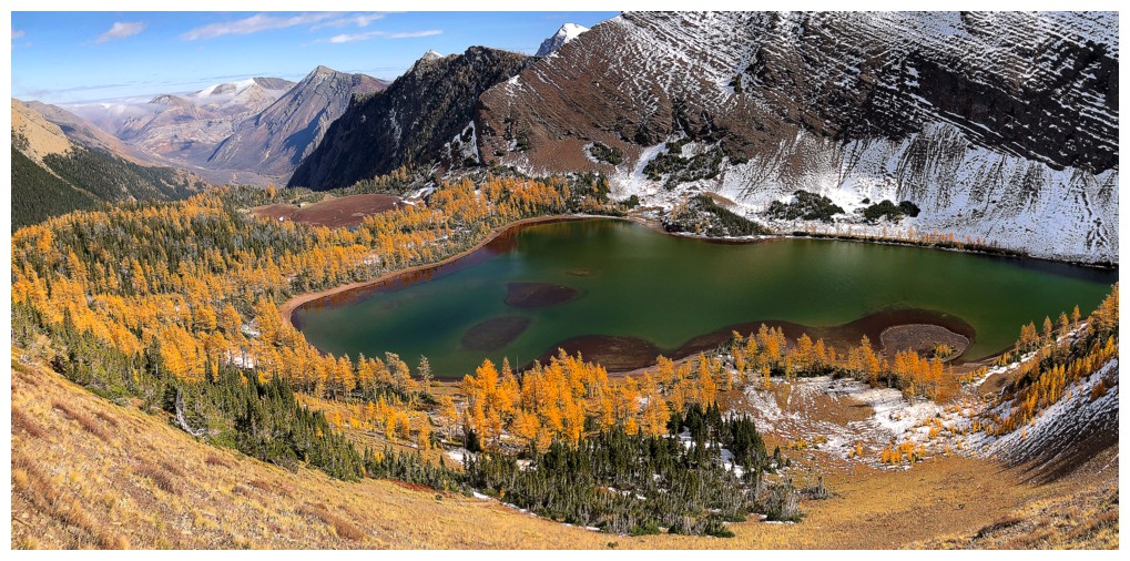
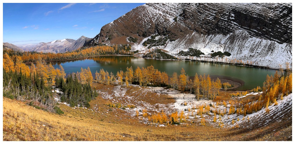
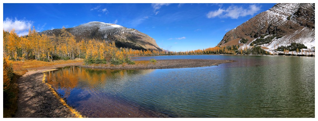
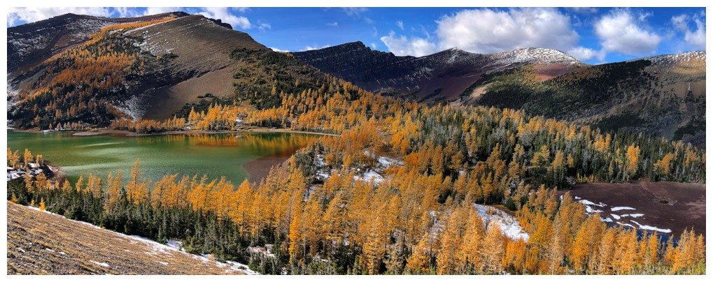
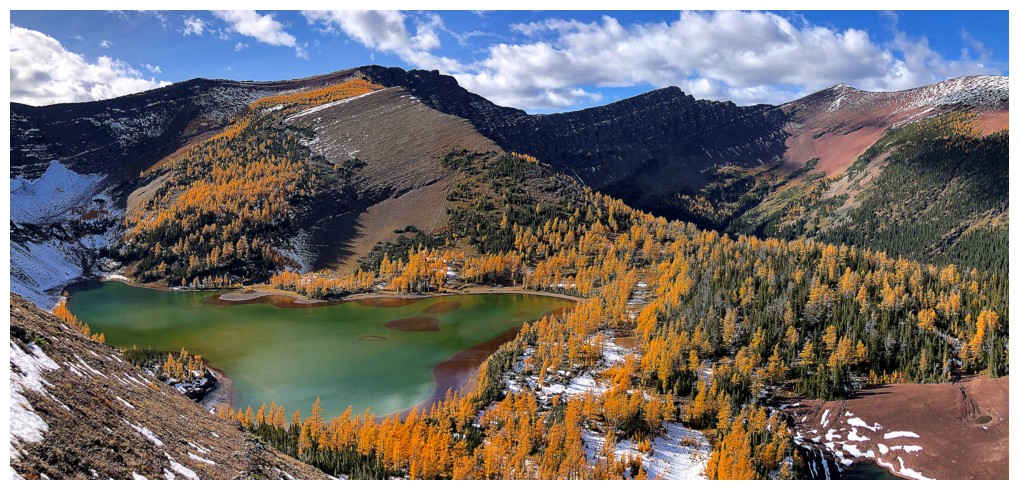
Tons of larches around the lake
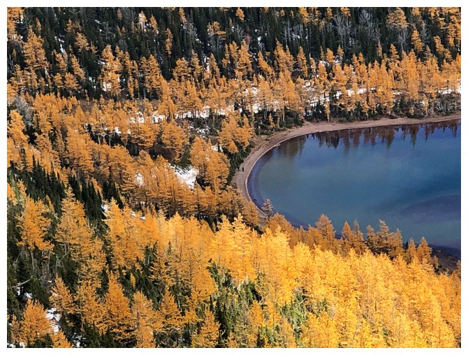
Spotted two people walking around the lake
Long Knife Peak
Lineham Ridge - one of the best hikes in the park
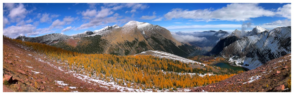
The larches above the lake are on full display....
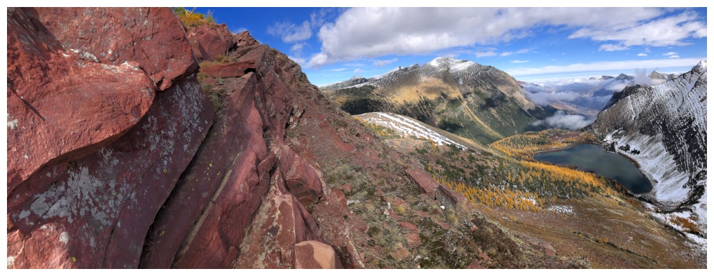
...and the red argillite is just going to make this part of the trip a "winner, winner, chicken dinner" event!
All the motivation needed to descend through the larches on return
The highpoint I'm aiming for (left), the "Peak of Despair" (centre), and part of Lineham Ridge (right)
At the highpoint (that's actually higher than Rowe)
The cairn
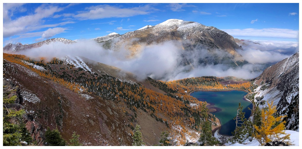
Still experiencing cool weather phenomena
And still "wowed" by the larches
Descending into the field of larches above the lake
Out onto the open ridge
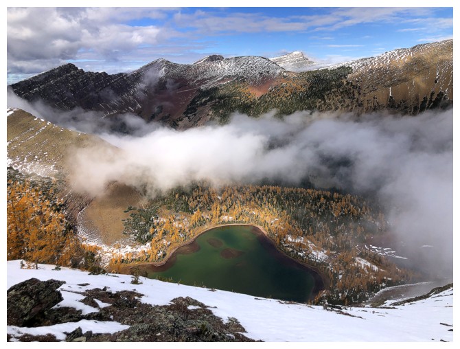
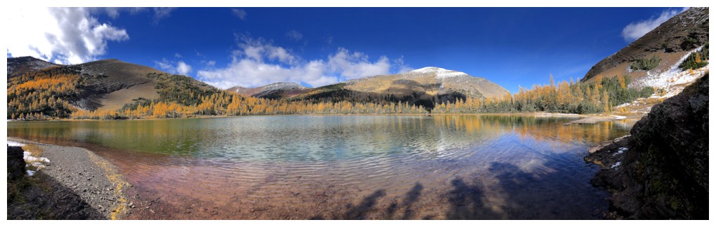
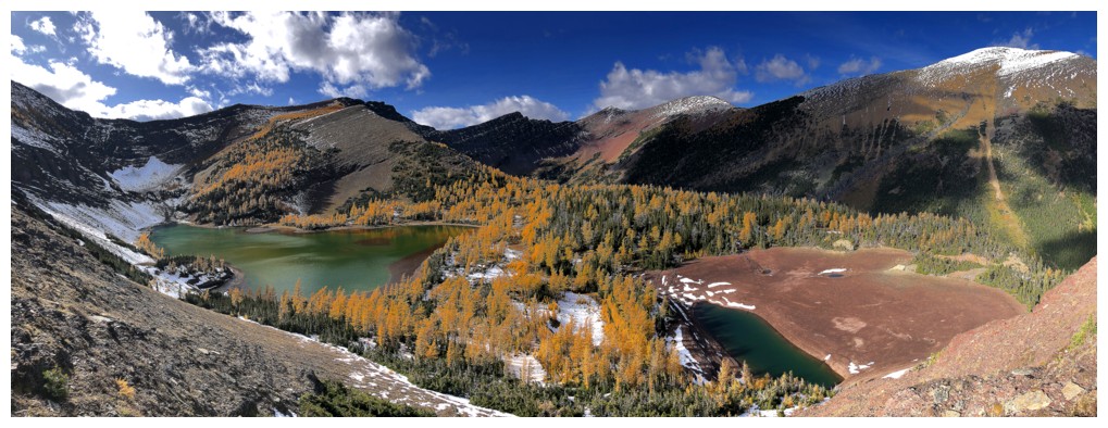
The higher Upper Lake. The lower Upper Lake is so low, it doesn't even appear to exist.
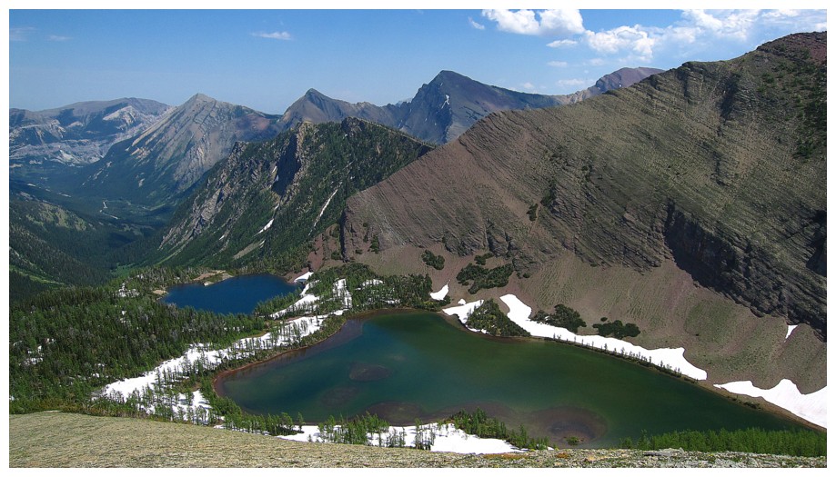
Similar photo taken on July 9, 2012. The lower Upper Lake is quite full at that time of the year.
Approaching the higher Upper Lake
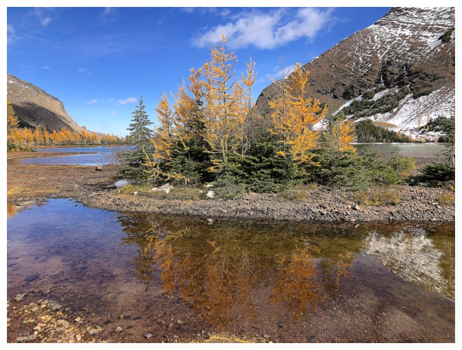
At the lakeshore
Mandatory circumnavigation of the lake
At the far southwest end
At the far northeast end
Following the dried-up drainage that connects the high Upper to the low Upper
The low Upper Lake and the ascent route back up to the northeast ridge of Rowe
The line going across the rock indicates how high the lake gets when full
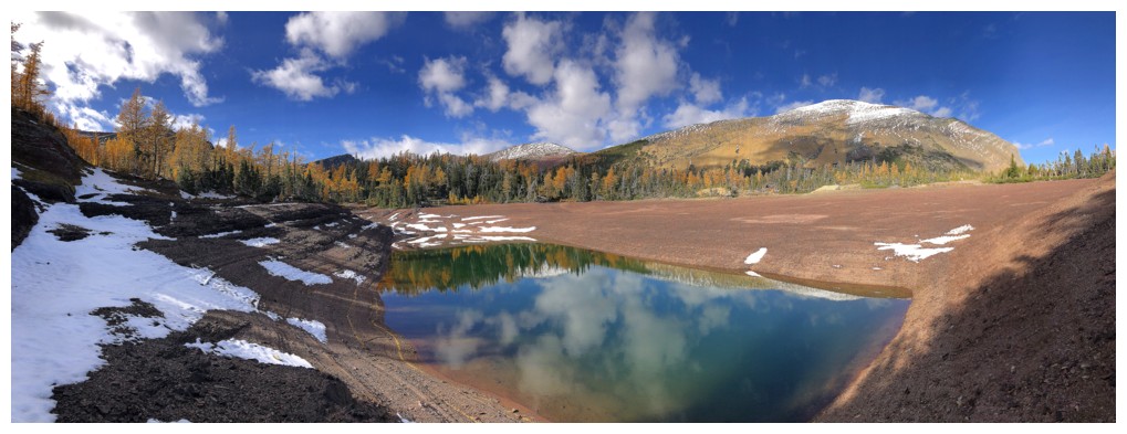
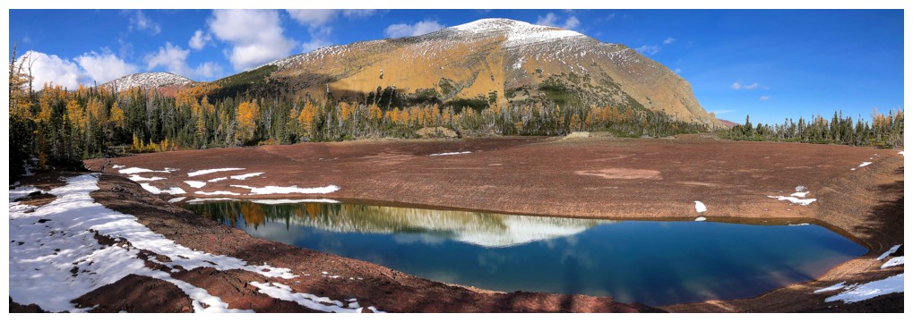
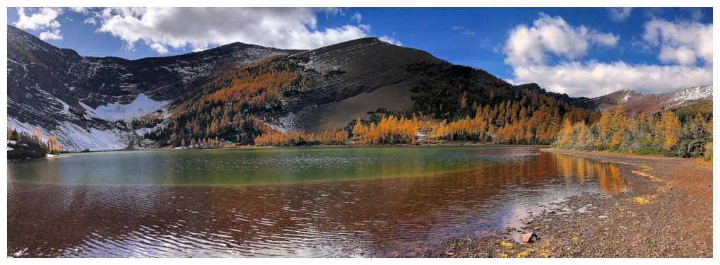
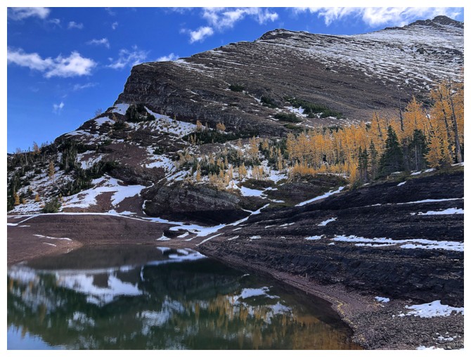
At this time of the year it's really just a big puddle!
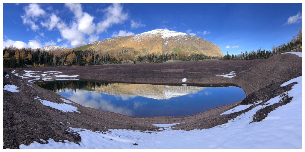
But a beautiful puddle, especially when reflecting Mount Lineham
#3
Gaining elevation above the lakes
Both lakes are visible
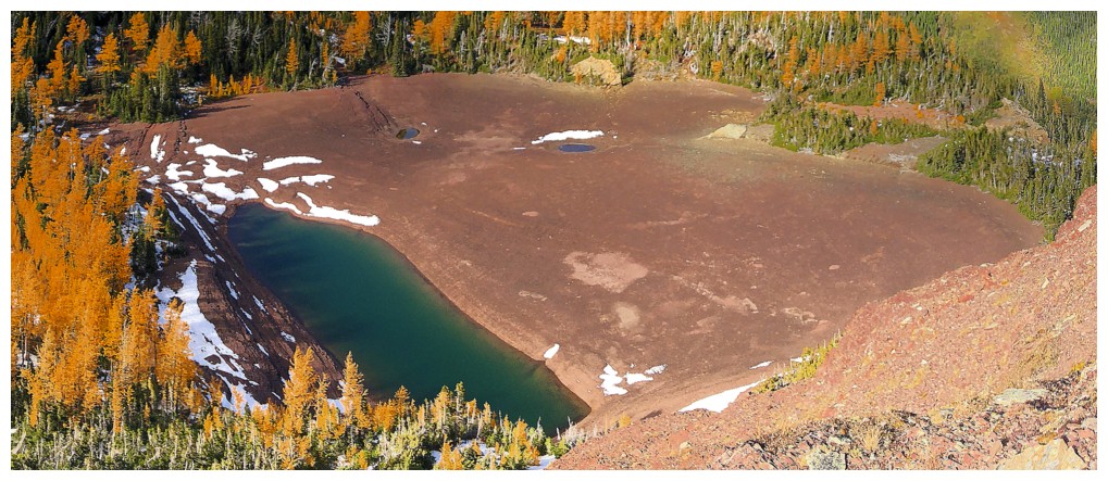
Close-up of the low Upper (Puddle) Lake, clearly showing how big the lake gets when full, compared to its present level
Looking over to the lowpoint of the northeast ridge, between the summit and the outlier
Buchanan Ridge and the eastern outlier of Mount Carthew
Looking up to the summit
Back on the northeast ridge just above the lowpoint
Last look at the Upper Lake
Pano from the ridge
Heading down to the lowpoint
Easy and scenic descent
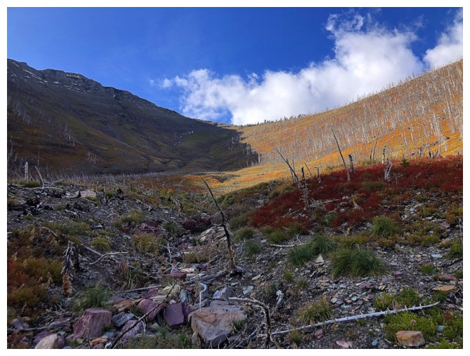
Lots of beautiful autumn colours to keep me entertained on descent
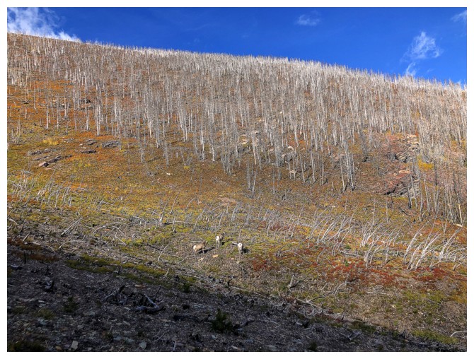
Bumped into a group of three sheep. They didn't pay any attention to me whatsoever.
Looking back up some of the descent route
Racing the setting Sun
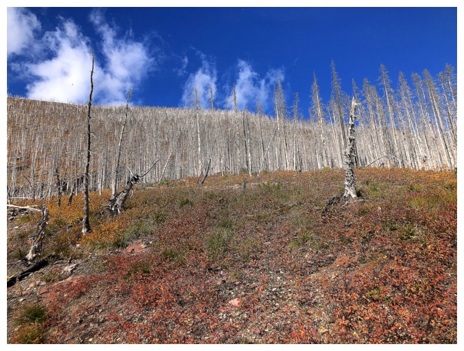
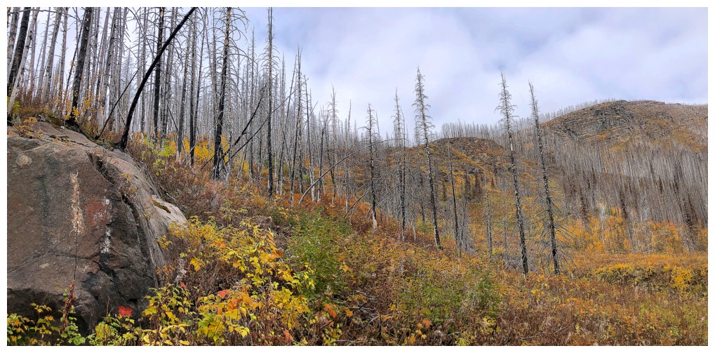
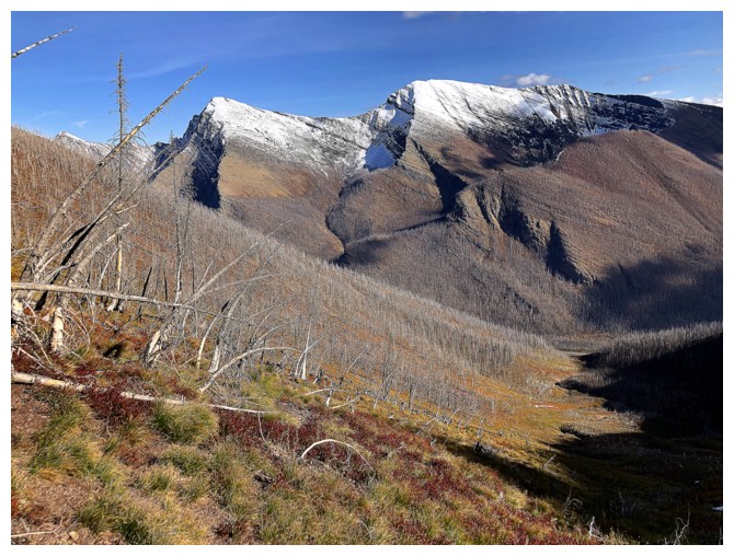
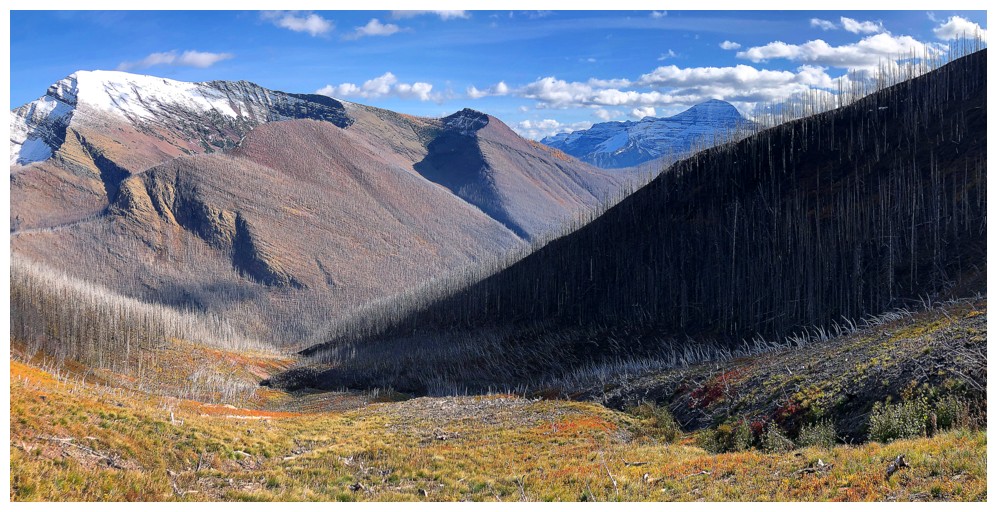
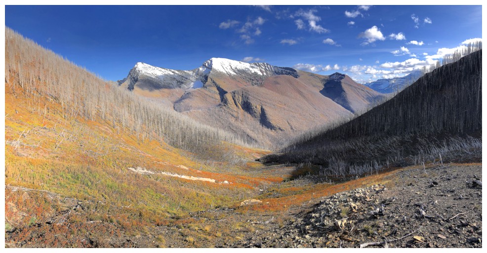
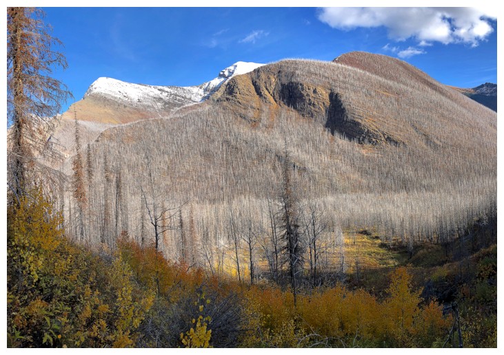
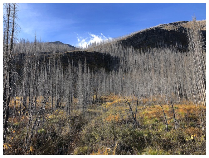
Results of the Kenow fire
Three out of the four Carthews: Mount Carthew (centre), Carthew Minor-Minor (foreground), and Carthew Minor
Classic sign that you are descending an avalanche slope
The Carthews again
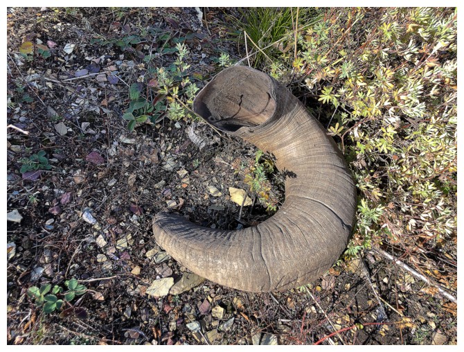
Somebody lost something
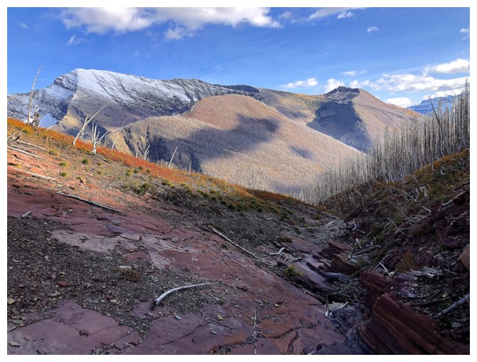
Parting glance at the descent route
The End
LOG