Surprise Station
August 18, 2025
Mountain height: 2900 m
Total elevation gain: approximately
1300 m
Ascent time: 5:25
Descent time: 4:30
Scrambling with
Doug Robson.
A 16-year
absence from the beautiful environs around Three Isle Lake prompted me to look for
possible ascents in the area. And David Jones’ Rockies South provides ideas in
spades! Routes up a host of unnamed but inviting peaks are described in the
book. 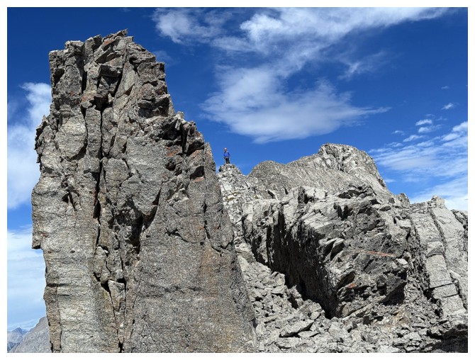 I
chose the shortest and apparently one of the easiest of the lot – Three Isle Peak.
A secondary motivation for Three Isle was to see how far Kevin and I
got up the
peak in 2006. Our objective for that day was Mount Beatty (the south
end of
which is now called Three Isle Peak), but we bailed on the ascent due
to poor
weather and increasingly challenging terrain.
I
chose the shortest and apparently one of the easiest of the lot – Three Isle Peak.
A secondary motivation for Three Isle was to see how far Kevin and I
got up the
peak in 2006. Our objective for that day was Mount Beatty (the south
end of
which is now called Three Isle Peak), but we bailed on the ascent due
to poor
weather and increasingly challenging terrain.
Doug
was
gracious enough to drive me and my weighty e-bike and at 7:20 am we
were
both (assisted) pedalling our way along the north side of Upper
Kananaskis Lake. 3.8 km later, the biking stopped and the hiking
started. The signs say
about 3.4 km to The Forks and then 3.6 km to Three Isle Lake
campground,
however, that 3.6 km section feels much longer and has a significant
amount of
elevation gain.
About 3 hours
into the trip we arrived at the Three Isle Lake Campground and started towards
the lower slopes of Three Isle Peak. A short stint of bushwhacking and longer
stint of boulder-hopping was required to get there. Admittedly, my
“Spider-sense” had been tingling through much of the ascent up to that point. A
GPS track on Gaia stopped just short of the Surprise Station summit, and there
was no mention of Three Isle Peak ascents anywhere. For a class 2 trip one
would think both to be popular ascents from the campground. Nevertheless, from
our present point on the ridge, the route up Surprise Station appeared to be
straightforward.
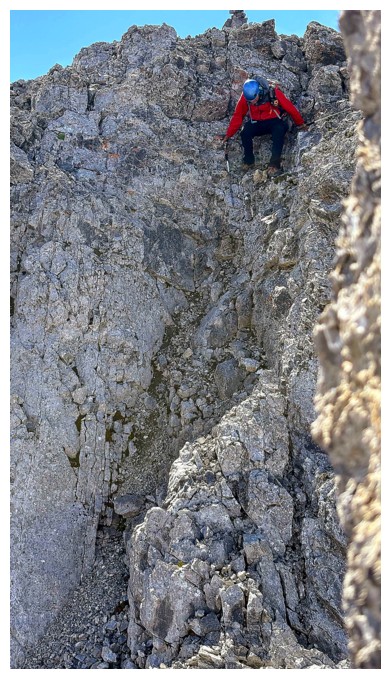
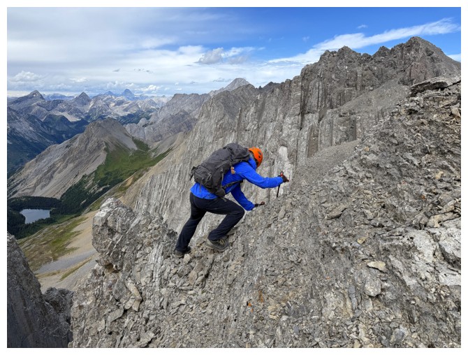
Surprise!!! It
was not – perhaps the source of the name! 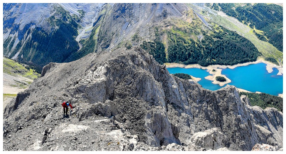 Although the lower and mid ridge were
ascended with ease, the upper ridge became increasingly exposed. After
traversing several sections where a slip down either side would have been
catastrophic, we arrived at the first crux, in the form of a steep, smooth
slab, again with exposure on both sides. A long discussion ensued. We didn’t
know what lay beyond this step and downclimbing it might prove to be quite challenging.
Eventually, the braver of our duo decided to ascend the slab, hoping easier
terrain lie ahead; afterall, we were very close to the summit of Surprise
Station at this point. Up Doug went, skillfully ascending the slab and showing
me the way. At the top he happily announced we could get to the summit with ease.
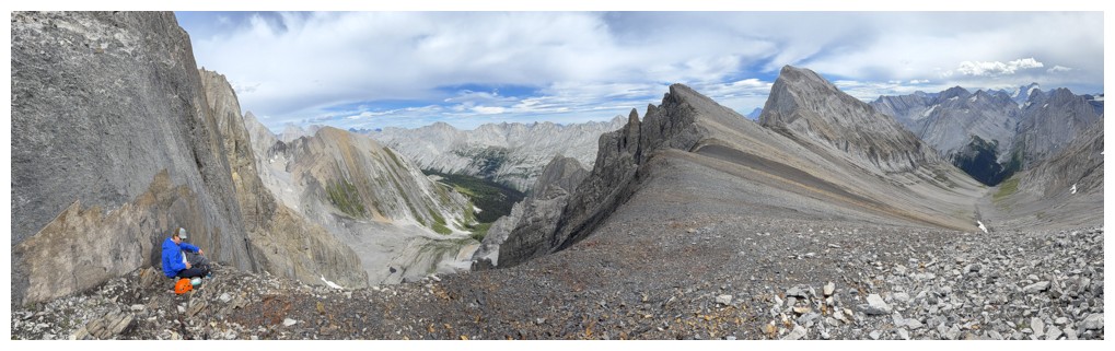
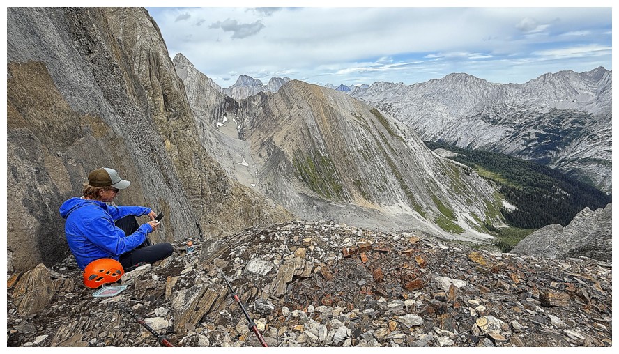
I followed Doug’s route exactly and within minutes we were both at the summit. Congratulations
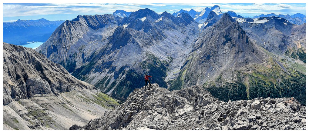
were extended before we took a short break to enjoy the outstanding views.
Surprise Station is one of those mountains that is smaller than most of the peaks
around it, but is situated perfectly to get a 360 degree panorama of everything in the
area. Mountains of the Royal, British Military, French, and Joffre groups all
made their grand appearances.
Although the lower and mid ridge were
ascended with ease, the upper ridge became increasingly exposed. After
traversing several sections where a slip down either side would have been
catastrophic, we arrived at the first crux, in the form of a steep, smooth
slab, again with exposure on both sides. A long discussion ensued. We didn’t
know what lay beyond this step and downclimbing it might prove to be quite challenging.
Eventually, the braver of our duo decided to ascend the slab, hoping easier
terrain lie ahead; afterall, we were very close to the summit of Surprise
Station at this point. Up Doug went, skillfully ascending the slab and showing
me the way. At the top he happily announced we could get to the summit with ease.
I followed Doug’s route exactly and within minutes we were both at the summit. Congratulations
were extended before we took a short break to enjoy the outstanding views.
Surprise Station is one of those mountains that is smaller than most of the peaks
around it, but is situated perfectly to get a 360 degree panorama of everything in the
area. Mountains of the Royal, British Military, French, and Joffre groups all
made their grand appearances.
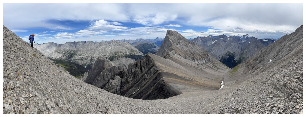
What next? The
summit of Three Isle Peak lay about 500 metres further north and was only 10 metres
higher. We had to make an attempt. A short downclimb and some easy ridgewalking
later and we arrived at crux #2 – apparently 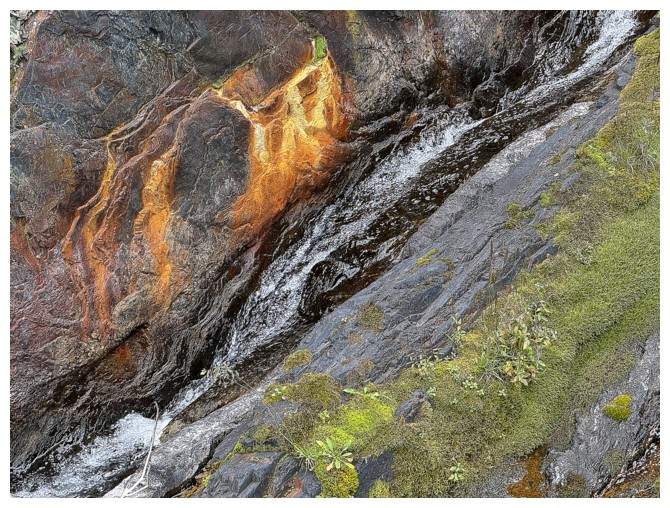 Three Isle was NOT going to
acquiesce without baring its teeth! This crux was sketchier than the first –
another exposed situation this time requiring a short traverse across a slope
of loose, hard dirt. Again, Doug stepped up to the plate and led the way. Once
across, easier terrain led to a lowpoint between Surprise and Three Isle.
Three Isle was NOT going to
acquiesce without baring its teeth! This crux was sketchier than the first –
another exposed situation this time requiring a short traverse across a slope
of loose, hard dirt. Again, Doug stepped up to the plate and led the way. Once
across, easier terrain led to a lowpoint between Surprise and Three Isle.
Although the
summit of Three Isle was relatively close at this point, we were both a little
frazzled from all the unexpected challenges and the weather was definitely
taking a turn for the worse. As well, the proposition of having to retrace our
steps back the way we came was most unsavory, especially if it did start to
rain. Also close by was a potential escape route off the mountain to the Three
Isle/Putnik col. I had ascended Putnik from this col in 2009, so I knew if we
could get down there, the remainder of the descent would go with ease.
Thankfully, the
route to the col was nothing more than a steep hike, though often on
hard-packed, slick dirt. We took a much-needed break, most of the stress of the
descent now in the rear-view mirror. A long but easy hike/scramble back to the
start followed.
Overall, an
extremely rewarding day, even though it was not at all what we were expecting,
and we failed to reach the summit of Three Isle Peak. I’m not sure I would
return to finish the job, as Surprise Station is only a few metres lower and
still boasts an outstanding view. Thank you, Doug, not only for joining me on
this super interesting trip, but also for leading the way on all the difficult
terrain.
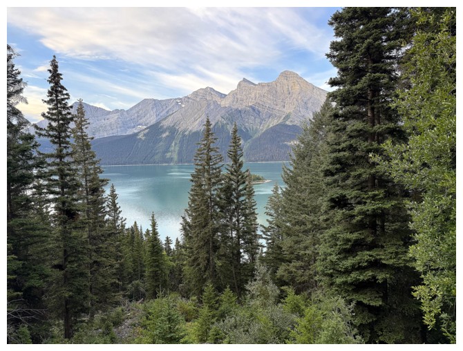
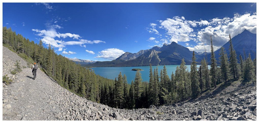
Glimpse of the Upper Kananaskis Lake during the bike approach
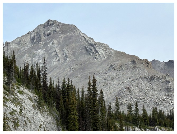
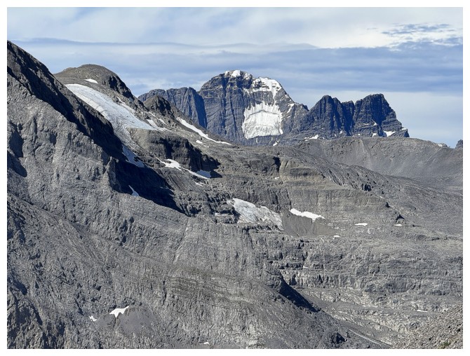
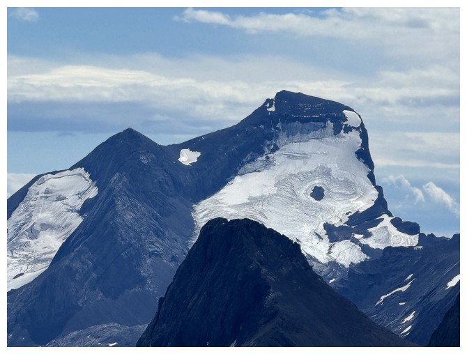
Mount Putnik at the right
"Corrugated clouds" and an unnamed peak south of Three Isle Lake
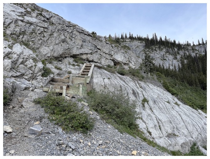
The famous wooden stairs that allow an easy ascent of the headwall
Putnik (left) and the unnamed
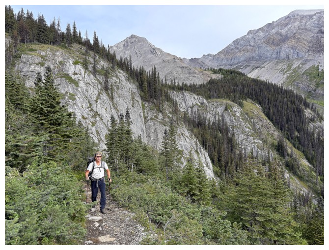
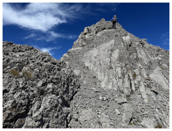
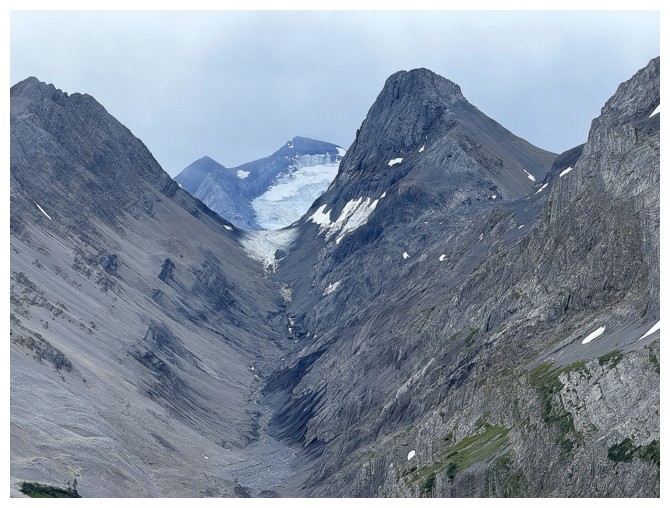
Our first decent look at the first part of the objective
Close-up - looks easy
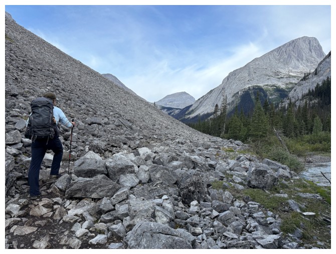
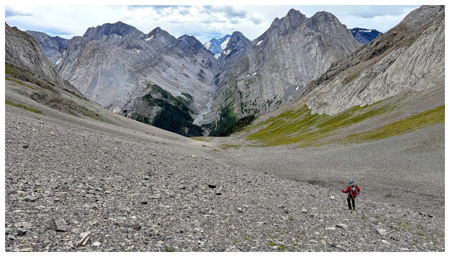
After a short bushwhack we are ready to tackle the boulder field
The boulder field
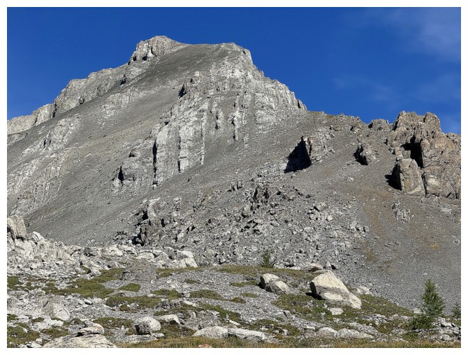
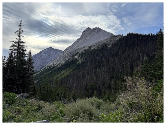
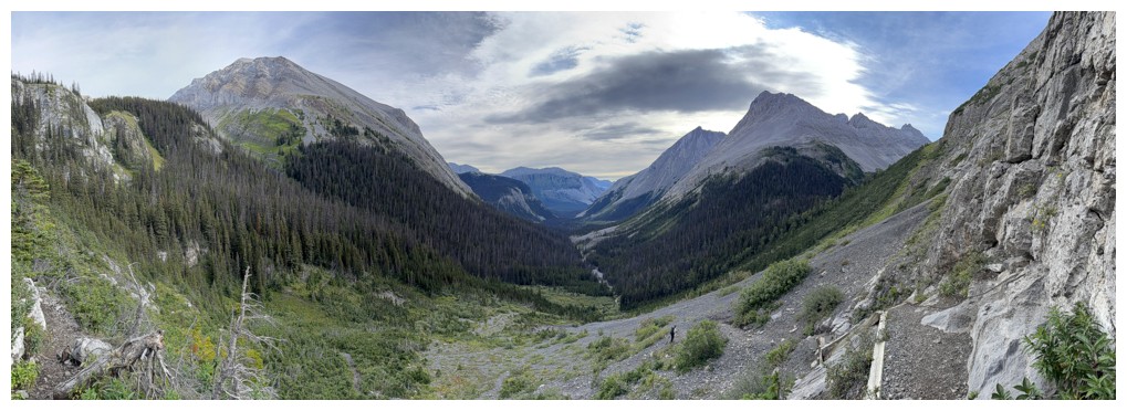
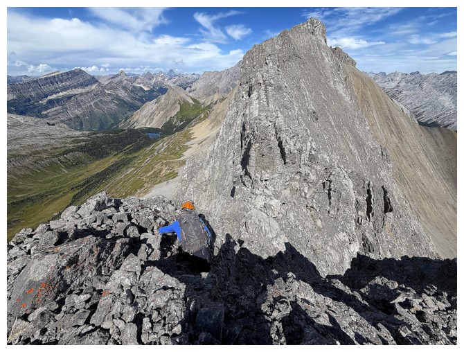
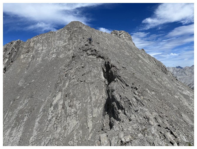
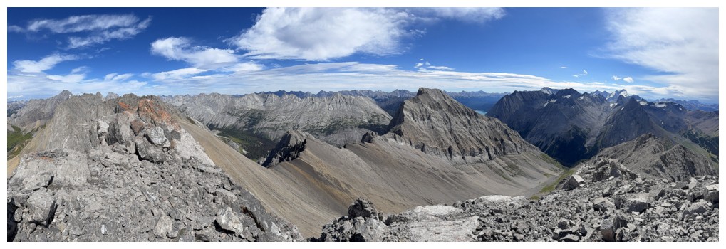
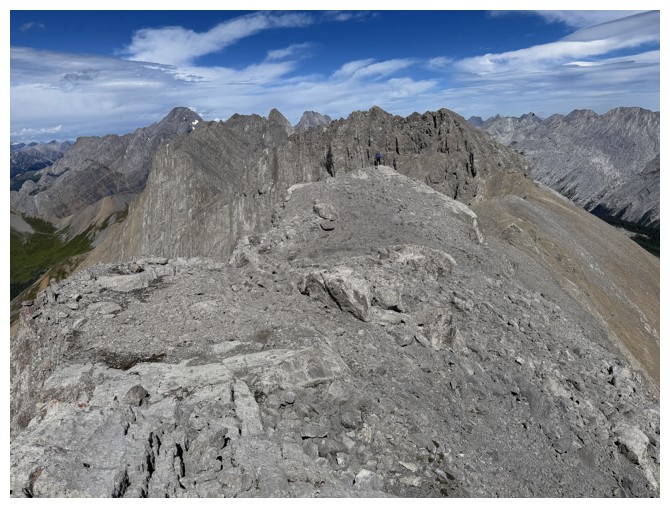
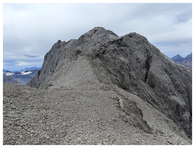
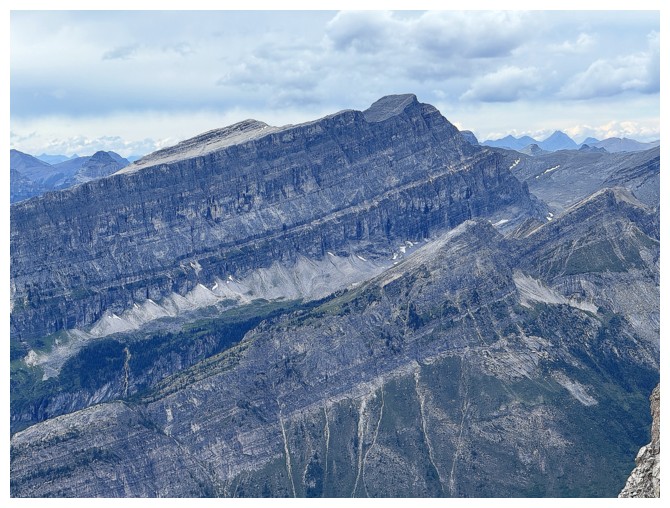
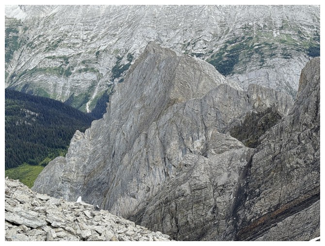
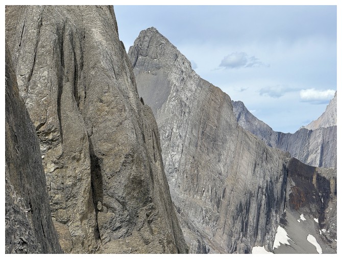
The south ridge of Surprise Station/Three Isle Peak
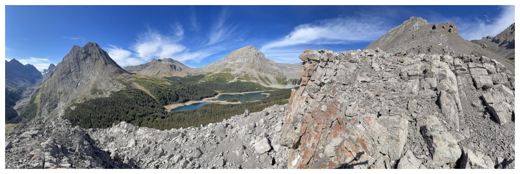
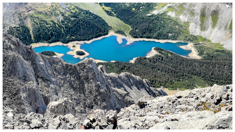
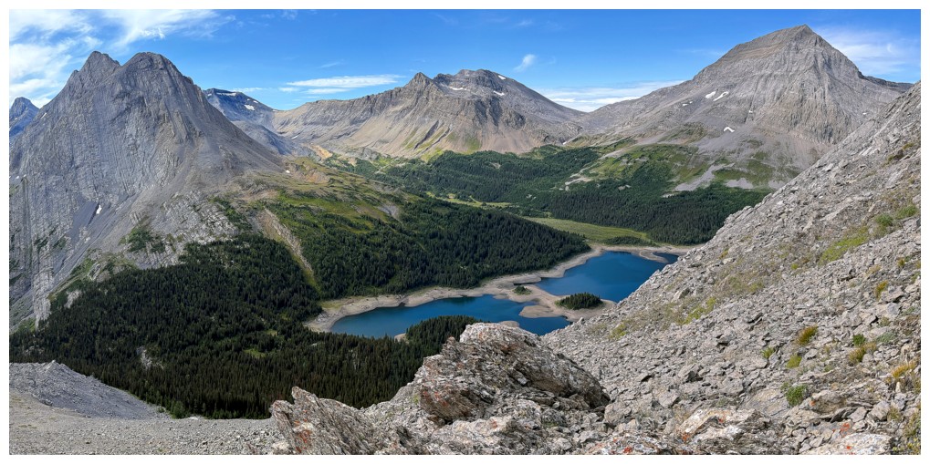
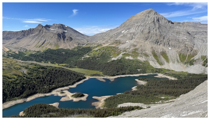
Views towards Three Isle Lake start to shine
Same as above (photo by Doug)
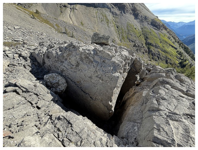
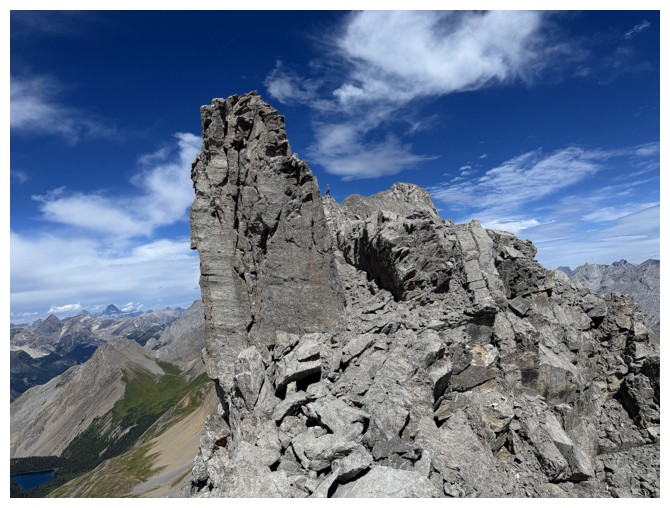
Interesting gap in the rock. "V" is for Vendetta or "V" is for V
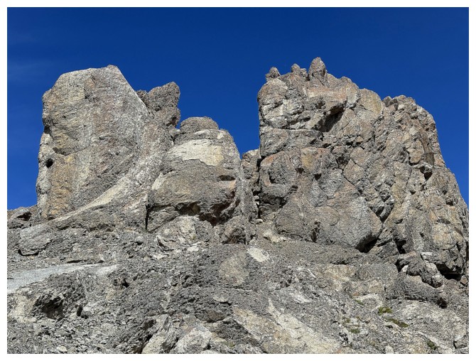
No shortage of interesting rock on this ridge
Same as above with Putnik
With Surprise Station
Even though they dulled the colour of the lake, the clouds here were pretty cool
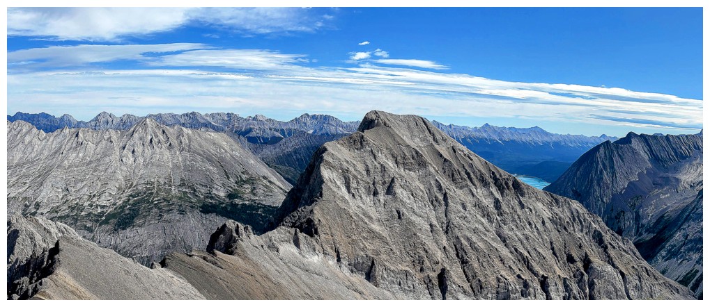
Doug and an outlier of Mount Lyautey, named Lakeview Station
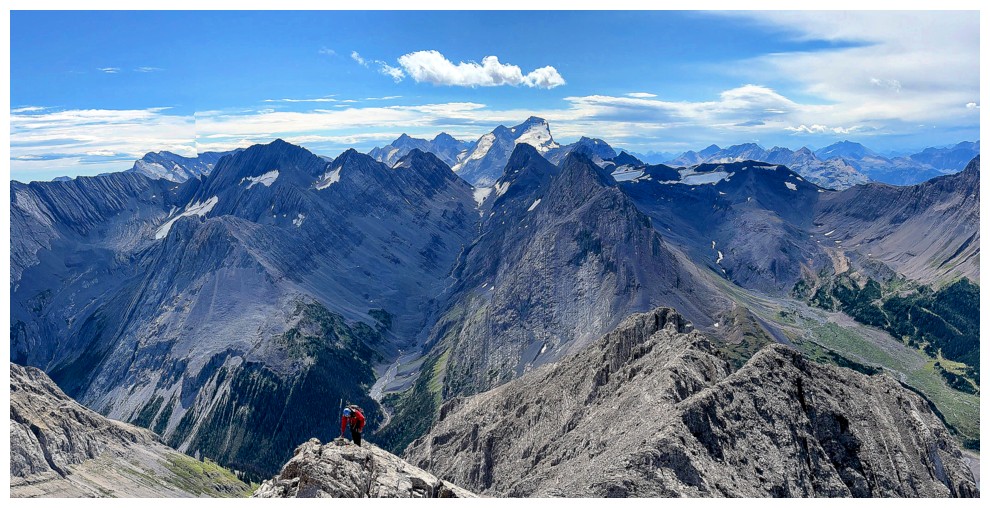
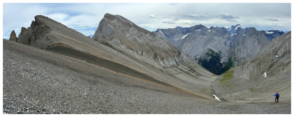
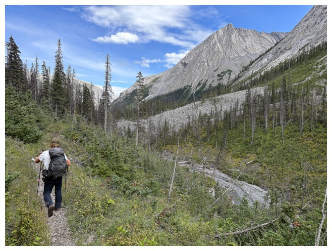
This view is going rule our world for most of the day
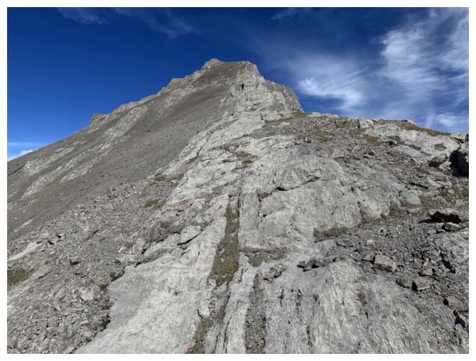
Easy travel up the wide ridge
The view again
And again. Mount Worthington at the right.
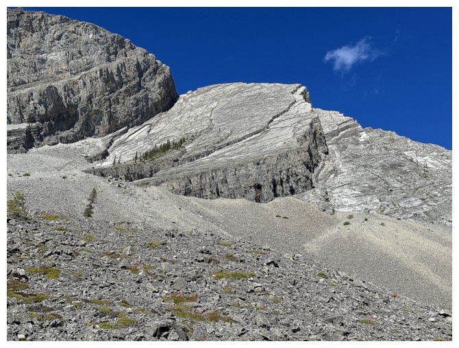
Walking up the slabs was very enjoyable
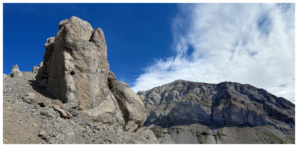
Interesting human-made rock formation (photo by Doug)
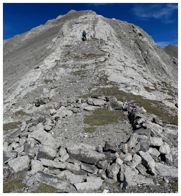
Same as above from my perspective
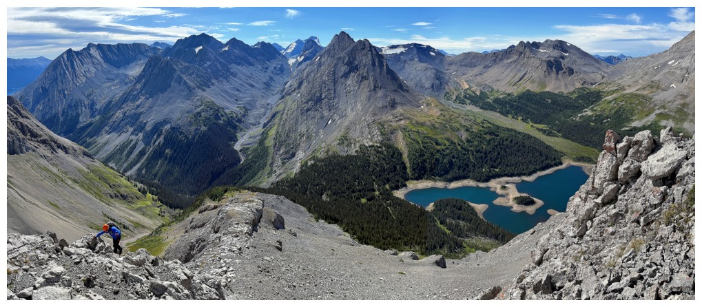
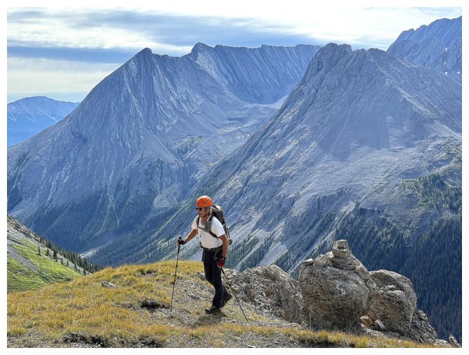
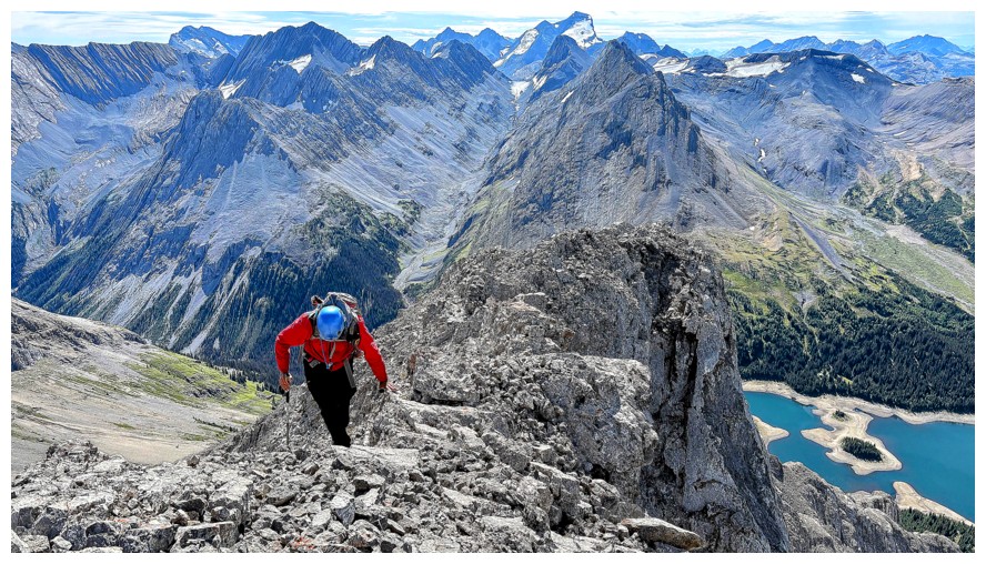
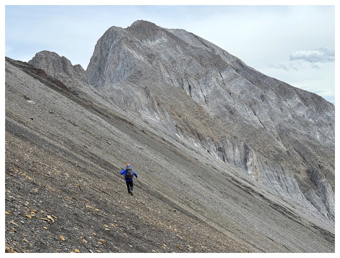
Somehow I got ahead of Doug. He led most of the ascent.
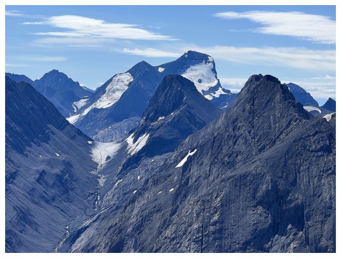
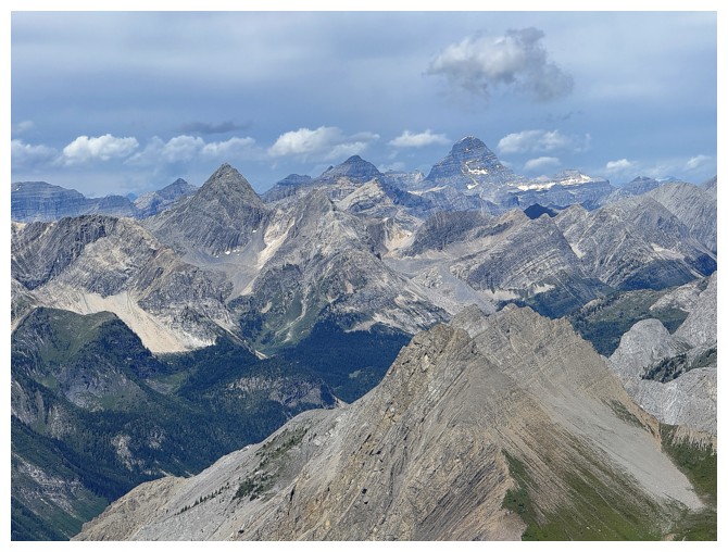
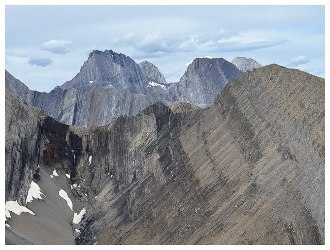
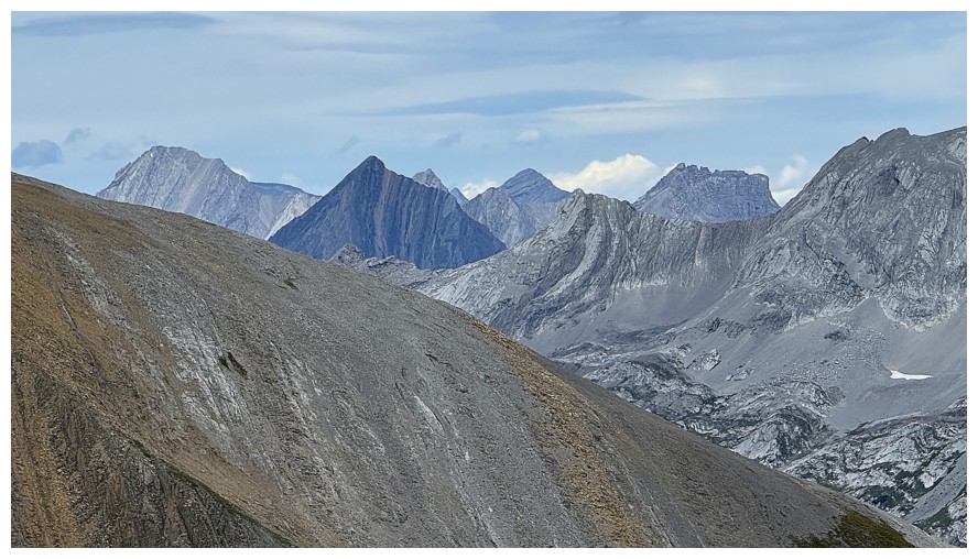
Mount King George and Mount Prince Albert (right)
Mount Joffre, with Mount Northover in front, and the unnamed peak at the right
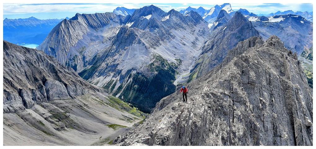
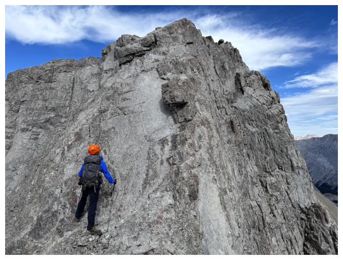
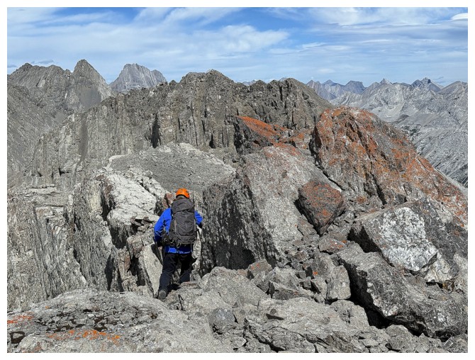
Doug tackles one of the first narrow sections of the ridge
Wide again
Doug captures the magnificent scene behind us (photo by Doug)
Same as above (photo by Doug)
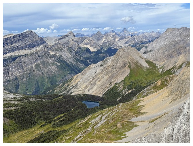
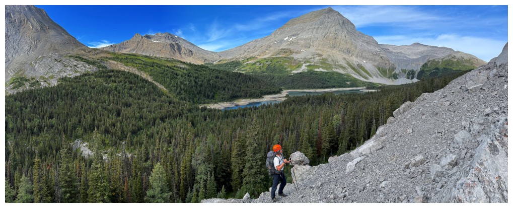
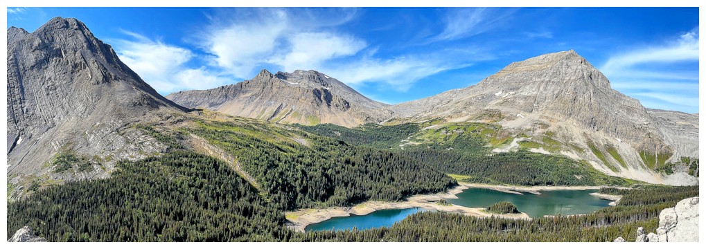
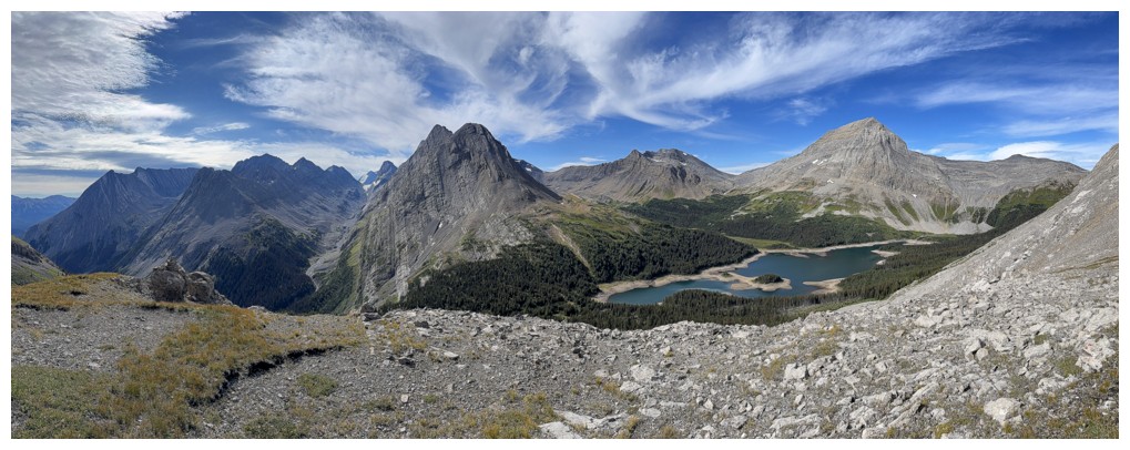
First look at Beatty Lake and the Assiniboine area in the distance
Assiniboine near the right and Eon to the left
Doug leads a short downclimb
Fortunately, it was easy enough to descend facing out (photo by Doug)
Lots of cool rock features to take our minds off the challenging terrain
Doug continues to lead the narrow ridge
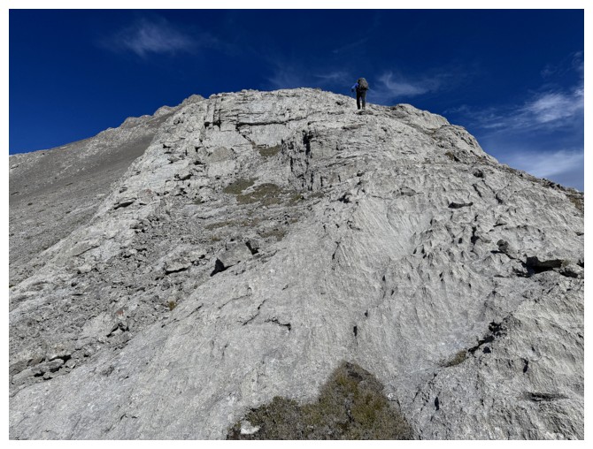
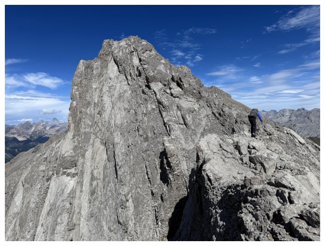
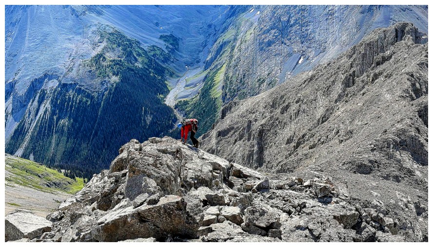
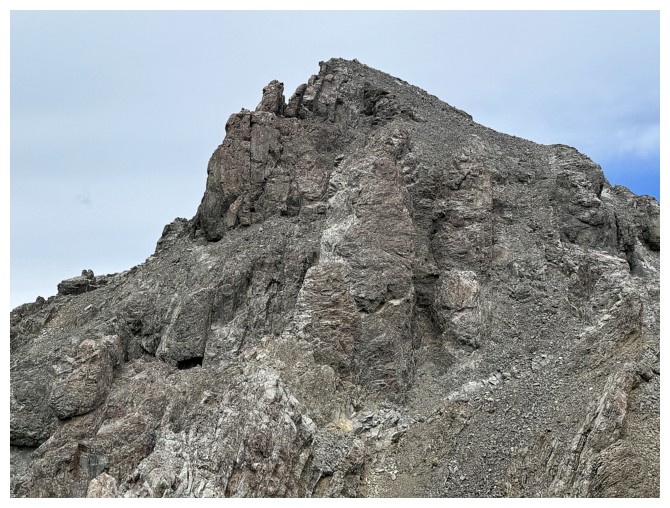
Crux #1. It is more challenging than it looks.
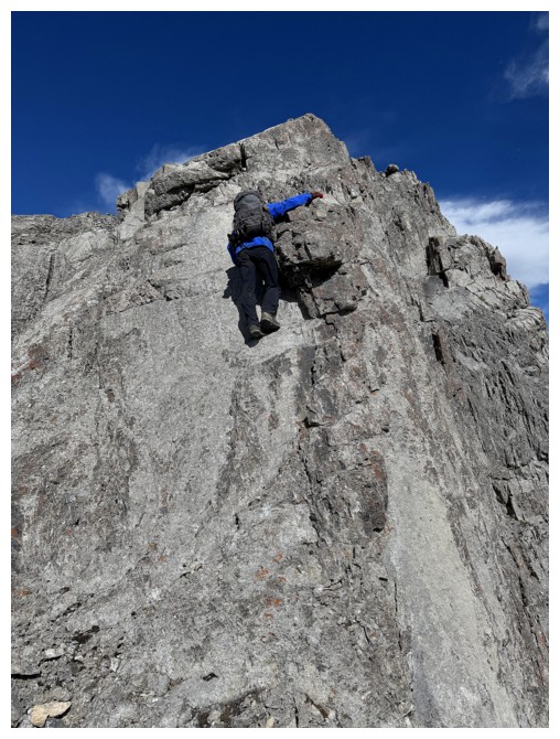
Up he goes
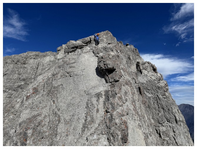
At the top
I'm up (photo by Doug)
Same as above (photo by Doug)
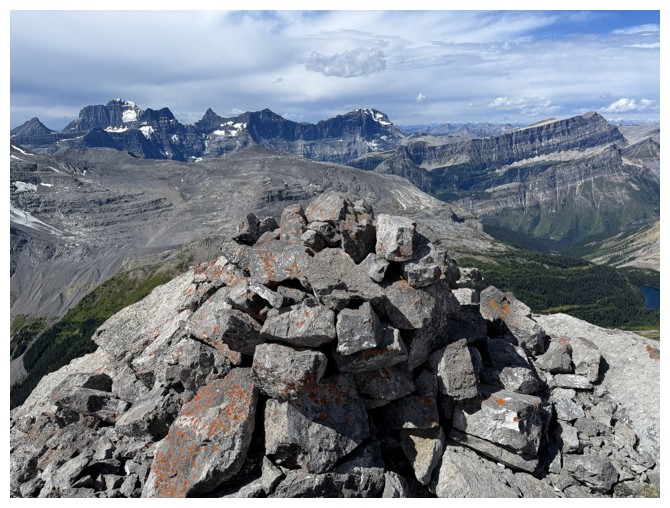
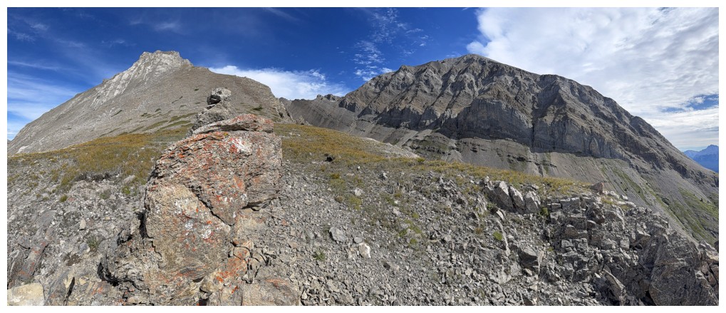
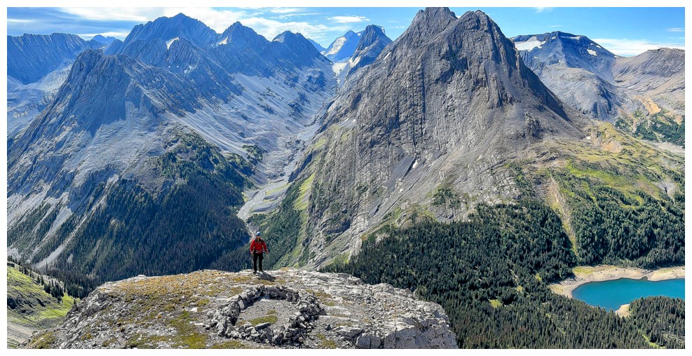
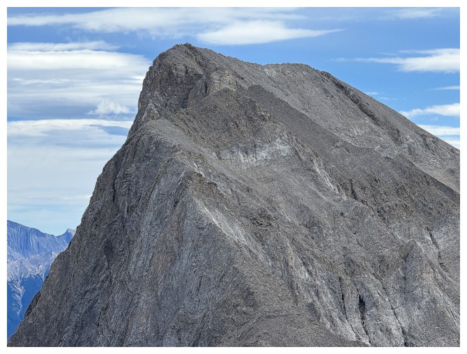
The cairn at Surprise Station
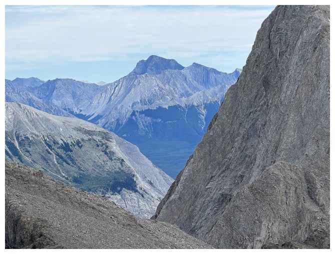
The west side of Mount Putnik
Close-up of Joffre
View to the east
Zoomed in
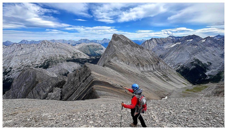
Moving on
Looks easy, but there are more difficulties ahead
Doug prepares for Crux #2
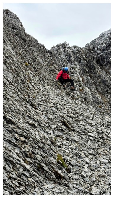
Again,
this short section is worse than it looks - scree on hard dirt and a
nasty drop-off to the descender's right (photo by Doug)
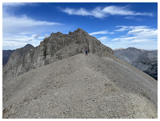
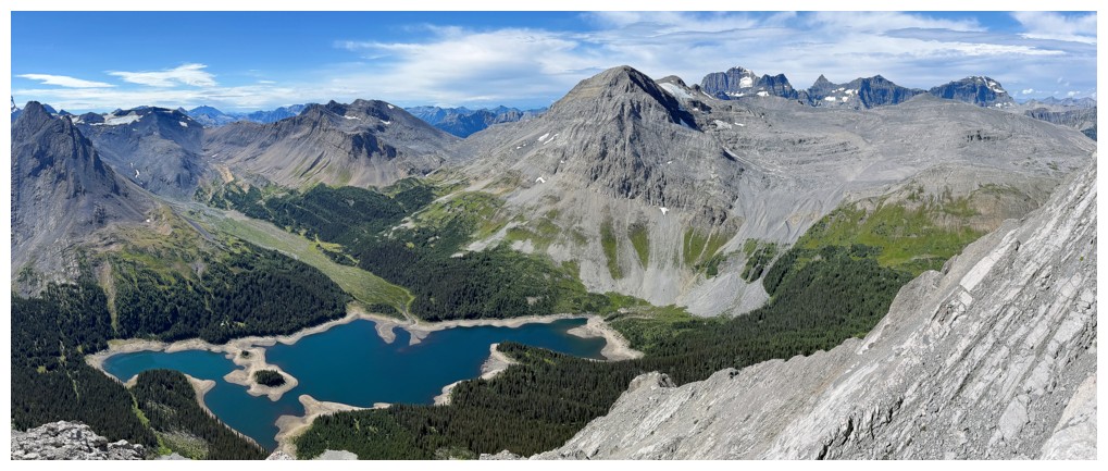
Back onto easy terrain, with the summit of Three Isle Peak ahead
Looking back to Surprise
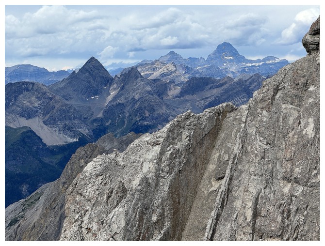
Assiniboine and company again and the steep strata of Three Isle's west face
The TSN Turning Point - this is where we decided to bail by going down to the Three Isle/Putnik col
Mounts King George, Prince Albert, and Prince Edward
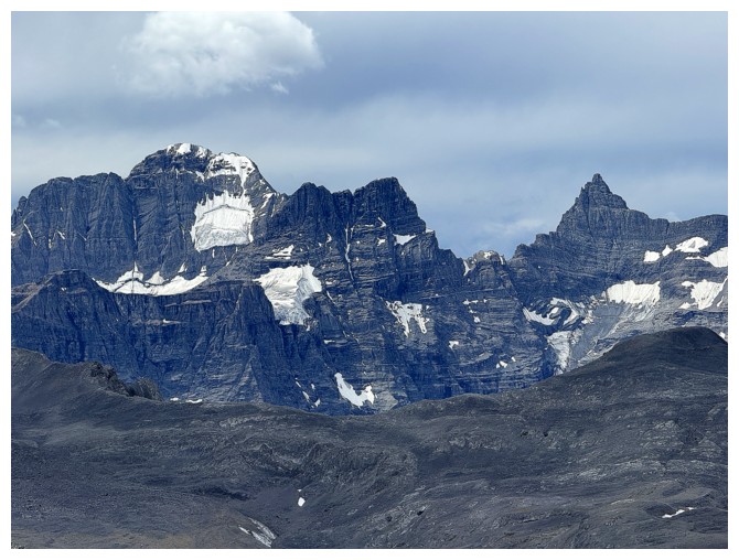
Mount Cradock
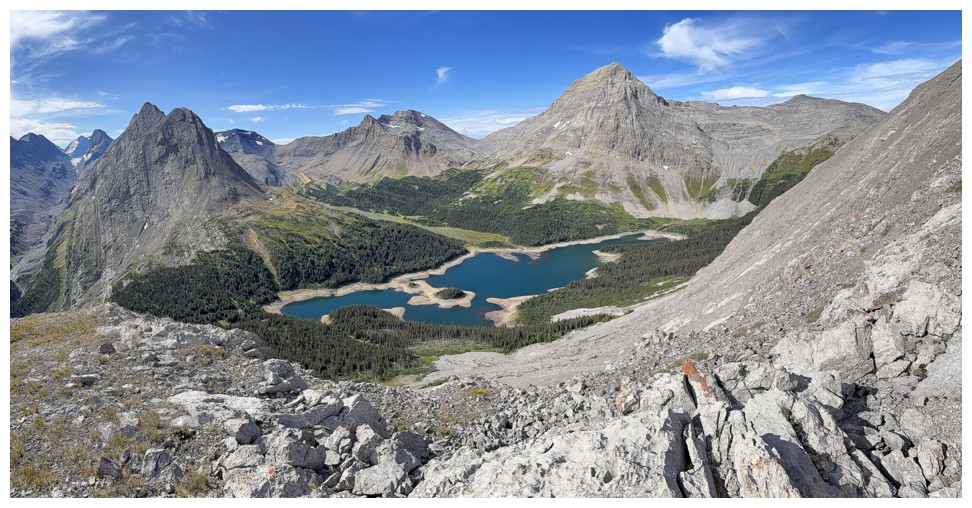
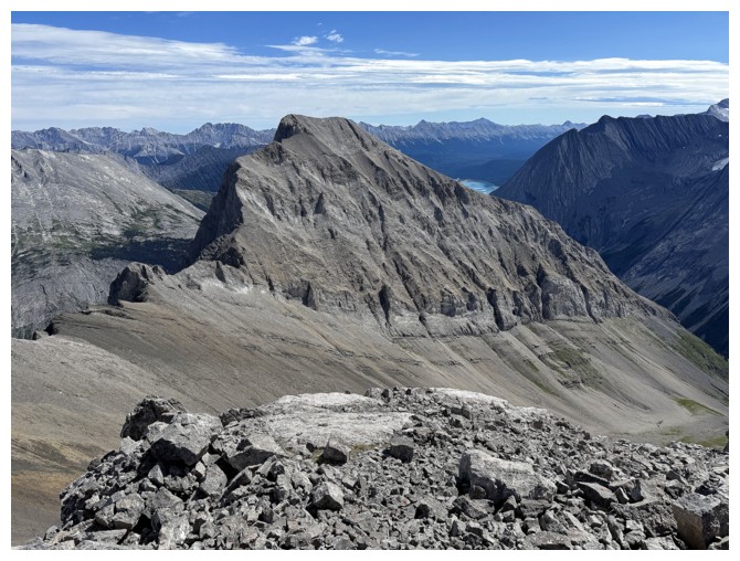
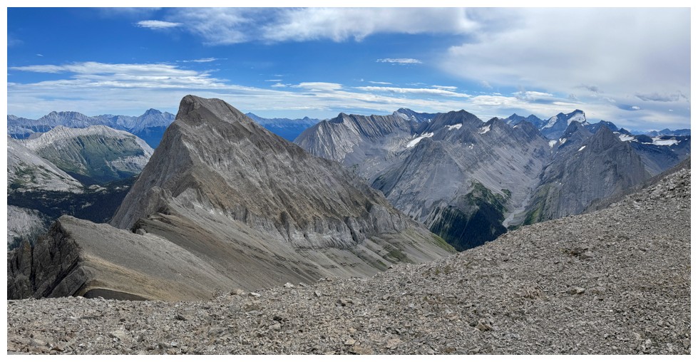
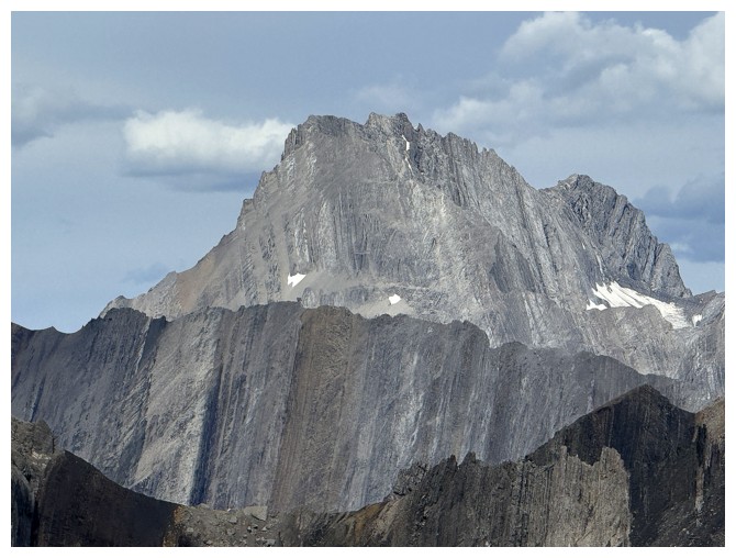
The view towards Three Isle Peak

The massive Mount Lyautey massif
Descending to the col
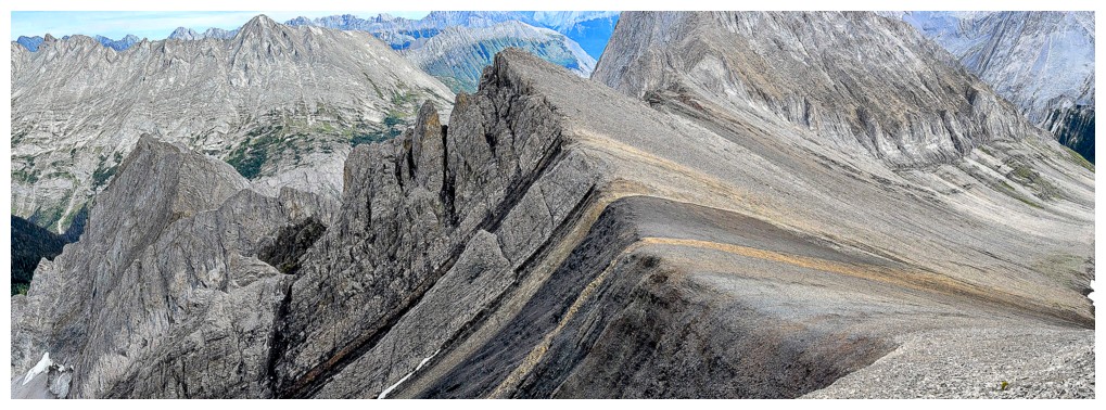
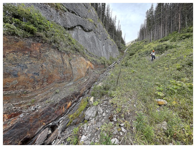
Very cool rock layers near the col (photo by Doug)
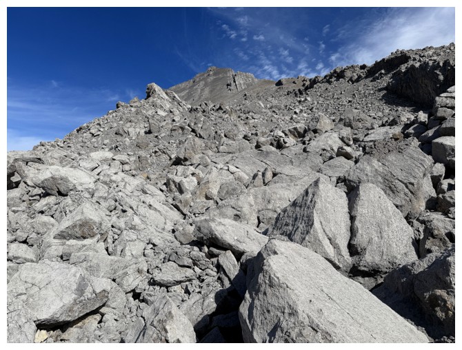
And some very intimidating outliers of Putnik
Elpoca Mountain
Mount Rae
The west ridge of Putnik

Doug arrives at the col
Good, wind-sheltered spot for a break
Peaks of the British Military Group
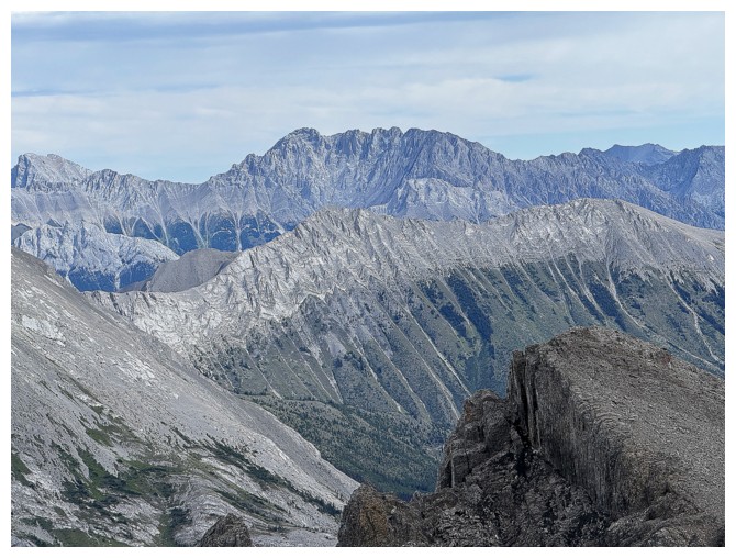
Peaks of the Kananaskis Range. Galatea, Chester, and The Fortress, among others.

The west ridge of Putnik was a real treat to look at
I think we actually had cellphone service. The peak in the centre is called Razor Flakes.
The south side of Mount Beatty looks insanely steep
Mount French
Easy descent from the col, though there was surprisingly little surfable scree
Doug's traverses to get to an easier descent line
Terrific views to the south while descending (photo by Doug)
Joffre and Mount Northover
Following the creek out to the trail
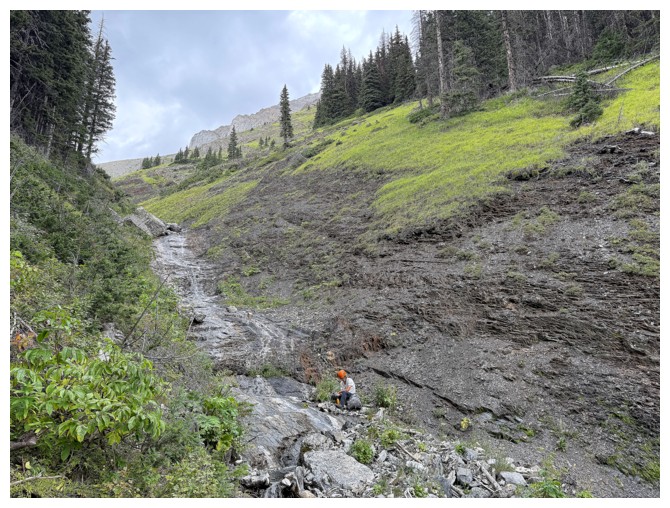
Doug refills his water
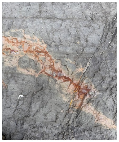
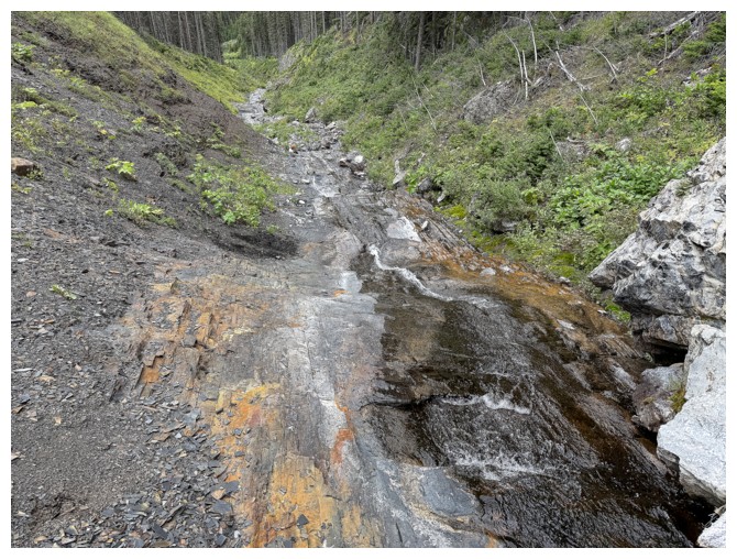
Some cool rock and colouration on the side of the creek
Same as above
The most colourful one
Back on the main trail
The famous Joy climbing route on Mount Indefatigable
Good views over the Upper Kananaskis Lake on the ride out
The End
LOG