Table Mountain V
(via north side)
March 1, 2025
Mountain height: 2225 m
Elevation gain: 740 m
Ascent time: 3:30
Descent time: 3:00
Solo scramble.
In April of
2024, looking down from the summit of Table Mountain, I had spotted this
potential route up the north side of the peak. The criteria for an attempt
would be little to no snow and definitely not during tick season, as a decent
section of bushwhacking would be required to get to the ascent drainage.
I was not
expecting, 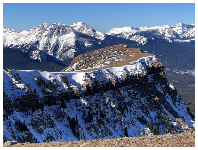 however, to be making that attempt in early March of any year. With
very little snow, especially high on the mountain, and predicted high winds,
the protected north facing route suddenly had great appeal – and off to the
Table Mountain trailhead I went.
however, to be making that attempt in early March of any year. With
very little snow, especially high on the mountain, and predicted high winds,
the protected north facing route suddenly had great appeal – and off to the
Table Mountain trailhead I went.
Initially, I
planned to gain some elevation on the Table Mountain trail and then
side-slope in an easterly direction to the drainage that splits the
awe-inspiring north face. Another route was revealed upon arriving at the
parking lot. The topo map indicated there existed a hiking trail heading east
from the Beaver Mines Lake Campground. I could follow this trail and then turn
south towards the drainage. The big unknowns for this route would be the
density of the intervening forest and the depth of the snow. A warm week of weather
had managed to melt most of the snow up high, but not so down low in the
Sun-starved valley.
The first part
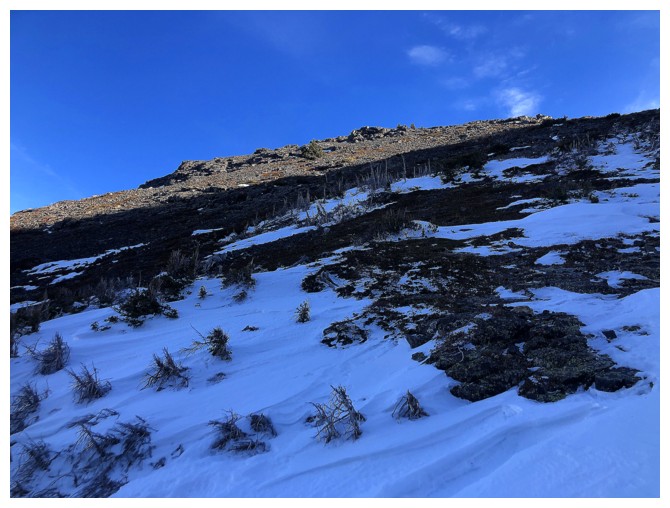
of the plan went well, atop bare ground, then firm snow. 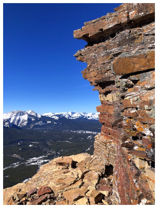 However, as soon as I
left the trail all bets were off! Deep, unsupportive snow prompted a few
uncouth words and a lingering regret to leave my snowshoes in my car.
Fortunately, that situation didn’t last long. Sections of bare ground offered
much easier travel and though the distance between the trail and drainage
turned out to considerably longer than anticipated, I made it to the drainage
relatively unscathed.
However, as soon as I
left the trail all bets were off! Deep, unsupportive snow prompted a few
uncouth words and a lingering regret to leave my snowshoes in my car.
Fortunately, that situation didn’t last long. Sections of bare ground offered
much easier travel and though the distance between the trail and drainage
turned out to considerably longer than anticipated, I made it to the drainage
relatively unscathed.
Speed and ease
of travel improved measurably once heading up the snow- and ice-filled creek. Here,
it quickly became apparent that this ascent route would be much better in the
summer, when the terrain is NOT Sun-starved. The drainage was lined with
colourful rock, begging some illumination.
I could have
followed the drainage all the way to the col between the true summit and the
Western Plateau (unofficial term for the western and more striking summit), but
the Sun was now shinning on the ridge to the left – it was calling me loud and
clear! 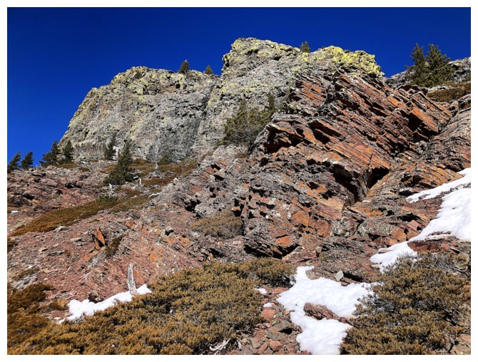 This route turned out to be far more interesting than the drainage,
featuring more colourful rock and airy views over the eastern edge. Only a very
brisk, though not cold, wind detracted from the ascent. I didn’t even stop at
the summit, wanting to find a little shelter from the wind from where I could take a
short break.
This route turned out to be far more interesting than the drainage,
featuring more colourful rock and airy views over the eastern edge. Only a very
brisk, though not cold, wind detracted from the ascent. I didn’t even stop at
the summit, wanting to find a little shelter from the wind from where I could take a
short break.
Retracing my
ascent route for descent didn’t make much sense – not when I could complete a
rewarding loop via the amazing west face. I had ascended this route with Linda
Breton in 2005 and descended it twice since then. The scenery throughout is
incredible and it remains my favourite route on the mountain. Less than a year
previous I had encountered a couple of amazing frozen waterfalls. Sadly, they
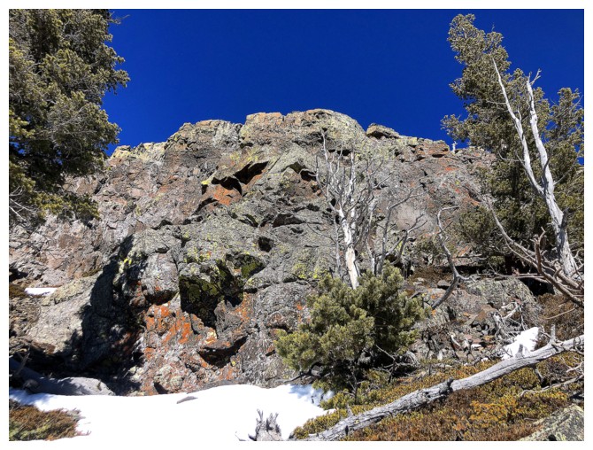
hadn’t formed yet, however, I did find a stunning area north of the falls,
featuring fantastic rock, dead trees, and lots of lichen.
The day ended on
the well-used Table Mountain trail. Microspikes to tackle the icy terrain were
more than welcome here.
One of those
routes that I’m certainly glad I completed, but will probably not run back to
repeat anytime soon. If so, I would try in early summer when the Sun reaches
the rock.

Looking back along the campground road

Syncline Mountain is one of the first mountains to receive full Sunlight

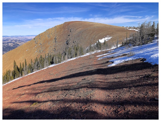
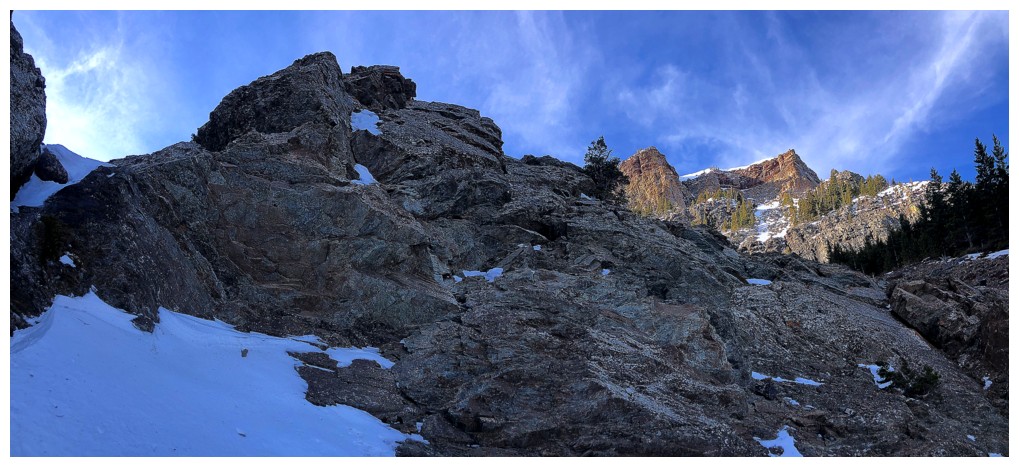
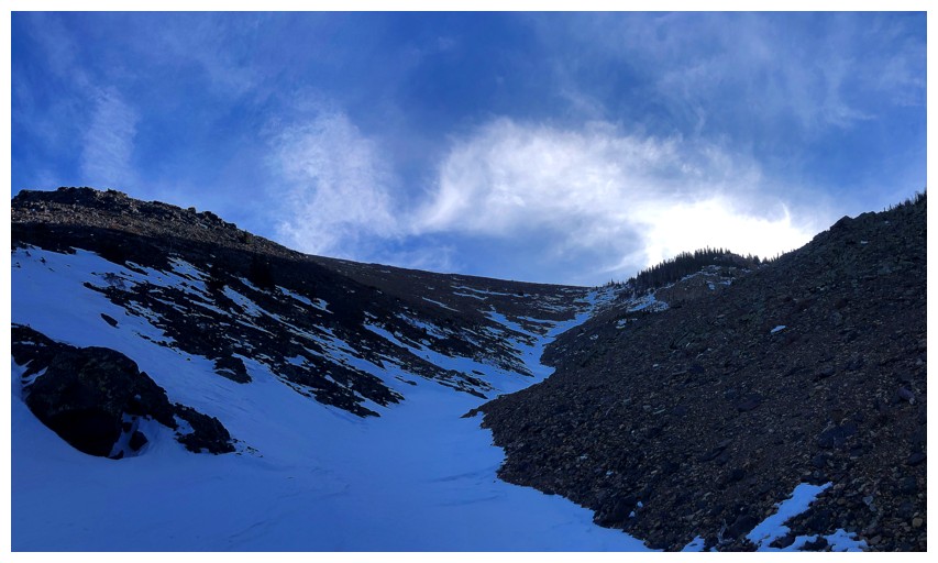
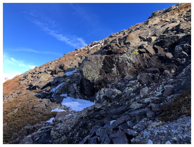
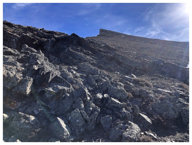
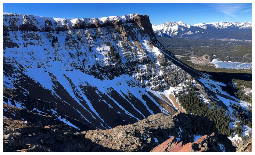
At the point where I'm ready to leave the trail and route-find my way
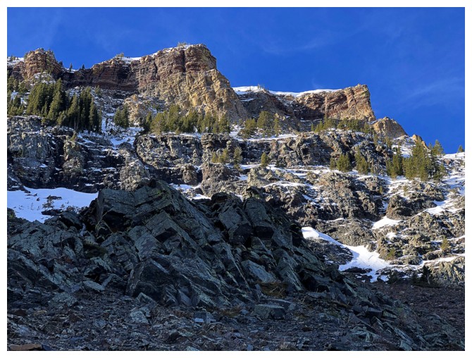
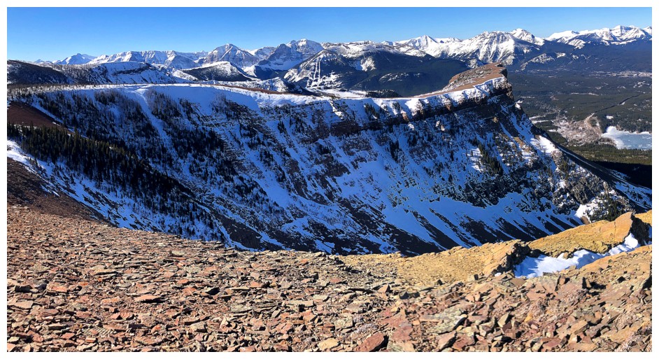
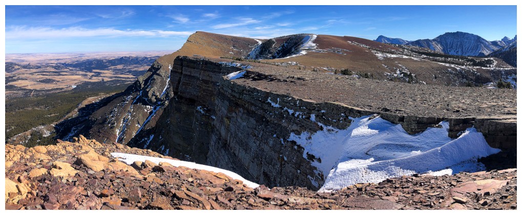
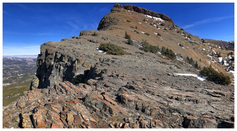
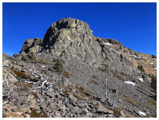
to the drainage that separates the true summit (left) and the Western
Plateau (right)

A brief moment of Sunlight, sometime later

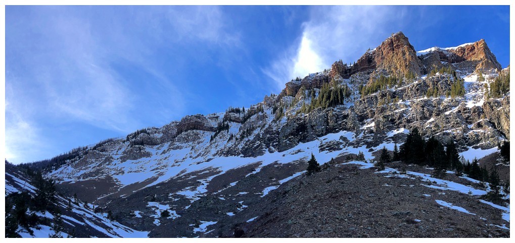
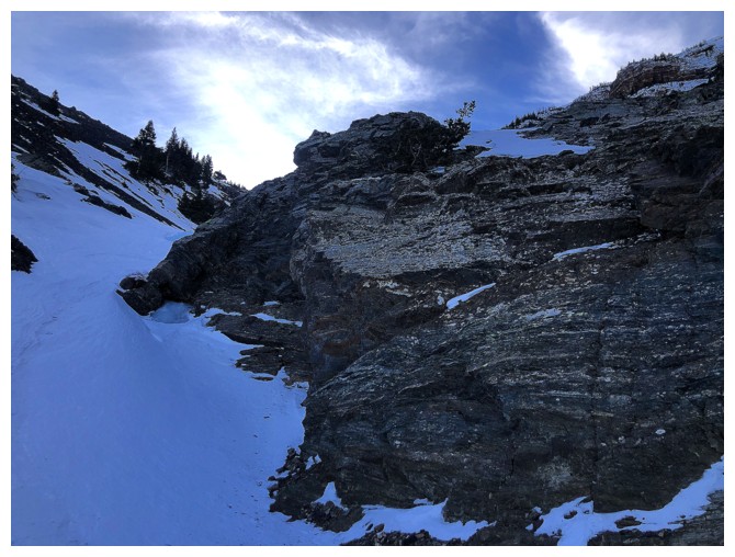
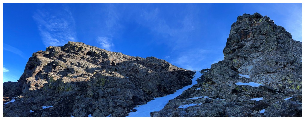
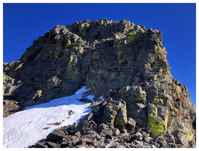
Getting closer

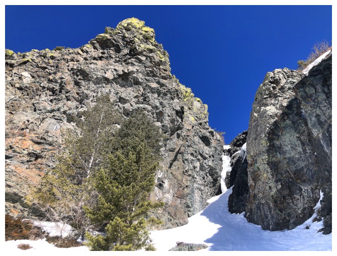
Finally in the drainage

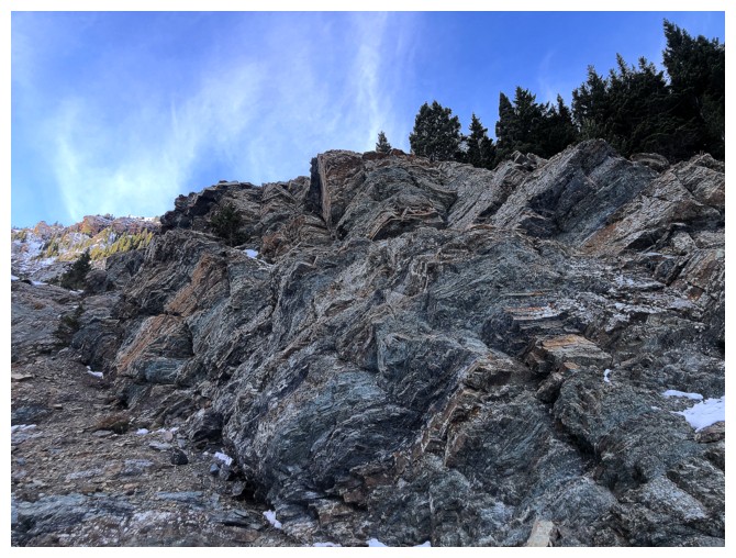
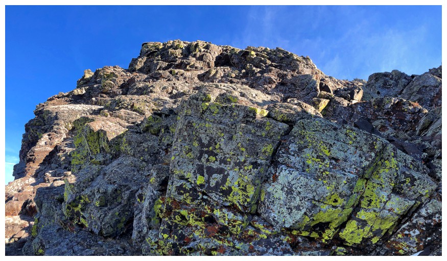
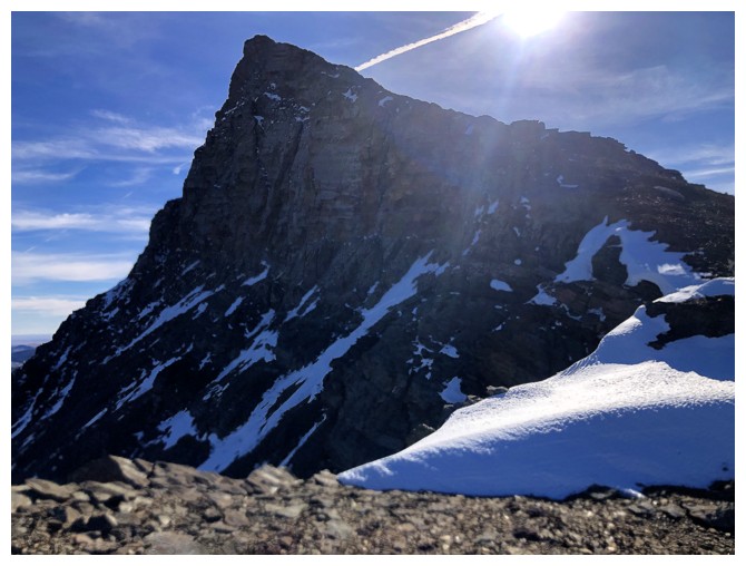
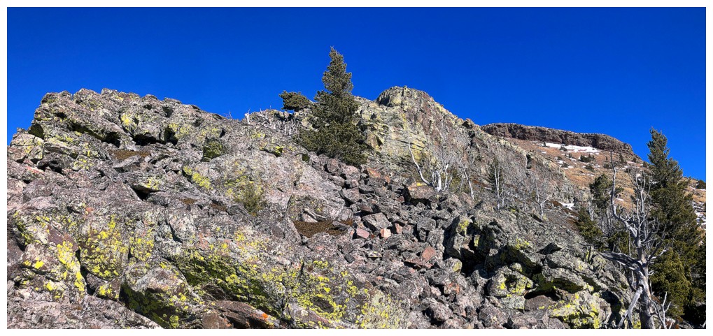
This buttress and its nearby twin were eye-catching throughout

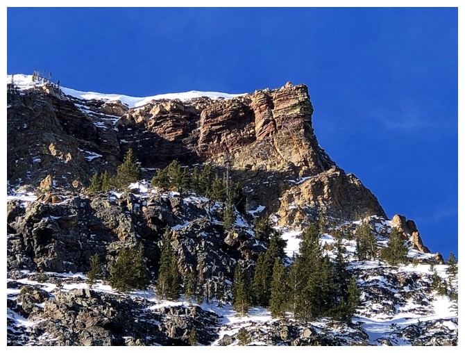
Close-up
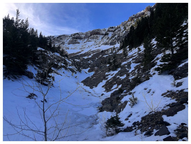
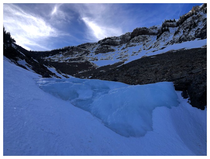
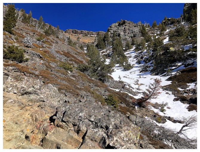
The drainage starts to open up. Travel up it was generally easy.
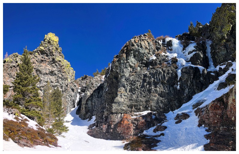
No Sun will be reaching this colourful rock at this time of year

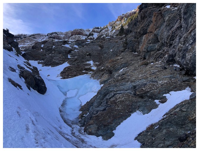
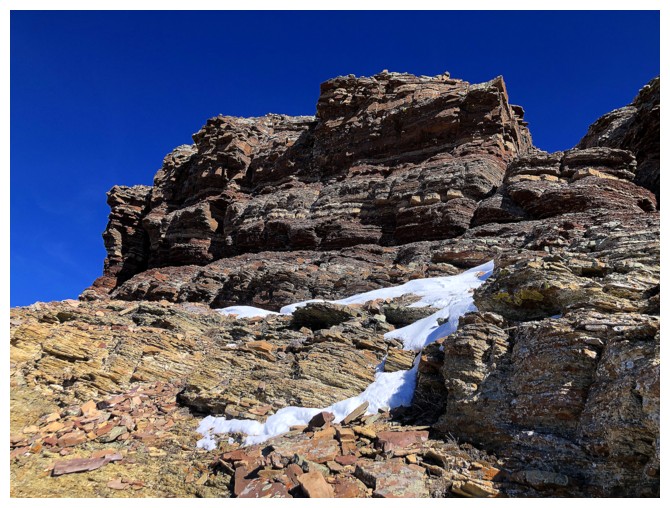
A few steep ice steps in the drainage were easily circumvented by staying on the snow
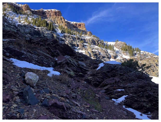
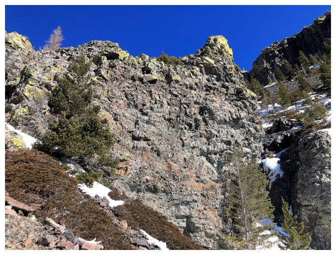
Longing for the Sun
At the least the buttresses were getting some
One of them
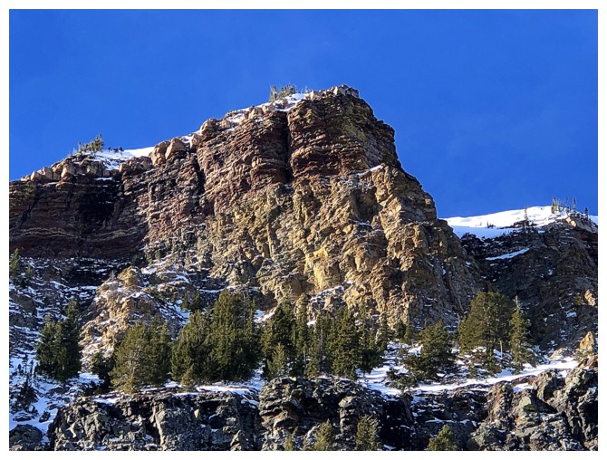
The other
Both
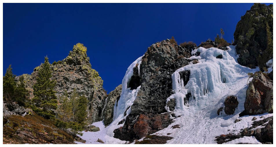
Another steep step
And more ice
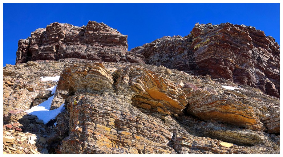
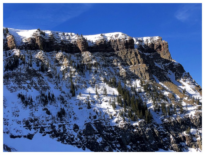
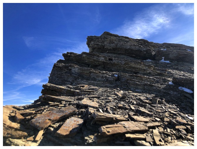
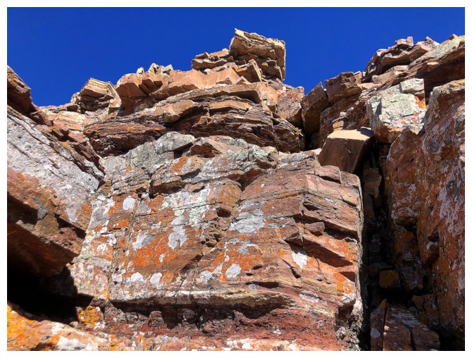
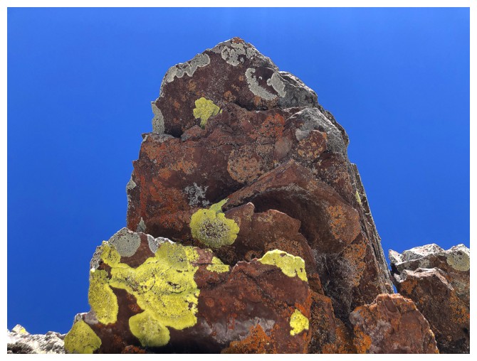
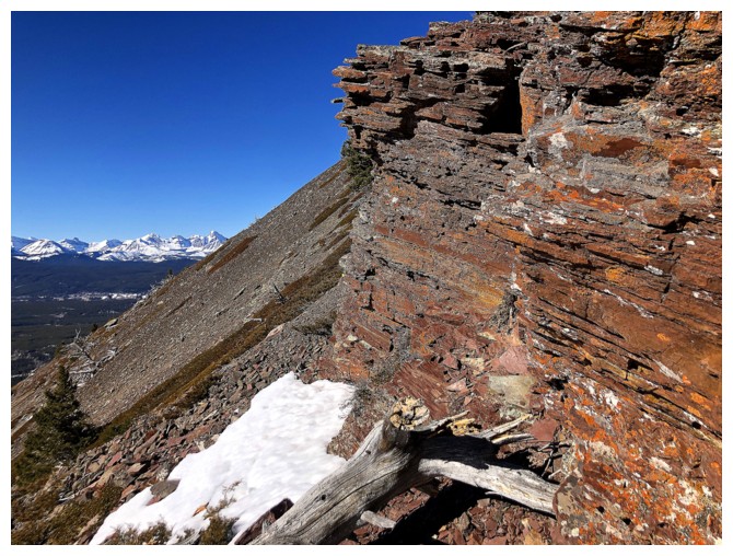
It's a bitter pill to swallow when the red argillite won't be lit up by the Sun!
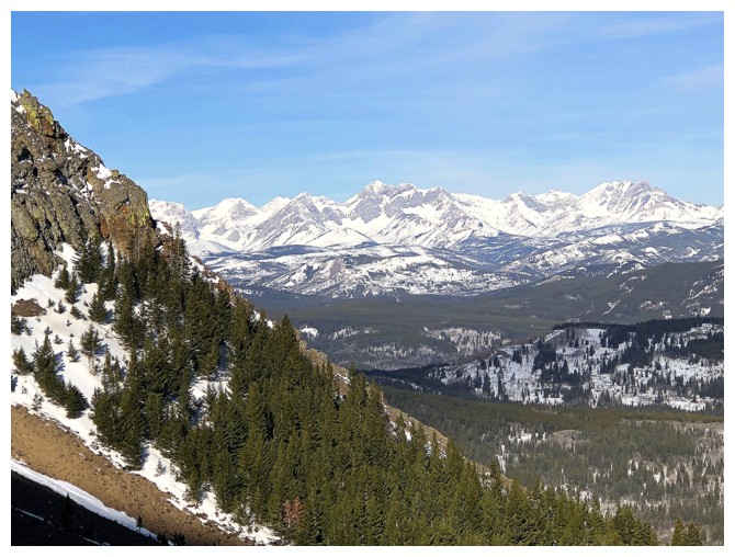
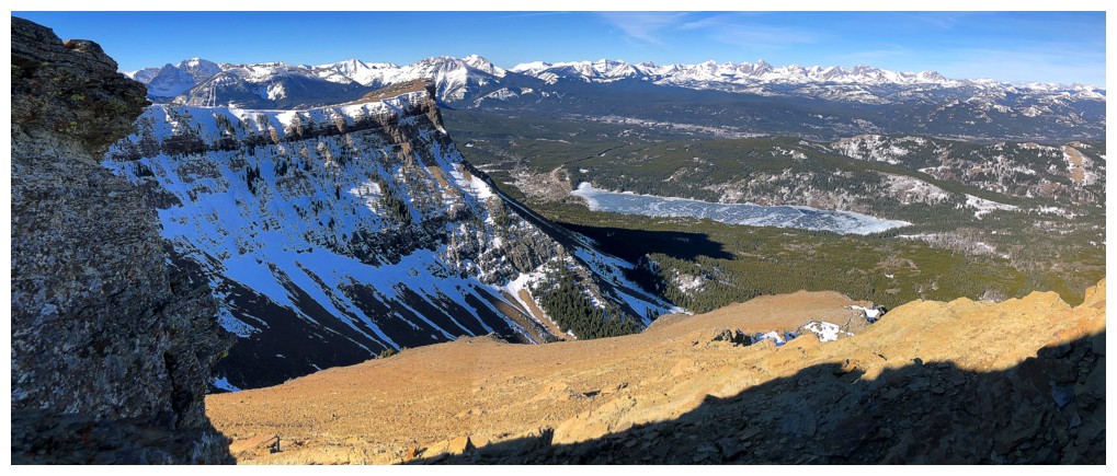
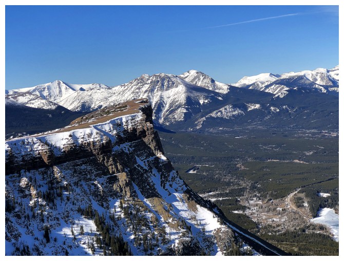
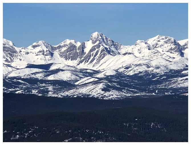
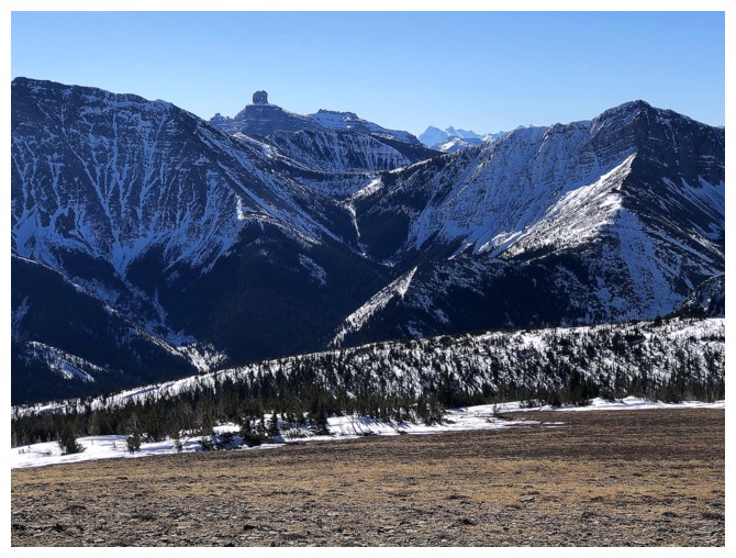
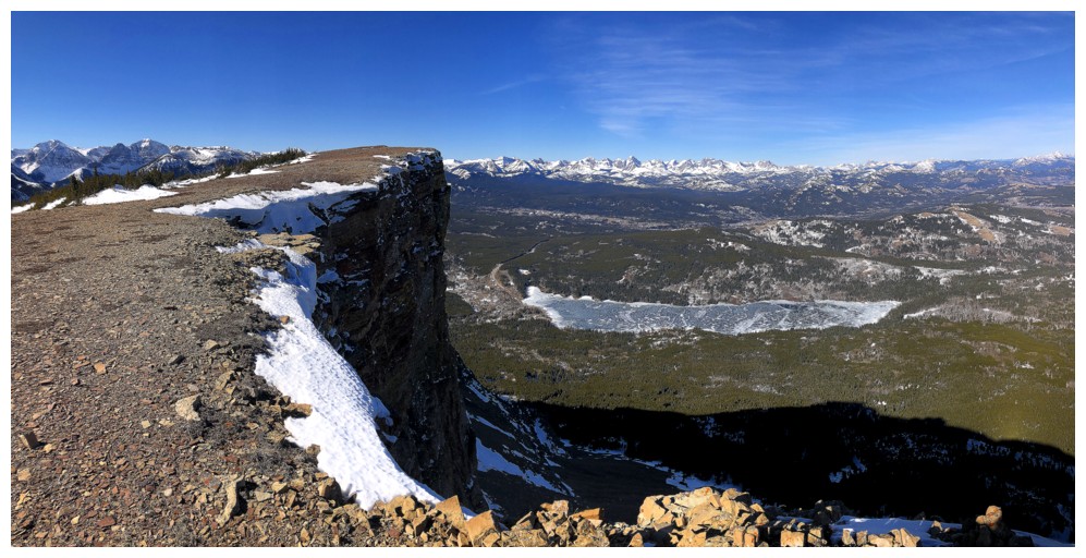
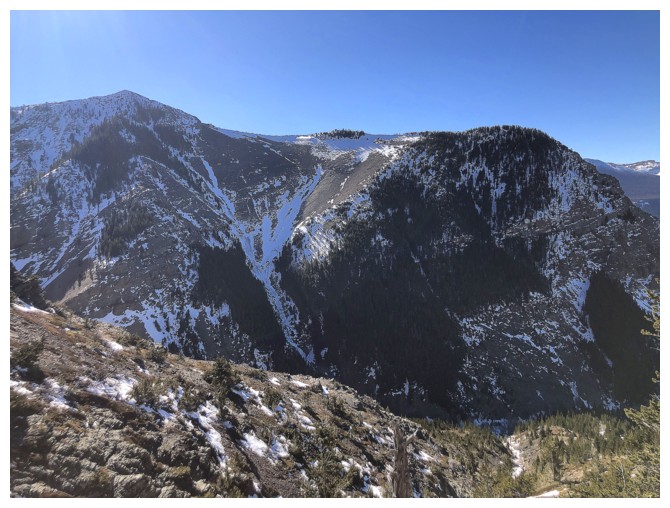
The Flathead Range
A route to the col looks straightforward, but the Sunlit slopes at the left look more inviting
Heading for the Sun
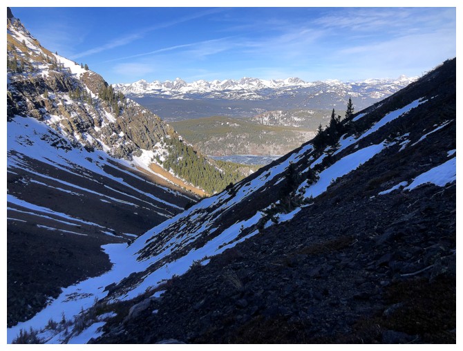
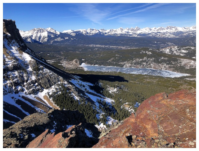
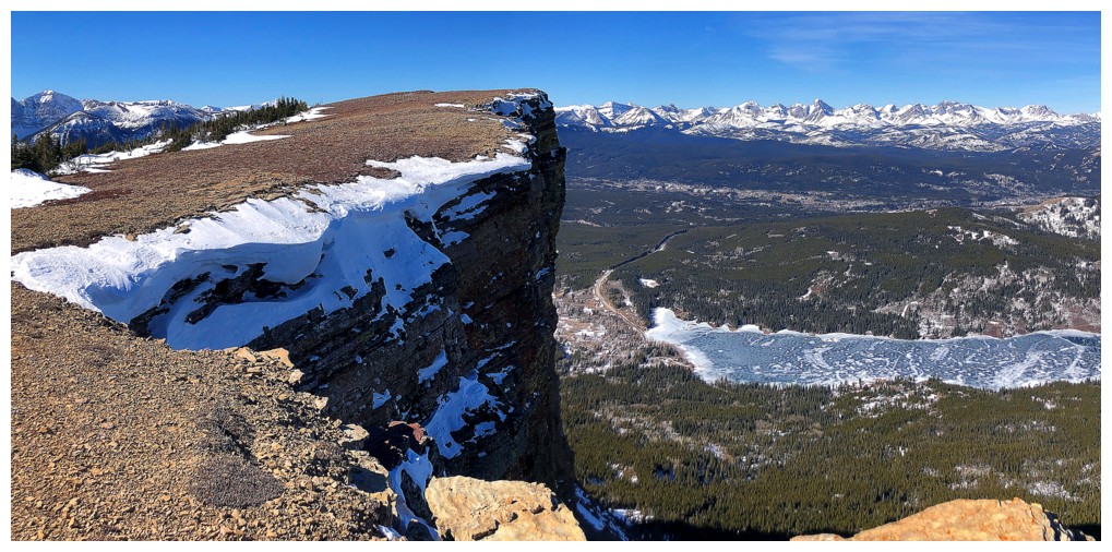
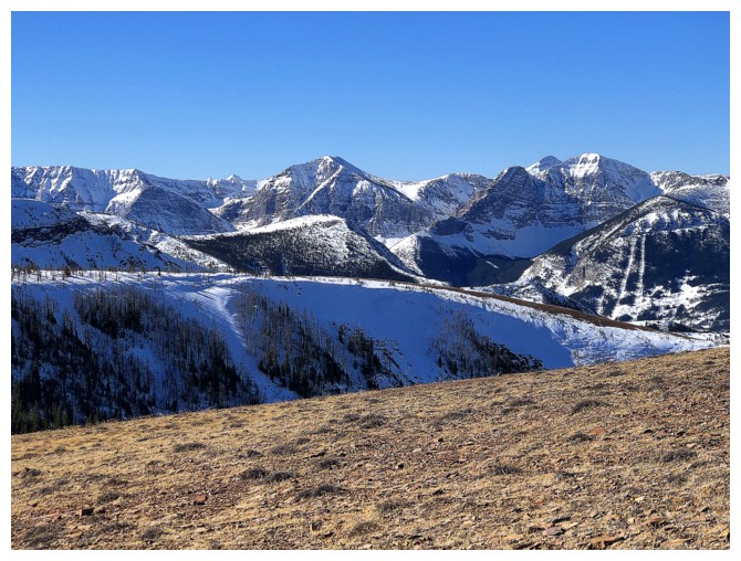
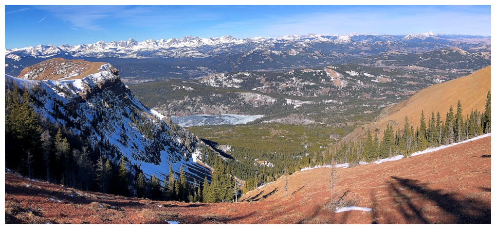
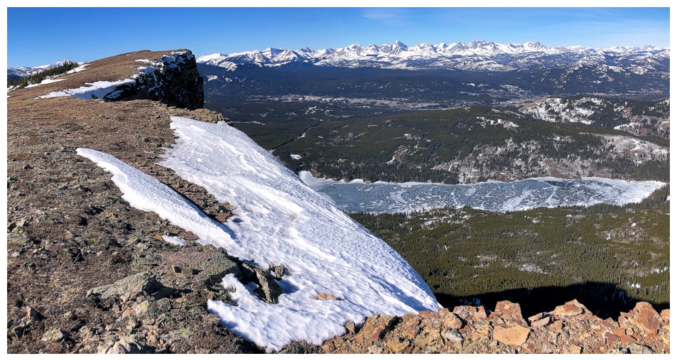
First glimpse of Beaver Mines Lake
The shadow to Sun transition
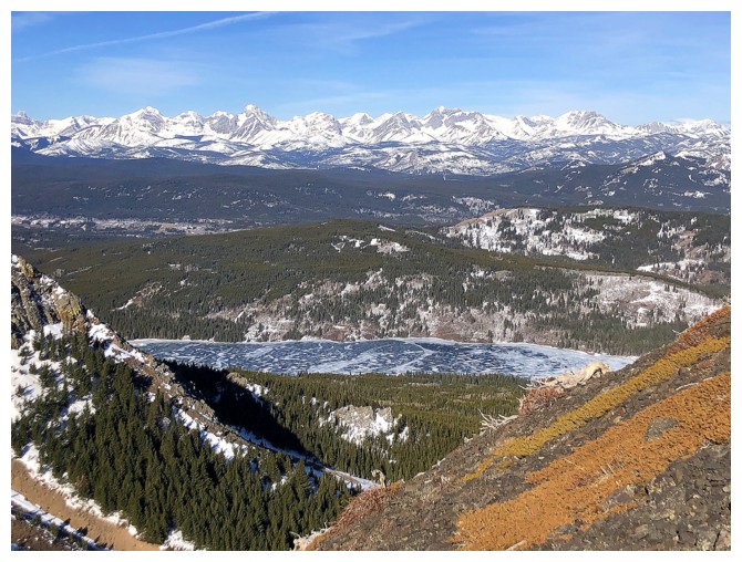
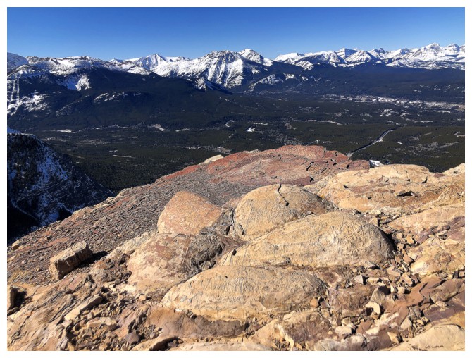
More of the lake and the Flathead Range
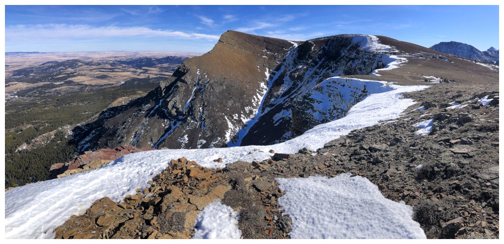
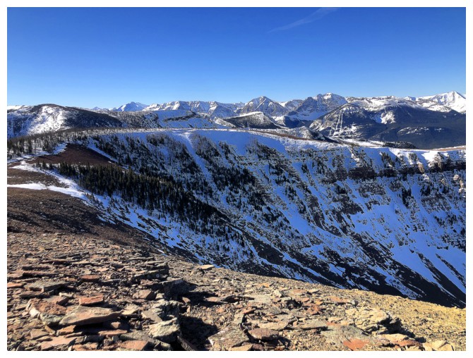
Part of the flat Western Plateau (WP)
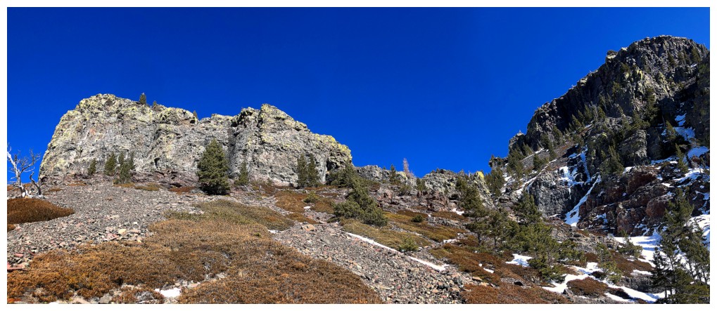
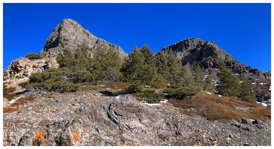
Lots of interesting terrain en route to the ridge
And some pleasant scrambling
Not quite the summit, but close
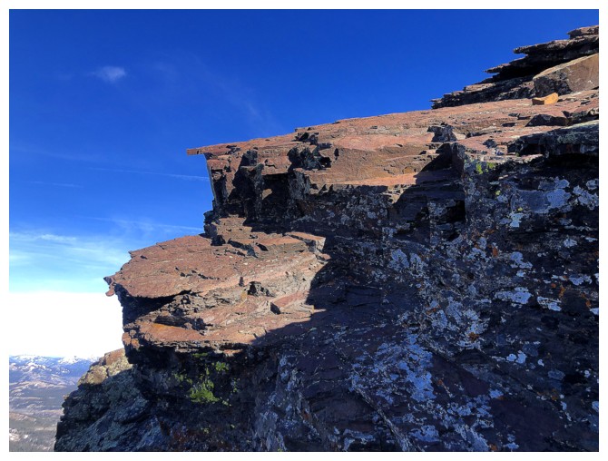
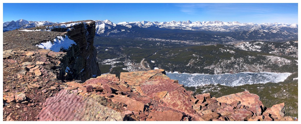
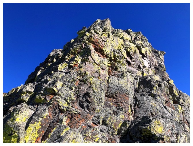
About time I saw some red argillite getting Sun!
And some yellow lichen
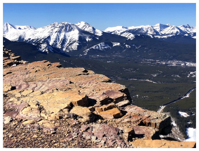
More of the WP
The summit
Hid behind this rock outcrop (left) is get some reprieve from the strong wind
The highpoint of the WP in the foreground and Syncline in the distant centre
Mount Darrah is as photogenic as always
Closing in on the summit
The col between the summit and the WP (left) is very low - more of a dip in the ridge than anything else
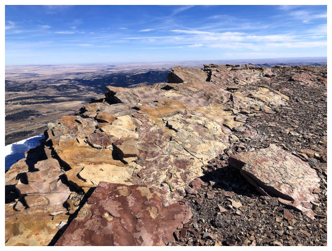
At the summit
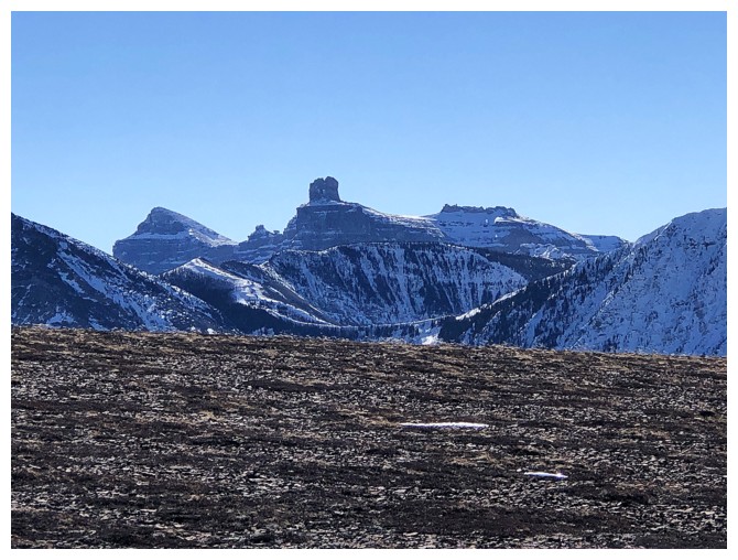
Distinctive Castle Peak just left of centre and less distinctive Larry Mountain at the right
View to the west

To the southwest
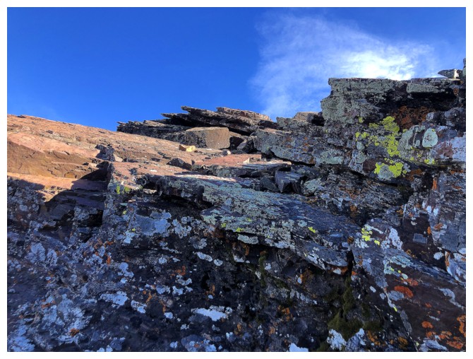
The colourful rock of Table's east ridge
Looking back to the summit upon finding a sheltered area
Back at the summit to get a few photos before descending
The WP
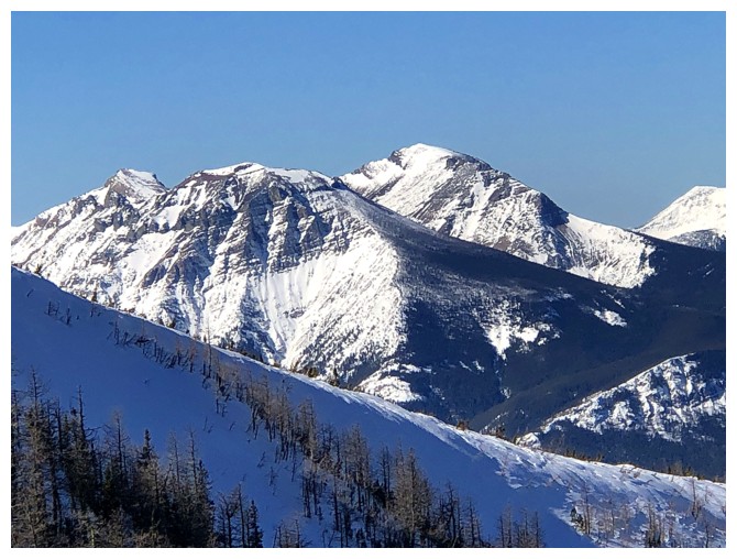
Close-up of Syncline
Good views to the north on descent
Windsor Mountain, left of Castle Peak
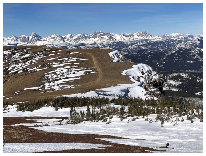
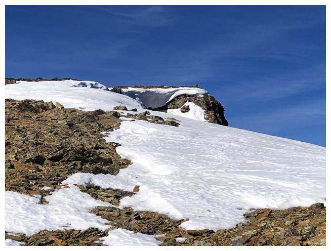
The trail on the WP is very pronounced, however following the edge of the ridge provides the most rewarding views
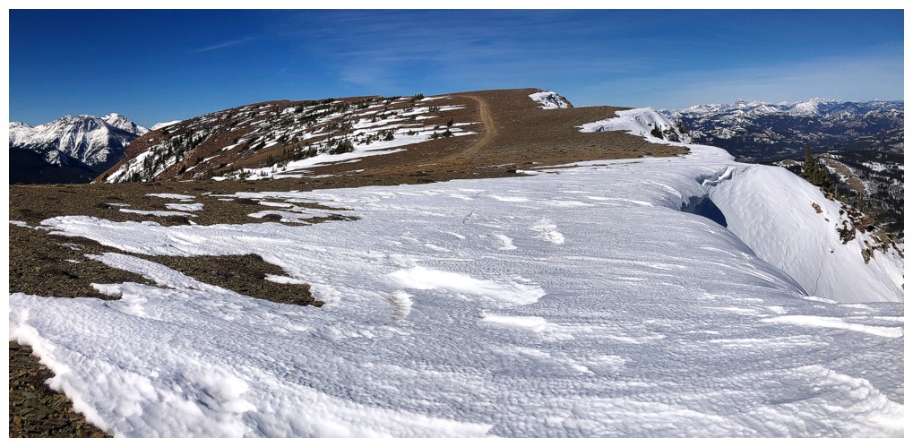
Just don't step out onto the cornices!
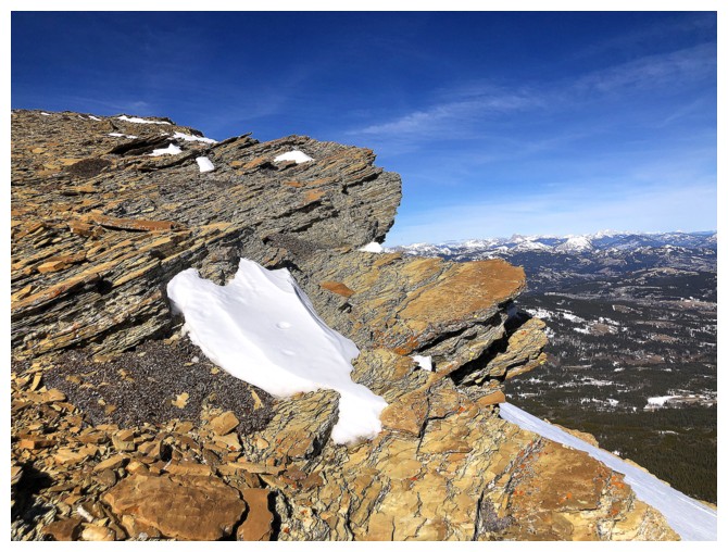
Views from the edge
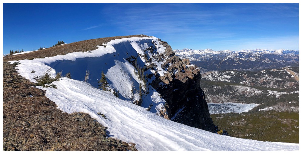
Weird mound-like rocks near the end of the WP

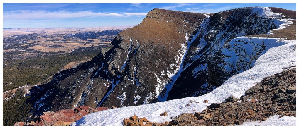
Looking for the easy and super beautiful route down through the rock bands at the end
The route is red argillite heaven!

The descent route then follows the ridge near the right
The weakness is at the right

This view of the WP from below is always a cool one
Same as above from further back
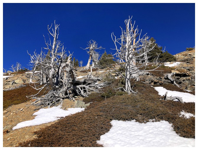
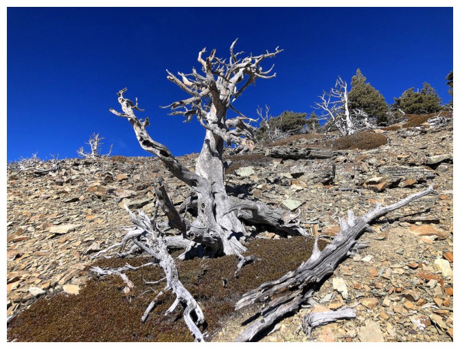
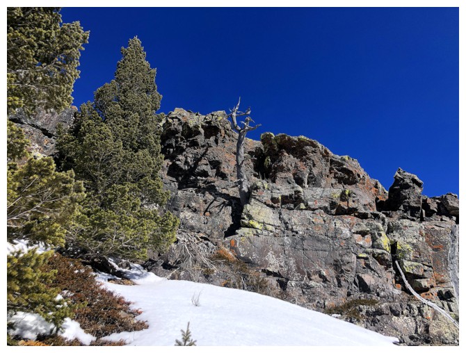
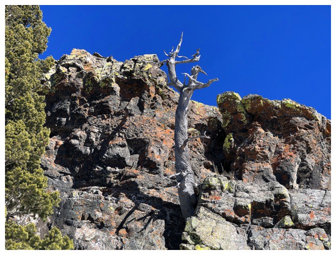
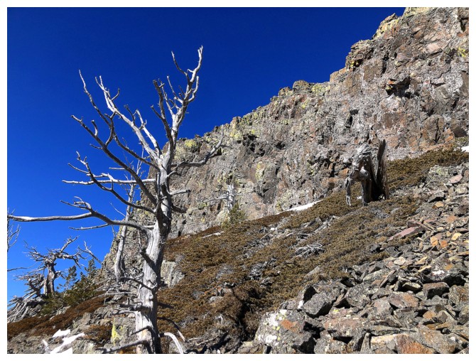
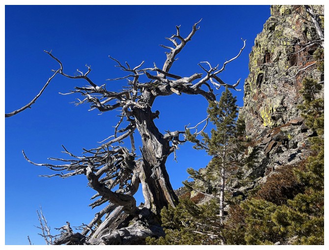
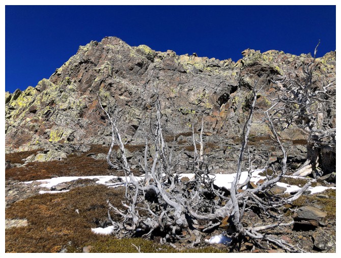
It's "cool dead trees" time
And "cool lichen-covered rock" time also
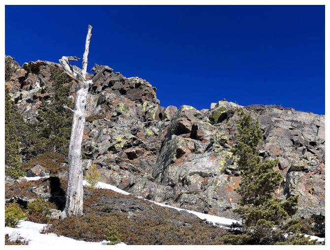
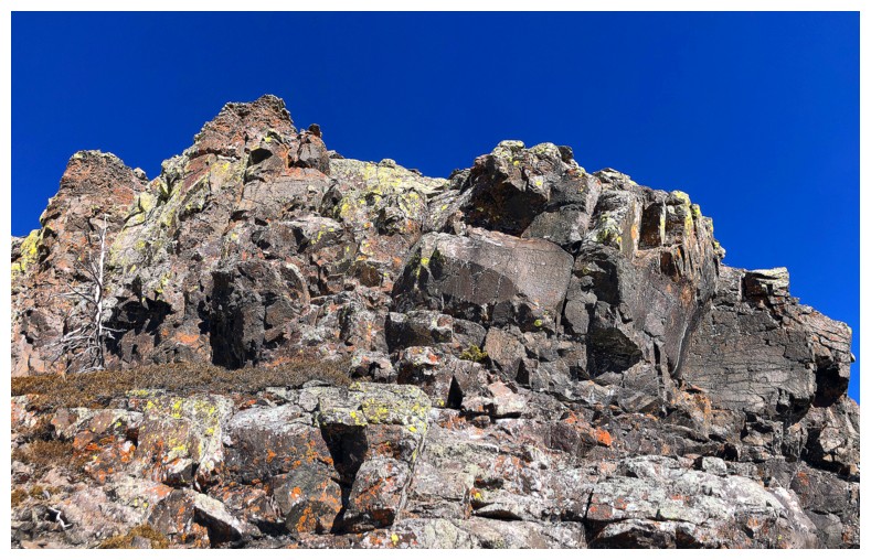
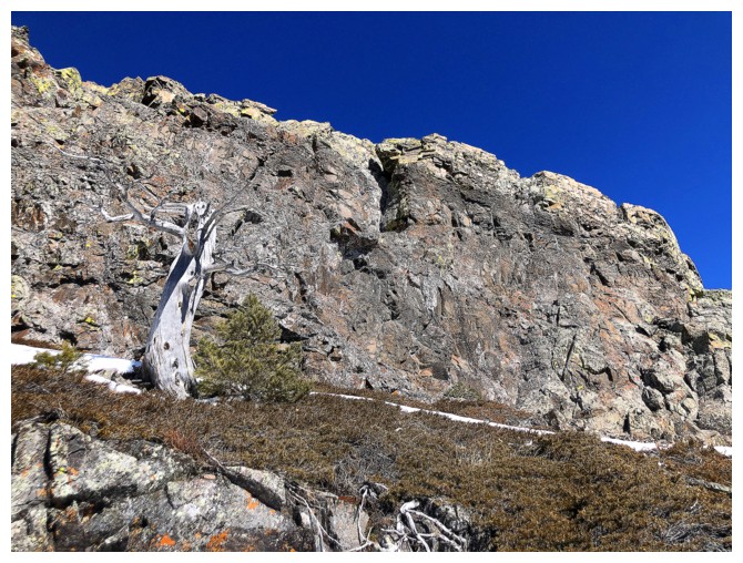
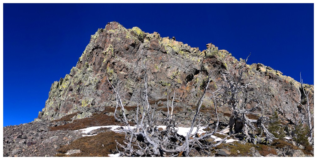
Exploring an amazing rock wall
Descending again
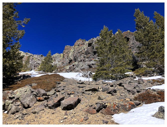
Back in the drainage that is the key to this descent route
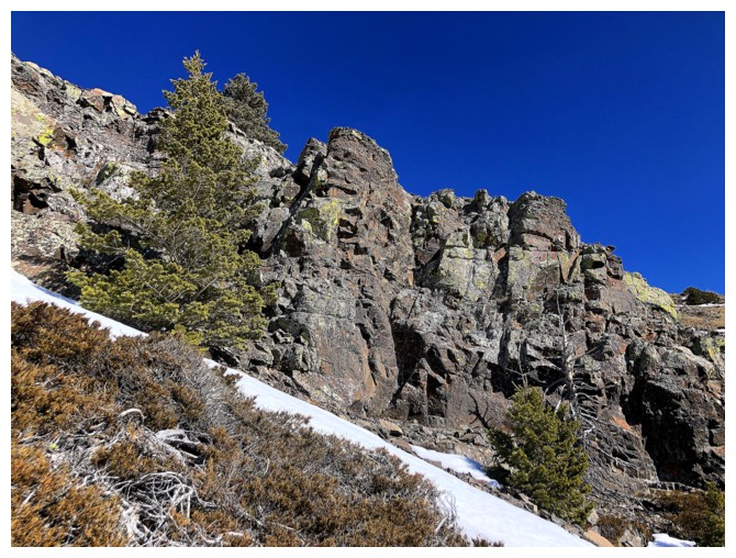
There is an easy route down through this very steep and colourful rock band
Revisiting the scene of the crime from April 13, 2024
Stunning, but not as stunning as the April trip
What it looked like in April, a year earlier

Continuing down
Another round of fantastic red rock scenery before reaching the trail
The descent route I took off this outlier of Table goes down the centre
The descent route is at the obvious weakness near the right
Parting look
The End
LOG