Bertha Minor
July 7, 2022
Mountain height: 2415 m
Elevation gain: 1125
m
Round-trip
time: 8:10
Solo scramble.
Even with the
unexpectedly foul weather, this, also unexpectedly, turned out to be one of the best trips I’ve
ever done in Waterton.
The objective
was the western outlier of Bertha Peak. It appeared to accessible from the
summit of Bertha, but I had a different route in mind. After reaching the
summit of Mount Richards in 2021, Dave and I decided to return to the Bertha
Lake outlet via the north side of the lake as opposed to the “normal” south
side. It was here that we noticed an abundance of red argillite slopes leading in
the direction of the outlier. With no other brilliant ideas for the day, this
became the objective.
All weather
forecasts pointed to clear skies from around 9 am to 3 pm and so hiking to Bertha
Lake at 7:30 am in generally overcast conditions was not too much of a concern.
I became a little more concerned (more bummed out) when I was in full rain gear
hiking around the lake in a steady rainfall. Eventually, I reached a small red
argillite drainage that appeared to have some potential to avoid any
bushwhacking.
From
that point
to the summit was simply magical: great footing in the drainage,
magnificent red argillite left, right and centre, fun sections of
hands-on scrambling,
and ever-improving views. The weather continued to be a source of
frustration
but at least the rain had stopped for now.
I reached the
highpoint, took a few photos and then continued on to another highpoint of
about equal height a few hundred metres away. Both summits had cairns and both
summits sported amazing views in every direction. Sections of the Waterton Lakes and Bertha Lake were noticeably
missing from the view, but a good view of Alderson Lake and the Carthew Lakes
made up for that.
The blustery and continually changing weather actually became a source
of interest at this point, as dark, threatening skies reigned to the
north, while patches of blue skies teased to the southwest.
The next order
of business was to see if I could continue along the ridge, down to the Bertha Peak/Bertha
Minor col and then make a loop route by retuning down a ridge that SOISTHEMAN had snowshoed in 2009. That too worked wonderfully,
offering easy downclimbing, a pleasant hike through the basin between the Peak
and Minor and then a surprisingly easy descent back to Bertha Lake, complete
with cairns and a trail. Of course, the weather had cleared completely by then,
but I was pretty pumped about the completing an unexpectedly amazing route and
cared less about the weather. Having said that, a return trip under clear skies
is already on the agenda.
As alluded to, a
thoroughly enjoyable route from beginning to end.
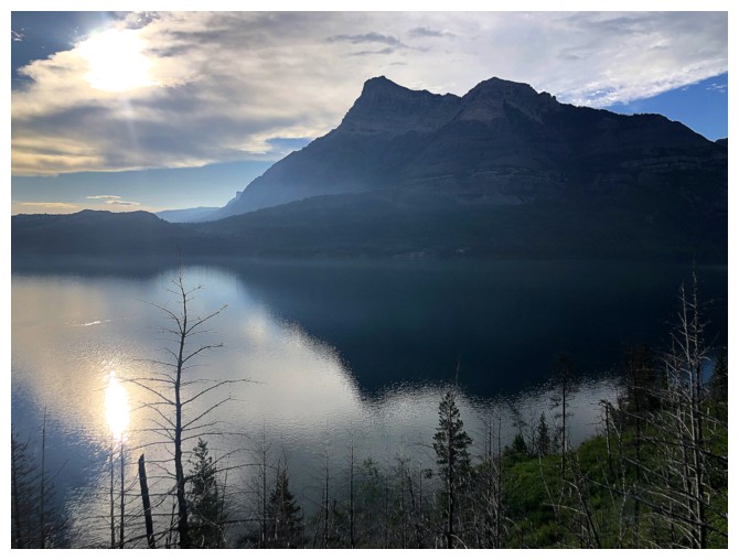
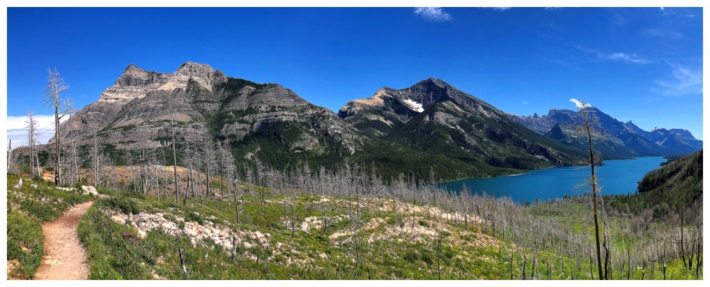
Morning over Upper Waterton Lake. Vimy Peak, above the lake, is as iconic to Waterton as Mount Rundle is to Banff.
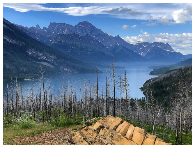
The first major viewpoint always impresses. At this point the weather seemed pretty good.
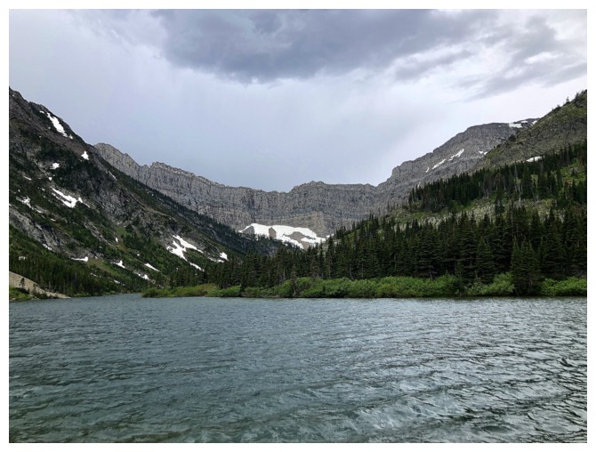
...not so good arriving at Bertha Lake
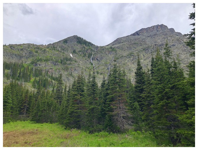
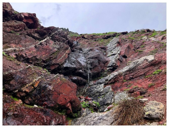
The fantastic Alan Kane route up Bertha Peak goes between the waterfalls
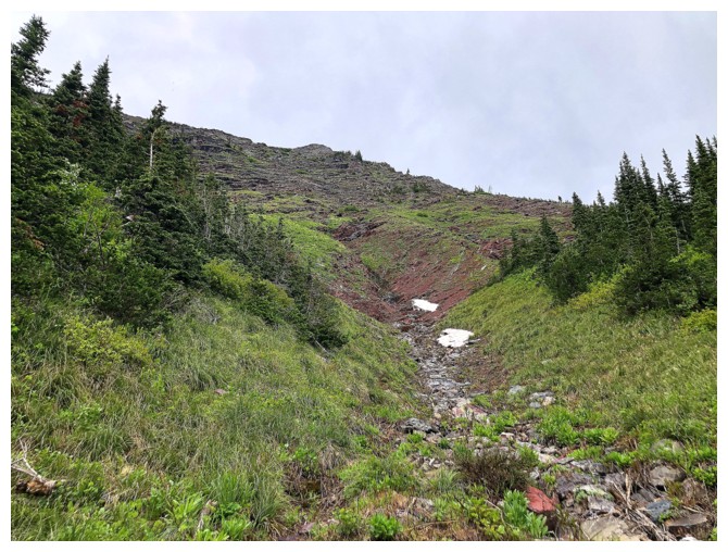
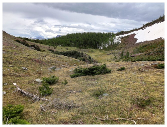
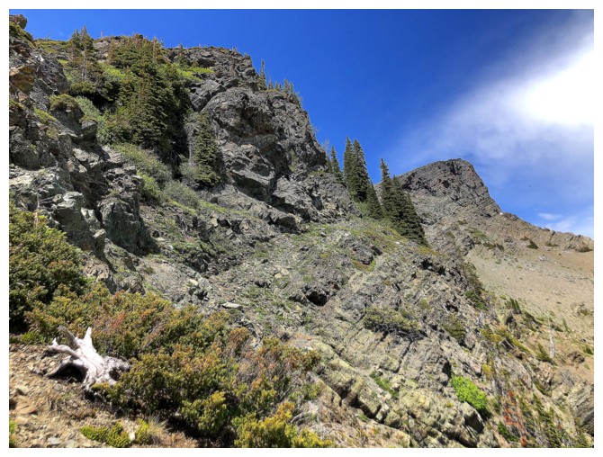
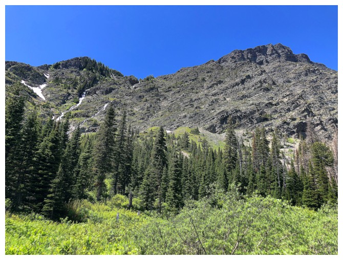
In the drainage and going up. Nothing too impressive yet.
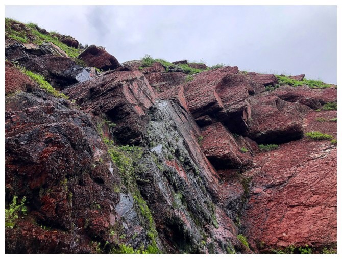
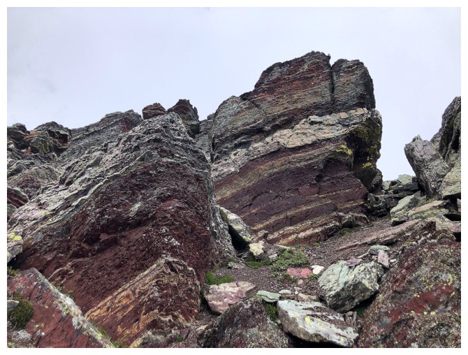
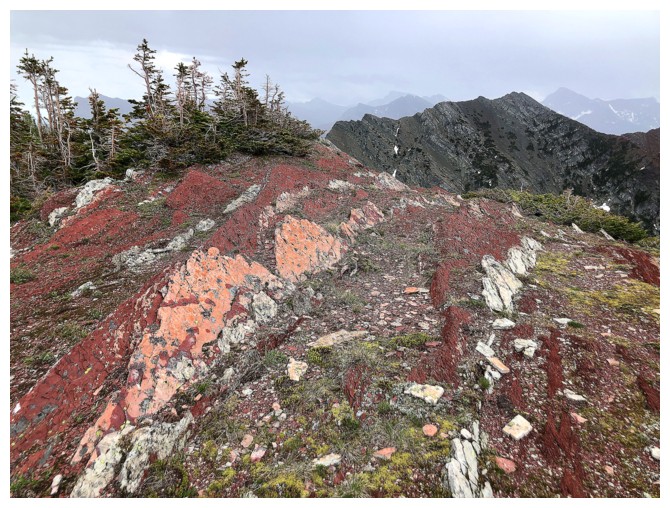
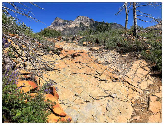
The massive formations of red argillite start to appear
Suddenly the ascent slope is full-on red argillite
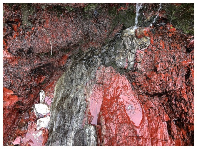
Close-up of the magnificent rock
Lots of fun hands-on scrambling up sections like this
....and this
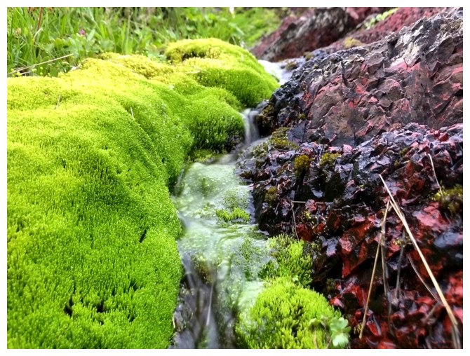
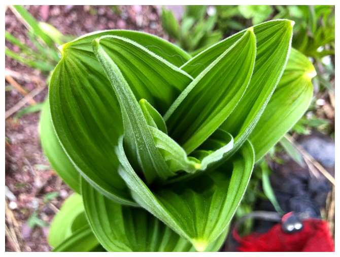
Bright green moss has significant visual appeal too
The spectacle continues
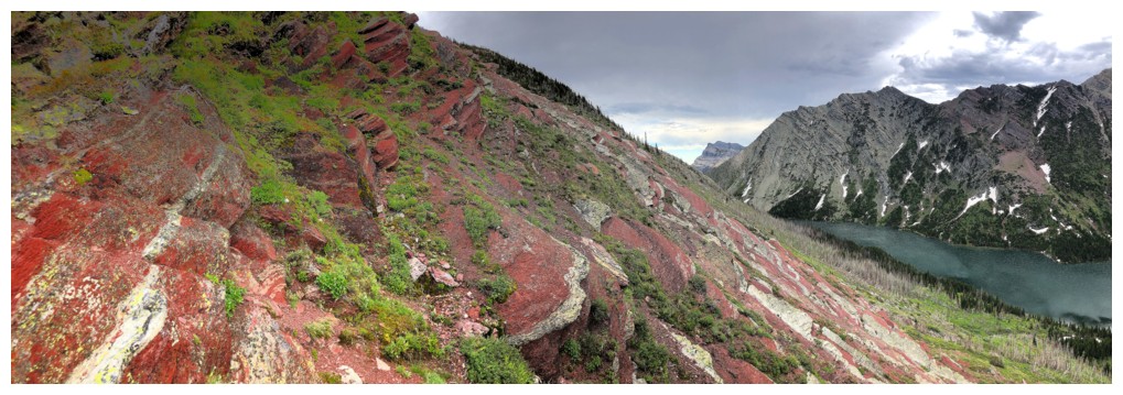
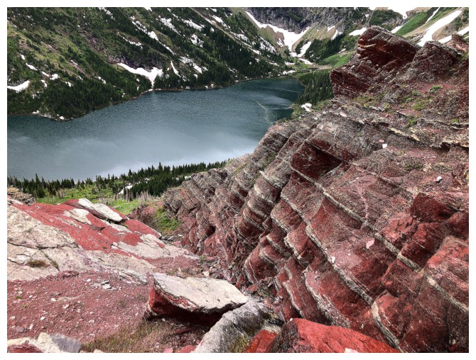
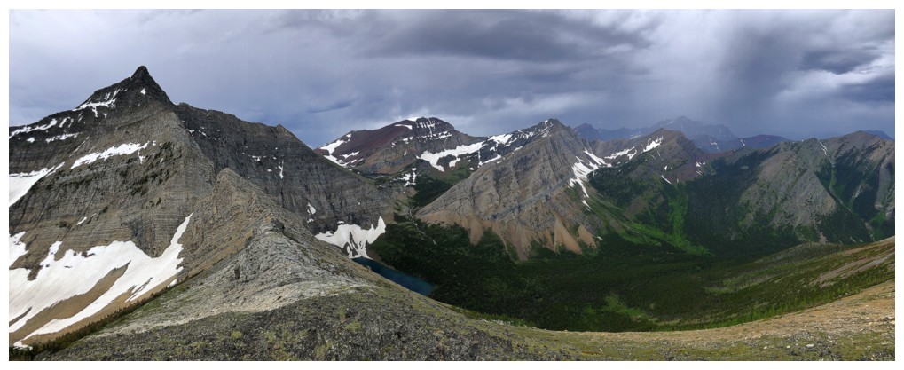
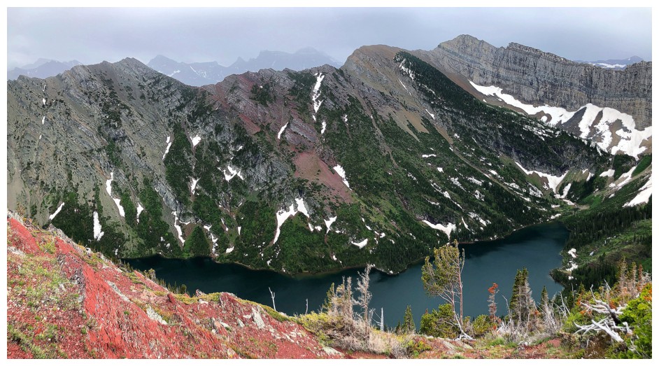
Add Bertha Lake
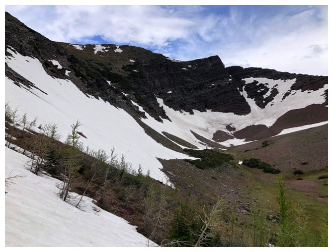
Can't imagine how incredible this would be with clear skies
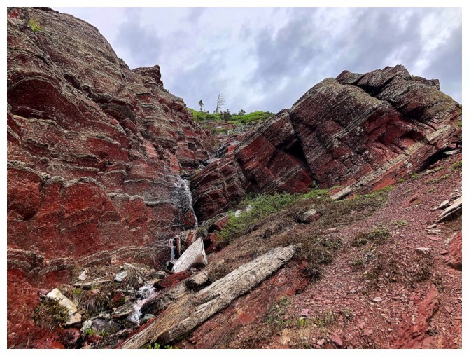
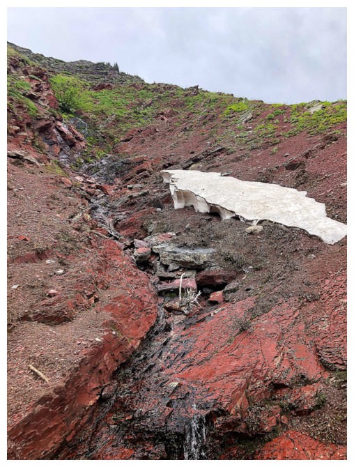
Tried to scramble right up the drainage here but the wet rock was fairly slick
A different example of bright green
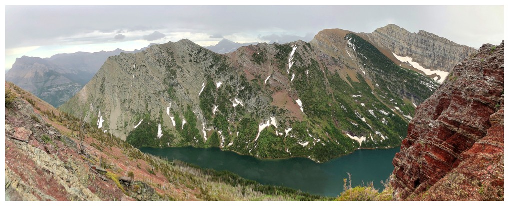
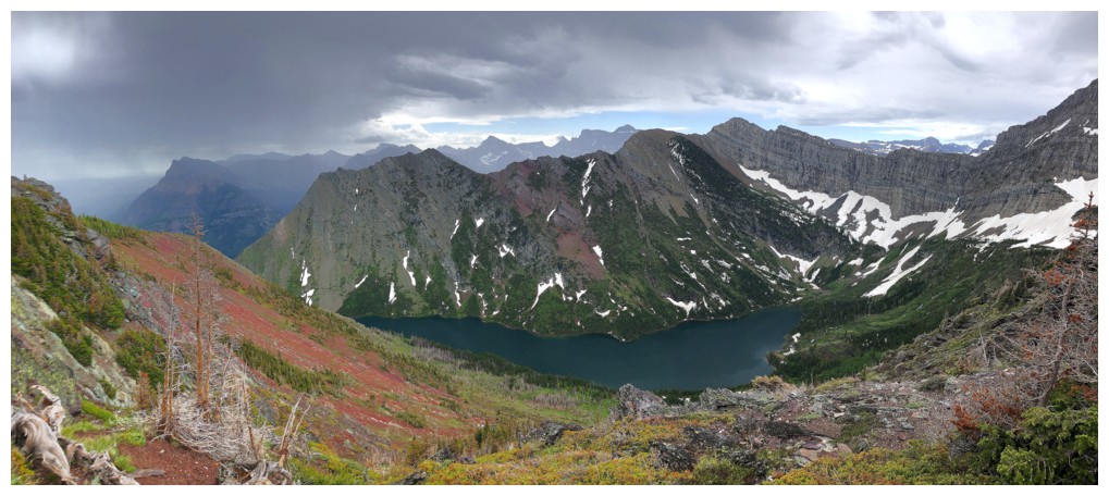
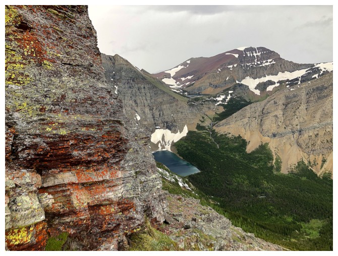
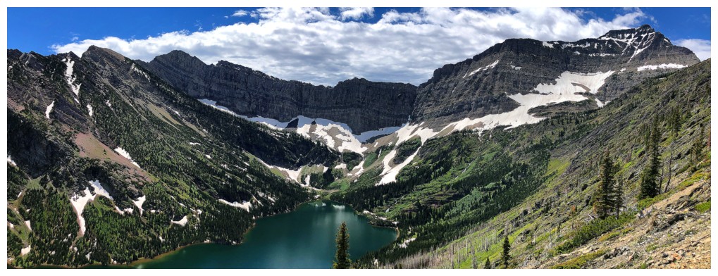
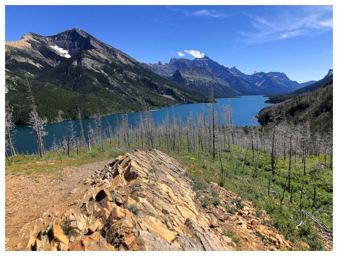
Bertha Lake and the challenging north ridge of Mount Richards
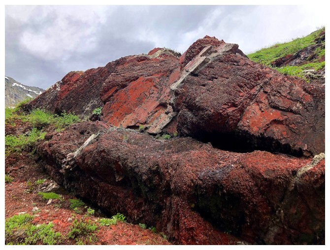
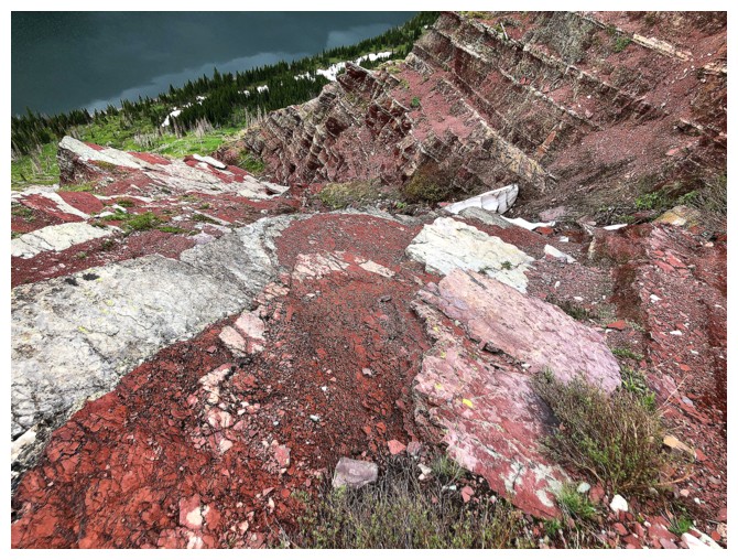
There are some awesome boulders and rock formations near the top of the ascent route
As well as terrific views back to Bertha Lake. Bertha Peak at the left.
The odd patch of blue sky had my hopes up
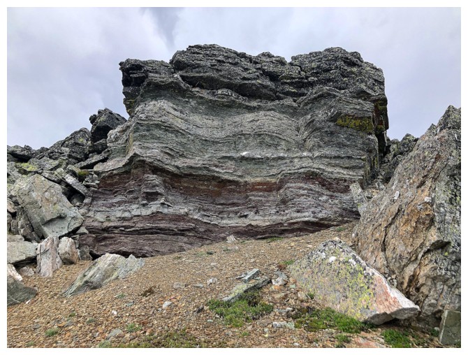
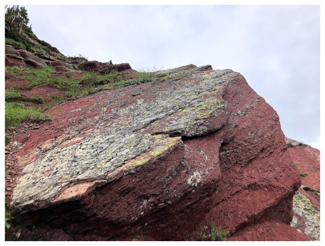
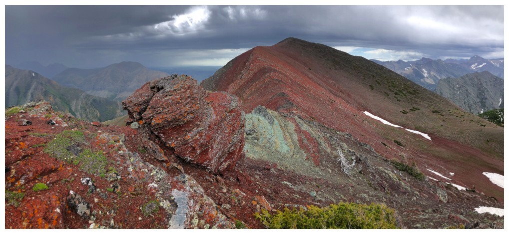
Some of that rock
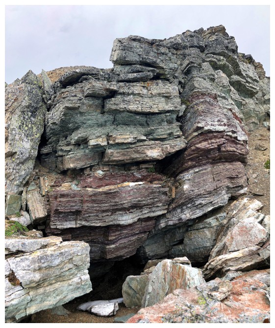
A small cave under this one
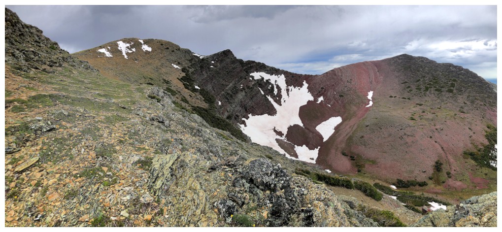
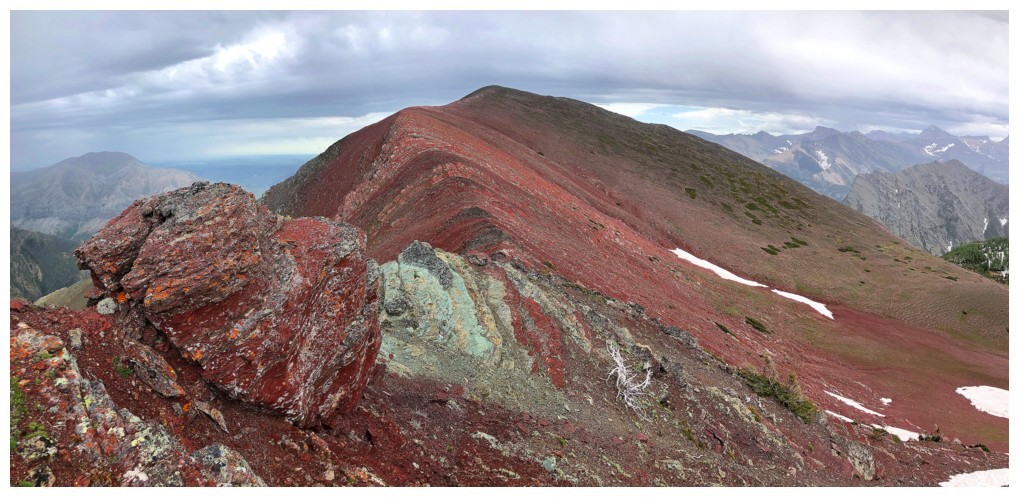
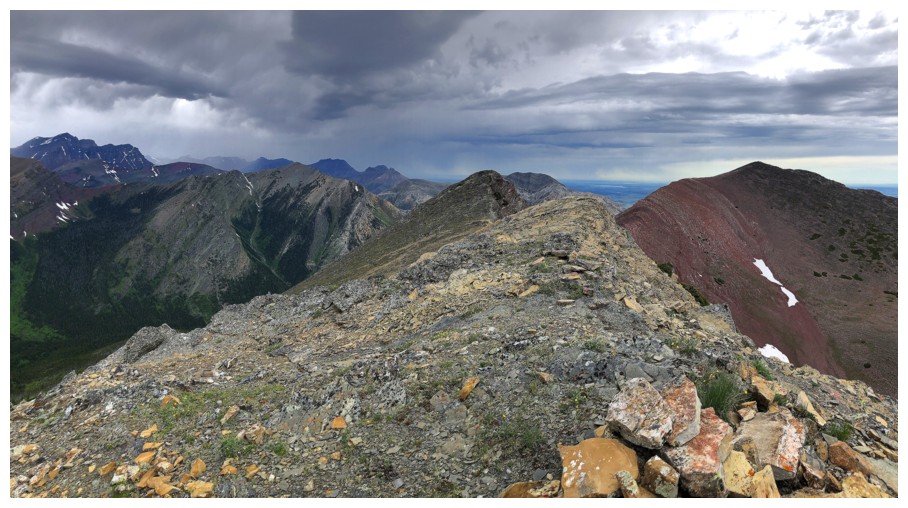
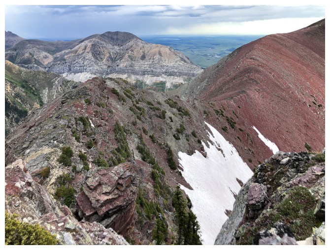
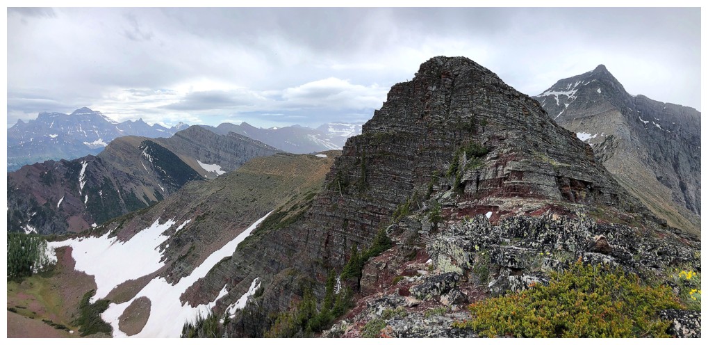
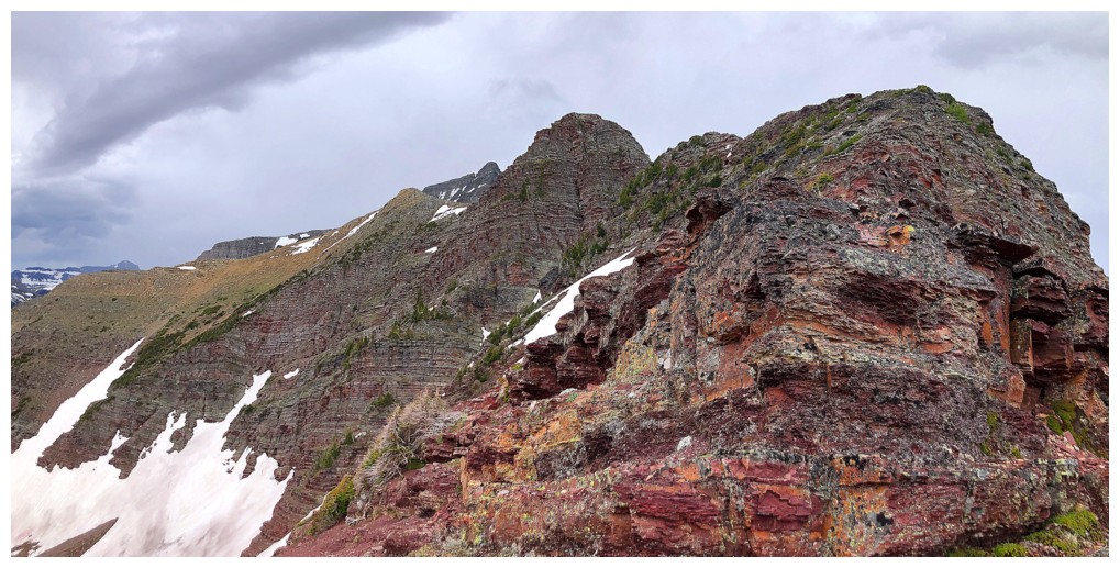
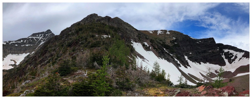
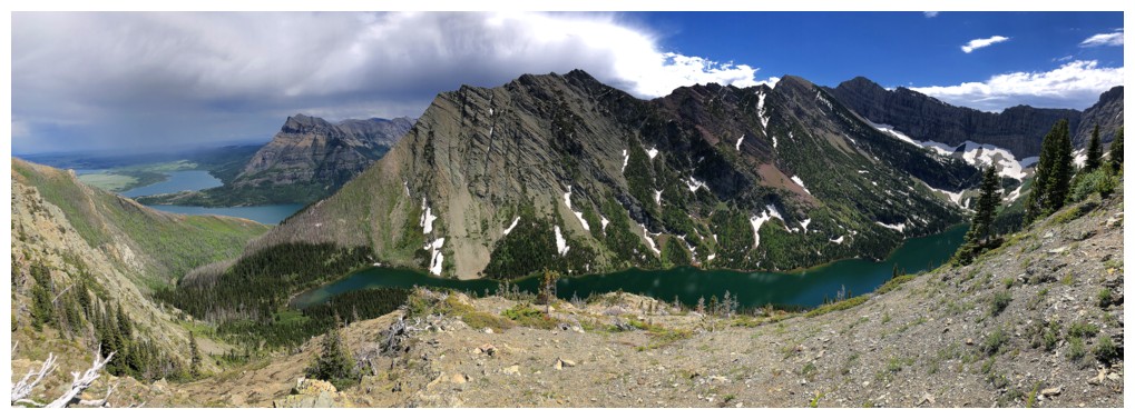
The two summits of Bertha Minor at the left and Bertha Peak at the right
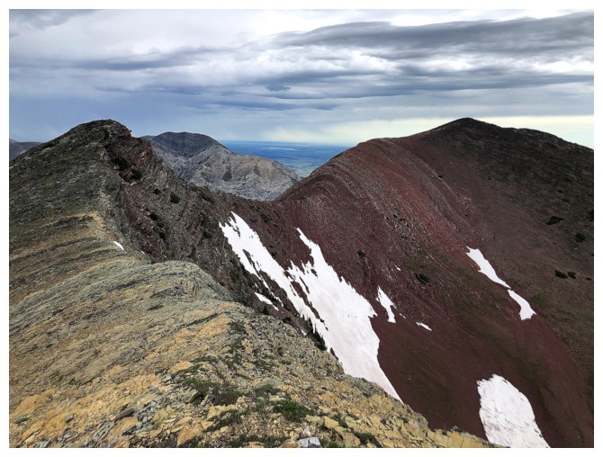
Same as above. The colours along the upper ridge would be wicked on a clear day.
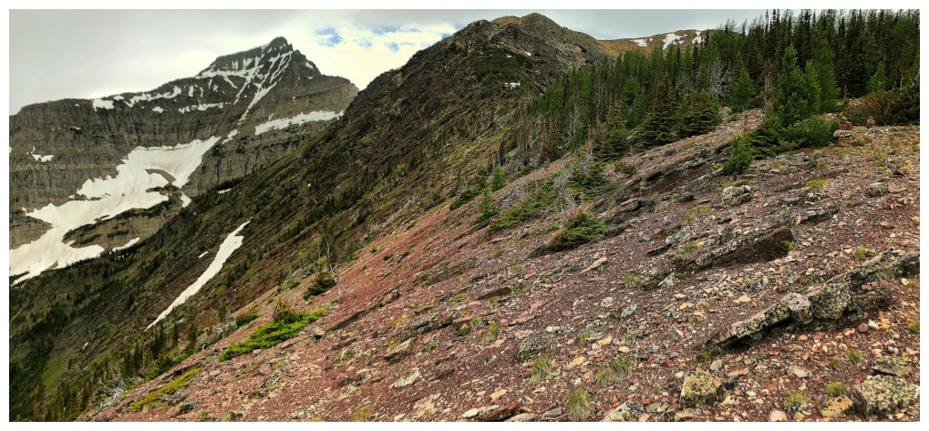
Easy ridgewalk to the first summit (just right of centre) from here
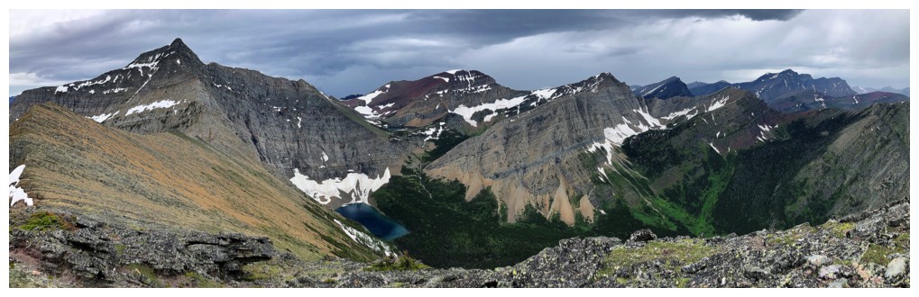
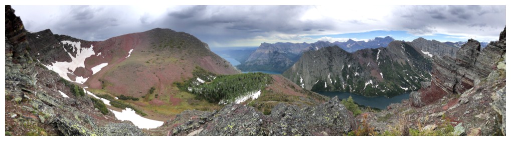
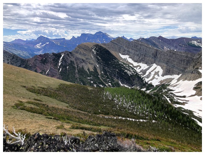
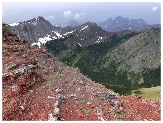
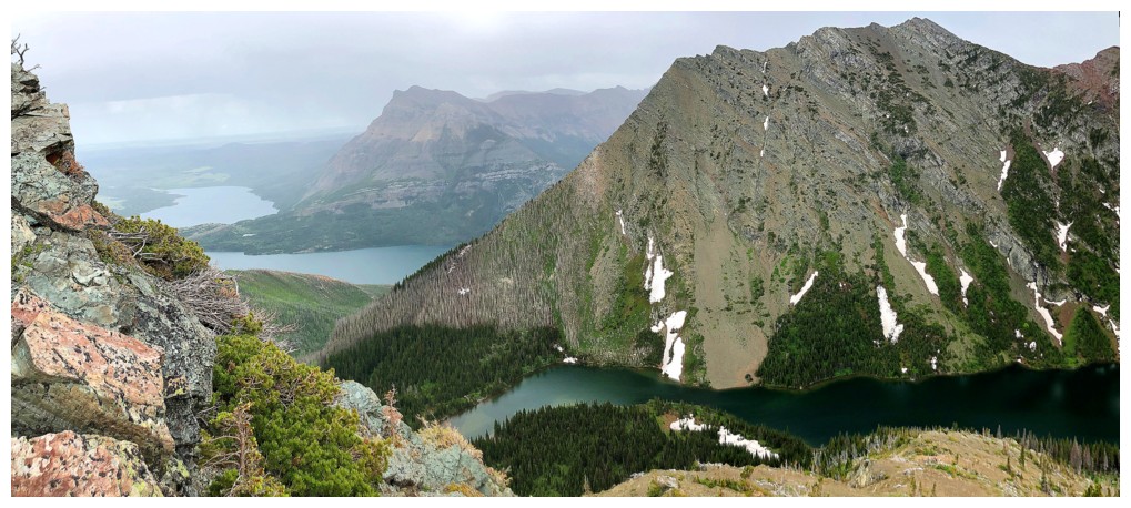
Mount Alderson - one of the best trips in the park
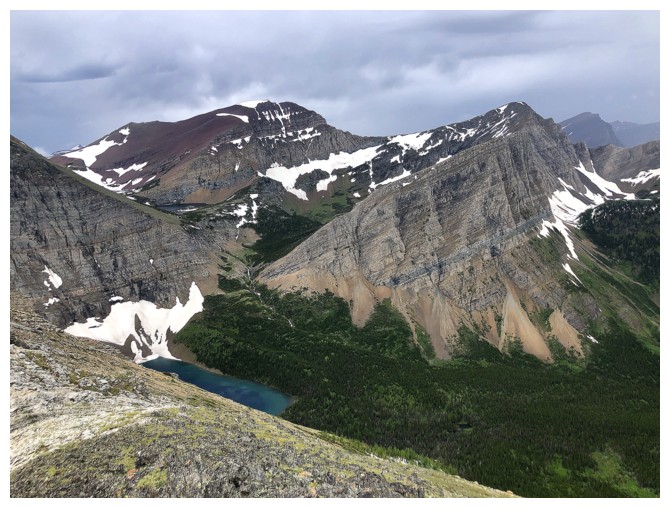
Mount Carthew, Buchanan Ridge, Buchanan Peak, and the first view of Alderson Lake
Not the clear skies I was expecting
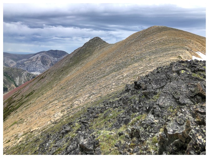
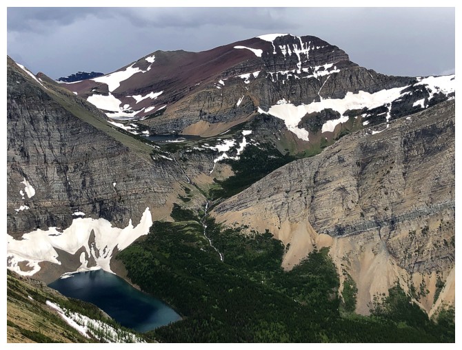
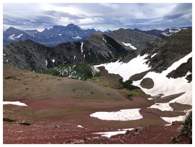
The two summits of Bertha Minor
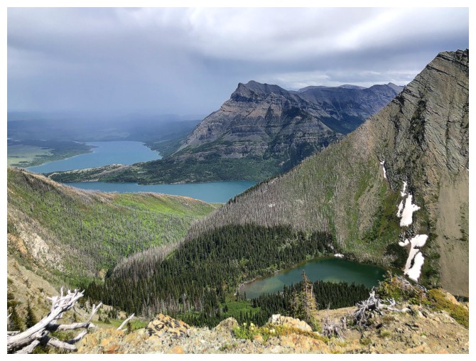
The hanging valley between Bertha Minor and Alderson is lush and full of larches
The view to the east is getting crazy!
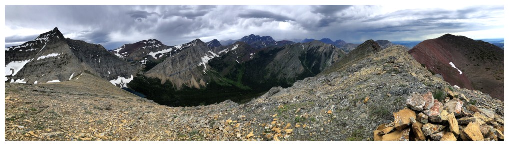
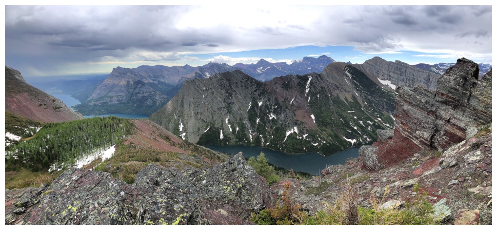
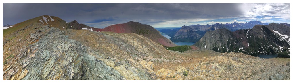
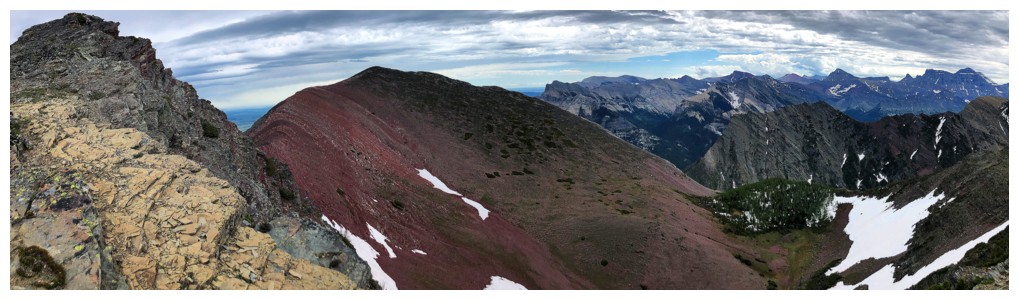
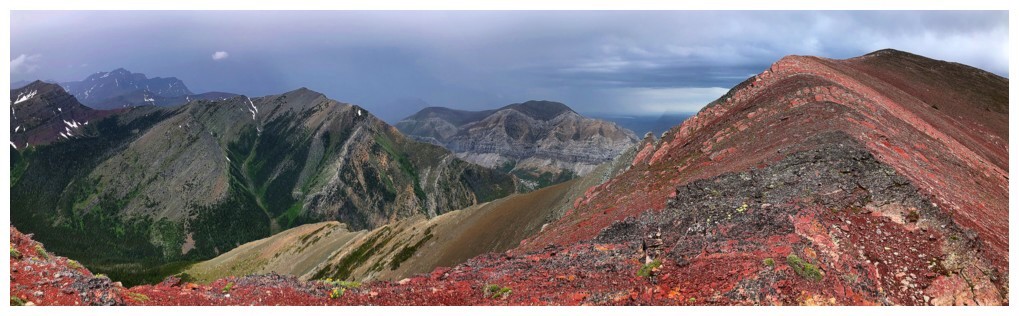
Summit #1 , pano #1
Summit #1 , pano #2
Summit #1 , pano #3
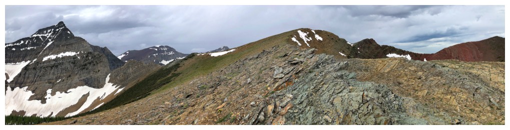
Short, easy walk to Summit #2
....that features the super red of super Bertha Peak
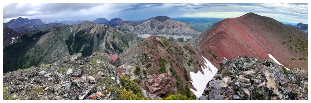
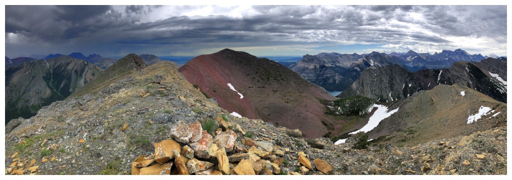
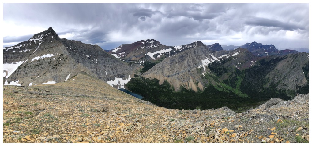
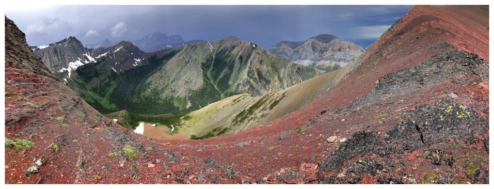
Summit #2 , pano #1
The best view of Mount Carthew and Alderson Lake
Summit #2 , pano #2
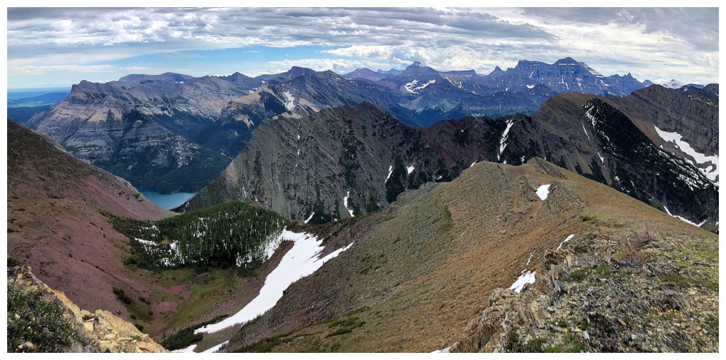
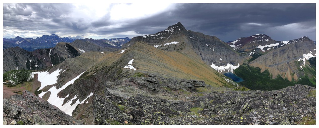
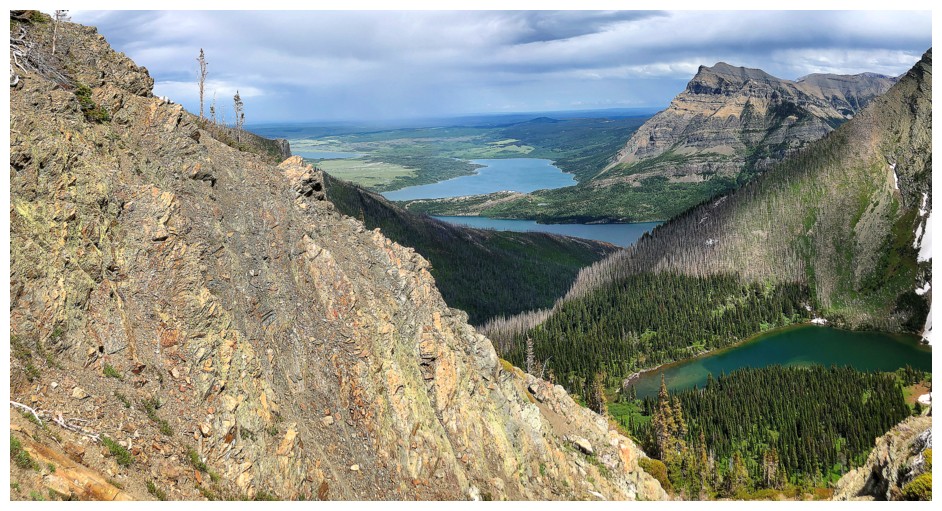
Start of the super interesting descent to the Minor/Peak col. Mount Crandell in the background.
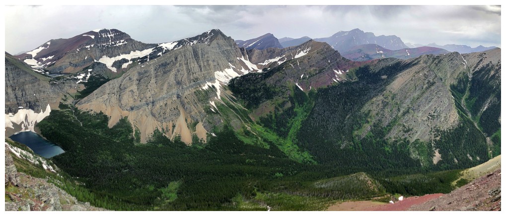
Speaking of lush, the Carthew Creek valley is exactly that.
About time I got a yellow lichen on red argillite photo!
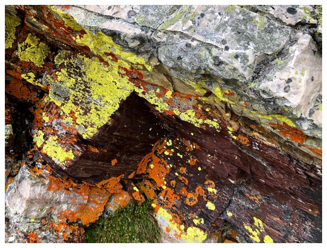
Orange lichen ain't no slouch either
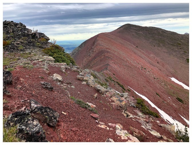
Non-stop red rock
Looking back to Summit #2
Can't wait to someday see this scene on a clear day, but the dark, stormy clouds to the north were pretty awesome too
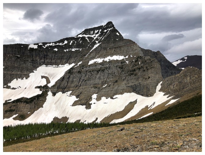
The king of Waterton, Mount Blakiston at the right
Looking down to the valley between Minor and Peak. It makes for a terrific and easy descent.
Still mesmerized by the red rock and stormy weather
Between the awesomeness of red argillite, the three summits (only one
official) of Buchanan Ridge can be seen from left to centre: Buchanan
Ridge, Buchanan, The Middle Child, and Buchanan Northeast. All very
worthwhile individual ascents. Connecting them is not possible without
climbing gear and skills.
Looking back again. This would be a fun ascent route from Bertha Peak because you would be upclimbing the difficulties.
In the pleasant valley between the peaks
A little elevation gain is required to reach the descent route
Back to the argillite slopes near the ascent route
I ascended the slopes at the left
Bertha Lake reappears
A little bit of side-sloping to avoid the trees
Add small sections of the Waterton Lakes to the view
Same as above
Here come those clear skies to the north
Clearing to the southwest too
Still blustery to the east
Almost fully clear
Clear skies over the Kane route
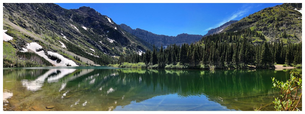
Back to Bertha Lake
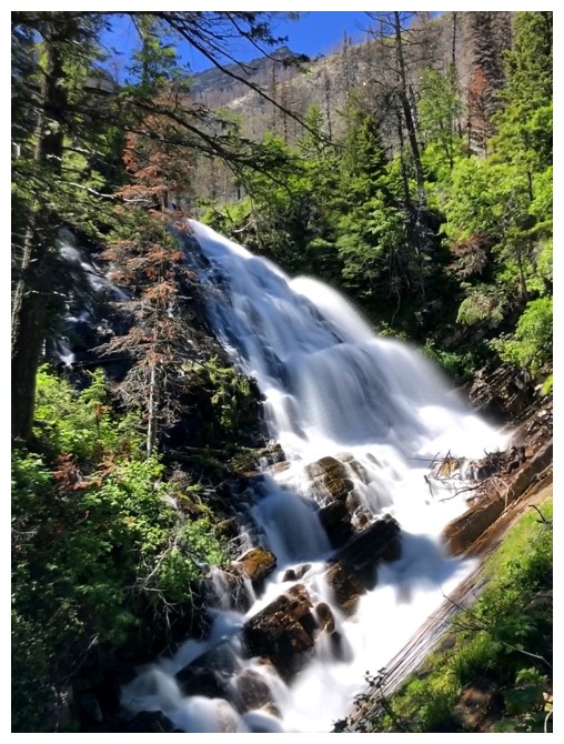
Lower Bertha Falls
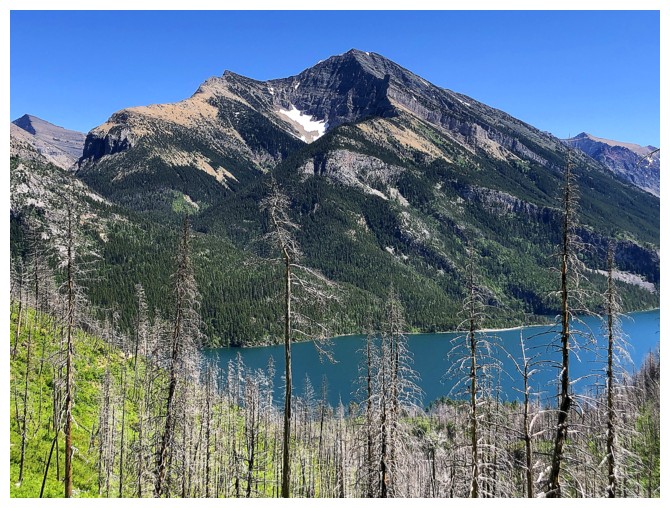
Mount Boswell on the other side of Upper Waterton Lake. This one
haunts me a little because it's one of the few peaks in Waterton that I
have not visited on a beautiful, clear day.
A very satisfying trio of mountains: Vimy, Boswell, and Cleveland
Very little red argillite at this low elevation, but lots of other colourful rock to ogle at
Back at the first viewpoint
The End
LOG