Buchanan Ridge II and Buchanan Peak II
December 5, 2020
Mountain heights: 2594 m, 2416 m
Total elevation gain: approximately 1200 m
Round-trip
time: 9
hours
 Solo snowshoe, scramble, and a little
mountaineering.
Solo snowshoe, scramble, and a little
mountaineering.
A recent and magnificent trip up the
northeastern-most highpoint of Buchanan Ridge was more than enough to renew my
interest in the lengthy ridge that includes Mount Carthew, Buchanan Ridge and
Peak, and several other significant highpoints. Initially, I was thinking of the
summit immediately northeast of the highest point of Buchanan Ridge. However, a
stellar weather day was at hand and therefore I couldn’t resist a repeat trip
up higher Buchanan Ridge with the option of also bagging Buchanan Peak or even Mount Carthew.
The Kane route to Buchanan via Mount Carthew was out of
the question, but my good friend Kevin Barton and I had completed a more direct
route from the Akamina Parkway 15 years earlier and I remembered it to be a
good one. After fording Cameron Creek (good thing I brought hip-waders as the
creek was surprisingly deep), I switched to snowshoes and started following a
subsidiary creek up the valley. Although my intention was to follow the creek
as far as possible, travel quickly became quite challenging and escaping the
confines of the creek was suddenly a necessity. This required clambering up a very steep
snow slope, but my snowshoes were up for the task.
 The ‘shoes were not up for the terrain that
followed, however. Crampons and an ice axe were donned, and travel continued.
Higher up, the ascent slopes were essentially snow-free. I reached the highest
point of Buchanan Ridge 3 hours, 20 minutes after leaving the car; that’s 45
minutes longer than Kevin and I took – speedy ascents are definitely a thing of
the past for me!!
The ‘shoes were not up for the terrain that
followed, however. Crampons and an ice axe were donned, and travel continued.
Higher up, the ascent slopes were essentially snow-free. I reached the highest
point of Buchanan Ridge 3 hours, 20 minutes after leaving the car; that’s 45
minutes longer than Kevin and I took – speedy ascents are definitely a thing of
the past for me!!
With perfectly clear skies and only a hint of
wind, my summit stay, though short, was fantastic. The view from Buchannan is
not as good as that from nearby Mount Carthew, but a step below “definitively
spectacular” is still pretty darn good! After a barrage of photos, it was
decision time. I had considered at attempt at Carthew, reasoning that upclimbing
the difficulties on the connecting ridge would be far easier than downclimbing
them. Unfortunately, as the 16th shortest day of the year, if I did
make the summit, doing much of the descent by headlamp was a forgone conclusion
(not to mention I’d still have to downclimb everything on descent!) – no
thanks! As such, I set my sights on Buchanan Peak – oddly, just an outlier of
the ridge that is 200 vertical metres lower than the Ridge.
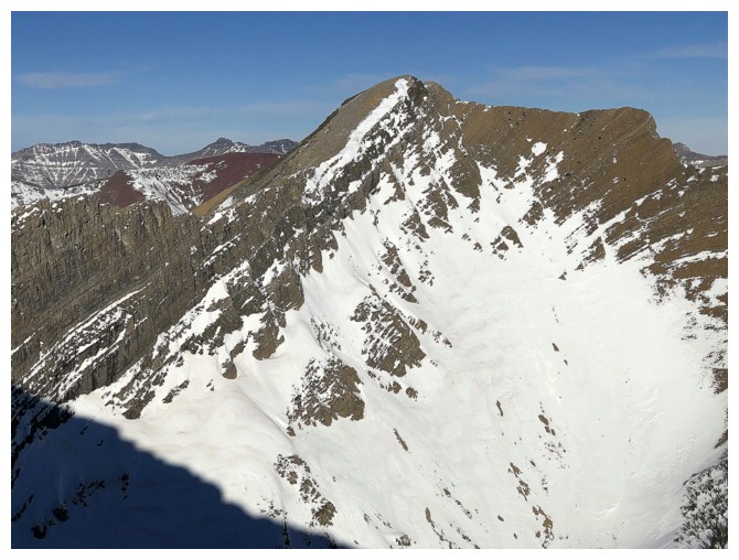
My
recollection of the descent to Buchanan
Peak amounted to “a short and fun scramble”. What I failed to remember
was some of the outrageously colourful rock along the way. My descent would be fun, but it was not short,
simply because I couldn’t get enough of the rock scenery. I tried to stay on
the ridge throughout, but a few steep rock bands required circumnavigation,
often on very steep, snowy terrain. I was especially glad to have crampons and
an ice axe here.
I didn’t stay at the summit of Buchanan Peak
for very long, as the lack of remaining daylight was now becoming bit of a
concern. Needless to say, the journey back up to the Ridge, though far more
tiring, was wonderfully scenic, the Sun lower in the sky resulting in an even
deeper blue sky. Once back at the summit of the Ridge, I could not resist a
quick side trip down the ridge that connects Buchanan to Carthew. Clearly this
ridge was a red argillite gold mine – the ultimate temptation for me – the ridge might as
well have been made up of pure Cadbury’s milk chocolate!!!
Regrettably, the side trip was cut short by
my need to finish the trip within the confines of the December day length. I did
have a headlamp but wanted to avoid that steep snow slope near the beginning
and preferred to do it with a reasonable amount of daylight. An easy bypass
route was found and I made it across Cameron Creek, just as darkness started to
set in.
An outstanding day in the Southern Alberta
Rockies. How many times have I written that?!!!!
On the other side of Cameron Creek and ready to snowshoe
Typical terrain at the beginning
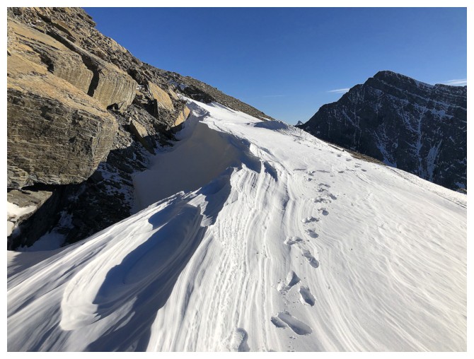
Looking down the very steep slope I had to ascend
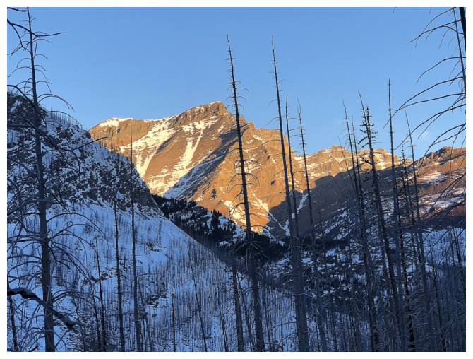
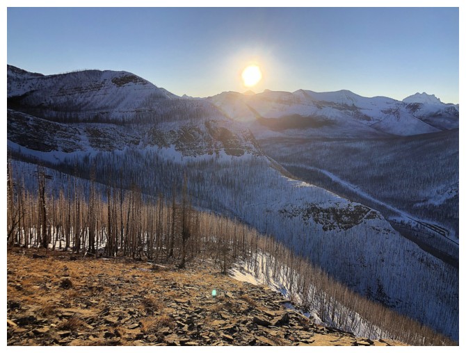
Mount Blakiston gets some early morning Sun
So does Mount Rowe
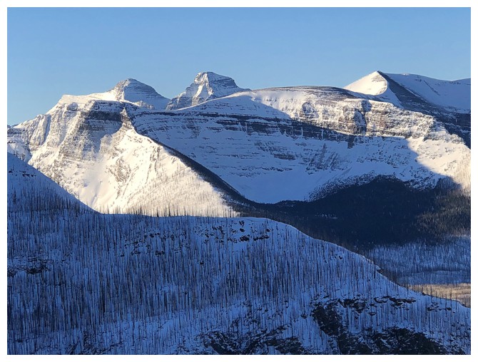
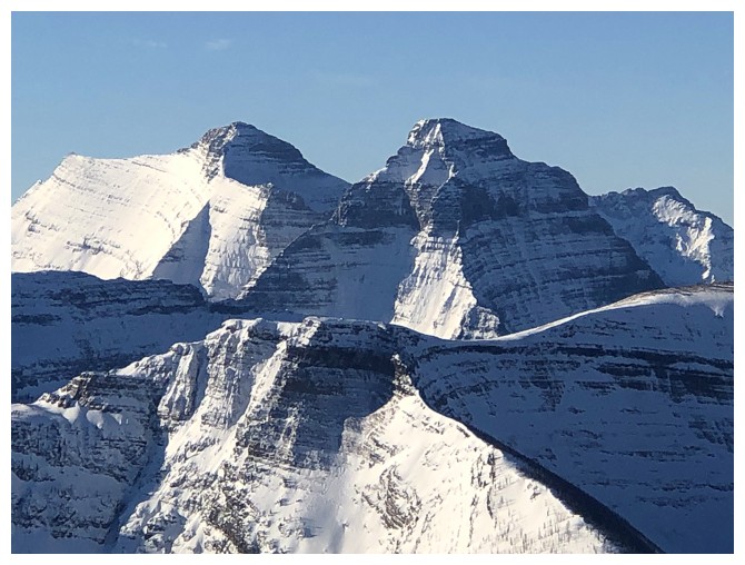
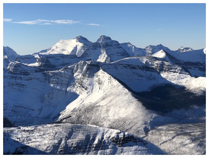
Carthew Minor, just left of centre - definitely one of my favourites in the area
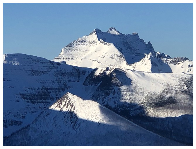
Mount Carthew - another favourite, but then aren't they all?!
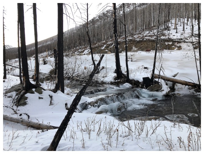
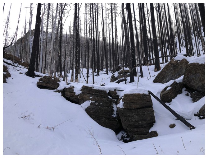
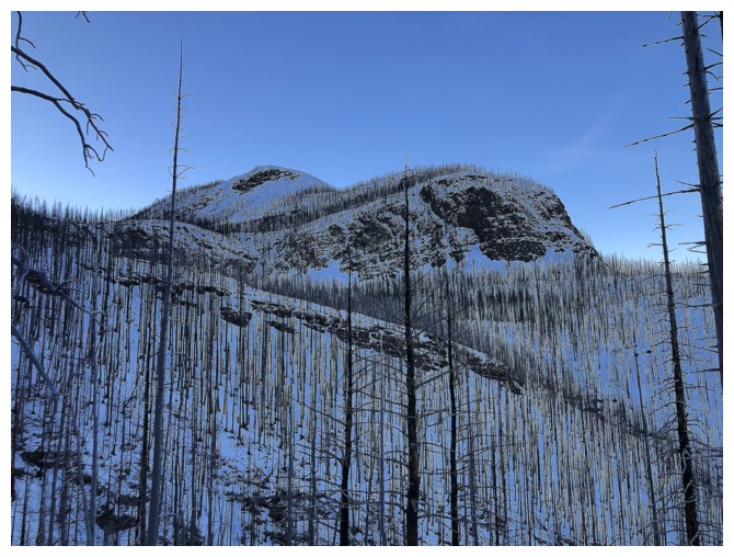
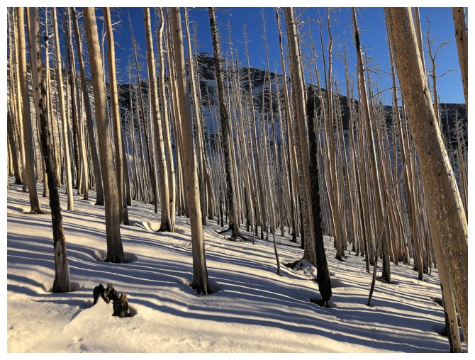
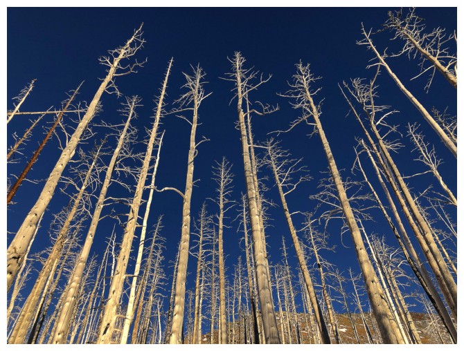
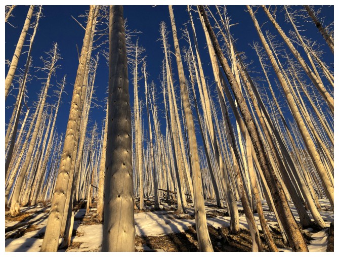
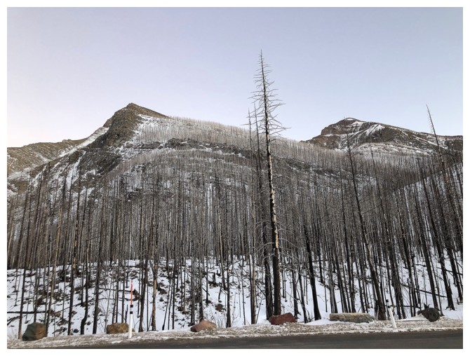
The 2017 Kenow fire has made ascending terrain like this very easy, for now
Mount Rowe and some burned trees
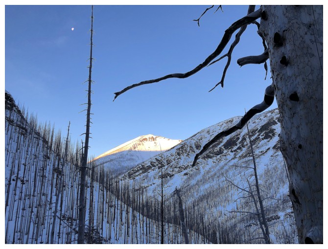
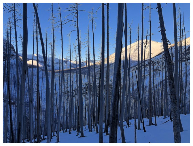
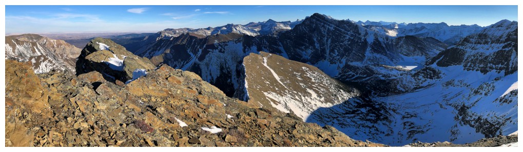
Above treeline the view to the northwest opens up
Mount Lineham - it's been too long since I visited that summit
Mounts Kintla and Kinnerly in the background and Akamina Ridge in front
Mount Custer
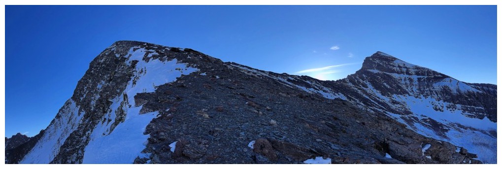
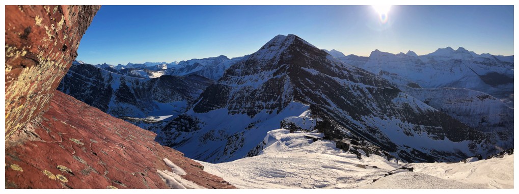
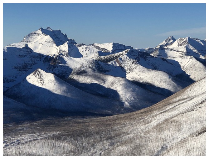
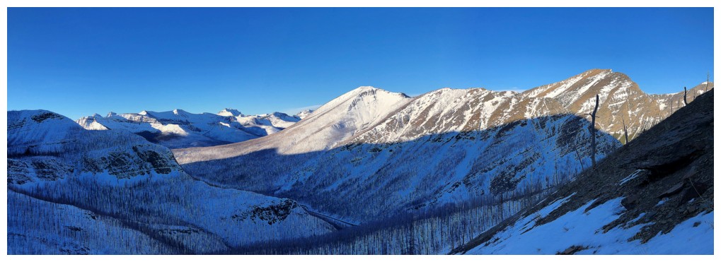
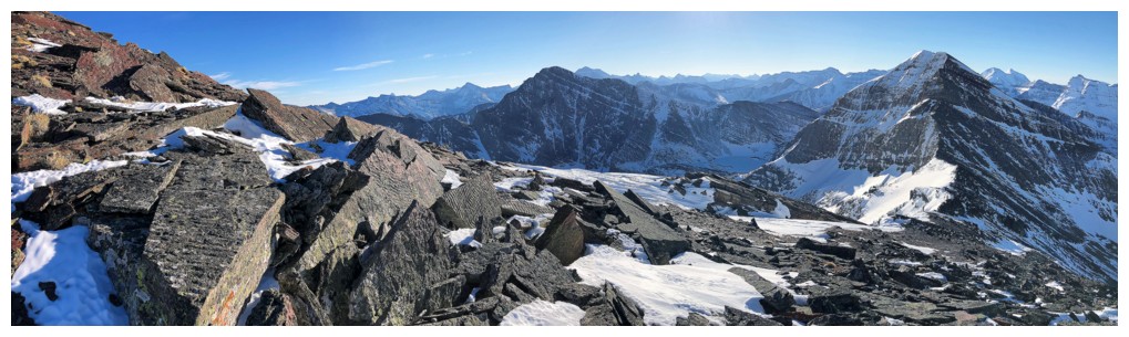
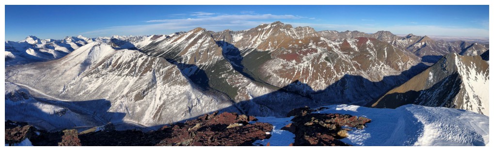
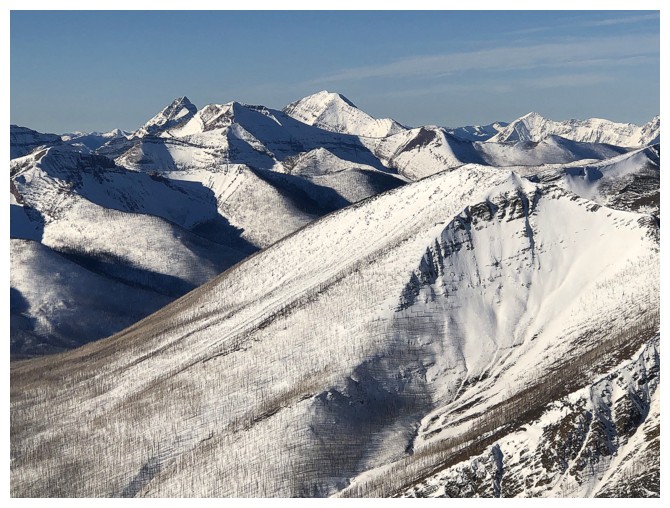
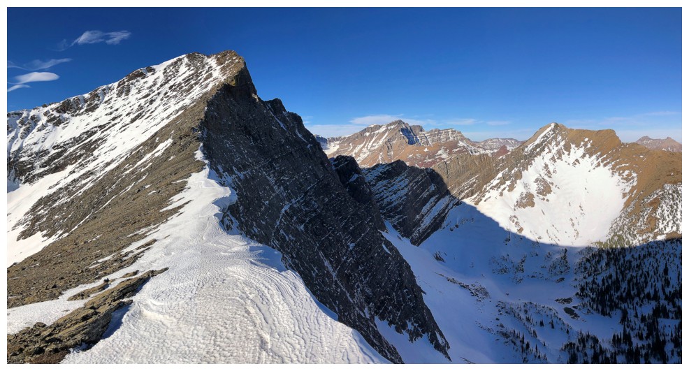
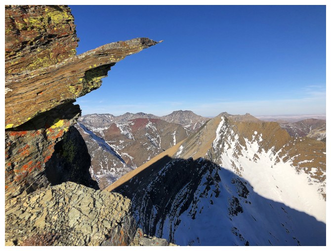
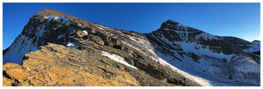
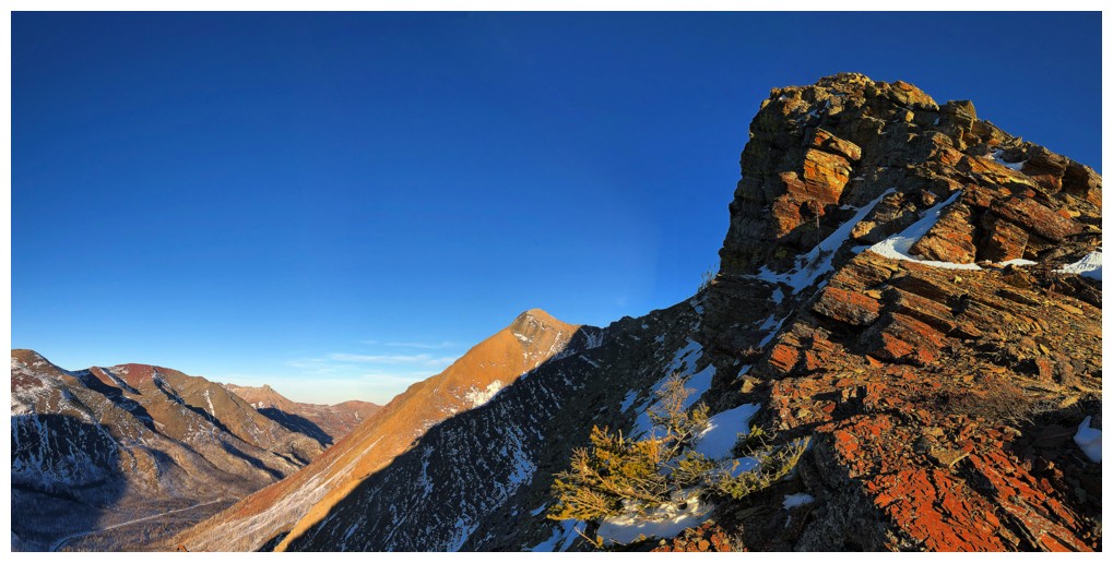
Some of the foreshortened route to Buchanan Ridge to the left and Carthew at the right
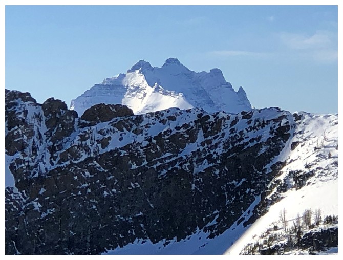
I must photograph Long Knife Peak more than any other mountain in Glacier National Park!
The view continues to improve
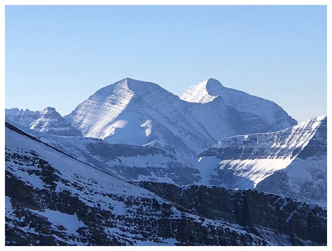
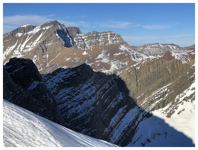
Two more impressive peaks in GNP: Mount Carter (left) and Rainbow Peak
Kintla, Kinnerly, and diminutive but very cool Forum Peak
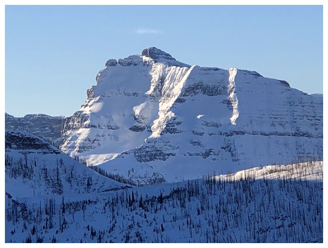
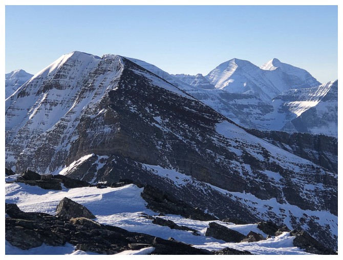
Beautiful and intimidating - Mount Peabody
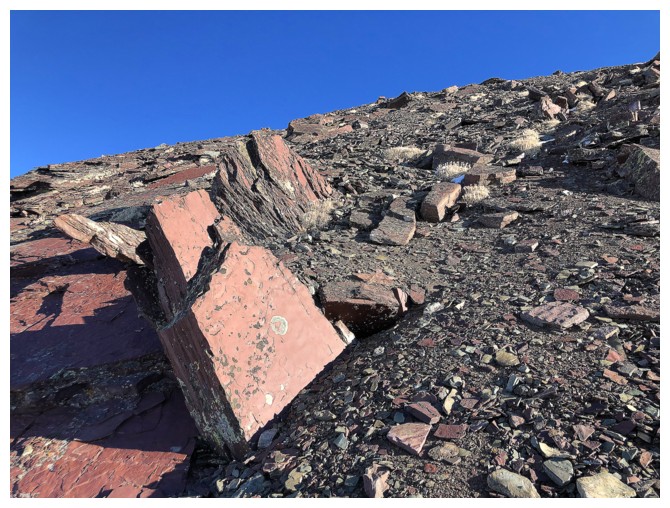
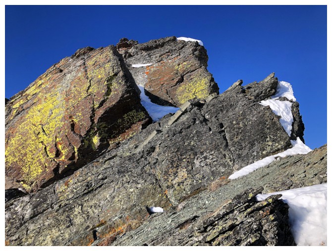
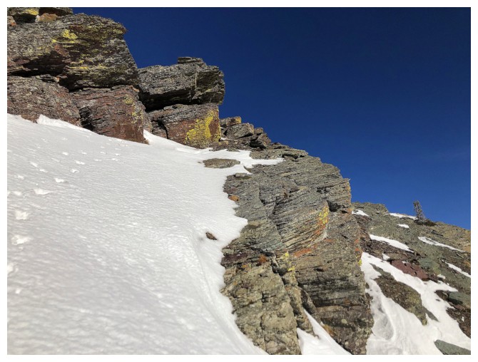
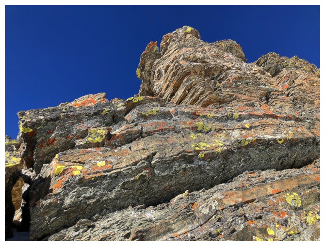
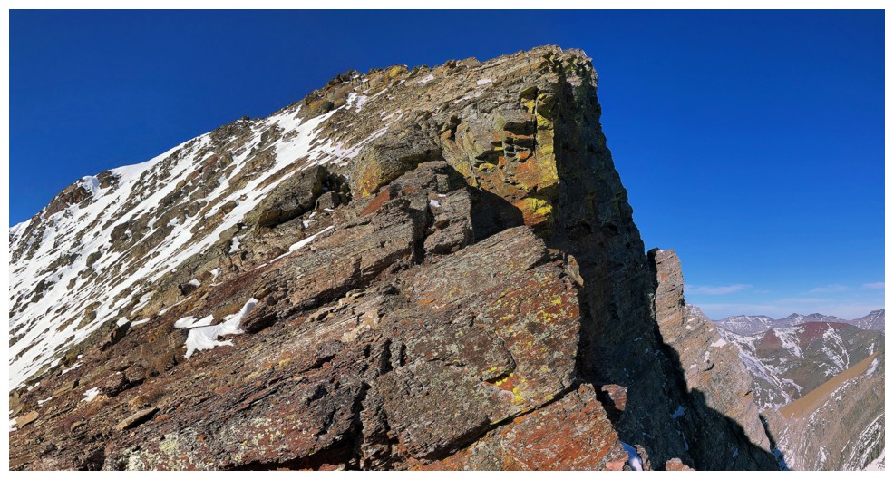
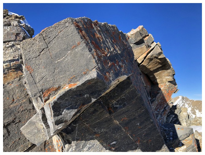
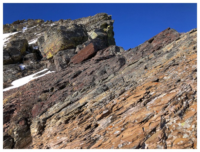
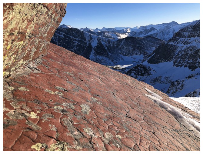
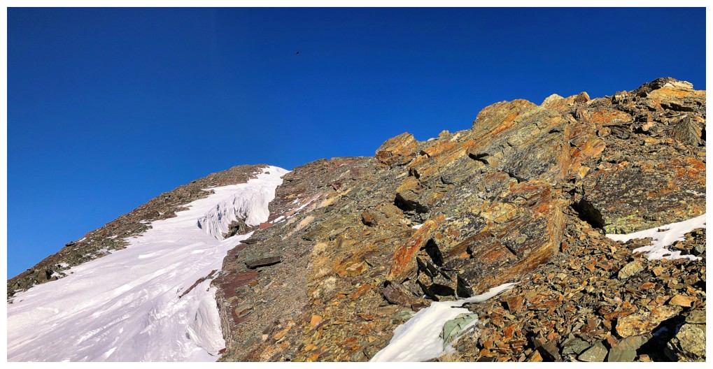
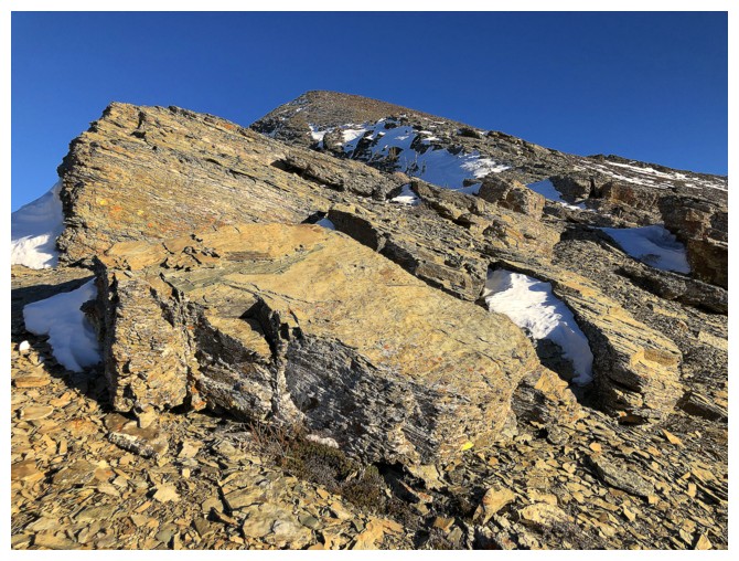
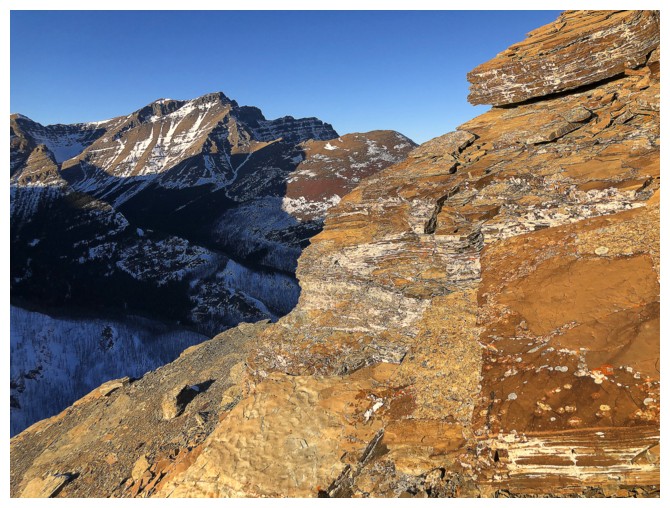
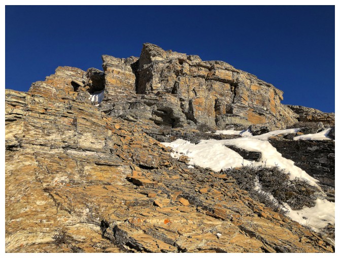
The first, but not last, red argillite encounter of the day
Blakiston joins the argillite
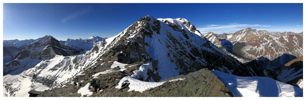
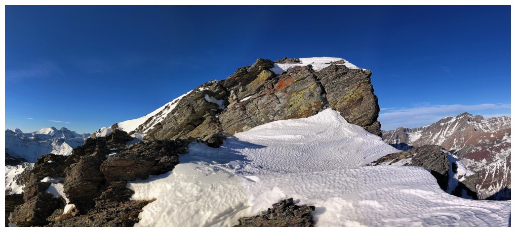
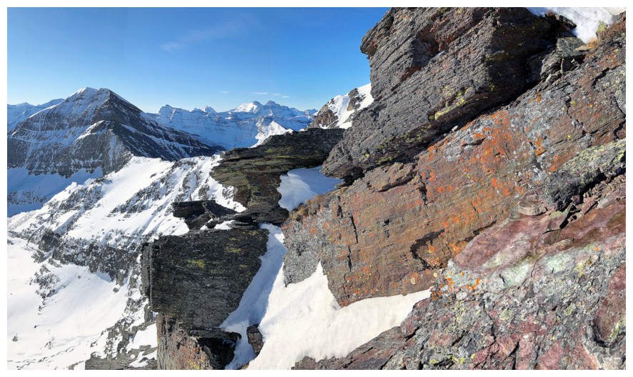
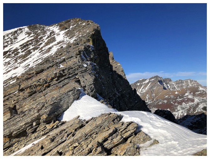
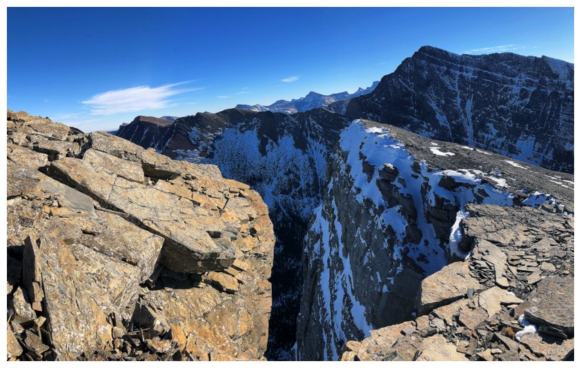
Traversing over to the connecting ridge between Buchanan and Carthew to finish the ascent
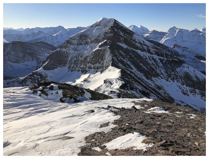
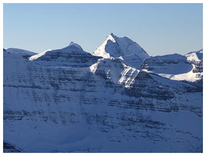
Carthew looks impressive too - that's because it is!
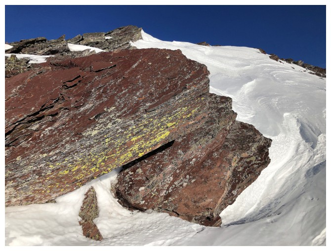
Yellow lichen on burgundy argillite, surrounded by pure white snow, with a clear blue sky - oooh!
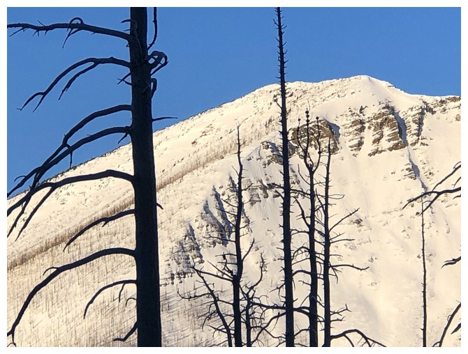
Although the northwest side of the mountain was the almost snow-free, the southeast side had plenty of the white stuff
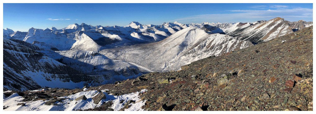
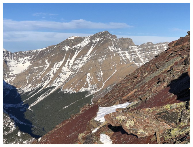
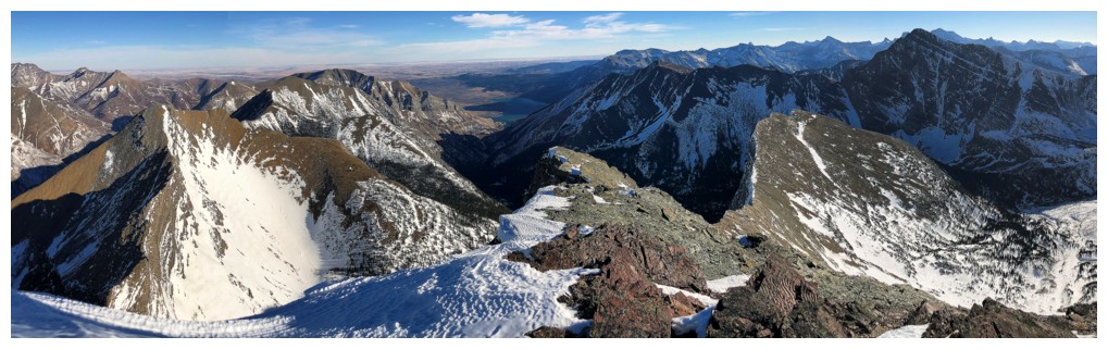
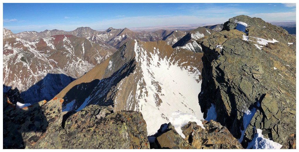
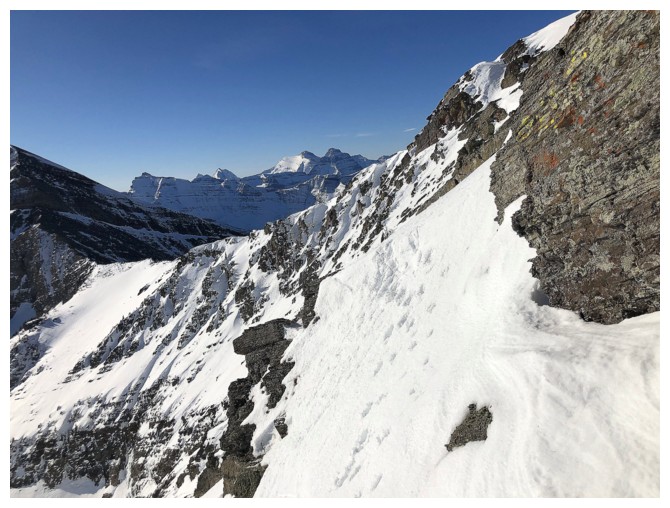
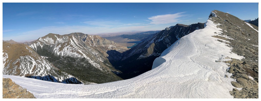
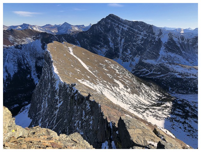
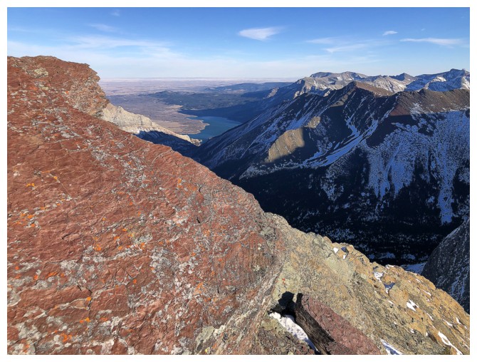
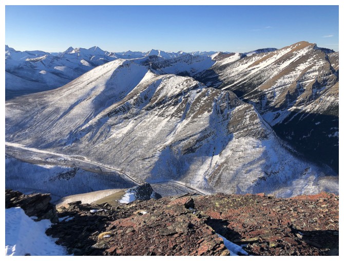
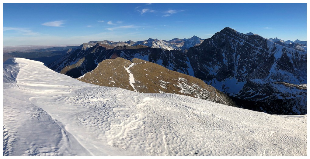
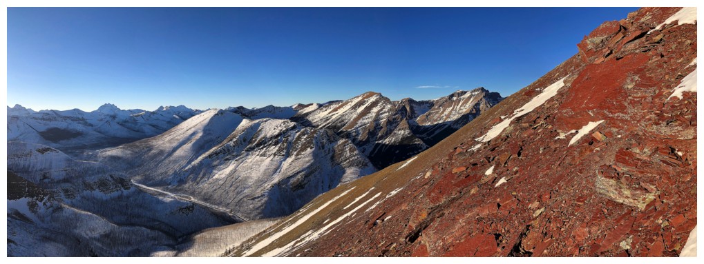
View from the ridge
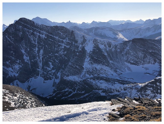
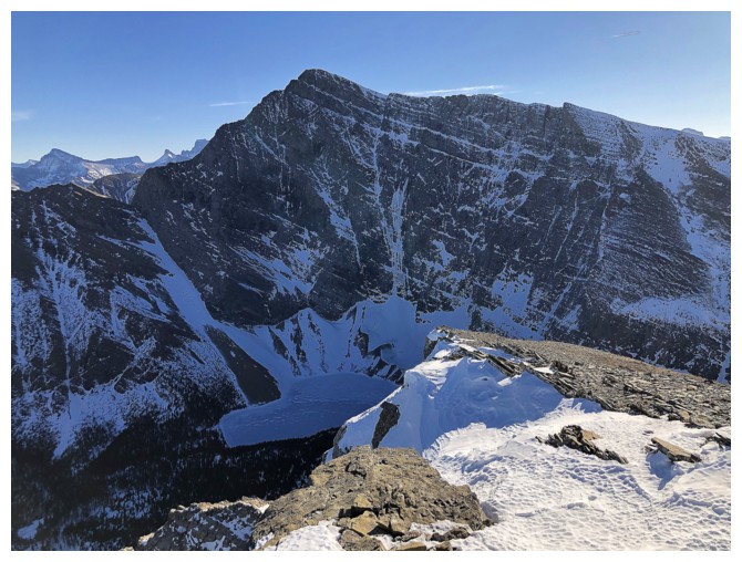
The snow-covered, lowest of the Carthew Lakes at the lower right. Looks quite different from the last time I saw it.
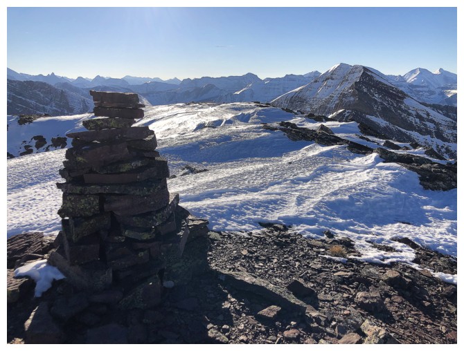
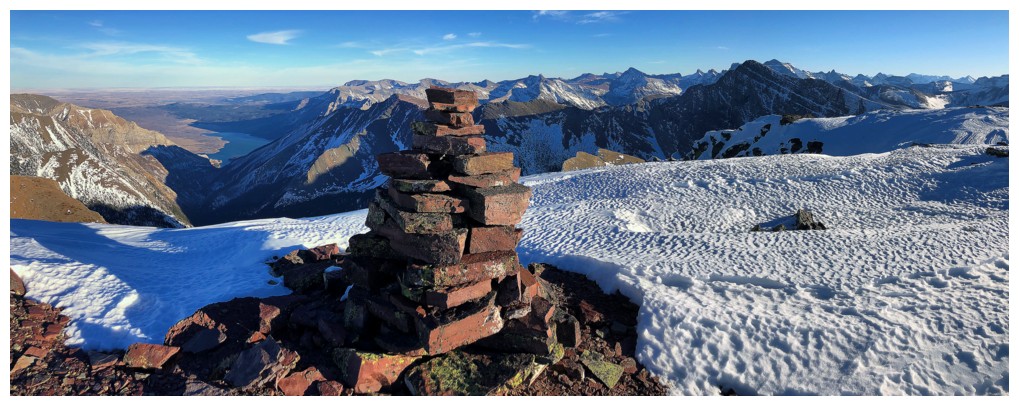
Big summit cairn
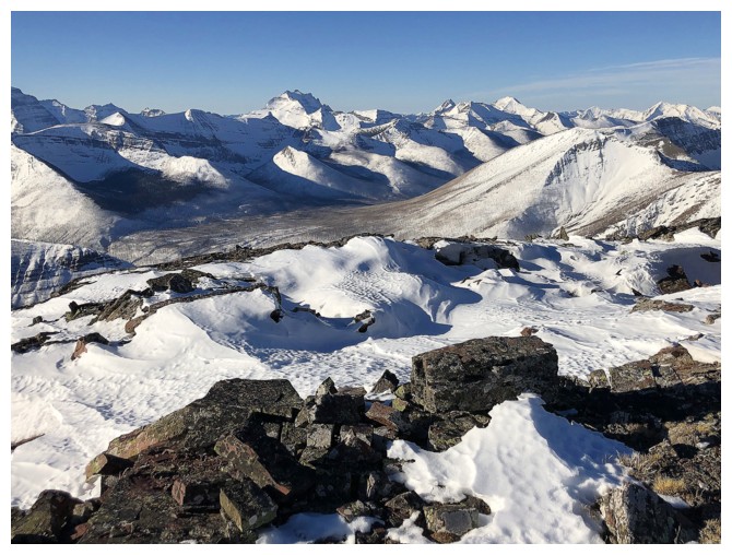
Summit view to the north
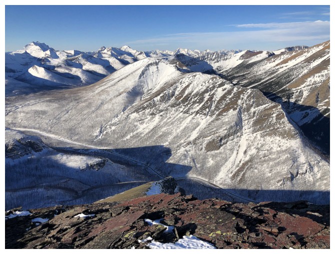
Mount Rowe is a fairly big mountain itself
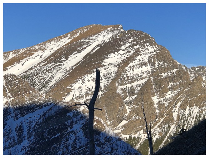
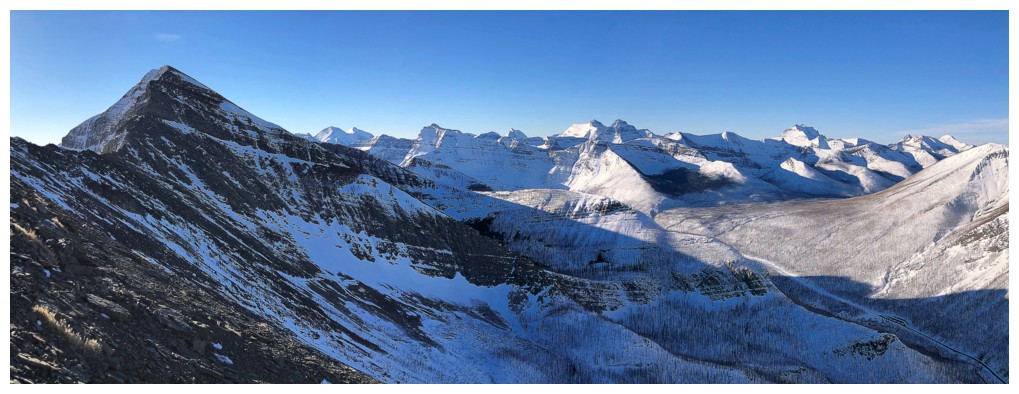
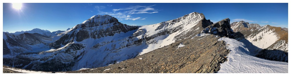
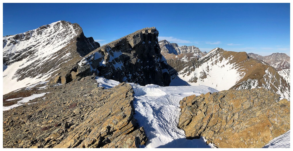
The continuation of Buchanan Ridge to the northeast features the highpoint that was the original objective and the one at far end I reached a month earlier
Thinking about attempting Carthew
Got pretty fixated on the view of Kintla, Kinnerly, Forum, and Akamina
Same with Rowe (foreground) and King Edward and Starvation peaks in the background
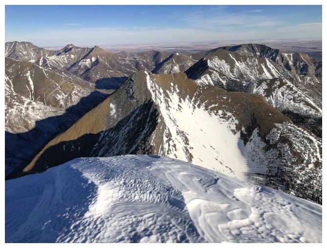
View to the northeast and east
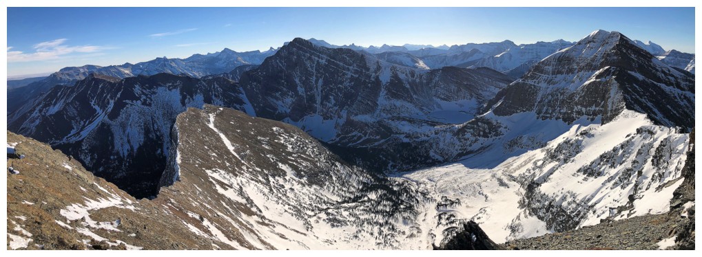
View to the east and southeast
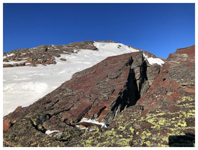
Start of the highlight of the day - the descent to Buchanan Peak
A splash of colour to get me warmed-up
And a splash of great views
Had to turn around continually while descending to take in the view behind
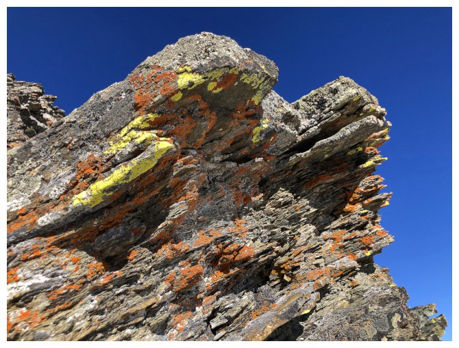
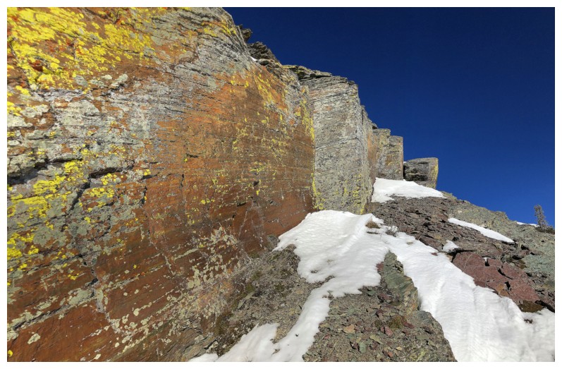
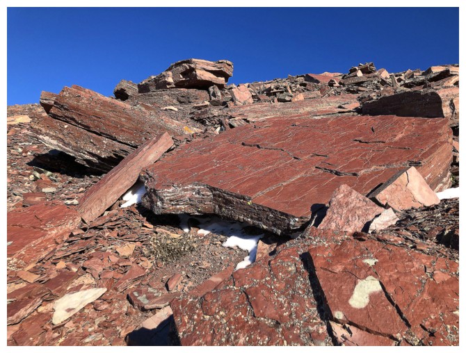
It's "lichen-covered rock" time
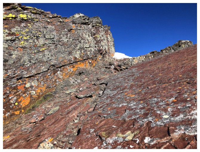
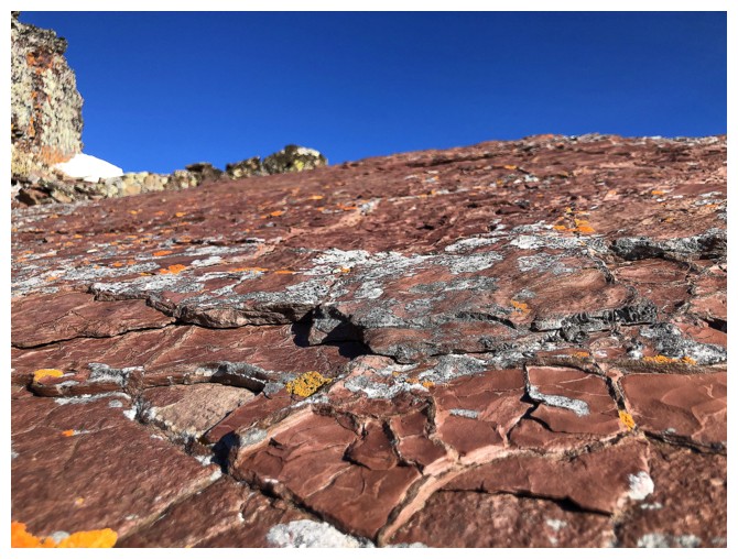
"Sweet red argillite" time
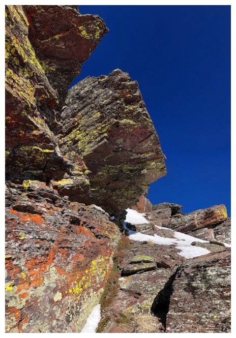
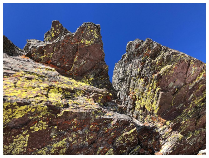
"Lichen on sweet red argillite" time
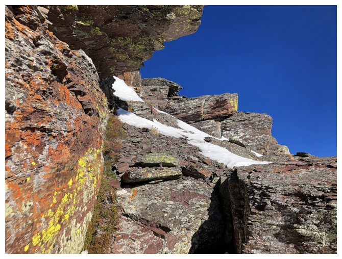
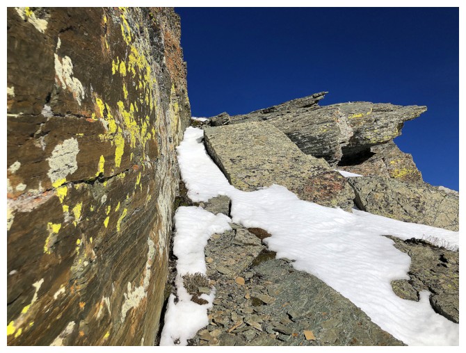
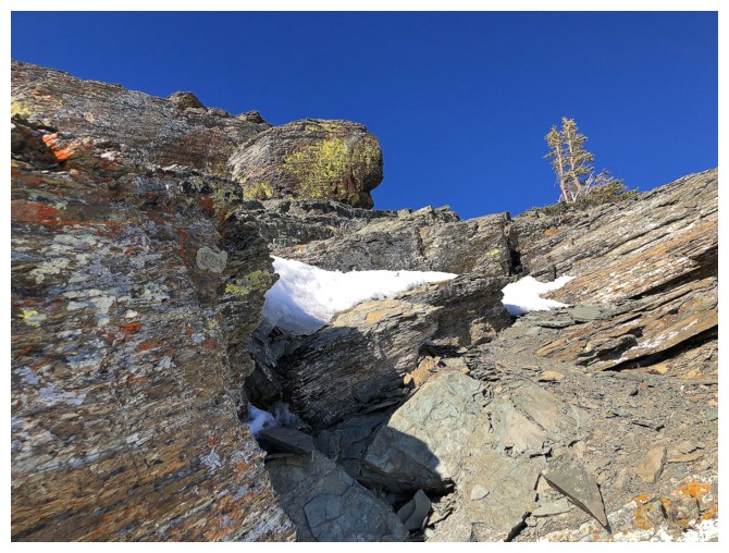
Traversing away from the ridge to circumvent a rock band I couldn't downclimb
Looking back to the snow slope I had to traverse to get back to the ridge
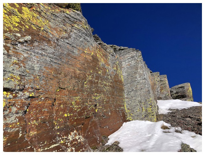
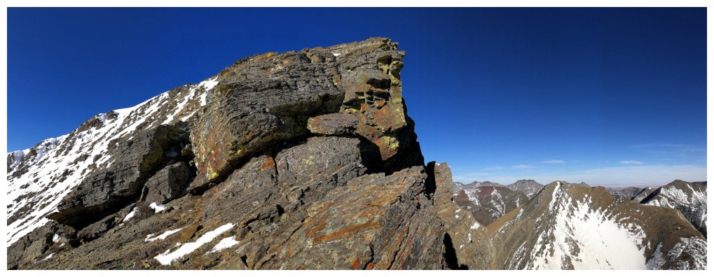
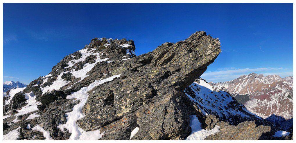
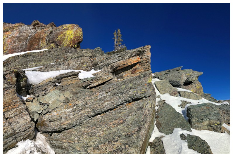
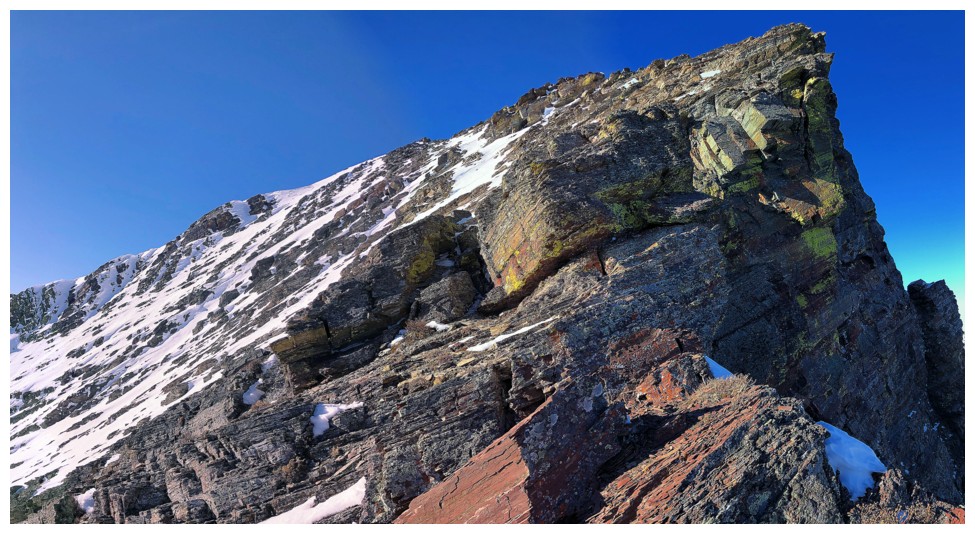
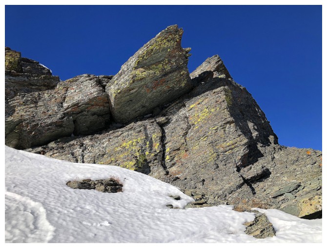
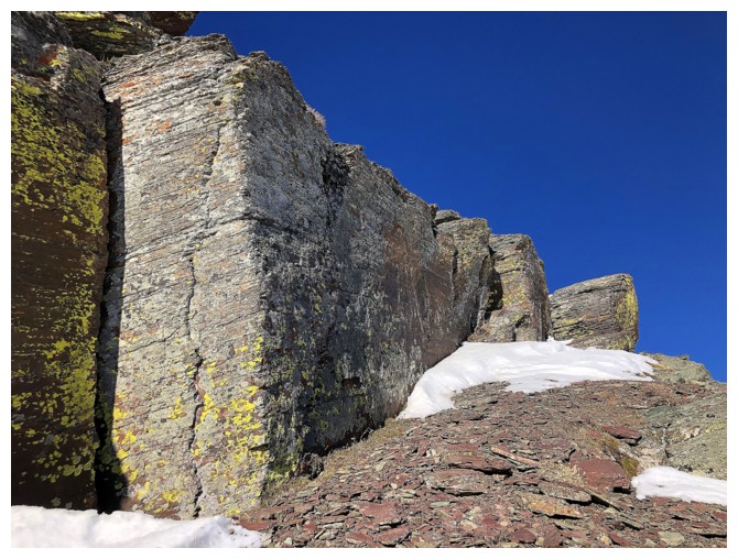
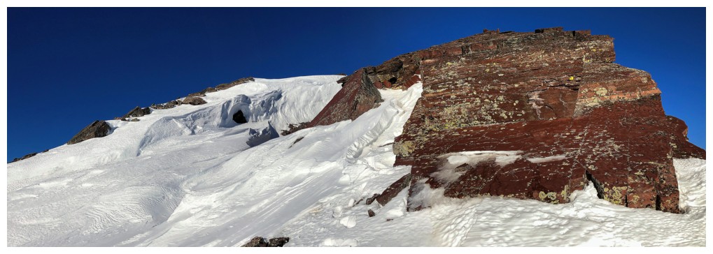
Amazing wall of rock!
That one too
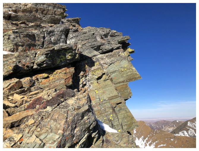
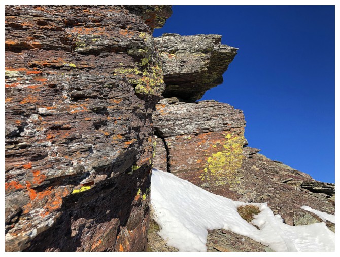
The rock at the left is actually the nose of a "face" in the rock
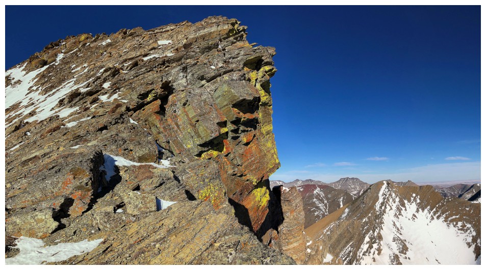
See it now?
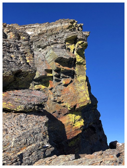
More apparent
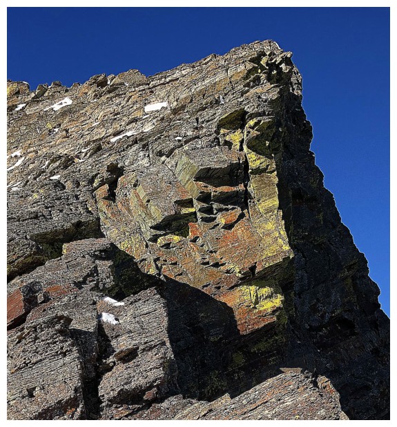
Even more apparent
Gonna' call this dude "The Guardian of Waterton"
The Guardian disappears from view
The connecting ridge between Buchanan and the next highpoint along the ridge looks fierce
The highpoint - someday perhaps
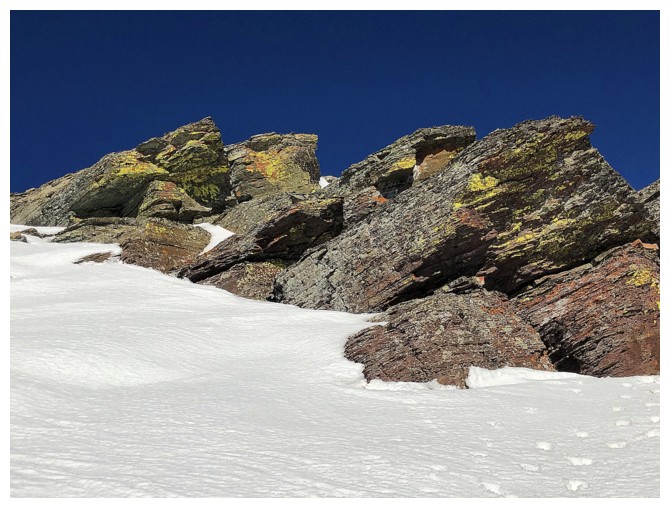
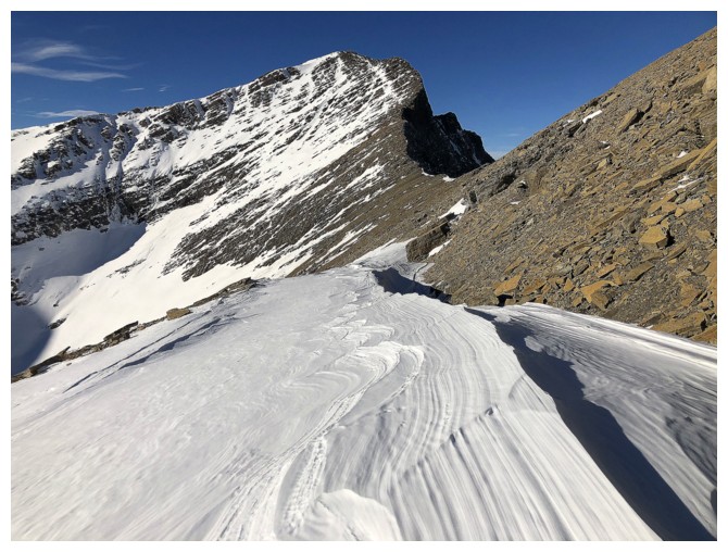
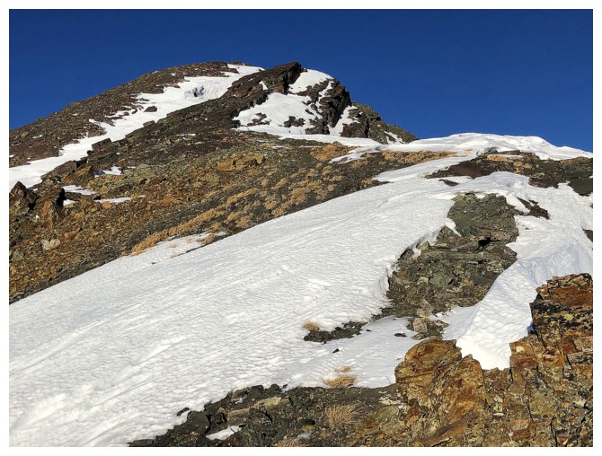
Starting to gain some elevation to Buchanan Peak
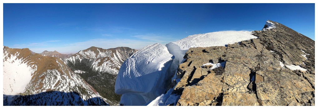
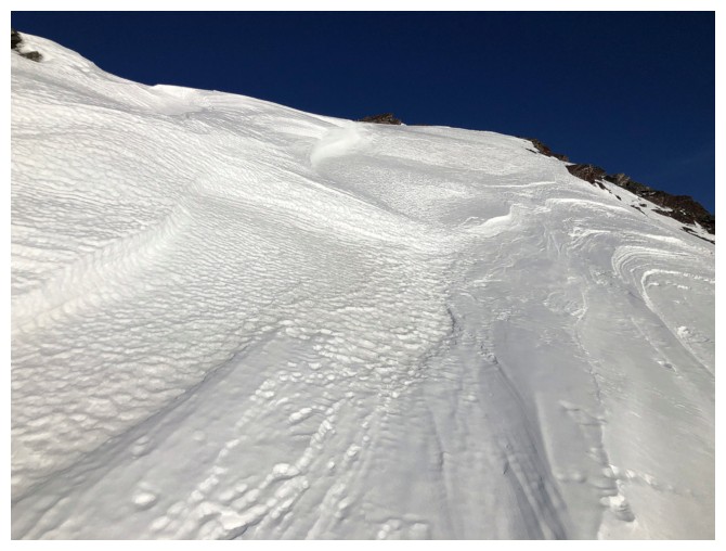
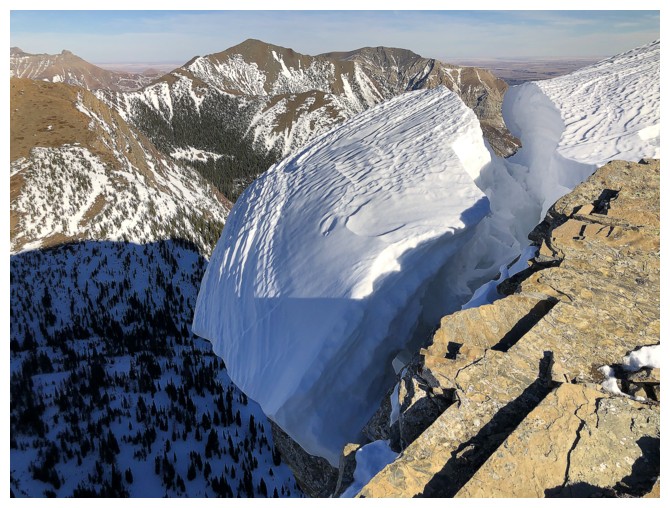
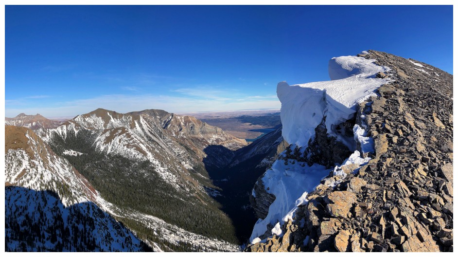
Cool, collapsing cornice
The north side of Buchanan Peak is quite vertiginous
 \
\
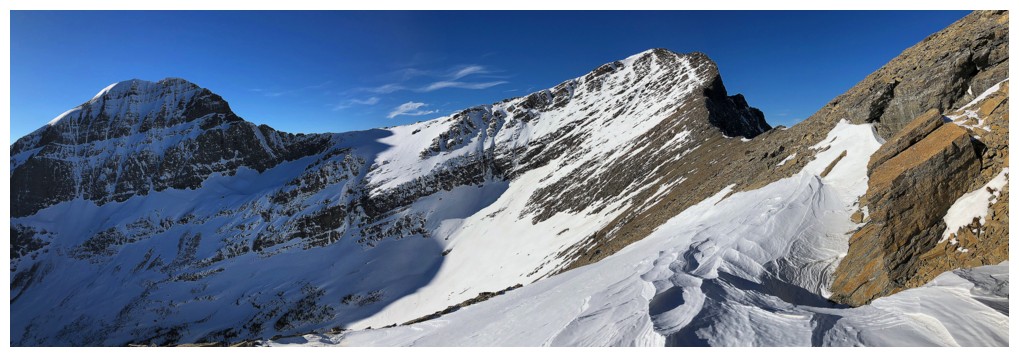
More cornices and almost to the top
Long Knife grabs my attention again
Went over the true summit and headed right for a lower summit to get a view of Alderson Lake
Looking back to the true summit (point near the right) and the rest of the route
Alderson Lake and Mount Alderson
Heading back. The true summit of Buchanan Peak in the centre.
Decided to bypass the summit on return, in favour of checking out this cool snow and rock feature
A huge fissure in the rock lies below the summit and is filled in with snow here
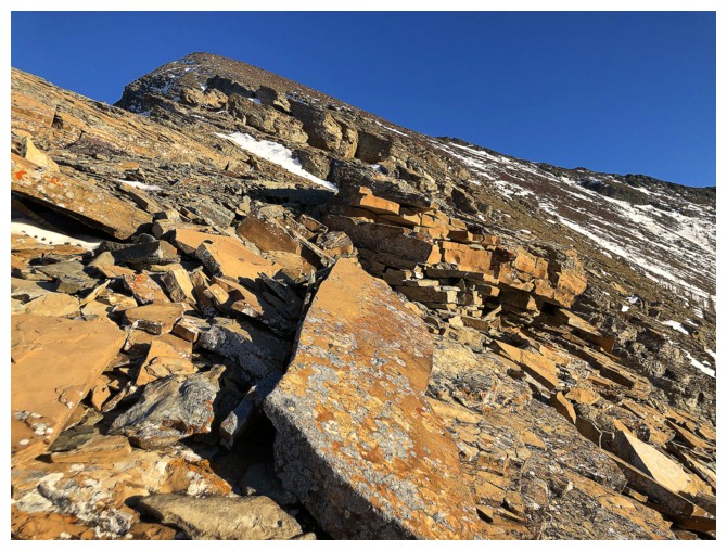
Excited about another round of amazing rock on the way back up to the Ridge
A good start
A good middle
Looking back down to the Peak
Back at the "Great Wall"
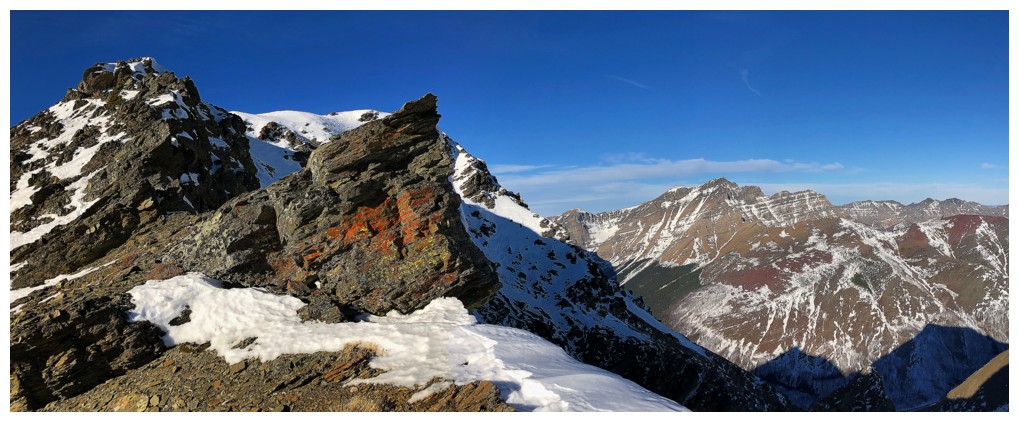
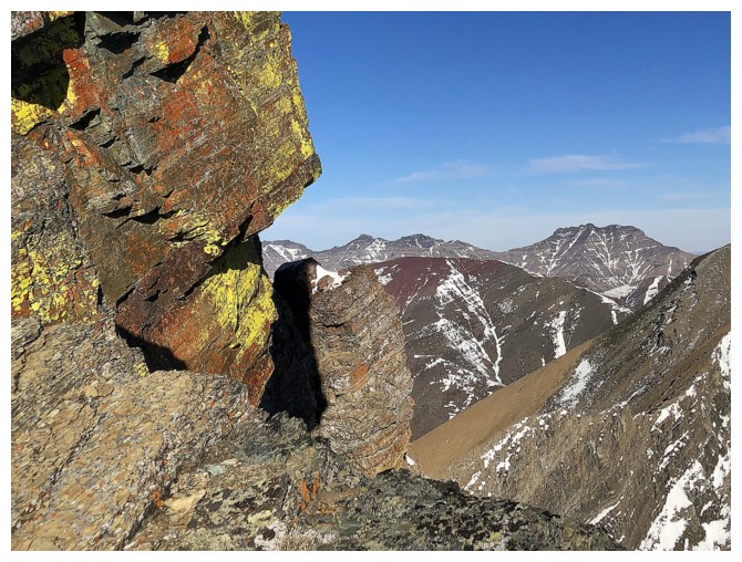
The route did grant occasional views of small sections of the Waterton Lakes (and big sections of red argillite)
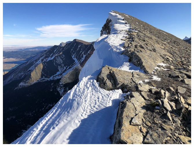
Almost back to the summit of the Ridge
Rowe starts to take on the shadows of late day
Summit cairn looks better now
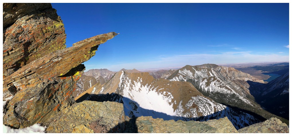
Detour down the Buchanan/Carthew connecting ridge
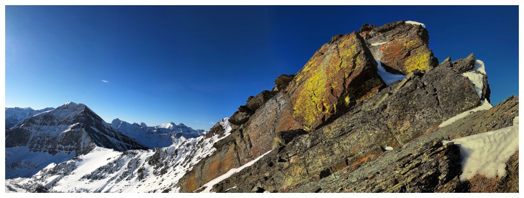
Yep - it's a red argillite gold mine!
The views aren't bad either
The red argillite is replaced with other great colours of rock
And back to the red stuff
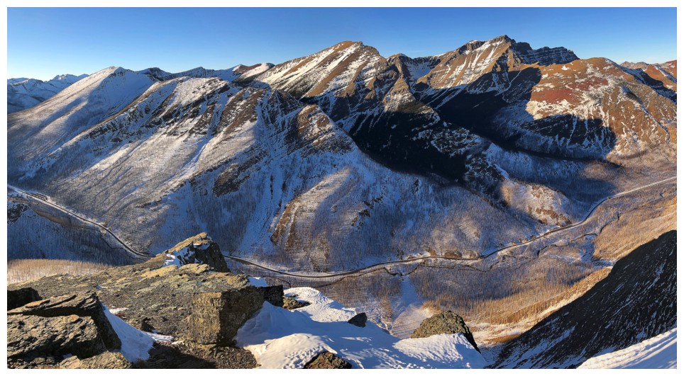
Back onto the correct descent route, with good late day views of Rowe, Lineham, and Blakiston, and the Akamina Parkway far below
The route is infinitely more scenic with the Sun shining on it
Case in point: similar photos from the same trip at different times of the day
Some of the best colours often occur just before the Sun slips below the horizon
The Sun is almost there
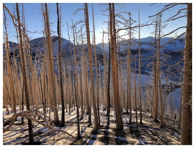
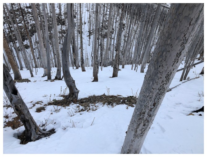
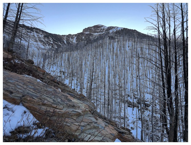
Back into the trees, but still enjoying the fire-ravaged scenery
Done! Parting look at the objective (left)
The End
LOG