Buchanan Ridge IV
December 29, 2023
Mountain height: 2594 m
Elevation gain:
1000 m
Ascent time: 4:00
Descent time: 2:35
Scrambling with Mark.
I was excited to
take Mark up this route up Buchanan Ridge. An early December ascent in 2020 cemented
itself as one of my favourite routes in the park. Although not as scenic as the
“normal” route via Mount Carthew, this line is the most direct to the highest
point of Buchanan Ridge, where a wonderful traverse down to Buchanan Peak
awaits. 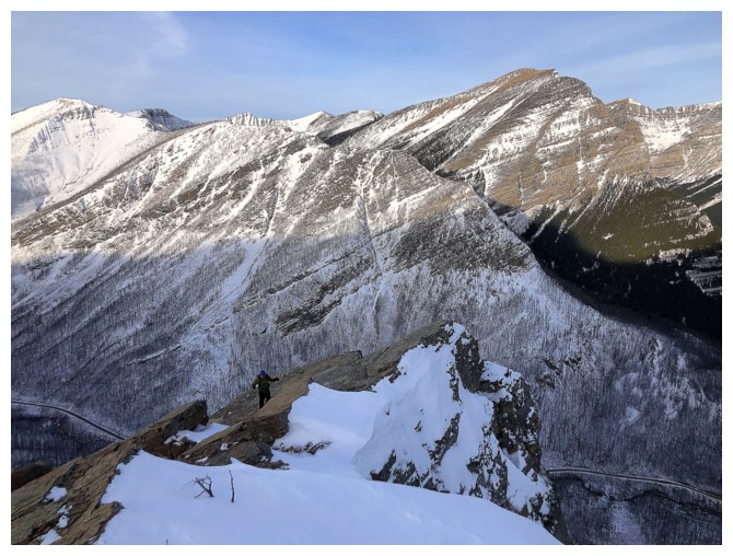 Quick shout-out to Kevin Barton ans Sonny Bou, whose idea this route was back in
2005 – thank you, my friends!
Quick shout-out to Kevin Barton ans Sonny Bou, whose idea this route was back in
2005 – thank you, my friends!
We arrived at
the start to see a shocking lack of snow on the ascent slopes for late December
– the snowshoes would be staying in the car. After crossing knee-deep Cameron Creek
(I can also add a thank you to the inventor of hipwaders here!), we donned our
microspikes and started up a subsidiary creek, enjoying easy travel due to the
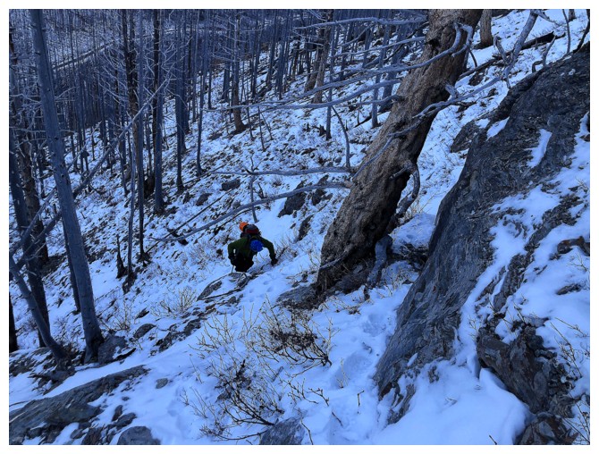
lack of deep snow. 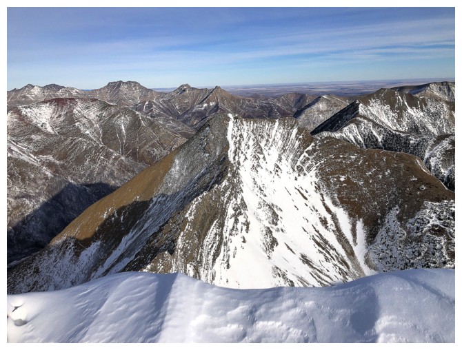 That changed upon leaving the creek onto the main ascent
slope. Microspikes were sufficient for ascending the steep and sometimes
slippery terrain, however descending would be more challenging – a problem for
later.
That changed upon leaving the creek onto the main ascent
slope. Microspikes were sufficient for ascending the steep and sometimes
slippery terrain, however descending would be more challenging – a problem for
later.
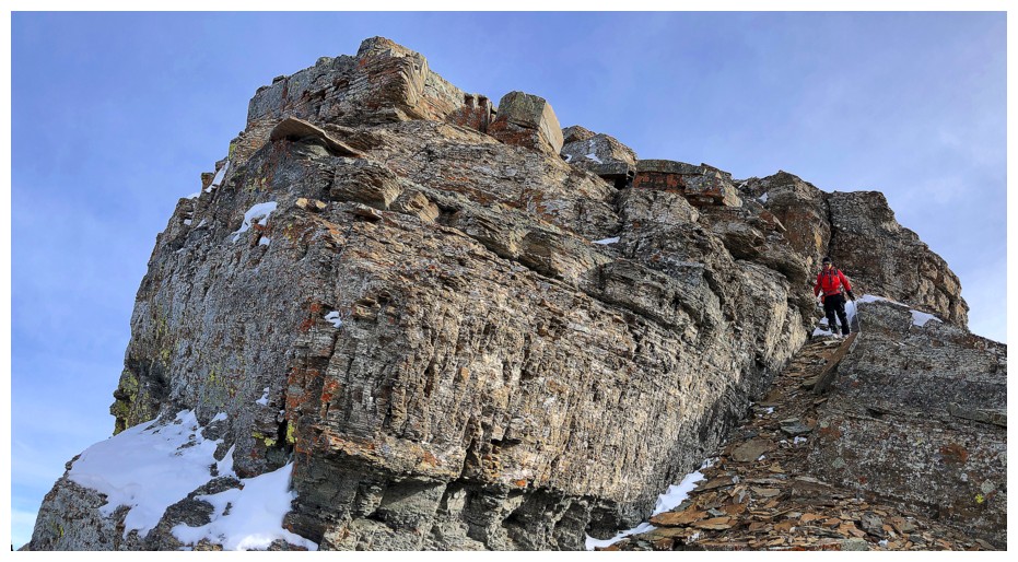
The crux rock
band was soon reached. In four ascents I don’t think I’ve ever used to same
route to get above the band, but that’s because weaknesses abound – take your
pick. More easy travel followed, before embarking on the super foreshortened
slog to the summit. Throughout, the weather toyed with us, at times looking to improve,
only to revert to that annoying thin layer of cloud status. 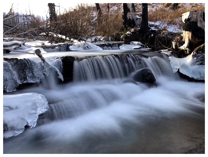 Things could have
been much worse, but I was hoping for a repeat of 2020 and this was not quite
it.
Things could have
been much worse, but I was hoping for a repeat of 2020 and this was not quite
it.
After enjoying a
downright balmy ascent, the other weather surprise reared its miserable head at
the summit – a light wind that made for bone-chilling temperatures. We had
already downgraded the trip to just Buchanan Ridge because of the hazy skies
and the shortness of the day. However, the almost intolerable cold put a final nail in the
coffin of any hope of continuing down to Buchanan Peak. No way were either of
us about to expose our hands to the cold while changing into crampons. We did
descend the ridge a short distance, looking for reprieve from the wind, but
none was to be found and so we returned to the summit and immediately started
down.
Thankfully, we soon warmed up and could enjoy some of the terrific rock scenery on descent. Below
the crux rock band, we did decide to switch from microspikes to crampons – good
decision, as the daytime heat (lower down, that is) had made the slopes even more slippery.
Not quite a triumphant
repeat of December 5, 2020, but still a thoroughly enjoyable day on one of
Waterton’s finest. We are sure to return on a perfectly clear day to complete
the traverse to the Peak.
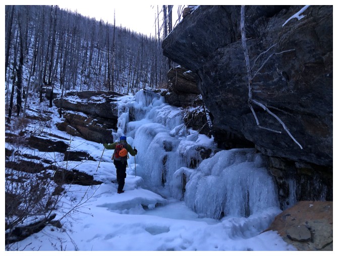
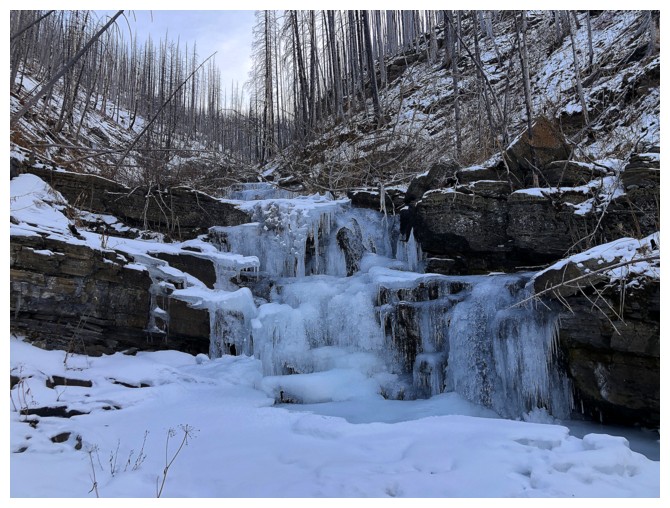
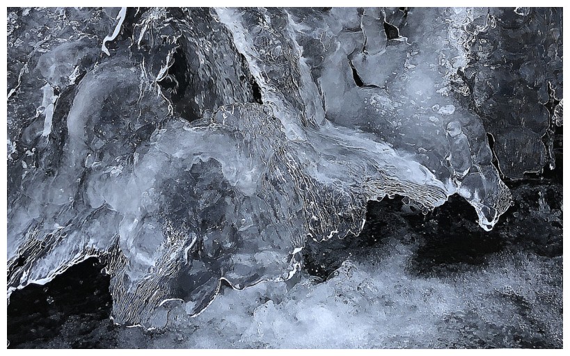
A cool frozen waterfall is encountered shortly after crossing Cameron Creek
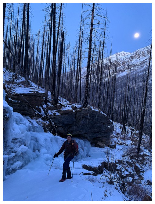
Same as above with the Moon
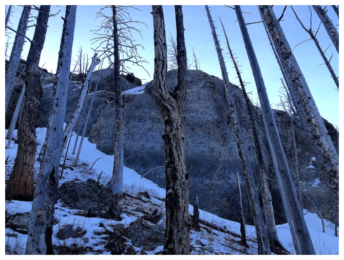
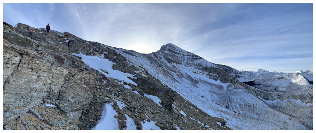
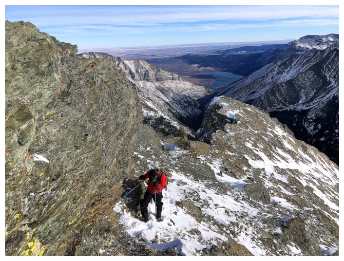
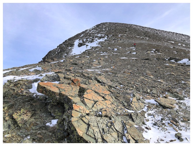
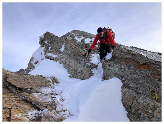
Approaching the crux rock band. The other crux of the day was the very steep and slippery slopes below the rock band.
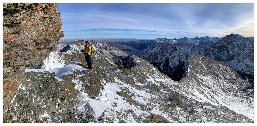
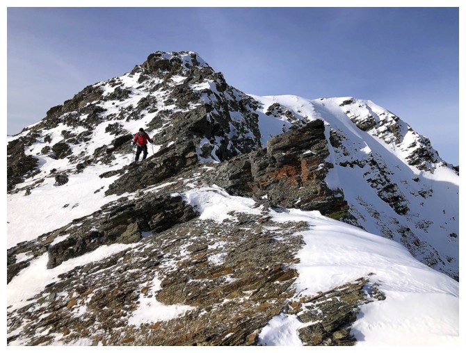
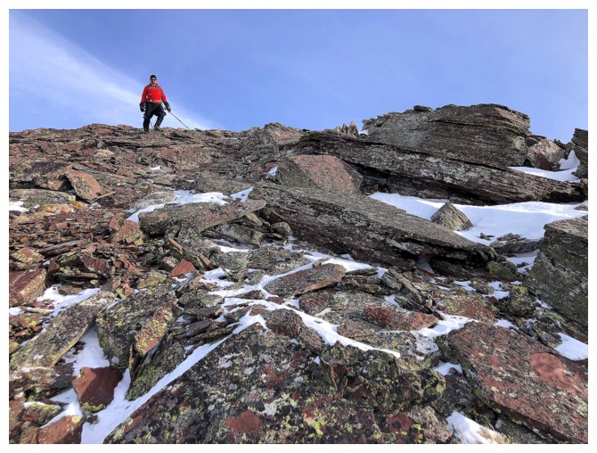
Mark approaches a weakness in the rock band
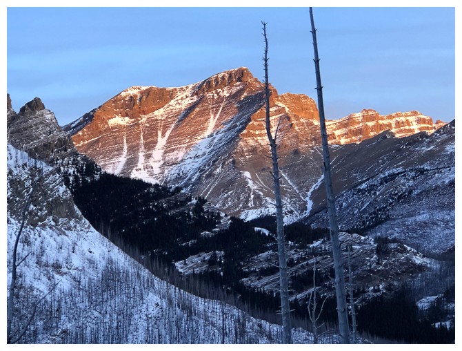
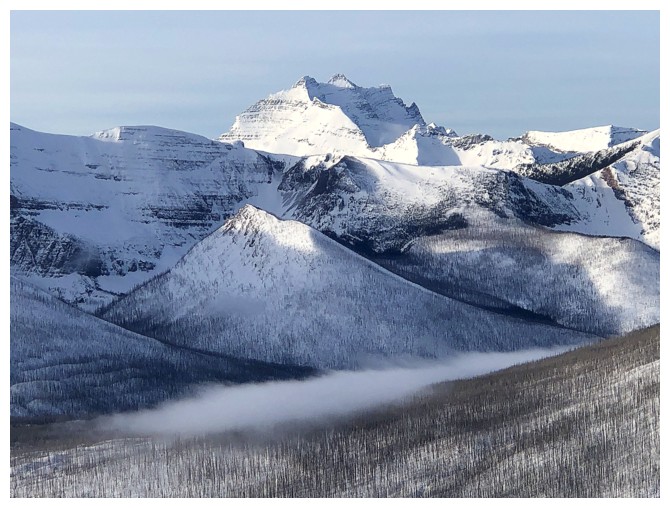
Mount Blakiston gets the first rays of Sun
Above the crux, the remainder of the ascent appears to be straightforward. It is, but is also very foreshortened.
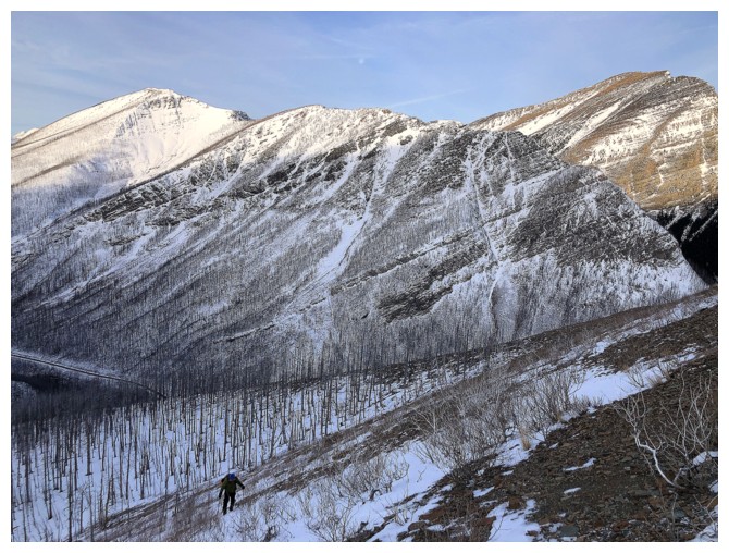
Mark grinds up the slopes. Mount Rowe, the eastern outlier of Rowe and Mount Lineham in the background.
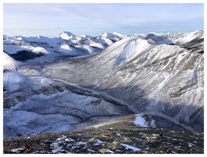
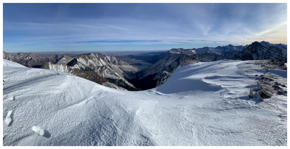
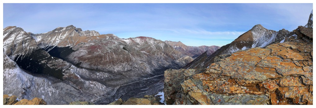
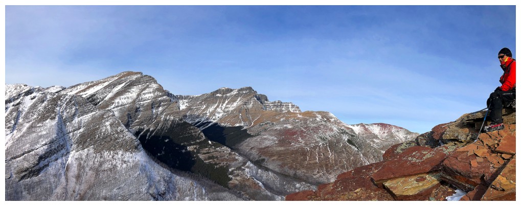
View to the west
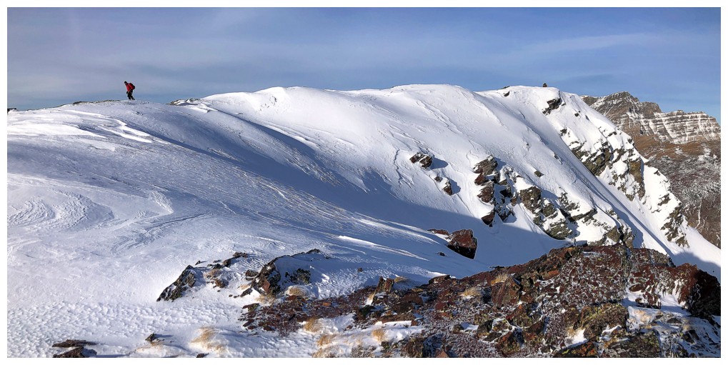
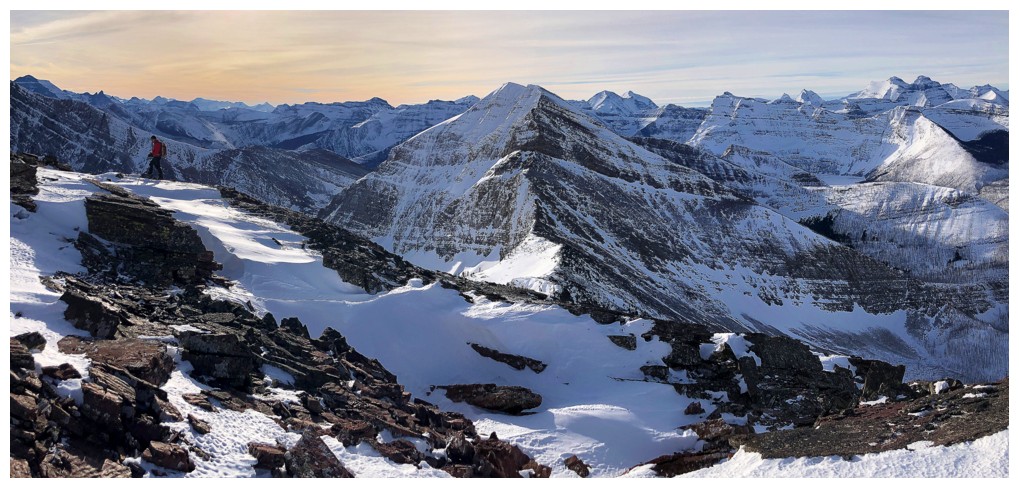
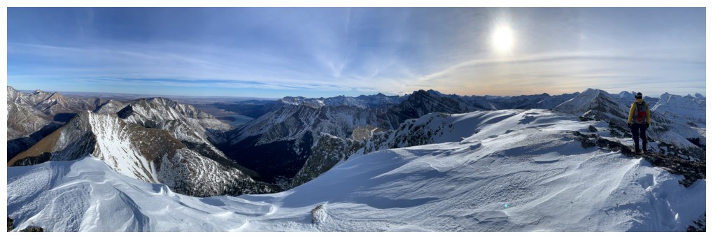
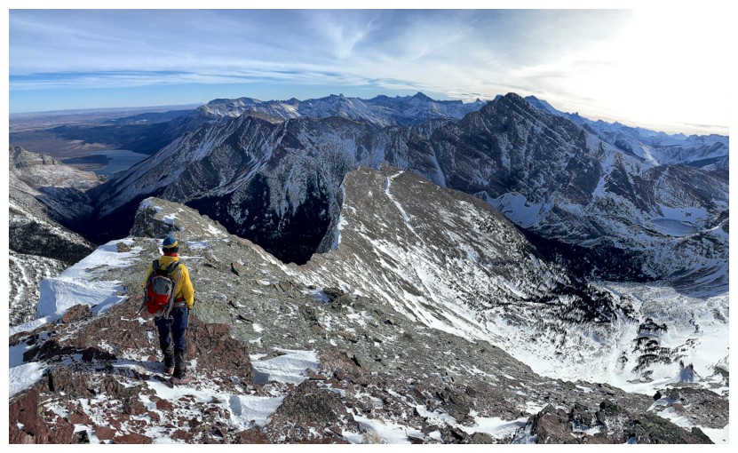
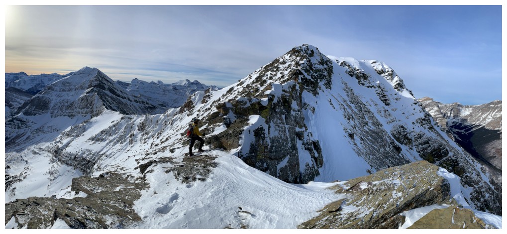
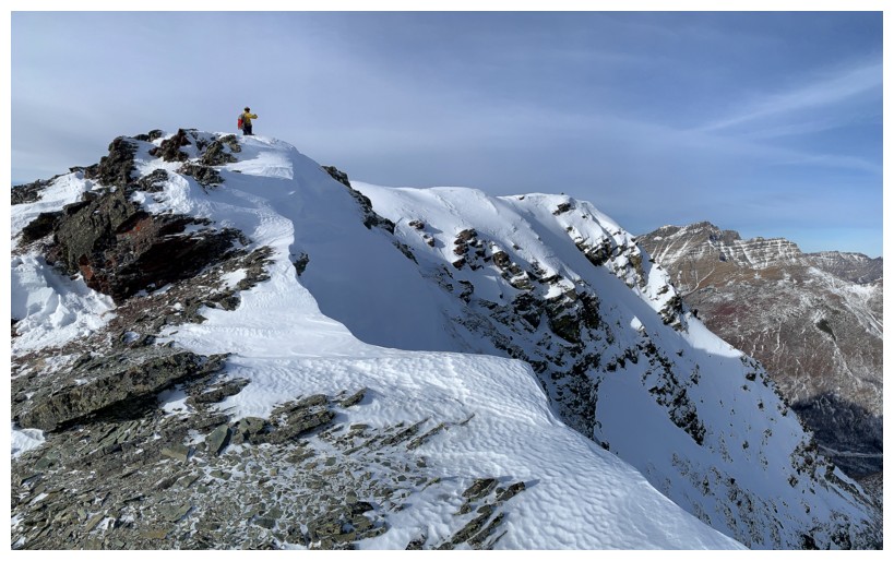
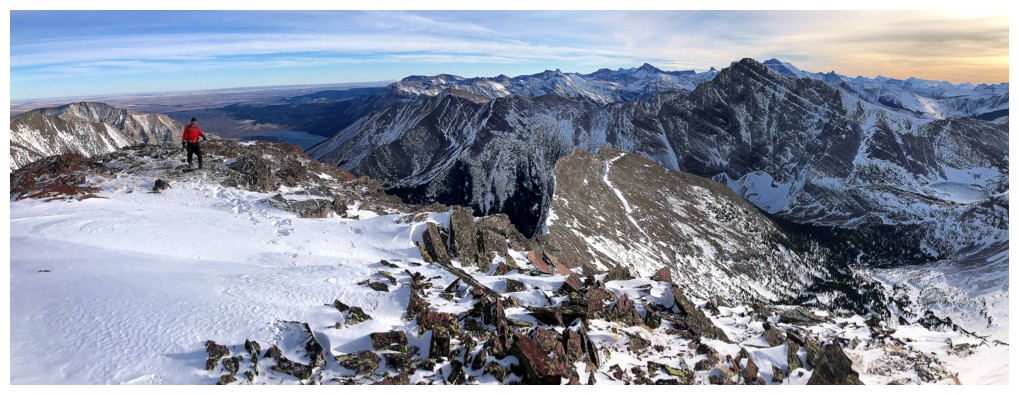
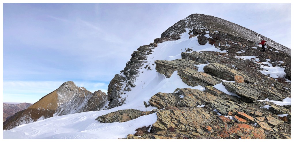
On the ridge and the summit is in view
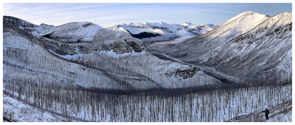
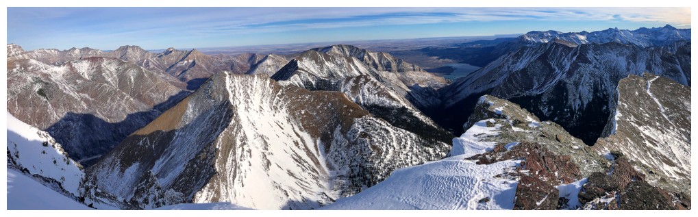
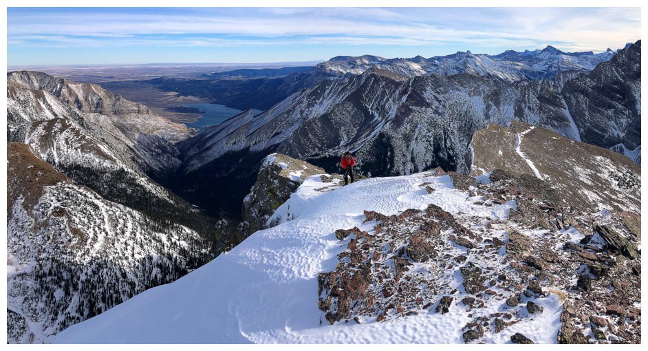
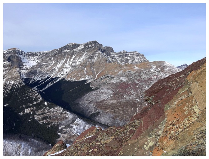
So is the terrific view of Lineham, Blakiston, and Ruby Ridge
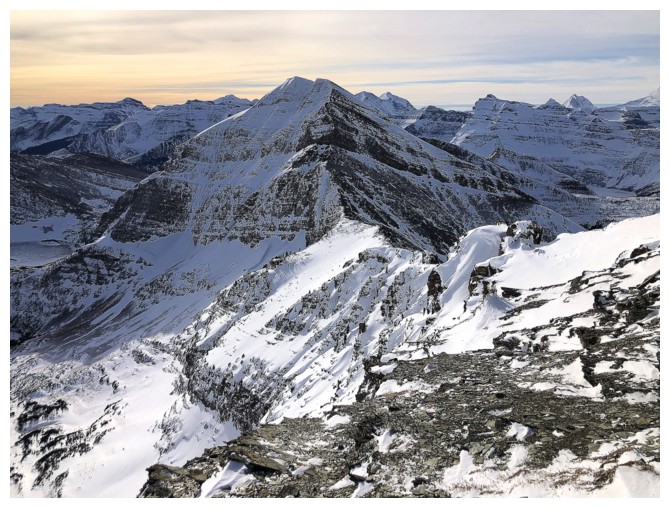
Still slogging up the ridge. Mount Carthew in the centre.
Long Knife Peak
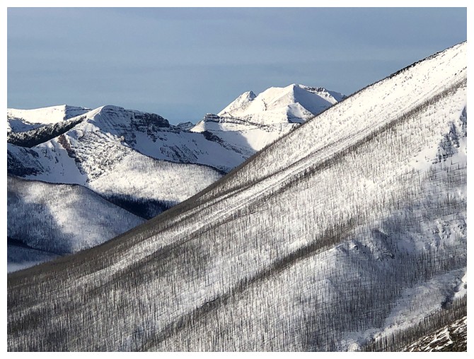
Part of Kishinena Ridge - a somewhat remote peak with difficult access
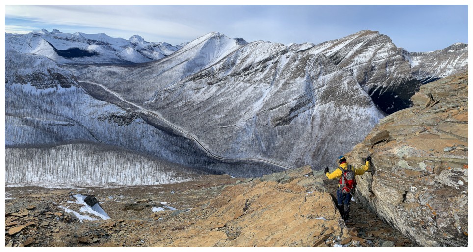
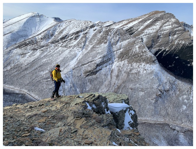
Mark and the view to the south. The Akamina Parkway snakes up the valley below.
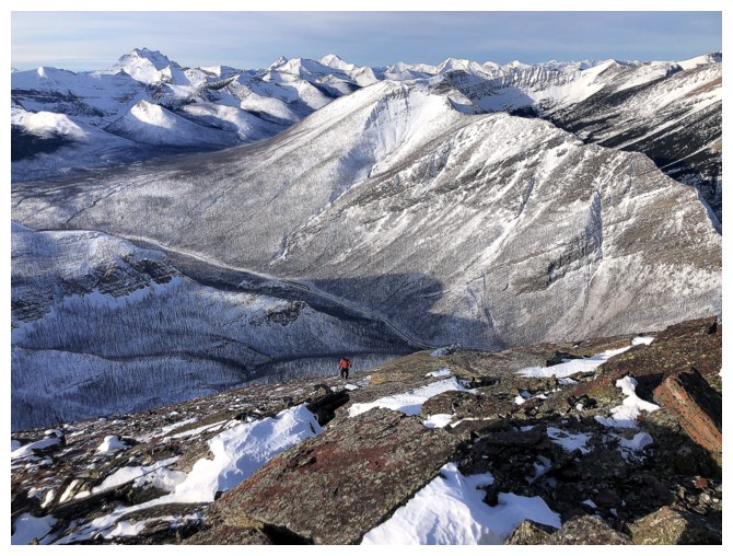
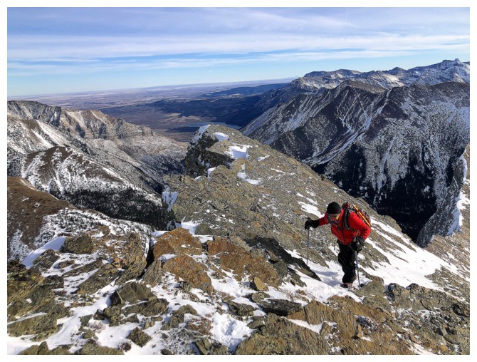
Mark is far below. The final section of the ascent is the most foreshortened part of the route.
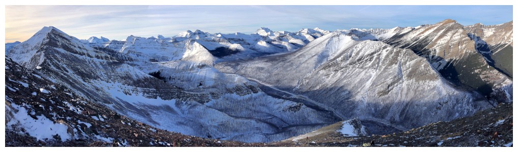
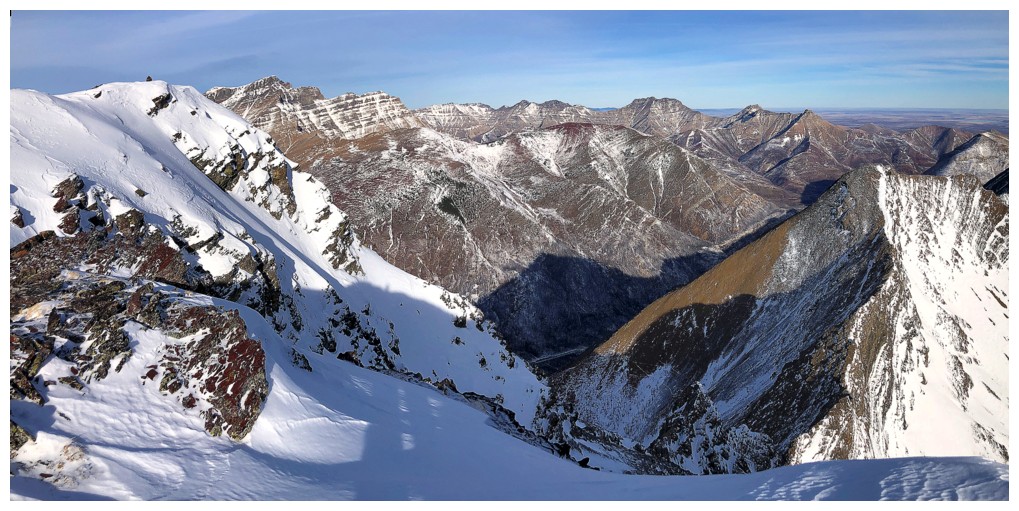
Great view but marred by the light cloud
Sheltering behind rock to get out of the increasingly cold wind
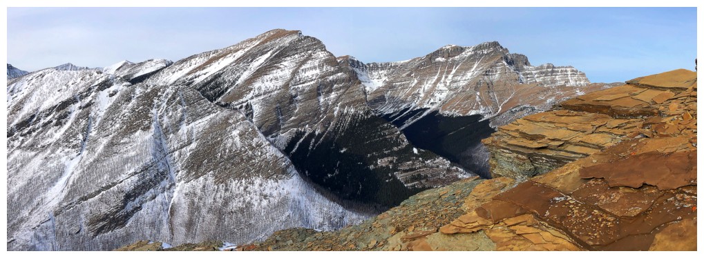
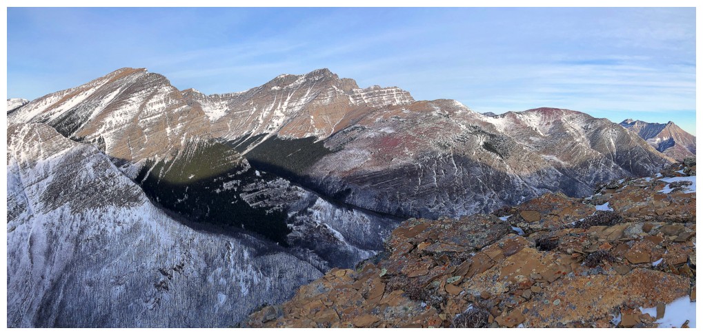
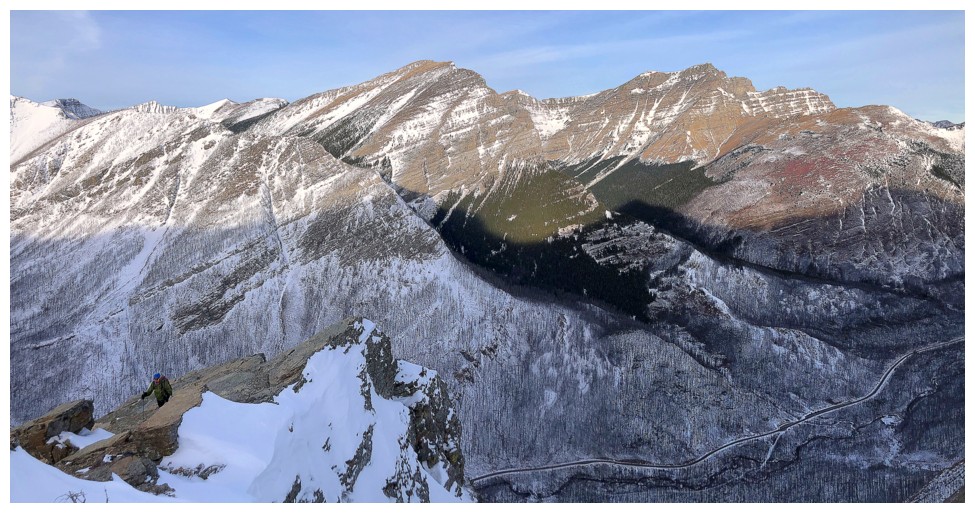
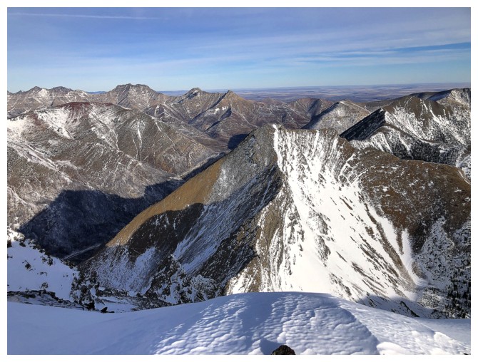
The impressive north side of Mount Carthew
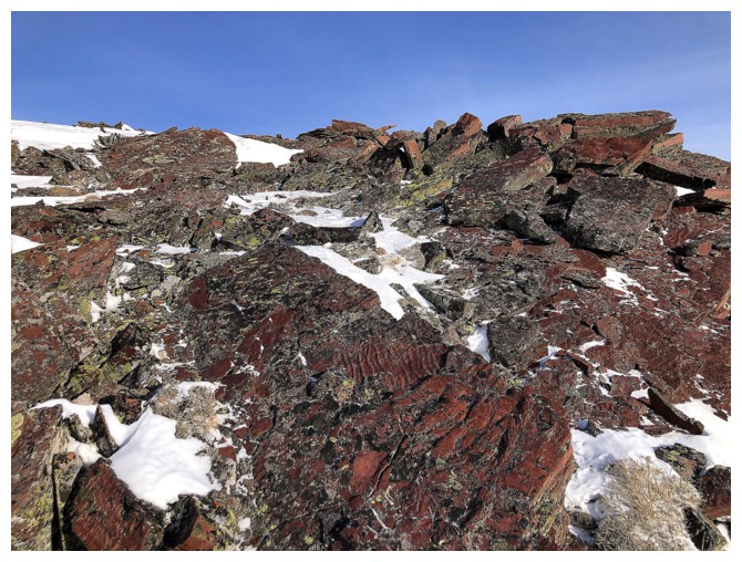
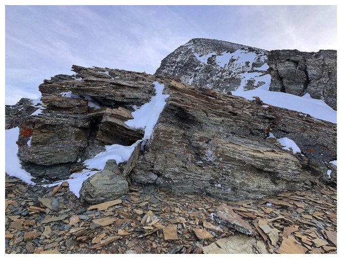
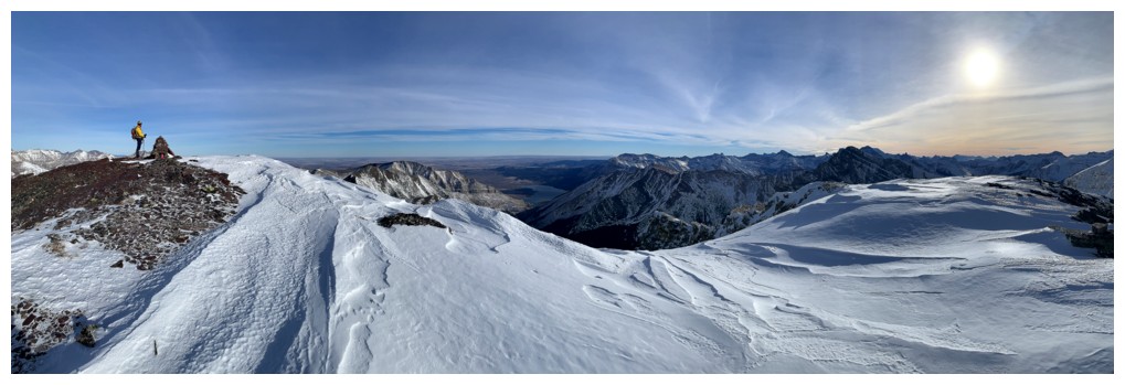
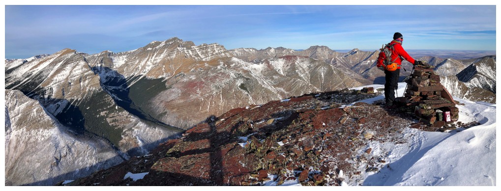
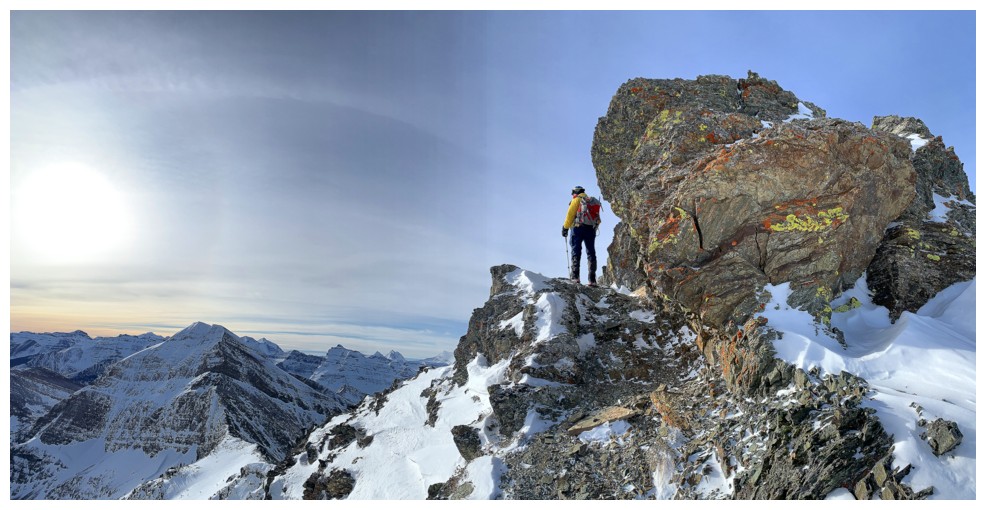
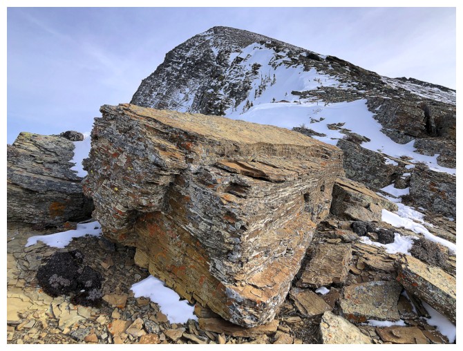
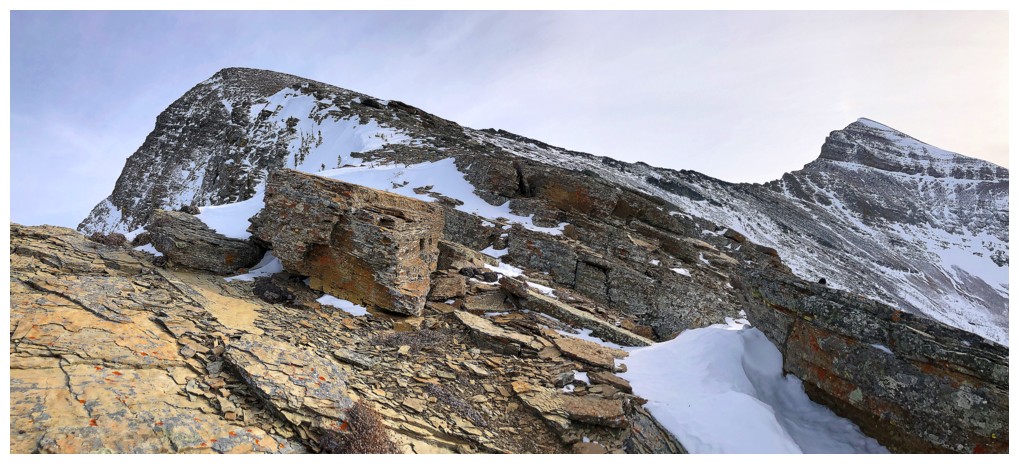
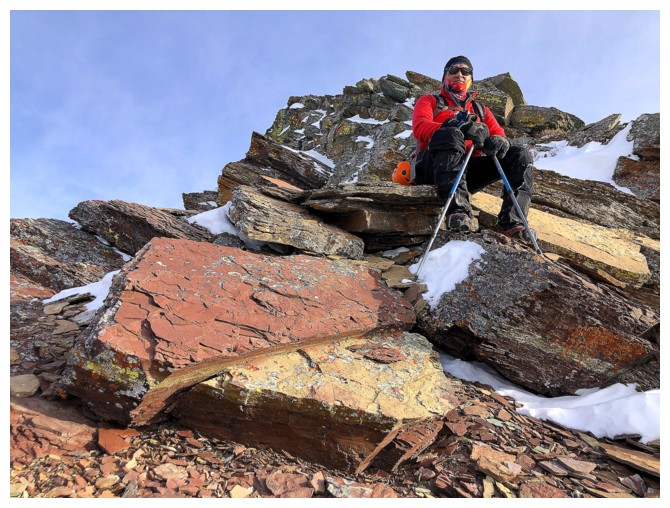
The summit block of Buchanan is all red argillite
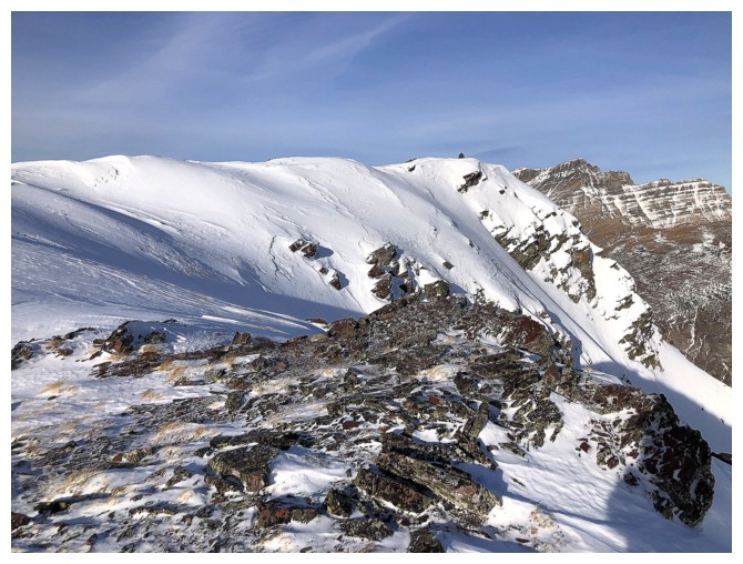
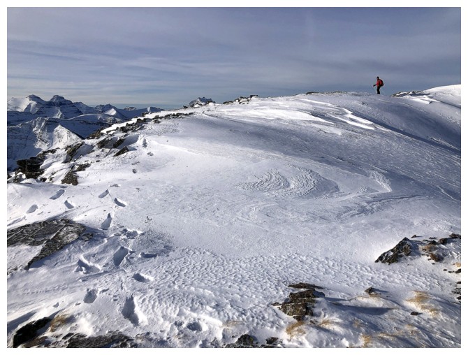
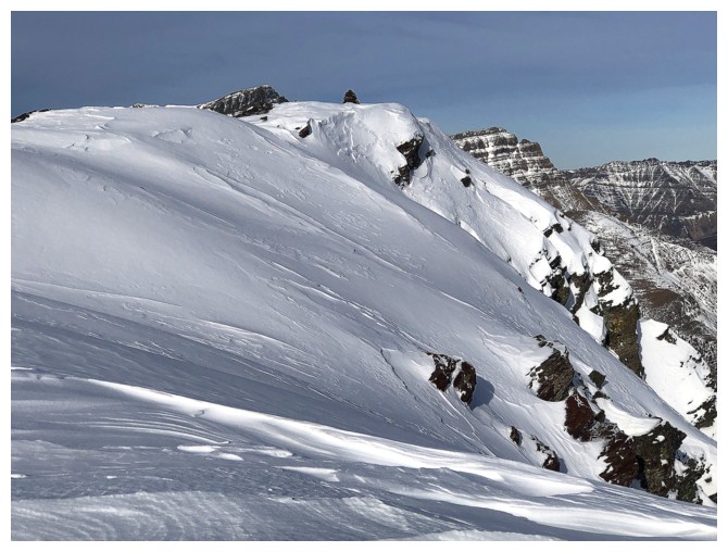
The summit cairn at the end of the snowy ridge
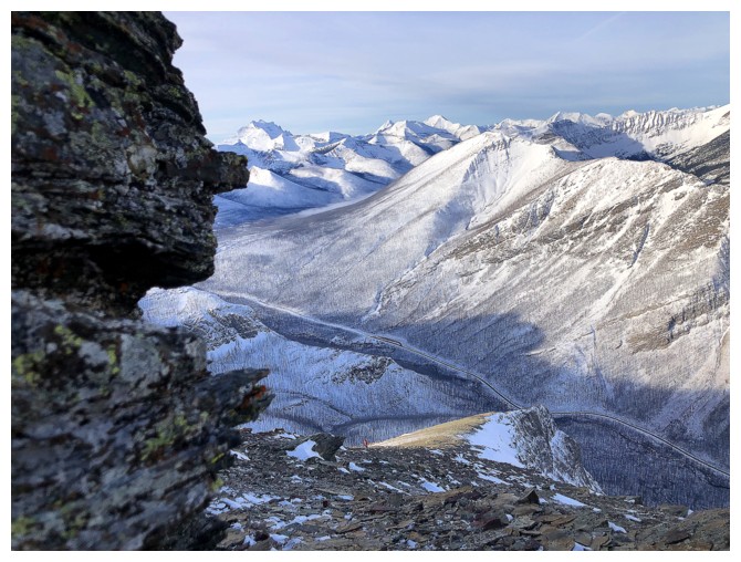
View from the ridge
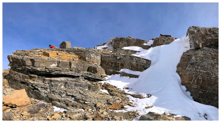
While of entire upper half of the ascent route was snow-free, the east side of the peak was holding plenty of the white stuff
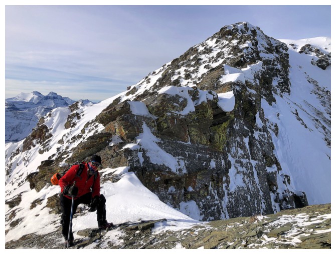
Mark ascends the final section
Mark hits of the ridge at the left
I'm at the summit (left) wondering how it could be above 10 degrees
Celsius in the valley and feeling like minus 30 at the summit!
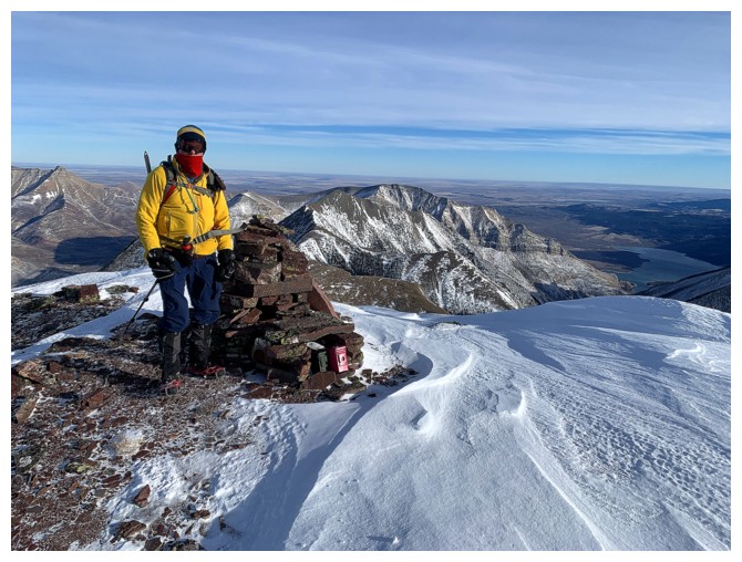
Trying to look warm and failing miserably!
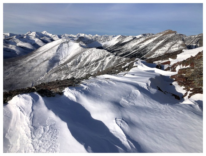
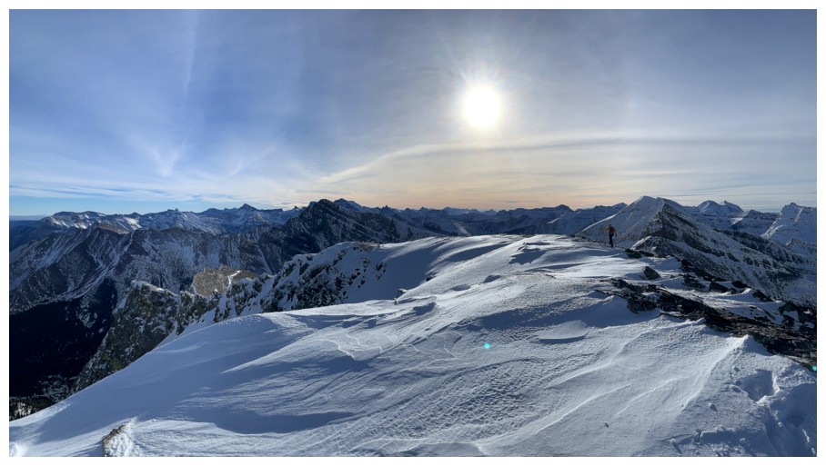
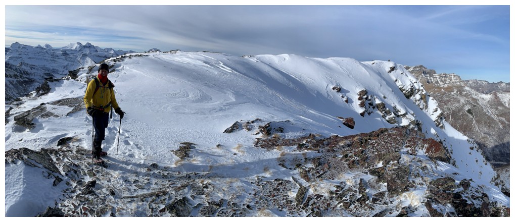
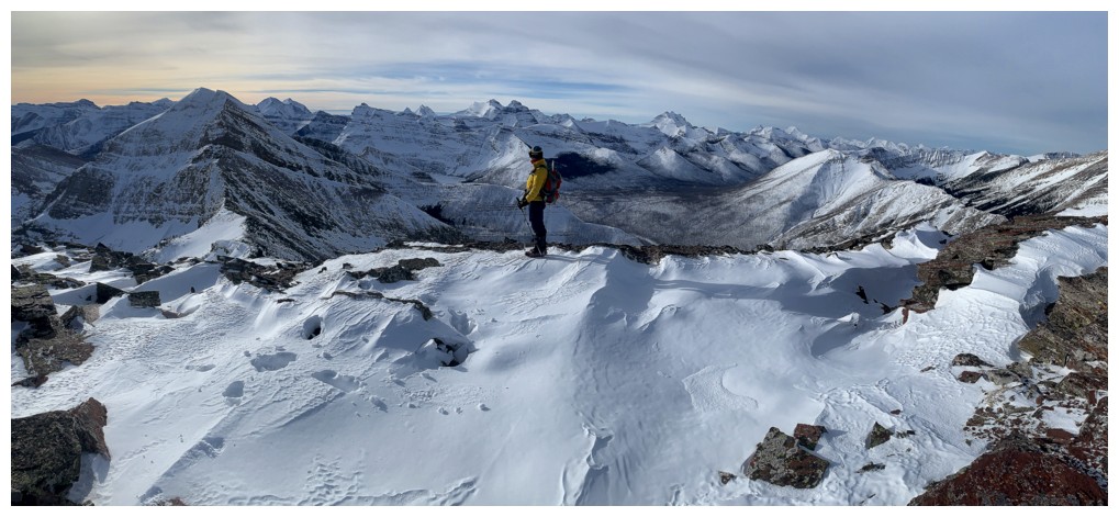
View to the northeast, north, and northwest
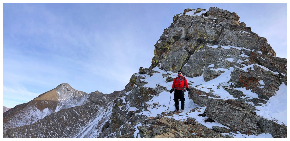
Heading east to see Buchanan Peak
Stay off the snow here
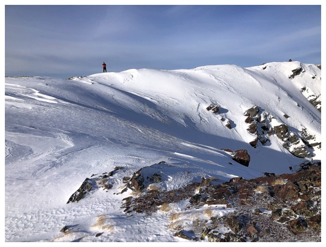
Mark takes a wide berth around the snowy east face
Immediately
north sits "Buchanan, The Middle Child" (a very unofficial name). Dave
suggested "Senator Peak", a far more fitting unofficial name, in honour of Senator William Ashbury Buchanan.
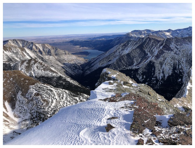
The Lower Waterton Lake is visible from here
Buchanan Peak in the centre. Not today, but I'm sure we'll find another opportunity.
Mark descends the ridge towards Buchanan Peak. We were looking for shelter from the viciously cold wind.
Haven't found it yet
Still no
Heading back to the summit
We thought we could get reprieve from the wind behind this outcrop, but the infamous Waterton wind finds every nook and cranny!
Lots of the snow on anything east facing
Back near the summit ridge
The cairn and those beautiful snowy slopes again
Last round of summit photos before the easy descent
Same as above
Descending
Mark on the foreshortened slope
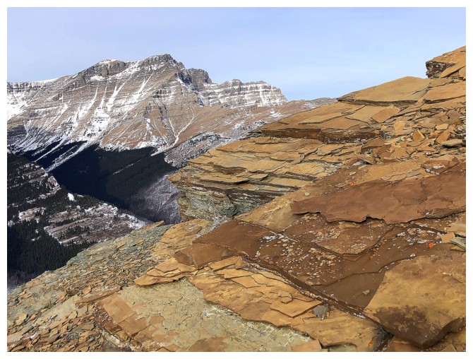
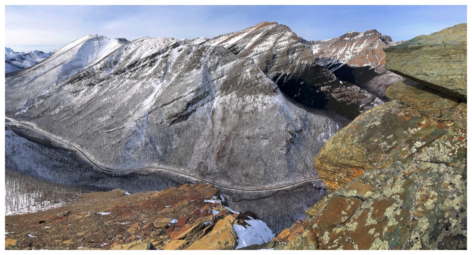
The descent features great views of Blakiston behind the colourful rock on the Buchanan ridge
And lots of interesting rock on the ridge itself
Case in point
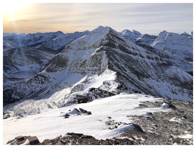
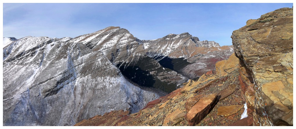
Buchanan and Carthew
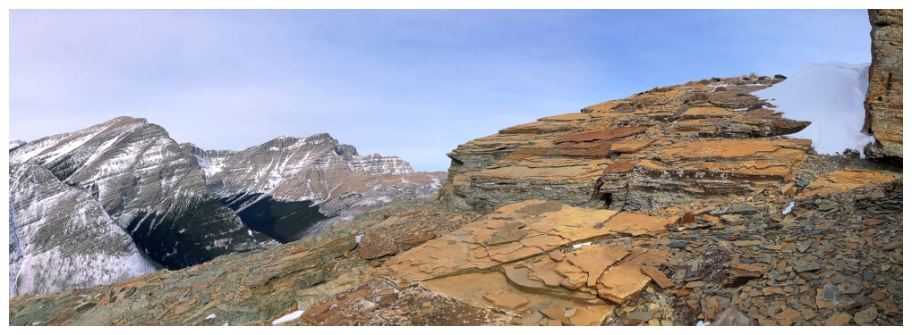
Back to the colourful rock of the ridge
The most snow we encountered on the upper slopes
Neat little gap in the rock to descend
Mark does the same
Enjoying the scenery far more now that our hands have relinquished their ice cube status!
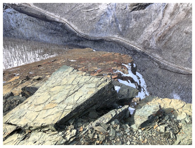
The road is still far below
More cool rock scenery
Same as above
Short break to take it in
Resting among the red argillite
Continuing down
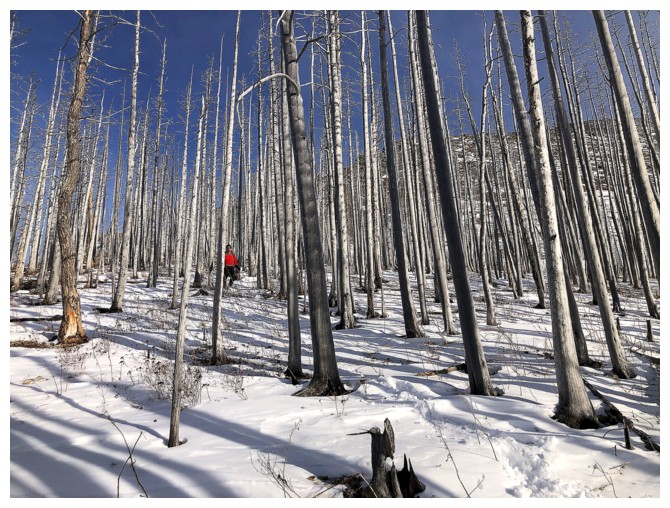
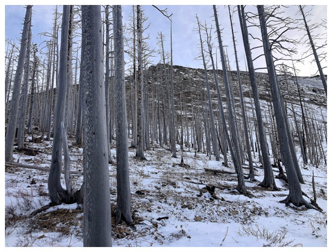
Passing through the trees stripped by the Kenow fire
Back at the subsidiary creek. Following it further up the valley leads to a couple of cool routes up Mount Carthew.
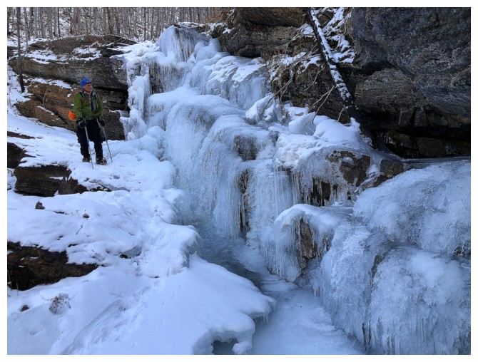
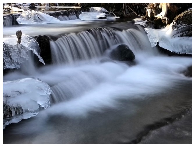
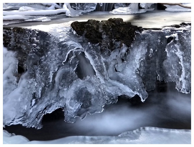
Back at the first frozen waterfall
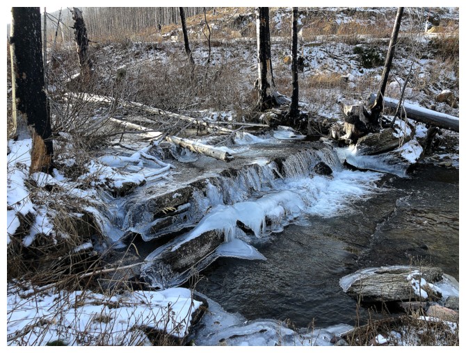
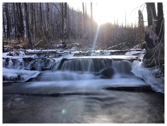
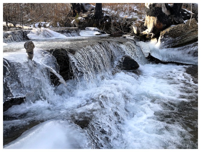
And back to Cameron Creek
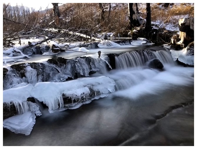
Of course it's long exposure photo time!
The nice thing about hip-waders is you hangout in the middle of the creek without having your feet and legs turn to popsicles!
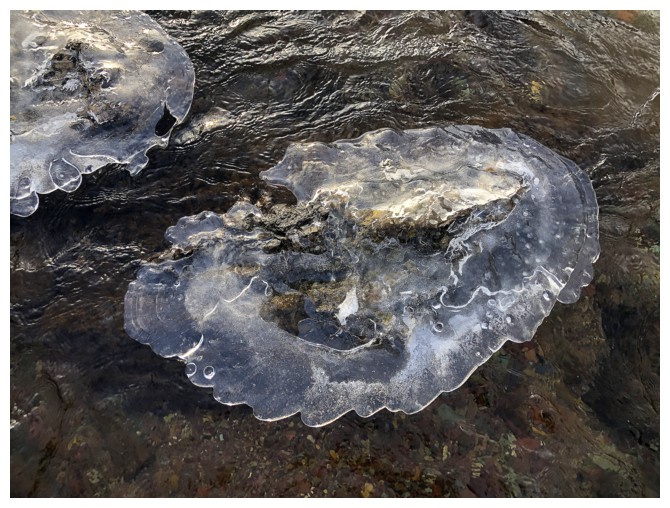
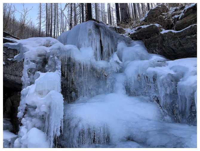
Ice on rock that reminded me of a jellyfish
Ice close-up
Farther back
Normal exposure photos are okay too
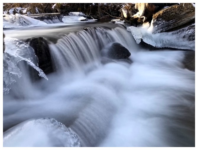
But one more long for good measure
The End
LOG