Kent Ridge South II
March 9, 2024
Mountain height: 2494 m
Elevation gain:
approximately 900 m
Ascent time: 3:10
Descent time: 2:35
Snowshoeing with
Mark.
This trip needed
to fit two criteria: 1. No avalanche risk; 2. A broken snowshoe trail for most,
if not all the ascent. Chester Lake or Rummel Ridge were definitely options, as
we drove the Smith-Dorrien road. 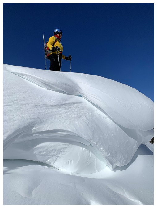 However, we eventually settled on a second ascent
of the south end of Kent Ridge. Our first trip up occurred almost 20 years
previous, and neither Mark nor I could remember a single detail of that ascent
so it would almost feel like a new trip. More importantly, we knew that Doug Lutz
and his merry band of snowshoers had forged a path up the mountain a week
earlier. As we drove by the start of the route, we could see their tracks were
still visible and in fact a couple of snowshoers were already on their way up –
bonus!
However, we eventually settled on a second ascent
of the south end of Kent Ridge. Our first trip up occurred almost 20 years
previous, and neither Mark nor I could remember a single detail of that ascent
so it would almost feel like a new trip. More importantly, we knew that Doug Lutz
and his merry band of snowshoers had forged a path up the mountain a week
earlier. As we drove by the start of the route, we could see their tracks were
still visible and in fact a couple of snowshoers were already on their way up –
bonus!
Huge shout-out
to Doug and his crew at this point. Following their path through the deep snow
was a godsend – we wouldn’t have made it 5 minutes up that slope if the
trail-breaking duties were ours alone; and also to the two guys in front of us
for re-breaking sections that were filled in with snow.
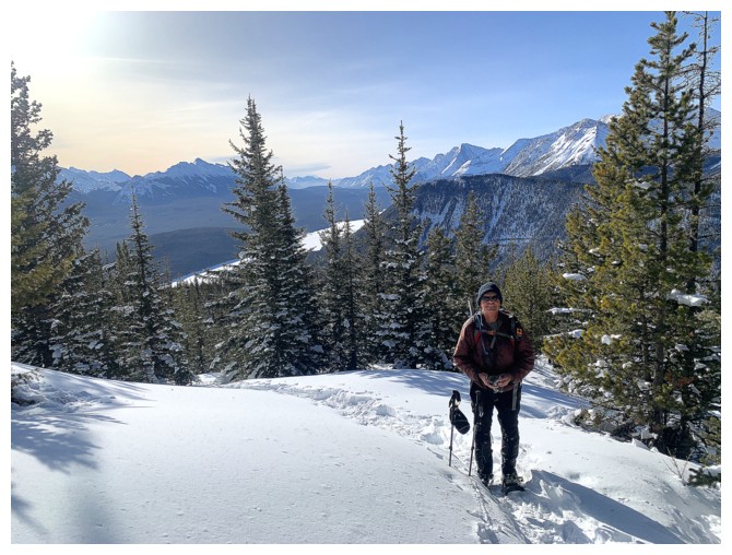
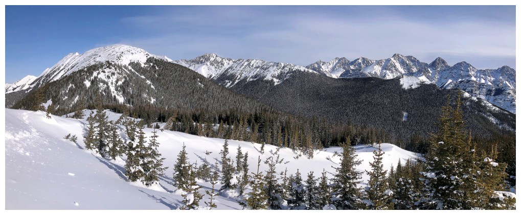
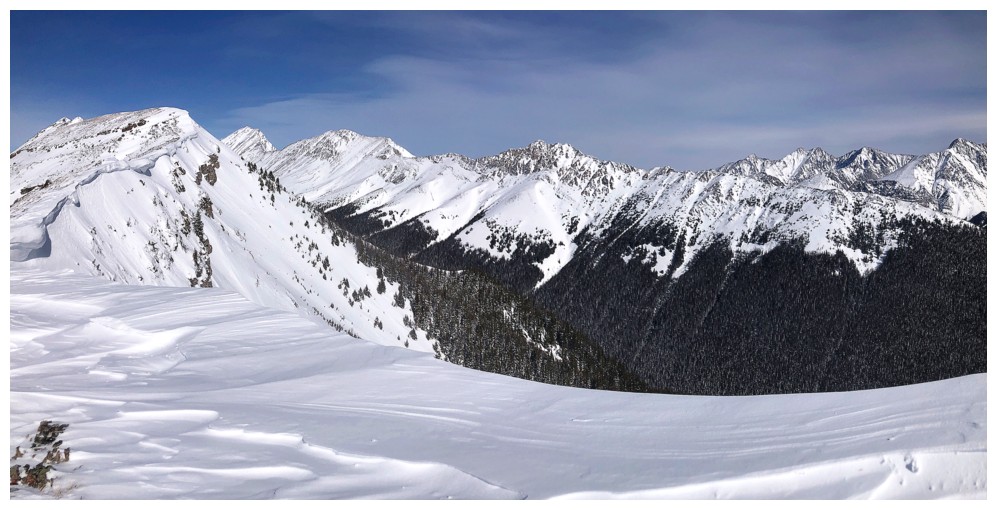
Though most of
the elevation is gained through viewless, forested terrain, once treeline is
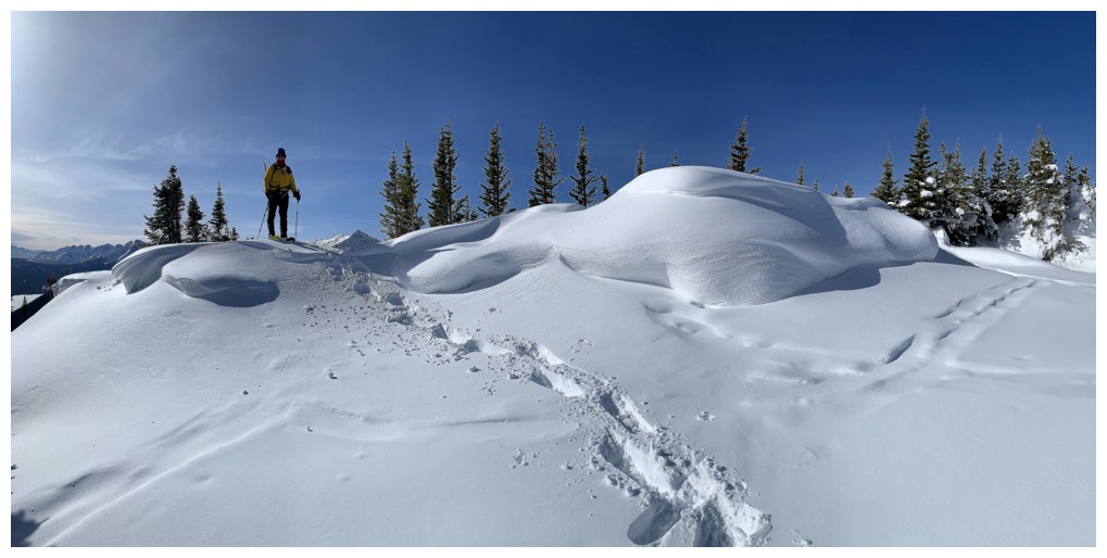
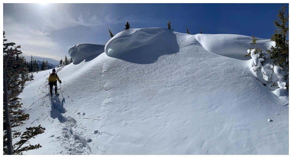
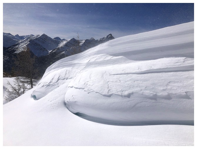
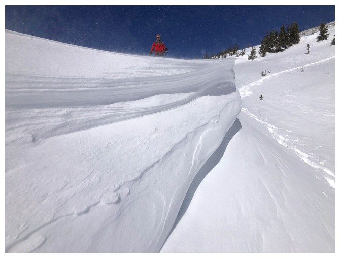
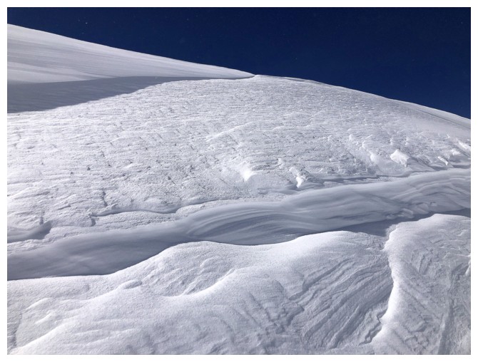
broken the scenery and views open up wonderfully. 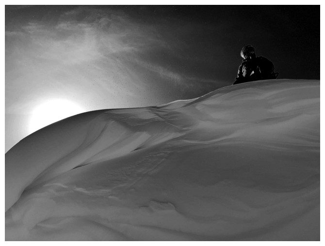 We arrived at the first summit to fantastic snowy views all around. The
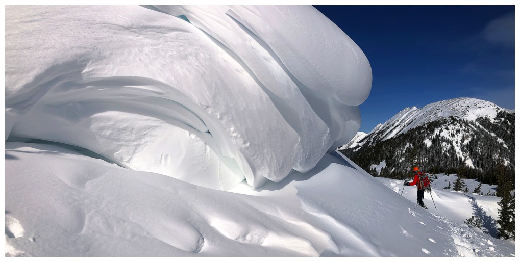
cornices were especially cool here.
We arrived at the first summit to fantastic snowy views all around. The
cornices were especially cool here.
Continuing on,
we lost elevation to a col, again
following the tracks of those before us. Up to this point, the wind had not been an
issue, but that was soon to change. Heading up the treed ridge on the other
side of the col we encountered the two snowshoers ahead of us, now on their way
down. When one of the two declared the wind on the ridge to be “exfoliating” we
knew our luck was about to run out. And run out it did!
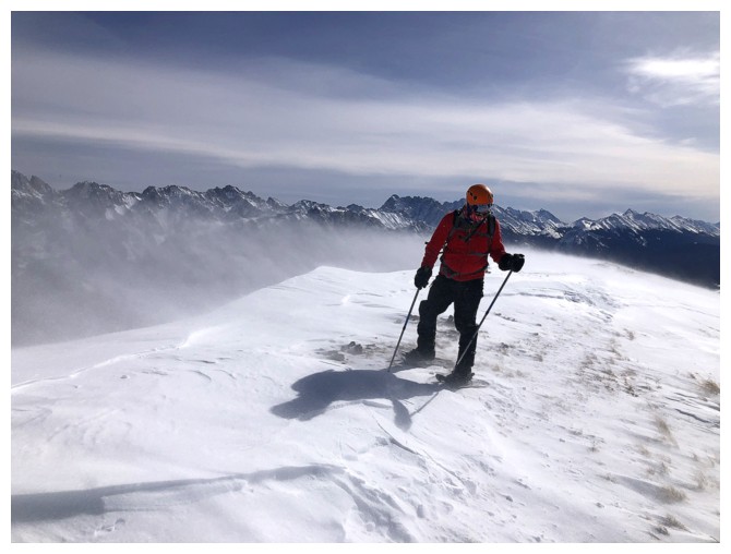
While
fortunately not a brutally bone-chilling one, the wind was viciously strong;
strong enough to stop our progress after reaching the first highpoint north of
the first summit. Even maintaining balance while taking photos of the wonderful vista became
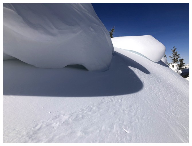
a challenge. We made a hasty retreat down the ridge. En route, a minor detour
into a somewhat sheltered area provided some of the best snow scenery of the
day. Another round of cornice photos followed upon reaching the first summit again,
followed by a super easy and fast downhill tromp back to the start.
Awesome day out
and again a big thank you to all those before us who made that wonderful trail!
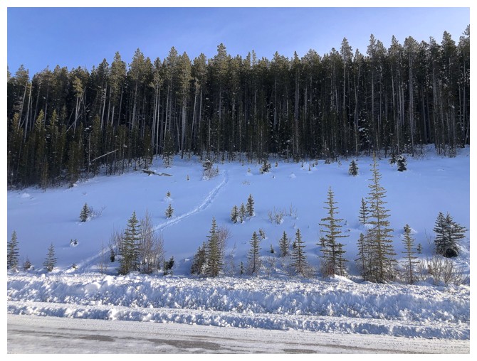
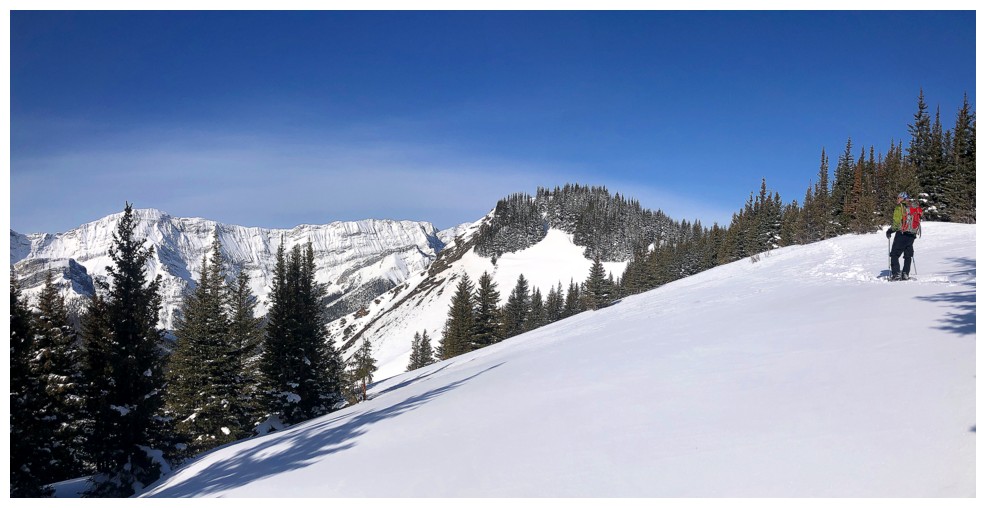
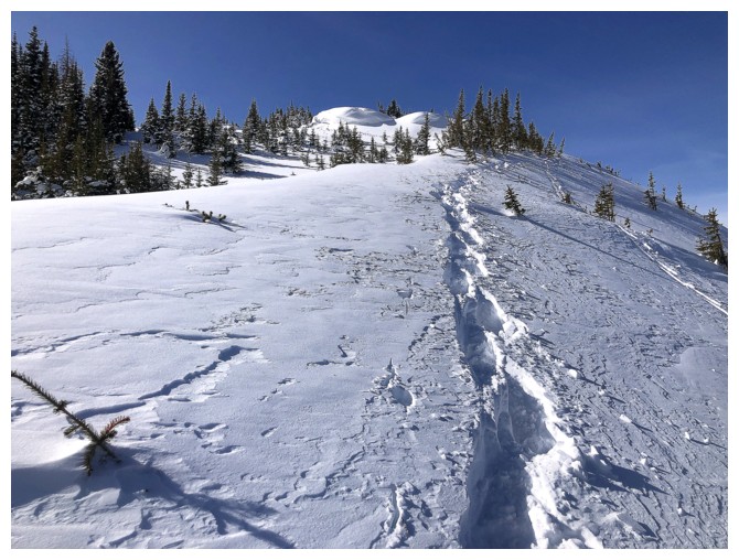
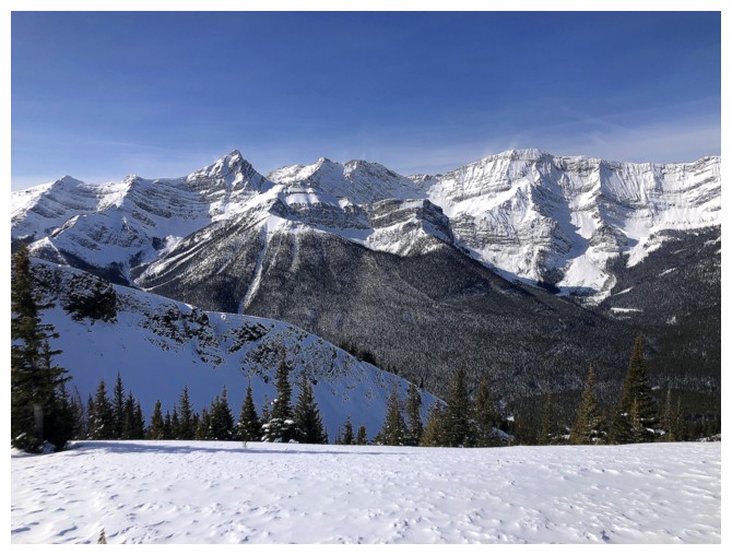
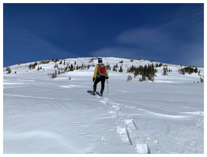
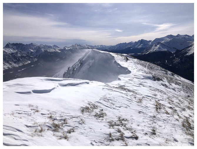
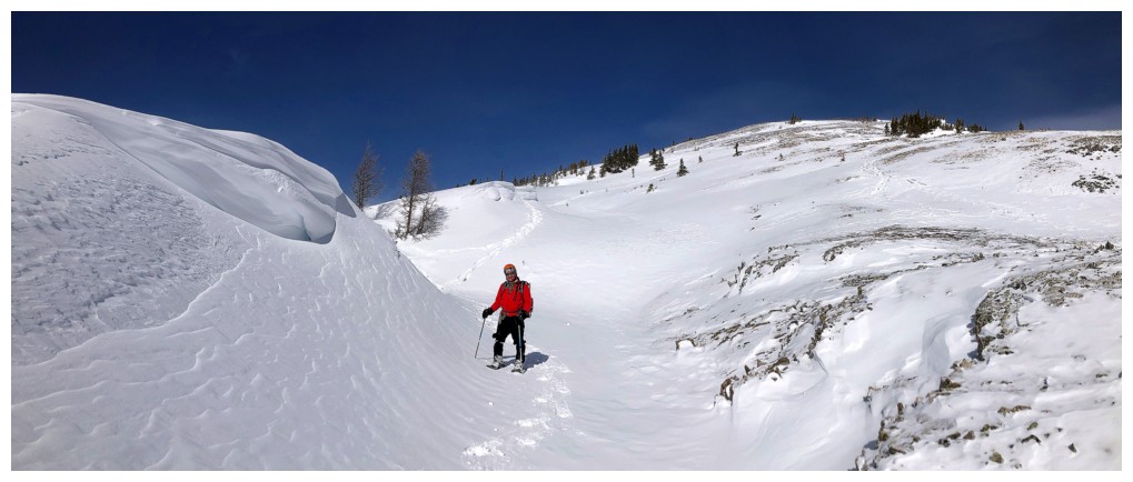
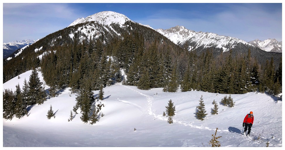
The "Lutz and company" track we are about to start up
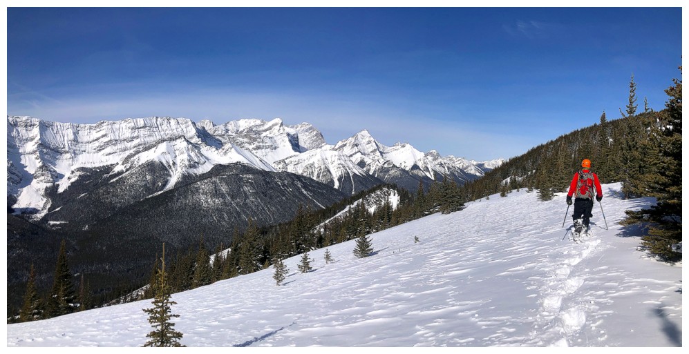
An hour later the views open up a little
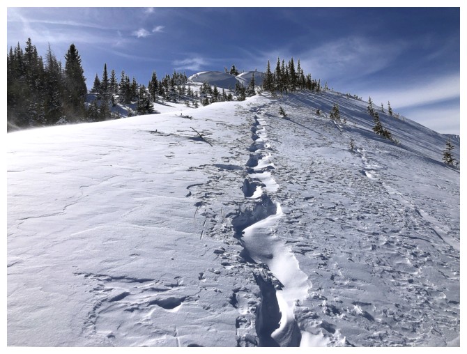
...then close in again. Note the depth of the track - though not as deep as the Vista Peak track, it still must have taken a concerted effort on the part of Doug's team to carve this one out.
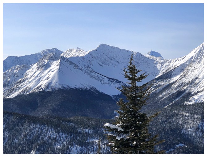
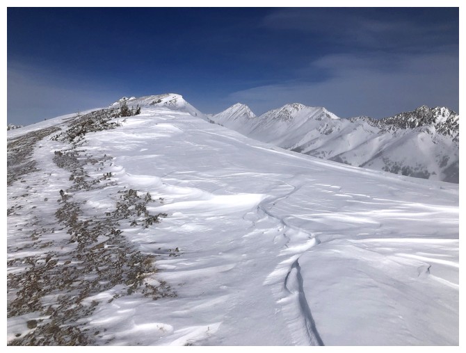
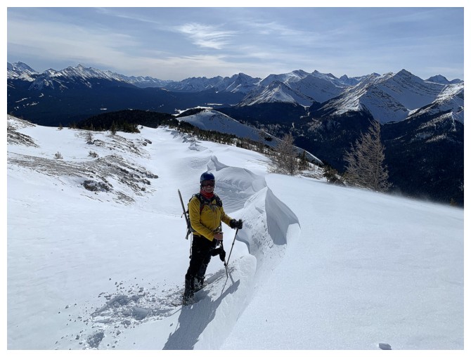
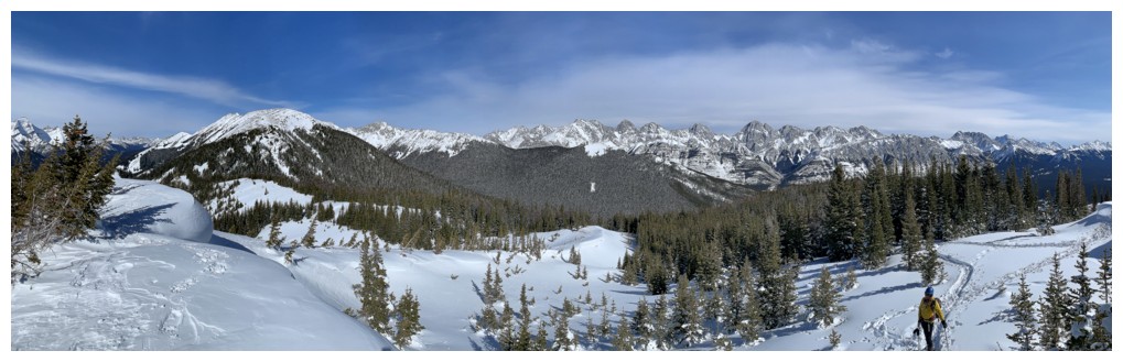
Mount Joffre peaks over the connecting ridge between Warspite and Invincible
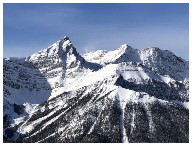
Mount Warpsite (left) and Warspite Ridge (foreground)
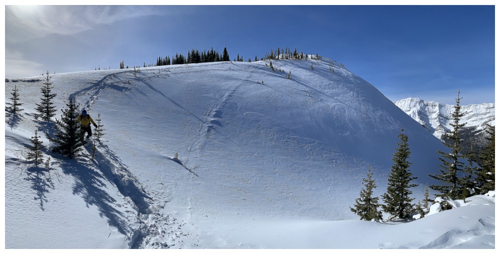
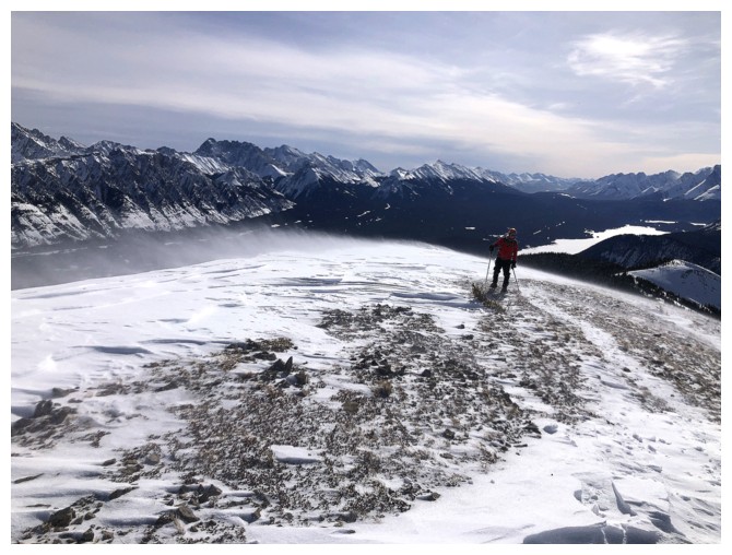
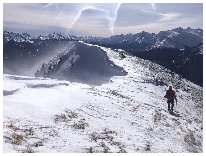
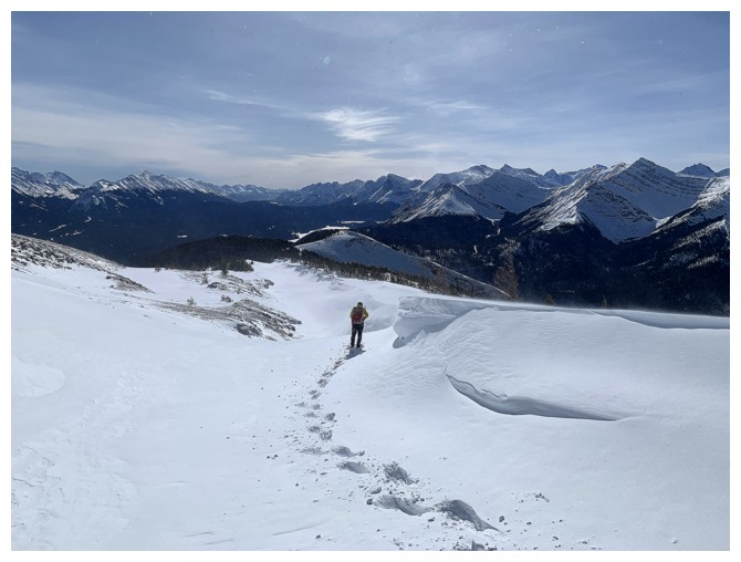
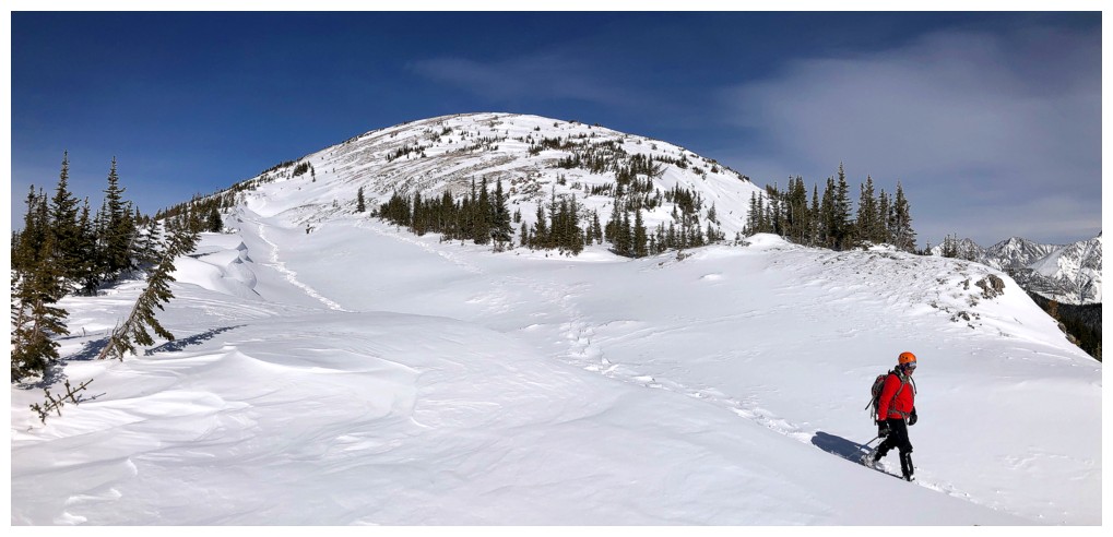
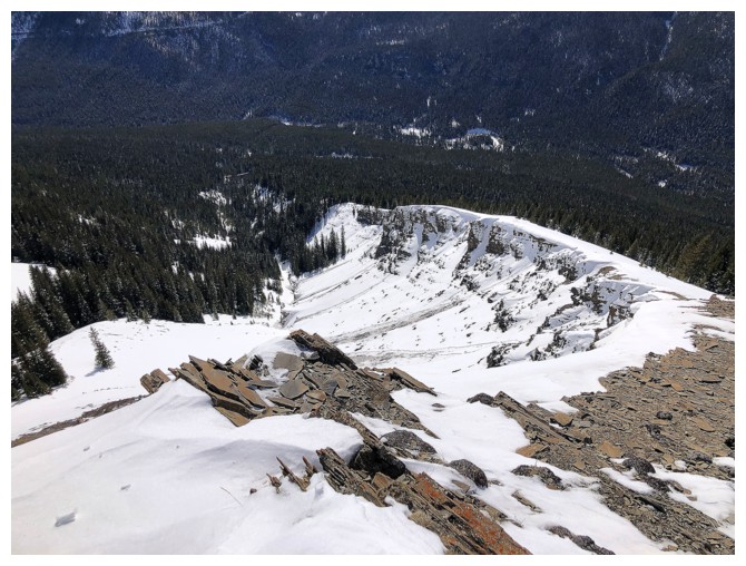
The south end summit appears
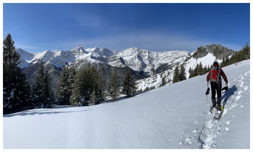
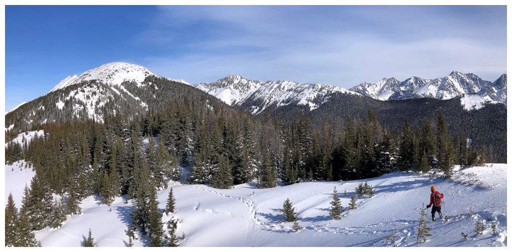
The British Military Group (BMG) is on full display throughout the remainder of the ascent
Same as above
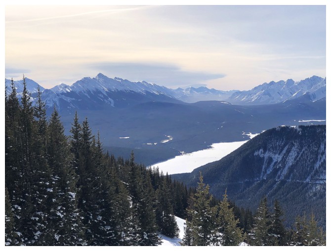
Some of the Lower Kananaskis Lake
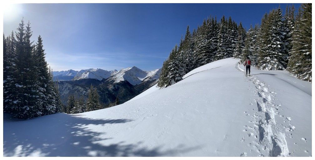
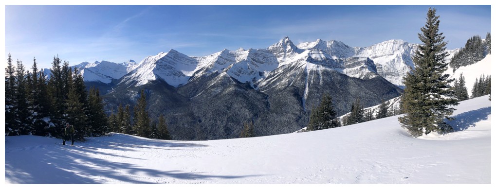
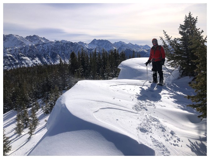
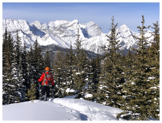
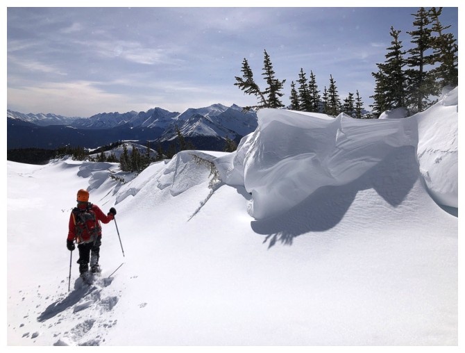
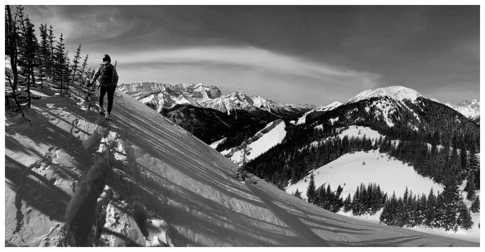
Approaching the last treed section before the first highpoint
Shoeing out into the open
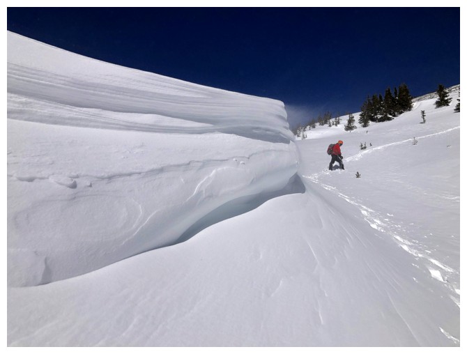
First round of fantastic snow scenery
Same as above
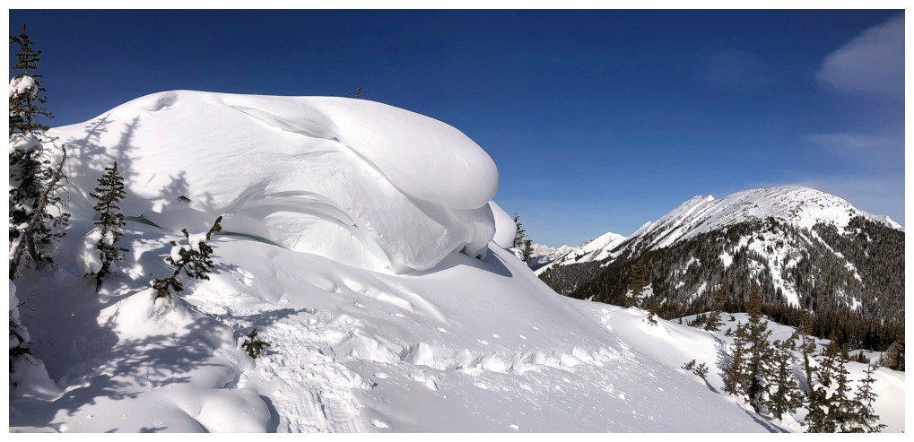
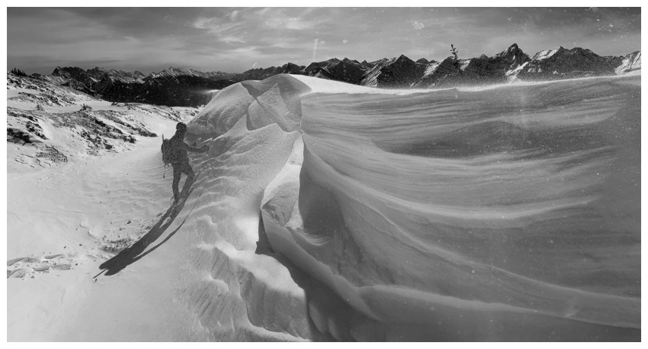
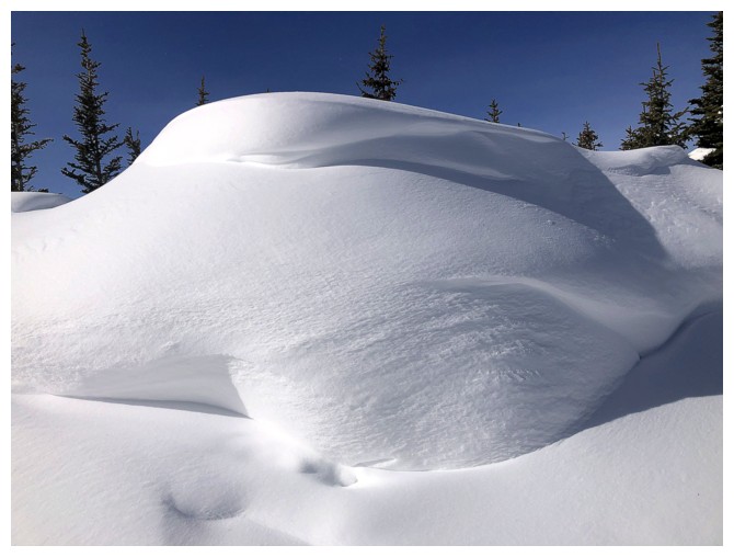
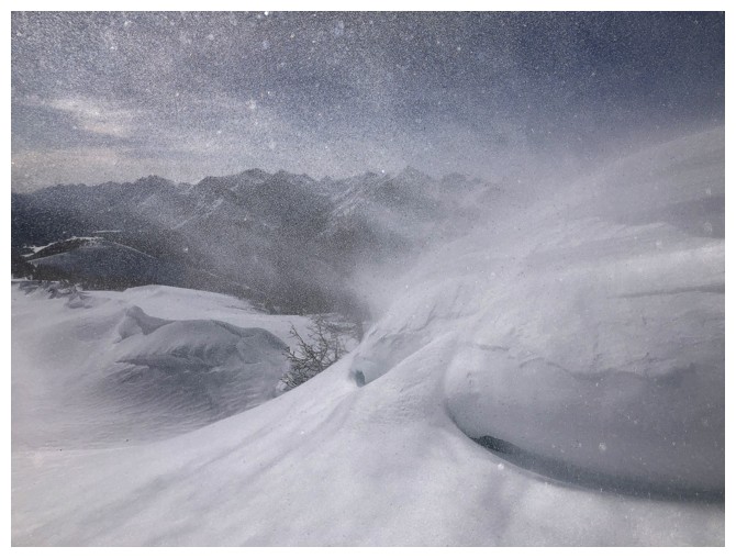
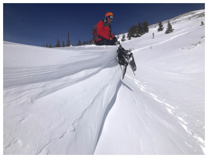
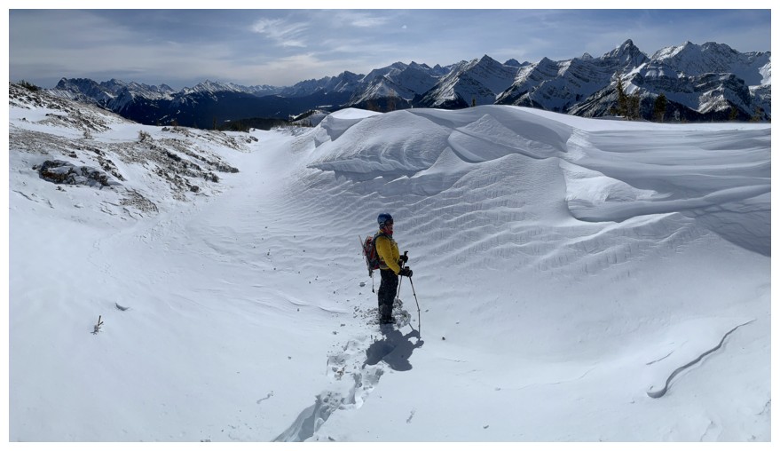
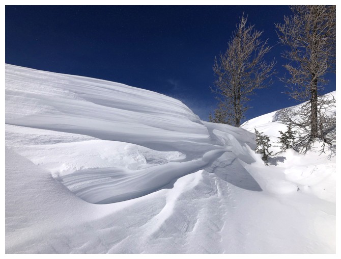
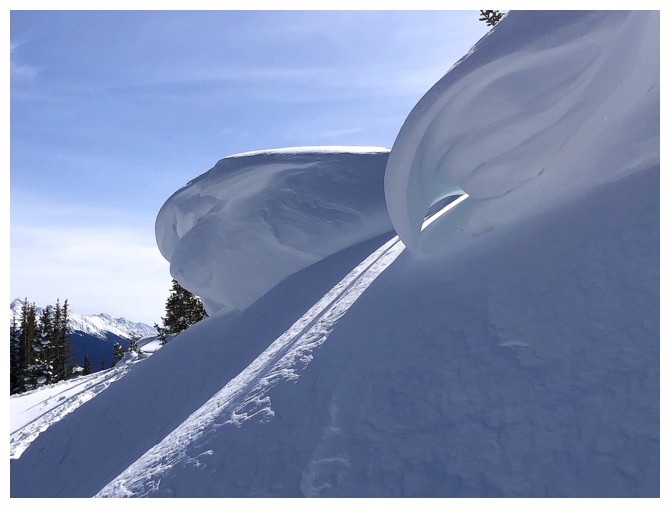
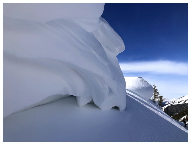
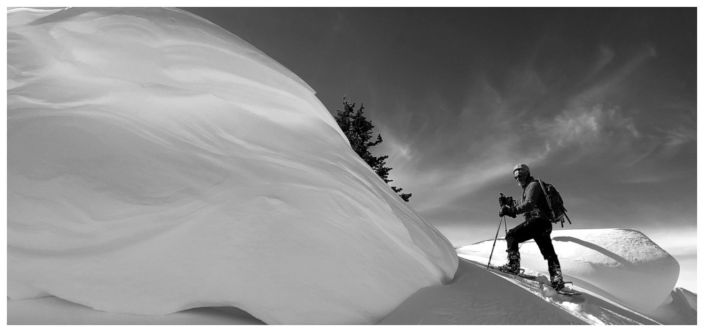
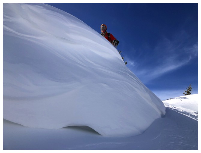
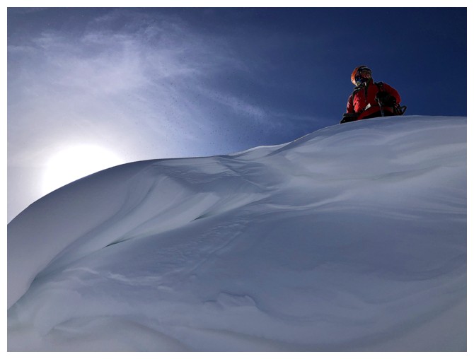
This cornice was the coolest of the lot and garnered tons of exploration and photo ops
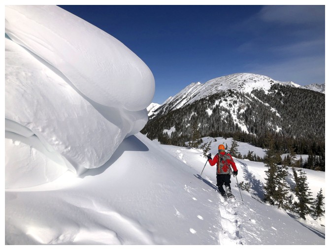
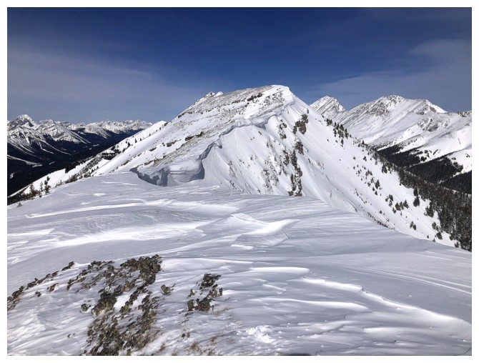
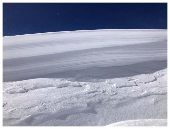
The next objective at the left and the view of some of the Opal Range at the right
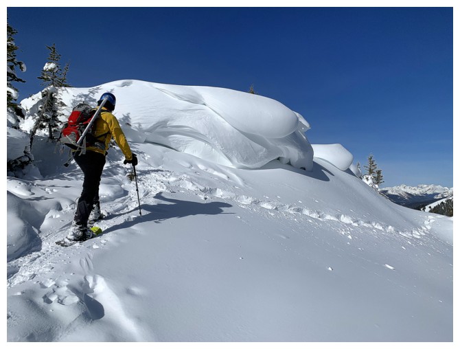
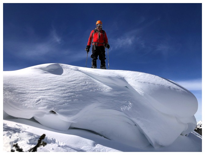
The tracks go around the snow formation but we had to stand atop it first
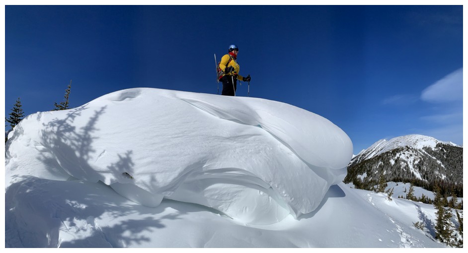
Mission accomplished
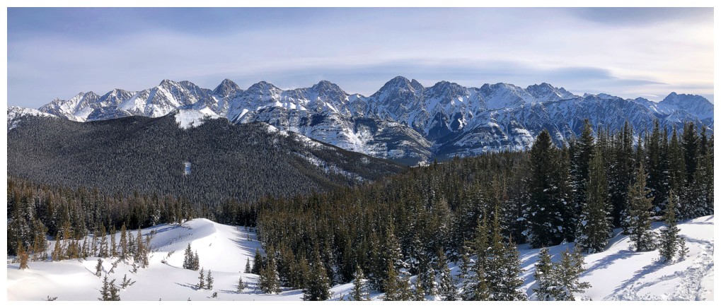
The Opal Range
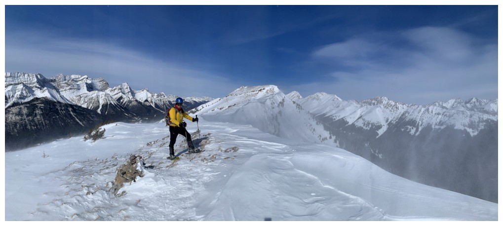
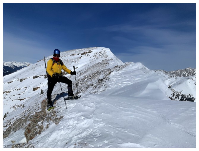
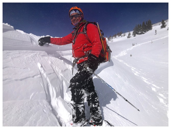
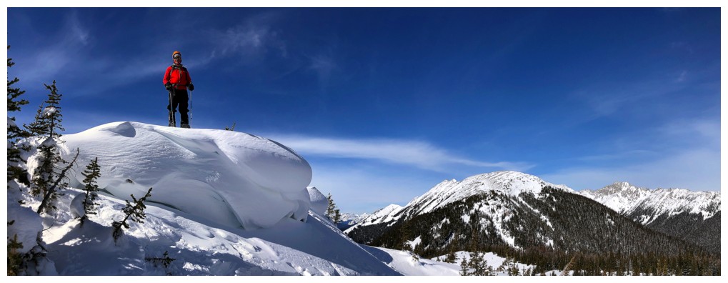
Mark at the highpoint
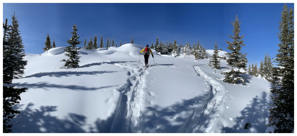
Continuing travel
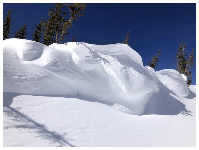
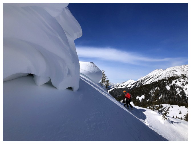
The best scenery of the day occurred here and at the similar section on descent
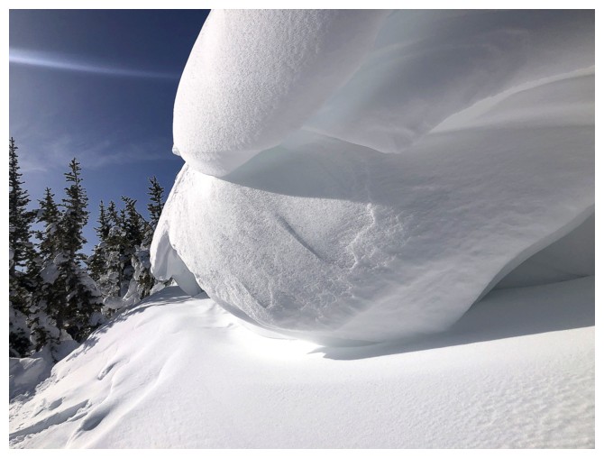
This type of scenery always reminds me of soft-serve ice cream, which I love so dearly!
Saying goodbye to the ice cream for now
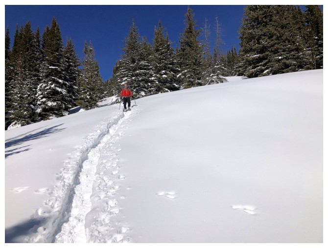
Our descent tracks - they would almost be completely filled in on return
Mark leads us down to the col
I follow
Mount Black Prince at the right - that was a challenging, but fun trip
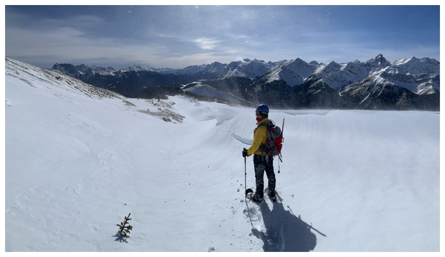
More open views of the BMG
Right to left: Murray, Prairie Lookout, Smith-Dorrien, French, Robertson
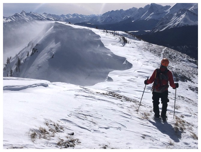
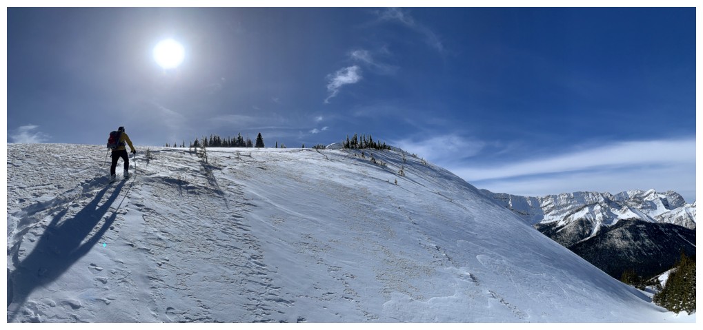
Easy trek to the summit from here, but the wind is soon going to be a factor in how far we can go
The snow here was wind-blasted and hard
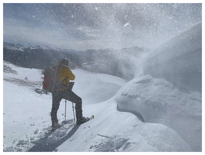
The start of our blowing snow challenges
On the ridge and heading to the highpoint (and staying well clear of that cornice!)
At our highpoint for the day, looking north to Mount Kent
View to the northeast
View to the north
There's that blowing snow
...alternating with brief periods of calm
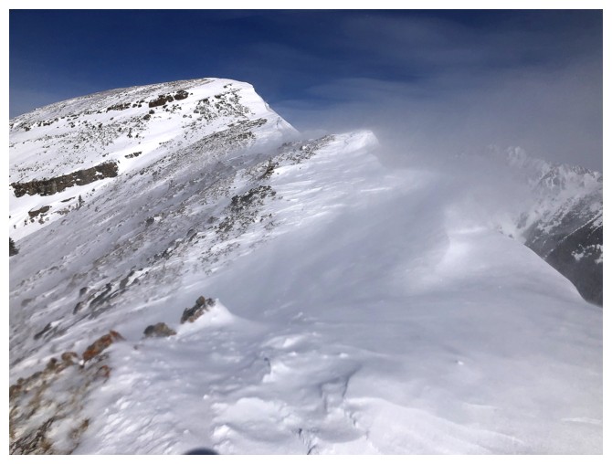
Back to viciousness
I spoke too soon!
View to the south
Heading down
The blowing snow is doing weird things (at the top) to my phone camera
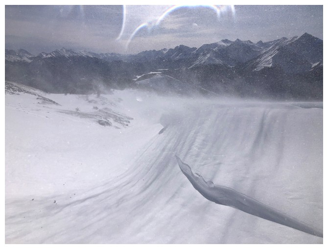
Same as above
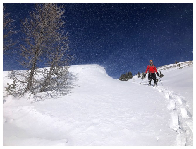
The alternate descent we took to get out of the wind
It worked for a bit
This wall of snow offered some protection
Close-up of The Wall and hail to Mr. David Gilmour - a six-string legend who communicates more with 3 notes than most do with 300!
The Wall was less effective here, but the wind was not as bone-chilling as expected
As such, Mark snowshoed atop The Wall
..and sat
Calm again
Back to breezy
We didn't see the usual amount of unreal snow scenery this winter, so it was good to get a taste of it on Kent
Same as above
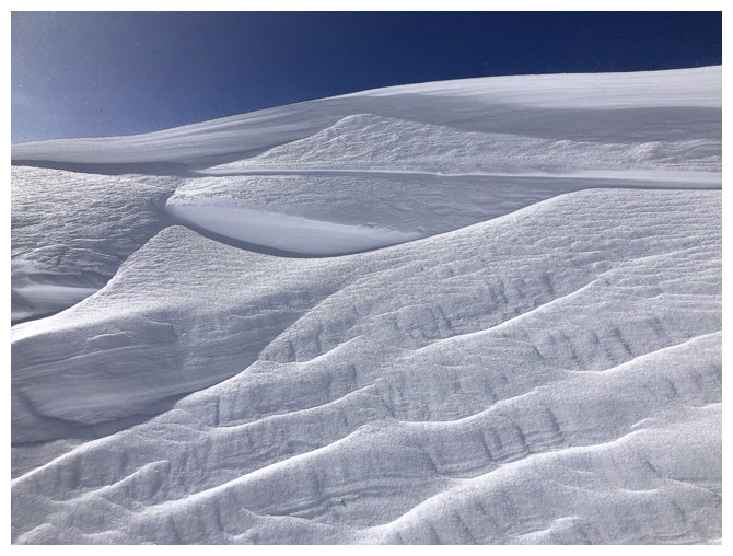
And again
And again with less colour
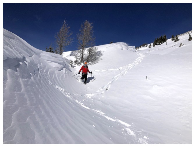
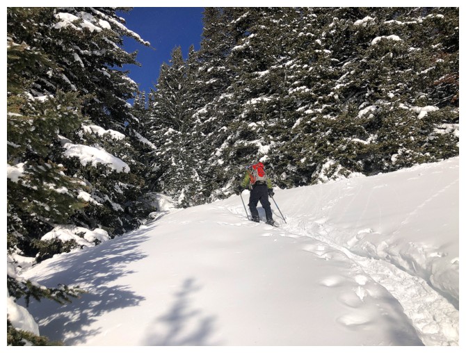
Snowshoeing down this little gully was very enjoyable
I must have really liked that Wall! Blue and white always only remind me of Scotland's Flag and my favourite Scottish singer
Throw in a little red to make the Union Jack!
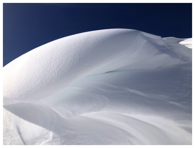
The cornices on the side continue to keep us entertained...
...in colour

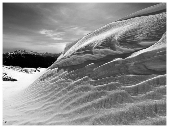
...and black and white!
End of the shallow gully
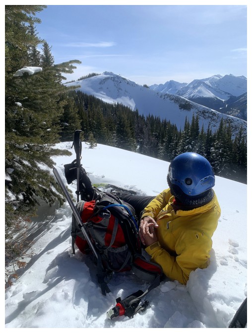
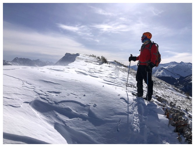
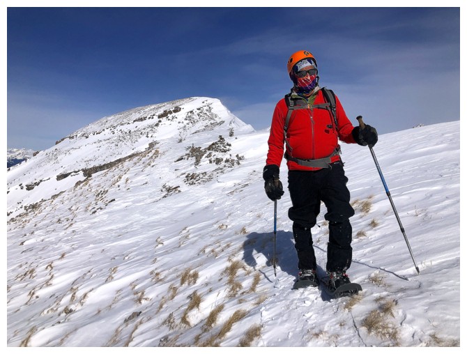
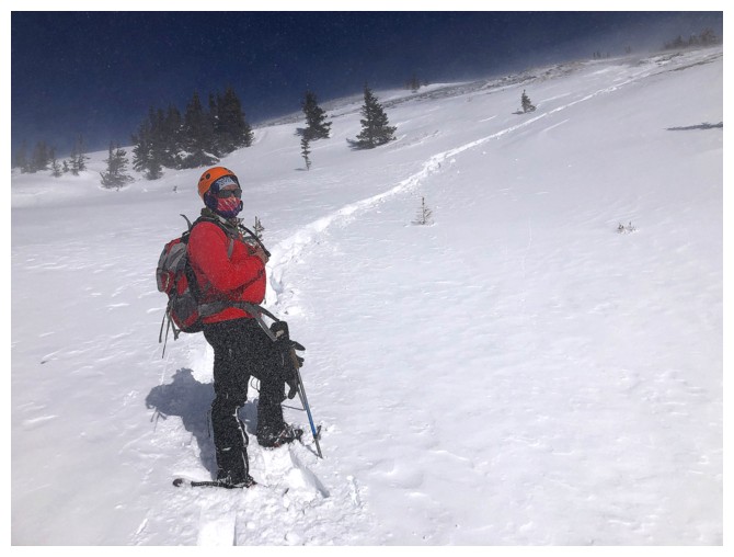
Our first and only rest break of the day - no wind and nice views
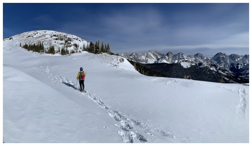
Gaining elevation back to the first highpoint
The tracks of the two before us are almost filled in already
Looking back to where we were
Of course another round of cornice photos is mandatory at this point
with Mark
without
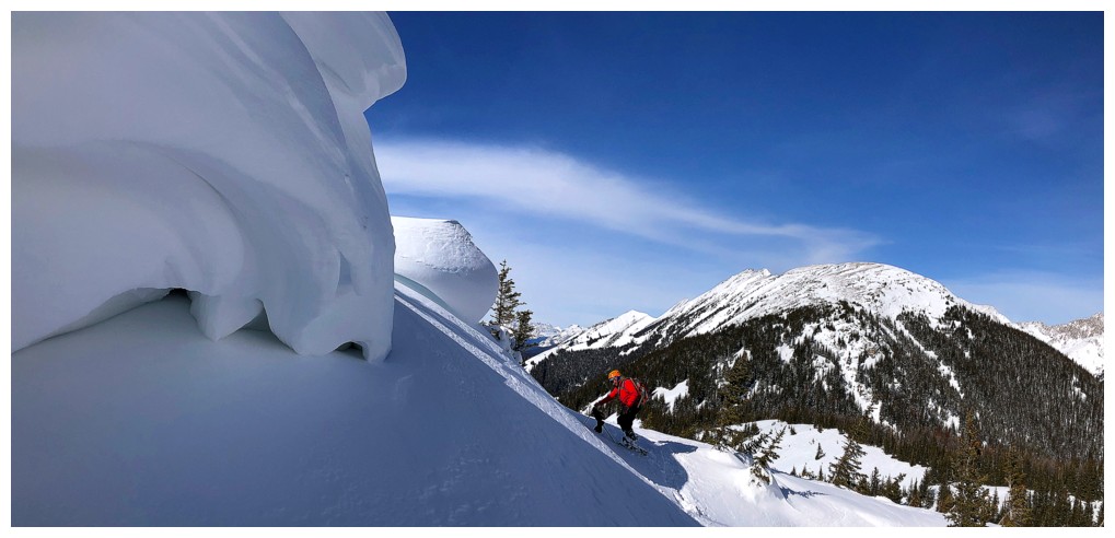
with is better
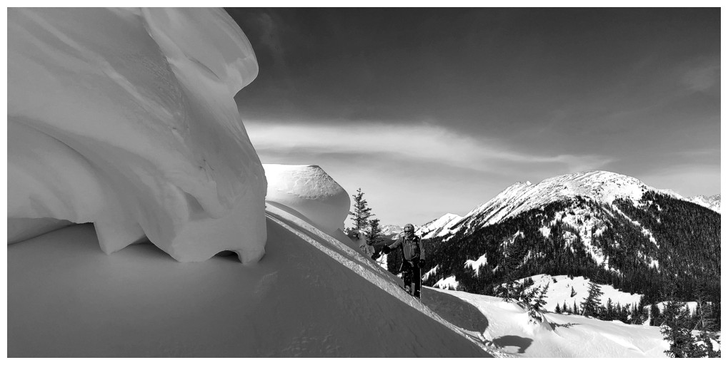
but it B&W better?
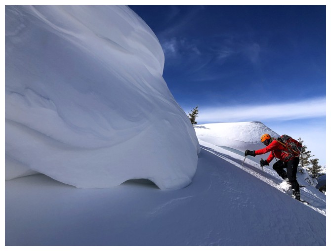
Mark decided to go up between the overhangs of snow
He's up
Last look at the view to the north
Last view of Mark at the top
Looking down the southwest side of the peak. We may have come up this way back in 2004.
Part of the easy descent.
The End
LOG