Kootenai Brown Peak III
Lost Mountain V
May 20, 2023
Mountain heights: 2470 m, 2509 m
Elevation gain: 1319 m
Round-trip time: 8:24
Scrambling with
Dave.
A long overdue
trip with my Southern Alberta Homie! I am usually lucky enough to do a trip
with Dave at least once a month and often multiple times during the summer
months. 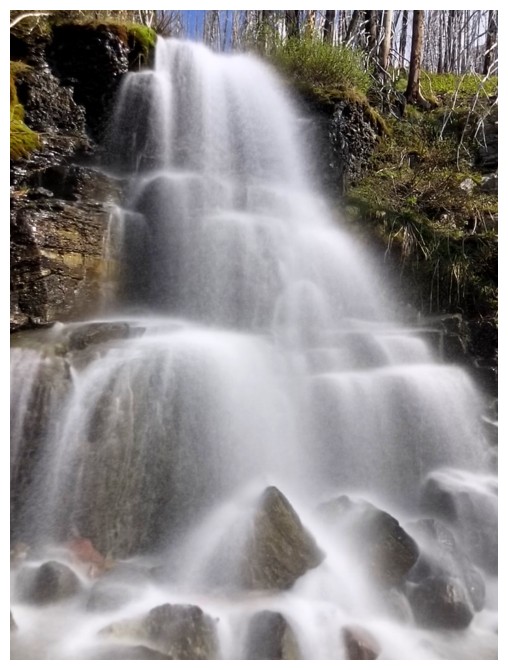 Unfortunately, busy schedules prevented us from getting together for
most of January, and all of February, March, and April. However, the usually
rainy and miserable May long weekend looked to provide sunny skies and so the
stage was finally set.
Unfortunately, busy schedules prevented us from getting together for
most of January, and all of February, March, and April. However, the usually
rainy and miserable May long weekend looked to provide sunny skies and so the
stage was finally set.
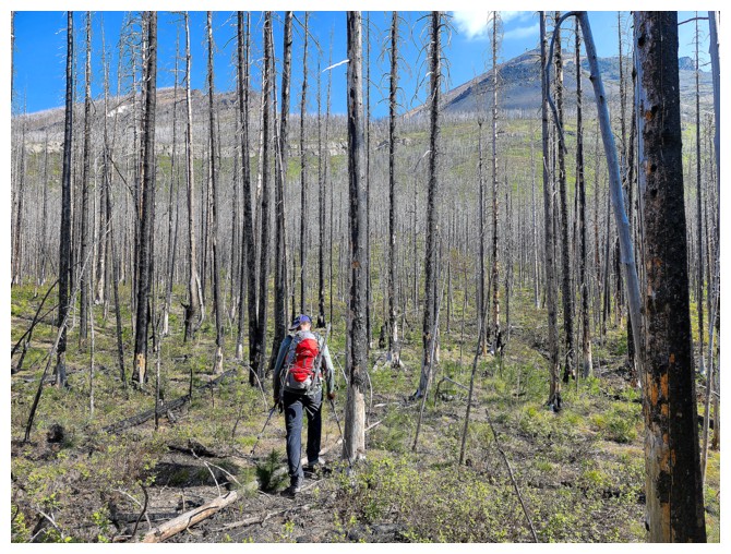
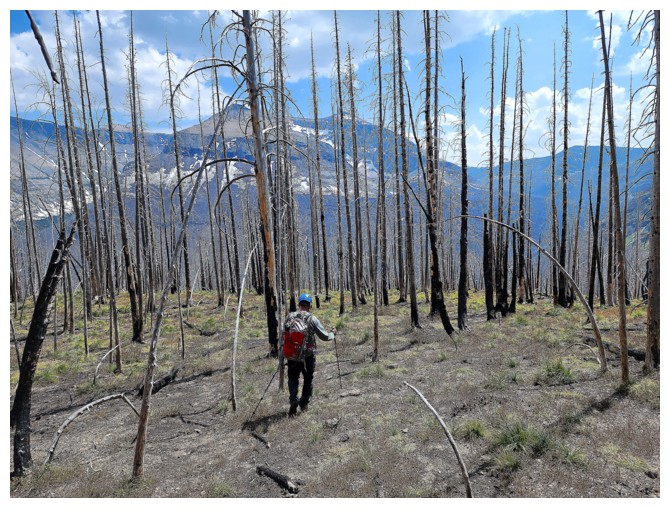
This was,
however, far from a “normal” May. Inundated with an alarming number of forest
fires, Alberta was a smoky mess, with extremely poor air quality. As such, we
decided to pick an objective en route. The skies were a little hazy as we
approached Waterton, but far better than expected. 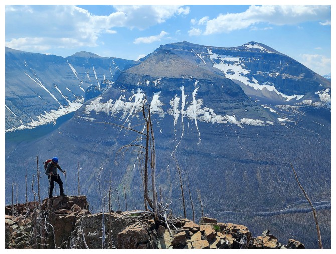 A substantial objective with
a decent amount of elevation gain would be on the plate. In fact, with forecast
high temperature in the high 20’s, oppressive heat was far more a concern than
forest fire smoke.
A substantial objective with
a decent amount of elevation gain would be on the plate. In fact, with forecast
high temperature in the high 20’s, oppressive heat was far more a concern than
forest fire smoke.
We eventually
settled on Lost Mountain, with the option to tag Kootenai Brown Peak. I had
done both a few times, but more than welcomed another opportunity to hike/scramble in the
magnificent area around Blakiston Creek. And as everyone who has completed many
trips in Waterton and The Castle knows, each peak, almost without exception,
has a variety of different routes to the top.
I was hardly
surprised (but very happy) when, after hiking several kilometres of the
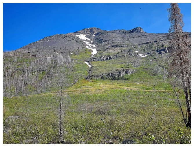
Blakiston Creek trail, a new potential route up one of the two peaks revealed
itself. This route would hopefully lead us to a hanging valley between Lost and
Kootenai, where we could decide which peak to ascend first. 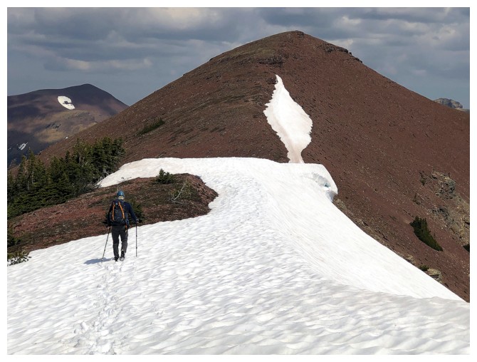 We could see the infamous and often imposing
limestone rock band impeding progress at one point, but also spotted several
weaknesses that would probably grant us access to the hanging valley.
We could see the infamous and often imposing
limestone rock band impeding progress at one point, but also spotted several
weaknesses that would probably grant us access to the hanging valley.
And that is
exactly how things unfolded – with one glaring exception (more of a pleasant
surprise). Once some elevation was gained, Dave led us over to what sounded
like a significant stream coming down the mountain. 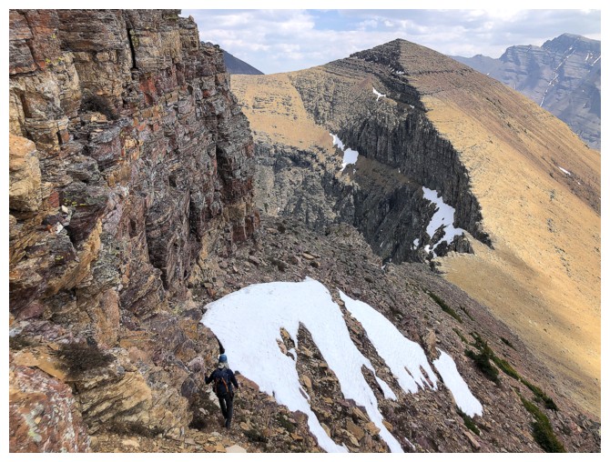 The
stream not only gave us
a chance to refill our water packs, but also provided outstanding
scenery,
especially above the limestone band. I didn't expect the long-exposure
feature of my phone to get much of a workout on this trip, but it was
huffing and puffing as much as I was by the time we could see the
valley above.
The
stream not only gave us
a chance to refill our water packs, but also provided outstanding
scenery,
especially above the limestone band. I didn't expect the long-exposure
feature of my phone to get much of a workout on this trip, but it was
huffing and puffing as much as I was by the time we could see the
valley above.
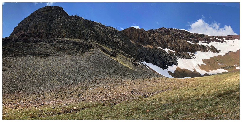
We eventually
gained the hanging valley and started to scope out possible routes up to
Kootenai’s south ridge. Going to Lost first would have been much easier, but
the Kootenai route looked way more interesting – very steep, but interesting!
And the steep
part turned out to be an illusion. Dave expertly led us up the face, encountering
only one or two moves of moderate scrambling. We were then able to follow the
beautiful ridge easily to the summit. Well, Dave ascended with ease; I was
sucking wind throughout!
We took an
extended break at the summit of Kootenai (I needed it!), before embarking on my
favourite section of the entire Anderson/Lost/Kootenai/Bauerman traverse – the magnificent
terrain between Kootenai and Lost. 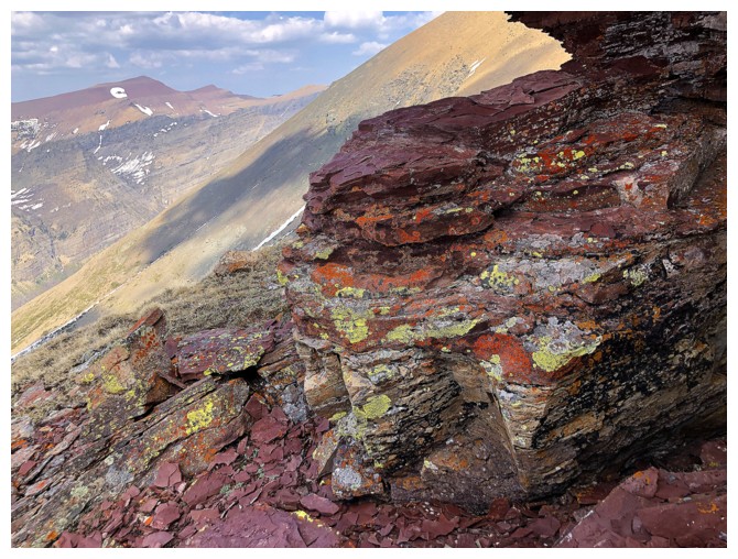 Replete with colourful, lichen-covered rock,
vertiginous views down the north side of the ridge, and easy but fun terrain to negotiate,
this section never ceases to enthrall me. The slog up to Lost sucked the life
out of me for the second time that day, but comfort was taken in the fact that
the reminder of the day would all be downhill.
Replete with colourful, lichen-covered rock,
vertiginous views down the north side of the ridge, and easy but fun terrain to negotiate,
this section never ceases to enthrall me. The slog up to Lost sucked the life
out of me for the second time that day, but comfort was taken in the fact that
the reminder of the day would all be downhill.
Many options
existed for descent. After a little discussion we both agreed that descending
the southwest side of Lost and then making our way back to our ascent route
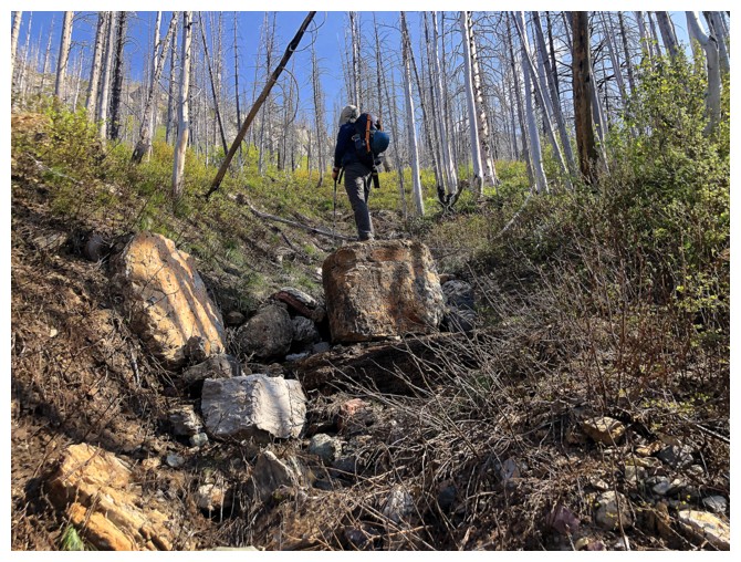
would be the fastest route and some of it new to us both. Except for some tedious rubble
near the top, the route worked remarkably well, and we were back on the trail
in no time. The 6 km hike back to the parking lot would have been easy were it
not for the oppressive heat. I sucked wind throughout that part too!
Except for my
less than impressive physical performance, this was a wonderful day, exploring
new routes on familiar mountains, with a top notch human being – thanks Dave,
as always, for your adventurous spirit, your amazing scrambling and route-finding
prowess, and your thoughtful and engaging conversation – sorry I couldn’t
respond promptly – I was out of breath!!
Click HERE and HERE to see Dave's riveting reports!
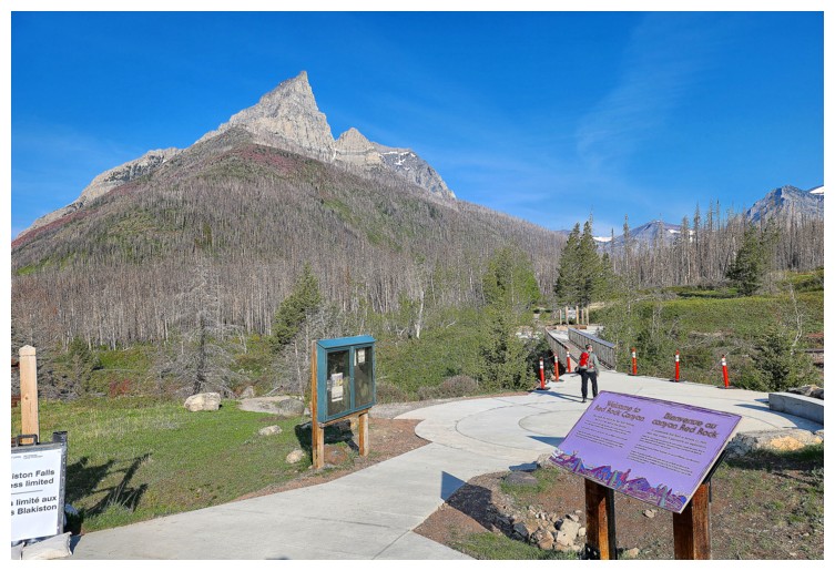
Anderson Peak is always a beautiful sight from the parking lot (photo by Dave)
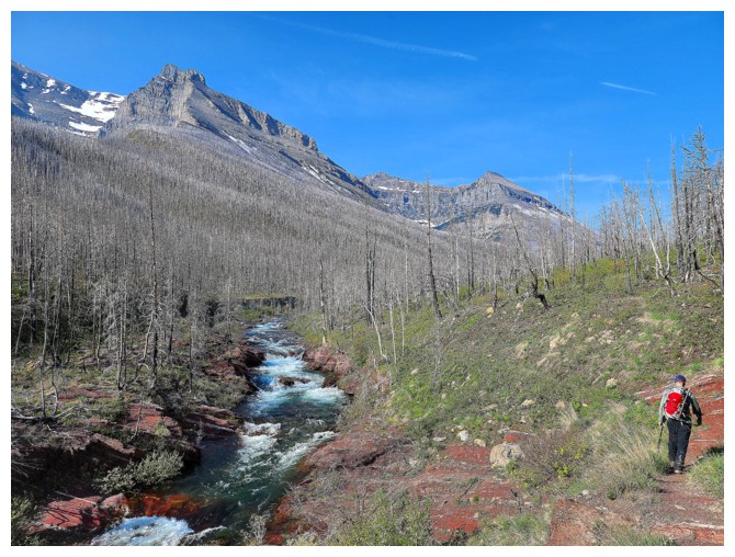
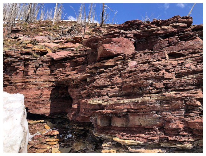
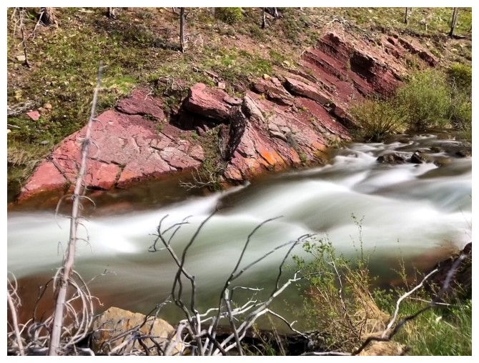
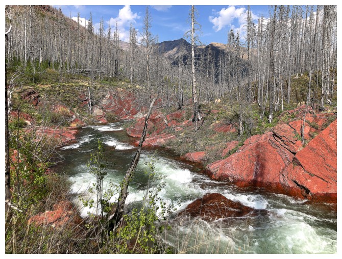
Passing the cool red argillite section in Blakiston Creek (photo by Dave)
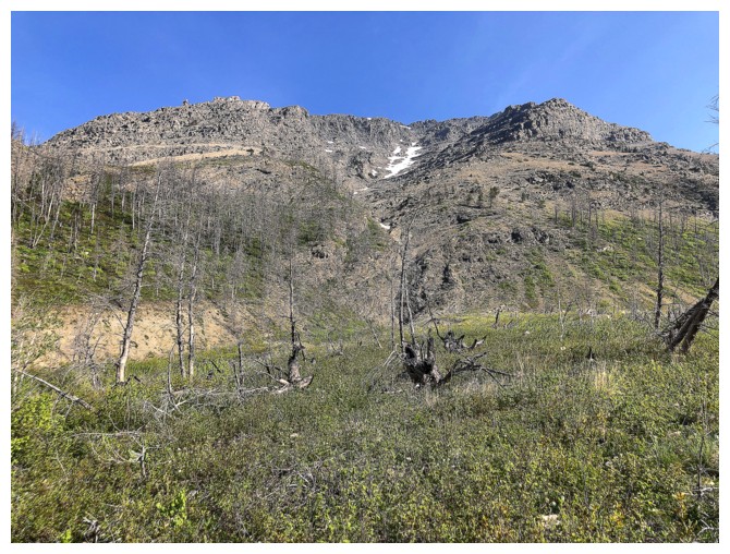
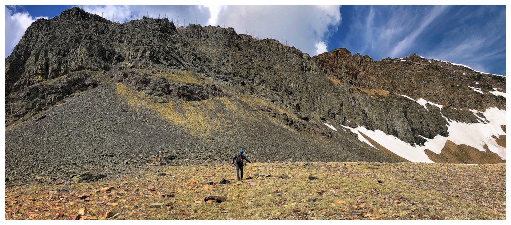
Looking up the best scramble route up Anderson Peak. Surprisingly, the route hasn't seemed to gain popularity.
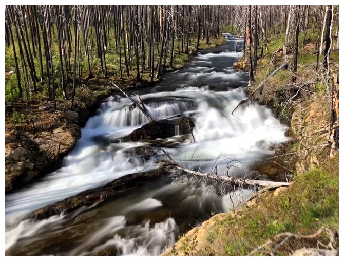
There are several beautiful cascades to see along the way
Passing by the more popular but less aesthetic route up Anderson (photo by Dave)
The south face route up Lost Mountain is easy but, again, not terribly aesthetic (photo by Dave)
Leaving the trail and heading towards the valley between Kootenai (left) and Lost (right) (photo by Dave)
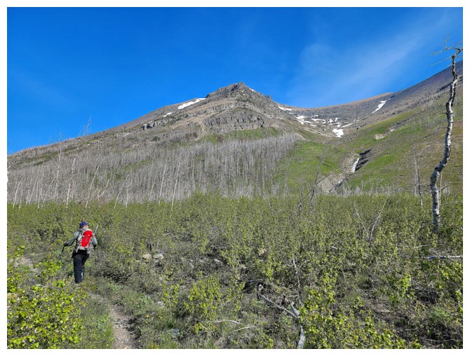
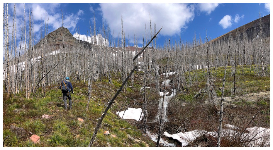
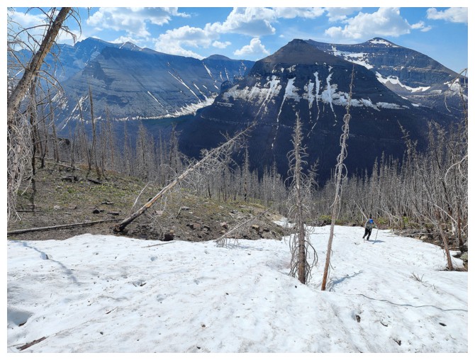
We followed a drainage for a while, but soon switched to more open slopes
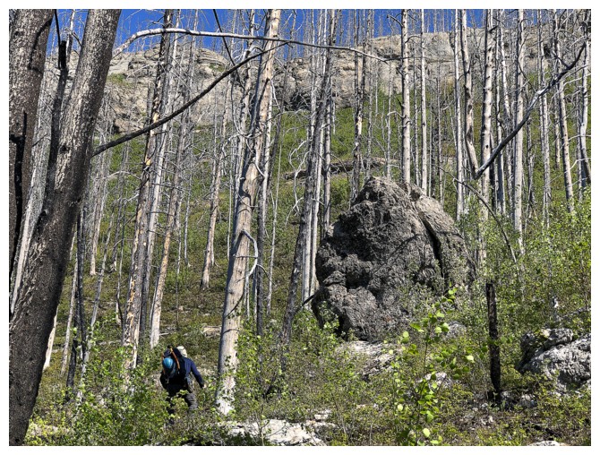
Dave approaches a lone big boulder
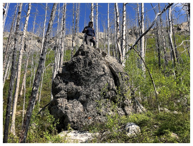
And then finds a way to stand atop it
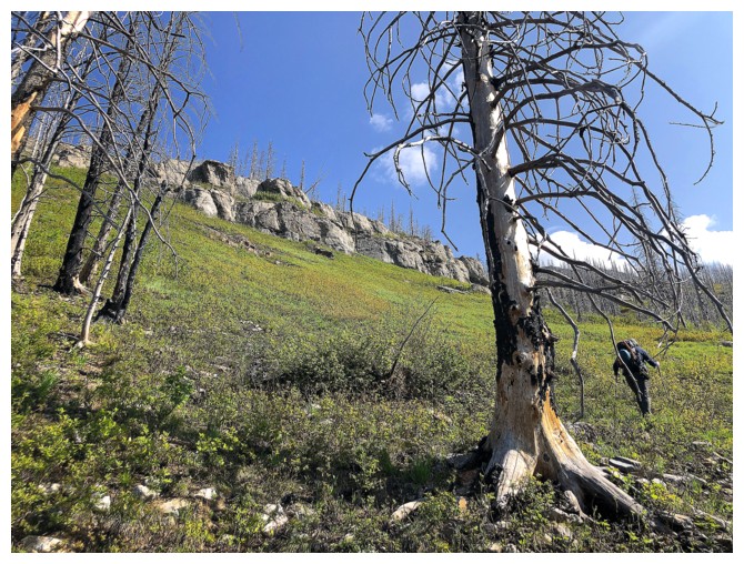
Dave leads us towards the stream
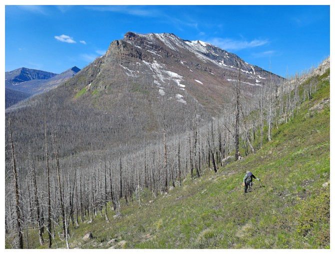
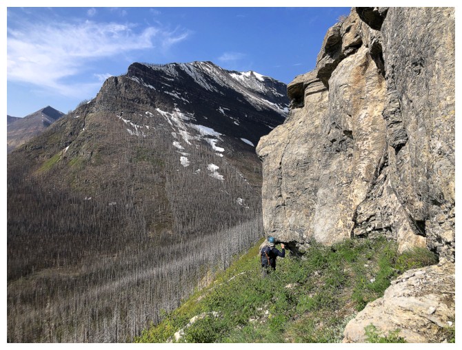
Open slopes and Lone Mountain -
were I to repeat that ascent I would bike the Snowshoe Trail, hike to
Twin Lakes, then to Lone Lake, and ascend the south ridge of the
objective. The Blakiston Creek route is shorter but none of it can be
biked (photo by Dave).
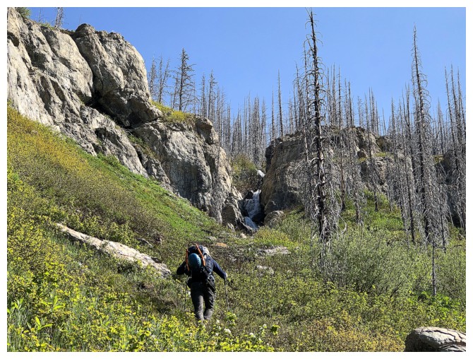
Approaching the stream and the first of many waterfalls
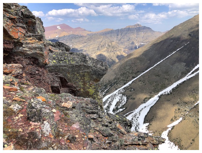
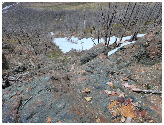
The limestone band
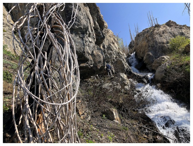
The stream and a weird tree at the left
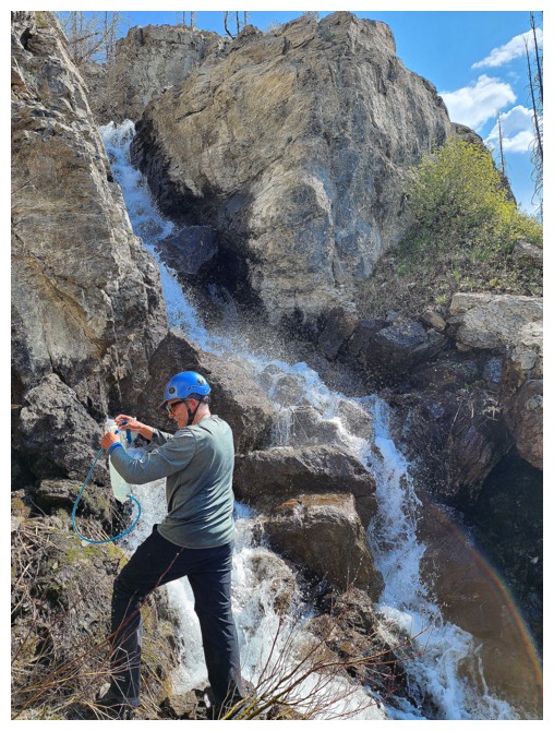
Great water source (photo by Dave)
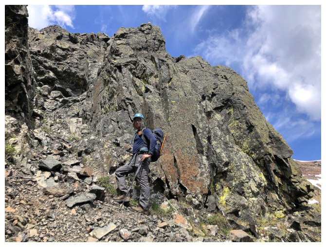
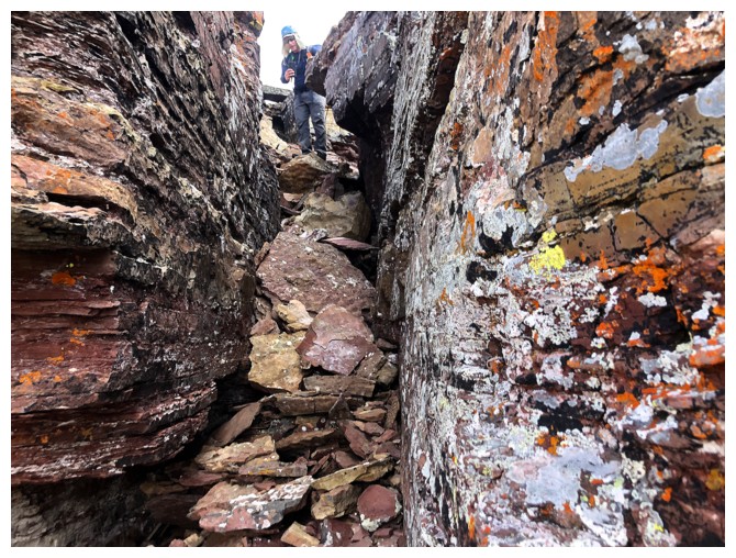
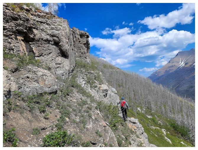
Dave searches for a weakness through the limestone band
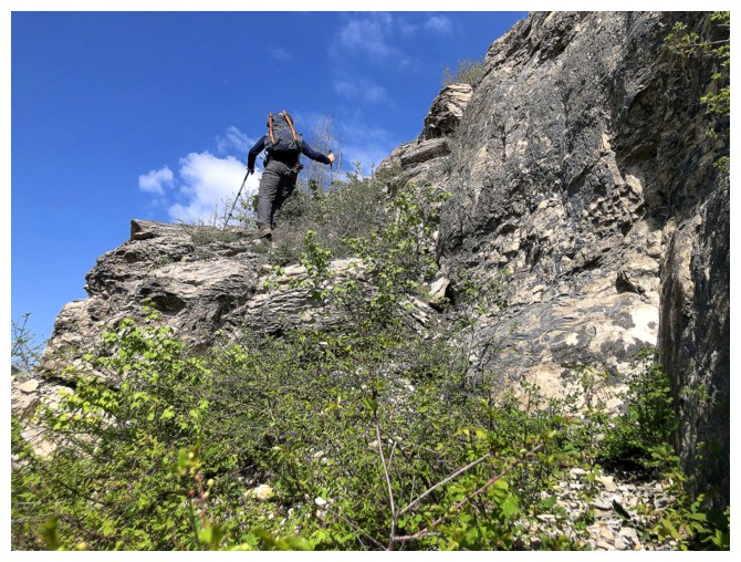
He's found one
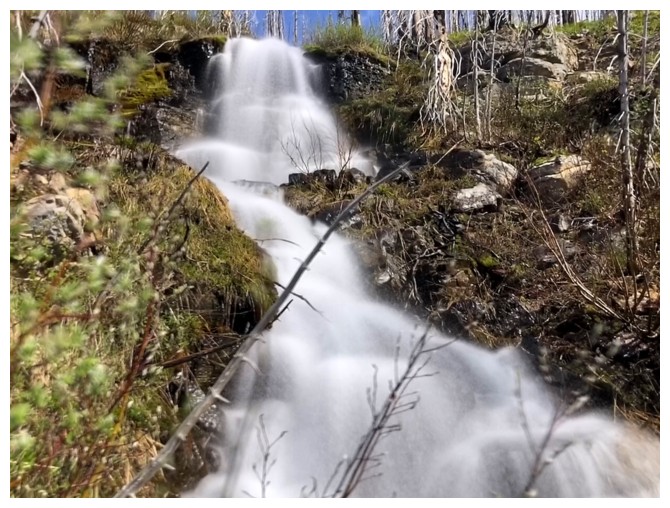
The second waterfall
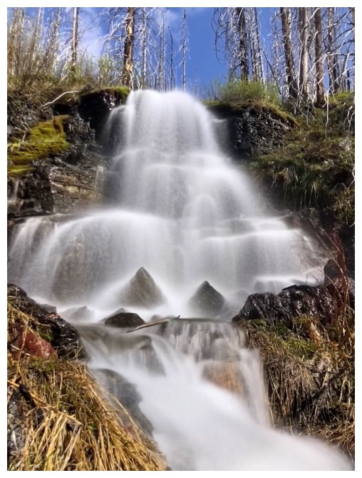
The third was the coolest
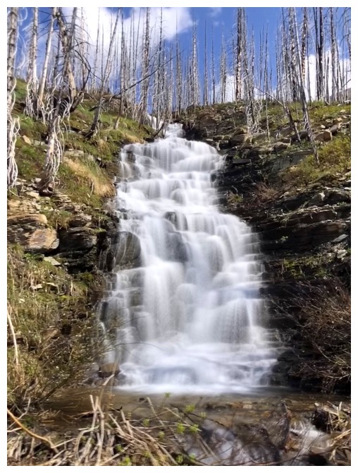
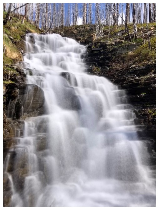
The fourth held its own
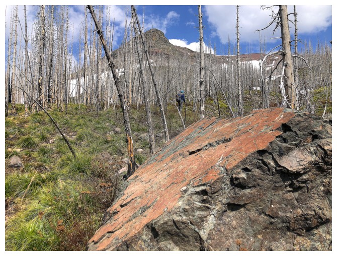
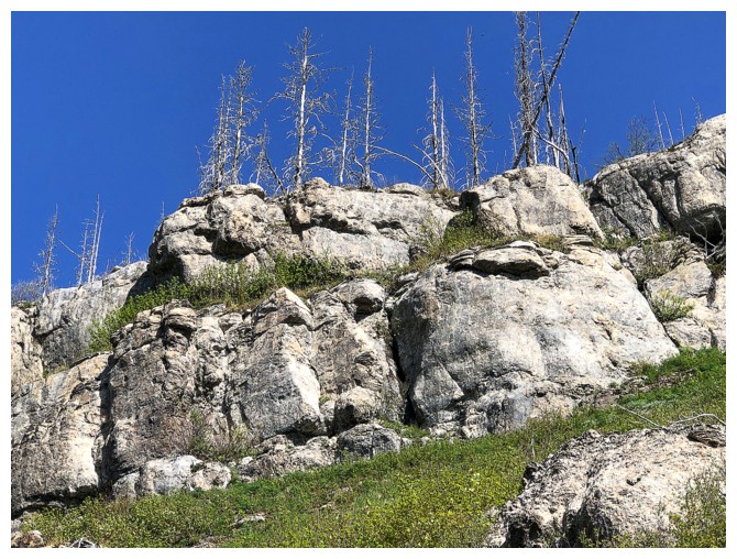
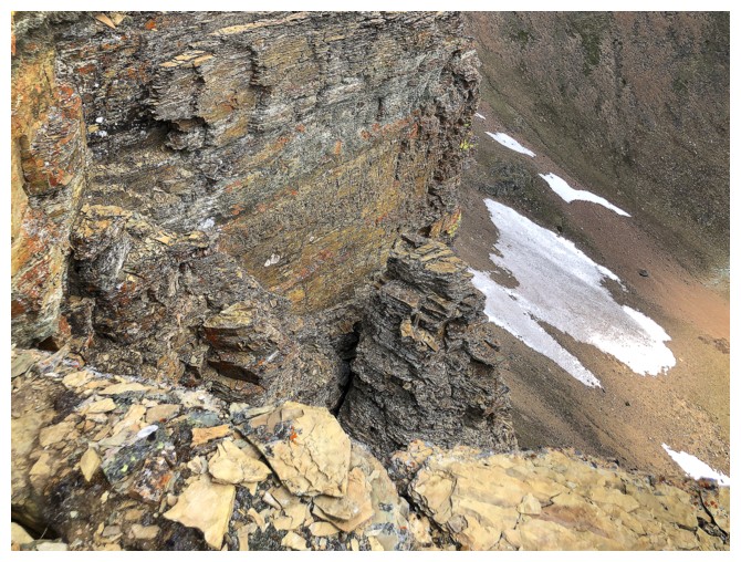
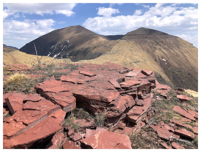
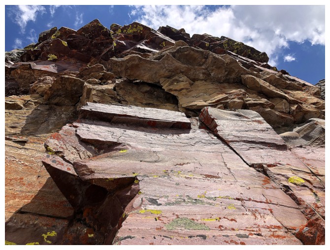
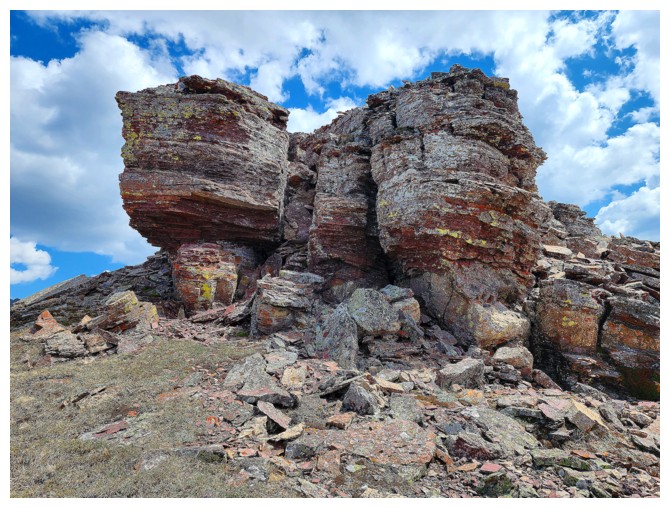
First "cool rock" encounter
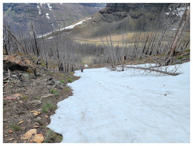
Entering the hanging valley
The stream scenery continues (photo by Dave)
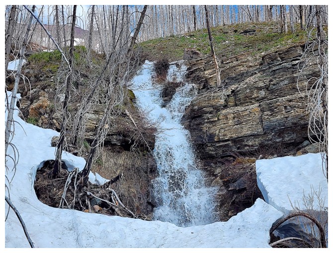
The snow made travel easier here (photo by Dave)
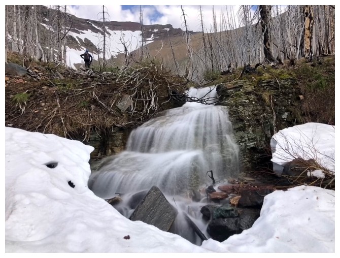
Last of the waterfalls
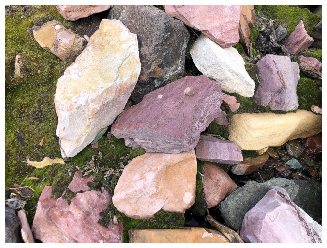
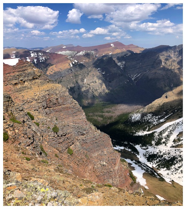
Not hard to see why The Castle, Waterton, and Glacier National Park are some of the most colourful parks on the continent
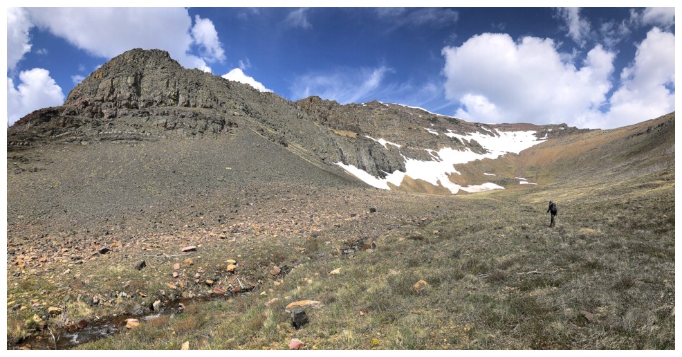
Dave leads us into the heart of the hanging valley
And then scopes out potential routes up to Kootenai's south ridge
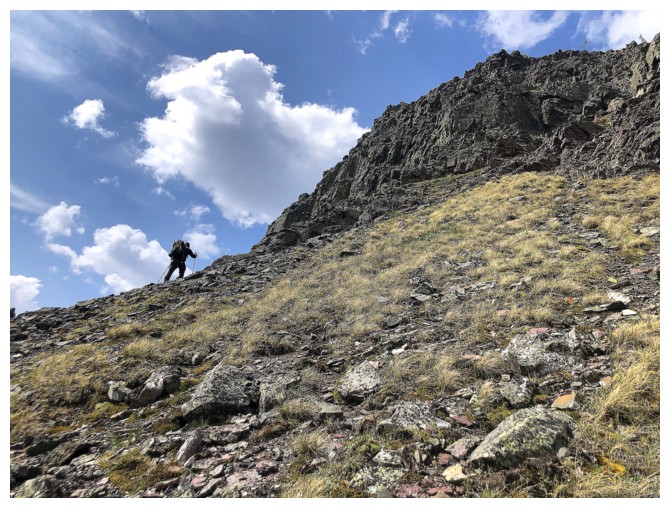
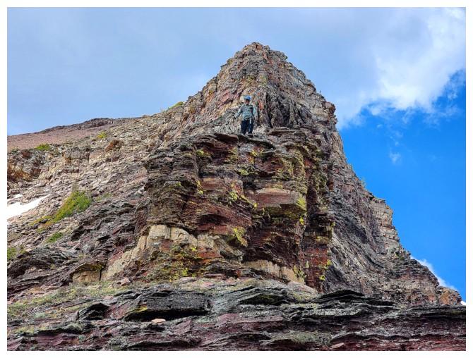
He's on the move and heading up to what appeared to be an unscramblable rock band
Dave finds the weakness
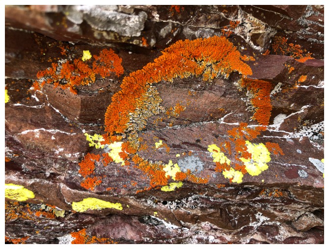
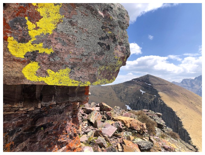
I'm distracted by lichen on argillite
Dave is ready to lead us to freedom!
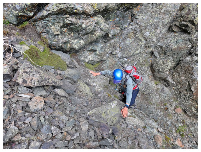
I follow. Only one of two moves of scrambling here (photo by Dave).
Looking over to Kootenai's summit (photo by Dave)
Gaining the south ridge. Mighty Piinaquiium (Mount Blakiston) behind (photo by Dave)..
Dave is making great progress up the ridge, while I question if aliens removed one of my lungs while I slept!
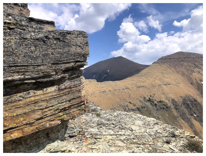
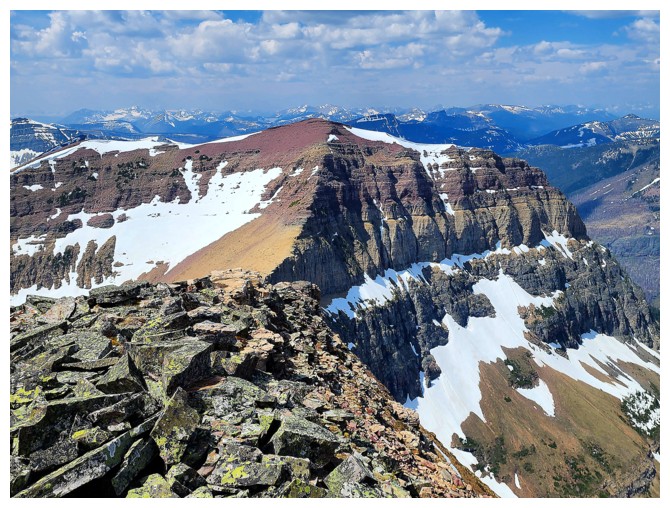
Some cool sandstone-like rock and Lost Mountain
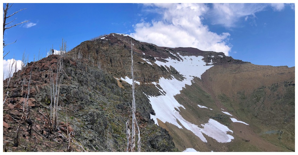
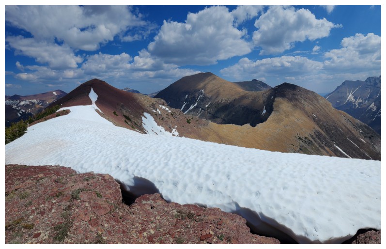
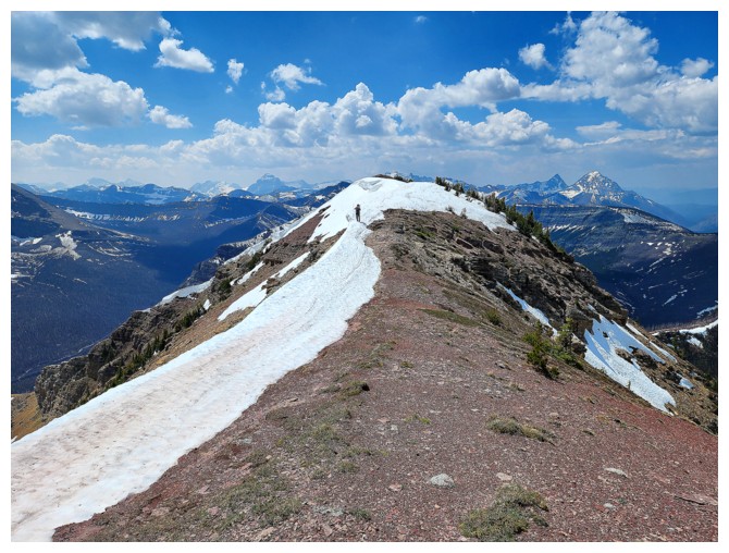
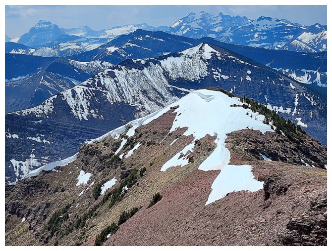
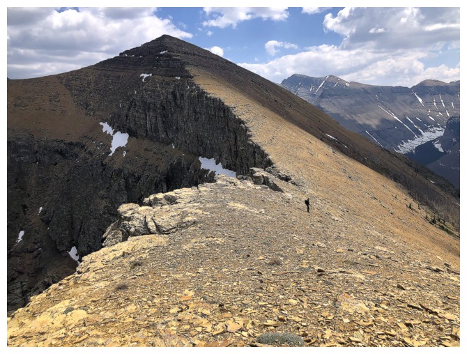
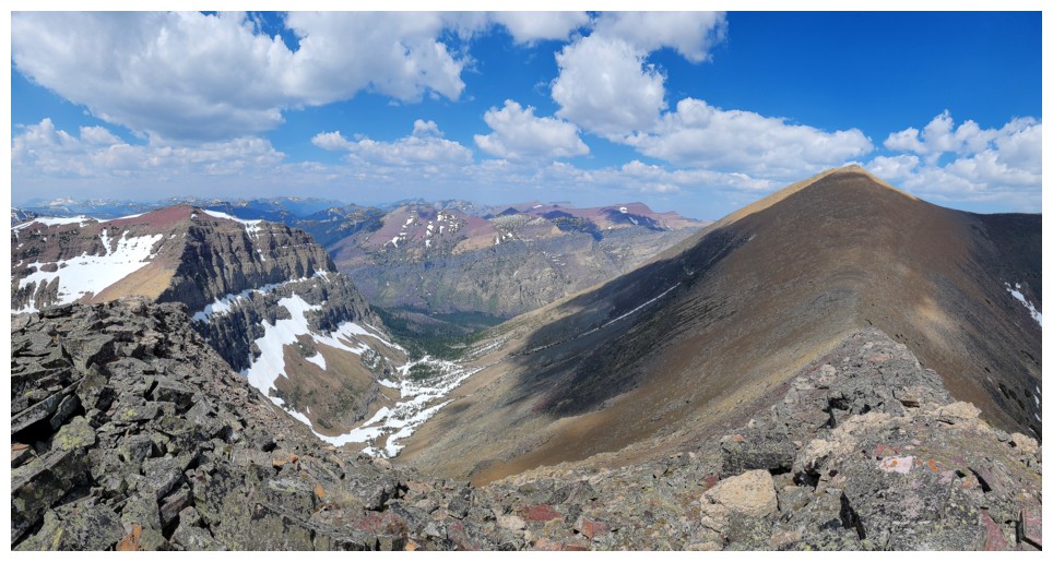
Kootenai (left) and Lost (right)
Dave enjoying some easy but fun scrambling up the ridge
Looking down the steep east side of the ridge
My slow pace gives Dave a chance to photograph the great views to the south (photo by Dave)
Looking over to Anderson Peak (centre) and Lost (right)
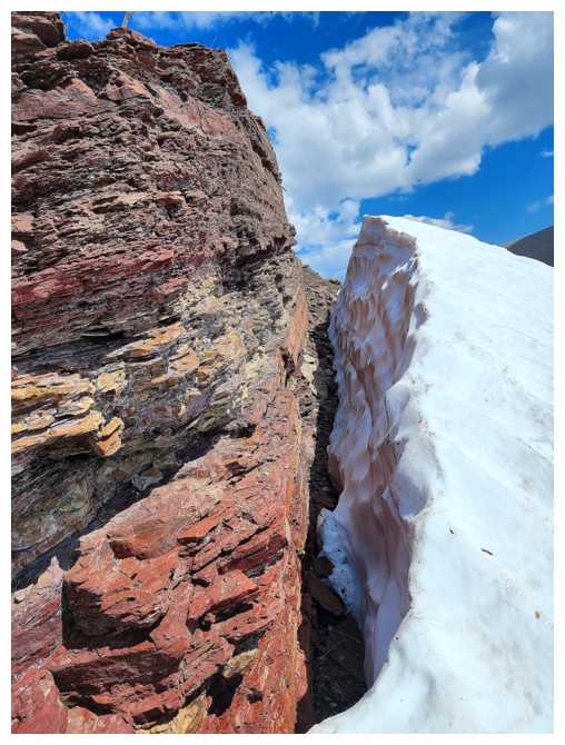
Dave has found my favourite combination of scenery: red argillite, snow, and blue sky (photo by Dave)
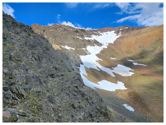
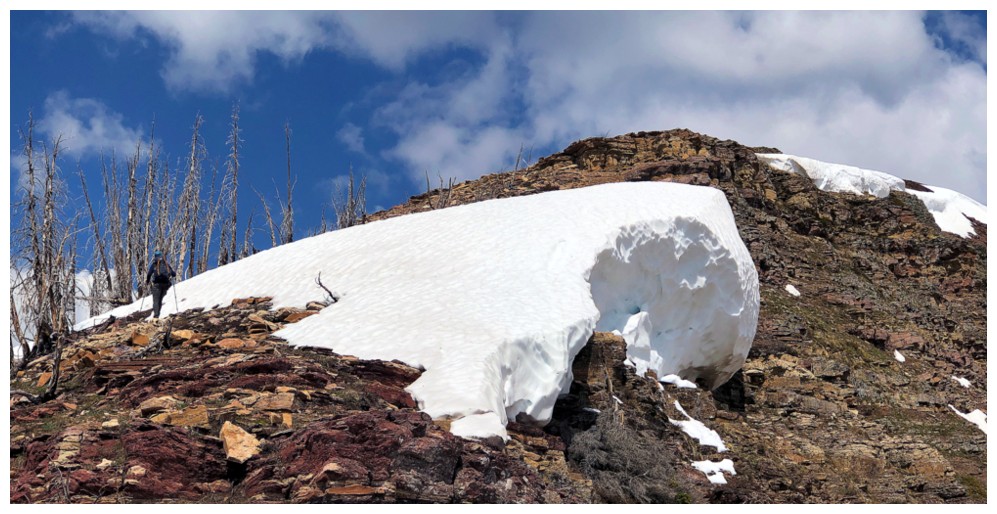
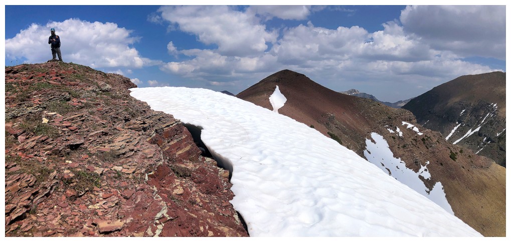
The only remaining snow on mountain was in the form of a couple of huge cornices along the ridge (photo by Dave)
My turn to enjoy the argillite
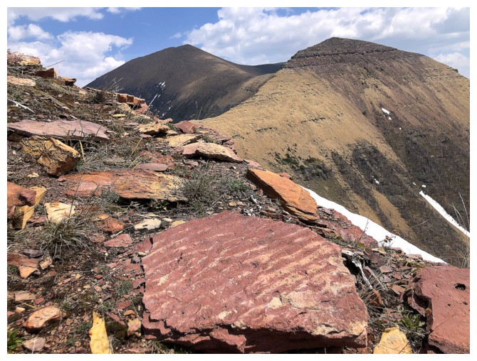
Ripple rock - yes, at one time in history that rock was at the bottom of a sea
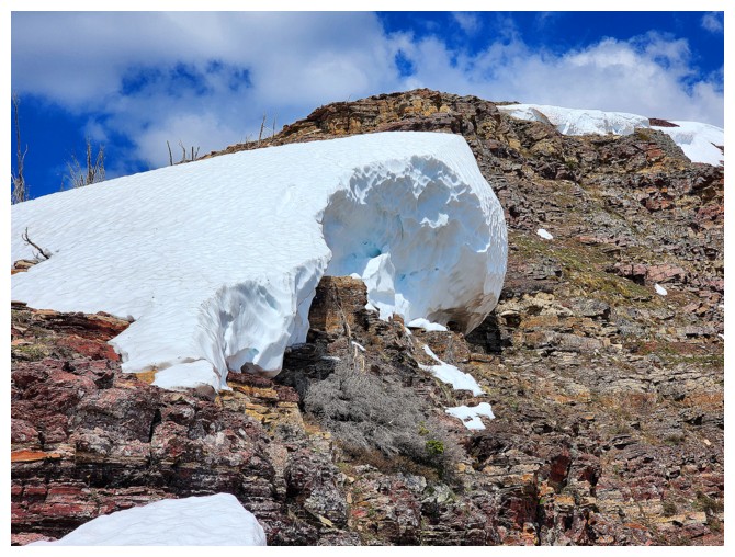
Big snow! (photo by Dave)
More argillite
Lagging behind again (photo by Dave)
Dave steers well clear of the edge of the cornice
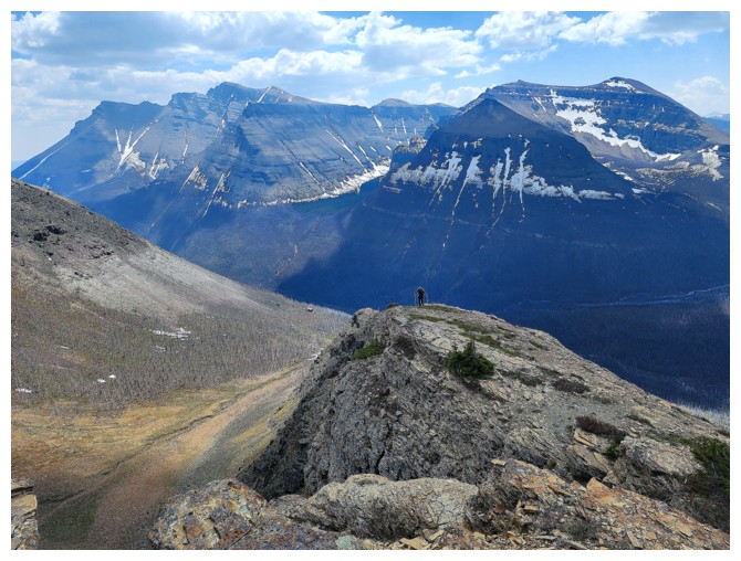
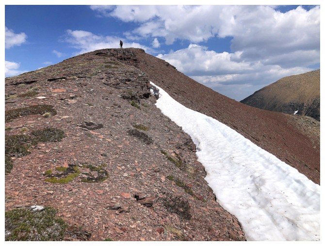
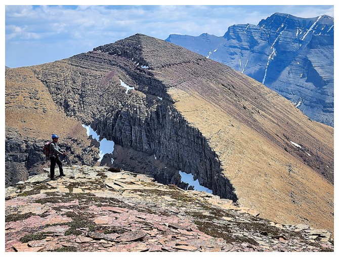
Dave reaches a major highpoint on the ridge
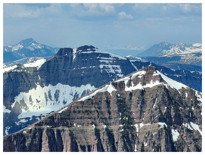
Dave's view to the east includes the summit of Kootenai, Anderson, Anderson's east peak, and Lost (photo by Dave)
And Mount Bauerman to the west (photo by Dave)
Dave is a very patient man and graciously waited for me at the highpoint (photo by Dave)
Sage Senior - a peak that deserves way more love than it presently receives (photo by Dave)
Almost there
Dave leads the way to the summit at the left
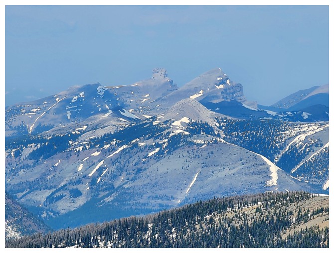
Kishinena Peak behind Bauerman (photo by Dave)
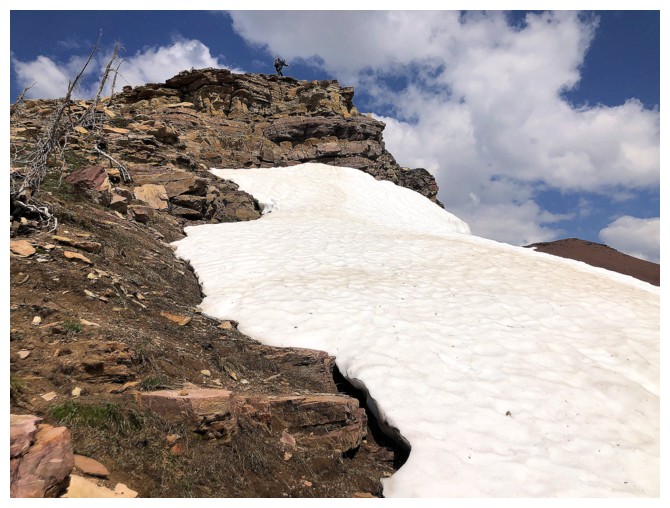
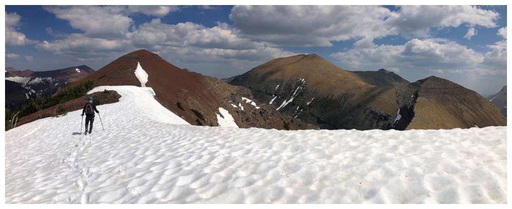
Easy travel to the summit
I chose the snow (photo by Dave)
Dave hits the summit
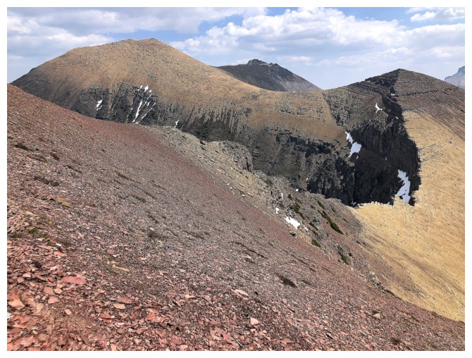
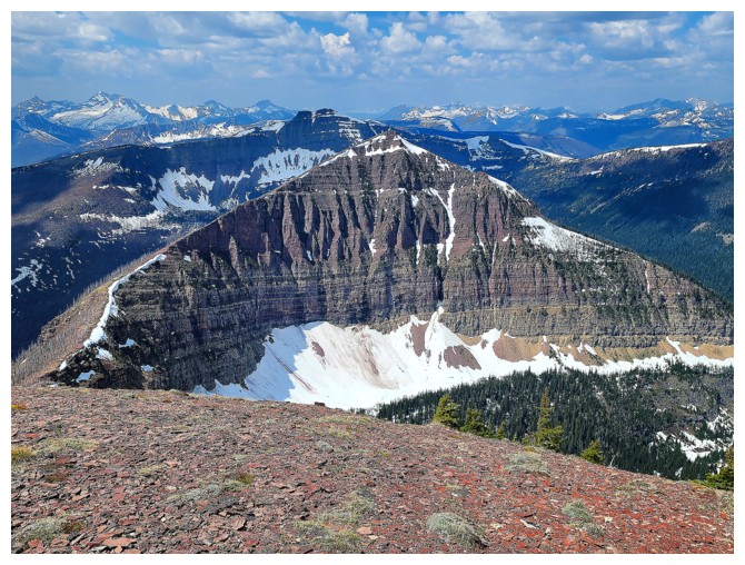
Anderson, it's east peak, and Lost
Finally caught up (photo by Dave)
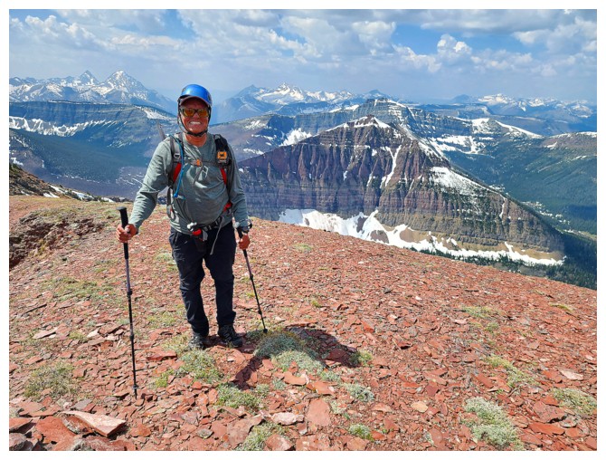
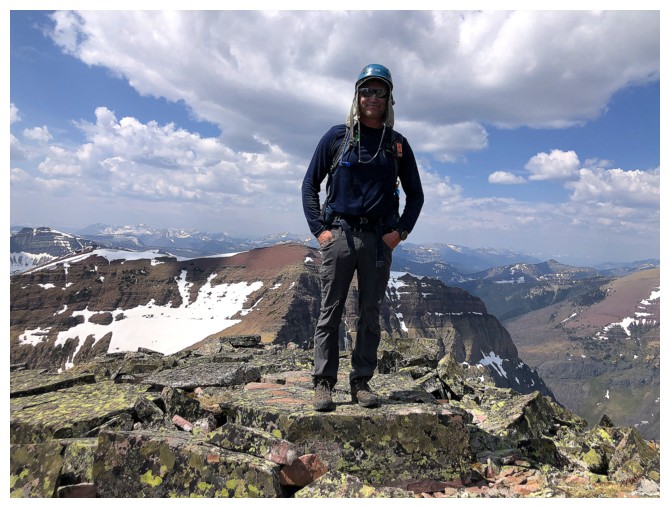
Dave at the summit
Piinaquiium (Mount Blakiston) (photo by Dave)
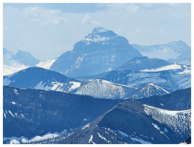
Mount Kinnerly in GNP (photo by Dave)
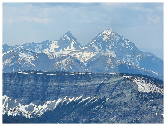
King Edward and Starvation peaks (photo by Dave)
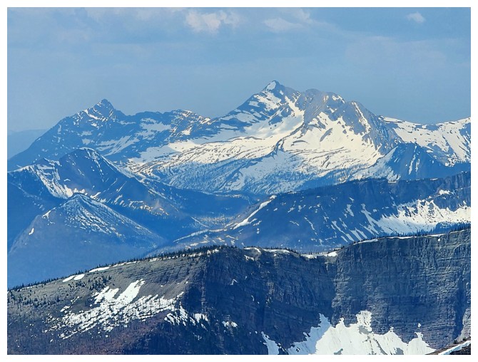
Miskwasini and Kenow (photo by Dave)
Mount Glendowan (photo by Dave)
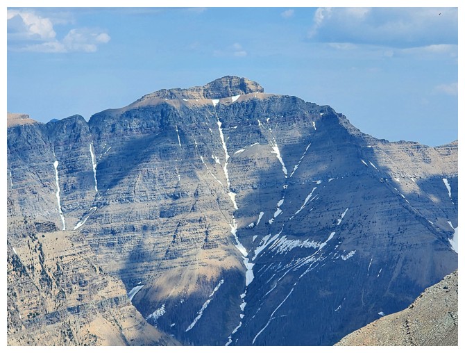
Newman Senior - the sight of that peak will, for a while, give me shivers, courtesy of a kinda' scary ascent in 2022 (photo by Dave)
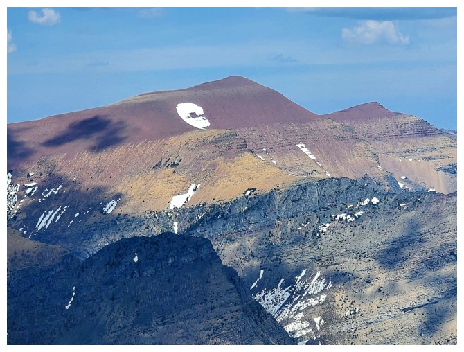
Loaf Mountain - no shivers for that one! (photo by Dave)
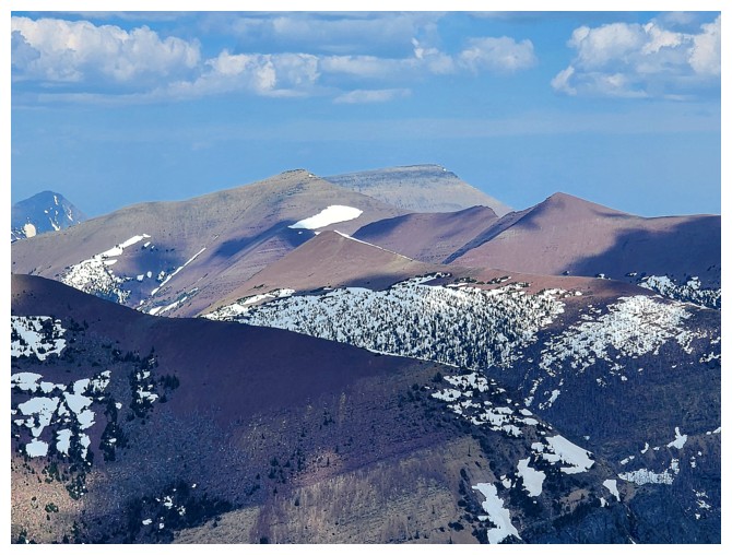
View to the southwest (photo by Dave)
Castle Peak and Windsor Mountain (photo by Dave)
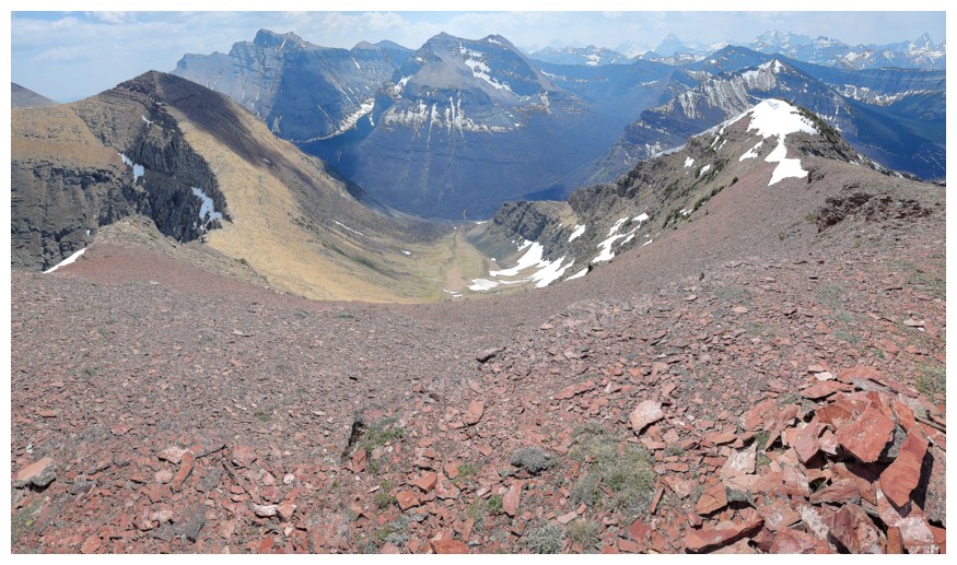
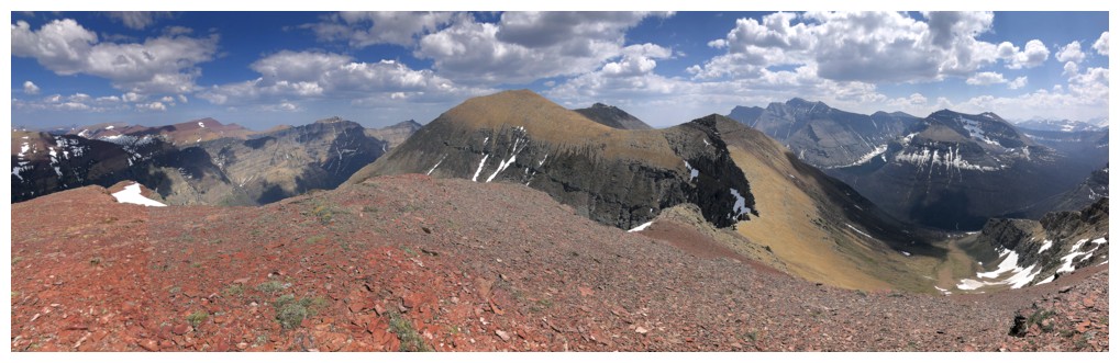
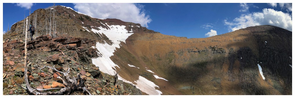
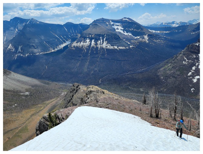
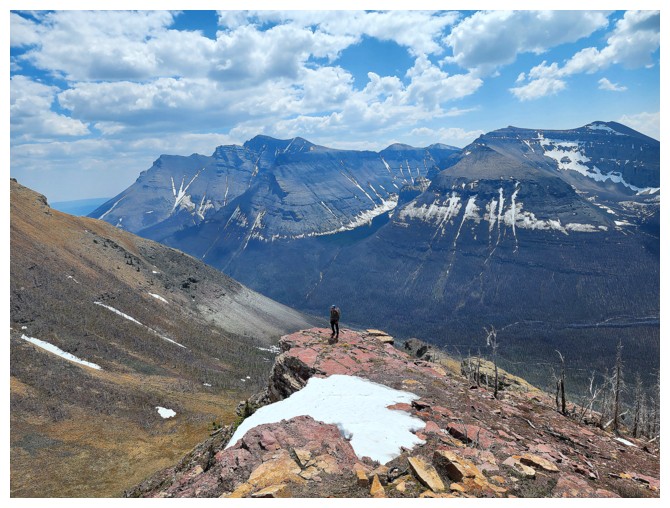
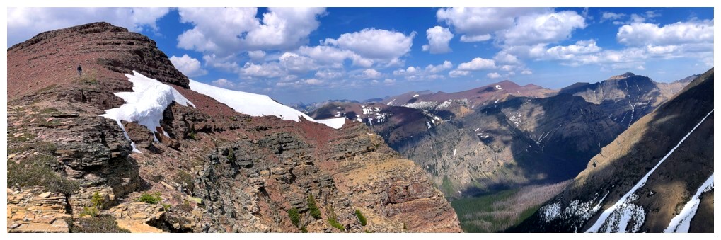
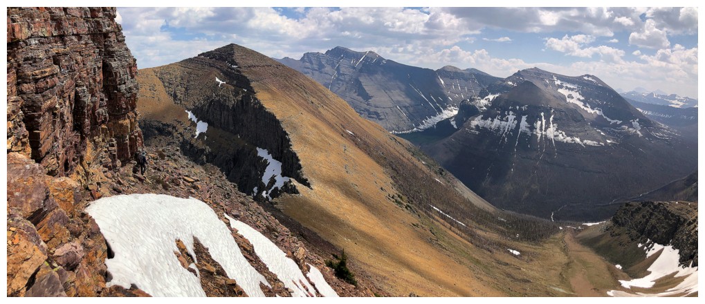
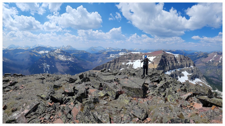
Pano of the ridge taken up (right) and the ridge we will take down (left)
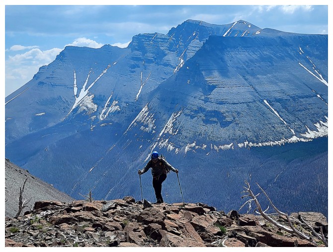
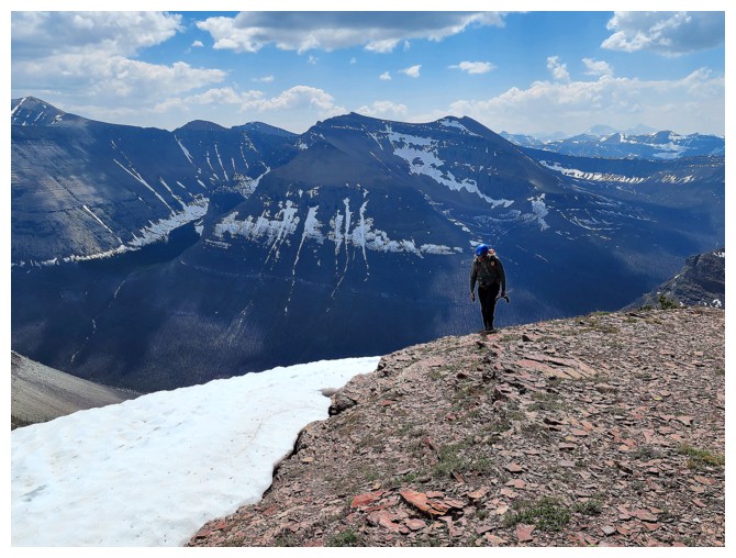
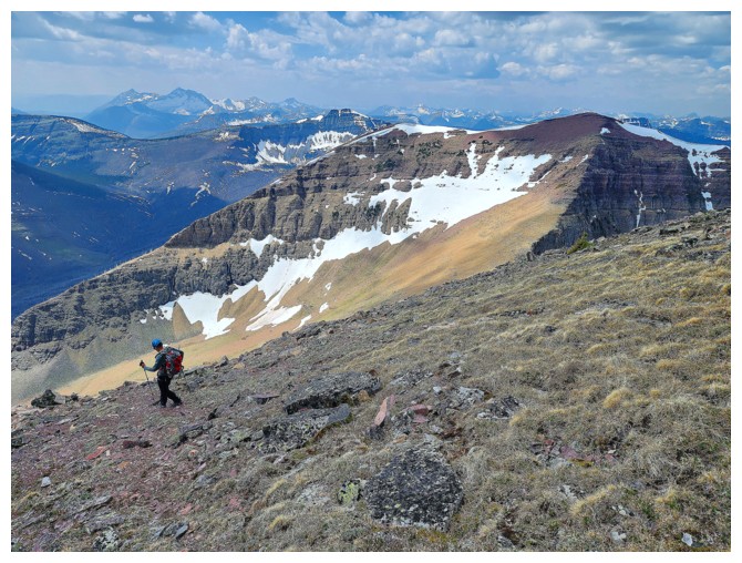
Leaving for Lost (photo by Dave)
The colours of Waterton and The Castle
The only reason I'm ahead of Dave at this point is because he had a rock in his boot
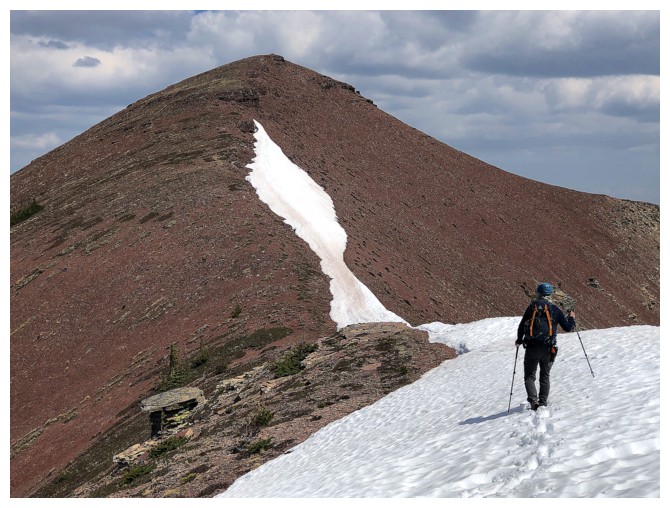
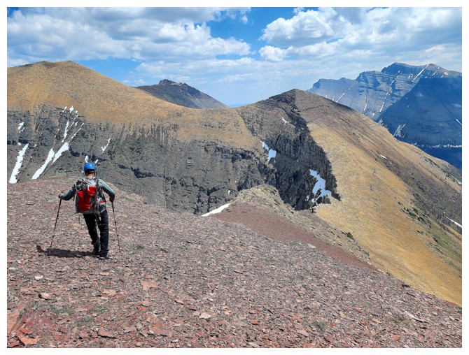
Great view of Lost and the easy route up (photo by Dave)
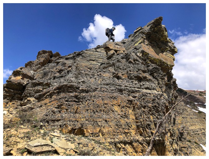
A little route-finding is required here but increased traffic has made the path obvious (photo by Dave)
Below the major rock band and traversing back to the ridge
Some of the very cool rock that makes this the best part of the traverse
Same as above
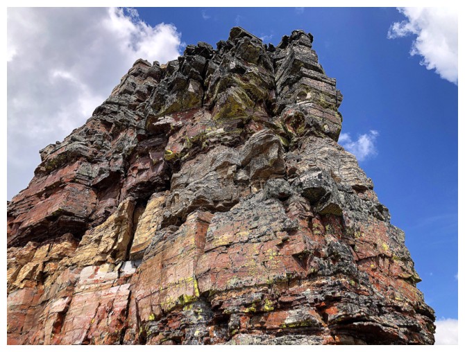
And again
Newman Senior and Mount Glendowan make another appearance - there's a terrific ridgewalk/scramble between the two
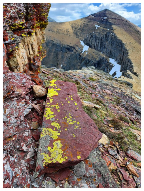
Dave is not immune to the lure of yellow lichen on red argillite! (photo by Dave)
I'm almost camouflaged amid the colourful rock! (photo by Dave)
Looking back at the interesting section (photo by Dave)
And forward to Lost

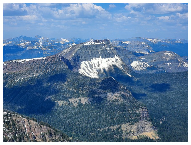
Anderson and Lost
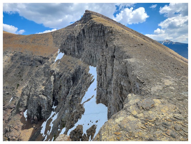
The precipitous north face of Lost (photo by Dave)
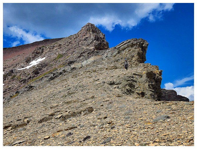
There
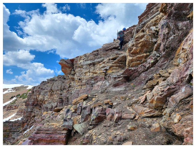
is one interesting obstacle en route to Lost. It can be circumvented on
the right side, but Dave chose to go right up the gap (photo by Dave)
There he is
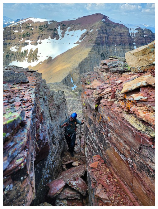
I follow (photo by Dave)

Summit is close (photo by Dave)
Taking the final few steps (photo by Dave)
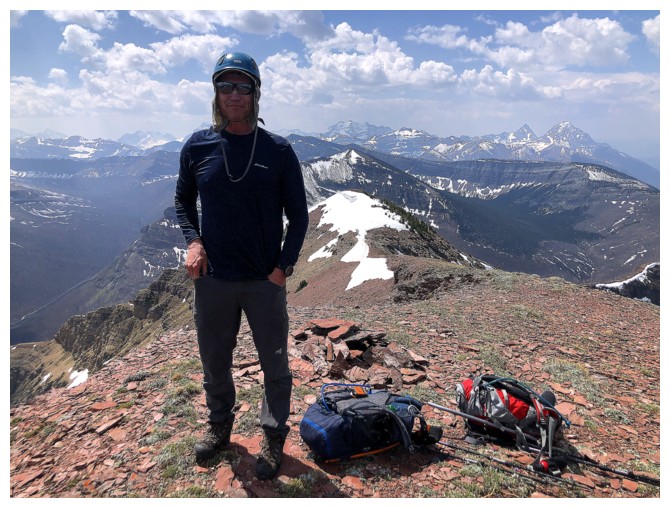
Summit
pano to from west to east, via the north. In math we would call this
Quadrants II and I on the Cartesian coordinate plane! (photo by Dave)
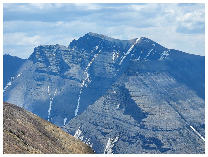
Kootenai Brown looking glorious
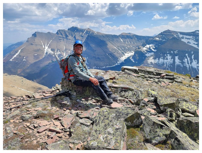
Risky Business (great soundtrack by Tangerine Dream) at the summit - sitting down on the rock during tick season! (photo by Dave)
Dave makes the right decision!
Heading down (photo by Dave)
Benefitting from very surfable scree (photo by Dave)
Dave looks down a steep rock band barring the way. Fortunately there was a easy route down a few metres away (photo by Dave).
Taking advantage of the little remaining snow (photo by Dave)
Nostalgic look at the ascent route we took up Kootenai
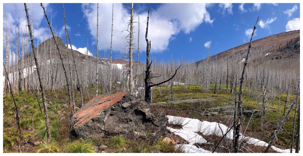
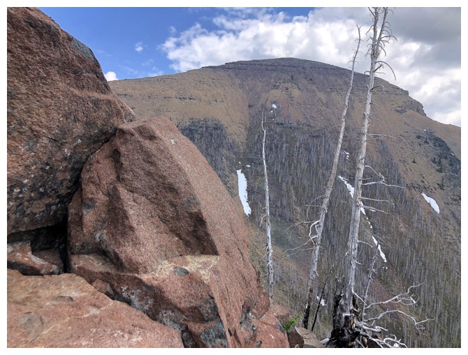
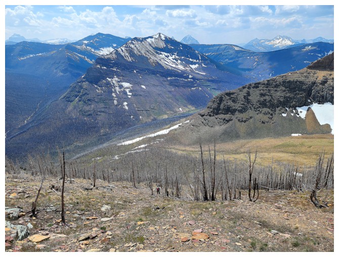
Results of the Kenow fire are striking (photo by Dave)
Down the crux (photo by Dave)
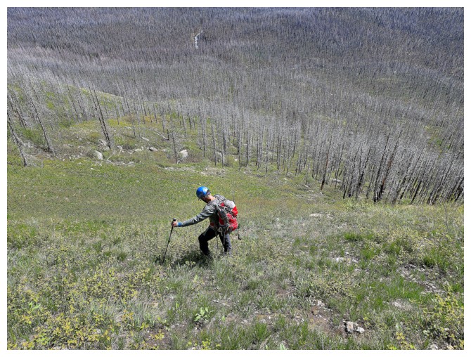
Down the steep grassy slopes (photo by Dave)
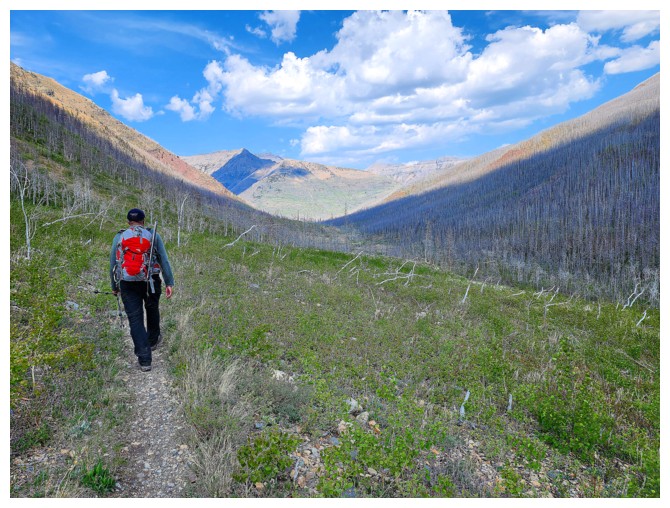
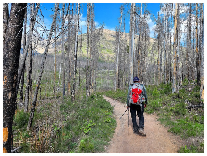
Back on the main trail. It's a long hike back to the start, especially in the unusually oppressive heat for May (photo by Dave)
Back at the best section of the Blakiston Creek hike ....
...where red argillite abounds
On the homestretch of an awesome trip! (photo by Dave)
The End
LOG