Mount Pushover attempt
July 31, 2022
Mountain height: 2920 m (bailed at 2890 m)
Elevation gain: approximately 1500 m
Round-trip
time: 12:50
Solo scramble.
This
mountain is
not appropriately named! I would rename it “Mount Way More Exposure And
Tricky Than Bargained For, On Insanely Loose Rock That Threatens To
Throw You
Off The Mountain At Any Given Moment” – it’s a mouthful but more
accurate than what
the word “pushover” implies!
Perhaps the
title of the mountain lies in the fact that it is sandwiched between two
mountains that are considerably more challenging to summit – Mount Northover
and Mount Lyautey. However, Pushover is not a peak to be taken lightly. 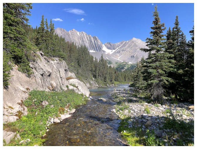 The
“easy scramble” description in David Jones “Rockies South is accurate - it's also an
old-school rating and should be treated with the respect for the generation of
climbers that “scrambled” exposed 4th and low 5th class terrain
without a rope (up and down) deserve.
The
“easy scramble” description in David Jones “Rockies South is accurate - it's also an
old-school rating and should be treated with the respect for the generation of
climbers that “scrambled” exposed 4th and low 5th class terrain
without a rope (up and down) deserve.
Having not
visited the Aster Lake area for over a decade, I was super keen to return to
this stunning environment and Pushover offered the perfect “carrot”! I also had
this “near-genius” idea to make the approach much easier. Instead of hiking
around the south side of the Upper Kananaskis Lake, I would bike around
the north side, all the way to the Point Campground, where I would only have to
hike a few kilometres to the Hidden Lake turn-off.
What a bust that
turned out to be! The first few kilometres around the lake are quite pleasant
on two wheels, but once you turn towards the campground, it’s all bets off! The
trail is steep, narrow, and rocky – i.e. very bike unfriendly. 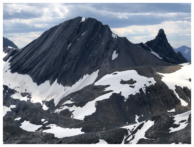 I bailed a short
distance in and dragged my bike back up to the turn-off. So much for an easier
approach and my “near-genius” status!
I bailed a short
distance in and dragged my bike back up to the turn-off. So much for an easier
approach and my “near-genius” status!
The hike to
Aster Lake went without a hitch but I had forgotten what a long and arduous hike
it is. Thankfully the scenery and views throughout were magnificent. Aster Lake
itself is somewhat of an anomaly. Having spent a good deal of time in the month
of July, 2022, enjoying some of the most colourful and spectacular lakes in the
Canadian Rockies, it felt odd to be standing at the shores of a lake that is a
decidedly dingy, dishwater gray colour from all angles.
After crossing
the lake outlet, I hiked up fairly steep slopes to the end of the south ridge
of Mount Pushover, thinking that this steep section was probably the crux of
the trip. Wrong again!! What followed was several hours of sketchy, exposed,
and at times unnerving scrambling up the ridiculously loose and often narrow
ridge. And it just kept going and going. Having spotted a couple of potentially
easier routes down the west side of the mountain, I decided to continue until I
reached an impasse or hopefully the summit.
Unfortunately,
the impasse came before the summit. About 50 horizontal metres and only 30
vertical metres from the top. I reached a short, but steep and very loose rock
band, with significant exposure on the left side and insane exposure on the right.
I started up the band but quickly came to two realizations: 1. This section
would be very scary for me to descend; 2. If any of the loose hands or footholds
failed, I would finally get to experience what a bungy cord jump felt like but without
the bungy cord. I bailed immediately!
Getting off this
death trap of a mountain went quite well. I was able to find a much easier
route down the west side and in fact spotted a potential route up to the summit that would
have probably avoided the impasse. However, by that time I was halfway down the mountain
and no carrot on the planet would have coaxed me to attempt another route up.
Were I to return to this peak I would probably try to gain the Northover/Pushover
col and then attempt the summit from that point. That’s a pretty iffy “Were I”
however!
The remainder of
the descent was a relative cakewalk, though of course it dragged on for way longer
than I would have liked.
Hard to say if I
will ever return to try Mount Pushover again, but if I do I will at least
know what to expect.
On the wrong side of Upper Kananaskis Lake, thanks to my "not-so-genius" approach route
The eye-catching northeast outliers of Mount Lyautey
At the turn-off to the Point Campground.
Another eye-catching scene with a Lyautey outlier
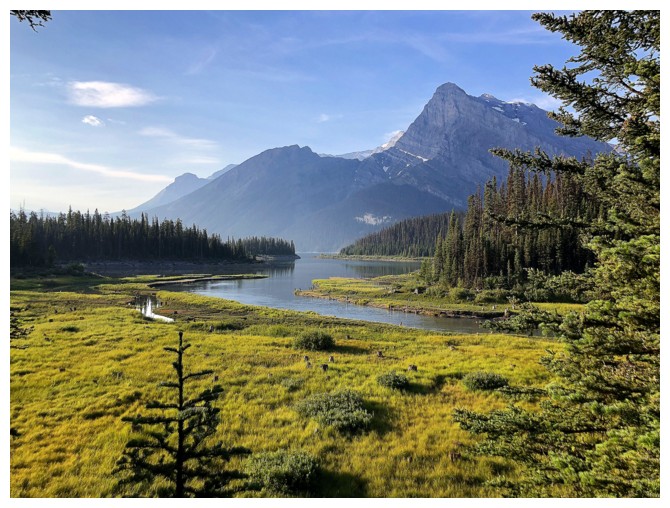
And one with Mount Sarrail and Rawson Lake Ridge
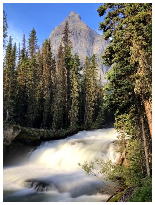
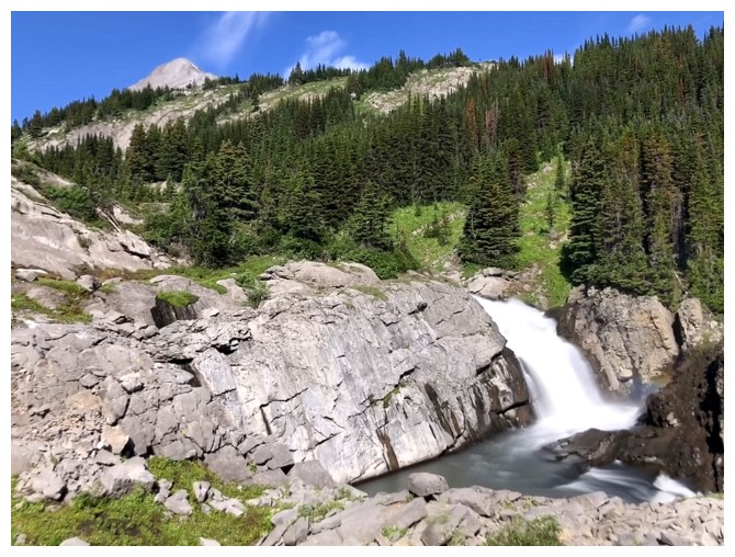
Upper Kananaskis Falls
Guess who?
Hidden Lake is very full at this time of the year. When it is low the hike to the other side is super easy.
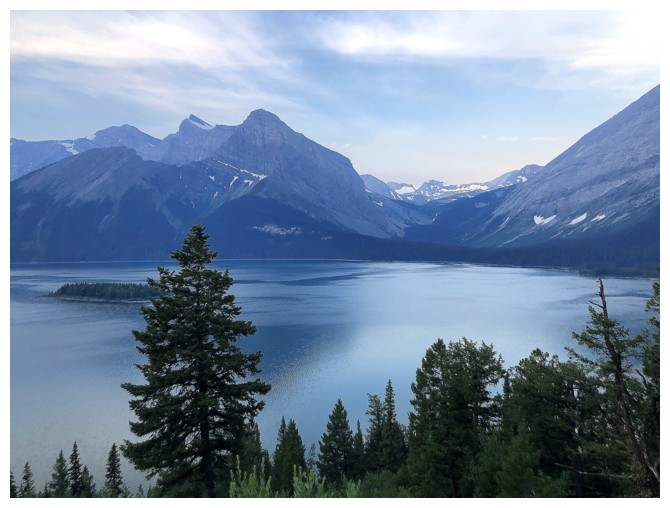
Looking back to Hidden Lake and Mount Indefatigable
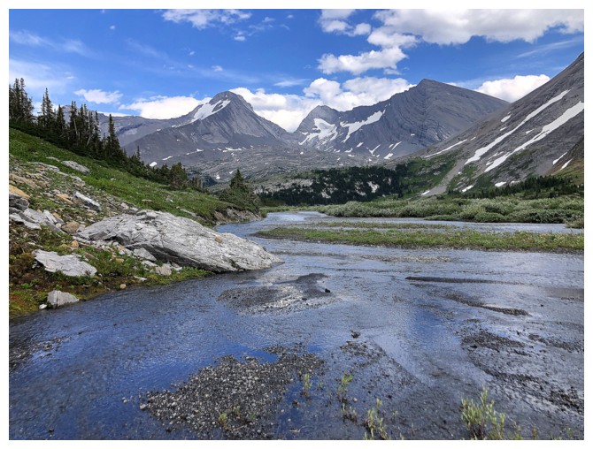
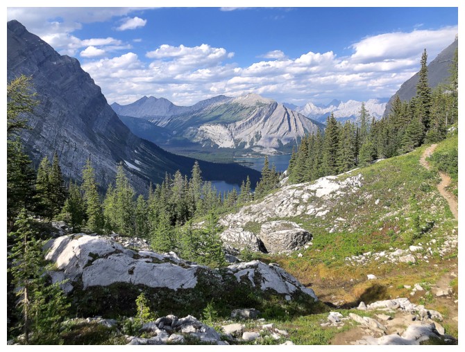
High on the Aster Lake Trail.
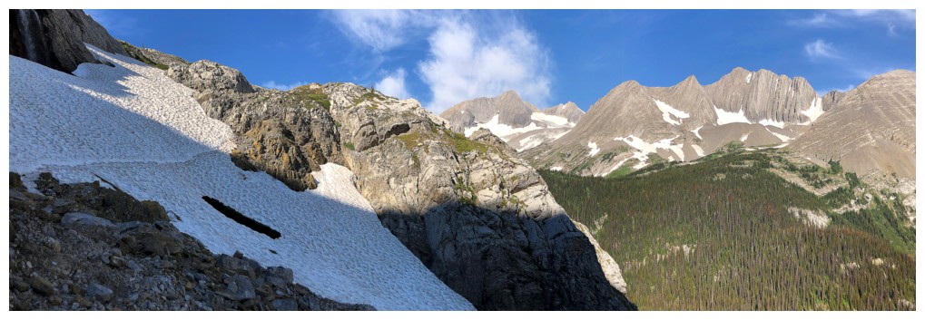
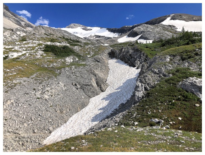
Same as above. Crossing the snow patch at the left was a little dicey, as the snow was rock hard.
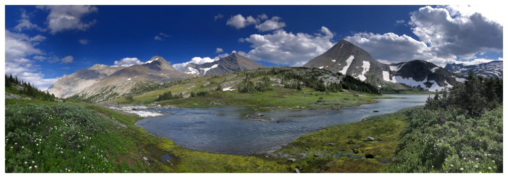
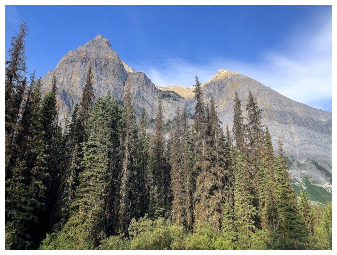
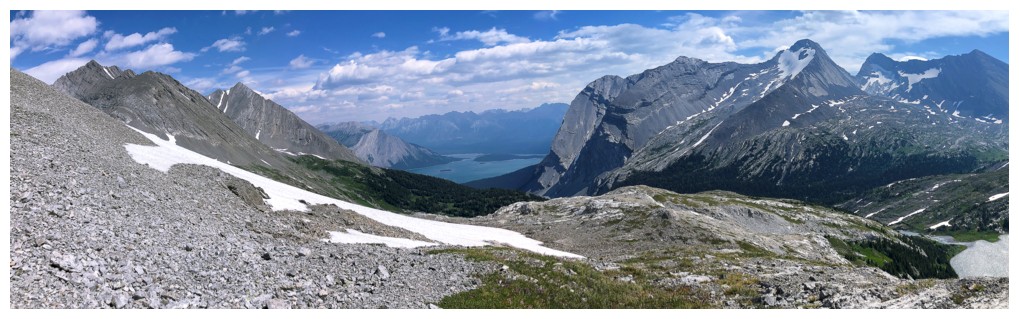
Great view!
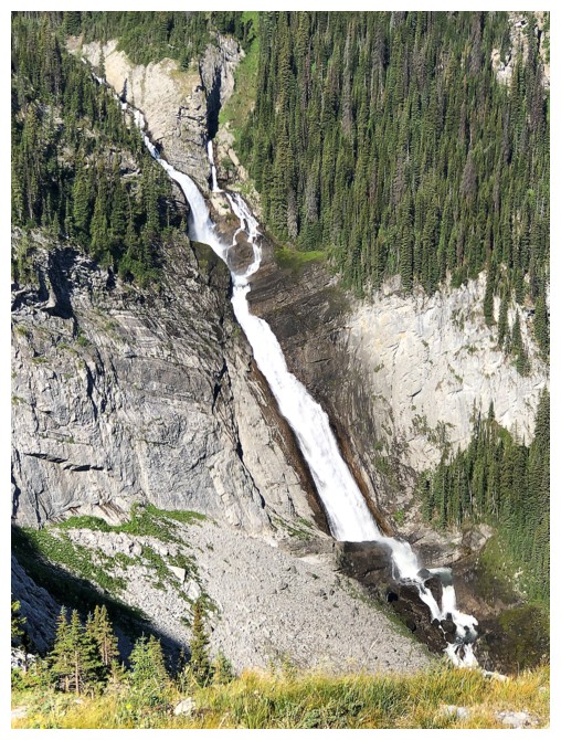
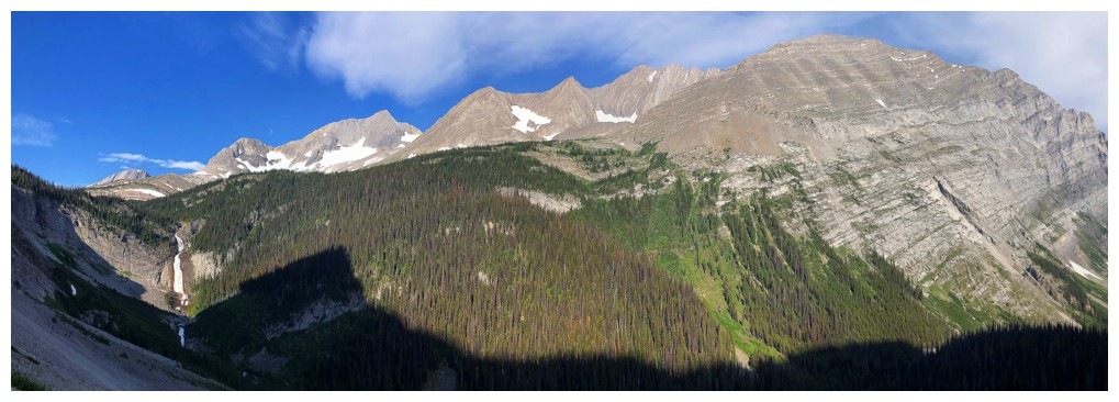
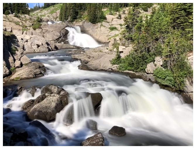
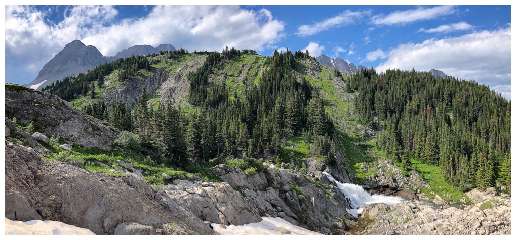
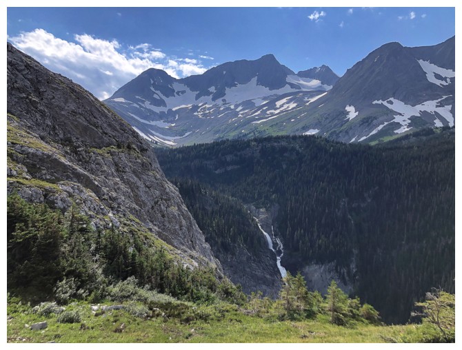
Immense Fossil Falls
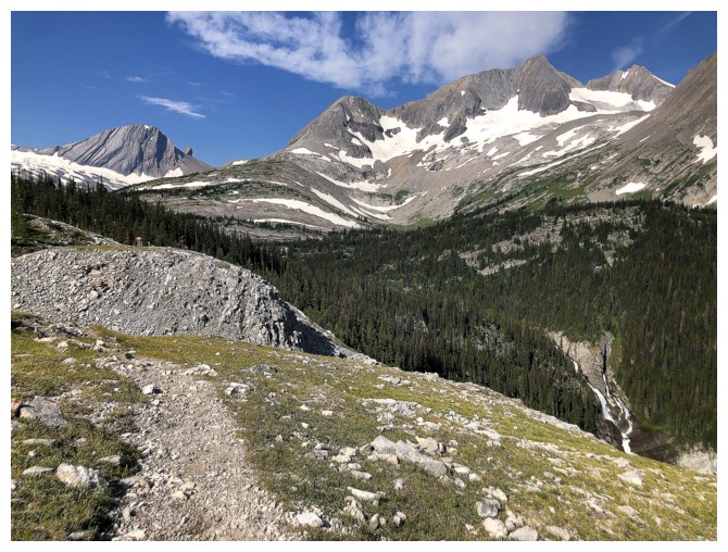
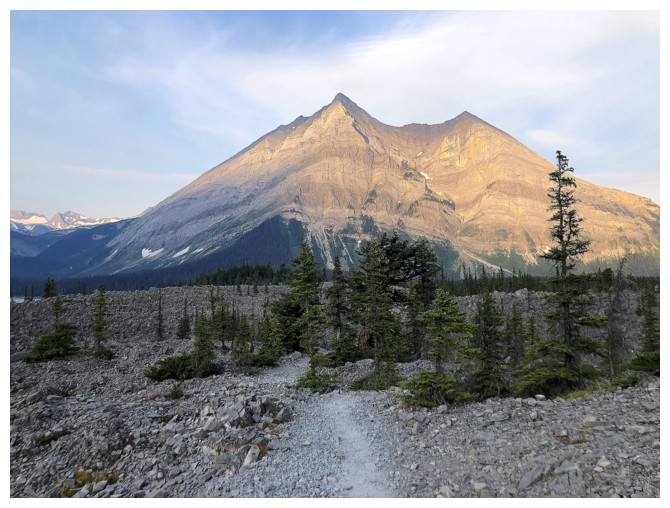
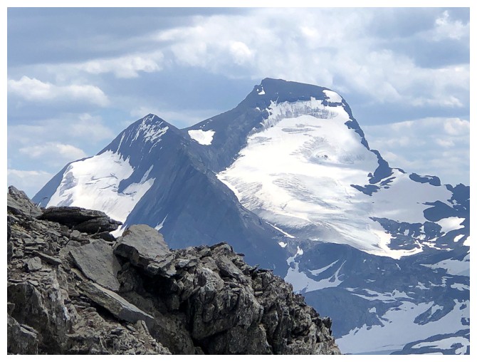
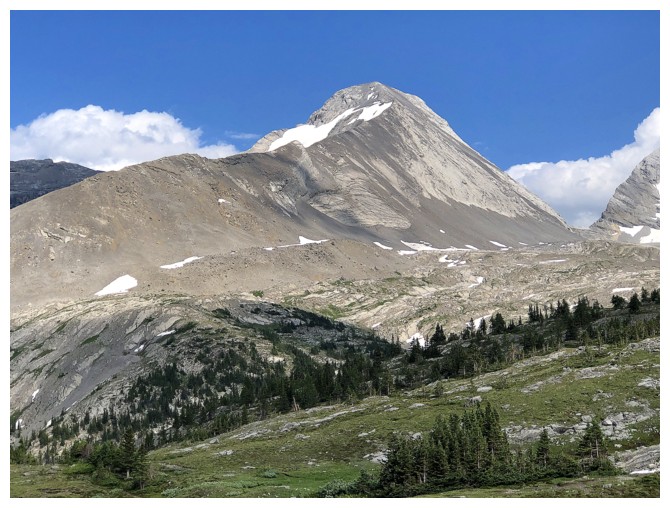
Mount Pushover makes its first appearance
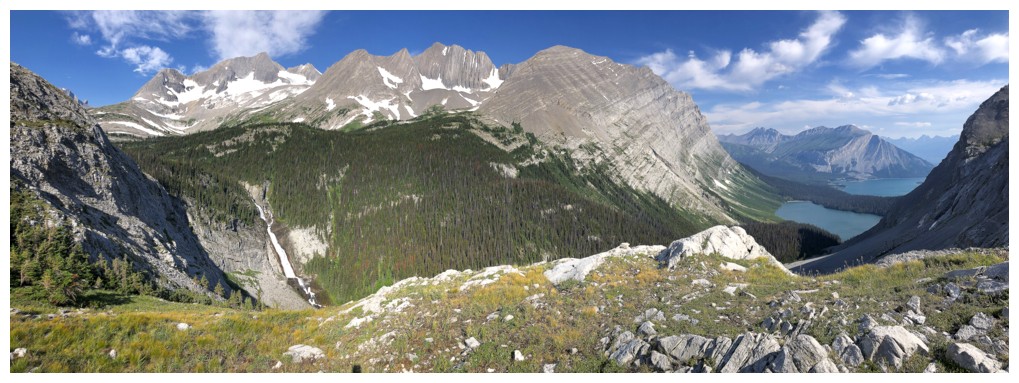
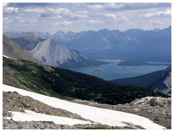
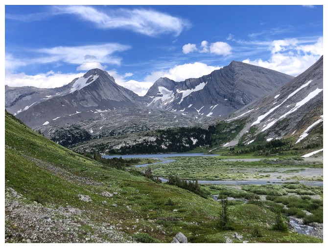
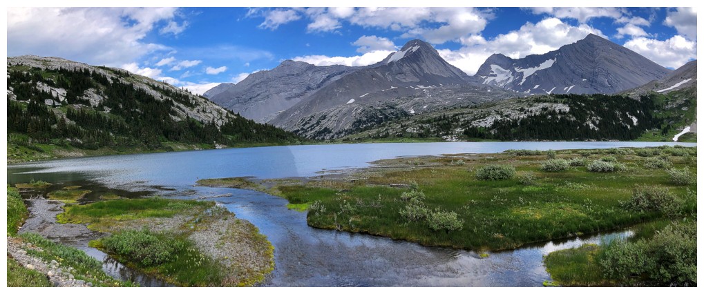
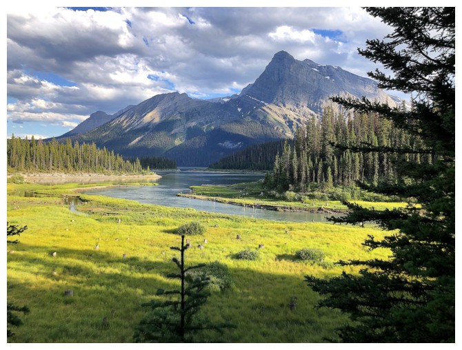
Foch Lake and Mount Marlborough
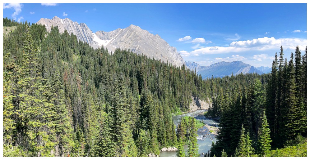
Aster Creek and Mount Lyautey
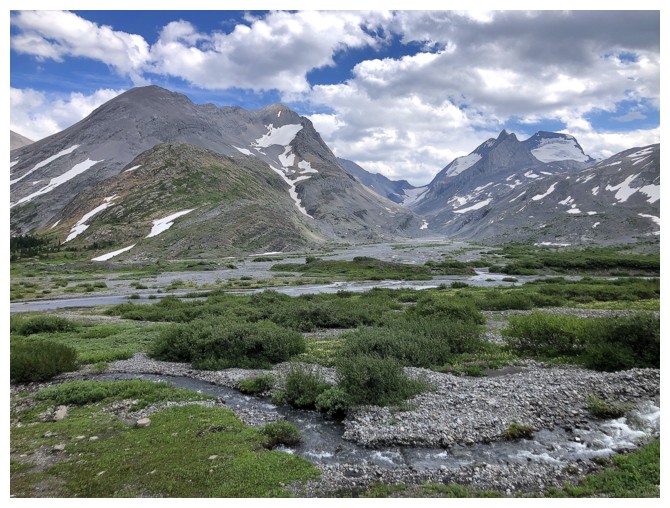
Besides Fossil Falls, Aster Creek creates several smaller falls
Same as above
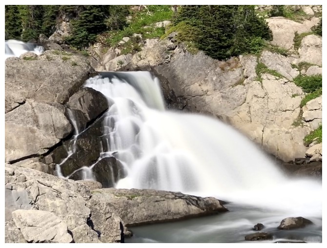
and again
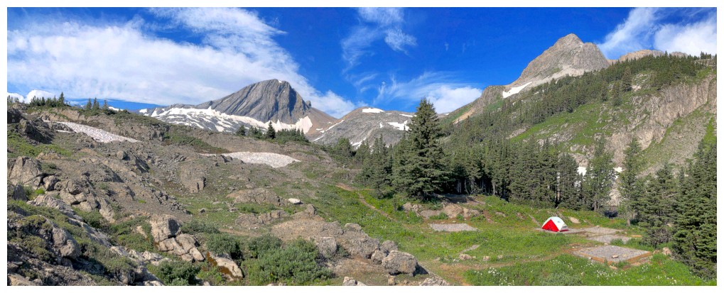
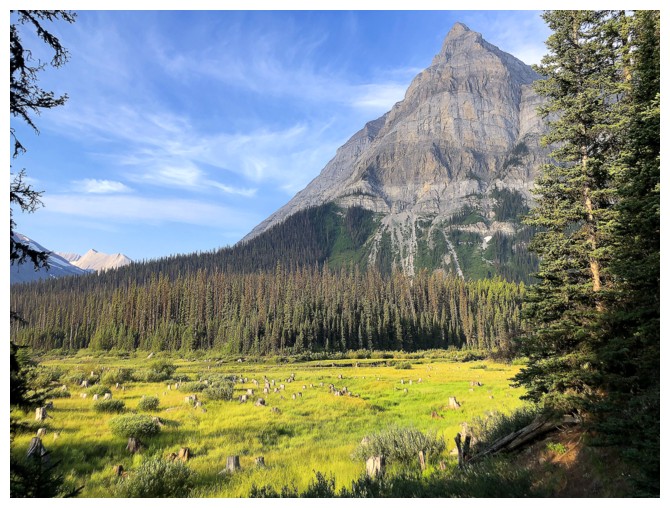
Approaching the Aster Lake Campground
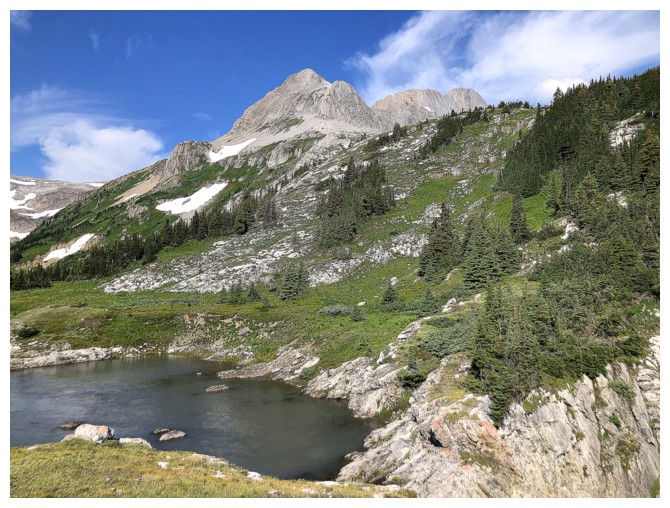
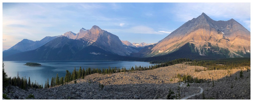
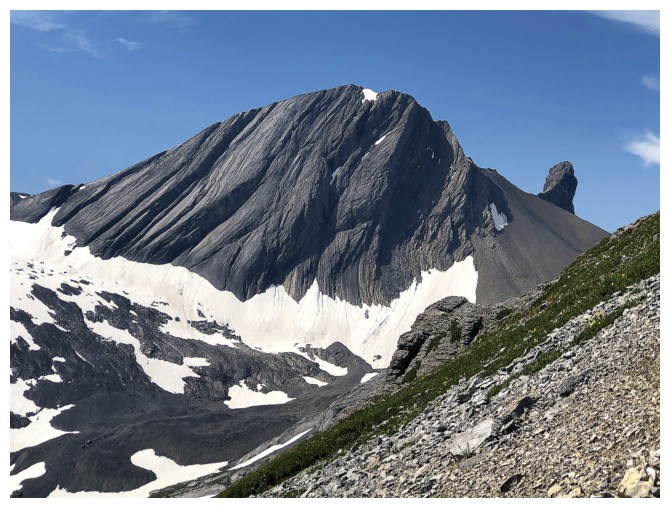
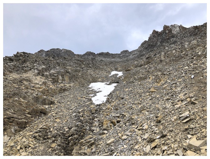
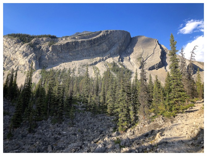
First good look at end of Mount Pushover's south ridge ascent route
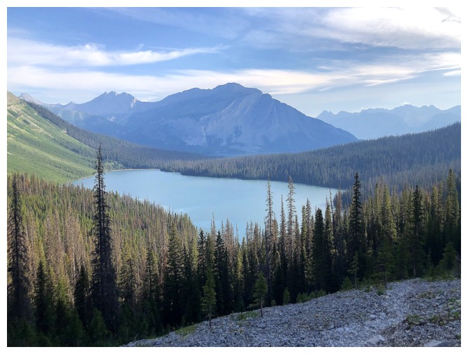
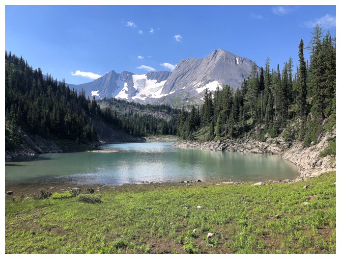
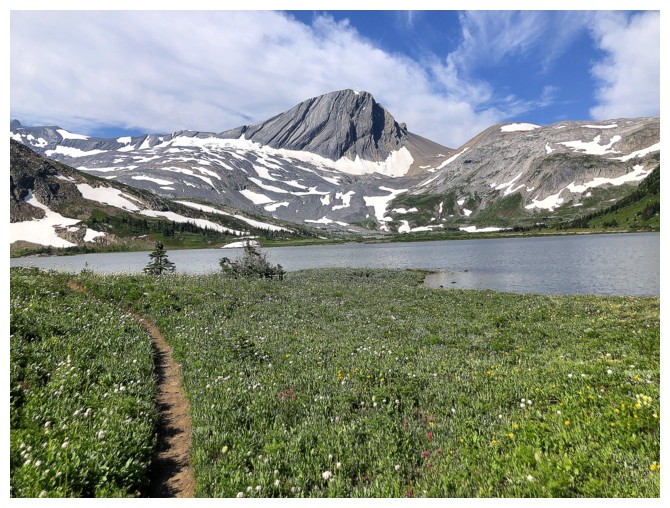
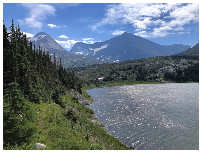
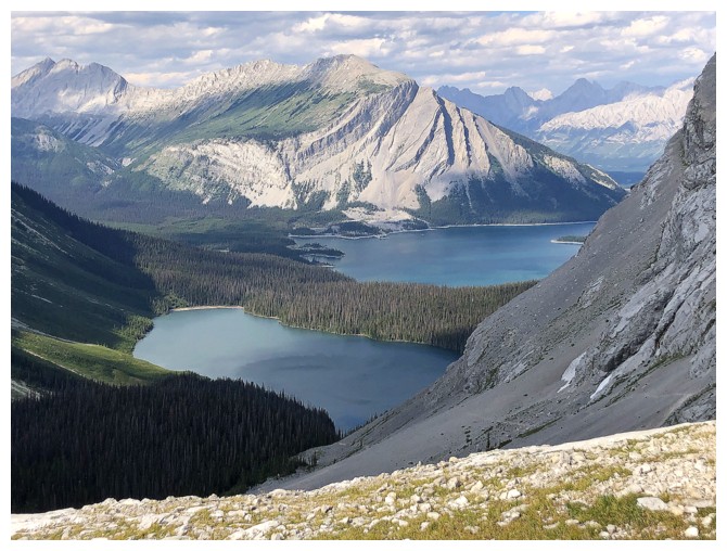
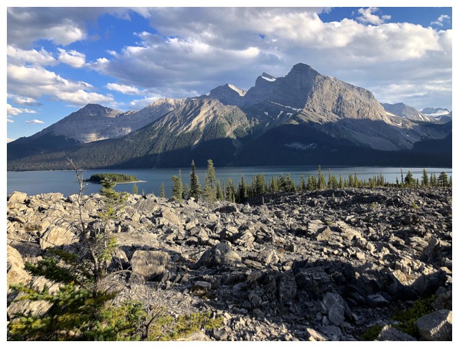
Approaching Aster Lake
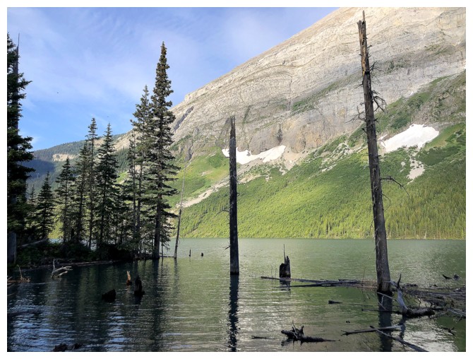
Warrior Mountain sits west of the lake
At the lake outlet and procrastinating what I dislike the most in the mountains: any form of hip-wader-less water crossing!
On the other side of the lake, having recovered from the crossing trauma!
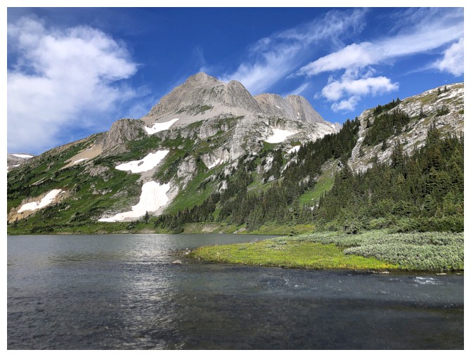
The south ridge of Pushover is dead ahead
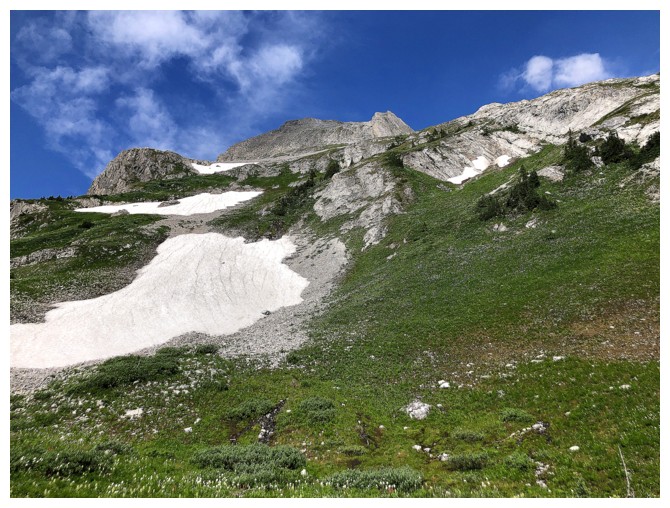
Easy slopes to start with, then some steep stuff to gain the end of the ridge
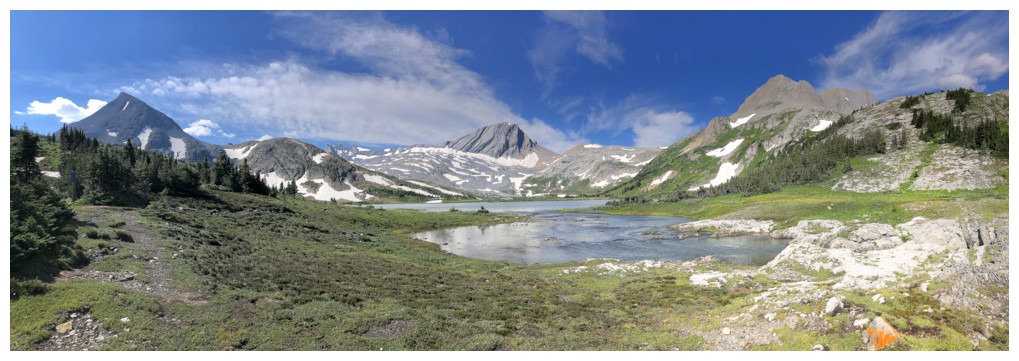
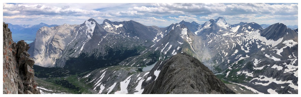
The view is quite remarkable from here on in
...in several directions
Approaching the steep terrain at the end of the south ridge
Looking over to Lyautey
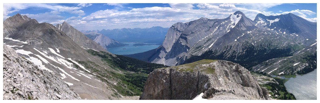
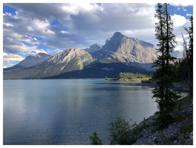
Looking down to the Upper Kananaskis Lake
Warrior Mountain and the distinctive "thumb" named Waka Nambe
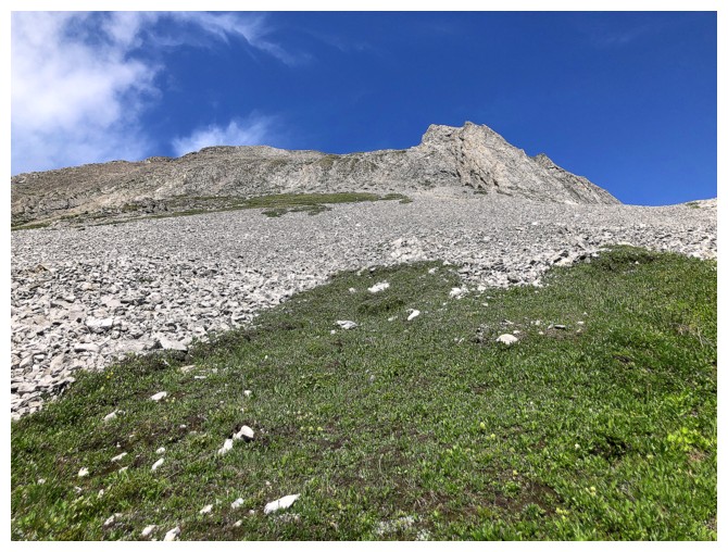
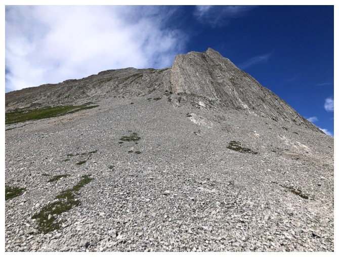
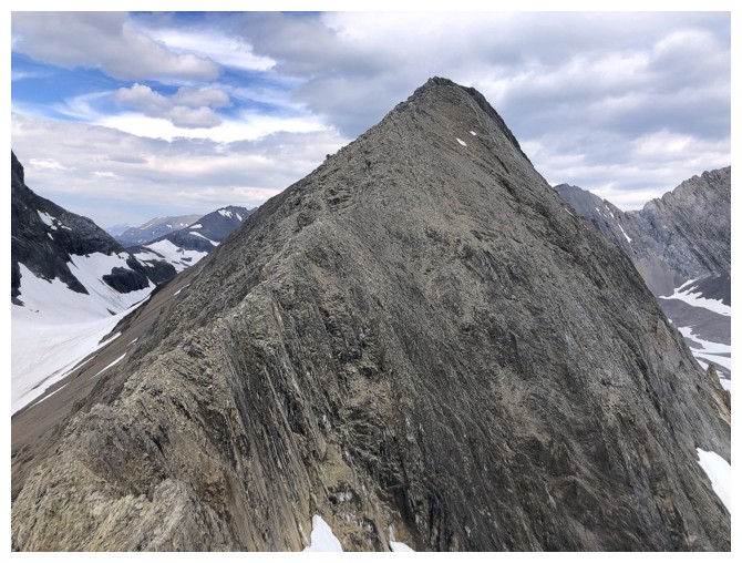
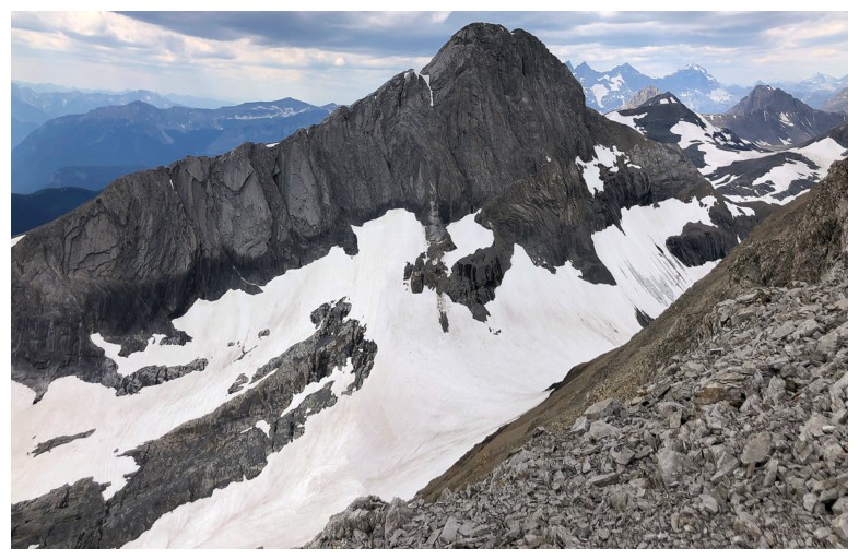
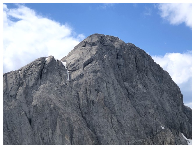
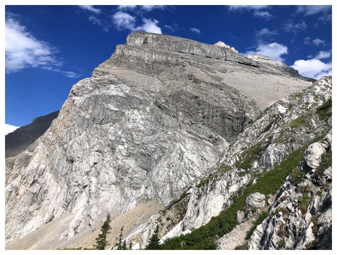
The summit block of Pushover is that dark, ominous thing near the left.
I should have taken note of its foreboding appearance and turned around
here!
A short distance up the south ridge and the view to the east is getting even better
It's looking a little more friendly here
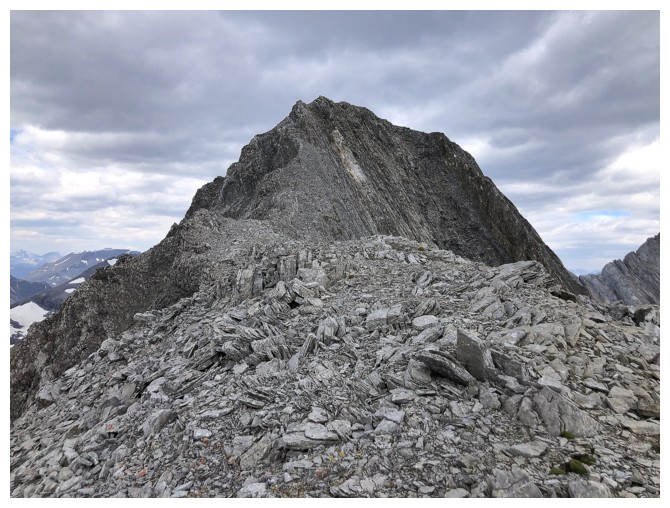
Approaching the challenging section of the ridge
Looking back at some of the difficulties, but there are plenty more to come
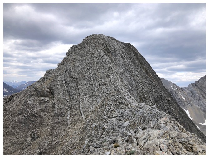
I thought I was home free at this point, but that's a false summit
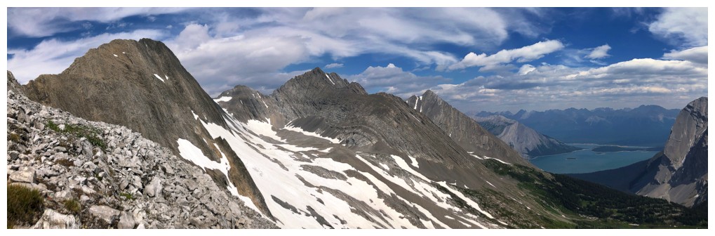
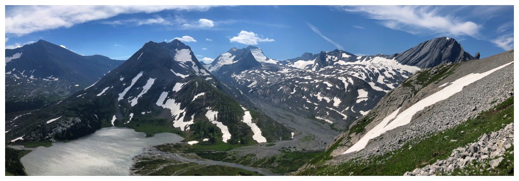
More peaks join the view to the south
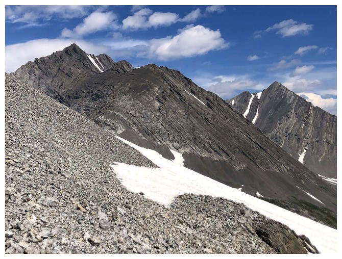
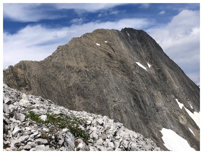
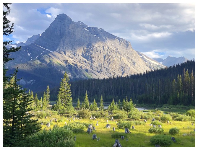
The bulk of Mount Northover
The summit is still a ways off
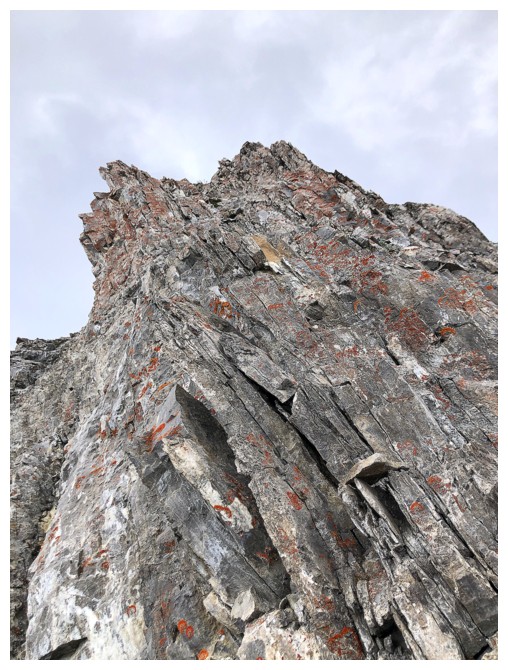
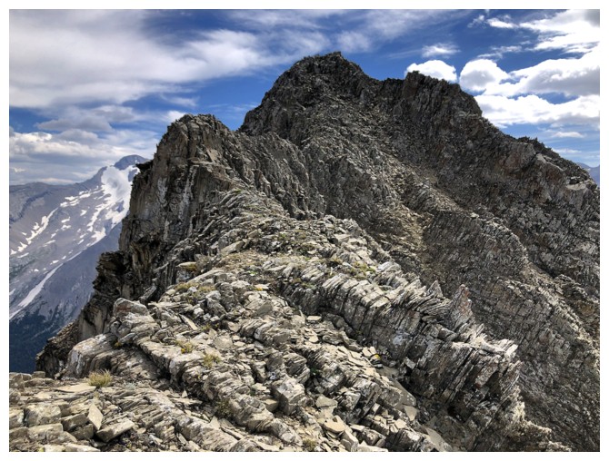
The crux where I backed down. It's more challenging and exposed than appearances dictate.
View from the end of the line for me
Magnificent Mount Joffre
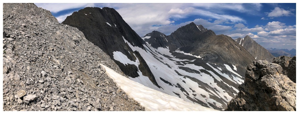
Looking up my descent route
The very challenging upper sections of Mount Northover's south ridge
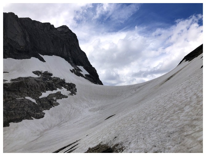
The Pushover/Northover col
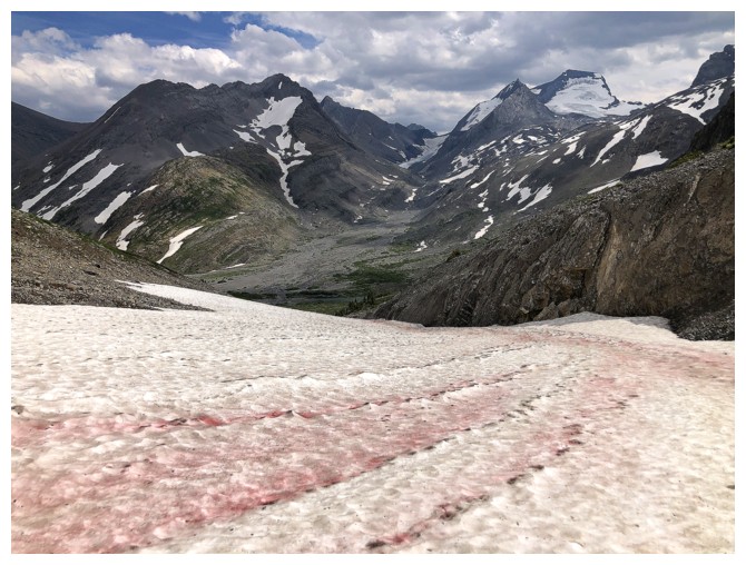
Pink algae on the snow
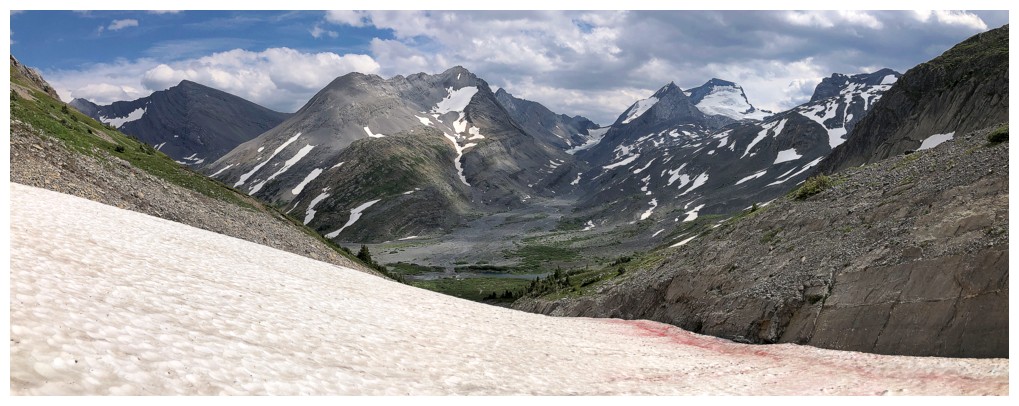
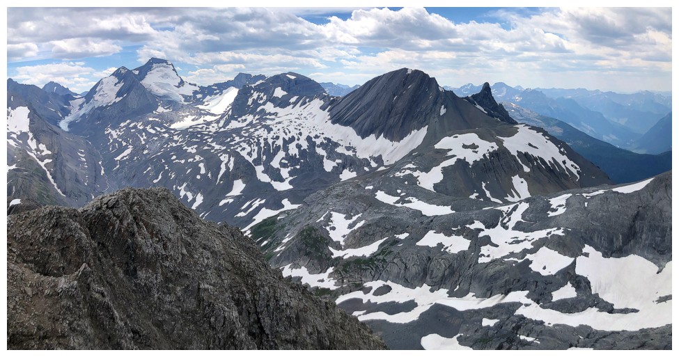
At least the alternate descent route provided different views of the area
Mounts Sarrail (left) and Foch
Mounts Marlborough (left) and Joffre
Following a stream out to Aster Lake
Back at the lake
Mount Sarrail - still on the to-do list
Scenery on the pleasant hike out
...but it's a long way back to the start!
Lots of places begging some exploration
Hidden Lake and Upper Kananaskis Lake posing again
A northern outlier of Sarrail
Parting glance at Pushover and Fossil Falls
Reprise of the beautiful views near
Upper Kananaskis Falls
Same as above
Back to being on the wrong side of the lake!
Mount Indefatigable and the famous Joy climbing route
Thankfully almost back at my bike
The End
LOG