Tombstone
Mountain North
August
7, 2011
Mountain
height: 3035 m
Elevation gain:
approximately
1340 m (for
the route we did)
Ascent time:
10:30
Descent
time:
5:00
Climbing
with Kevin and Raff.
16
killer hours of breath-taking scenery, mind- numbing scree slogging,
exposed
ridgewalking and climbing, and intense debate about the nature of this
magnificent peak.
 Where
is the true summit of Tombstone Mountain in the amazing Opal Range? The
NTS
maps incorrectly identifies the south peak as the summit – a peak that
is
frequently ascended by scramblers because it appears as Tombstone South
in Alan
Kane’s Scrambles. The Green Book
notes this fact and describes the real Tombstone as having two summits,
north
of Tombstone South. By sheer coincidence both summits were first
reached on the
same day in September of 1975.
Where
is the true summit of Tombstone Mountain in the amazing Opal Range? The
NTS
maps incorrectly identifies the south peak as the summit – a peak that
is
frequently ascended by scramblers because it appears as Tombstone South
in Alan
Kane’s Scrambles. The Green Book
notes this fact and describes the real Tombstone as having two summits,
north
of Tombstone South. By sheer coincidence both summits were first
reached on the
same day in September of 1975.
The
three
of us set out to ascend the highest point of Tombstone, wherever that
may lie.
 We brought along Rick Collier’s route description as a potential ascent
route.
We brought along Rick Collier’s route description as a potential ascent
route.
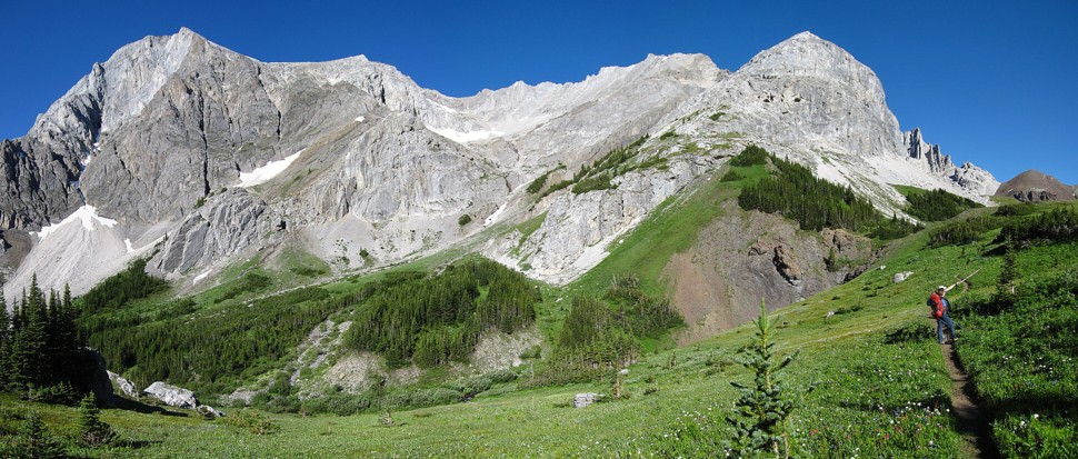
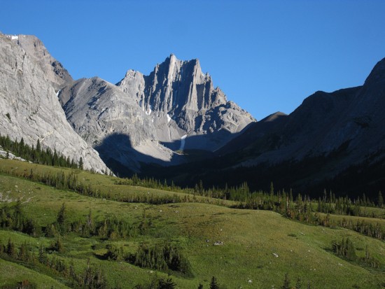
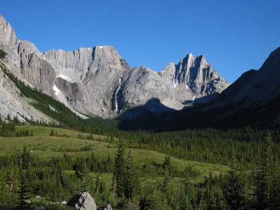
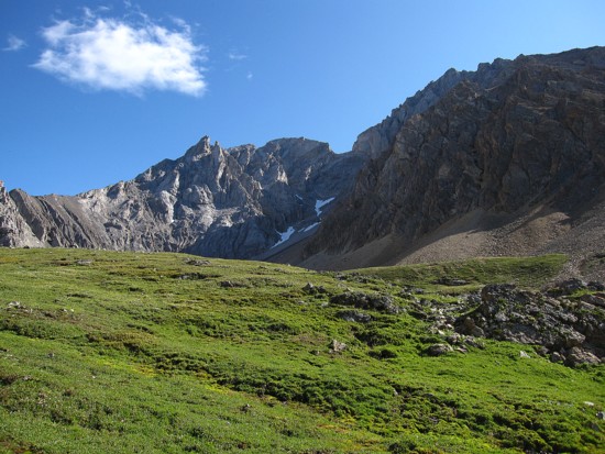
The
highlight of the day for me came early when we emerged from the trees
into the
upper Piper Pass valley (unmarked valley between Elpoca Mountain and
Tombstone
Mountain). The scenery here was astonishing: the rugged light grey
walls of
Elpoca, Schlee, and Jerram, green, grassy meadows, and of course a
perfectly
blue sky. At the pass a line of delineation separating the limestone
from a hump
of brown coloured rock (not sure what it was but seemed way too hard to
be
shale) was remarkable. Thankfully we were all in need of a food break
at this
point and therefore had tons of time to soak in this gem of a valley.
En
route to the Piper Pass, we had decided to try a variation of a known
route.
The first ascent party had used the west ridge to achieve the north
summit. Our
goal would be to descend the north side of Piper Pass, gain the north
ridge of
Tombstone and follow it to the summit. This would probably intercept
the west
ridge route at some point.
Upon
reaching the Piper Pass col, one really smart member of the group
decided that
tackling the west ridge immediately was a good idea. The other two
descended
easily to a small but pretty lake and started towards the north ridge.
Needless
to say, the smart guy was repelled by the wildly tilted strata of rock
layers
characteristic to peaks of the Opal Range and had to return all the way
to the
col and then down to the lake. (I won’t embarrass the smart guy by
identifying
him, but suffice it to say he has a very pleasant perma-tan, courtesy
of his
Sri Lankan father.)
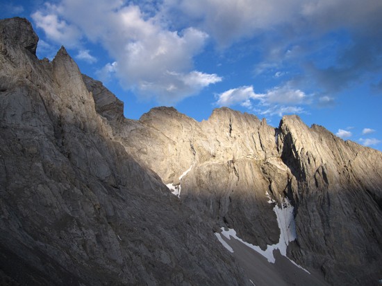
The
toughest and still controversial aspect of Tombstone Mountain now
reared its
multi-pronged head (pun intended). Where is the summit? Like its other
Opal
Range counterparts, Tombstone is a series of pinnacles and towers,
separated by
huge notches and gaps and connected by deathly narrow ridges. From our
present
vantage point, ascertaining which tower was the highest was next to
impossible.
 At the first, it looked like the one right in front of us, but that
hope
quickly vanished when Kevin traversed a ledge to discover that it
wasn’t even
close. However, the true summit now appeared to be only a short
distance away.
At the first, it looked like the one right in front of us, but that
hope
quickly vanished when Kevin traversed a ledge to discover that it
wasn’t even
close. However, the true summit now appeared to be only a short
distance away.
The
distance was short, but the time needed to get there far from it. The
intervening ridge between us and the summit was narrow in places, loose
(big
surprise there!), and went up and down like a yo-yo on amphetamines!
Raff
expertly led and ridge until it ceased to be scrambling and graduated
to
climbing. Kevin stepped up here and set up a rappel to get down to a
scree bay
in front of the summit block. 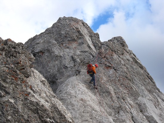 The east side of the mountain here was
viciously
overhanging. As Kevin quaintly put it, “You fall here and the first
thing
you’ll hit is the Little Elbow River, 800 vertical metres below!”
The east side of the mountain here was
viciously
overhanging. As Kevin quaintly put it, “You fall here and the first
thing
you’ll hit is the Little Elbow River, 800 vertical metres below!”
After
the rappel, Kevin led the only pitch of climbing to the summit. He
belayed Raff
and me up and another conversation ensued. This definitely appeared to
be the
true summit, but one tower to the south looked to be of equivalent
height. Mr.
Collier said the true summit was the northern most tower and we were on
it. A
single rock cairn on the narrow highpoint seemed to confirm this.
Congratulations
were extended and we stayed awhile to enjoy a totally awesome summit
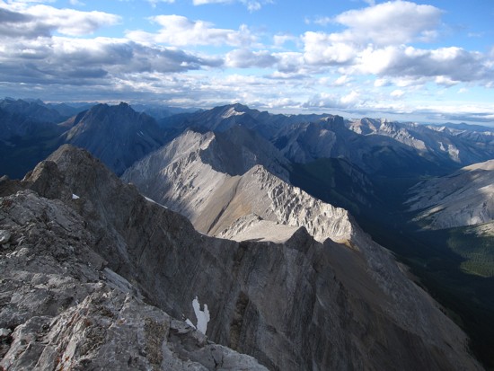
panorama. The superior height and strategic location of Tombstone granted us
unobstructed
views in all directions. The east side of the main Opal Range peaks was
jaw-dropping.
Although
we hoped an easier descent would present itself, the south ridge looked
terrifying and we quickly decided to return the way we came. This
turned out to
be considerably faster and easier than on ascent. Back at the west
ridge the
decision was made to try to descend slopes north of the ridge and then
escape
down the south side of the mountain, thus avoiding the 240 m elevation
gain
from the lake to Piper Pass. We rolled the dice and fortunately won.
The route
worked magnificently, shaving a good 45-60 minutes off the return
journey.
The
last couple of hours of the day were a little mind-numbing and the
trail seemed
to drag on forever, however, at least there was a trail to follow
throughout most of the descent. 16 hours after leaving the car we
arrived back
at it. Raff, having completed an 11 hour ascent of Mount Inflexible the
day
before was pretty tired, I was a complete basketcase (due to other
circumstances of the day), but Kevin seemed to be brimming with energy.
A
very, very cool day in the mountains with the best of company and
climbing
partners.
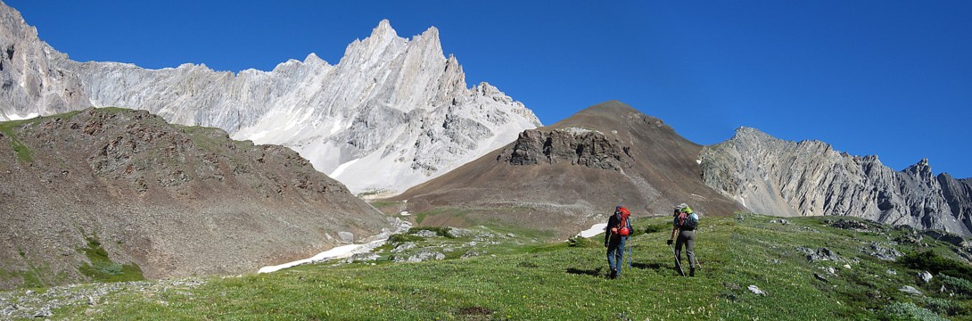
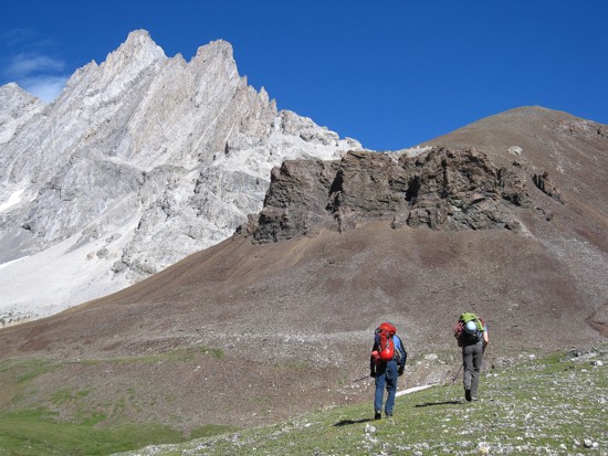
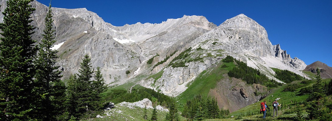
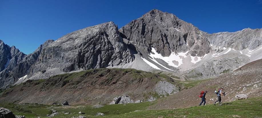
 Raff and Kevin on the trail with Tombstone South ahead
Commonly refferred to as "Cat Ears", these peaks are the southern outliers of Mount Jerram
Cat Ears and Mount Schlee (left)
Raff tries to dry out his socks after an unexpected dip in Piper Creek
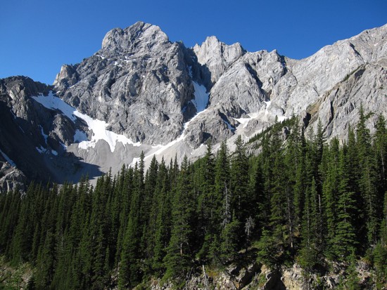
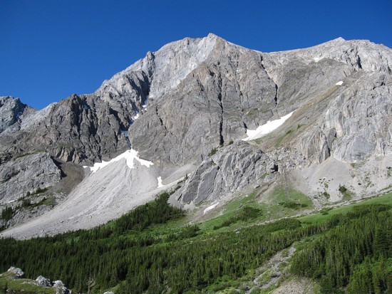
The northeast side of Elpoca Mountain
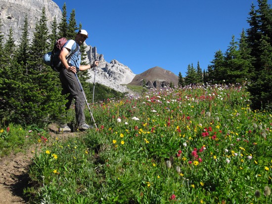
Kevin enjoys the late season flowers
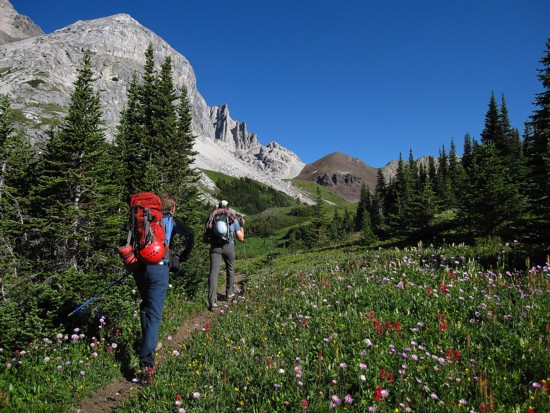
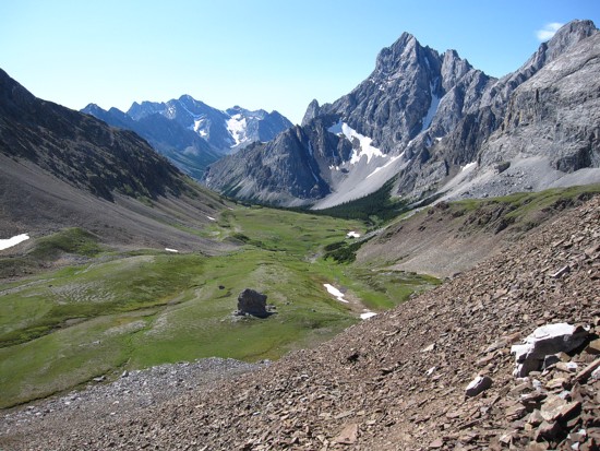
Entering Paradise; this was my favourite part of the trip
The amazing delinaetion of rock, east of Cat Ears
More of Elpoca's north ridge
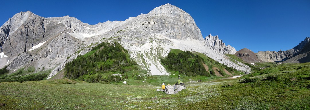
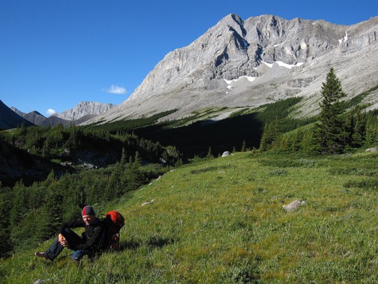
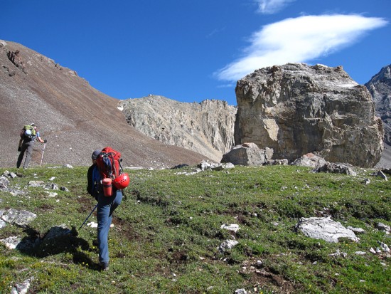
Taking in food and the magnificent scenery
On the go again
More great scenery
Cat Ears definfitely commanded much attention
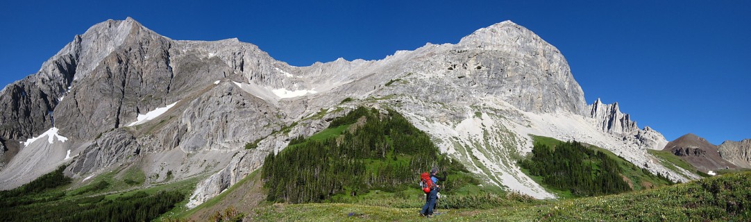
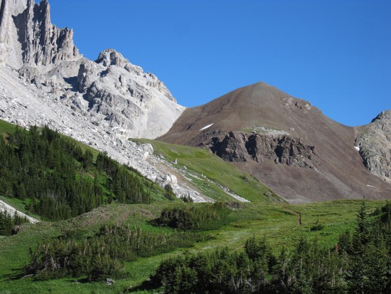
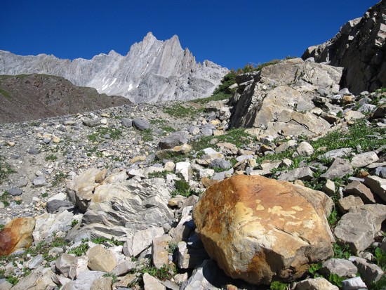
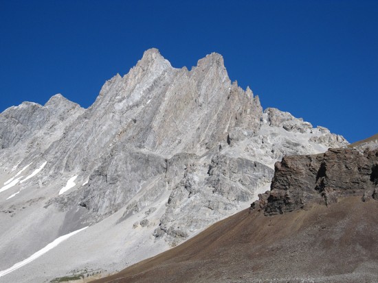
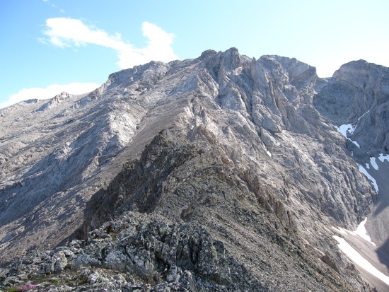
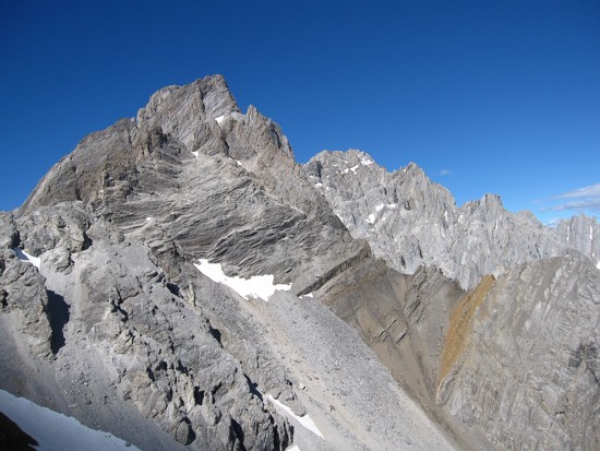
The west ridge of Tombstone North (left)
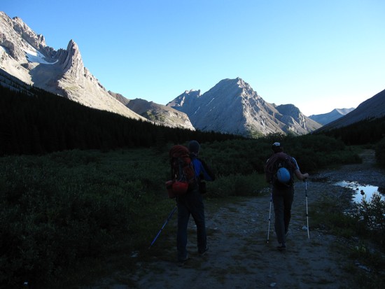
The boys hike past Mount Schlee
You know what again!
A huge boulder that Kevin has bouldered on before
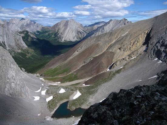
Looking back at the ascent valley and Elpoca
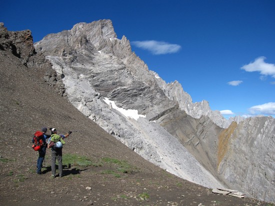
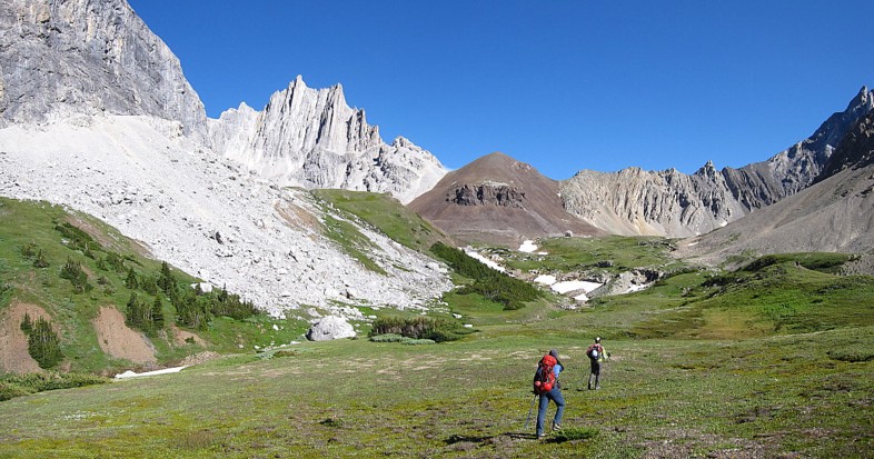
Hiking to the col; the summit is the flat looking section, right of the pointed pinnacle, just right of centre
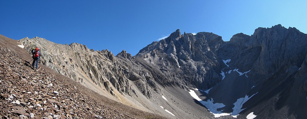
Looking up the west ridge from the col; it looked straightforward to somenone!
On the west ridge, looking down to the tarn
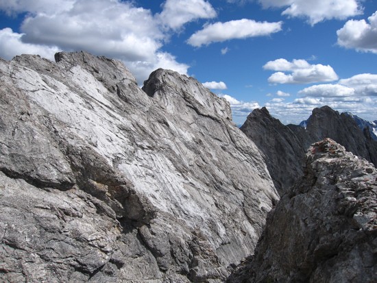
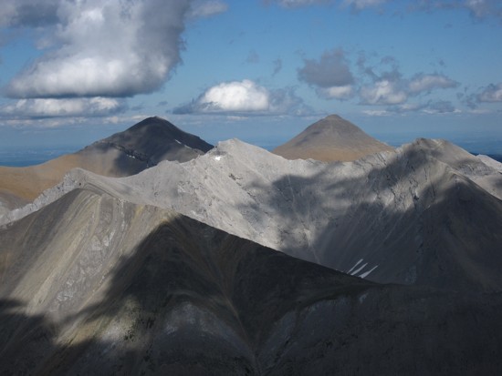
Mount Jerram (left ) and other wonderful peaks of the Opal Range
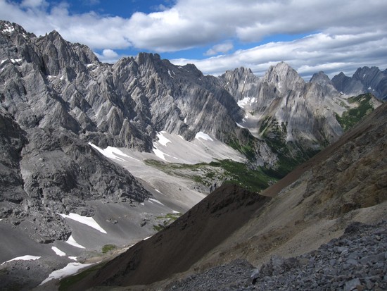
Same as above; from left to right: Jerram, Burney, Unnamed, The Blade and Blane, Brock, Hood, and Packenham
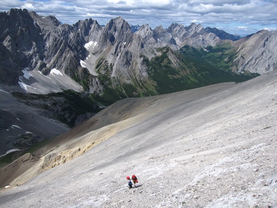
Raff on the tedious northwest slopes of Tombstone
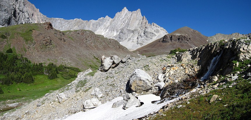
Ripsaw
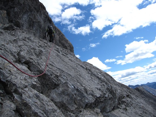
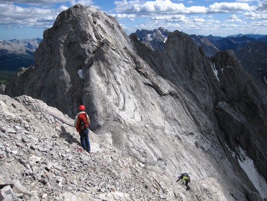
Kevin leads the way across an easy ledge
Around the corner is this scene; the summit is in the centre
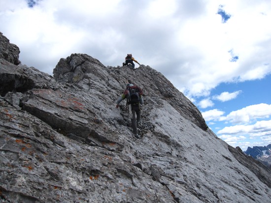
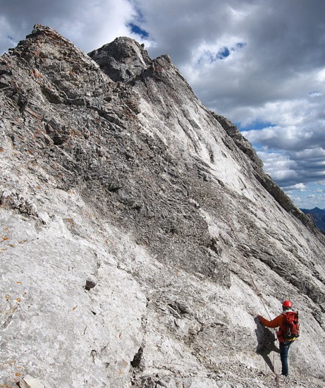
Raff leads the exposed ridge
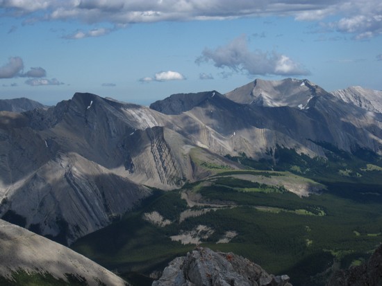
Views to the southeast
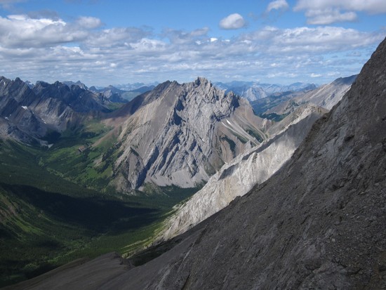
Outlaw (left) and Banded Peak
Raff belays Kevin down to check out the terrain
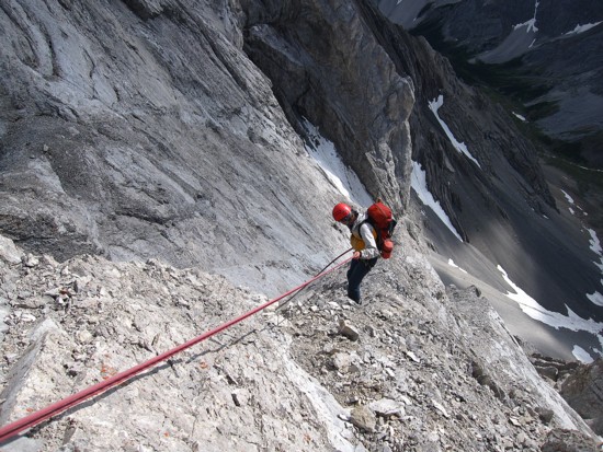
Raff raps
Kevin at the summit (sticking out to the right of the summit block) setting up a belay station
Raff heads up
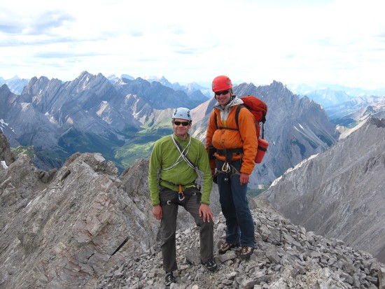
Happy people at the top
The view to the northeast
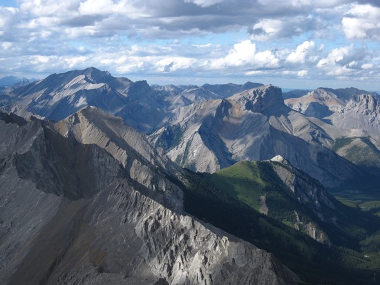
The summit ridge and view to the south
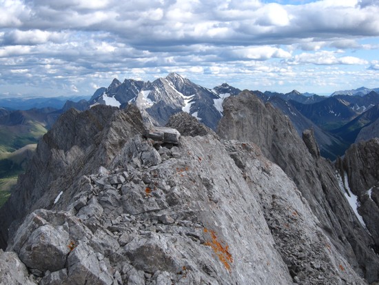
The continuation of the Tombstone ridge to the north
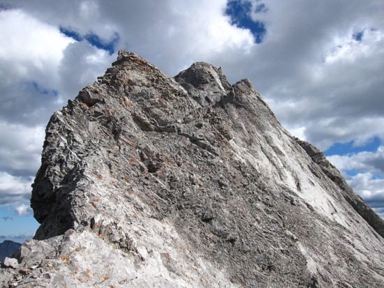
A last look at the summit ridge of the objective
LOG