Avion Ridge III
and exploration
October 2, 2022
Mountain height: 2420 m
Elevation gain: approximately 1200 m
Roundtrip time: 7:10
Solo scramble.
24 hours after bailing on this trip
because of a series of self-induced blunders, I was back at the trailhead to
try again. The goal of trip was to reach a minor outlier of Avion Ridge right
above Goat Lake via a drainage west of the Goat Lake Trail. That route was a
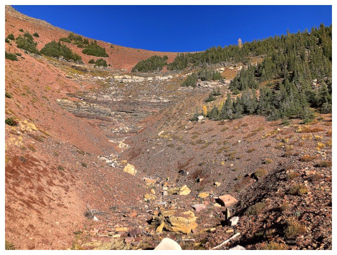
bust, the drainage looking way too waterfall-like to offer a scramble route up.
Plan B: a much longer and circuitous route to the outlier via the normal route
up Avion Ridge.
When all was said and done, I didn’t
make the summit of the outlier. However, I did get to see a staggering amount of
jaw-dropping fall scenery and a glut of stunning yellow larches.
Highlight #1: Goat Lake. The lake,
backdropped by a most visually captivating outlier of Avion, is phenomenal with
clear skies. With clear skies and fall colours the lake went next level –
breathtaking!
Highlight #2: The northeast outlier of
Avion. This outlier is equal in height to the true summit and boasts a view as
impressive as that from its counterpart. I had planned on hitting this summit
on return by taking the hiking trail that bypasses it, but when it comes to
missing a great view in order to save a few metres of elevation gain
“resistance is futile”! My head said stick to the trail, but my feet went up
instead of across.
Highlight #3: The field of yellow
larches between the outlier and the true summit. I envisioned it would be good
but not this good! Larches galore and ample opportunity to see then from afar
or close-up.
Highlight #4: The view from the true summit.
With clear skies this view never disappoints.
Highlight of the day: After visiting
the true summit, I descended the ridge to the southeast and then went down into
the valley between the summit and the north outlier – initially down the edge
and then right through the thick of the golden trees. The fall colours here
were magnificent.
Now late into the trip I was finally
able to set my sights on the original objective. Unfortunately, instead of
staying low and trying to get to the summit from the southwest side, I decided
to gain the ridge northwest of the summit. Hopefully there would be a weakness
in the obvious notch between the ridge and the summit along that route. There
was in fact a weakness, but it was at the high-end of my downclimbing ability.
A slip would have had serious consequences and so I conceded that summit would
not be seeing me today. I also passed on a very tempting potential shortcut route down to
Goat Lake, recalling a recent recon in that area that ended up on very sketchy
terrain.
The remainder of the trip involved
regaining the summit of the northeast outlier and then the standard long but
scenic route back to the parking lot via Goat Lake.
An unexpectedly awesome day out with
amazing fall colours. I’ll be back someday with a short rappel rope to
complete the unfinished business.
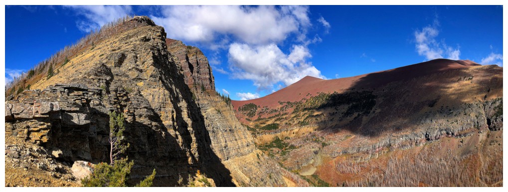
The
Sun hits the objective of the trip. From this angle it appears to be a
significant summit, but is merely a minor bump at the southeast end of
the northeast outlier of Avion.
More Sun and the better look at the serious southeast side of the bump
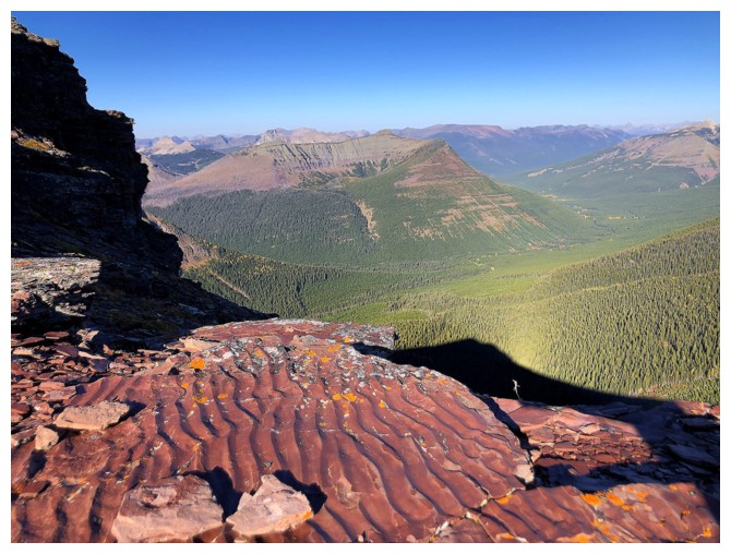
Across the valley sit Anderson Peak, Kootenai Brown Peak and Mount Bauermann - all pat of a wonderful traverse
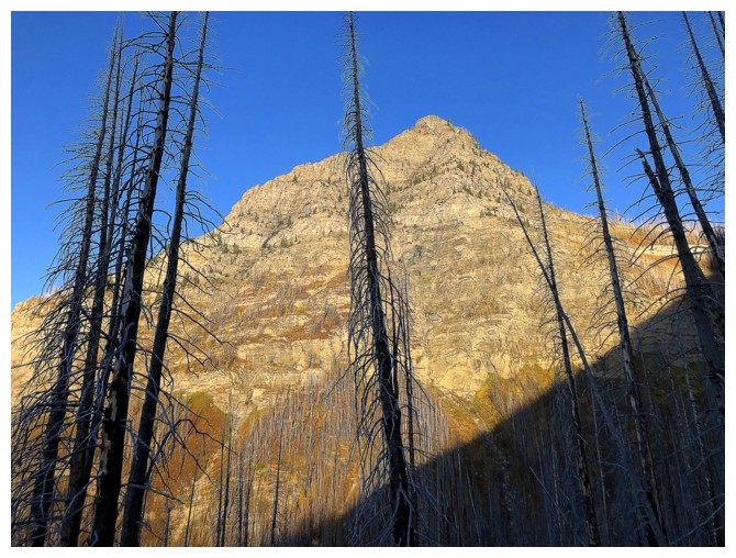
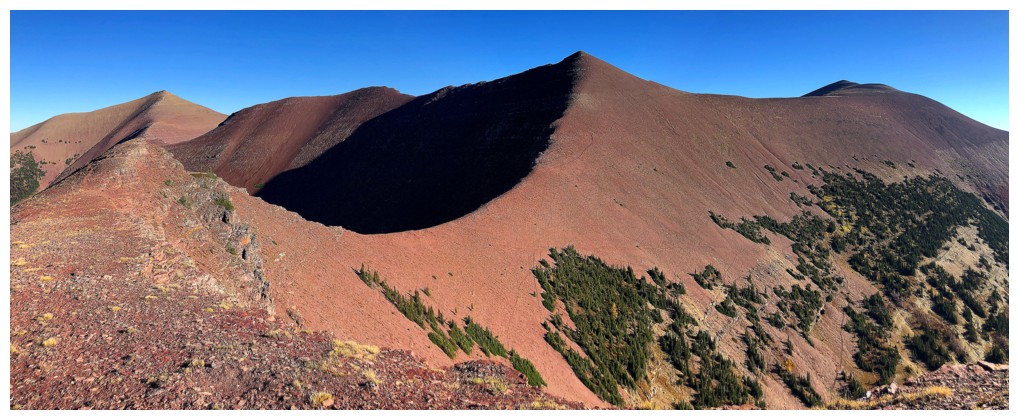
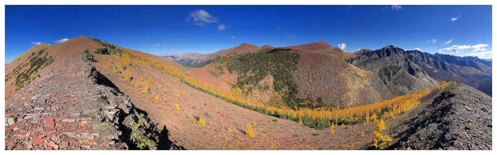
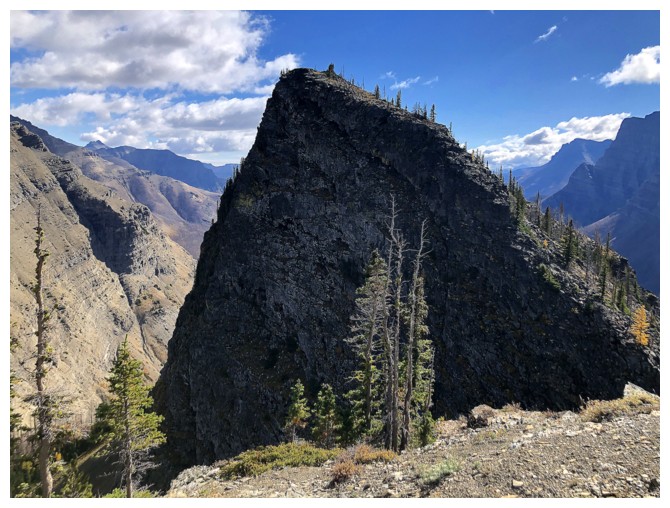
The
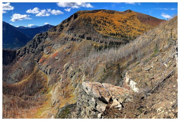
objective (we'll call it "Goat Peak" for the purposes of this report)
at the left and the super colourful northeast outlier of Avion Ridge
(let's go with "Avion's Brother") at the right
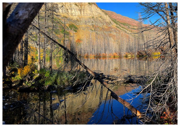
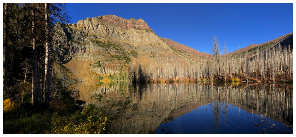
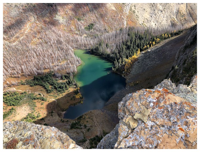
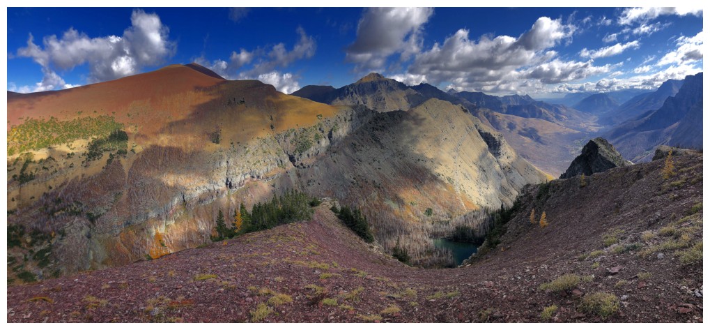
Approaching Goat Lake and I can already tell it's going to be a stunner!
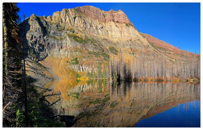
Fall colours, amazing rock colours, and lake reflections - perfect!
A
few weels earlier I tried to ascend terrain near the left to gain the
end of the ridge. I ended up on some pretty intense terrain and backed
down.
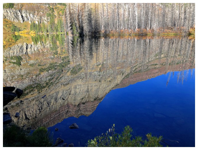
The reflections were as gratiying as the actual object
Same as above
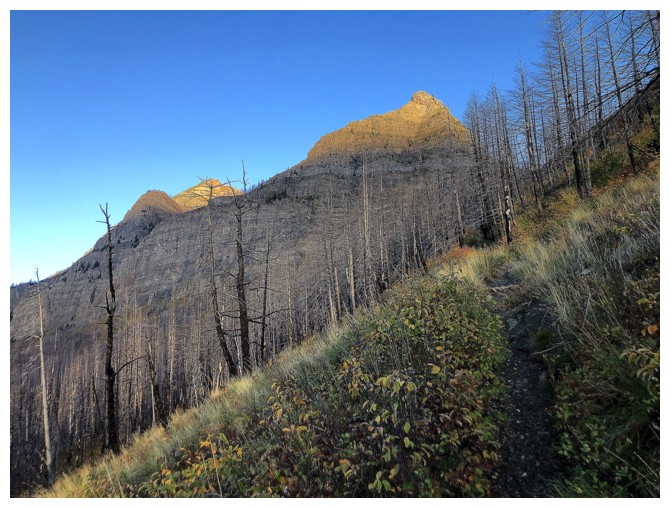
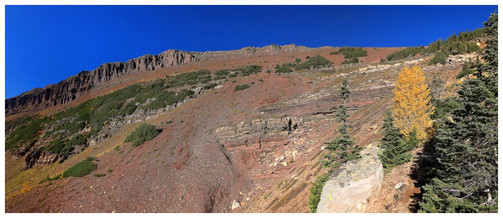
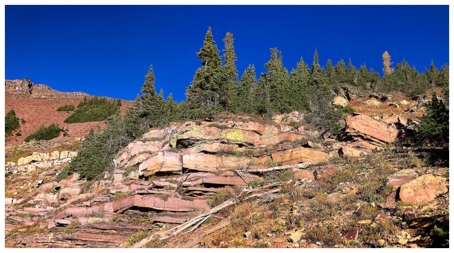
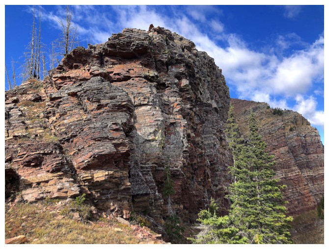
On the trail to the Avion/Newman col and seeing the first signs of red argillite
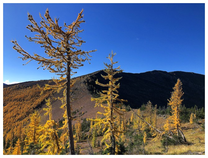
A few solitary larches dot the valley
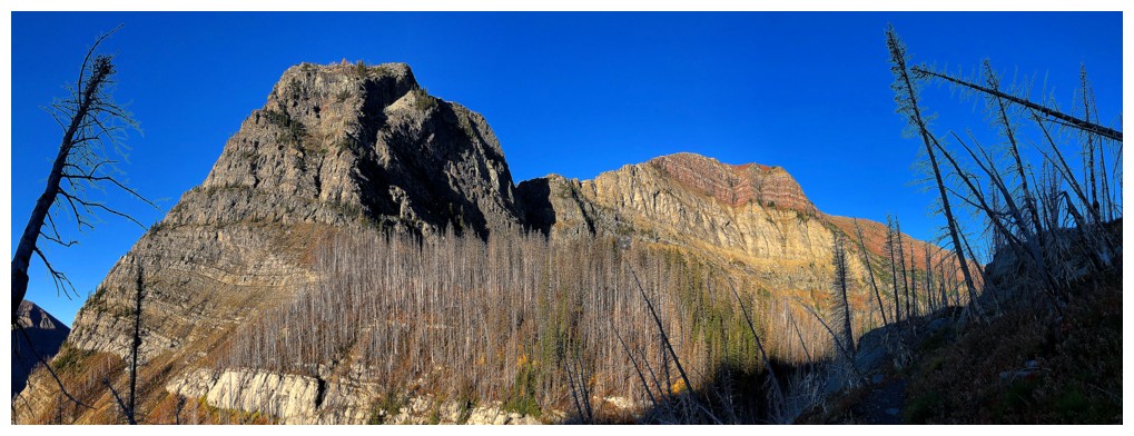
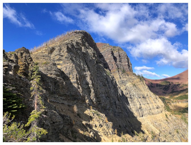
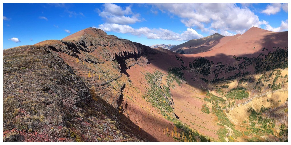
Avion's
Brother. After bailing on that sketchy route a few weeks earlier,I
traversed under the rock lining the summit ridge to a point near Goat
Peak.
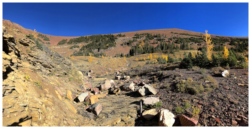
The trail goes far right at this point, but it is far more interesting to follow the drainage up to the col
Another solitary larch
And another with some the cool and colourful rock in the drainage
At the col. The trail goes around here at the right. Following the ridge takes you to Avion's Brother.
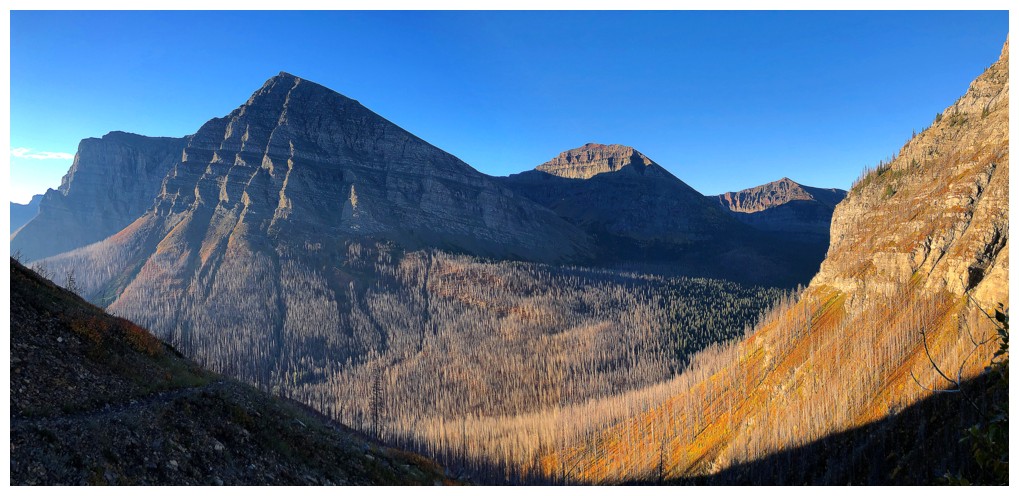
Looking back to Newman Peak at the right
Red ripple rock and Sage Mountain
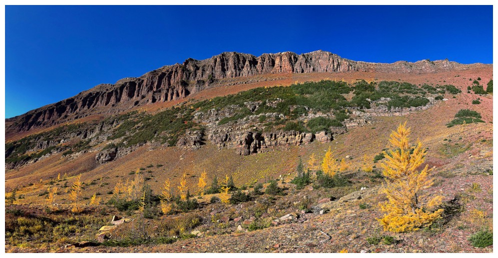
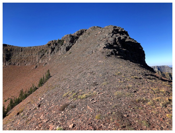
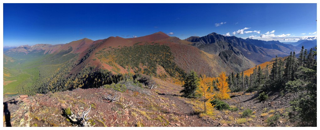
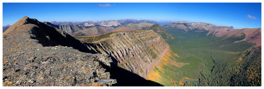
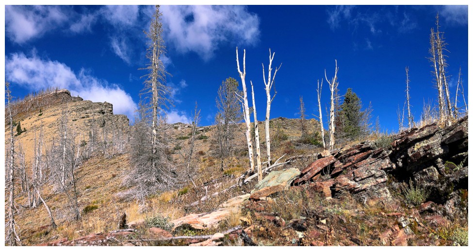
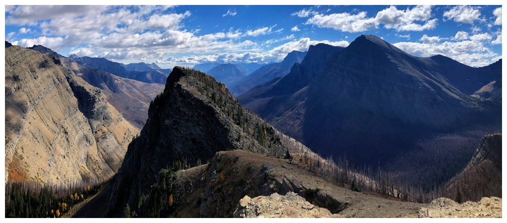
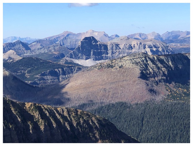
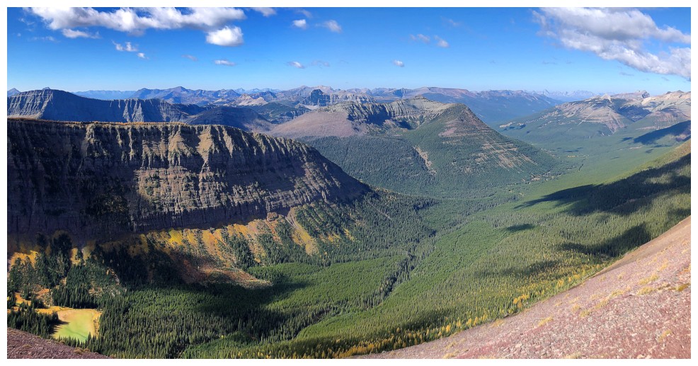
The summit of Spionkop Ridge provides perhaps the best viewpoint in The Castle
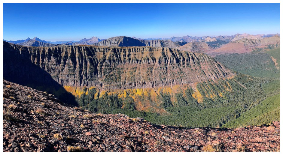
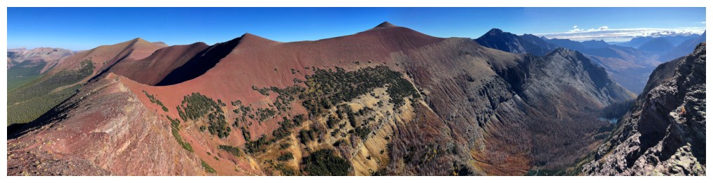
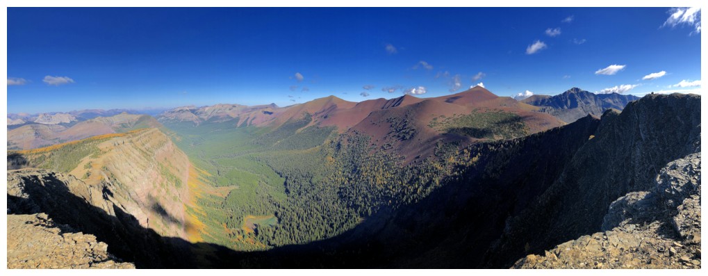
The ridge in the foreground extends northwest from the true summit of Avion
Spionkop, Newman Peak, and Newman Senior
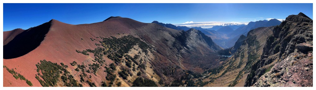
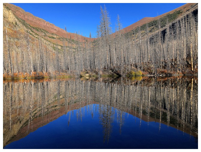
The Goat Lake approach valley between Newman and Avion's Brother
Summit view to the southwest
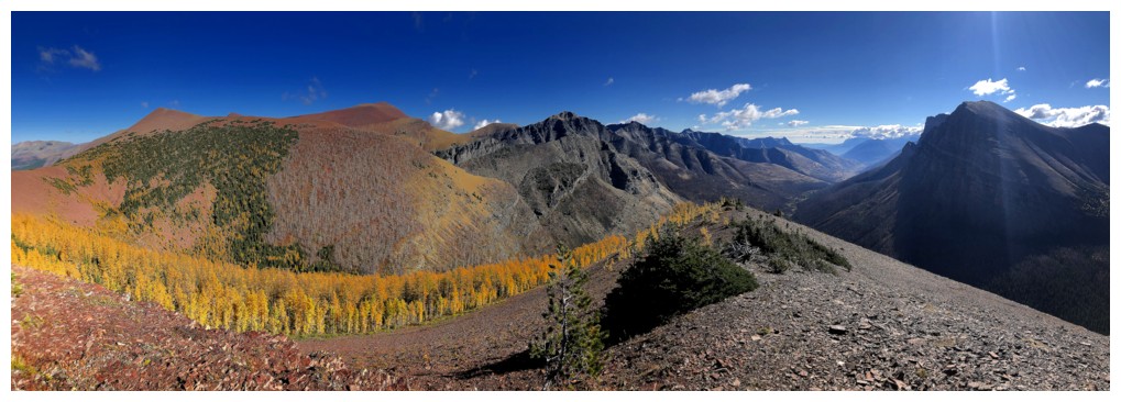
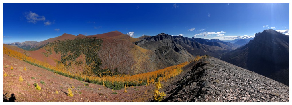
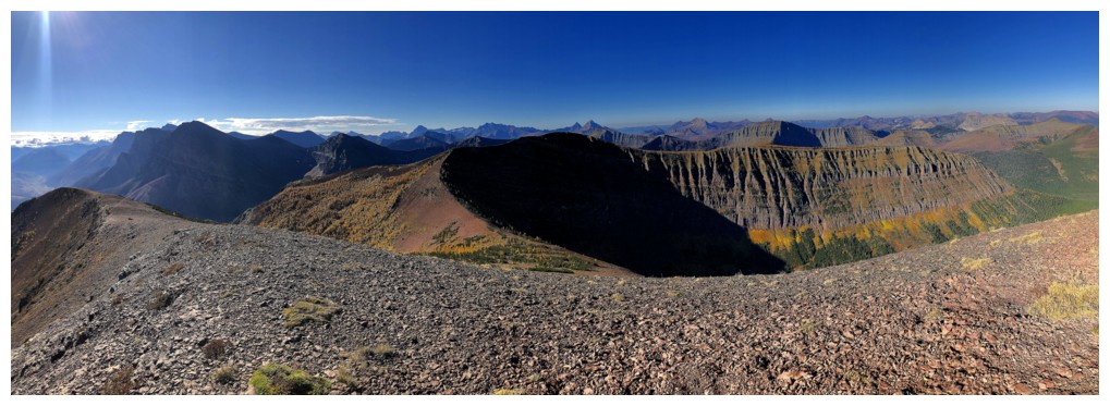
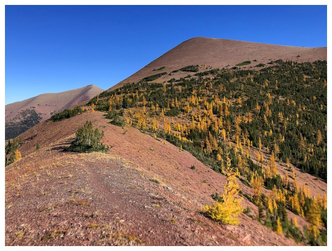
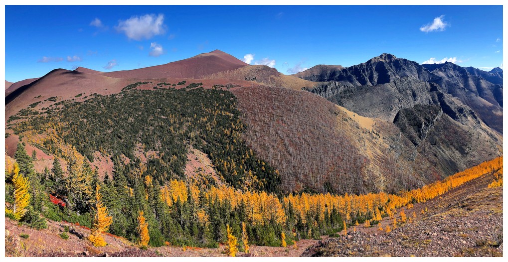
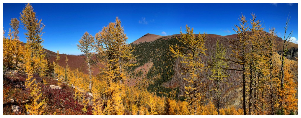
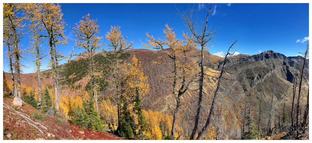
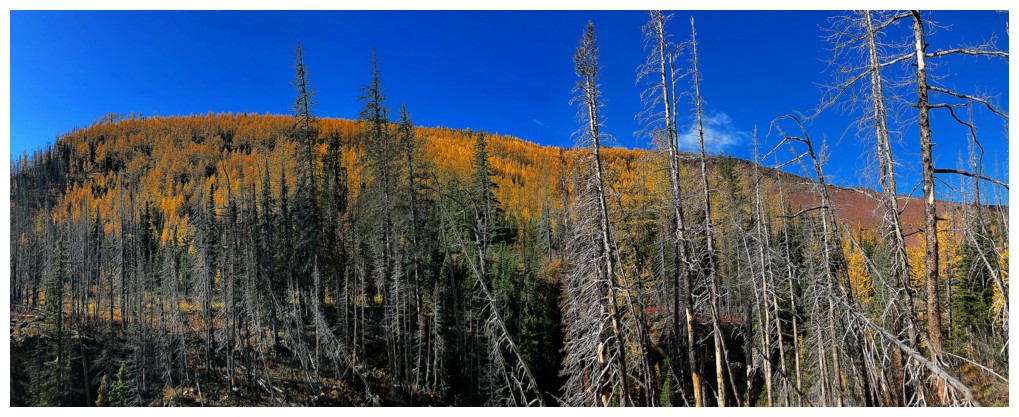
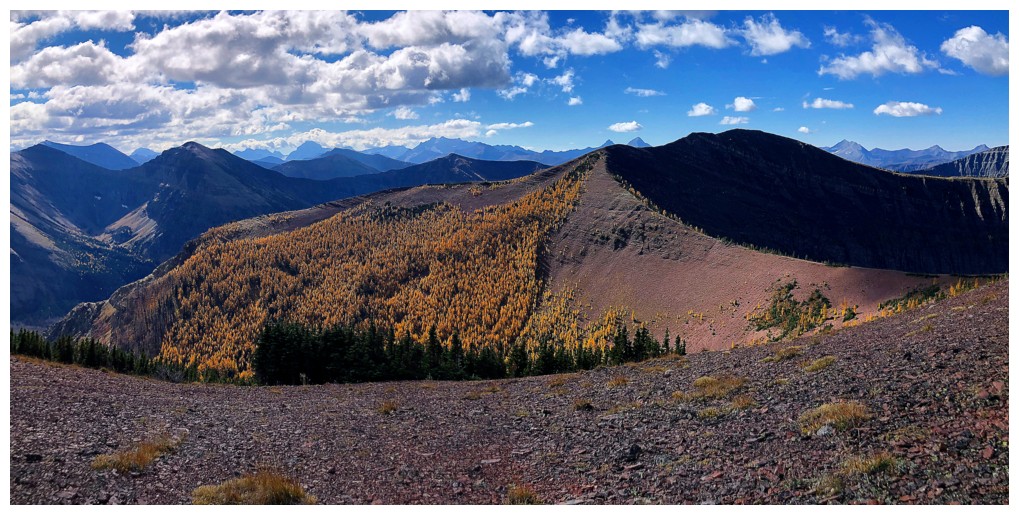
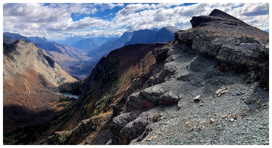
First good look at "larch central" on the southeast side of Avion Ridge
Heading down the Avion/Brother col
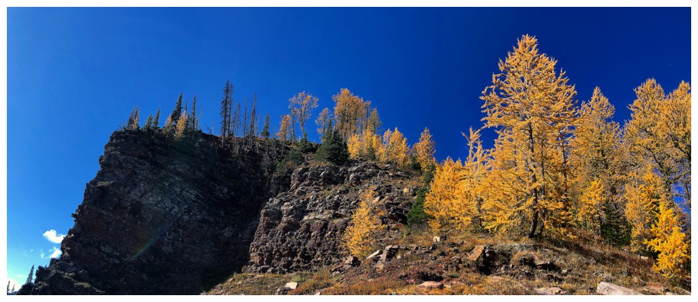
Lots of opportunities to see the larches up close
Looking back to the Brother
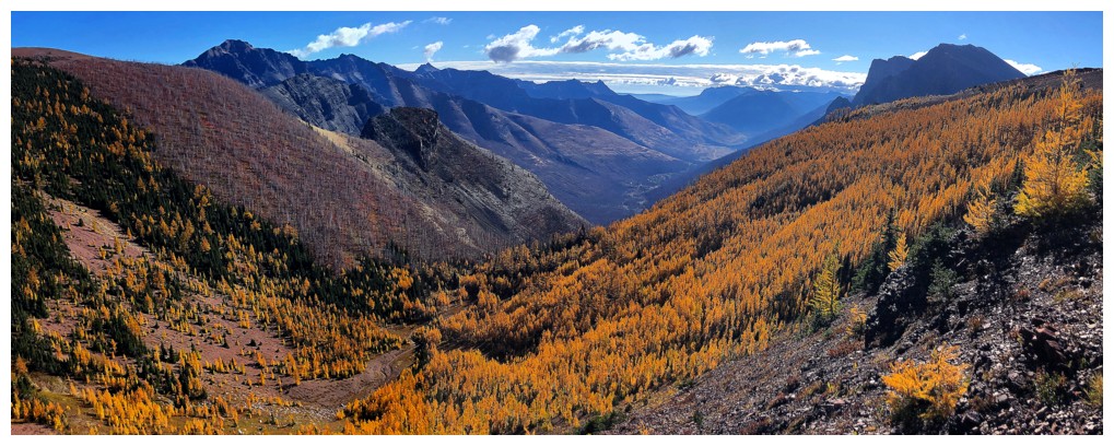
The valley between the ridges is the larch highlight of the route
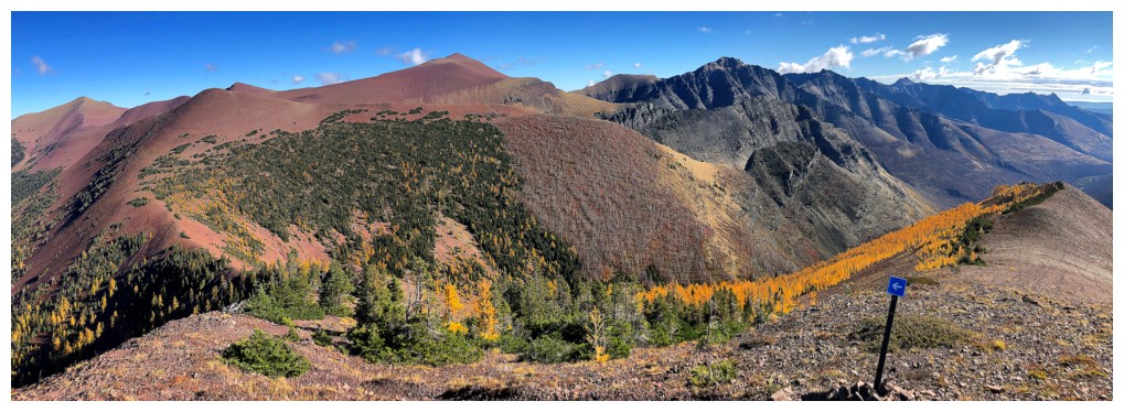
Nice sign for anyone who gets lost
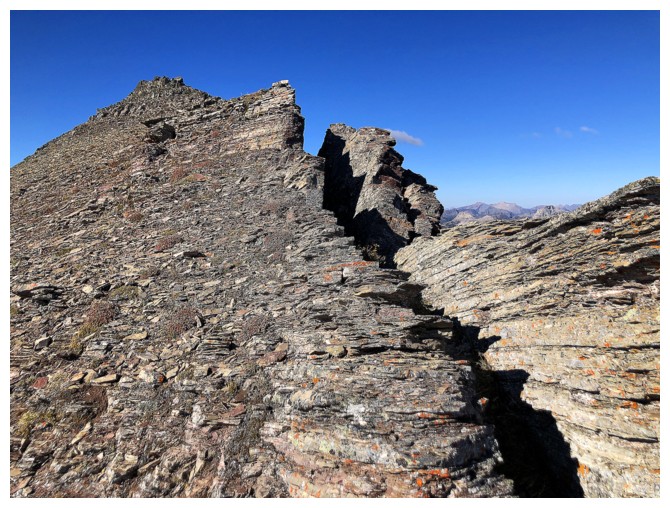
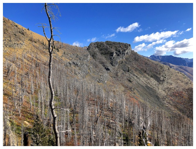
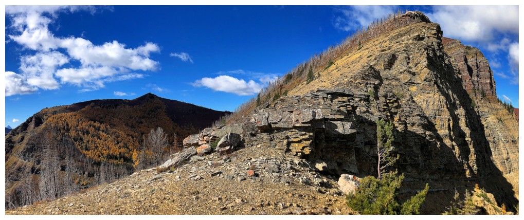
A big chunk of the mountain seems to be separating from the rest of it
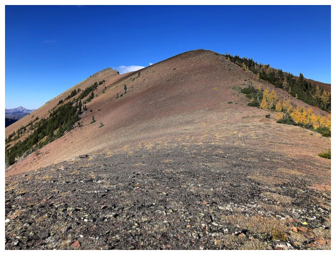
Approaching the summit at the left
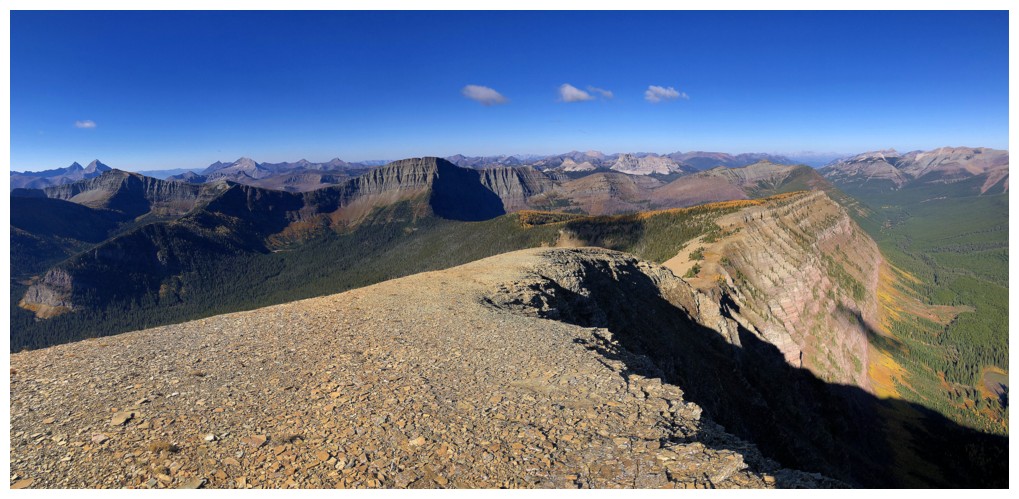
Summit view to the west
Sage Senior - still a personal favourite in Waterton
Back at the sign that pointed left. I went right here.
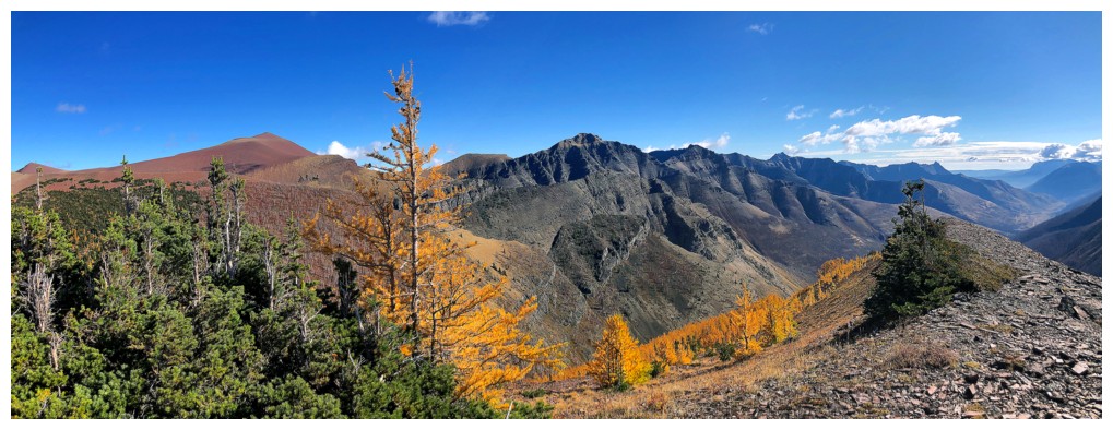
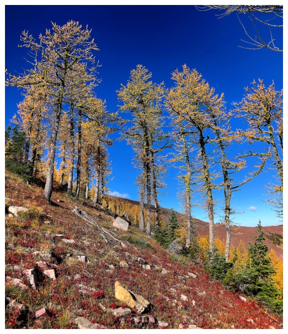
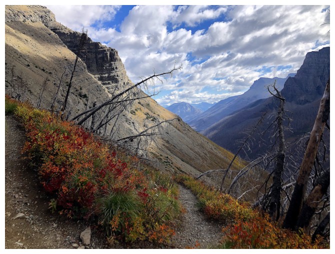
The larches of the southeast face start to appear
Looking back to the summit
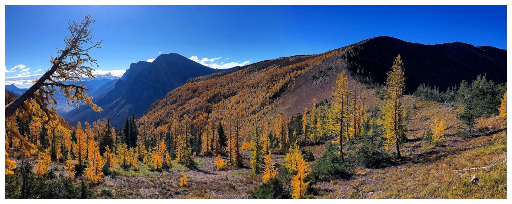
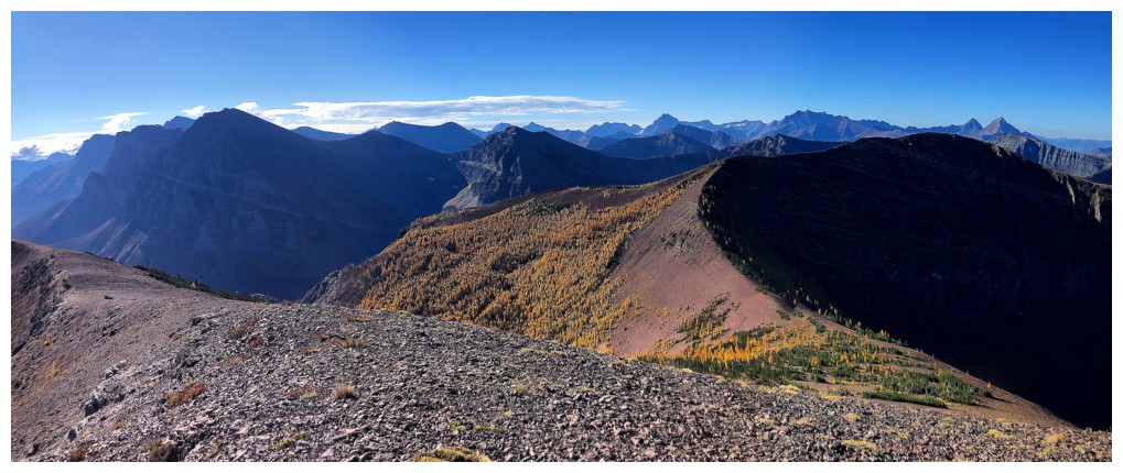
Easy travel down the ridge, towards the field of larches
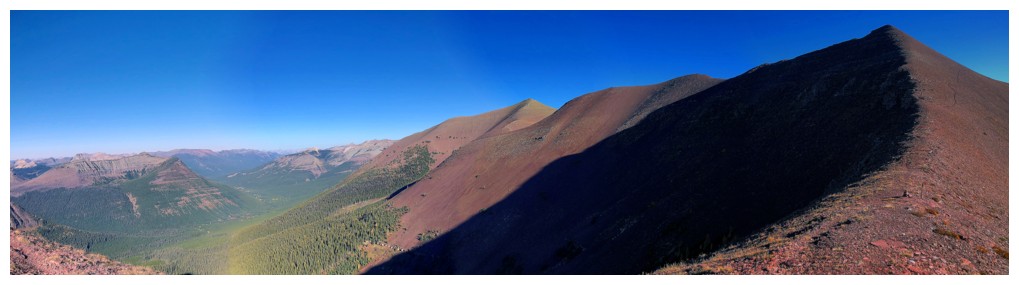
One of those panoramic photos that makes a straight ridge appear curved
Almost ready to descend into the larches
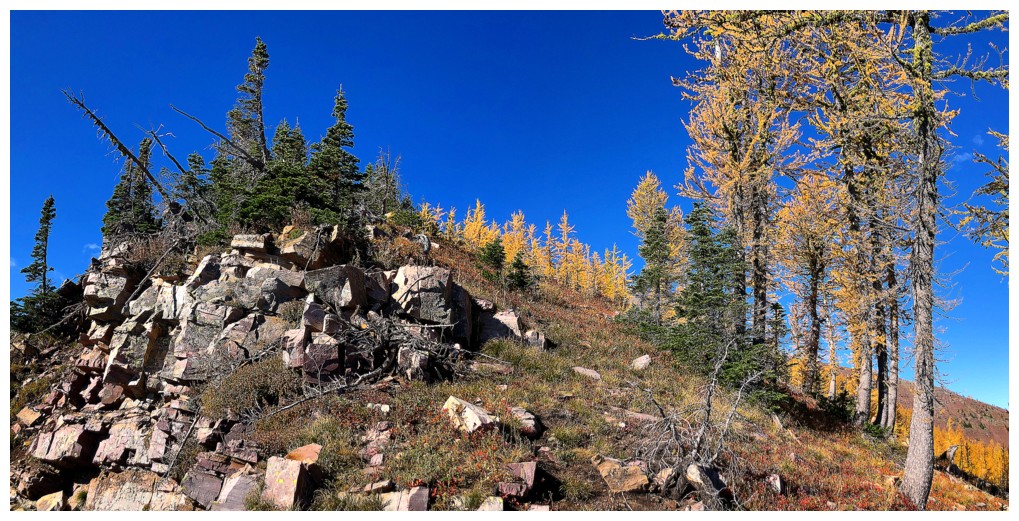
Decided to stick to the ridge before going into the thick of it
A few sections of vegatation in its red state enhanced the already colourful scenery
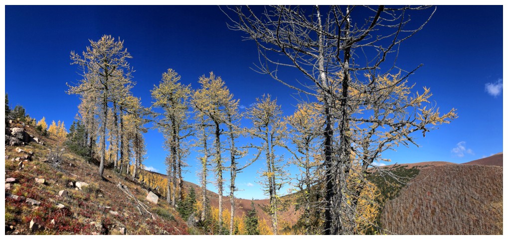
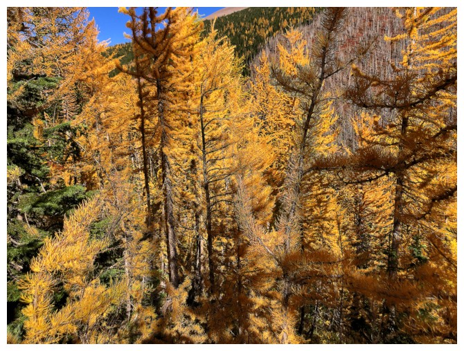
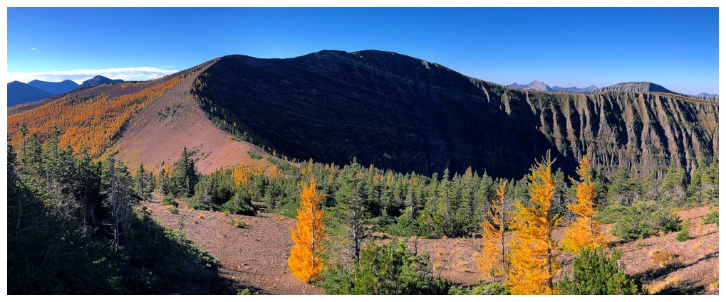
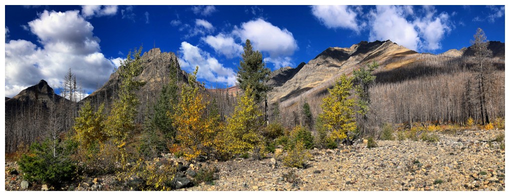
Into the thick of it now!
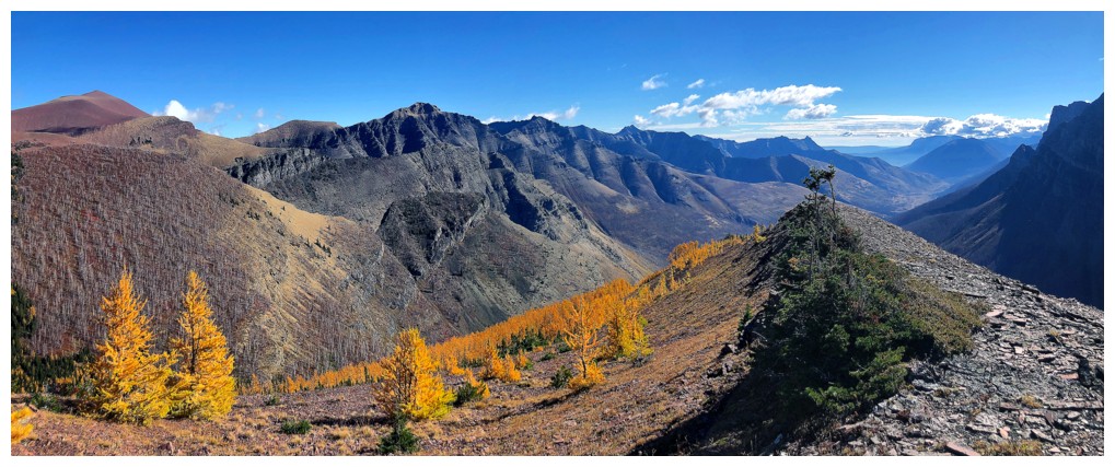
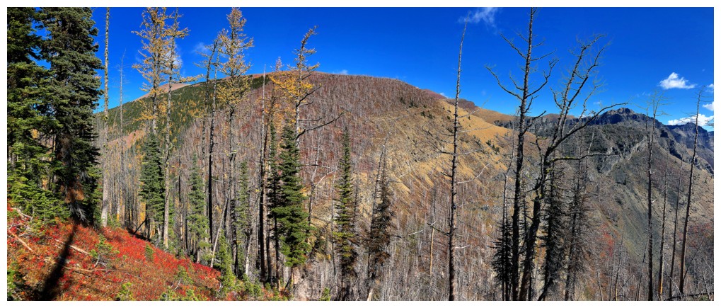
Out of the larches and looking at the day's original objective - Goat Peak
The field of larches I just came through
At this point I should have stayed low and attempted to ascend the gully between the ridge at the left and Goat Peak
Staying high, however, did have its scenic advantages
Approaching the ridge
The
notch between the ridge and Goat Peak. I tried to downclimb here but
there weren't any decent handholds on the most exposed section.
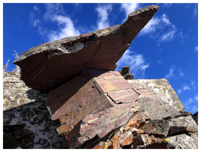
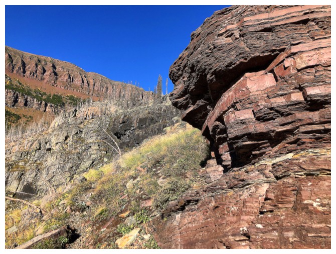
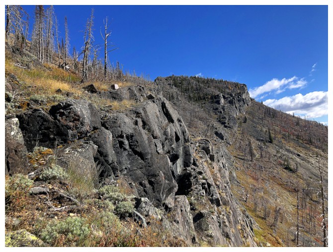
At least there was some cool red argilitte to photograph!
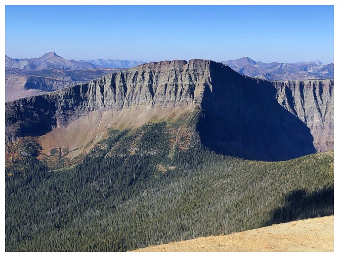
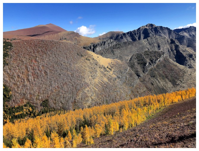
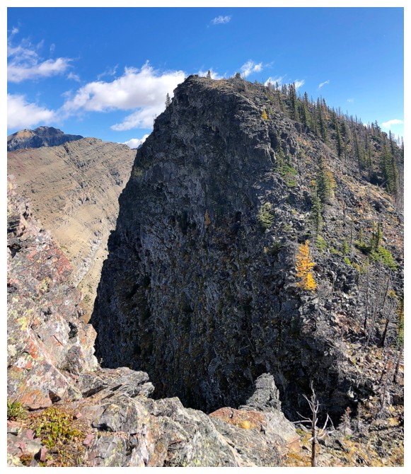
The awesome east face of Avion's Brother. I tried to get up this way a few weeks earlier.
Goat Peak looks fairly impressive from here but it's much lower than Avion and Avion's Brother
Heading back up the ridge to the summit of Avion's Brother again. Newman Peak and Newman Senior at the right.
The false summit of Avion at the left
Goat Lake far below
Goat Peak still looks cool, but it's about to get much smaller
The east face of Brother is fantastic
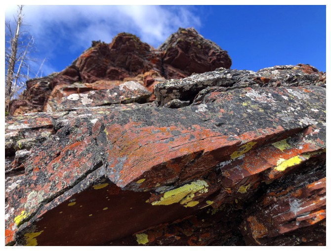
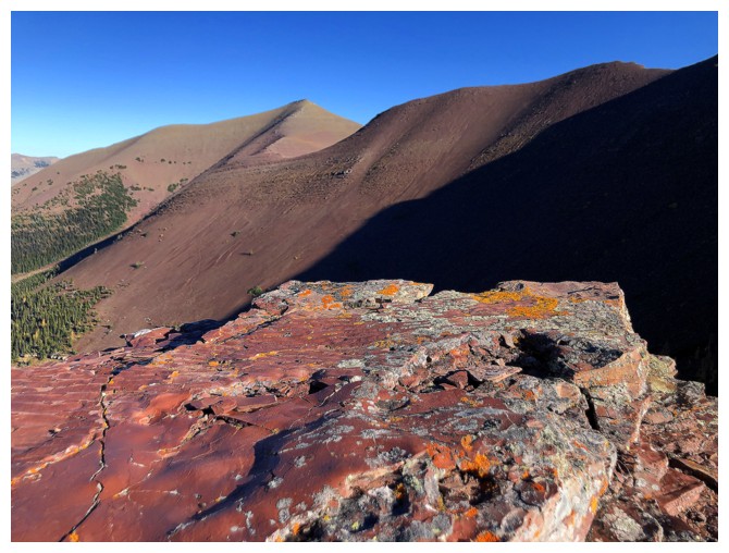
About time I saw some yellow lichen on red argillite!
The colours of Waterton
Looking
humoursly at the route I did end up taking after bailing on the
skectchy route a few weeks earlier. From near the Avion's
Brother/Newman Peak col, above the trees and below the rock bands - a
good kilometre of red argillite side-sloping!
Last look at Avion's true summit and larch field
A few familar peaks in the west and southwest corner of The Castle: Mount Matkin in the foreground and Scarpe and Jake Smith in the distant centre
Last look to the northwest
Descending Avion's Brother to the col
Getting cloudy, but still lots of cool fall colours along the Goat Lake Trail
I always stop here on the bike ride back to check out Glendowan (right) and the southeast end of Newman Senior (just left of centre). Goat Peak at the far left.
The End
LOG