Bellevue Hill VII
January 23, 2021
Mountain height: 2116 m
Elevation gain: approximately
900 m
Round-trip
time: 7:40
Scrambling with Mark.
The initial plan for the day was give ice
climbing another go. Our short stint with the activity had amounted to
completing a few very easy routes (mainly WI2) in 2007 and 2008. Attempting one
of the Compound Gullies in Waterton sounded like a great way to dip out feet
back into the water, even if just on a small level.
 Unfortunately, we awoke the morning
of the attempt to an air temperature of -19 degrees Celsius and forecast 30-50
km/h winds – that puts the wind chill around -31 – no thanks! Back in the day, I wouldn’t have batted an eyelid at -31; but
that was back in the day! Though I don’t mind a little suffering, “little” is
the operative word and spending 4-8 hours with frozen hands and feet is about
as appealing to me as macaroni and cheese without the cheese!
Unfortunately, we awoke the morning
of the attempt to an air temperature of -19 degrees Celsius and forecast 30-50
km/h winds – that puts the wind chill around -31 – no thanks! Back in the day, I wouldn’t have batted an eyelid at -31; but
that was back in the day! Though I don’t mind a little suffering, “little” is
the operative word and spending 4-8 hours with frozen hands and feet is about
as appealing to me as macaroni and cheese without the cheese!
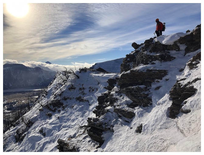
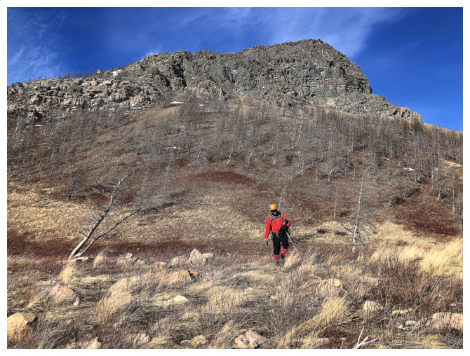
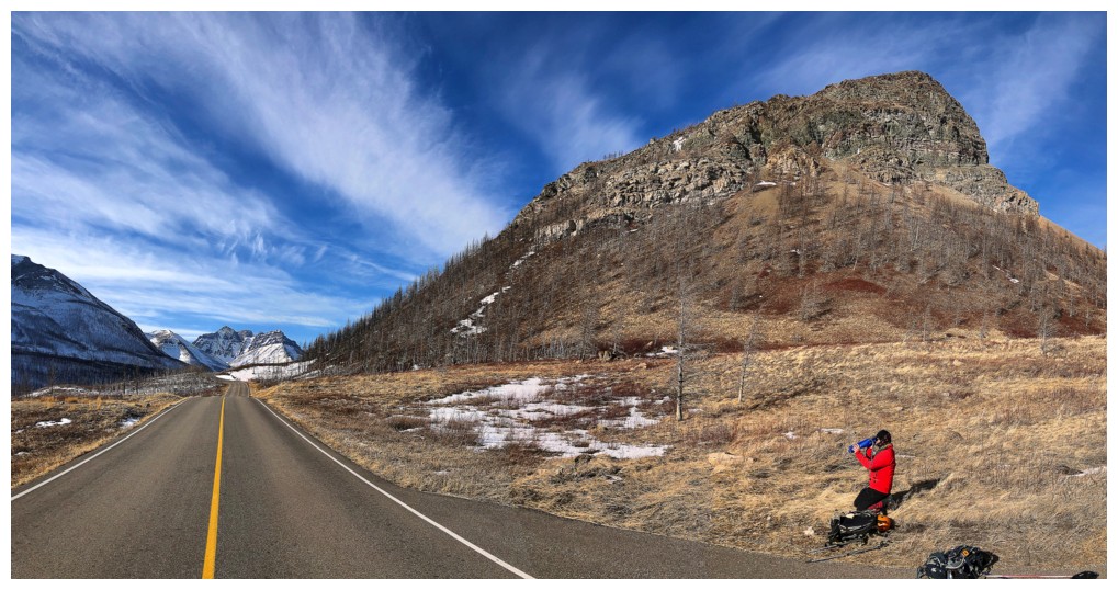
We changed our plans to an ascent of Bellevue
Hill from the east. This would be my seventh excursion on the “hill” and
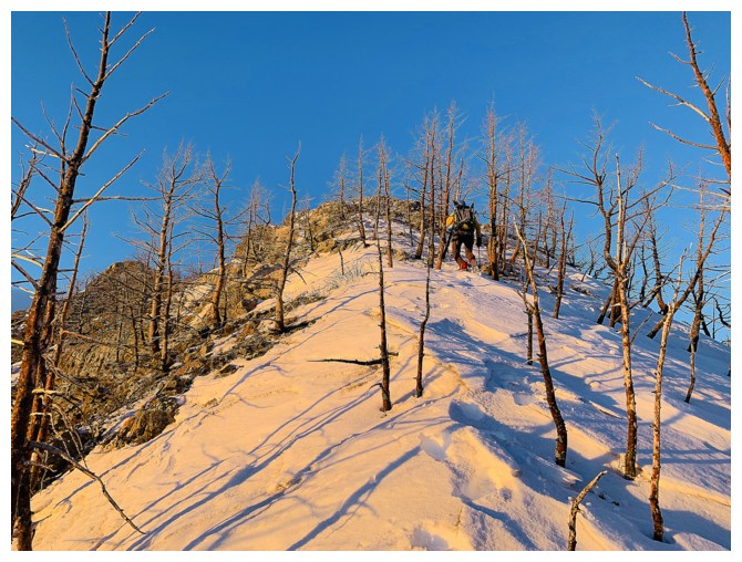
Mark’s first. After a headlamp approach, we started up the easy east ridge,
enjoying pleasant early morning scenery and a merciful lack of wind. It almost
goes without saying that this changed dramatically upon reaching the first
highpoint. Luckily, we were smart enough to put on all our extra layers of
clothing before topping out on it, but as soon as we did, the temperature (wind
chill to be more specific) went from tolerable to downright bone-chilling.
We made it to the summit without issue, but
constantly taking my hands in and out of my gloves to take photos throughout
caused me considerable discomfort – a problem that has a remarkably simple
solution: stop taking so many photos!!!
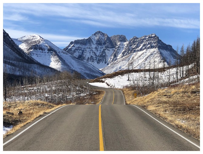
 Unfortunately, the completely clear skies we
were expecting never fully materialized. We did enjoy some interesting views of
distant mounts Kintla and Kinnerly between the cloud layers, but no clouds at
all would have been preferable. If there is one thing that can take my mind off
miserably frozen hands it’s the spell-binding views of Waterton
on a clear, winter day.
Unfortunately, the completely clear skies we
were expecting never fully materialized. We did enjoy some interesting views of
distant mounts Kintla and Kinnerly between the cloud layers, but no clouds at
all would have been preferable. If there is one thing that can take my mind off
miserably frozen hands it’s the spell-binding views of Waterton
on a clear, winter day.
Hoping for possible improvements in the
weather and after a short, marginally sheltered summit break, we decided to
make a loop route out of the trip, descending the south ridge and then hiking
around the base of the mountain back to the start or hiking to the road closure
on Red Rock Canyon and then asking Mark’s wife to pick us up.
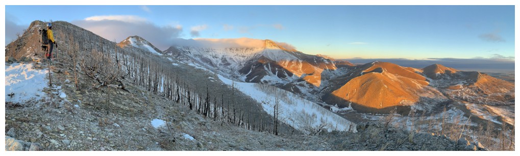
The severe cold remained throughout, but the
clouds did clear a little, revealing more of the stunning scenery. Especially
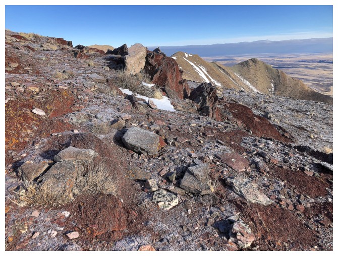
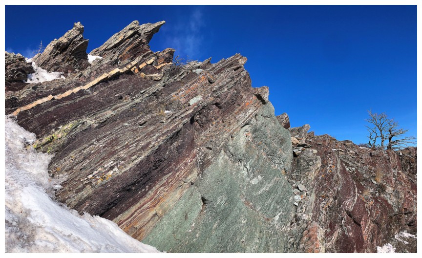
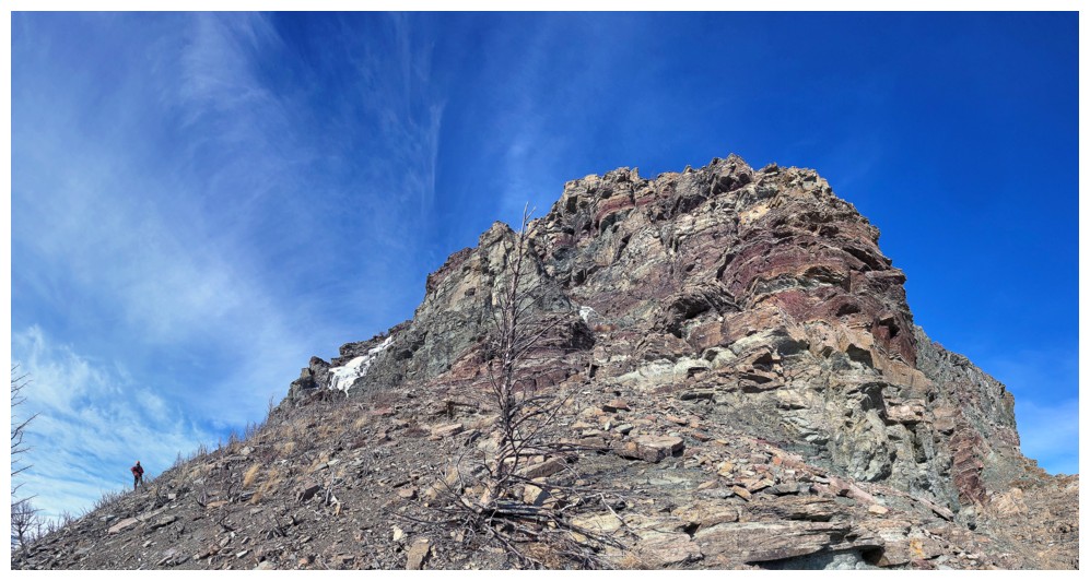
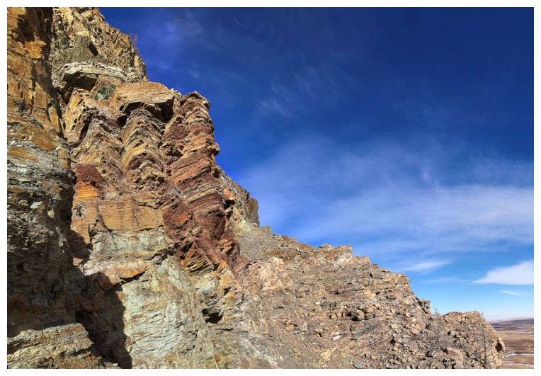
gratifying was a little exploratory diversion around the east face. Having not
seen this terrain since my first trip up Bellevue, 15 years earlier, I had
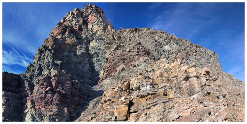
forgotten that the east side of the hill is one of the most colourful and
geologically fascinating areas in the entire park – not bad for an infrequently
ascended peak that rises only to 2116 m!
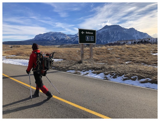
Regrettably, we eventually had to leave the
face and made our way easily down to the Red Rock Canyon road. Although hiking
along the base of the mountain back to the car had great appeal, we were both
tired (primarily from fighting a losing battle with the cold) and the shorter
option of hiking to the road closure won out. Keri graciously picked us up,
after a very pleasant hike along the deserted road.
Not quite the weather we would have liked,
but overall a super scenic day on one of the most unjustly neglected mountains
in the park.
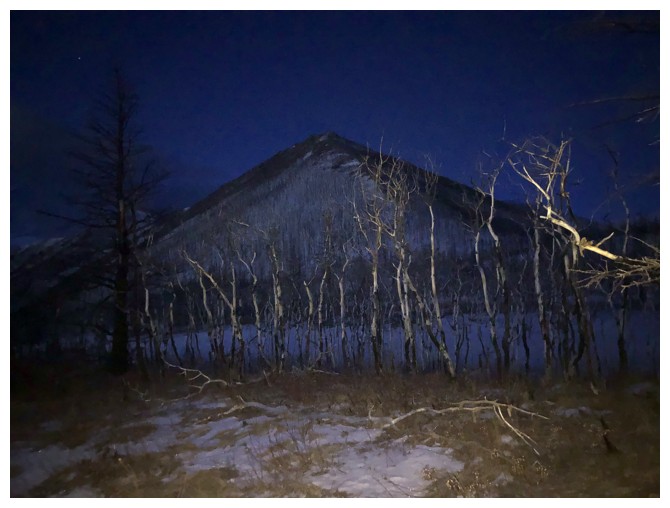
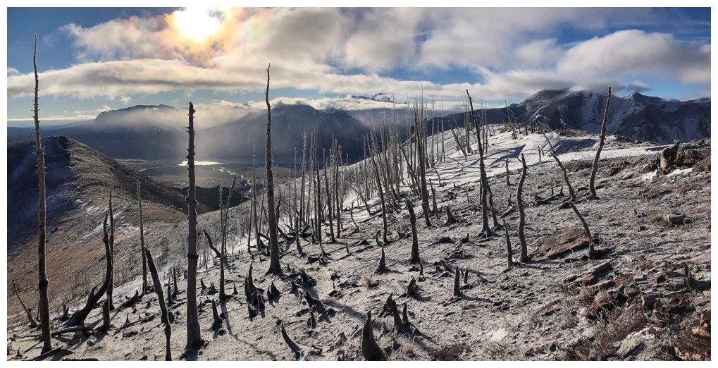
Headlamp view of Bellevue Hill's east ridge
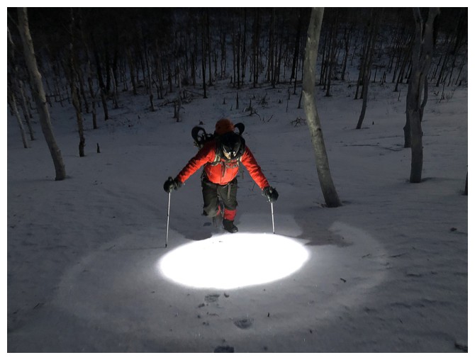
Heading up the east ridge - headlamp still required
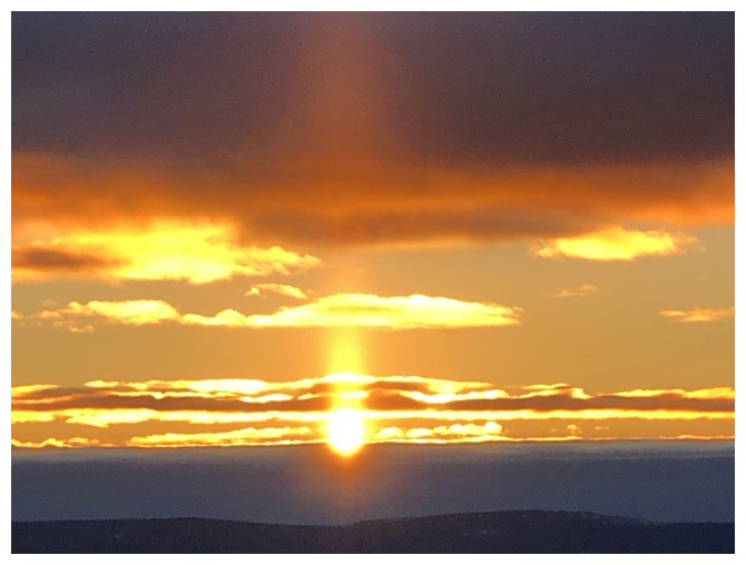
"Here Comes the Sun" - latest version
Terrific sunrise, but we both would have preferred no clouds
The Sun hits the snowy ridge in front of us
Ascending that ridge
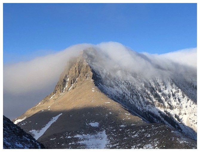
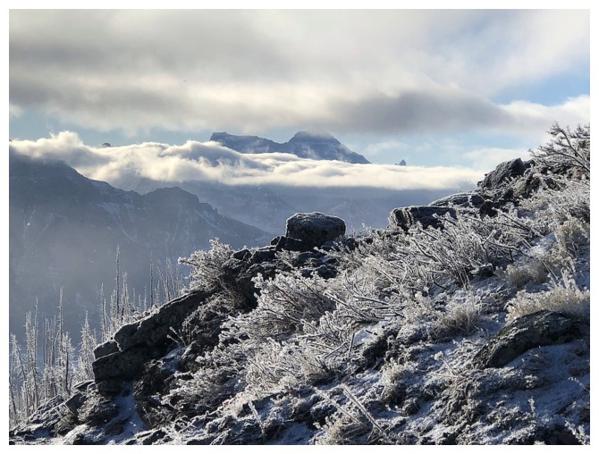
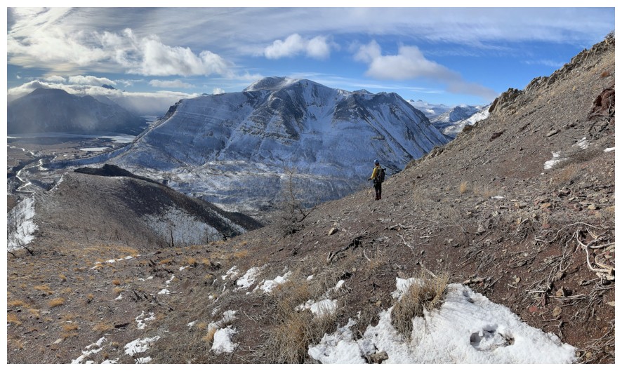
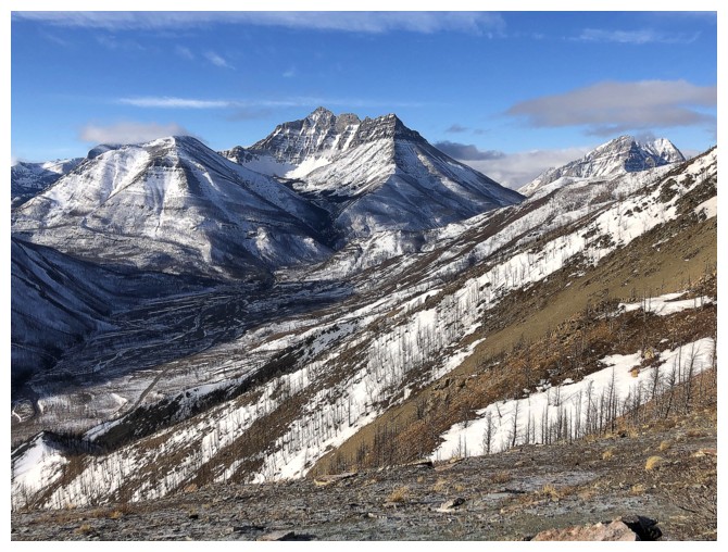
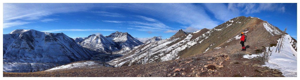
Almost at the first highpoint and noticing a wall of cloud drooped across the ridge that connects Mount Galwey to "Rogan Peak"
The horseshoe-shaped Lakeview Ridge behind us
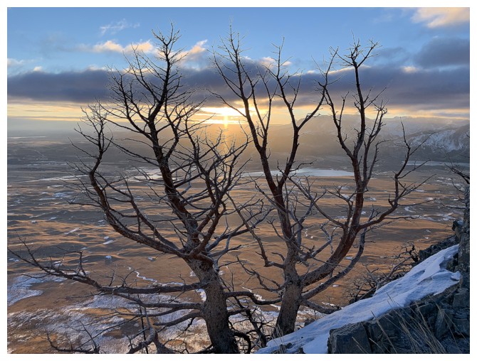
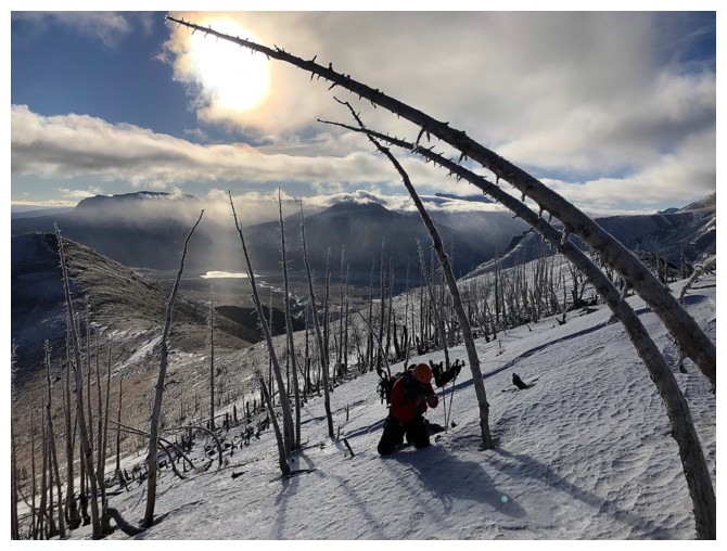
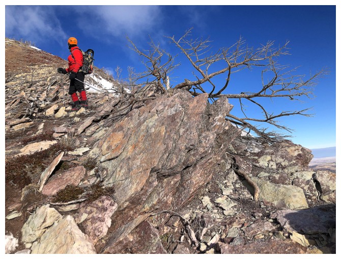
Cool, scary tree!
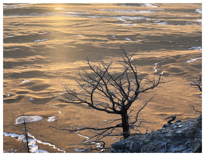
Another one
A huge bank of cloud stayed to the east throughout the day
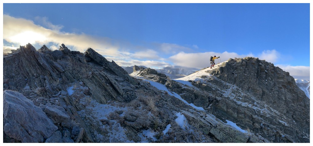
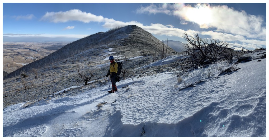
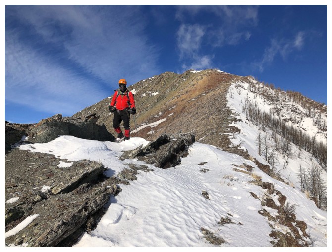
Pleasant and easy ridgewalk to the first highpoint
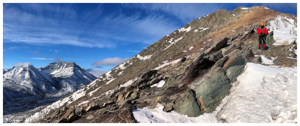
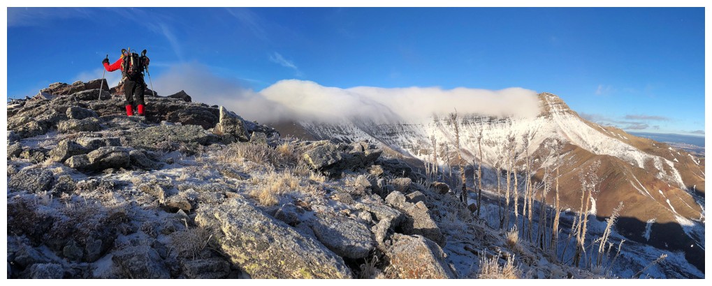
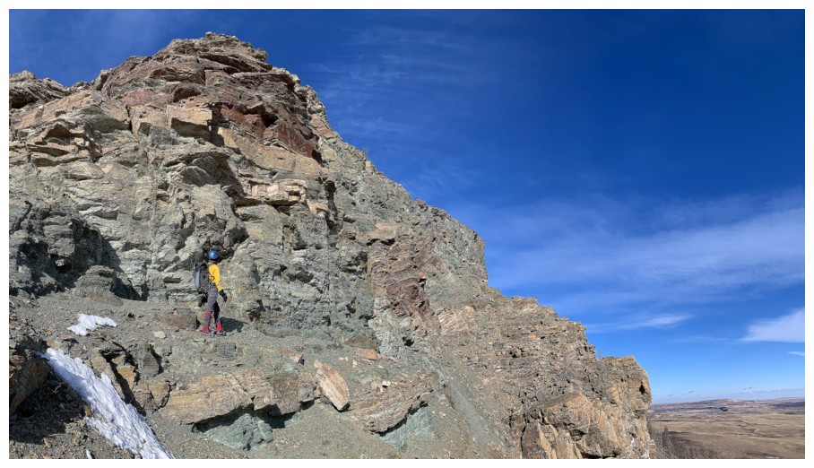
Big cairn at the first highpoint. Conditions from this point on were brisk to downright bone-chilling!
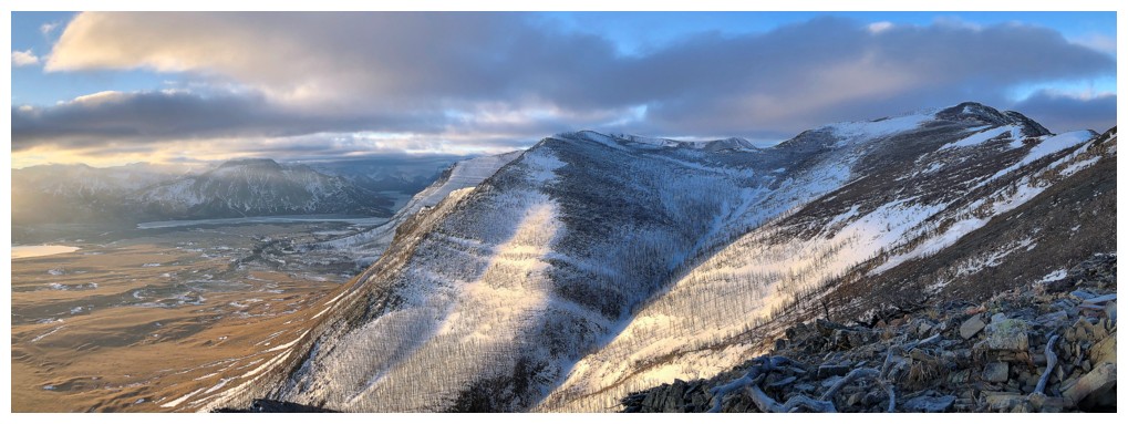
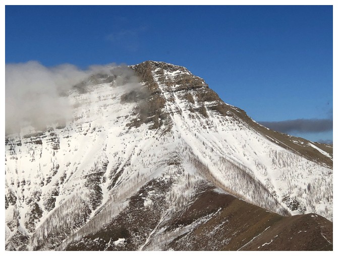
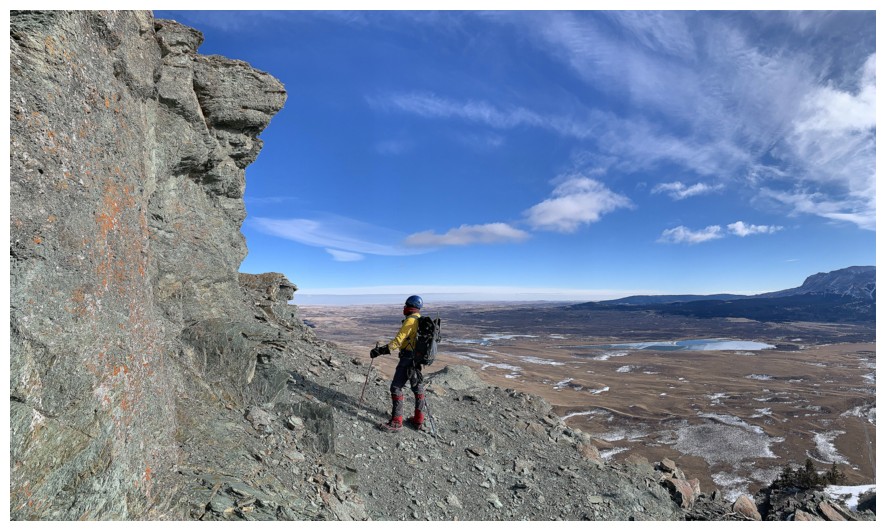
True summit at the far right. While the northeast side of Bellevue was
very snowy (as seen here), the east face was essentially snow-free.
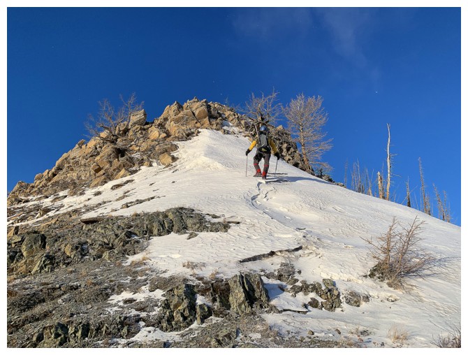
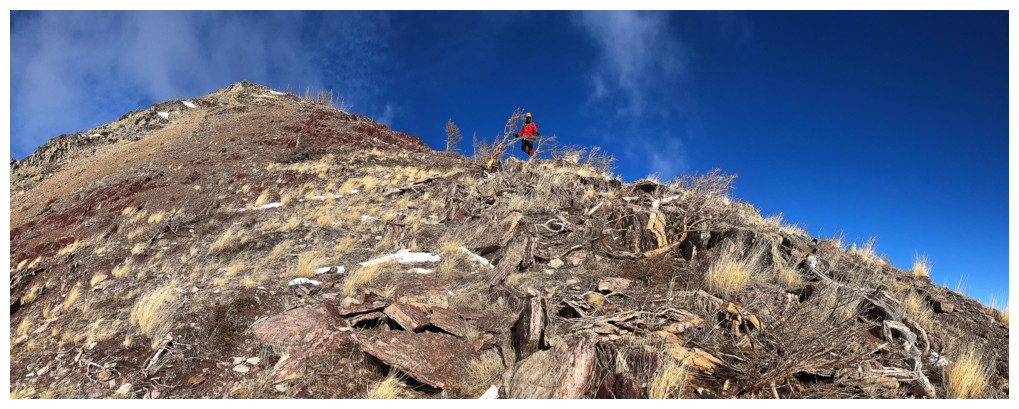
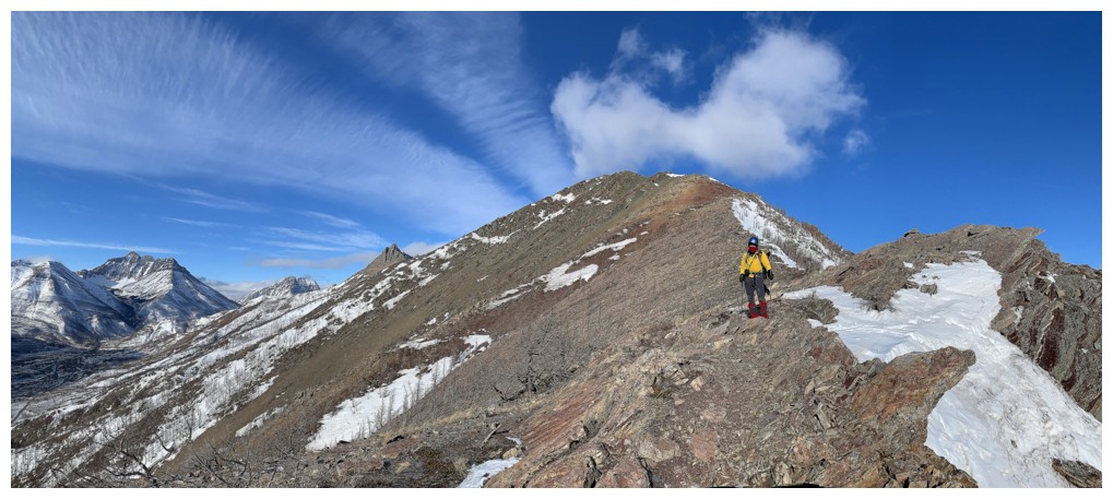
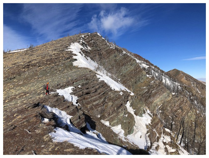
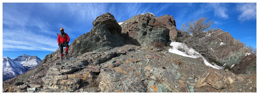
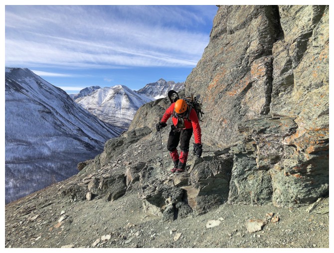
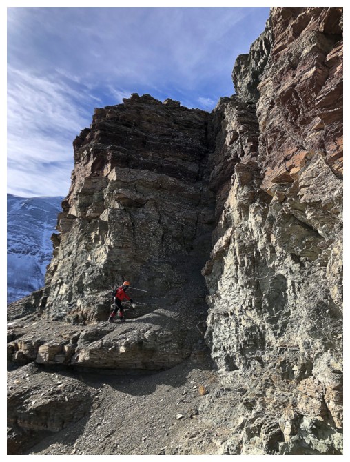
Heading to the next highpoint
A few moves of steep scrambling to get up that one
Lots of ups and downs on this ridge, but they are all very small
Like this one
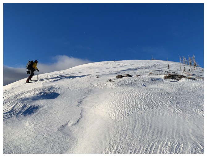
Hard-packed snow made travel easier at times
Looking back at a coupe of the highpoints
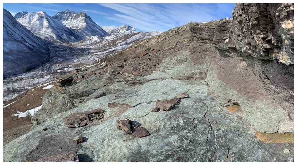
A few sections of red argillite along the way to keep us entertained
Clouds over Galwey
Rogan Peak
Lakeview ridge again
Cool, winter scenery
Same as above with Mount Cleveland
The clouds persist over Galwey
Still fixated on Lakeview Ridge
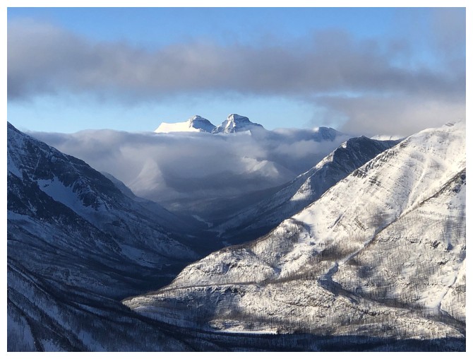
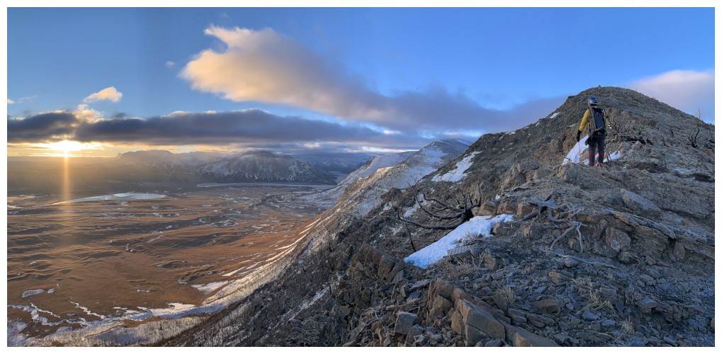
Distant mounts Kintla and Kinnerly make a welcome appearance
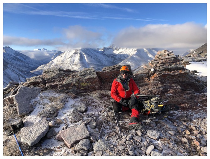
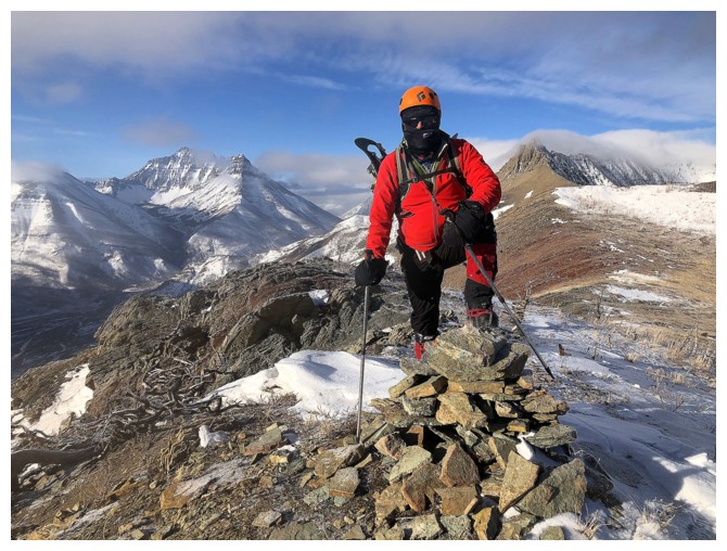
At the summit. The King of Waterton, Mount Blakiston, is hiding behind the clouds.
My summit pose. Looks peaceful, but we were both deathly cold at this point.
Why is Mark on the ground?
Because he hates getting his own shadow in photos like this one
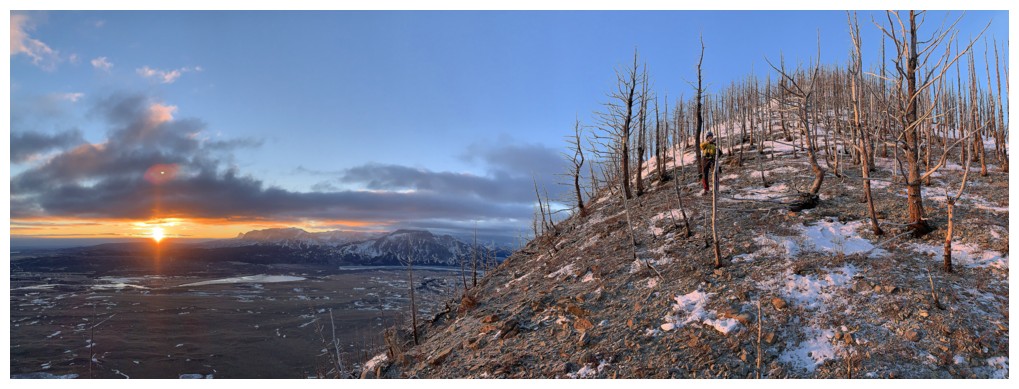
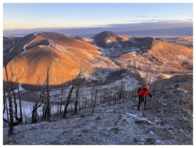
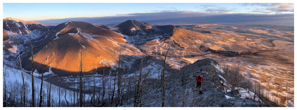
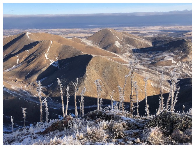
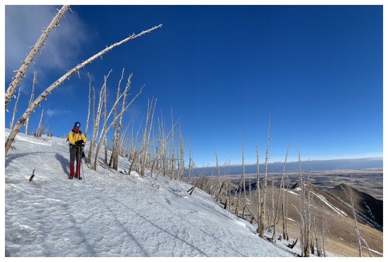
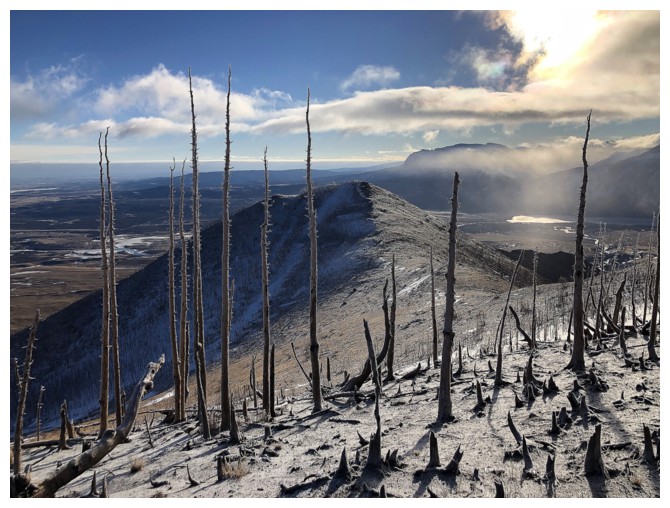
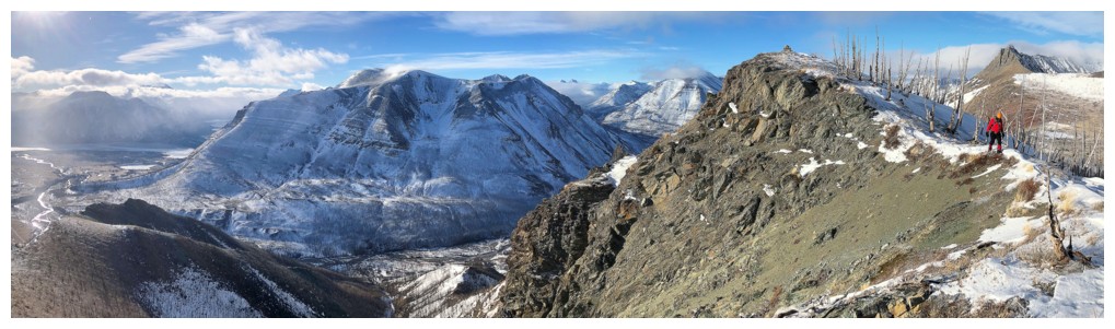
Hiking just below the ridge provided a little shelter from the wind and
some terrific views of the remnants of the 2017 Kenow fire
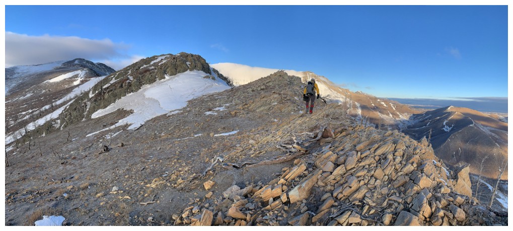
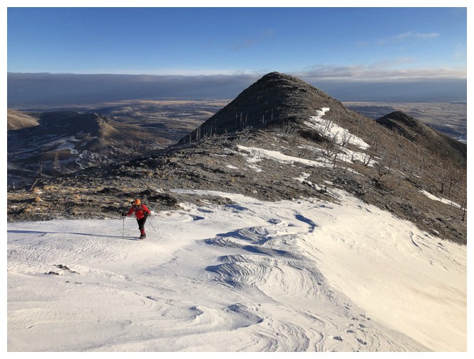
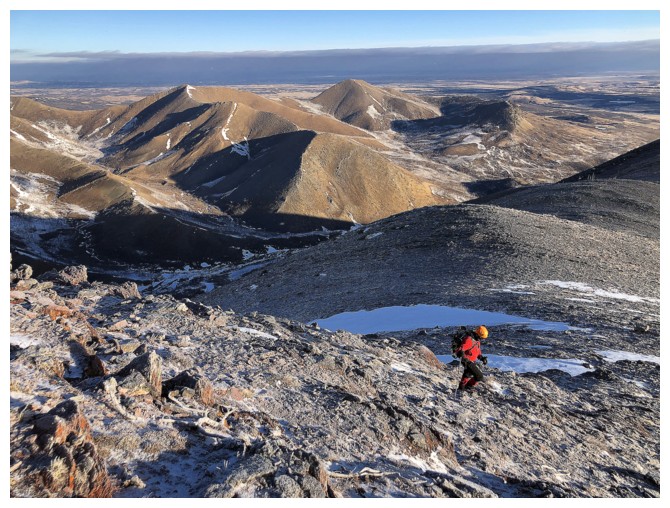
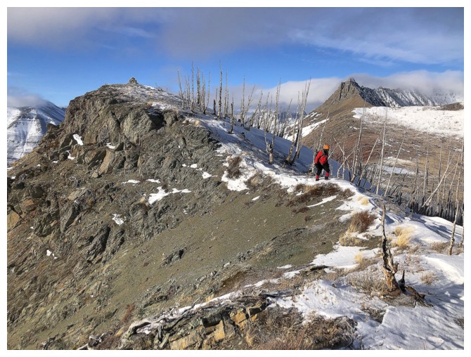
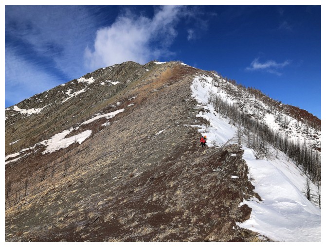
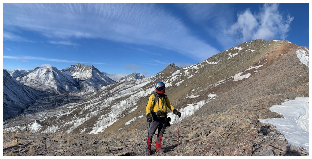
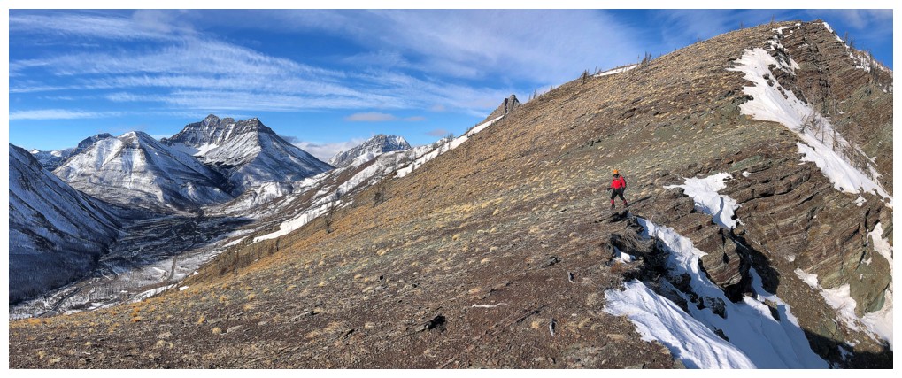
Traversing south to the next highpoint ahead
Looking back to the first highpoint we reached at the right
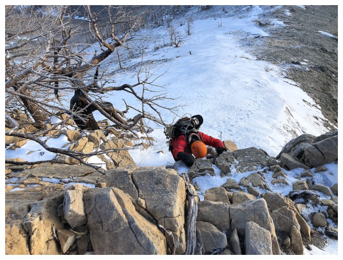
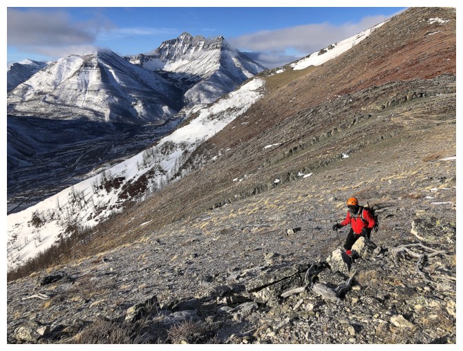
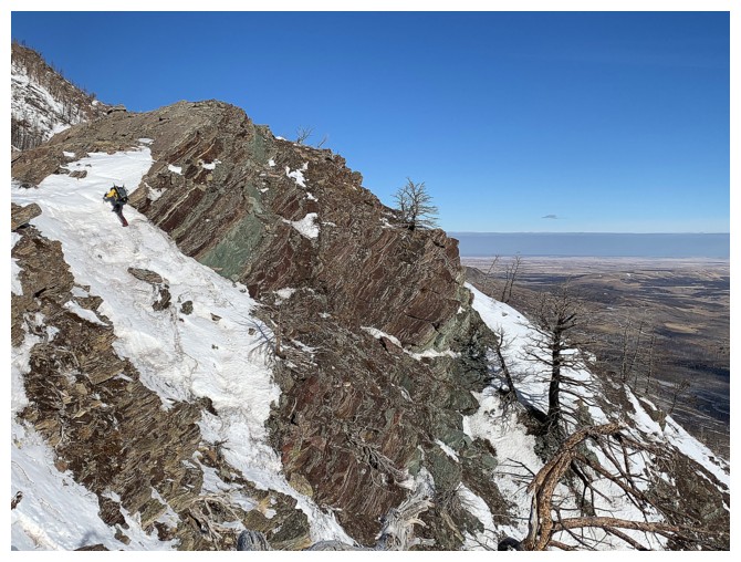
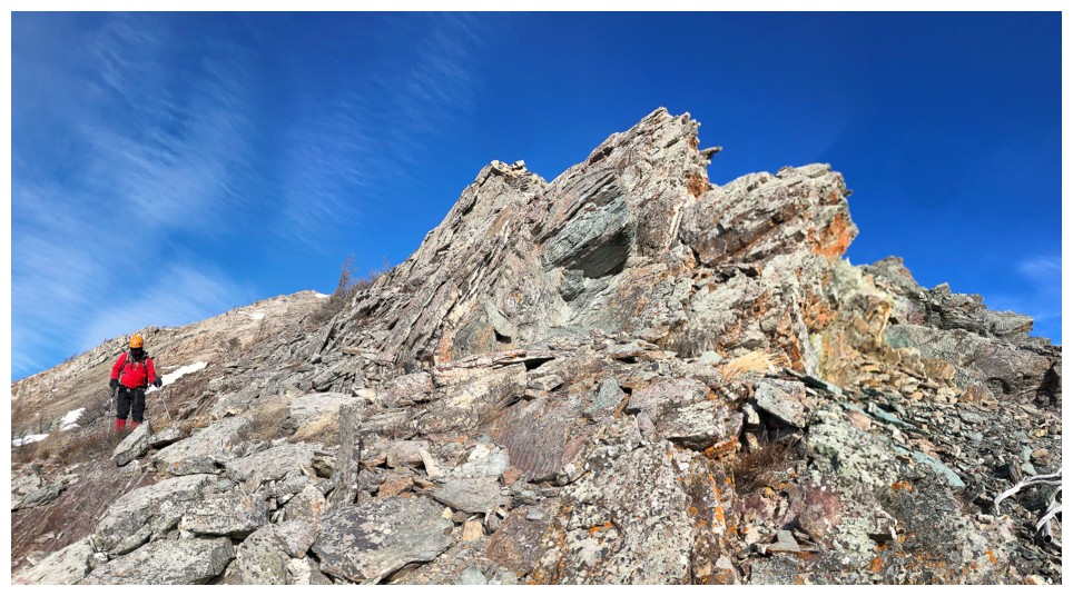
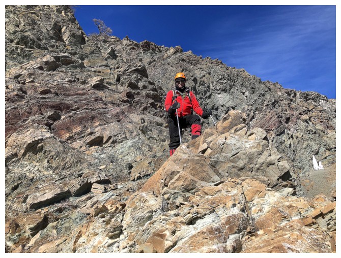
Mark descends another section of striking red argillite
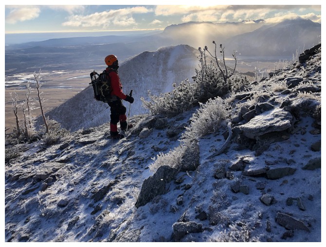
Trying to find shelter again
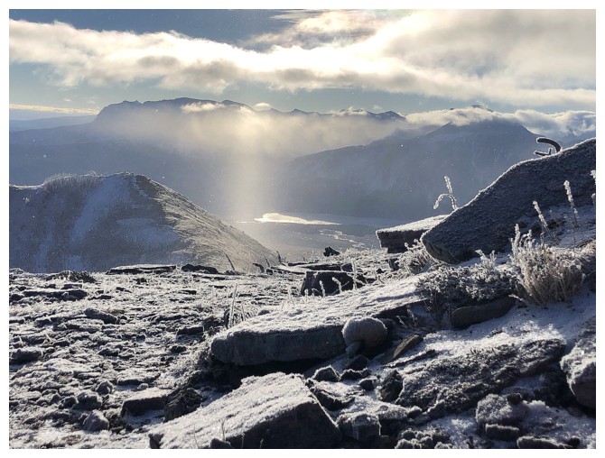
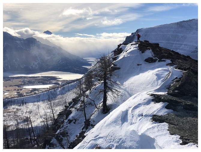
Suddenly, Blakiston is cloud-free. Ruby Ridge is left of Blakiston.
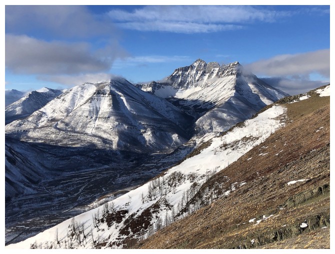
Ruby and Blakiston
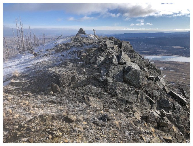
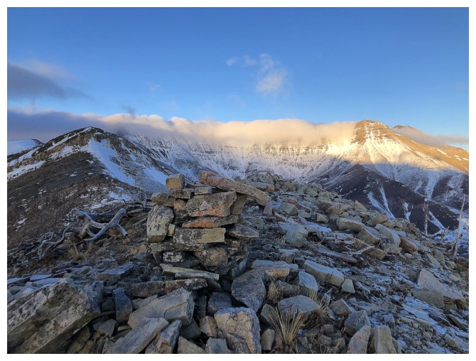
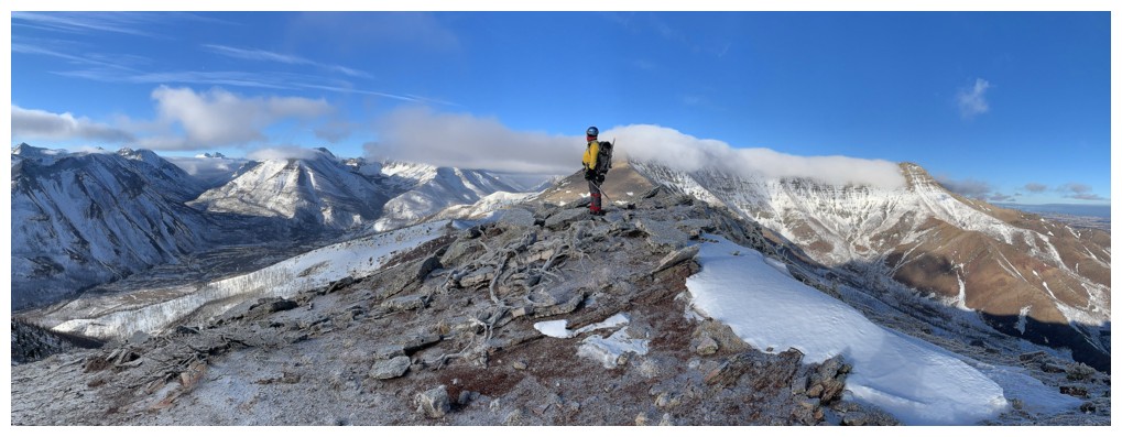
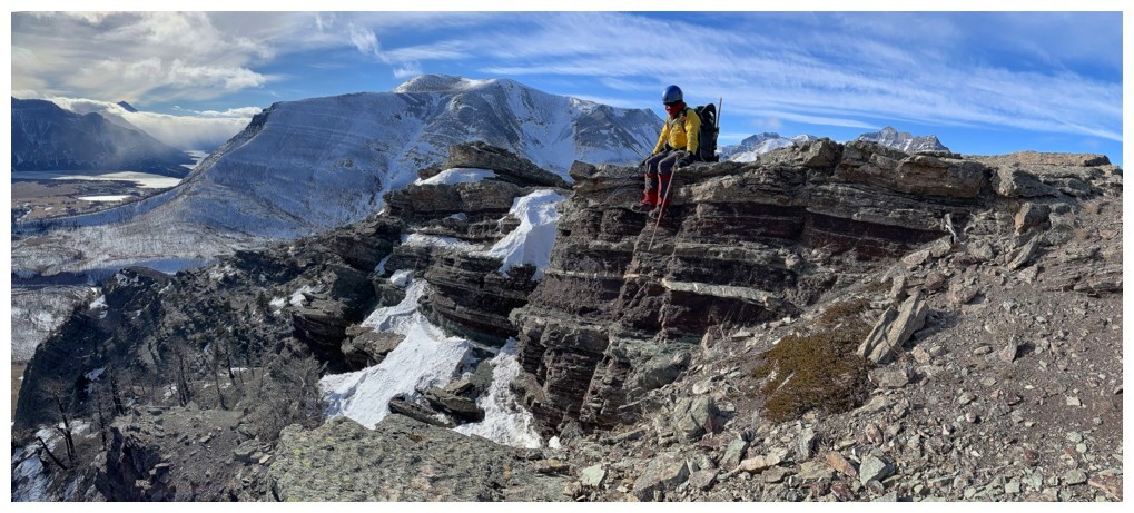
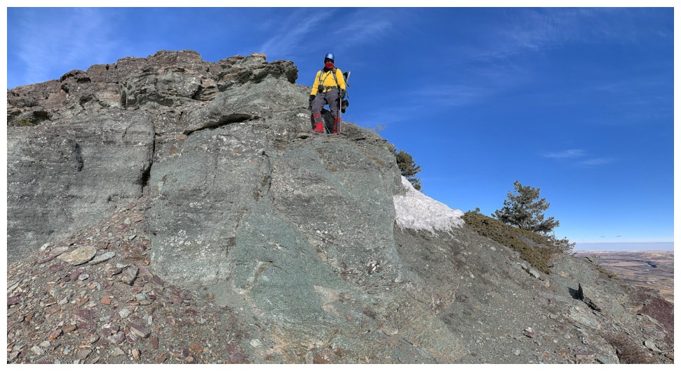
Big cairn at the next highpoint
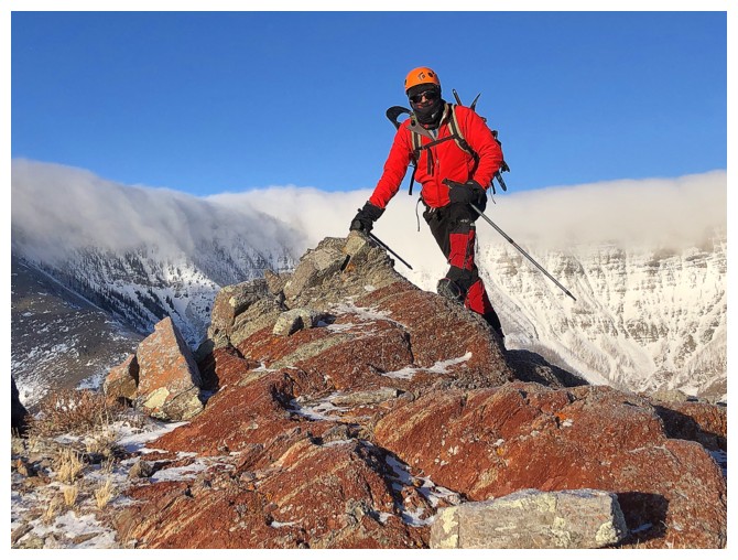
Mark at the summit
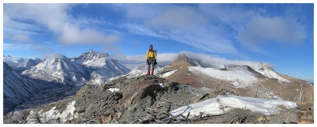
My turn
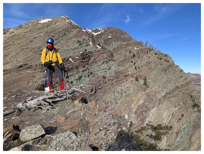
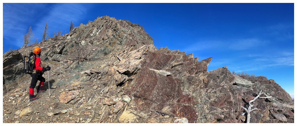
Leaving that highpoint to descend one of the more fascinating ridges in the park
Same as above with massive Mount Crandell
Admiring Crandell
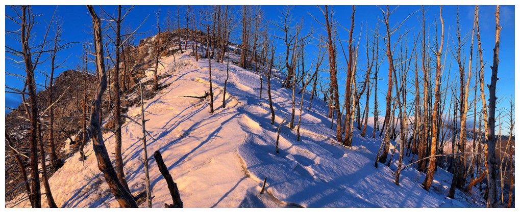
Typical terrain, high on the ridge - good footing and scenic
The colourful rock starts to appear
Anderson Peak (tied with Crypt Peak and Mount Dungarvan for my favourite hands-on scrambles in Waterton) appears to the left of Blakiston
Looking back at something we just passed
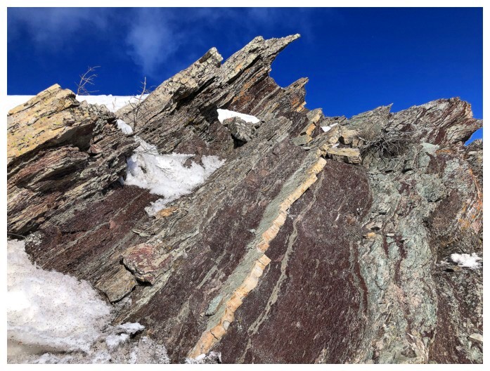
Had to backtrack a short ways to check out an interesting section of rock.....
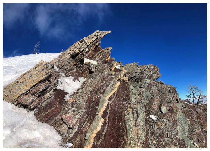
......this one. The strip of light coloured rock in the centre was super cool!
Looking over to Mark from where I descended to see the rock
Same rock
Back on track
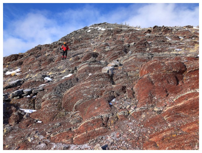
Mark looks down the awesome layers of exposed rock on Bellevue's east
face. There were many potential routes down this side of the mountain,
but they would best be tackled from ground up.
Mark at another minor highpoint along the ridge. The clouds obscuring
everything on Mount Cleveland except its summit was very reminiscent of
a recent ascent of Crandell.
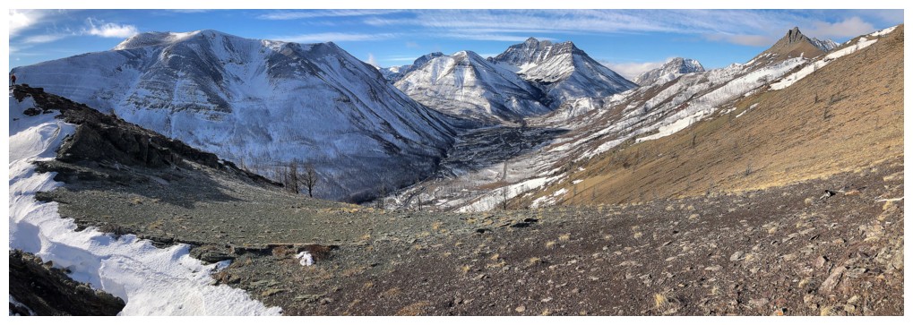
Losing elevation, but gaining views: Crandell, Ruby Ridge, Blakiston, Anderson, and Galwey are all visible
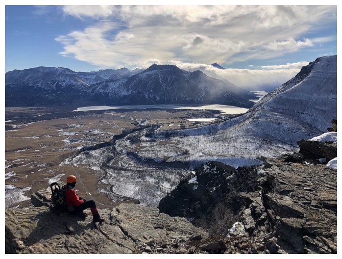
Mark takes in the view over the Waterton Lakes
Chillin' on the argillite
Staying near the edge for the best rock scenery
This outcrop of grayish green argillite was particularly interesting
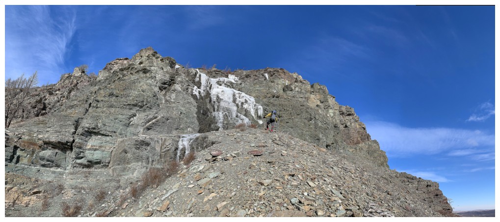
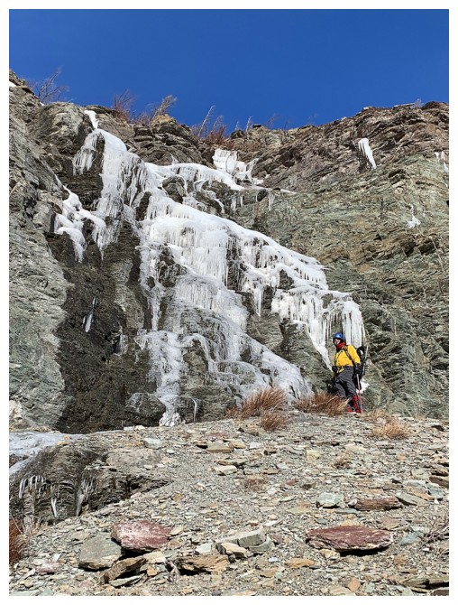
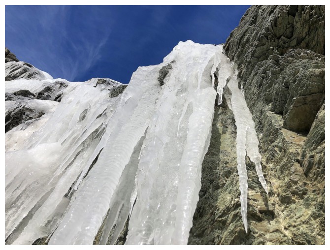
At this point we traversed around the mountain to check out a small frozen waterfall
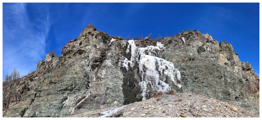
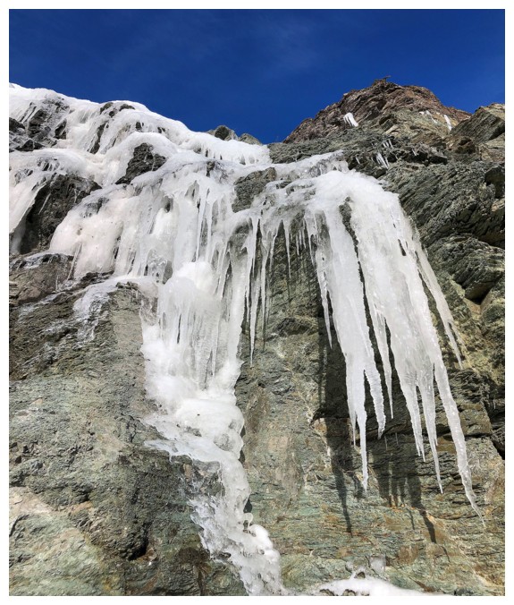
Small, but delightfully scenic
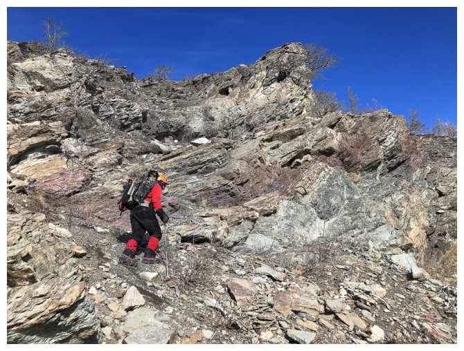
More traversing
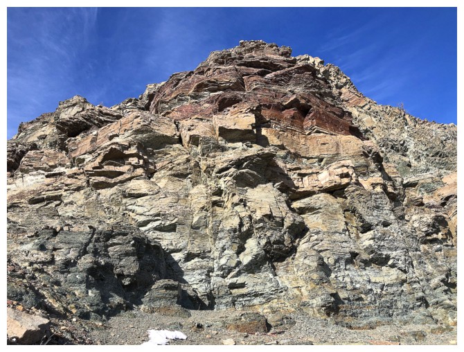
Now on the east face of the mountain, the colourful rock scenery is front and centre
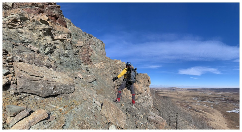
Mark traverses over to a steep escape gully
We opted to bypass the gully in order to check out this rock wall
End of the traverse and time to descend
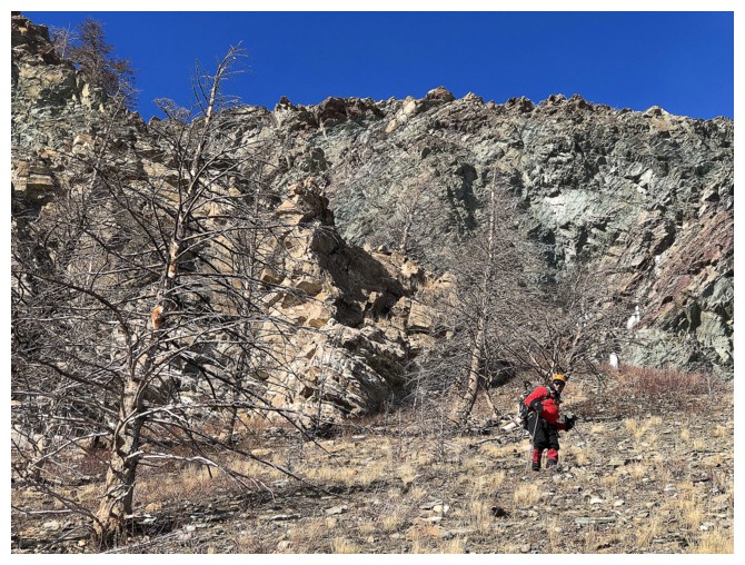
Off the rock and onto steep but easy descent slopes
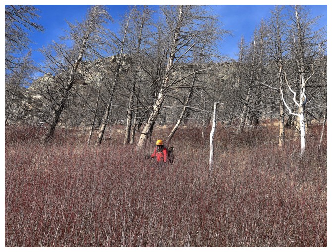
Mark wades through a section of red-tinged brush
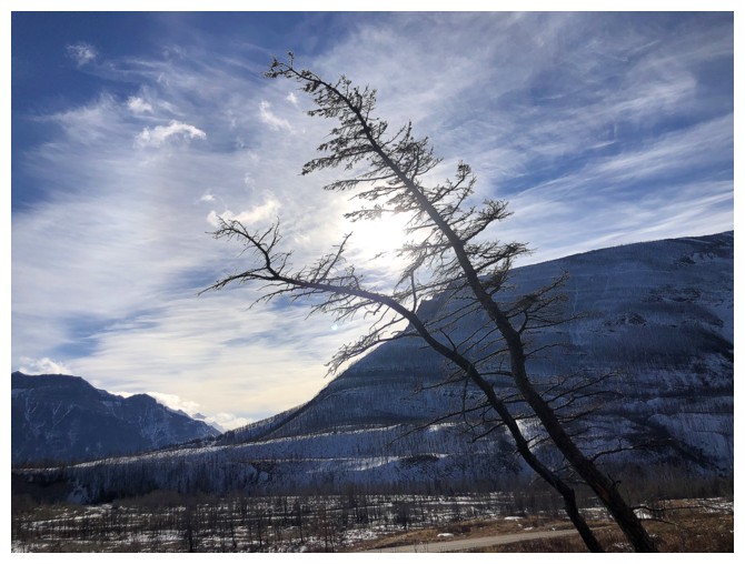
Random tree
Looking back at the section we descended
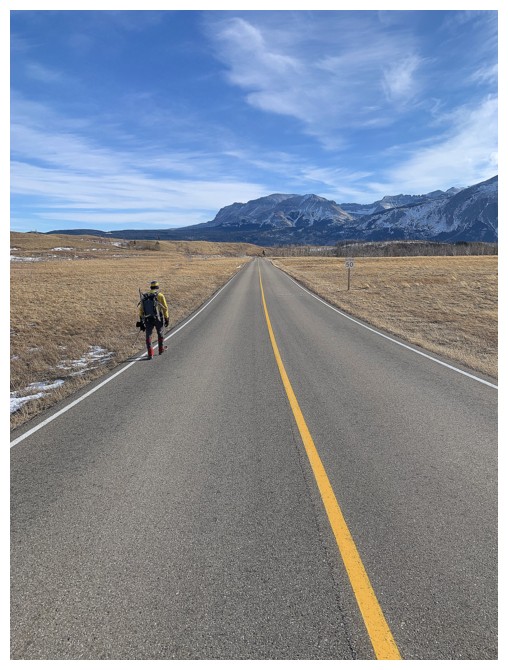
Hydrating at Red Rock Canyon road. Our water hoses froze much earlier in the day.
Blakiston provides a pretty good backdrop on the deserted road
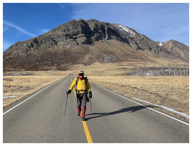
Easy hiking back to the main road. Sofa and Vimy in the background.
Parting look at Bellevue Hill.
The End
LOG