Mount Crandell IV
December 29, 2020
Mountain height: 2378 m
Elevation gain: approximately
900 m
Ascent
time: 3:30
Descent
time: 2:35
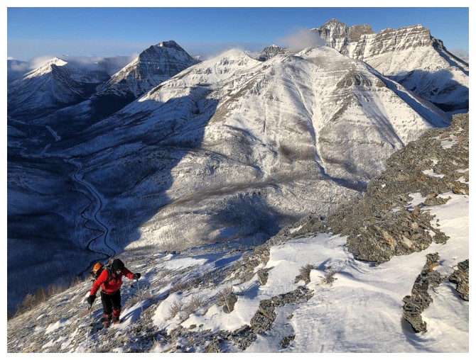
 Scramble with Mark.
A number of factors led to Mark and I
repeating an ascent of Mount Crandell one year, less a day, after Crandell III:
1.
I had done a little reconnaissance work on a
route that starts from the Crandell Lake trailhead and it appeared to offer an
interesting way up the mountain.
2.
A recent (and record) snowfall had created danergous snow conditions all over the Rockies and I thought the planned route
would be a relatively safe one.
3.
I was recovering from a lower back strain and
wanted a short day.
4.
Crandell III was such a blast, we couldn’t resist
another winter ascent of the mountain, especially by a totally different route.
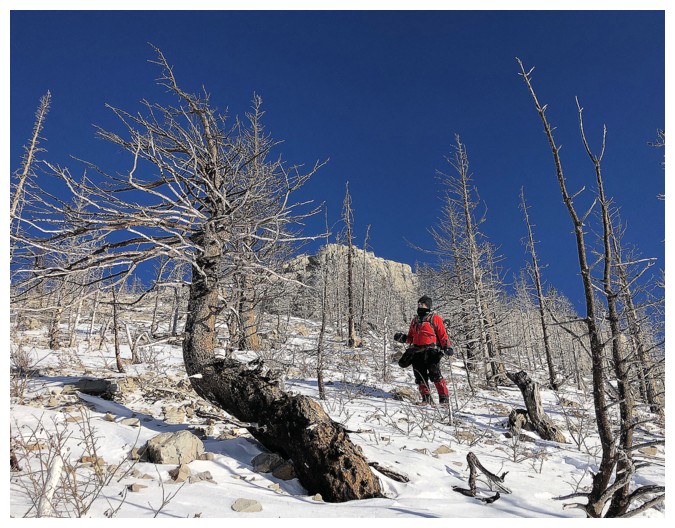
 We started the trip by headlamp and were
immediately surprised not only to find the Crandell Lake trail thoroughly
packed down, but very little new snow on the whole route– it appeared that
Waterton was spared the walloping of snow Calgary and the more northern Rockies received a week earlier (or
the vicious Waterton wind had simply blown that snow into Manitoba!). This
trend continued all the way up to the first highpoint. We had snowshoes and ice
axes strapped to our packs and crampons inside, but they would stay where they
were throughout – Microspikes were sufficient from bottom to top and down
again.
We started the trip by headlamp and were
immediately surprised not only to find the Crandell Lake trail thoroughly
packed down, but very little new snow on the whole route– it appeared that
Waterton was spared the walloping of snow Calgary and the more northern Rockies received a week earlier (or
the vicious Waterton wind had simply blown that snow into Manitoba!). This
trend continued all the way up to the first highpoint. We had snowshoes and ice
axes strapped to our packs and crampons inside, but they would stay where they
were throughout – Microspikes were sufficient from bottom to top and down
again.
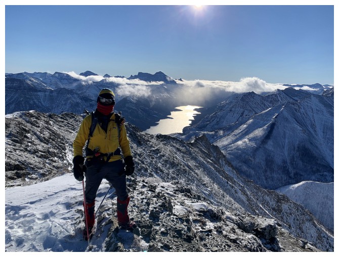
 We lucked out with the weather and wind up to
that point, experiencing cold but not bone-chilling temperatures and some very
cool clouds formations to the west, especially around Mount Cleveland. Views
from the ridge were excellent and quite unique. While the sunny skies held, the
tolerable temperatures did not. Turning south towards the summit we were
greeted by a brisk west wind – not a terribly strong wind, but one that was
perhaps the coldest we’ve ever experienced. Even wearing a balaclava and two
toques the right side of my head turned into what felt like a block of ice!
Mark suffered equally.
We lucked out with the weather and wind up to
that point, experiencing cold but not bone-chilling temperatures and some very
cool clouds formations to the west, especially around Mount Cleveland. Views
from the ridge were excellent and quite unique. While the sunny skies held, the
tolerable temperatures did not. Turning south towards the summit we were
greeted by a brisk west wind – not a terribly strong wind, but one that was
perhaps the coldest we’ve ever experienced. Even wearing a balaclava and two
toques the right side of my head turned into what felt like a block of ice!
Mark suffered equally.
With little shelter from the wind at the
summit, we continued for a short distance down the south ridge (the upper
section of Kane’s Bear’s Hump and Tick Ridge routes), hoping for a slightly
better view of the Waterton Lakes. We got that and also a merciful break from
the wind a few metres below the ridge. This was a godsend, allowing us to
warm-up before the even colder return trip, and to admire the spectacular view.
And yes, the return trip, at least the first
part, was brutally cold, now going a little more into the wind. Things improved
dramatically upon reaching the first highpoint (odd given that we were now
traveling directly into the wind) and we were able to take a more leisurely
stroll down the mountain. With the Sun in a more favourable position in the
sky, the rock scenery for this part of the trip was infinitely more gratifying.
Four fantastic ascents of Mount Crandell via
four different routes and there still seems to be many options for other lines.
It’s clear that we are far from done with this wonderful mountain.
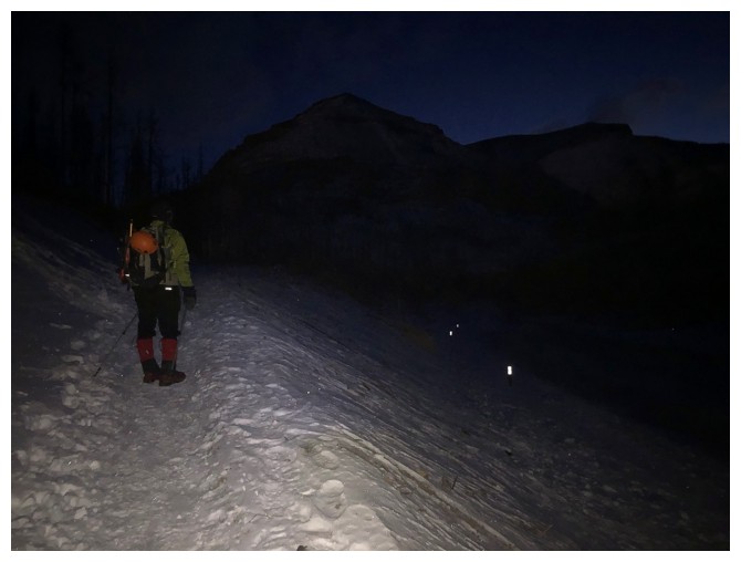
Headlamps at the trailhead. The summit can be seen at the right and the
peak at the left is the one we will ascend to get to the summit.
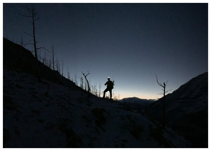
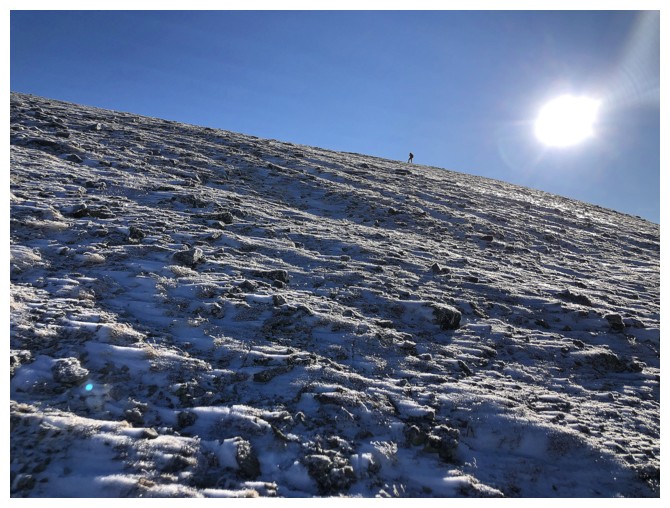
Still going by headlamp, as we start up the main ascent slope to the left
The east peak of Ruby Ridge behind - one of the more colourful peaks in the park
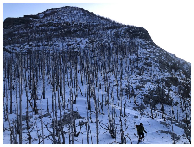
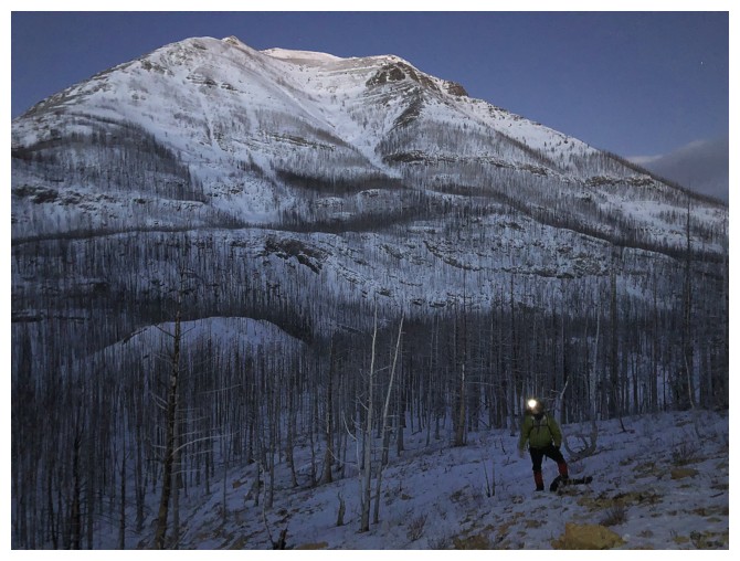
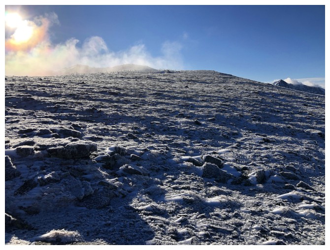
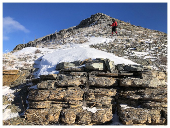
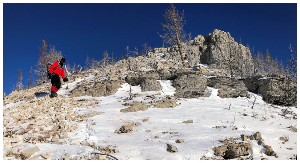
The initial part of the ascent slope
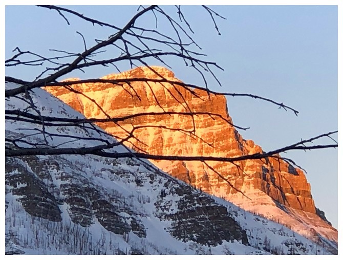
The east shoulder of Mount Blakiston getting the first of the Sun's rays
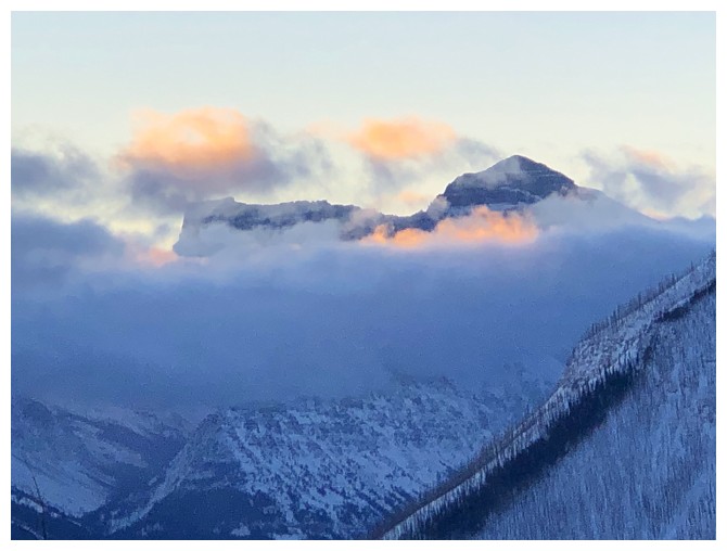
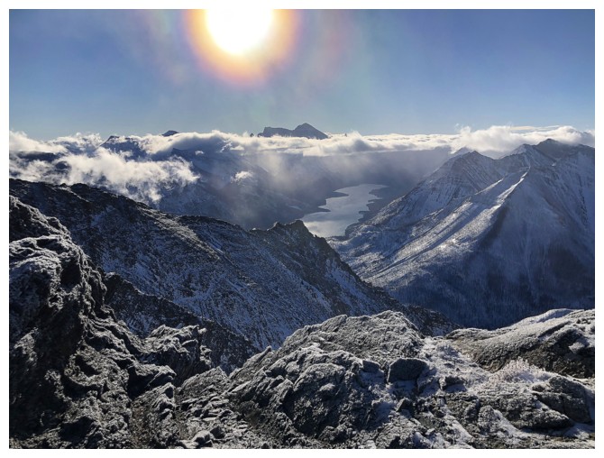
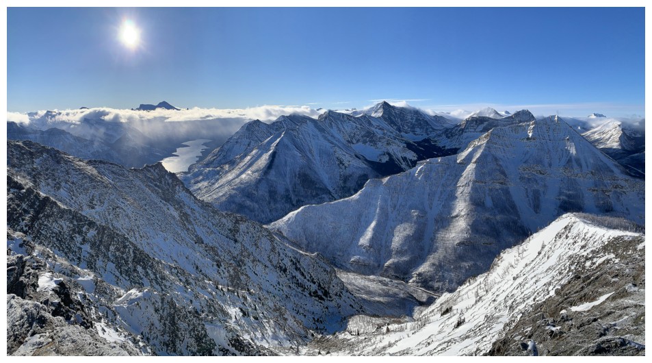
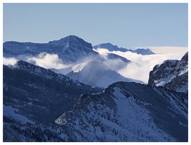
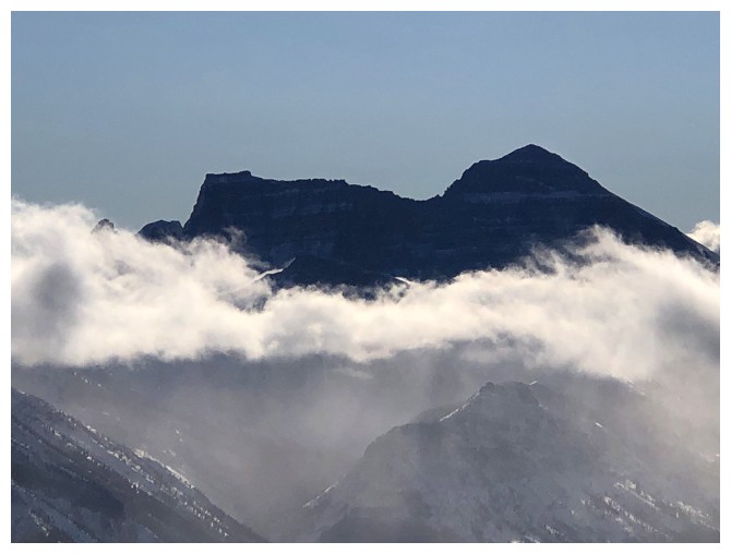
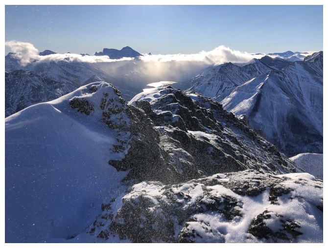
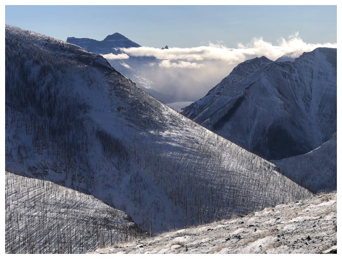
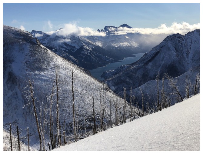
"Hello Cleveland" - this cloudy view of Glacier National Park's highest mountain would become one of the highlights of the trip
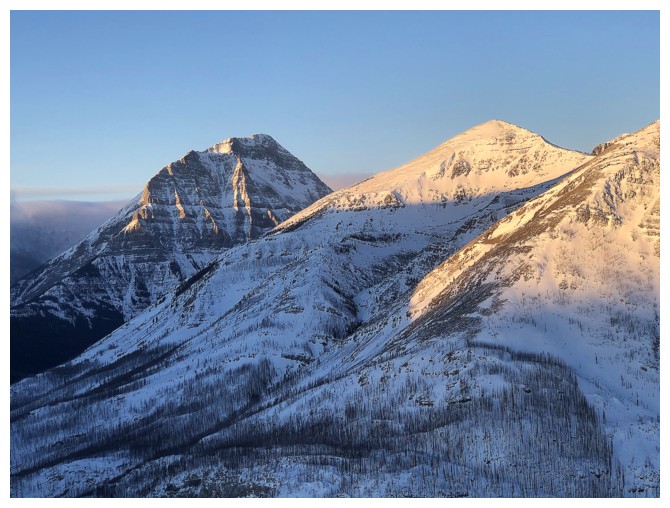
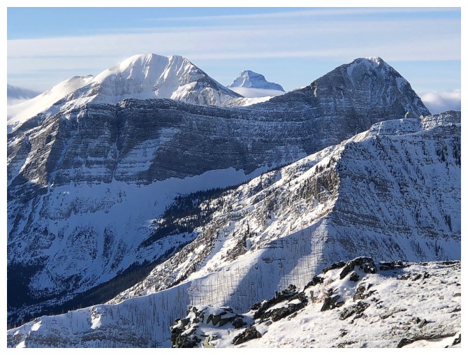
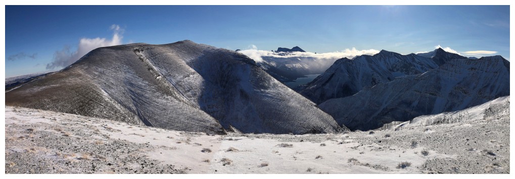
Mount Lineham (left) and the true summit of Ruby Ridge
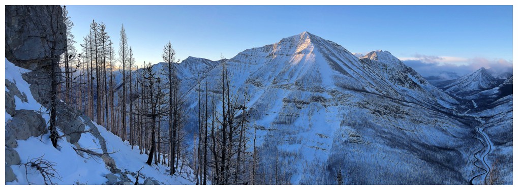
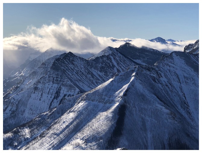
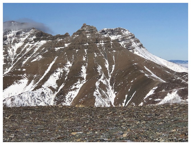
Buchanan Northeast is front and centre throughout - a very worthwhile objective
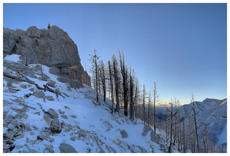
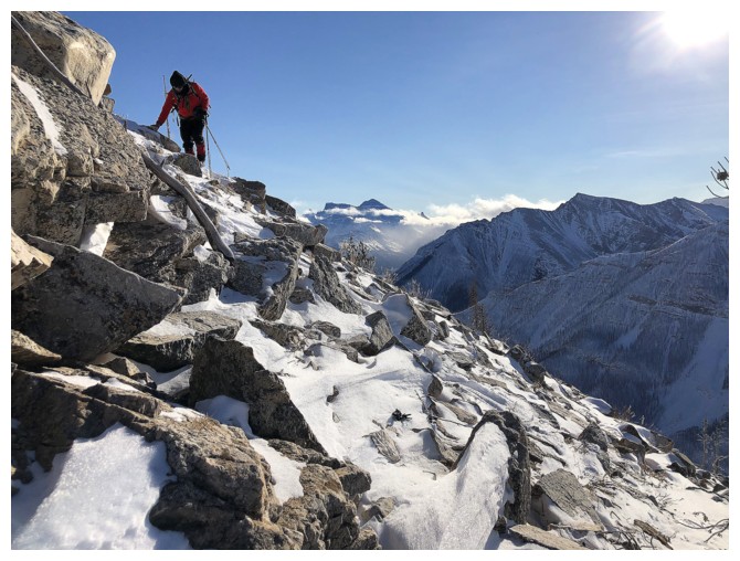
Atop one of several terrific rock bands (they all looked much better later in the day though)
View to the west that will be another source of much photo attention
Leaving the top of the rock band
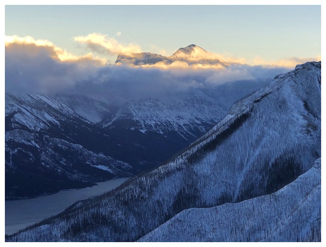
The cloud layer would stay in front of Cleveland all day, but leave its summit visible
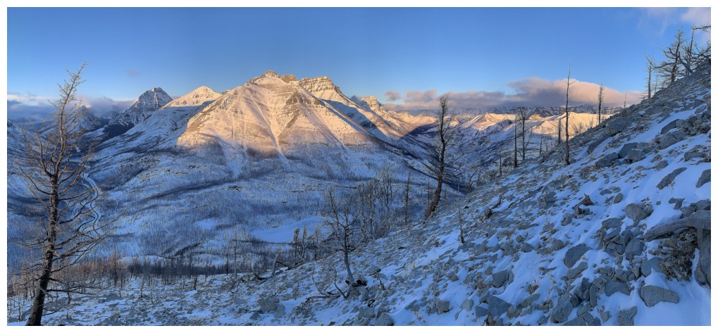
Patiently waiting for the Sun to light up the mountains to the west
Little by little
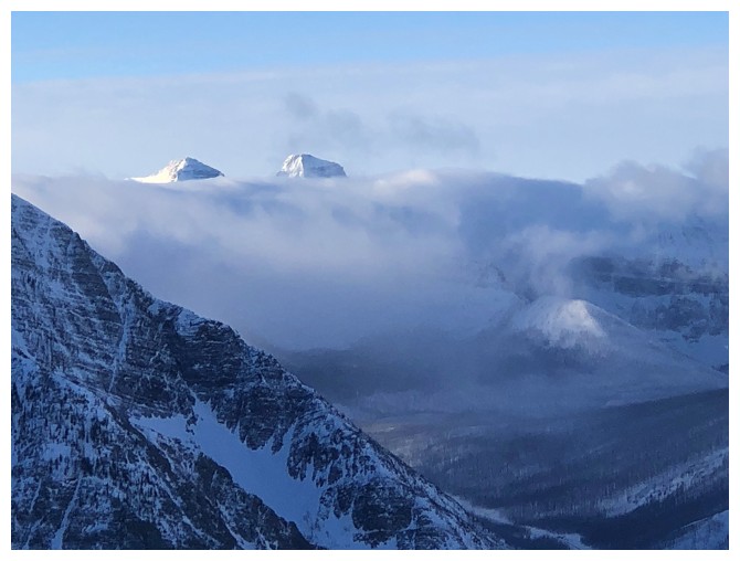
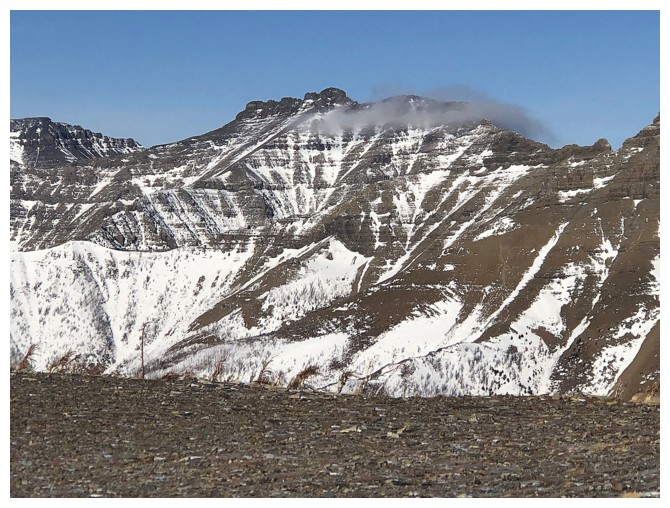
The summits of peaks to the north remain shrouded by clouds through most of the day. Except Mount Galwey at the far right.
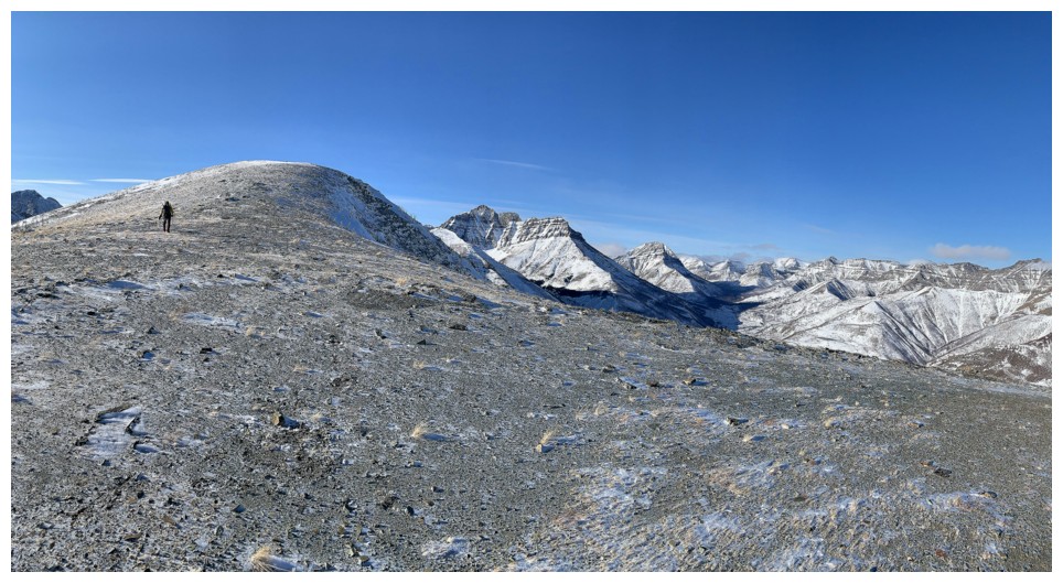
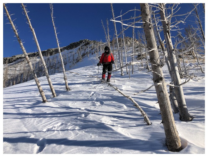
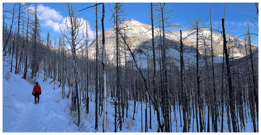
Easy travel up and a shocking lack of snow
And the view continues to improve
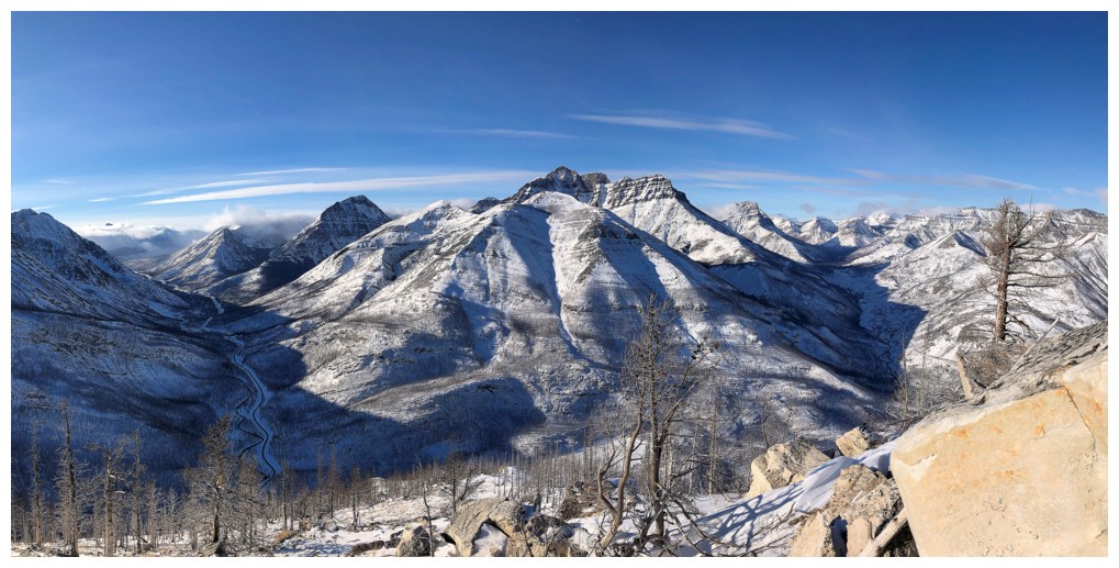
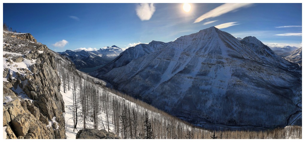
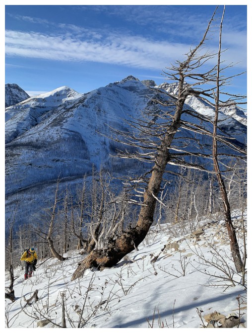
Mount Rowe in front and the
three summits of Long Knife Peak behind. Contrary to the perspective
the photo implies, the two mountains are separated by about 12 km of
physical distance and the US/Canada border.
Blakiston and Ruby for the umpteenth time!
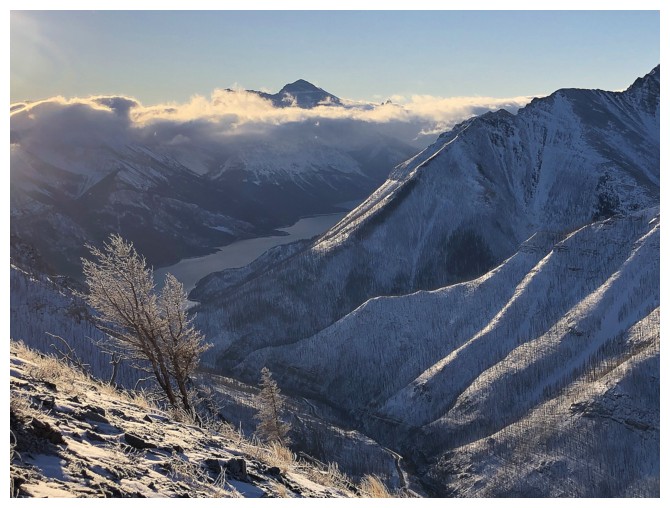
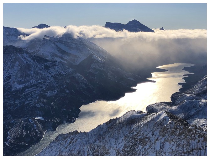
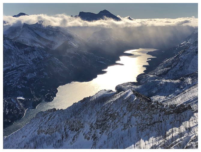
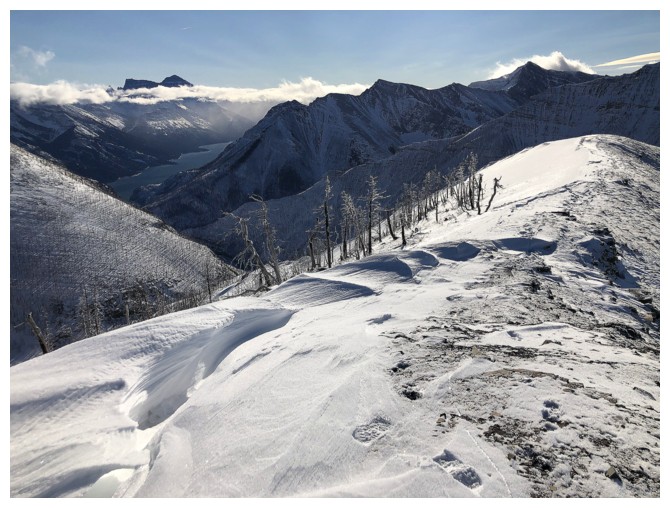
The first and certainly not last photo of Cleveland the Waterton Lakes from this specific angle
Probably not going to get too many lichen photos on this day, so here it is
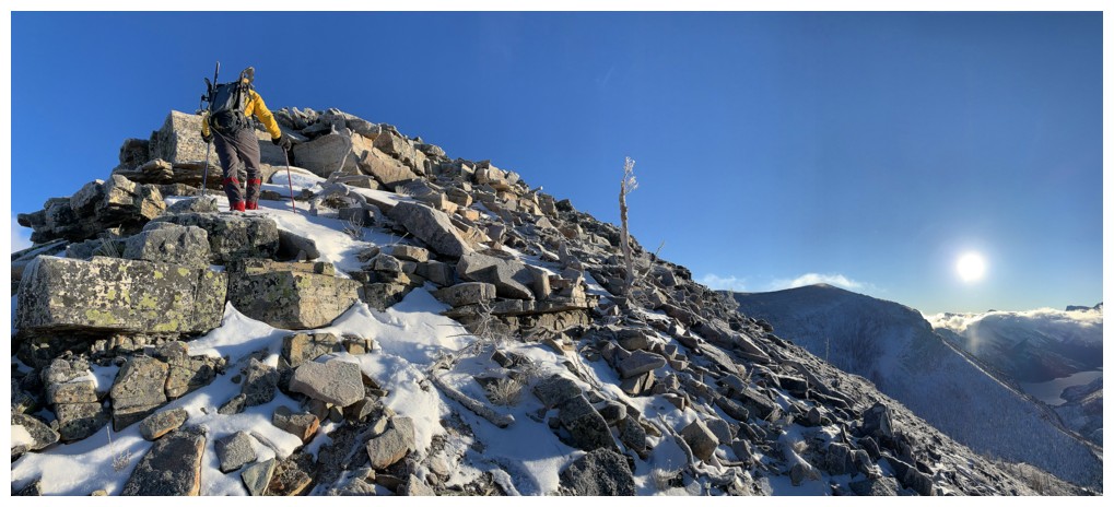
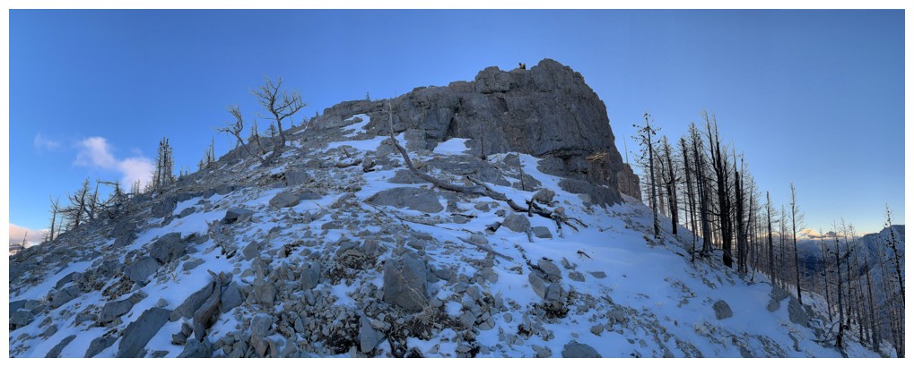
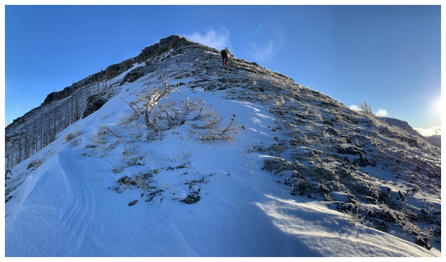
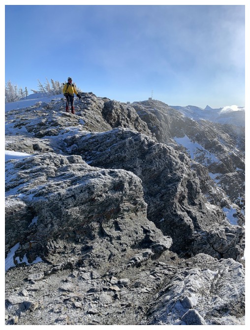
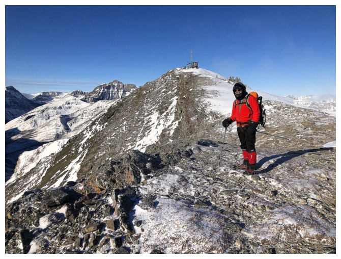
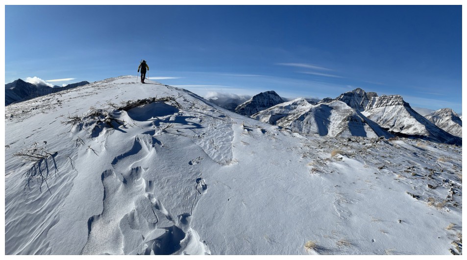
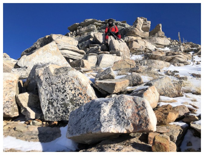
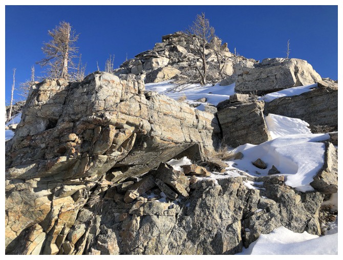
Approaching the summit of the major highpoint
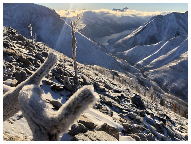
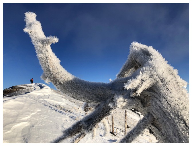
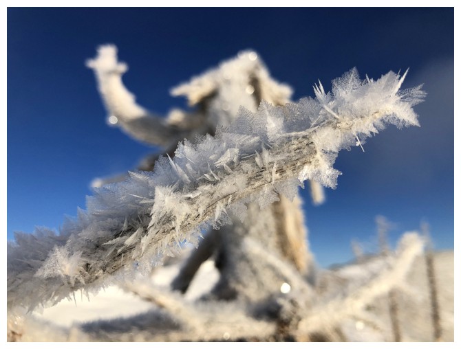
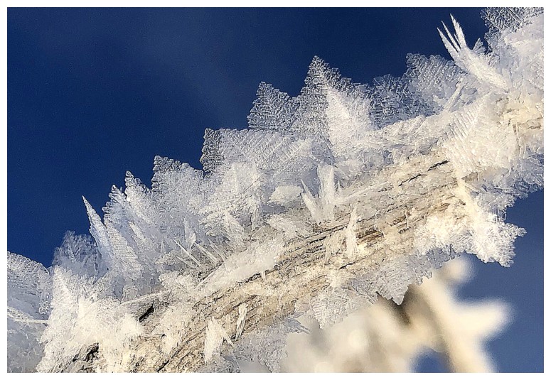
Hoar frost on trees is always a treat to see
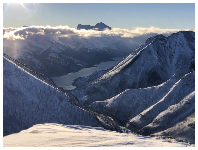
......so is Mount Cleveland
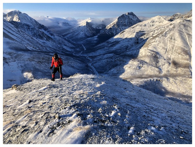
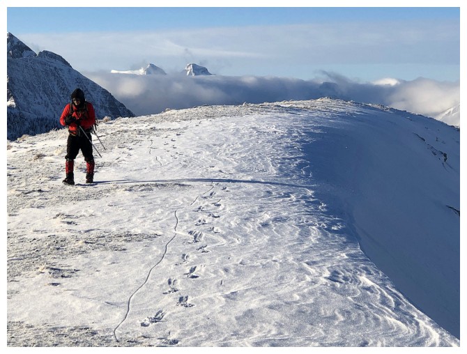
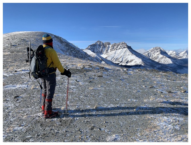
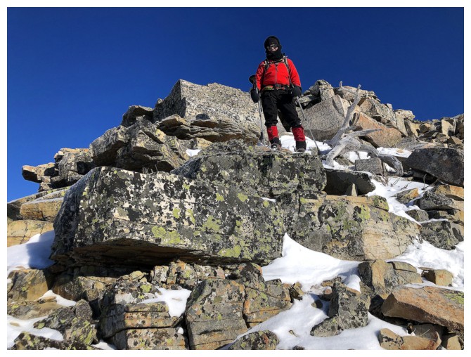
Mark tops out at the highpoint
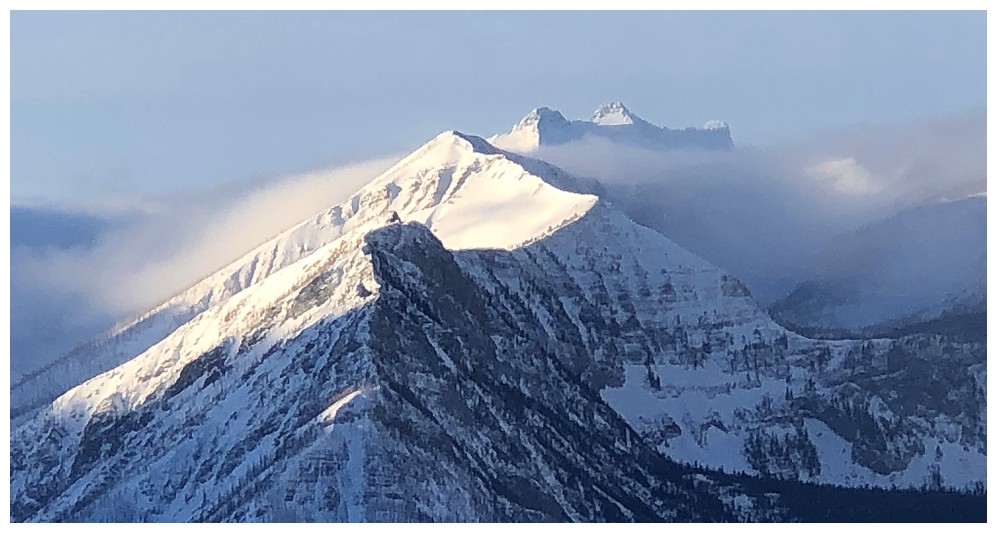
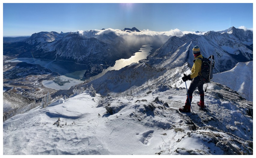
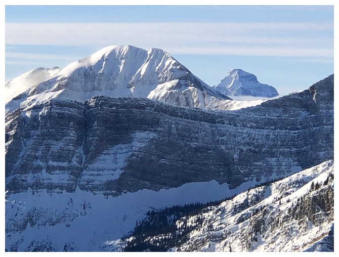
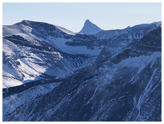
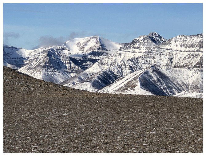
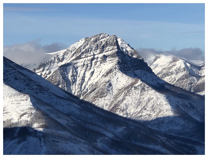
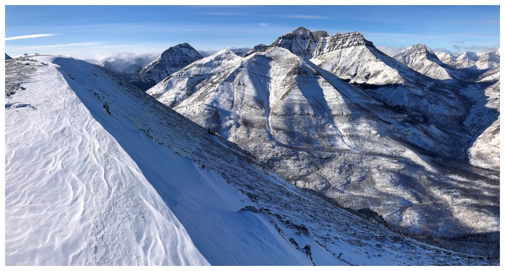
Like Cleveland, mounts Kintla (left) and Kinnerly were happy to reveal their beautiful and lofty summits
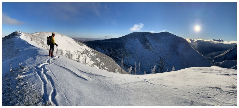
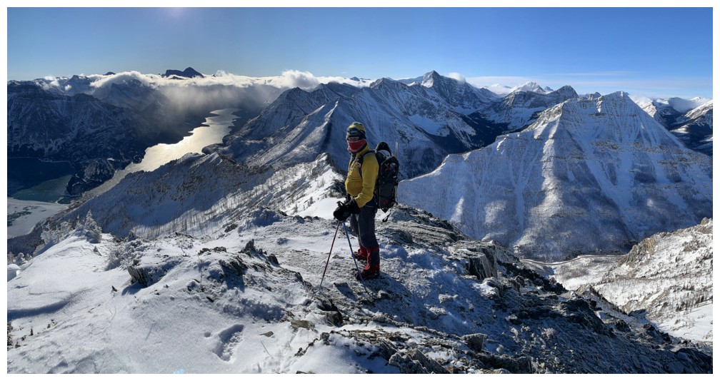
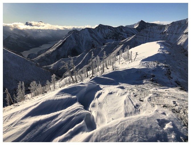
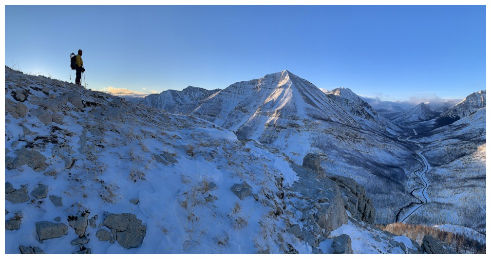
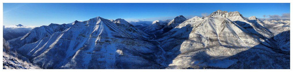
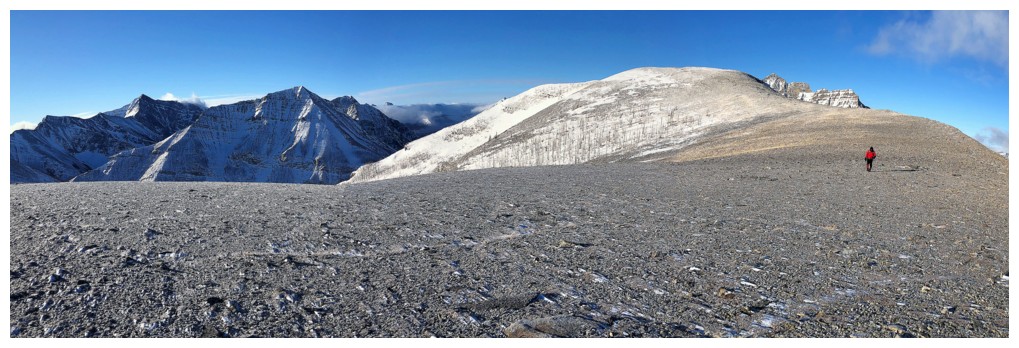
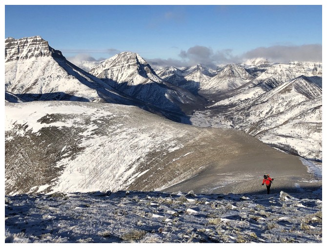
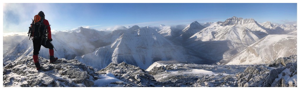
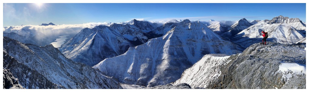
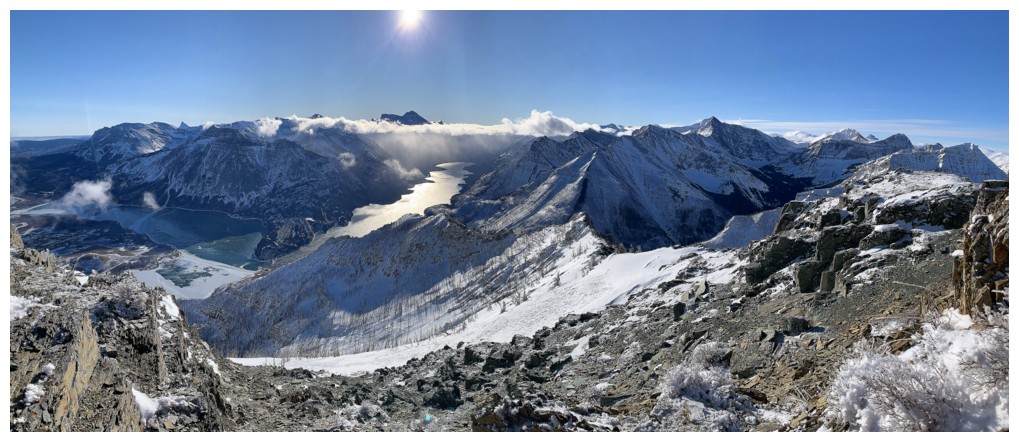
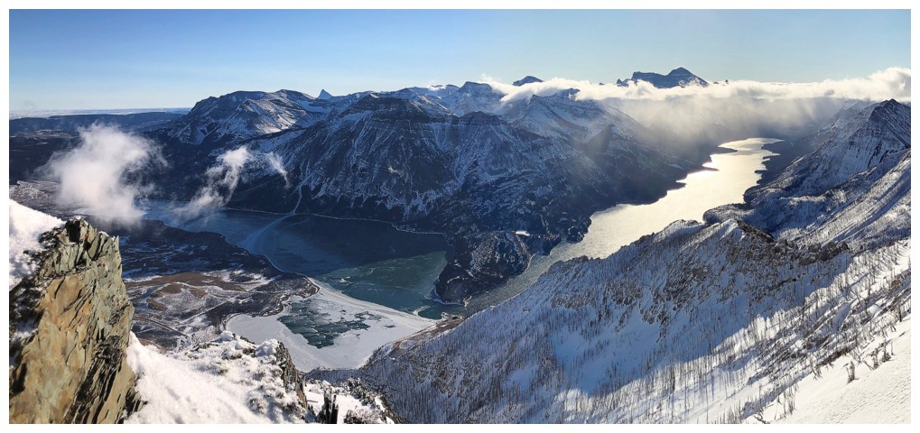
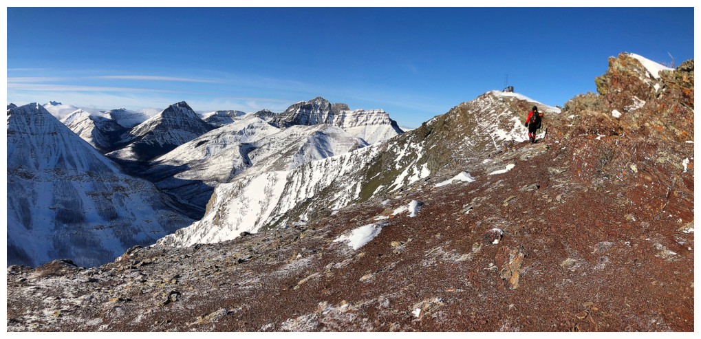
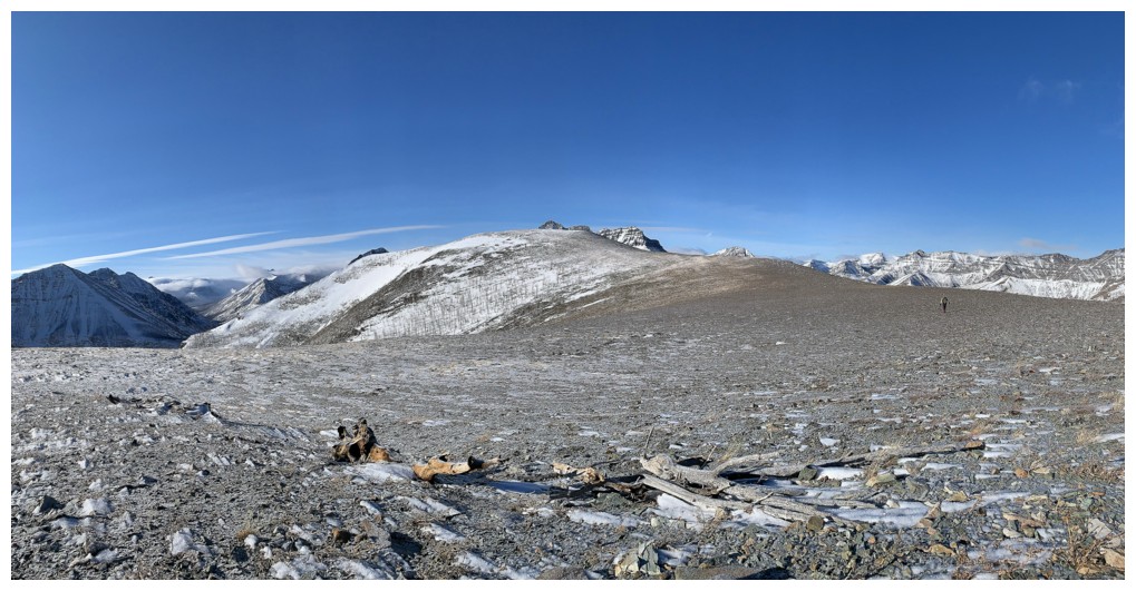
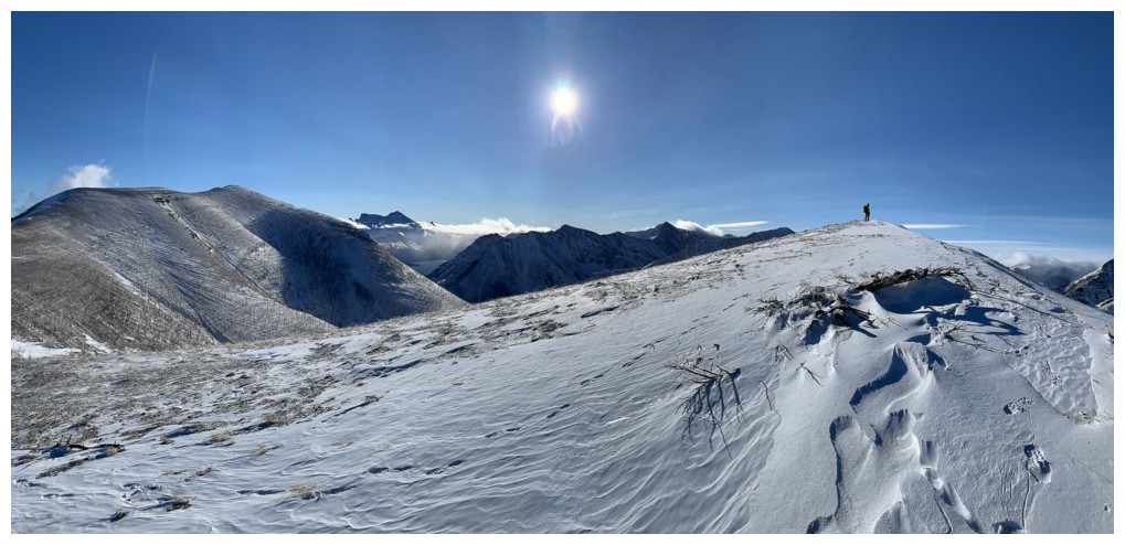
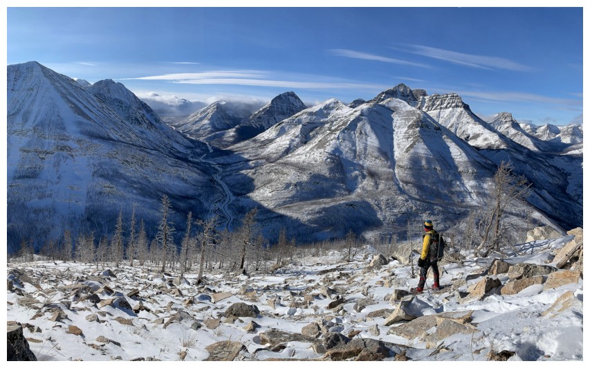
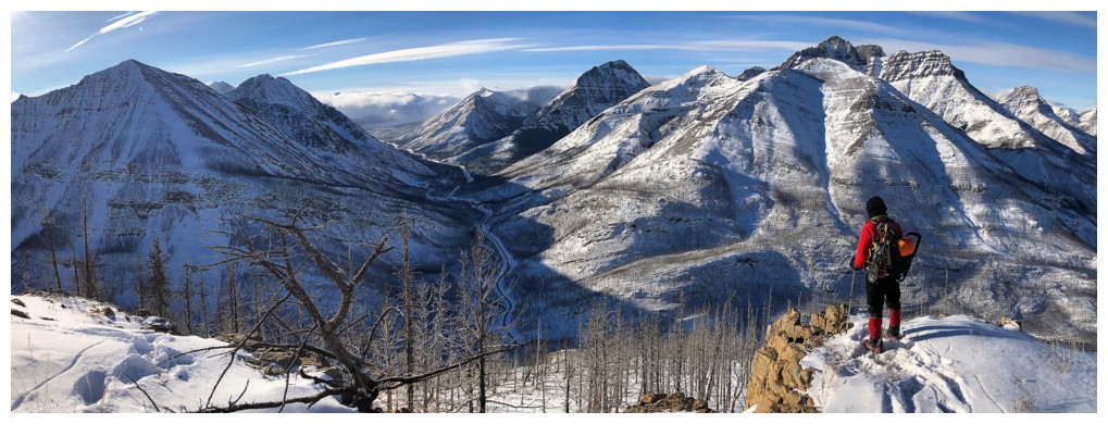
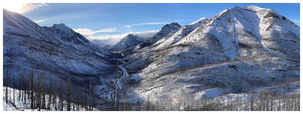
View from the highpoint, with the summit of Crandell just right of centre. It's an easy 2 km hike to the top.
More hoar frost
It will probably melt in the sunny conditions, so might as well enjoy it now!
Time for some frosty close-ups
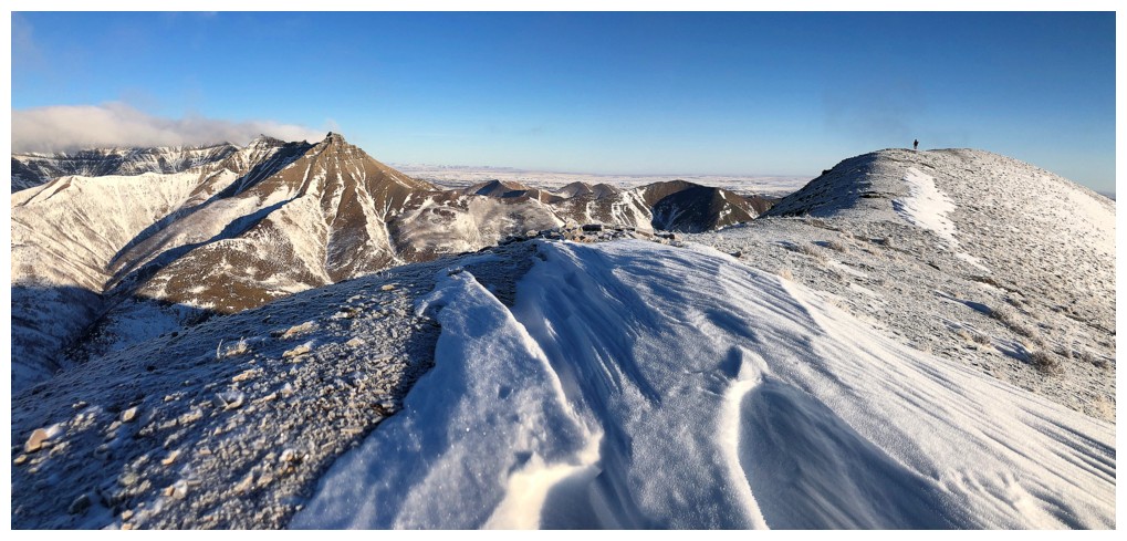
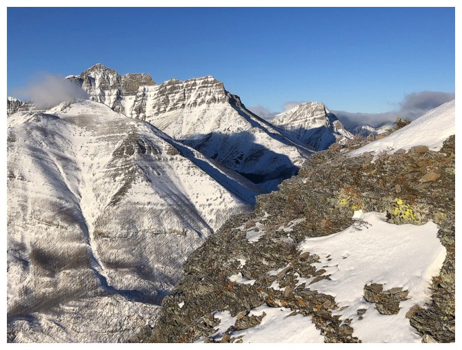
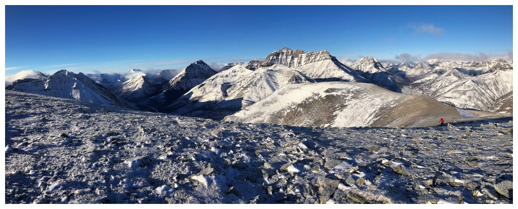
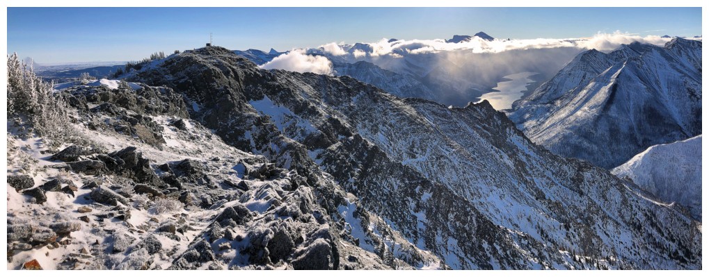
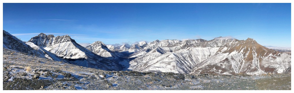
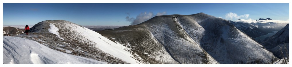
Back to the bigger picture. Awesome hike across the ridge.
Looking back to the southwest
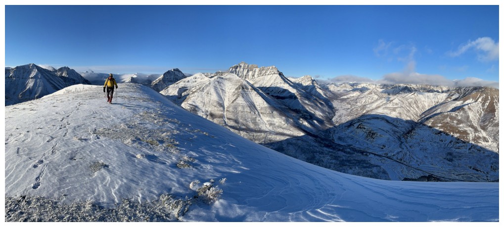
Looking back to the northwest
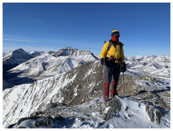
Near the end of the ridge. We were still plenty warm at this point.
Mark, Kintla, and Kinnerly
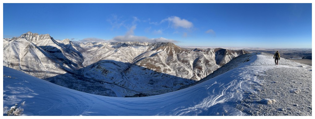
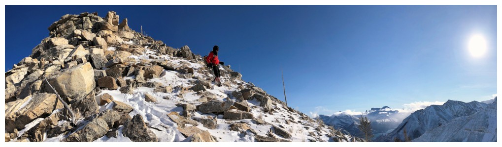
Turning south onto the expansive ridge that connects the highpoint to the summit
Even easier travel than gaining the highpoint, but the cold was severe at this point
I need a phone that records and prints the wind-chill temperature - it was brutal at this point!
The views were too good to avoid exposing our hands to the cold to take photos
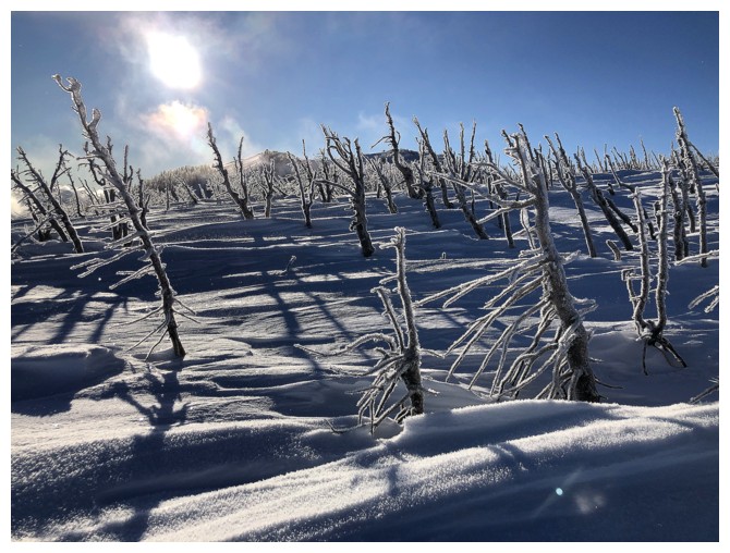
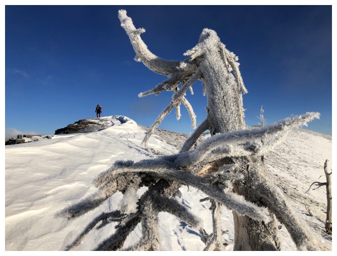
Another irresistible section of hoar frost covered trees. The price of
this photo were frozen fingers on my right hand for the remainder of the ascent, even with my thick winter gloves on.
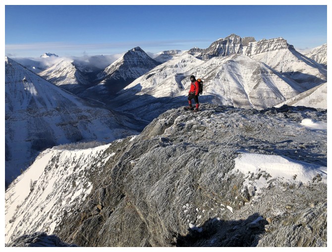
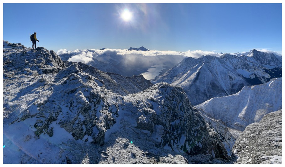
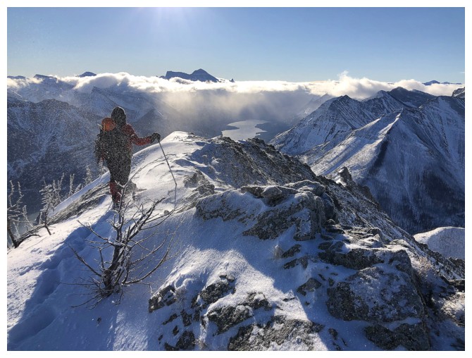
Reaching another magnificent viewpoint
Mark takes in the view, as a cloud of thin mist passes by
Back to clear skies
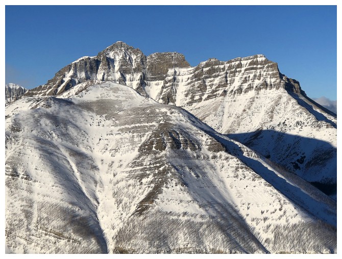
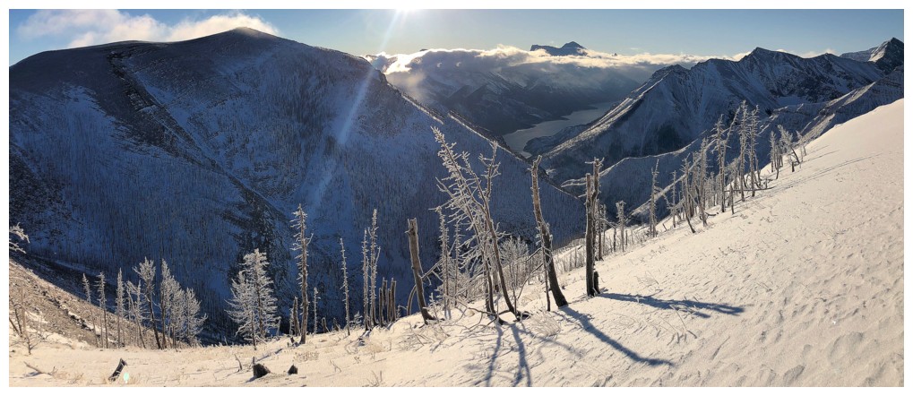
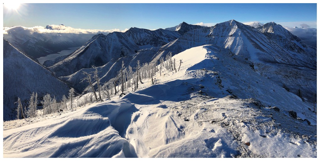
The frost covered ridge, with the summit, just right of centre
We thought this would probably be the best view of the day - we were wrong!
Same as above
Ditto
Already
passed the summit and heading down the south ridge. Neither of us took
a single photo at the top because of the extreme cold.
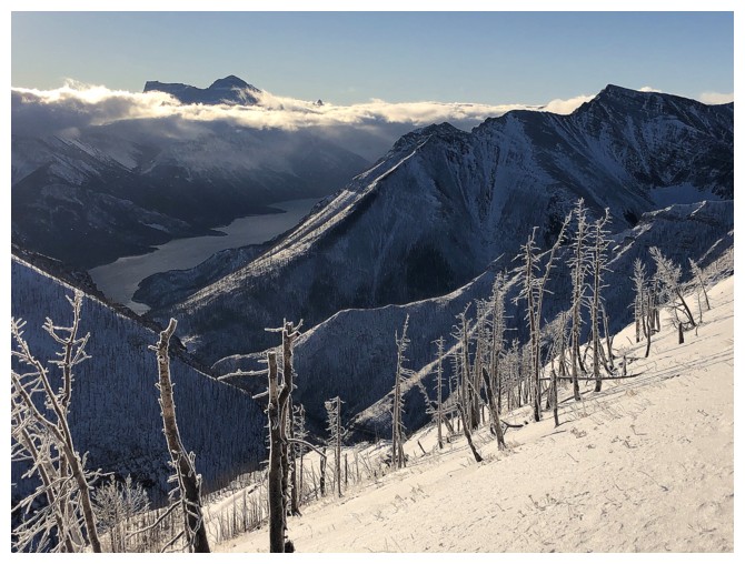
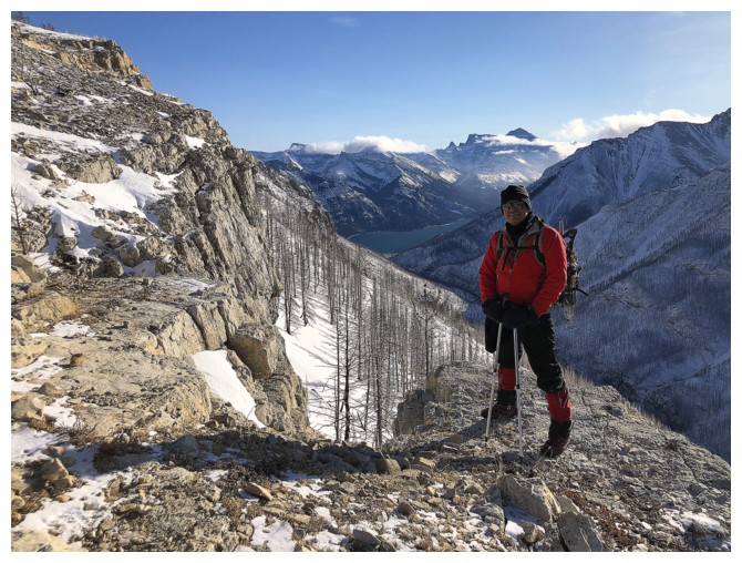
Great view, but little of the Upper Waterton Lake is visible
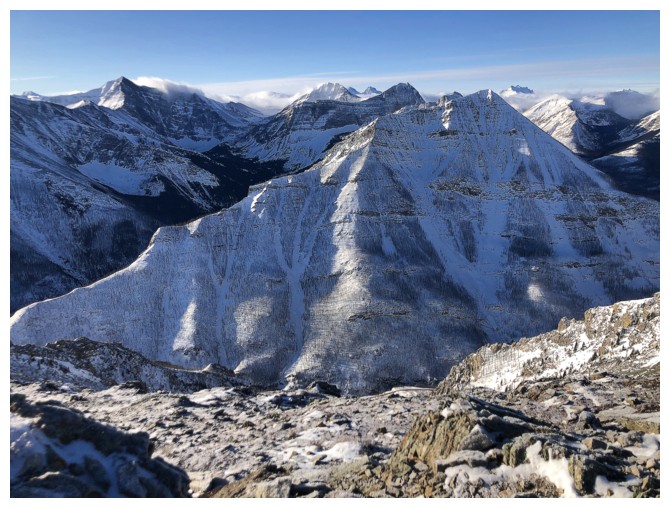
All of Buchanan Northeast is visible though
Hands-down the best view of the day
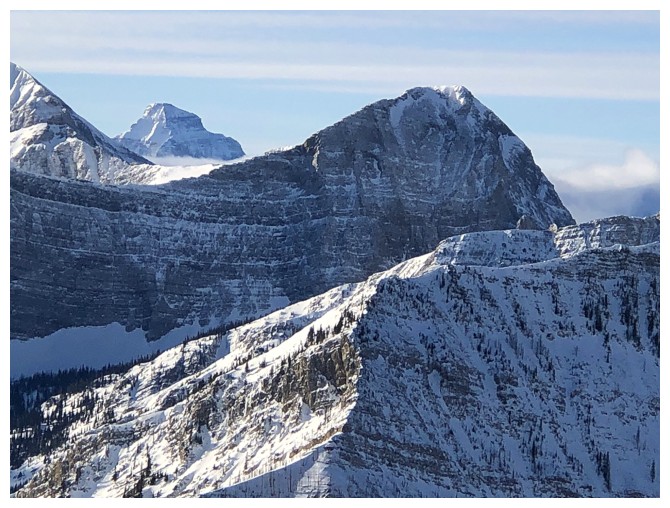
Mount Kinnerly between Mount Carthew (left) and Buchanan Ridge
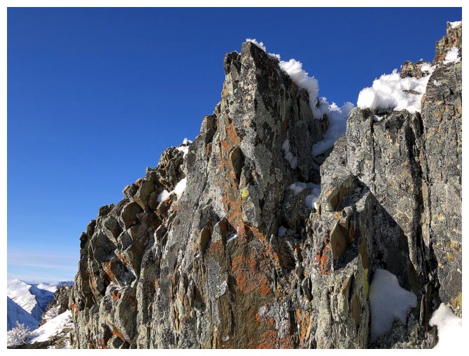
Getting another lichen shot as we warm up below the ridge
View from our little shelter below the ridge
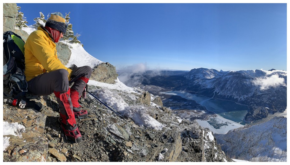
Not a stitch of wind in the shelter
The clouds continue to make things interesting to the west
Glare on lakes sometimes ruins photos and sometimes enhances them - I'll go enhance in this case
A view that never stops giving
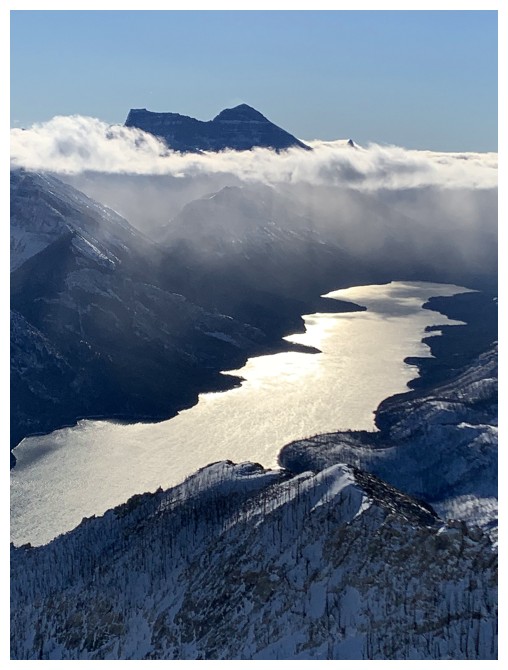
Last glary lake shot
Not sure what these peaks are
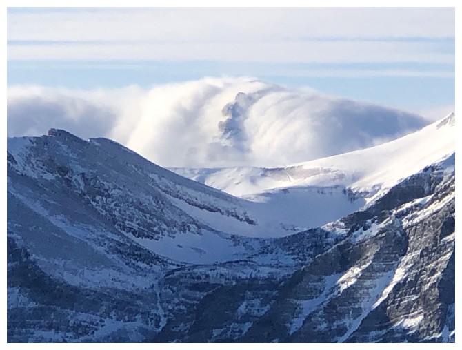
This cloud looked like the beginning of Armageddon!
Carthew and Kinnerly again
Kinnerly and Buchanan again
You know who again
Chief Mountain
I lied about the glary lake shots
A last look - really!
Looking back as we traverse the cool ridge
Heading back to the summit. Any red argillite photo is worth frozen fingers!
Mark was brave enough to expose his hands at the summit to take two photos - here's one...
...here's the other
Back to the expanse
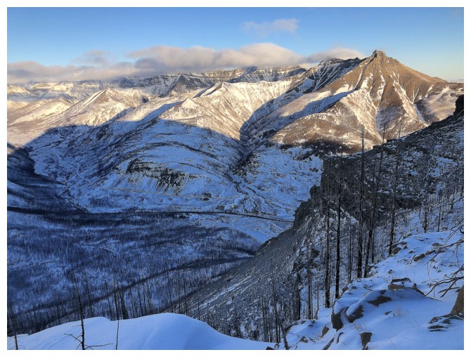
The clouds have finally lifted from the summits of the peaks to the north: Mount Galwey and Rogan Peak
Outstanding Mount Dungarvan
Newman Senior and Mount Glendowan - terrific traverse
I'm rushing ahead to escape the cold
The treasure of peaks between Blakiston and Galwey - so many great ascent lines
There's one of them: Anderson Peak
Almost back to the highpoint
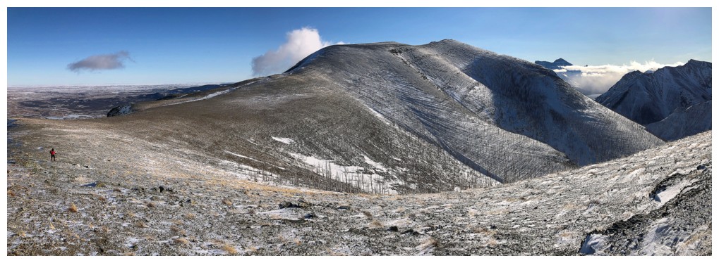
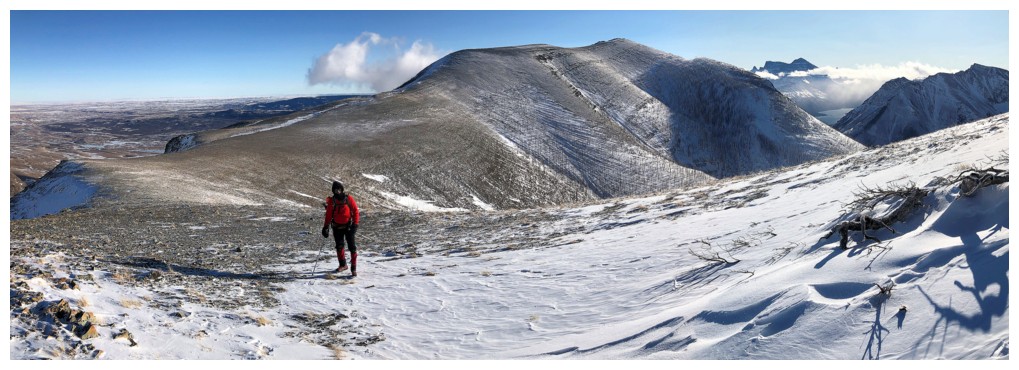
The gentle "football field-like" northwest side of Mount Crandell is
such a contrast to the craggy southeast side, where the Kane route's,
numerous climbing routes, and two world class ice climbs reside
We had both warmed up at this point, even though we were traveling directly into the wind - go figure!
As usual, can't get enough of any Waterton view on a clear day
Same as above
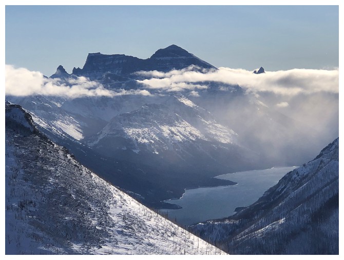
Goodbye Cleveland
Mount Cleveland deserves to be the centre of attention, given its photogenic nature, and on this day especially
The hoar frost on the trees is gone
And, yes, a last look at Cleveland and the Upper Waterton Lake
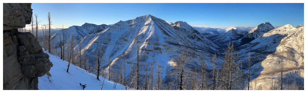
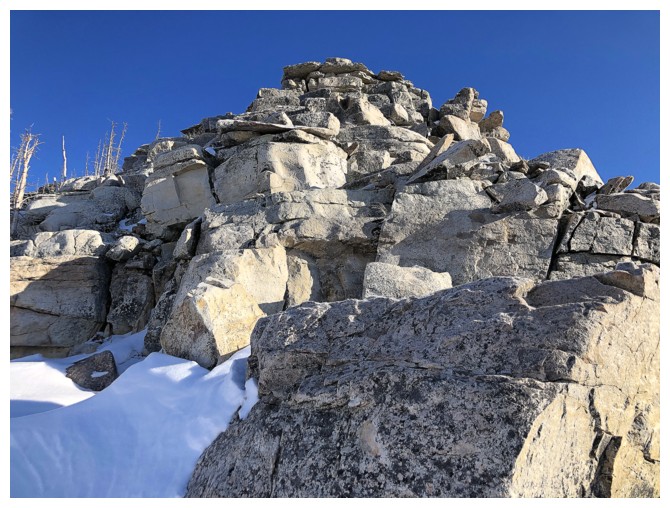
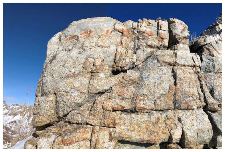
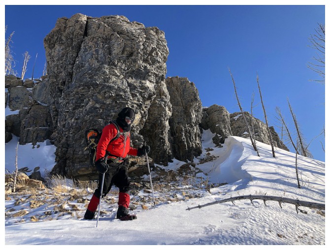
Way more cool and colourful rock on this ascent route than we both thought - just needed the Sun to shine upon it
The view to the west kept us entertained also
Taking a quick detour away from the ascent route to see the great rock
Solid rock that makes the southeast side of Crandell pretty much the
only area in Waterton where excellent technical climbing exits
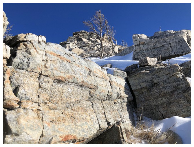
Waterton is more than just red argillite!!
Another detour to check out the northwest side of the ridge - lots of terrain there that begs exploration
Another outstanding viewpoint
And more outstanding rock
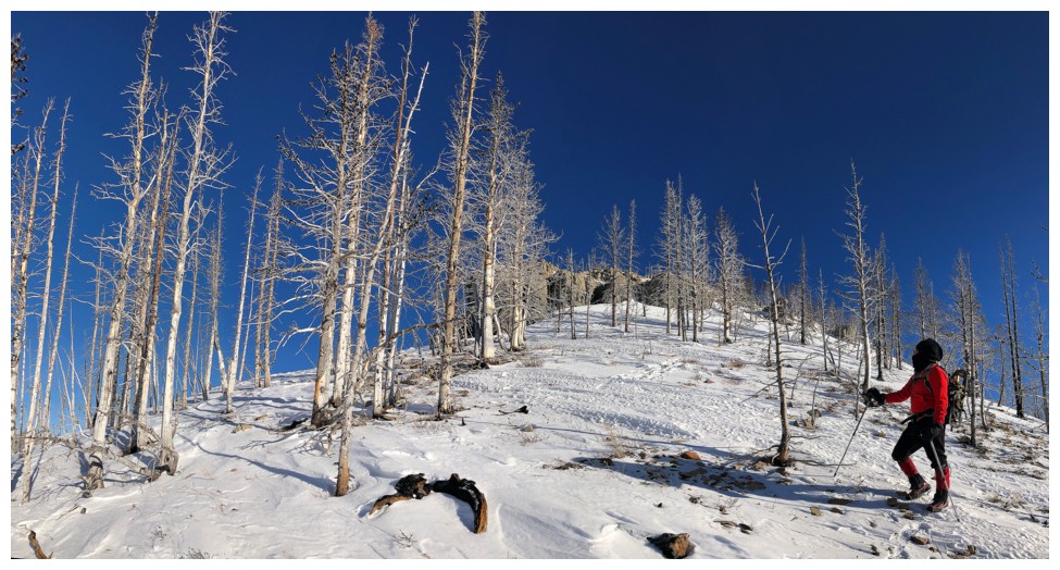
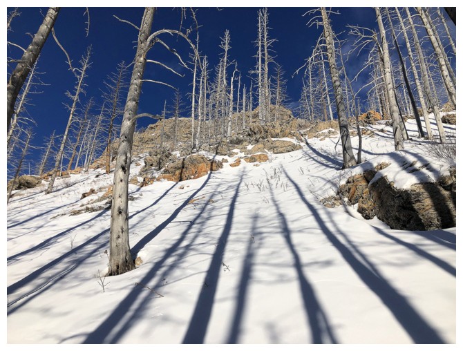
Stripped of their bark by the 2017 Kenow fire, many of the trees in Waterton now have a white/silver colour
Buchanan Northeast is back in shade
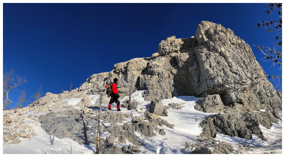
The rock band I stood atop of several hours earlier
Marks checks out a very distinctive tree
I did too
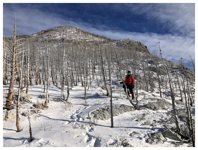
Before the fire, this slope would essentially be green year-round
Parting look at the objective
The End
LOG